| Pages:
1
2 |
MulegeAL
Nomad

Posts: 298
Registered: 8-25-2009
Location: PDX/Mulege
Member Is Offline
|
|
It shows on your map in low light.
Start east at La Balleena.
Goes ne by San Raymundo, Los Panales, El Mezcal.
Stay east/straight at jct that goes N to Guadelupe.
Goes south of rancho Agua Agria.
Comes out of the mtns to your bullet on green track that goes ne to Mulege. Very scenic ride,
Driven every day by the local rancheros out there.
|
|
|
DizzyNick
Newbie
Posts: 24
Registered: 2-21-2023
Member Is Offline
|
|
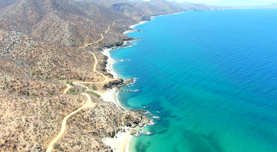
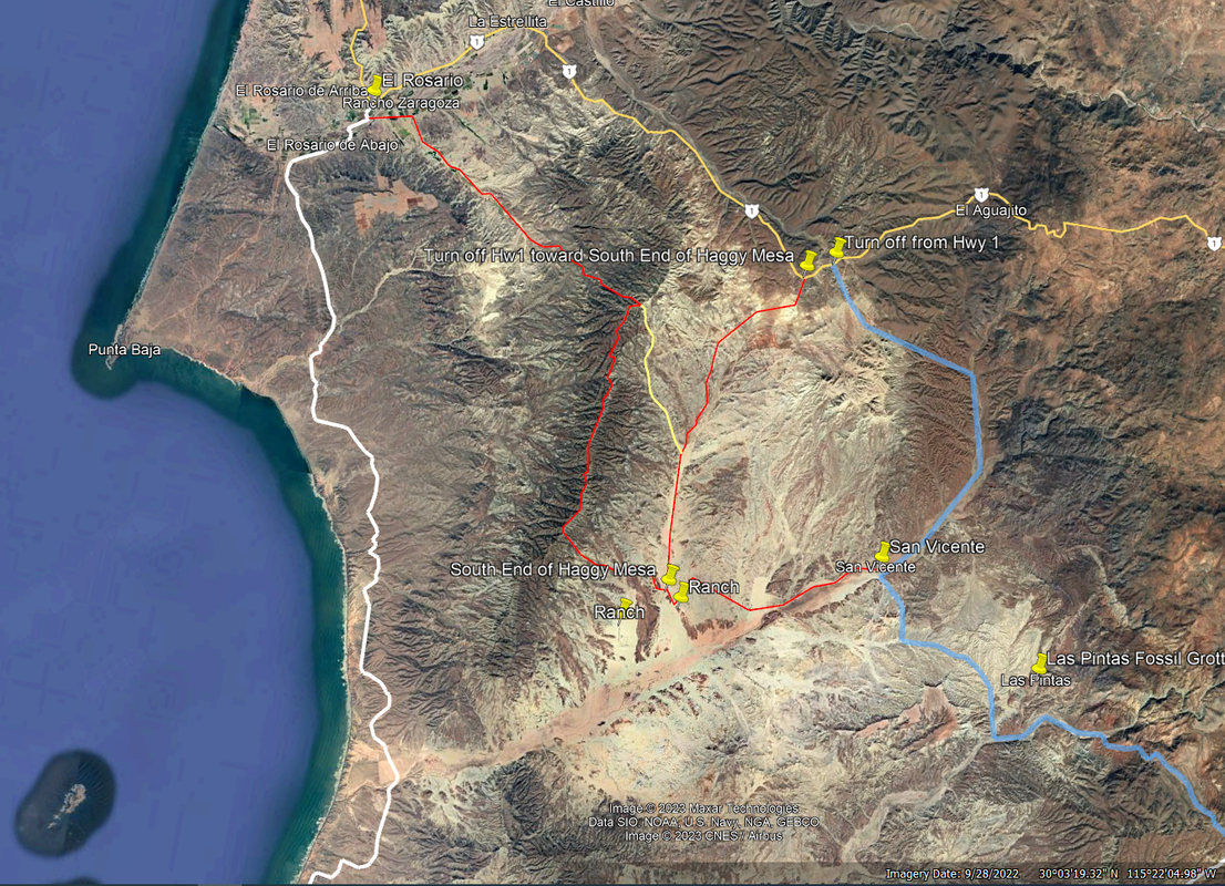
Quote: Originally posted by JZ  | Here is an alternative route that is East of yours going into El Rosario. It rides Haggy's Mesa. Never do it, but it looks like a lot of fun.
|
That looks awesome, I'm definitely adding that on my to do list!
|
|
|
JZ
Elite Nomad
Posts: 9411
Registered: 10-3-2003
Member Is Offline
|
|
There is a YouTube video of guys riding bicycles on it. I searched but can't find it at the moment. It is bad azz.
|
|
|
DizzyNick
Newbie
Posts: 24
Registered: 2-21-2023
Member Is Offline
|
|
That looks amazing but I think at this point we will be lucky to make it to La Paz with enough time to return. I dont think we will get further than
that. Maybe next trip though!
|
|
|
bajaric
Senior Nomad
Posts: 613
Registered: 2-2-2015
Member Is Offline
|
|
Dang! That is a lot of remote trail riding.
You appear to have an outstanding knowledge of GPS navigation, but even so should count on some extra miles on the trail as a result of taking a wrong
turn at a fork in the road. It happens to everyone.
A low-tech backup navigation aid is a good addition to the electronic stuff. In a pinch, with a paper copy of the Benchmark atlas and an old Nuvi GPS
you can find your current location by using a ruler to mark an X on the map from the latitude and longitude printed along the edge of the page. A
compass can then be used to show the direction to your intended destination. The old Garmin Nuvis are super reliable and can be purchased for cheap
on eBay. You don't need the built in maps, just the GPS function to determine latitude and longitude as a backup in case you primary GPS navigation
system fails without warning, as they are prone to do at the worst possible time.
|
|
|
JZ
Elite Nomad
Posts: 9411
Registered: 10-3-2003
Member Is Offline
|
|
For GPS I like Back Country Navigator and Gaia.
I prefer satellite view over topos. Both of them allow you to download satellite images for off-line use. It does take a lot of memory to download
all of Baja. Time too. But well worth it. It's like you can see yourself riding on the trails.
You should consider handheld radios. Can get maybe a mile or so out of them. Baofeng makes good ones.
[Edited on 2-26-2023 by JZ]
|
|
|
DizzyNick
Newbie
Posts: 24
Registered: 2-21-2023
Member Is Offline
|
|
I think we will be set for navigation between the group. some of us have Gaia, Garmin Explore, E32, and a handfull of other apps along with a couple
Handheld GPS devices. The problem is even with all this access to information, we don't know what trails are do able and what trails are not!
|
|
|
DizzyNick
Newbie
Posts: 24
Registered: 2-21-2023
Member Is Offline
|
|
One question that has been looming is this gpx track I have found, allegedly for the Bill Nichols Trail. However I have also found a different track
also labeled Bill Nichols Trail. So my question is, is this the real one or something else?
Attachment: Bill Nichols Trail.gpx (38kB)
This file has been downloaded 91 times
|
|
|
David K
Honored Nomad
Posts: 64558
Registered: 8-30-2002
Location: San Diego County
Member Is Offline
Mood: Have Baja Fever
|
|
I wish these would open for me. Can you post a kmz file?
Bill Nichols made many m/c trails.
The first one, most know about is the Rock or Rockman Trail, from near Puertecitos west to Hwy. 1, north of Cataviña.
Another trail is to L.A. Bay without roads, parallel to the north of the paved road.
Another is south from El Rosario, then around that south region to Cataviña.
|
|
|
DizzyNick
Newbie
Posts: 24
Registered: 2-21-2023
Member Is Offline
|
|
Attachment: 20230226133411-66046-map.kmz (4kB)
This file has been downloaded 76 times
|
|
|
David K
Honored Nomad
Posts: 64558
Registered: 8-30-2002
Location: San Diego County
Member Is Offline
Mood: Have Baja Fever
|
|
Yes, that is the Bill Nichols Rock (or Rockman) Trail.
Here is a web page I made about it featuring a letter from 'slider' (Kevin Ward), with a track map from 'bajalou'.
https://vivabaja.com/the-bill-nichols-rock-trail/
|
|
|
advrider
Super Nomad
Posts: 1847
Registered: 10-2-2015
Member Is Offline
|
|
Rockman trail is workout on a 500, not sure I would do it on anything bigger. We did the haggy ridge trail a few years back and it was a blast. Doable
on bigger bikes.
The other single track off of the two track from El Rosario is fun. I've heard it called the cactus trail. One of my favorites. I think I sent it to
you?
[Edited on 2-26-2023 by advrider]
|
|
|
JZ
Elite Nomad
Posts: 9411
Registered: 10-3-2003
Member Is Offline
|
|
| Quote: Originally posted by advrider | Rockman trail is workout on a 500, not sure I would do it on anything bigger. We did the haggy ridge trail a few years back and it was a blast. Doable
on bigger bikes.
The other single track off of the two track from El Rosario is fun. I've heard it called the cactus trail. One of my favorites. I think I sent it to
you?
[Edited on 2-26-2023 by advrider] |
How difficult/dodgy was Haggy?
|
|
|
Bajazly
Senior Nomad
Posts: 999
Registered: 6-4-2015
Location: Goodbye Cali and Hello San Felipe
Member Is Offline
Mood: More Relaxed Everyday
|
|
Dizzy, I live in San Felipe and could offer support in a bad situation from say the border to Bahia de Los Angeles or a bit south. Not a bike guy but
I could get to just about anywhere you are going that a truck could do. I have a trip to the states early April but will be back here on the 12th.
PM me if you want to talk.
Believing is religion - Knowing is science
Harald Pietschmann
"Get off the beaten path and memories, friends and new techniques are developed"
Bajazly, August 2019
|
|
|
DizzyNick
Newbie
Posts: 24
Registered: 2-21-2023
Member Is Offline
|
|
Thanks everyone for your input!
After some talk amongst our group, we have made a timeline draft.
Once again I ask for your advice, and to reference the map posted earlier to see which way we will get to these destinations. We decided to cut out la
paz in favor of spending multiple nights at other locations. Our biggest dilemma has been which places to spend more than one night at, so any input
here would be great appreciated!
1 tecate to San filepe. Easy dirt 200kms
2 San filepe to San quintin. Easy dirt through the mountains 250kms
3 San Quentin to Catavina. Big ride day. Mixed beach, highway, dirt, single track 300kms
4 Catavina extra day
5 Catavina to Guerrero Negro. Big ride day. Single track, dirt roads, possibly highway at the end 300kms
6 Guerrero Negro to San Juanico. Easy ride day. Main routes. 300kms
7 San Juanico to Loredo. Fun ride day with beach stop at Agua Verde 200kms
8 loredo to Mulegé. More scenic roads. 250kms
9 Mulegé to Bahia Las Angeles. Big ride day, less travelled roads. 300kms
10 Bahia las Angeles extra day
11 Bahia las Angeles to Alfonsinas. Window rock trail, fun double track. 175km
12 Alfonsinas to ensenada or San Quintin
13 get to tecate
|
|
|
TMW
Select Nomad
Posts: 10659
Registered: 9-1-2003
Location: Bakersfield, CA
Member Is Offline
|
|
I would let how everyone feels determine where I would spend an extra day or two. All the major towns have their + and -.
|
|
|
| Pages:
1
2 |