David K
Honored Nomad

Posts: 64540
Registered: 8-30-2002
Location: San Diego County
Member Is Offline
Mood: Have Baja Fever
|
|
Mexico Hwy. #1 turns 50 on Dec. 1, 2023!
This is really a major 'kilometer post' in the road's history!
In the new Baja Bound Bulletin, I mentioned that, as a lead-in to an old article I wrote about the Old Main Road and how it differed from the highway
that was completed at the end of 1973: https://www.bajabound.com/bajaadventures/bajatravel/the_old_...
Where the ceremony was held was on the 28° Parallel, that separates the two political units of the peninsula: Baja California (a state for over 20
years) and Baja California Sur, then a federal territory, but months away from statehood.
As one who first saw the eagle in June 1974 (It was not there a year earlier and there wasn't even a traffic circle as there is now, going around it)
I am saddened how the military took over the site, then planted trees that almost hide it's grandeur.
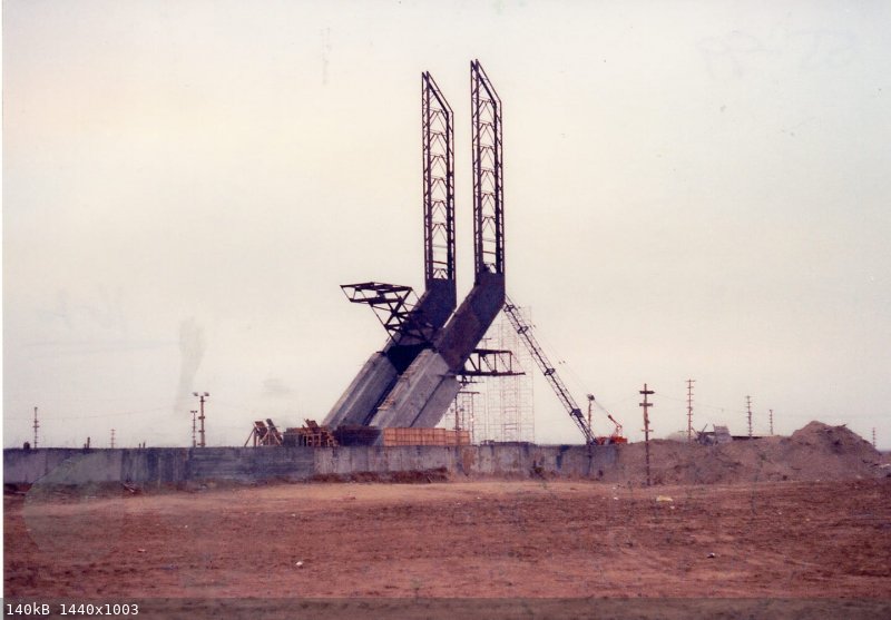
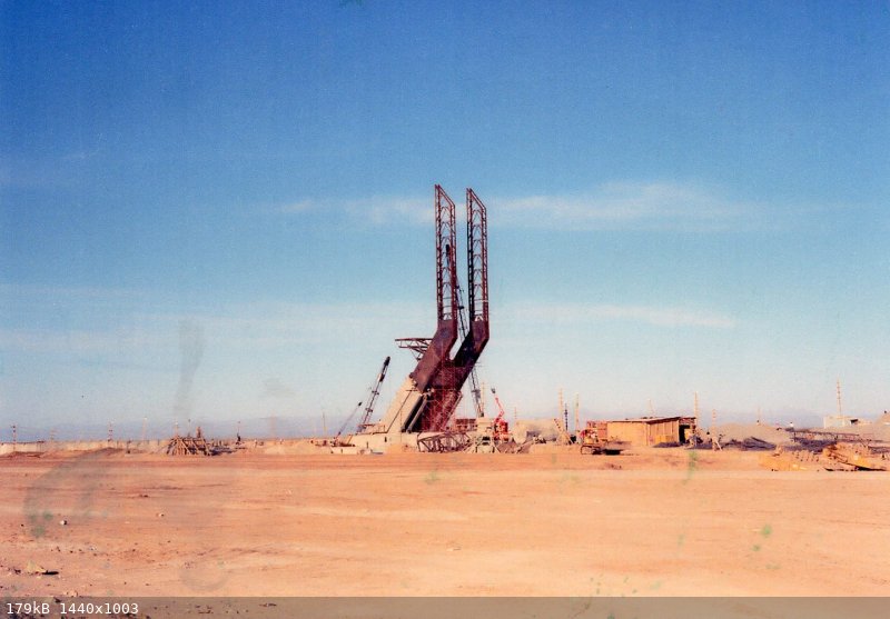
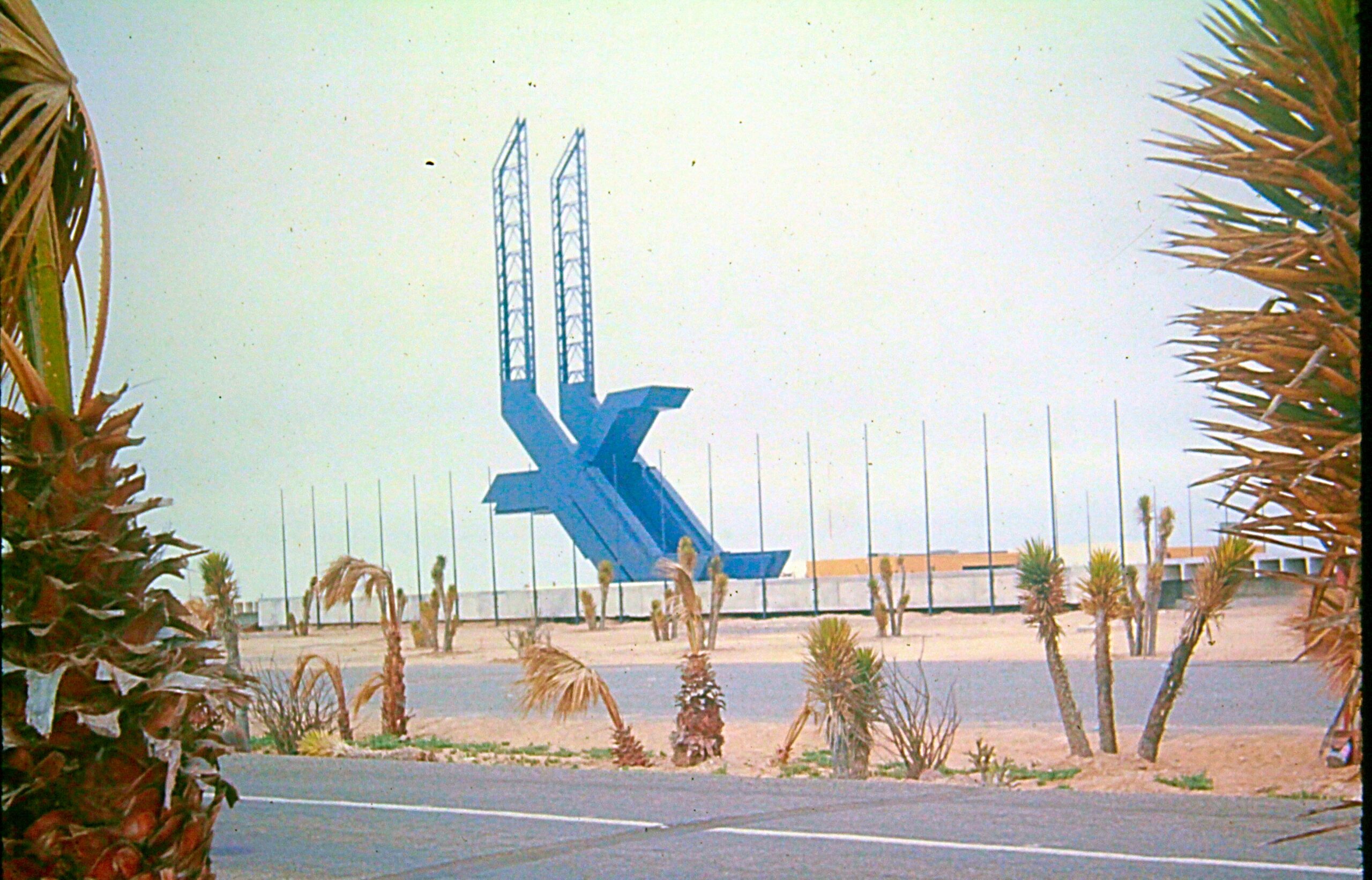
BELOW: Two photos of the rapidly built, 140 ft. tall, Eagle Monument (under construction from July to November 1973) followed by one at the opening
ceremony on Dec. 1, 1973, with the president of Mexico, Luis Echeverría, presiding.
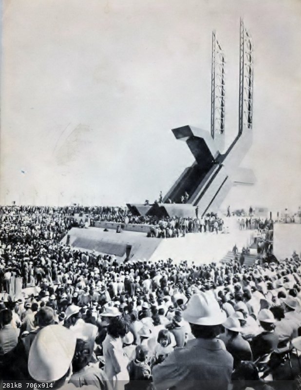
Below the eagle was a large room, designated to be a museum. Many donated artifacts, including Mama Espinoza. Those have vanished.
[Edited on 11-16-2023 by David K]
|
|
|
David K
Honored Nomad
Posts: 64540
Registered: 8-30-2002
Location: San Diego County
Member Is Offline
Mood: Have Baja Fever
|
|
Illustrations before and after the highway construction:
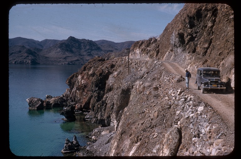
The first three photos were taken in the 1950s and 60s:
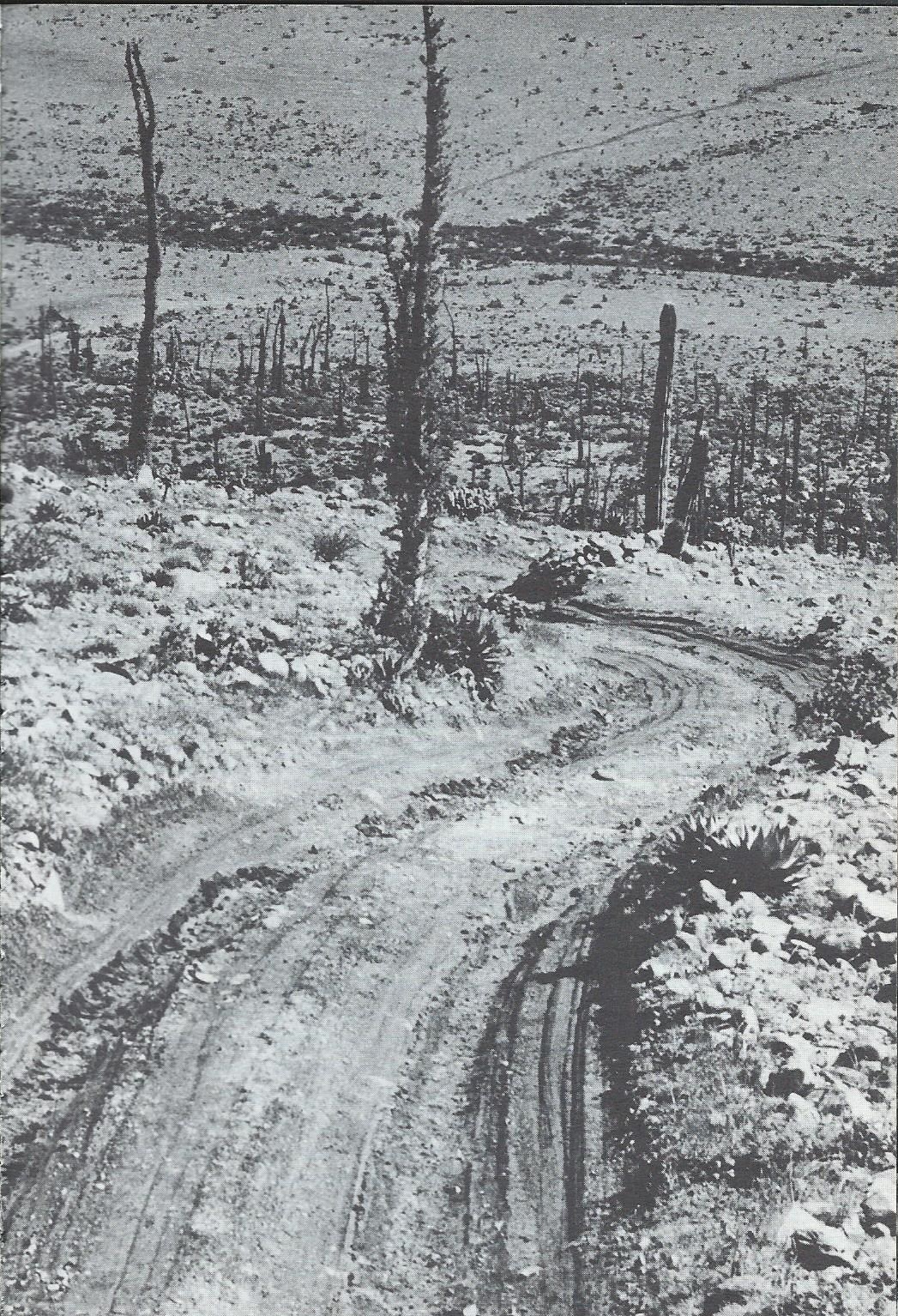
The Old 'highway' about 25 miles south from El Rosario (today around Km. 94).
The old 'highway' bridge in Mulegé
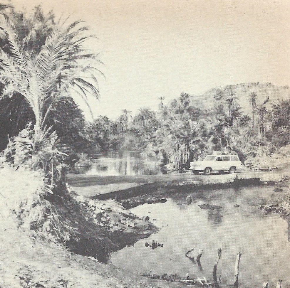
The old 'highway' along Bahía Concepción
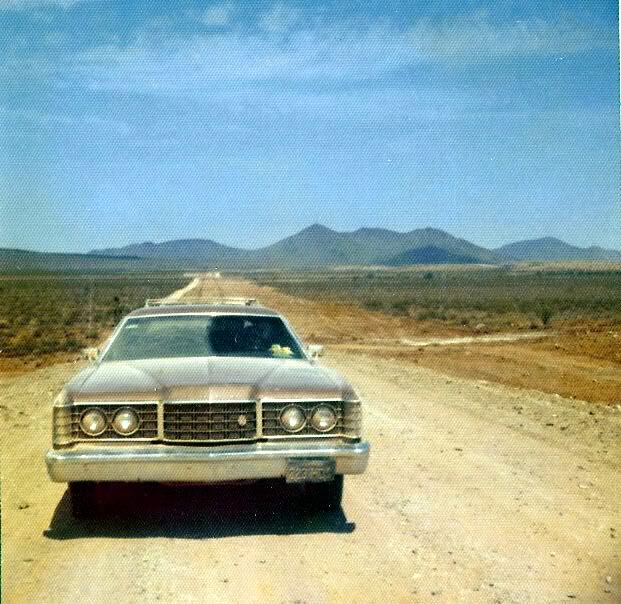
Our trip in the summer of 1973, on the unpaved roadbed just south of Laguna Chapala. We were expecting the road was nearing completion so taking the
new station wagon wouldn't be too taxing on it. Wisely, my father added a second fuel tank to it and air-adjustable height shocks.
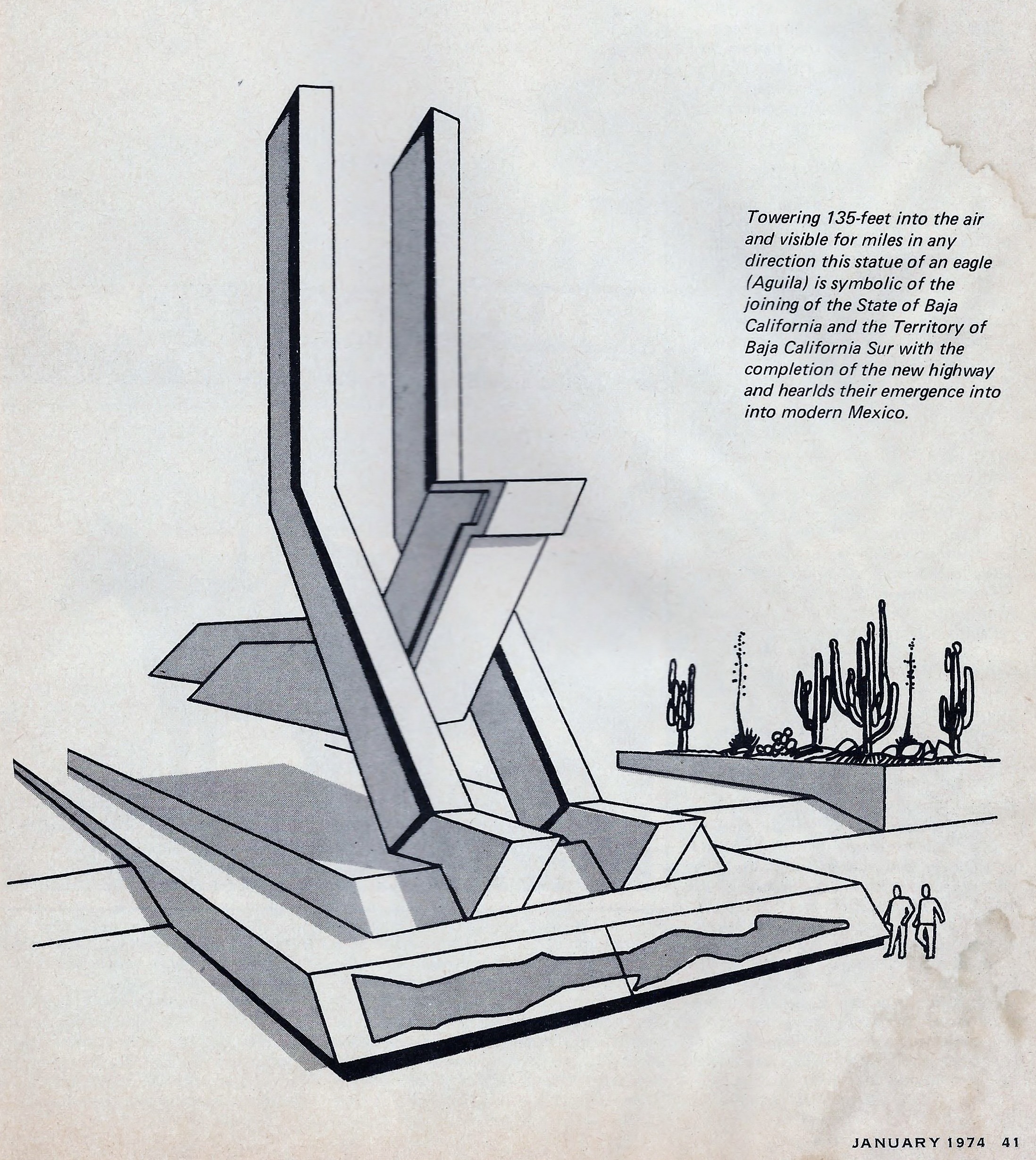
Prior to the completion, an artist conceptual drawing of the monument. I believe this was in the Western Outdoor or Auto Club magazine.
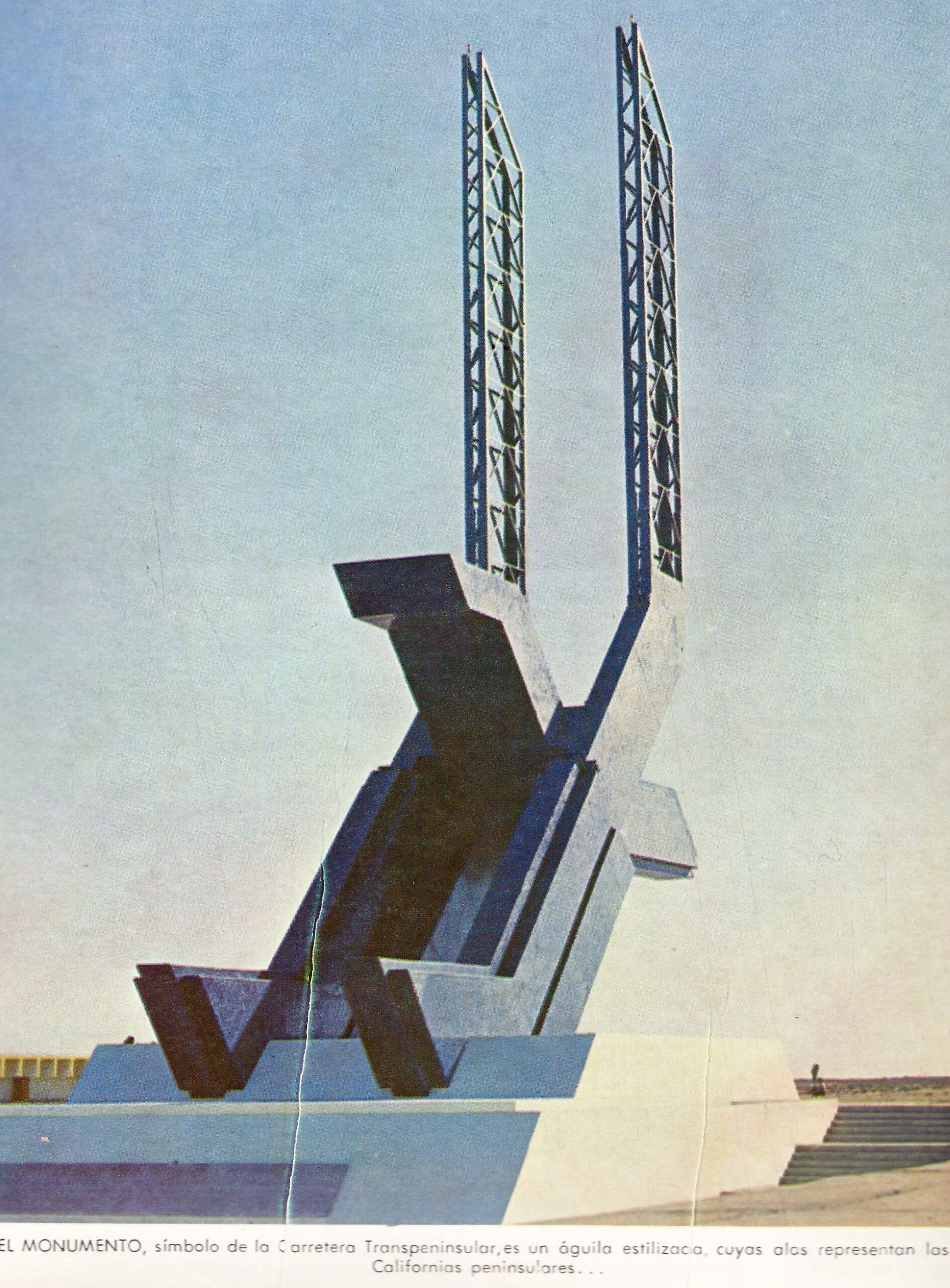
How the Eagle ended up looking, from a book about the new highway.
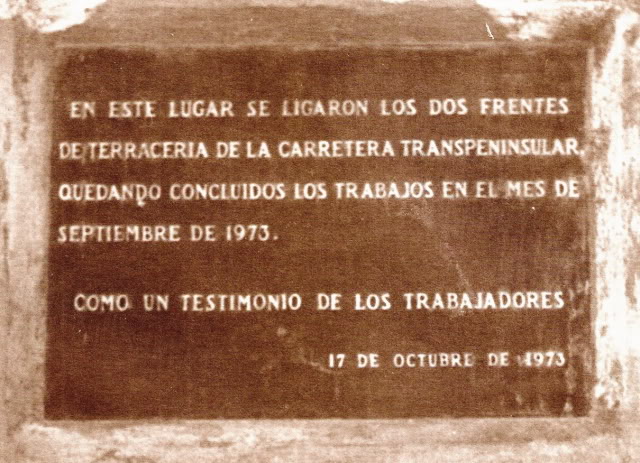
A photo of the original plaque marking the location where highway crews from the north and from the south met, at Rancho San Ignacito (south of
Cataviña/ Santa Ynez). The brass plaque was removed 20-some years ago. The San Ignacito restaurant owner painted the words on the wall, but missed
getting the final year correct.
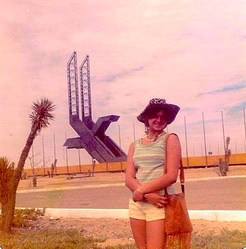
My high school girlfriend on our 1976 trip to Loreto, poses for me at the monument.
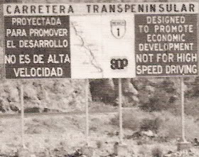
These signs were placed in several locations along the new highway.
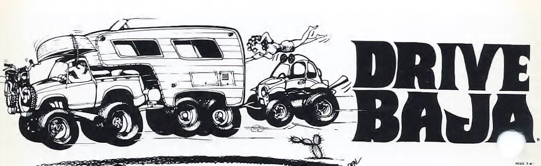
How comic illustrator Dave Deal ('Big Deal') saw the new visitors using a paved road to reach the great destinations on the peninsula. Dave was one of
the original Baja 1000 (Mexican 1000) racers and his Baja bug still holds the record for fastest time to La Paz, before the highway was all paved!
Dave's great ideas for talking cars was used by Pixar for the film of that name and more to follow!

|
|
|
David K
Honored Nomad
Posts: 64540
Registered: 8-30-2002
Location: San Diego County
Member Is Offline
Mood: Have Baja Fever
|
|
Summer 1974
Now that the highway was completed, my dad said, "let's check it out"!
The Baja California Bulletin asked if they could use my summer 1973 guide report for their Dec/Jan 1974/75 magazine. Obviously, that report/booklet
was made before the highway was completed... My folks were great (and they loved Baja), so not only would we retrace our 1973 trip to Loreto, but go
all the way to Cabo and make a couple of side trips so I could write a more-complete guide.
Here are a few pictures from the '74 trip:
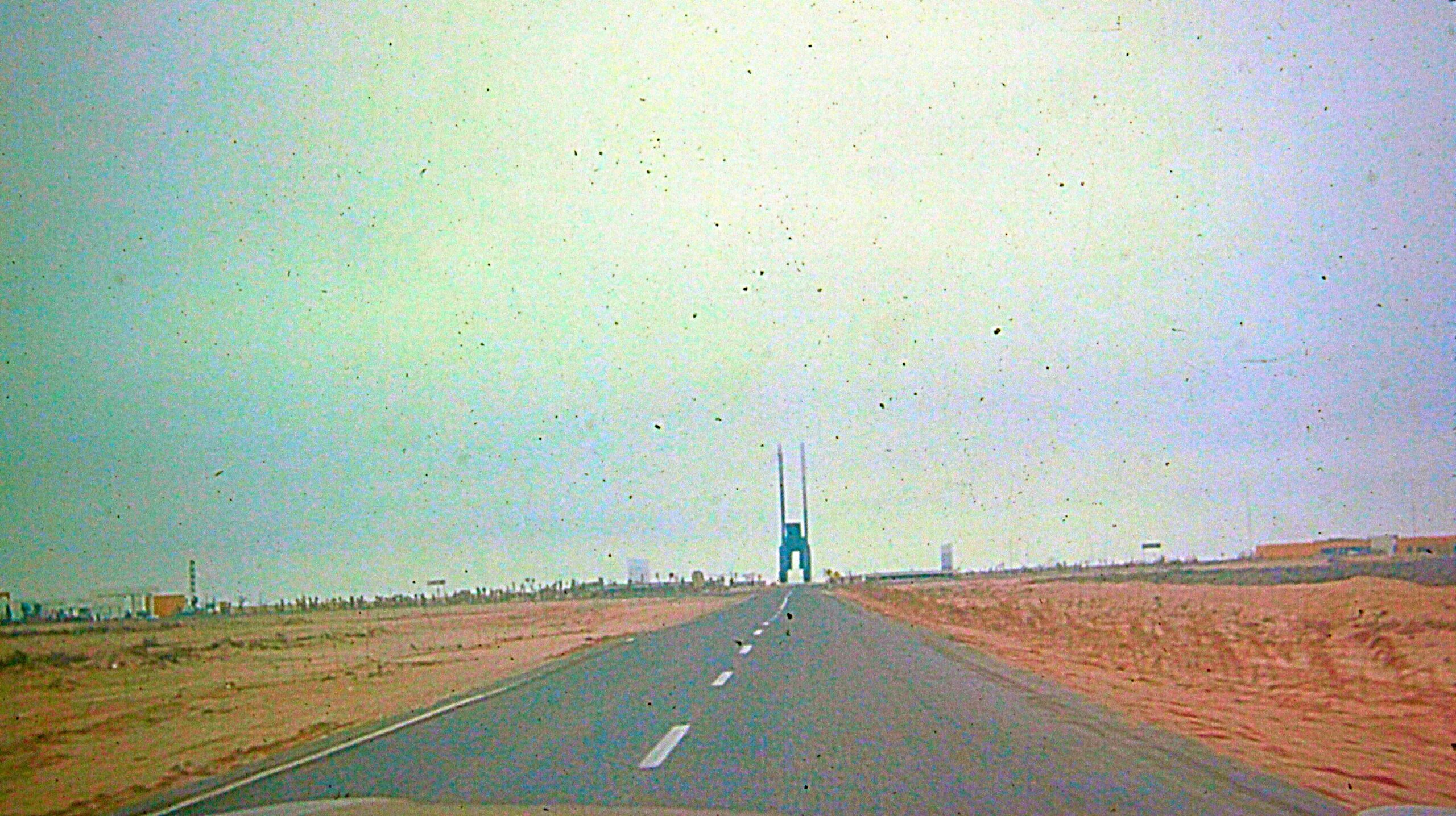
Nearing the new giant eagle, which for many miles we wondered what the two projectiles were. Someone on my Facebook group called it a 'giant tuning
fork'.
You sure don't get this view, anymore!
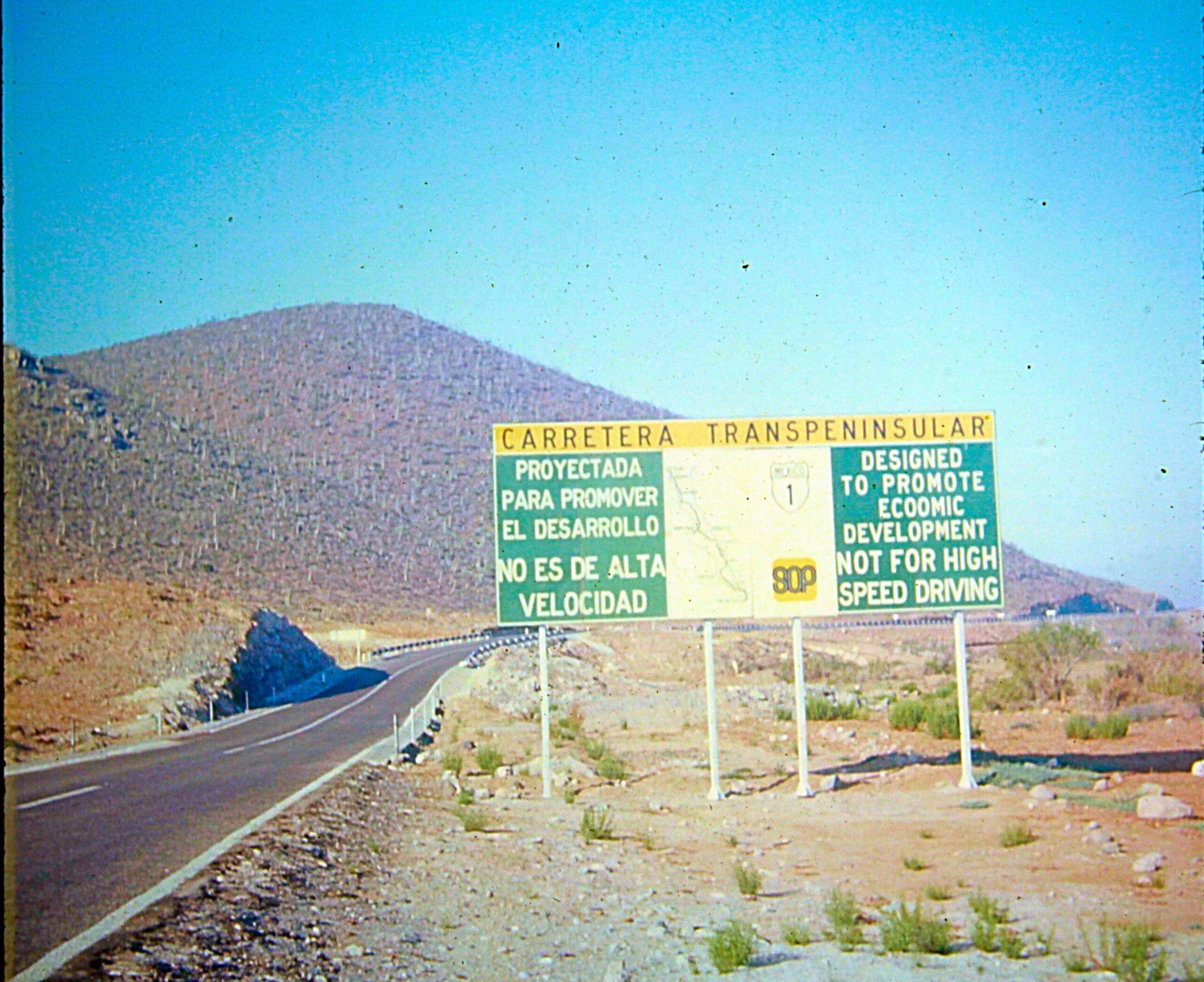
These promo signs were many, up and down the peninsula... the English spelling wasn't always correct!
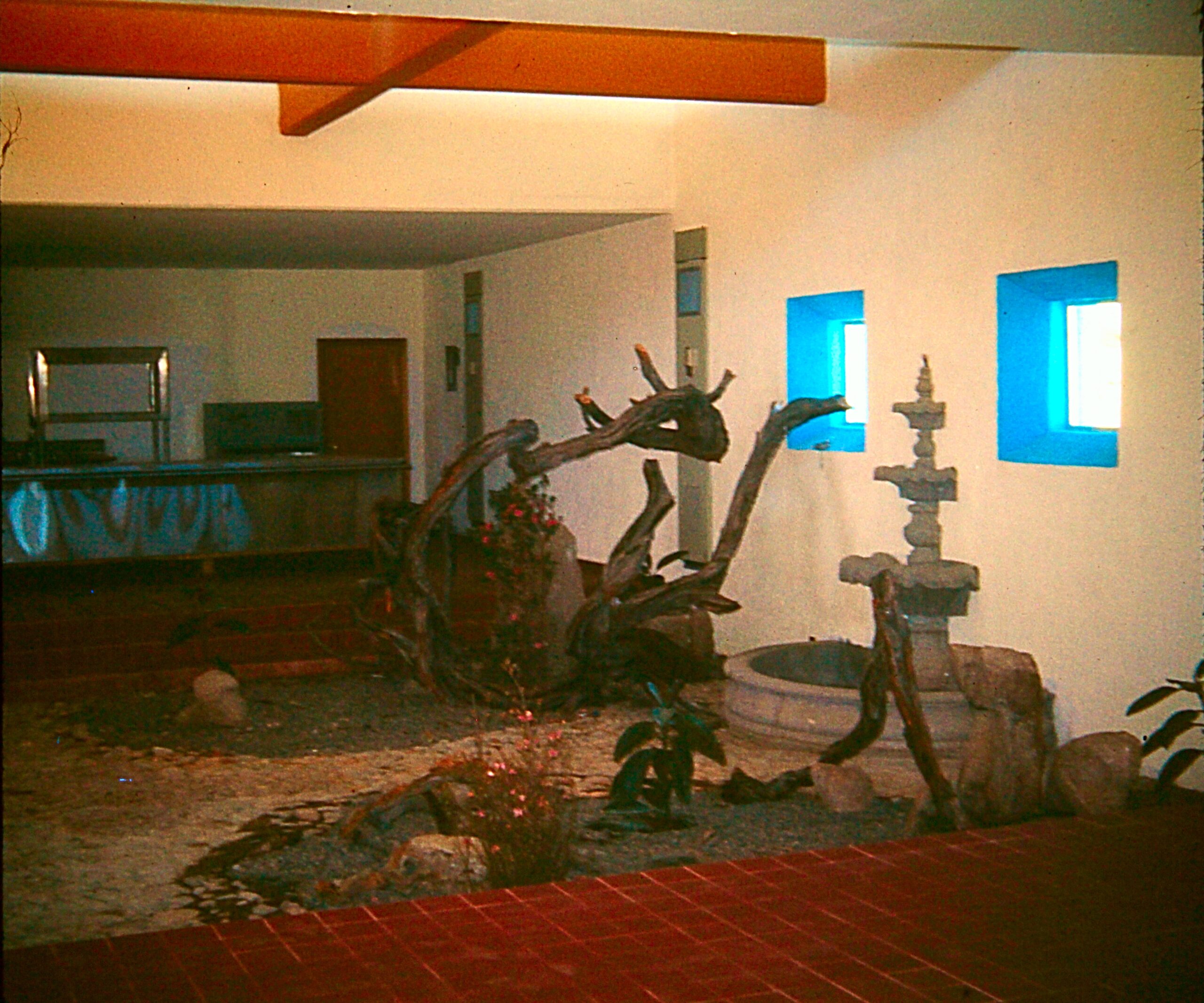
The parador (rest stop) cafeterias were very pleasant, with sunken gardens. This one was at Cataviña and this long-empty building is now a new
market.
PARADORS:
Located at or near San Quintín, Cataviña/Santa Inés, Punta Prieta (L.A. Bay road junction), Paralelo 28° (Eagle Monument/ Guerrero Negro), and San
Ignacio. Paradors were made to provide travelers with services not yet along the new highway section [San Quintín to San Ignacio]: Food, restrooms,
showers, gas station, trailer (RV) park, and a hotel (except Punta Prieta).
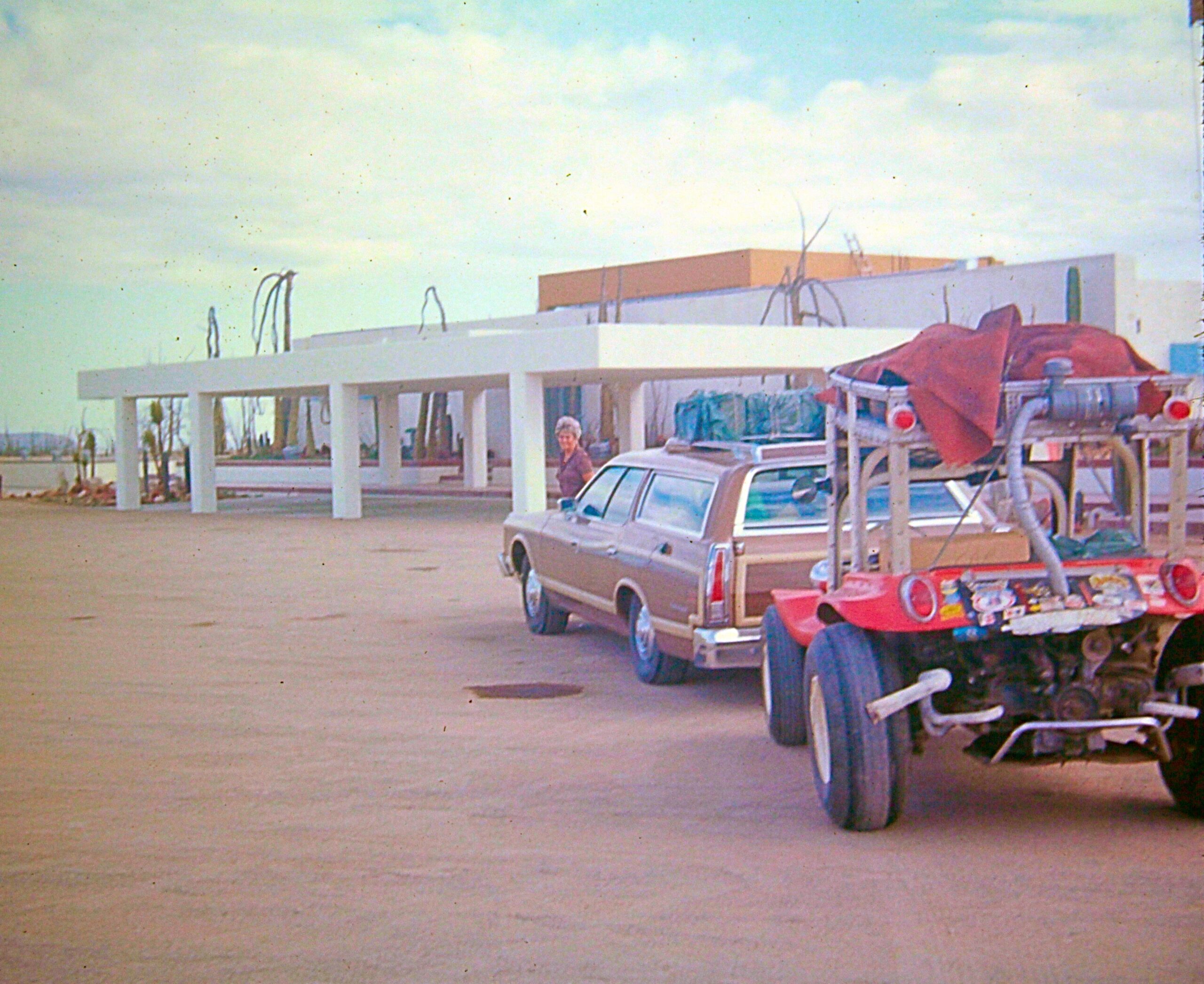
Here at Parador Punta Prieta, we disconnected the dune buggy to check out the new paved road to Bahía de los Angeles, and leave it parked at the gas
station lot for a couple hours. That's my mom.
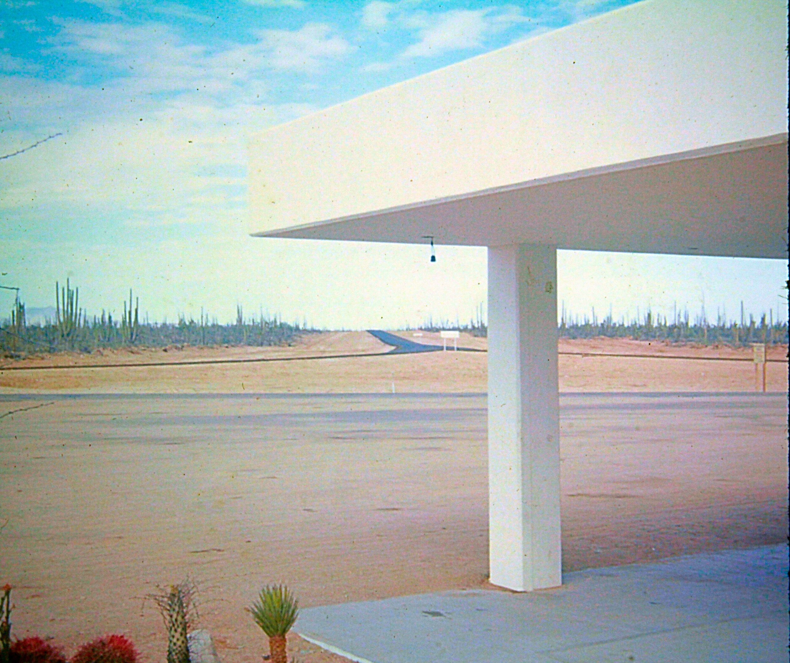
Look, fresh asphalt! Guess what? The paving ended just out-of sight of the parador. Two years later, on our next trip to L.A. Bay, still only paved a
short distance.

L.A. Bay highway in 1974
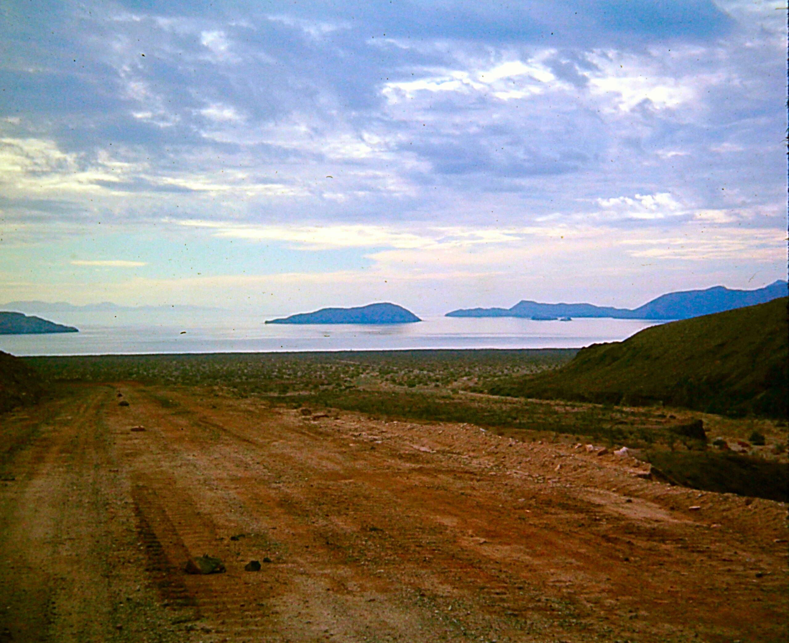
Arriving at the view of L.A. Bay
[Edited on 11-17-2023 by David K]
|
|
|
|


