| Pages:
1
2
3
4
5 |
baitcast
Super Nomad

Posts: 1785
Registered: 8-31-2003
Location: kingman AZ.
Member Is Offline
Mood: good
|
|
Got to get mine in to!
Gonzaga Bay 1964.....My first date with three sisters
This was a trip report I made a year or so ago on the old Amigos board and thought maybe some of you nomads might get a kick out of it.
A friend of mine asked me if I wanted to know a good spot to go fishing,you bet I said where?....a place in mexico on something called the sea of
cortez,lived in huntington bch in those days,jest a hop skip and jump and I would be there great!!!
My friend drew up a map for me,just bought a 64 vw bus and he said I was ready to ,all I had to do was drive down to a bay called Gonzaga and meet a
old guy by the name of papa he would show me where to fish,so I packed up the bus,wife two kids and a friend......
He also said I might have a problem or 2 on the road but everything should be fine,I thanked him.
I have always thought that stupidity must be blessful,for in those days I was my late 20,s and still stupid but happy and was always game to try
anything if it had anything to do with fishing!!.....
My friend had also mentioned it might get a little hot it was july and I should plan on it ,no problem I borrowed one of those window coolers you hang
on the outside of the rig,there I took care of the heat problem,went out and bought a map which gave mileage and some other stuff,we were ready to go.
The trip........
left huntington bch late on night ,should be in san felipe by morning, puertecitos a couple of hours later ,Gonzaga for lunch,everything went
smoothly,arrived in san felipe on time , and now the dirt I can,t wait finally the trip starts,not 10 min,s later we were stuck in a sand pit,I could
still see san felipe,this is not what I had in mind,I did bring a shovel,half hour later we were on our way again........
the going was a little slower than I had planned but no matter we were headed south,finally puertecitos dead ahead,getting a little tired,the kids are
a bit loud,my wife is talking to herself not loud something about this #$%^ road
I couldn,t make out the other things ,my friend is saying nothing by now,stopped for some gas in town,while there a gringo came by and asked where we
were going I said Gonzaga Bay its just down the road a ways from here!!!
Left the window cooler at the station,does,nt work going 10 15 miles anyway,he thanked me.......
Not2 mins out of town I lost track of the road saw nothing but rock,know its here somewhere.....
going is slow ,its very hot,my oldest daughter is getting sick.......
and my wife ...I can hear her now she is getting mad it me,how could I do this to to her and the kids.......
I was very reasurring and told her the bay was just over the next rise,having no idea what I was talking about,the map I just bought mentions
something about three hills that must be climbed and we are in them....
God help us.....
the first two we just made,we are at the bottom of the last and my wife wan,ts to go home,she wan,ts to get out and walk,no problem dear we will get
over this we,ll have it made,I put my foot in it and up we go,going slower I see a rock ledge dead ahead must slow down,now stopped can,t make it
over,put my foot on the brakes and start to slide back down the hill.....
at the bottom of the canyon my spots several wrecks,poor souls never made it,we are now backing down the hill,my hands are shaking,kids are crying,my
friend is white faced,tried once more but could not get over the ledge.....
one thing left to do back down to the bottom,told everyone to get out and walk,just what my wife wanted to do in the first place.......
Well this time I made it ,felt like rocky on top of that mountion.......
flat lands dead ahead,I am numb between the ears but know we are getting close.....
No sooner than we get to the bottom of the hills and I,m stuck again in the sand,will this never end???
Digging and more digging,starting to get pretty good at this though...can,t be to far,daughters temp. is still up,monster headache,finally arrive at
papa,s late in the day but find just a couple of old house,s and a shack or two and no trees,
I check my map my friend gave me,I,m suppose to go down the canyon just before papa,s,he said the fishing was best there and a nice beach so I turned
around and made for the canyon,found a set of tracks to follow,you guessed it stuck again only this time no amount of digging is going to get us out,
my friend said he would watch the family for me so now I,m walking back to papa,s,sometime later I arrive in camp and this little old man come,s up to
me smiling and said something,he already knew what the problem was ,
first thing you know chichi his son and a man with a big rig shows up ,things appeared to be a little slow in camp anyway this would everyone
something to do ......
Didn,t take long for them to get us out.......Guess we will stay at papa,s place,the ground looks firm and I,m not moving,the wife got the kids in the
water for a cool down and I and my friend enjoyed the best and the coldest beer we have ever drank to this day.
After a wonderful nites sleep we got up and started looking for shade,no trees what do you do for shade I asked he smiled and pointed toward his front
porch........
Lucky for us papa had started to build a big cabana all it needed was a roof,so my first day of vacation we finished the roof.....still lots to this
vacation but you get the idea,lots to learn but having fun,going home no problem all the up hills were now down hills and I knew what firm ground
looks like,when we hit the highway at san felipe we all smiled and my wife leaned over and gave me a big kiss and said when we come down next vacation
maybe we should go a month or so sooner,might not be so hot
Anyone can catch fish in a boat but only \"El Pescador Grande\" can get them from the beach.
I hope when my time comes the old man will let me bring my rod and the water will be warm and clear.
|
|
|
willardguy
Elite Nomad
Posts: 6451
Registered: 9-19-2009
Member Is Offline
|
|
LOVED that road....the first half dozen times. after that the dozens and dozens of weekly trips carting building materials to Papa's over that road,
not so much! 
|
|
|
David K
Honored Nomad
Posts: 64479
Registered: 8-30-2002
Location: San Diego County
Member Is Offline
Mood: Have Baja Fever
|
|
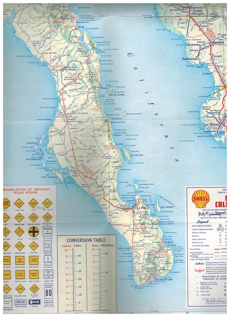
Agree that the Puertecitos to Gonzaga road before 1986 was indeed the toughest main route in Baja! Drove on it in '65, '67, '74, '75, and '79. The
first two years as a passenger as I was under 16.
However, the silt beds of Laguna Chapala were so much worse to drive through (Tijuana to Cabo in 1966) that my dad chose going via Gonzaga on our 1967
trip to L.A. Bay.
|
|
|
StuckSucks
Super Nomad
Posts: 2306
Registered: 10-17-2013
Member Is Offline
|
|
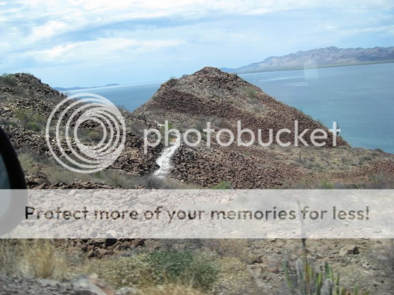
I believe this is a chunk of old road along Bahía Concepción:
|
|
|
JZ
Elite Nomad
Posts: 9228
Registered: 10-3-2003
Member Is Online
|
|
Someone needs to build and share a kmz. Maybe I'll do it.
|
|
|
4x4abc
Ultra Nomad
Posts: 4163
Registered: 4-24-2009
Location: La Paz, BCS
Member Is Offline
Mood: happy - always
|
|
I have almost all of it
haven't found some sections south of Guerrero Negro yet
Harald Pietschmann
|
|
|
David K
Honored Nomad
Posts: 64479
Registered: 8-30-2002
Location: San Diego County
Member Is Offline
Mood: Have Baja Fever
|
|
The old road did not go through or near Guerrero Negro. That town didn't exist until the late 1950s.
I highlighted it from near El Arco to near San Ignacio:
Attachment: Old Road-1.kmz (3kB)
This file has been downloaded 201 times
|
|
|
JZ
Elite Nomad
Posts: 9228
Registered: 10-3-2003
Member Is Online
|
|
So how much of it can you drive these days without climbing over boulders?
|
|
|
David K
Honored Nomad
Posts: 64479
Registered: 8-30-2002
Location: San Diego County
Member Is Offline
Mood: Have Baja Fever
|
|
It's not boulders, it is property fences or washouts in sections that are not used any longer. As you can see from the maps I have edited to show the
old road route, the new highway follows it pretty closely. The old road made a good construction access road. The road crews even graded much of the
old road to improve access for construction vehicles. The two areas where the old road and the new are apart are from Rosarito (Nuevo Rosarito) to
near Vizcaino and from the bottom of Bahia Concepcion to Insurgentes.
The new highway favored Guerrero Negro over El Arco and favored Loreto over Comondú.
|
|
|
4x4abc
Ultra Nomad
Posts: 4163
Registered: 4-24-2009
Location: La Paz, BCS
Member Is Offline
Mood: happy - always
|
|
Quote: Originally posted by David K  |
The old road did not go through or near Guerrero Negro. That town didn't exist until the late 1950s.
I highlighted it from near El Arco to near San Ignacio:
|
my mistake - I had south of Comondu in mind
Harald Pietschmann
|
|
|
mtgoat666
Select Nomad
Posts: 17294
Registered: 9-16-2006
Location: San Diego
Member Is Offline
Mood: Hot n spicy
|
|
The prettiest old road section is the old road thru Catavina.
From what I have seen, the definition of old road is a bit loose. The old road changed over time. 120 years from now, when the ic engine is obsolete
(and petroleum is gone, sea level is 60 ft higher, and San Felipe summers are a whole lot hotter), your “new road” will be your g-g-great
grandchildren’s “old road”
Woke!
“...ask not what your country can do for you – ask what you can do for your country.” “My fellow citizens of the world: ask not what America
will do for you, but what together we can do for the freedom of man.”
Prefered gender pronoun: the royal we
|
|
|
David K
Honored Nomad
Posts: 64479
Registered: 8-30-2002
Location: San Diego County
Member Is Offline
Mood: Have Baja Fever
|
|
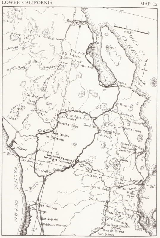
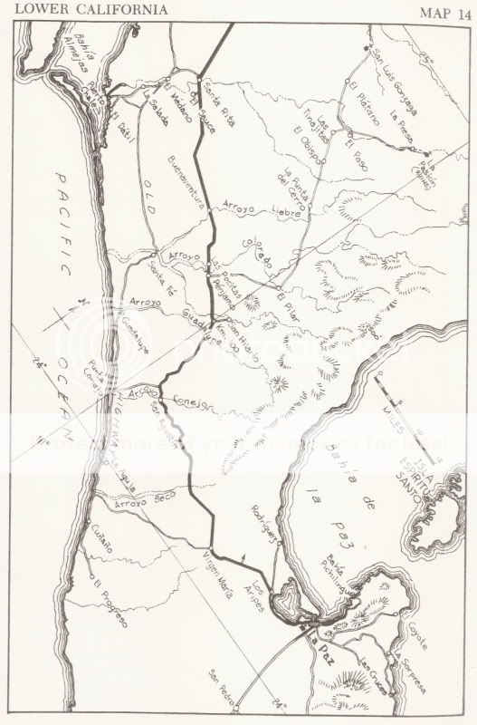
In the 1960s and much of the 50s, from Comondú the route was out the same canyon as the current route. The road bumped into the long straight, graded
road at Poza Grande. The older road was not straight and went through Santo Domingo, and south along the coast by Punta Conejo.
1962:
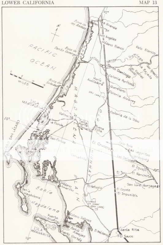
1958:
1941:
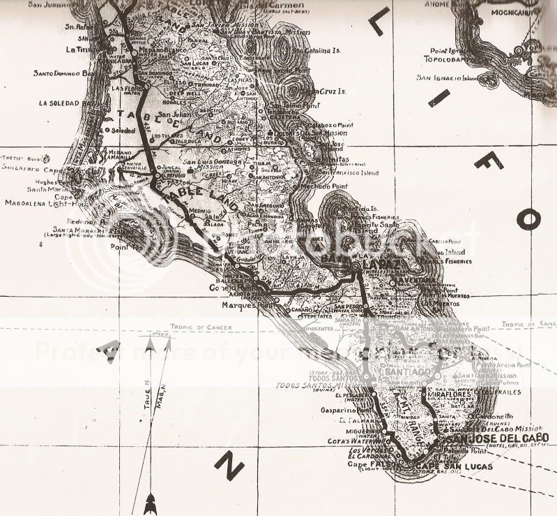
[Edited on 6-5-2019 by David K]
|
|
|
HeyMulegeScott
Senior Nomad
Posts: 690
Registered: 8-25-2009
Location: Orygone/Mulege
Member Is Offline
|
|
Here's part of the old road in the bottom of the pic and I was told the zig zag in the top of the picture is how they brought in equipment to make the
new road.

|
|
|
JZ
Elite Nomad
Posts: 9228
Registered: 10-3-2003
Member Is Online
|
|
What bay is that in Conception?
|
|
|
David K
Honored Nomad
Posts: 64479
Registered: 8-30-2002
Location: San Diego County
Member Is Offline
Mood: Have Baja Fever
|
|
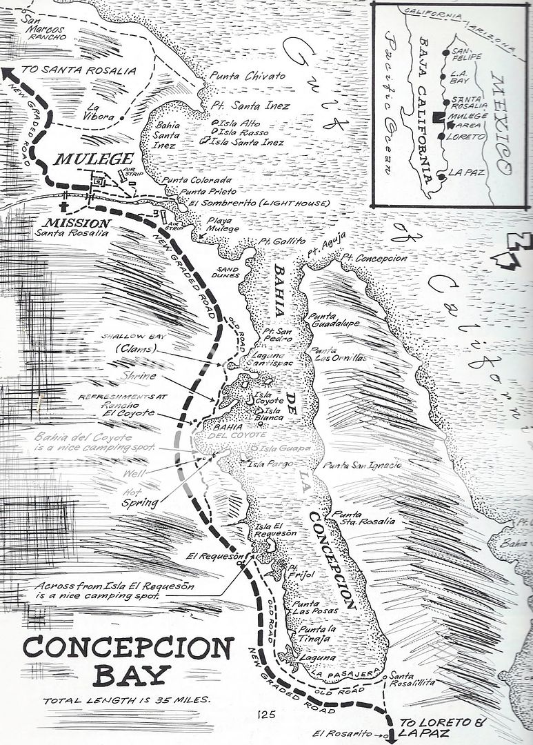
In the 1970 Cliff Cross Baja Guide, he drew in the new road where he thought it was being built. Cliff mentions a construction camp was at El
Requesón during his research trip (possibly in 1969?). In 1966, it was just the old road, along the edge of the bay except for where it went inland
between El Coyote and Buenaventura/ Requesón).
Construction crews used the old road and yes, there was some of the old road obliterated where the new road was on top of it. However, that narrow
switchback to the top of the ridge was not likely used to transport anything for roadwork, IMO.
In his 1974 Updated guide, Cliff Cross corrected the paved highway location from his 1970 & 1972 editions...
Except for south of El Requesón, the new paved highway and the old road were in the same or very near the same place.
|
|
|
HeyMulegeScott
Senior Nomad
Posts: 690
Registered: 8-25-2009
Location: Orygone/Mulege
Member Is Offline
|
|
Burro.
|
|
|
David K
Honored Nomad
Posts: 64479
Registered: 8-30-2002
Location: San Diego County
Member Is Offline
Mood: Have Baja Fever
|
|
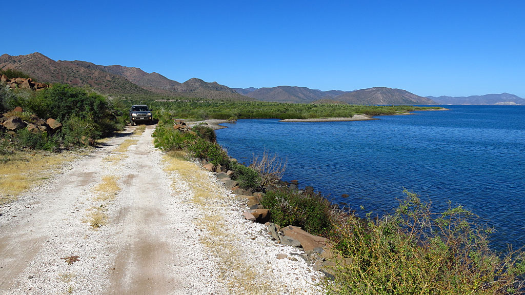
Here is a look at the old road, from the new, south of Requesón:
|
|
|
HeyMulegeScott
Senior Nomad
Posts: 690
Registered: 8-25-2009
Location: Orygone/Mulege
Member Is Offline
|
|
- -that narrow switchback to the top of the ridge was not likely used to transport anything for roadwork, IMO. - -
David -It's a mystery then. Maybe created by aliens or lost Vikings? 
|
|
|
David K
Honored Nomad
Posts: 64479
Registered: 8-30-2002
Location: San Diego County
Member Is Offline
Mood: Have Baja Fever
|
|
| Quote: Originally posted by Three2tango | - -that narrow switchback to the top of the ridge was not likely used to transport anything for roadwork, IMO. - -
David -It's a mystery then. Maybe created by aliens or lost Vikings?
|
Maybe? LOL... I looked at Google Earth to see if it goes down the other side, and it does...
So, as sharp as the switchbacks are, probably not used for construction equipment trucks but maybe it was a temporary detour for travelers as they
built the highway on that cliff?
|
|
|
4x4abc
Ultra Nomad
Posts: 4163
Registered: 4-24-2009
Location: La Paz, BCS
Member Is Offline
Mood: happy - always
|
|
the challenge to create a complete GPS file is that
1 the old maps are not very accurate
2 place names are either wrong or have changed
3 it is sometimes very difficult to visually trace the old road(s) on Google Earth due to development (many new roads crisscrossing the area) or
intense vegetation growth
even with old photographs some locations are very challenging
still scratching my head on some Concepcion images from the 30's
the track zig zagging down the mountain at Cuesta El Burro is likely a work track - it is not well defined and not improved at all
equipment transport makes sense to me
Harald Pietschmann
|
|
|
| Pages:
1
2
3
4
5 |


