| Pages:
1
2
3
4
5 |
David K
Honored Nomad

Posts: 64490
Registered: 8-30-2002
Location: San Diego County
Member Is Offline
Mood: Have Baja Fever
|
|
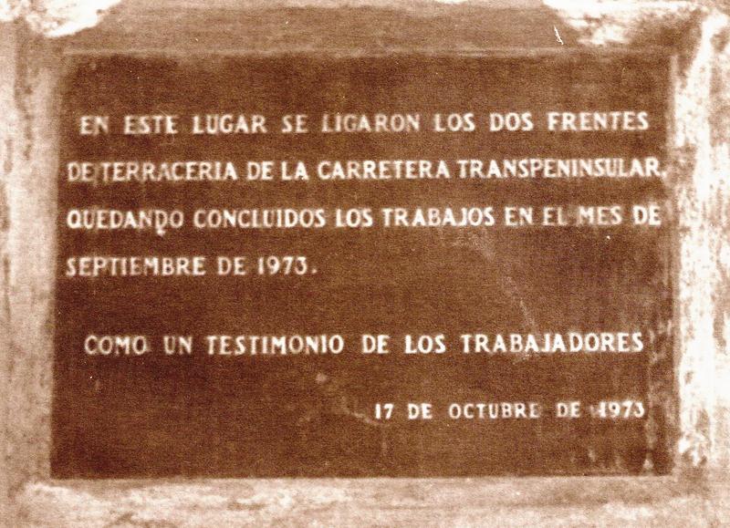
The highway construction companies in 1970-73 were one in the south building north and one in the north building south. The south team made much
greater progress than the north team. By 1972, the south team built the highway from Constitucion to Santa Rosalia. The north team only got paving to
Colonia Guerrero/ San Quintín area from Colonet on a roadbed that was already made back in the 50s.
1973 is when the magic happened and more companies were added to rush the job. The width of the final section was made the minimum. By July the south
team reached Laguna Chapala with the new roadbed with paving in sections to Punta Prieta. The north team only made it through El Rosario to near San
Agustin with paving to the Mission San Fernando road. By November, the road was completed.
The north and south construction teams met at San Ignacito (12 kms. south of Cataviña). The highway was officially opened on Dec. 1, 1973.
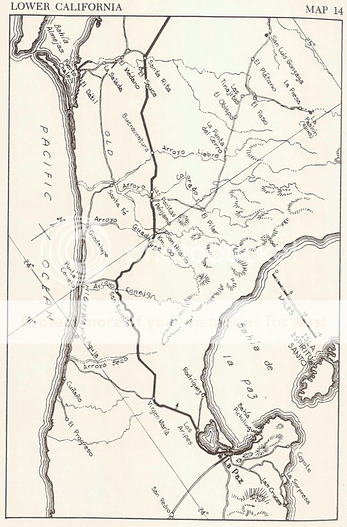
The last AAA Map (1973) made before the highway was finished:

|
|
|
4x4abc
Ultra Nomad
Posts: 4165
Registered: 4-24-2009
Location: La Paz, BCS
Member Is Offline
Mood: happy - always
|
|
spent a couple of hours looking again for traces of the old road south-east of El Medano
NOTHING!
Harald Pietschmann
|
|
|
David K
Honored Nomad
Posts: 64490
Registered: 8-30-2002
Location: San Diego County
Member Is Offline
Mood: Have Baja Fever
|
|
That is the old-old road (1940s) west of Santa Rita. Use Howard Gulick's map to see the route. Southeast: It heads to Rancho Santa Fe. The Baja 1000
has used it or a parallel route.
[Edited on 6-6-2019 by David K]
|
|
|
4x4abc
Ultra Nomad
Posts: 4165
Registered: 4-24-2009
Location: La Paz, BCS
Member Is Offline
Mood: happy - always
|
|
well, all those maps are fine and dandy - but to actually trace the old route on Google Earth is a completely different story
Harald Pietschmann
|
|
|
David K
Honored Nomad
Posts: 64490
Registered: 8-30-2002
Location: San Diego County
Member Is Offline
Mood: Have Baja Fever
|
|
When I get home tonight, I will have a go at it Harald... But, I bet you will have more luck. Howard's maps are very good. He was an engineer and at
every curve in the road, he got out of his Willys Wagon, walked several feet away (so the compass would not be affected by the Jeep's metal) and took
the directional reading.
His hand drawn maps were quite amazing. The Lower California Guidebook (1956-1970) used abbreviated versions, reduced scale maps to fit in the book. I
saw one of his original maps when I was a kid at the home of one of his traveling partners, Andy Anderson.
The maps are archived at the University of California, San Diego.
|
|
|
TMW
Select Nomad
Posts: 10659
Registered: 9-1-2003
Location: Bakersfield, CA
Member Is Offline
|
|
Harald try using Bing satellite images. They are clearer than GE.
|
|
|
4x4abc
Ultra Nomad
Posts: 4165
Registered: 4-24-2009
Location: La Paz, BCS
Member Is Offline
Mood: happy - always
|
|
OK - then here is the challenge:
bring me a usable track of the old road between El Medano and Rancho Tepeyac - Rancho Santa Fe and I'll buy you dinner and unlimited drinks
forget the 1950's Pemex exploratory tracks (almost always dead straight lines)
Harald Pietschmann
|
|
|
David K
Honored Nomad
Posts: 64490
Registered: 8-30-2002
Location: San Diego County
Member Is Offline
Mood: Have Baja Fever
|
|
From Rancho Santa Fe south to Punta Conejo is easy but from R. Santa Fe north to El Médano, I am only seeing very straight lines once north of the
arroyo crossing... Not that the 1940s road can't be a straight line, but Howard drew it with a bit of a bow to it, it seems to me?
Do you have the dates when Pemex did their exploratory drilling there? I know they tried near Scammon's Lagoon.
Gulick's first edition (1956) has road logs on both new and old highway roads. He traveled them in 1953.
|
|
|
4x4abc
Ultra Nomad
Posts: 4165
Registered: 4-24-2009
Location: La Paz, BCS
Member Is Offline
Mood: happy - always
|
|
the Pemex exploration tracks are from the 1950's
they are kind of a Baja mystery
they are there, but no official documents
some government announcement that they wanted to do it, but nothing more
some are used as roads by the locals now
the Pemex tracks between El Medano and Santa Fe do not match any of the maps from 1940 to 1970
I have found some cow tracks and possible sections of that elusive old road, but not much
I think we can call that stretch now the "El Medano Gap"
http://baja101.com/Baja-GPS/Medano-Gap.kmz
Harald Pietschmann
|
|
|
Russ
Elite Nomad
Posts: 6741
Registered: 7-4-2004
Location: Punta Chivato
Member Is Offline
|
|
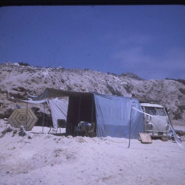
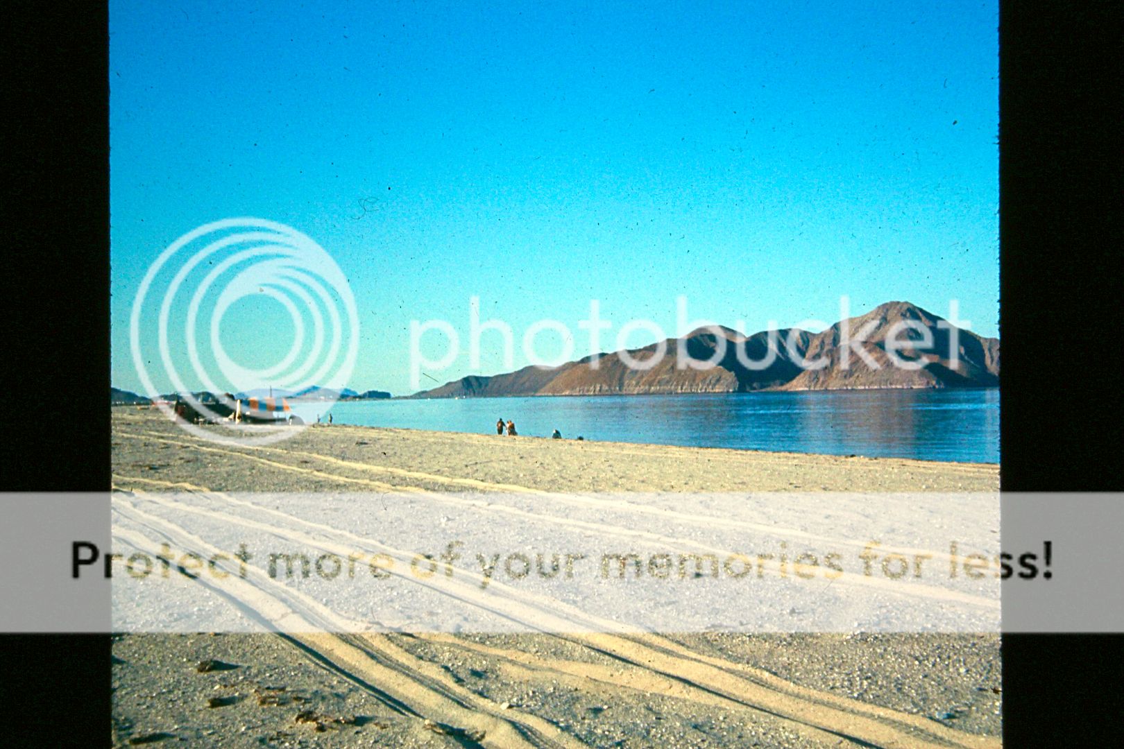
Here's a couple from my '68 trip to Cabo area.
A young me
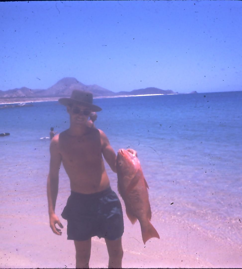
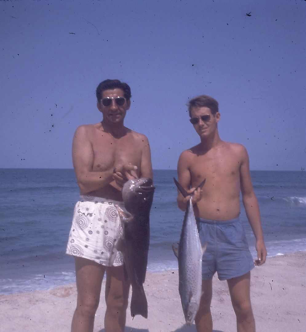
Our camp where we stayed for 3 weeks. We called it Solitito. The folks I was with started Las Baracas. Haven't been there since that trip.
[Edited on 6-9-2019 by BajaNomad]
Bahia Concepcion where life starts...given a chance!
|
|
|
Russ
Elite Nomad
Posts: 6741
Registered: 7-4-2004
Location: Punta Chivato
Member Is Offline
|
|
All photos taken June & July of '68
Bahia Concepcion where life starts...given a chance!
|
|
|
Fatboy
Senior Nomad
Posts: 716
Registered: 6-28-2005
Member Is Offline
|
|
So cool, have Road Envy for all you folks that went to Baja pre '70's.
Can't go to the Baja of back then anymore but reading old books and trip reports and seeing old pictures is really neat.
|
|
|
watizname
Senior Nomad
Posts: 769
Registered: 8-7-2009
Member Is Offline
|
|
Quote: Originally posted by Russ  | Here's a couple from my '68 trip to Cabo area.
A young me
Our camp where we stayed for 3 weeks. We called it Solitito. The folks I was with started Las Baracas. Haven't been there since that trip.
|
Sooooooooo-------All those stories about Big Fish were TRUE. Didja see the size of that Sierra?? Nice fish Russ. 
[Edited on 6-9-2019 by BajaNomad]
I yam what I yam and that\'s all what I yam.
|
|
|
David K
Honored Nomad
Posts: 64490
Registered: 8-30-2002
Location: San Diego County
Member Is Offline
Mood: Have Baja Fever
|
|
Here are four photos from 1974 near Alfonsina's where I camped, and on the road going from Gonzaga Bay north to Puertecitos (I was 16 on my first
non-parent Baja trip):
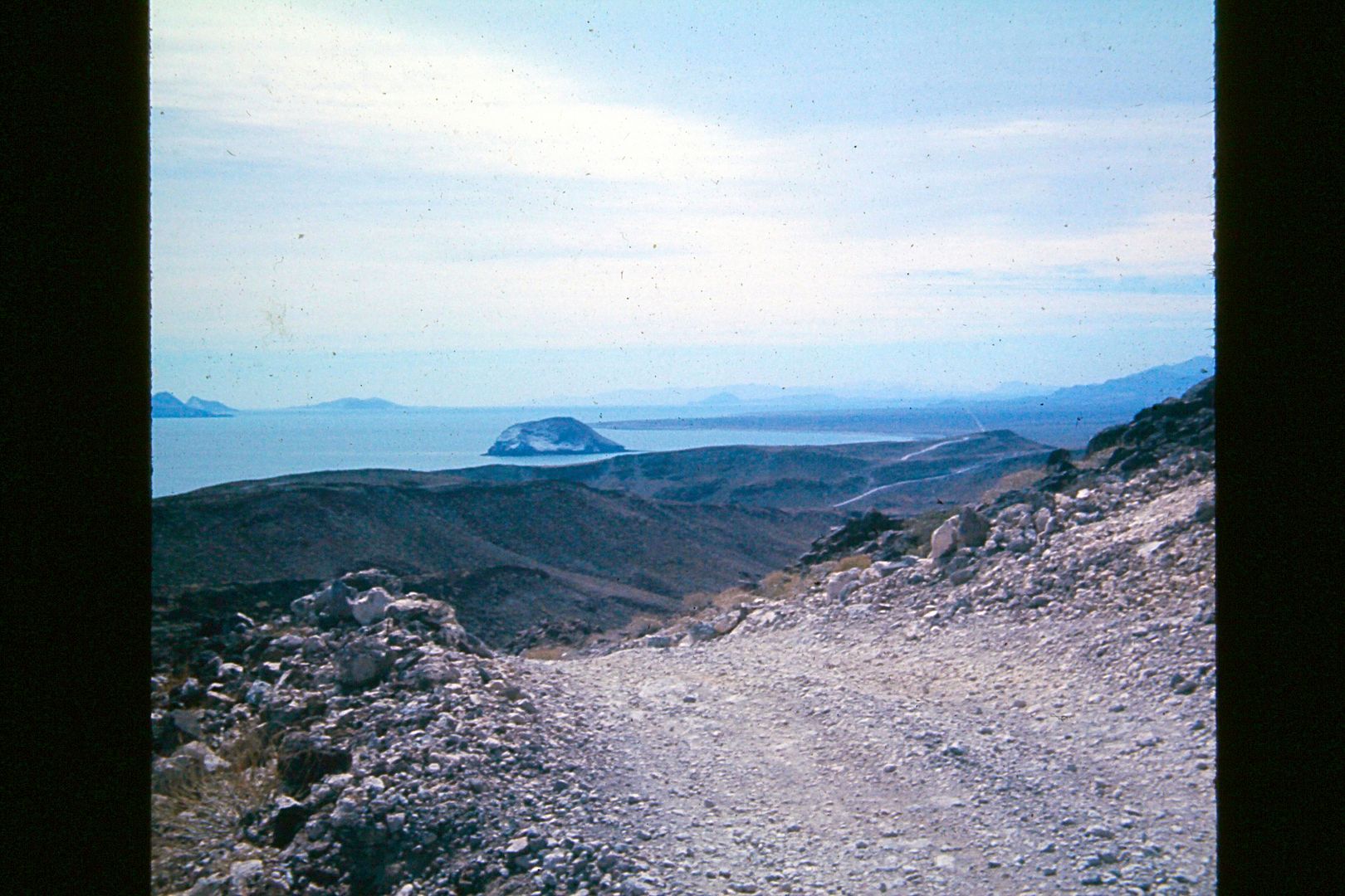
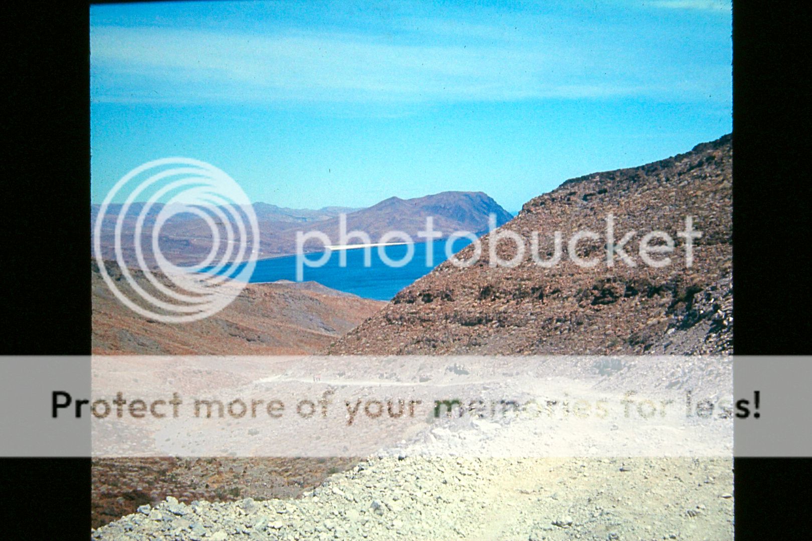
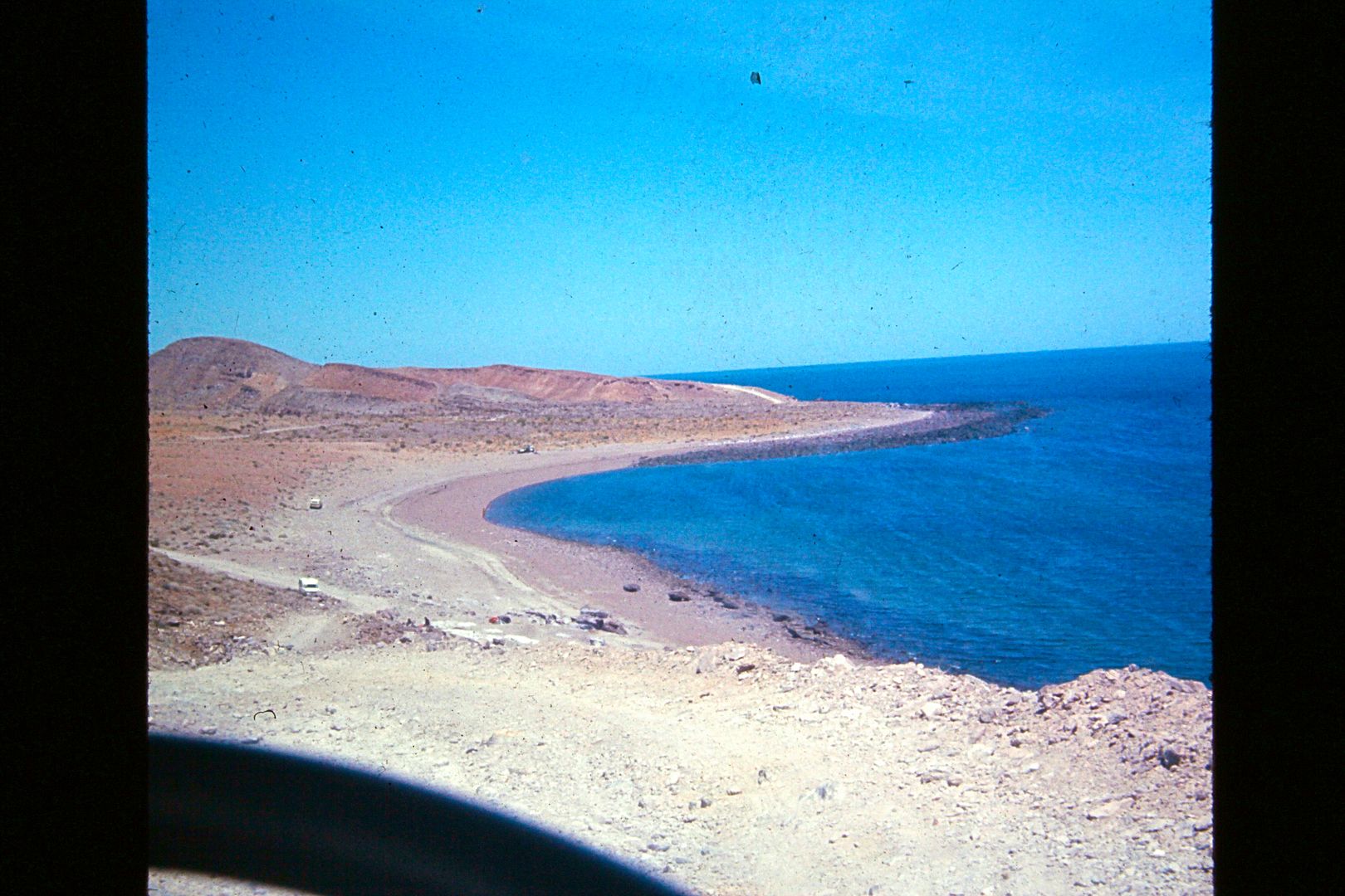
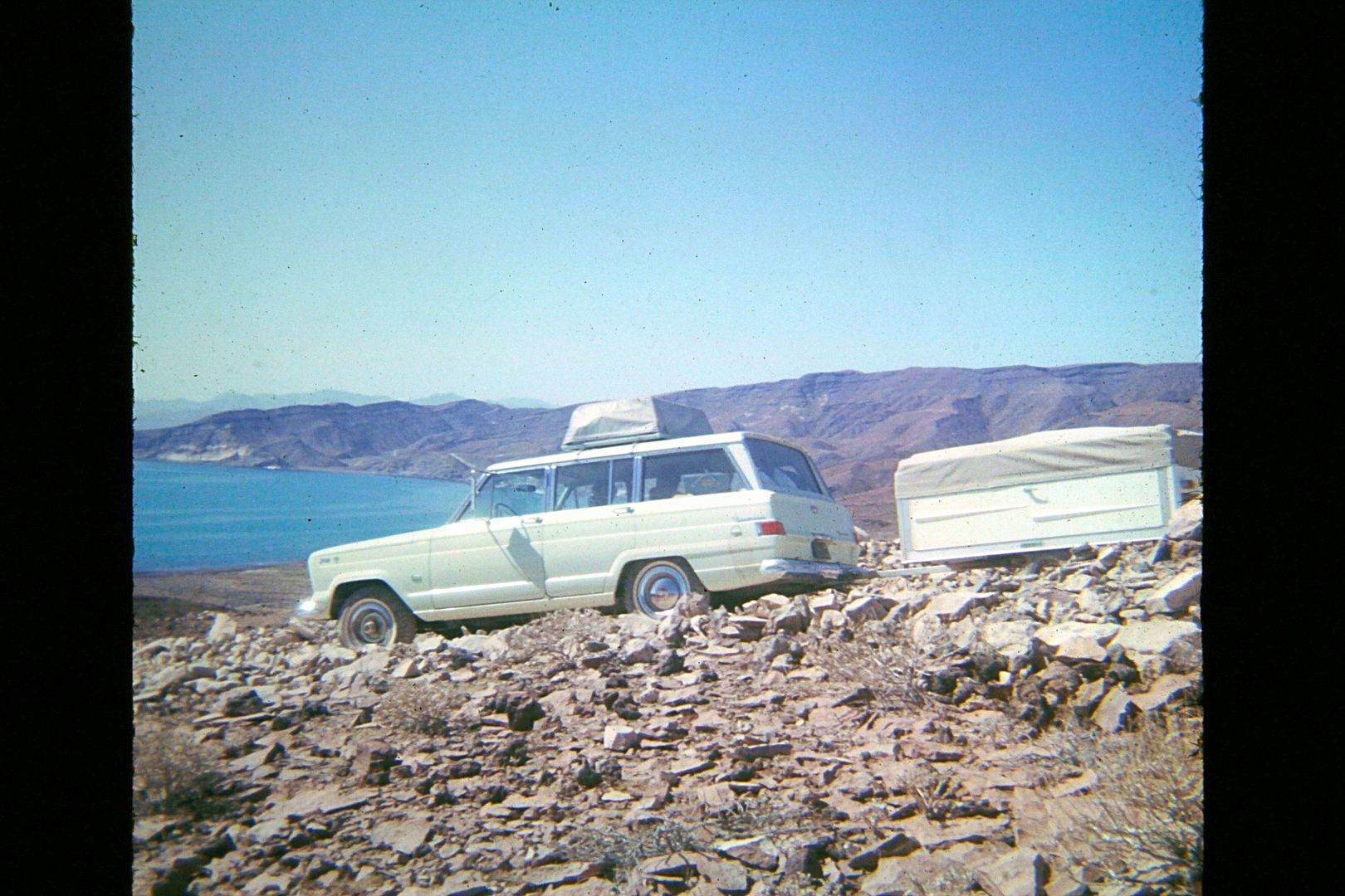
Here's a photo from 1965, our first family Baja trip in the new Jeep Wagoneer, to Gonzaga Bay (south from Puertecitos):
|
|
|
4x4abc
Ultra Nomad
Posts: 4165
Registered: 4-24-2009
Location: La Paz, BCS
Member Is Offline
Mood: happy - always
|
|
does this grade have a name?
Harald Pietschmann
|
|
|
David K
Honored Nomad
Posts: 64490
Registered: 8-30-2002
Location: San Diego County
Member Is Offline
Mood: Have Baja Fever
|
|
In fact, the major grades did and were how the truckers referred to them. The big grade in the photo may have been the longest. In the distance in my
photo is Cerro Prieto volcano.
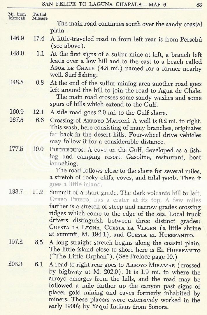
Here, from the Lower California Guidebook, 1962 edition:
Here is the map of the grades from Cliff Cross, 1970:
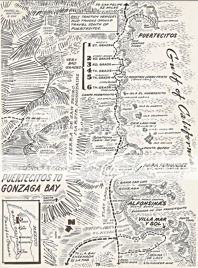
Gringos have called the grades the sisters (or 3 sisters) or three Marías, etc. My parents referred to them as the "Gonzaga Grades" in the 1960s,
diving over them three times. I drove over them in 1974, 75, and 79. The 1979 trip was extremely tough as the road was no longer maintained after
Highway 1 was completed and all commercial traffic came in from there, via Calamajué to 1983, then via the new graded road from Chapala after.
[Edited on 6-9-2019 by David K]
|
|
|
Fatboy
Senior Nomad
Posts: 716
Registered: 6-28-2005
Member Is Offline
|
|
Do you know which one is in your picture?
|
|
|
David K
Honored Nomad
Posts: 64490
Registered: 8-30-2002
Location: San Diego County
Member Is Offline
Mood: Have Baja Fever
|
|
Because the photo shows it some distance to the south of Cerro Prieto, and it is a long grade, my guess is Cuesta El Huerfanito, #6 on Cliff Cross'
map, and the one in Russ' photo showing the cut at the top. That cut was a new (1960-ish) addition to reduce the steepness a bit.
The original pilot road that Arturo Gross made (1956) can be seen in spots. The government followed Grosso a couple of years later and improved
Grosso's road. That road remained until it was virtually impassable in the early 1980s and in 1986, the new, wide, graded road was built. When the new
paved highway went in beginning in 2007, they used a different alignment in some places.
Here is a photo from Howard Gulick taken just north of El Huerfanito in 1956...

[Edited on 6-9-2019 by David K]

|
|
|
David K
Honored Nomad
Posts: 64490
Registered: 8-30-2002
Location: San Diego County
Member Is Offline
Mood: Have Baja Fever
|
|
Puertecitos in 1956, the pilot road just completed and nothing yet developed there... Howard Gulick photo:

In 1959...

[Edited on 6-9-2019 by David K]
|
|
|
Fatboy
Senior Nomad
Posts: 716
Registered: 6-28-2005
Member Is Offline
|
|
Neat Gulick pictures
|
|
|
| Pages:
1
2
3
4
5 |


