| Pages:
1
..
3
4
5
6 |
PaulW
Ultra Nomad

Posts: 3015
Registered: 5-21-2013
Member Is Offline
|
|
Davids 1962 map defiantly shows two Arroyo Grandes. Is this the map Tom is referring to. As we know Borrego, Arrajal or Sharp could be the summit
called Borrego on the 62 map.
Looking at the map IMO the second AG is probably Arroyo Arrajal, and I can see the connection heading northerly toward Pinta Pass and easterly where
Arrajal becomes a flat flood plain heading to Hwy3. Arrajal does have uncounted side arroyos not explored by me.
BTW, the flow of water from the CODE track to get to the present day AG flows NW at the N end and SE from the S end after Pinta Pass East. When
driving cross country in then N area we crossed dozens of water paths heading NW.
|
|
|
David K
Honored Nomad
Posts: 64519
Registered: 8-30-2002
Location: San Diego County
Member Is Offline
Mood: Have Baja Fever
|
|
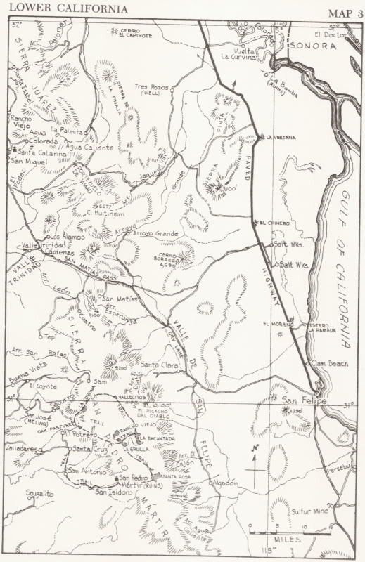
Quote: Originally posted by TMW  | | I think we have been looking at the wrong Arroyo Grande. In the Lower California Guidebook by Gerhard and Gulick map 3 there are two Arroyo Grandes
shown. The one we know of that runs by the wells for the mine and the other is shown running east and west just above Cerro Borrego and I think the
latter one is what Henderson walked into. I know that on the map the latter one was probably ment by the book authors as the ranch but I think
Henderson was referring to it in his statement especially when he talks about how they drove up to the hillside and reaching the base of C. Borrego.
Something to ponder at least. Last year when Phil and I went down Arrroyo Grande we only saw one place, as I recall, that came anywhere near
Hendersons description of huge verticle walls. |
The Arroyo Grande that is behind Borrego Mountain (Arrajal mtn in the Almanac) is the same one that goes to the wells for the gold mine west of La
Ventana restaurant.
The following is from memory, I don't have the letter in my hand...
Henderson and his friend was seeking a way to get to the canyons where he might find blue palm trees. They would later realize they came too far south
on the old dirt road to San Felipe.
Henderson drove from near El Chinero west in Arroyo el Arrajal (as called in the Almanac) and he gave the latitude of where they parked and began the
hike.
They found the rock pile while hiking over the range and while descending down to Arroyo Grande, westward... They spent the night in Arroyo Grande it
would seem. They hiked to the base of Borrego Mountain (Arrajal) and back over the ridge to the car. Henderson gives details of where and what to look
for to Choral Pepper hoping she could get Erle Stanley Gardner to fly her over the area. Henderson also IDs a rock type formation in Arroyo Grande
where the rock pile wash meets Arroyo Grande.
I am asking everyone to please photograph the rock pile if they should find it... it looks out of place (ie. man made) and is the size of a large
grave on the flat bench on the north side of the canyon. I would naturally appreciate being there when it is found or have an opportunity to see it
before it is looted. This would be an important historical discover and put Diaz firmly into the books as the first land expedition into California.
|
|
|
David K
Honored Nomad
Posts: 64519
Registered: 8-30-2002
Location: San Diego County
Member Is Offline
Mood: Have Baja Fever
|
|
| Quote: Originally posted by PaulW | Davids 1962 map defiantly shows two Arroyo Grandes. Is this the map Tom is referring to. As we know Borrego, Arrajal or Sharp could be the summit
called Borrego on the 62 map.
Looking at the map IMO the second AG is probably Arroyo Arrajal, and I can see the connection heading northerly toward Pinta Pass and easterly where
Arrajal becomes a flat flood plain heading to Hwy3. Arrajal does have uncounted side arroyos not explored by me.
BTW, the flow of water from the CODE track to get to the present day AG flows NW at the N end and SE from the S end after Pinta Pass East. When
driving cross country in then N area we crossed dozens of water paths heading NW.
|
For the life of me, I couldn't figure out why some are seeing two arroyos named Arroyo Grande! Well, today, elbeau mentioned it and gave me the visual
aid, circling the names!
There is ONE arroyo named 'Arroyo Grande' on the map and then there is ONE rancho named 'Arroyo Grande' on the map... the ranch is the small circle at
the end of the dirt road from east of San Matias Pass. If you don't read the guidebook or see that little circle, you may think there are two arroyos
named Arroyo Grande!
The arroyo on the map that is below the Rancho Arroyo Grande name is what the Almanac calls Arroyo El Arrajal and heads straight for El Chinero
mountain on the 1962 map.
|
|
|
PaulW
Ultra Nomad
Posts: 3015
Registered: 5-21-2013
Member Is Offline
|
|
10-4
Good eye
|
|
|
elbeau
Nomad
Posts: 256
Registered: 3-2-2011
Location: Austin, TX
Member Is Offline
|
|
Just to make sure we keep this as confusing as we can:
Henderson wrote to Choral Pepper in 1967, describing a trip that happened several decades earlier. While composing the letter it's possible that he
used the 1962 map and made the same mistake that we just did 
|
|
|
David K
Honored Nomad
Posts: 64519
Registered: 8-30-2002
Location: San Diego County
Member Is Offline
Mood: Have Baja Fever
|
|
Oh that will keep them guessing El Beau!
In the letter, where they parked the Model A is given. That alone is gold as to their route to Arroyo Grande!
Choral Pepper never disclosed the details in Desert Magazine or her Baja book, and that left folks like Bruce Barber starting their search at La
Ventana (the last point Henderson drove to according to the published articles).
I am not even sure if Choral new she had the letter still and if she just wrote from memory when she read the letter in 1967? The letter was buried in
the big box of papers and photos I received after Choral died.
Just a side note, Choral had a nick name her friends/family used, and it came from her father: 'Corke' (the e is silent). I don't use it because of
her known name and that the silent e would be questionable. The e was added by her (she told me) to make the word Cork look feminine.
She was a cool lady and loads of fun to visit with and chat about Baja with!

Choral at the cave she discovered from a helicopter and unseen from the canyon trail. Mexico's anthropologist named it after her (Pepper Cave), but
Choral insisted she would need to climb to it for that honor. J.W. Black joined her and Dr. Margain took photos from across the canyon where the
helicopter could land...

Choral and J.W. Black climbing to the cave she discovered

J.W. Black at Pepper Cave
The first American woman at San Francisco de la Sierra, arriving by copter (mules were the only other way, 2-3 day ride) in the early 1960's...

Choral (wearing hat) with the women and children of San Francisco
Erle Stanley Gardner and Choral Pepper...

The gang was treated to great stories around the campfire by mystery novelist (and Perry Mason creator), Erle Stanley Gardner.

With San Ignacio's famous Frank Fischer (with copy of Gardner's whale book)

'Uncle Erle' as the gang called him loved Baja and the desert and loved people to be with him... he covered all expenses for everyone he invited
along. The Perry Mason TV series and his books made these Baja expeditions possible.
In 2001, Coronado, Calif...

|
|
|
TMW
Select Nomad
Posts: 10659
Registered: 9-1-2003
Location: Bakersfield, CA
Member Is Offline
|
|
I don't think Henderson made it to Arroyo Grande. Based on where he parked his car he would have had to walk NW not west to get to any wide area in
Arroyo Grande. I think he walked into Arroyo El Arrajal. I think the fact that he says, "verticle walled blocks before reaching the base of Cerro
Borrego," tells me he was walking west or SW not NW, especially. In his letter to Pepper he referenced the Guide Book map3 and I think he also saw
Arroyo El Arrajal as Arroyo Grande since it is not noted as Arrajal on map3.
|
|
|
David K
Honored Nomad
Posts: 64519
Registered: 8-30-2002
Location: San Diego County
Member Is Offline
Mood: Have Baja Fever
|
|
They realized they were too far south for where they hoped to get too... so Northwest was the correct direction to try and get to the Tinajas range
where they hoped to find blue palms.
Obviously, going 20 miles by foot in good conditions is an all day event. They walked less than 10 miles or let's say near 10 miles from the Model A
to Arroyo Grande (the arroyo, not the ranch). I think they then went south to the foot of Borrego Mountain (Cerro el Arrajal today) and back east over
the divide into the arroyo tributary of El Arrajal to the Model A.
It wasn't until Walter was back home, maybe years later, that he read the Mechior Diaz story and concluded that was an explanation for the elaborate
pile of rocks.
|
|
|
TMW
Select Nomad
Posts: 10659
Registered: 9-1-2003
Location: Bakersfield, CA
Member Is Offline
|
|
PaulW have you driven the 2013 SF250 course that went thru Arroyo El Arrajal? If so did you see any huge verticle walls?
|
|
|
David K
Honored Nomad
Posts: 64519
Registered: 8-30-2002
Location: San Diego County
Member Is Offline
Mood: Have Baja Fever
|
|
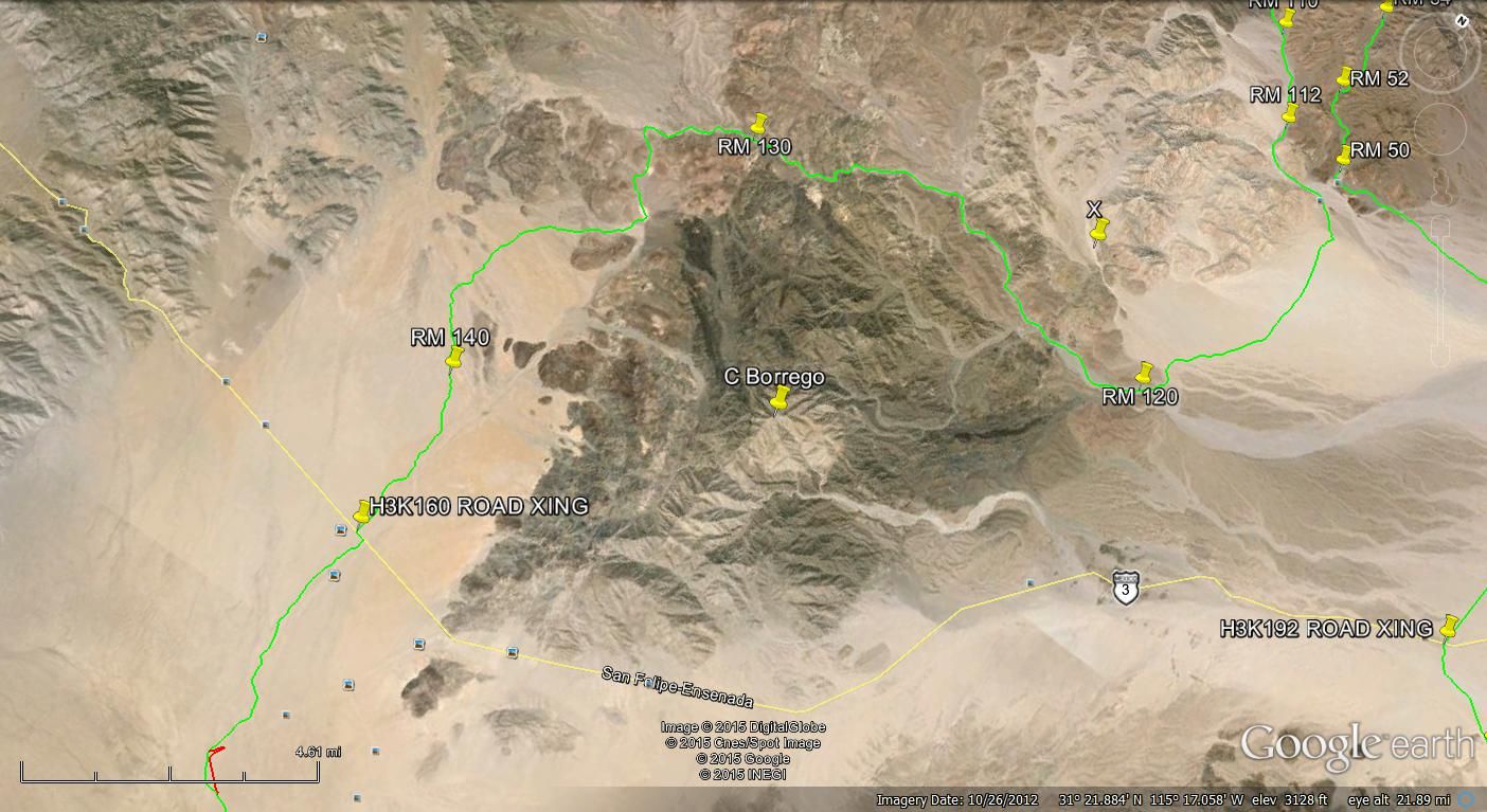
My hunch is that Henderson returned to the Model A on the race course (RM 130 to RM 120, 10 miles)... and that was after he came up Arroyo Grande (5
miles?) from where he saw the vertical walls (which were at the junction of the west flowing wash he arrived to Arroyo Grande in, on Day 1.
|
|
|
PaulW
Ultra Nomad
Posts: 3015
Registered: 5-21-2013
Member Is Offline
|
|
I don't think so. In that time frame there probably were no roads until the racers defined them north of the ck pt. Sure one could make way thru
several arroyos and climb over several substantial ridges. A very difficult path until arroyo Arrajal is reached - then on to Pinta pass then on to
AG.
If the two crossed Pinta pass west and the easiest way to get close would have been via the Buck Indian trail which starts at Chinero. It could also
be accessed from the area east on the San Matias road. The Arrajal outflow plain is pretty big and can be driven all the way from Hwy 5 or 3.
After PP west heading N, I know of no vertical walls and the arroyo flow is NNW. No west flow.
Walls can be seen in Arrajal, but nothing like in the guts of AG.
Lots of west flowing arroyos out of the Pintas on the trail N of Pinta pass east, but tall walls are not present.
Clarification needed. Where did they park the A ?
PPW is the SCORE track, PPE is the CODE track.
|
|
|
TMW
Select Nomad
Posts: 10659
Registered: 9-1-2003
Location: Bakersfield, CA
Member Is Offline
|
|
We need to see the map Henderson was using at the time. It may better explain which way he went after leaving the car. I doubt he just took off
without having some reference as to which way to go.
|
|
|
David K
Honored Nomad
Posts: 64519
Registered: 8-30-2002
Location: San Diego County
Member Is Offline
Mood: Have Baja Fever
|
|
Well, it seems this is getting enough attention to give us all a break, and I would like to see the rock pile before I die... details sent to Paul, no
doubt a great Nomad who went to the aid of Pappy Jon in Arroyo Matomi last year without hesitation... and we thank him for that and these great posts
on Nomad.
u2u sent
Please photo the site well and share with me if you find it.
|
|
|
TMW
Select Nomad
Posts: 10659
Registered: 9-1-2003
Location: Bakersfield, CA
Member Is Offline
|
|
It will start getting hot soon and we will not be able to start looking. I think we should start by following what Henderson did. Drive out to where
he went and parked then start walking. On the ground in the area we may be better able to define where he went. Plot some possible paths first but try
and visualize what he saw. Maybe get a plane to fly over the area first if we can.
|
|
|
David K
Honored Nomad
Posts: 64519
Registered: 8-30-2002
Location: San Diego County
Member Is Offline
Mood: Have Baja Fever
|
|
| Quote: Originally posted by TMW | | It will start getting hot soon and we will not be able to start looking. I think we should start by following what Henderson did. Drive out to where
he went and parked then start walking. On the ground in the area we may be better able to define where he went. Plot some possible paths first but try
and visualize what he saw. Maybe get a plane to fly over the area first if we can. |
A drone would be great!
I think we have ATVs now that can get closer to the west flowing canyon, by going up the gentle slope from the east side. However, from the Arroyo
Grande side, if that huge block wall is seen, then that would be the correct canyon to go up from... that is what I was hoping to see in your
photos... the prime choice was the one you didn't get a picture of...
Well, the cat's out of the bag... almost no secrets left to share... almost!
|
|
|
David K
Honored Nomad
Posts: 64519
Registered: 8-30-2002
Location: San Diego County
Member Is Offline
Mood: Have Baja Fever
|
|
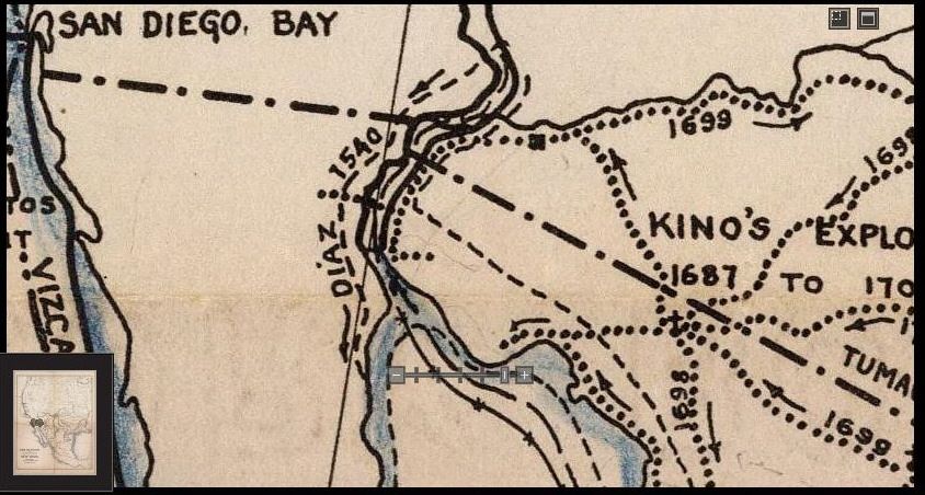
Here's a map showing Diaz' route ... well the route we hope he took, ending in the Sierra Pinta (Sierra las Pintas in the Almanac):
|
|
|
TMW
Select Nomad
Posts: 10659
Registered: 9-1-2003
Location: Bakersfield, CA
Member Is Offline
|
|
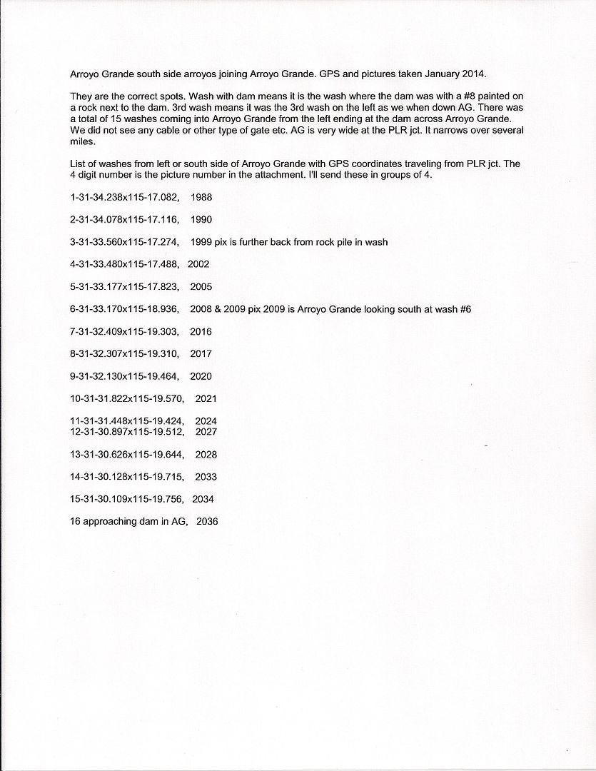
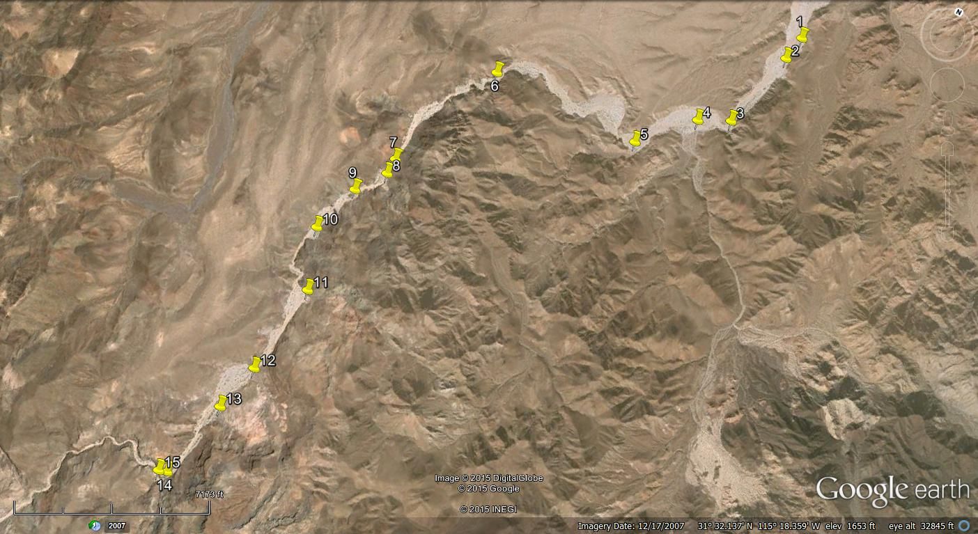
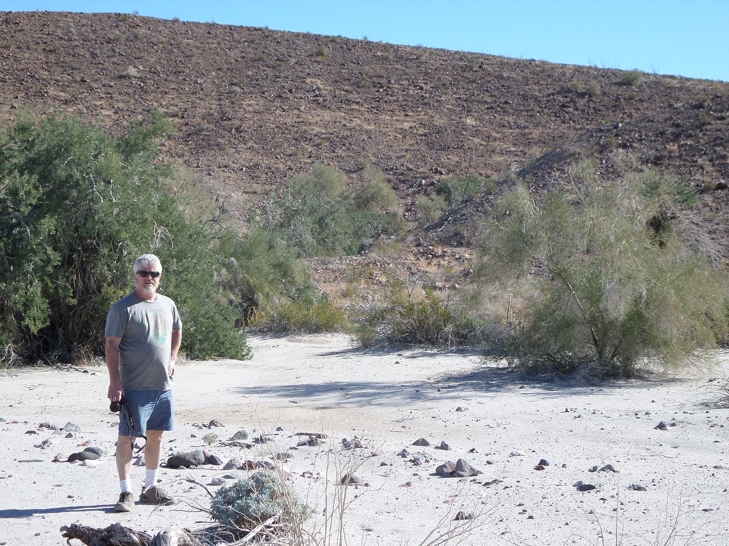
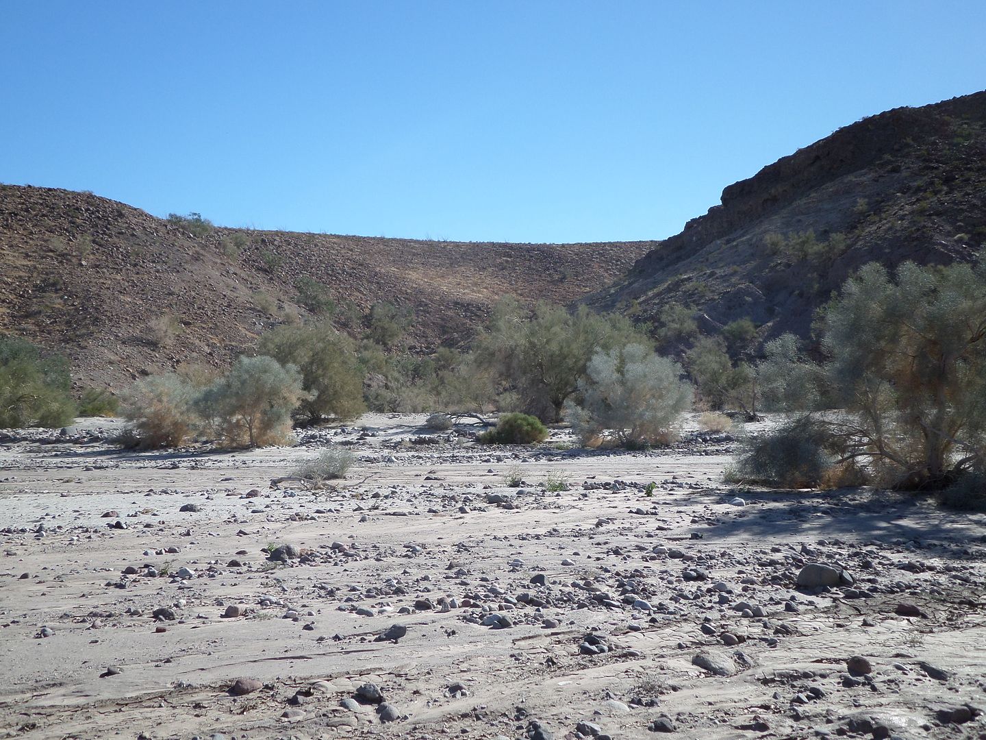
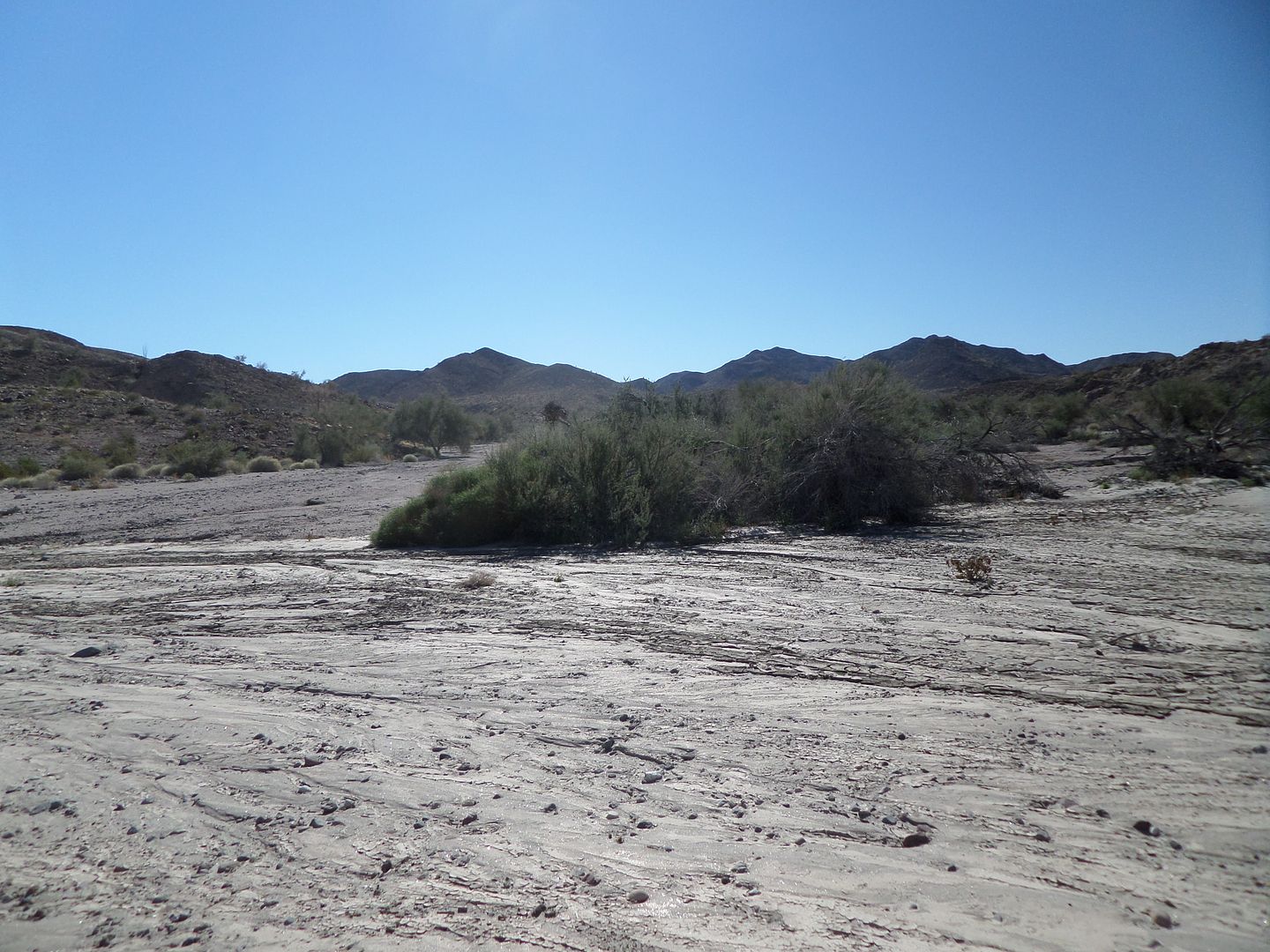
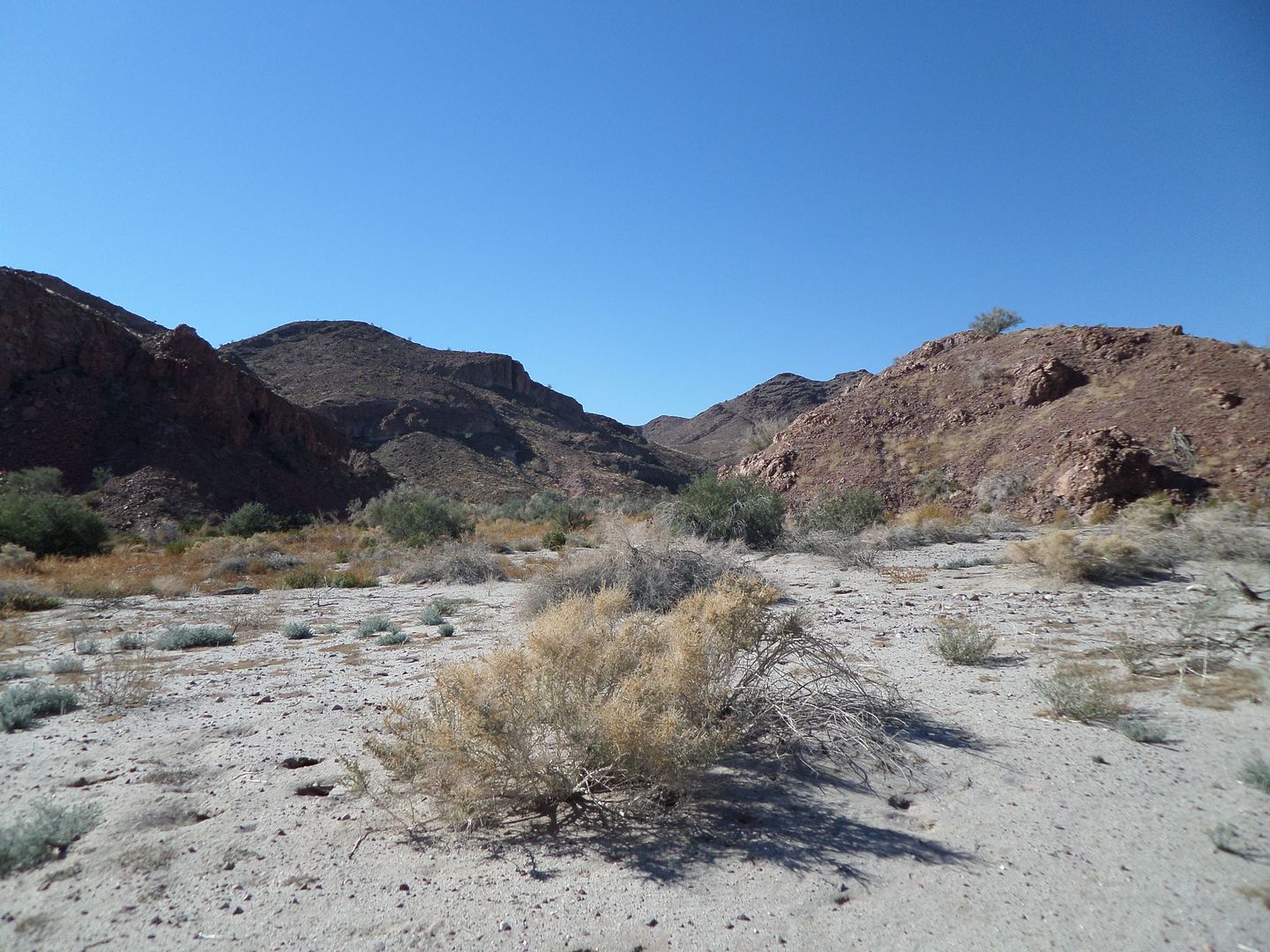
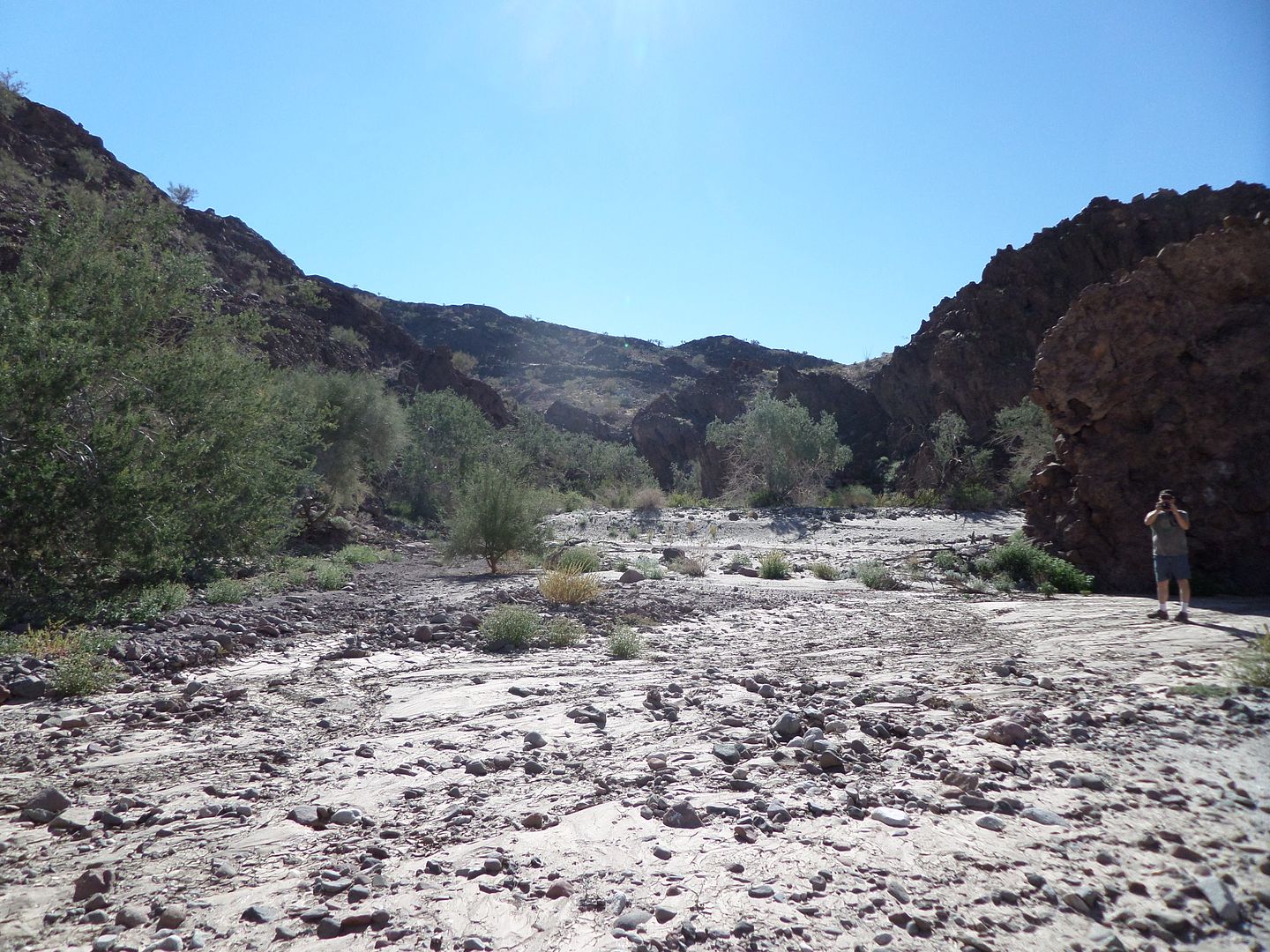
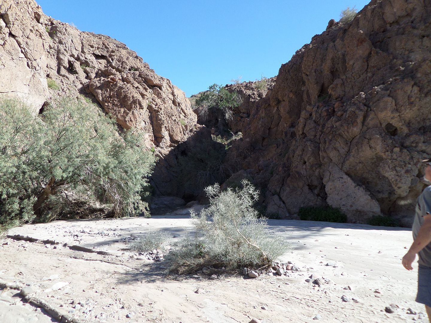
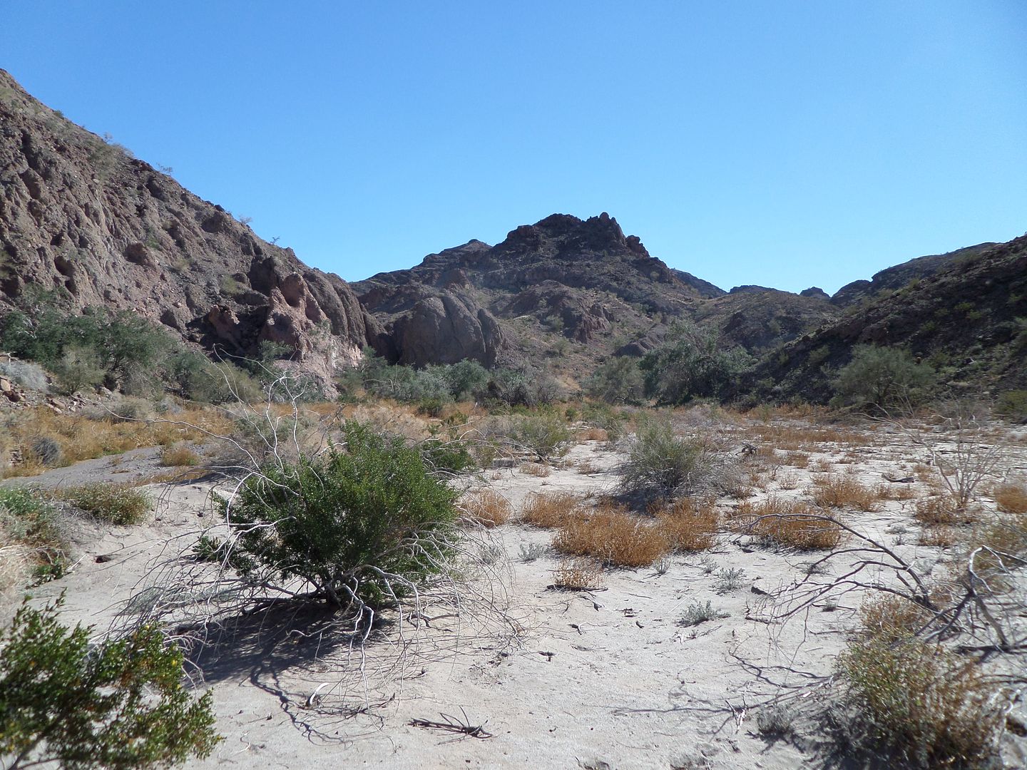
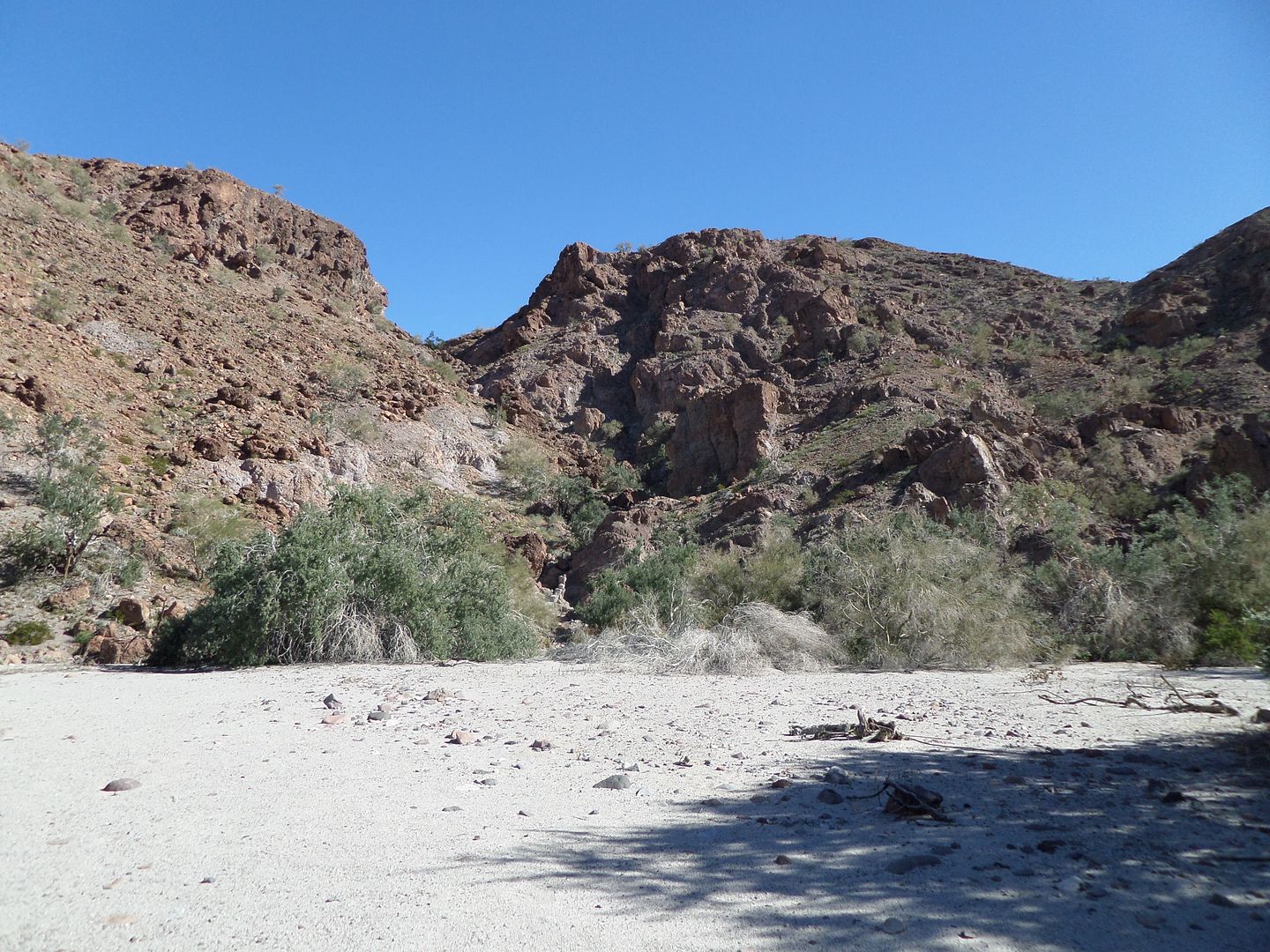
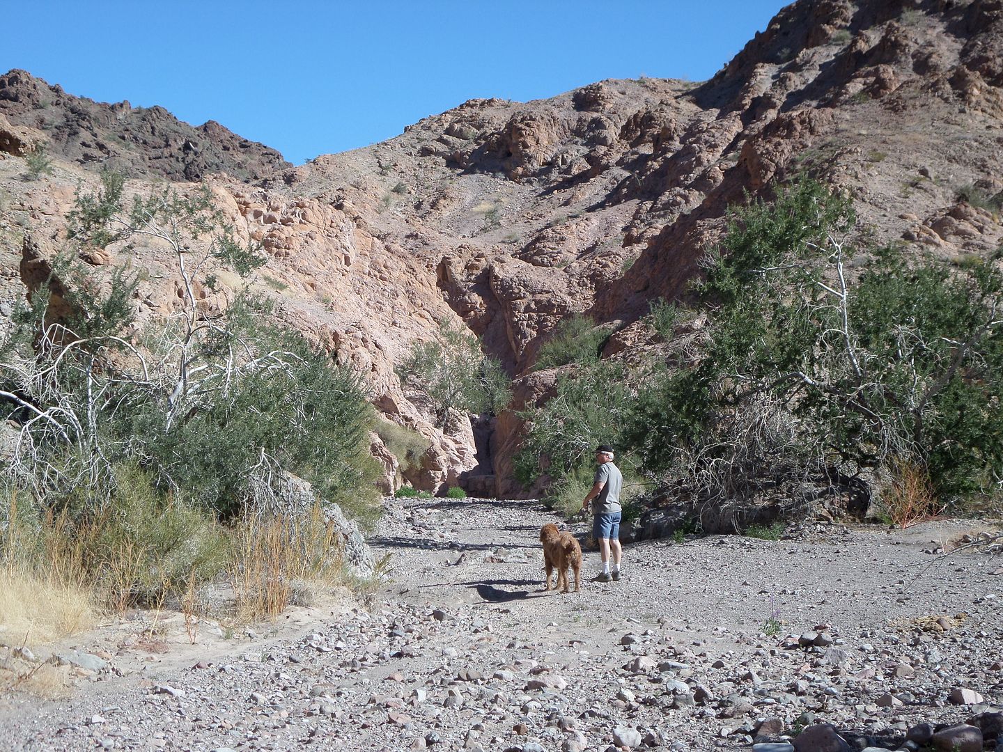
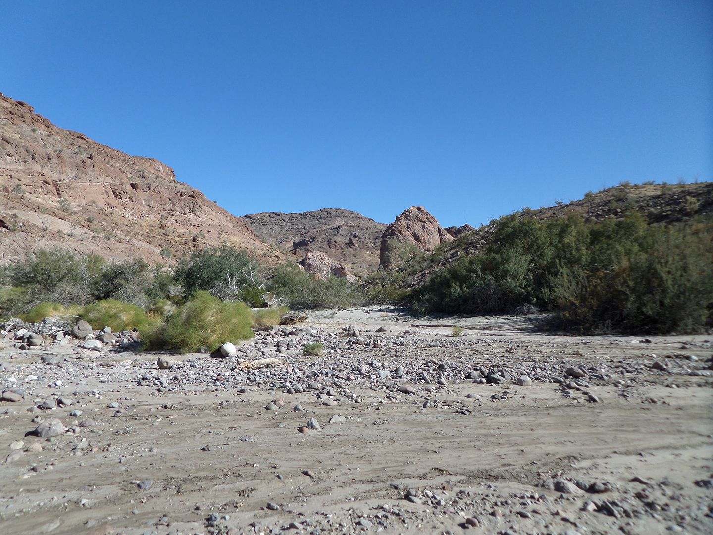
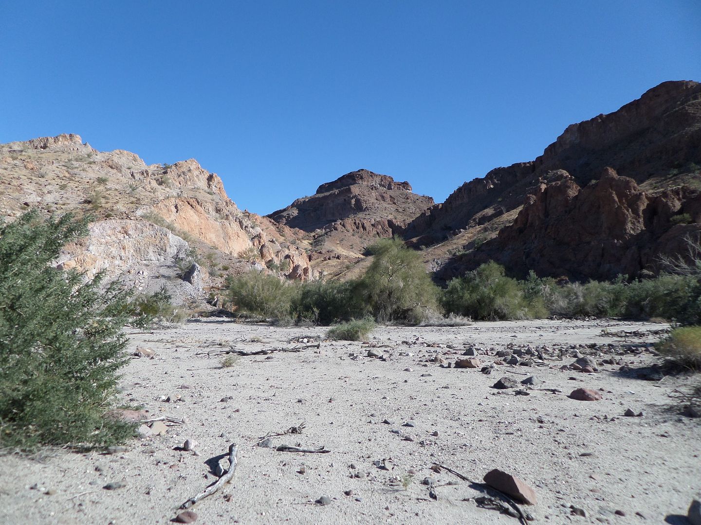
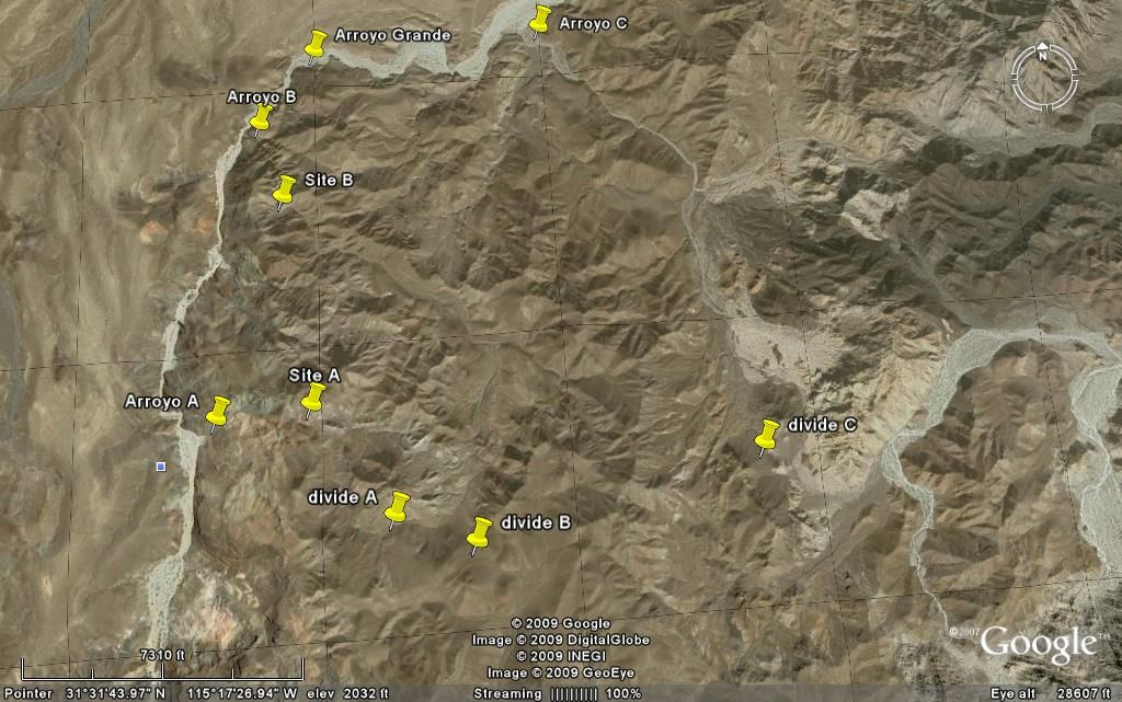
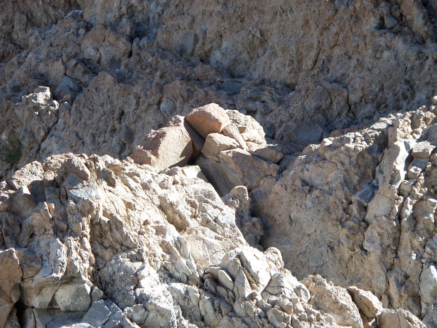
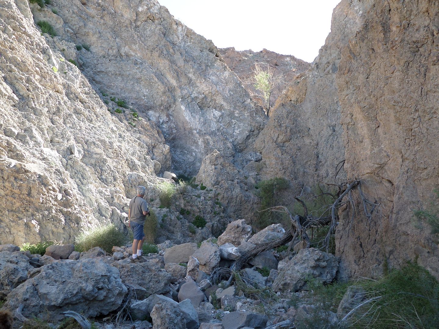
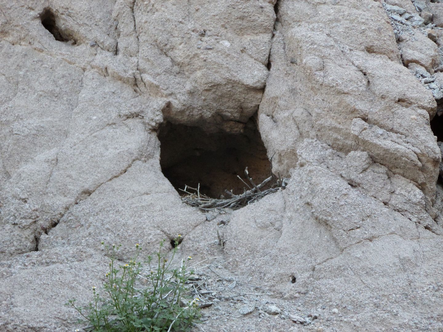
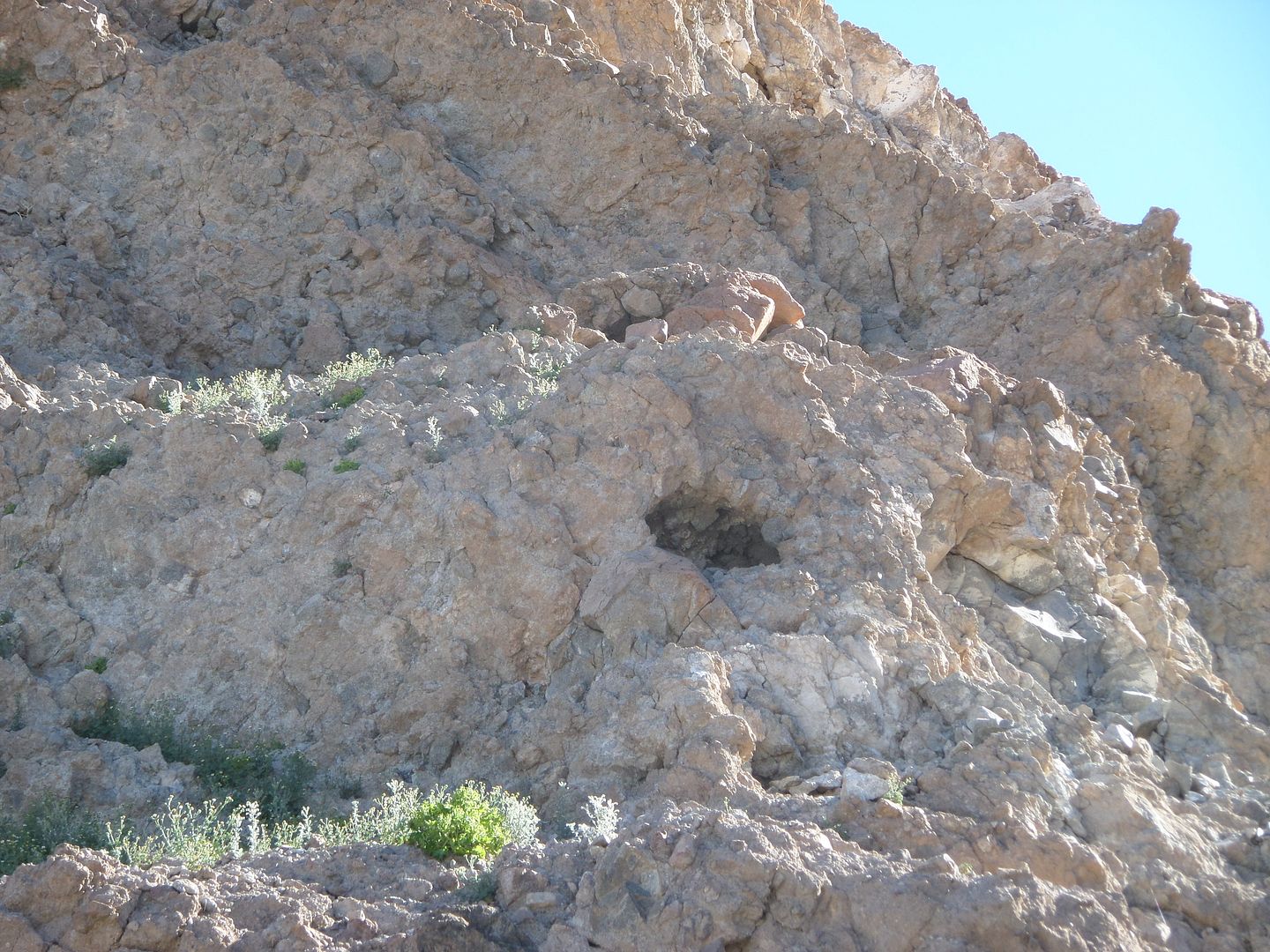
Here are the 15 side washes Phil and I photographed in Jan. of 2014.
Wash 1
Wash 2
Wash 3

Wash 4
Wash 5
Wash 6
Wash 7
Wash 8
Wash 9

Wash 10
Wash 11
Wash 12
Wash 13
Wash 14
Wash 15
David K thinks I missed a wash but I forgot which one. He can provide the GE GPS location.
|
|
|
David K
Honored Nomad
Posts: 64519
Registered: 8-30-2002
Location: San Diego County
Member Is Offline
Mood: Have Baja Fever
|
|
Awesome job TW!
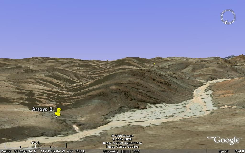
Without going through our email exchanges, I think the wash I had called 'B' on my map is between your #6 and #7 washes in the map above. It is a long
winding canyon with what looks like the landform that Henderson said the rock-pile was on.
|
|
|
David K
Honored Nomad
Posts: 64519
Registered: 8-30-2002
Location: San Diego County
Member Is Offline
Mood: Have Baja Fever
|
|
Here it is on Google Earth:
[Edited on 2-21-2015 by David K]
|
|
|
TMW
Select Nomad
Posts: 10659
Registered: 9-1-2003
Location: Bakersfield, CA
Member Is Offline
|
|
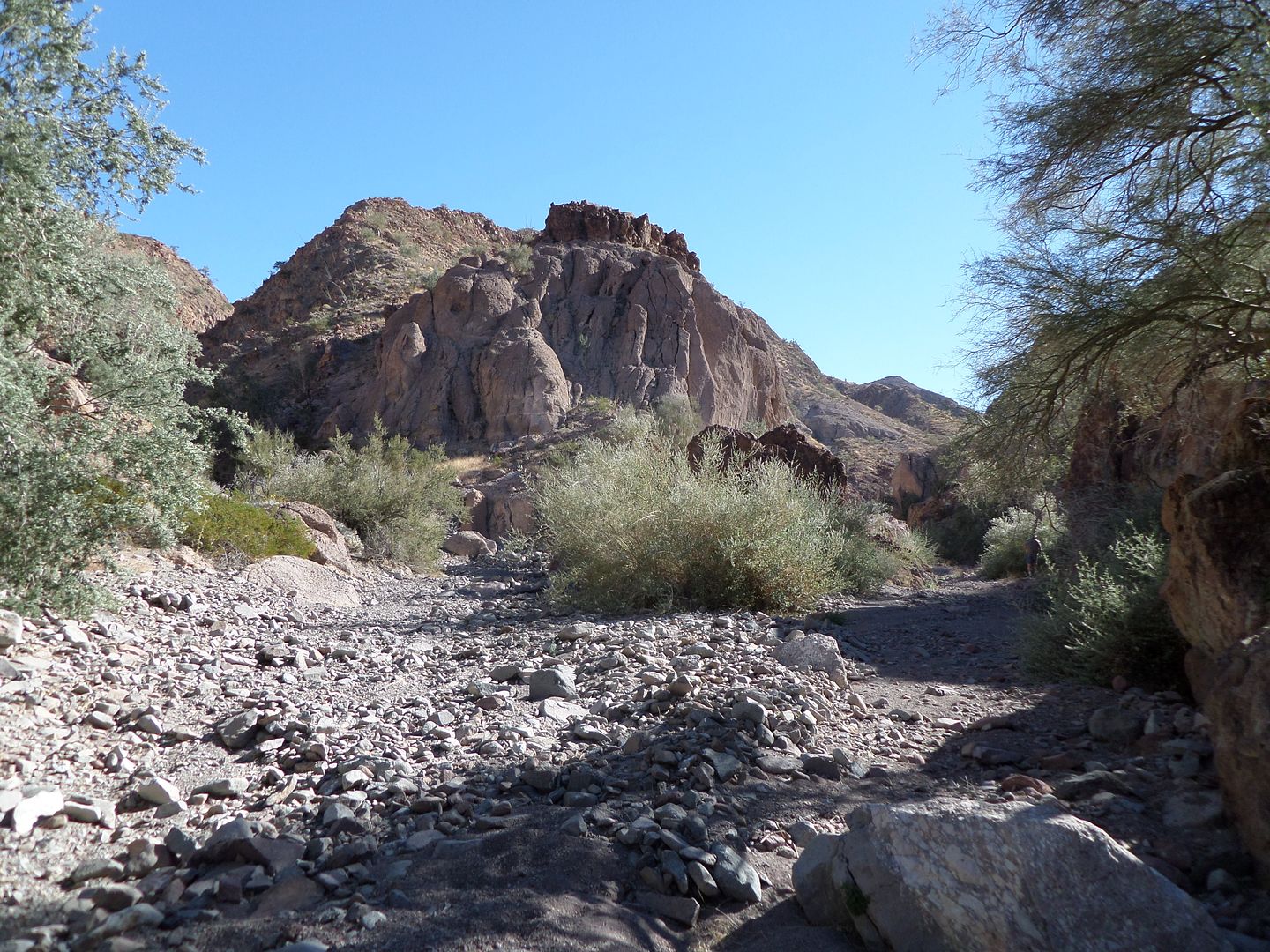
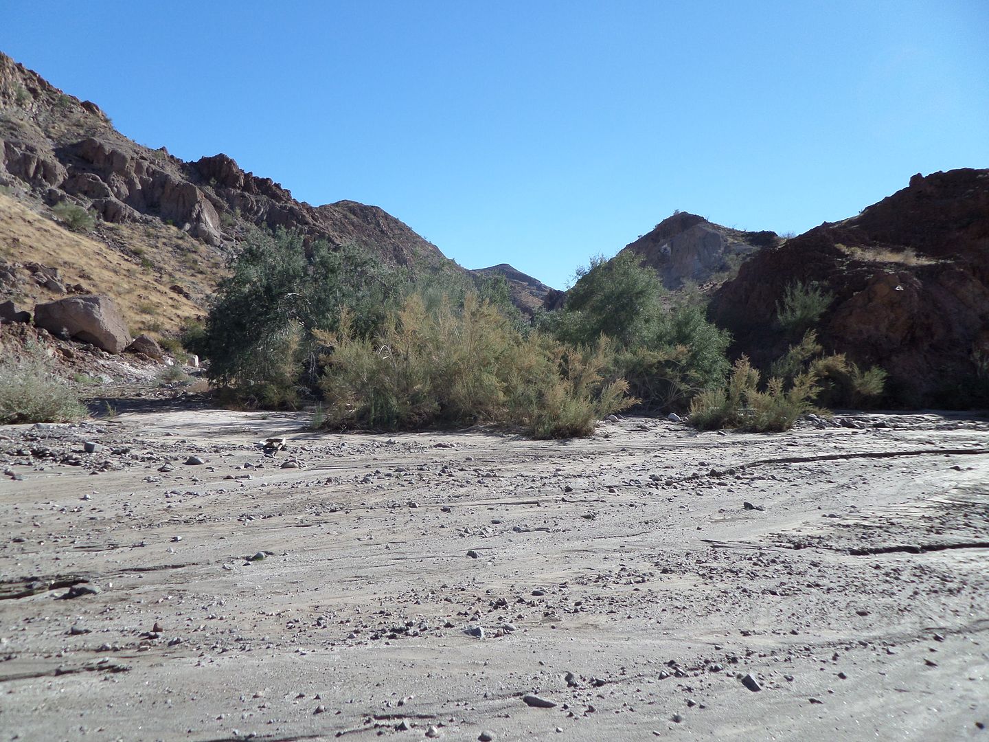
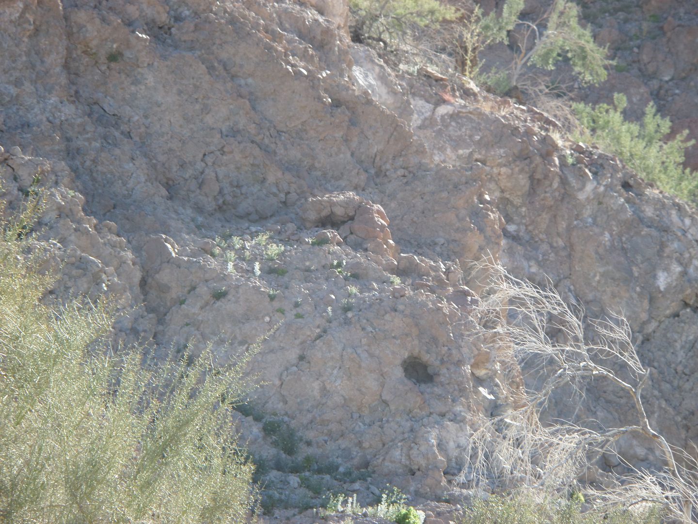
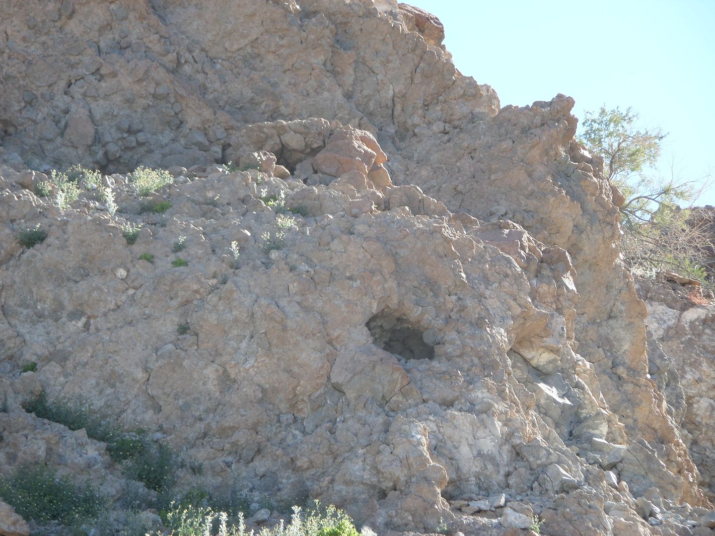
Wash 3 was interesting in that it had high walls and rock piles up high. Wash 4 openned into a wide area of Arroyo Grande and 3 was next to it.
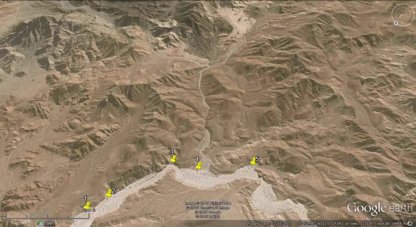
Wash 3 from AG
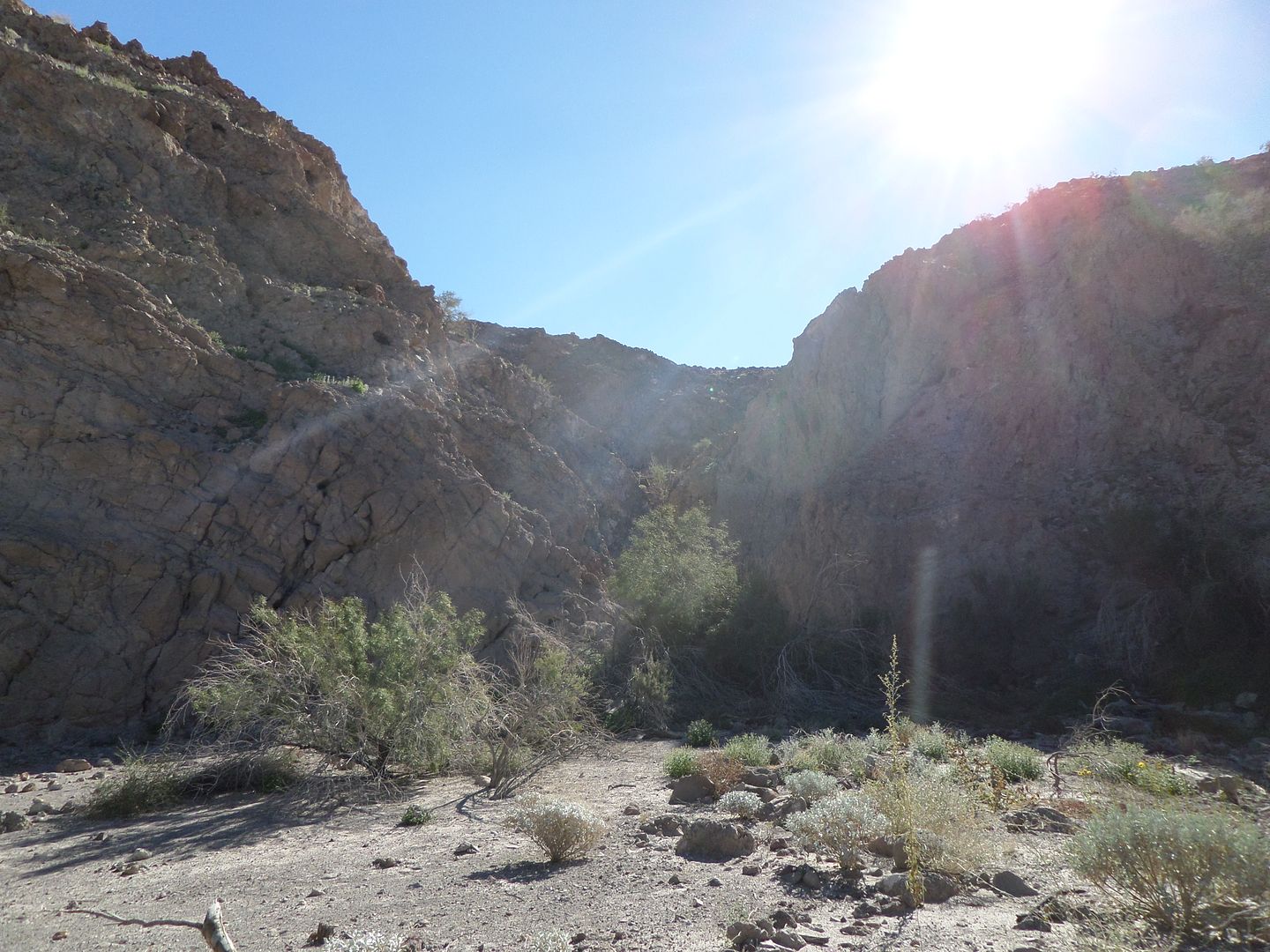
Wash 3 further in
|
|
|
| Pages:
1
..
3
4
5
6 |


