| Pages:
1
2 |
David K
Honored Nomad

Posts: 64480
Registered: 8-30-2002
Location: San Diego County
Member Is Offline
Mood: Have Baja Fever
|
|
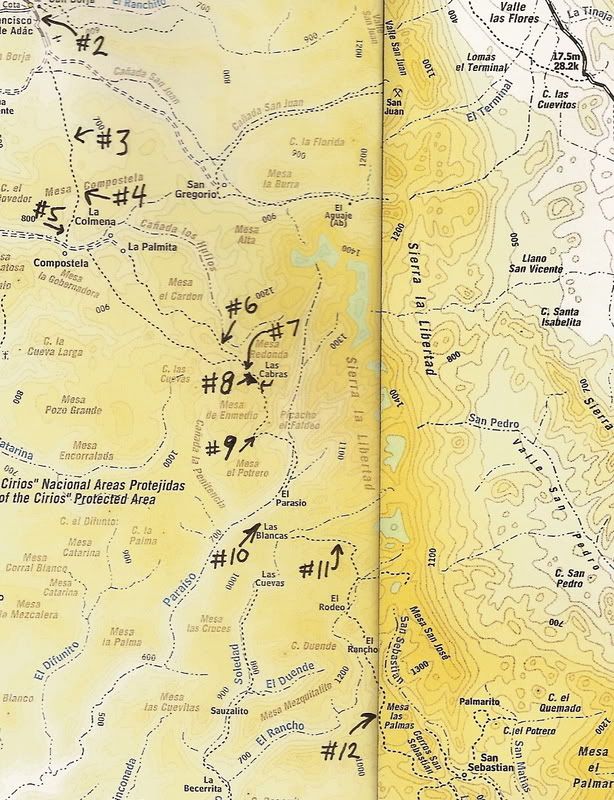
ECR-2a) EL CAMINO REAL from space: SAN BORJA to SANTA GERTRUDIS (Sierra route)
On rainy days, I work on other projects... usually Baja and history related.
In the past, I have posted links to Google Satellite images of the missions and sections of the 'El Camino Real', the Spanish line of communication in
Old California (today known as Baja).
Recently, more of Baja has been made available in higher resolution imaging and it is now possible to see nearly all of the old Camino Real from
space.
Maps of the route of the Camino Real have been made by Howard Gulick, in the 1950's and also for Harry Crosby, in 1977. Howard traveled many sections
of the Camino Real when working on the famous Lower California Guidebook c1956-1970. His maps can be viewed in my web page: http://vivabaja.com/ECR/page12.html
Harry rode on the Camino Real in the 60's and 70's and authored The King's Highway in Baja California... Harry's photos and maps can be viewed at this
link:
https://web.archive.org/web/20160329013158/http://www.sandie...
The following photos are from Google Earth, which has the ability to drop down and look sideways at an image... giving one a three-dimensional effect
'3-D', without special glasses!
The Jesuit Order (in Baja from 1697-1768) were the great road builders (with local native labor, of course)... and many sections of well-aligned
roadbed across volcanic mesas are easy to spot, often running very straight, between points.
Because they were removed just a few years after establishing San Borja mission, very little advanced road work north of San Borja is seen. The
Franciscans and Dominicans only did road building when required, such as to climb grades... other areas the Camino Real made after 1768 look no
different than a cattle trail in most cases.
So, I started this project at San Borja and then traveled south... The photo images are looking southbound, just above the Camino Real, as if you were
flying low above it.
I copied a topo map and labeled exactly where each of the photographs was taken, it is at the end. I made 12 images starting with #1 at San Borja and
ending (for now) a few miles before San Sebastian. This is about 1/2 the distance to the next mission south, Santa Gertrudis.
Below the first 12, I have added photos and maps to show the Camino Real all the way to Santa Gertrudis.
I am in hopes that if you haven't yet begun to see Baja as a living history story book, you will! Imagine what it was like to walk or ride an animal
for hundreds of miles over days and weeks just to get from one part of Baja to another!!!
ECR-1 (Mision Santa Maria to Mision San Borja) is here: http://forums.bajanomad.com/viewthread.php?tid=37019
ECR-2b (San Borja to Santa Gertrudis, Gulfo route): http://forums.bajanomad.com/viewthread.php?tid=36065
EDIT: Updated the link to Harry Crosby's maps and ECR details.
[Edited on 9-13-2017 by David K]
|
|
|
David K
Honored Nomad
Posts: 64480
Registered: 8-30-2002
Location: San Diego County
Member Is Offline
Mood: Have Baja Fever
|
|
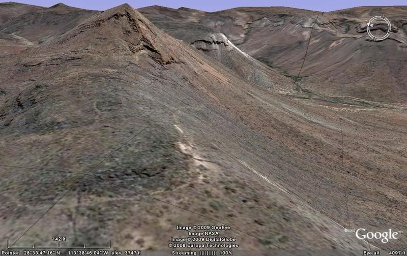
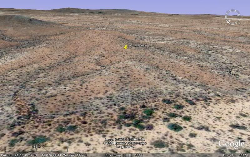
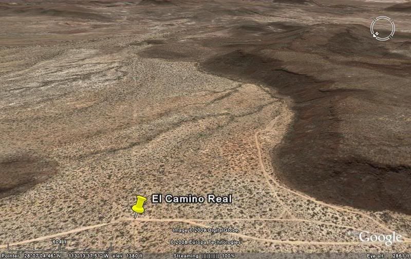
#1) SAN BORJA, looking south to the grade up to the valley.
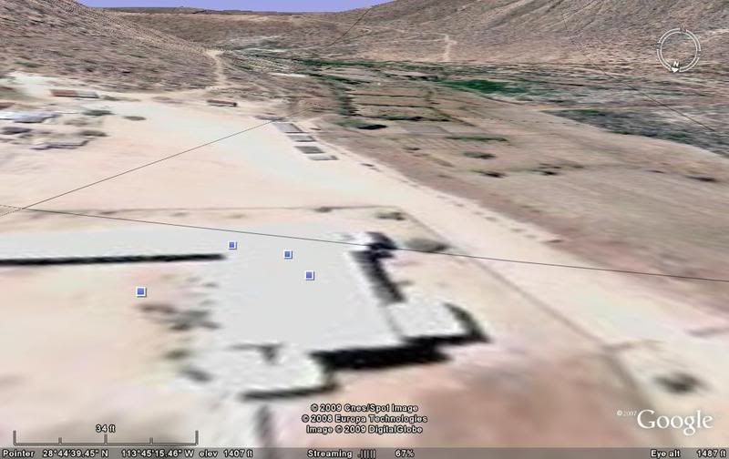
#2) The grade up from the mission to the valley the large clearing is the old airstrip. The Camino Real runs straight along the right side of the
strip, across the valley to a switchback up the distant mountain.
#3) Switchback up to the Mesa Compostela
#4) Along the mesa...
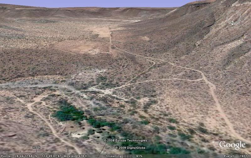
#5) Nearing the drop into the canyon containing Rancho Compostela...
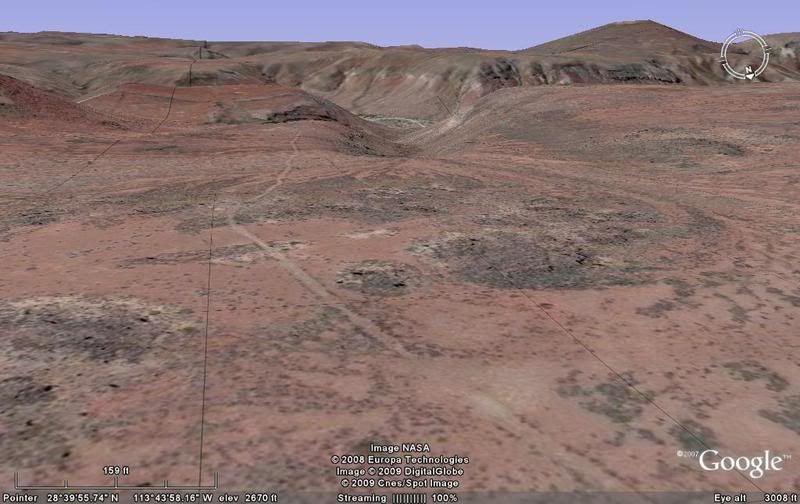
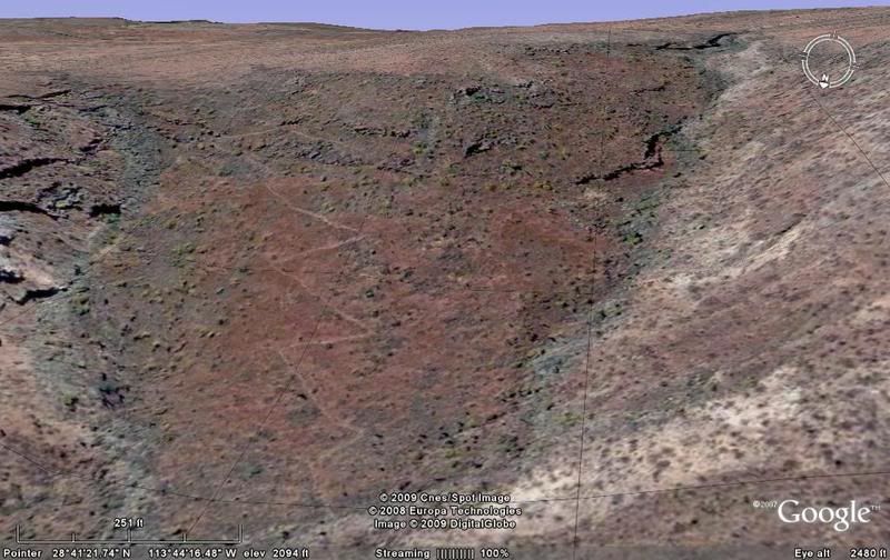
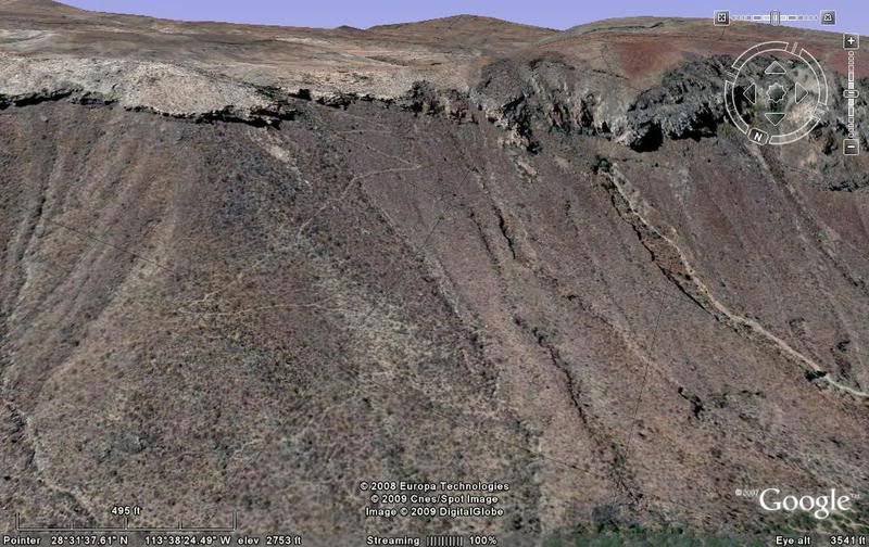
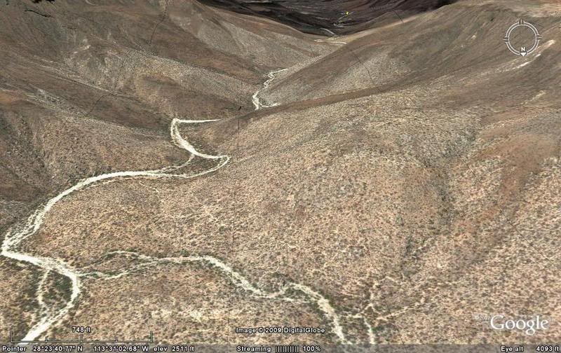
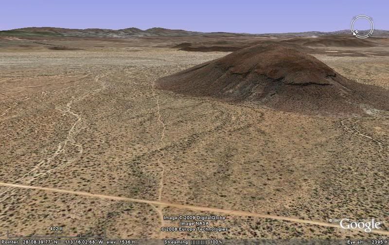
#6) Nearing Mesa Redonda, a parallel section of the Camino Real soon joins in. Recent mine digs are all over this area.
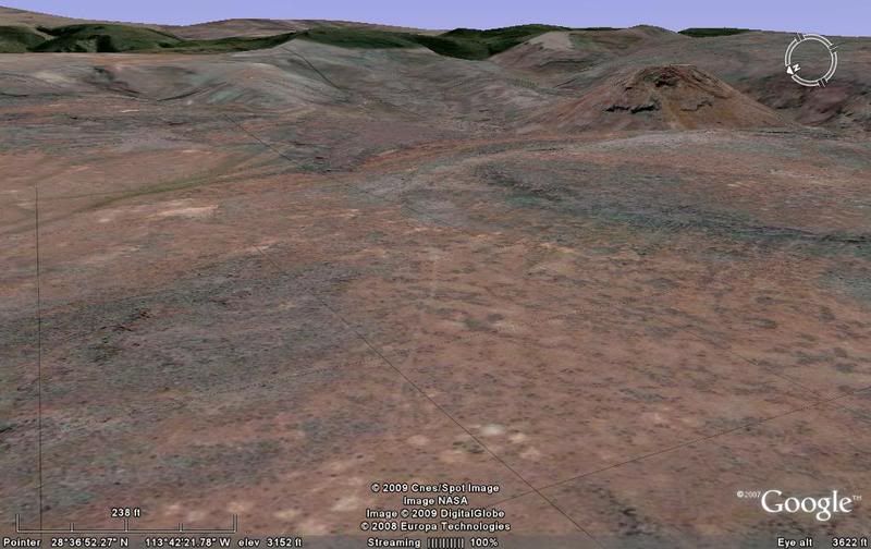
#7) There is a mile wide low resolution (dark) strip running north & south between image #7 and #8 (Las Cabras). The terrain (lava) made road
building difficult in some places.
#8) Las Cabras corrals on the old mission trail. Many such corrals are seen on the Camino Real. Las Cabras is noted on Harry Crosby's map and the Baja
Almanac topo.
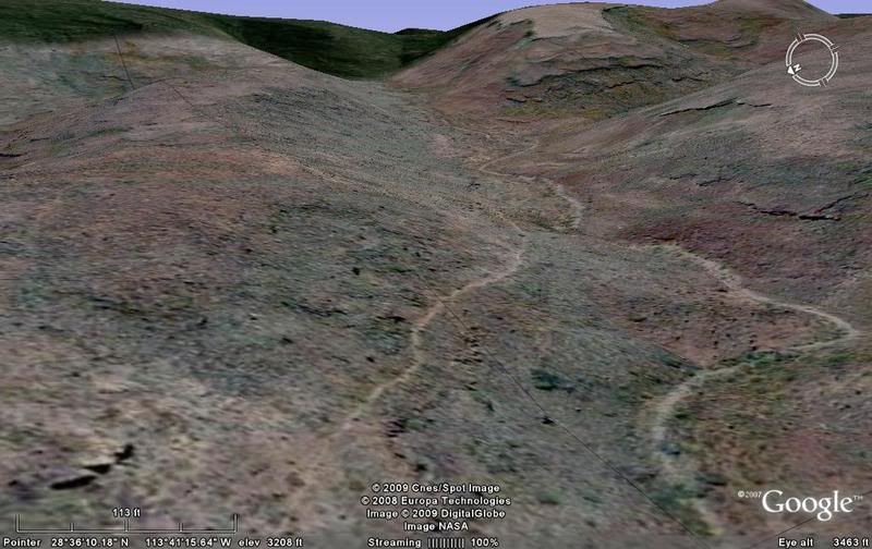
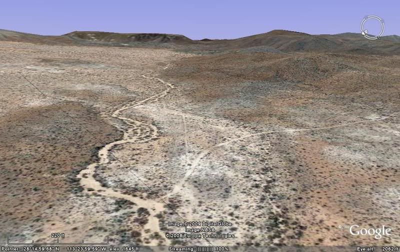
#9) Arroyo El Paraiso was a major obstacle to the padres and even today, as recent ECR rider 'Baja Bucko' can testify!
This is the north grade, top...
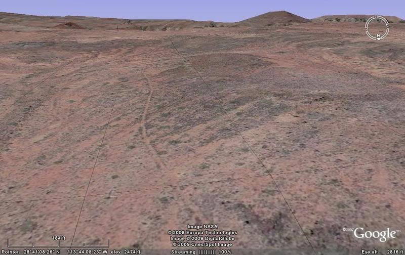
#10) After going along the bottom of this huge canyon for a couple miles, the Camino Real climbs up the south grade...
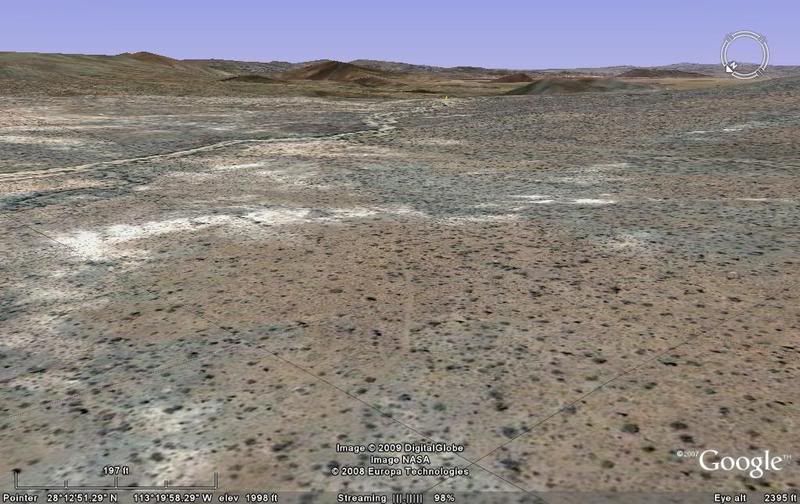
#11) Sometimes the lava just didn't allow for the normal road building through the entile section...
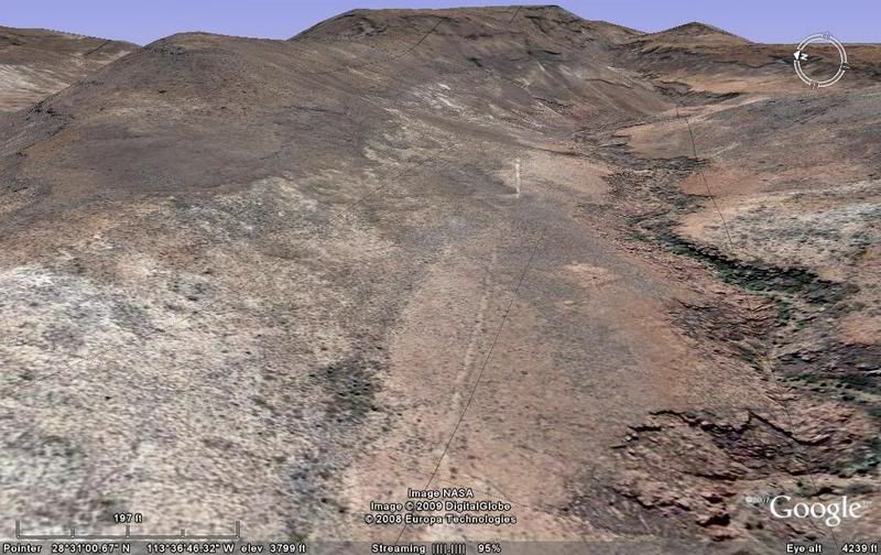
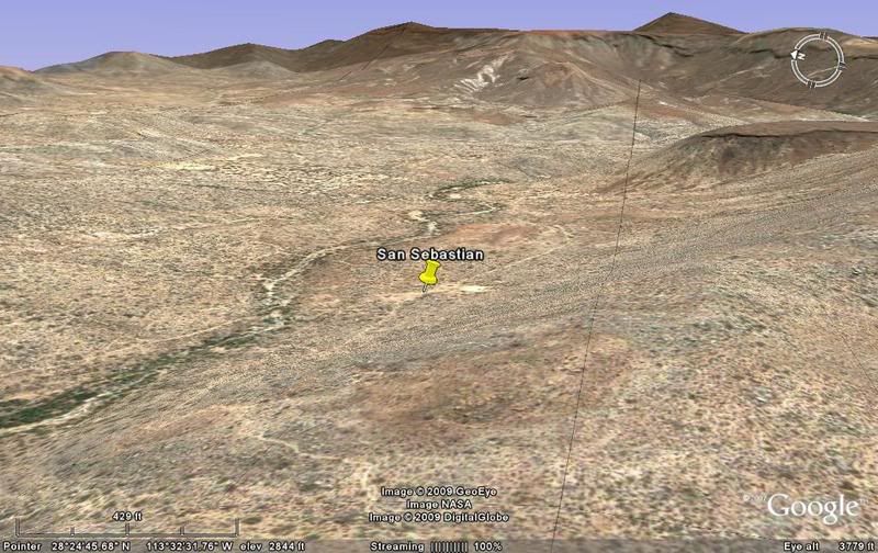
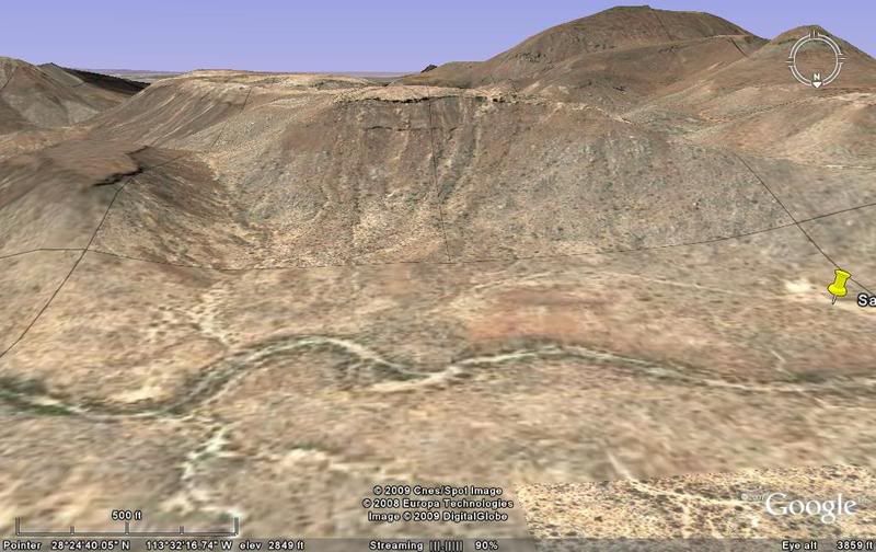
#12) Up on Mesa las Palmas, the trail will drop off the far end then follow the natural drainage to San Sebastian and on south.
Stay tuned for future additions!
[Edited on 12-23-2008 by David K]
|
|
|
David K
Honored Nomad
Posts: 64480
Registered: 8-30-2002
Location: San Diego County
Member Is Offline
Mood: Have Baja Fever
|
|
Close up of the Camino Real area... The numbers are the photos/ satellite images... Number one is San Borja, at the top... another map is below after
the next group of photos...
[Edited on 12-25-2008 by David K]
|
|
|
David K
Honored Nomad
Posts: 64480
Registered: 8-30-2002
Location: San Diego County
Member Is Offline
Mood: Have Baja Fever
|
|
Harry's map:

|
|
|
David K
Honored Nomad
Posts: 64480
Registered: 8-30-2002
Location: San Diego County
Member Is Offline
Mood: Have Baja Fever
|
|
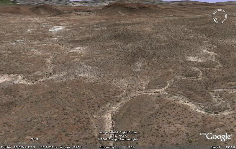
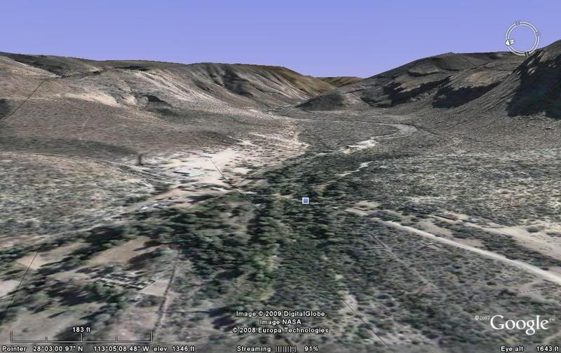
5 more, moving south...
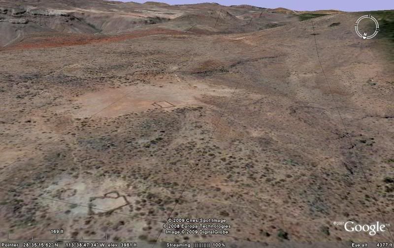
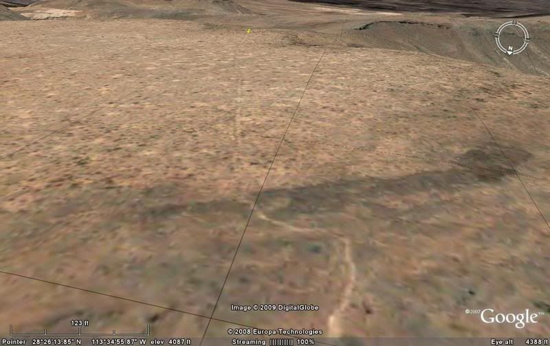
#13) Looking down at Rancho San Sebastian...
#14) Just past San Sebastian the old trail turns up along a small mesa. staying out of the sand of the big arroyo...
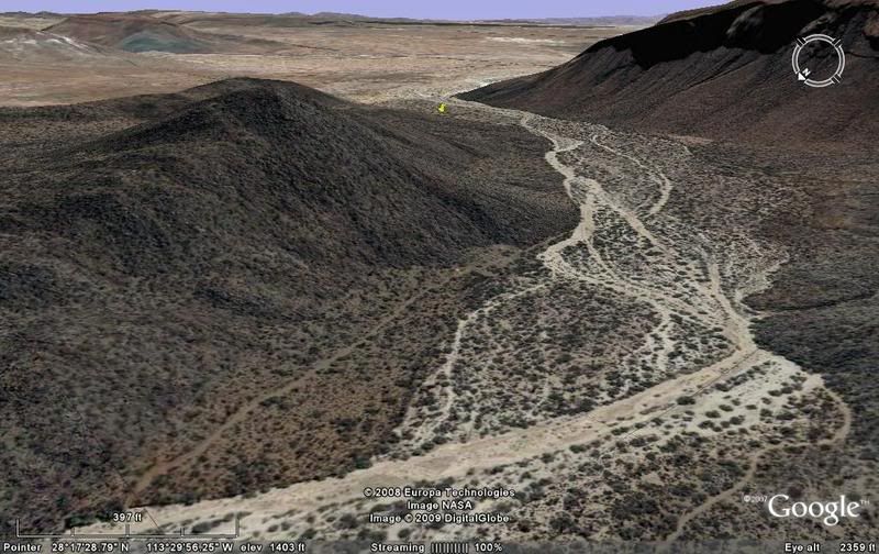
#15) Very hard to see the trail as it drops back into Arroyo San Sebastian...
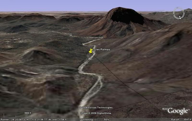
#16) Nearing Rancho Tres Palmas...
#17) Along Arroyo San Luis, nearing Rancho Nuevo...
[Edited on 12-24-2008 by David K]
|
|
|
David K
Honored Nomad
Posts: 64480
Registered: 8-30-2002
Location: San Diego County
Member Is Offline
Mood: Have Baja Fever
|
|
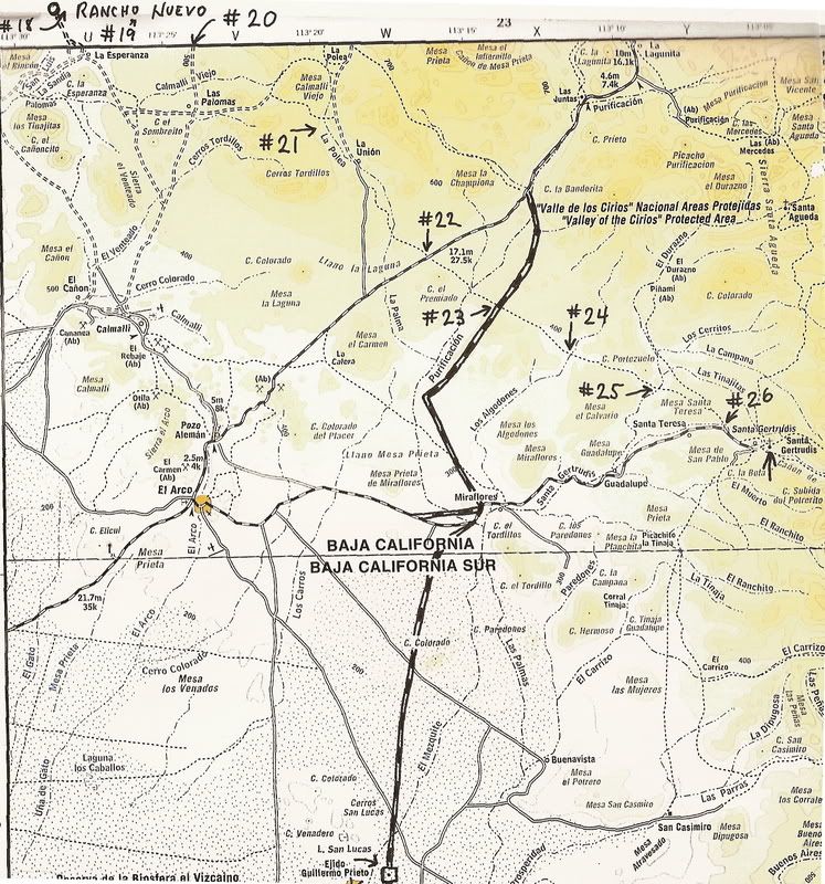
Map with locations of images 13-17 added
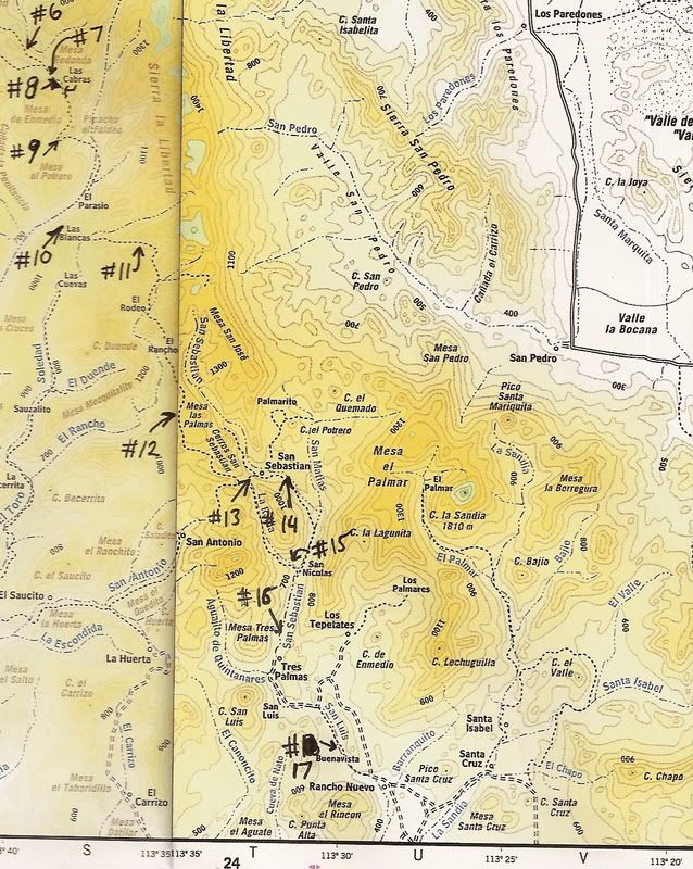
Photos #18 and 19 are also in this area... 18 is just east of Nuevo and 19 is just below Mesa Santa Cruz.
[Edited on 12-25-2008 by David K]
|
|
|
David K
Honored Nomad
Posts: 64480
Registered: 8-30-2002
Location: San Diego County
Member Is Offline
Mood: Have Baja Fever
|
|
On to Santa Gertrudis!
#18) Just past Rancho Nuevo. Autos have used this section.
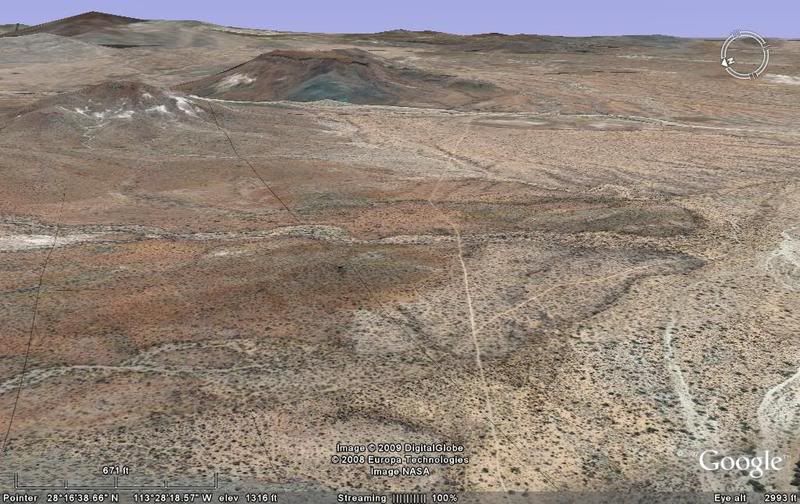
#19) Just across Arroyo La Sandia, at the base of Mesa Santa Cruz... very faint here.
#20) Crossing the east road to Santa Cruz
#21) Approaching La Union
#22) Crossing the El Arco/ San Francisquito road
#23) Crossing the short cut road between Guillermo Prieto and the San Francisquito road.
#24 Crossing Arroyo Los Algodones
#25) Climbing out of Arroyo El Duranzo and across Mesa Santa Teresa
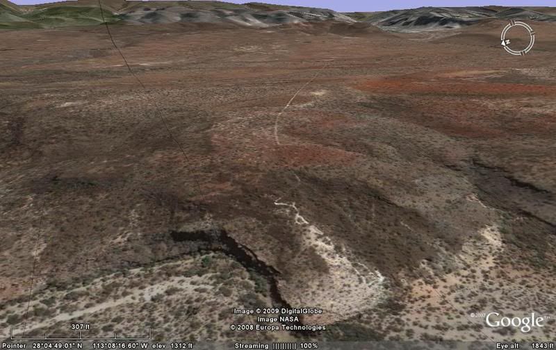
#26) Dropping off the mesa and meeting the El Arco graded road
SANTA GERTRUDIS
MAP
[Edited on 12-24-2008 by David K]
|
|
|
Barry A.
Select Nomad
Posts: 10007
Registered: 11-30-2003
Location: Redding, Northern CA
Member Is Offline
Mood: optimistic
|
|
OUTSTANDING!!!! Thank you, David.
Barry
|
|
|
David K
Honored Nomad
Posts: 64480
Registered: 8-30-2002
Location: San Diego County
Member Is Offline
Mood: Have Baja Fever
|
|
MERRY CHRISTMAS!!!
Perhaps after the gang that coming tonight leaves after Christmas, I will work on the next section... to San Ignacio?!
|
|
|
David K
Honored Nomad
Posts: 64480
Registered: 8-30-2002
Location: San Diego County
Member Is Offline
Mood: Have Baja Fever
|
|
I have edited some of the stuff, removed a couple maps that didn't add much info., etc.
As you can see from Harry Crosby's map, there is an alternate Camino Real between San Borja and Santa Gertrudis... rejoins/ branches near Santa Cruz/
Calmalli Viejo. This eastern branch is also known as the GOLFO CAMINO REAL.
I have found several pieces of it, but it is not quite as dynamic or complete as the central branch, shown above. There is also a western branch and
the same is true of the Camino Real between Santa Gertrudis and San Ignacio (three routes/ branches).
So, you people who love this stuff... STAY TUNED!
[Edited on 12-27-2008 by David K]
|
|
|
Jack Swords
Super Nomad
Posts: 1094
Registered: 8-30-2002
Location: Nipomo, CA/La Paz, BCS
Member Is Offline
|
|
Very nice David....hope it rains some more so you can concentrate on these projects.
|
|
|
David K
Honored Nomad
Posts: 64480
Registered: 8-30-2002
Location: San Diego County
Member Is Offline
Mood: Have Baja Fever
|
|
THANKS A LOT JACK!   
I do hope to have some good stuff to share when we come back from our New Years trip, too!!
|
|
|
Jack Swords
Super Nomad
Posts: 1094
Registered: 8-30-2002
Location: Nipomo, CA/La Paz, BCS
Member Is Offline
|
|
Great David! We're headed out this week to the reputed "garden" of the Mission of La Paz (about 100 miles away from the city) and will also have some
photos etc. to share. Research seems to indicate another site to register with INAH. Looking forward to your newest contribution.
|
|
|
Sharksbaja
Elite Nomad
Posts: 5814
Registered: 9-7-2004
Location: Newport, Mulege B.C.S.
Member Is Offline
|
|
Fascinating, thanx David.
DON\'T SQUINT! Give yer eyes a break!
Try holding down [control] key and toggle the [+ and -] keys
Viva Mulege!
Nomads\' Sunsets
|
|
|
Pompano
Elite Nomad
Posts: 8194
Registered: 11-14-2004
Location: Bay of Conception and Up North
Member Is Offline
Mood: Optimistic
|
|
David..once again great information and priceless Baja history. Well done y muchas gracias, maestro!
I do what the voices in my tackle box tell me.
|
|
|
Paulclark
Nomad
Posts: 357
Registered: 10-13-2008
Location: Castillo de Arena
Member Is Offline
|
|
Thanks for the work you have done. We are leaving tomorrow for San Juanico, then north to San Ignacio -- looking for sections of the Camino Real.
|
|
|
David K
Honored Nomad
Posts: 64480
Registered: 8-30-2002
Location: San Diego County
Member Is Offline
Mood: Have Baja Fever
|
|
Hi Paul,
The Camino Real leaving San Ignacio in both directions is very easy to spot... just go out a ways and see if the road has the characteristics of the
Camino Real and goes to the known spots... A few months ago I posted the images of ECR near San Ignacio...
|
|
|
David K
Honored Nomad
Posts: 64480
Registered: 8-30-2002
Location: San Diego County
Member Is Offline
Mood: Have Baja Fever
|
|
Exploring Baja is great fun!
Seeing where people traveled over 200 years ago, and the roads they built to travel Baja is wild!
|
|
|
David K
Honored Nomad
Posts: 64480
Registered: 8-30-2002
Location: San Diego County
Member Is Offline
Mood: Have Baja Fever
|
|
More rainy days... and no work for me
So, I am producing the next section of the mission trail space photos: Santa Gertrudis to San Ignacio.
There are three routes (Pacifico, Sierra, and Golfo)... since I like Pacifico, I will show that one first! Stay tuned!
|
|
|
rob
Senior Nomad
Posts: 509
Registered: 10-19-2004
Location: Pacific Coast, BCS
Member Is Offline
|
|
Dave,
I bought the Lower California Guidebook (you talked about it on another thread) for $8 - it's pure gold! It even mentions our ranch (although just " .
. .off to the left is Rancho Aguja . . ").
Outstanding Googling.
|
|
|
| Pages:
1
2 |


