David K
Honored Nomad

Posts: 64479
Registered: 8-30-2002
Location: San Diego County
Member Is Offline
Mood: Have Baja Fever
|
|
ECR-1) See EL CAMINO REAL: MISION SANTA MARIA TO SAN BORJA (from space in 3-D)
These articles posted on Baja Nomad are to both entertain the armchair adventurer as well as assist the Baja explorers who are fascinated by the
efforts and construction in Baja 200 to 300 years ago! Much of the Camino Real can now be seen from space on 'Google Earth' or Wikimapia.org.
The trail north of San Borja to Santa Maria was never built to the standards of the trail south of San Borja to Loreto because the Jesuits were
expelled from California (Baja) only 2 years after they started the mission north of San Borja. They had not the time to create the road to their
standards. The Franciscans and Dominican who followed the Jesuits were not the road builders that the Jesuits were... so, with only a few exceptions,
this northen section resembles no more than a cattle track.
An excellent source of Camino Real details can be found in these articles by Harry Crosby:
https://web.archive.org/web/20160329013158/http://www.sandie...
Part of this article is reproduced below as an excellent primer on Camino Real history!
This section of the mission road is very difficult to spot in most of the areas it crosses. The Jesuits founded San Borja in 1762. The next mission at
Calamajue was founded in 1766 and moved and renamed Santa Maria in 1767.
This installment is ECR-1, going from north to south the way the Jesuits marched to Loreto when they were forced from their missions and ordered to
return to Europe in 1768.
In 1768, the Jesuits were removed from the New World and forced back to Europe. They were not north of San Borja long enough to build the same quality
of road seen south of San Borja to Loreto. Instead, the mission trail is mostly a cattle or mule path. The route is known because the points along the
way are documented. It is possible that some of what I believe is the mission road is not, but the route is consistent and finding nothing better, I
posted the only track I could find going the right direction. Should you find a better track, please let me know so I may update the image!
The Franciscans and Dominicans that followed the Jesuits in California were not the road builders and only constructed roads were terrain required it.
I have hiked the Camino Real near Mision Santa Maria and Gonzaga Bay... and there are some switchbacks built that show the old trail from 240 years
ago.
Here is part of Howard Gulick's El Camino Real map-3, showing where he saw or learned of the Camino Real location during his travels in the early
1950's:
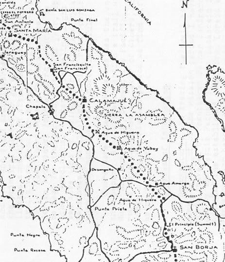
Using Google Earth, I have 24 images of the trail route and maps showing the location of the images...
The first marker pin beyond Mision Santa Maria is labeled 'End of Road Const.' and is where Fred Hampe of Rancho Santa Ynez ended the effort to build
a road to Punta Final on the gulf coast. The bulldozed road bed is seen ending on the rim of the deep canyon. The El Camino Real climbs uphill from
that road on the hillside to the north, 1/2 mile from the end of the bulldozed road. Once at the top of the hill, the Camino real circles around to
the north side of the canyon, as shown my the marker pins.
msm-1) 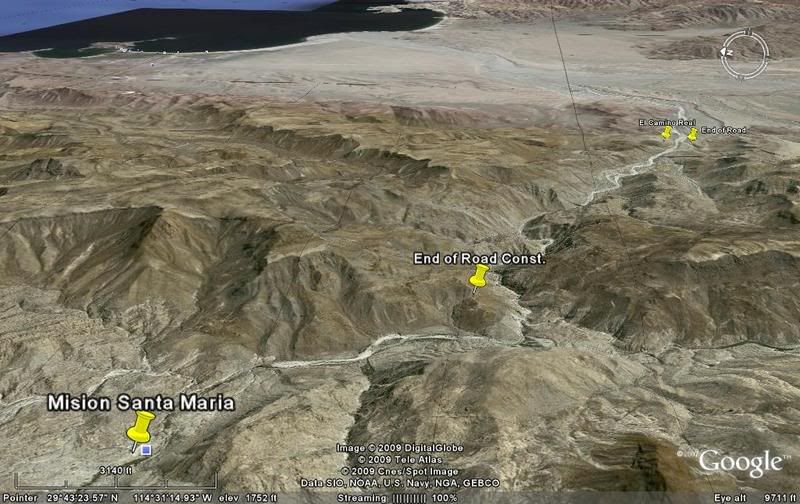
From the mission, the ECR (El Camino Real) and auto. road share the same route for 1.5 miles, then the trail turns left (north) and switchbacks up a
steep slope to the top of the ridge and follows it east and southeast, just above the deep Santa Maria canyon.
msm-2) 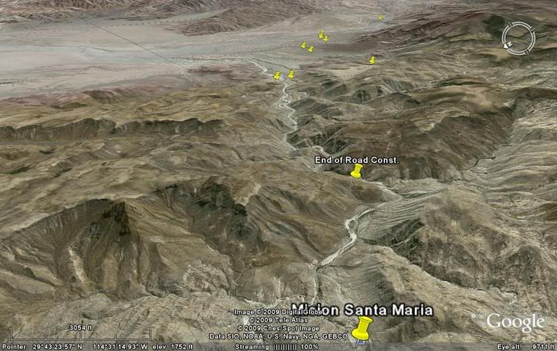
msm-3) 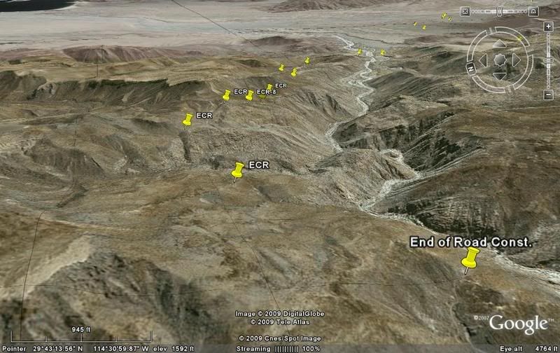
The pin markers are from GPS recordings I took in 2003 (8) and three more from Don Jorge when he followed me a week later and continued on from where
I turned back.
msm-4) 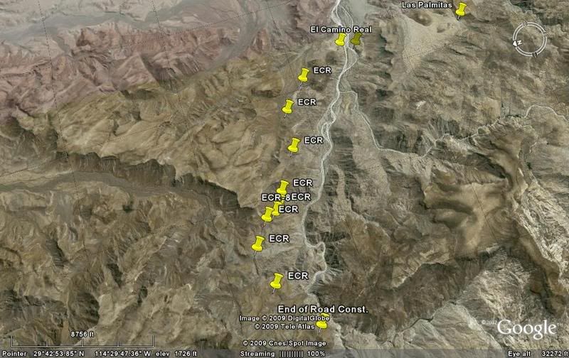
It is likely that the early travelers enjoyed the sweet water found at Las Palmitas oasis. Residents from Punta Final/ Gonzaga Bay have been getting
their drinking water here for years.
msm-5) 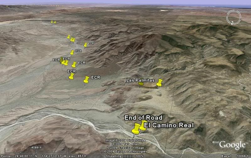
msm-6) 
msm-7) 
Just west of dirt Highway 5...
eventually joining with the highway.
msm-8) 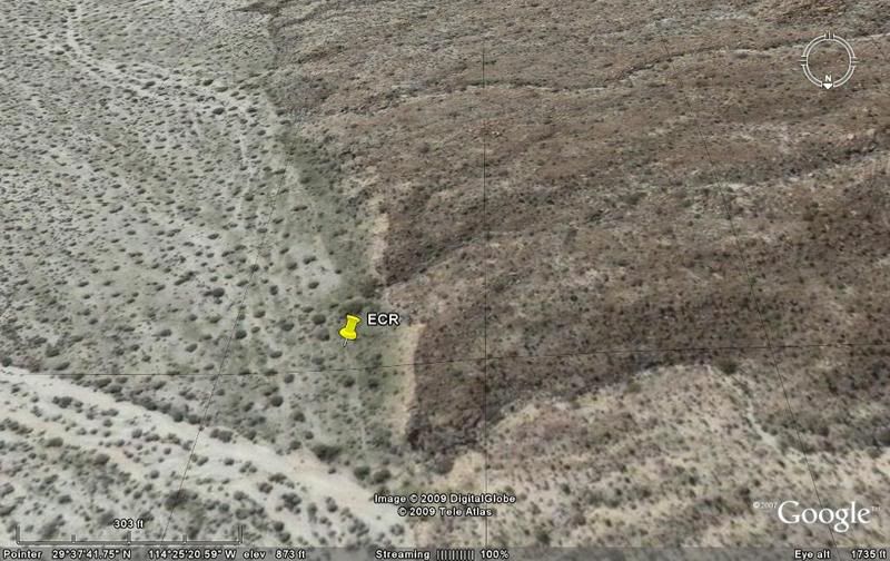
LAS ARRASTRAS, now an abandoned site... In mission times this was a water source (just west) called SAN FRANCISQUITO or San Francisco. Everything in
this region, the sierra, arroyo, mine mill, and the larger part of Gonzaga Bay (Ensenada de San Francisquito) carries the name given by the padres.
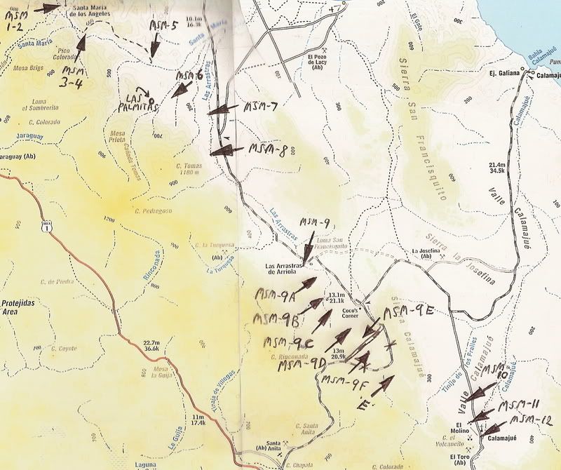
msm-9) 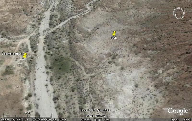
After posting the 17 images... I discovered more of the Camino Real on Google Earth, so they will be inserted here as msm-9A to msm-9F as well as
possible section labeled as E (short for ECR). The map is also revised. Here now is the Camino Real heading south from Las Arrastras (very near 'San
Francisquito' water hole)...
msm-9A) 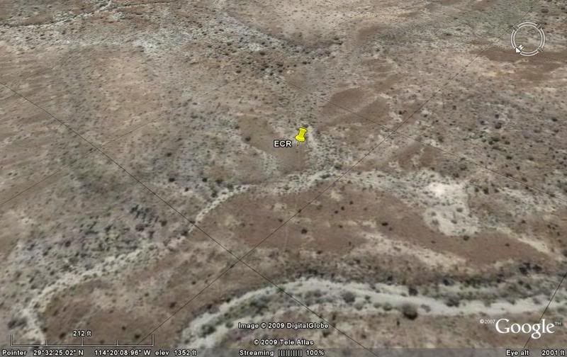
msm-9B) 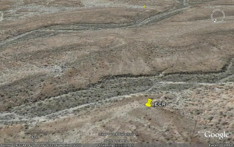
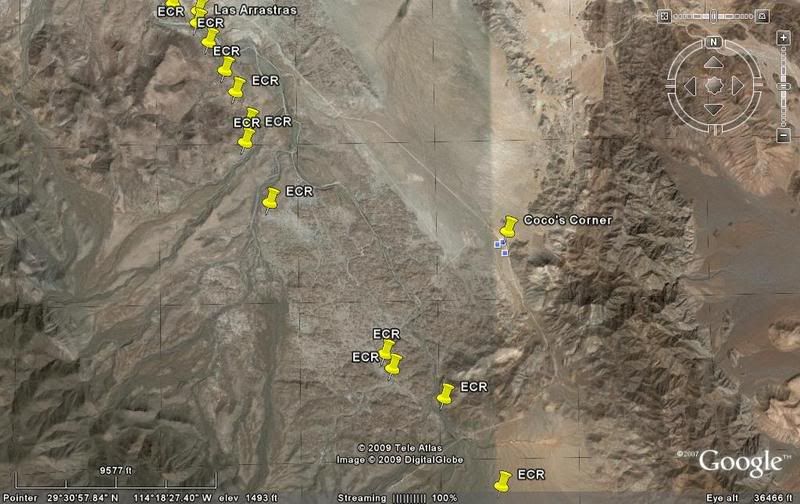
msm-9C) Here about 1-2 miles west of Coco's Corner: 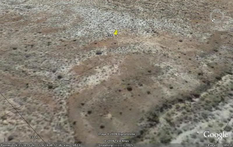
msm-9D) 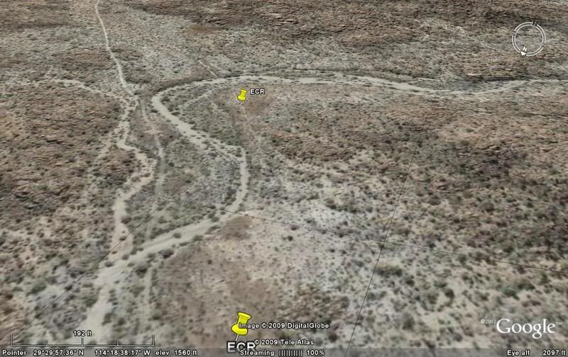
msm-9E) Just north of Hwy. 5 crossing: 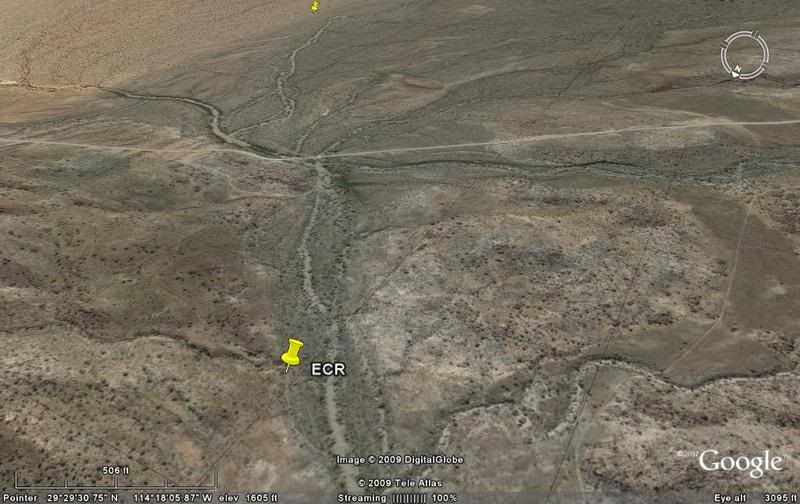
msm-9F) 
site E) 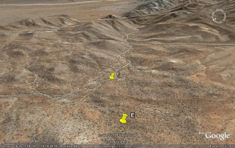
In the distance the markers for the ECR north of Calamajue can be seen.
Continued...
[Edited on 2-19-2009 by David K]
[Edited on 9-13-2017 by David K]
|
|
|
David K
Honored Nomad
Posts: 64479
Registered: 8-30-2002
Location: San Diego County
Member Is Offline
Mood: Have Baja Fever
|
|
Nearing Calamajue...
msm-10) 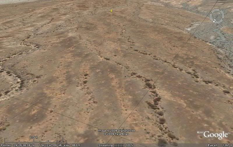
The trail goes between the auto road and the airstrip...
msm-11) 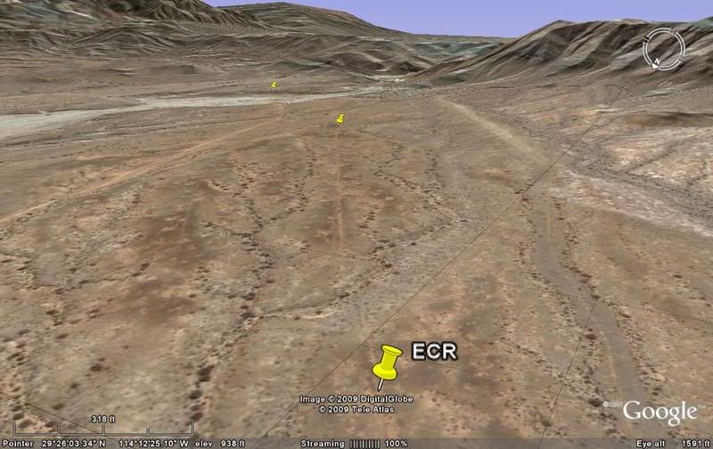
The ECR joins the auto road and drops into Arroyo Calamajue. The mssion site is on the terrace above the opposite bank of the arroyo. (the photo on
Google Earth/ blue square, is of the gold ore mill, not the mission as it states)
From here on south the auto road and mission trail both use the arroyo.
Once out of the arroyo, the Camino Real stays close to the base of the Sierra la Asamblea to the important water hole 'Tinaja de Yubay'.
msm-12) 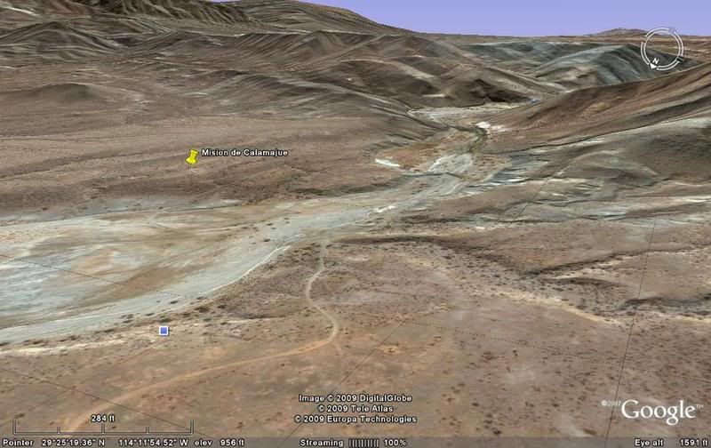
YUBAY: looking out the canyon... a detour off the ECR route was required to get to the water. The pin marker on the hill to the south is showing Cerro
la Palmita, a natural landmark to help travelers find Yubay.
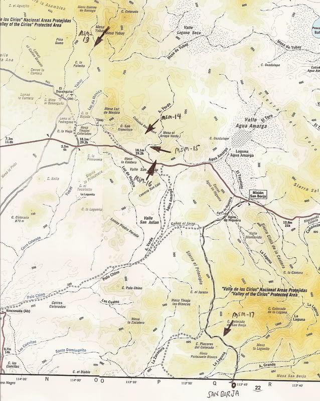
msm-13) 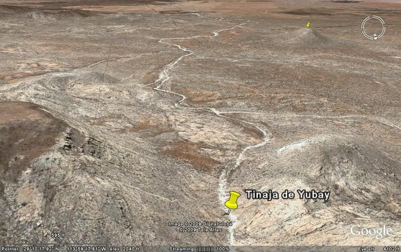
msm-14) 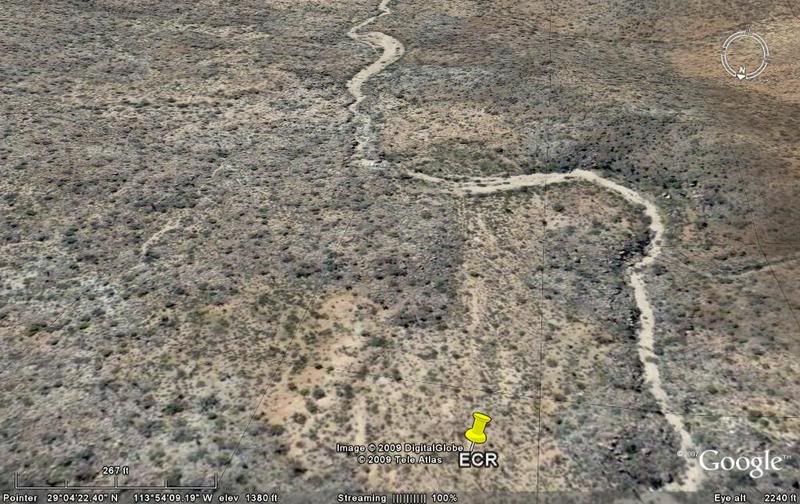
msm-15) 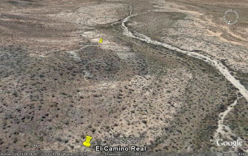
Soon, the trail route crosses the L.A. Bay highway...
msm-16) 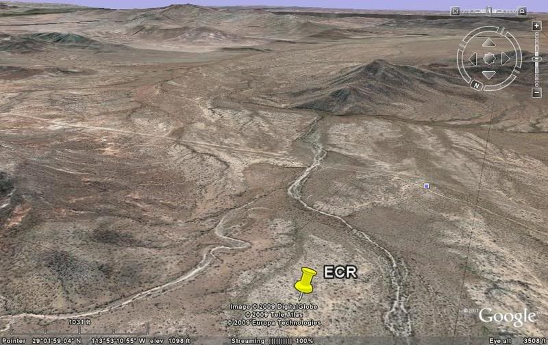
The San Borja road and the Camino Real take the same route for most of the way in this region...
msm-17) 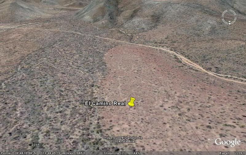
The map will help to see where the images are on the topo map... The road (Hwy. 5) south of Coco's Corner was not correctly located... why the 'x x'
over it, and the approx. correct path was drawn in.
ENJOY!
[Edited on 2-19-2009 by David K]
|
|
|
David K
Honored Nomad
Posts: 64479
Registered: 8-30-2002
Location: San Diego County
Member Is Offline
Mood: Have Baja Fever
|
|
To continue south over the Camino Real, go to:
ECR-2a (San Borja to Santa Gertrudis, Sierra route): http://forums.bajanomad.com/viewthread.php?tid=36002
[Edited on 6-9-2011 by David K]
|
|
|
David K
Honored Nomad
Posts: 64479
Registered: 8-30-2002
Location: San Diego County
Member Is Offline
Mood: Have Baja Fever
|
|
New discoveries this morning! I have found more pieces of the mission road between Las Arrastras and Calamajue... in an area I wasn't looking, until I
reviewed Gulick's map! I added the map at the top of this thread and will soon be adding more images and a revised image location map... stay tuned!
|
|
|
David K
Honored Nomad
Posts: 64479
Registered: 8-30-2002
Location: San Diego County
Member Is Offline
Mood: Have Baja Fever
|
|
Here's a high view of where (this morning on Google Earth) I found parts of the Camino Real south of Las Arrastras and west of Coco's Corner... I
added the close ups in the thread, so they are in order from north to south...
[Edited on 2-19-2009 by David K]
|
|
|
David K
Honored Nomad
Posts: 64479
Registered: 8-30-2002
Location: San Diego County
Member Is Offline
Mood: Have Baja Fever
|
|
7 new images added, more introduction text, added link to Harry Crosby's articles... post updated!
|
|
|
David K
Honored Nomad
Posts: 64479
Registered: 8-30-2002
Location: San Diego County
Member Is Offline
Mood: Have Baja Fever
|
|
HARRY CROSBY DESCRIBES...
THE KING'S HIGHWAY IN BAJA CALIFORNIA, published in 1974 with text and photographs by Harry Crosby, contains a narrative account of following El
Camino Real from Loreto to Mission San Fernando. It describes, rather minutely, the terrain, botany, people and culture of today -- details which far
exceed the scope of this article. It is important to note that the maps and data presented here are NOT found in the book. They represent instead an
expansion and further pursuit of the subject which was the book's theme.
------------------------------------------------------------------------------------
Now from Harry Crosby:
"The term "El Camino Real" seems to have had its origin in medieval Spain. There it was used to distinguish the principal routes in each district, the
roads built or improved with the King's funds and used to extend his authority either as a route of passage for royal orders or royal arms. Such
thoroughfares were patrolled to keep their users safe from bandits. In time, because these better maintained highways were favored by most travellers
and transporters of goods, camino real came to mean simply the principal road between any two major centers.
In New Spain (colonial Mexico) the first road building seems to have resulted directly from royal plans and expenditures; therefore, for a time,
people may have thought of them collectively as the King's Highway. Before long they led from Mexico City to regional capitals like Guadalajara and
Durango (to the northwest) and then by further branches to other cities and finally to presidios on the frontiers.
Many people today, especially in Alta California, think of El Camino Real as an adjunct of missions, a road which ran from one to another and tied
them into a continuous system. Actually the connection between camino real and mission was incidental; it was expedient to the crown that usable roads
be built from capitals and centers of commerce to presidios and missions. These two institutions were the cornerstones of Spain's colonial expansion
on the continent and also her devices for stabilizing the uneasy frontiers. Such settlements depended heavily on a ready flow of supplies and
communications. Roads built in support of these outposts soon came to serve colonists and towns as well. Camino real once again was simply the main
road in an area and that usage survives to this day here and there in the regions which were once colonies of Spain.
In California, by chance, the relation of road and mission was somewhat different, at least in the first years of Christian conquest. After a number
of aborted efforts by various combinations of military, civil and religious forces, California, beginning in 1697, was finally opened and converted by
the Society of Jesus which had obtained a royal license for that purpose. Under the terms of their license the Jesuits controlled the military which
accompanied them and consequently were the masters, under the Crown, of the entire undertaking. Therefore, all road building during their tenure
(1697-1767) was actually done at their behest and often under their direct supervision. (See the accompanying article, "Road Building In Antigua
California," as reported in APOSTOLIC ENDEAVORS).
Jesuit needs for roads began as soon as they had consolidated a hold on their first beachhead at Loreto and began to travel to evangelize nearby
tribes. Their first recorded trail clearing was on a 1698 entrada to Londó lying to the north (see Map I) and the first heavy duty road building began
in 1699 when they had to cross the cordillera to the west to found Mission San Francisco Javier de Biaundó. Here, as was often to prove the case in
subsequent constructions, an already old Indian trail was used as the base of the new trail cleared for pack and riding animals.
From these beginnings a system of road-trails was extended with each new mission establishment. The principal thrust in early years was toward the
northwest; by 1734 roads had been opened as far as 28° N. latitude, the present boundary between the two states of Baja California. Progress to the
south did not really begin until 1720 when La Paz received a mission. Thereafter trails were constructed all over the cape region and even between La
Paz and Loreto. However, the difficulty of the terrain, shortages of food and water, and the hostility of southern tribes conspired to prevent the
roads of the south from serving as vitally as those of the north and made other means of transport more attractive. For many years vessels sailing on
the gulf were favored over land travel as a means of getting supplies from the presidio and mother mission at Loreto to the establishments of the
south.
Meanwhile, on the northern frontier, the missionaries found the people more congenial and their efforts were rewarded with great numbers of
conversions. In consequence Jesuit energy was channelled more toward the expansion of their northern frontier then toward developing the rebellious
south. When the Society of Jesus was expelled in 1767, interest in the north was unabated. José de Gálvez sent Gaspar de Portolá north to found San
Diego and Monterey. The camino real which the Jesuits had built as far as Mission Santa María (see Map VII) was pressed into use by Portolá's forces
and by all those who labored after them with supplies and reinforcements.
By 1771 the pioneers of Alta California had selected the best route from Santa María to San Diego and had put it to regular use; El Camino Real in
Baja California essentially was complete, a few minor additions and changes would be added in fifty more years of Spanish rule.
In Alta California the special connection between missionaries and road construction seen in Antigua California did not continue. The Franciscans who
established the new northern missions did not control their military escort so their relationship to the developing camino real was little different
from that of religious orders with missions in any other part of New Spain.
This paper presents a study of a route and its road construction which connects Loreto, the capital of Antigua California with San Diego, the first
and most southerly establishment of Alta California. This route is designated here as El Camino Real in deference both to old Spanish tradition and
popular California conceptions. Here is a road which was heavily used during the development of Upper California; some knowledge of its location and
history is a worthy adjunct to general California studies. The Camino Real leading northward from San Diego has been thoroughly traced and published.
The present study will show what preceded it and is offered as a foundation or prologue to Alta California happenings. This first California
communication link long ago fell from use and even from sight, but it was once the vital land route which tied Mexico City, by way of San Blas and
Loreto, to the New California of San Diego and Monterey.
The character of El Camino Real during its active life was that of a carefully cleared trail which traversed the length of the peninsula as directly
as possible while conforming to several demands and limitations. These requirements, in brief, were that it touch at the principal population centers
(missions), that it pass near water and food for beasts of burden used on it, and that it traverse terrain that could be made passable without efforts
which would prove unreasonably heroic or expensive. Occasionally not all these factors could be reconciled and a few compromises resulted. For
example, the mission of Santa Rosalia de Mulegé lay too far off the route which was otherwise best for through traffic passing to the north from
Loreto. Therefore this mission was served by a sideroad. Elsewhere it will be noted that alternate routes had to be developed to combat heat or
waterless conditions during some seasons. However, despite exceptions, the best generalization would be that El Camino Real was remarkably direct, so
much so, in fact, that directness proves to be an excellent criterion when looking for "lost" stretches of trail, parts which have dropped from use
and suffered serious erosion.
The southern half of the road lies over primarily volcanic terrain, much of it very uneven and strewn with countless pieces of fractured basalt. The
construction of the road typically consisted of clearing all surface rock fragments to make a level path about two to three meters in width. When this
trail had to change elevations the original Jesuit builders engineered excellent switchback grades traditionally called cuestas. In many cases these
involved the construction of walls made of dry-laid rock which were then back-filled with earth and other rock fragments. The building of cuestas was
formidable work and often required the removal, or at least shifting, of large stones.
At first the soldiers did all the work which required tools or skill. In a very short time however the neophytes were trained in the necessary but
relatively uncomplicated mechanical procedures. Thereafter it appears that priests usually planned overall projects and selected routes. Soldiers
acted as foremen and Indians provided the labor. The remains of El Camino Real give eloquent testimony of the wisdom, the skill and the immense labor
which went into its building.
The best preserved stretches of the road are on mesas and in the mountains where much work had to be done to create a roadbed. Low flat areas rarely
show a trace of the old road today because the battering storms of more than one hundred and fifty years have washed over them since the last royal
employees worked on their maintenance. It is exceptionally fortunate that most of the first half of El Camino Real in Baja California was built over
mesas and mountains, exactly the sort of terrain where its traces were most likely to endure. The builders, like the Indians before them, had to
follow a path which led from water supply to water supply. These, whether springs or catchments, were much more frequent in the higher elevations
which consist mostly of rock. This relatively impervious material tends to bring or keep water at or near the surface. In the sandy lower country any
water is usually too far below the surface to be available unless deep wells are dug.
In the northern part of the peninsula conditions for the survival of old road constructions were not nearly as good. The high Sierra de San Pedro
Mártir and greater rainfall produce larger flows of runoff water which can be obtained quite near the coast in soft sedimentary rock. The road in the
north therefore was not only built on a less resistant base but was also exposed to greater erosion. As a result very little of the actual road
construction can be detected north of Mission Santa María (although the route can be traced by other means).
The southern two thirds of the Baja California peninsula displays a maze of usable trails and, upon close study, remnants or other evidence of manmade
routes now too eroded to trace at length. In order to pinpoint a particular route and cite it as El Camino Real, or the principal north-south road of
the period from 1700 to 1820, more evidence is needed than the palpable remains of a trail. This evidence is available from three different sources.
The best proof of the old road's location is documentary. Many records exist which mention places along El Camino Real. (see annotated bibliography)
When they are combined, a long list of names is obtained, which, for most stretches, clearly indicated the general routing of traffic. This essential
information is made useful however only to the extent to which we can locate old placenames. The resolution of that problem is intimately related to a
second source of data: tradition.
Any student of Baja California hinterlands quickly learns that the events of one hundred or more years ago are not lost or forgotten. The present
population of the remote areas in the southern part of the peninsula are descended from the same people who used the old roads a century or more in
the past. Virtually all place-names in use in those earlier times are still used or are readily identified and located, particularly by older people.
The student of such matters soon learns to respect the accuracy of such traditions because he usually has additional means of identifying at least
some of the places in which he is interested. He notices that specific descriptions, surviving constructions, etc. nearly always tally with the
reports of his local guides. Tradition serves in two ways. It locates and it provides us with direct surviving knowledge as to the whereabouts of the
old road.
A third source of evidence lies in the remains of the trails themselves. The Jesuits had certain ways of working and, after following stretches of
road unequivocally built under their direction, it is fairly simple to distinguish their work from subsequent constructions. This is particularly true
with respect to El Camino Real because so much of it lay through country which has had a very small population and little economic development. People
in such places have therefore built only simple inter-ranch footpaths and virtually never a thoroughfare which could be confused with the Jesuit road
which came to be used as El Camino Real.
The Jesuit proclivity for selecting direct routes and constructing straight roads has been noted along with some of the factors which curbed their
desires. However they were not easily detoured. These religious taskmasters were not loathe to expend the labor of their soldiers and Indians in
removing sizable obstacles. This distinguishes Jesuit roads from nearly all subsequent work in the Baja California uplands. When open country was
available, Jesuit trails were layed out as if by transit. Their remarkable straightness exceeds that of the best work by subsequent ranchers, miners,
etc.
When cuestas had to be constructed the Jesuit builders called for many walls and the use of large amounts of fill material. Their generally wide roads
on steep grades contrast with later constructions which are no wider or more elaborately built than was necessary for a safe passage.
A fourth source of evidence, negative evidence in a sense, can be employed to justify the final placement of El Camino Real. Alternate routes can be
sought which would also meet the criteria suggested for identifying the old road. In a number of places there are long or short alternate and roughly
parallel trails. These must be accounted for in order to have complete confidence in a final selection. Some can be eliminated by library research. A
number of trails can be positively identified as the work of certain companies or individuals who kept records. A useful example is that of El Boleo,
a coppermining concern which operated fifty ranches in the greater Santa Rosalia area between 1900 and 1950 and built an elaborate system of roads to
serve them. Local tradition likewise can identify a number of trails and associate them with specific ventures subsequent to the era of El Camino
Real. Finally, these alternates can be examined carefully to determine the mode of construction and to find evidence of hard and long use.
When all these tests are applied to alternate routes, some still give evidence of having been built and having served during the epoch of the royal
road. These must be considered legitimate alternates either coexisting with another choice or representing a route used before or after. Incidentally,
not all such alternates need be the subject of conjecture. For example, there is a wealth of documentary evidence for the existence and simultaneous
use of the two trails from Mission La Purisima to Mission San Ignacio. One, the more direct, went by way of Mission Guadalupe and was used by nearly
all through traffic. The other went by way of Guajademí to Mission Santa Rosalía de Mulegé and was used by those who had business at the latter
mission.
Other alternates in simultaneous use might have offered seasonal advantages. For example, the eastern route from Mission Santa Gertrudis to Mission
San Borja is substantially shorter and easier on loaded animals. Nevertheless it is extremely hot and poorly supplied with water in a typical summer
season whereas the western alternate has an average elevation over 300 meters higher and is exposed to Pacific breezes as well as having more frequent
springs and water catchments.
Some sets of alternates probably reflect different patterns of usage. For instance, the three routes through the Sierra de San Juan represent not only
a situation comparable to the one described in the Sierra de San Borja, but also an additional factor. During part of the mission period the western
route was established to connect various ranches and visiting stations with the mother missions of San Ignacio and Santa Gertrudis. Though this route
was the longest and perhaps the most difficult of the three, during that time it offered welcome breaks at inhabited places and, possibly more
important, plentiful mission labor to insure excellent trail maintenance. This last was no small matter; each major storm could wash away the soft
materials from the roadbed exposing a new jumble of boulders which had to be cleared away.
But whether a single clearly defined construction or a complex of parallel trails, the consecutive parts of El Camino Real add up to a coherent,
logical pathway over which it is still quite practical to ride the length of the peninsula. The trail still exists in written records, in men's
memories and in surviving constructions. The purpose of this work is to translate a summary of this information into map form in order to make it
accessible to students of California history."
[Edited on 2-19-2009 by David K]
|
|
|
David K
Honored Nomad
Posts: 64479
Registered: 8-30-2002
Location: San Diego County
Member Is Offline
Mood: Have Baja Fever
|
|
Kind of like with George Lucas and 'Star Wars'... this Part 1 or 'ECR-1' was not originally the first section I posted...
I decided to put some order into this project. Unlike the padres, I am working towards Loreto from the northernmost Jesuit mission... The trail really
BEGINS at the FIRST California mission and heads NORTH towards Santa Maria and on to Alta California.
The excellent built Jesuit road pretty much ended at San Borja... but enough of the 'simple' trail can be seen from space to make this last Jesuit
section worth the effort to show you all!
Harry Crosby is the best expert on the trail and Jesuit history. However, Harry's notes, book and map of this region are not too detailed and I
believe he traveled the auto road from Calamajue to Las Arrastras having missed the route through the mountain that Howard Gulick shows from his
1952-55 research paper and map.
Harry utilized Howard's maps and notes for his early 1970's trip on the ECR... and until I reviewed Howard's notes myself... I was searching for the
trail east from Las Arrastras... along the auto road route.
Howard shows in '52, there were definite 'muestras' or signs of the mission road going due south of Las Arrastras ('San Francisquito' is the water
source, 0.6 mile from Las Arrastras, on Howard's map).
As soon as I looked south... I found it... in several places... and I added images after msm-9 (A-F) and section E, which all line up.
Naturally, I will post photos from the ground when I do a survey of the route there, in person.
I hope some of you find this of interest! If we don't keep the history of California alive... with interest and involvement, it could die like any
ignored or neglected plant or animal!!
|
|
|
David K
Honored Nomad
Posts: 64479
Registered: 8-30-2002
Location: San Diego County
Member Is Offline
Mood: Have Baja Fever
|
|
Part 2: San Borja south to Santa Gertrudis (Sierra route): http://forums.bajanomad.com/viewthread.php?tid=36002
|
|
|
David K
Honored Nomad
Posts: 64479
Registered: 8-30-2002
Location: San Diego County
Member Is Offline
Mood: Have Baja Fever
|
|
Bump for Mando!
|
|
|
|


