David K
Honored Nomad

Posts: 64478
Registered: 8-30-2002
Location: San Diego County
Member Is Offline
Mood: Have Baja Fever
|
|
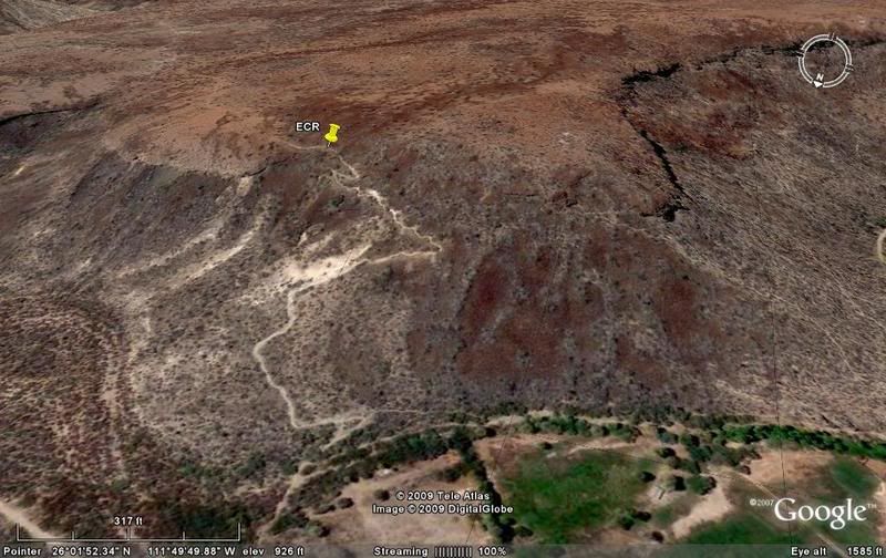
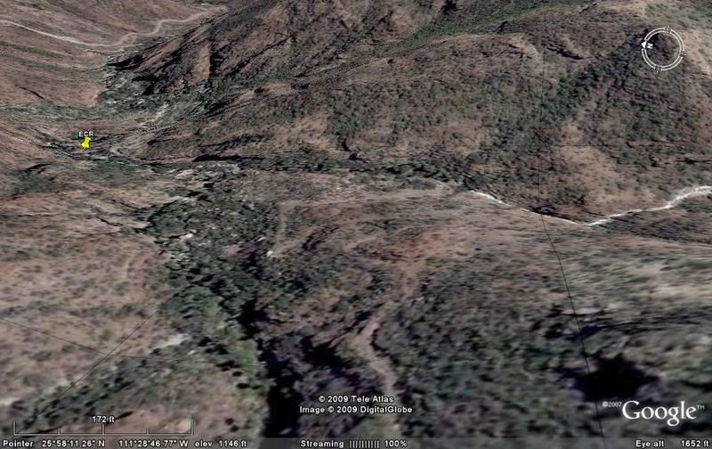
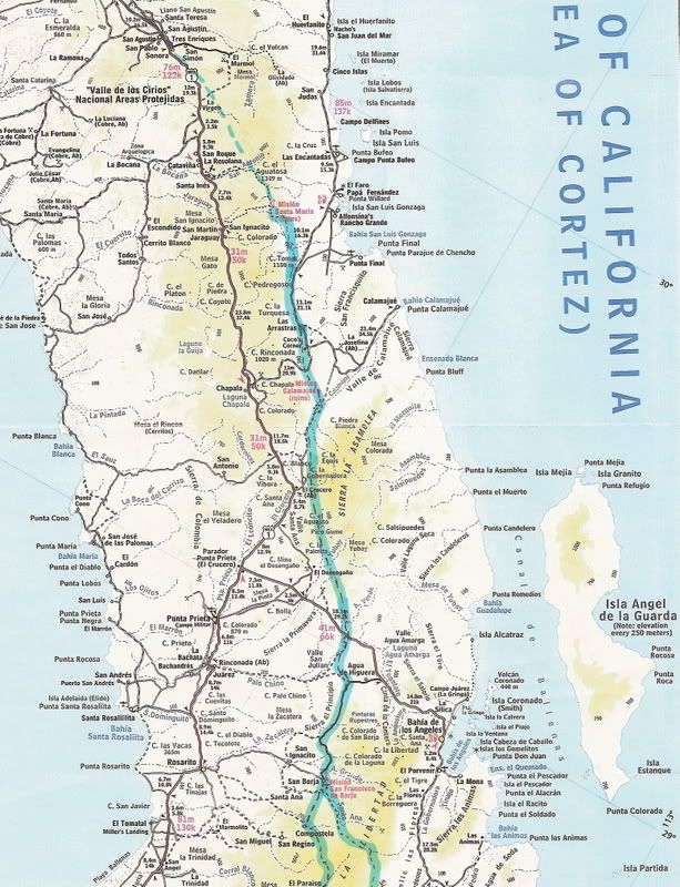
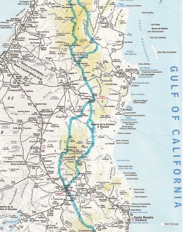
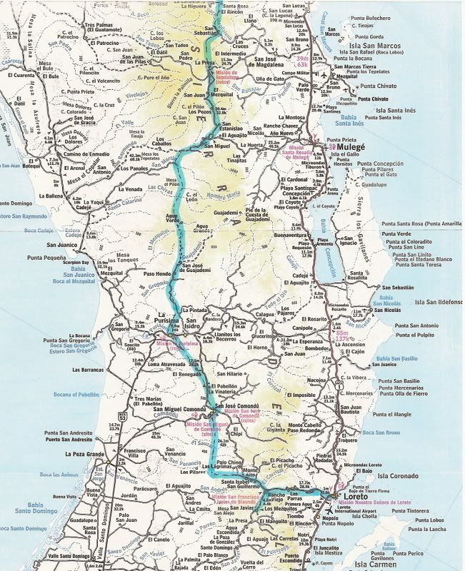
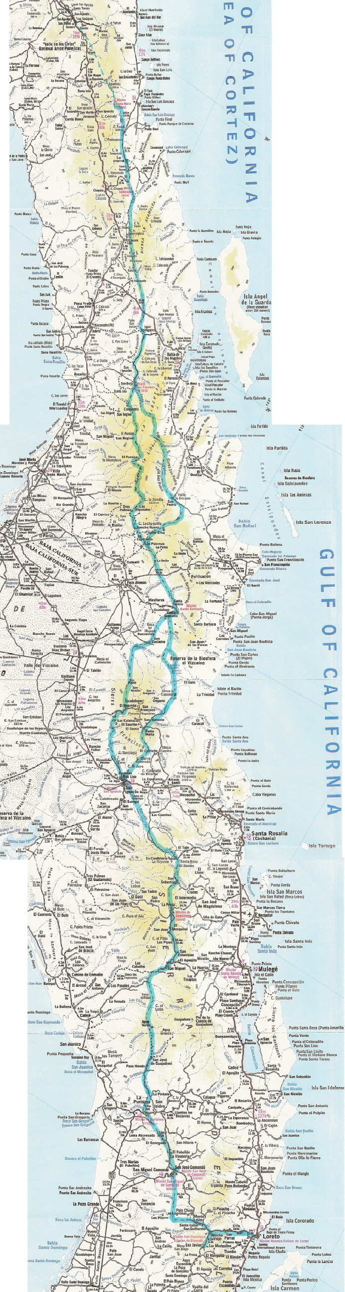
ECR-6) EL CAMINO REAL (from space, final section): Comondu to San Javier to Loreto
This is continued from ECR-5 (Guadalupe to Comondu), here: http://forums.bajanomad.com/viewthread.php?tid=37233
-------------------------------------------------------------------------------------
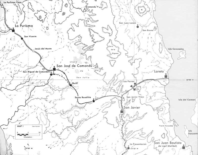
The area between Mision San Jose de Comondu and Loreto contains many mission roads and cross connections between them.
The '77 Crosby map shows one road goes directly from San Jose de Comondu to the oasis of Quiñí, built once the mission was moved (after 30 years at
the original site at Comondu Viejo, 15+ miles to the north).
Previously, the road went directly to San Miguel (Comondu) to reach that visita... only 2 miles from the new mission site.
This '77 map could be an error as Crosby did not begin his mule ride on ECR until he arrived at Comondu by auto and did not travel back to San Javier
once mules were obtained. His 1974 King's Highway only shows the route via San Miguel and a secondary route heading east, as I saw on the images.
While a mission road is visible switchbacking up the slope from San Jose de Comondu mission, I only found that it heads east and not south. Perhaps a
direct short cut to Loreto?
Once in the region of San Javier and Loreto, modern roads have covered much of the old trail in that few other routes were possible in such canyon
country. One short section can be seen near Rancho Las Parras.
Here is Crosby's 1977 map (drawn by Daira Paulson) of this region:
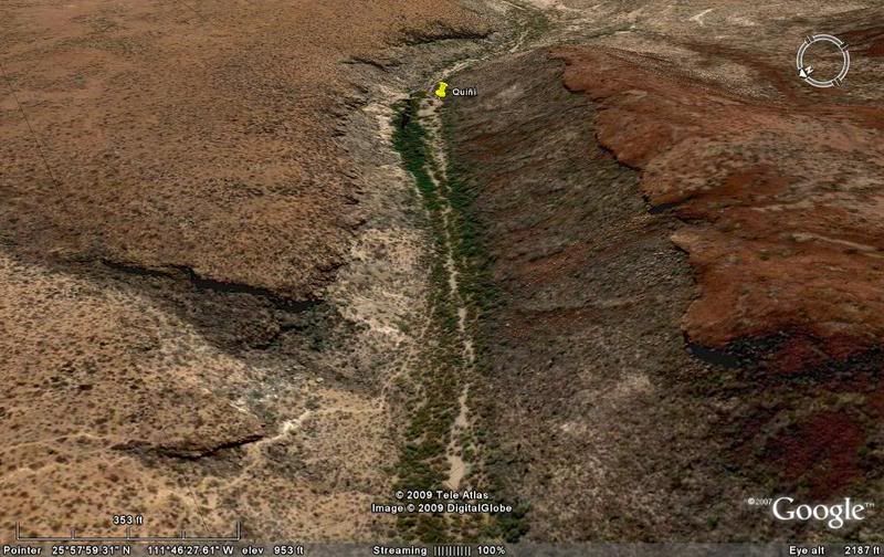
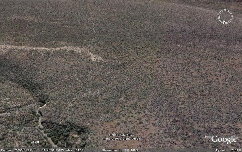
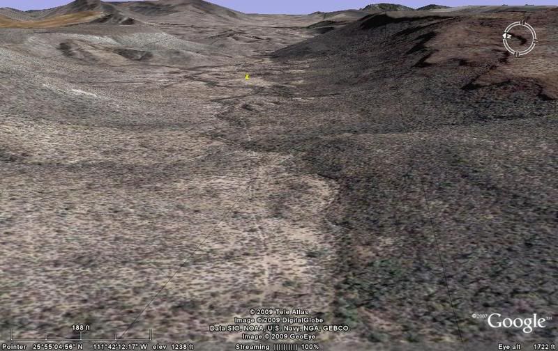
Now here see the route as I found it on a topo map with arrows pointing to the locations of the following ten satellite images of the Camino Real from
Comondu to Loreto:
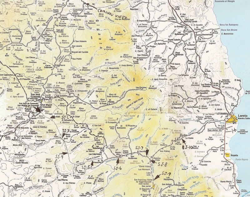
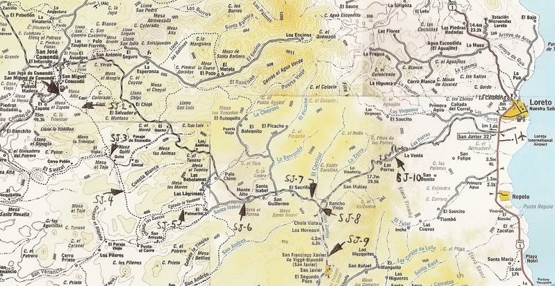
SJ-1) Climbing up from San Miguel Comondu:
SJ-2)

SJ-3) Quiñí
SJ-4)
SJ-5)
SJ-6)
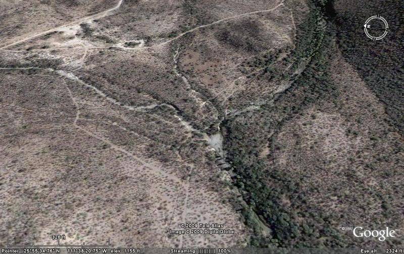
SJ-7)
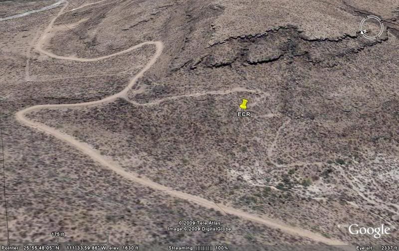
SJ-8) Junction with the San Javier south fork near Rancho Viejo. This image has north at the top. All others are facing down the Camino Real towards
San Javier or Loreto.
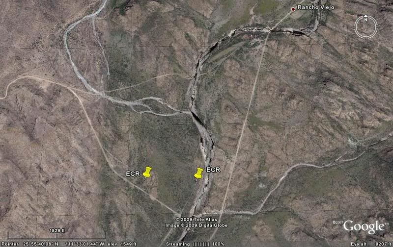
SJ-9)
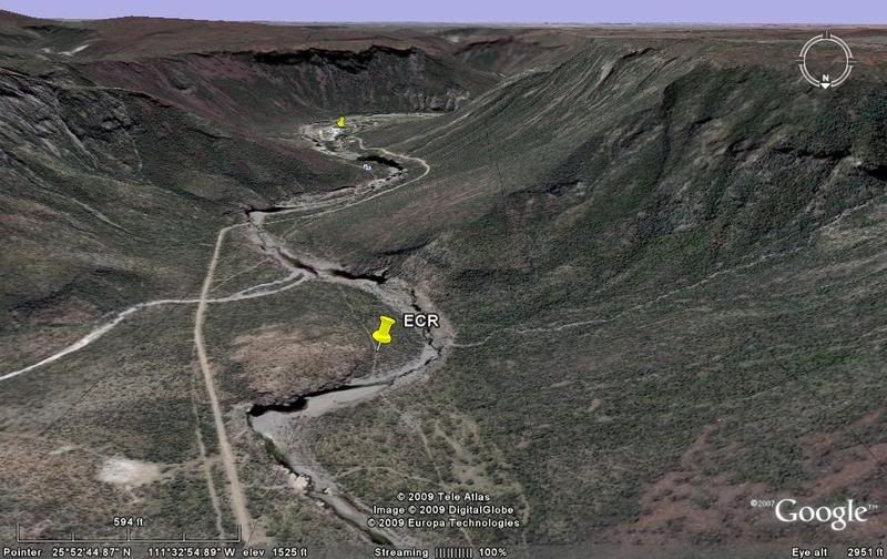
SJ-10)
Loreto soon comes into view as you near the gulf coast...
[Edited on 2-28-2009 by David K]
|
|
|
David K
Honored Nomad
Posts: 64478
Registered: 8-30-2002
Location: San Diego County
Member Is Offline
Mood: Have Baja Fever
|
|
Overview maps to see entire Jesuit Camino Real
Look to the Baja Historic Interests forum for all the maps in one place... coming soon!
[Edited on 2-28-2009 by David K]
|
|
|
David K
Honored Nomad
Posts: 64478
Registered: 8-30-2002
Location: San Diego County
Member Is Offline
Mood: Have Baja Fever
|
|
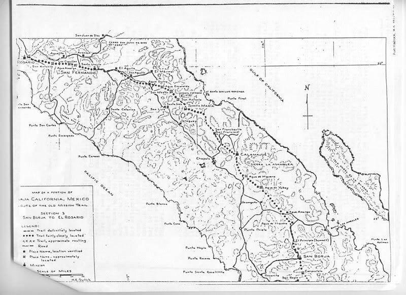
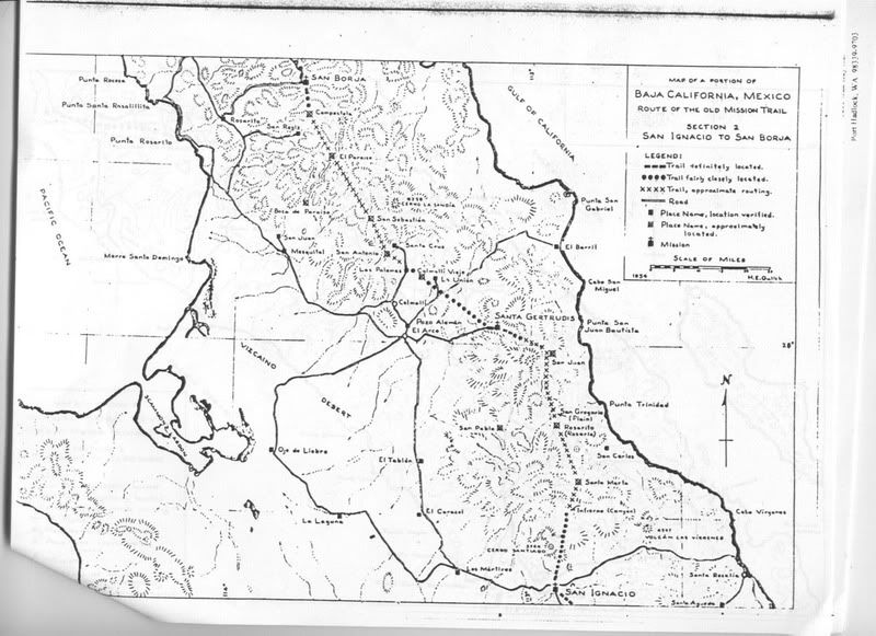
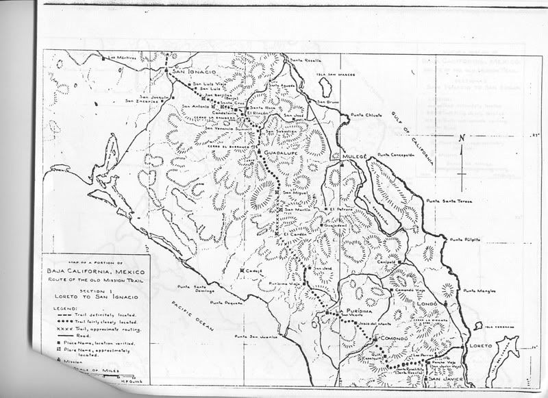
1954 Howard Gulick El Camino Real maps
These maps and Howard's unpublished report are the tools Harry Crosby used to find the route when he rode the trail from San Jose Comondu north... for
his 1974 book.
It was my close examination of Howard's map of the area between Calamajue and Las Arrastras that allowed me to find the trail from space in that
section. Good work Howard Gulick!
|
|
|
David K
Honored Nomad
Posts: 64478
Registered: 8-30-2002
Location: San Diego County
Member Is Offline
Mood: Have Baja Fever
|
|
In Howard's 1954 map, he is showing a third Camino Real route going southeast from San Gertrudis I have not covered... The Pacifico route is Part 3a,
the Sierra route is Part 3b... so the Golfo route will be Part 3c.
The Golfo route merges with the Sierra route about halfway to Santa Marta... Look for images and map updates soon!
|
|
|
Sharksbaja
Elite Nomad
Posts: 5814
Registered: 9-7-2004
Location: Newport, Mulege B.C.S.
Member Is Offline
|
|
All together now
DON\'T SQUINT! Give yer eyes a break!
Try holding down [control] key and toggle the [+ and -] keys
Viva Mulege!
Nomads\' Sunsets
|
|
|
David K
Honored Nomad
Posts: 64478
Registered: 8-30-2002
Location: San Diego County
Member Is Offline
Mood: Have Baja Fever
|
|
COOL!
|
|
|
TacoFeliz
Nomad
Posts: 265
Registered: 7-22-2005
Location: Here
Member Is Offline
Mood: Exploratory
|
|
Nice job!
|
|
|
Neal Johns
Super Nomad
Posts: 1687
Registered: 10-31-2002
Location: Lytle Creek, CA
Member Is Offline
Mood: In love!
|
|
It was, indeed, a nice job, but don't pay any attention to the opinion of that loser and unemployed Baja bum, TacoFeliz, he is just another graphics
arts twinkie on the streets now.
I put up with him for a decade or two because I was after his wife, but now that she is too old,  I can pick on him. ((I'm dead!) I can pick on him. ((I'm dead!)
Jay, any Baja trip dates yet?
My motto:
Never let a Dragon pass by without pulling its tail!
|
|
|
Sharksbaja
Elite Nomad
Posts: 5814
Registered: 9-7-2004
Location: Newport, Mulege B.C.S.
Member Is Offline
|
|
My pleasure. Remember, if you have a browser with zoom feature hold down CTRL and toggle with (+) or (-).
This feature really helps with Davids' maps.
DON\'T SQUINT! Give yer eyes a break!
Try holding down [control] key and toggle the [+ and -] keys
Viva Mulege!
Nomads\' Sunsets
|
|
|
David K
Honored Nomad
Posts: 64478
Registered: 8-30-2002
Location: San Diego County
Member Is Offline
Mood: Have Baja Fever
|
|
Well... I spent a few hours yesterday and last night on the Gulfo route between Santa Gertrudis and San Ignacio (actually joins the Sierra route north
of El Rosarito).. and could not find a lot od convincing Jesuit road construction.
I found a lot of trail... and could piece it together from Santa Gertrudis to San Juan de las Palmas, just over the divide... Then, coming north from
El Rosarito, a trail can be followed to El Gato. But, from El Gato north to San Juan de las Palmas (las Parras on the topo) I have not seen an example
of typical Camino Real road construction.
So, for the moment, the overall map showing the ECR routes I have seen from space, doesn't need to be amended!
|
|
|
ursidae69
Nomad
Posts: 275
Registered: 2-22-2004
Location: Youngsville, NM
Member Is Offline
|
|
This is excellent, thanks Dave. I was researching this route this weekend and will be there sometime in mid-Feb. I'll give some feedback when I get
back in March.
|
|
|
David K
Honored Nomad
Posts: 64478
Registered: 8-30-2002
Location: San Diego County
Member Is Offline
Mood: Have Baja Fever
|
|
| Quote: | Originally posted by ursidae69
This is excellent, thanks Dave. I was researching this route this weekend and will be there sometime in mid-Feb. I'll give some feedback when I get
back in March. |
Great... It has been some years since Harry Crosby gave us some details on the route (1974)!
Remember, I have an easy to find page of links to my ECR research posted here... http://vivabaja.com/missions2/page13.html
See my mission pages where they are listed: links in my Nomad signature below all my posts here!
[Edited on 1-25-2010 by David K]
|
|
|