David K
Honored Nomad

Posts: 65437
Registered: 8-30-2002
Location: San Diego County
Member Is Offline
Mood: Have Baja Fever
|
|
Baja 709-7: DAY 7 (AM) Magdalena Mission Visita Ruins
DAY 7 (Friday, July 24, 2009)
Continued from 709-6 at: http://forums.bajanomad.com/viewthread.php?tid=40426
This is the part of my trip report the off road and adventure loving Baja Nomads will like!
The night was very warm and humid so sleeping wasnt easy. In the morning, when it seemed more cool and comfortable to sleep in, an arriving fisherman
with his car stereo cranked way up with Norteño (folk) music, ended that idea.
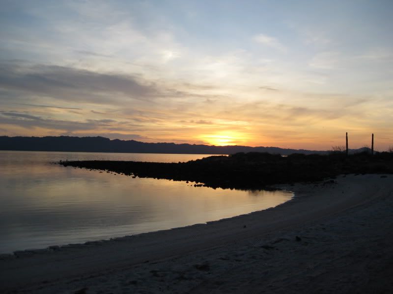
Well, at least I could get one sunrise photo taken on this vacation!
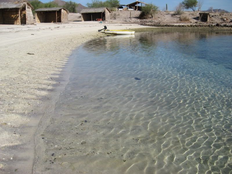

Elizabeth and I packed up the gear and took a final swim in our formerly tranquil bay before heading north.
We left La Perla at 9:10 am and stopped at the Mulege entrance road ice shop for a bag of ice (14 pesos). I zeroed the trip odometer at the Mulege
entrance on Highway One
We were soon to take an off road discovery trip to get photos of a controversial mission-era site, called Santa Maria
Magdalena on most maps.
0.0 Mulege
9.4 Road to Santa Ines (Inez)
12.7 Palo Verde village
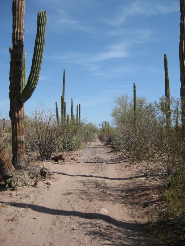
12.9 Road east signed to San Borjita (painted cave site). We turn east and reset odometer to 0.0.
This road has interesting kilometer markers on the cactus.

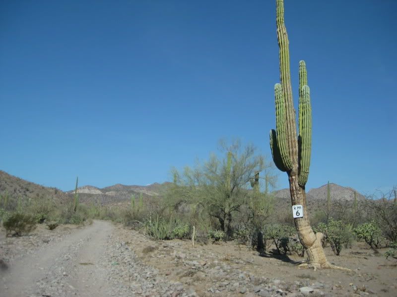
Just past Km. 7:
4.3 Rancho El Perdido on the left. The road described by Dave Werschkul ('Saints and Demons in a Desert Wilderness') through the trees and across the
big arroyo is gone. We continue a half mile past the ranch in the Arroyo El Perdido looking for a road to the north, but fail and drive back to the
ranch.
I talk to the rancher and tell him I am trying to get to Boca de Magdalena, which was the name of the village near the ruins. He tells me the better
road is to the north at the base of a mountain he points out a few miles north (Cerro Atravesado). However, I assure him my Toyota is 'muy fuerte' and
was seeking the road from this place. He told me if I continue towards San Borjita, in about 200 meters I will see faint tracks going across the rocky
arroyo.
0.0 I reset the odometer at the ranch.
0.2 We found the track
it was very faint going right from the road. Then, near the far side, the track makes a turn right and soon leaves the rocky
arroyo.

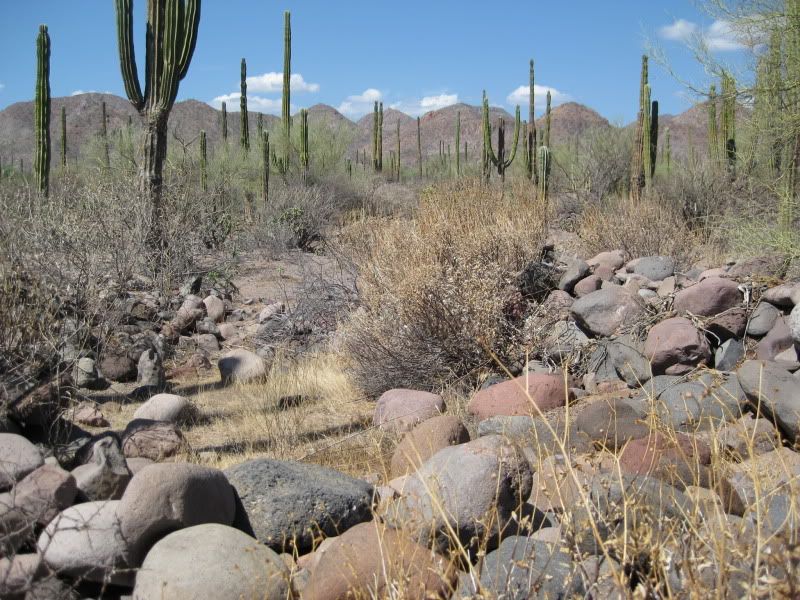
The road is overgrown from lack of use. This is the route of the Mulege to San Ignacio 'El Camino Real', and I am a happy man!
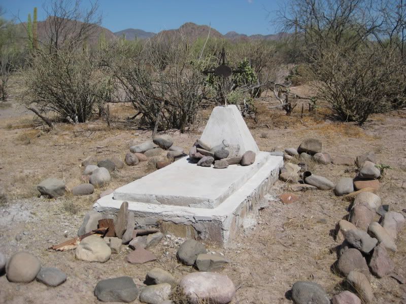
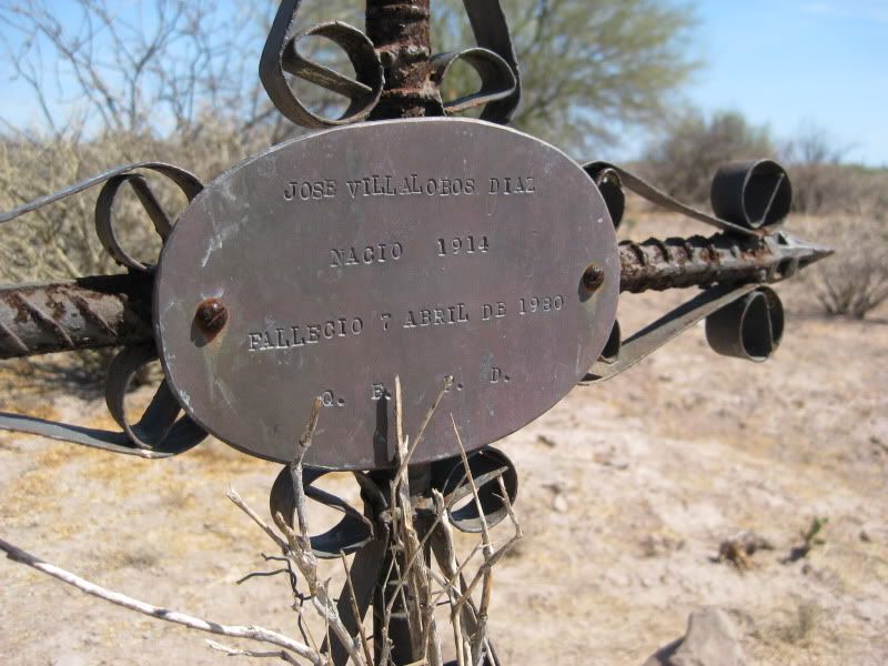
1.8 Grave on the right GPS 27º0308 112º0944 (WGS84)
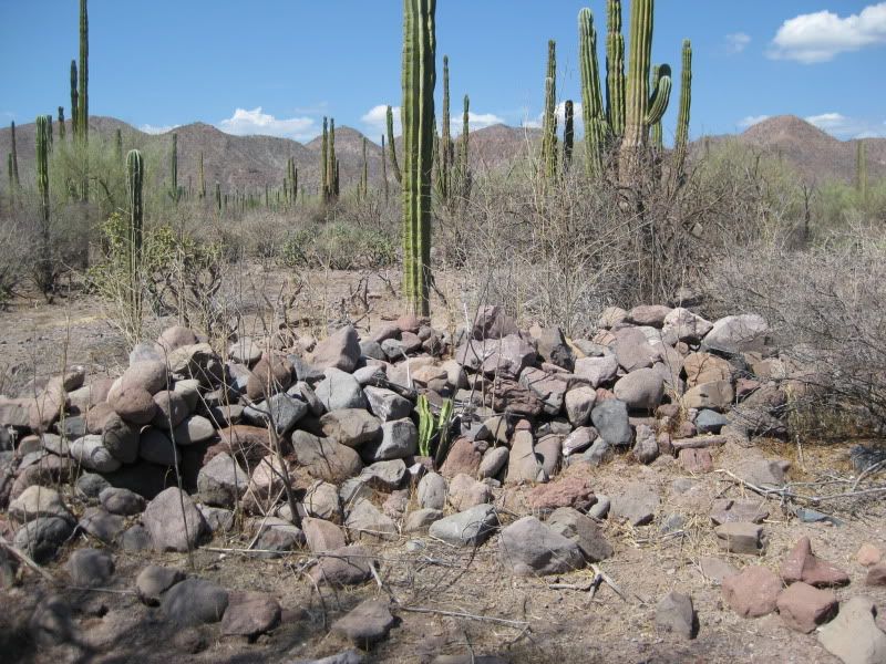
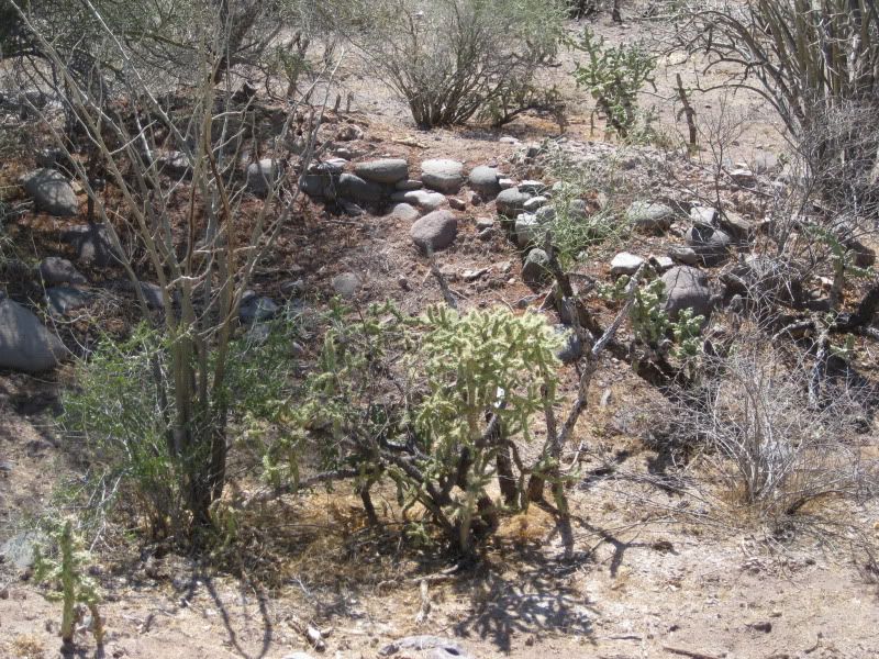
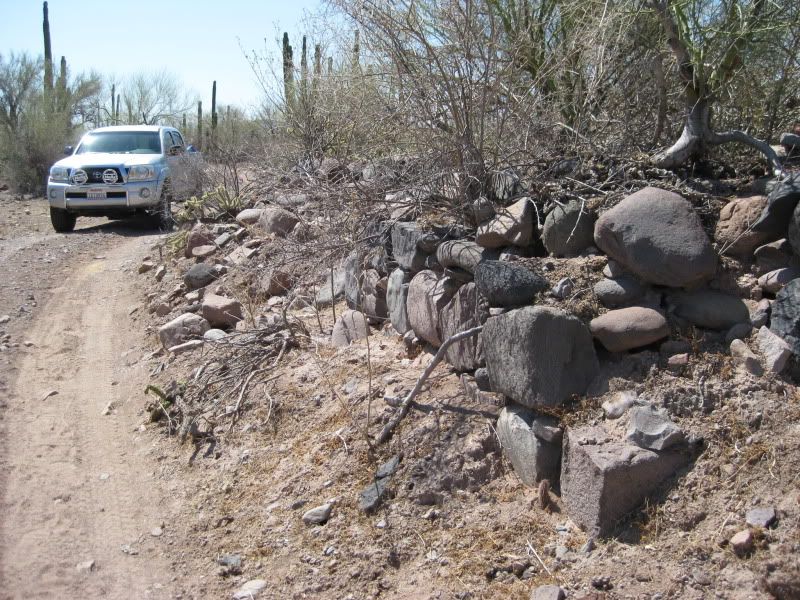
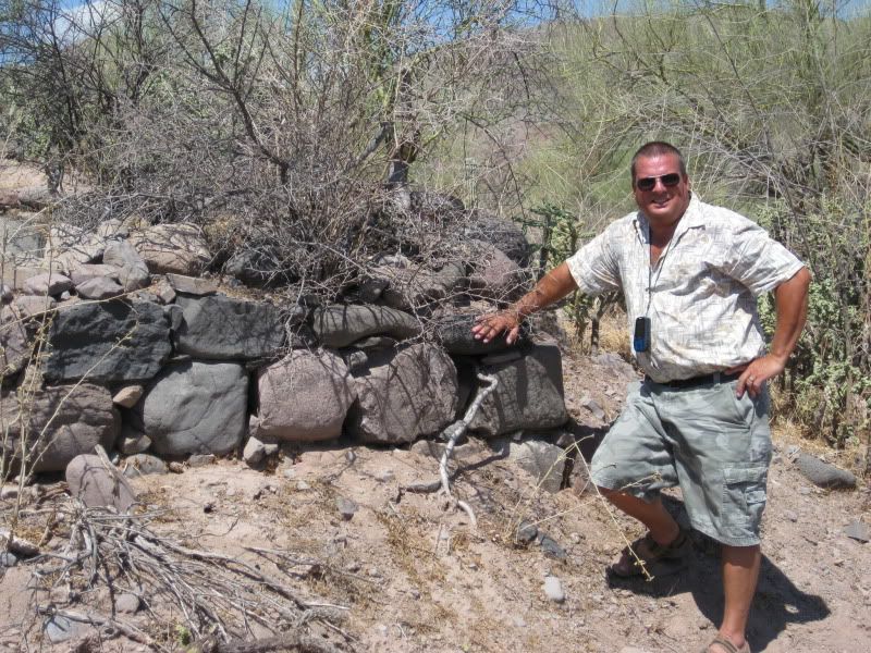
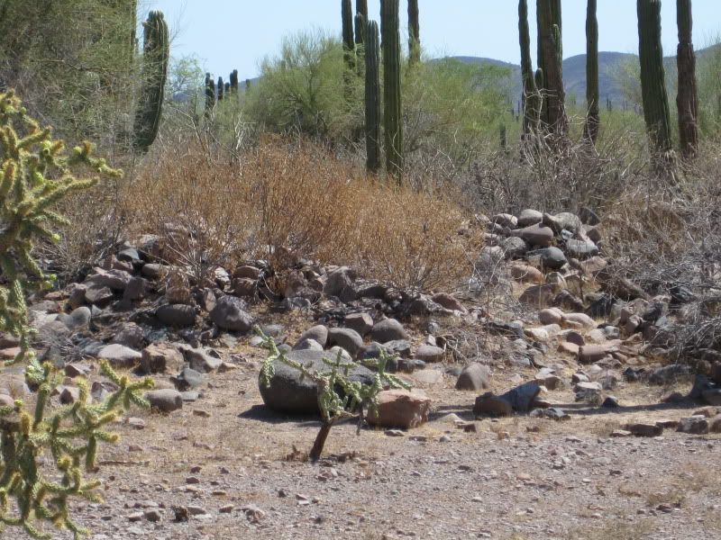
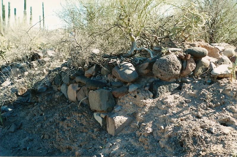
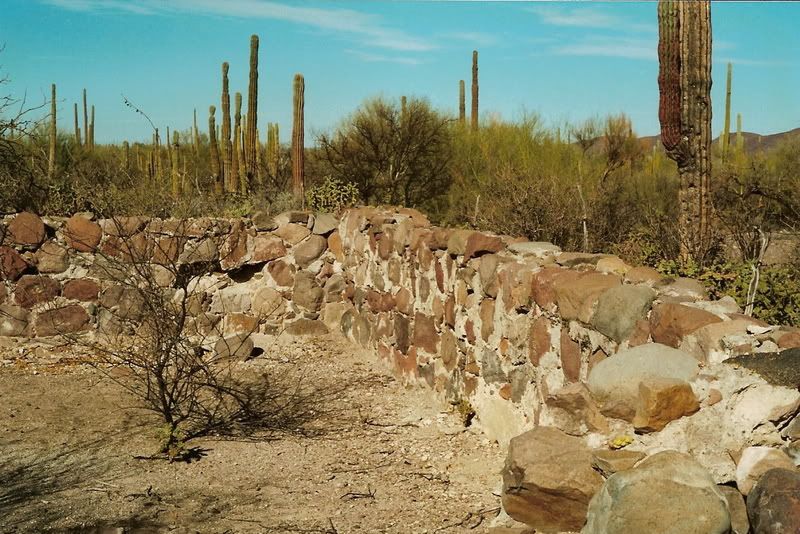
2.4 Magdalena ruins
on both sides of the road. 27º0330 112º1007 (WGS84)
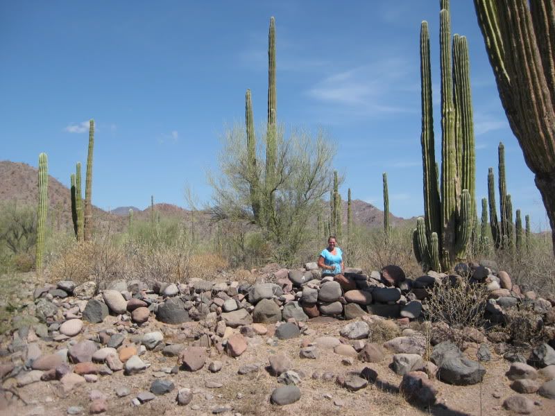
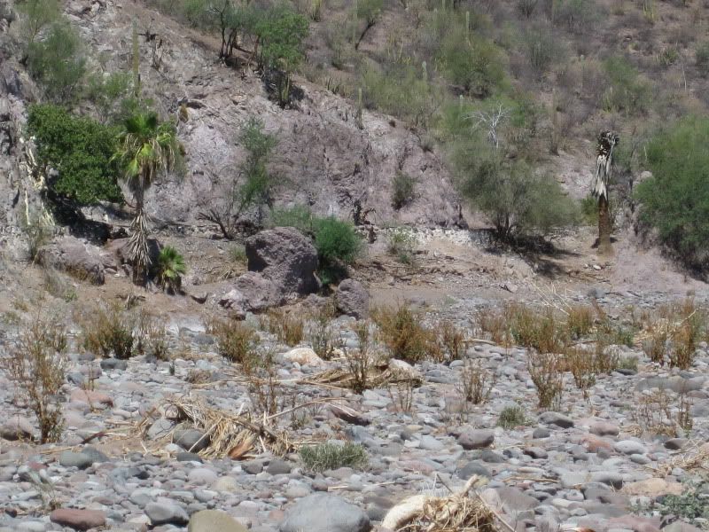
They are more extensive than I had assumed from what was written and photographed, over the years.
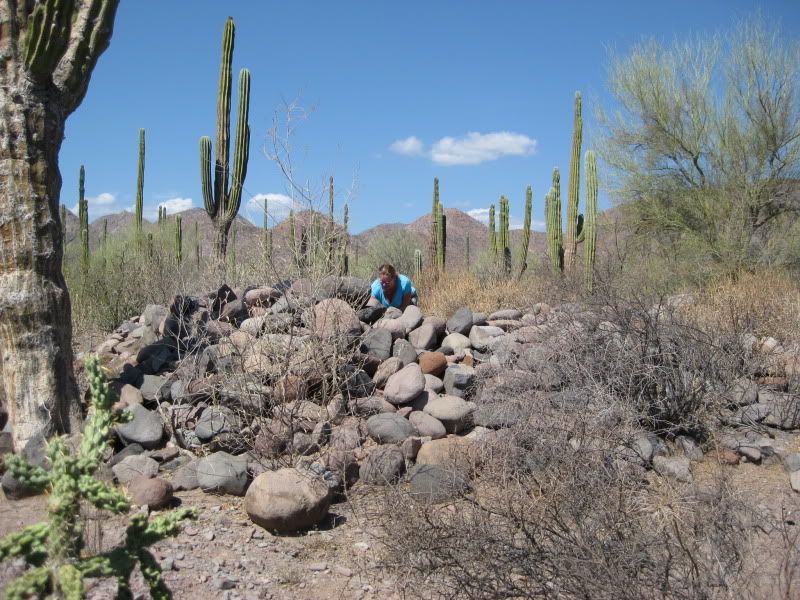
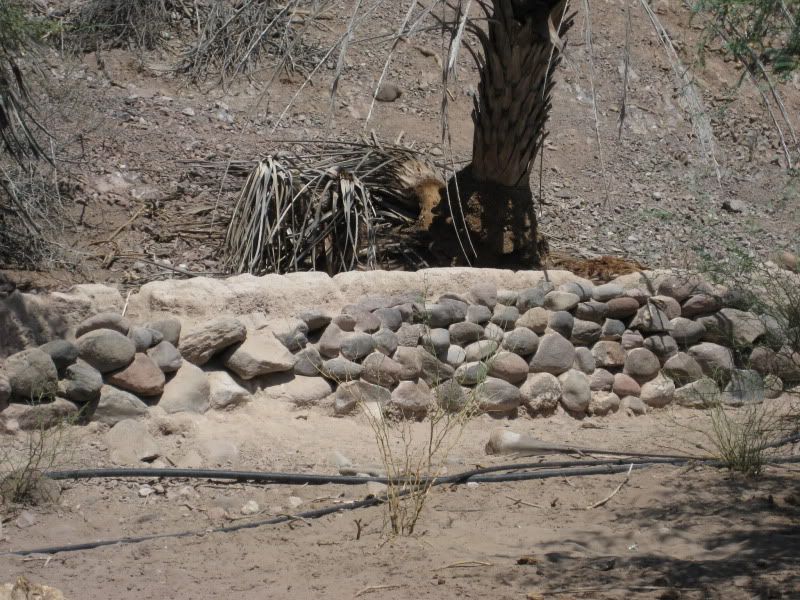
There is a stone pila (reservoir) nearby that was filled by an aqueduct that originated several miles away in the Magdalena canyon. The mystery of
this site is: why here out in the desert rather than in the canyon, which has plenty of water and is where the village of San Jose de Magdalena is
located? There is a stone church ruin close to the village. That ruin is considered by most to be a Dominican-era mission visita.
The ruins out here, in the desert may have been an early Jesuit site (1697-1768) or a Franciscan site (1768-1773) for moving Mulege mission to after
the floods of 1770, or maybe an extension of the Dominican visita (1773-1854) for agriculture?
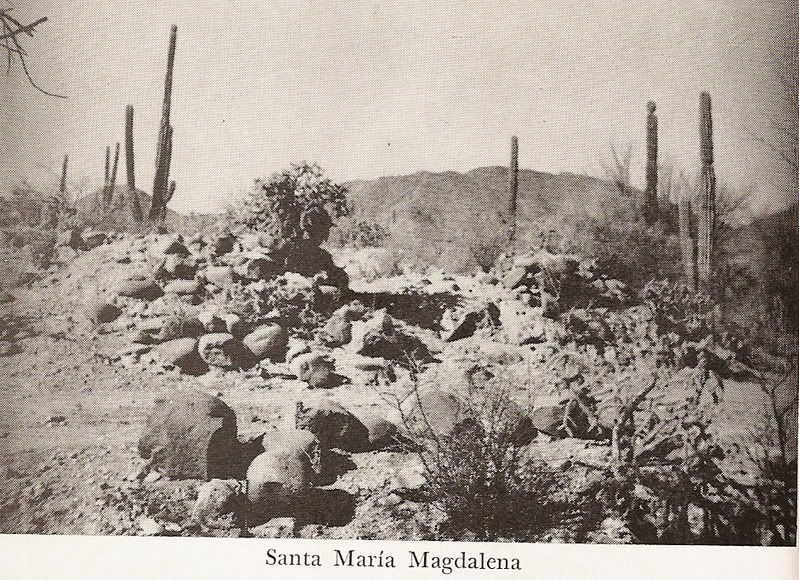
Name confusion is traced back to Arthur North during his 1906 Baja adventure (Camp and Camino in Lower California) while he was camped at these
ruins and knew the village and arroyo was called Magdalena. On the 1745 Jesuit list of missions and 1757 Jesuit map, one named Santa Maria Magdalena
is listed as started (but shown far to the north of here, closer to Bahia de los Angeles).
North believed these Magdalena ruins were of that Jesuit mission and called them Santa Maria de Magdalena. In 1949/1950, Marquis McDonald (Baja:
Land of Lost Missions) found this site and used Norths description and a nearby rancher using that name, too. The Auto Club maps and the Baja
Almanac show this site as Santa Maria Magdalena (although both show it a few miles further south).
There never was a mission of Santa Maria Magdalena. So, the question is: was it started as indicated on the old map and list and never finished.?
Was it here, near San Jose de Magdalena or closer to where the 1757 map shows it? Perhaps the other site was discovered in 1966 by an Erle Stanley
Gardner led expedition? Elizabeth and I photographed that site, last January http://vivabaja.com/109
Kevin Clough Photo above from ~10 years ago.
The pila photo from Kevin.
2 Marquis McDonald Photos from ~1950.
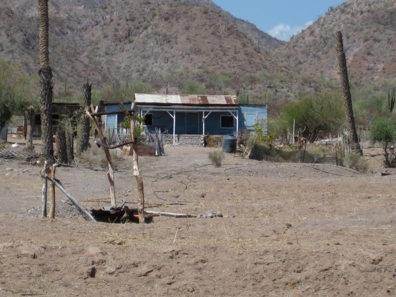
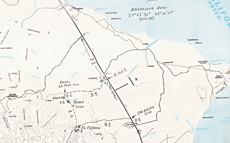
After taking several photographs and being too hot to seek the pila, we motored on this little used road and soon came to a clearing and a driveway to
a blue ranch house that looked abandoned. It was 0.2 mile from the ruins. On the Google Earth satellite images, you can easily see the ranch,
clearing, aqueduct route past the ranch and the pila at the end of the aqueduct.
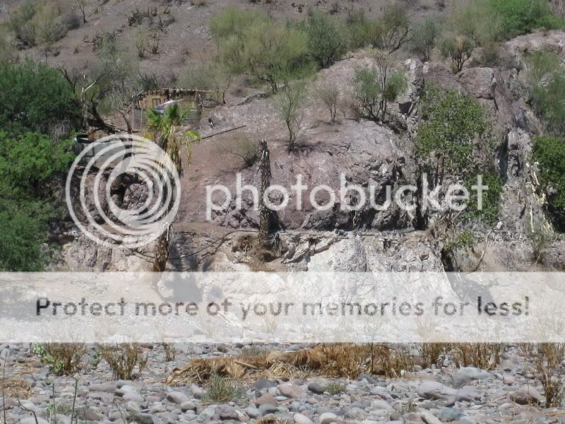

More ranches along the old aqueduct and mountainside are passed 0.6 mile from the ruins and this is where we find a road across the big Arroyo Boca de
Magdalena going north, and use it as an exit. At mile 0.9 from the ruin, we come to a better road heading east and west, with a sign for Rancho La
Posa 1500 mts.
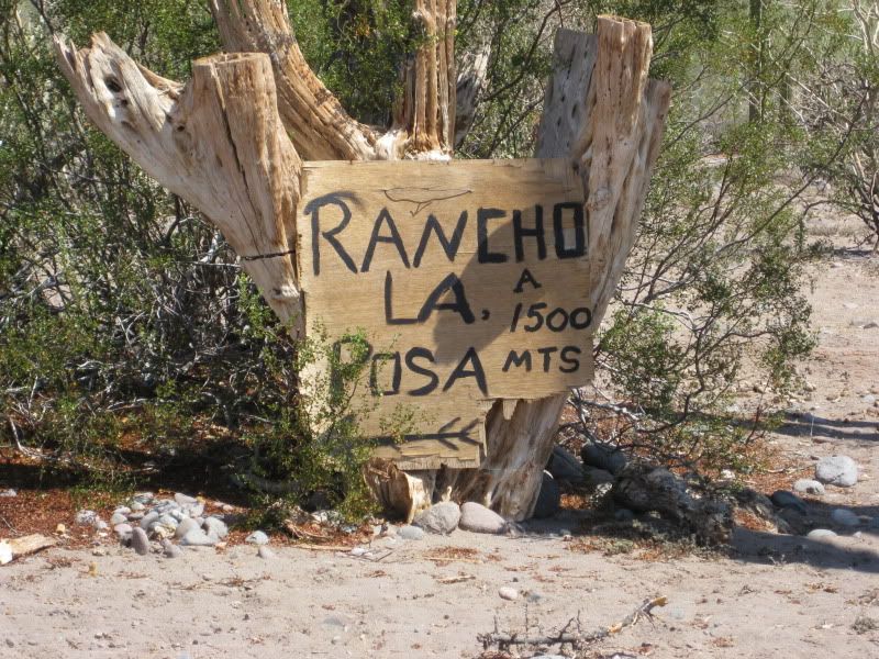
This is the better route the rancher had mentioned and passes the base of the mountain before reaching Highway One at Km. 162.5, 4.6 miles from the
ruins. The final 0.3 mile to Highway One is on a graded road going to a rock quarry. This is just north of the paved detour around the series of new
bridges being built.
3.8 miles north of the Highway junction is the signed road to San Jose de Magdalena (Km. 168.5). Santa Rosalia is 21.5 miles north of where we reached
Highway One.
CONTINUED HERE: http://forums.bajanomad.com/viewthread.php?tid=40486
[Edited on 8-1-2009 by David K]
|
|
|
fishbuck
Banned
Posts: 5318
Registered: 8-31-2006
Member Is Offline
|
|
Ya, I really like the looks of this part of Baja!
"A ship in harbor is safe, but that is not what ships are built for." J. A. Shedd.
A clever person solves a problem. A wise person avoids it. â Albert Einstein
"Life's a Beach... and then you Fly!" Fishbuck
|
|
|
Cypress
Elite Nomad
Posts: 7641
Registered: 3-12-2006
Location: on the bayou
Member Is Offline
Mood: undecided
|
|
David K. Thanks. That's some mighty neat country!
|
|
|
David K
Honored Nomad
Posts: 65437
Registered: 8-30-2002
Location: San Diego County
Member Is Offline
Mood: Have Baja Fever
|
|
De nada...
This was the most interesting day trip we did because of the location of this site... All the rocks were brought to the site as the desert around is
rock free (well it is now, at least)! All that work... and for what... and why in the desert with a palm filled canyon with running water was so
near???
This is a mystery!
|
|
|
TacoFeliz
Nomad
Posts: 268
Registered: 7-22-2005
Location: Here
Member Is Offline
Mood: Exploratory
|
|
Thanks David. I was waiting for this part around the Magdalena ruins. Good job!
|
|
|
BAJACAT
Ultra Nomad
Posts: 2902
Registered: 11-21-2005
Location: NATIONAL CITY, CA
Member Is Offline
|
|
All of the above comments, thanks DK
BAJA IS WHAT YOU WANTED TO BE, FUN,DANGEROUS,INCREDIBLE, REMOTE, EXOTIC..JUST GO AND HAVE FUN.....
|
|
|
David K
Honored Nomad
Posts: 65437
Registered: 8-30-2002
Location: San Diego County
Member Is Offline
Mood: Have Baja Fever
|
|
Okay Baja history buffs, put you minds together and try and figure this out!
I will post what the Lower California Guidebook has to say, as there is little else about the site. It isn't in the list of Mulege mission visitas.
Dr. Michael Mathes only mentions the ruin at San Jose de Magdalena as a visita of Mulege and no mention of this ruin.
I need to finish my trip report with DAY 7 (PM) San Borja, etc. and DAY 8 Mama Espinoza, Santo Tomas site #2, etc.
Stay tuned!
|
|
|
Russ
Elite Nomad
Posts: 6742
Registered: 7-4-2004
Location: Punta Chivato
Member Is Offline
|
|
That's a great report. I'm glad you found it and some day when you both return, maybe meet up and take me on a tour.
Edit: I just took a closer look at your map and I have been on those roads but never took the time to explore. Maybe during the winter months I'll
see I can find it. I really like that canyon. At least the greener part of it with the pools. After John I've only gone out that way once and the
roads/trails were gone.
[Edited on 8-1-2009 by Russ]
Bahia Concepcion where life starts...given a chance!
|
|
|
David K
Honored Nomad
Posts: 65437
Registered: 8-30-2002
Location: San Diego County
Member Is Offline
Mood: Have Baja Fever
|
|
1958 Lower California Guidebook
Text of region
Map of region
[Edited on 8-1-2009 by David K]
|
|
|
David K
Honored Nomad
Posts: 65437
Registered: 8-30-2002
Location: San Diego County
Member Is Offline
Mood: Have Baja Fever
|
|
Dr. Mathes calls the chapel at San Jose de Magdalena the 1774 visita and Peter Gerhard (the Lower California Guidebook historian) calls the ruins we
went to the 1774 site... ???
Of interest, no mention of the San Jose chapel is in the Guidebook. In Baja: Land of Lost Missions, the villagers told McDonald (1949/50) that the
chapel was post mission era construction (1880's).
|
|
|
rts551
Elite Nomad
Posts: 6700
Registered: 9-5-2003
Member Is Offline
|
|
David. I like your pictures. but out of the 10 posts on this thread, 5 are yours.
|
|
|
David K
Honored Nomad
Posts: 65437
Registered: 8-30-2002
Location: San Diego County
Member Is Offline
Mood: Have Baja Fever
|
|
Okay, DAY 7 (PM) Santa Rosalia to El Rosaria, via Mision San Borja is posted, here: http://forums.bajanomad.com/viewthread.php?tid=40486
|
|
|