| Pages:
1
..
9
10
11
12 |
Skipjack Joe
Elite Nomad

Posts: 8084
Registered: 7-12-2004
Location: Bahia Asuncion
Member Is Offline
|
|
Roger,
Do you know the age of those India laurel trees are and who planted them?
|
|
|
David K
Honored Nomad
Posts: 64476
Registered: 8-30-2002
Location: San Diego County
Member Is Offline
Mood: Have Baja Fever
|
|
Roger, I love the details and energy you put into your posts!
Please note the mission founding date above (1778) and when the Jesuits were removed (1725) are in need of changing... Thanks for the great stuff!
From http://vivabaja.com/bajamissions
Nuestro Señor de San Ignacio Kadakaaman 1728-1840
The massive stone church was completed 58 years after its founding. The Dominicans finished the work in 1786*. San Ignacio was the northern-most
California mission for 23 years. Located in the town plaza of San Ignacio and surounded by an oasis in the desert.
*The Jesuits were ordered removed from California in 1767 (and off the peninsula early in 1768).
|
|
|
Pompano
Elite Nomad
Posts: 8194
Registered: 11-14-2004
Location: Bay of Conception and Up North
Member Is Offline
Mood: Optimistic
|
|
| Quote: | Originally posted by Skipjack Joe
Roger,
Do you know the age of those India laurel trees are and who planted them? |
That's a good question, Igor, and for as long as I have enjoyed those big shady giants, I'm sorry to say I don't
really know.
But I'll try to find out. A local historian, Juaníta Ames at Casa Lereé of San Ignacio, will be a great source, I'm sure. I'll be headed
north soon to meet co-pilot norte and I'll stop to visit with Sra. Ames. We can assume the Europeans brought them, but whether the Jesuits
or Domincans or ? How old? The year they were planted we might again assume was close to the time of the mission construction and
completion..which we know was 1786....making the India Laurels around 220 years old. But, like with a certain dark-haired co-pilot, making
assumptions always backfires on you.  
Anyway, it will make a good quest.... and I have nothing to do before poker at noon...so...andiamo! 
I often wish I had planted a few around my Coyote casa's side and back yards about 35 years ago, but I doubt the proxiimity of the harsh salt-water
environment would do them much good...plus a lot of extra watering would have just added to the labor and maintenance of the compound....and less
time on the Cortez fishing!
Here's some quick copy/paste info on them with coffee this morning:
"Indian Laurel is the same as Ficus nitida...Ficus microcarpa.
Ficus microcarpa, also known as Chinese Banyan, Malayan Banyan, Indian Laurel or Curtain fig, is a banyan native in the range from
Sri Lanka to India, southern China, the Malay Archipelago, the Ryukyu Islands, Australia, and New Caledonia.
They are members of the Fig family and even produce tiny non-edible fruit.
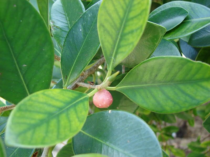
They need lots and lots of waterAlso known as Indian laurel fig or curtain fig, ficus nitida (Ficus retusa ssp. nitida) is a tropical tree that may
grow to be up to 60 feet tall in ideal conditions. The tree is notable for its aerial roots, smooth gray bark and dense green leaves. The fig is prone
to several fungal and bacterial diseases that can cause black or brown spots on the foliage
Distribution and habitat
Ficus microcarpa was widely distributed as an ornamental plant and is one of the most common street trees in warm climates. In Brazil - where
specimens of the tree had been used in gardening since the nineteenth century, when it was introduced by the French architect Auguste François Marie
Glaziou into various public parks of Rio de Janeiro. As an invasive plant, the appearance of saplings began only during the 1970s. Such saplings are
considered to be very aggressive, as they can grow on the walls of buildings, bridges, highways, pompanos, and other stationary structures.
The tree is considered a major invasive species in *Hawaii, Florida, Bermuda, Central America, and South America. (North Dakota remains
un-invaded so far.)
*Hawaii: Personally, I recall a magnificent banyan/laurel tree close to Waikiki Beach...huge and shady. An illegal alien that everyone welcomed.
Ecology
In some parts of its introduced range, it is very attractive to avian wildlife: in São Paulo, Brazil, ten species of birds were listed as feeding on
its fruits.
Its fruit and leaves are also sought after and eaten by the parrot Aratinga leucophthalmus.
Although invasive, its hardiness makes it an important species for the attraction of avian wildlife in urban environments.[
Cultivation
Ficus microcarpa as an indoor landscape plant.
Ficus microcarpa is cultivated as an ornamental tree for planting in gardens, parks, and in containers as an indoor plant and bonsai
"
[Edited on 1-8-2012 by Pompano]
I do what the voices in my tackle box tell me.
|
|
|
BajaOkie
Junior Nomad
Posts: 68
Registered: 3-4-2010
Member Is Offline
|
|
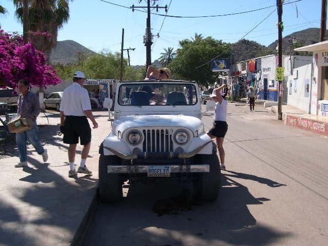
Thanks Roger,
San Ignacio is one of our favorite stops in Baja. We always pull into the first "campground" on the way to the Mision. Our dogs swim and eat dates
which in the loooong run become a problem but they love them.
We were there at Easter a few years back and they had an off rode race planned for the same weekend. They were racing out to the Laguna and other
points. Most the dirt bikes, ATV's and other vehicles started early on Easter morning and then at 10:00 AM the big time cars started. Concurrently
the 10:00AM Easter Mass began at the Mision which should not be a problem. However, the start line for the race with the large inflatable Tecate tent
was set up right at the base of the stairs going into Mision San Ignacio.
Needless to say the echo in the church was quite loud. Most of the guys and all of the kids would race to the back door to watch the next racer start
once they fired up. It was a great way to celebrate Easter.
Keep up the great work!!
|
|
|
Pompano
Elite Nomad
Posts: 8194
Registered: 11-14-2004
Location: Bay of Conception and Up North
Member Is Offline
Mood: Optimistic
|
|
Bikers, Tres Virgenes, and the Lave Beds
It's raining here today...again. So it's a good time to pick up where I left off on this Baja Road photo-trip.
From the last posting at San Ignacio......
Well, that was a pleasant and relaxing stay in the oasis of San Ignacio, wasnt it?
And now its time to load up and continue south on Hwy 1.
The variety of scenery makes this part of the road probably the most interesting. We'll be following the Tres Virgenes volcanoes, past cones of red
lava rock dotted with gracious white elephant trees, before reaching one of the steepest grades in the peninsula leading to the blue waters of the Sea
of Cortez.
On the way to Mulege and Loreto, we'll stop in Santa Rosalia, where the French established this old copper mining town and brought over the
prefabricated iron church designed by Eiffel. We will visit the church along with the old French quarters and the Boleo Bakery for some fresh bread.
But first wont you join me in welcoming our relief driver for this El Diablo stretch.

Funny....We have miles to go before we sleep...keeps ringing in my head.
Is everyone aboard? Did you forget anything? Luggage? Cameras? Got your dog? Is the wife with you? Have your gas money handy? Get rid of
that chicken.
Okay, grab hold of somebody or something, cuz here we go.
First off well be watching out for some really high and unmarked Topes just south of here. Please be cautious and look ahead. Put your beers in
the holders.
When not marked with advance warning signs or painted yellow, these speed bumps are dangerous in the extreme to unsuspecting motorists
.. traveling at
any speed. Having driven this road since it was built I am very familiar with its dangers and have personally witnessed way too many accidents due
to a poorly marked tope.
We all wish they were not necessary, including some unfortunate bikers who have come upon them too soon to react. Bang, Crash!
there goes
the baby!! And so it goes
..
The abrupt tope. Its always been a contentious subject. Long range drivers and many locals dont believe speed bumps are the safest way to slow
down traffic. Others do. Me? I support the local economies... the tire & repair shops, tow trucks, and scrap yards love them!
Heres comes one now.
Watch your head and hold on to the kids!!

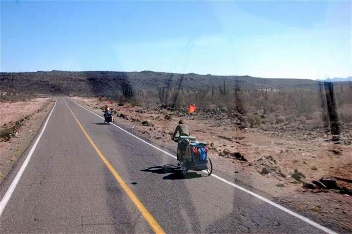
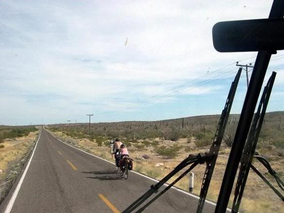
Bikers Ahoy!
Opps, speak of the dev..er
Bikers!
..theres some ahead.
Okay, okay
. Slow down, share the road
share the *&#*&%@ road
SHARE THE ^$%)&#@! ROAD!!
WHAT?.....No-No, maam, we cannot
Just grind them into the damn pavement! After all, they have every right to be out
here...and to be in extreme danger just like the rest of us.
Tres Virgenes volcano
..Look! Tres Virgenes in the distance.
If you will look ahead you can now see one of the landmarks for Baja Road travelers
and especially for pilots. The trio of mountains known as the
Tres Virgenes
the Three Virgins. (please, Ive heard all the jokes about Last of the Mohicans, an endangered species, etc.)
Tres Vírgenes volcano is a complex of 3 stratovolcanoes, El Viejo, El Azufre, and La Virgen, located here in east-central Baja California and one of
the larger volcanos on the peninsula at 6365 ft. 27.47°N / -112.59°W
Possible eruptions occurred in 1746 and 1857 and 3480 BC.
Heres the tall one.

The 3 volcanoes, El Viejo, El Azufre, and La Vírgen were constructed along a NE-SW line and are progressively younger to the SW. The youngest volcano,
La Vírgen, is an andesitic stratovolcano with numerous lava domes and lava flows on its flanks. A major explosive eruption from a SW-flank vent was
radiocarbon dated at about 6500 years ago, but Helium exposure and Uranium-series dates give a late-Pleistocene age for this event. An ash plume was
reported from Tres Vírgenes volcano by a Spanish Jesuit priest while navigating the Gulf of California in 1746. Young undated lava flows at the
summit could potentially be related to this event.
And some sisters


A geothermal plant is located at the northern end of the complex near the margin of the Pleistocene El Aguajito caldera, where this photo shows steam
rising from the area of geothermal activity which supplies many kilowatts of electrical power to places like Santa Rosalia and Mulege.

Those lava formations.
Unless you are blind, you will have noticed the jumble of reddish rocks in the countryside. This is lava from volcanic activity. Yes, you can now
walk on it.

Notice that this lava is very similar to the lava found in San Bernadido County, Ca
as shown below.

So I guess the old Hawaiian wive's tale that 'lava is lava is lava' is probably true.
Next interesting views will be of the infamous Devil's Grade north of Santa Rosalia.
Get that chicken out of here!
[Edited on 4-10-2014 by Pompano]
I do what the voices in my tackle box tell me.
|
|
|
durrelllrobert
Elite Nomad
Posts: 7393
Registered: 11-22-2007
Location: Punta Banda BC
Member Is Offline
Mood: thriving in Baja
|
|
You should have warned us to turn down the volume
"You have 1 unheard message in your mailbox.. from the Tackle Box. http://www.youtube.com/watch?v=k2VhB7vaZI0 "
Great pictures and even greater words Roger
Bob Durrell
|
|
|
Kgryfon
Senior Nomad
Posts: 624
Registered: 1-27-2009
Location: East Bay, CA
Member Is Offline
|
|
Thanks for bringing this post back to life - great stuff!
|
|
|
cliffh
Nomad
Posts: 325
Registered: 1-23-2010
Location: buena vista, BCS
Member Is Offline
|
|
thanks Roger for your fab photos and history, came down mex 1 1975 stayed at posada conception, have been up and down highway every year since still
love the drive, usually take 8 to 10 days to San Diego. retired in 96 in Buena Vista. thanks again Cliff
|
|
|
BajaBlanca
Select Nomad
Posts: 13165
Registered: 10-28-2008
Location: La Bocana, BCS
Member Is Offline
|
|
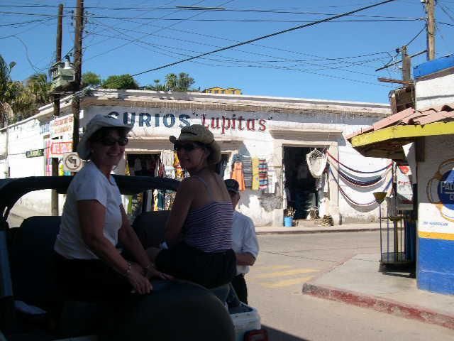
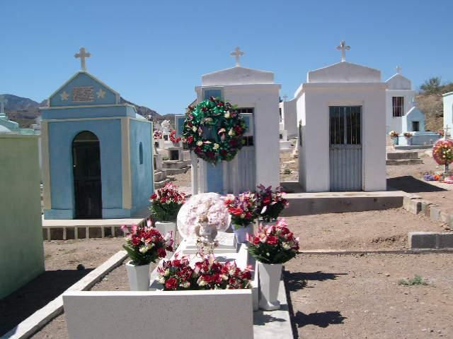
Skipjack asked when the trees in the san Ignacio plaza were planted and it was circa 1917 as this photo shows:
http://forums.bajanomad.com/viewthread.php?tid=67239#pid8144...
|
|
|
Pompano
Elite Nomad
Posts: 8194
Registered: 11-14-2004
Location: Bay of Conception and Up North
Member Is Offline
Mood: Optimistic
|
|
El Diablo....The Devil's Grade

Cuesta del Infierno
alias
El Diablo
..The Devils Grade, seven miles of switchbacks. Without a doubt, one of the steepest and most dangerous grades on the Baja
Highway.
Excuse me for saying this, but you're a foolish driver and destined for an accident or worse if you don't pay attention and take precautions while
taking this grade a few miles north of Santa Rosalia. In over 40 years of making this winding climb, I've seen far too many deaths, rollovers,
crashes, and other mayhem on this canyon grade. To this day, I approach it with extreme caution
and Ive logged over 3 million miles without a major
mishap. The reality is
you WILL be in danger whether going down
or up. SO PAY ATTENTION! A judicious use of engine and brakes
going down is mandatory.
Flashback: I once trailered a heavy 31ft long - 11 ft wide twin diesel sportfisherman from San Diego and down that grade. We were prepared, had
knowledge of the grade, had excellent tow & braking rig, experienced driver, communication with pilot cars front and rear. Brrrr
.I still have
stark memories of those seven miles of controlled terror. Of course we made it and had many years of fun with that boat, but I would never do that
again. Once was enough for me, thanks.
Here is the first grade
BEFORE the real one to come just over the hill ahead. Its where I know Im close, so I slow down and ready myself.


On this particular trip, Co-pilot brought along her Maltese huskies. They are true bravehearts, Yatzi and Dexter.

Great traveling companions and adventures, these
.

We start on a dangerous mission..

Any traffic must be approached with caution, whether downhill or uphill.

Be prepared for sudden sights like this
could be right around the next curve.

Memorials like these are reminders to Pay Attention to where you are.

Wrecks like this white one are all too common on El Diablo.


Pay particular attention to any bikers on the grade, and most importantly, any other sudden traffic when meeting. There are many places where there is
just no extra room...period.

The only thing that could possibly be worse
would be FOG. Personally, I would not take El Diablo in a fog. Best to wait it out
wont be long in
clearing.

Almost out of it now
.if youve made it this far, youre doing okay. But still go slow and continue using the engine to brake, and save your brakes
for an emergency.

Ahh
.a good glimpse of the welcoming Sea of Cortez ahead. The island in the distance is Tortuga. My old fishing grounds.

A short straight and level stretch goes by this propane plant
.GASPASA. Stop and fill whatever tanks you have if in dire need, otherwise there are
places to fill down the road.

Keep heading on over the next hill and down to the sea. Getting close to home now!

Well, you made it! Good. This is a good place to pull over, enjoy the view, and take stock of your rig.

(p.s. Just kidding about the Maltese Bros. Theyre alive and doing very well.)
Next stop will be Santa Rosalia. Maybe a boleo or two
I do what the voices in my tackle box tell me.
|
|
|
Bajagypsy
Super Nomad
Posts: 1416
Registered: 8-31-2006
Location: BahÃa Asuncion BCS
Member Is Offline
Mood: Living the dream
|
|
Pompano, I so missed your trip reports and pictures! Thank you for posting them again!
|
|
|
Pompano
Elite Nomad
Posts: 8194
Registered: 11-14-2004
Location: Bay of Conception and Up North
Member Is Offline
Mood: Optimistic
|
|
Ciudad de Madera - City of Wood
Next Stop
SANTA ROSALIA
And so now, we come down from the Diablo Grade to the sea
where a semi driver is taking a refreshing stop and enjoying the view. After a long tiring
drive, no doubt. Or
he may be just wondering where the heck his trailer went?? Hey! The same thing has happened to me
.

We follow the winding shorefront highway into town
.and notice thats it another WINDY day.

Look there
.Just a few miles offshore you can see the island of Tortuga, renowned for decades as a great visual landmark for aviators
& sailors
.plus, of course, a great yellowtail fishing hole spot for local sportsfisherman, charters, and pangueros. A reward is offered for the
return of my seaplow anchor lost there many moons ago.

Thinking of fish
remember back in 2004 when this great white shark was net-caught and brought ashore at Santa Rosalia. Big bruiser, eh?
Id always suspected that something BIG was making off with my baits!

THE BOLEO MINING COMPANY
Once called the ugliest town in Baja, the dusty, and sooty mine town has transformed. Santa Rosalia is now an attractive and interesting town.
The story begins in 1868 when some very rich copper ore was discovered by a hombre named José Rosas Villavicencio. The Villavicencio family has been
in central Baja since 1732 when one enlisted as a Spanish soldier to protect the missions. José found the ore as blue- green spheres
(boleos) and he had a ship captain take them across the gulf to Guaymas to be analyzed.
This is what he found and what started the whole ruckus at Santa Rosalia

Two German men paid José 16 pesos for the location of the copper and small scale prospecting began. (Cheap enough? Hah..that story always
reminds me of the mythical? Dutch purchase of Manhattan Island from the Indians for peanuts.) The discovery was eventually seen by a French
geologist from the House of Rothschild which purchased all the smaller mine claims in 1885.
The original Boleo Mining Company
.and workers.

Those dastardly Pemex stations
Youll notice one of the newer Pemex stations on the waterfront side as you close in on the town. Yes, yet another one of the infamous Santa
Rosalia Pemex stations that are so frequently complained about because of their suspicious pumps. Personally, I have stopped for fuel in Sta.
Rosalia exactly twice in four decades, and thus learned
as always at any Pemex station
let the buyer beware. Id suggest
bringing your own clearly marked 20 litre container for show and tell. At the very least youll get a smile from the attendants.

Not so nice beaches
The town's black sand beach is most interesting and a reminder of the proximity to the mining operation.
Interesting, yes
.but not a popular beach for either tourists or locals. Conception Bay its not! In 40 years, one walk was enough for me.

THE MARINA A FONATUR/SINGLAR PROJECT


Fonatur is the government agency charged with promoting all kinds of tourism throughout Mexico. Singlar is a sort of subagency of
Fonatur that develops, builds and maintains marinas and fuel docks in select locations. However, this is all somewhat new here and Singlar still has
a long way to go to be competitive with other Sea Of Cortez marinas.
As a lifetime boater Im a huge fan of marinas when needed
as Im more of a gunkholer. But some marinas I like more than others. I really like the
new Singlar marina at Sta. Rosalia and will dock there without hesitation. Why?... Heres some comparisons with other marinas: For instance, at Cabo
San Lucas marina it costs over $100 per day for a 32 cruiser. We all know Cabo certainly is the exception, but that fee just drives away most
cruising people, who by their very nature are economical. Then there was a 22% docking fee for fuel when topping off tanks at Singlar Puerto
Escondito. Also fees for a simple mooring buoy out in the common bay were more than a slip in Marina Costa Baja and there are virtually no services
available. Small wonder that there are fewer boats in that inner harbor these days. I can remember times years ago when that Puerto Escondito
hurricane hole was literally crowded with boats
and lots of interactive parties.
Maybe the best of the best in Baja Sur
Marina Costa Baja in La Paz. Their services include cable internet and TV to the boat, a cruisers lounge with
wireless access and wide-screen TV, pump outs at your slip with one day notice, shuttle to and from town, good restaurants surrounding the inner
harbor, three pools (infinity, wading, and lap at the nearby Fiesta Inn with a new cruisers pool and palapa, workout facilities, good security,
frequent live music, free outdoor movies, and otherwise top of the line facilities.
Upon entering Santa Rosalia Harbor, you will see a brand new Singlar marina just after entering the breakwater. A couple of Singlar employees will
usually wave you in and help with docking. Their fees: 10 pesos/foot/night or 40 pesos/foot/week. One week is usually the best choice
lets you see
the local sights and sample a few cafes.
Just past the marina you come to
.
The Main Intersection into the city featuring the Boleo engine

To be continued
..cuz I need to go fishing.
with The Eiffel? designed church ..a little controversy there

the Boleo Bakery
which claims to be the most famous bakery in the world!. Help me turn some loaves in the oven
of course, the best taco stands
..some good bars
scenic drive thru town..
...very pretty senoritas..
lots of hotels, shops, services, cops, crooks, and STUFF.
[Edited on 1-13-2014 by Pompano]
I do what the voices in my tackle box tell me.
|
|
|
Pescador
Ultra Nomad
Posts: 3587
Registered: 10-17-2002
Location: Baja California Sur
Member Is Offline
|
|
Roger, the black beaches are actually caused by the mine tailings that were pumped out into the ocean but kept coming back and getting ground up. The
towers you see in the marina were for the "escorias" which were a type of byproduct of the copper smelting.
One of the songs I do is called "Playas Negras" which was written by my best friends uncle, Sonny Mendoza Collins. One of the stanzas goes: "Y las
escorias el mar vuelve a la orilla". Which means: And the dregs of the sea return to shore.
|
|
|
Pompano
Elite Nomad
Posts: 8194
Registered: 11-14-2004
Location: Bay of Conception and Up North
Member Is Offline
Mood: Optimistic
|
|
| Quote: | Originally posted by Pescador
Roger, the black beaches are actually caused by the mine tailings that were pumped out into the ocean but kept coming back and getting ground up. The
towers you see in the marina were for the "escorias" which were a type of byproduct of the copper smelting.
One of the songs I do is called "Playas Negras" which was written by my best friends uncle, Sonny Mendoza Collins. One of the stanzas goes: "Y las
escorias el mar vuelve a la orilla". Which means: And the dregs of the sea return to shore. |
Jim, thanks for reminding me...will edit that now. Chalk it up to too much time listening to a geology professor living at Pta Chivato decades ago.
I think he was drinking a wee bit too much rum. 
Looking forward to hear your rendition of 'Black Beach'.
Getting back to where I left off on this tour through Sta. Rosalia, if you take the turn at the locomotive monument and head into 'el centro' you'll
come immediately upon my favorite taco stand in the area...."Pepe's"
Been there forever and I can recommend everything on his menu, but particularily like a trio of tacos...1 fish, 1 shrimp, 1 more fish...bueno!
Always nice to be remembered, here he is waving at me.

We continue rolling on into the towns center through some nicely shaded streets. Head west on Alvaro Obregón street for two blocks and one of the
main attractions of the city will be on your right
The Metal Church
. 'Iglesia de Santa Bárbara'.
The Metal Church
To throw more fuel on the debates about religion on Nomads, here are some facts and some controversy about the church.
Originally built entirely of stamped steel sheet squares, it is supported by a formidable steel structure in a sober and austere style. Despite some
necessary modifications, it still preserves some of the original 1800s spirit.
Tradition credited its design to architect Gustave Eiffel and that it was shown in the 1889 Universal Exposition of Paris, France, along with
the tower, and that it was awarded a prize. Originally destined for construction in Africa, the French mining company director Charles La Forgue found
it disassembled in Belgium and bought it in 1894, probably to alleviate the nostalgia of the French community at Santa Rosalia who missed the
lifestyle and glamour of the European architecture.
Then, in the early 1990s Angela Gardner, an American architectural student who visited Santa Rosalía and examined the church, came to a hypothesis
that the church design was from a different architect, belonging to the House of Duclo rather than Eiffel's firm, to the dismay of the
locals, who believe this would diminish the appreciation of the building. As no historical record or blueprint has appeared, neither version could be
confirmed. The recent disclosure of the historical archives to the public by the INAH (Mexico's National Institute of Anthropology and History) has
not provided additional information.
So
most of us will stay with the first theory
that it was designed by Eiffel
and thats that. Hey, its more Baja-like, right?
[Edited on 1-13-2014 by Pompano]
I do what the voices in my tackle box tell me.
|
|
|
Pompano
Elite Nomad
Posts: 8194
Registered: 11-14-2004
Location: Bay of Conception and Up North
Member Is Offline
Mood: Optimistic
|
|
Keep driving on the main street, Alvaro Obregón, and within a short distance look to the right for this other city
attraction. (And I hope youre not on a diet?)
The Boleo Bakery
.Panderia El Boleo

This is the famous French bakery, Panadería El Boleo, that travelers and locals alike, seem to be addicted to. The baguettes produced here are
supposed to be the best in all of México and the pastries and other bakery items are equally delicious.
I really like the boleos, but not so much the other pastries
.too much flour and sugar is no bueno these days. But lots of folks have their favorites
from this bakery. One of my old time favorite ways to eat those boleos was when Co-pilot would slice em, dip em in egg, milk, and nutmeg..and make
them into French toast. Along with a good slice of Honey Virginia ham
.Now that was a breakfast treat at mi casa!
This bakery has been in constant operation since 1901. I was a customer a long time ago, but not that early! But from our early days in Conception
Bay, a bunch of us would willingly find some excuses to travel the 60-mile distance to Sta. Rosalia
like propane, groceries, etc
.but mostly just so
we could treat ourselves with the fresh hot boleo rolls. Wed make a impromptu picnic by pulling over on the malecon for a good ocean view, slice
some boleos, slather them with fresh butter and homemade mango jam
.yummmy.
Of course we were duty bound to bring home intact the many bags of boleos requested by our neighbors back in the bay.

If you ask, most likely you will be given permission to tour the actual ovens and baking procedures
.its an unique experience and a tour back in
history. I loved using those long paddles to turn the boleo rolls in the classic old ovens. What a hoot that is! I kept thinking
I
gotta build me one of THESE!!

The City of Wood
Looking at the storefronts and houses along this area, you will notice immediately why Santa Rosalia is called The City of Wood.
To explain how all this lumber came to be, back in the early days when the Boleo Mining Company shipped the smelted ore to Washington state to be
refined, the ships would return from Washington with loads of lumber and other supplies for the town. Which makes it so unique in Baja is the fact
that most of the buildings in the downtown area are made of this wood and show the French influence in the architecture. As most of you know, cement
block is the preferred construction material in most of Baja.

Lots of various stores and services along the downtown streets, including 2 banks, Bancomer and Banamex, both of which have ATMs. (On a sidenote
about banking there, I once used Bancomer for a peso/dollar checking account, but quit them after a large wire transfer went bouncing around the world
before I finally managed to collect weeks later
not without a lot of hassle.) Yes, Santa Rosalia has just about everything you need for your home,
your motorhome, whatever. I have found more unique shops and great cafes here by just walking the business districts. You would be surprised at what
you come up with
.You can have it all.
I found an old style barber shop and relaxed with a shave and haircut. Special!
I also recall visiting butcher shops with a amigo from Pta. Chivato who ate lots of meat
and hated veggies. An odd thing back then..all meat at the
butcher shops was sold for about the equivalent of 55 cents a pound
no matter what cuts you wanted. It was a mite tough to chew, but even so, we had
the butcher cut a lot of thick steaks!
Another favorite of mine...the peaceful scene of a gent reading his book on the porch...and enjoying life.

That gentleman has probably visited this nice building in town. A biblioteca
a public Library in Parque Morelos, at the east end of town near the
harbor, that has an exhibit of historic photos from the town's peak mining period. Ive spent many a pleasant afternoon there.

Plus this one
.Nunez 'Brooks', a book store in the center. Back in the day of C-band satellite tv, I drove many miles to find my precious Satellite
TV guide magazine called Orbit. It was the ONLY store to sell it
short of a long trip to La Paz. I prized my monthly copy
as much as gold
and would never lend it out to anyone
period. I'd let folks look at it, but never take it out. Another tv fan and neighbor, Jake
on the hill would often try to borrow my copy, but I always kept it hidden in a secure spot.

Don't you just love the way a lot of signs are misspelled?
The main saquare
a great place to relax and watch the world go by.

Lots of events are centered here. Like snoozing on the benches
.

HOTEL FRANCES Another piece of history.
A little harder to find is this jewel, Hotel Frances, built in 1886, restored nicely with some upstairs rooms that give you a pretty
good view of the Sea of Cortez. You drive up a street climbing the hills past the Naval Hospital, take a winding right, and
well
ask directions!
Look for the locomotive.
Many years ago, I met the architect hired to restore this place to its original and elegant condition. He imported and used many exotic hardwoods
like mahogany and teak from South America and SE Asia
made the place beautiful. Also was quite a party guy at the Serinadad Sat night fiestas.


Flashback photo at the bar with mi amiga.
note the bellbottom sunflower jeans Hoo-boy!

FRUIT STAND Found as you are coming from a town trip on your right. Next to the main highway. This place always has a large
selection of fresh fruits and veggies. Stop and browse for good deals, I always do.

THE FERRY TO GUAYMAS
The ferry terminal (to Guaymas on mainland México) is on the waterfront just south of the entrance to town, you can't miss it. I used to take this
ferry all the time
both ways
back in the day when coming from the north-central states. A great way to shave off many hundreds of miles coming from
that direction. Good times
unless it was very windy
then OMG, it sucked big-time. Whew
.lots of seasick folks in the main salon
.phew and retch.
Then Id roll out my sleeping bag on the topdeck and enjoy the fresh air and night skies.
I will never forget one nighttime voyage when I had bought what I thought was a private sleeper cabin We were late coming back to the room, got into
bed in the dark with something in mind, and a few minutes later, the lights suddenly came on and there was this older couple staring at us from their
bunk beds
.quite a surprise for all of us.


Sometimes it was best to sit outside and play some cribbage to pass the voyage. 15-1, 15-2, 15-4
..

MALECON CAFÉ
HANDY
The last time we had lunch there, the seafood was very good. The view is always terrific.

JUSTICE BLDG NEXT TO FERRY OFFICE
For all your needs with Justice. Plus fm3 passports, visas, etc. Visit the D.A.

DRIVE ALONG THE MALECON

MORE OCEANVIEWS FROM MALECON
Hmmm
.look a mite windy out there?

A MOTEL WITH A VIEW
MOTEL EL MORRO


SCENIC VIEWPOINT SOUTHSIDE
Good place to pull out, park, and enjoy a nice view back at the waterfront of Santa Rosalia.

AN RV PARK
Cant say much about this place, as Ive never had an occasion to stay there, or even drive in to inspect. Like Sargeant Shultz says
.I know
nothing!

Federal Police
Youll notice the building and patrol cars on the left when you are headed south out of town. You should drive slowly, I think?
Again
I know nothing!! But
I always check my speed

A NEWER BRIDGE
On the southern outskirts of town. A recent hurricane prompted the construction of this bridge
a very welcome addition.

And lastly, you will pass a cereso
a prison. Where you probably dont want to visit. A mite different than our prisons up north.

Next villages south are San Lucas Cove and San Bruno, which we already visited in this thread a few pages back. So...next stop might be Mulege cuz
theres lots of variables...and damn little continuity... to writing this. Hey, I could use a secretary! 
[Edited on 3-12-2014 by Pompano]
I do what the voices in my tackle box tell me.
|
|
|
Pompano
Elite Nomad
Posts: 8194
Registered: 11-14-2004
Location: Bay of Conception and Up North
Member Is Offline
Mood: Optimistic
|
|
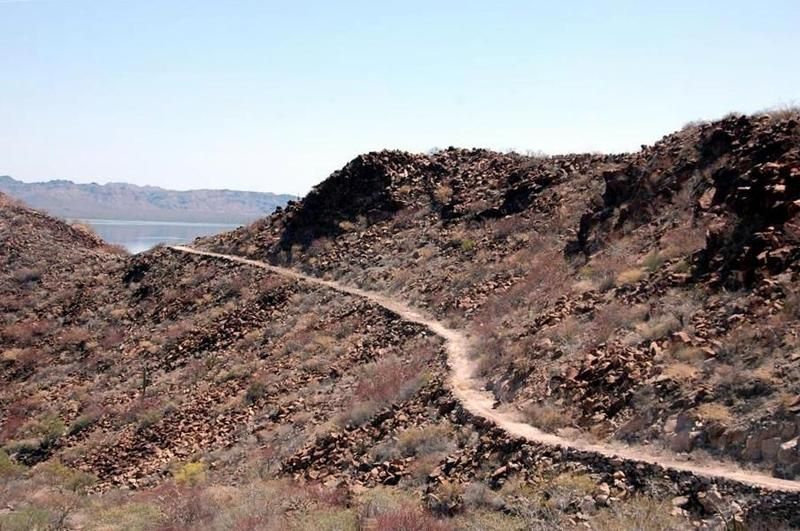
Like many of you, I've always enjoyed taking that certain side road whenever I come across it...like this one many years ago in Baja Sur.
We were discussing a drive into the mountains one night at Ray's Cafe at Santispac years ago. Anyone remember when Ray's at the beach was so much
fun..cuz we didn't have to drive all the way into Mulege for a great dinner and drinks?
Early the next day, we started our trip from Coyote and had to make a Mulege stop, of course.
All is loaded into my Jeep and we're ready to roll.
South of Santa Rosalia, BCS and east into the mountains is a small pueblo called San José de Magdalena. It's refreshing to be driving into the heart
of the mountains far from what is thought of as a tourist destination. What to expect? Well, it's kind of like opening a box of chocolates. (Me? I
love the carmel nougats...like this mountain village.) For a flimsy excuse to go exploring, we were in search of garlic growers and the local
cemetery. Hey, we're easy to interest.
Getting there....Directions From Santa Rosalia south 16 miles ..and watch for a road to the right at kilometer #169 . There may or may not be a sign
on the main road. 17 miles round trip, no services.
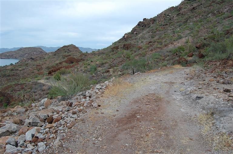
It was a lovely clear morning for the drive in the mountains from Coyote Bay. The eight miles in from the Highway 1 turnoff was scenic..and a bit
bumpy back then...(not like today with a great new road almost all the way. Mexico has taken on the job of opening up some of these heretofore
isolated communities, a real gift from the Mexican government.)
THE ROAD IN
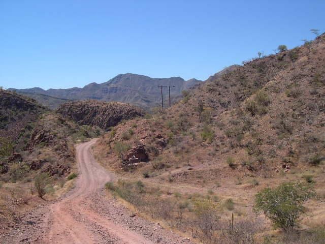
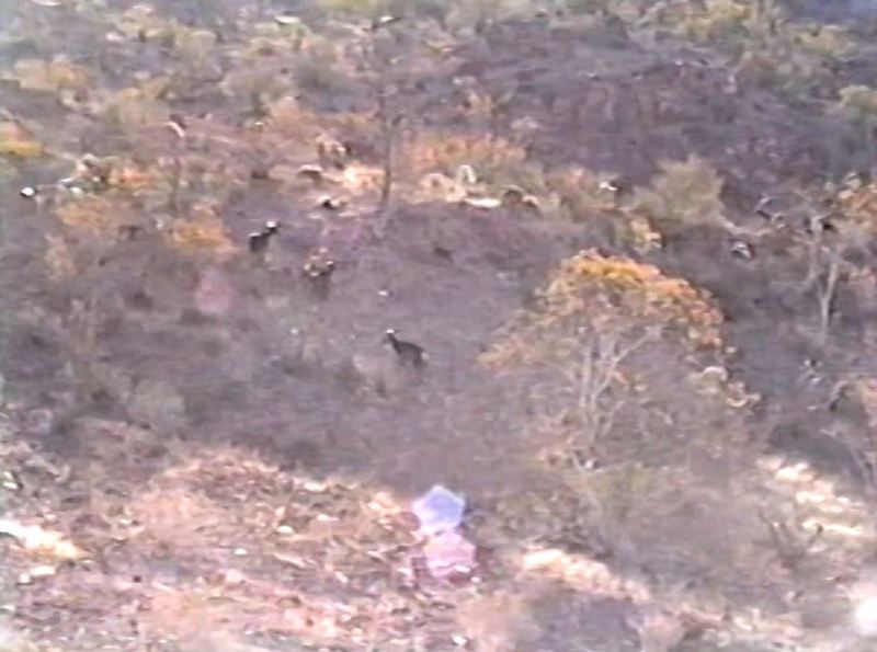
The grades are steep, but the road is a joy to drive, witch in our case included a colorful herd of goats who bleated and welcomed at us from a
hillside.
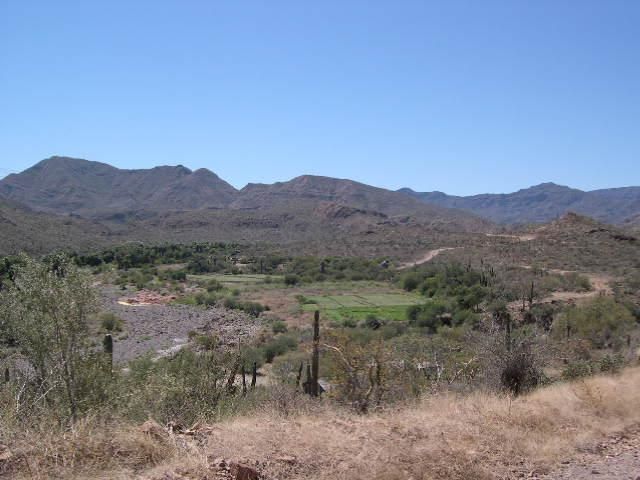
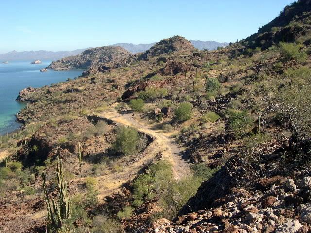
Then farther on... up over one ridge and dropping down the other side, quite suddenly there is a lush green field in the midst of the Cardón cactus,
scrub and palm trees.
AND ALSO SOME IRRAGATED FIELDS
The pavement ended just short of Magdalena. I followed a white rocky one lane road that curled around a pond thick with bullrushes growing at its
edges. Lots of frogs and mudhens. This area sustained life for hundreds of years because there was water.
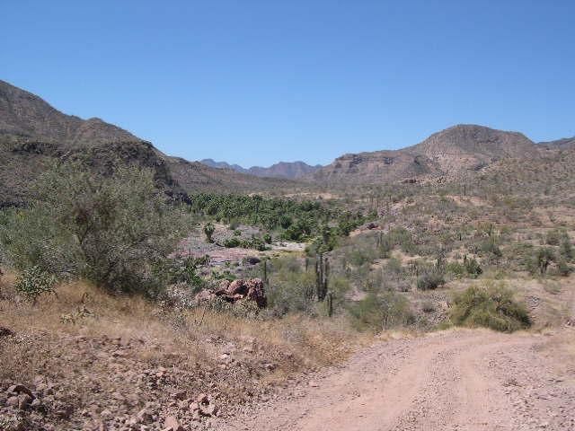
Now welcome to Magdalena, a sleepy but thriving village in the mountains to the west between Sta. Rosalia and Mulege. With a good fresh water source,
it is a area with lots of agriculture..featuring many different crops, including onions and garlic. Livestock is another industry. The pace of life
here is more like the olden days of Baja. You feel far removed from the touristy areas on the nearby shores of the Sea of Cortez. Step back in time
as you view these photos of a real gem...Magdalena of the mountains.
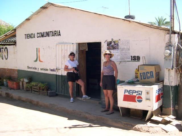
CONASUPA STORE..a community gathering place that also has many staples for sale.
San Jose de Magdalena
The first people to enjoy Baja's natural beauty were the Cochimi and Guaycura Indians. Written history came later, so there is little record of their
lives that remain. Yet they were a living force before they were "discovered." They were hunter-gatherers and moved with the seasons, but built small
villages and maintained a life for 7,000 years or more. Visita de San José de Magdalena was founded in 1774 by the Dominican missionaries to minister
to the Cochimí Indians. It was an outlying area of the Misión Santa Rosalía de Mulegé. This visita, or subordinate mission station, was closed in
1828. Ruined walls of adobe brick can still be seen combined with other more modern building materials in haphazard construction of metal and earthen
bricks. Written history shows that the indigenous of the Baja did not survive being 'discovered'. But their ancestors live on in the faces and behind
the eyes of many people living here today.
I had first thought that we would find expansive fields as this area is known for its garlic production. But this was not a huge California
agricultural center at all.
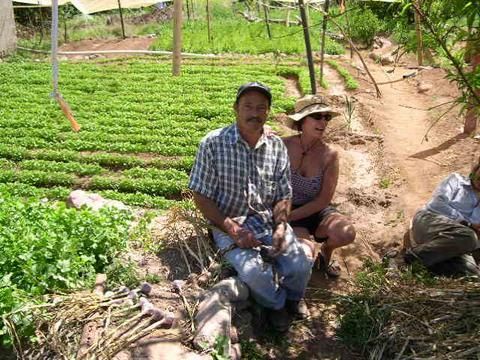
A typical garlic garden of Magdalena.
GARLIC GROWER..I had to kid Co-pilot later, as she looks to be picking the growers pockets.
How those garlands came into being. First, the "seed" is actually one of the sections of the garlic bulb which is planted in September. Through the
temperate and rainy months, the one clove has become a full garlic bulb again. Such magic. By February and into March it is time for the harvest. The
men use special tools to dig the garlic bulbs, leaving the long grass-like leaves to dry. But they cannot be allowed to completely dry as they would
be too brittle to weave. They are covered, sprinkled with water to maintained pliability. Bullrushes are collected to use as the cord for binding.
BRAIDING GARLIC ROPES
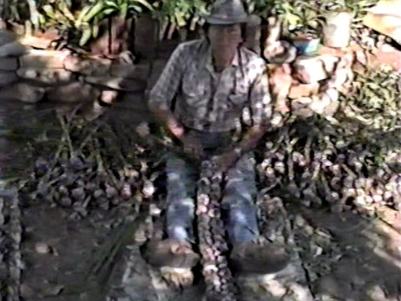
This man's hands moved confidently as he selected each bulb, tied it off with the bullrush and laid them in neat rows. It took him about 15 minutes to
complete one strand. He would work like this all day long for the entire harvesting. A humble man working in the old ways. His work ends up in
grocery stores and tourist gift shops.
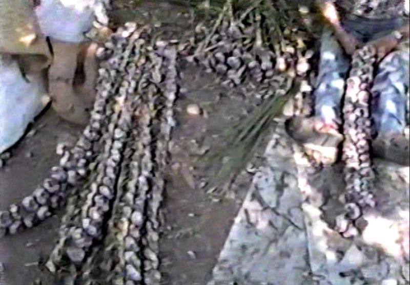
Ah, those fragrant garlic ropes! How I loved to take back Up North a few garlands as gifts for my amigos kitchens. Back in the day, my favorite
place in Mulege to buy those garlands was from my old friend and a true gentleman....Fernado Aquilar, may he rest in peace.
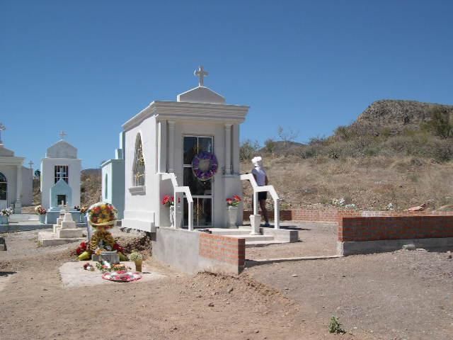
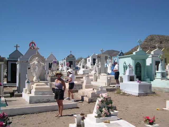
San Jose de Magdalena cemetery.
Further on there are a few homes and the peoples' cemetery. The mausoleums looking like tiny houses in different colors, a quiet village created for
the ancestors.
We followed a short, shaded road and found a place of quiet peace.
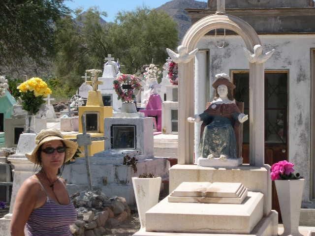
The life of the dead is placed in the memory of the living.
RESPECTFULLY FILLING VASES FROM THE POOL. You made a small donation and filled a can with water to refresh the many vases in the cemetery.
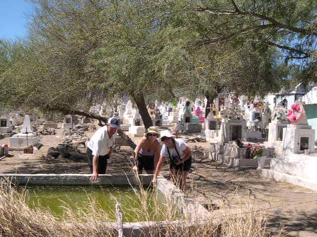
These are somber celebrations and comforting tributes to a loved one's life.
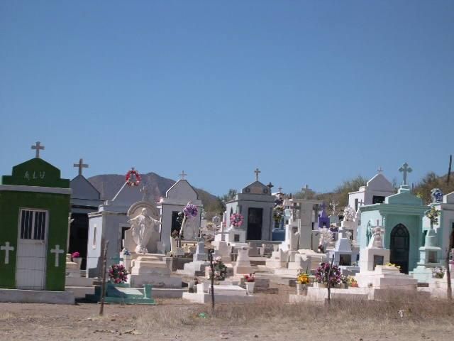
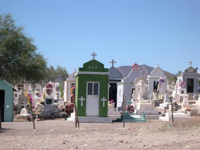
We ended with a prayer for all ....which brings an end to our exploratory journey.
And that was our first time to Magdalena...some time ago....with many return trips over the years since. Hope you enjoyed this Walkabout with Camera
into the mountains. God willing and the creek don't rise, there should be a few more.
I do what the voices in my tackle box tell me.
|
|
|
Whale-ista
Super Nomad
Posts: 2009
Registered: 2-18-2013
Location: San Diego
Member Is Offline
Mood: Sunny with chance of whales
|
|
Beautiful place. Lovely memorials. Thank you for the travelogue
\"Probably the airplanes will bring week-enders from Los Angeles before long, and the beautiful poor bedraggled old town will bloom with a
Floridian ugliness.\" (John Steinbeck, 1940, discussing the future of La Paz, BCS, Mexico)
|
|
|
Kgryfon
Senior Nomad
Posts: 624
Registered: 1-27-2009
Location: East Bay, CA
Member Is Offline
|
|
Every time this thread is resurrected I go through the whole thing. Reminds me why I want to chuck it all and be there, now.
|
|
|
Kgryfon
Senior Nomad
Posts: 624
Registered: 1-27-2009
Location: East Bay, CA
Member Is Offline
|
|
Oh, and I laughed out loud/loved the photo of you in the wizard/gypsy outfit! Don't know how I missed it the first time around. For the time, you
were very styling...sort of! 
|
|
|
Pompano
Elite Nomad
Posts: 8194
Registered: 11-14-2004
Location: Bay of Conception and Up North
Member Is Offline
Mood: Optimistic
|
|
EL CAMINO REAL
Do you ever wonder about those bell-shaped markers you see on the 101 Freeway? Most of you probably already know what they represent, but maybe don't
know all the history and significance. If not, then I'll try to add some input here for you.
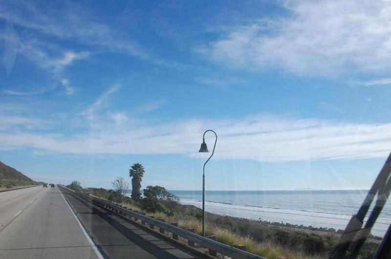
A brief history lesson of the Padre Bells:
They have been there since the early part of the century to mark the original route of "El Camino Real" from San Diego to Sonoma and down the
Baja peninsula. Also known as The King's Highway or The Royal Road, the 700-mile-long El Camino Real in California Alta linked 21 missions, which
were founded by Father Junipero Serra and spaced one day's journey apart by horse. Over the years the El Caminio Real gave way to modern highways,
primarily Routes 101 and 82 that you drive today.
El Camino Real, the Royal Road, was the Spanish king's highway in California. There were other caminos reales in America. One of these was
the royal road from Mexico City to Santa Fe, New Mexico called El Camino Real de Tierra Adentro. Within the United States this road is now a National
Historic Trail. Another was El Camino Real de los Tejas, which went from the Rio Grande in Texas to Natchitoches, Louisiana. This road is also a
National Historic Trail. California's El Camino Real, also commonly known as the California Mission Trail, connected a series of missions (religious
outposts), assistencias (supporting sub-missions), presidios (fortified military bases), pueblos (towns), and other Spanish interests in the region.
Spain, then Mexico, controlled California until 1848, when Mexico ceded Alta California to the United States.
The bells were first paid for and erected by the El Camino Real Association in the early 1900s. Originally there were about 450 bells along El Camino
Real, but because of theft and vandalism the number dwindled to about 75. In response, the Legislature appointed Caltrans as guardian of the bells in
1974, responsible for repairing or replacing them. Replacements are made of concrete, rather than cast iron, to discourage theft.

El Camino Real as an American auto trail, was perhaps the first signed automobile route in the nation. As early as 1906, the famous mission
bell guideposts and signs were placed on the highway. El Camino Real as a road name implies different things at different times. It was the original
'King's Highway' during the Spanish colonial era, but as such was little more than a horse trail. Today, El Camino Real is an official signed
California route that largely follows US Highway 101 and other major highways.
This highway was also generally called the Coast Route by the Automobile Club of Southern California. In the mid 1920s, El Camino Real and the Coast
Route became part of a larger auto trail system called the Pacific Highways System. This large highway system not only included what became US 101,
but also US 99 and other highways.
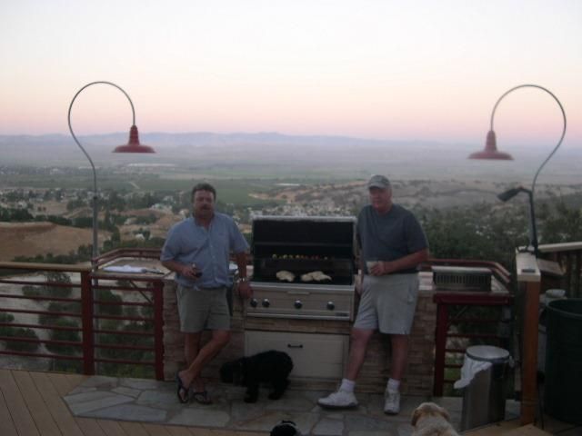
A good friend lives along the old Camino Real in southern California and is a history buff like me. He decided to illuminate his home's patio
barbeque with lamp posts manufactured especially to look like the old route markers of the padres. Here we are enjoying a cook-out and a view back
into time.
In Baja, El Camino Real is recorded by several authors and a simple Google search will reveal them all, but no bell markers were ever put in place on
the Baja Road..why tempt thieves and souviener collectors?
EL CAMINO REAL IN BAJA today..as it passes by Coyote Bay.
Part of the Camino Real in my Baja neighborhood at Coyote Bay, south of Mulege.
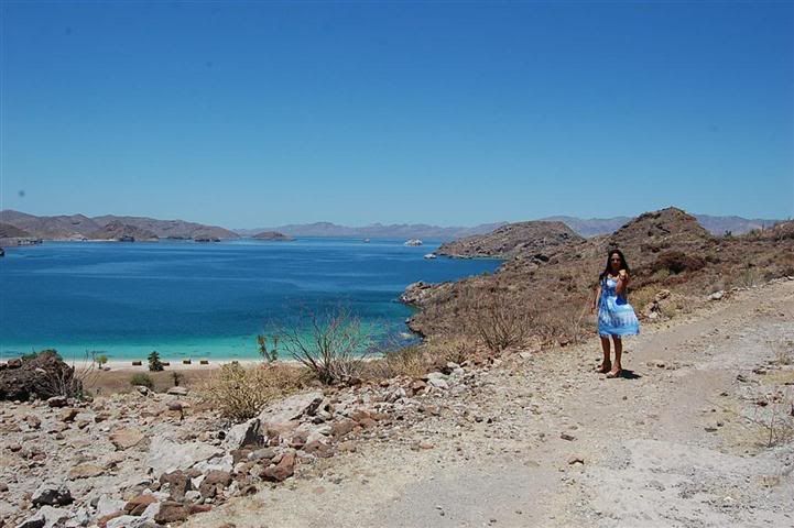
One Camino Real above Coyote Bay is where this 'belle' is standing.
So..if you ever find yourself wondering for whom those bells toll, then perhaps you need a trip to Baja to find out for yourself...and let us know it.
[Edited on 6-4-2015 by Pompano]
I do what the voices in my tackle box tell me.
|
|
|
| Pages:
1
..
9
10
11
12 |
|


