desertcpl
Super Nomad

Posts: 2406
Registered: 10-26-2008
Location: yuma,az
Member Is Offline
|
|
gonzaga road
got a question , I know they are putting in a new road to Gonzaga Bay, is the work still going on and how far have they got.
I might be planning a trip soon to Mulege would you take this road to connect with HWY 1,, (I am driving a Tacoma 4x4)
if so how much time do you think I would save or not save , I know its tough going on some places
[Edited on 9-11-2010 by desertcpl]
|
|
|
mcfez
Elite Nomad
Posts: 8678
Registered: 12-2-2009
Location: aka BN yankeeirishman
Member Is Offline
|
|
this may help you
http://forums.bajanomad.com/viewthread.php?tid=47413#pid5444...
| Quote: | Originally posted by desertcpl
got a question , I know they are putting in a new road to Gonzaga Bay, is the work still going on and how far have they got.
I might be planning a trip soon to Mulege would you take this road to connect with HWY 1,, (I am driving a Tacoma 4x4)
if so how much time do you think I would save or not save , I know its tough going on some places
[Edited on 9-11-2010 by desertcpl] |
Old people are like the old cars, made of some tough stuff. May show a little rust, but good as gold on the inside.
|
|
|
David K
Honored Nomad
Posts: 65475
Registered: 8-30-2002
Location: San Diego County
Member Is Offline
Mood: Have Baja Fever
|
|
| Quote: | Originally posted by desertcpl
got a question , I know they are putting in a new road to Gonzaga Bay, is the work still going on and how far have they got.
I might be planning a trip soon to Mulege would you take this road to connect with HWY 1,, (I am driving a Tacoma 4x4)
if so how much time do you think I would save or not save , I know its tough going on some places
[Edited on 9-11-2010 by desertcpl] |
Always check the Road Conditions forum for Baja Road reports...
Here is what I posted there last July:
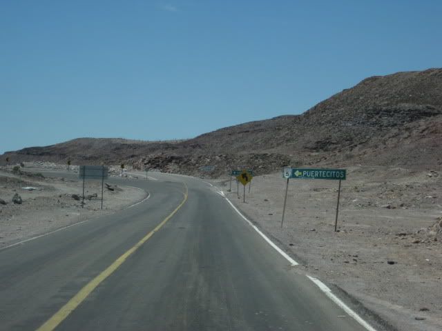
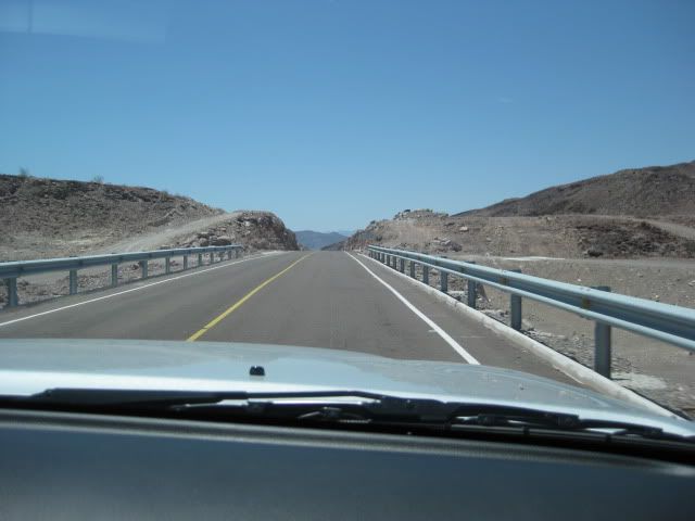
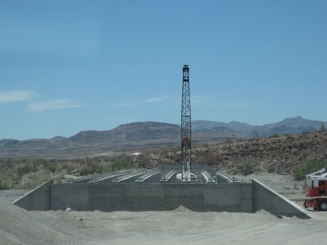
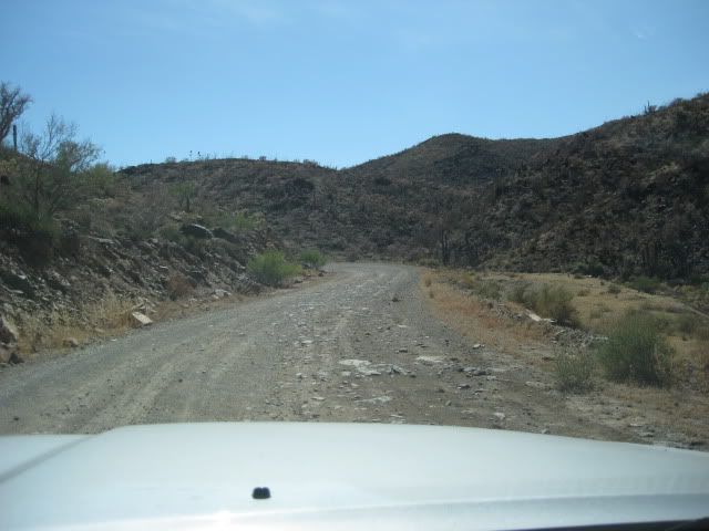
The new highway south of Puertecitos is totally different than the poor highway that runs the 55 miles from San Felipe to Puertecitos... It is built
to the new standard, wider, with shoulders that will make riding bikes safe... and designed for high speed. As of Monday, 7-19-10:
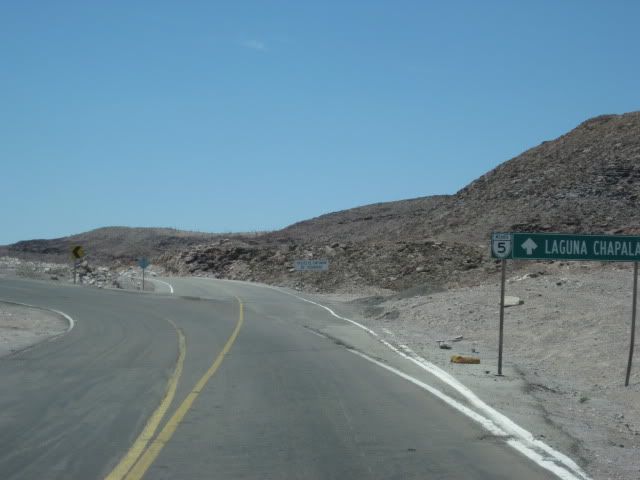
0.0 (0 min.) Puertecitos Entrance Road, sign ahead for Laguna Chapala.
5.2 (6 min.) Playa Cristina
6.2 La Costilla
17.6 (20 min.) El Huerfanito (off to east of highway, no sign)
18.5 Detour off pavement onto older road, regraded for construction traffic. Piles of sand on road mark this point, no sign. Ahead on pavement is sign
for Campo Tano at Mile 19.0. At 19.3 is a sign 'End of Pavement, 200 mtrs.'). At 19.5 is the absolute end at an unfinished bridge. No sign of road
work on the opposite side of arroyo. Road work does continue beyond, out of sight from here.
Return back to Mile 18.5, detour onto dirt... log continues from this point.
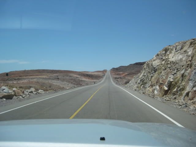
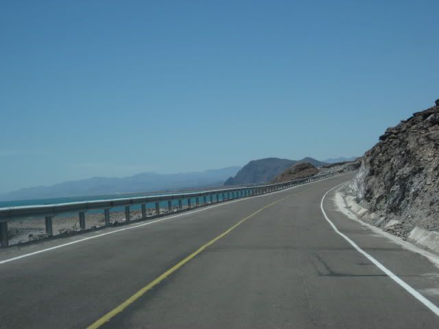
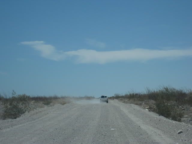
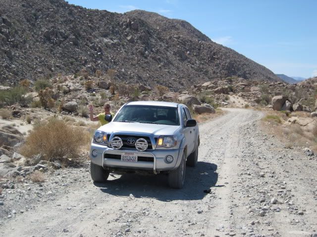
25.1 (34 min. from Puertecitos, not including run to end of pavement) End of new road construction alongside old road. Old road new grading ends...
very rough, rocky road on to Gonzaga. Motorhomes and trailers should avoid!
26.0 'Okie Landing' to east (note cement pads along end of gravel beach marking the fish camp of the 1960's.
33.1 (1 hr. 14 min.) Campo Delfines
36.3 (1 hr. 26 min.) Las Encantadas
37.9 (1 hr. 31 min.) Punta Bufeo
43.1 (1 hr. 59 min.) El Faro
43.4 (2 hr. 1 min.) Papa Fernandez' Bahia San Luis Gonzaga
Military Checkpont is just a mile + ahead.
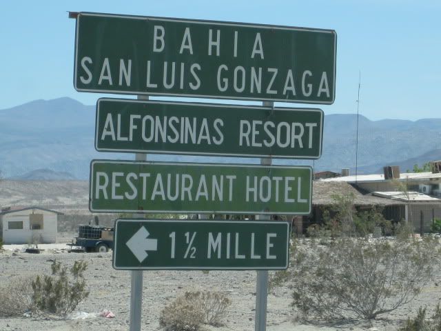
46.1 (2 hr. 12 min.) Alfonsina's Pemex (closed from 2-4 pm), Rancho Grande Market just ahead on right.
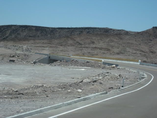
Clear odometer for next section... The main road south from Gonzaga is much better than the road north, but the rough surface still limits maximum
speed to ~30 mph (twice that of the north section) in a Tacoma, loaded.
0.0 Rancho Grande 'Gonzaga Bay'
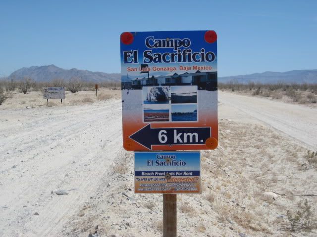
1.3 (8 min.) Road to Campo Beluga and Sacraficio
7.5 (22 min.) Road west to Arroyo Santa Maria and Las Palmitas oasis on the old mission trail 'El CaminoReal'
10.0 (28 min.) Road in from left is the south access route to Punta Final
16.7 La Turquesa Canyon road to west (green pools of water, turquoise mine, and very difficult off road and abandoned mine road shortcut to Hwy. 1
near El Pedregoso)
19.2 (52 min.) Las Arrastras site access road. Gold ore grinding mills, well, nearby waterhole of San Francisquito on the Camino Real.
23.0 (1 hr.) Coco's Corner (cold Pacifico for sale $2) Coco in Ensenada, helper Ramón on hand.
36.1 (1 hr. 30 min. driving time) HWY. 1, Laguna Chapala. Gasoline and tire repairs advertised, 1 km. south.
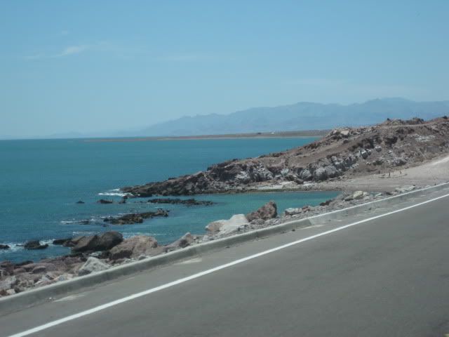
Some photos...
Poor hwy. north of Puertecitos
Road log above, begins here.
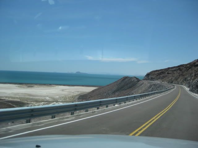
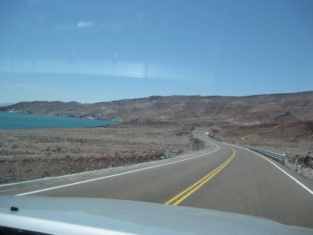
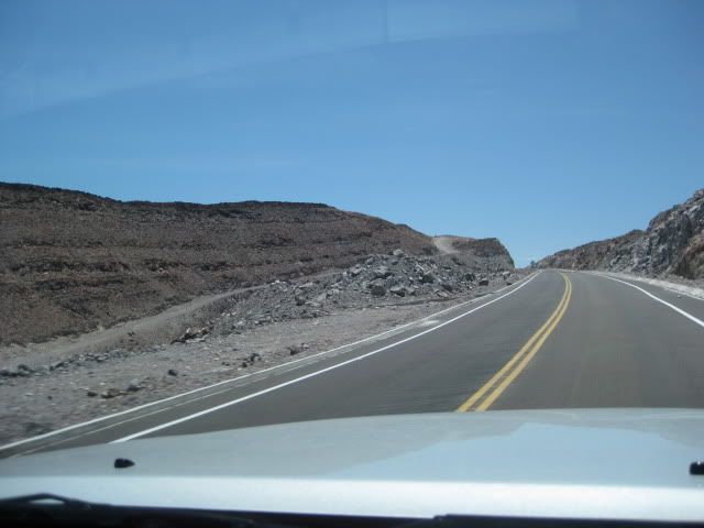
Old old road on left... looks like it was graded for detour.
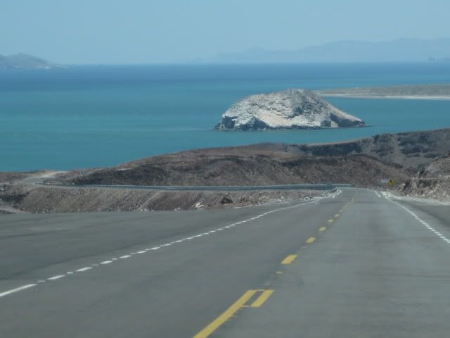
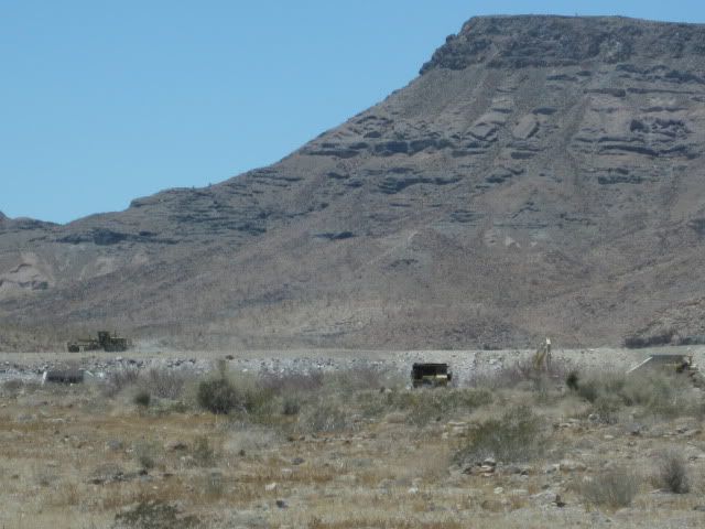
El Huerfanito Island

Bridge at very end of pavement
Old road, regraded along new road.
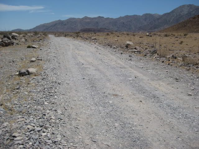
It's rougher than it looks!
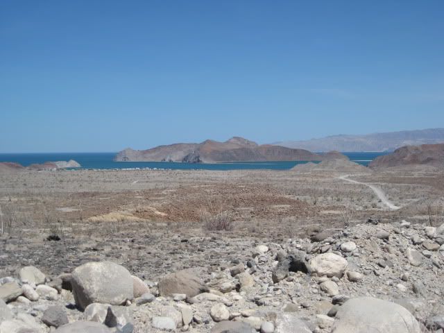
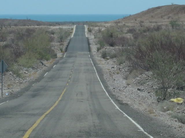
First view Gonzaga Bay
Road south of Coco's Corner.
More photos in the trip report... See Nomad Baja Trip Reports Forum!
[Edited on 9-12-2010 by David K]
|
|
|
desertcpl
Super Nomad
Posts: 2406
Registered: 10-26-2008
Location: yuma,az
Member Is Offline
|
|
guess what i am really asking , would it be faster for me to go this way,, or my usual way by going thru Tecate, to ensenada to Hwy 1 to mulege
|
|
|
dizzyspots
Senior Nomad
Posts: 603
Registered: 9-22-2008
Location: Mescal AZ
Member Is Offline
Mood: rather be on the beach at Gonzaga
|
|
in June. we made it from San Felipe to Rancho Grande at Gonzaga Bay...in 3.5 hrs...moderate pace pulling a small off road pop up in our FJ Cruiser
with a kayak on top...if that helps
|
|
|
Skipjack Joe
Elite Nomad
Posts: 8091
Registered: 7-12-2004
Location: Bahia Asuncion
Member Is Offline
|
|
Drive at your own risk. The road is perilous.
This driver was not so lucky.

|
|
|
mcfez
Elite Nomad
Posts: 8678
Registered: 12-2-2009
Location: aka BN yankeeirishman
Member Is Offline
|
|
Very rough road.....especially when passing Coco's ...the rocks are really sharp. I got bad luck every single time.......Land Rover tires are garbage
on that particular section of road! Now have a Ram!
Also...you'll have go REAL slow on the unimproved road if you are towing ...
| Quote: | Originally posted by desertcpl
guess what i am really asking , would it be faster for me to go this way,, or my usual way by going thru Tecate, to ensenada to Hwy 1 to mulege
|
Old people are like the old cars, made of some tough stuff. May show a little rust, but good as gold on the inside.
|
|
|
Marc
Ultra Nomad
Posts: 2802
Registered: 5-15-2010
Location: San Francisco & Palm Springs
Member Is Offline
Mood: Waiting
|
|
Go real slow! Bashed the skid plate on my big Tundra 4X4. Take about 1/3 air out tires. My last try was August '08. Join the club and drive it before
the "that road" is paved over and will just be another bragging right.
|
|
|
desertcpl
Super Nomad
Posts: 2406
Registered: 10-26-2008
Location: yuma,az
Member Is Offline
|
|
I drove to Gonzaga 2 years ago, before they started the new road, I first went to Gonzaga, (pt final) maybe it was 1978, have been maybe 6 times now
|
|
|
David K
Honored Nomad
Posts: 65475
Registered: 8-30-2002
Location: San Diego County
Member Is Offline
Mood: Have Baja Fever
|
|
| Quote: | Originally posted by Skipjack Joe
Drive at your own risk. The road is perilous.
This driver was not so lucky. |
On July 19, 2010...
|
|
|
bajalou
Ultra Nomad
Posts: 4459
Registered: 3-11-2004
Location: South of the broder
Member Is Offline
|
|
Even with the bad roads, I figured I saved 4-5 hours on the trip south.
No Bad Days
\"Never argue with an idiot. People watching may not be able to tell the difference\"
\"The trouble with doing nothing is - how do I know when I\'m done?\"
Nomad Baja Interactive map
And in the San Felipe area - check out Valle Chico area |
|
|
desertcpl
Super Nomad
Posts: 2406
Registered: 10-26-2008
Location: yuma,az
Member Is Offline
|
|
| Quote: | Originally posted by bajalou
Even with the bad roads, I figured I saved 4-5 hours on the trip south. |
Thanks,, now this is what I was wanting to know. any more input?
|
|
|
David K
Honored Nomad
Posts: 65475
Registered: 8-30-2002
Location: San Diego County
Member Is Offline
Mood: Have Baja Fever
|
|
Well... you read my road log, with times... yes? I was in a 2010 4WD Off Road Tacoma, so you know how good they are... 20 miles of SLOW, rough road
and 40 some miles of better graded road in total.
Do take a side trip 2 miles to Alfonsina's on the bay (turn left at the Pemex station) and have a beer or meal... what a view!
Coco's Corner is 23 miles south of the Pemex and that makes another beer stop before reaching Hwy.1 in 13 more miles.
|
|
|