| Pages:
1
2 |
David K
Honored Nomad

Posts: 65559
Registered: 8-30-2002
Location: San Diego County
Member Is Online
Mood: Have Baja Fever
|
|
9-18-10: To Las Pintas Petros PART I (incl. Otay to Blvd. 2000!)
Part 1, Friday 9-17-10
A quick weekend adventure was in order from my birthday, so we headed south to Baja! Our destination for the evening was El Rosario's Baja Cactus
Motel.
We left California at the Otay Border about 6:30 pm, Friday afternoon...
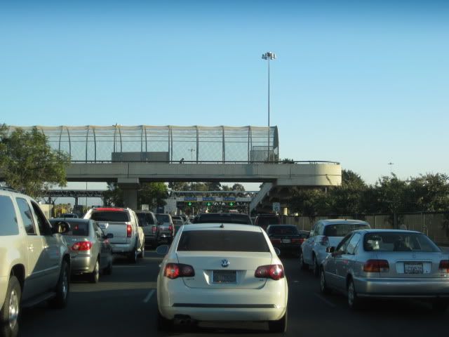
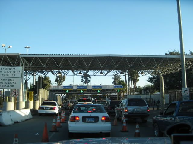
The line going into Mexico moved quickly, and we did get a red light and pulled up to the customs officer standing between lanes, who quickly had us
continue on (only an ice chest in the truck bed).
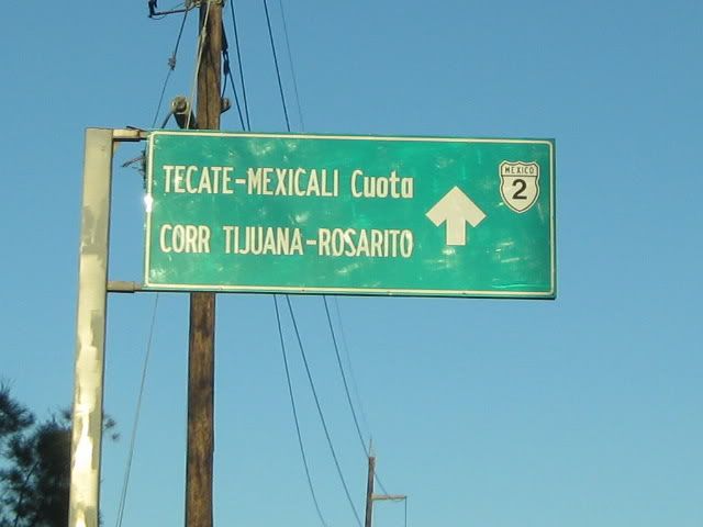
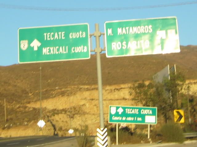
Ahead from the border, 1.1 miles is Blvd. Industrial where a left turn is made to get to the Corredor 2000 (formerly Blvd. 2000) which is a fast, easy
freeway to the Ensenada highway, just south of Rosarito.
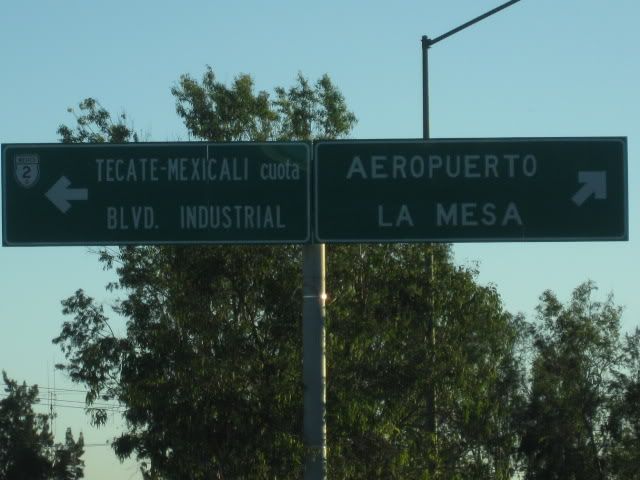
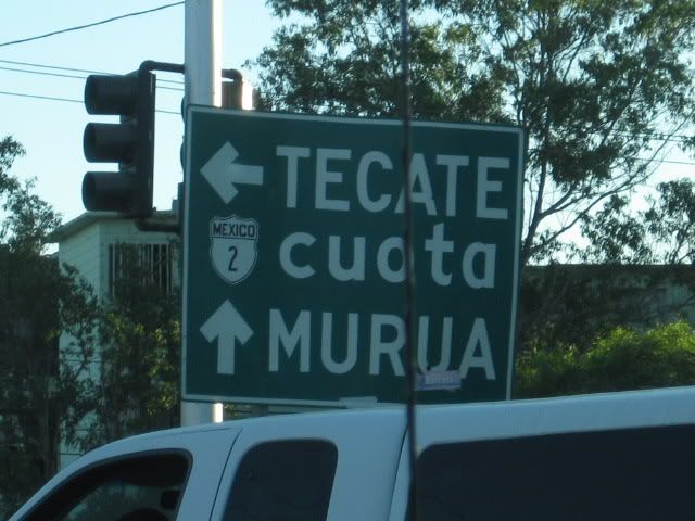
This is also the route to the Tecate Toll (Cuota) highway (Mex. 2-D).
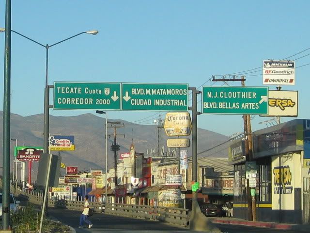
About 5 miles down Blvd. Industrial is where the Corredor 2000 (to the right) and the Tecate Toll Highway (to the left) begin.
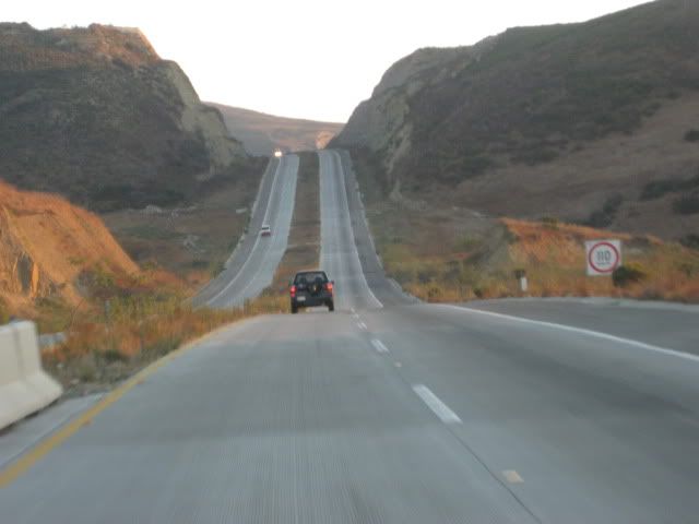
The sun was setting as we neared the end of the Corredor 2000 on the Pacific Coast.
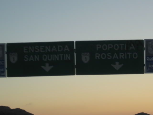
The Corredor 2000 ends on the Free (Libre) Ensenada highway at Popotla, about 32 miles from the Otay Border. We went home via the Corredor 2000 and
the Tecate Free Highway (Mex. 2) to the Tecate Border (38 miles from Mex. 1 at Popotla).
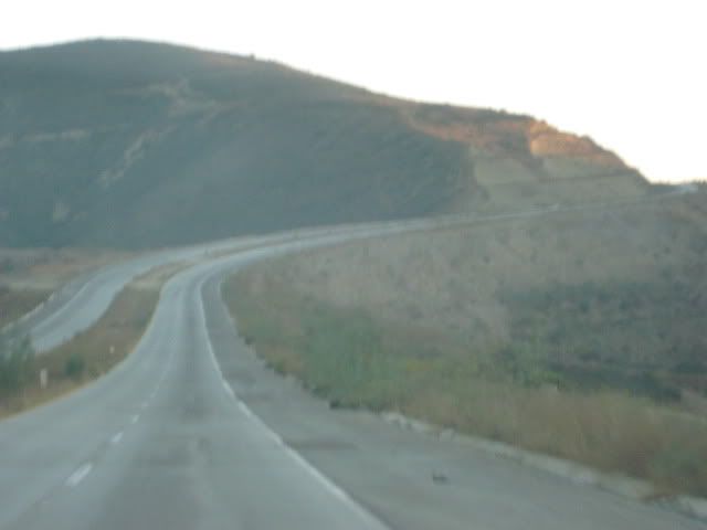
South of Ensenada at Maneadero, we enjoyed some yummy carne asada tacos at Los Poblanos (red taco shop on the east side of the road). From Maneadero
to almost Ejido Uruapan (12 miles) they are widening the highway and there are a few miles of dirt and paved detours. The military checkpoint just
beyond Uruapan (north of Santo Tomas) and again just north of El Rosario both waved us through southbound, but did an inspection northbound.
We arrived in El Rosario at 11:30 pm Friday night and enjoyed a great night's sleep at Baja Cactus...
To Be Continued...
[Edited on 9-25-2010 by David K]
|
|
|
RnR
Senior Nomad
Posts: 841
Registered: 5-1-2010
Member Is Offline
|
|
Great photo log going south, David. I have come north through Otay a few times but never south. This year will be a southbound trip as I have a lot
of stuff to declare and will be above TJ's limit.
| Quote: | Originally posted by David K
|
Which one of these lanes is the "Declare" lane? And, what happens immediately on the Mex side of the border?
I have a full size pickup and a 26 ft trailer. Will need to park and declare. I've looked across at Mex Customs while going northbound in
preparation for this year but can't quite decipher the lanes. Looks like I should be able to park under the roof in long diagonal spaces. Anybody
done this?
|
|
|
David K
Honored Nomad
Posts: 65559
Registered: 8-30-2002
Location: San Diego County
Member Is Online
Mood: Have Baja Fever
|
|
Just like Tijuana, the far right lane.
|
|
|
David K
Honored Nomad
Posts: 65559
Registered: 8-30-2002
Location: San Diego County
Member Is Online
Mood: Have Baja Fever
|
|
Saturday, 9-18-10:
We slept well at Baja Cactus and were in no rush, so we casually got motivated and went 2 miles down the highway to Baja's Best (Bed and Breakfast)
Restaurant... across the highway from the Turista Motel on the far edge of El Rosario. Elizabeth had hot cakes and eggs and I had their chorizo and
eggs breakfast burritos... delicious!
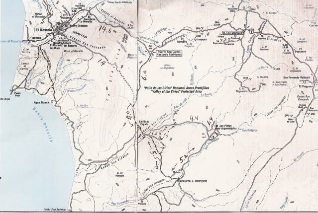
With so many interesting sites around El Rosario, we had not decided exactly which ones to visit until then. We decided on Las Pintas, but this time
to try the northern road in and see more of the top of the boulder field. We have been to Las Pintas several times before, and it never ceases to
amaze us. See http://vivabaja.com/pintas for our day there in 2005 and http://vivabaja.com/406 when my son and I spent some time there in 2006 (on pages 5-7).
The access to Las Pintas is off the road to Punta San Carlos, a tiny fishing village and nearby wind-surfing resort, about 36 miles from Highway 1 http://www.solosports.net . The turnoff is between Km. 80 & 81 (just over 14 miles from El Rosario's Pemex station). There are two turn offs,
the first one is signed for 'Puerto San Carlos' and the second one is just ahead at the second curve in the highway. Set your trip odometer to zero
when you leave the pavement.
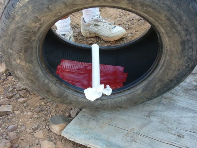
Just over 3 miles from the highway on the graded road, my low air tire warning light came on! For the second time, a pointy rock punctured one of the
truck's tires (BFG Rugged Trail, with 16,000 miles on it). I was able to plug the leak and refilled the tire with my electric air pump. The same thing
happened at 13,000 miles while southbound from Gonzaga Bay, near Laguna Chapala (on a different tire). We were in no rush, so we turned back to have
the tire patched in El Rosario at Raul's Tires ($5.00). No more flats on this trip... note to self: Get new rubber for the truck!
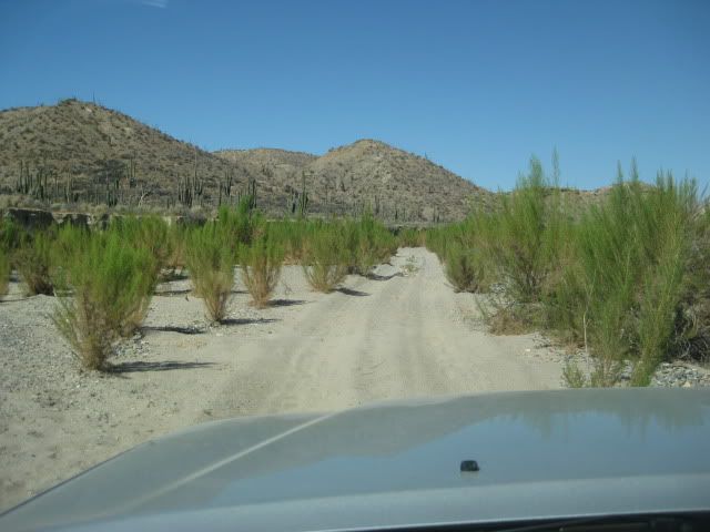
Take Two, back on the road to Punta San Carlos! Six miles from Highway One we pull over for a beer break where the old road from El Rosario meets the
new, graded road to San Carlos... Life is good!
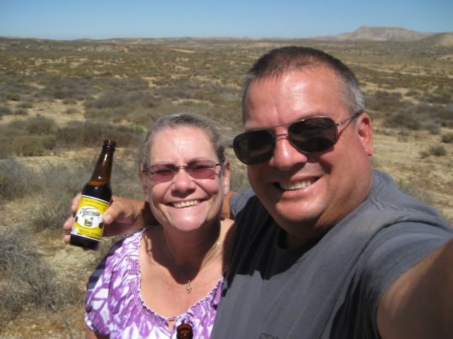
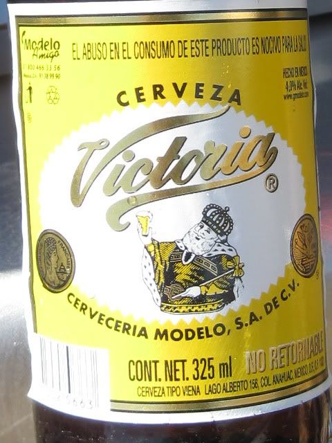
Victoria is a really good tasting beer that isn't as common as our other favorites (XX, Pacifico, Sol, Modelo, Tecate).
We noted the mileage at Rancho Emiliano Zapata as 10.0, and knew the northern road to Las Pintas was not far past the ranch, and took the first road
we saw, 1.9 miles ahead. 1.8 miles on this side road is another road to the left (which was correct), but seemed to me to be going too far north so I
elected to continue ahead. The road ahead returned to the San Carlos road. No matter, we will just continue south to the normal Las Pintas access
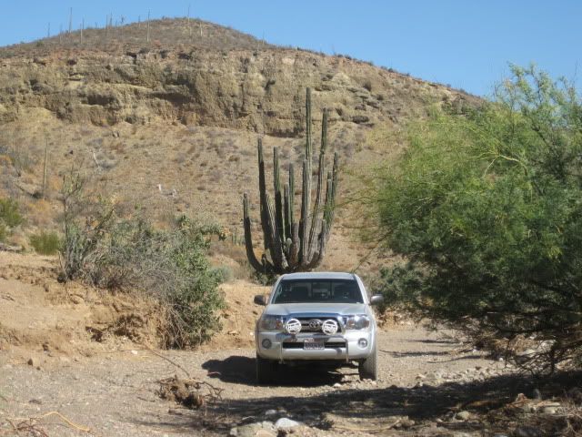
road, and return via the less used northern road! Just before the Las Pintas road, the San Carlos road enters a cardonal (a cardon cactus forest, the
cardon is the world's largest cactus).
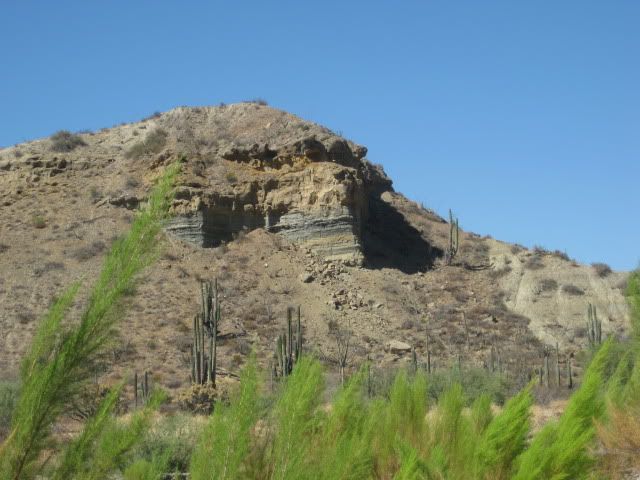
The Las Pintas road is 17.4 miles from Highway 1, and if you miss the first one, another is just ahead. Go too far and a ranch is passed, then you
will cross the big Arroyo San Fernando (a usually dry riverbed).
Once on the Las Pintas road, reset your odometer for the 7.2 mile drive in... Here is my road log to Las Pintas:
DIRECTIONS
Highway 1, southward from El Rosario 14.6 miles (between Km. 80-81), turn right at the left curve. GPS: 30°01.59', 115°32.05' (Map datum set to 'NAD27
Mexico')
Go 17.4 miles on the good graded dirt road to a single track road going left. If passed, just ahead is a ranch house on the right and there is a
second left road that joins the first. Set odometer to '0.0'. GPS: 29°49.64', 115°28.42'.
Pass ranch houses ('Malvar') and make an 'S' turn right, into Arroyo San Fernando. You soon will be reach a (possibly) closed gate at Mile 3.5. Always
re-close any gate after you pass through.
Mile 5.2, (GPS: 29°52.53', 115°25.22') turn LEFT off of Arroyo San Fernando road, and follow a small side arroyo. Brush may scratch your vehicle in
here.
Mile 5.4, (GPS: 29°52.69', 115°25.26') turn RIGHT, out of small arroyo and cross low divide to small valley.
Mile 7.2 LAS PINTAS parking area. GPS: 29°53.90', 115°24.48', elev. 755'. You are 24.6 miles from Highway 1 and 39.2 miles from El Rosario's Baja
Cactus Motel and Pemex gas station, per my odometer.
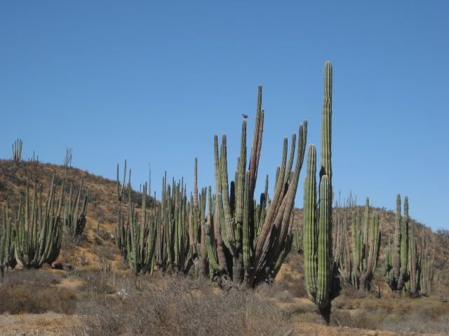
Cardon cactus along the Las Pintas road.
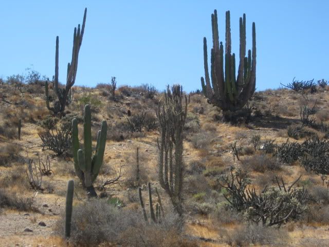
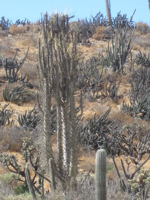
An unusual multi-branched boojum tree.
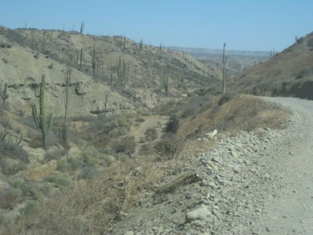
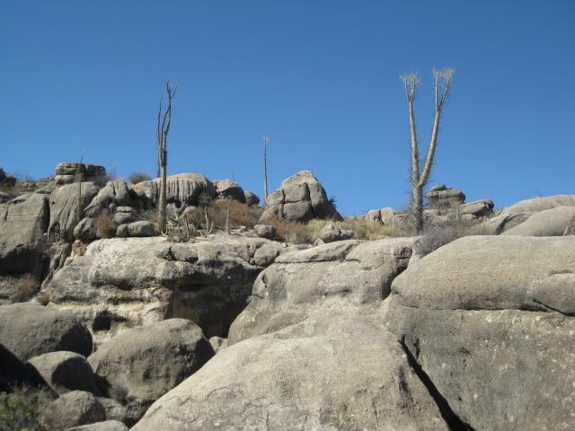
The road drops into the San Fernando riverbed before reaching the side canyon for Las Pintas.
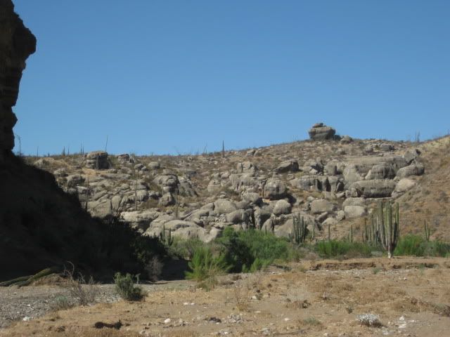
Nearing Las Pintas.
As close as we can drive. The storm of last January really changed the terrain here, as the sand was washed away and made getting to the rock art a
bit more of a climb.
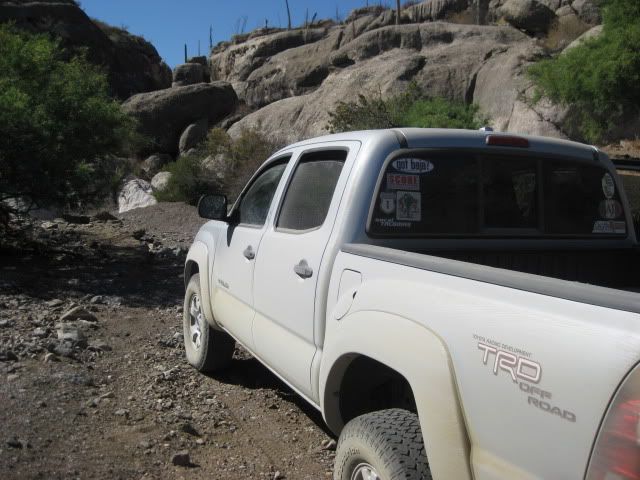
I can't say enough good things about my truck! It is my third Tacoma, and comfort and off road ability is supreme. Only the tires could be better!
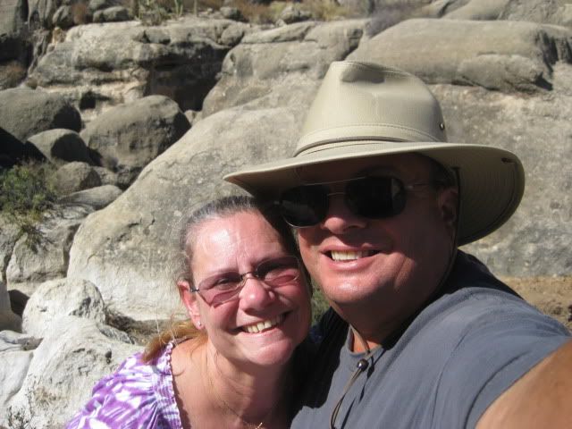
Here we celebrated my birthday, exploring Baja!
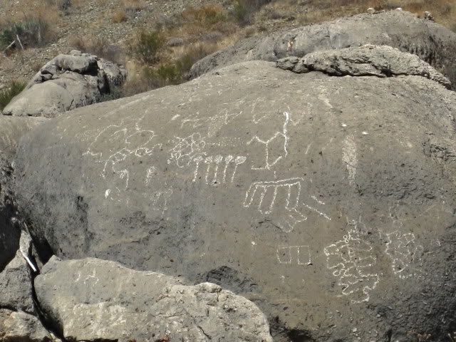
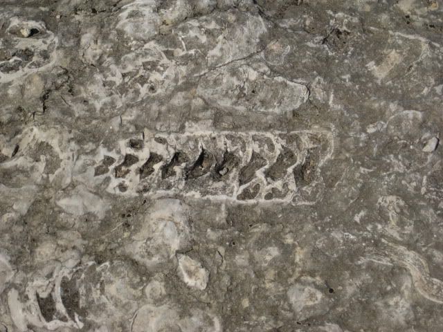
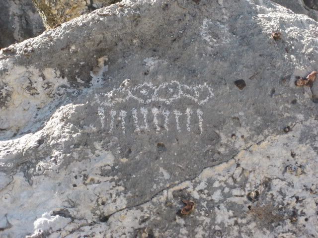
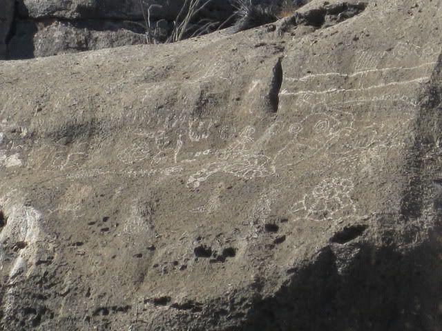
Okay, we have arrived at Las Pintas and we make a lunch, have some cold beer, and explore around the lower end of the rock art and fossil site. In the
next part, see more of the lower Las Pintas site and then we travel around to the top end of Las Pintas and see fantastic rock art that we have not
seen before!
To Be Continued...
[Edited on 9-22-2010 by David K]
|
|
|
wessongroup
Platinum Nomad
Posts: 21152
Registered: 8-9-2009
Location: Mission Viejo
Member Is Offline
Mood: Suicide Hot line ... please hold
|
|
Super job from an old man.... 
Thanks for all the work, really great job... all kidding aside...
[Edited on 9-22-2010 by wessongroup]
|
|
|
Pacifico
Super Nomad
Posts: 1299
Registered: 5-26-2008
Member Is Offline
|
|
| Quote: | Originally posted by RnR
Great photo log going south, David. I have come north through Otay a few times but never south. This year will be a southbound trip as I have a lot
of stuff to declare and will be above TJ's limit.
| Quote: | Originally posted by David K
|
Which one of these lanes is the "Declare" lane? And, what happens immediately on the Mex side of the border?
I have a full size pickup and a 26 ft trailer. Will need to park and declare. I've looked across at Mex Customs while going northbound in
preparation for this year but can't quite decipher the lanes. Looks like I should be able to park under the roof in long diagonal spaces. Anybody
done this? |
RnR -
I have done this before and like David said, it is the far right lane. You will go through that lane quite aways (which is covered part of the way)
and then it will take you to a large parking area with the customs agents. There you will present your receipts and declaration papers, and then go
pay. There is an office a short walk back north from the parking lot on the right. Good luck!
|
|
|
RnR
Senior Nomad
Posts: 841
Registered: 5-1-2010
Member Is Offline
|
|
Thanks for the detail and confidence boost.
|
|
|
RnR
Senior Nomad
Posts: 841
Registered: 5-1-2010
Member Is Offline
|
|
David,
Even better photos in the second post. Great!
|
|
|
Pacifico
Super Nomad
Posts: 1299
Registered: 5-26-2008
Member Is Offline
|
|
Great report David! Looks interesting there....
I have a couple questions about Corridor 2000:
"The Corredor 2000 ends on the Free (Libre) Ensenada highway at Popotla, about 32 miles from the Otay Border. We went home via the Corredor 2000 and
the Tecate Free Highway (Mex. 2) to the Tecate Border (38 miles from Mex. 1 at Popotla)."
1. I take it you still have to travel the free road a little ways to get onto the toll road? Are the on-ramps under construction?
2. Going north, Can you take the Corridor 2000 to the Tecate Toll Road to get to Tecate or only to the Tecate Free Highway (Mex. 2)?
Thanks!!!
|
|
|
David K
Honored Nomad
Posts: 65559
Registered: 8-30-2002
Location: San Diego County
Member Is Online
Mood: Have Baja Fever
|
|
| Quote: | Originally posted by Pacifico
Great report David! Looks interesting there....
I have a couple questions about Corridor 2000:
"The Corredor 2000 ends on the Free (Libre) Ensenada highway at Popotla, about 32 miles from the Otay Border. We went home via the Corredor 2000 and
the Tecate Free Highway (Mex. 2) to the Tecate Border (38 miles from Mex. 1 at Popotla)."
1. I take it you still have to travel the free road a little ways to get onto the toll road? Are the on-ramps under construction?
2. Going north, Can you take the Corridor 2000 to the Tecate Toll Road to get to Tecate or only to the Tecate Free Highway (Mex. 2)?
Thanks!!! |
1. YES, about 8 miles to Cantamar is the first on ramp to the toll road... next one is at Splash (near the Half Way House) and the third is at La
Fonda... The Free Road is now 4 lanes wide all the way to the Cantamar sand dunes. We took it to La Fonda (La Mision) and got on the toll road there
(because it was dark and we were rushing for El Rosario. However, the free road is nice all the way to Ensenada, and we use it northbound, all the way
to Popotla.
The on-ramps to the toll road from Corredor 2000 are still unfinished. There must be some issue with the politics of connecting the state highway BC
201 with the Federal toll road Mex. 1-D ???
2. YES, it is 7 miles LONGER to Tecate using the Tecate toll road and costs like 8 dollars! Use the free road, it is 4 lanes wide all the way to
Tecate and passes the Toyota Tacoma Plant!
[Edited on 9-22-2010 by David K]
|
|
|
David K
Honored Nomad
Posts: 65559
Registered: 8-30-2002
Location: San Diego County
Member Is Online
Mood: Have Baja Fever
|
|
| Quote: | Originally posted by RnR
David,
Even better photos in the second post. Great! |
Part 3 gets better! Stay tuned! Thank you!!!
|
|
|
Pacifico
Super Nomad
Posts: 1299
Registered: 5-26-2008
Member Is Offline
|
|
| Quote: | Originally posted by David K
| Quote: | Originally posted by Pacifico
Great report David! Looks interesting there....
I have a couple questions about Corridor 2000:
"The Corredor 2000 ends on the Free (Libre) Ensenada highway at Popotla, about 32 miles from the Otay Border. We went home via the Corredor 2000 and
the Tecate Free Highway (Mex. 2) to the Tecate Border (38 miles from Mex. 1 at Popotla)."
1. I take it you still have to travel the free road a little ways to get onto the toll road? Are the on-ramps under construction?
2. Going north, Can you take the Corridor 2000 to the Tecate Toll Road to get to Tecate or only to the Tecate Free Highway (Mex. 2)?
Thanks!!! |
1. YES, about 8 miles to Cantamar is the first on ramp to the toll road... next one is at Splash (near the Half Way House) and the third is at La
Fonda... The Free Road is now 4 lanes wide all the way to the Cantamar sand dunes. We took it to La Fonda (La Mision) and got on the toll road there
(because it was dark and we were rushing for El Rosario. However, the free road is nice all the way to Ensenada, and we use it northbound, all the way
to Popotla.
The on-ramps to the toll road from Corredor 2000 are still unfinished. There must be some issue with the politics of connecting the state highway BC
201 with the Federal toll road Mex. 1-D ???
2. YES, it is 7 miles LONGER to Tecate using the Tecate toll road and costs like 8 dollars! Use the free road, it is 4 lanes wide all the way to
Tecate and passes the Toyota Tacoma Plant!
[Edited on 9-22-2010 by David K] |
Thanks for the info!!! I will try it next time heading north....
|
|
|
Skipjack Joe
Elite Nomad
Posts: 8092
Registered: 7-12-2004
Location: Bahia Asuncion
Member Is Offline
|
|
David,
Could you make out what those petroglyphs represented?
They seem to be just geometric shapes.
Maybe there was a budding Euclid among them.
|
|
|
BAJA.DESERT.RAT
Senior Nomad
Posts: 980
Registered: 11-5-2009
Location: BAJA SUR
Member Is Offline
|
|
Hola david k, as always, thank you for the great trip report and fantastic pictures.
i appreciate greatly your photo description from the tecate crossing to the blvd 2000 route. does this route totally bypass all the road construction
i have been told and read about just south of tecate ?
i'll be going north in october and cross at tijuana but on my return in march, in your opinion, will they be making headway to complete the
construction from tecate to ensenada ?
BIEN SALUD, DA RAT
|
|
|
desertcpl
Super Nomad
Posts: 2407
Registered: 10-26-2008
Location: yuma,az
Member Is Offline
|
|
tires
David or anyone else that would like to answer this
David I see that you have had recently 2 flat tires,, do you use tire sealer that you put into the tire? would you recommend it
|
|
|
Taco de Baja
Super Nomad
Posts: 1913
Registered: 4-14-2004
Location: Behind the Orange Curtain, CA
Member Is Offline
Mood: Dreamin' of Baja
|
|
| Quote: | Originally posted by desertcpl
David or anyone else that would like to answer this
David I see that you have had recently 2 flat tires,, do you use tire sealer that you put into the tire? would you recommend it
|
That stuff probably makes a gooey mess inside the tire and may even ruin the modern low pressure sensors inside the tire. I would not recommend it
I always use the plug kits and also carry the tools to dismount the tire and put a patch on the inside. If the hole is too big an inside patch is the
only way to go.
Even duct tape can be used in a pinch over a VERY large patch and hole. The hole in this tire was big enough to stick a thumb in. It was also 20
miles off road. The spare also got a hole, and then the tire shredded itself, hence the need to patch this one...Talk about stressful times 
Truth generally lies in the coordination of antagonistic opinions
-Herbert Spencer
|
|
|
desertcpl
Super Nomad
Posts: 2407
Registered: 10-26-2008
Location: yuma,az
Member Is Offline
|
|
thanks for the info
|
|
|
David K
Honored Nomad
Posts: 65559
Registered: 8-30-2002
Location: San Diego County
Member Is Online
Mood: Have Baja Fever
|
|
| Quote: | Originally posted by BAJA.DESERT.RAT
Hola david k, as always, thank you for the great trip report and fantastic pictures.
i appreciate greatly your photo description from the tecate crossing to the blvd 2000 route. does this route totally bypass all the road construction
i have been told and read about just south of tecate ?
i'll be going north in october and cross at tijuana but on my return in march, in your opinion, will they be making headway to complete the
construction from tecate to ensenada ?
BIEN SALUD, DA RAT |
Thank you!
I don't have a clue of the rate of their work... I find it odd that they tear up such long sections at one time, rather than get shorter sections done
so that drivers don't have 10 or more miles of dirt detours to drive on.
The Corredor 2000 route totally avoids all of the construction on Hwy. 3... as you never go onto Hwy. 3.
Southbound, cross at Otay (as I did above) or cross at Tecate, and take Hwy. 2 or 2-D to the Corredor 2000 (BC 201)
The Corredor 2000 is about 6 miles east of Otay or 16 miles west of Tecate, using either Mex. 2, or 2-D.
|
|
|
David K
Honored Nomad
Posts: 65559
Registered: 8-30-2002
Location: San Diego County
Member Is Online
Mood: Have Baja Fever
|
|
| Quote: | Originally posted by Skipjack Joe
David,
Could you make out what those petroglyphs represented?
They seem to be just geometric shapes.
Maybe there was a budding Euclid among them. |
I have a book on the meaning, and might try to share some of that. In 2001, one of the kids on our Viva Baja/ BBBB-1 tour of Las Pintas knew some of
the meanings (like rainfall) and was interesting to hear... Neal Johns was there when they were drawn, so we should ask him! He does know the meaning
of the symbols for fertility... typical sailor!
|
|
|
capt. mike
Elite Nomad
Posts: 8085
Registered: 11-26-2002
Location: Bat Cave
Member Is Offline
Mood: Sling time!
|
|
i want to know if any of those have UFO ot ET refs to them??
i think the smarter guys were here 1st.
------- Art Bell speaking thru a marooonic IQ level guy AKA capt. mike 
formerly Ordained in Rev. Ewing\'s Church by Mail - busted on tax fraud.......
Now joined L. Ron Hoover\'s church of Appliantology
\"Remember there is a big difference between kneeling down and bending over....\"
www.facebook.com/michael.l.goering |
|
|
| Pages:
1
2 |