| Pages:
1
2 |
David K
Honored Nomad

Posts: 64478
Registered: 8-30-2002
Location: San Diego County
Member Is Offline
Mood: Have Baja Fever
|
|
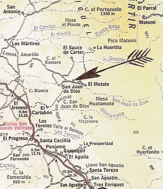
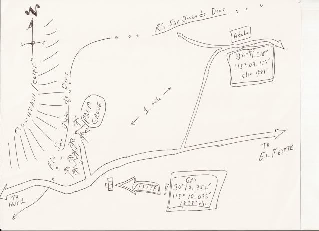
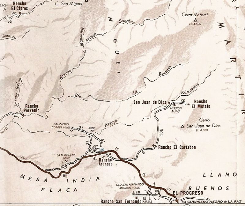
SAN JUAN DE DIOS 30°10'57.6" -115°10'04.5"
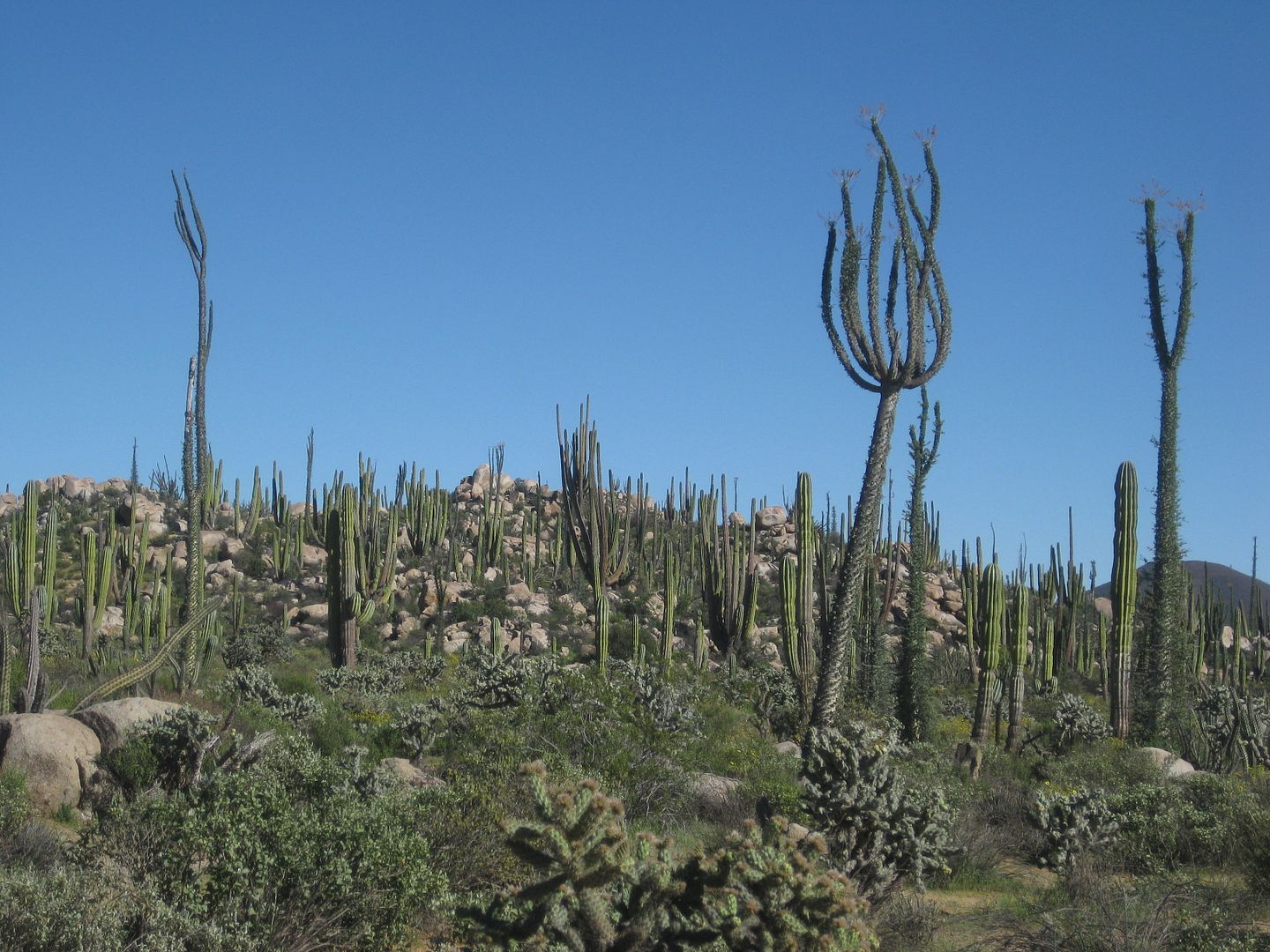
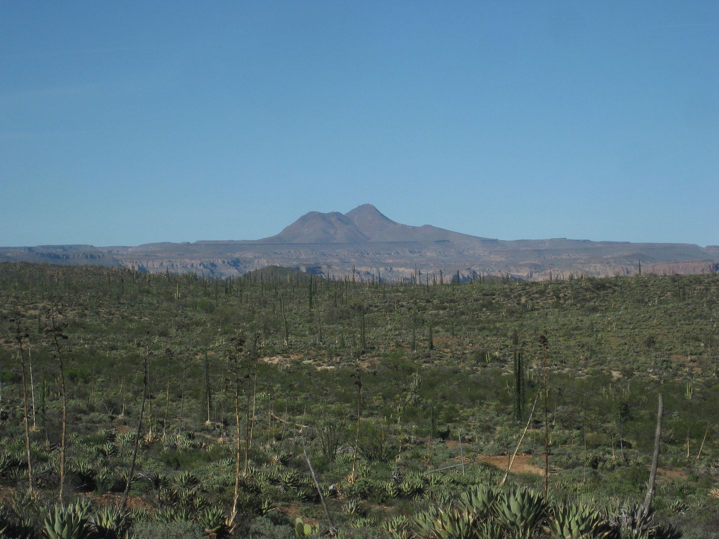
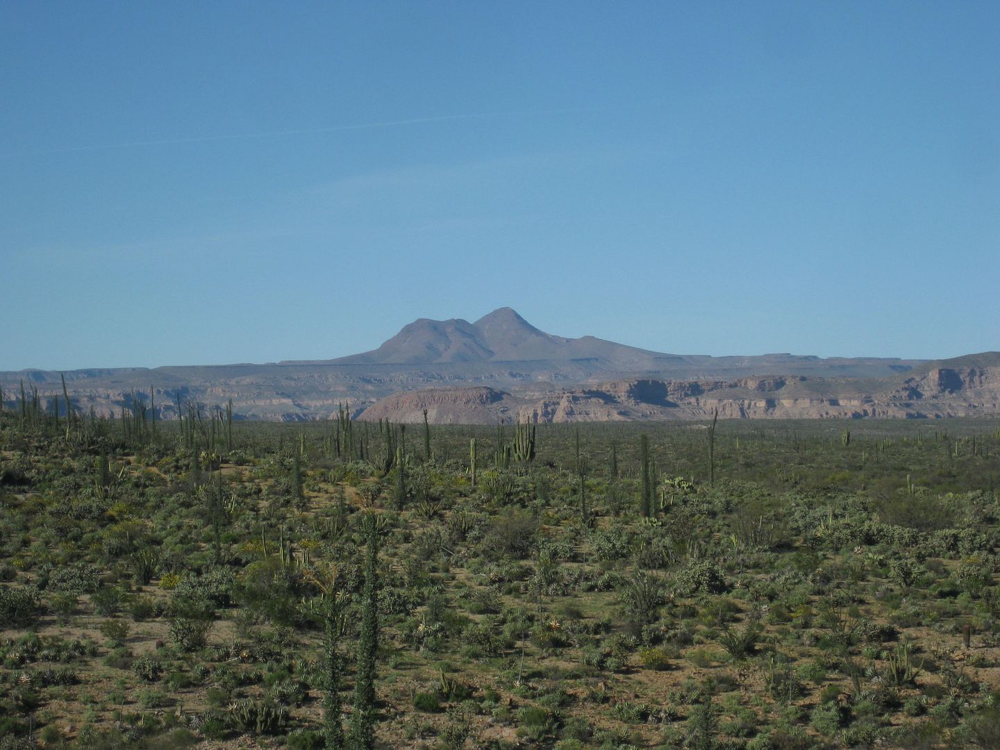
Some images of the visita to the San Fernando Velicata mission.
INAH FLOOR PLAN
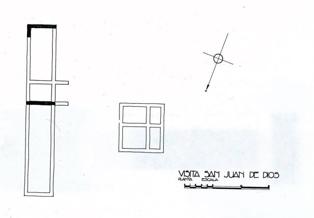
Photo by Clyde McMorrow published in 1973
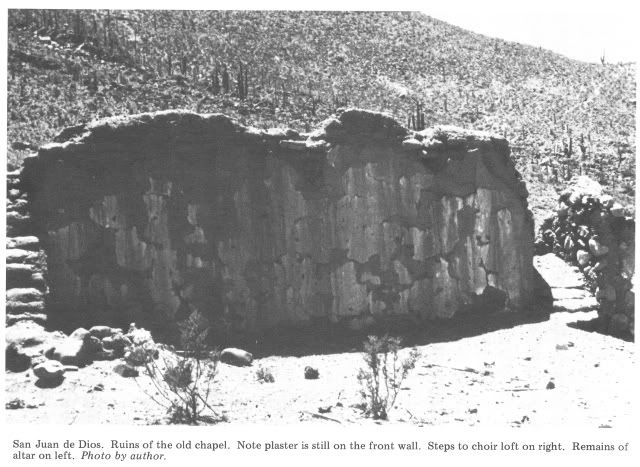
Two photos by David K from July, 2000:
Four photos by Jack Swords from Nov., 2003:

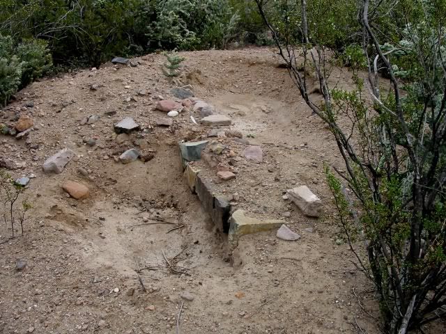
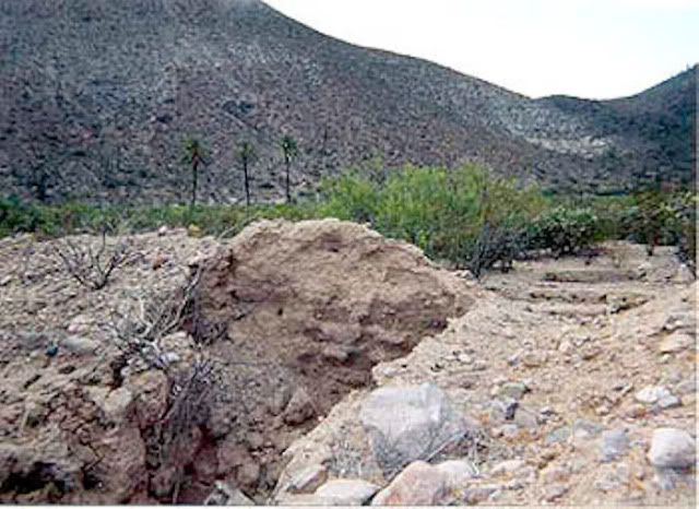
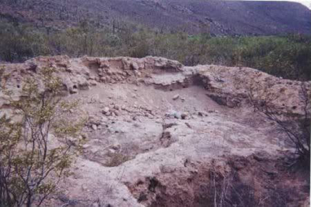
The site was destroyed by a farmer, plowing the area who couldn't perserve the 100' x 50' area containing the 225 year old ruins.
David M took the following photos in 2008:
[Edited on 3-27-2017 by David K]
|
|
|
David K
Honored Nomad
Posts: 64478
Registered: 8-30-2002
Location: San Diego County
Member Is Offline
Mood: Have Baja Fever
|
|
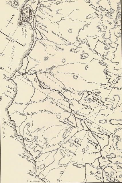
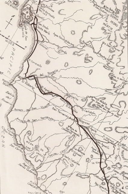
MAPS
2003:
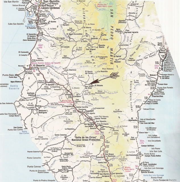
1962:
Hwy. 1 late 1973 added:
My sketch of the site following my last visit in Nov. 2002:
|
|
|
Mexitron
Ultra Nomad
Posts: 3397
Registered: 9-21-2003
Location: Fort Worth, Texas
Member Is Offline
Mood: Happy!
|
|
I'd be interested in seeing what was planted. I'm heading into that area, hopefully, in the late fall/early winter so I could take photos then.
|
|
|
David K
Honored Nomad
Posts: 64478
Registered: 8-30-2002
Location: San Diego County
Member Is Offline
Mood: Have Baja Fever
|
|
| Quote: | Originally posted by Mexitron
I'd be interested in seeing what was planted. I'm heading into that area, hopefully, in the late fall/early winter so I could take photos then.
|
Great Steve... Some panorama shots would be nice to see. I also saw a road on Google Earth that gets pretty close to the base of Matomi Mountain... on
the southwest slope.
|
|
|
BajaBlanca
Select Nomad
Posts: 13165
Registered: 10-28-2008
Location: La Bocana, BCS
Member Is Offline
|
|
what a shame ... that is what a lack of education produces ... I am sure the farmer had no clue of the loss he was creating.
|
|
|
David K
Honored Nomad
Posts: 64478
Registered: 8-30-2002
Location: San Diego County
Member Is Offline
Mood: Have Baja Fever
|
|
Seriously... and it isn't like he needed that small area of the big plain he was plowing... it could have been saved with any common sense... and
sadly, it is probably someone hired by the Espinoza family... Mama's son Sony is the one who showed me the site in July, 2000... as it was hidden by
shrubs, but very close to the road between the San Juan de Dios river crossing/ oasis and Mama's ranch home, El Metate.. just down the road.
|
|
|
academicanarchist
Senior Nomad
Posts: 978
Registered: 9-7-2003
Member Is Offline
|
|
Historic preservation in Mexico is always an issue, and there are literally thousands of sites that INAH theoretically has responsibility for that are
not protected, There are some 38,000 archaeological sites in Mexico, and most are unprotected and undeveloped. In my many visits to colonial sites, I
have seen many examples of local ignorance that has resulted in the destruction of architectural or artistic patrimony. At one convent in Hidalgo, the
local parish has converted the convent into a museum. There are priceless and bueatiful polychrome murals that date to the 16th century. To identify a
number of the murals, the museum personnel scarped away sections of the murals to put small signs. They have placed light directly above the murals,
which causes them to fade. I have also seen examples of the sacristan having used tape to put a sign up, but placed the sign on a mural. When I
questions the sacristan, he said they use powerful cleaners to clean off the mural after they remove the tape. Unfortunately, Mexico does not have the
luxury or the resources to protect the thousands of historic sites in the country.
|
|
|
David K
Honored Nomad
Posts: 64478
Registered: 8-30-2002
Location: San Diego County
Member Is Offline
Mood: Have Baja Fever
|
|
Thanks for the reply Robert!
Here is San Juan de Dios on the 1974 Auto Club Map... note is is called a 'mission ruin' and in the correct place.
Visitas were indeed missions when ever the Padre from the 'head' mission 'visited' them on his rounds. Most of the missions had several visitas as
satellites to the head mission as places where food could be raised and homes for the numbers of neophytes that were greater than the head mission
could support.
|
|
|
Mexitron
Ultra Nomad
Posts: 3397
Registered: 9-21-2003
Location: Fort Worth, Texas
Member Is Offline
Mood: Happy!
|
|
Never made it last fall David but its top of the list for this winter.
|
|
|
David K
Honored Nomad
Posts: 64478
Registered: 8-30-2002
Location: San Diego County
Member Is Offline
Mood: Have Baja Fever
|
|
BAJA'S recently lost historic treasures such as the mission visita should be marked out with survey stakes and caution tape so these cowboys and
farmers who need more than their common sense to avoid destroying 250 year Holy Ruins. The three mission sites of Santo Tomas are still visible, but
only the third site has standing walls. None of the three at Santo Tomas have received any INAH preservation because of disputes with land owners of
the sites.
|
|
|
David K
Honored Nomad
Posts: 64478
Registered: 8-30-2002
Location: San Diego County
Member Is Offline
Mood: Have Baja Fever
|
|
In our book (The Old Missions of Baja & Alta California 1697-1834), we describe what was a 'visita', but there are so many, we decided to not
include naming them or including them (unless they became full missions). In my Baja Missions web site, I have a section on just visitas of Baja
California to show ones there are photographs of: http://vivabaja.com/missions3
Thank goodness for the photos that have 'preserved' the sites visually where it has been destroyed physically!
|
|
|
David K
Honored Nomad
Posts: 64478
Registered: 8-30-2002
Location: San Diego County
Member Is Offline
Mood: Have Baja Fever
|
|
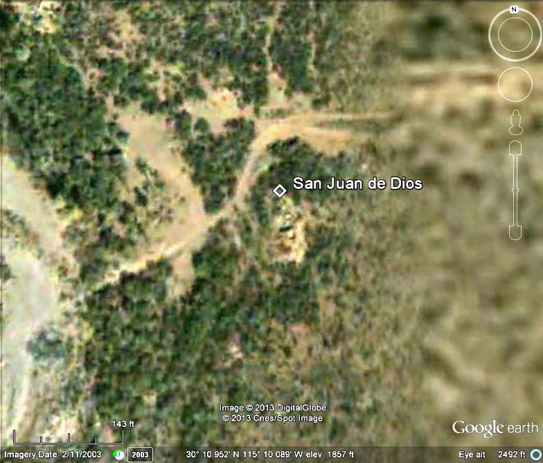
2003 Google Earth Shows the Visita Ruins!
Google Earth High Definition just got a bit wider in one strip of Baja images, and the mission visita site of San Juan de Dios (destroyed by a farmer
in 2008) can now be easily seen from space in these 2003 images...
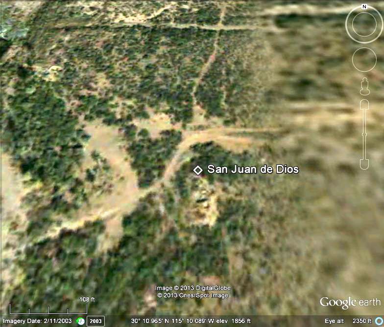
North is at the top, the road crosses the riverbed on the west side of the ruins and the palms are across the road from the ruins. The road heads east
to El Metate, 2.5 miles away. The white diamond is on the north end of the ruin.
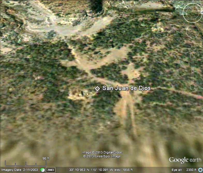
Looking west.
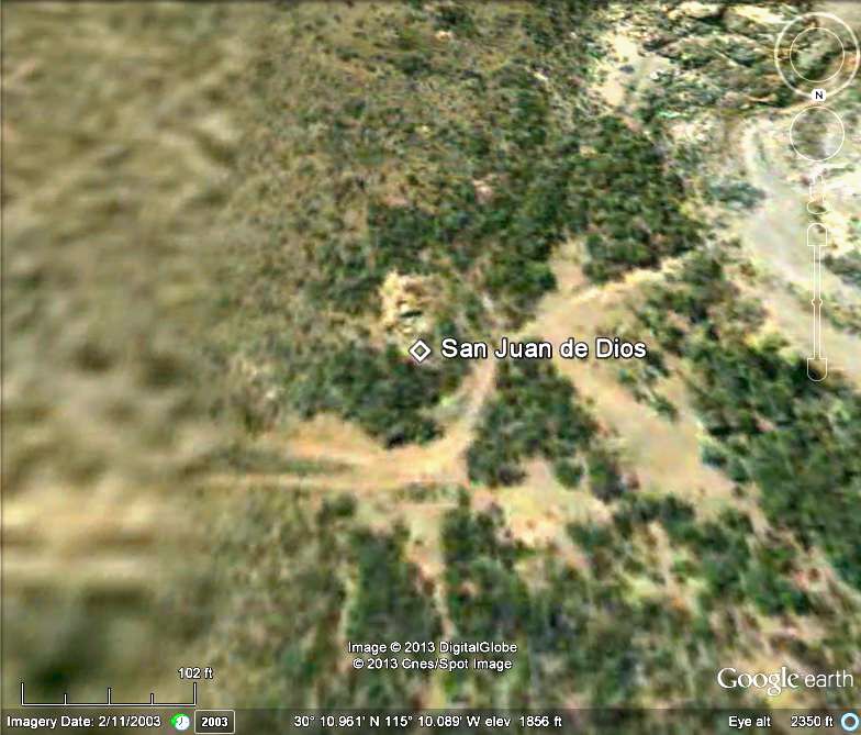
Looking south.
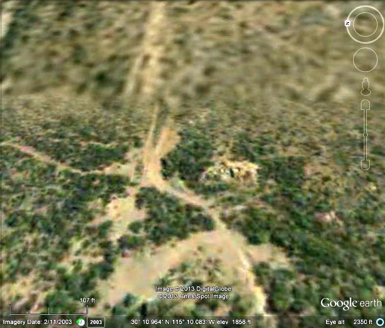
Looking east... note the blurry area begins just east (lower resolution images. The label was removed for this image.
Back north. Saved by photography, plowed over by farmer.
|
|
|
Jack Swords
Super Nomad
Posts: 1094
Registered: 8-30-2002
Location: Nipomo, CA/La Paz, BCS
Member Is Offline
|
|
Still awaiting current photographs of the site. Be interested to know if any rubble is left.
|
|
|
Islandbuilder
Senior Nomad
Posts: 555
Registered: 11-9-2011
Location: nob
Member Is Offline
Mood: bewildered
|
|
Too bad there isn't a program that could identify and mark (as you mentioned above) the sites of the ruins, and then pay the farmers not to damage the
remains. I doubt that the farmers will benefit from the added tilled land very much, so the renumeration could just be a few pesos.
Interesting that in this case he destroyed the remaining adobe, but left the foundation (right?) stones in place. Too hard to plow around the walls,
and also too hard to stone-boat the rocks away?
Amazing job finding the place David! Lot's of contacts and detective work pay off.
|
|
|
David K
Honored Nomad
Posts: 64478
Registered: 8-30-2002
Location: San Diego County
Member Is Offline
Mood: Have Baja Fever
|
|
It was Sony Espinoza (one of Mama's boys) who showed me the site when we were camping in the palm grove by the creek... it was so well hidden, yet
next to the road... You really got to look around! Google Earth is great for exploring as it has more areas with higher resolution shown.
|
|
|
David K
Honored Nomad
Posts: 64478
Registered: 8-30-2002
Location: San Diego County
Member Is Offline
Mood: Have Baja Fever
|
|
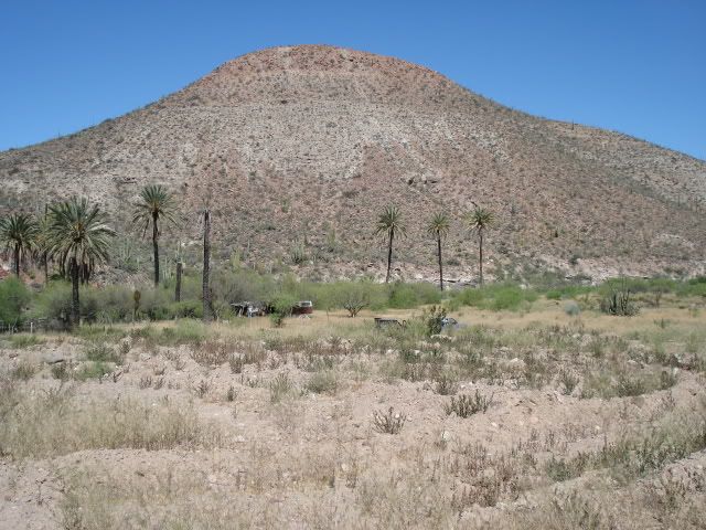
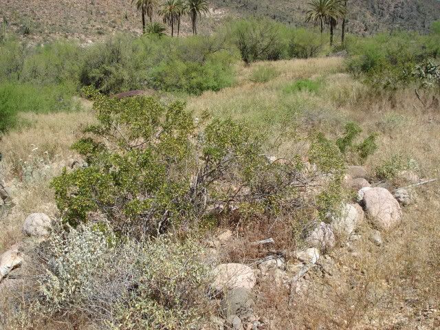
Well, I finally got there myself a couple weeks ago (March 2017).
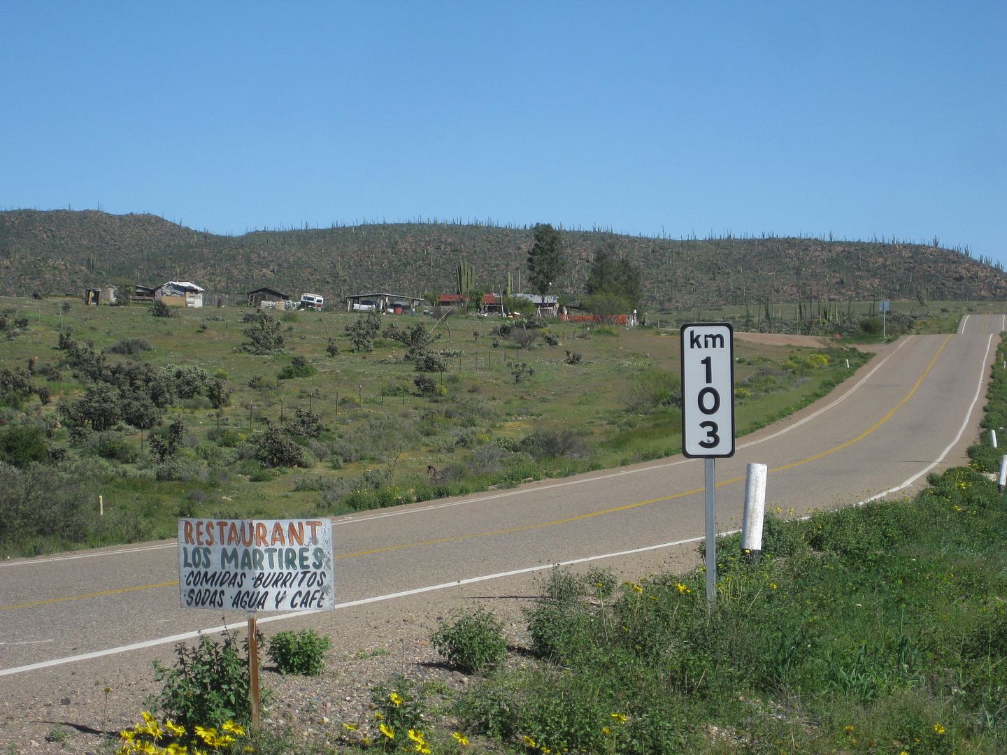
Just 500 feet past the Km. 103 marker is the trucker restaurant El Sacrificio (at the signed road for Los Martires), on the left. Turn in here and go
uphill past the restaurant. To the right was an airport runway used during the construction of Hwy. 1 in 1973... named El Arenoso, after the old ranch
a few more miles down the road.
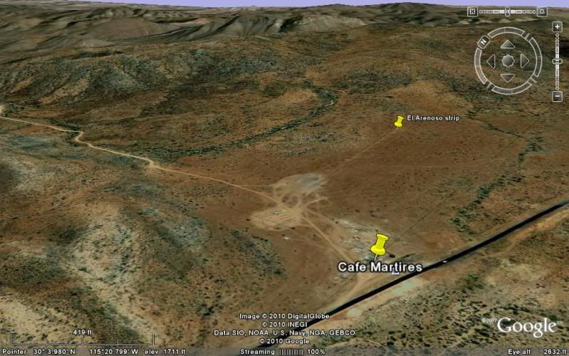
Set odometer to 0.0 at Hwy. 1 and the El Sacrificio (Martires turnoff) restaurant.
2.4 Fork, go left.
3.5 El Sauzalito Copper Mine. New Ranch built upon old town site.
4.8 Arroyo San Juan de Dios crossing (dry this time)
5.1 Fork: left to El Rosario via La Vibora, go right.
5.3 Fork: left to Los Martires and beyond, go right.
8.6 Fork, go right.
10.5 Road left to ranch.
10.7 Road in from left to ranch.
13.2 Pila (water tank) 'San Sebastian'
15.5 Fork, go left (gate on right fork).
16.9 Fork: left to El Sauce de Carter, go right.
20.1 Gate, close behind you.
21.5 Gate 'Rancho Las Palmas', close behind you.
21.7 Cross Arroyo San Juan de Dios. Rancho Las Palmas on left. Park on right across from water tank to visit ruins.
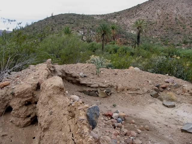
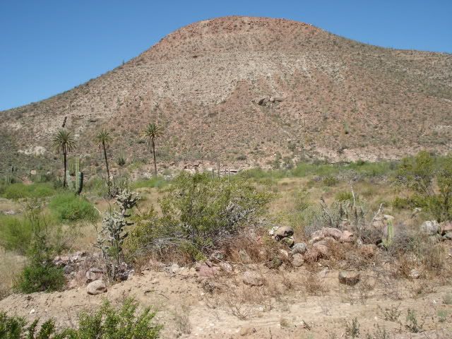
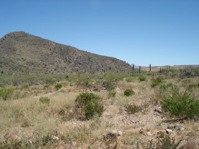
Cerro Matomí (the waterfall I was at three days ago is just the other side!)
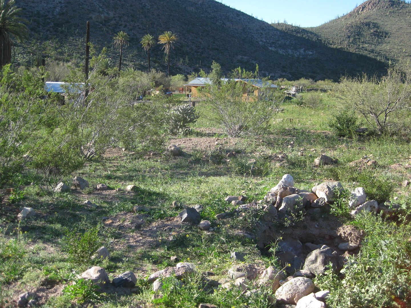
Rancho Las Palmas at San Juan de Dios, from arroyo crossing.
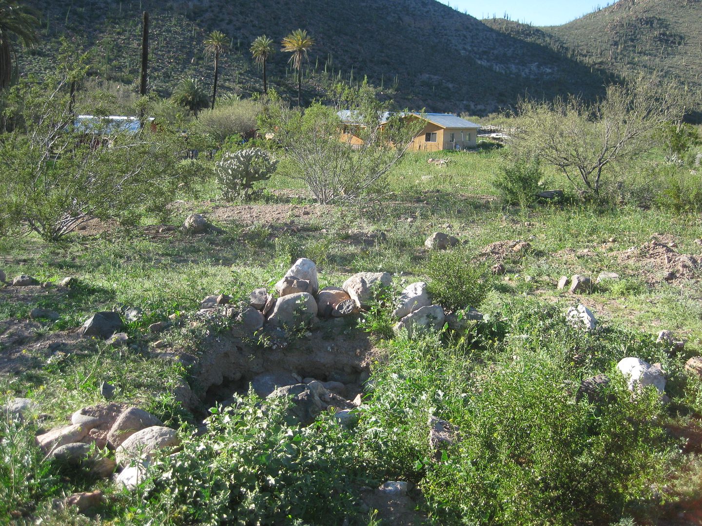
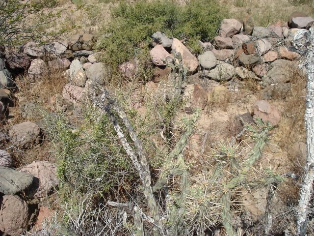
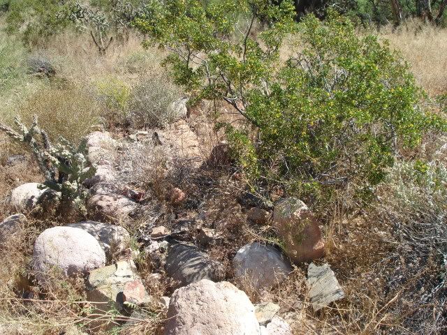
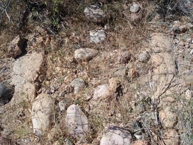
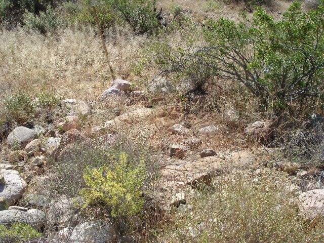
Ruins unearthed with ranch behind.
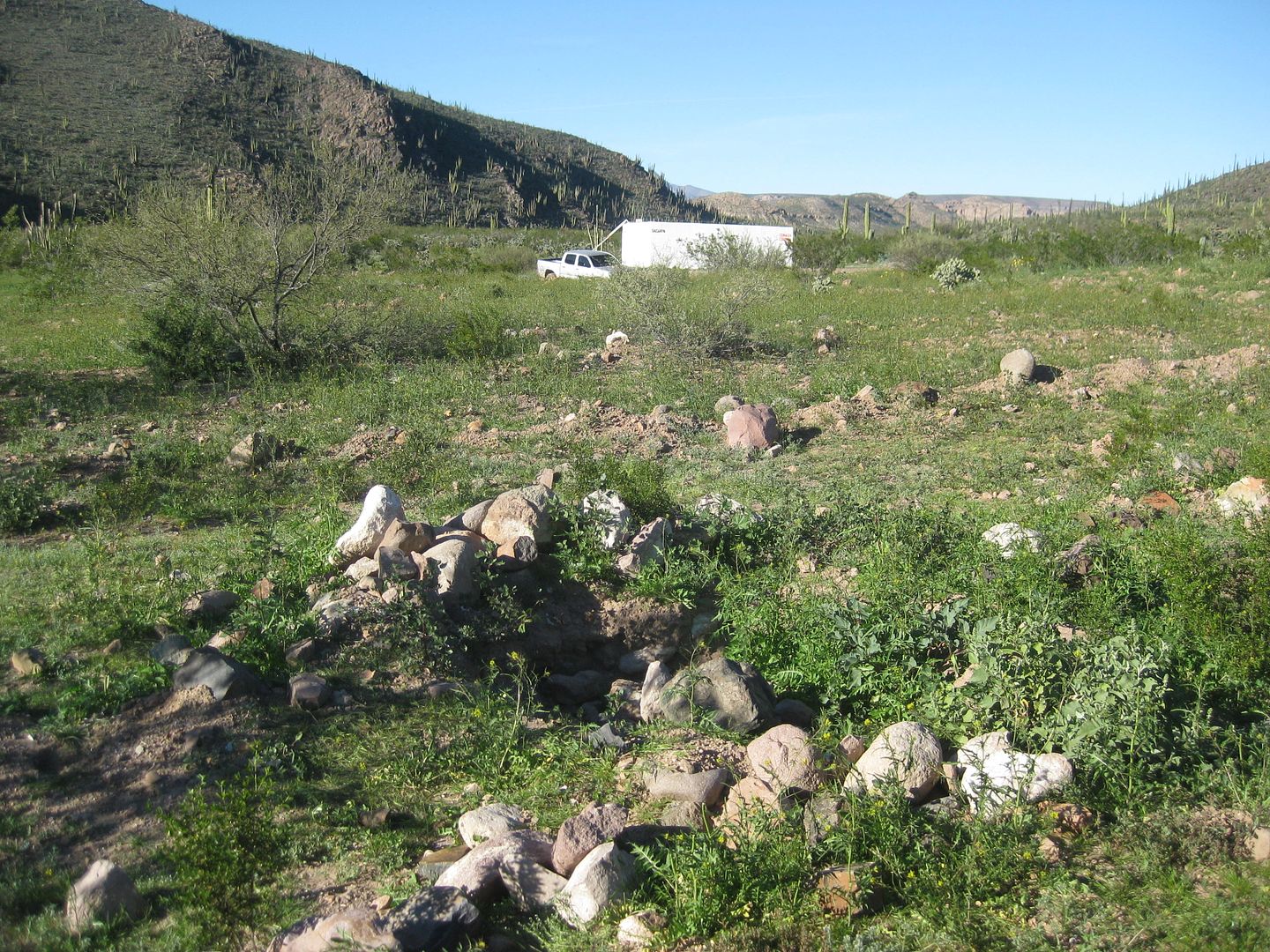
Looking north from ruins to my truck and water tank along road.
BEFORE:
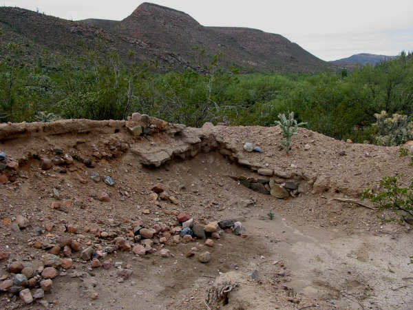
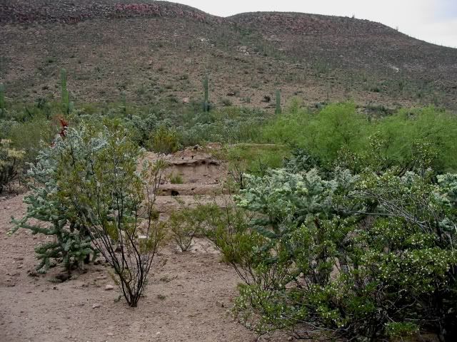
Jack Swords photo of 2003.
AFTER:
Looking south from the ruins. Rancher told me there is a mission period wall in the cardón cactus area. 2017
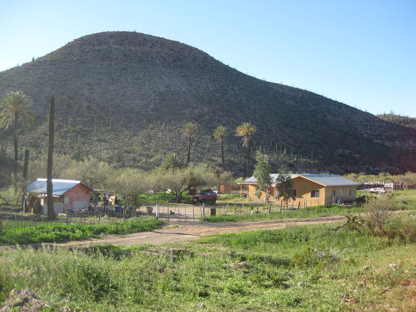
Rancho Las Palmas.
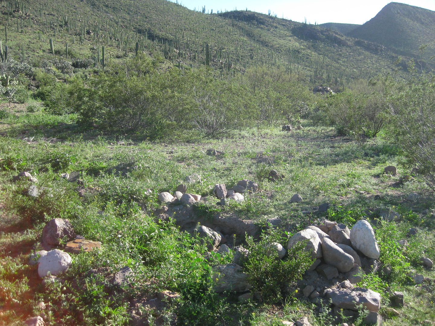
The resident there (Alfonso Duerte Espinoza) told me it was Sony Espinoza who bladed over the mission visita ruins in 2006. It was a very sad incident
indeed. No reason for the destruction. Nothing has been done on the land since no crops planted. Only a smal part of a covered-over room has been
opened back up.
BEFORE:
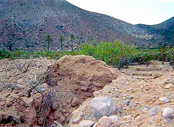
2000
AFTER:
2017
[Edited on 3-27-2017 by David K]
|
|
|
fishbuck
Banned
Posts: 5318
Registered: 8-31-2006
Member Is Offline
|
|
Perfect. I was looking for a daytrip mission to go and find. This looks just right from San Quintin.
"A ship in harbor is safe, but that is not what ships are built for." J. A. Shedd.
A clever person solves a problem. A wise person avoids it. – Albert Einstein
"Life's a Beach... and then you Fly!" Fishbuck
|
|
|
David K
Honored Nomad
Posts: 64478
Registered: 8-30-2002
Location: San Diego County
Member Is Offline
Mood: Have Baja Fever
|
|
It was a visita of Mission San Fernando, and sadly, the bulldozing over the ruins really takes the charm away. But, you could look for that wall the
rancher told me about (photograph it please). Then, you could see where Mama Espinoza lived after she got married, Rancho El Metate, just 2 1/2 miles
further down that road... It continues on out to the plains to the east.
The closest mission to San Quintin is Santo Domingo, 5 miles from Hwy. 1, north side of the bridge at Colonia Vicente Guerrero.
|
|
|
fishbuck
Banned
Posts: 5318
Registered: 8-31-2006
Member Is Offline
|
|
Quote: Originally posted by David K  |
It was a visita of Mission San Fernando, and sadly, the bulldozing over the ruins really takes the charm away. But, you could look for that wall the
rancher told me about (photograph it please). Then, you could see where Mama Espinoza lived after she got married, Rancho El Metate, just 2 1/2 miles
further down that road... It continues on out to the plains to the east.
The closest mission to San Quintin is Santo Domingo, 5 miles from Hwy. 1, north side of the bridge at Colonia Vicente Guerrero.
|
Ok. I will check your book to get properly orientated.
"A ship in harbor is safe, but that is not what ships are built for." J. A. Shedd.
A clever person solves a problem. A wise person avoids it. – Albert Einstein
"Life's a Beach... and then you Fly!" Fishbuck
|
|
|
Jack Swords
Super Nomad
Posts: 1094
Registered: 8-30-2002
Location: Nipomo, CA/La Paz, BCS
Member Is Offline
|
|
Sad! Glad folks have been taking photographs of these mission ruins.
I believe just past Cafe Martires the road goes to an old copper mine.
|
|
|
| Pages:
1
2 |


