| Pages:
1
2 |
mcfez
Elite Nomad

Posts: 8678
Registered: 12-2-2009
Location: aka BN yankeeirishman
Member Is Offline
|
|
Reliable new highway news
While staying at Bahia Christina last week...waiting for the 40 + consent winds to die off (never did!).....here's what I got from the Cantina located
there.
The Cantina has been leased out to a catering company to serve meals (taken to location) for the road construction site(s) and to serve the men there
at the restaurant. Having said that....
Last week there is a crew sitting at the table. A well dressed crew. Engineers! Had the blueprints on the table...obviously talking shop. I asked one
of the guys near our camp (he speaks fluent Spanish)...to ask them some questions concerning the new highway.
The strip under construction near isle el huerfanito ...is to be opened within two weeks.
The section to Gonzaga Bay is to be completed in mid Spring.
The highway completion to Mex1 will be done by 2012.
There are no current construction delays.
From my own sightings....
Impressive guard rails along the highway where truly needed.
New driveways being installed for many camps...using the old entrances (many complaints from owners that the "new" entrances were improper for them).
Dirt fill is being used. Compacted by roller.
Camp signs going up! Didn't expect to see this happen. Looks like a highway in California now!
Concrete pillars marking ravines and dangerous off road areas...painted white for night time driving,
[Edited on 10-25-2010 by mcfez]
Old people are like the old cars, made of some tough stuff. May show a little rust, but good as gold on the inside.
|
|
|
Von
Senior Nomad
Posts: 961
Registered: 10-1-2006
Location: Poway-Rosarito
Member Is Offline
Mood: getting ready!
|
|
DAM! and WOW! I wonder if the real estate market in Gonzaga will go up in value or go down in Value?
READY SET.....................
|
|
|
shari
Select Nomad
Posts: 13052
Registered: 3-10-2006
Location: bahia asuncion, baja sur
Member Is Offline
Mood: there is no reality except the one contained within us "Herman Hesse"
|
|
a teeny update from our highway crews...the first "pasta" is laid all the way into town now...the black ribbon cutting through the desert looks kinda
weird!!! Another company comes in to do the final surface pavement....to be done in 2 weeks too.
|
|
|
mcfez
Elite Nomad
Posts: 8678
Registered: 12-2-2009
Location: aka BN yankeeirishman
Member Is Offline
|
|
| Quote: | Originally posted by Von
DAM! and WOW! I wonder if the real estate market in Gonzaga will go up in value or go down in Value? |
Up.
And here's why:
From a story I heard from Camp Puertocitos .....the current owner. She's a smart woman!
"In the old days when the Pacific side was unpaved.....it was shorter to take the Sea of Cortez side. Pavement went in on the Pacific.....and all
truck traffic went that route. Now....when the pending highway....being paved all the way...trucks will roll back to Cortez...saving hours of driving.
Makes a lot of sense to me
Old people are like the old cars, made of some tough stuff. May show a little rust, but good as gold on the inside.
|
|
|
Riom
Nomad
Posts: 492
Registered: 12-17-2004
Member Is Offline
|
|
| Quote: | Originally posted by mcfez
Now....when the pending highway....being paved all the way...trucks will roll back to Cortez...saving hours of driving. Makes a lot of sense to me
|
That's one of the downsides of it being paved, a lot more traffic Mexicali-San Felipe, and a lot of heavy truck traffic through San Felipe.
There are two separate rumors on where the "San Felipe Bypass" will eventually run. One is from north of El Dorado, running right around the back of
El Dorado then across the desert towards the airport.
I think the more credible one is going straight at the curve just before the arches then round the back of town, much closer in.
Both are merely rumors!
Rob
|
|
|
David K
Honored Nomad
Posts: 65573
Registered: 8-30-2002
Location: San Diego County
Member Is Offline
Mood: Have Baja Fever
|
|
mcfez, did you ask or hear anything about the archeological site discovered that caused the delay near El Huerfanito?
|
|
|
mcfez
Elite Nomad
Posts: 8678
Registered: 12-2-2009
Location: aka BN yankeeirishman
Member Is Offline
|
|
| Quote: | Originally posted by David K
mcfez, did you ask or hear anything about the archeological site discovered that caused the delay near El Huerfanito? |
We asked a general question and got back what I reported. I felt that they were a little annoyed that we interrupted their table talk....but they were
very nice fellows.
The archeological site is most likely where I buried my Mother in Law a few years back :-)

Old people are like the old cars, made of some tough stuff. May show a little rust, but good as gold on the inside.
|
|
|
David K
Honored Nomad
Posts: 65573
Registered: 8-30-2002
Location: San Diego County
Member Is Offline
Mood: Have Baja Fever
|
|
Funny answer!
Nice photo of the parking viewspot for El Huerfanito island!
Been going south of Puertecitos since I was 7 years old (1965) and seeing a modern highway there is quite a event!
|
|
|
Phil S
Super Nomad
Posts: 1205
Registered: 10-28-2003
Member Is Offline
Mood: After 34 years. Still in love w/ my wife
|
|
Holy cow! ! ! ! ! ! ! ! I can't wait for this to be finished Drove it once years ago in my pickup. Was a "one time" event. However. I don't think
we'll ever go any other way to Loreto & points further south.
|
|
|
Von
Senior Nomad
Posts: 961
Registered: 10-1-2006
Location: Poway-Rosarito
Member Is Offline
Mood: getting ready!
|
|
So if i live right off the 15 freeway in sandiego next to the 8. would it be faster to get down to BOLA through the new road or just take the same old
hwy 1 ?
READY SET.....................
|
|
|
Brian L
Nomad
Posts: 250
Registered: 6-21-2010
Location: Alpine, CA
Member Is Offline
Mood: No Bad Days
|
|
I wish there was a decent map of it to compare distances. I did a quick ruler guess with Google and got about 340 miles compared to 280 miles. That
is from Tijuana to where it will meet the Hwy 1.
That could be a quicker route than through Ensenda and south...???
Brian
|
|
|
Bajahowodd
Elite Nomad
Posts: 9274
Registered: 12-15-2008
Location: Disneyland Adjacent and anywhere in Baja
Member Is Offline
|
|
Think about the difference in traffic. It's really slow going through Ensenada. Then, there are the mountains where, almost without fail I get caught
behind some trucks. After that, the traffic from just about Colonet, until after Los Pinos can be a major aggravation. Multiple towns, slow buses,
traffic lights. So, mileage alone is not the key issue. Better to figure it by time. How long does it take to get from San Diego proper to the gate
going in to Mexicali? After that, with the exception of San Felipe itself, traffic and other obstacles are way less than Mex1.
|
|
|
David K
Honored Nomad
Posts: 65573
Registered: 8-30-2002
Location: San Diego County
Member Is Offline
Mood: Have Baja Fever
|
|
| Quote: | Originally posted by blane
I wish there was a decent map of it to compare distances. I did a quick ruler guess with Google and got about 340 miles compared to 280 miles. That
is from Tijuana to where it will meet the Hwy 1.
That could be a quicker route than through Ensenda and south...??? |
This morning, Cortez Blue had asked to compare the two routes, but from San Felipe... here was my answer:
San Felipe to Mulege... via all paved roads?
Now, means you drive the 152 miles to Ensenada then south 550 miles, for a total of 702 miles... driving time ~14 hours.
Future, via Gonzaga Bay: San Felipe to Laguna Chapala is 136 miles plus Laguna Chapala to Mulege= 287 miles for a total of 423 miles or ~9 hours
driving average time.
Today via Ensenada is 702 miles/14 hour VS. Future via Gonzaga Bay at 423 miles or ~9 hours.
A difference of 279 miles and 5 hours.
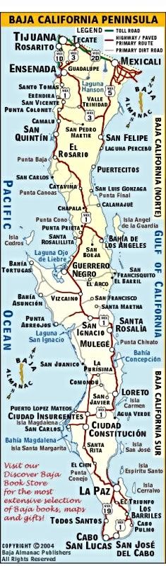
The overall peninsula map:
Avoiding the Ensenada and San Quintin valley traffic would be a reason to use Hwy. 5 when it is done, otherwise from San Diego, Hwy. 1 is shorter to
points south of Gonzaga. However, anyone who is closer to Mexicali than Tijuana and is heading south of Gonzaga... Hwy. 5 will be the choice' as it
will for the Mexican truckers going from the mainland to Baja Sur!
|
|
|
bajalou
Ultra Nomad
Posts: 4459
Registered: 3-11-2004
Location: South of the broder
Member Is Offline
|
|
Several years ago, people in San Felipe that traveled south a lot said it was 5-6 hours faster via Gonzaga than Ensenada - even with the rough roads.
No Bad Days
\"Never argue with an idiot. People watching may not be able to tell the difference\"
\"The trouble with doing nothing is - how do I know when I\'m done?\"
Nomad Baja Interactive map
And in the San Felipe area - check out Valle Chico area |
|
|
Brian L
Nomad
Posts: 250
Registered: 6-21-2010
Location: Alpine, CA
Member Is Offline
Mood: No Bad Days
|
|
How about a guess for someone coming from, say the corner of I8 and I15 in San Diego.
Using the I-8 to Tecate, then the Toll Road from Tecate to 5, and then 5 to where it meets the 1.
vs.
Tijuana to 1D to 1 to where it will meet the new 5.
Brian
|
|
|
David K
Honored Nomad
Posts: 65573
Registered: 8-30-2002
Location: San Diego County
Member Is Offline
Mood: Have Baja Fever
|
|
| Quote: | Originally posted by blane
How about a guess for someone coming from, say the corner of I8 and I15 in San Diego.
Using the I-8 to Tecate, then the Toll Road from Tecate to 5, and then 5 to where it meets the 1.
vs.
Tijuana to 1D to 1 to where it will meet the new 5. |
Hwy. 1 is shorter... from your starting point if you are going south of Laguna Chapala... even when Hwy. 5 is finished.
The question will be is it FASTER when you have city traffic in Ensenada and local or farm traffic in the San Quintin valley to deal with?
|
|
|
mcfez
Elite Nomad
Posts: 8678
Registered: 12-2-2009
Location: aka BN yankeeirishman
Member Is Offline
|
|
| Quote: | Originally posted by Von
So if i live right off the 15 freeway in sandiego next to the 8. would it be faster to get down to BOLA through the new road or just take the same old
hwy 1 ? |
yes
The drawback here is that there be lots of trucks.....trying to pass might be a pain. But still.....I can get to BoLA in what...4 hours....would be
fantastic.
One can see in the pic below...the new driveways being put in. This is near Black Mountain
[Edited on 10-26-2010 by mcfez]

Old people are like the old cars, made of some tough stuff. May show a little rust, but good as gold on the inside.
|
|
|
David K
Honored Nomad
Posts: 65573
Registered: 8-30-2002
Location: San Diego County
Member Is Offline
Mood: Have Baja Fever
|
|
| Quote: | Originally posted by mcfez
| Quote: | Originally posted by Von
So if i live right off the 15 freeway in sandiego next to the 8. would it be faster to get down to BOLA through the new road or just take the same old
hwy 1 ? |
yes
The drawback here is that there be lots of trucks.....trying to pass might be a pain. But still.....I can get to BoLA in what...4 hours....would be
fantastic.
One can see in the pic below...the new driveways being put in. This is near Black Mountain
[Edited on 10-26-2010 by mcfez] |
From San Diego:
To go east to Mexicali, then turn south to Hwy. 1 at Laguna Chapala:
San Diego to Mexicali is about 120 miles... Mexicali to Laguna Chapala is about 261 miles... 381 total, about 8 hours when all paved.
San Diego to Laguna Chapala via Hwy. 1 is about 340, about 7 hours.
Pretty close!
|
|
|
mtgoat666
Platinum Nomad
Posts: 21136
Registered: 9-16-2006
Location: San Diego
Member Is Offline
Mood: Hot n spicy
|
|
| Quote: | Originally posted by mcfez
Last week there is a crew sitting at the table. A well dressed crew. Engineers!
The highway completion to Mex1 will be done by 2012.
|
mcfez:
pretty funny  you should write standup comedy you should write standup comedy
i am skeptical of mexican government funding for roads in rural areas -- such funding is sort of like the wind, it comes and goes... don't count your
chickens before they are hatched!
|
|
|
mcfez
Elite Nomad
Posts: 8678
Registered: 12-2-2009
Location: aka BN yankeeirishman
Member Is Offline
|
|
| Quote: | Originally posted by mtgoat666
| Quote: | Originally posted by mcfez
Last week there is a crew sitting at the table. A well dressed crew. Engineers!
The highway completion to Mex1 will be done by 2012.
|
mcfez:
pretty funny you should write standup comedy
i am skeptical of mexican government funding for roads in rural areas -- such funding is sort of like the wind, it comes and goes... don't count your
chickens before they are hatched! |
Agree! I "think" this project's funding has been secured 100%.
Rumors I heard.....now I said rumors! : President Fox and wife.. bought a huge chunk of land down by Gonzaga Bay while in office. Maybe this highway
has something connected to that.
Old people are like the old cars, made of some tough stuff. May show a little rust, but good as gold on the inside.
|
|
|
| Pages:
1
2 |


