| Pages:
1
2 |
David K
Honored Nomad

Posts: 65595
Registered: 8-30-2002
Location: San Diego County
Member Is Offline
Mood: Have Baja Fever
|
|
Old Road and Hwy. 1 (Part 4: El Arco to San Ignacio)
Continued from Part 3: http://forums.bajanomad.com/viewthread.php?tid=48866
El Arco and nearby Calmalli were the imporant gold mines of the last century and earlier... However, by the time Highway One was built in central
Baja, they were nearly ghost towns and Guerrero Negro (started in 1955) was the 'new kid on the block'... so the new highway swung way west to service
it. El Arco did get a paved access highway from the new road, but the ultra thin pavement has all broken away since the 1970's.
From El Arco the old road headed pretty much straight south, then curved east around the base of the Sierra de San Francisco mountains. The old and
new road first touch about 5 miles south of the new town of Vizcaino. The method of farming in this desert using 'pre-historic' water (trapped since
the ice age) was started in 1959 by Americans at Rancho Wilson... which later was called the pilot ranch or El Piloto.
Enjoy the following maps and images of the old road...
In 1941, this automobile guide map showed the old main road as a heavy dark line. Do not confuse that for pavement!
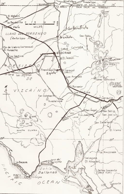
In the 1950s and early 1960s, Howard Gulick produced excellent road maps of Baja California that were published in the Lower California Guidebook.
Here is the 1962 edition map with the new highway and some new roads added in. The old ranch place names are also located on the new satellite images,
below...
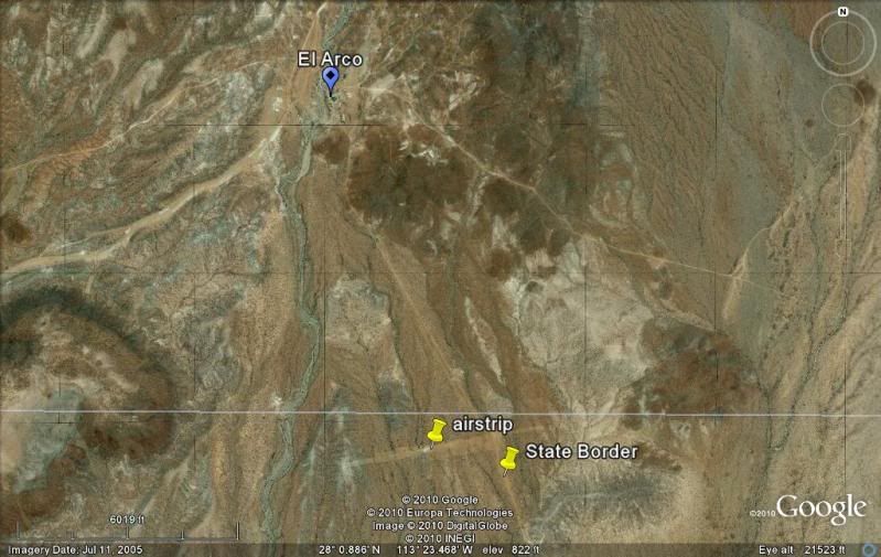
Now, as seen from above... all views al with north at the top:
El Arco, the dirt airstrip south of town and the old main road where it crosses the state border. The newer access road to El Arco from Hwy. 1 is at
the top left, and the road to Santa Gertrudis is on the top right...
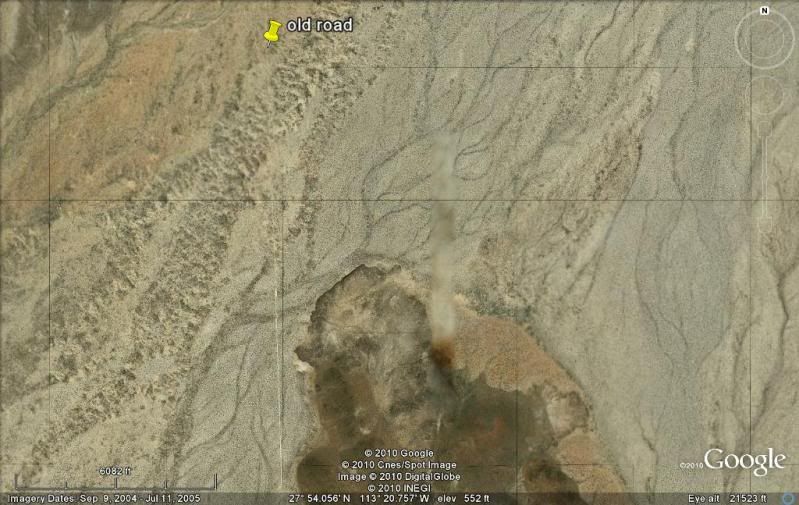
Arroyo Los Carros...
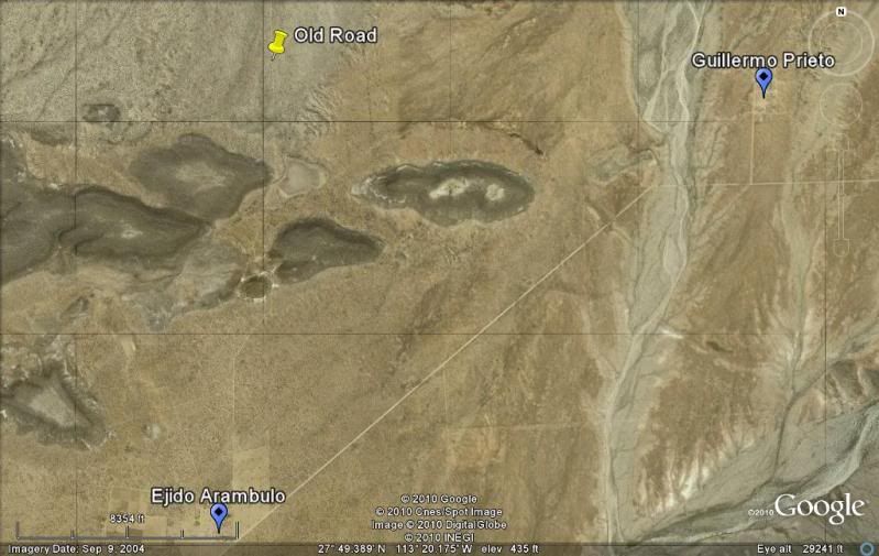
The old road passes right next to Ejido Angel Cesar Mendoza Arambulo and crosses the newer graded road to Ejido Guillermo Prieto and Santa Gertrudis.
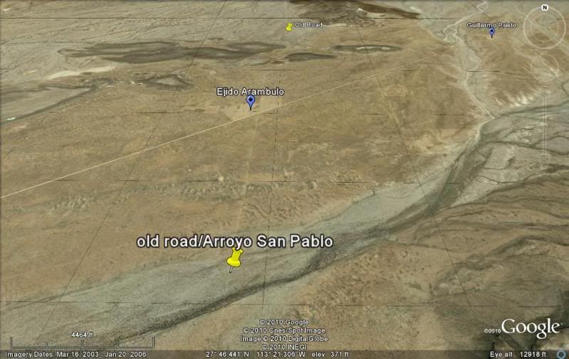
Old road crosses Arroyo San Pablo (which contains the mission visita of San Pablo and originates by San Francisco de la Sierra at the top of the
mountain).
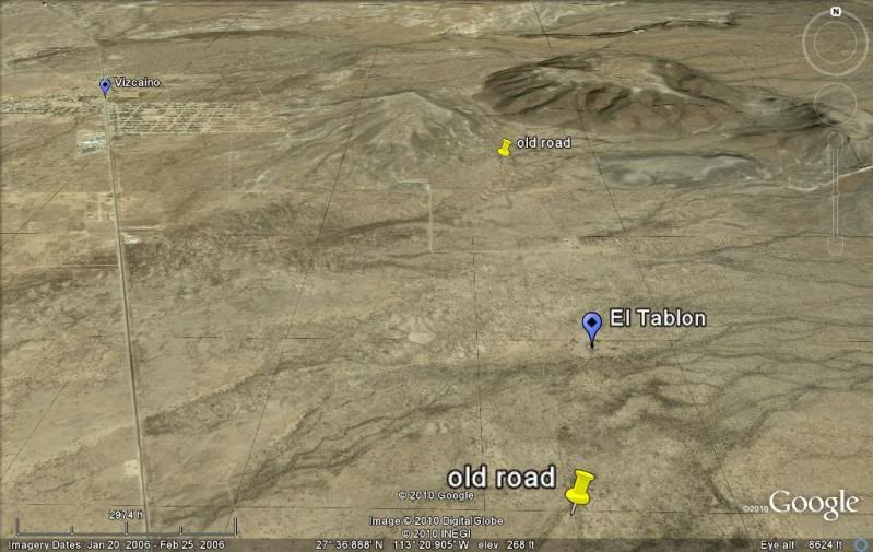
Rancho El Tablon is just east of the old road... and both are east of Highway One near Vizcaino.
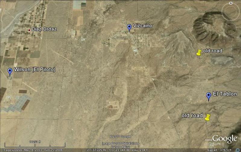
A higher view to show old Rancho de Wilson (El Piloto), Vizcaino, and the old road.
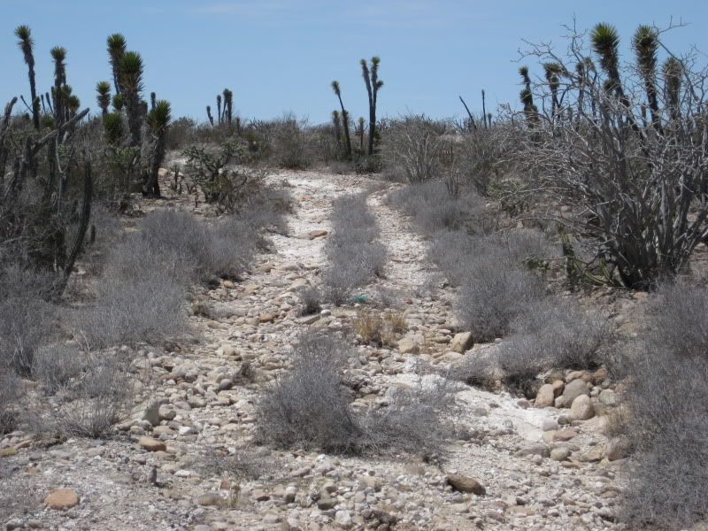
The old road crosses the new, just north of the paved side road to Ejido Emiliano Zapata. In 2009, we pulled off Hwy. 1 to photograph the old road (I
traveled over in 1966)...
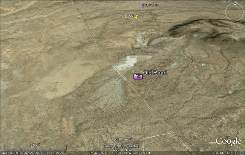
Looking north:
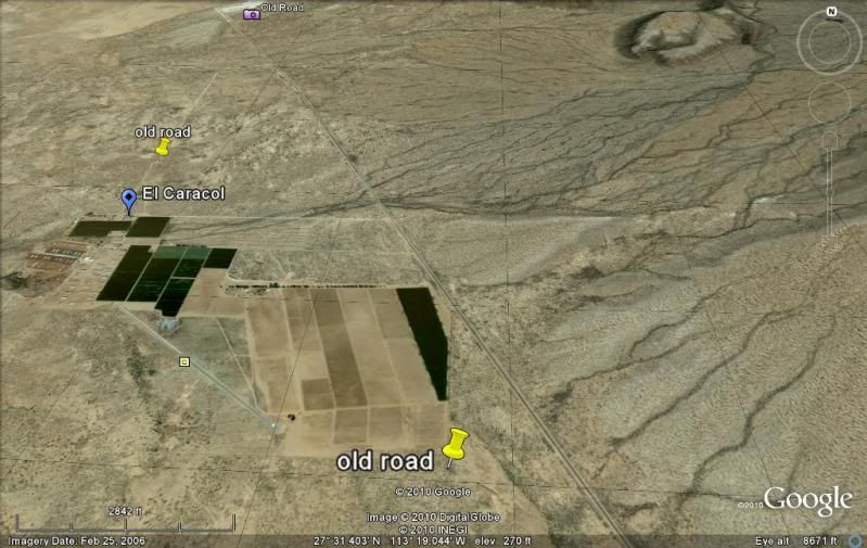
The new Rancho Caracol paved airport is built almost on top of the old main road. Other farming activity has erased many sections of the old road.
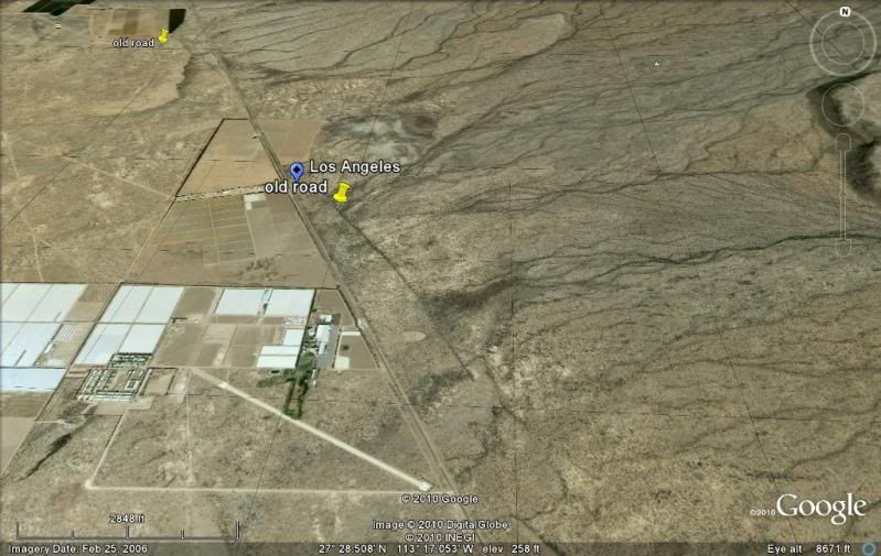
The old and new roads cross at Rancho Los Angeles.
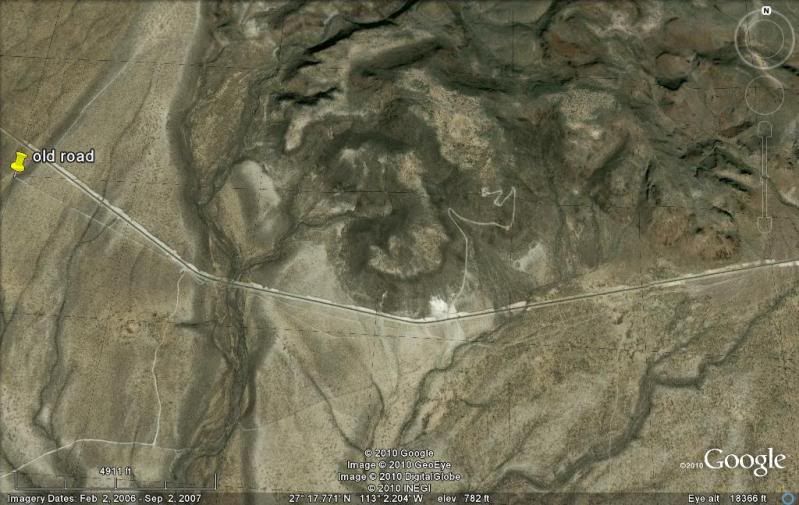
The old road is about a half mile east of Highway 1 where it crosses the new road to San Francisco de la Sierra.
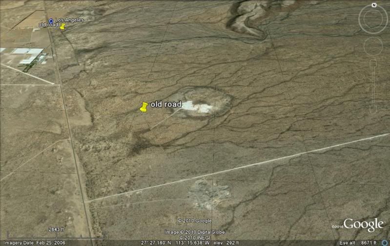
Old Rancho El Porvenir is on the old road...
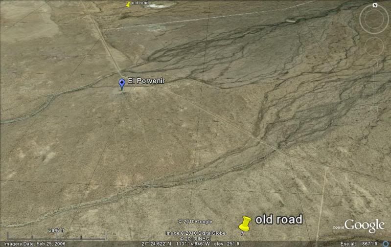
The old and new road are furthest apart in this area at Rancho Los Martires.
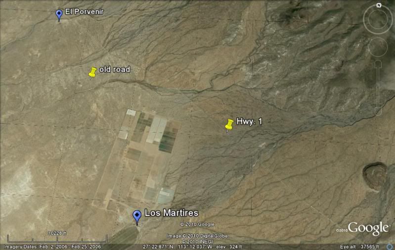
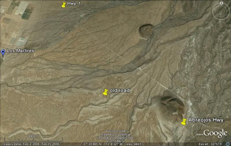
The old road crosses the paved Punta Abreojos road just south of Highway 1.
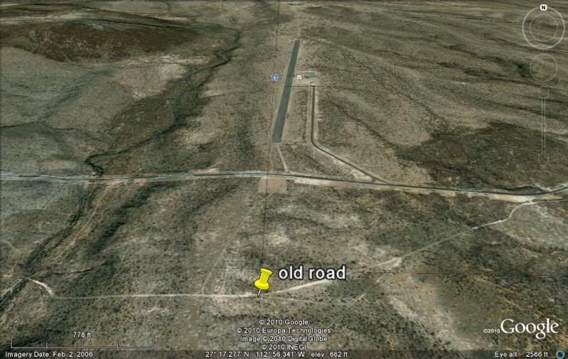
The final miles into San Ignacio find the two routes very close to each other.
Near the San Ignacio paved airport...
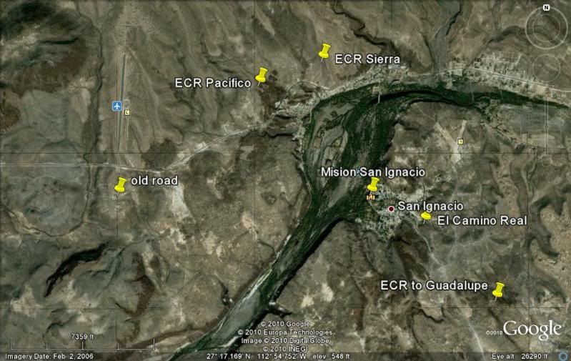
San Ignacio... which was the very important mission site and several branches of the Jesuit El Camino Real can be seen coming together at the mission
town.
The old road and new highway are either very near each other or together from San Ignacio to Santa Rosalia and Mulege.
South of Mulege, the old road was very close to the edge of Bahia Concepcion and south of the bay, the old road headed inland and passed through San
Jose Comondu (or La Purisma as an optional route south) on its way to La Paz.
Stay tuned for more of the old road in Baja California!
[Edited on 11-13-2010 by David K]
|
|
|
TMW
Select Nomad
Posts: 10659
Registered: 9-1-2003
Location: Bakersfield, CA
Member Is Offline
|
|
In the 7th satellite pix down the old road meets the hwy near KM133 just south of the light area where road material was accessed. The Baja 1000 came
out there several times. A few years ago I tried to follow the old road back to El Arco and at some point it was so overgrown etc I had to leave it.
|
|
|
David K
Honored Nomad
Posts: 65595
Registered: 8-30-2002
Location: San Diego County
Member Is Offline
Mood: Have Baja Fever
|
|
| Quote: | Originally posted by TW
In the 7th satellite pix down the old road meets the hwy near KM133 just south of the light area where road material was accessed. The Baja 1000 came
out there several times. A few years ago I tried to follow the old road back to El Arco and at some point it was so overgrown etc I had to leave it.
|
Yup... that's where I took a photo of the old road heading north from Hwy. 1 crossing. I put a camera icon on the satellite image of the spot.
This was (of course the original Baja (Mexican) 1000 route of 1967-1972 besides being the 'main highway' in those years and earlier (see 1941 map)...
The Baja 1000 has used that road a few times since 1972 as you mentioned...
It would be fun to drive the old road everywhere possible and log it... Someday, the parts that no longer are used to get to ranches and mines will be
too overgrown or eroded from washouts. Heck, it has been 37 years since the highway was finished!
|
|
|
David K
Honored Nomad
Posts: 65595
Registered: 8-30-2002
Location: San Diego County
Member Is Offline
Mood: Have Baja Fever
|
|
On Dec. 1, 1973 the Transpeninsular Highway was officially opened at the base of the Eagle Monument, near Guerrero Negro... It had been completed in
November, 37 years ago... after a mad rush the final year to complete the great missing piece between San Quintin and Santa Rosalia.
In July of 1973, there was still about 150 miles unpaved (Mision San Fernando turnoff to Villa Jesus Maria, with sections paved to on north to Punta
Prieta) and close to 60 miles on the old main road! We were detoured off the new road bed southbound at Agua Dulce and didn't see new road
construction coming north until it was encountered near Laguna Chapala.
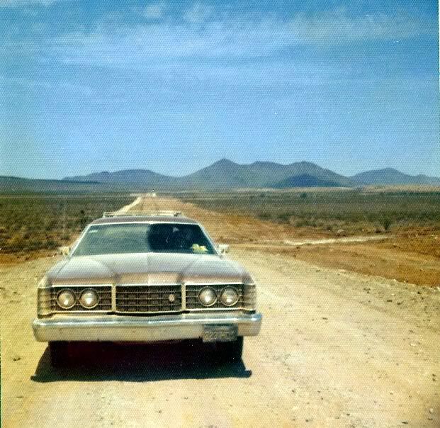
Photo of our family wagon in the Chapala dust detour along new roadbed (we sold the 4WD and took the new Ford south hearing the highway was nearly
completed, lol!):
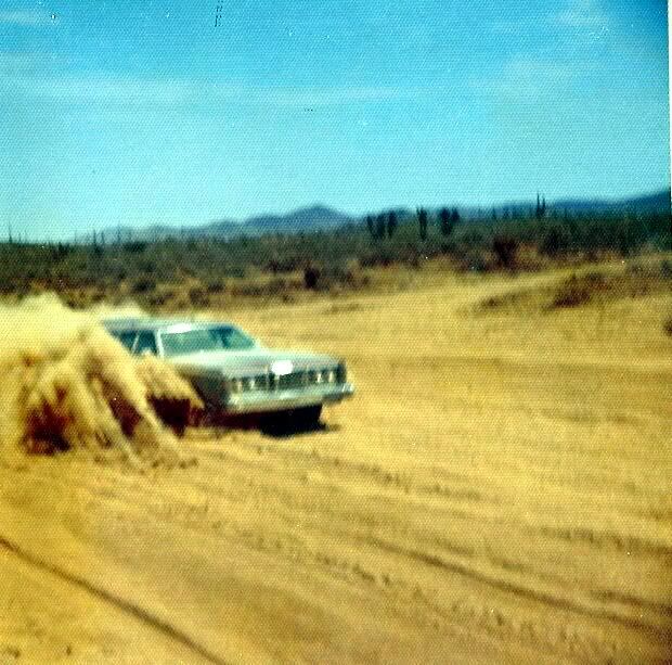
Here is our wagon on the new roadbed leaving Laguna Chapala valley, July 1973:
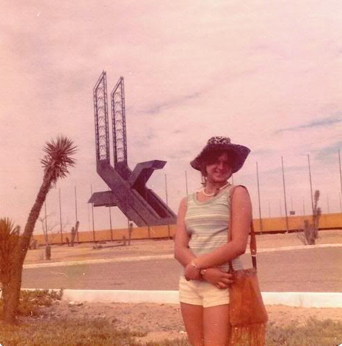
In 1976, following my graduation we took a trip to Loreto in two vehicles... my girlfriend and I in my Jeep and my folks in the Ford. Here she is at
the Eagle Monument in June, 1976... long before the trees and army base!
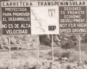
These billboards were located along the new highway every few hundred kilometers...
|
|
|
TMW
Select Nomad
Posts: 10659
Registered: 9-1-2003
Location: Bakersfield, CA
Member Is Offline
|
|
I noticed new signs in Baja Sur that read about the same in spanish only. Saying to the effect the hwy is not for high speed driving.
|
|
|
Phil S
Super Nomad
Posts: 1205
Registered: 10-28-2003
Member Is Offline
Mood: After 34 years. Still in love w/ my wife
|
|
Thank you David. Interesting read. Glad I didn't have to traverse the roads "in the old days"!!! didn't take me long to figure out & wanted ten
ply tires on my pickups to drive the roads in the late 80's & early 90's. And did take some really bad hits in "volkswagon" deep chuck holes.
Regular 4 plys would have blown I'm sure.
|
|
|
David K
Honored Nomad
Posts: 65595
Registered: 8-30-2002
Location: San Diego County
Member Is Offline
Mood: Have Baja Fever
|
|
| Quote: | Originally posted by Phil S
Thank you David. Interesting read. Glad I didn't have to traverse the roads "in the old days"!!! didn't take me long to figure out & wanted ten
ply tires on my pickups to drive the roads in the late 80's & early 90's. And did take some really bad hits in "volkswagon" deep chuck holes.
Regular 4 plys would have blown I'm sure. |
It was an adventure to drive to the tip of Baja in the old days... Often people would write books or magazine articles if they did it!
In 1966, pavement ended north of Colonet and a very washboard roadbed continued to San Quintin and the dirt road could probably be driven in a
passenger car to El Rosario if it wasn't too low to the ground.
Between El Rosario and La Poza Grande (south of Comondu) it was just 500 miles of single lane track, not graded (except between Santa Rosalia and
Mulege)... two cars could not pass each other without one getting off the road... but it was rare to pass another car all day in Baja! Poza Grande
south was one long washboard road until pavement was found about 100 miles north from La Paz. It had been paved further... to past Constitucion in
1961, but that 30+ miles of asphalt vanished by 1966.
The road into Cabo San Lucas from La Paz was only paved 10 miles south, then graded to beyond San Bartolo, then a single lane Jeep road the remaining
distance. The road to Todos Santos was graded, but Todos to Cabo was a little single track dirt road.
The good 'ol days   bouncing down Baja! bouncing down Baja!
|
|
|
jahImpala3
Junior Nomad
Posts: 80
Registered: 12-6-2007
Member Is Offline
|
|
Love it!
|
|
|
David K
Honored Nomad
Posts: 65595
Registered: 8-30-2002
Location: San Diego County
Member Is Offline
Mood: Have Baja Fever
|
|
Great... I will finish this in good time... Meanwhile, if you have any special requests for maps, satellite images, history, old out of print books...
Let me know if I can help!
All this stuff and memories I have is only valuable to you if you can enjoy it too!
|
|
|
ArvadaGeorge
Nomad
Posts: 358
Registered: 9-2-2003
Member Is Offline
|
|
In March 2010 we tried to ride (on M/C's ) the old road from Vizcaino north to El Arco,I have riden this rout many times in the past. The old road is
very difficult to ride now because of fencing--a lot of fencing. We poked around a lot and I finally found a way thru --you really need to take mex 1
north a bit from Vizcaino & then turn in.
[Edited on 11-16-2010 by ArvadaGeorge]
|
|
|
David K
Honored Nomad
Posts: 65595
Registered: 8-30-2002
Location: San Diego County
Member Is Offline
Mood: Have Baja Fever
|
|
Good point George... besides erosion damage, fences are also something we can't see on the satellite images. The old road will vanish someday... where
it isn't still used.
|
|
|
David K
Honored Nomad
Posts: 65595
Registered: 8-30-2002
Location: San Diego County
Member Is Offline
Mood: Have Baja Fever
|
|
Between Vizcaino and San Ignacio
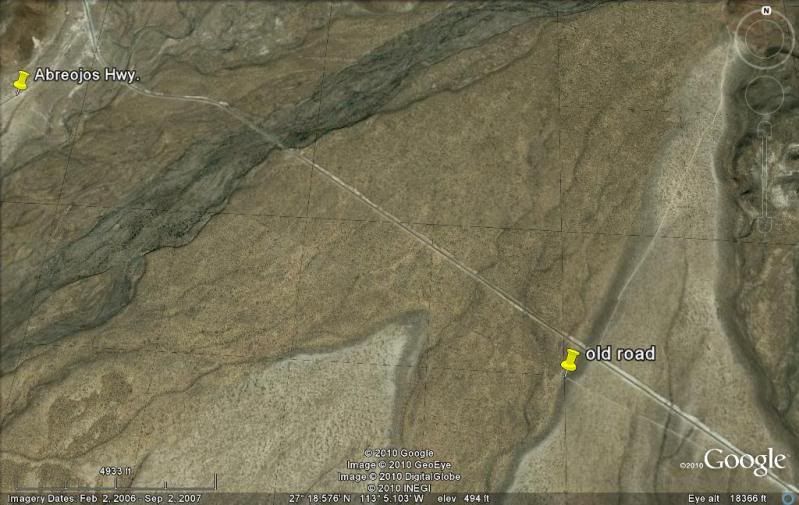
On the old road, July, 2012... where it crosses the highway to Punta Abreojos, just south of Hwy. 1... I am pointed northward:
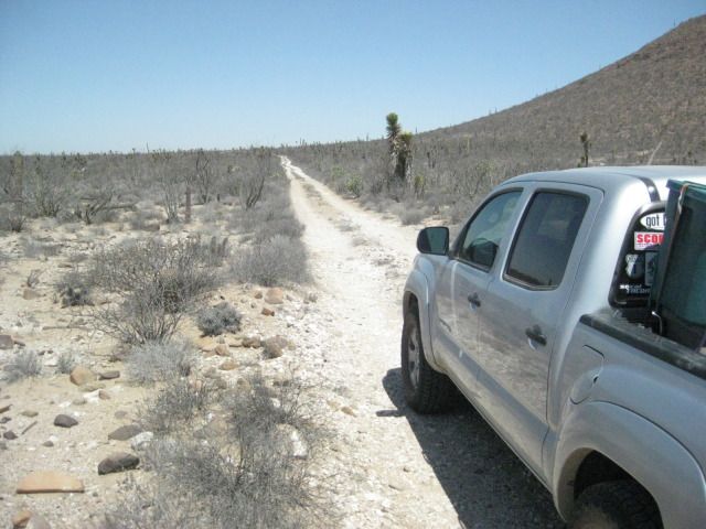
I was just to the left of the yellow pin 'Abreojos Hwy.'
[Edited on 9-13-2012 by David K]
|
|
|
baja09
Newbie
Posts: 24
Registered: 11-24-2011
Member Is Offline
|
|
Baja Roads
great Job David!....do you have any info, and maybe pics of Devils grade?.......
A+P......... PILOT........Baja Sur Lover
|
|
|
David K
Honored Nomad
Posts: 65595
Registered: 8-30-2002
Location: San Diego County
Member Is Offline
Mood: Have Baja Fever
|
|
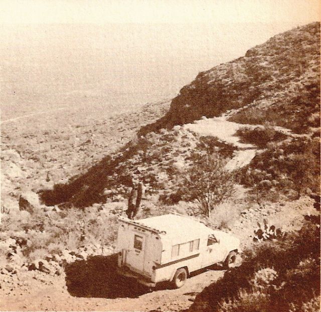
Do you mean La Cuesta del Infierno, north of Santa Rosalia?
In 1966, we drove it at night! The switchbacks on the old road were so sharp, my dad had to back up the Jeep Wagoneer to make the turns without
dropping off the edge.
Here is the first steep grade east of San Ignacio, the Cuesta las Virgenes where you can see the tight switchback in a photo from Cliff Cross' 1970
Baja Guide:
|
|
|
fudscrud
Nomad
Posts: 113
Registered: 6-8-2010
Member Is Offline
|
|
Good info David. I'll be riding through there in about a week but will be on the track that parallels to the east from Piedra Blanca through
Miraflores and down to Guillermo Prieto. I may visit Sta Gertrudis via a "shortcut"(a dotted trail headed southeast from 4mi. so. of Piedra Blanca)
then back to Miraflores and south. This "shortcut" totally fades out in a couple of places on GE, so we'll see...
Note: All the above is subject to change. (just like my contracts)
|
|
|
David K
Honored Nomad
Posts: 65595
Registered: 8-30-2002
Location: San Diego County
Member Is Offline
Mood: Have Baja Fever
|
|
Hope you have a great time! The roads were all excellent last July, even the shortcut to Pozo Aleman, even though we reached the San Francisquito road
to the east of Pozo Aleman... but just went less than a mile west to find the old mine town.
|
|
|
liknbaja127
Nomad
Posts: 464
Registered: 1-17-2012
Member Is Offline
|
|
Wow, great times, you have had! Love the history of your trips.
Do you have any maps for the northern part. We are doing a trip from
Rancho Veronica to Mikes. We used to go thru Laguna Hanson area and
come out near La Independencia, last time we could not find road! Lots of gates, have you been in this area lately? Thanks for the help.
|
|
|
David K
Honored Nomad
Posts: 65595
Registered: 8-30-2002
Location: San Diego County
Member Is Offline
Mood: Have Baja Fever
|
|
| Quote: | Originally posted by liknbaja127
Wow, great times, you have had! Love the history of your trips.
Do you have any maps for the northern part. We are doing a trip from
Rancho Veronica to Mikes. We used to go thru Laguna Hanson area and
come out near La Independencia, last time we could not find road! Lots of gates, have you been in this area lately? Thanks for the help.
|
I will be happy to show maps of the Sierra Juarez roads, but in another thread okay? It is an area I have not traveled in much. Thanks for the
comments. See Baja Road Conditions forum later and I will share what I have there.
Edit: Here they are: http://forums.bajanomad.com/viewthread.php?tid=66405
[Edited on 3-28-2013 by David K]
|
|
|
DavidE
Ultra Nomad
Posts: 3814
Registered: 12-1-2003
Location: Baja California México
Member Is Offline
Mood: 'At home we demand facts and get them. In Mexico one subsists on rumor and never demands anything.' Charles Flandrau,
|
|
David,
Do you have a couple of maps comparing la cuesta del diablo from the early 60's as compared to today. Either my memory is fading or the early road was
not anywhere near the present paved road. Meaning at least a few hundred meters to a couple of miles.
A Lot To See And A Lot To Do
|
|
|
David K
Honored Nomad
Posts: 65595
Registered: 8-30-2002
Location: San Diego County
Member Is Offline
Mood: Have Baja Fever
|
|
| Quote: | Originally posted by DavidE
David,
Do you have a couple of maps comparing la cuesta del diablo from the early 60's as compared to today. Either my memory is fading or the early road was
not anywhere near the present paved road. Meaning at least a few hundred meters to a couple of miles. |
Hi David,
The old road is very near the highway and if you look at Google Earth you can follow the two and see where the highway goes over the top of the old
road of the 1960's you and I remember!
My dad, in a rush to get to Mulege to start fishing, drove through San Ignacio and down the grade at night!!! I was asleep for that, but he told me he
had to back up a few times just to make the hairpin turns in the grade down! The last place we saw in daylight that day was Rancho Los Angeles,
between El Arco and San Ignacio.
|
|
|
| Pages:
1
2 |


