| Pages:
1
2 |
surfer jim
Super Nomad

Posts: 1891
Registered: 8-29-2003
Location: high desert
Member Is Offline
|
|
I see some waves in one photo.....now that is good to know.
|
|
|
roundtuit
Senior Nomad
Posts: 607
Registered: 12-21-2004
Member Is Offline
Mood: Wife's Job
|
|
There is a fishing guide in Mulege by the name of Mateo who everybody here knows. He can tell stories about it as either he or his sister lived there
with Mateos folks. His dad worked at the mine
Never learned from a book-Only from mistakes, mine and yours
|
|
|
David K
Honored Nomad
Posts: 64486
Registered: 8-30-2002
Location: San Diego County
Member Is Offline
Mood: Have Baja Fever
|
|
| Quote: | Originally posted by rockman
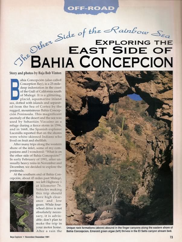
There are several references to the Gavilan mine which produced manganese (not magnesium) for the US war effort during WWII. At that time, more than
6,000 people worked at the mine. It was operated by a Mexican subsidiary of the Homestake Mining Co. Lessened post-war demand diminished the
output, and the mine closed when a hurricane devistated much of the infrastucture in 1946. Although many of the foundations and concrete floors still
survive, all of the equipment was salvaged and moved to other operations. The ore consisted of veins of pyrolusite, traces of which can still be
picked up. There are great campsites, but the drive from the west side of the peninsula to the east can be quite challenging. High clearance is
mandatory.
Best References:
Baja Explorer magazine (Later called Baja Life), Nov-Dec, 1991. Article by Bob Vinton.
Manganese on Punta Concepcion, by James Noble, Calif Inst of Tech, in Economic Geology, v45#8, Dec, 1950. |
Here is the magazine cover, followed by the 4 pages of the article by Baja Bob (Bicycle Bob) Vinton!
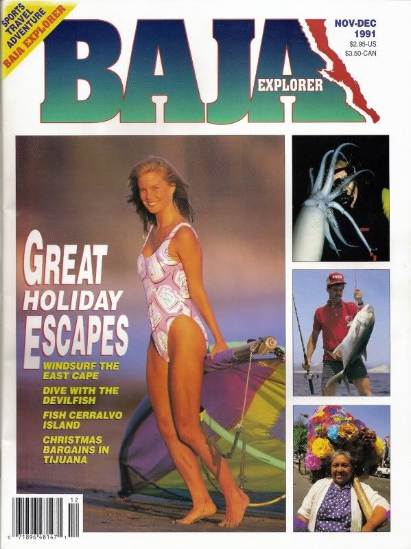


The Baja Explorer Magazine was one of the great creations of Landon Crumpton, who also published the Baja Atlas and Baja Almanac Map Books.
|
|
|
David K
Honored Nomad
Posts: 64486
Registered: 8-30-2002
Location: San Diego County
Member Is Offline
Mood: Have Baja Fever
|
|
You guys able to read the article okay?
|
|
|
rockman
Junior Nomad
Posts: 97
Registered: 11-30-2003
Location: Port Hadlock, WA & Loreto BCS
Member Is Offline
|
|
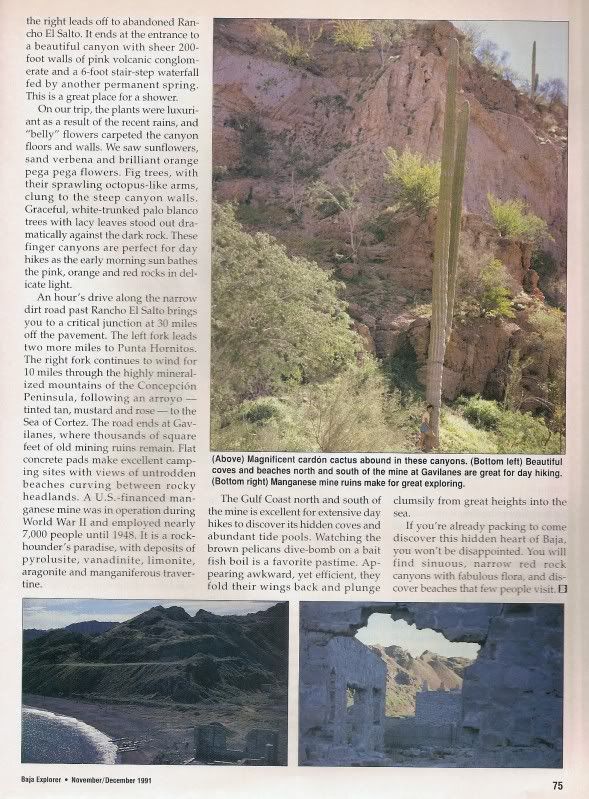
This is a photo of some of the remaining buildings at Gavilan. Prominent in the foreground is the generator building, and the ore-processing crusher
bldg. Going seaward on the beach, one can see the pilings that were once part of the pier, the seaward portion of which has been destroyed by surf
and storms.
[Edited on 4-14-2011 by rockman]
[Edited on 4-14-2011 by rockman]
[Edited on 4-14-2011 by rockman]

|
|
|
David K
Honored Nomad
Posts: 64486
Registered: 8-30-2002
Location: San Diego County
Member Is Offline
Mood: Have Baja Fever
|
|
Thanks Norm...
|
|
|
David K
Honored Nomad
Posts: 64486
Registered: 8-30-2002
Location: San Diego County
Member Is Offline
Mood: Have Baja Fever
|
|
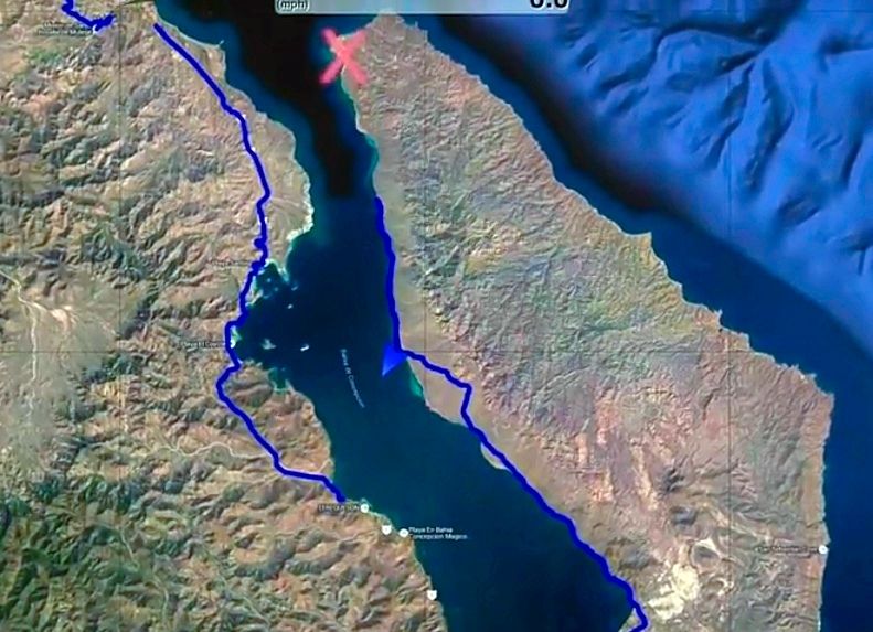
Wanted to visit the mine in 2016 but the road along the east side of Bahía Concepción was wiped out a few miles short of reaching the end, where the
mine road goes over to the other side.
|
|
|
defrag4
Senior Nomad
Posts: 536
Registered: 2-5-2011
Member Is Offline
|
|
ive often wondered what was on the eastern side of BoC, thanks for bump David, will have to make a trip up there to explore and see how it looks
nowadays
|
|
|
David K
Honored Nomad
Posts: 64486
Registered: 8-30-2002
Location: San Diego County
Member Is Offline
Mood: Have Baja Fever
|
|
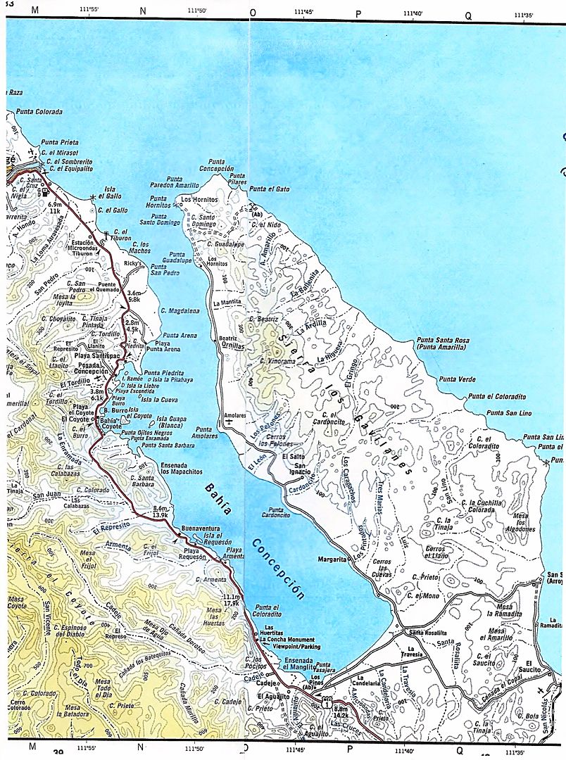
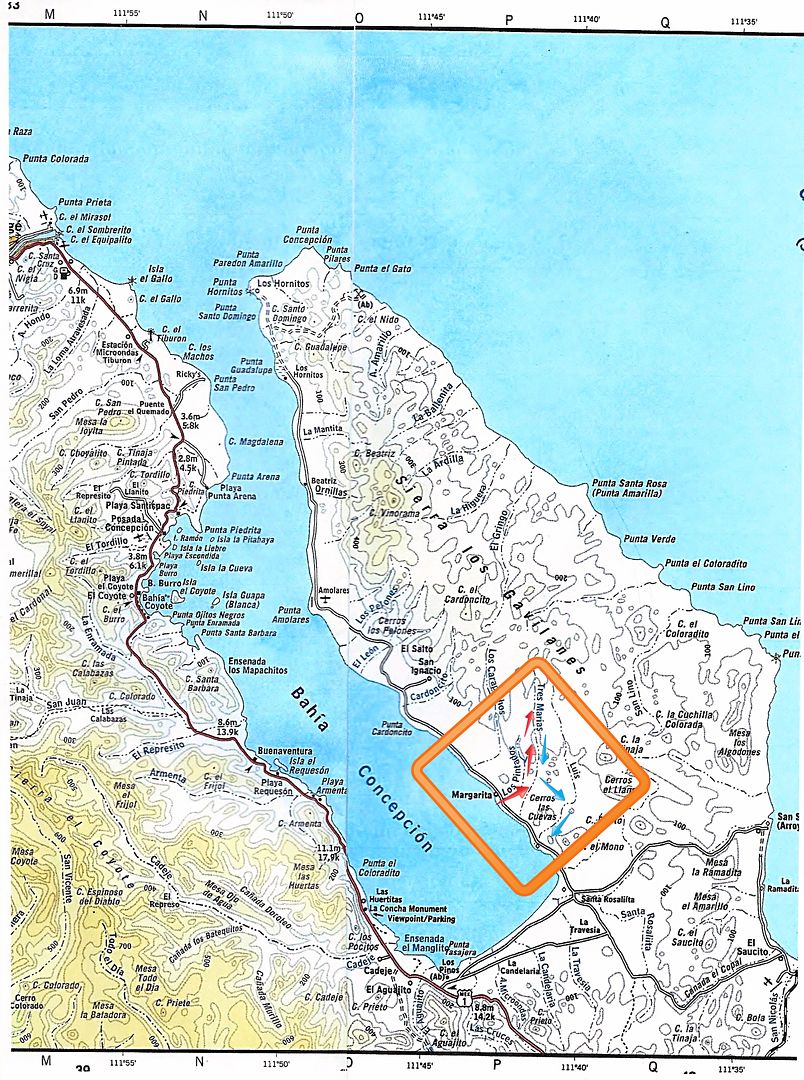
The Other Side of Bahía Concepción, Sept. 2016
Quote: Originally posted by defrag4  | | ive often wondered what was on the eastern side of BoC, thanks for bump David, will have to make a trip up there to explore and see how it looks
nowadays |
Here are the two posts with photos I made following our Baja Extreme 2016 tour:
Yes, there are roads on the peninsula that creates the Bay of Concepcion... ranches, too... and a WWII Manganese mine on the east side of the north
end.
Erle Stanley Gardner was curious, but in 1966, he got no answers. He decided it would become a quest! I will write more about it in a future
article...
In the November 1991 issue of Baja Explorer Magazine, Bob Vinton (aka Bicycle Bob or Baja Bob) details the road as do Tom and Patti Higginbotham in
their 1996 central Baja guidebook, 'Backroad Baja'. So, we weren't flying blind into the unknown. Heck, the AAA Baja map even shows the road, as do
the Baja Almanac map books.
Mark at Playa Buenaventura gave us the latest scoop in that the original road around the bottom of the bay at Km. 76 should be avoided due to a mud
field near the abandoned government trailer park. Go another mile south or so, to the newer ranch road left (just north of Km. 74).
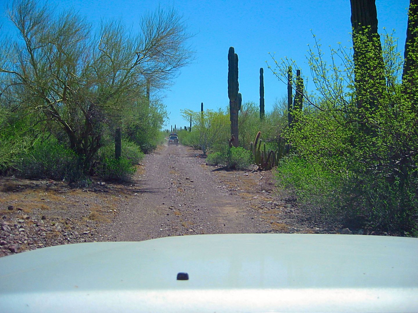
That is exactly what we did, and deflated our tires for some serious off roading that would last until midnight!
Leaving Highway One, our new off road adventure begins!
These mileages may vary with your odometer, use them only as a general guide. May the Force be with you!
A cattle ranch is passed at 0.4 mile.
At Mile 1.0 we join the old, pre-1970 main Baja road, that comes in from Km. 76 off Mex. 1.
At Mile 3.7 the main route of travel forks left for the bay.
At Mile 4.7 the road closest to the bay from the trailer park comes in from the left.
At Mile 5.6 fork to the left heading north.
At Mile 6.6 the road is next to the bay and going northbound.
At Mile 8.2 a road we used on the return (Ham's Shortcut) meets the coast road.
At Mile 9.9 (just north of three cardón cactus growing side-by-side (and called The Three Musketeers) is the wash/ route to Los Pintados rock art. On
the report for tomorrow, learn how we missed finding it and what we found instead!
Around Mile 13, the road goes inland as the coastline curves off to the west.
Mile 15 come close to the bay again briefly, then head towards the mountain.
Mile 16.8, curve left and head back downhill towards the bay.
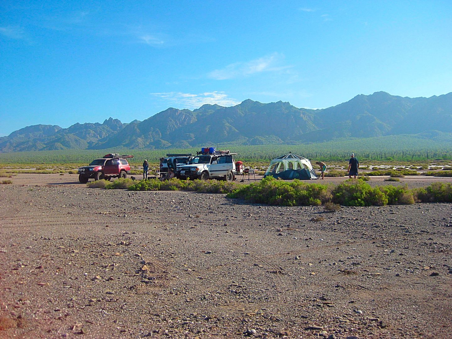
Mile 19.4, reach a salt flat-like area near Punta Amolares. We camped near here about midnight
Mile 25 End of the road for us, a "grand canyon" gully stops us about 11pm+
We estimate we are about 7-8 miles short of our goal, a sandy beach called either "Santo Domingo" or "Los Hornitos" on maps. The manganese mine road
is a mile south of that beach.
We head back south to find a suitable place to set up our tents and get some needed rest. We go back south 5.6 miles and find a big flat near a gravel
beach, and all is good at Punta Amolares.
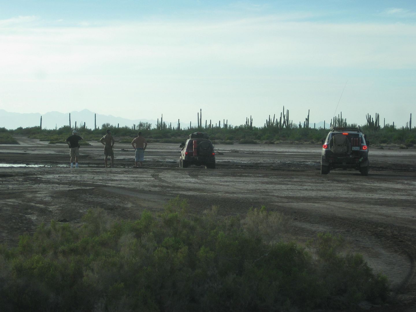
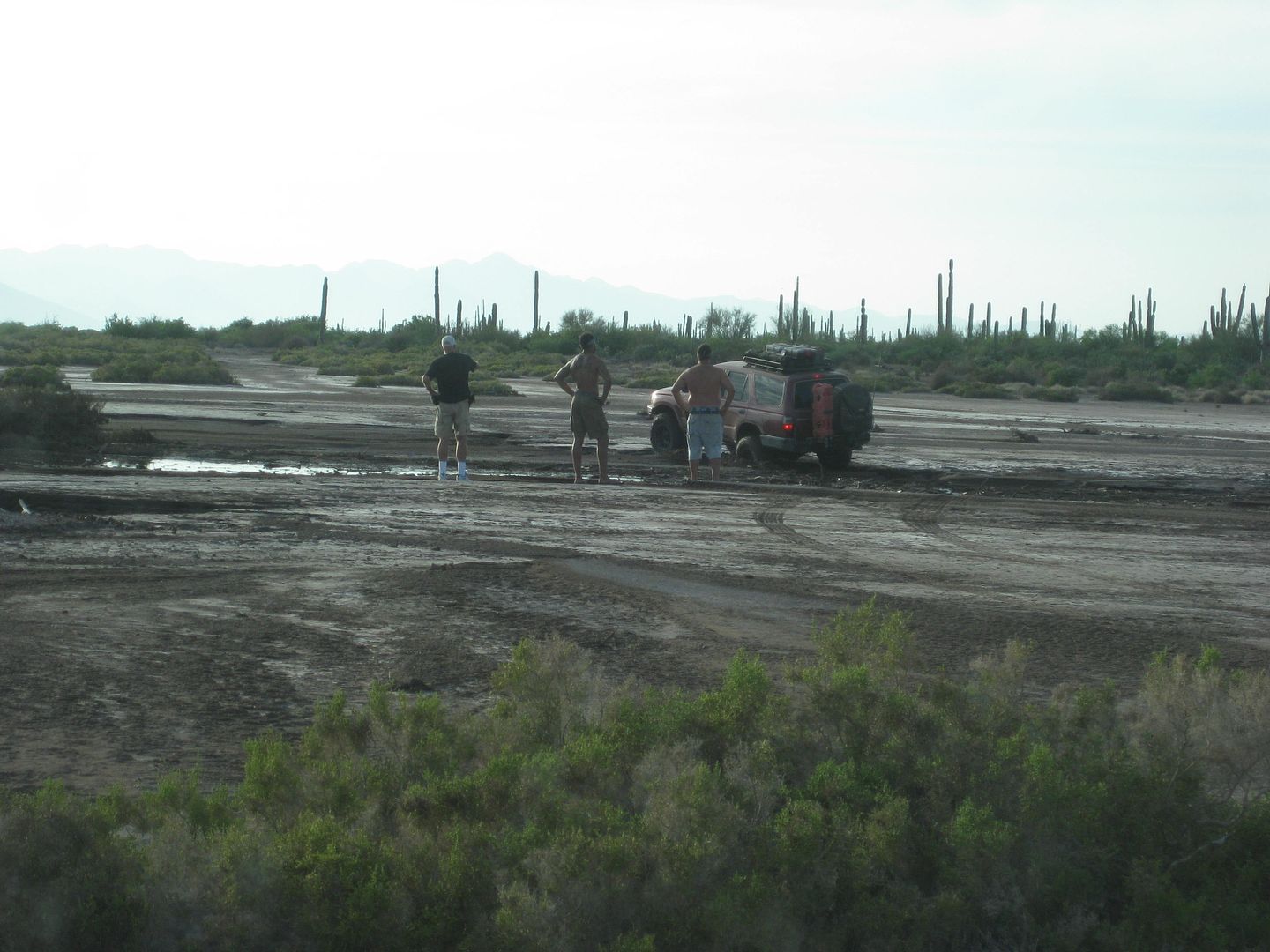
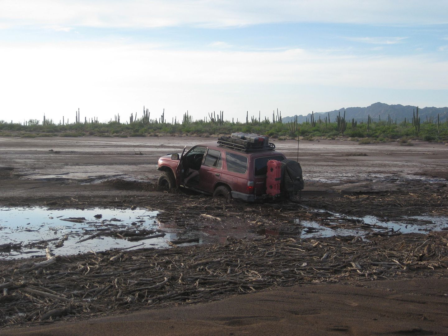
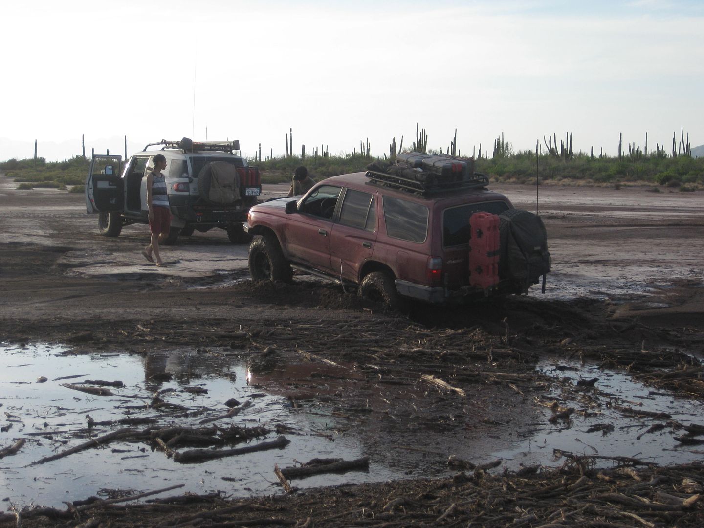
The rest of us went a bit more to the right and had no problem on this mud flat.
|
|
|
David K
Honored Nomad
Posts: 64486
Registered: 8-30-2002
Location: San Diego County
Member Is Offline
Mood: Have Baja Fever
|
|
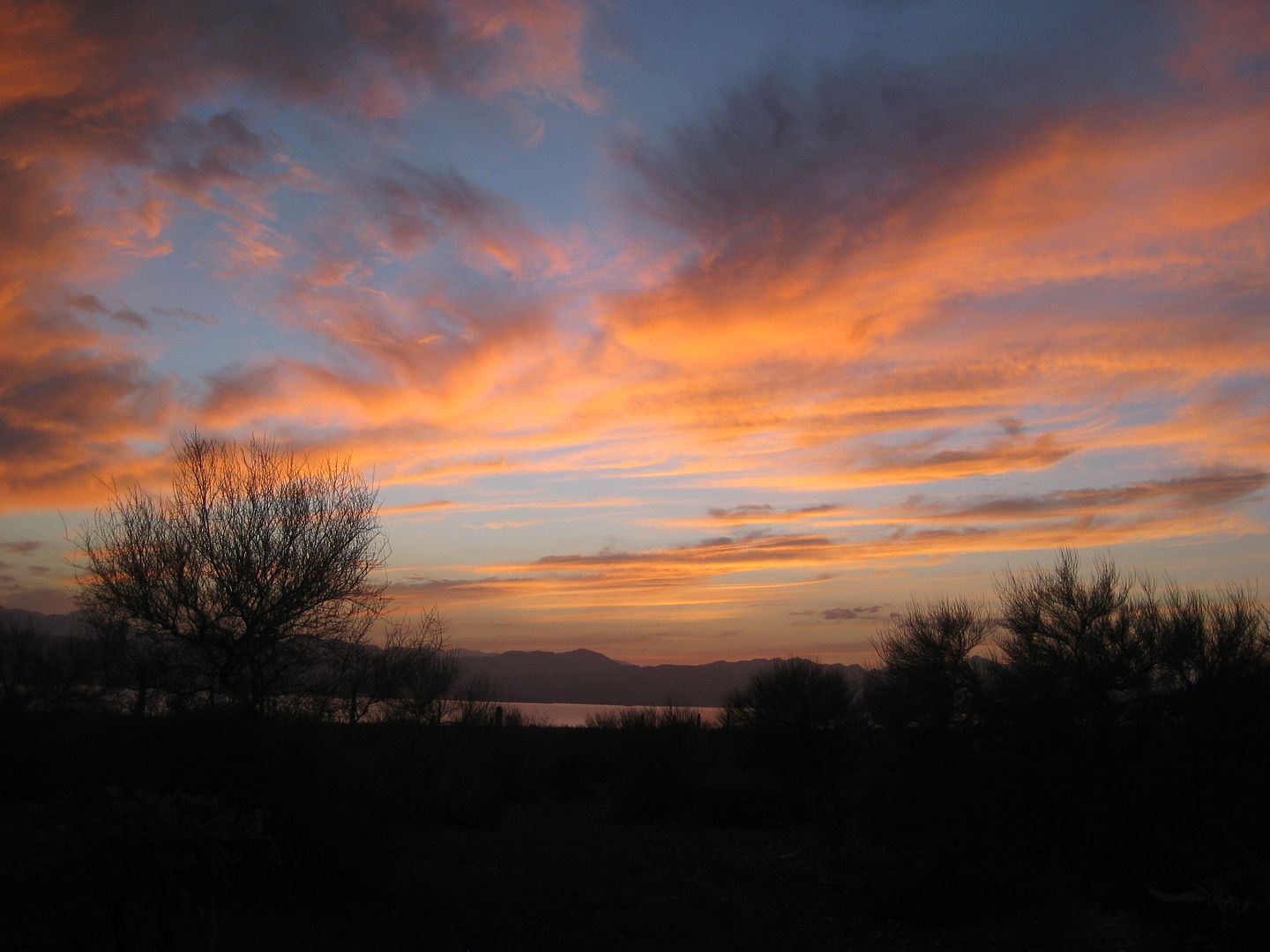
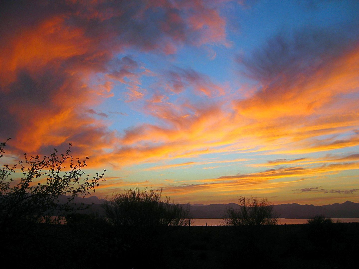
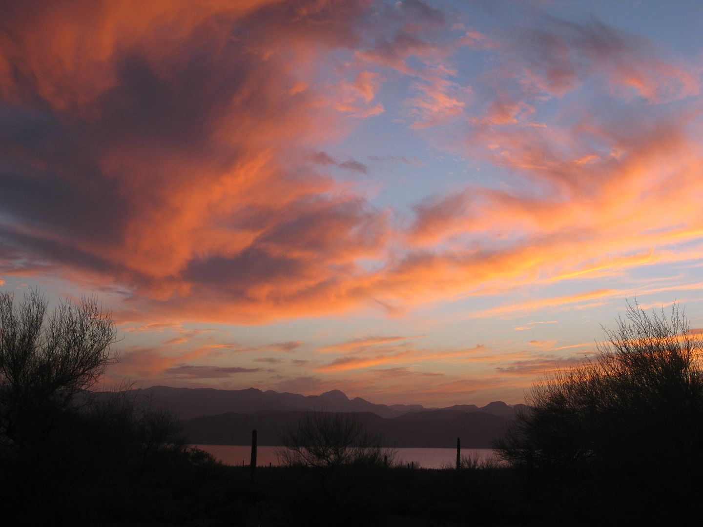
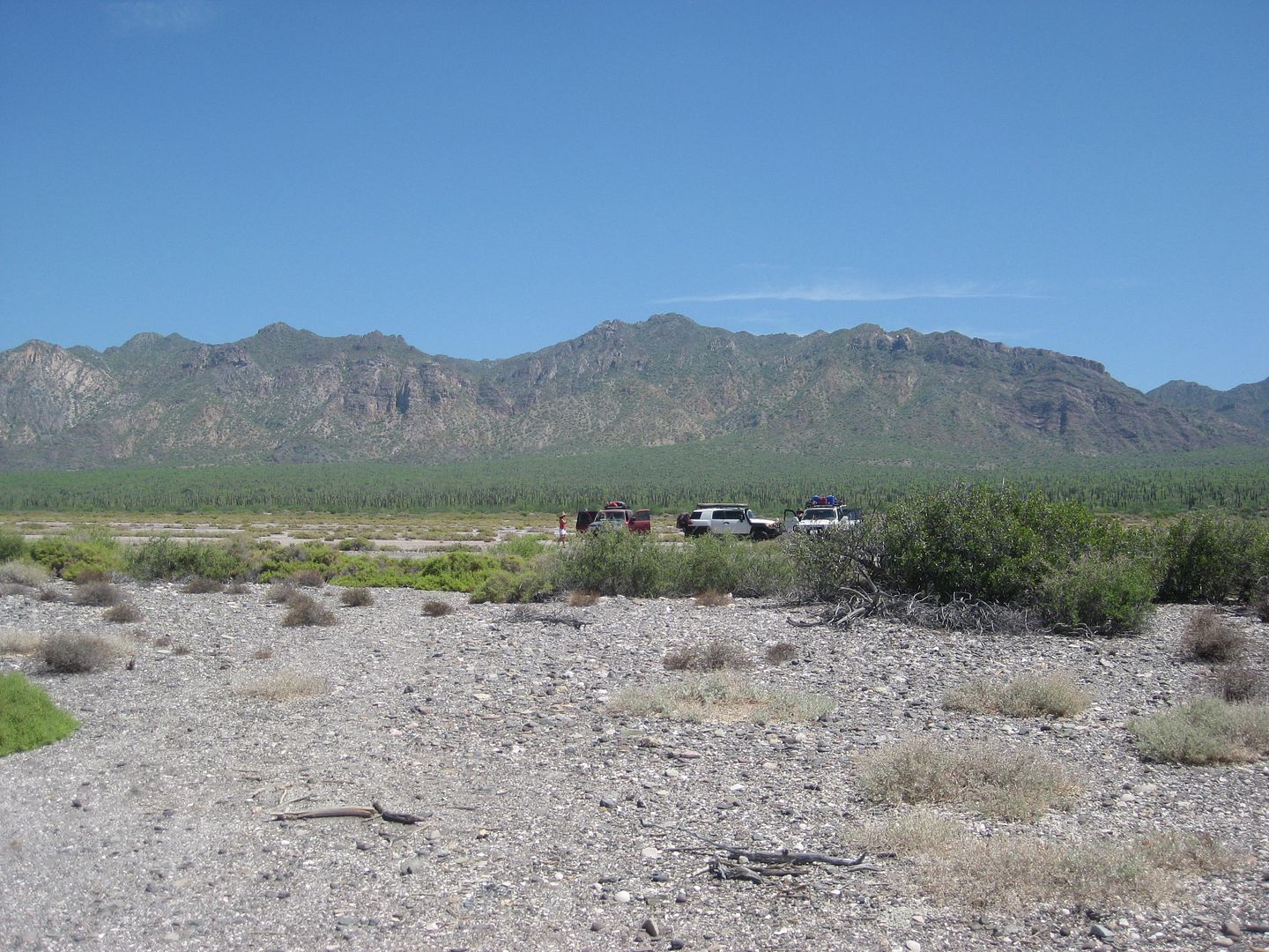
We are camped on a salt flat-like area not far from the shore of the bay... a narrow line of low shrub is all that is between us and the water, a few
hundred feet away. Chef Jesse makes us an egg, bacon, and cheese scramble which we devoured with pleasure! It was a long, tough night drive so we were
not in any hurry to get up, and the breakfast was greatly appreciated. My passenger, Pat, likes fresh-brewed coffee and I have my camp stove set up
each morning for him to percolate a pot. He has brought Starbucks, and it was quite good even for me as a not so big coffee drinker.
We all walk to the shore and Nick goes snorkeling in the warm water. A puffer fish calmly swims to us (see it in Ham's video). We are finally heading
back south at 12:45pm heading back. I should mention that the road north of Amorales (where we camped) is very overgrown and not been used in ages
except perhaps for motorcycles! All of us got tons of "Baja pin stripes" last night! In the video, you can see the brush lit by Ham's amber lamps that
we drove through, twice. [I got my truck 'clayed' in a detail job two days ago to remove the scratches. Only one was too deep to rub out.]
In my notes, I note that we passed through a fence gate 4.8 miles southbound from camp at 1:21 pm (closing it after we all pass through, of course).
We pass a Ford Courier or Ranger truck coming north on the road driven by a rancher, friendly waves are exchanged... and we admire that his truck is
2WD and travels frequently on what we would call a 4WD only road... LOL!
We reach the Arroyo los Pintados 'road' at Mile 10.4 from camp... and there are no tracks, just the arroyo north of the Three Musketeer cardón cacti.
There is a fork in the wash in 0.7 mile and I take the left branch (which was correct for the painted cliff), but the wash route becomes difficult and
we turn around after 0.4 mile and head for the right branch... and sure enough I see tire ruts, so we think we are on the correct route. I did not
have the GPS for the painted cliff, and was just winging it. Where we ended up going was fascinating and proves that in Baja, all roads go someplace
interesting!
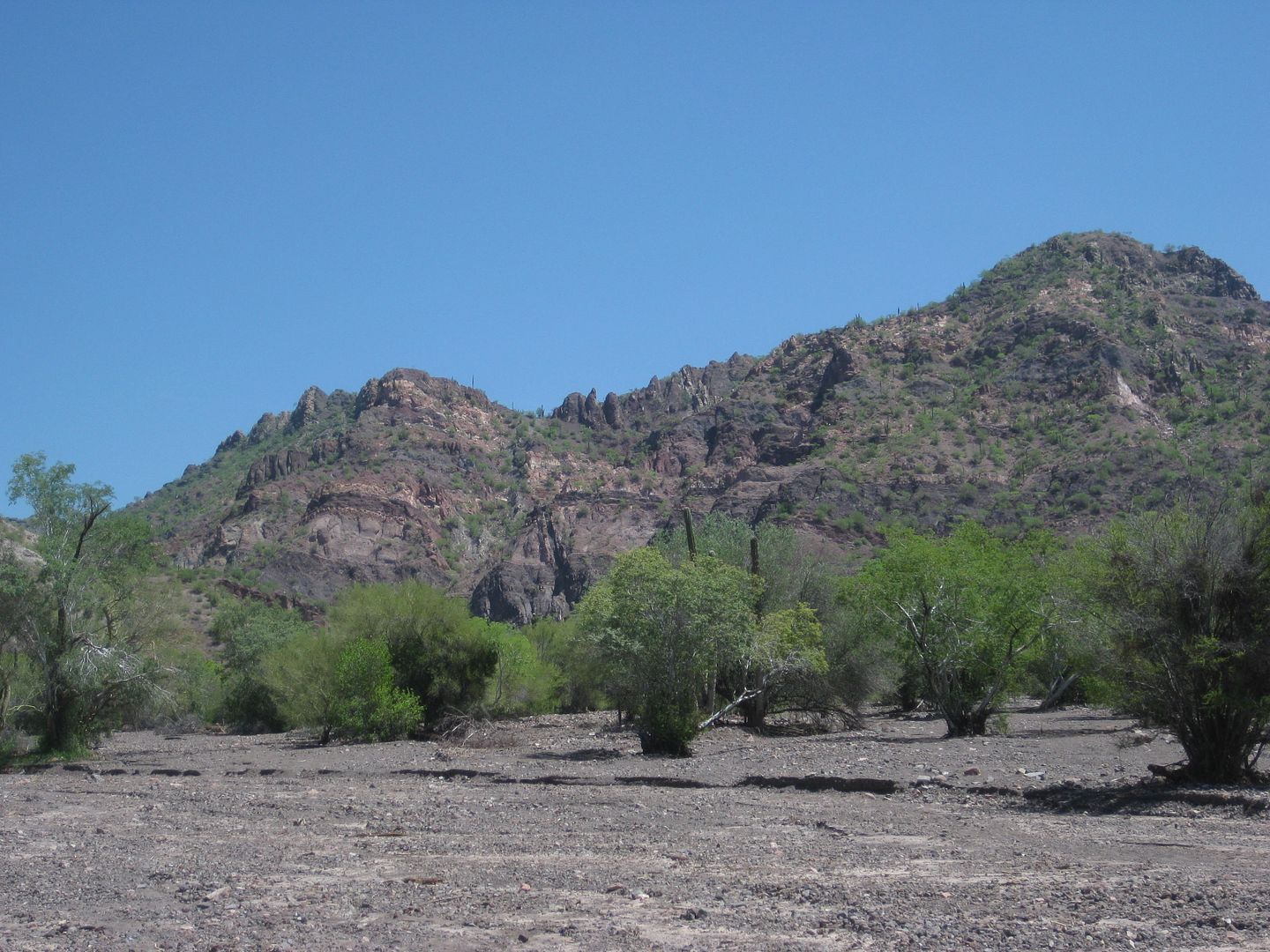
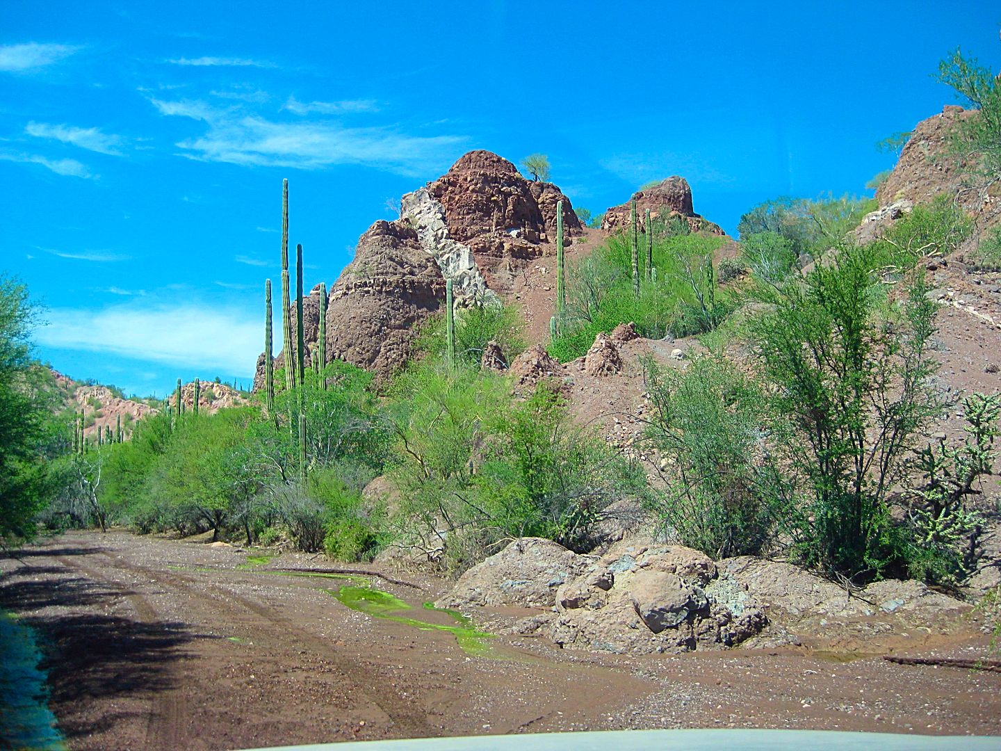
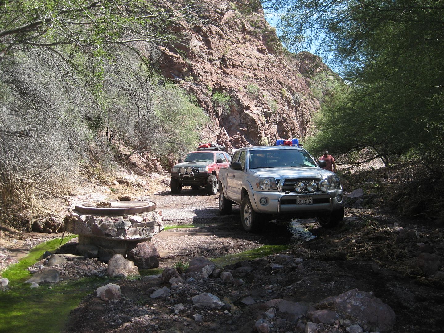
Well, the right branch road climbs out of the arroyo and there is a steep down-and-up gully. Nick is lead rig and it takes him a few tries... we toss
in some rocks to help us bigger vehicles not bottom-out the rear end. We drop into another arroyo (Tres Marías) and go up it and soon are in a
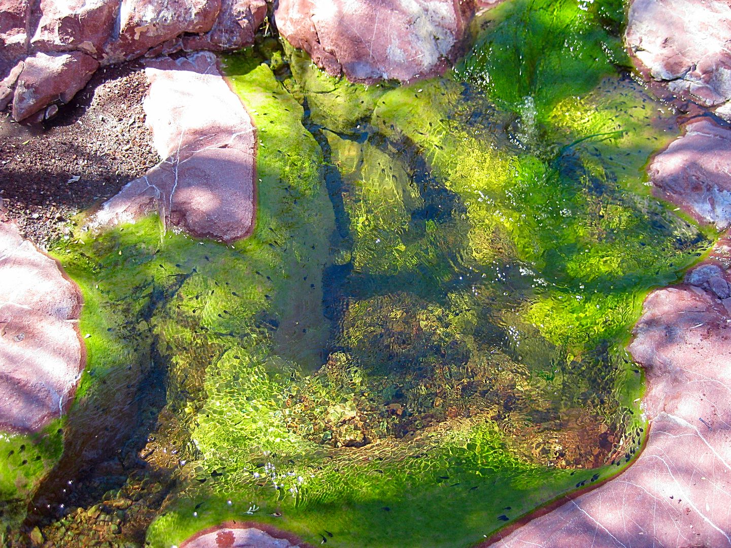
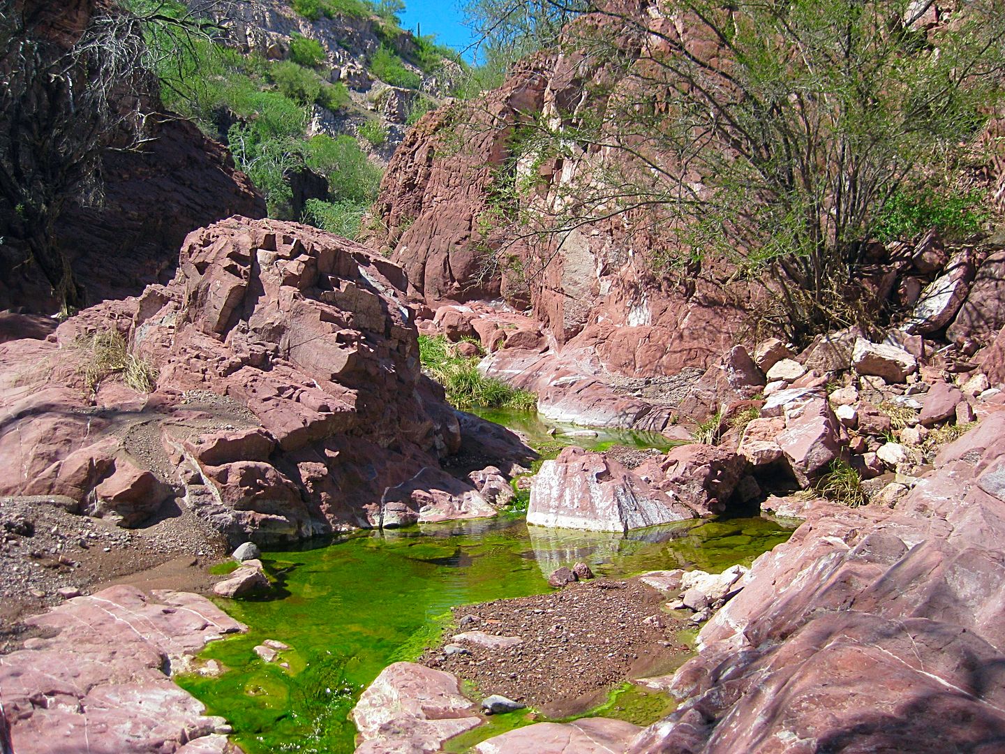
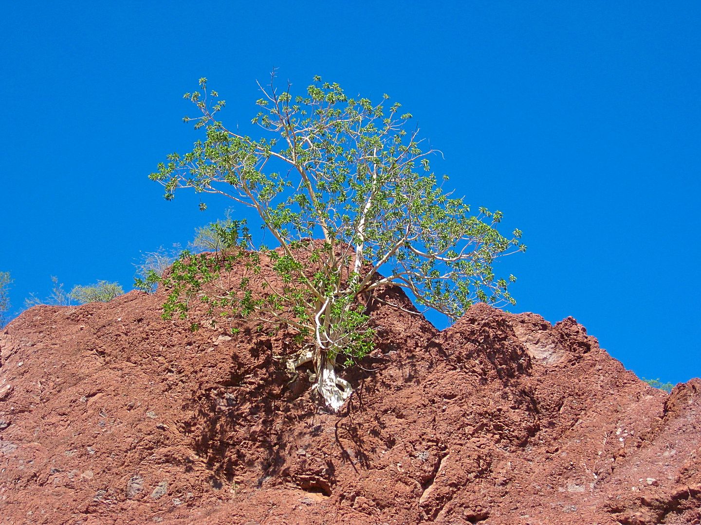
running stream! I love seeing water in the desert and it shows you (if you get away from main roads and into the backcountry) how the Indians could
survive in an otherwise waterless land.
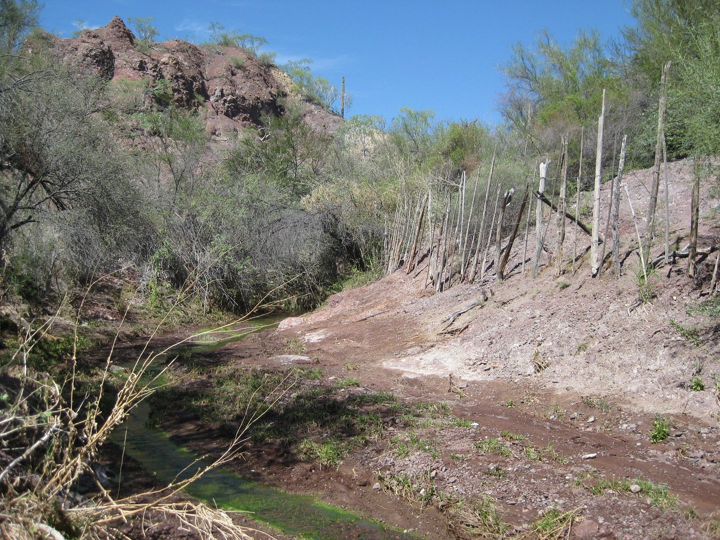
Where the canyon narrows and further driving is halted we see what looks like a man-hole plate on top of a well, a few feet higher than the arroyo
floor. There is a concrete foundation on the side of the arroyo and just ahead is a side ravine (that the water is coming from) with a fence along the
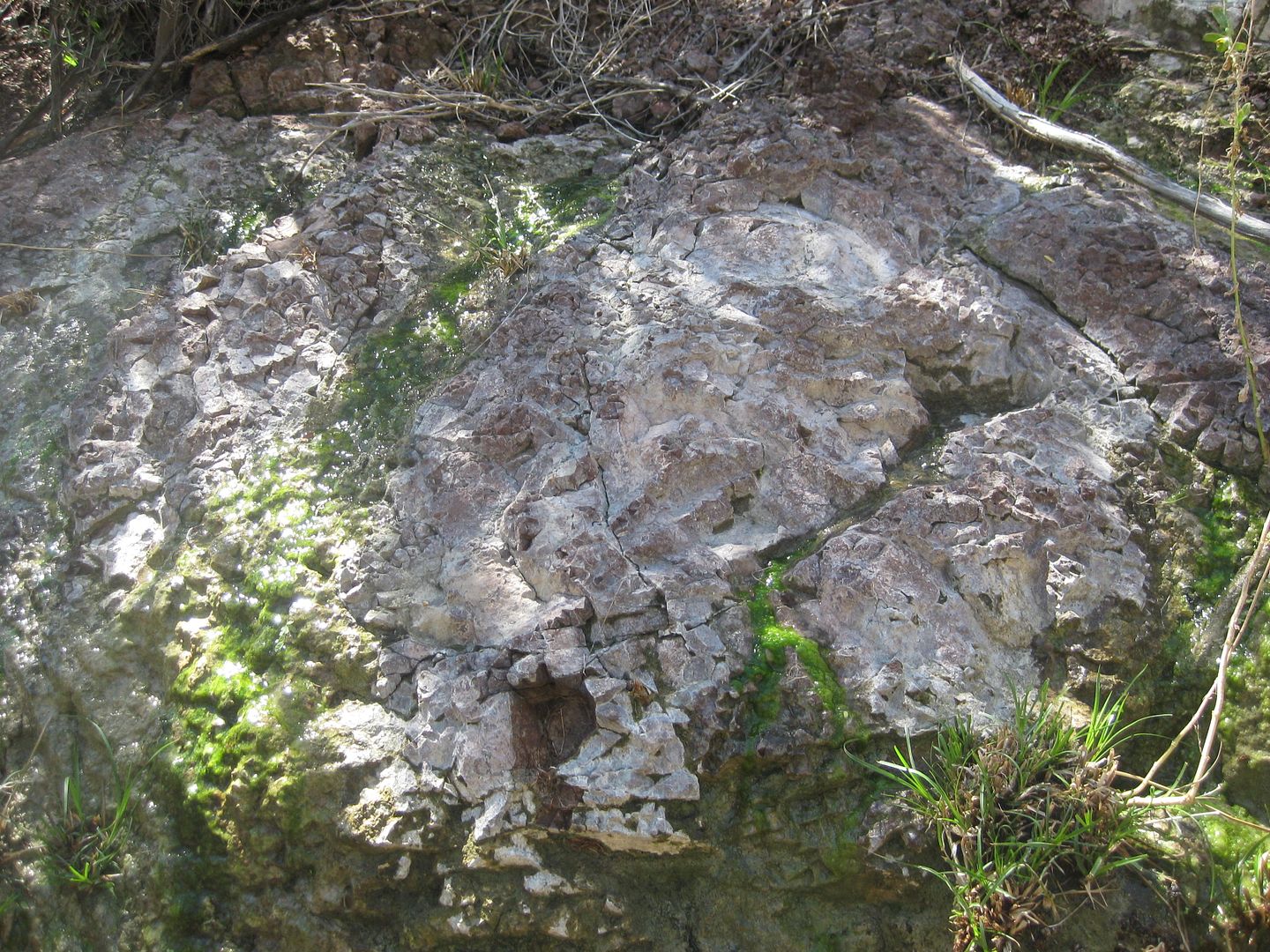
side of the slope... very odd? We walk to see where the water is pouring out of solid rock and it is an amazing place (to me)!
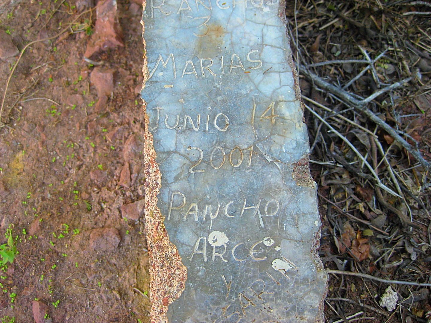
Investigating the concrete foundation, we read it is from 'Pancho Arce, June 14, 2001' and this is (was) 'Rancho Tres Marías'. We are about 4 miles
from the bay shore road (it seems a lot longer).
Coming back, Ham spots an old road that will allow us to avoid the deep gully and we turn left out of Arroyo Tres Marías and cross over to Arroyo
Luis (on the Almanac map). Ham had spent weeks downloading GoogleEarth images of the area of Baja we hoped to see and had a screen in his FJ with the
GPS of his truck and that is how he found the cut across road! We reached the bay shore road about 5 miles from Rancho Tres Marías site. We were back
at Highway One in 7.2 more miles, on the same road we took the day before.
Before I get into the next part of Day 6 (Campo La Perla), here are maps and photos...
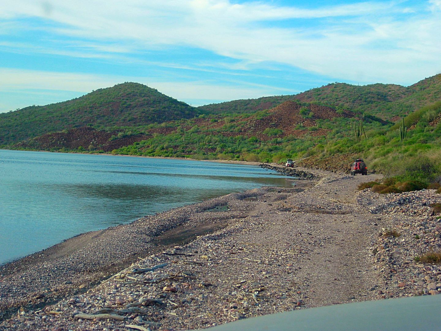
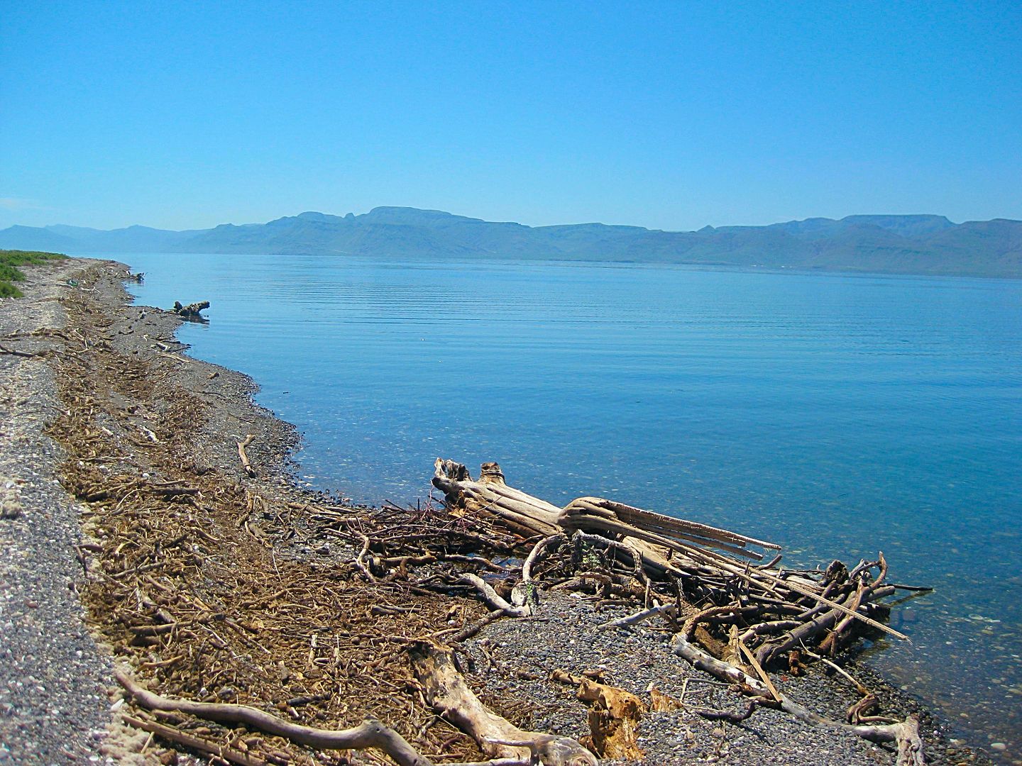
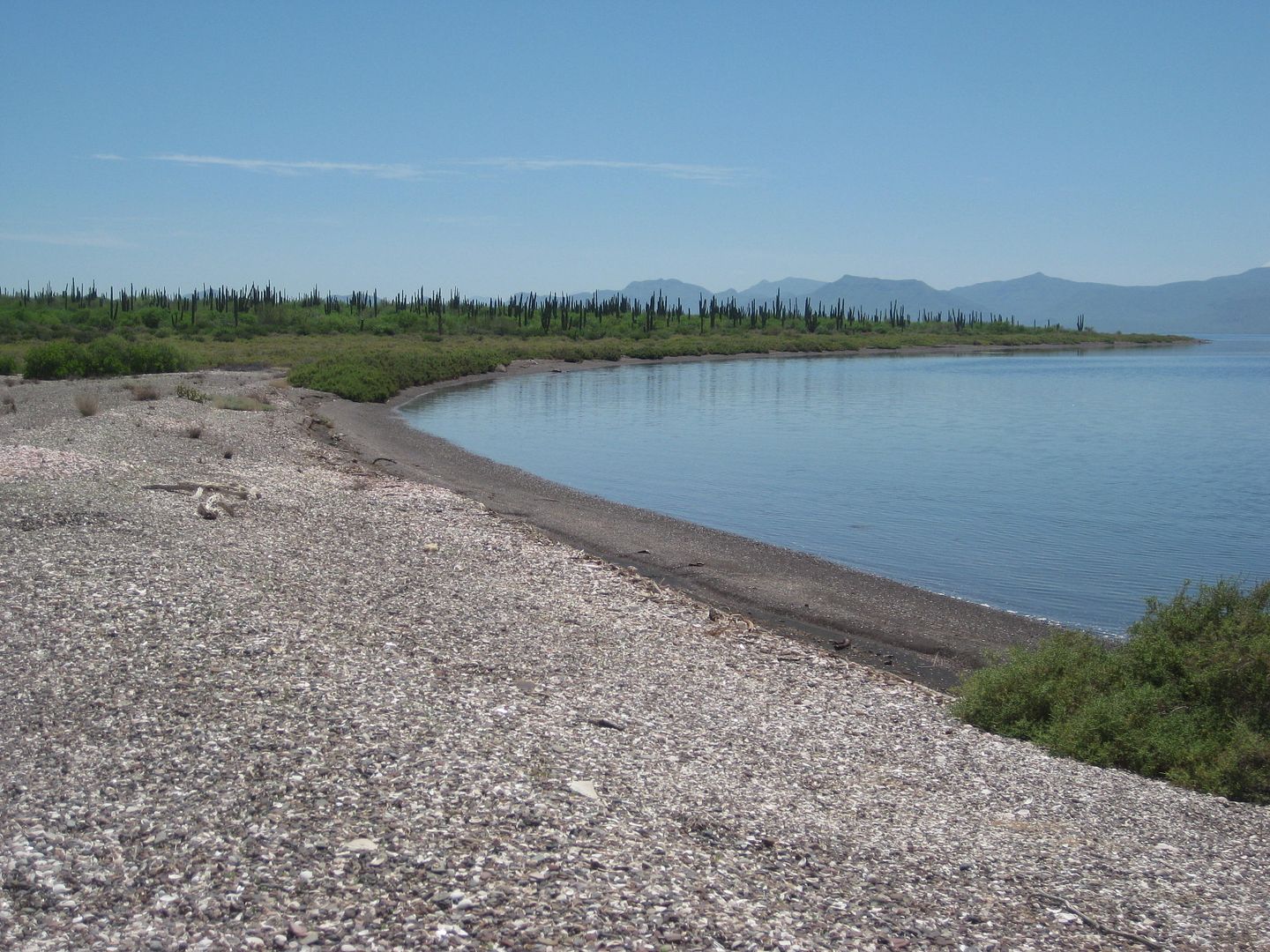
The beach at Punta Amolares:
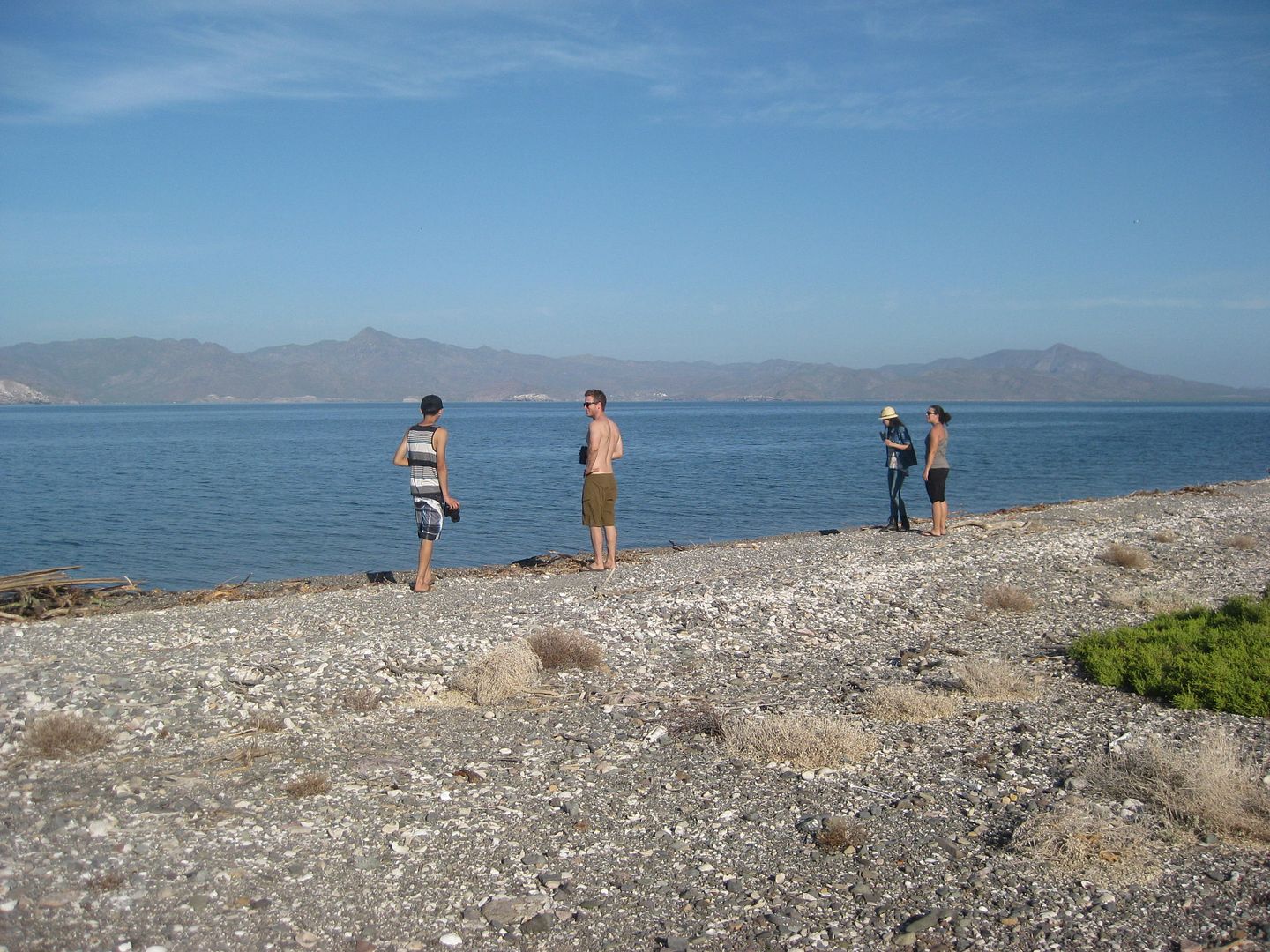
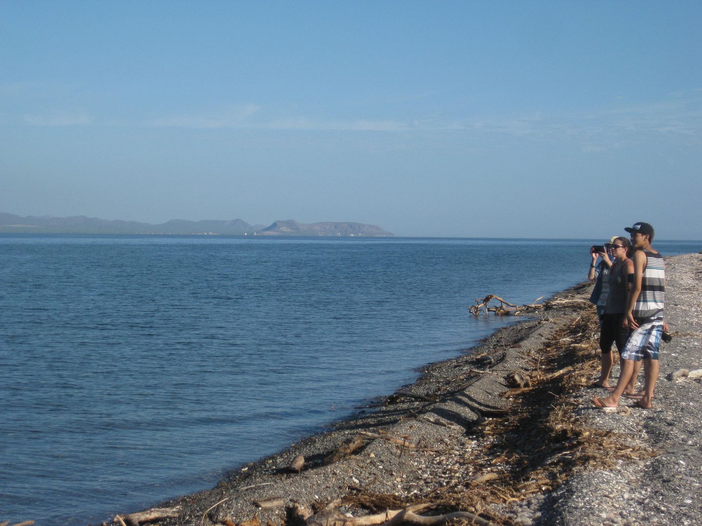
Looking across the bay:
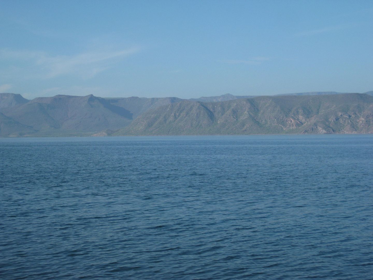
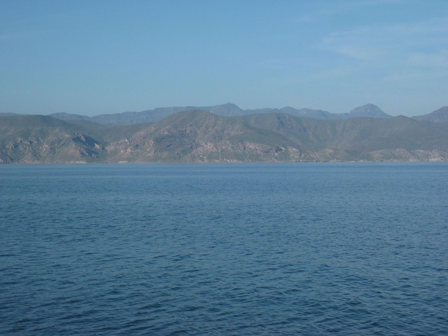
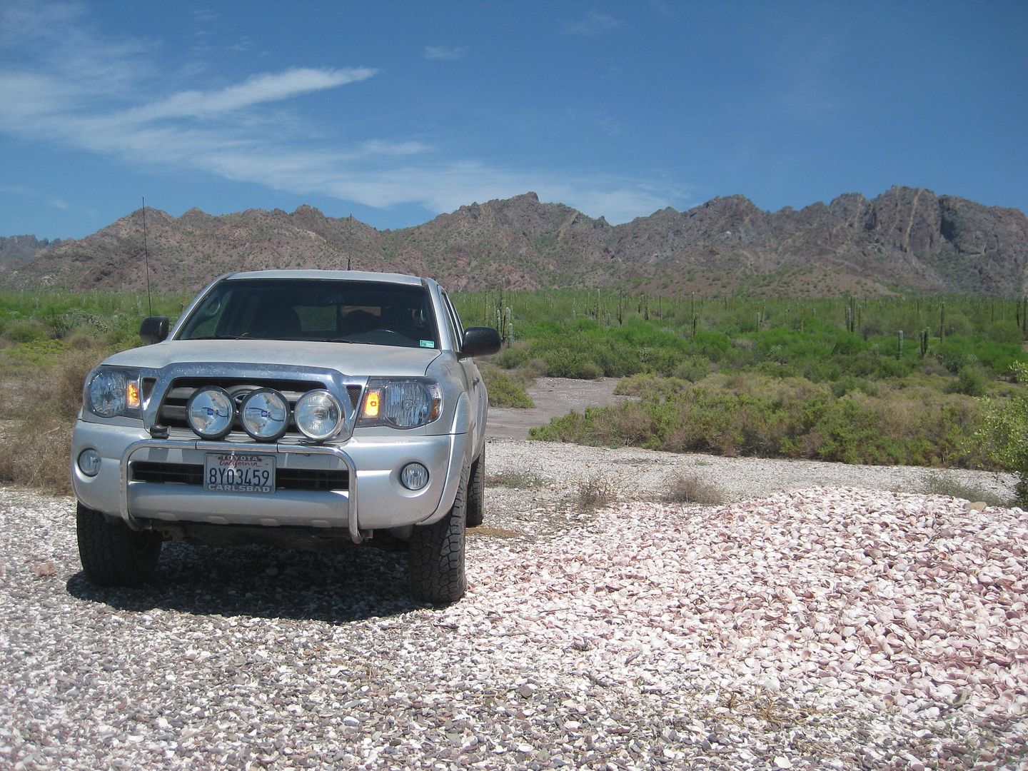
Our camp:
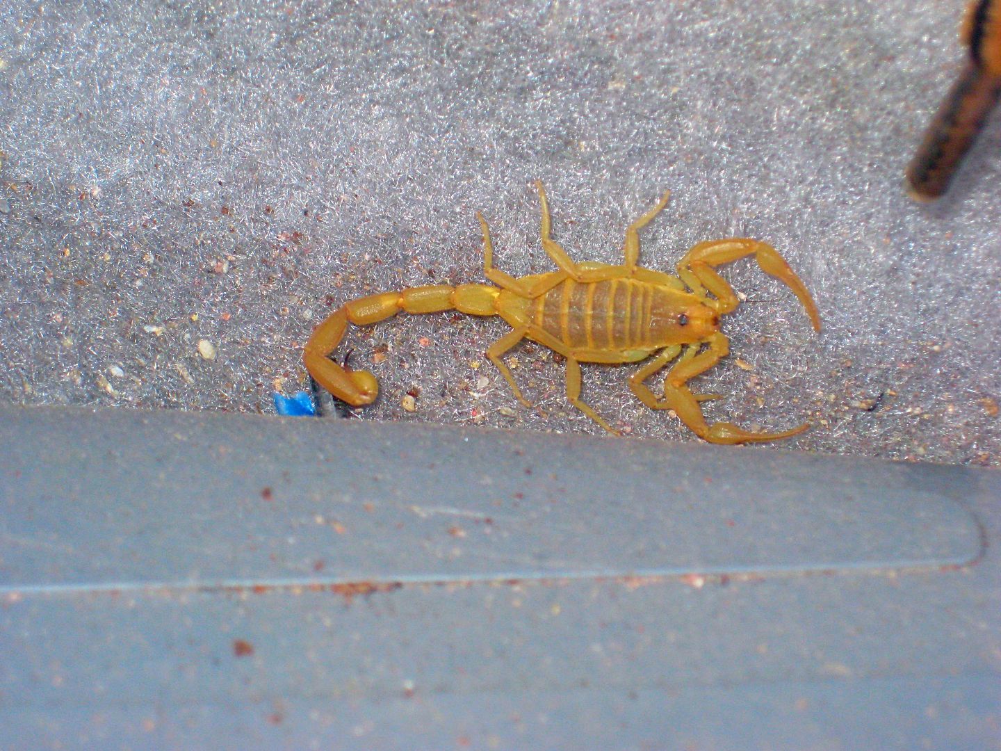
A surprise INSIDE my truck!!!
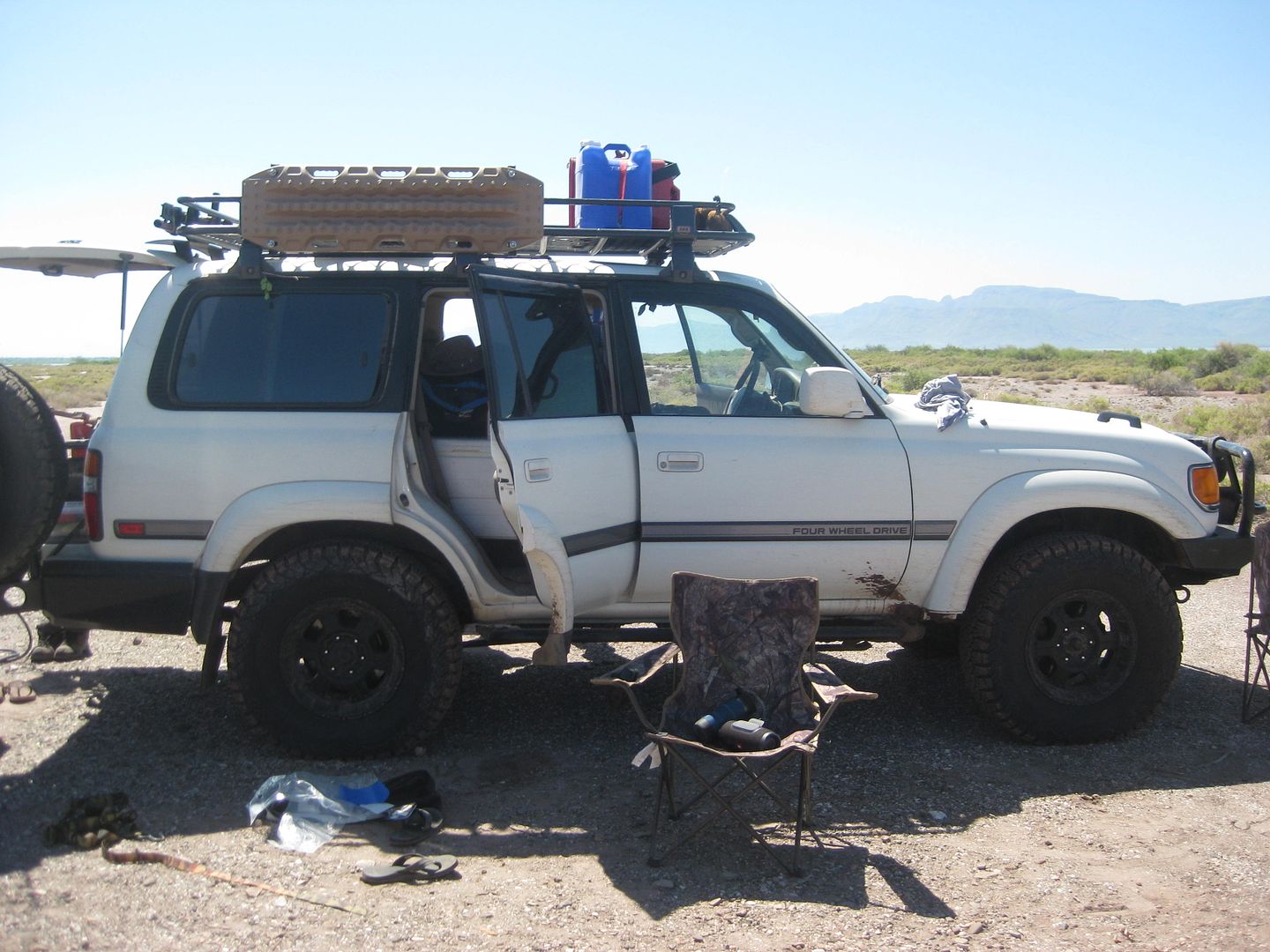
Jesse's Land Cruiser:
One more walk to the water...
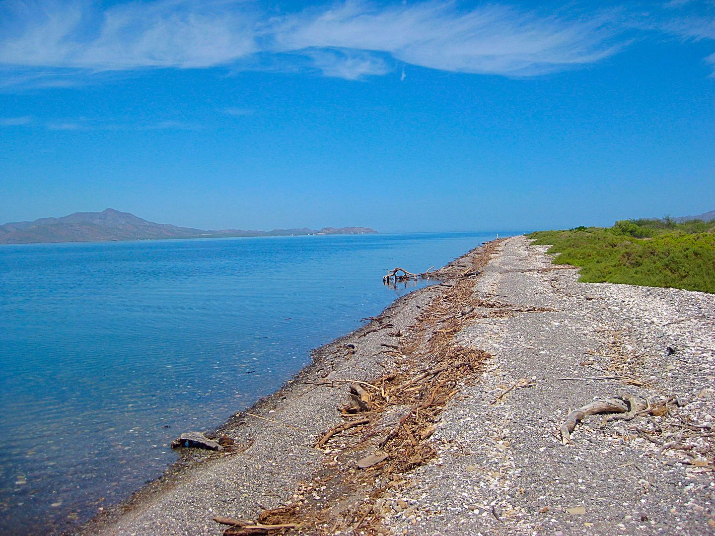
Our camp from the near the water...
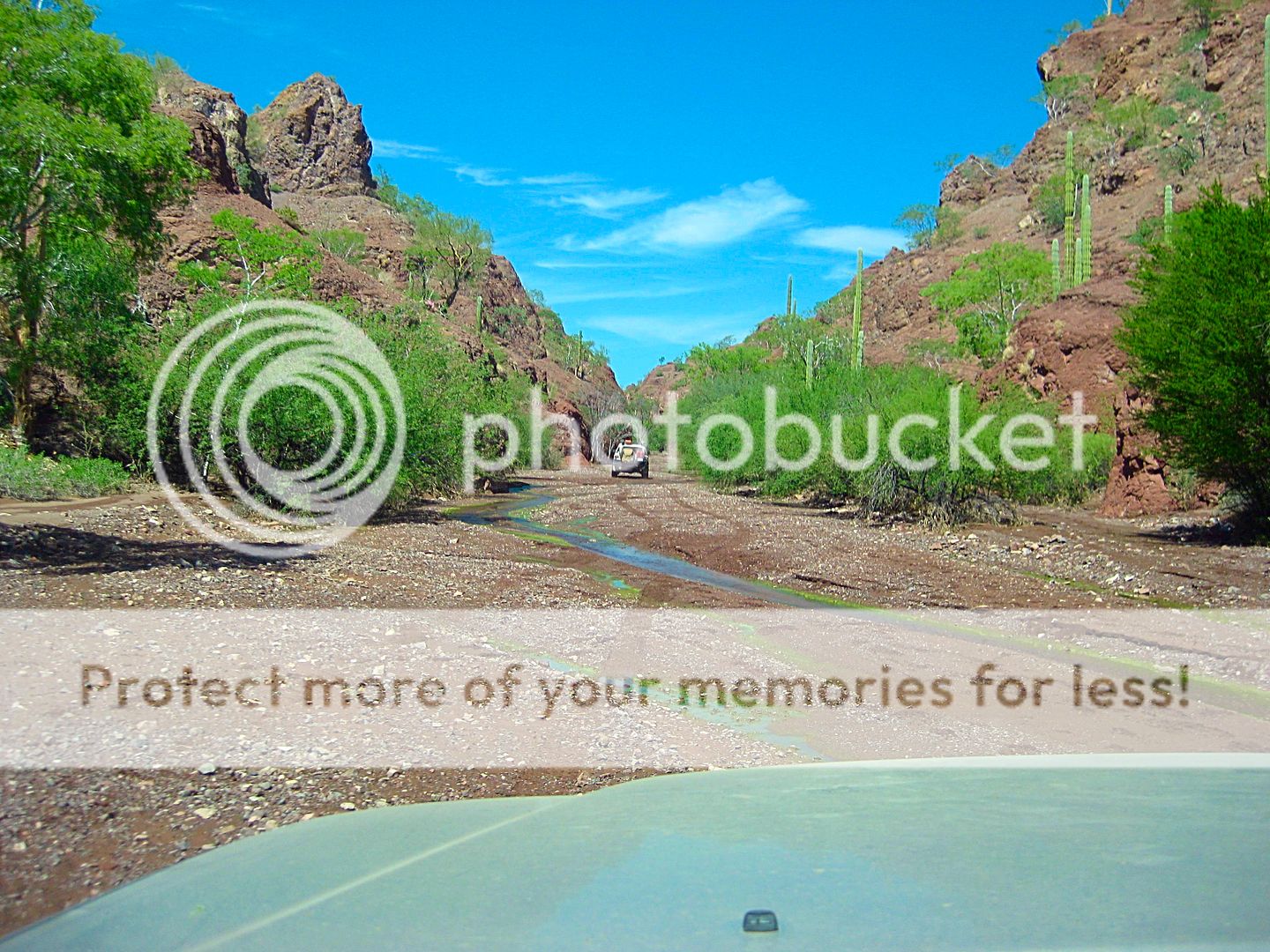
The drive back south...
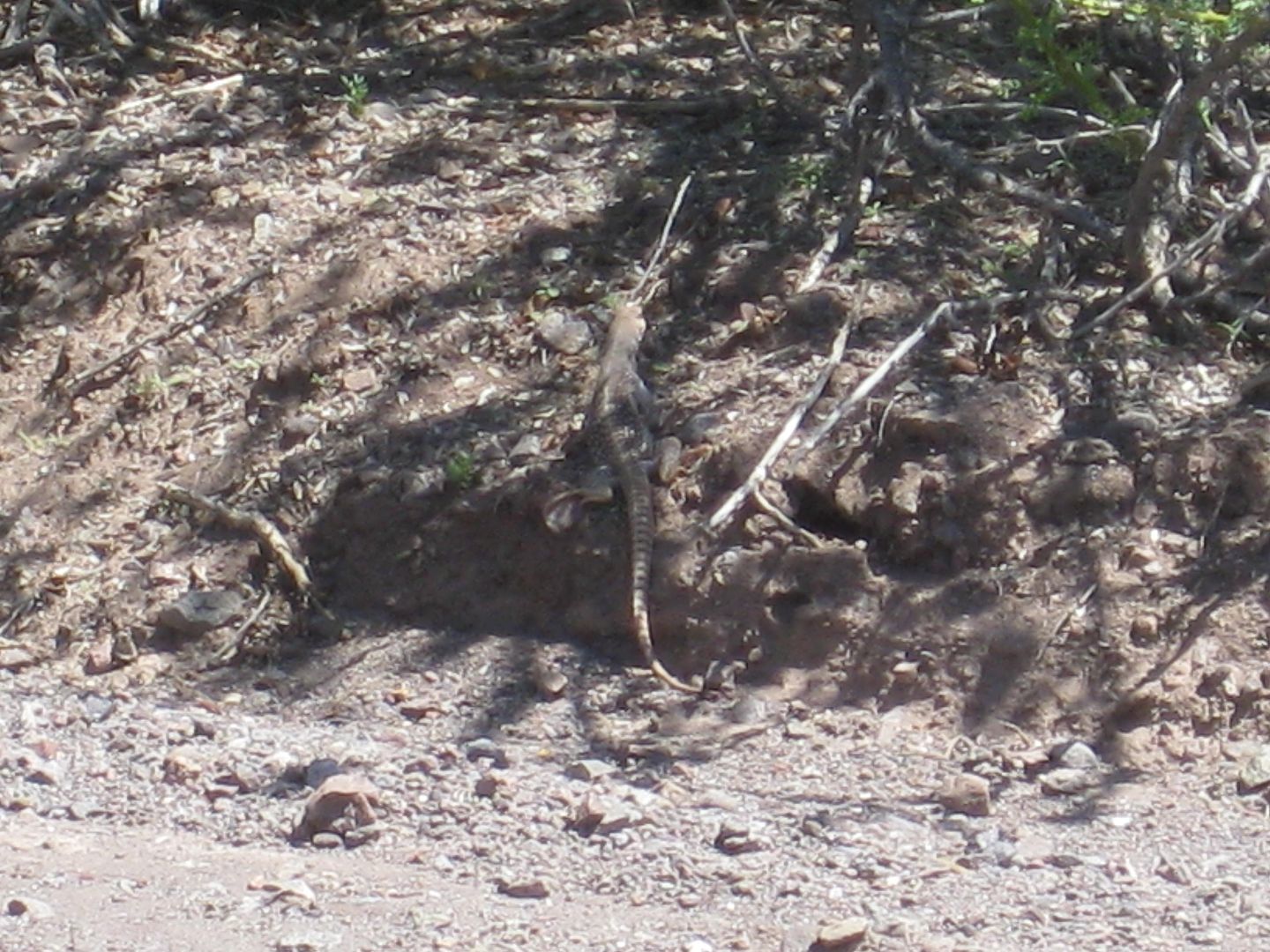
Big lizard...
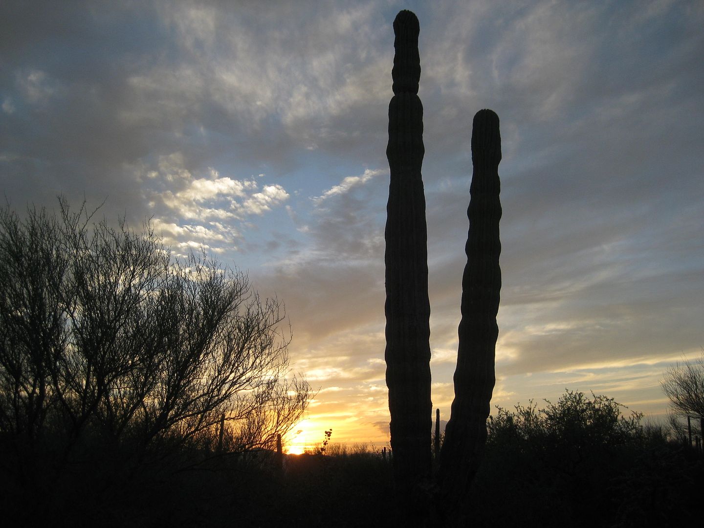
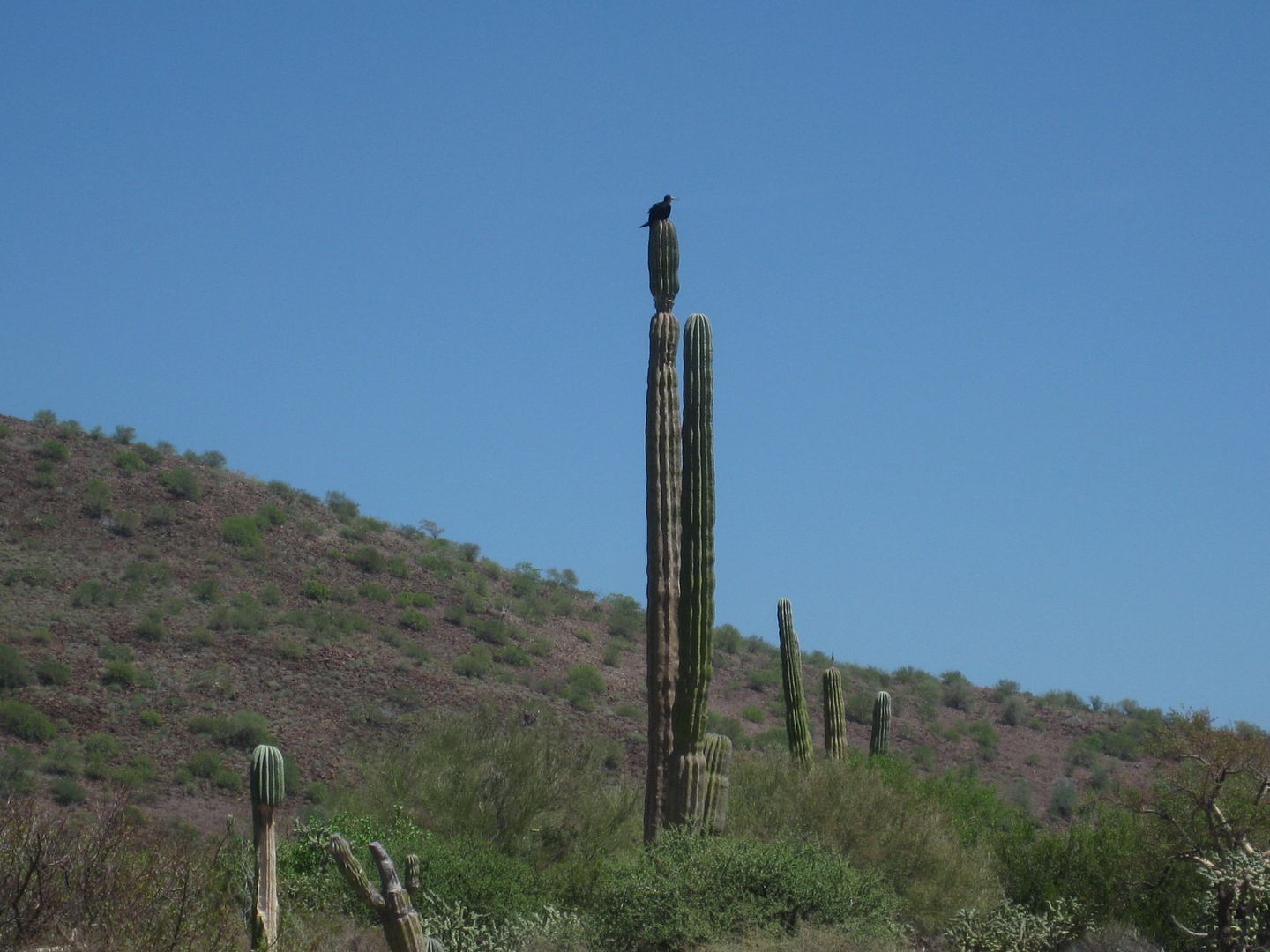
Osprey on cardón:
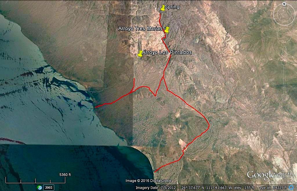
Arroyo Tres Marías:
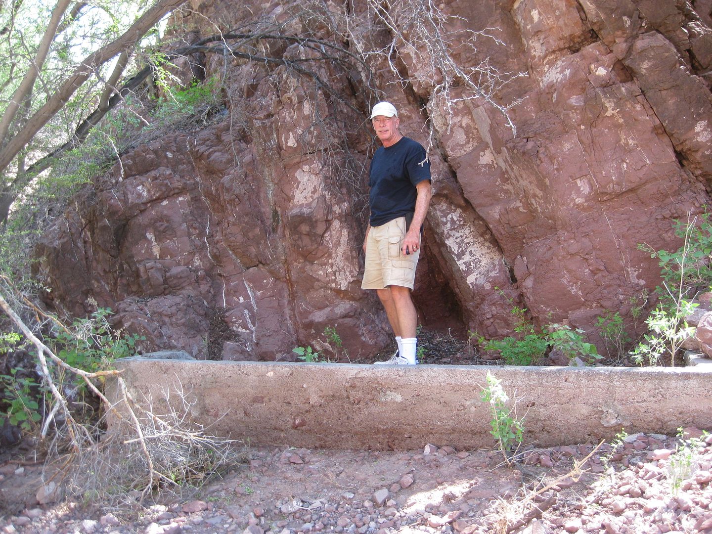
Pat on the foundation.
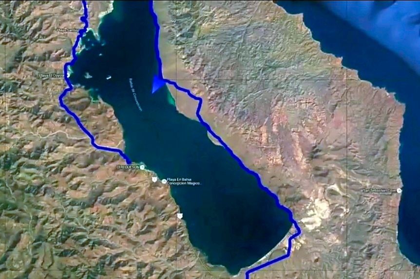
MAPS:
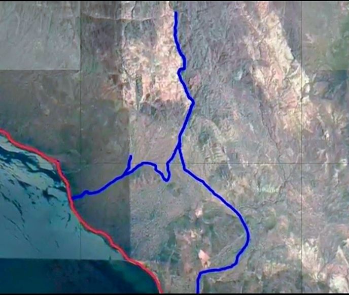
Ham's GPS track. Note the short left fork, which was the correct direction for Los Pintados.
I traced the roads on GE, where we returned to the bay shore road was just south of the road I traced.
Red arrows for drive in and blue for drive out.
|
|
|
Geo_Skip
Nomad
Posts: 154
Registered: 5-15-2009
Location: Alta California and......../
Member Is Offline
|
|
Thanks rockman for your accurate info.
Manganese was used to harden steel. Not all steel needs hardening (becomes brittle) but in war many alloys are used.
In fact manganese ore deposits are not especially rare. A manganese mine operated in WWII in Sausalito, California in the Bay Area.
|
|
|
defrag4
Senior Nomad
Posts: 536
Registered: 2-5-2011
Member Is Offline
|
|
| Quote: Originally posted by David K | We are camped on a salt flat-like area not far from the shore of the bay... a narrow line of low shrub is all that is between us and the water, a few
hundred feet away. Chef Jesse makes us an egg, bacon, and cheese scramble which we devoured with pleasure! It was a long, tough night drive so we were
not in any hurry to get up, and the breakfast was greatly appreciated. My passenger, Pat, likes fresh-brewed coffee and I have my camp stove set up
each morning for him to percolate a pot. He has brought Starbucks, and it was quite good even for me as a not so big coffee drinker.
We all walk to the shore and Nick goes snorkeling in the warm water. A puffer fish calmly swims to us (see it in Ham's video). We are finally heading
back south at 12:45pm heading back. I should mention that the road north of Amorales (where we camped) is very overgrown and not been used in ages
except perhaps for motorcycles! All of us got tons of "Baja pin stripes" last night! In the video, you can see the brush lit by Ham's amber lamps that
we drove through, twice. [I got my truck 'clayed' in a detail job two days ago to remove the scratches. Only one was too deep to rub out.]
In my notes, I note that we passed through a fence gate 4.8 miles southbound from camp at 1:21 pm (closing it after we all pass through, of course).
We pass a Ford Courier or Ranger truck coming north on the road driven by a rancher, friendly waves are exchanged... and we admire that his truck is
2WD and travels frequently on what we would call a 4WD only road... LOL!
We reach the Arroyo los Pintados 'road' at Mile 10.4 from camp... and there are no tracks, just the arroyo north of the Three Musketeer cardón cacti.
There is a fork in the wash in 0.7 mile and I take the left branch (which was correct for the painted cliff), but the wash route becomes difficult and
we turn around after 0.4 mile and head for the right branch... and sure enough I see tire ruts, so we think we are on the correct route. I did not
have the GPS for the painted cliff, and was just winging it. Where we ended up going was fascinating and proves that in Baja, all roads go someplace
interesting!
Well, the right branch road climbs out of the arroyo and there is a steep down-and-up gully. Nick is lead rig and it takes him a few tries... we toss
in some rocks to help us bigger vehicles not bottom-out the rear end. We drop into another arroyo (Tres Marías) and go up it and soon are in a
running stream! I love seeing water in the desert and it shows you (if you get away from main roads and into the backcountry) how the Indians could
survive in an otherwise waterless land.
Where the canyon narrows and further driving is halted we see what looks like a man-hole plate on top of a well, a few feet higher than the arroyo
floor. There is a concrete foundation on the side of the arroyo and just ahead is a side ravine (that the water is coming from) with a fence along the
side of the slope... very odd? We walk to see where the water is pouring out of solid rock and it is an amazing place (to me)!
Investigating the concrete foundation, we read it is from 'Pancho Arce, June 14, 2001' and this is (was) 'Rancho Tres Marías'. We are about 4 miles
from the bay shore road (it seems a lot longer).
Coming back, Ham spots an old road that will allow us to avoid the deep gully and we turn left out of Arroyo Tres Marías and cross over to Arroyo
Luis (on the Almanac map). Ham had spent weeks downloading GoogleEarth images of the area of Baja we hoped to see and had a screen in his FJ with the
GPS of his truck and that is how he found the cut across road! We reached the bay shore road about 5 miles from Rancho Tres Marías site. We were back
at Highway One in 7.2 more miles, on the same road we took the day before.
Before I get into the next part of Day 6 (Campo La Perla), here are maps and photos...
The beach at Punta Amolares:
|
looks like a fun trip to some beautiful remote spots, how did that 4runner get out of the mudhole haha, those salty mudpits can suck!
|
|
|
David K
Honored Nomad
Posts: 64486
Registered: 8-30-2002
Location: San Diego County
Member Is Offline
Mood: Have Baja Fever
|
|
We gave him a pull. It was just too aggressive a crossing point. The rest of us drove around easily.
[Edited on 3-13-2019 by David K]
|
|
|
| Pages:
1
2 |
|