| Pages:
1
2
3
4
5 |
willardguy
Elite Nomad

Posts: 6451
Registered: 9-19-2009
Member Is Offline
|
|
larry, whats the deal with the mules, are they necessary?
|
|
|
larryC
Super Nomad
Posts: 1482
Registered: 8-11-2008
Location: BoLA
Member Is Offline
|
|
Theree is no water up there, no food, and no hotel to sleep in, so you have to carry everything you need in with you. On top of that to get there is
almost straight up for about 6 hours. I wasn't blessed with a hikers body so I need all the help I can get. Pack animals are worth their weight in
gold up there.
|
|
|
David K
Honored Nomad
Posts: 64480
Registered: 8-30-2002
Location: San Diego County
Member Is Offline
Mood: Have Baja Fever
|
|
Yah, Larry... a few years ago Neal Johns and others started to drive to San Juan from the road to San Gregorio (from San Borja). They only didn't go
all the way because one got a flat in a bad place, and they were running low on time (they had arranged with Jose at San Borja for a mule trip to El
Aguaje on the Golfo Camino Real)... Photos at http://vivabaja.com/neal
So is it no longer possible to drive a Toyota or Jeep to San Juan, if you know?
I will repost the Google Earth images of San Juan and the Las Flores railroad line.
|
|
|
willardguy
Elite Nomad
Posts: 6451
Registered: 9-19-2009
Member Is Offline
|
|
gotcha. ah,umm, can,t wait to see the pictures!
|
|
|
David K
Honored Nomad
Posts: 64480
Registered: 8-30-2002
Location: San Diego County
Member Is Offline
Mood: Have Baja Fever
|
|
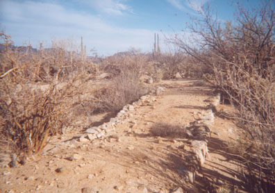
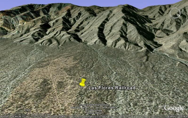
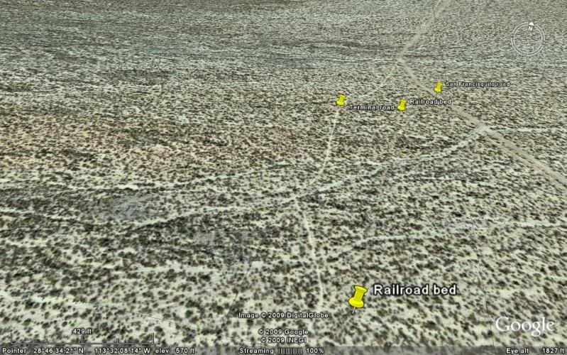
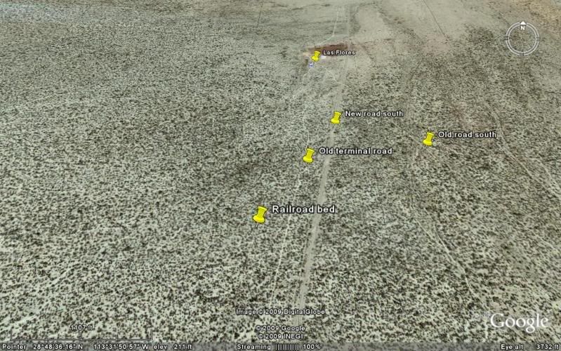
Las Flores & San Juan Mine Railroad (1895-1910)
The railroad line runs 5.4 miles from the ruins of Las Flores (south of Bahia de los Angeles) to the bottom of El Terminal canyon where a cable bucket
tram line brought the ore down from the San Juan mines high atop the sierra.
Here is the railroad bed at Las Flores heading south...
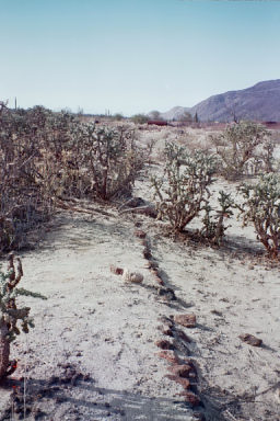
========================================================
Here is the railroad bed near the terminal (south end)...
=======================================================
As the railroad approaches the terminal platform, the line is elevated via this ...
=========================================================
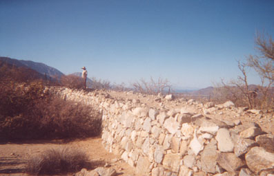
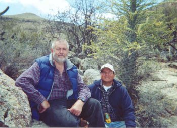
Here is the terminal platform where Dr. Abraham Vasquez ('Doc' of Camp Gecko) shows me where giant wheels were once mounted at the bottom of the cable
tram line. Here the ore was dumped into train cars for the trip north to Las Flores where the ore was processed...

======================================================
Doc and I pose by one of the tram tower timbers as we hike up the canyon...

======================================================
One of the ore buckets that litter the canyon bottom (the good stuff has already been removed and some is on display at the museum in Bahia de los
Angeles...

=========================================================
In 2003 my daughter and I went back for another look...

========================================================
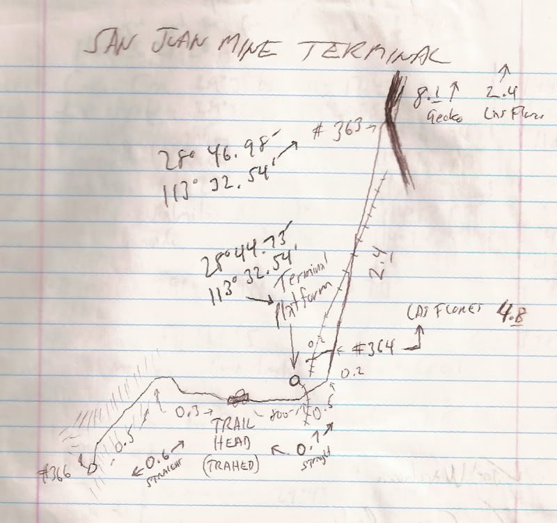
GPS and Mileage Notes (map datum NAD27 Mex.)
0.0 Camp Gecko Driveway (4.1 mi. so. of pavement/ town): 28º53.96', 113º31.85'
5.7 The old Las Flores jail is 0.3 mi. to right.
8.1 Top of long grade, a poor road continues ahead (28º46.98', 113º32.00'). Main road to Punta San Francisquito bends left.
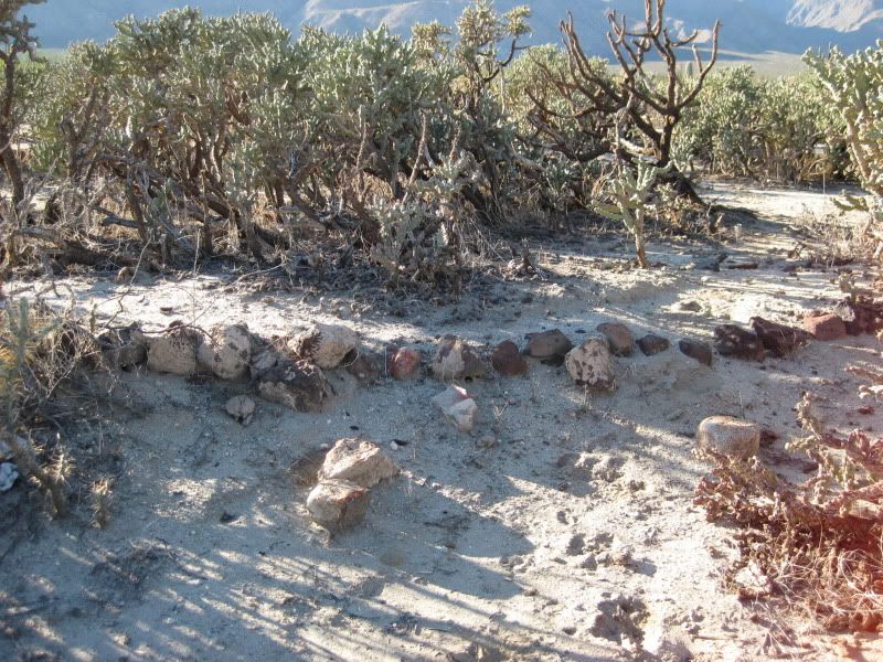
11.1 Park where railroad crosses, now going from south to north, uphill. Platform at 28º44.73', 113º32.54' a short walk north from the road.
The auto road continues a short distance ahead to the trail going up Terminal Canyon to the San Juan mines. Before the cable tramline, pack animals
brought the ore down the mountain.
===========================================================
The museum of Bahia de los Angeles... on the outside, to the right, is a display of the railroad and ore tram bucket system... In front of the town
plaza is the locomotive that was left at Las Flores and an ore car that came from the smaller gauge train line up at San Juan...

-----------------------------------------------------------------------------------
Years ago, at Las Flores...
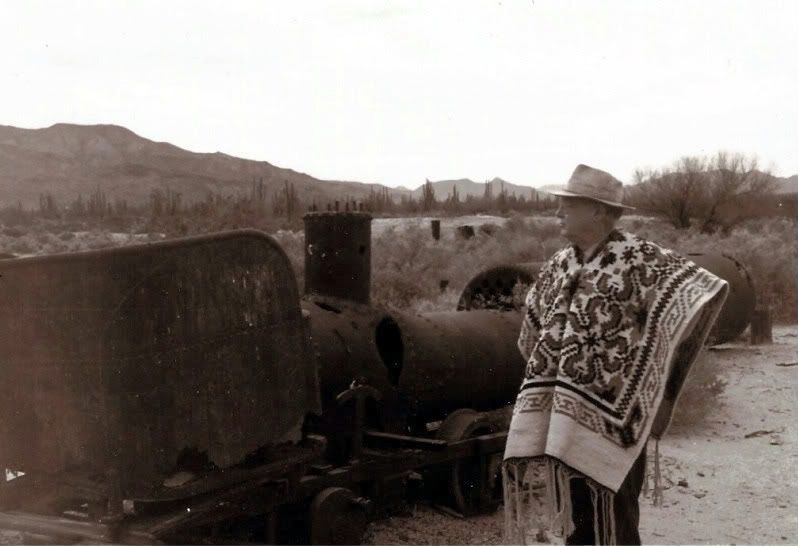
Erle Stanley Gardner, 1966.
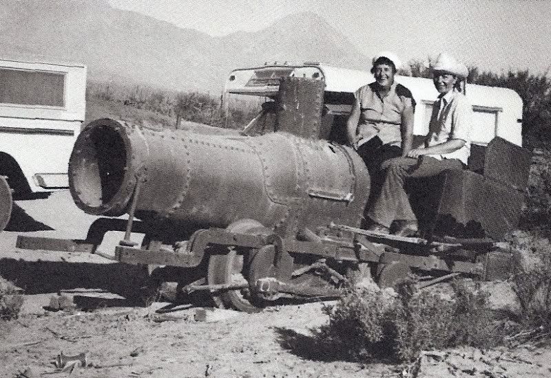
From Marv Patchen's 'Baja Adventures' (1970's photo)
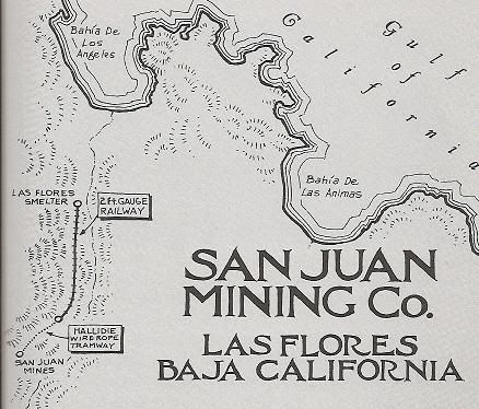
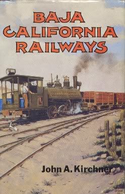
Railroad map from this book...
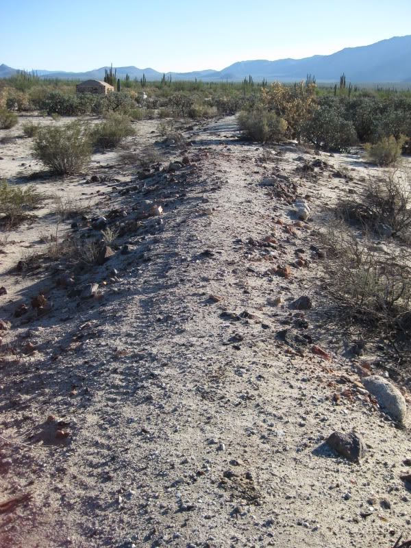
Rail bed, looking south 2009.
Looking north, 2009.
The railroad bed, just west of the Las Flores jail...
2002 notes:
---------------------------------------------------------------------------------------
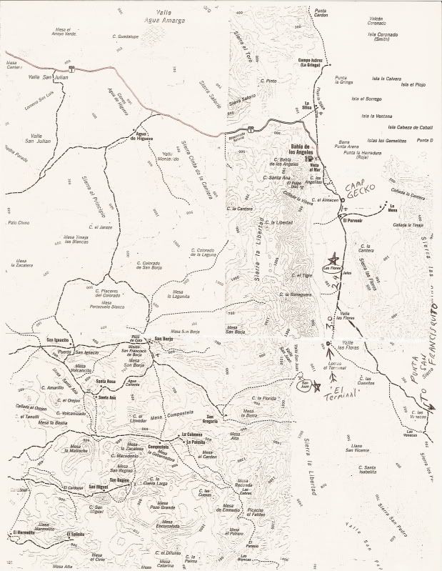
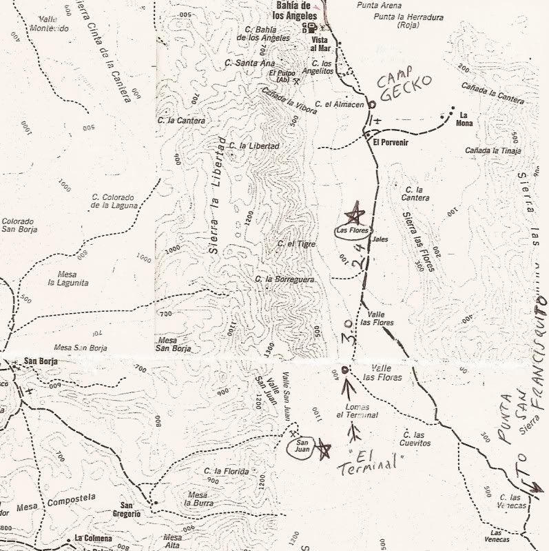
Map for reference.... stars placed by Las Flores and San Juan mines, terminal platform noted with arrow. Mileages from Las Flores (east of jail house
on graded road) to the junction with the road that continues uphill to the terminal (2.4)... and then 3.0 on to the terminal on the minor road
(overgrown brush will scratch vehicle).
It should be noted that the original topo map is incorrect with the placement of the graded road south of Las Flores (I doctored the map to correct
its location), and in naming Arroyo el Terminal: It is labled at the next arroyo south of where it really is! Too faint to see in this reproduction...
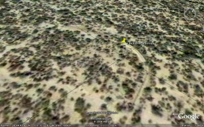
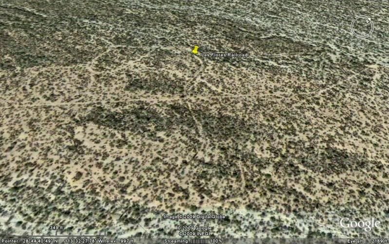
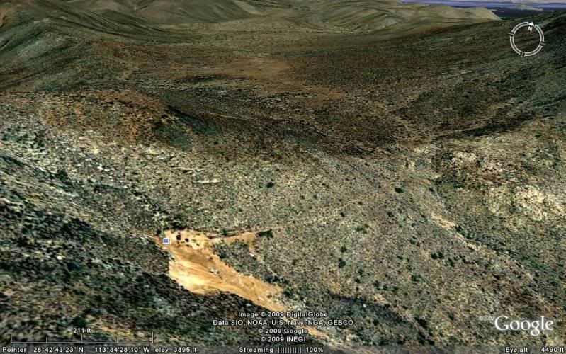
Google Earth allows you to see the railroad line route as it circles at the terminal, otherwise hidden by vegetation on the ground... next!
Terminal Platform at south end of railroad.
Here ore buckets came down the mountainside using a cable tram (see L.A. Bay museum for display).
Here's a look at the mountain the ore came down from... Originally using mules, then the cable tram bucket system.
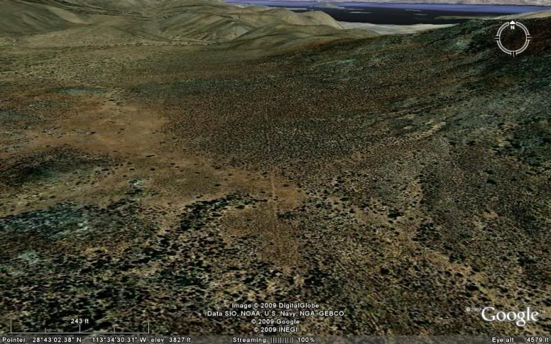
Here is the San Juan Mine, on the top of the 4,200' mountain where gold and silver was extracted... there were other mines, as well... A tiny railroad
line went from here to the top of Terminal Canyon where the ore buckets were loaded.
Tiny railroad line in the San Juan Valley... elev. 3,836'
Here's the top of the cable tram line route...
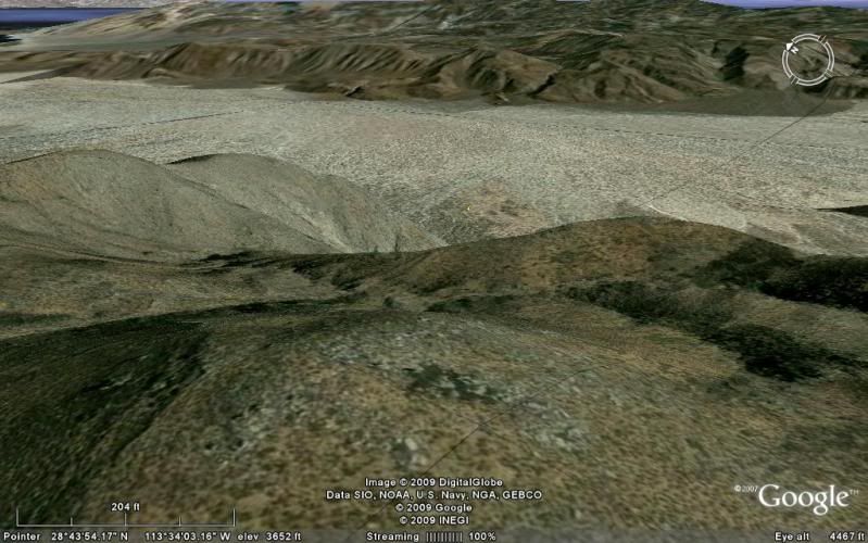
From the bottom of the tramline, the Las Flores Railroad took the ore to Las Flores for processing into ingots...
Here is where the San Francisquito road makes a bend, 2.4 miles from Las Flores and the road and railroad to the terminal:
Here is near Las Flores at the north end of the railroad line:
Now, about that 'road' up to Las Flores... I recall that Larry said it was pretty well gone, after reviewing previous posts.
[Edited on 3-19-2012 by David K]
|
|
|
Neal Johns
Super Nomad
Posts: 1687
Registered: 10-31-2002
Location: Lytle Creek, CA
Member Is Offline
Mood: In love!
|
|
About that road to Los Flores (San Juan) mine....
The reason we stopped was my friend in a 4Runner was handicapped (no useful legs) and we had a little trouble with a tire that rolled off a rim. We
got about 2/3 of the way up and the road was still passable. I had my pop-top camper on my Tacoma. A little brushy the first half mile.
Time for a Jeep to try it! Ken?
At Mission San Borja, drive straight through the compound, up a short rocky hill to go along the left side of Arroyo San Borja for 0.3 miles where the
road goes right and crosses the arroyo and climbs up to the mesa/airport. At the far end of the airport, take the left fork SE toward San Gregorio.
About seven miles from the Mission the road goes over some white soil (probably an old spring) and for sharp eyes there is an old stone wall corral on
the left. This is the area of San Juan (Rancho). The faint road to the mine is on the right side of the corral and goes NE away from the road which
continues to Rancho San Gregorio and Rancho Nuevo (about a mile further).
![San Juan corral [640x480].jpg - 48kB](https://forums.bajanomad.com/files.php?pid=707069&aid=29733 "San Juan corral [640x480].jpg - 48kB")
My motto:
Never let a Dragon pass by without pulling its tail!
|
|
|
Barry A.
Select Nomad
Posts: 10007
Registered: 11-30-2003
Location: Redding, Northern CA
Member Is Offline
Mood: optimistic
|
|
Wow, David and Neal--------once again you both have outdone yourselves and provided the most meaningful information available, it would seem. THIS
is the reason I have joined this board, and remain with it.
Many thanks.
Barry
|
|
|
Udo
Elite Nomad
Posts: 6321
Registered: 4-26-2008
Location: Black Hills, SD/Ensenada/San Felipe
Member Is Offline
Mood: TEQUILA!
|
|
Most gracious thanks for the information, David & Neal.
I think David must have Google Earth professional. That's some great detail.
Udo
Youth is wasted on the young!
|
|
|
David K
Honored Nomad
Posts: 64480
Registered: 8-30-2002
Location: San Diego County
Member Is Offline
Mood: Have Baja Fever
|
|
| Quote: | Originally posted by willardguy
could you or david pin the san juan mine area on the google map? is it close to the tinaja yubay area? and what the heck is a tinaja?
|
A tinaja is a place where water can be found... not a spring, but a pool that is protected from the sun and lasts for long periods after the last rain
or flash flood. Sometimes the water is under the sand, and you have to dig for it... That is sometimes called a coyote well, as animals can smell the
water just below the sand and did to it. Tinaja de Yubay is perhaps the most famous in Baja. Neal Johns has some great photos there: http://vivabaja.com/neal2 after a wet season and it was really full.
Another one is Tinaja de Santa Maria, just south of Valle la Bocana on the Golfo Camino Real between Santa Gertrudis and San Borja... a 4WD can drive
to it... Both times I went, the water was below ground, but you could see the coyote holes. Arthur North camped there in 1906 and wrote about it in
his 'Camp and Camino in Lower California' c1910.
Here is a Google Earth image from up high to show San Juan, Las Flores, San Borja, etc....
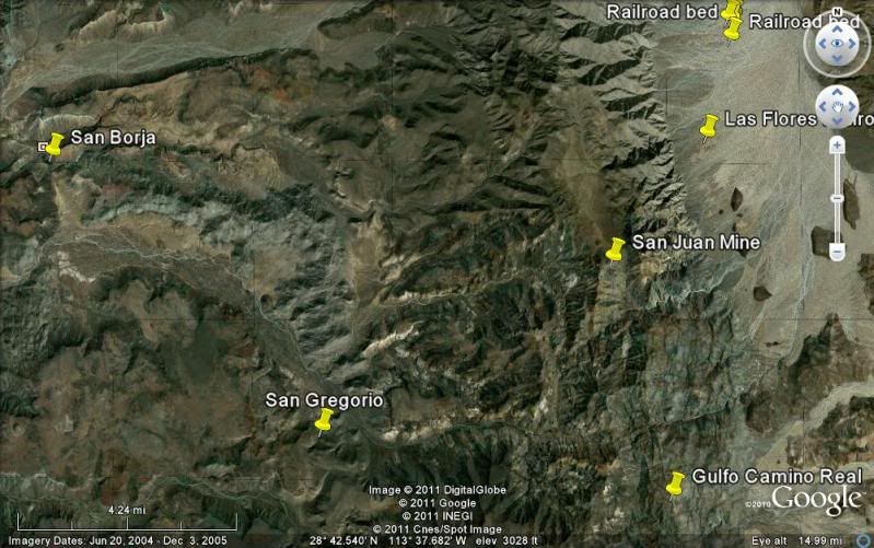
Yes, Gulfo is supposed to be Golfo!
[Edited on 3-19-2012 by David K]
|
|
|
larryC
Super Nomad
Posts: 1482
Registered: 8-11-2008
Location: BoLA
Member Is Offline
|
|
| Quote: | Originally posted by David K
| Quote: | Originally posted by David K
Yah, Larry... a few years ago Neal Johns and others started to drive to San Juan from the road to San Gregorio (from San Borja). They only didn't go
all the way because one got a flat in a bad place, and they were running low on time (they had arranged with Jose at San Borja for a mule trip to El
Aguaje on the Golfo Camino Real)... Photos at http://vivabaja.com/neal
So is it no longer possible to drive a Toyota or Jeep to San Juan, if you know?
I will repost the Google Earth images of San Juan and the Las Flores railroad line. |
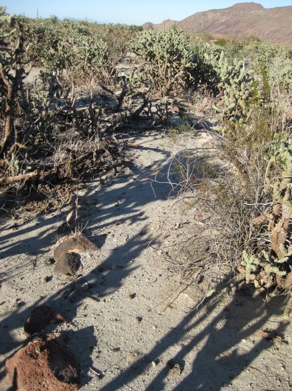
The flat tire may not be the only reason they didn't go all the way. If they had kept going they might have found other obsticlals. I tried on a quad
in April '03 and after alot of hunting and pecking we got as far as the base of the mountain where the road peters out. Walked from there (found the
old road bed in several places along the way) up to the rock buiding but not knowing what the layout of the mine was and running out of time we turned
around and headed back to san Borja and didn't get back till after dark.
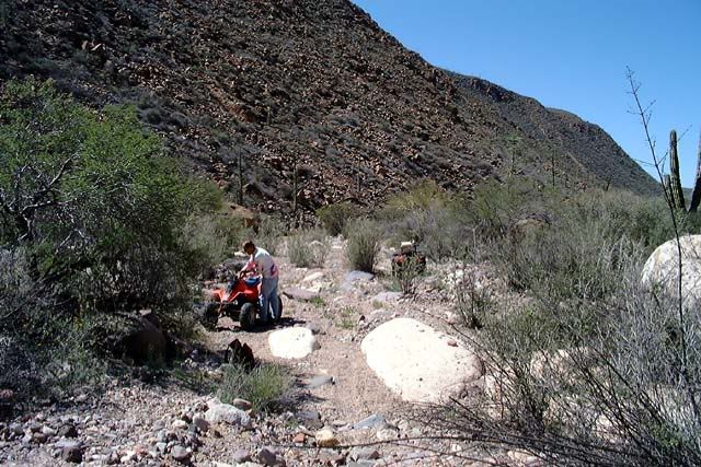
This is as far as we got on the quads
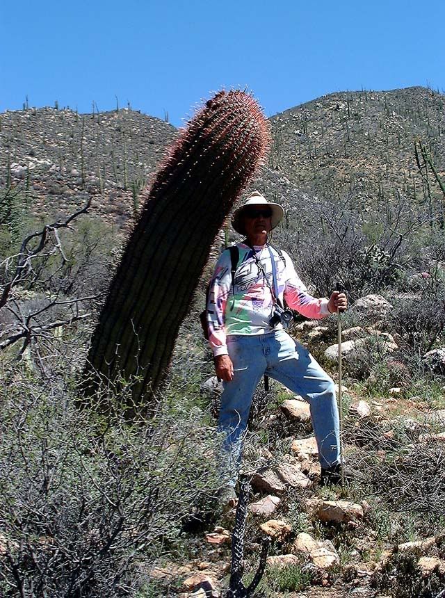
Along the way ther are some pretty good sized bareel cactus,
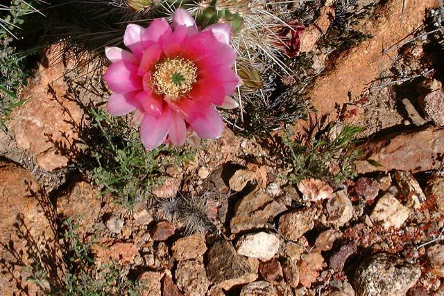
and some pretty flowers
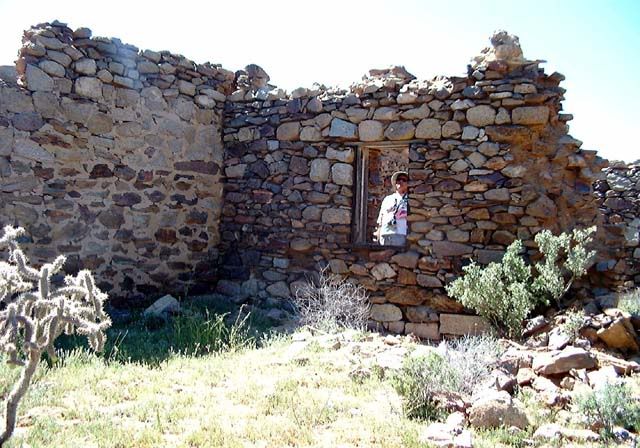
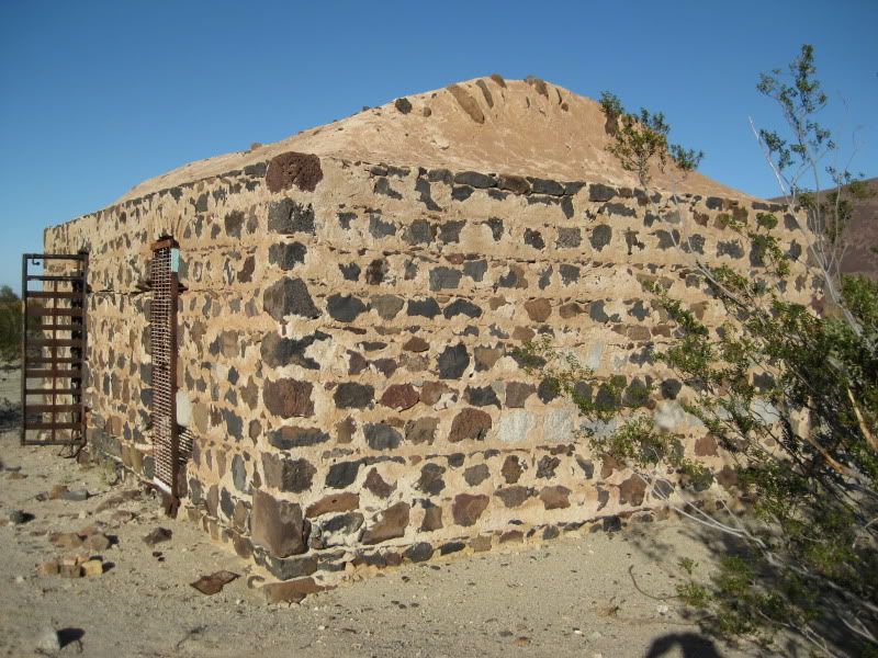
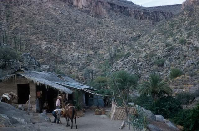
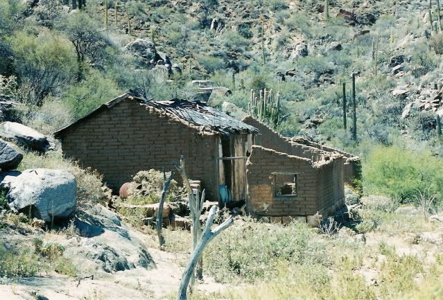
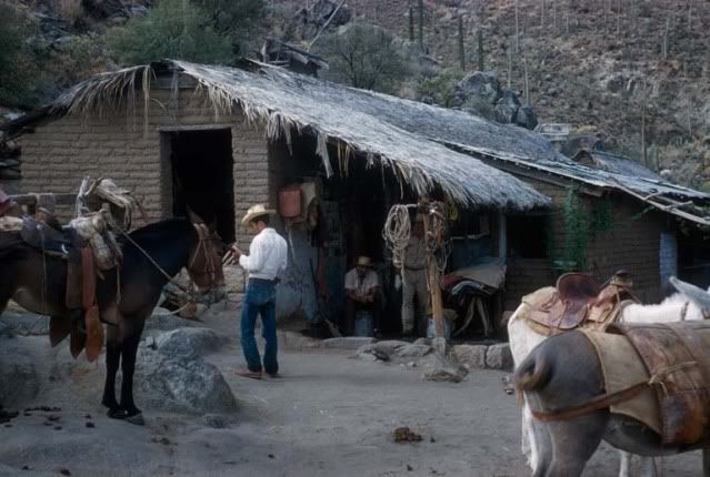
at the top of the trail you come to this stone building, not sure what its function was but Carolina calls it the "foremans" or "asseyors" building.
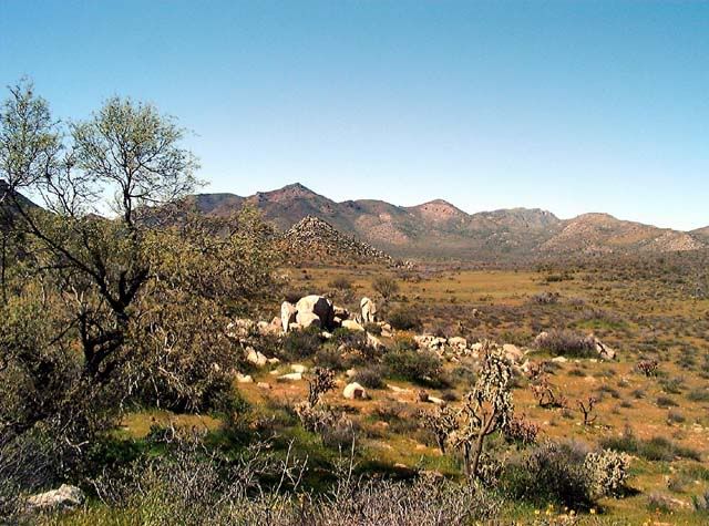
Francisco Munoz told me he landed his plane up here at the mine once. I walked the meadow and measured it with my gps. It is flat, no rocks, and is
almost 1200' long. Any adventurous pilots out there? I'll go up with you on the second trip.
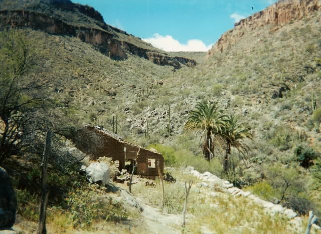
I walked to El Aguaje last year with Rafael from Rancho San Gregorio. He has reopened the ranch, built a ranch house and some private rooms. He serves
meals at the rancho. We walked from there to Aguaje, about 2 hours, there is a family there now doing some farming. Can't find my pics right now.
[Edited on 3-19-2012 by larryC] |
|
|
|
willardguy
Elite Nomad
Posts: 6451
Registered: 9-19-2009
Member Is Offline
|
|
I found this article dated 2010 about a canadian company sniffing around our mine.About Cronus:
Cronus Resources Inc. is a publicly traded exploration company guided by an experienced management team
with proven track records of financial, business and technical success. With a focus on the acquisition,
exploration and development of mineral projects in Latin America, the Company has consolidated a large land
package surrounding the historical high‐grade San Juan Mine in Baja, Mexico.
|
|
|
David K
Honored Nomad
Posts: 64480
Registered: 8-30-2002
Location: San Diego County
Member Is Offline
Mood: Have Baja Fever
|
|
willardguy, on Google Earth you can see a new mine being developed between L.A. Bay and San Borja... north of San Juan... way past the Las Tinajitas
petro site in Arroyo Grande (next valley north of San Borja).
[Edited on 3-19-2012 by David K]
|
|
|
Barry A.
Select Nomad
Posts: 10007
Registered: 11-30-2003
Location: Redding, Northern CA
Member Is Offline
Mood: optimistic
|
|
| Quote: | Originally posted by willardguy
I found this article dated 2010 about a canadian company sniffing around our mine.About Cronus:
Cronus Resources Inc. is a publicly traded exploration company guided by an experienced management team
with proven track records of financial, business and technical success. With a focus on the acquisition,
exploration and development of mineral projects in Latin America, the Company has consolidated a large land
package surrounding the historical high‐grade San Juan Mine in Baja, Mexico. |
Ah Ha!!!! Very interesting!!! What do you bet the road to the San Juan mine becomes more accessible soon. Those acquisition companies normally
don't mess around, but they can be patient, and keep projects on the shelves for a long time.
Barry
|
|
|
David K
Honored Nomad
Posts: 64480
Registered: 8-30-2002
Location: San Diego County
Member Is Offline
Mood: Have Baja Fever
|
|
| Quote: | Originally posted by larryC
Francisco Munoz told me he landed his plane up here at the mine once. I walked the meadow and measured it with my gps. It is flat, no rocks, and is
almost 1200' long. Any adventurous pilots out there? I'll go up with you on the second trip.
I walked to El Aguaje last year with Rafael from Rancho San Gregorio. He has reopened the ranch, built a ranch house and some private rooms. He serves
meals at the rancho. We walked from there to Aguaje, about 2 hours, there is a family there now doing some farming. Can't find my pics right now.
|
That is a famous Francisco Muñoz landing site, indeed!
The following photos I posted for you on Apr. 18, 2011... here one more time for newbies.. a look at Baja with 50 years seperating them:
SAN GREGORIO 2001 & ~1951 compare.
In 2001:
50 years earlier:
2001:
50 years earlier:
Very special to connect with Baja's past!
The 1950's photos are from Howard Gulick, author of the Lower California Guidebook. See his entire collection: http://libraries.ucsd.edu/speccoll/baja/gulick/index.html
|
|
|
willardguy
Elite Nomad
Posts: 6451
Registered: 9-19-2009
Member Is Offline
|
|
so that is a before and after photo of the same building?
|
|
|
Ateo
Elite Nomad
Posts: 5847
Registered: 7-18-2011
Member Is Offline
|
|
nice before and after's............
|
|
|
willardguy
Elite Nomad
Posts: 6451
Registered: 9-19-2009
Member Is Offline
|
|
so those photos are of san gregorio and the way to get there is thru san borja and las flores valley with the mine and railroad stuff is on the other
side of the mtn range? and who's the guy wearing the white ball cap?
|
|
|
David K
Honored Nomad
Posts: 64480
Registered: 8-30-2002
Location: San Diego County
Member Is Offline
Mood: Have Baja Fever
|
|
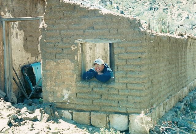
| Quote: | Originally posted by willardguy
so those photos are of san gregorio and the way to get there is thru san borja and las flores valley with the mine and railroad stuff is on the other
side of the mtn range? and who's the guy wearing the white ball cap? |
Yes, San Gregorio is at the end of the road south then southeast from San Borja, then a 1/4 mile hike on the Golfo Camino Real to the ranch house
(note that the adobe sits on cut blocks of rock... this is mission-era construction).
The hat is actually tan, a Hunter (irrigation) hat I am wearing.
Here is a photo of Amo Pescar and me on the Camino Real between the road end and San Gregorio... Neal & Marian Johns and my son Chris was also
along then (almost 11 years ago):
|
|
|
Neal Johns
Super Nomad
Posts: 1687
Registered: 10-31-2002
Location: Lytle Creek, CA
Member Is Offline
Mood: In love!
|
|
larryC,
Thanks for the info on the San Juan road near the top, we never counted on getting all the way, a line on Google Earth is not a guarantee of a
passable road. Your info is greatly appreciated!
Neal
Looking back toward abandoned Rancho San Juan from near Rancho San Gregorio/Nuevo:

My motto:
Never let a Dragon pass by without pulling its tail!
|
|
|
David K
Honored Nomad
Posts: 64480
Registered: 8-30-2002
Location: San Diego County
Member Is Offline
Mood: Have Baja Fever
|
|
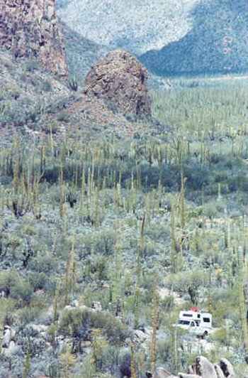
Here is my photo the same direction as Neal's. It is taken from the Golfo Camino Real near Rancho San Gregorio looking west-northwest. See Amo
Pescar's camper? It is at the end of the auto road, coming from San Borja to San Gregorio.
|
|
|
| Pages:
1
2
3
4
5 |


