| Pages:
1
2
3
..
6 |
WideAngleWandering
Nomad
 
Posts: 416
Registered: 3-13-2012
Location: US-Based but traveling
Member Is Offline
|
|
Planning a few weeks in Baja
Howdy nomads,
I'm planning to spend a few weeks in Baja sometime in May (as soon as I finish getting the truck together). Start and end dates aren't fixed.
I've been reading tons of information about how to get to various places but not a whole lot of info on how to choose which places to aim for.
I'm all about exploring but I'd like to have a few spots in mind.
I'll be driving a 4x4 with mud terrains, air compressor, spares, etc.
I don't want to do any hardcore wheeling by myself but I'll drive on almost any road, non-technical trails, beaches, etc.
I have a Garmin but no idea how useful it will be in Mexico with my hacked up maps
My range is 280 miles plus 2 jerry cans worth 150 more in a pinch, all Diesel.
I'll be starting in Mexicali and ending in La Paz (ferry to Mazatlan)
Interested in wilderness camping
Organised camp sites are ok if they are tent-friendly (space to put a tent next to a bunch of RVs is not what I consider friendly)
Even better is a palapa for my hammock with my truck parked nearby
I'll hit up the occasional economical-but-nice hotel but I prefer to camp when possible
I'd like to photograph pristine landscapes and architecture / ruins / missions
I'm always looking for good coffee and/or beer
I have a mask & fins. Good beaches for swimming? I'm a weak swimmer trying to rehab a shoulder injury so nothing crazy.
I figure I'll head for San Felipe and then Gonzaga Bay but that's as much detail as I have in my head thus far. Where should I wander off to?
|
|
|
rts551
Elite Nomad
     
Posts: 6700
Registered: 9-5-2003
Member Is Offline
|
|
any of the area between San Felipe and Gozaga will be to your liking except it is starting to get warm by May. Then I would head for Vizcaino,
fillup, and head for the Pacific for a couple of days. Take the coast route south from Asuncion to Abreojos. from there you can head back over to
the gulf at Santa Roslia.Kinda best of both worlds this way since you have a little time/
|
|
|
DENNIS
Platinum Nomad
       
Posts: 29510
Registered: 9-2-2006
Location: Punta Banda
Member Is Offline
|
|
Try not to get too isolated, WAW. It's a bad idea these days....especially if you're alone.
I hate mentioning this to folks, but it's a fact to be reckoned with.
|
|
|
David K
Honored Nomad
        
Posts: 65442
Registered: 8-30-2002
Location: San Diego County
Member Is Offline
Mood: Have Baja Fever
|
|
Bahia de los Angeles and on the way Calamajue Tinaja de Yubay Desengano San Borja oh yah lots of sites.
|
|
|
chuckie
Elite Nomad
     
Posts: 6082
Registered: 2-20-2012
Location: Kansas Prairies
Member Is Offline
Mood: Weary
|
|
YUP!
|
|
|
sancho
Ultra Nomad
    
Posts: 2524
Registered: 10-6-2004
Location: OC So Cal
Member Is Offline
|
|
If you haven't looked at them, there are other forum
sections here, Trip Reports, Camping, Fishing, etc.
|
|
|
Marc
Ultra Nomad
    
Posts: 2802
Registered: 5-15-2010
Location: San Francisco & Palm Springs
Member Is Offline
Mood: Waiting
|
|
WideAngle, you travel the way I do. Just head south with the AAA map and have fun. Everything will be an adventure. Don't drive at night and don't get
to isolated. It will be hot so don't forget you can always take a break or two on the Pacific side. Don't forget tarps for the wind.
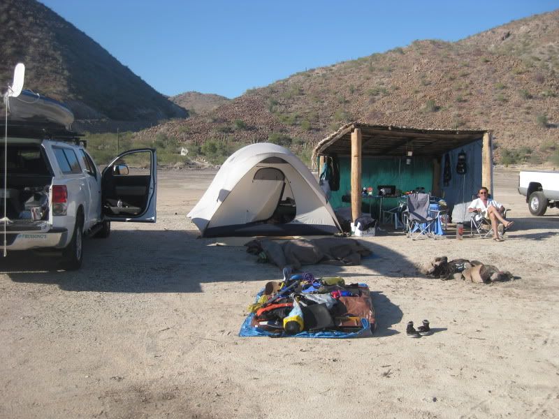
Santispac Beach (Mulege) Feb 2012

[Edited on 5-4-2012 by Marc]
|
|
|
shari
Select Nomad
      
Posts: 13052
Registered: 3-10-2006
Location: bahia asuncion, baja sur
Member Is Offline
Mood: there is no reality except the one contained within us "Herman Hesse"
|
|
For photography and exploring I would not miss Comondu area...enter from Insurgentes..turn left and go towards san juanico...turn up at Ejido
Francisco Villa...un friggin believeable up there....our camp has a VW van parked there right now and lots of room for tents...nice climate if the
gulf side gets too hot...stop in for a beer!
|
|
|
WideAngleWandering
Nomad
 
Posts: 416
Registered: 3-13-2012
Location: US-Based but traveling
Member Is Offline
|
|
| Quote: | Originally posted by DENNIS
Try not to get too isolated, WAW. It's a bad idea these days....especially if you're alone.
I hate mentioning this to folks, but it's a fact to be reckoned with. |
I hear you, and I know this is always a risk, but I must admit I'm having trouble gauging the danger in Baja.
I know some of you do it regularly and survive. What's the secret? Do you also play Russian roulette in your free time? 
|
|
|
David K
Honored Nomad
        
Posts: 65442
Registered: 8-30-2002
Location: San Diego County
Member Is Offline
Mood: Have Baja Fever
|
|
There is more danger in any US city every day, than there is a year of camping in Baja... Bad stuff happens, so better that it happen while you are
LIVING the LIFE, than staying 'safe' and locked up in your own home... yes?
Please feel free to see many photos of many sites in my web page http://VivaBaja.com my special interest is the peninsula history, I have a Spanish Missions page with photos at the 27 Spanish missions and many
of their visitas (sub-mission visiting stations): http://vivabaja.com/bajamissions
To get a feel for what's there (at many interesting sites in Baja - norte): See http://vivabaja.com/tours click on a site, grouped around many destination towns.
We visited many mission sites last trip to Baja CA Sur: http://vivabaja.com/709 even discovered one that was reported destroyed by road builders.... not!
By all means, ask away!
[Edited on 5-4-2012 by David K]
|
|
|
Maderita
Senior Nomad
  
Posts: 695
Registered: 12-14-2008
Location: San Diego
Member Is Offline
|
|
The first leg of your trip, Mexicali to San Felipe, is 130 miles of flat desert, and a hot, boring drive, IMHO. Mid- late May temps are likely 90 -
110F. Seems like a waste when the drive south on dirt roads through the Sierra de Juárez would be scenic. Usually mild May temperatures at those
elevations (4,000' to 5,000'). Start at La Rumorosa at the top of the grade on Hwy 2. Turn south on dirt roads toward the Parque Nacional / Laguna
Hanson. A truck or SUV is recommended, but 4WD not needed in May. There should be some water remaining in the shallow lake. Nice wilderness camping
and hiking at Canyon Tajo (half-way to Laguna Hanson). Mid-week, the camping should be quiet at the main area (west side) of the lake. Or, drive
around to the east side of the lake for privacy. Continue south to Hwy 3 at Ojos Negros. From there, Drive southeast to Hwy 5 and south to San Felipe.
Or, drive west to Ensenada and south on Hwy 1 on the Pacific Coast, perhaps camping near Erenidira or San Antonio del Mar on the way to San Quintin.
How much time do you have? A side trip off Hwy 3 (at Valle Trinidad) to Mike's Sky Ranch in the Sierra San Pedro Mártir and on to the Observatory
would be incomparable to anything else in Baja. Nice camping up high on the plateau, but be prepared for a chilly night. Plan on an extra two or three
days should you venture to the observatory. Search the forum for more info on any of these places.
|
|
|
BajaBlanca
Select Nomad
      
Posts: 13247
Registered: 10-28-2008
Location: La Bocana, BCS
Member Is Offline
|
|
right now, the Pacific part of Baja is on the cool side and we are having strong winds in the afternoons .... but the mornings have been exquisitely
beautiful.
I think you will enjoy the bahia concepcion beaches further south from Mulege. comparable to any famous beach around the world. and very few people
staying there this time of year.
|
|
|
wilderone
Ultra Nomad
    
Posts: 3895
Registered: 2-9-2004
Member Is Offline
|
|
"I'd like to photograph pristine landscapes and architecture / ruins / missions"
Be sure to go to Mision San Borja. Ask one of caretakers there to take you to the pictographs. Go to San Borja the back way from Bahia de los
Angeles. You'll see plenty of pristine desert landscape en route. If you're interested in birding, the birds are great at San Borja due to their
water cachments there - warm pools, which flow into a reservoir, which they use to water their garden. Great sunsets there too.
|
|
|
shari
Select Nomad
      
Posts: 13052
Registered: 3-10-2006
Location: bahia asuncion, baja sur
Member Is Offline
Mood: there is no reality except the one contained within us "Herman Hesse"
|
|
We feel very very safe in this area of central pacific baja from Bahia Tortugas to Pta.Abreojos because of all the security patrols that the fishing
cooperativas do. They patrol all the beach areas a few times a day and get a bead on any strange vehicles in the area...which discourages the bad
guys. Also if you break down or have any kind of emergency, they will come along and have radios and are very helpful....so remote camping is safe
here...plus the villages are small and everyone knows everyone so crime is much less prevalent...because somebody is always watching and
caring...family looks after family and the old baja spirit is present.
|
|
|
David K
Honored Nomad
        
Posts: 65442
Registered: 8-30-2002
Location: San Diego County
Member Is Offline
Mood: Have Baja Fever
|
|
| Quote: | Originally posted by wilderone
"I'd like to photograph pristine landscapes and architecture / ruins / missions"
Be sure to go to Mision San Borja. Ask one of caretakers there to take you to the pictographs. Go to San Borja the back way from Bahia de los
Angeles. You'll see plenty of pristine desert landscape en route. If you're interested in birding, the birds are great at San Borja due to their
water cachments there - warm pools, which flow into a reservoir, which they use to water their garden. Great sunsets there too.
|
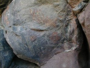
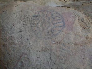
YES... exactly why I suggested San Borja... and just 2 miles on the San Borja road (from the L.A. Bay paved road) turn left for the beautiful 7 mile
drive to Montevideo painted cliffs. You pass through beautiful desert gardens and drive right up to the rock art sites...


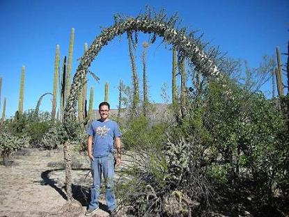
Boojum trees are fun!
Some samples of Montevideo:


|
|
|
Skipjack Joe
Elite Nomad
     
Posts: 8091
Registered: 7-12-2004
Location: Bahia Asuncion
Member Is Offline
|
|
| Quote: | Originally posted by WideAngleWandering
| Quote: | Originally posted by DENNIS
Try not to get too isolated, WAW. It's a bad idea these days....especially if you're alone.
I hate mentioning this to folks, but it's a fact to be reckoned with. |
I hear you, and I know this is always a risk, but I must admit I'm having trouble gauging the danger in Baja.
I know some of you do it regularly and survive. What's the secret? Do you also play Russian roulette in your free time?  |
I feel that any danger if it exists comes when you offroad camp close to hwy 1 or it's settlements. I still do it but always south of El Rosario in
hilly areas where I'm out of sight from the hwy. But if you're somewhere off the beaten track like San Borja you've got zero chance of being acosted.
Regarding offroad places to go:
You might try the Bay of LA to El Arco to Hwy 1 loop. On the way you will pass Las Animas which is a beautiful piece of shallow aquamarine water, San
Rafael which has good snorkeling, San Francisquito which is a beautiful little bay, and the finest grove of cardon cactus in all of baja just before
you get to El Arco. Lots of opportunity to beach camp with nobody around. Lots of washboard road. Bring everything with you (water).
But there are tons of places. It's a choice of heat vs wind. I prefer the heat until it's intolerable then cross the peninsula. I can't take the wind
for more than 4 or 5 days. I can still remember taking one of those solar bag showers at San Roque .... brrrrrrrr. That was July.
|
|
|
Udo
Elite Nomad
     
Posts: 6364
Registered: 4-26-2008
Location: Black Hills, SD/Ensenada/San Felipe
Member Is Offline
Mood: TEQUILA!
|
|
I concur with Shari on this area.
Hard to believe that such a place exists in Baja...but then there Bahia Asunción!
| Quote: | Originally posted by shari
For photography and exploring I would not miss Comondu area...enter from Insurgentes..turn left and go towards san juanico...turn up at Ejido
Francisco Villa...un friggin believeable up there....our camp has a VW van parked there right now and lots of room for tents...nice climate if the
gulf side gets too hot...stop in for a beer! |
Udo
Youth is wasted on the young!
|
|
|
WideAngleWandering
Nomad
 
Posts: 416
Registered: 3-13-2012
Location: US-Based but traveling
Member Is Offline
|
|
| Quote: | Originally posted by Maderita
The first leg of your trip, Mexicali to San Felipe, is 130 miles of flat desert, and a hot, boring drive, IMHO. Mid- late May temps are likely 90 -
110F. |
I know it - this departure delay is really frustrating. I was planning to do this back in February.
| Quote: | | How much time do you have? |
As much as I want but for planning purposes I'm setting aside ~3 weeks for Baja. I'd like to have some time on the mainland too.
| Quote: | | A side trip off Hwy 3 (at Valle Trinidad) to Mike's Sky Ranch in the Sierra San Pedro Mártir and on to the Observatory would be incomparable to
anything else in Baja. |
You make a compelling case. I'm sold.
I do like observatories:
http://www.flickr.com/photos/wideanglewandering/6908024377/
Thanks for all the suggestions. I'm trying to absorb all this now.
|
|
|
WideAngleWandering
Nomad
 
Posts: 416
Registered: 3-13-2012
Location: US-Based but traveling
Member Is Offline
|
|
i started putting together a google map to visualize the suggestions.
thanks again.
http://g.co/maps/9qsen
| Quote: | Originally posted by shari
For photography and exploring I would not miss Comondu area...enter from Insurgentes..turn left and go towards san juanico...turn up at Ejido
Francisco Villa...un friggin believeable up there....our camp has a VW van parked there right now and lots of room for tents...nice climate if the
gulf side gets too hot...stop in for a beer! |
This sounds great. I'm not sure I found it on the map but I have made a note of it.
| Quote: | | Be sure to go to Mision San Borja. |
sold
| Quote: | | You might try the Bay of LA to El Arco to Hwy 1 loop. |
Intrigued but not sure I understand the route. Google does a chit job of labeling road names but it looks like highway 18 south from LA to San Rafael
and on to El Arco?
|
|
|
David K
Honored Nomad
        
Posts: 65442
Registered: 8-30-2002
Location: San Diego County
Member Is Offline
Mood: Have Baja Fever
|
|
It's no highway... but the road between Mex. 1 and El Arco was paved once and called Mex. #18.
Mision San Borja is 22 miles south of the highway into L.A. Bay and 22 miles east from the village of Rosarito (south of Punta Prieta)... sometimes
refered to as Nuevo Rosarito to seperate it from the city near Tijuana, on the beach! Pretty much in the center of Baja.
SEE THIS BLOG PAGE (GREAT PHOTOS): http://www.bajabus.org/day-2-bahia-de-los-angeles-to-mission...
Thanks La Paz Gringo!
[Edited on 5-5-2012 by David K]
|
|
|
| Pages:
1
2
3
..
6 |

