| Pages:
1
2
3 |
geoffff
Senior Nomad

Posts: 643
Registered: 1-15-2009
Member Is Offline
|
|
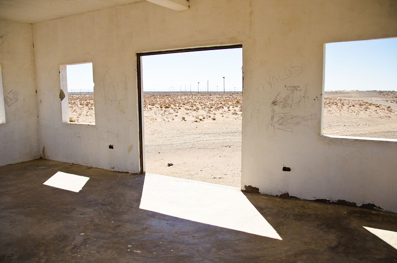
Missions, Hot Springs, Cave Art (2012)
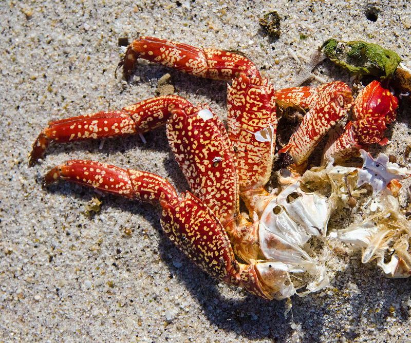
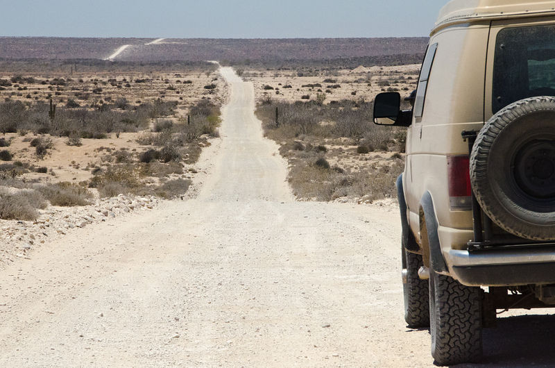
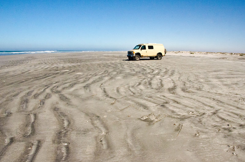
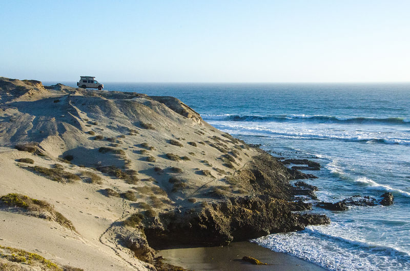
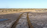
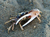
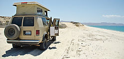
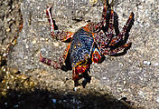
Shell Island
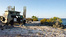
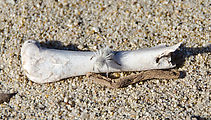
I tried to camp my first night at DavidK's Shell Island, but the access road was flooded with gooey mud. A little crab with a huge claw waved me away.
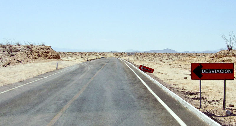
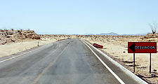
South of Puertecitos
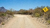
More and more pavement! Paved road has now reached (gps: 29.9391,-114.5265), almost at the turn-off for Punta Bufeo.
Next I explored the coast southeast of Bah�a de los Angeles.
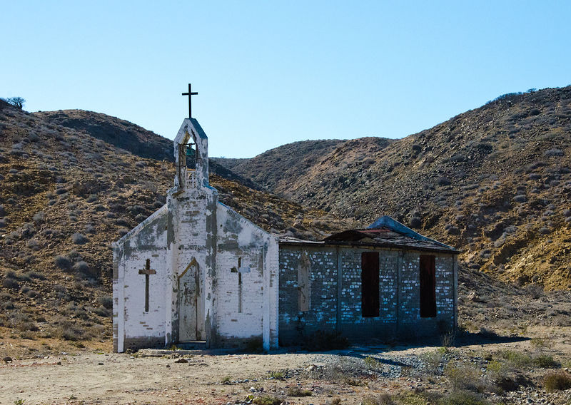
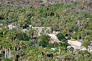
Santa Maria Magdalena
I visited Santa Maria Magdalena, DavidK's "Lost Mission" site. (Thanks, DavidK!)
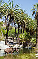
Bah�a de las Animas
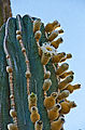
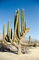
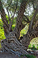
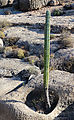
I camped here on the beach, near the fishing village of Las Animas. The card�n cactuses were blooming.
Punta Ballena
(Thanks again, bajanomad MICK for sharing this place!)
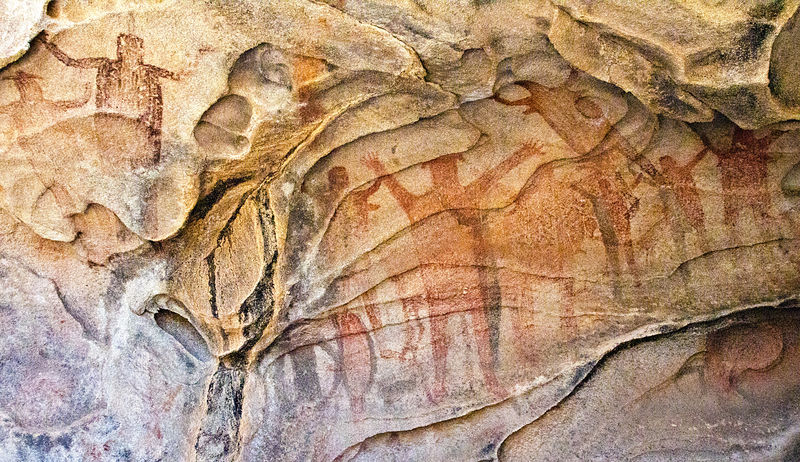
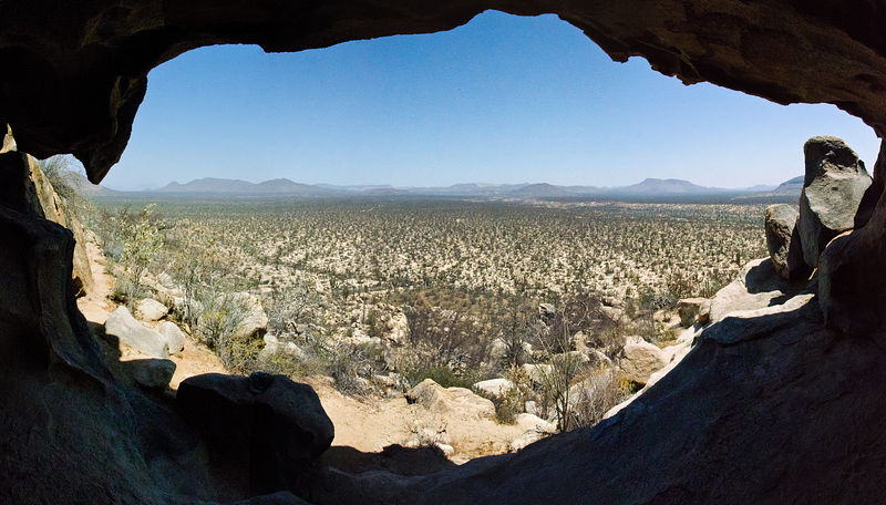
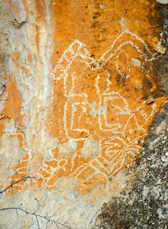
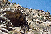
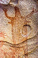
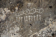
Mesa el Carmen Cave Paintings
I found these pictographs scouting around on Google Earth before my trip.
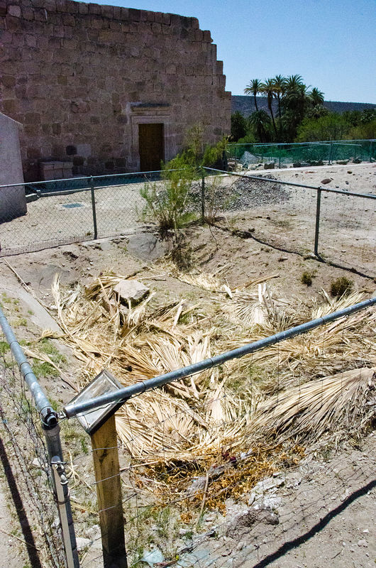
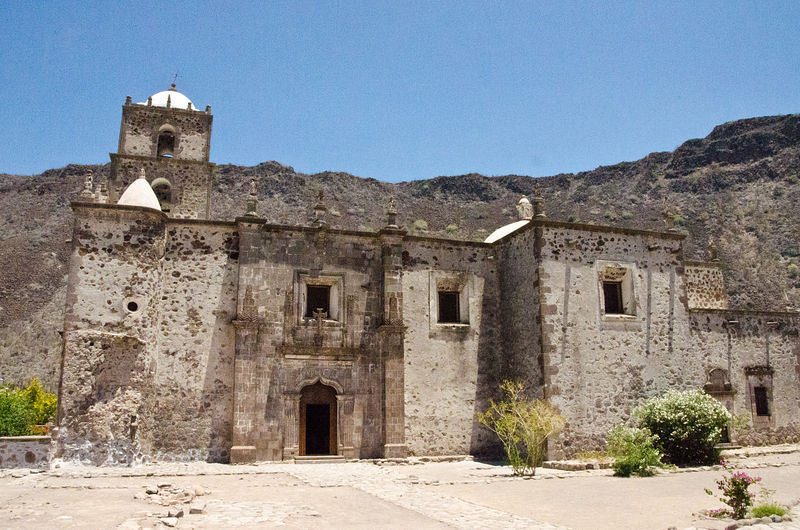
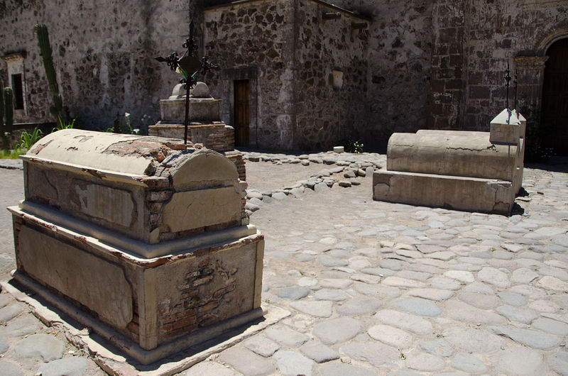
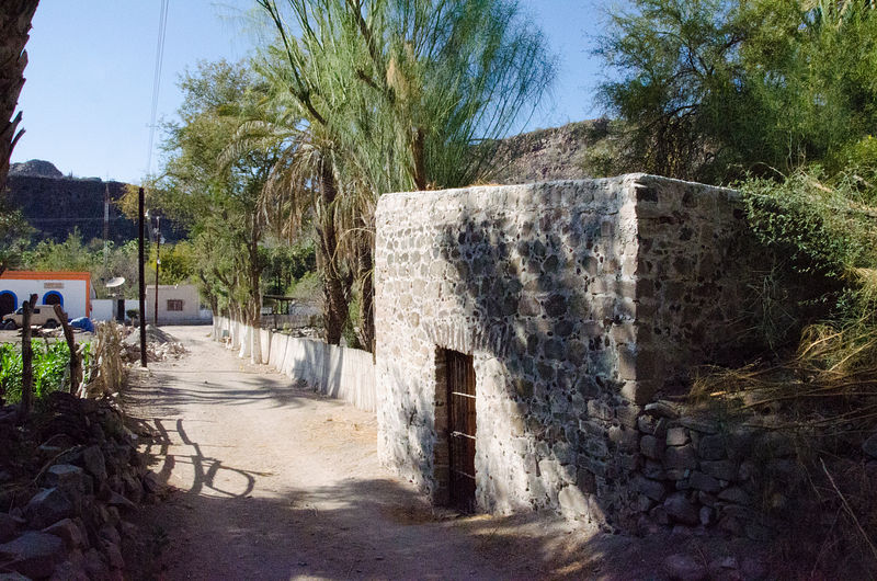
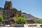
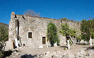
Mis�on Santa Gertrudis
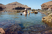
San Cosme Hot Spring
At the bottom of the steep road down from Mesa Siquito is San Cosme, where there is an underwater hot spring close to the shore. It is only accessable
at low tide, from a seashore "road" that is usually submerged. The local ejido has added a locked gate on this route, so I had to ask the caretaker
for permission to enter. He repeatedly expressed how much he liked my baseball cap, so I left it with him as a gift.
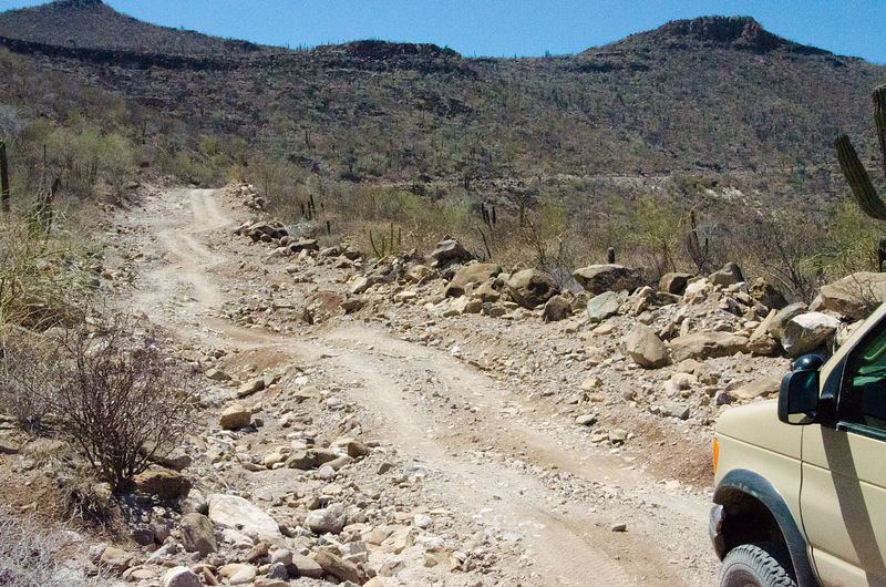
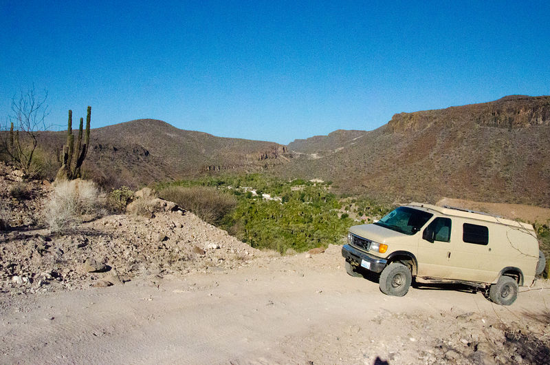
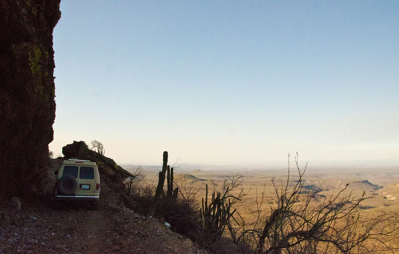
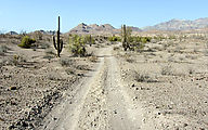
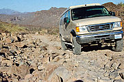
Sierra la Giganta
Next I spent a couple days taking the backroads inland from Loreto up over Sierra la Giganta to Mis�on San Javier, and onwards to the Pacific coast
along a rocky dirt track. Slow going!
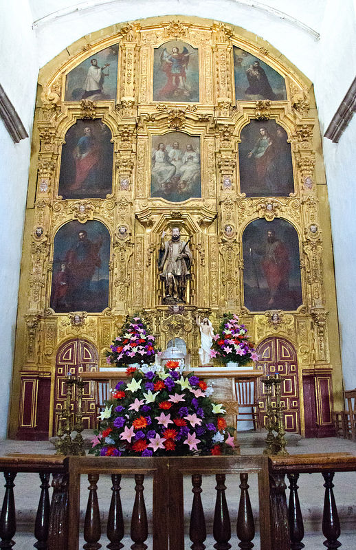
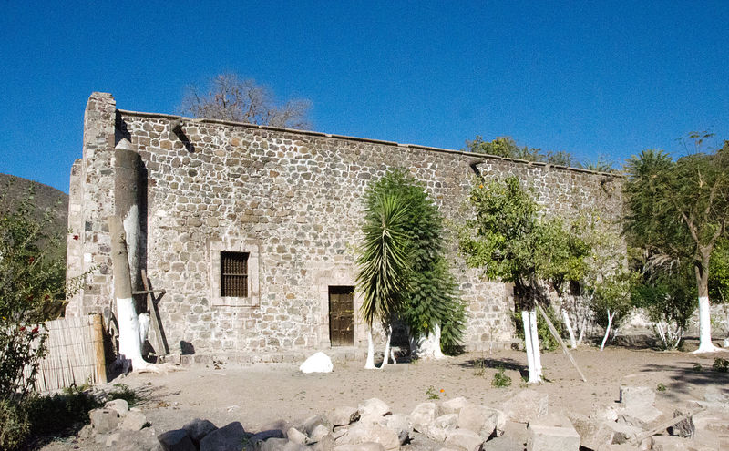
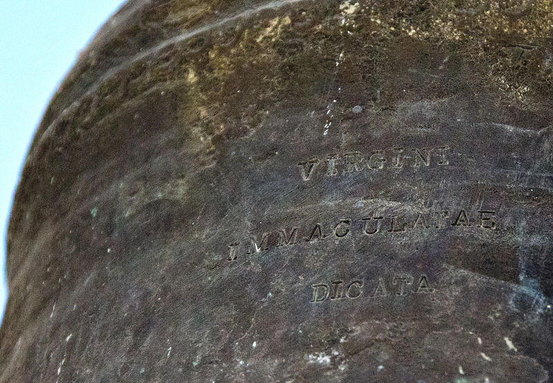
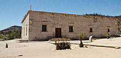
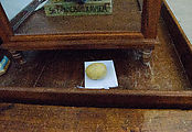
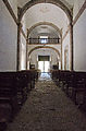
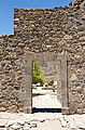
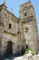
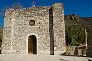
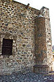
Mis�on San Javier
The road to San Javier is paved, but very winding and steep. The mission is in great shape, and is interesting to explore inside & out. (gps:
25.8610,-111.5438) I wonder what that carefully placed potato was about?
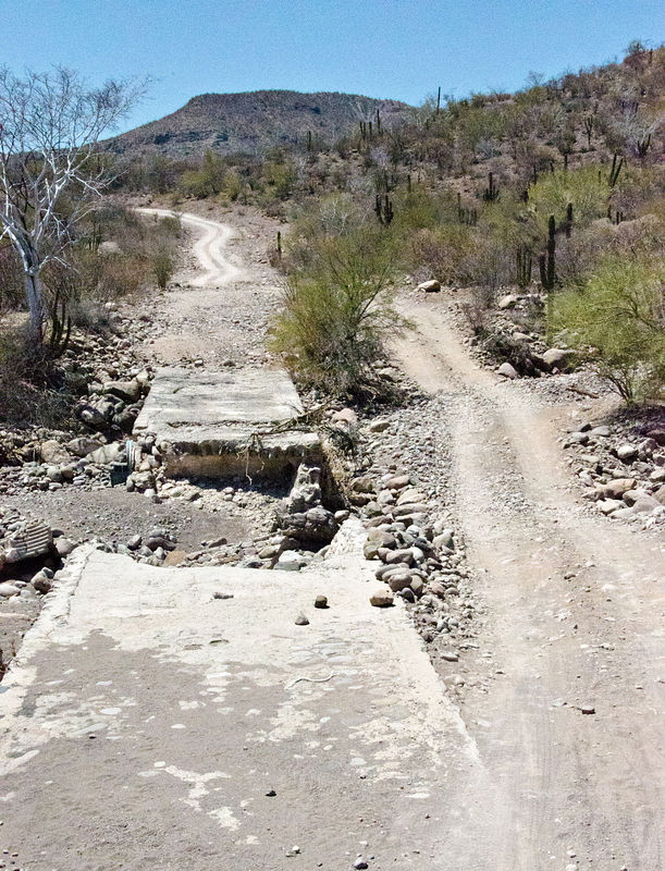
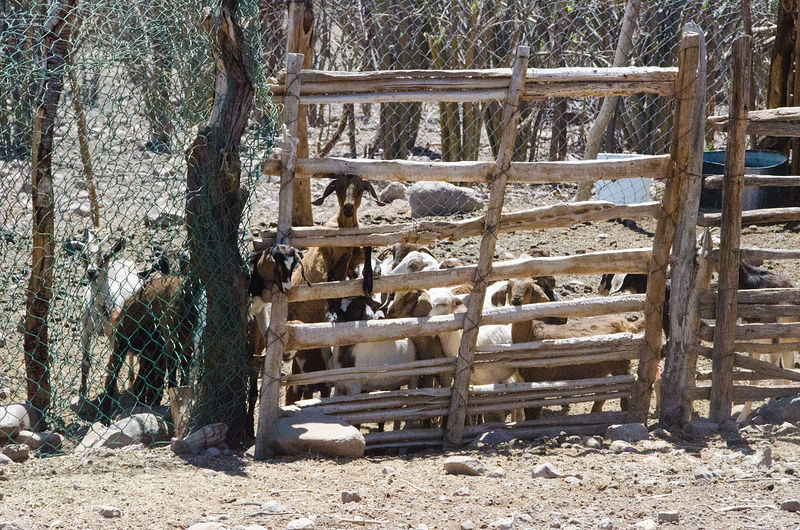
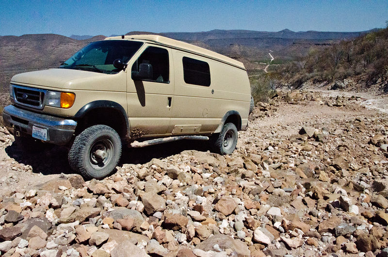
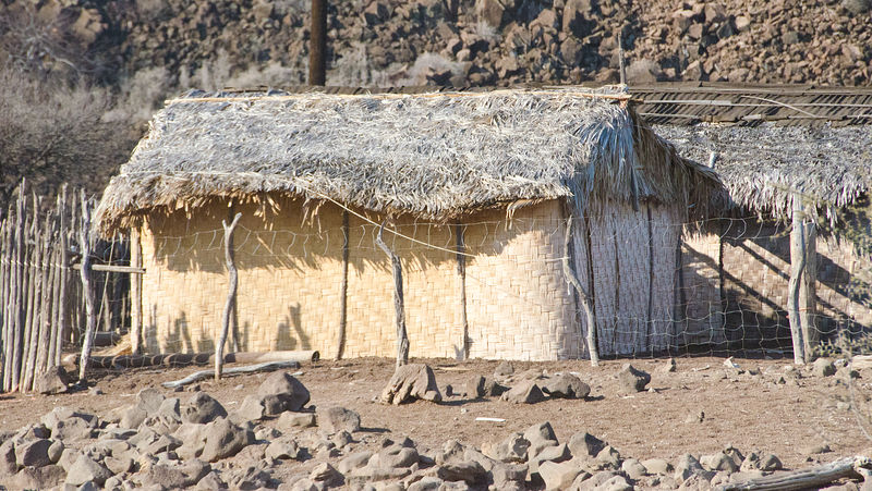
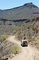
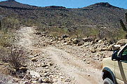
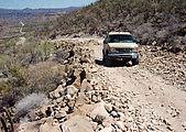
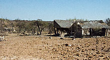
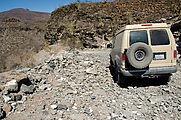
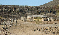
Then, heading west again, the going got rough -- steep and rocky -- often washed out. If I had a motorcycle I bet I could cover this ground much
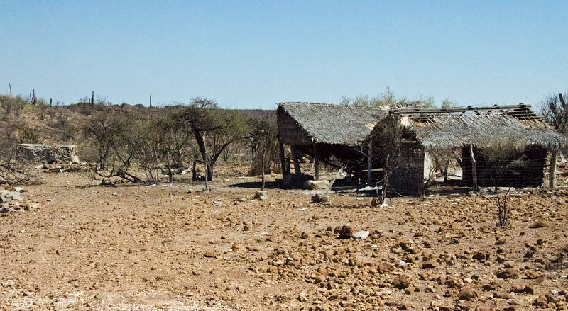
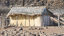
quicker, but with my van's stiff suspension I was often travelling at 15 MPH. Bumpity bumpity bump. I passed sites my map identified as Monte Alto,
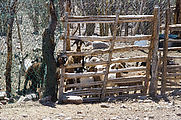
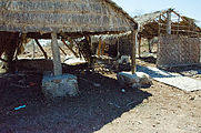
Palo Chino, and Las Animas -- each having just a few ranch buildings with thatched roofs and walls made of woven mats. Nobody was around except for
some very hungry looking goats who were very excited to see me and disappointed when I left.
  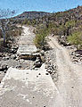        
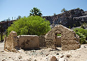
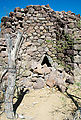
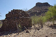
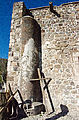
El Horno
This ruined structure once was used to make mortar for building the nearby missions. (gps: 25.9965,-111.7104)
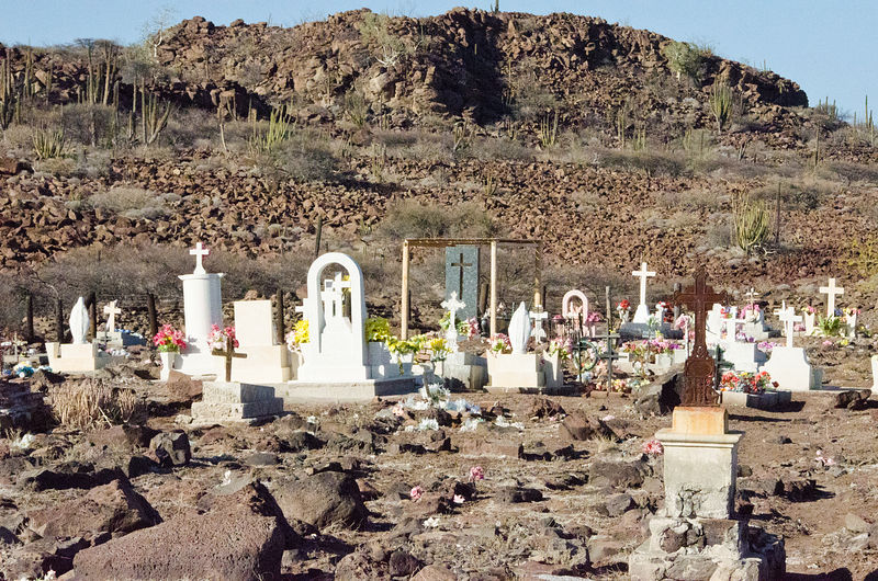
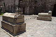
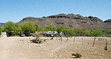
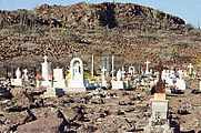
Mis�on San Jos� de Comond�
The main road out of town heads southwest. I instead took the more minor road northwest, which climbed steeply back up onto the mesa, with a great
view of San Jos� Comond�. The town cemetery is also up there. (gps: 26.0593,-111.8338)
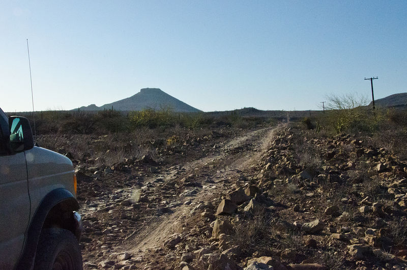
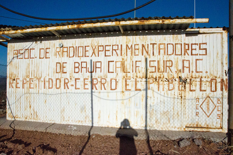
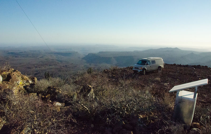
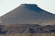
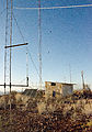
El Pabellon
I love roads that climb to mountain peaks. El Pabellon is topped with a set of radio towers, and so has an access road (verified in advance by
satellite photo) -- a very steep & narrow crumbly 4x4 road, it turns out. From the top I watched the sunset, and camped for the night. (gps:
26.0988,-111.8952)
  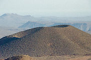 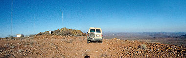    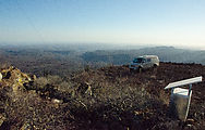
Driving down was almost as exciting as driving up.

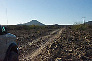
Continuing west.
Next I headed west to the Pacific coast on a nice sandy road. I was surprised when I encountered pavement (new, I assume, as it was not shown on my
map). (gps: 26.2086,-112.3598) This smooth paved road lasted only until San Juanico.
 
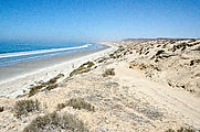
Bah�a San Juanico (Scorpion Bay)
Sandy beaches and the busy fishing boats at San Juanico. (gps: 26.2597,-112.4714)
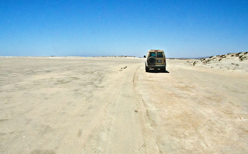
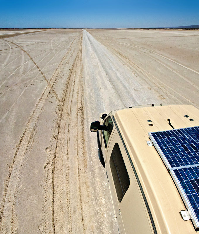
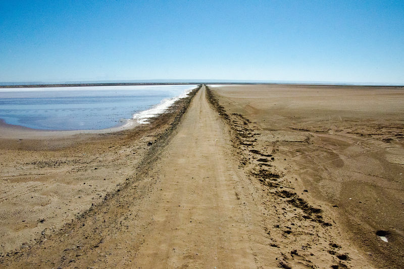
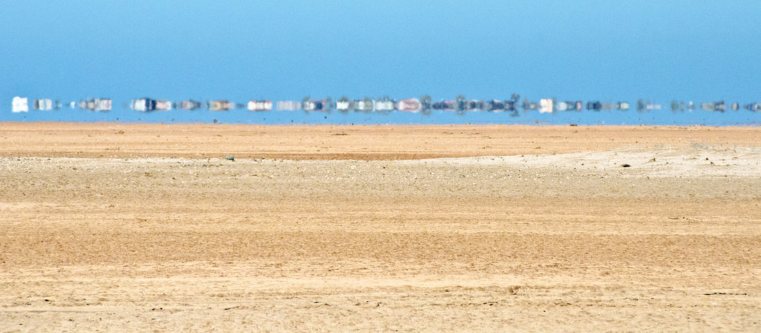
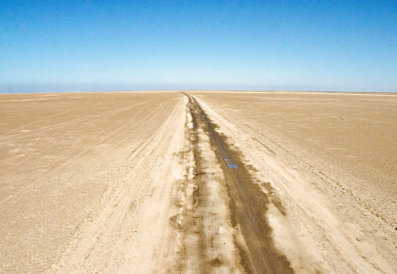
Salitrales San Ignacio
From San Juanico, I continued northwest driving a smooth dirt track over Salitrales San Ignacio -- salt flats up the coast to Laguna San Ignacio.
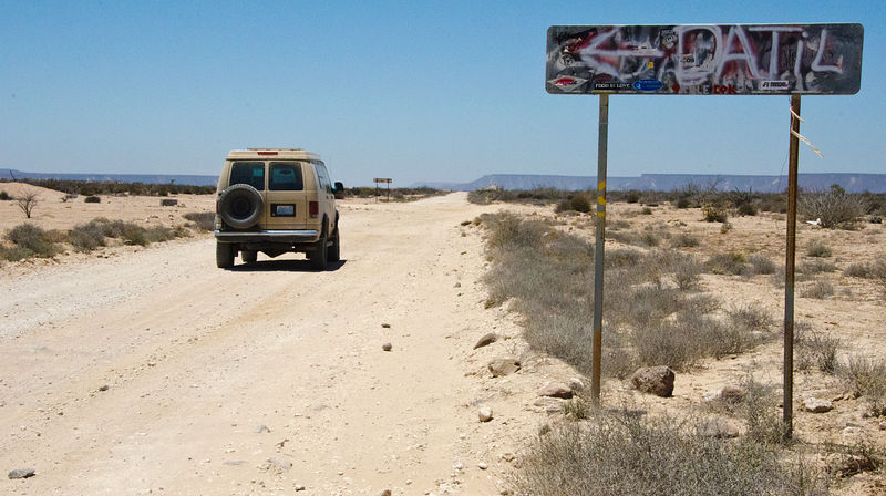
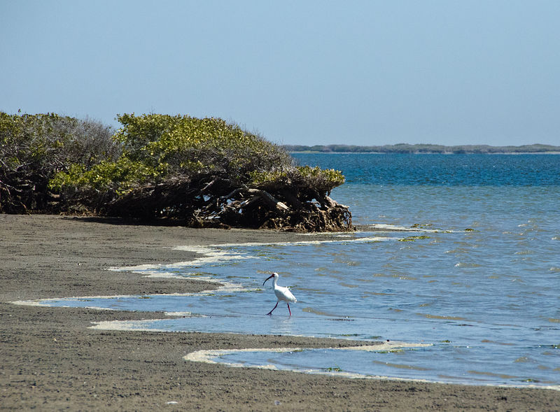
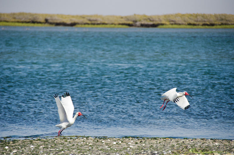
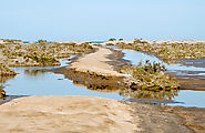
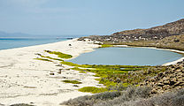
Estero El D�til
     
Estero Delgadito
Studying satellite photos of this area before my trip, I found a road out the two-mile narrow peninsula northwest of the fishing village of El
Delgadito. It looked like a beautifully remote place to camp. Tracking this location down in person, I was stopped by a friendly resident of El
Delgadito who assumed I was lost trying to find my way to San Ignacio. After explaining that I really was intending to go this way, he shared that he
thought this spot was his favorite, most beautiful location -- [almost] surrounded by water. He was extremely chatty (and patient with my limited
Spanish), finally inviting me to breakfast and fishing the next morning (tempting but I declined).
End of the peninsula, Estero Delgadito. (gps: 26.6352,-113.0812)
     
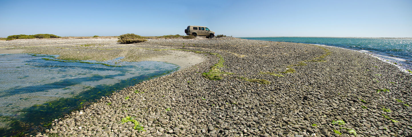
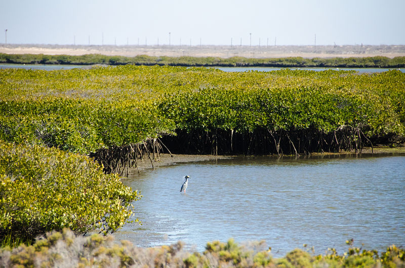
Estero el Cuarenta
More sandy beaches (Pacific side) and mangroves (marshy estuary side). (gps: 26.5485,-112.9886)
     
Continuing northwest again -- more salt flats...
At Vizcaino I made a side trip from Highway 1 southwest to Bah�a Asunc�on. A road also continues westward all the way to Bah�a Tortugas, but as
of May, 2012 the newly-constructed pavement ends only about 15 miles west of the Bah�a Asunc�on intersection, where the route reverts to wasboard
hell. (gps: 27.46435,-114.18939)
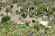
Bah�a Asunc�on (Scorpion Bay)
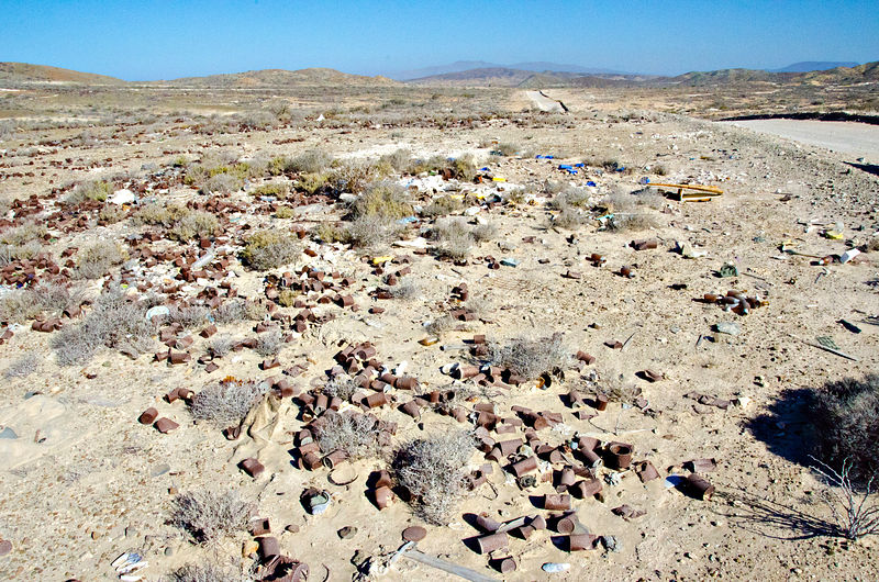
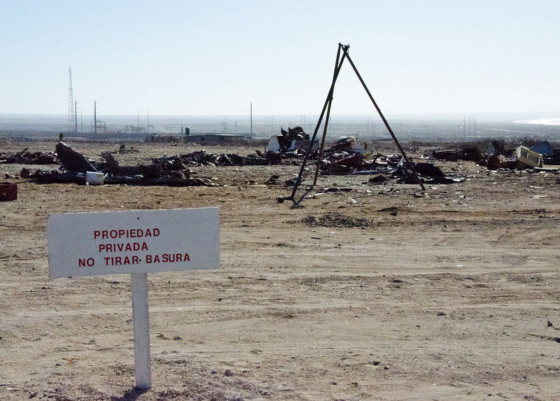
The town of Bah�a Asunc�on is a beautiful location (gps: 27.1247,-114.2966), marred only by some areas of sprawling trash just northwest of town.
   
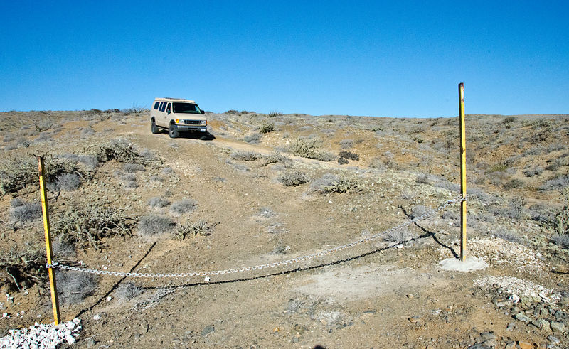
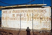
Punta San Roque
This road ends at the little fishing village of San Roque. (gps: 27.1830,-114.3955) A few steep dirt tracks continue west up into the hills of Punta
San Roque, but I encountered them blocked by locked chains. One such track did have a well-used track going right around its gate, so I decided to
risk taking advantage of this bypass. (gps: 27.1874,-114.4030)
 
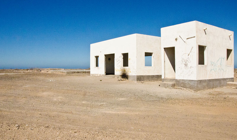
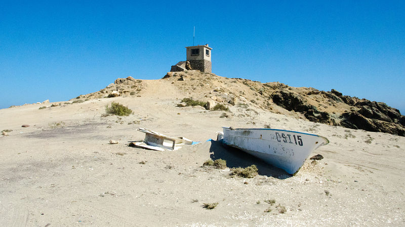
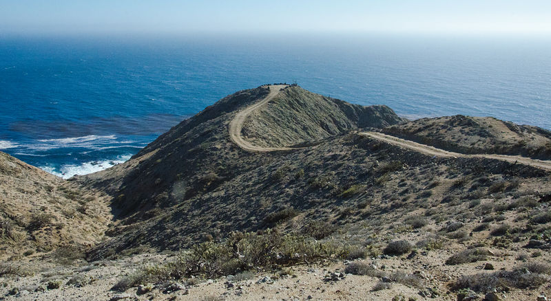
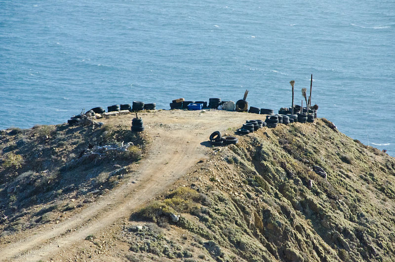
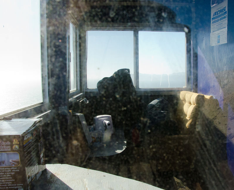
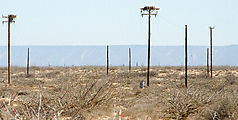
Punta San Roque is covered in a network of newly-bulldozed 4x4 dirt tracks, which are often unnervingly steep. After finding a few coastal lookout
shacks (appearing recently occupied), I came to the realization that this area might be used by the military to watch for smugglers. It was fun to
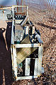
explore, but I decided not to camp around there. What do you think?
    
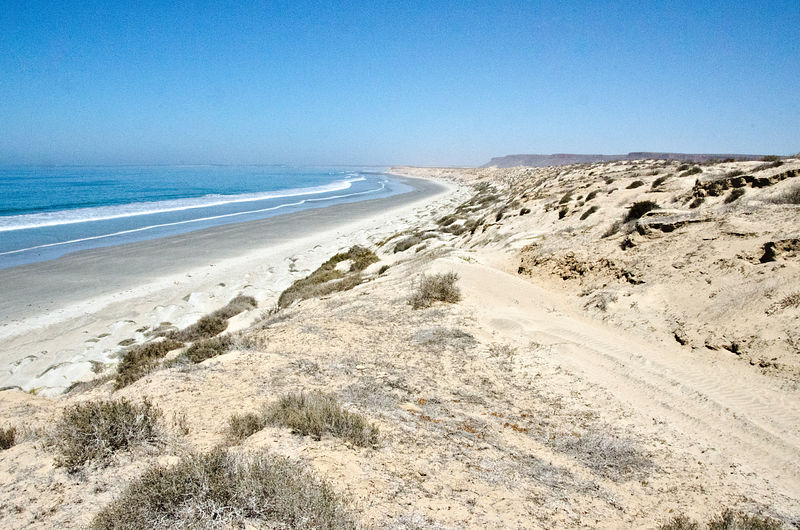
Bah�a San Pablo
West of Punta San Roque are the beaches of Bah�a San Pablo, a scenic place to camp for the night. (gps: 27.1934,-114.4277)
     
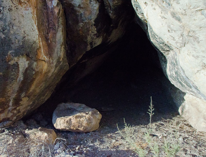
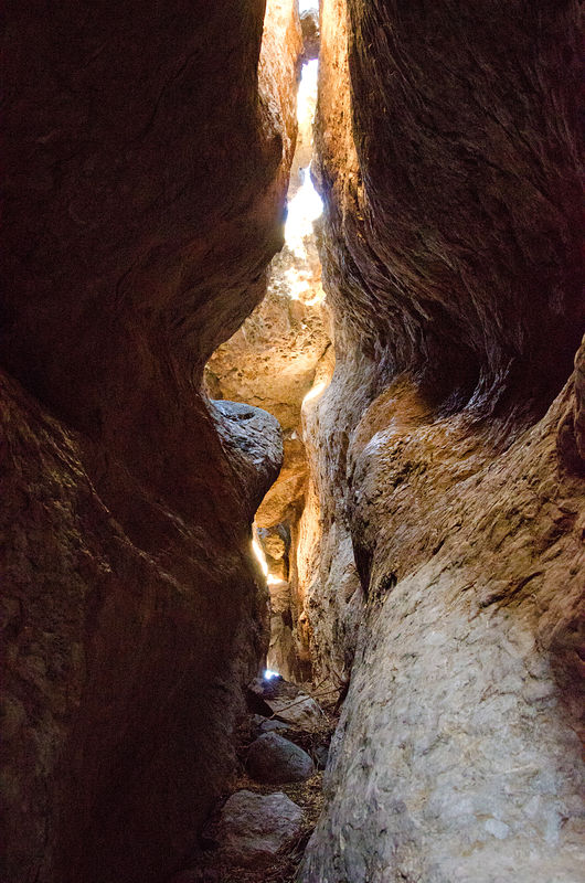
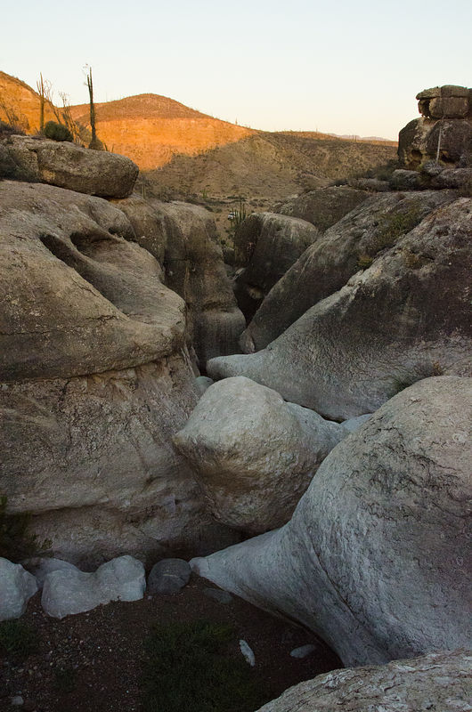
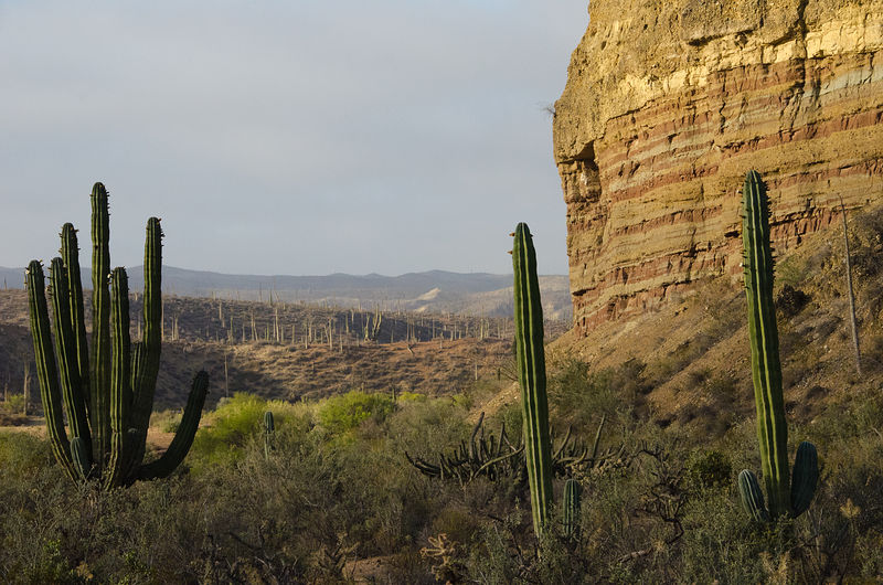
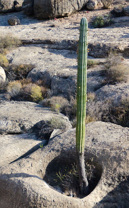
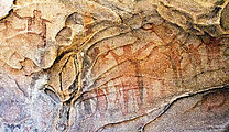
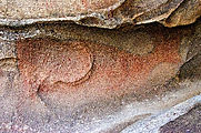
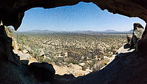
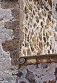
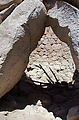
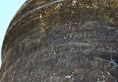
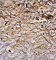
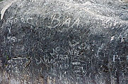
Las Pintas Petroglyphs
This is an extensive region of boulders marked by petroglyphs. I spent hours clambering around photographing any carvings I spotted.
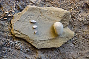
A little cave contained what appeared to be some kind of stone tools for grinding.
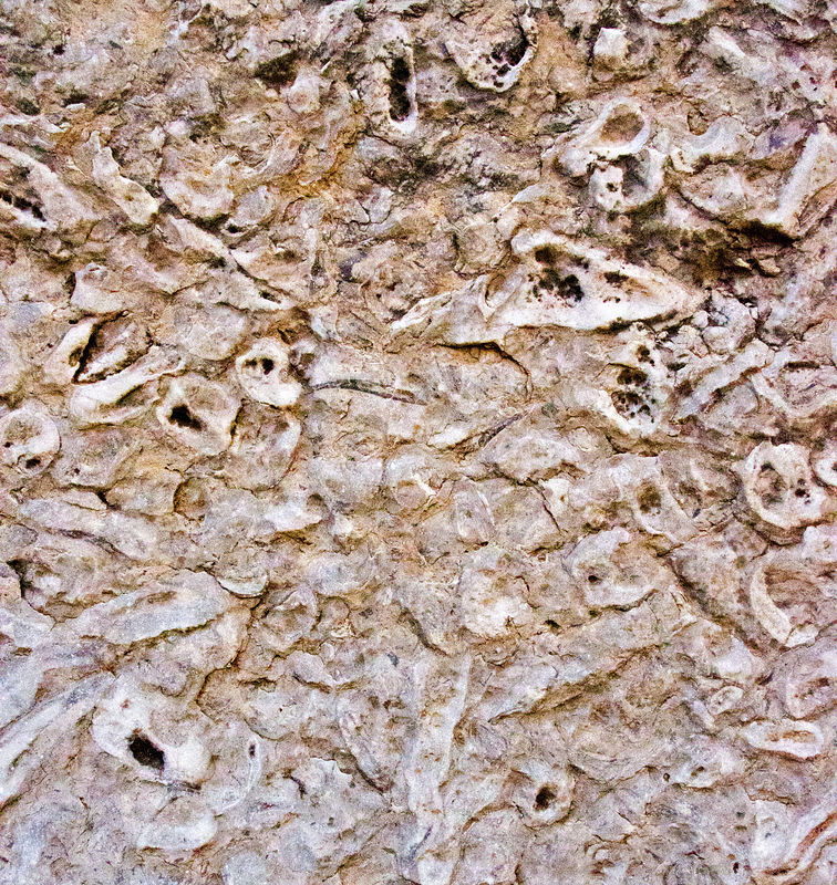
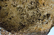
The rocks themselves were also interesting -- many of which are made of up fossils.
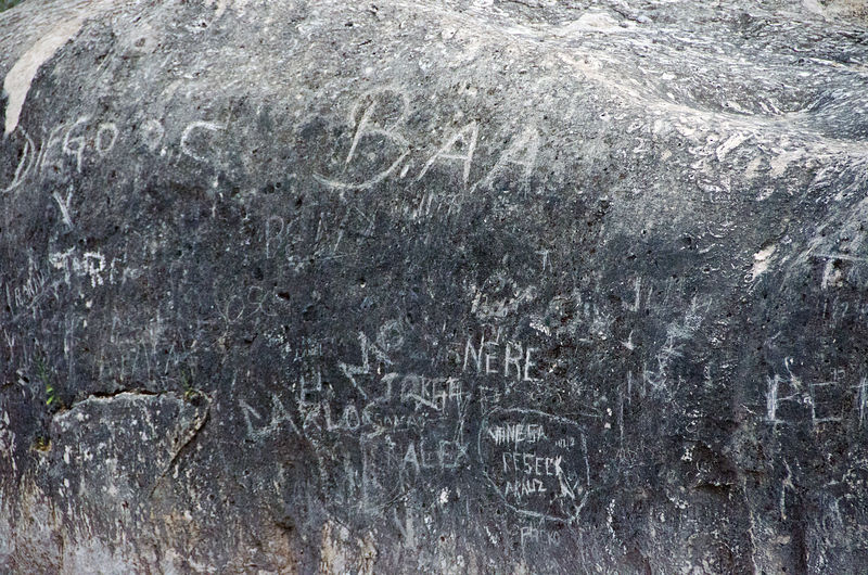
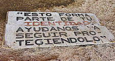
Unfortunately, a little bit of modern graffiti mars the rocks at the "entrance" to this area.
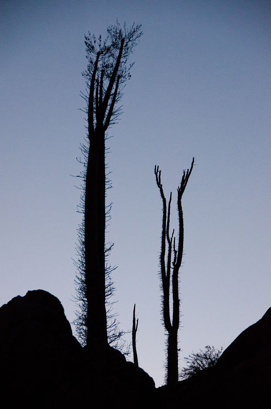
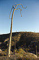
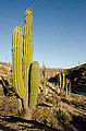
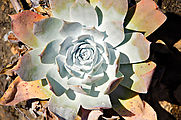
Cactuses and other interesting plants thrive here, often squeezed into sandy pockets in the boulders.
I have a few more photos & details here: http://octopup.org/baja2012
-- Geoff
[Edited on 4-25-2019 by geoffff]
|
|
|
captkw
Ultra Nomad
Posts: 3850
Registered: 10-19-2010
Location: el charro b.c.s.
Member Is Offline
Mood: new dog/missing the old 1
|
|
awsome post!!
damn nice photo's !! Thanks K & T 
|
|
|
BajaWarrior
Super Nomad
Posts: 2307
Registered: 9-27-2006
Location: Mission Bay, San Diego. Playa Hermosa, San Felipe.
Member Is Offline
Mood: Anxious to get south
|
|
What a great trip, looks like you covered all the bases!
Haven't had a bad trip yet....
|
|
|
Skipjack Joe
Elite Nomad
Posts: 8084
Registered: 7-12-2004
Location: Bahia Asuncion
Member Is Offline
|
|
What a cool trip! You got to some really remote places. I really enjoyed that and am looking forward to seeing more on your website.
|
|
|
woody with a view
PITA Nomad
Posts: 15937
Registered: 11-8-2004
Location: Looking at the Coronado Islands
Member Is Offline
Mood: Everchangin'
|
|
good times. how long for the round trip?
|
|
|
geoffff
Senior Nomad
Posts: 643
Registered: 1-15-2009
Member Is Offline
|
|
| Quote: | Originally posted by woody with a view
good times. how long for the round trip? |
This was 10 days in Baja. Here's a rough map from my GPS track log:

-- Geoff
[Edited on 6-25-2012 by geoffff]
|
|
|
SFandH
Elite Nomad
Posts: 6925
Registered: 8-5-2011
Member Is Offline
|
|
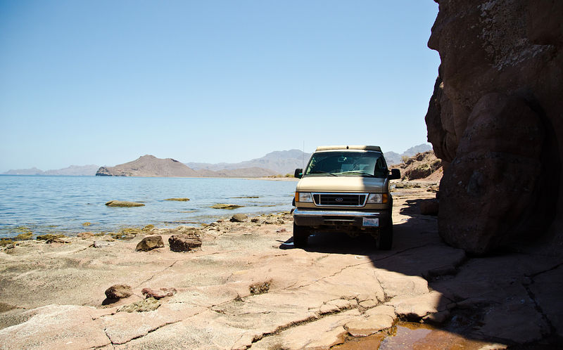
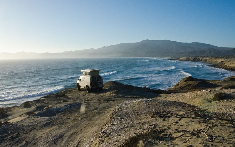
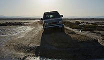
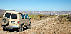
Cool pop top van!! Great baja rig for gettin to just about anywhere.

Thanks for taking the time to post the thumbnail pics.
[Edited on 6-25-2012 by SFandH]
|
|
|
Mexitron
Ultra Nomad
Posts: 3397
Registered: 9-21-2003
Location: Fort Worth, Texas
Member Is Offline
Mood: Happy!
|
|
Wow, that's a lot of territory to cover! Thanks for the report.
|
|
|
David K
Honored Nomad
Posts: 64480
Registered: 8-30-2002
Location: San Diego County
Member Is Offline
Mood: Have Baja Fever
|
|
Wow, I need to come back when I have more timem, to study your photos better... Sorry that you couldn't get onto Shell Island at high tide... It is an
island, afterall!
Very full trip, a lot of Baja in 10 days!
|
|
|
nbacc
Senior Nomad
Posts: 770
Registered: 12-27-2008
Location: Northern California
Member Is Offline
|
|
nice report............enjoyed that Nancy
|
|
|
goldhuntress
Senior Nomad
Posts: 663
Registered: 1-28-2010
Member Is Offline
|
|
Thank you for taking the time to share your AWESOME photos and trip report! Love the van!
|
|
|
TMW
Select Nomad
Posts: 10659
Registered: 9-1-2003
Location: Bakersfield, CA
Member Is Offline
|
|
Excellent report and pictures, thanks.
|
|
|
Neal Johns
Super Nomad
Posts: 1687
Registered: 10-31-2002
Location: Lytle Creek, CA
Member Is Offline
Mood: In love!
|
|
One of the best trip reports w/photos I've seen!
But I'm just a kid - shut up DK!
Neal Johns
My motto:
Never let a Dragon pass by without pulling its tail!
|
|
|
BajaGeoff
Super Nomad
Posts: 1727
Registered: 1-11-2006
Location: San Diego and Campo Lopez
Member Is Offline
Mood: Heading To Baja!!!
|
|
Great report Geoff.....you covered a whole lot of ground in 10 days! Really nice photos too!
|
|
|
David K
Honored Nomad
Posts: 64480
Registered: 8-30-2002
Location: San Diego County
Member Is Offline
Mood: Have Baja Fever
|
|
Cool Pic!

Really outstanding... 
|
|
|
BajaBlanca
Select Nomad
Posts: 13165
Registered: 10-28-2008
Location: La Bocana, BCS
Member Is Offline
|
|
I so agree - outstanding report. wish you had stopped by ourneck of the woods ! you could have driven the coast road from la bocana to bahia
asuncion....it is very beautiful.
stop by next time and say hi !
|
|
|
geoffff
Senior Nomad
Posts: 643
Registered: 1-15-2009
Member Is Offline
|
|
| Quote: | Originally posted by BajaBlanca
I so agree - outstanding report. wish you had stopped by ourneck of the woods ! you could have driven the coast road from la bocana to bahia
asuncion....it is very beautiful.
stop by next time and say hi ! |
Thanks, will do!
Maybe I should try to do an all-coast tour someday -- drive a loop of every coastal road where one exists. Has anyone done that?
-- Geoff
|
|
|
bacquito
Super Nomad
Posts: 1615
Registered: 3-6-2007
Member Is Offline
Mood: jubilado
|
|
Great report-thanks!
Were you traveling alone? What navigation equipment do you carry? Is much of your trip planned in advance via sat. photos?
bacquito
|
|
|
GregN
Junior Nomad
Posts: 99
Registered: 5-13-2004
Location: Palm Springs
Member Is Offline
|
|
Great trip. Great pics. Congrats.
|
|
|
geoffff
Senior Nomad
Posts: 643
Registered: 1-15-2009
Member Is Offline
|
|
| Quote: | Originally posted by bacquito
Great report-thanks!
Were you traveling alone? What navigation equipment do you carry? Is much of your trip planned in advance via sat. photos? |
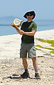
Yes, this trip was done alone. While I do often travel with family or friends, the introvert in me sometimes craves the total freedom of time
adventuring by myself. I frequently hear how it's considered foolish to get yourself far from civilization without a backup vehicle -- but it's a
risk I take with my eyes open. I bring a mountain bike (disassembled inside the van), oodles of water, a satellite phone (rented), a cheap Mexican cell phone, a Spot device -- and, in general I'm pretty crafty field-repairing things. Even on the most remote parts of my trip, I was never more than a few
miles from ranchos, fishing villages, or recent-looking tire tracks.
In my car, have maps of Mexico showing on a little touchscreen notebook computer (Asus Eee PC T91MT) mounted on my dashboard connected to a GPS.
I spent much of my free time before this trip studying books, maps, and the internet (especially this forum, and including Google Earth). If you are
exploring a new regions in Google Earth, look for the subtle little photo icons to pop up. A well-placed photo can indicate an adventure treasure.
-- Geoff
[Edited on 6-28-2012 by geoffff]
|
|
|
| Pages:
1
2
3 |