| Pages:
1
2
3
..
13 |
David K
Honored Nomad

Posts: 65430
Registered: 8-30-2002
Location: San Diego County
Member Is Offline
Mood: Have Baja Fever
|
|
JULY 2012 BAJA TRIP TO THE TIP and beyond! ALL 15 DAYS POSTED!
2022 EDIT: See the trip report and photos, without the Photobucket watermarks, in this trip album page: https://vivabaja.com/p712/
Here is the overall trip, followed by DAY 1 report (with those details many of you enjoy) and photos for Day 1 and the morning of Day 2, on Shell
Island.
I provided some details that most of you Baja folks know, but for those not (yet) into travel to Mexico may appreciate. Please send me a private
message or u2u if you have a question you don't care to have others see or discuss. My email is: info AT vivabaja.com (AT= @)
Baja California July 2012: 2,622 miles
Day 1 (Saturday July 14th): To Shell Island via Tecate, Mexicali, San Felipe.
Day 2 (Sunday): To Bahia Concepcion via Coco's Corner, Calamajue, Guerrero Negro, Santa Rosalia.
Days 3, 4 (Monday, Tuesday): At Bahia Concepcion plus Mulege dinner.
Day 5 (Wednesday July 18th): To La Paz via Loreto and Ciudad Constitucion.
Day 6 (Thursday): To El Triunfo, Real de Santa Ana, San Bartolo, Los Barriles, Punta Pescadero, San Juan de los Planes, La Paz.
Day 7 (Friday): La Paz Museums, La Balandra, El Tecolote.
Day 8 (Saturday): To Todos Santos, El Pedrito, Cabo San Lucas, El Tule, San Jose del Cabo, Santiago, Las Cuevas, La Paz.
Day 9 (Sunday): To: Isla Espirito Santo, Isla Partida, Las Tres Virgenes Restaurant.
Day 10 (Monday July 23rd): To Bahia Concepcion via Las Pocitas, Cd. Constitucion, Ligui, and Loreto.
Day 11 (Tuesday): To Bahia Asuncion via San Ignacio, Punta Abreojos, La Bocana.
Day 12 (Wednesday): At Juan y Shari's Bahia Asuncion Bed & Breakfast, Fossil Hunting.
Day 13 (Thursday): To Bahia San Rafael via Vizcaino, Pozo Aleman, San Francisquito.
Day 14 (Friday): To Shell Island via Bahia de los Angeles, Laguna Chapala, Bahia San Luis Gonzaga.
Day 15 (Saturday July 28th): To San Diego via San Felipe, Mexicali and Tecate.
A week before our trip began, we did a run to Tijuana to get our tourist cards (also called an FMM, it is like a visa needed for trips beyond the
border towns or stays over 3 days). The fee for an FMM (valid for 180 days) was 290 pesos or US$24, each The INM office at the Tijuana border is open
7 days a week from 6 am to 10 pm. The INM official can now receive the payment, so no need to have an open bank nearby, as in the past. We also
purchased pesos at the Chula Vista Costco money exchange (Palomar exit, I-5 to Broadway, north) for some of our trip purchases (mostly gasoline) and
the exchange rate was 12.905 pesos per dollar. Except for the border region gas stations, the cost of gasoline was $2.95/ gallon (10.05 pesos/ liter).
If I post a price in pesos, the equivalent dollar value will be shown.
Saturday, July 14: Crossed the border at Tecate 11:14am. When entering Mexico there is a red light/ green light signal to tell you to
continue on in or to pull over for inspection. Being a pickup truck full of stuff, we got a red light. Since Tecate is a very quiet border going into
Mexico, it took just a few seconds for the officer to glance at my truck and tell me to continue on into their country. They are looking for items
that may be resold in Mexico such as appliances, electronics, etc. Camping and personal gear is no problem.
Signs point the way towards Mexicali making the little bit of city street use very simple. Just east of town on Highway #2, we stop at a Pemex station
and topped the gas tank. price of 87 octane Magna from the green/ verde pump was $3.02/ gallon (slightly higher price along the border). Got on the
toll highway (Highway #2-D) towards Mexicali for a quick 80 mile trip east to Highway #5 for San Felipe. Toll at El Hongo was 57 pesos (or posted
US$4.30), toll at La Rumorosa was 20 pesos ($1.55), and final toll near the junction with Highway #5, was 60 pesos ($4.65).
Highway #5 has been torn up for widening in sections for the past few years and during this trip, there was a total of 20 miles of unpaved detours
along the new road work. This is in the area 47 miles south of the Highway 2-D junction (at the sand dunes) to El Chinero mountain (between the active
gold mine and Highway 3 junction). The detours were mostly smooth and watered down for dust control.
At the Highway 3 (Ensenada) junction, 160 miles from Tecate is the first major military inspection where soldiers may ask you to step out of your car
so they can look for illegal drugs, guns or ammo. They are always polite, friendly and very quick (at least to us). Most of the time they will ask you
where are you coming from and where are you going. In a couple locations they recorded my name and asked what year model my Toyota Tacoma was (2010).
Showing them your driver's license makes their writing of your name easier. They never asked to see passports or tourist cards, and never have on any
of my trips as it is not in their duty of looking for guns and drugs.
At El Dorado Ranch, we stooped to top our gas tank. This is 7 miles north of San Felipe, just past the big Rockodile sign (a crocodile). The price
here is the same as at all other Baja stations for this trip with one exception and the border zone price. Magna (Regular 87 octane) is 10.05 pesos
per liter or $2.95 per gallon. If you are using dollars, this station was giving an exchange rate of 13.00 pesos per dollar. I took on 10.5 gallons
for the 183 mile drive from Tecate. The convenience store at the El Dorado Pemex had 8 packs of Tecate Light Beer for 84 pesos ($6.46 for 8 cans).
We left the station at 3:30pm, drove the 7 miles to San Felipe, turning south at the traffic circle. In 6 miles, a left turn is made (ahead goes to
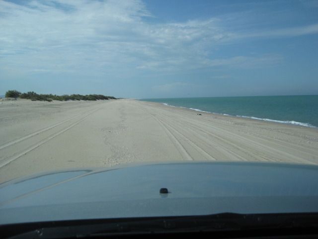
the airport) and this point is also Kilometer 0 for Highway #5 south. Several vacation home and camp areas are passed as we head for a very special
beach I have been camping on for the past 34 years, before most of the region's development and before paved roads ventured south of San Felipe. It is
a barrier island that during the highest tides is surrounded by water and impossible to access or leave. Being difficult to get to is one reason it
remains as beautiful today as it was the first time I camped here, on the beach I call Shell Island. The access road to the island is near Km. 26,
almost 22 miles from San Felipe. We arrived at our campsite at 4:40 pm. Our vacation had begun!
Photos: 2022 EDIT: See the trip photos without the Photobucket watermark in this trip album page: https://vivabaja.com/p712/
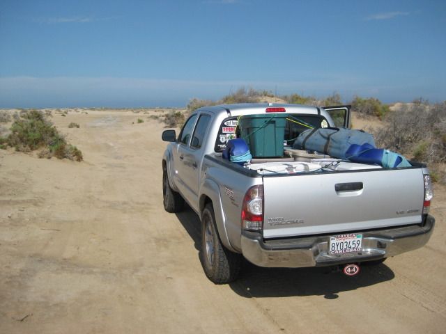
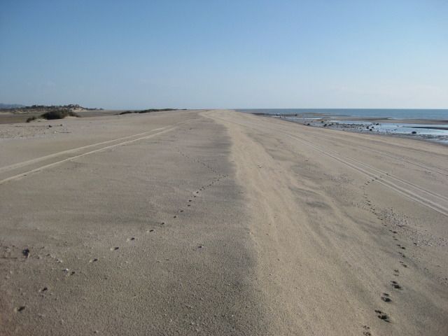
After crossing the salt/mud flat seen here, we reach the beach on the island.
While the entire 4 mile long island is usually deserted, we have a favorite spot next to the dunes a couple miles away from the road.
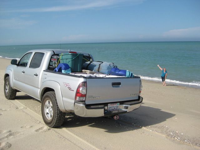
Elizabeth quickly gets into the Baja Feeling mode.
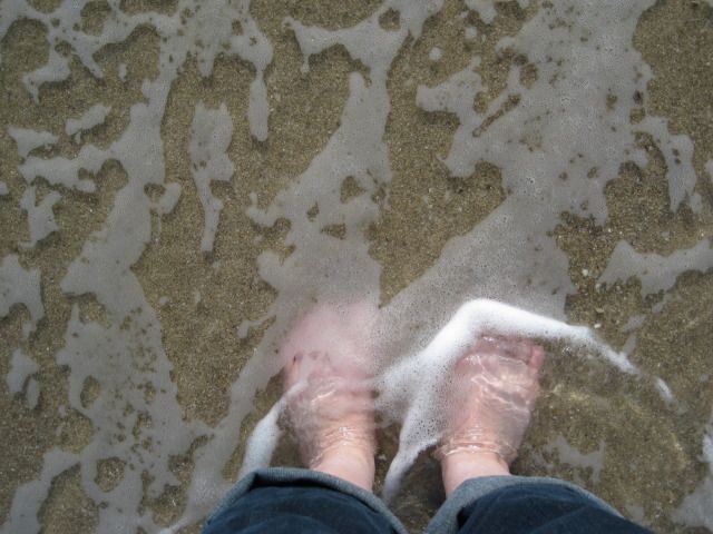
... and makes her first contact with the Sea of Cortez.

Whelk eggs were spotted on the wet sand. A whelk is a large sea snail.
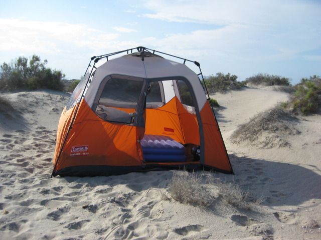
New, easy up tent! Our last time camping here (July 4th weekend, 2011) a sudden strong wind devastated our camp and ruined our old tent. That same
wind sunk the sport fishing ship Erik with many lives lost, about 50 miles south here.
Sunday, July 15: We woke up with the sun and soon were packed up.
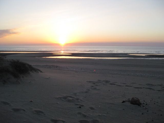
Here are views north and south on Shell Island (low tide):

===============================================================
Sunday's drive to Bahia Concepcion coming next (Enchanted Islands, Coco's Corner, Calamajue Canyon, and more!).
[Edited on 7-4-2020 by David K]
[Edited on 3-27-2022 by David K]
|
|
|
Bob H
Elite Nomad
Posts: 5867
Registered: 8-19-2003
Location: San Diego
Member Is Offline
|
|
Only the beginning of a great trip report and it's already good! Tell me, how in the world do you know about whelk eggs?
http://en.wikipedia.org/wiki/Whelk
Whelk egg capsules...
http://www.youtube.com/watch?v=w1ISXARzj5s
[Edited on 7-29-2012 by Bob H]
The SAME boiling water that softens the potato hardens the egg. It's about what you are made of NOT the circumstance.
|
|
|
Ateo
Elite Nomad
Posts: 5946
Registered: 7-18-2011
Member Is Offline
Mood: Just trying to close my Baja Nomad account….
|
|
Very cool DK. Can't wait to hear about day 11. I'll be in that area soon. Looks like you covered a lot of ground!
|
|
|
dtbushpilot
Ultra Nomad
Posts: 3296
Registered: 1-11-2007
Location: Buena Vista BCS
Member Is Offline
Mood: Tranquilo
|
|
Great start DK, looking forward to the rest. Sorry we missed you and bajatripper when you came through Los Barriles.....dt
"Life is tough".....It's even tougher if you're stupid.....
|
|
|
edm1
Senior Nomad
Posts: 568
Registered: 8-23-2006
Location: Oak Hills, Ca
Member Is Offline
|
|
David, very nice and colorful new camping tent! Let's hope it will last and evade the unexpected camping night winds in Baja.
Sounds like you're writing your trip report not just for us nomads but also for newer guests here in the forum, with sidebar comments along the way.
That is a great informative way to entice newbies to the beauty and excitement Baja has to offer.
Looking forward to the next reports, especially on those places where I've never been before.
|
|
|
Bob H
Elite Nomad
Posts: 5867
Registered: 8-19-2003
Location: San Diego
Member Is Offline
|
|
| Quote: | Originally posted by edm1
Sounds like you're writing your trip report not just for us nomads but also for newer guests here in the forum, with sidebar comments along the way.
That is a great informative way to entice newbies to the beauty and excitement Baja has to offer. |
Gotta love this about David K, always representing the best of Baja for those who have not been there or want to go there.
The SAME boiling water that softens the potato hardens the egg. It's about what you are made of NOT the circumstance.
|
|
|
Ken Cooke
Elite Nomad
Posts: 8970
Registered: 2-9-2004
Location: Riverside, CA
Member Is Offline
Mood: Pole Line Road postponed due to injury
|
|
VIVA BAJA!
|
|
|
nbacc
Senior Nomad
Posts: 770
Registered: 12-27-2008
Location: Northern California
Member Is Offline
|
|
I am loving it.
|
|
|
David K
Honored Nomad
Posts: 65430
Registered: 8-30-2002
Location: San Diego County
Member Is Offline
Mood: Have Baja Fever
|
|
Thanks guys... I will get to work on Day 2, etc. This is just a warm up, with the data for Baja newbies... I am also posting this report on Tacoma
World, which only has a small number of Mexico travelers (from what I can tell). Way too many are scared of Mexico after the way our news media hypes
up crime there, but doesn't compare the two places in real terms (ie. crime is not against tourists and Americans are far more likely to be victims in
their own cities than ever in Mexico).
Anyway, I am as excited to continue this report and show you some of the 1,000 photos as if I was going back again to relive the trip... and it was a
GREAT trip!
[Edited on 12-24-2012 by David K]
|
|
|
Ken Cooke
Elite Nomad
Posts: 8970
Registered: 2-9-2004
Location: Riverside, CA
Member Is Offline
Mood: Pole Line Road postponed due to injury
|
|
| Quote: | Originally posted by David K
Way too many a scared of Mexico after the way our news media hypes up crime there, but doesn't compare the two places in real terms (ie. crime is not
against tourists and Americans are far more likely to be victims in their own cities than ever in Mexico). |
Before clicking on Tacoma World, it was my impression that Toyota drivers welcomed international travel more than Jeep drivers. But, from viewing
that site's response to David K's threads, I guess more Jeep people than Toyota's (from the USA), make the drive south of the border.
I have noticed that no matter the make of the vehicle, the driver behind the wheel - if Latin-American or Spanish-speaking is more likely to travel
into Baja Mexico across the board.
Being raised by well-traveled Parents, I view Baja as my backyard and not a mystery-laden land rife with danger and Bandidos. That's the Amazonian
sector of Peru and Colombia!
[Edited on 7-30-2012 by Ken Cooke]
|
|
|
Curt63
Super Nomad
Posts: 1171
Registered: 3-28-2009
Location: San Diego, Ca.
Member Is Offline
Mood: Fish tacos and Tecate
|
|
Lookin good buddy!
No worries
|
|
|
Bajaboy
Ultra Nomad
Posts: 4375
Registered: 10-9-2003
Location: Bahia Asuncion, BCS, Mexico
Member Is Offline
|
|
Great memories for sure DK. Thanks for taking the time to share with us.
|
|
|
David K
Honored Nomad
Posts: 65430
Registered: 8-30-2002
Location: San Diego County
Member Is Offline
Mood: Have Baja Fever
|
|
Sunday, July 15, 2012
Sunday morning we got moving south at 7:38 am and reached the Puertecitos entrance road in an hour (time includes adding air to the tires once we were
off the deep sand of Shell Island). The Puertecitos road is at Km. 74.5 and the new, wider, high speed highway begins here. The 52 mile highway from
San Felipe to Puertecitos is an older style, narrow paved road with sudden, steep vados (dips) that prohibit high speed. I reset my Tacoma's trip
odometer at the Puertecitos junction to note the mileage where the new pavement has reached, and other points south.
Playa Cristina is at Mile 5.0, La Costilla is at Mile 6.1, the wide turnout with the view of the Enchanted Islands is at Mile 14.7 and just before Km.
100 marker. Okie Landing (a fishing resort from the 1960's with just concrete slabs remaining) is at Mile 25.5/ Km. 117. The pavement ended just north
of here one year ago.
The end of pavement this trip is at Mile 31.3, just beyond Km. 126. That is almost 6 miles (10 km.) added in one year. This is no rush job, but the
quality of the highway is fantastic, with a 110 kph (~70 mph) speed limit.
Turnoffs to Campo Delfines is at Mile 31.9, Punta Bufeo is at Miles 36.6, Papa Fernandez' is at Mile 41.7, Military checkpoint is at Mile 42.8, and
the Pemex gas station/ Alfonsina's road/ Rancho Grande store are at Mile 44.2 from Puertecitos road and the time was 10:06 am.
The remaining unpaved road to Bahia San Luis Gonzaga is graded smooth. From the end of pavement to the Pemex and Rancho Grande is 12.9 miles. We
topped the gas tank at Gonzaga Bay. Trip odometer reset to 0.
Las Palmitas oasis/ El Camino Real access road is at Mile 7.2, the first boojum (cirio) trees were at Mile 13.9, and Coco's Corner is at Mile 22.4. We
were at Coco's from 11:00 to 11:52 am. It was a nice visit, Coco seemed quite happy, and his only request was for a new battery for his quad.
Otherwise he gets around on a wheelchair or walks on his stumps.
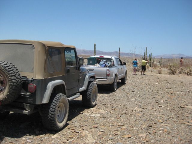
At Coco's when we arrived were a couple from Ventura in a Jeep Wrangler with good off road tires. They wanted to go south through Calamajue Canyon,
but Coco had told them the water was too deep for them to take the risk. Just a couple weeks earlier, Bajatripper had passed south via Calamajue and
reported the stream much smaller than typical and the water was no problem for his Toyota 4Runner. I told the couple that they could follow me and I
would be happy to pull them through with my Tacoma, if needed. Coco said he wouldn't take responsibility for them, and I assured him that I would!
There are two roads southbound from Coco's Corner, the most used one is the main road to Highway #1 at Laguna Chapala which is graded and will be the
route or close to the route of the future paved highway. The other goes through Calamajue (say: Cal-a-ma-WAY) canyon is was the main route south
before 1983 when the graded road from Laguna Chapala was completed. For several miles, the road and the year-round stream of mineralized water are one
in the same. The Baja 1000 race often uses the Calamajue route, and that often creates a difficult drive until nature repairs the damage.
The road begins heading east and for 6.3 miles is a graded road that continues to the Sea of Cortez (also called the Gulf of California) at Puerto
Calamajue. The road we want turns south off the graded road and in 6.6 miles arrives at the top edge of the Calamajue river gorge. To the left here
are ruins of a gold ore processing mill from the early 1900s. The road drops to the valley floor and at Mile 13.1 from Coco's Corner a faint track
goes to the left and climbs up the opposite bank 0.4 mile to the first site of the 17th Spanish California mission, founded in 1766. Only there for a
few months, the mission was moved because the water was far too salted with minerals to grow any crops. The new location was given the name Santa
Maria de los Angeles and the first location has typically only been known as Calamajue, the local native Indian name (however one Jesuit missionary
wrote that it was first called Nuestra Señora de Columna).
We made lunch next to the ruins of the mission and rock corrals, probably built by miners years after the mission period ended. We got on the road
again at 1:25 pm and soon were driving in water and across only a couple of deep puddles, but no challenge at all for either the Jeep or Toyota.
At mile 21.1 from Coco's Corner (not including the side trip to the mission) we were out of the canyon and passed the access road to Highway 1 at Km.
251. This cut across road was built in 1973 during the building of Highway 1 to get water, needed for compaction of the roadbed. The next 6.9 miles
are mostly slow because of the whoops (short, deep bumps) usually created by race traffic. After passing Rancho El Crucero, opening the gate across
the road (and closing it behind us), we reach Highway 1 at Mile 28.0 from Coco's Corner and at Highway 1, Km. 261. We add air to the tires for highway
running and are on our way at 3:02 pm. The couple in the Jeep headed for Bahia de los Angeles to finish their vacation.
Reset trip odometer to 0 at El Crucero/ Km. 261. Mile 13.0 is the Bahia de los Angeles junction. The next military inspection station is at the
turnoff to El Tomatal, near the Pacific coast of Baja California. Mile 69.9 is the Villa Jesus Maria Pemex station (121.2 miles driven since Gonzaga
Bay gas fill-up) and after topping off we are southbound at 4:20 pm.
Normally, one expects to show his tourist card at the state border, near Guerrero Negro and typically, this is the only place were you are asked to
show it. A big stop sign is in front of the immigration office, just a bit south of the huge steel eagle and traffic circle, built on the state border
between Baja California and Baja California Sur. We stopped, anxious to show the officer our papers, but he just glanced from the doorway and waved us
on.
The southern half of the peninsula is on Mountain Time, so we advance our truck's clock from about 5 pm to 6 pm. Also the kilometer markers work in
reverse, getting smaller as you drive south. We pass through Vizcaino at 6:48pm (65 miles south of Villa Jesus Maria). We pass by San Ignacio (Km. 73)
at 7:30 pm after another military check. Now, if it is your first time into Baja, do not pass San Ignacio without taking the short paved road right,
to the plaza, to see this beautiful oasis and giant stone mission church.
The highway makes two steep drops to the Sea of Cortez, the second is the steepest and is called Cuesta del Infierno (Hell's Grade). On our way south,
it was unpaved as new highway work is being performed. On our return, paving was underway.
We arrive at Santa Rosalia (Km. 0) and go to the second Pemex station on your left (next to the harbor), as the other three have a bad reputation for
dishonest pumps or attendants. In fact, the primary bad station (just ahead, on the right) was closed for remodeling (and maybe tamper-resistant
pumps?). It was just after sundown when we left at 8:22 pm.
We arrive at our destination on beautiful Bahia Concepcion, just as it was dark. We will camp this and the following two nights here, getting some
long awaited rest and enjoying one of Baja's most beautiful bays and beaches.
Some photos:
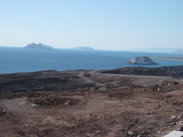
Islas Encantadas (Enchanted Islands) viewpoint parking, near Km. 100, south of Puertecitos.
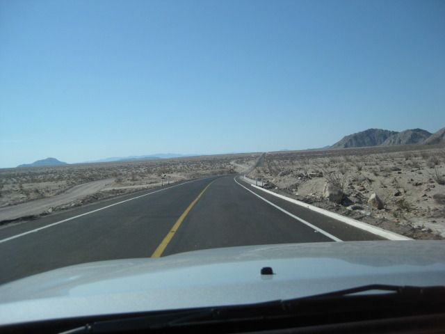
New, fast highway south from Puertecitos.
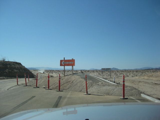
End of pavement, July 15, 2012 (about 13 miles north of Gonzaga Bay Pemex Station).
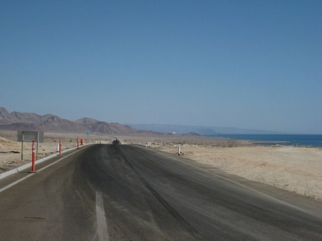
View north from south end of highway, near Km. 126.
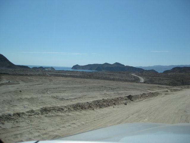
First view of Bahia San Luis Gonzaga.
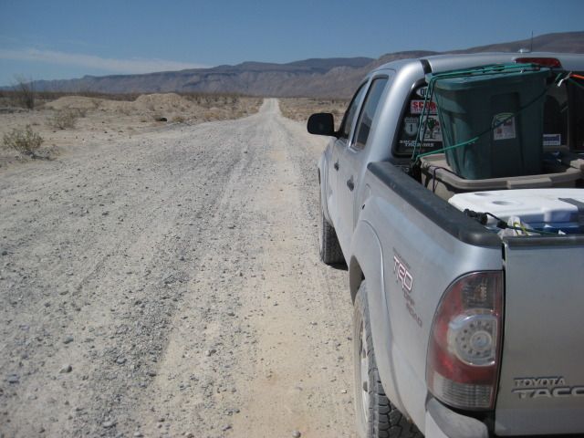
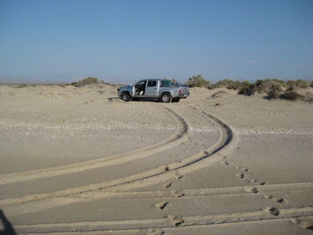
Road south from Gonzaga begins smooth, but gets rockier as one nears Coco's Corner.
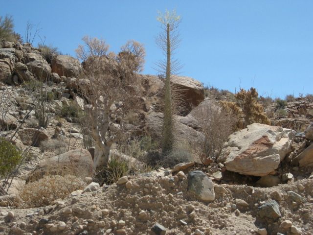
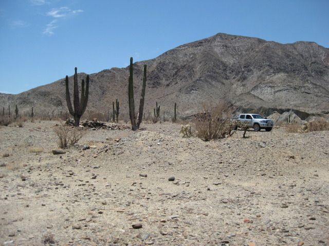
The first boojum tree I spotted along Highway 5, about 8 miles north of Coco's or 14 miles south of Gonzaga.
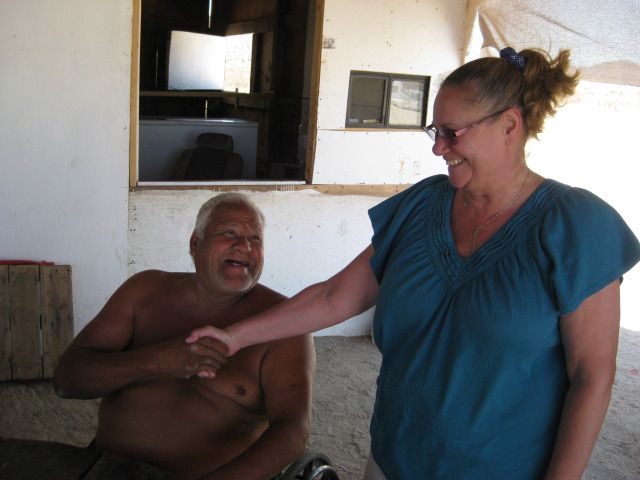
Elizabeth greets an old friend, Coco.
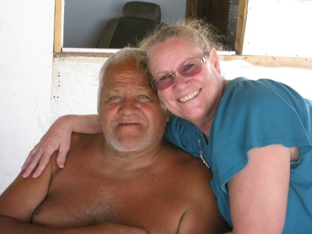
Coco wants a hug!
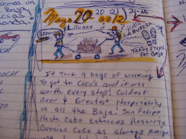
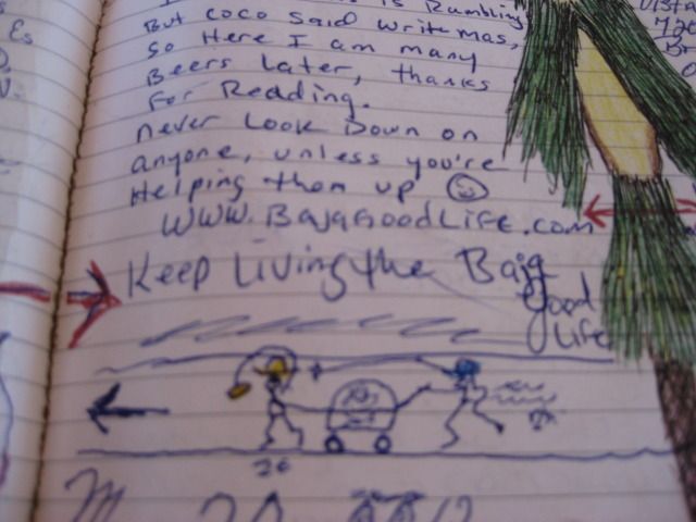
Coco is surprised to hear the couple (John and Rachel, walking the length of Baja) have arrived in La Paz, and shows us their entry (and his cartoon)
of when they passed here weeks earlier.
Coco and David K

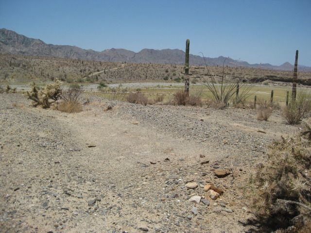
The old gulf coast road south to Calamajue Canyon.
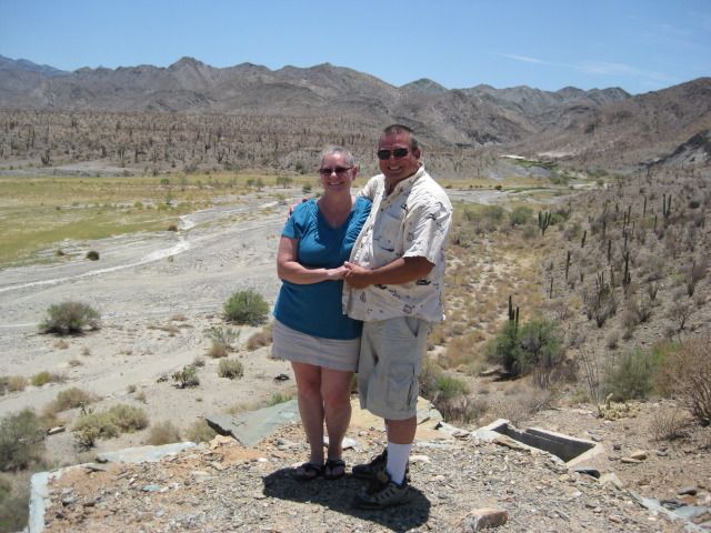
Baja Angel (Elizabeth) and I at the mill ruins on the edge of the cliff at Calamajue.
We arrive at the 1766 mission site.
The adobe walls have all melted down.
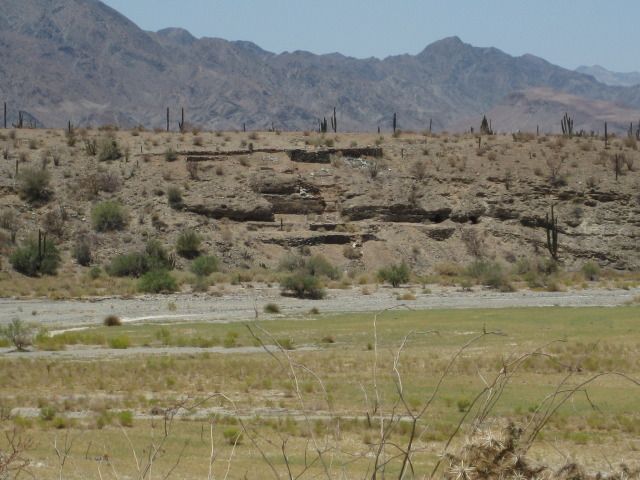
The view of the gold ore mill ruins, across the canyon from the mission site.
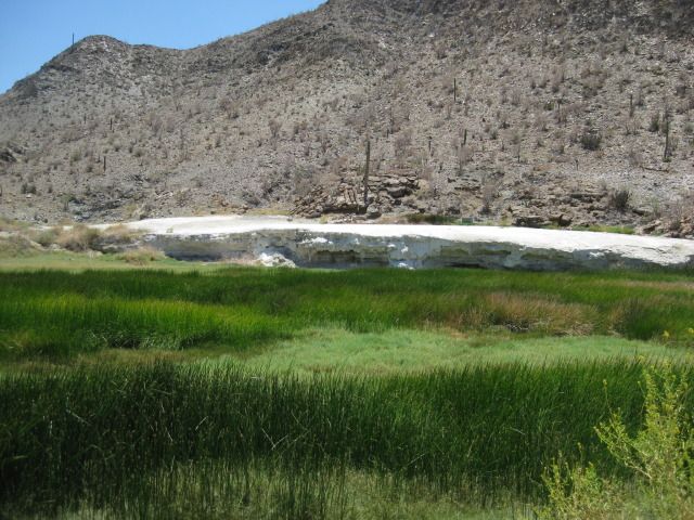
White mineral deposits from springs along the creek, in the canyon.
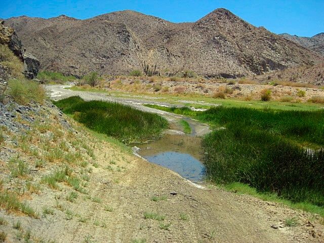
The deepest puddle this month!
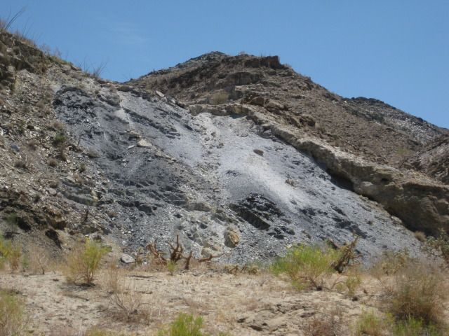
Lots of colors in the canyon.
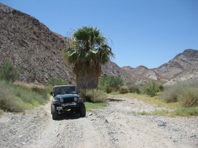
Several palms are growing in the canyon, too.
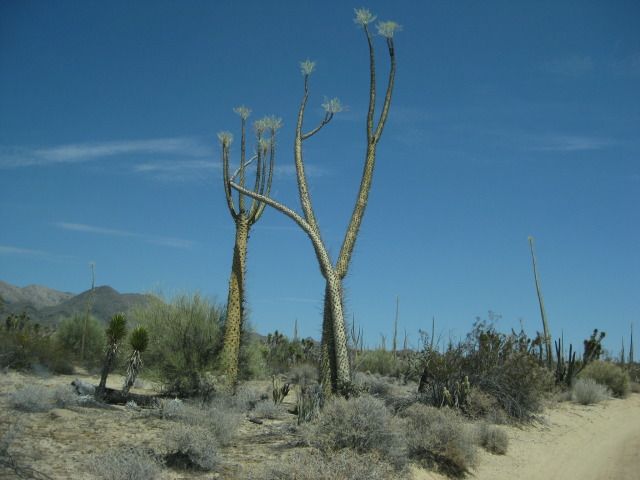
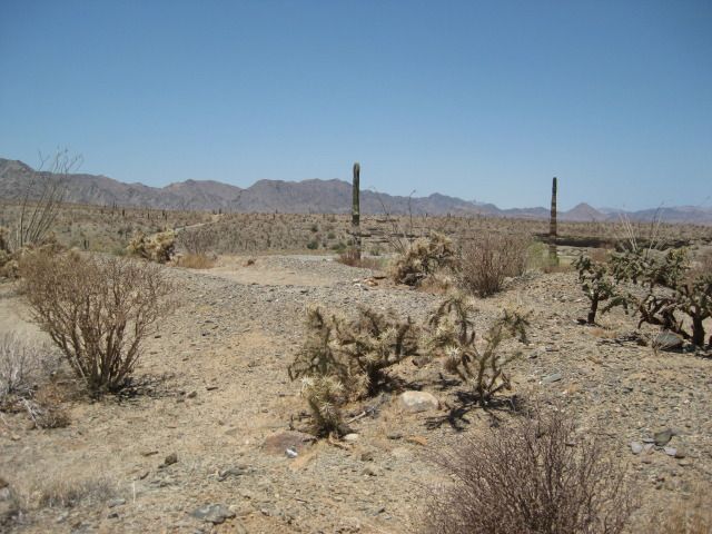
Once out of the canyon, the Baja desert begins to entertain us with dancing boojum trees.
I am now driving to get to our next camp before it is dark (driving highways in Baja in the dark is not a good idea because cattle and burros are
attracted to the pavement at night, plus you miss great scenery).
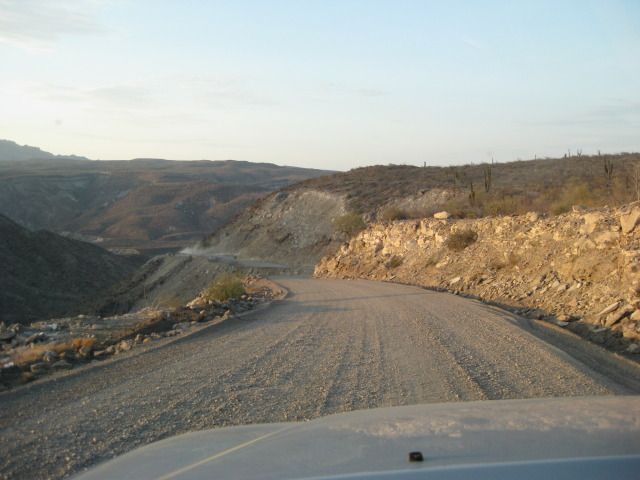
The unpaved, wider but still steep Cuesta del Infierno, near Santa Rosalia.

Last photo today showing some old French mine buildings, across the highway from the gas station. Santa Rosalia was a huge copper mine dating back to
the late 1800's operated by the French.
Stay tuned for more.
[Edited on 7-4-2020 by David K]
|
|
|
bacquito
Super Nomad
Posts: 1615
Registered: 3-6-2007
Member Is Offline
Mood: jubilado
|
|
Great report , photos-look forward to more.
bacquito
|
|
|
elbeau
Nomad
Posts: 256
Registered: 3-2-2011
Location: Austin, TX
Member Is Offline
|
|
Great trip report! Looking forward to reading the rest.
|
|
|
David K
Honored Nomad
Posts: 65430
Registered: 8-30-2002
Location: San Diego County
Member Is Offline
Mood: Have Baja Fever
|
|
Thanks!
Nomads:
Please let me know if your connection or whatever makes seeing the post difficult as I keep adding days and photos. I think there is a point when too
many photos will make opening this thread difficult on slower browsers or less than highest speed Internet connections.
I will break this 15 Day trip report into multiple posts, if needed.. no problema!
|
|
|
Udo
Elite Nomad
Posts: 6364
Registered: 4-26-2008
Location: Black Hills, SD/Ensenada/San Felipe
Member Is Offline
Mood: TEQUILA!
|
|
Great trip report, David.
Love the detailed photos.
Udo
Youth is wasted on the young!
|
|
|
Udo
Elite Nomad
Posts: 6364
Registered: 4-26-2008
Location: Black Hills, SD/Ensenada/San Felipe
Member Is Offline
Mood: TEQUILA!
|
|
Hi, Ken!
I noticed you have a video imbedded in your avatar.
I have a really cool mwv video a friend sent me, but all it has is a title.mwv
How can I post the video to share with other Nomads on this board?
| Quote: | Originally posted by Ken Cooke
VIVA BAJA! |
Udo
Youth is wasted on the young!
|
|
|
Pacifico
Super Nomad
Posts: 1299
Registered: 5-26-2008
Member Is Offline
|
|
Great report! I look forward to the rest.....
"Plan your life as if you are going to live forever. Live your life as if you are going to die tomorrow." - Carlos Fiesta
|
|
|
David K
Honored Nomad
Posts: 65430
Registered: 8-30-2002
Location: San Diego County
Member Is Offline
Mood: Have Baja Fever
|
|
When we first saw them on the beach, a few years ago, a Baja Nomad identified what they were for us. They are also called 'Mermaid's Neclace'...
|
|
|
| Pages:
1
2
3
..
13 |
|