| Pages:
1
2 |
Paulina
Ultra Nomad

Posts: 3812
Registered: 8-31-2002
Location: BCN
Member Is Offline
|
|
Trip Report/Rancho San Gregorio/San Juan Mine/ Baja 1000
(ON Edit: I've resized these photos twice to DKs specifics. So they are what they are. I'm over it! ;-)
Dern recently got back from working BFG radio relay for the Baja 1000-Rancho San Gregorio/San Juan Mine/Bahia de Los Angeles.
He worked on this report over the Thanksgiving holiday in Punta Banda. I am posting HIS trip report/photos.
"I got a call from friends of ours asking if I could do some radio relay for BFG, for the Baja 1k in or around the Bay of LA region. After tossing it
around for a couple of days and figuring out my work schedule, I happily accepted.
My next thought was where to go. Bahia has some great locations to do radio work; the problem is getting to them. The mountain range goes from sea
level to 5000 ft real quick. Paulina and I were tossing around ideas when we both thought it would be cool if I could get up to the San Juan Mine.
Hmmm
The challenge was on.
I remembered the thread on Nomad about LarryC going up there. I pulled up the thread and checked out the pics and read about San Gregorio on the
western slope of the mountain range. Paulina sent LarryC a u2u and she located the email address for Rancho San Gregorio. I shot Rafael Villavicencio,
the contact for RSG, a message of what I wanted to do.
I invited my friend Cy to come along. We got up early on Saturday, November 10th and left the Avila Beach area at 4am. We needed to meet the up with
the whole BFG crew in San Diego by 11:30am for a meeting and to gather up necessary radio equipment.
After a long day of meetings, last minute Costco run, peso exchange, El Recreo in Maneadero, we made it to the house in Punta Banda around 6pm. We
unpacked the truck and repacked it again with the things we needed for the trip down to Bahia, and headed out at o-dark thirty that following
morning. That would give us an extra day to do our homework and secure a spot before the race.
Got to Bahia around 2 in the afternoon and set up the house. Up till this point, I still hadnt heard back from Rafael Villavicencio. So, the plan was
to get up super early on Mon. and head out to RSG to see what we could arrange in person. As luck would have it, before leaving town, I stopped at the
internet café that next morning to check my emails and there was a reply from Rafael. He said that he could take us up to the San Juan mine and that
he had two pack mules that we could use. Whoo Hooo!! A plan is coming together.
Ive been to San Borja multiple times but never San Gregorio. It took a few tries to find the final road that leaves San Borja and heads up to San
Gregorio but we figured it out.
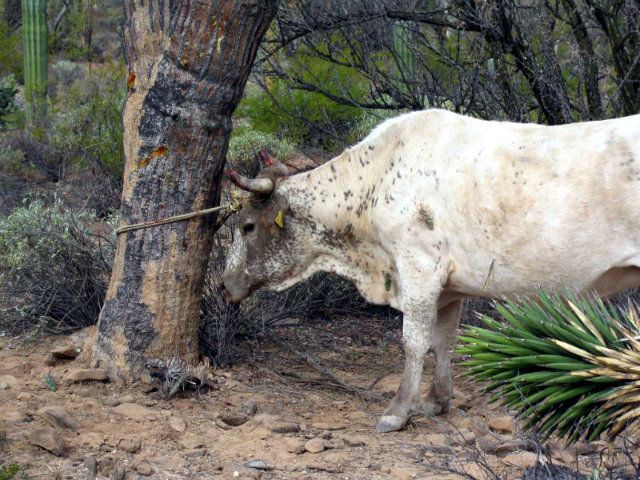
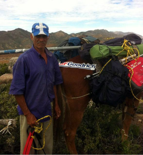
Waiting for his new owner to show up...
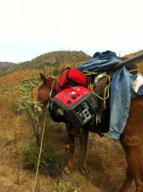
We got to the ranch around mid morning and met with Rafael. We explained to him what all we needed the mules to pack; generator, batteries, radio
gear, 30telescoping pole, antennas, water, food, clothes etc. We said that we have back packs and that we could carry stuff as well. He said that we
didnt need to carry anything, that the mules would do it all. Okie dokie. Works for us! He also gave us a tour of the ranch while we were there. What
a beautiful place.
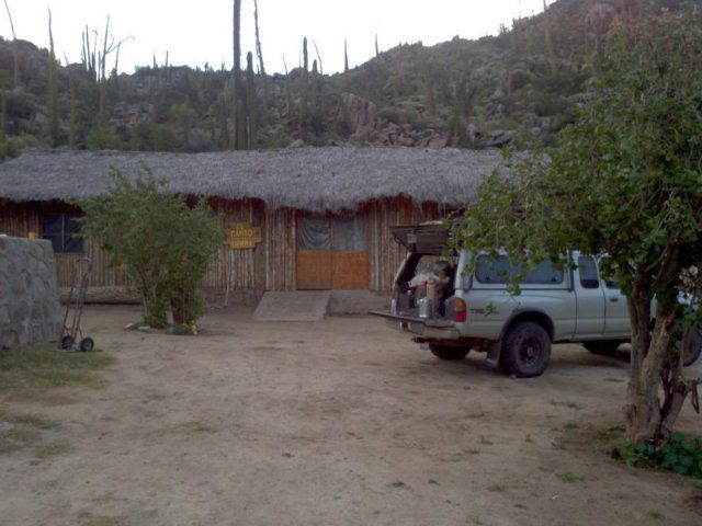
The main ranch house
The pila is huge, I'd say about 25'x25'
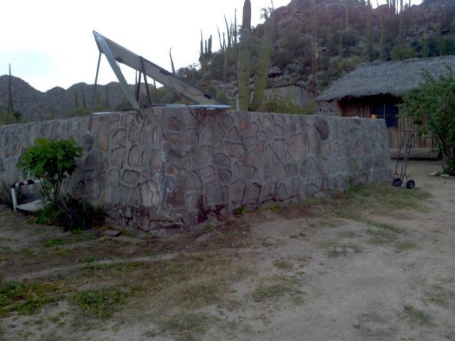
They grow most of their own veggies and raise chickens and rabbits for food. They are off grid and live out there fairly self sufficient. The funny
thing is that they have internet and phone. He receives the same internet signal that Bahia gets. He has an antenna up on the Mine ridge that shoots a
signal right down on him. He has to maintain it himself and just had to hike up there to fix it two days before we got there. Thats why we got a
reply so late.
Rafael is also big in holistic healing, mainly using the native plants that grow in Baja. Throughout our time with him, he showed us many species
that had a medicinal value. He also pointed out many edible plants.
Prior to leaving, we discussed a price for two guides and two mules. 2000 pesos. Seemed pretty fair to me since the guides and mules would stay
overnight at the mine as well. We made plans to show up at the ranch around sundown on Wed., sleep there and get up early Thurs/race day to start our
hike to the top to be set up before noon.
With all our ducks in a row now, that gave us all day Tues. and half day Wed. to round up things we needed from our place, get organized and ready to
go for our adventure. The weather had been a concern in the back of my head. Upon arriving to Bahia on Sun., the North winds were howling. They didnt
even let up during the night. If its windy down low, I could just imagine how bad they would be up on the mountain. Luckily for us, they subsided on
Tues. and the weather started to cooperate.
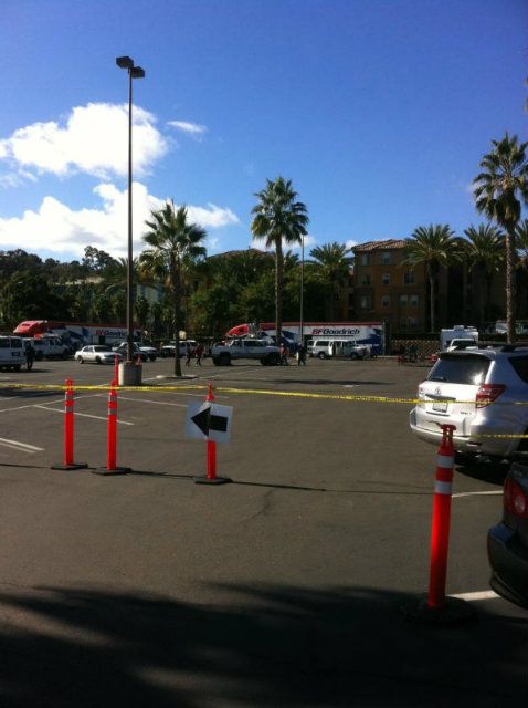
We headed out from our place around noon-ish on Wed. Before heading to the rancho, we needed to check in with the BFG Pit that was located in town
across from Costa del Sol. We let them know what the plan was and that wed be talking to them by noon on Thurs.
We made it out to the turnoff to San Borja/San Gregorio a little early and decided to kill some time on the side of the highway and see if our friends
from Punta Banda that were going to stay at our place would pass by. No luck. Turns out, we found out later, they were already in town.
We headed down the road at 3pm on the button. With our last run to the rancho, we knew that it would take two hours exactly to get there. We pulled in
just after dark. The sun goes down fast when youre chasing it! We were offered to sleep in one of the bunkhouses but declined due to it being such a
beautiful night with the stars and all. We set up our cots, had a little grub, got on the internet with our iphones to check in with Paulina and then
hit the sack fairly early.
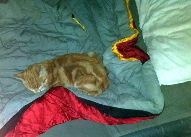
Both of us slept kind of restless as the ranch kitten was adamant on jumping on our heads throughout the night. It finally settled down in my sleeping
bag and slept the rest of the AM.
The ranch did have three dogs, all female. They don't want male dogs peeing all over their gardens.
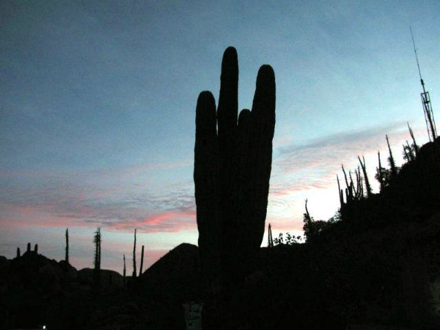
ILY Cactus at sunrise
We got up around 4am that next morning (race day Thurs.). I got coffee going and we packed up our stuff for the trek.
Making coffee on my tailgate
The guides were up and moving, feeding and saddling up the mules.
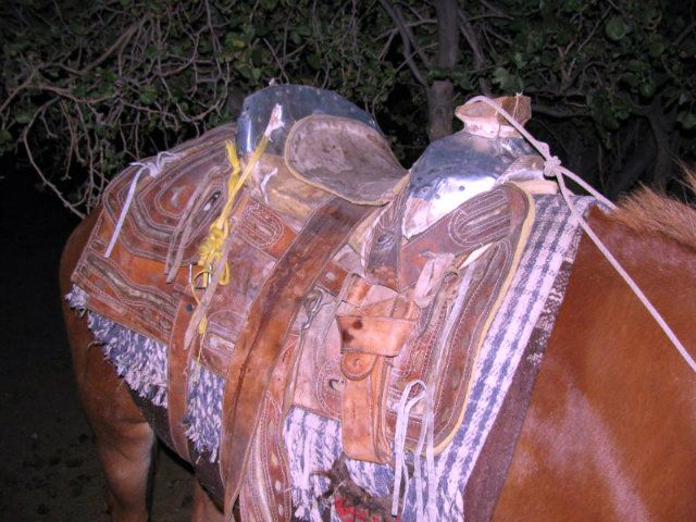
Rafael called this saddle, "chica nada"
They needed to get a jump start on us as Rafael suggested we drive up the arroyo as far as we could and meet them at the head of the trail, as this
would shave off two hours of walking. This road/arroyo that we took was the old wagon trail that serviced the mine back in the day. This road was not
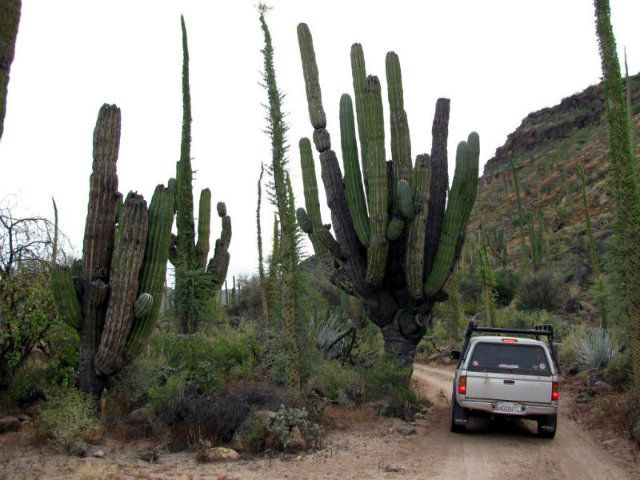
designed for large vehicles. I wouldnt do it in anything but a small size 4WD or quad. My little Tacoma had some tight squeezes and as a result, it
now has a new /fresh set of Baja pin striping. After about 45 min driving, we met up with the guides. Rafael rode with us to ensure that the mules got
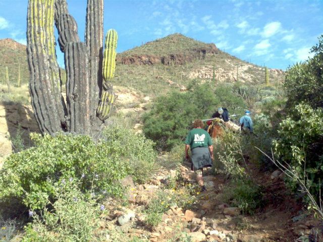
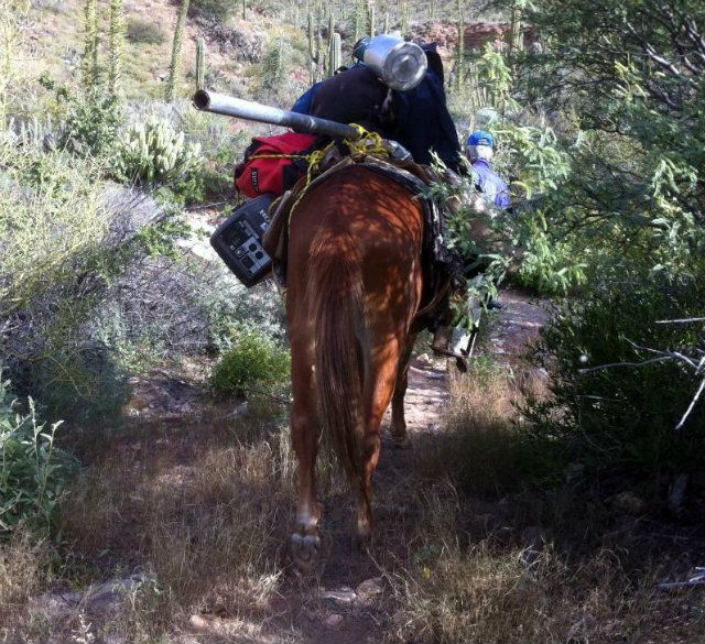
packed up properly. He then walked back to the rancho. Cy and I and our two guides started our hike up the mountain.
Carga ancha
The hike went fairly quick. The views looking back to the west were spectacular. On Rafaels last trip up to the mine, he saw 17 borregos. We kept a
sharp eye out for them but to no avail. Our guides moved at a fairly quick pace, so if we stopped to take a photo or take in the view, theyd leave us
in the dust. We followed behind the mules and had to pay attention to the one carrying the telescoping pole. He would stop in the middle of the trail
to eat grass, next thing you know; youre bashing your forehead into the pole. Half way through the hike I got smart and found a switch to whap the
mules butt to keep him going.
Where is the red flag when you need one?
One of the guides was named Fermin. He must have been 65-70 ish, tall, skinny and everything he said came out super mumbled. Classic guy.
Fermin was from Tijuana and had worked with Rafael doing construction there for many years. He carried a machete with him and cleared a path as we
climbed. He wore the coolest shoes; old school vaquero style with tire treads for a sole. I believe they are called techuas. (Someone chime in if
you know the correct name.) I remember seeing a few pairs just like them in the museum in Bahia. Fermins shoes were made by a man in Bahia named
Patricio. Turns out that Patricio is Rafaels uncle, and grew up out at San Gregorio.
David was our other guide. He was maybe in his late thirties and was Rafaels brother in law. Nice guy and very helpful. We found out that he
definitely knows lots of cuss words after he got impaled in the thigh by one of those long thorny chollas. I didn't get a photo of David, only video.
The hike is deceiving. Once I got to what I thought was the top, it opened up into a big valley/meadow similar to what one would encounter up in the
Sierras. I would estimate around 3800 in elevation. In the valley we saw lots of remnants from the mine activity. I didnt know this, but a train
ran up there. We followed the railroad ties and track as we headed to the eastern ridge that we needed to climb to reach our final destination. We
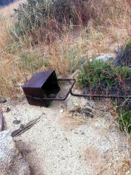
also saw several mine buckets that were used to carry material down the mountain.
There were some old rock buildings in the valley as well. After crossing the valley, we hiked another 500 up to reach the ridge that would overlook
the Las Flores valley and the town of Bahia.
The view was breathtaking! We could see the Pacific to the west, San Francisquito and Playa Rafael to the south and all of Bahia and the surrounding
islands to the North.
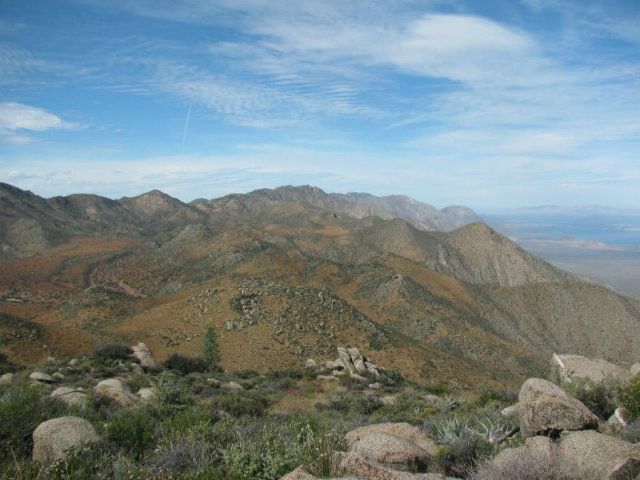
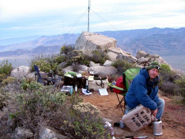
We could also see the entire valley that we had walked through previously and two mine shafts in the distance to the west. Our final altitude was
4379.
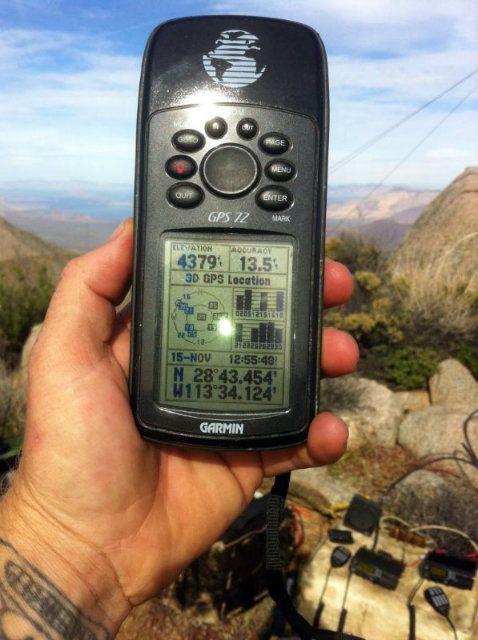
There were peaks that were higher in the surrounding area but access for the mules was impossible. We ended up adjacent to the cell/internet tower
that services Bahia and Rancho San Gregorio.
Valle San Juan, looking west
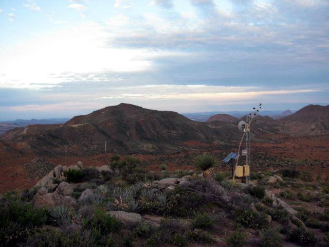
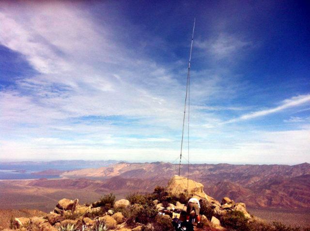
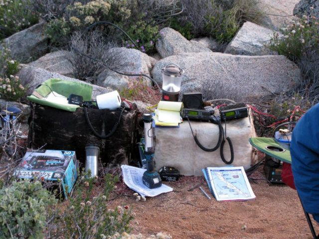
Our spot was perfect. We immediately unloaded the mules and began to set up. We found a granite boulder that had just the right crack to wedge our
antenna pole in and right behind it was a nice flat spot for our tent.
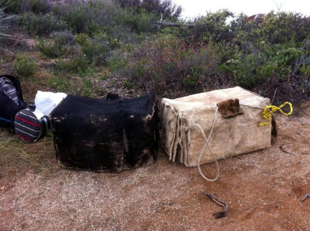
Cow hide mule boxes that we used for desks
Taking in the view
As soon as the mules were unloaded, our guides went back down in the valley and set up camp in a small mine shaft. The mules had plenty of grass to
eat with all the rain that had fallen throughout the summer; however, there was no water. The following day, Fermin and David cut up a large barrel
cactus for them. They loved it. I didnt realize how much water is inside those things.
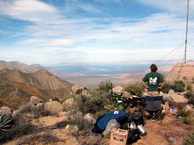
By noon we were up and running.
We did radio checks, chatted with folks on the course to see how long we could maintain contact, made contact with our relay to the north in Catavina
and our relay south up in Sierra San Francisco. They came in loud and clear as if they were right next to me. I could hear one of our relays in
Puertocitos but wasnt able to make contact. At one point in the afternoon, I made contact with another relay all the way down just south of Loreto,
approximately 250 miles away.
Our office for the next day and half
Things started to get busy around 3 in the afternoon and didnt let up till 10 the next morning. It was a long night fueled with lots of coffee.
Getting the coffee started
During the night the weather turned on us. Thirty five mph winds out of the west and a little rain. I was a little concerned as I had left my truck
parked in a steep, narrow arroyo. We had to do a scramble to keep the radios dry, and secure our tent better so it didnt end up blown down by the
Las Flores jail. Sometime in the wee hours of the am the wind let up and the rain stopped.
Our guides came back up to our spot around 9am Friday morning. We still had a few more cars to clear our area before we could pull the plug. At 11am
we got the OK to wrap it up. It took an hour to pack the mules and we headed down the hill. 2.5 hours later we were at my truck. 1 hour later we were
back at the rancho. We paid Rafael, got some watermelons that he grew at Aguaje, his other ranch, and then hit the road. We made it to the Bahia
highway at 6pm.
After stopping for dinner at Alejandrinas in Bahia we headed to the trailers. What a long day! We chatted it up with our friends that watched the
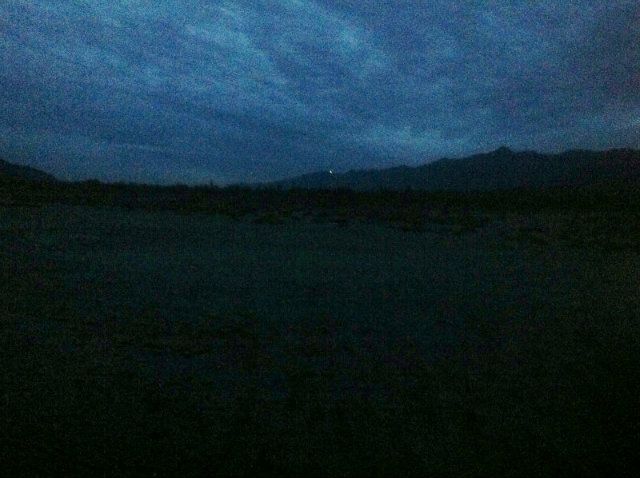
race from our place and shared stories. They told us they had taken a picture from our place, of the mountain we were on as we shined a 3000 lumen
flashlight towards them. It made for a neat photo.
All in all we were up for 41 hours. I sure did sleep well that night!
Saturday morning we were up early and headed back to Punta Banda. Sunday, we were on the road at 4am and headed for Tecate. It took 1.5 hr to cross.
We had no traffic through San Diego and LA and made it home to San Luis Obispo by 2pm. I still had time to watch some football. All in all, I had a
great time and would do it all over again in a heartbeat."
So, there you have it, Dern's trip report.
Respectfully submitted, his personal secretary,
P>*)))>{
[Edited on 27-11-2012 by Paulina]
\"Well behaved women rarely make history.\" Laurel Thatcher Ulrich
|
|
|
fandango
Senior Nomad
Posts: 549
Registered: 1-30-2006
Member Is Offline
|
|
Very cool!
sbwontoo
|
|
|
Bajaboy
Ultra Nomad
Posts: 4375
Registered: 10-9-2003
Location: Bahia Asuncion, BCS, Mexico
Member Is Offline
|
|
Awesome report! Dern found us at Las Pasaditas in El Rosario on his return trip. Baja is such a small place.
zac
|
|
|
Pacifico
Super Nomad
Posts: 1299
Registered: 5-26-2008
Member Is Offline
|
|
Great, detailed report! Thanks!
"Plan your life as if you are going to live forever. Live your life as if you are going to die tomorrow." - Carlos Fiesta
|
|
|
Santiago
Ultra Nomad
Posts: 3533
Registered: 8-27-2003
Member Is Offline
|
|
Wow.
|
|
|
Skipjack Joe
Elite Nomad
Posts: 8088
Registered: 7-12-2004
Location: Bahia Asuncion
Member Is Offline
|
|
Thanks, Paulina.
Although I know nuthin about car racing I can appreciate the adventure of it. And the views are really marvelous. I've often looked up at the face of
that mountain and wondered what it would be like up there.
|
|
|
Ateo
Elite Nomad
Posts: 5917
Registered: 7-18-2011
Member Is Offline
|
|
Thank you for posting. That was an adventure!!! I loved every minute if it.
|
|
|
Santiago
Ultra Nomad
Posts: 3533
Registered: 8-27-2003
Member Is Offline
|
|
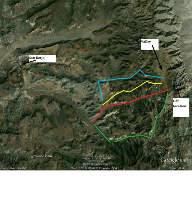
Which way did you go - I've shown a few options.
|
|
|
larryC
Super Nomad
Posts: 1499
Registered: 8-11-2008
Location: BoLA
Member Is Offline
|
|
Good report, brings back memories. Maybe I'll get off my butt and plan another trip up there this winter. Too bad you didn't have time to explore the
mine shafts. It is fascinating what they did up there 100+ years ago.
Santiago, if I had to hazard a guess from his desciption, I'd say he used your "red" route. The "road/trail" starts at the old rock corrals and goes
up the arroyo. On a quad I got as far as the base of the mountain where the trail starts up. Your "green" route seems to go through Aguaje. Passable,
but a little longer. I'm not familiar with the blue and yellow routes.
Larry
Off grid, 12-190 watt evergreen solar panels on solar trackers, 2-3648 stacked Outback inverters, 610ah LiFePo4 48v battery bank, FM 60 and MX60
Outback charge controllers, X-240 Outback transformer for 240v from inverters, 6500 watt Kubota diesel generator.
|
|
|
David K
Honored Nomad
Posts: 65297
Registered: 8-30-2002
Location: San Diego County
Member Is Offline
Mood: Have Baja Fever
|
|
Wonderful Report and good job on the photos Paulina!
Too bad the Tacoma couldn't make it all the way, but it seems like the old wagon road is just too badly washed out...?
The San Juan Mine and Las Flores below were an intensive mine operation. The first railroad brought the ore from the mine opening to the top of the
cable tramline... The cable buckets then brought the ore down the side of the mountain... the buckets were dumped in the next railroad's cars for the
5-6 mile trip to Las Flores where the ore was processed... then taken by wagon to the bay for shipment. The rich ore did not run out, but instead the
mine was closed by the revolution of 1911.
See more (including satellite maps, including the trail up from San Gregorio) in this post: http://forums.bajanomad.com/viewthread.php?tid=42384
|
|
|
David K
Honored Nomad
Posts: 65297
Registered: 8-30-2002
Location: San Diego County
Member Is Offline
Mood: Have Baja Fever
|
|
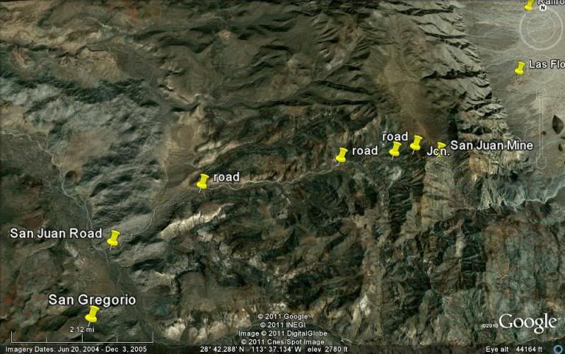
| Quote: | Originally posted by Santiago
Which way did you go - I've shown a few options. |
Here you go Santiago... unless he says different, I bet this is the road Dern took?:
|
|
|
oladulce
Super Nomad
Posts: 1625
Registered: 5-30-2005
Location: bcs
Member Is Offline
|
|
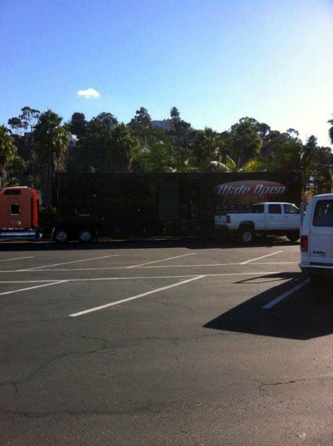
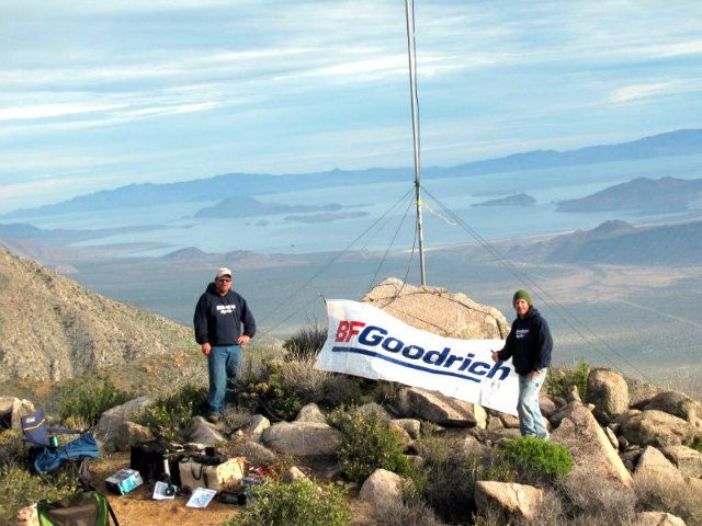
Excellent adventure and great pics Dern! That last photo with the BFG sign looks like a fake movie back drop- very cool.
And nice write-up madam secretaria.
Wouldn't you love to have one of those cowhide travel bags? No more problems picking out your bag on the luggage carousel. (But if that was the fate
of the poor guy tied to the cardon, maybe not.)
|
|
|
nbacc
Senior Nomad
Posts: 770
Registered: 12-27-2008
Location: Northern California
Member Is Offline
|
|
very cool report..............thanks Nancy
|
|
|
TacoFeliz
Nomad
Posts: 268
Registered: 7-22-2005
Location: Here
Member Is Offline
Mood: Exploratory
|
|
Great report. I particularly liked the BFG bumper sticker on the mule butt.
|
|
|
Santiago
Ultra Nomad
Posts: 3533
Registered: 8-27-2003
Member Is Offline
|
|
I guessed at the routes from GE. I've only been as far as the corral and the old ruins.
|
|
|
Santiago
Ultra Nomad
Posts: 3533
Registered: 8-27-2003
Member Is Offline
|
|
anyone know if somebody has actually hiked/climbed down the face of the mountain where the tramway was? Before the tramway, did the mules carry the
ore down the mountain or back thru San Borja?
|
|
|
David K
Honored Nomad
Posts: 65297
Registered: 8-30-2002
Location: San Diego County
Member Is Offline
Mood: Have Baja Fever
|
|
| Quote: | Originally posted by Santiago
anyone know if somebody has actually hiked/climbed down the face of the mountain where the tramway was? Before the tramway, did the mules carry the
ore down the mountain or back thru San Borja? |
Yes, when I was first in the Terminal Canyon with Doc, he asked if I wanted to go up to San Juan that day! He was in far better shape than I and after
climbing maybe 1/4 of the way up, I said I was good with what we had done...
One time we bumped into a group led by Capt. Muñoz wife taking some college kids up to San Juan... Carolina has gone up as well... that is how they
got stuff for the museum, I think. Before the cable tramway, the ore was carried by mules,... so you hike on the mule trail. The ore was processed at
Las Flores, going to San Borja was not an option... just an easier route for supplies.
|
|
|
Paulina
Ultra Nomad
Posts: 3812
Registered: 8-31-2002
Location: BCN
Member Is Offline
|
|
Secretary Paulina here, I should be getting paid for this!
Dern says....
"Santiago's red route looks to be about right.
What LarryC said is about right too. We drove up the arroyo about as far as we could, then we continued walking up the arroyo a short distance where
we met up with the trail head that followed up a spine in the mountain all the way to the top. We came out at the very southern end of the San Juan
valley.
Google earth is deceiving. A lot of times what you think looks like a road on the computer isn't one when you're standing in it or actually driving on
it. Not all arroyos can be walked in."
Respectfully submitted,
P>*)))>{
\"Well behaved women rarely make history.\" Laurel Thatcher Ulrich
|
|
|
Marc
Ultra Nomad
Posts: 2802
Registered: 5-15-2010
Location: San Francisco & Palm Springs
Member Is Offline
Mood: Waiting
|
|
| Quote: | Originally posted by Santiago
Wow. |
Ditto
|
|
|
David K
Honored Nomad
Posts: 65297
Registered: 8-30-2002
Location: San Diego County
Member Is Offline
Mood: Have Baja Fever
|
|
| Quote: | Originally posted by Paulina
Secretary Paulina here, I should be getting paid for this!
Dern says....
"Santiago's red route looks to be about right.
What LarryC said is about right too. We drove up the arroyo about as far as we could, then we continued walking up the arroyo a short distance where
we met up with the trail head that followed up a spine in the mountain all the way to the top. We came out at the very southern end of the San Juan
valley.
Google earth is deceiving. A lot of times what you think looks like a road on the computer isn't one when you're standing in it or actually driving on
it. Not all arroyos can be walked in."
Respectfully submitted,
P>*)))>{ |
Then that would also be the route I have pinned as 'Road' on my GE image.
Neal Johns and company started to drive up to San Juan about 10-12 years ago until John Perko got a BFG tire failure: http://vivabaja.com/neal
|
|
|
| Pages:
1
2 |