TMW
Select Nomad

Posts: 10659
Registered: 9-1-2003
Location: Bakersfield, CA
Member Is Offline
|
|
Topo Maps
I recently purchased a DVD topo map set from Go Trekkers. It has 1:1million, 1:250K and 1:50K scales. The cursor shows the Long. and Lat. in Degrees
and Decimal Minutes. The interesting thing is the 1:1million shows the paved highways and towns as they are today. The 1:250K shows the highways but
some of the towns are missing like Catavina. The 1:50K shows hwy 1 ending at El Rosario and under construction a short ways after that. It then shows
the old road from before the paved road. It shows the road thru Laguna Chapala and around it to the east but no road to Coco. Another interesting
thing is it shows all the old airplane runways. I've looked them up on Google Earth with the coorinates given and yep you can see the remains of the
runways and there are a lot of them. South of San Felipe was very interesting.
|
|
|
Neal Johns
Super Nomad
Posts: 1687
Registered: 10-31-2002
Location: Lytle Creek, CA
Member Is Offline
Mood: In love!
|
|
Which one did you get, TW? The GT2016qc3mm ?
My motto:
Never let a Dragon pass by without pulling its tail!
|
|
|
TMW
Select Nomad
Posts: 10659
Registered: 9-1-2003
Location: Bakersfield, CA
Member Is Offline
|
|
Yes that's it.
|
|
|
TMW
Select Nomad
Posts: 10659
Registered: 9-1-2003
Location: Bakersfield, CA
Member Is Offline
|
|
Oops I misspoke when I said it didn't show a road from the east side of Laguna Chapala to Coco. It does I just had to zoom in closer. Probably more of
a horse trail.
|
|
|
David K
Honored Nomad
Posts: 64549
Registered: 8-30-2002
Location: San Diego County
Member Is Offline
Mood: Have Baja Fever
|
|
That indeed was a horse or burro trail, used for the NORRA Baja 500 (to 1973)... and considered by most in the 1970s as impassable (before the graded
dirt highway was built across to Puerto Calamajue, just before 1983). The main route south of Gonzaga went through Calamajue canyon before the graded
road from Laguna Chapala was built.
Tom, as they are old maps, specially pre Hwy. 1 in central Baja... I would love to see and maybe share them with other history buffs?
|
|
|
Russ
Elite Nomad
Posts: 6741
Registered: 7-4-2004
Location: Punta Chivato
Member Is Offline
|
|
I'm just trying to figure out the E32-2013 map I installed on my iMac and Garmin Nuvi Pretty cool on the iMac but haven't figured how to get the same
map to show on the GPS. I took a short test run today and the route transferred to the iMac really well. Even drew in where I went where no road
showed. Here's what it looks like on the computer.
Home

Zoomed in on my test run follow the red arrows
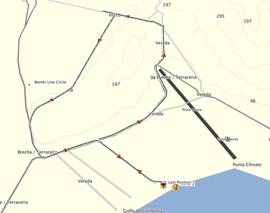
Bahia Asuncion ---- zooming in
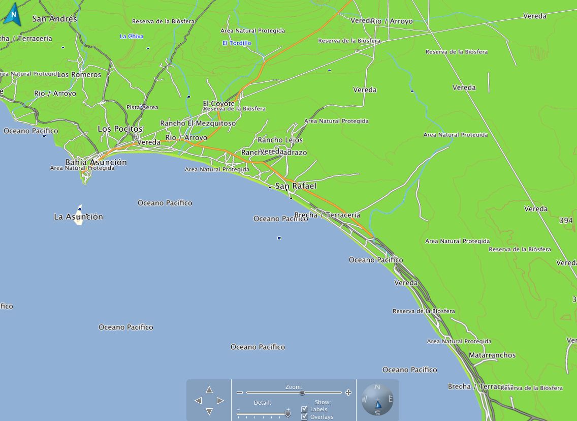


[Edited on 2-12-2013 by Russ]
Bahia Concepcion where life starts...given a chance!
|
|
|
TMW
Select Nomad
Posts: 10659
Registered: 9-1-2003
Location: Bakersfield, CA
Member Is Offline
|
|
I also have the E32 map on my Garmin GPS. Just put it on but haven't used it yet. Will play with it this weekend at Death Valley.
|
|
|
TMW
Select Nomad
Posts: 10659
Registered: 9-1-2003
Location: Bakersfield, CA
Member Is Offline
|
|
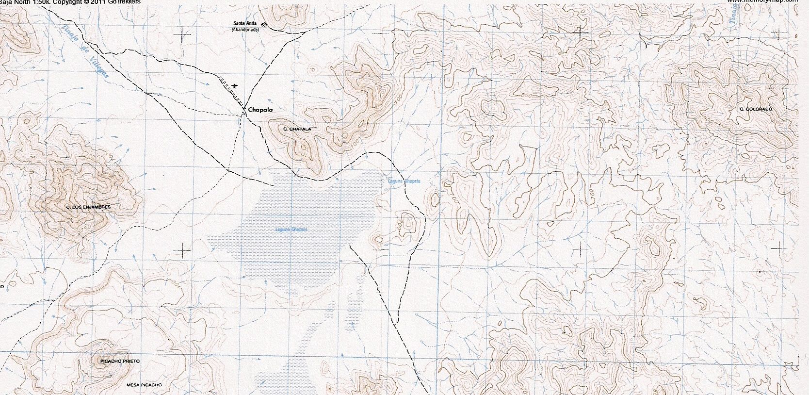
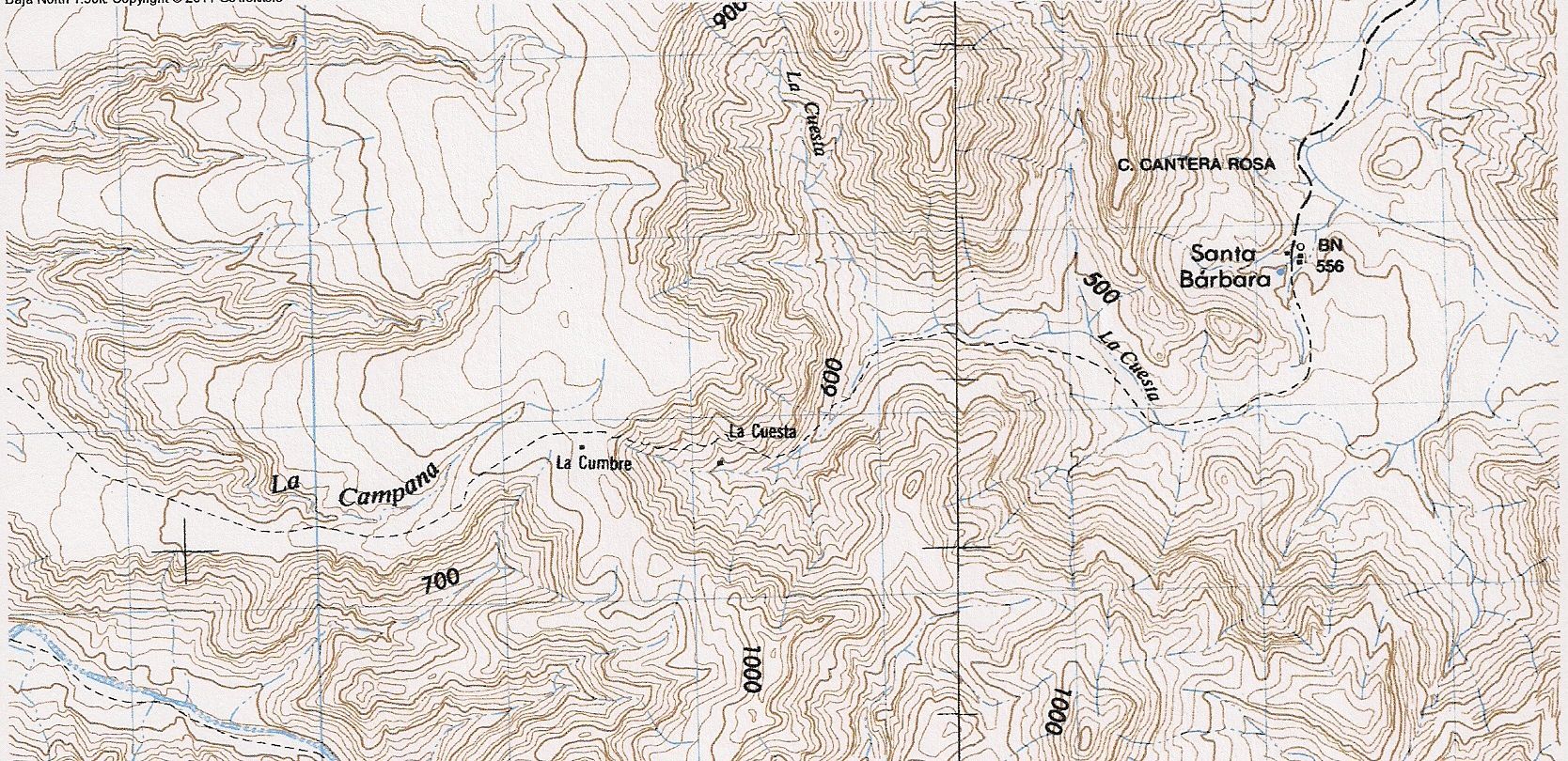
Here is Laguna Chapala.
Mission Santa Gertrudis to Santa Barbara.

|
|
|
David K
Honored Nomad
Posts: 64549
Registered: 8-30-2002
Location: San Diego County
Member Is Offline
Mood: Have Baja Fever
|
|
Oh, I didn't catch the split between the two maps TW, and was saying Santa Barabara is in the wrong place! LOL... I looked closer and saw it is a
second map (good to double space between likns)! That trail from Santa Gertrudis to Santa Barbara is a mission road... and easily seen from space on
Google Earth.
|
|
|
bajajudy
Elite Nomad
Posts: 6886
Registered: 10-4-2004
Location: San Jose del Cabo,BCS
Member Is Offline
|
|
We were just in the Inegi office in La Paz. They have a beautiful new office on Abasolo. We had a few hard copy topos made, took about 15 minutes,
cost 60 pesos each.
For those of you who like to hold a map.
|
|
|
TMW
Select Nomad
Posts: 10659
Registered: 9-1-2003
Location: Bakersfield, CA
Member Is Offline
|
|
DK I just kinda stuck them up to show how they looked. If you zoom out sometimes just a bit you lose the trail on the 1:50K.
|
|
|
TMW
Select Nomad
Posts: 10659
Registered: 9-1-2003
Location: Bakersfield, CA
Member Is Offline
|
|
| Quote: | Originally posted by bajajudy
We were just in the Inegi office in La Paz. They have a beautiful new office on Abasolo. We had a few hard copy topos made, took about 15 minutes,
cost 60 pesos each.
For those of you who like to hold a map. |
What is the scale of the maps and are they Baja Sur only?
|
|
|
Jack Swords
Super Nomad
Posts: 1094
Registered: 8-30-2002
Location: Nipomo, CA/La Paz, BCS
Member Is Offline
|
|
Inegi in La Paz will also burn your topo choices on a CD for use on your laptop. Pretty impressive office.
|
|
|
bajajudy
Elite Nomad
Posts: 6886
Registered: 10-4-2004
Location: San Jose del Cabo,BCS
Member Is Offline
|
|
| Quote: | Originally posted by Jack Swords
Inegi in La Paz will also burn your topo choices on a CD for use on your laptop. Pretty impressive office. |
Yea we already have that.
TW-Sorry I dont know the scale and they are buried in the camper
|
|
|


