| Pages:
1
2 |
David K
Honored Nomad

Posts: 64476
Registered: 8-30-2002
Location: San Diego County
Member Is Offline
Mood: Have Baja Fever
|
|
Bump for a Nomad asking about the Camino Real between the mission and Gonzaga Bay desert floor.
|
|
|
MexicoTed
Senior Nomad
Posts: 708
Registered: 8-2-2004
Member Is Offline
|
|
By the way David, I found a Facebook page of a group that went to the mission and Poza la Escuadra in November. I emailed the person in charge and he
said it's the photo on the Facebook page. Did you ever see this oasis David?
https://www.facebook.com/events/709708172507273
|
|
|
David K
Honored Nomad
Posts: 64476
Registered: 8-30-2002
Location: San Diego County
Member Is Offline
Mood: Have Baja Fever
|
|
Think that one is down in the canyon east of the mission. See Wilderone's reply above.
|
|
|
4x4abc
Ultra Nomad
Posts: 4163
Registered: 4-24-2009
Location: La Paz, BCS
Member Is Offline
Mood: happy - always
|
|
the pool on the facebook page is 29°42'52.42"N, 114°31'29.69"W
I know it very well, been guiding tours there for 20 years
Harald Pietschmann
|
|
|
TMW
Select Nomad
Posts: 10659
Registered: 9-1-2003
Location: Bakersfield, CA
Member Is Offline
|
|
Caution note:
If anyone plans to drive to the trail from the Gonzaga side the road going down into Arroyo Santa Maria was badly damaged from rain and not passable
two years ago. There is a soft sand hill to the east maybe 100 yards that you can drive down but may not be able to drive back up. We did the drive
into Las Palmitas in 2014 but had to take the Arroyo Santa Maria back to the new highway bridge. It was a lot of soft sand driving so air down
accordingly.
|
|
|
David K
Honored Nomad
Posts: 64476
Registered: 8-30-2002
Location: San Diego County
Member Is Offline
Mood: Have Baja Fever
|
|
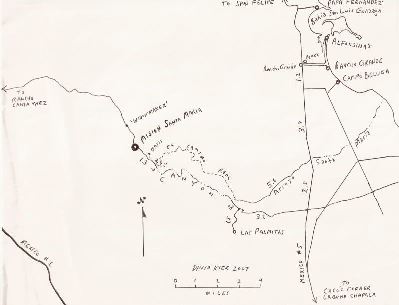
Quote: Originally posted by 4x4abc  | the pool on the facebook page is 29°42'52.42"N, 114°31'29.69"W
I know it very well, been guiding tours there for 20 years |
Thank you Harald:
Here is a zoom-in on your GPS waypoint:
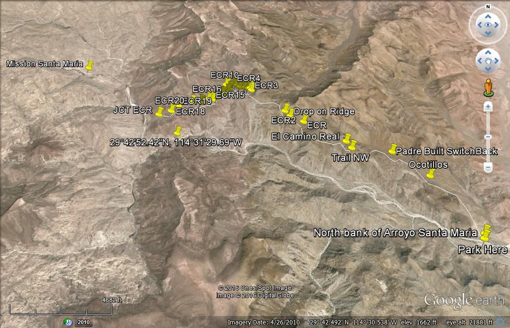
The mission is in the upper left and the road from Gonzaga is on the lower right ("Park Here"). The El Camino Real is tracked between the two. "Jcn
ECR" is where the mission trail reached the auto road, about 1.5 miles from the mission. The hike on ECR between the Park Here and the mission will
take about 5-6 hours, if not rushed.
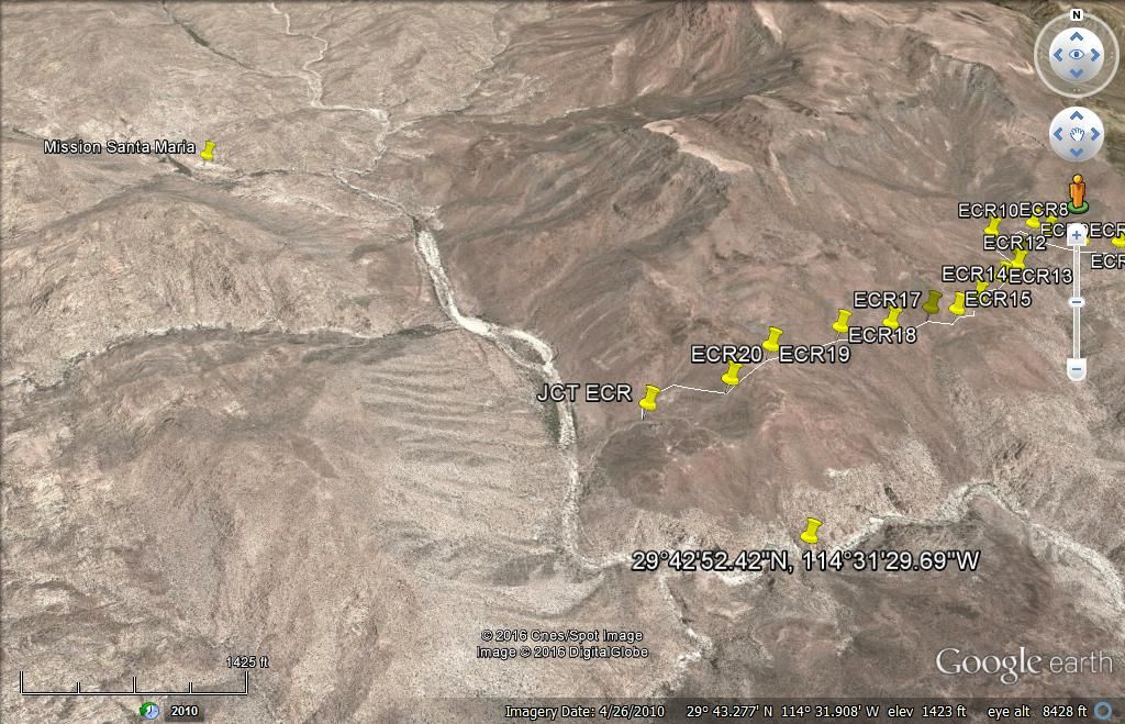
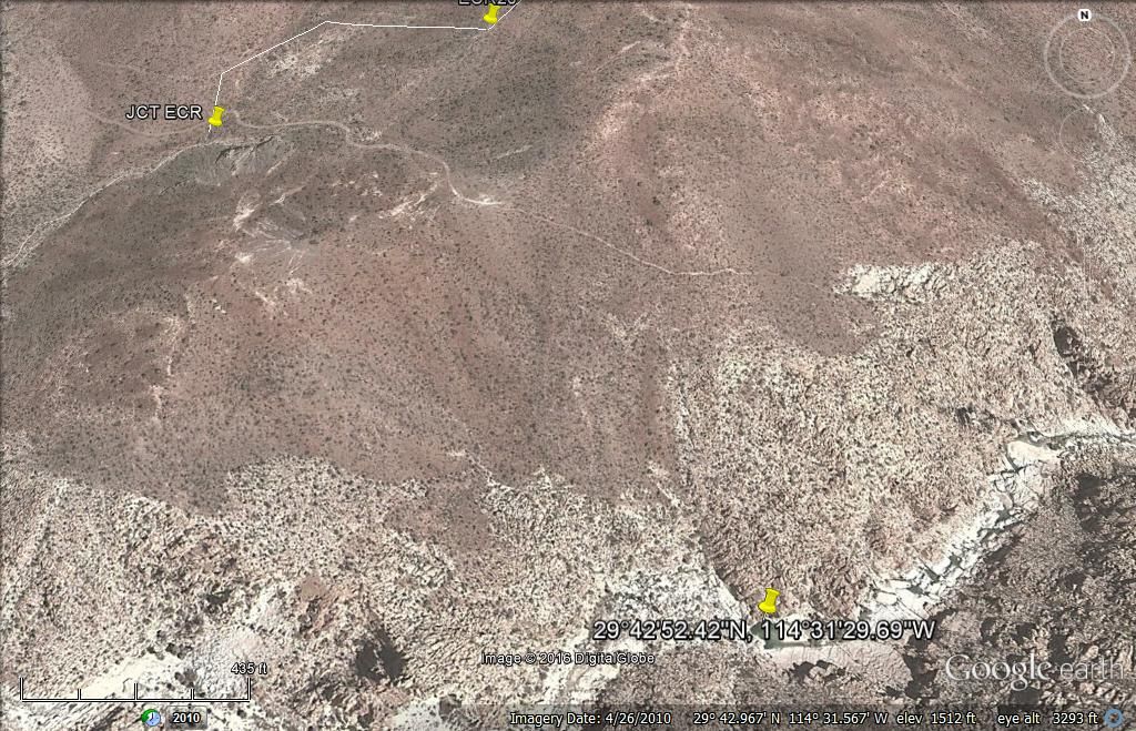
The "Indian Trail" (Original El Camino Real route) is the one dropping down into the canyon from the ridge above, where the road construction from
Rancho Santa Ynez ended in the 1960's.
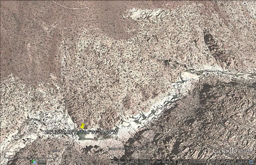
The Pool Location. Thank you 4x4abc.
|
|
|
David K
Honored Nomad
Posts: 64476
Registered: 8-30-2002
Location: San Diego County
Member Is Offline
Mood: Have Baja Fever
|
|
| Quote: Originally posted by TMW | Caution note:
If anyone plans to drive to the trail from the Gonzaga side the road going down into Arroyo Santa Maria was badly damaged from rain and not passable
two years ago. There is a soft sand hill to the east maybe 100 yards that you can drive down but may not be able to drive back up. We did the drive
into Las Palmitas in 2014 but had to take the Arroyo Santa Maria back to the new highway bridge. It was a lot of soft sand driving so air down
accordingly. |
South of the big bridge on Hwy. 5 about 2.5 miles is the road to Las Palmitas and the Arroyo Santa María access. A new rancho (signed "Las Palmitas")
was at the new paved highway junction. As TMW stated, the steep drop-off into the arroyo valley, 3 miles west of Hwy. 5, may be badly washed out and
require driving in the arroyo sand from the new bridge. There is a road in the arroyo, but 4WD and deflating tires may be needed to easily drive the
5.6 miles in the arroyo. I am not sure about access from the arroyo up to the highway since the bridge was built.
|
|
|
PaulW
Ultra Nomad
Posts: 3005
Registered: 5-21-2013
Member Is Offline
|
|
Looks like one should drive off the approach at the n end of the bridge then one can plainly see a track (road) up the gully side which should lead to
the old normal path. Lots of heavy traffic using that road. Last time I was their I Posted pics of that area. Can't find the pics now. Sorry no help.
Anyway I would not ever drive up the arroyo when I have other choices.
|
|
|
David K
Honored Nomad
Posts: 64476
Registered: 8-30-2002
Location: San Diego County
Member Is Offline
Mood: Have Baja Fever
|
|
| Quote: Originally posted by PaulW | Looks like one should drive off the approach at the n end of the bridge then one can plainly see a track (road) up the gully side which should lead to
the old normal path. Lots of heavy traffic using that road. Last time I was their I Posted pics of that area. Can't find the pics now. Sorry no help.
Anyway I would not ever drive up the arroyo when I have other choices. |
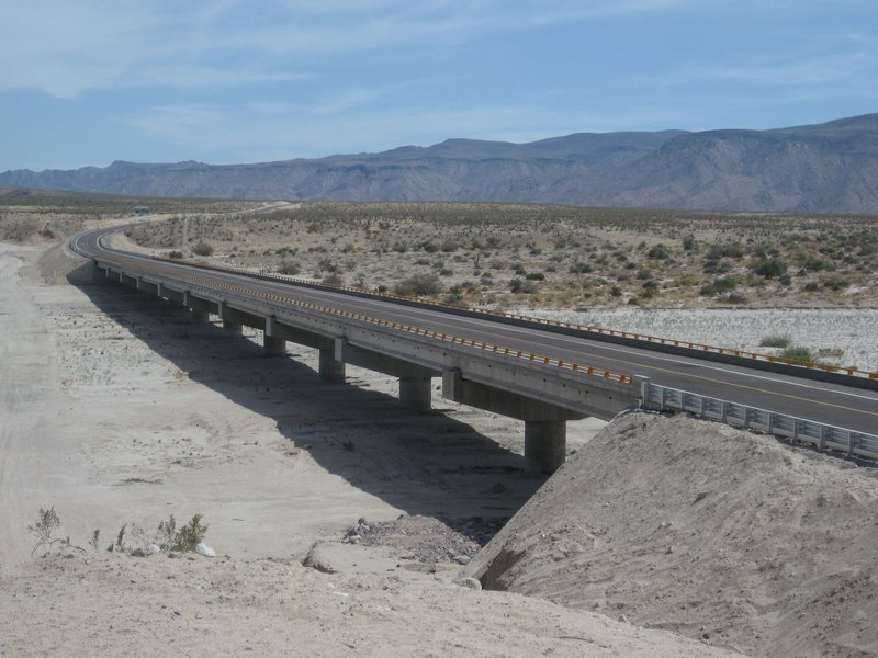
As you can see on my map's mileage notes, I drove both the Las Palmitas/ Canyon access road and the Arroyo Santa MarÃa riverbed. The arroyo
route was deep sand.
Now, there is a long bridge and a paved highway... and on both sides of the highway is a barb-wire fence that has cut off these historic roads into
the desert. The last time I was there, in 2018, the Las Palmitas road (Km. 159) was cut off, but tracks to it, left the highway around Km. 158 and
paralleled the highway back south to the original road west. The bridge is at Km. 155 and the fancy monument/ bridge viewing area is at Km.
154.5.

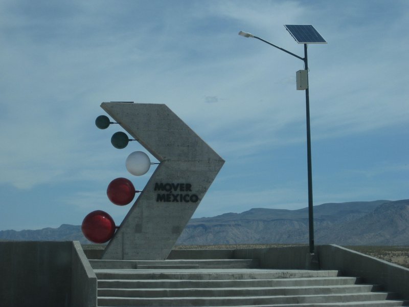
View south
|
|
|
BajaNomad
|
Thread Moved
10-23-2020 at 02:57 PM |
| Pages:
1
2 |


