David K
Honored Nomad

Posts: 64480
Registered: 8-30-2002
Location: San Diego County
Member Is Offline
Mood: Have Baja Fever
|
|
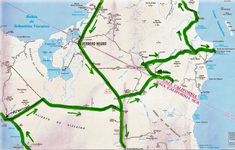
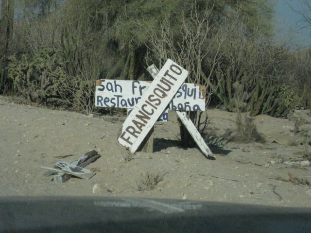
Near El Arco to San Francisquito, San Rafael, & L.A. Bay
By request, here is a look back to July 2012 of this part of our trip that shows the road, maps and sites in this part of central Baja:
| Quote: | Originally posted by BajaRat
And has anyone drivin the road out lately..... the loop from BOLA, San Raphael, San Francisquito, El Arco ?
|
Last July... but in the opposite direction and met the road at Pozo Aleman, just east of El Arco (coming from Mision Santa Gertrudis and Guillermo
Prieto, north from Vizcaino.
Here is that portion of my trip report from last year:
===============================================================
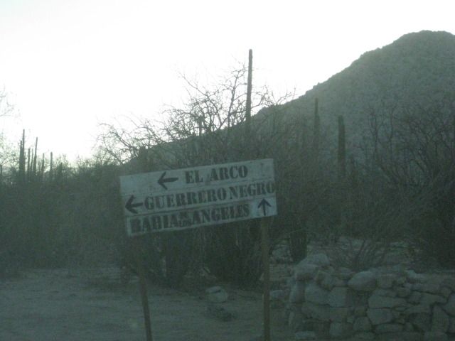
Day 13-b: To Pozo Aleman (German Well)
We left Mision Santa Gertrudis and came back out the 11 miles to the 4 way intersection. The left road goes back to Highway #1 (26 miles), and was the
way we came in. The right hand road continues northward for 12.3 miles to the Punta San Francisquito and Bahia de los Angeles road. We go straight
across on the road west to El Arco.
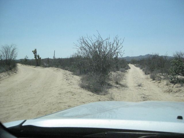
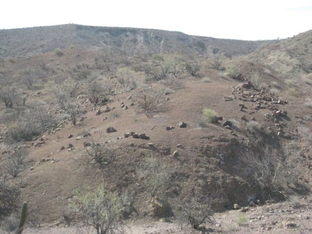
In 5.5 miles, the graded El Arco road bends to the left slightly where the older, Pozo Aleman road continues straight. It is 2:04pm, so we have plenty
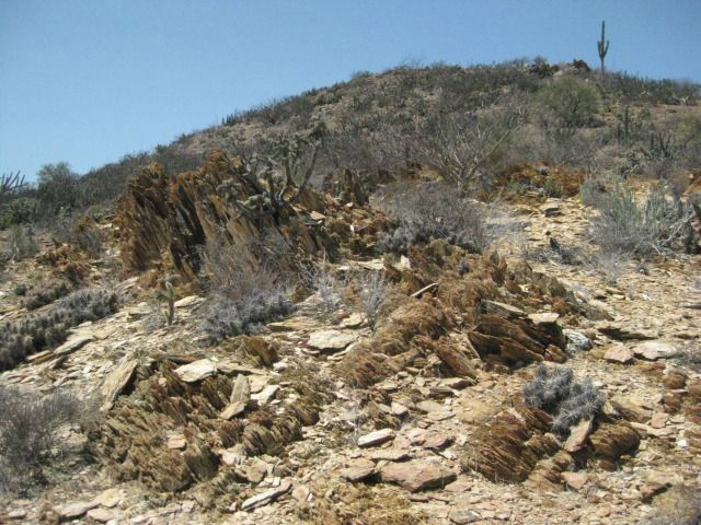
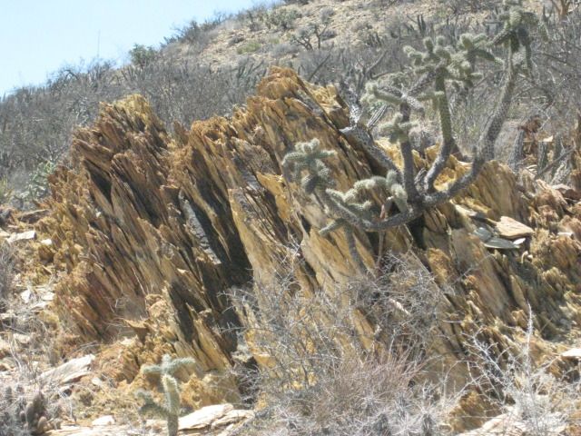
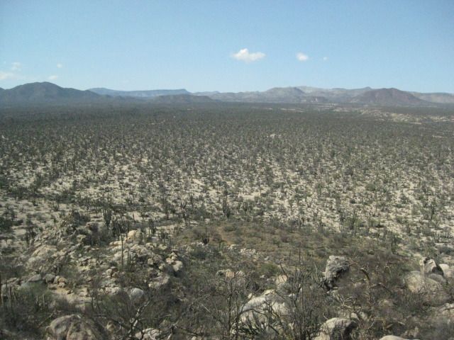
of summer daylight still ahead. In a few miles we come to some interesting geology and several other roads going to mine claims, perhaps. I expect
this road to go right to Pozo Aleman, as the map shows, but instead it meets the El Arco-San Francisquito road just to the east of Pozo Aleman. It has
been 4.4 miles from the El Arco/Santa Gertrudis road.
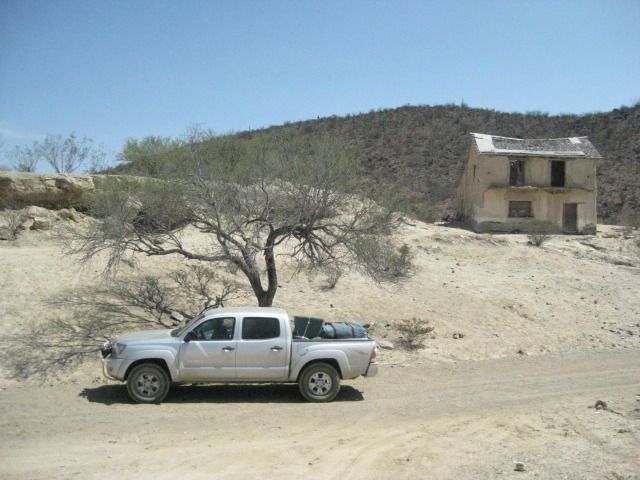
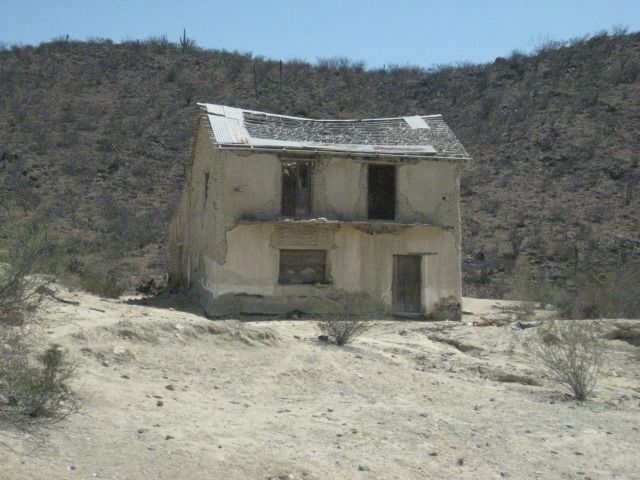
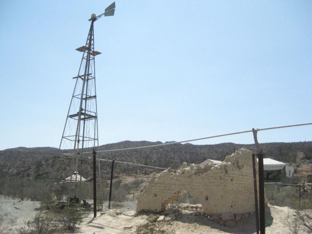
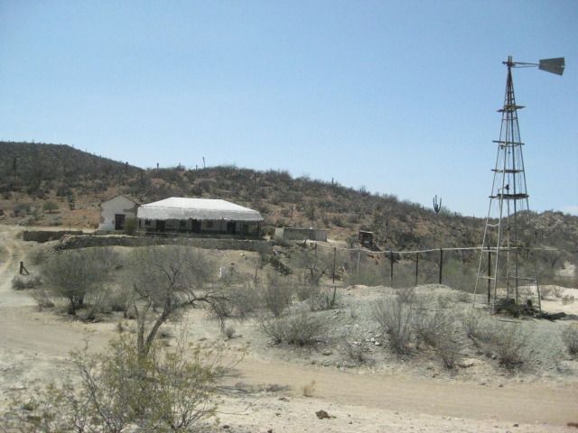
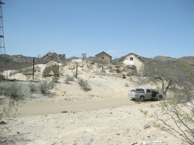
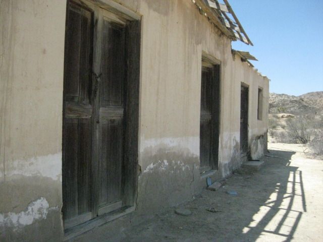
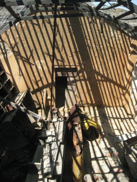
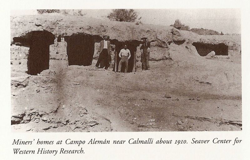
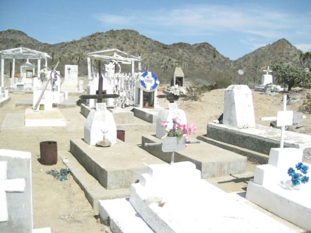
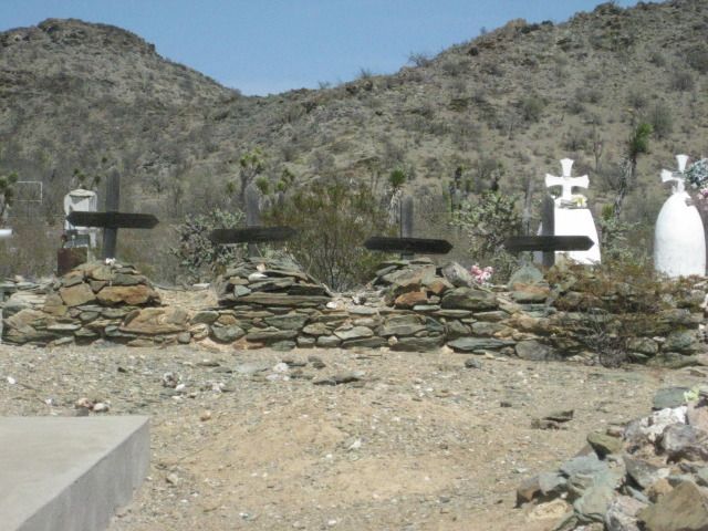
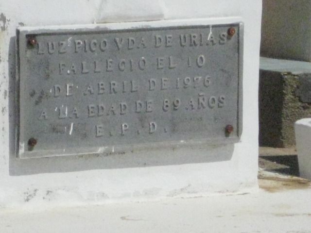
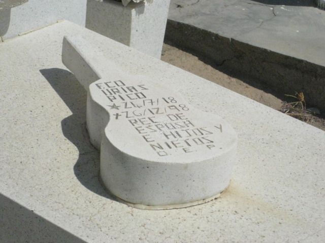
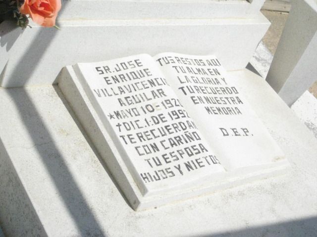
In just 0.4 mile going west, we are at the driveway into Pozo Aleman that passes the cemetery. It is 0.7 mile to Pozo Aleman from the graded road.
There are several abandoned ruins of adobe and wood homes, as well as the underground homes seen in a 1910 photograph here. There is one rather large
home across the gully from the others, and it looks to be occupied, but we see nobody.
There is plenty to look at here and then at the cemetery before we continue our drive east. We leave Pozo Aleman at 3:05pm and are hopeful we can find
the big painted cave we saw in the book at Sharis (I also have seen photos of it on Baja Nomad from at least two other people). To not cause any
grief, I will not publish the mileages or GPS of the road to the painted cave. See it in the next part of the trip report.
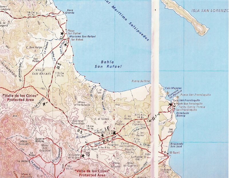
Map of the area, and mileages on the roads we used, between stars. The 4.4 mile road actually ended 0.4 mile east of Pozo Aleman (not shown on map).
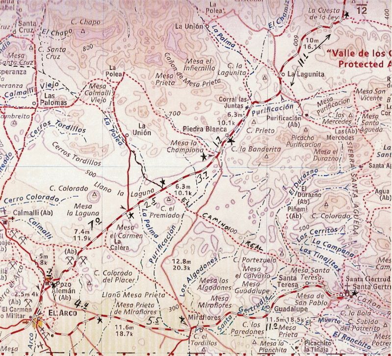
Fork, 16.5 miles from Santa Gertrudis: El Arco left/ Pozo Aleman right.
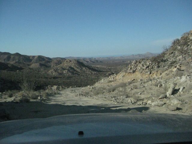
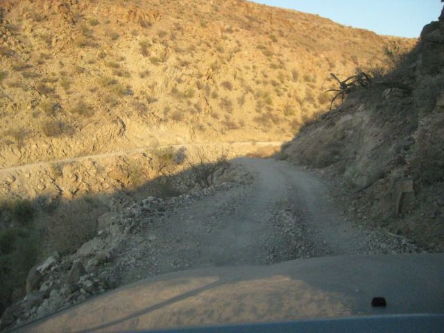
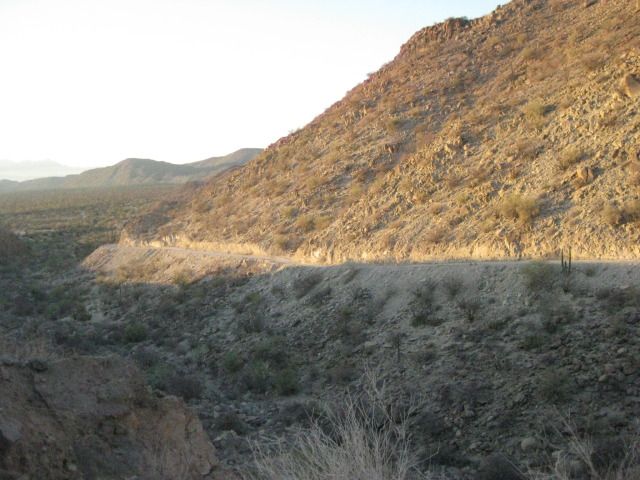
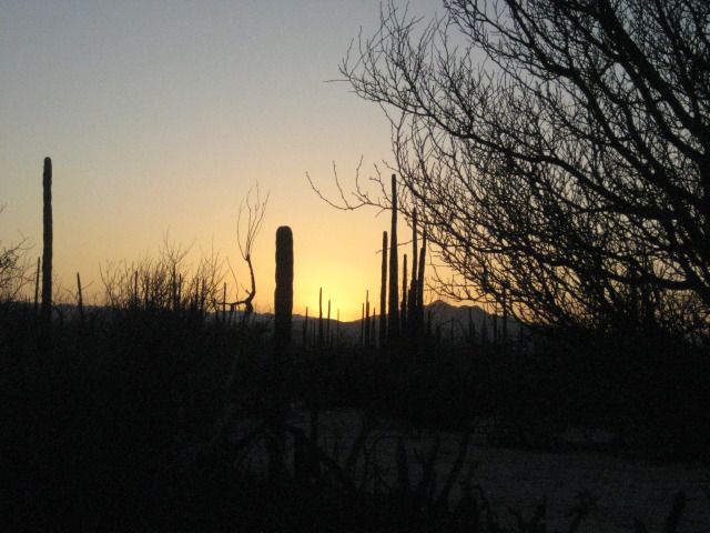
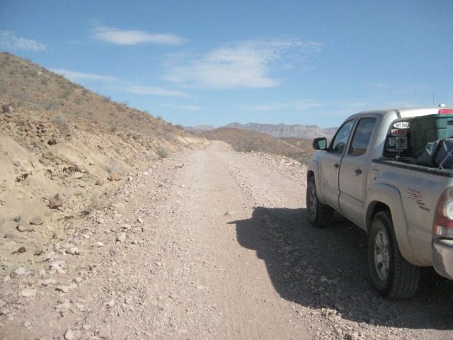
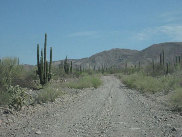
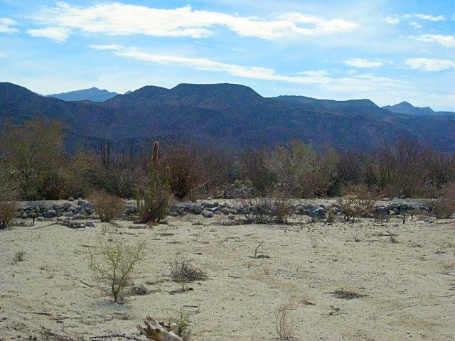
This is the kind of road I like to drive in Baja!
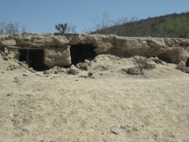
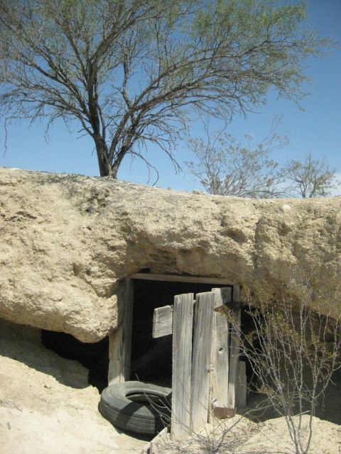
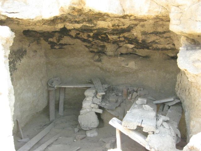
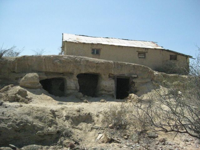
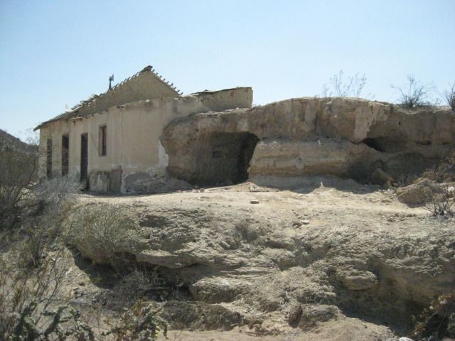
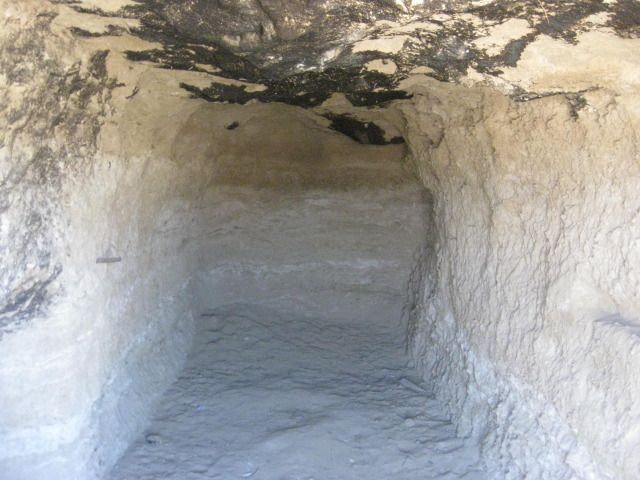
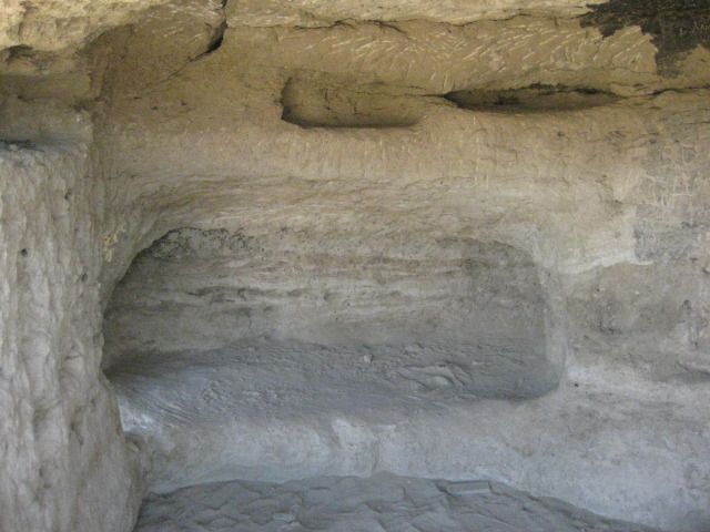
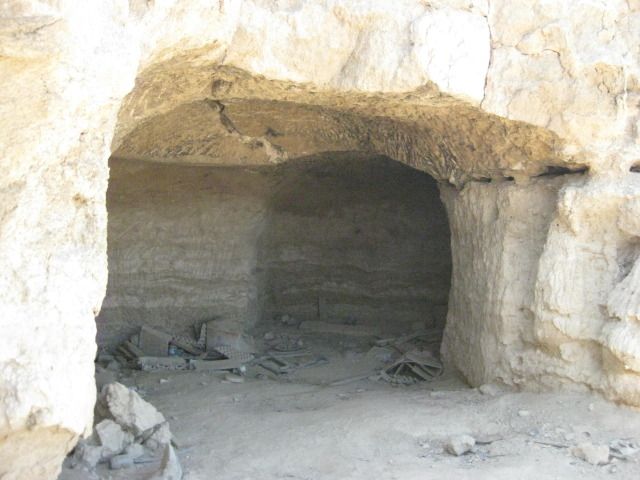
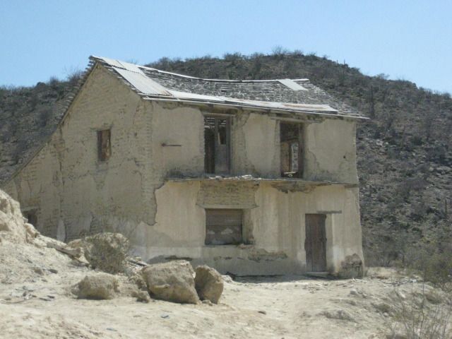
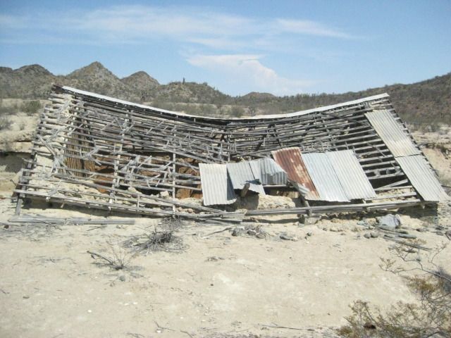
This building is half in the hillside, I walk over to the roof to look down inside.
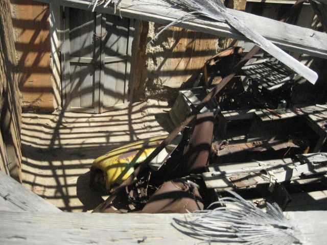
Looks like parts of an old truck in there.
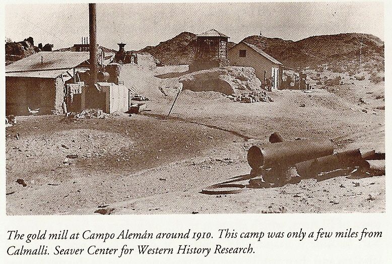
1910 photo.
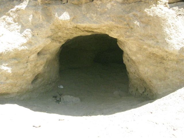
Next we try and find the Cave of El Arco
=================================================================
Day 13-c
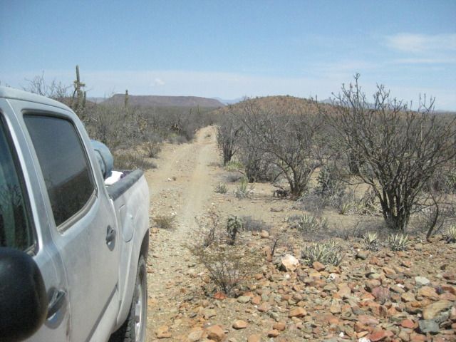
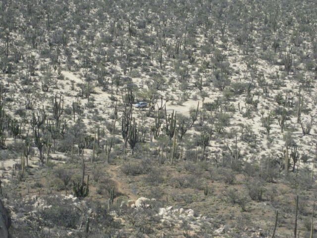
We leave Pozo Aleman at 3:05pm and take the graded road for some miles until I spot a side road with lots of travel. It ends in just ¾ of a mile at a
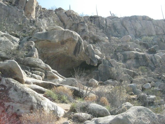
turn around, next to the side of a big hill. A close look up the hill and I see a cave. From the turn around, a well worn foot trail heads up the
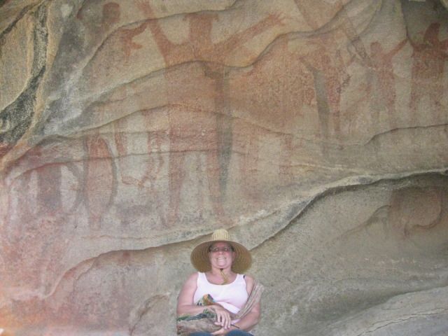
hillside. Obviously many folks have been here, perhaps tours. Along the trail, near the cave is a carved Elephant tree with the name Arce and the
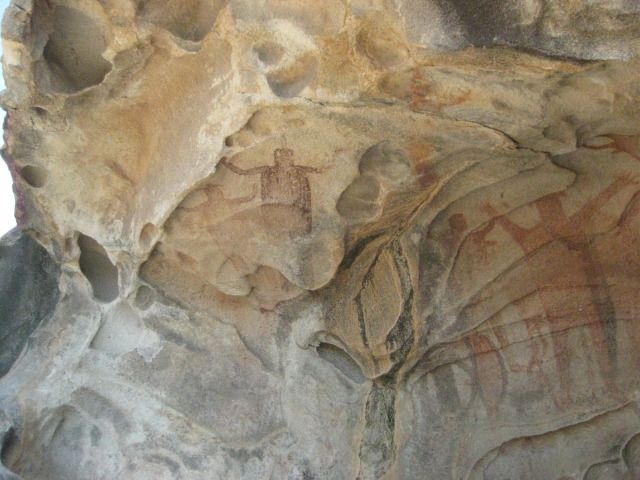
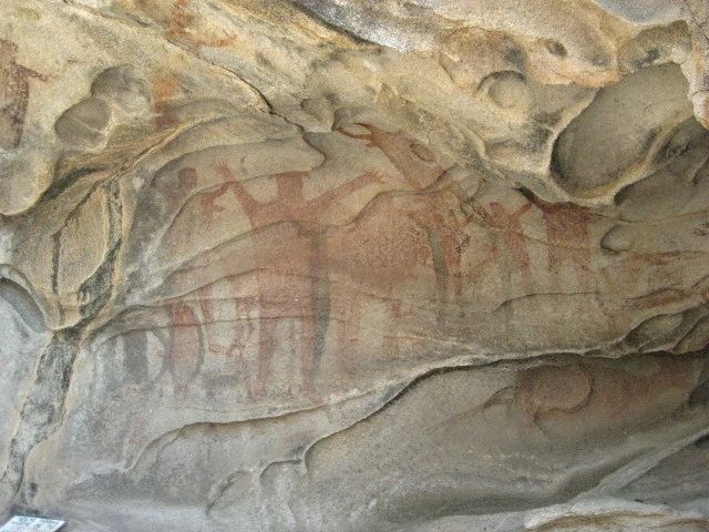
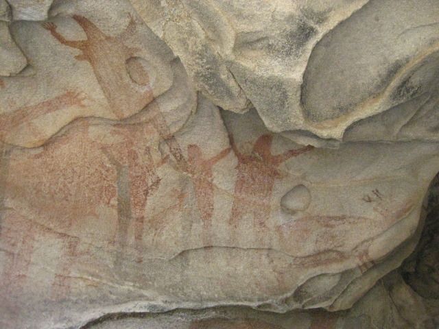
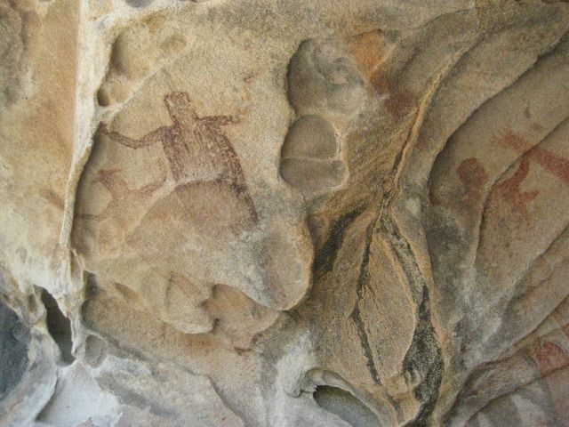
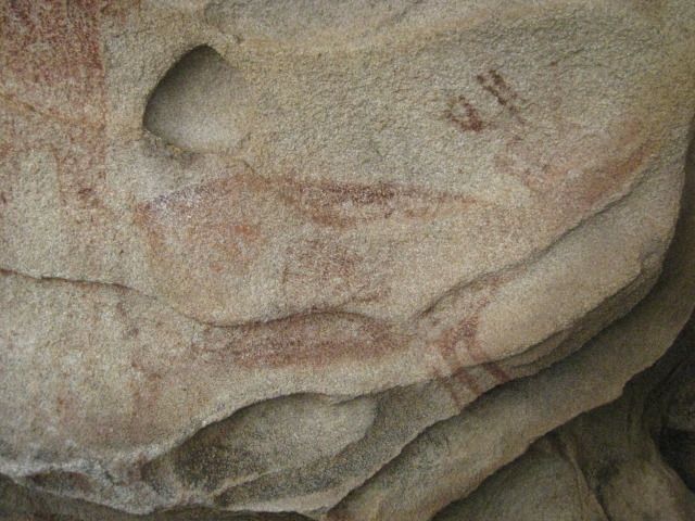
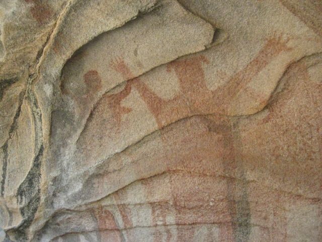
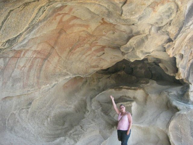
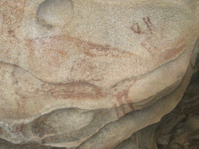
year 1990, perhaps when it was discovered? The site is a major painted cave, yet Harry Crosby did not include it in his books cataloging the
hundreds of central Baja California painted caves. Crosby researched his cave paintings book in the 1970s, so perhaps this one (near El Arco) had
indeed not yet been discovered?
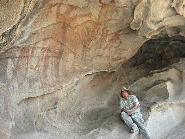
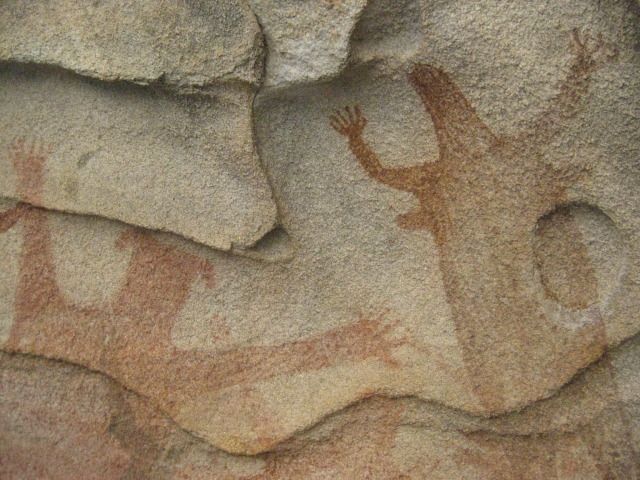
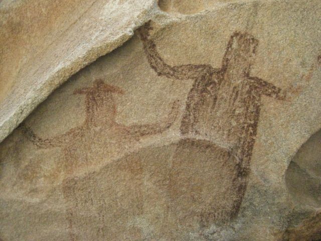
We take many photos at the cave and we note that it contains paintings of 4 men, 4 women, 4 deer, 4 fish and 2 dark figures with one wearing a hat.
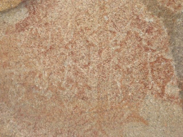
So, we call it the cave of fours, plus 2! Some of the images are faint and painted over others
so take your time and study the art here or in my
photos
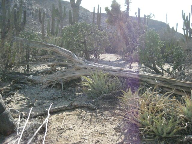
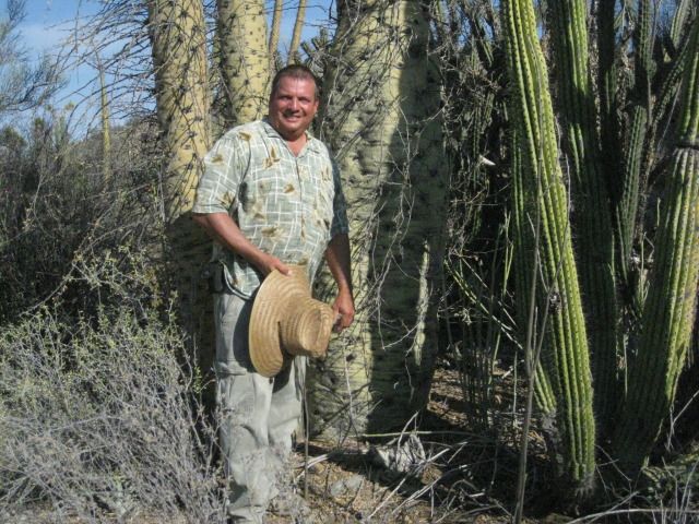
A most exciting site on our great 15 Day Baja vacation. On our way back down the trail we photograph some boojum trees, some pitahaya dulce,
and more ball moss. We are back to the Tacoma and driving again at 5:00pm. It is summer, and the sun is still well up in the sky.
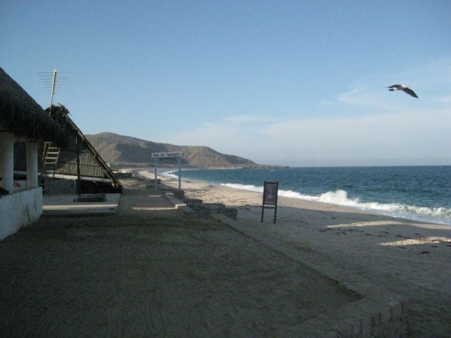
Our goal is Punta San Francisquito where a beautiful beach is located I camped at back in 1983...
Photos:
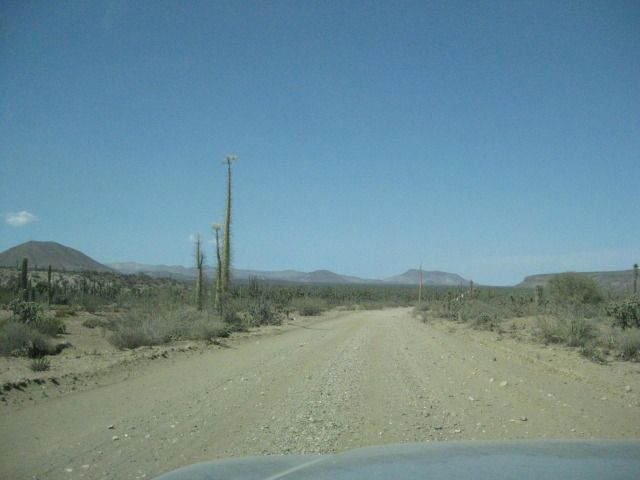
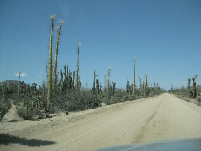
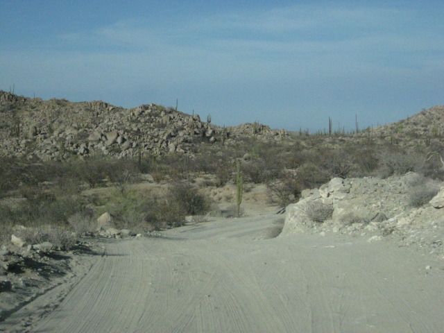
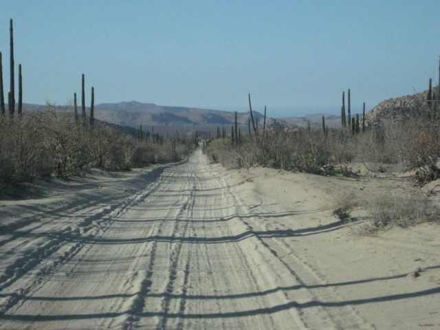
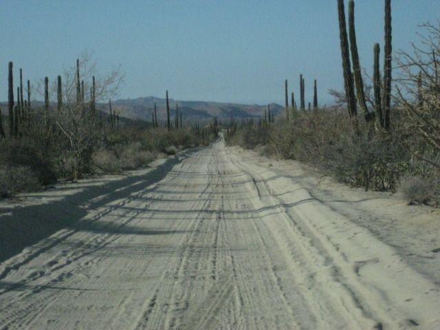
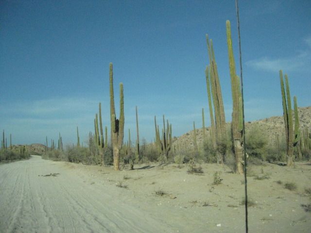
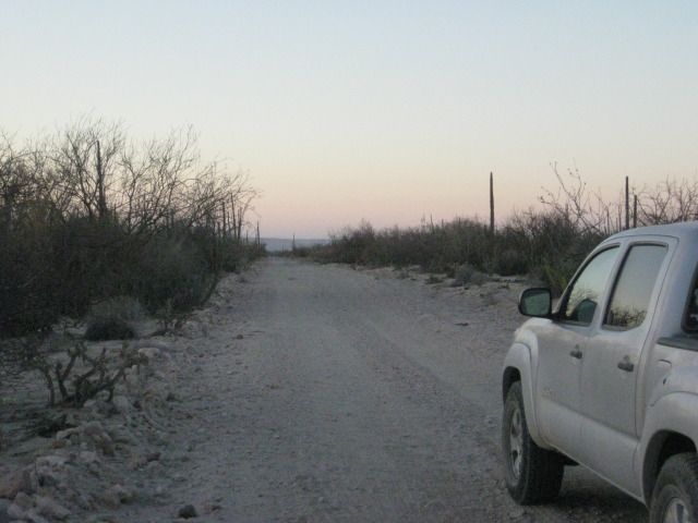
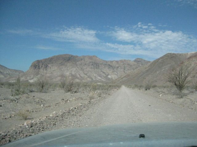
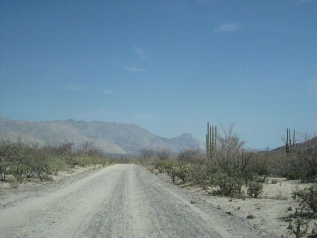
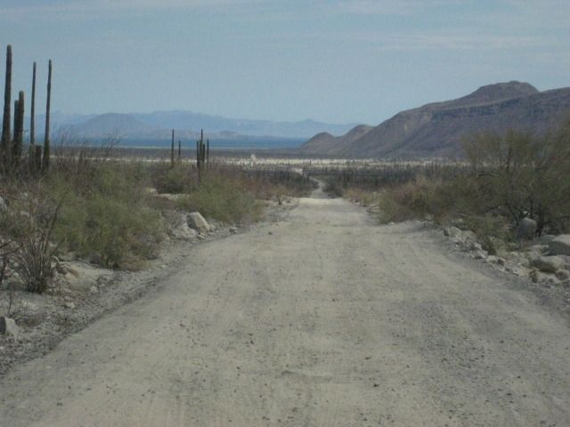
The El Arco/ Punta San Francisquito road is fast and easy to drive.
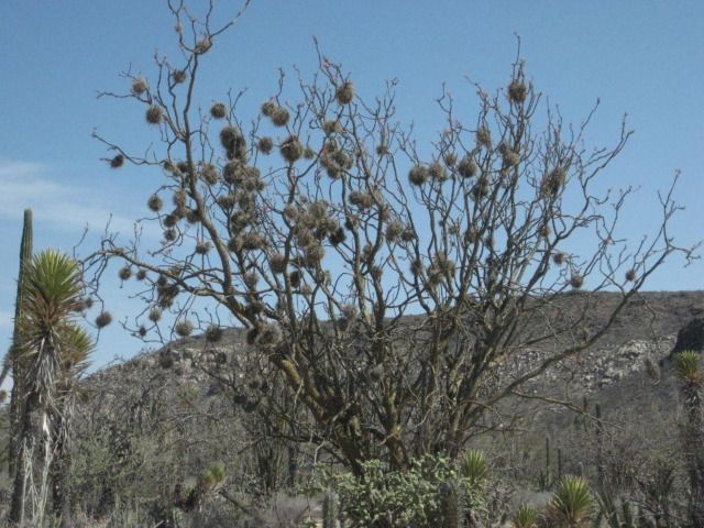
Ball moss.
The painted cave is up there.
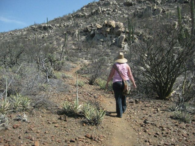
The trail is easy to follow, and only gets steep near the cave.

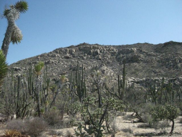
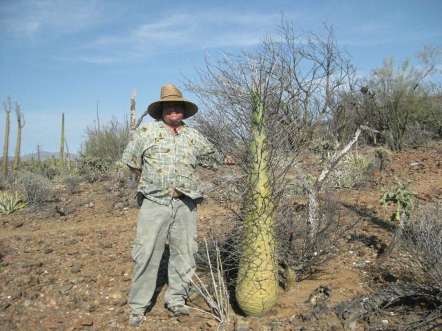
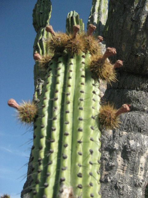
The Pitahaya Dulce or Organ Pipe Cactus was the source of much joy to the Cochimi Indians when its fruit ripened in the fall.
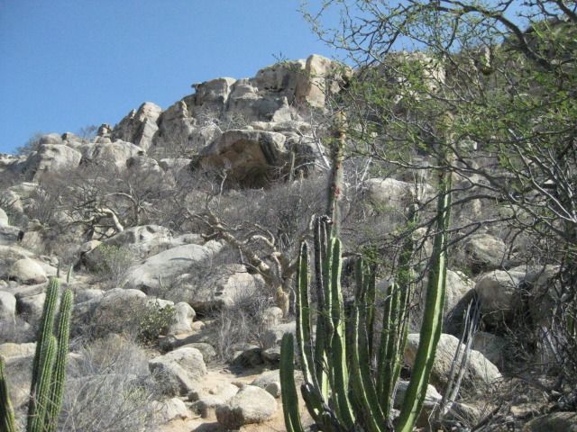
The cave
getting closer!
Looking back down the trail.
We can see the giant paintings.
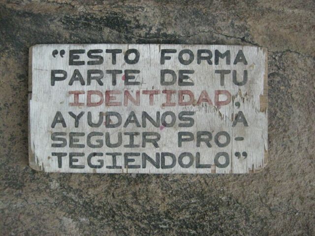
The only sign at the site


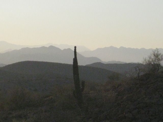
I spot a boojum tree (cirio) about my height
They can grow to 60 feet or more.
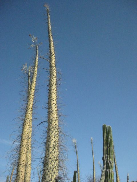
The base of the tall boojums.
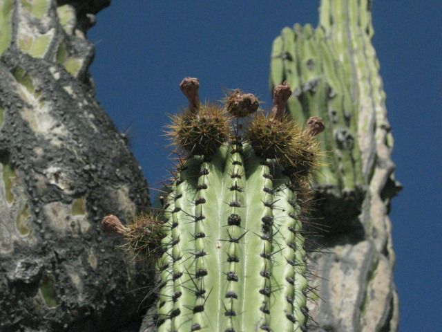
Here are some young pitahaya fruit. In a couple more months they will be ripe for eating.
We return to the road to Punta San Francisquito and continue east as the sun slowly drops in the west.
=======================================================================
Day 13-d
The painted cave was just plain awesome, and another of the Wonders of Baja that keep us going back, no matter how much the American media attempts to
scare us away from Mexico!
I did some more research into this cave site, as it is one of the grand ones. It would surprise me if a rancher named Arce was the first to find it,
in 1990. I have both versions of Harry Crosbys The Cave Paintings of Baja California (1975 & 1997). In the newer Sunbelt edition, I found it
mentioned on pages 236 and 237. This cave was seen by Leon Diguet in 1895, who called it The Cave of el Carmen, but the location was not exact
(Diguet said it was between Calmallí and Santa Gertrudis) and Crosby never found it during his travels to the painted caves.
We left the parking area for the cave hike at 5:00pm and we still had 2-3 hours of light to get there and set up our camp, we didnt know it yet, but
Punta San Francisquito would not turn out to be the ideal camp spot as I had envisioned.
Here is a road log and comments from Pozo Aleman to Punta San Francisquito:
00.0 Pozo Aleman entrance at graded road between El Arco and San Francisquito (approx. 2.5 miles from El Arco).
00.4 Road right to/from Mision Santa Gertrudis (20.9 miles).
07.0 Road left to La Unión ranch.
09.5 Cross El Camino Real, the mission road built in the 1700s here between Mision Santa Gertrudis and Mision San Borja. To the left, it has been
turned into an auto road to La Unión. To the right, just a straight trail to the southeast. See map.
13.2 Road south to Guillermo Prieto and Highway #1 (near Vizcaino) in 38 miles. It crosses the Mision Santa Gertrudis road in 12.3 miles (12.8 per the
Baja Almanac).
14.9 Piedra Blanca, a ranch and guest resort offering accommodations, meals, guided tours, and more.
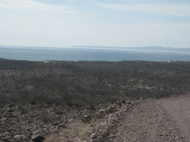
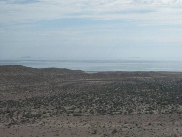
In just about 10 miles the peninsular divide is reached with a view of the Sea of Cortez and the many islands offshore. This was once the top of a
very steep grade called La Cuesta de la Ley (The Grade that Rules). However, it was totally re-graded in the early 1980s so 4WD is no longer needed.
26.0 Bottom of Cuesta de la Ley.
33.0 El Progreso, ranch. Road east curves to the left, road to El Barril forks to the right.
33.6 T Junction: Left (west) is road to Bahia de los Angeles, access in 1.5 miles. Right is main road east.
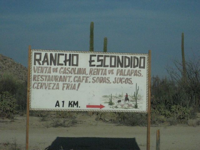
33.8 Rancho Escondido road right, tourist services offered.
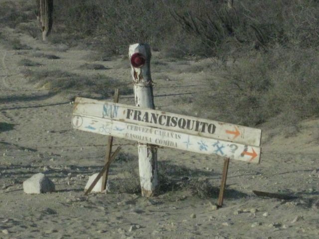
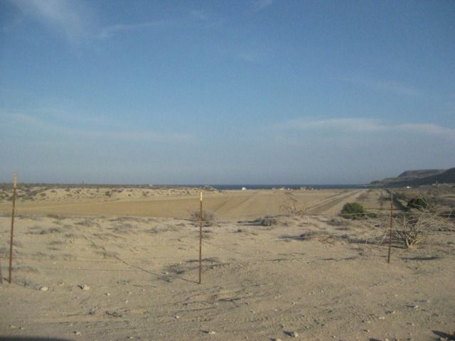
44.7 Gated entrance to Cala or Puerto San Francisquito ahead, turn right for Punta San Francisquito Resort. Soon drive along airport runway on dry
lake bed.
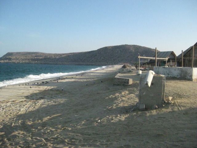
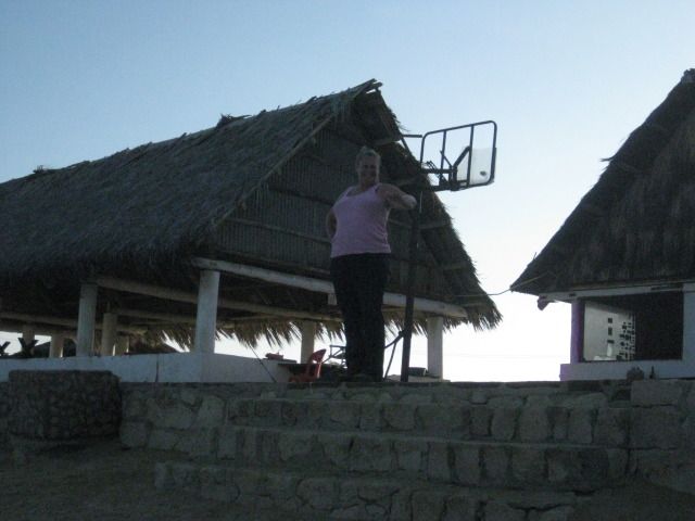
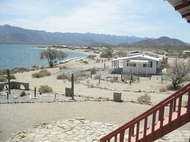
46.7 Punta San Francisquito Resort. Damaged by recent earthquake, but open for business (meals, rooms).
It is 6:20pm and the sun is still up, but not for a whole lot longer. We have a look around and chat with the lady in charge, who was watching TV. It
is windy, waves are crashing on the beach and setting up camp here would be a chore. We also didnt get a very receptive greeting even though there
were no other guests there. When I asked the lady about that, she just said it was too hot for tourists, and returned to watching TV.
We decide to push north for Bahia San Rafael, 35 miles away
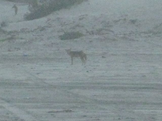
We get to San Rafael at 7:30, and the man who runs the camp there, Pancho, is gone and
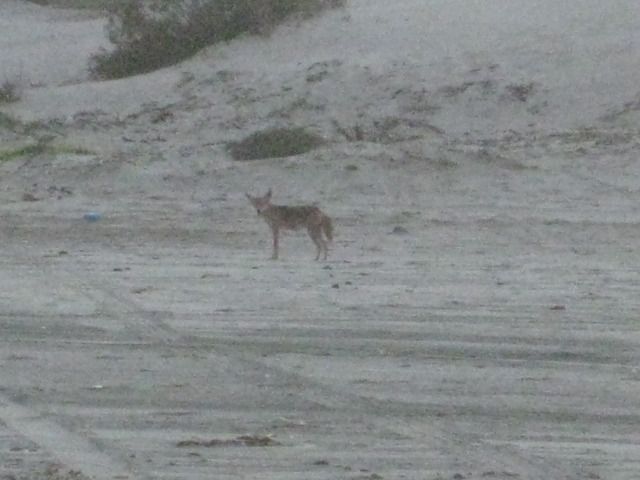
his house is locked up. There are fishermen shacks and one man is there. We drive down onto the beach to have a look at the one palapa on the sand for
camping. It doesnt look real inviting. We see a few coyotes nearby, and I capture one with my camera who is brave enough not to run away. There is
another access road onto the beach a bit north, so we turn around and drive back out on Panchos driveway to drive 2.1 more miles north to the other
beach. That works out perfect for us. We set up camp with ease (love that easy-up tent), make dinner, and enjoy campfire time before turning in for a
great nights sleep!
Maps & Photos:

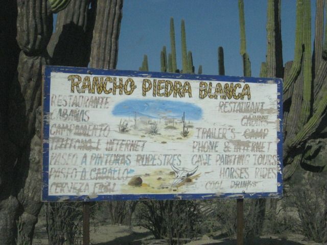
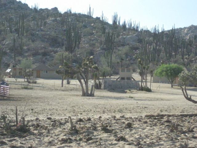
Guest rooms at Piedra Blanca.
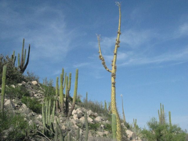
Ball moss on a boojum (cirio) tree.
La Cuesta de la Ley.
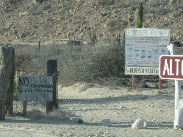
Gate and signs make it not very inviting to go to the cove on the sheltered bay.
This way is open and inviting. Unlike the way it is shown on the map, the graded road goes directly to the cove (Cala San Francisquito) entrance gate,
2.0 miles past the resort.
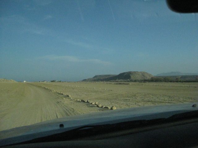
Along the airstrip.
Punta San Francisquito Resort.
Leaving, we take one more look at the runways.
This is the grade shown on the map as Puerto el Portezuelo.
Sunset, just a few miles from San Rafael.
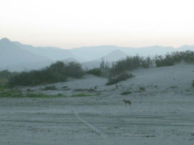
On the beach, just beyond Panchos and the fishermen shacks.
Tomorrow (Day 14) we head for Bahia de los Angeles and meet up with old friends
==============================================================
Friday, July 27, 2012 (Day 14)
We awake to a beautiful morning on the beach at Bahia San Rafael. After some photos of the beach, we pack up and are on the road at 8:52am. Once again
we are on the graded road, 2.1 miles north of the driveway to Panchos San Rafael beach camp and tire repair shop. I reset the odometer to 0. We stop
for photos in a couple places as we cruise north on the typical Baja graded road. To help with tire life and smoother ride off pavement, I have been
lowering the pressure from the normal 38 psi I run with a heavy load to 28 psi.
Mile 16.8: We come to the road for Bahia las Animas at 9:35am. This side road goes north to a fishing camp on a beautiful bay that was perhaps the
possible location for a mission that was abandoned before it was completed. Two miles from the end of the road at the camp, a large hill is passed. On
this hill are rock walls, at the base of the hill was an earth dam and reservoir behind it, and nearby is the trunk of a date palm. Other walls go
across the desert. It is quite a mystery and first photographed and documented by Desert Magazine editor Choral Pepper back in 1966. Choral later
would conclude that this site fits as the location of a started mission called Santa Maria Magdalena on the 1757 Jesuit map, shown south of Bahia
de los Angeles. Las Animas Bay was first explored by the Jesuit Fernando Consag in 1746, who arrived by sea seeking new mission locations to the north
of San Ignacio. It is all a great mystery and the purpose of all the work down here is otherwise unknown. See our 2009 examination of Choral Peppers
lost mission found: http://vivabaja.com/109
Mile 20.6 (9:49am): The old road going south from L.A. Bay leaves the graded road here. It was opened up by the Erle Stanley Gardner party in 1966
using dune buggies and 4WDs to find the ancient trail they were told about by Dick Daggett in Bahia de los Angeles. See the effort in Gardners 1967
adventure book, Off the Beaten Track in Baja.
Mile 30.6 (10:13am): As the graded road curves to the right, an old road comes in from the left. This goes 3 miles south to the railroad terminal area
where the gold and silver ore was loaded onto the small railroad cars bound for the mill at Las Flores. The ore came thousands of feet down from the
San Juan mine on top of the mountain using a cable tramway. All this activity pretty much ended in 1911 because of the revolution in Mexico. Just past
this junction on the graded road, look over to your right and see the railroad bed. The train engine from this railroad is now on display in the Bahia
de los Angeles town plaza.
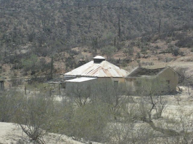
Mile 33.0 (10:21am): Over to the left is a small building. This is the Las Flores jail and vault that was once in a large town at the north end of the
railroad line. Las Flores is where the ore was processed into ingots and then they were carted to the bay where boats would pick them up.
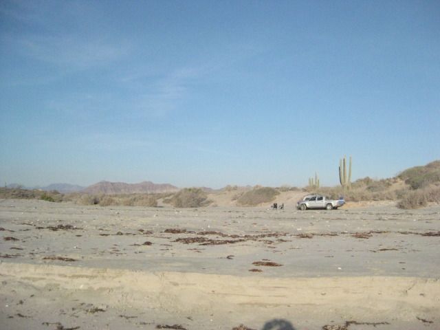
Mile 38.6 (10:33am): Camp Gecko, a private residence area now, at one time a fun place to camp with friends.
Bahia de los Angeles town is 4 miles north of the Camp Gecko entrance. We have some friends who have homes just north of Gecko, and we want to visit
with them. First we find Mary Ann Humfreville, and she suggests we go have lunch in town and see if Paulina and Dern can join us. Mary Ann and her
late husband Mike have been coming to Bahia de los Angeles since the 1970s. Mike wrote a book about their summers on the bay, both before and after
they had children. The book is called In the Shadow of the Volcano and can be purchased at the museum in Bahia de los Angeles. In the United States
or Canada, contact me as I have the remaining copies that were published.
We all go into town and after filling our gasoline tanks, we go to fill our stomachs at Alejandrinas Restaurant, a place that has been getting great
reviews on Baja Nomad forums. The reunion was great, and good to hears everyone is doing well. The town is quiet, as the summer heat is not enjoyed by
many travelers, we love it nice and warm.
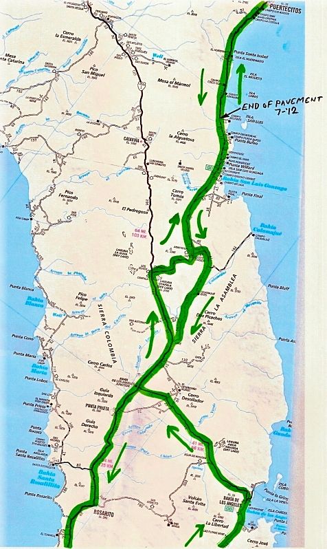
Heres our trip route map, this covers the area from Bahia de los Angeles to Puertecitos:
The highway into/out-of Bahia de los Angeles is in great condition and it is about 40 miles back to Highway #1 (65 kilometers). We get on the road at
2:20pm and reach Highway #1 at 3:02pm.
Along the way, 12.6 miles from Bahia de los Angeles or 27 miles from Highway #1, is the signed road south to Mision San Borja. The junction is at the
Km. 45 marker and if you have any time for the 22 mile dirt road drive, visiting this mission founded in 1762 is very much worth the drive and time.
San Borja is the furthest north of the cut stone built missions in all of California. Remember, the Baja peninsula was California first, and once the
padres came north of the peninsula they simply referred to the new land as Alta (Upper) California. Once you have an upper California, to clarify
discussion, the peninsula then was called Baja California. Read more on San Borja in my article published last month, here: http://www.bajabound.com/bajatravel/mission_san_borja.php
Northbound on Highway #1: At 3:15pm we pass El Crucero in 12.9 miles, at Km. 261. This is where we joined Highway #1 two weeks earlier, southbound
after visiting the Calamajue mission site. At Km. 251, 6.3 miles from El Crucero, is the water road to Calamajue Canyon. It was built in 1973 during
the construction of the Baja Highway to bring in water. It meets the road to El Crucero from Calamajue, just above the canyon entrance.
At 3:40pm we come to the Highway #5 junction with Highway #1, in the Laguna Chapala Valley. It is 30 miles from the Bahia de los Angeles Junction. We
take photos of the many signs including the battered up information one. Now, Highway 5 is still a dirt road for the final 45 miles of it. So, I
deflate my tires to help prevent rock punctures and to improve the ride. However, in just a few miles my low air pressure warning light comes on, and
my front right tire has a hole in the center.
It takes 3 plugs to stop the leak, and it usually isnt this hard to do it. In a couple miles the plugs fail, so I repeat the steps to avoid changing
the tire, not that that is any big deal. I know they can patch the tire at Gonzaga Bay (Rancho Grande) and prefer to keep the new spare new, as long
as possible. 9 years ago, I even purchased a used tire at Rancho Grande when I had a rock hole too big to patch. They actually had the correct size
for my 2001 Tacoma. Since then, I lower the air to about 25 psi and avoid big rock damage.
We pass Cocos Corner at Mile 12.7 from Laguna Chapala, and it is 4:52pm. With the tire issue and sun getting low, we did not stop to visit with Coco.
We usually always like to make a visit there and buy a cold Pacifico from him. I wanted to let him know that Calamajue Canyon was no problem two weeks
earlier from the little water we found there, compared to past years.
At Mile 25.3 we pass the south access road for Punta Final (part of it is the older road south, before the graded one we are on was made about 1987).
At Mile 33.7 (from Highway #1/ Laguna Chapala) is the road to Campo Beluga, on the bay. We stayed there in 2007: http://vivabaja.com/207/page3.html
Rancho Grande, Gonzaga Bay is 35.0 miles from Highway #1. There one can eat at the new restaurant, shop for many items including booze in their
market, and in back is the tire shop. The tire gets fixed, and we are okay on gasoline, so no need to top off at the Pemex station, across the road
from Rancho Grande. The Pemex is also next to the road to the bay at Alfonsinas Resort (Restaurant, Bar, Motel): http://vivabaja.com/908/page9.html and http://vivabaja.com/1106/page10.html for pictures at Alfonsinas.
The sun is headed behind the mountains, but with so much of the road to the north paved, we are still comfortable about getting to Shell Island.
Specially with the tire repaired. As it turned out, the hole was in the same spot as a previous patch made last January when I got the first flat, on
this same tire (on a rocky road but didnt deflate). Perhaps that is why it was more difficult to plug? The older patch failed more than the tire
failed, a second time. That road between Chapala and Cocos Corner is very rocky, so go slow and save your tires. I have had no other failures during
the 24,000 miles I have had on these Hankook Dynapro ATM tires.
I reset my trip odometer at Rancho Grande/ Gonzaga Pemex
just ahead is the military checkpoint, and they do their full inspection. It is all very
professional and we are soon on our way.
We pass the road to Papa Fernandez Resort at Mile 2.5, then come to new highway construction at Mile 2.7. From here to the pavement we are sometimes
on detours, sometimes on the new roadbed. Punta Bufeo Resort road is at Mile 7.5 and we are on new pavement at Mile 12.8. We come to the detour sign
at Mile 13.0 and it is all pavement from here north. So, 13 miles from Rancho Grande & the Pemex or 10.5 miles from Papa Fernadez road
right
about at the turnoff to Campo Delfines, is where the pavement begins going north, on July 27, 2012.
We come to the paved Puertecitos entrance road at 8:07pm and Mile 44.4 from the Gonzaga Bay Pemex. The new paved Highway #5 south from Puertecitos
began being built about 5 years ago. In September of 2008, only 2 miles were paved. In July, 2010, 18 miles were paved. In July, 2011, 24 miles were
paved. Now, in July/August 2012, 31 miles are paved. The land here is very rugged and the volcanic rock must be a tough thing to cut through!
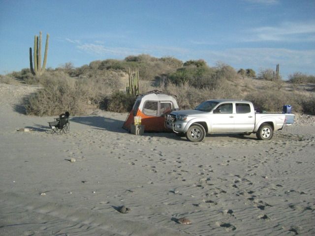
We arrive at our beach camp on Shell Island tired, but happy. This is our favorite place to camp in all of Baja. Perhaps because it is an easy days
drive from home (about 6 hours), but mostly because it is all sand and usually no other people. We enjoy the quiet times, but we also had great times
with others on this trip!
I will wrap-up this trip with tomorrows (DAY 15) details for the drive home and crossing the border
Hasta Pronto (See you soon)!
DAY 14 photos:
Good Morning Bahia San Rafael!
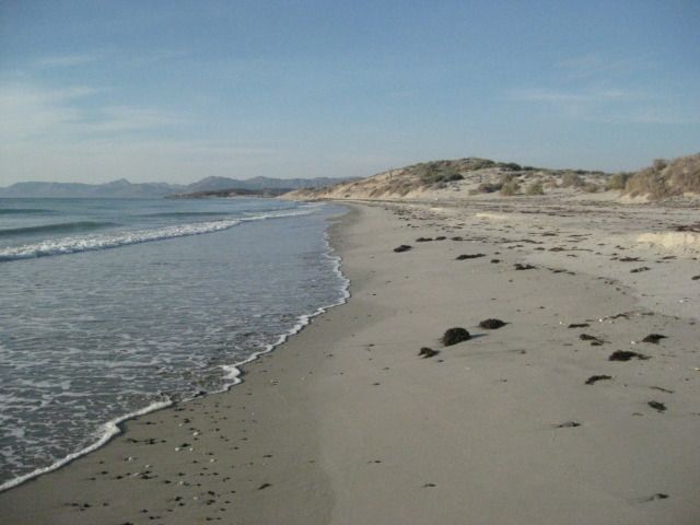
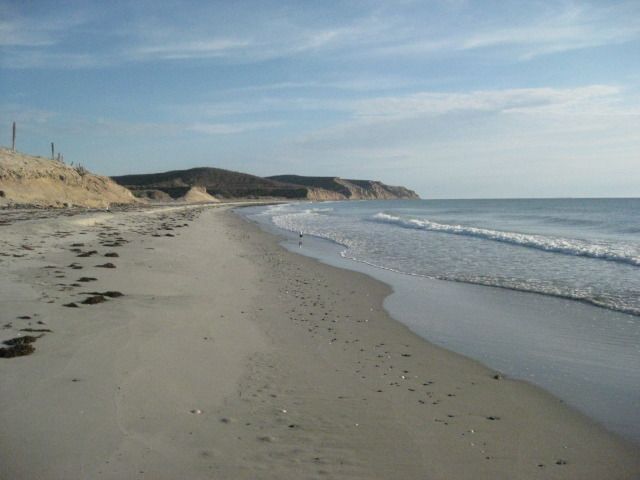
Our camp from the waters edge.
On the road, looking back to the beach where we camped.
Thats Boca Grande, just north of San Rafael. Baja Nomads have reported very bad mud out there. The best story comes from Barry A about his
experience at Boca Grande.
This is the road to Bahia las Animas.
Mikes Mountain comes into view. This is a peak above Bahia de los Angeles were an American (Mike) would climb to regularly and he made a rock house
on top. See photos and discussion about it here:
http://forums.bajanomad.com/viewthread.php?tid=58661
The road reaches the highpoint in the valley and bends towards the bay. The road to the terminal area for the railroad comes in here. Just ahead, on
your right is
the railroad bed. See photos at the terminal: http://www.vivabaja.com/402/page4.html and http://www.vivabaja.com/403/page11.html
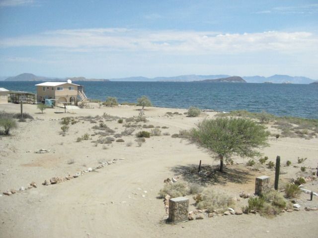
The view from Mary Anns porch, Bahia de los Angeles.
|
|
|
dtbushpilot
Ultra Nomad
Posts: 3288
Registered: 1-11-2007
Location: Buena Vista BCS
Member Is Offline
Mood: Tranquilo
|
|
Great trip report DK (then and now). Every time I go through that area I'm on my way to somewhere else, I really need to slow down and smell the
cactus one of these days......dt
"Life is tough".....It's even tougher if you're stupid.....
|
|
|
David K
Honored Nomad
Posts: 64480
Registered: 8-30-2002
Location: San Diego County
Member Is Offline
Mood: Have Baja Fever
|
|
Thanks David... Yes it is a great part of Baja... but so are many of the other parts, verdad?
Have a nice Sunday!
|
|
|
Frank
Senior Nomad
Posts: 861
Registered: 6-5-2005
Location: San Diego
Member Is Offline
Mood: Is it time to leave yet?
|
|
This makes it even harder to sleep now. Thanks DK 
|
|
|
David K
Honored Nomad
Posts: 64480
Registered: 8-30-2002
Location: San Diego County
Member Is Offline
Mood: Have Baja Fever
|
|
Sorry about that Frank. Blame Baja for being so cool.
A reminder, this post is two days out of our 15 day report to answer Baja Rat's question in Capt. Mike's thread, and put here so as to not distract
from it. A good idea from a Nomad amigo.
|
|
|
Udo
Elite Nomad
Posts: 6321
Registered: 4-26-2008
Location: Black Hills, SD/Ensenada/San Felipe
Member Is Offline
Mood: TEQUILA!
|
|
WOW!
DK...
This is the kind of trip report one keeps to oneself, because you don't want others to come and spoil the locations.
terrific trip report, buddy!
Udo
Youth is wasted on the young!
|
|
|
David K
Honored Nomad
Posts: 64480
Registered: 8-30-2002
Location: San Diego County
Member Is Offline
Mood: Have Baja Fever
|
|
Hi Udo. I think Nomads are good to share with, so don't worry too much. Have a great day amigo!
|
|
|
larryC
Super Nomad
Posts: 1482
Registered: 8-11-2008
Location: BoLA
Member Is Offline
|
|
I didn't look at your post last July, but I did just now and noticed your last photo of Maryann's view to the north is a photo of my house.
Larry
Off grid, 12-190 watt evergreen solar panels on solar trackers, 2-3648 stacked Outback inverters, 610ah LiFePo4 48v battery bank, FM 60 and MX60
Outback charge controllers, X-240 Outback transformer for 240v from inverters, 6500 watt Kubota diesel generator.
|
|
|
güéribo
Nomad
Posts: 239
Registered: 10-17-2014
Member Is Offline
|
|
Re-igniting this thread. Has anyone been to Calmallí lately? Found this nice photo on the web.

|
|
|
David K
Honored Nomad
Posts: 64480
Registered: 8-30-2002
Location: San Diego County
Member Is Offline
Mood: Have Baja Fever
|
|
Thanks for the photo Güéribo.
Jack Swords has a few photos of Calamllí in his photo web pages... on page 3 of this site: http://www.vivabaja.com/swords/
|
|
|
|


