| Pages:
1
2 |
PaulW
Ultra Nomad

Posts: 3113
Registered: 5-21-2013
Member Is Offline
|
|
La Ventana-- found
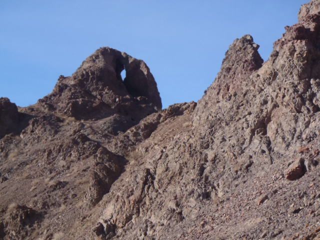
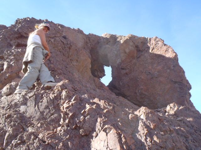
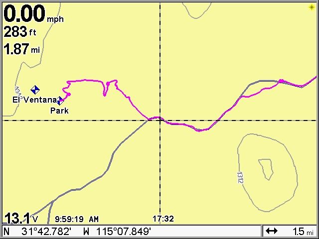
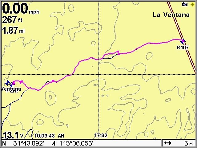
I found some time to make some screen shots and post them here. The travel from Hwy5 is pretty easy it crosses 2 gully's one had a steep climb to get
up to the ridge. 4WD would be good, but normal clearance vehicle should work. Note the topo lines and the graded road in black.
La Ventana Found N31-42.912, W115-08.5014 Parked at N31-42.868, W115-08.382
PaulW
|
|
|
David K
Honored Nomad
Posts: 65561
Registered: 8-30-2002
Location: San Diego County
Member Is Offline
Mood: Have Baja Fever
|
|
Great job... How where you clued to that hole being the original?
Could you see the hills at San Felipe through it?
|
|
|
shari
Select Nomad
Posts: 13052
Registered: 3-10-2006
Location: bahia asuncion, baja sur
Member Is Offline
Mood: there is no reality except the one contained within us "Herman Hesse"
|
|
is that why La Ventana is called that?
|
|
|
David K
Honored Nomad
Posts: 65561
Registered: 8-30-2002
Location: San Diego County
Member Is Offline
Mood: Have Baja Fever
|
|
| Quote: | Originally posted by shari
is that why La Ventana is called that? |
In researching this for you Shari, there is perhaps a different La Ventana than the one Paul found?
Page 81, Lower California Guidebook by Peter Gerhard and Howard Gulick:
1.7 miles south of La Ventana restaurant (formerly also a gas station, 72.7 miles south of Mexicali):
"A little-traveled old track left follows the edge of the salt flats to the easternmost point of the Sierra Pinta, 1.4 mi. An
outlying little hill has an opening through it which gives the name La Ventana ("window") to this entire area."
|
|
|
PaulW
Ultra Nomad
Posts: 3113
Registered: 5-21-2013
Member Is Offline
|
|
| Quote: | Originally posted by David K
Great job... How where you clued to that hole being the original?
Could you see the hills at San Felipe through it? |
==========
We were looking for a passage up an unnamed wash leading N from the graded road. On the others tried to go thru a ditch that he could not make and
while I was standing around there it was.
So we drove over there. I made the track on the way back the edited the wrong one out.
So to answer your question you would need to be near the first "U" turn heading west to see the thing.
Sure hope its is the real original? Nothing else anywhere like that within a 10 mile radius.
BTW Later we did find the N track and it led us back to near Saldana thru some sand dunes and narrow washes.
|
|
|
PaulW
Ultra Nomad
Posts: 3113
Registered: 5-21-2013
Member Is Offline
|
|
HI, All,
Here are some Gerhard/Gulick details Per DavidK's words below.
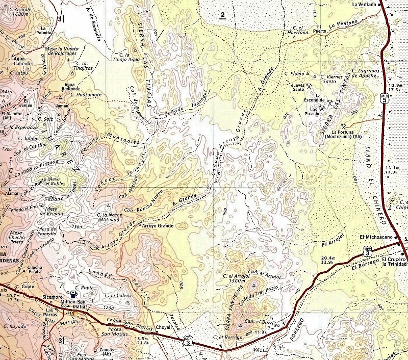
The place where the La Ventana buildings are located is
K105.25 on the road at N31.740817,w115.068908
1.71 miles down the road is km108
No road to the left because hard left is the mountain, however leading NE is a wash. From my GPS map 1.4 miles should be the place to look at the edge
of the sand/salt spit
Gerhard/Gulick place is very near N31.72304w115.045053
and K108 =n31.71755,w115.05812
Put these cords onto GE and have a look. Maybe you will see a faint road on the N side of the wash? Maybe my 1.4 miles is a little to far? Make your
own GE track and note your miles & report.
It probably will be an easy drive. So next fall I will go have a look.
PaulW
================
| Quote: | Originally posted by David K
| Quote: | Originally posted by shari
is that why La Ventana is called that? |
In researching this for you Shari, there is perhaps a different La Ventana than the one Paul found?
Page 81, Lower California Guidebook by Peter Gerhard and Howard Gulick:
1.7 miles south of La Ventana restaurant (formerly also a gas station, 72.7 miles south of Mexicali):
"A little-traveled old track left follows the edge of the salt flats to the easternmost point of the Sierra Pinta, 1.4 mi. An
outlying little hill has an opening through it which gives the name La Ventana ("window") to this entire area." |
|
|
|
David K
Honored Nomad
Posts: 65561
Registered: 8-30-2002
Location: San Diego County
Member Is Offline
Mood: Have Baja Fever
|
|
Howard Gulick researched the guidebook in the 50's and to 1961... So it has been a long long time. That window rock may have collapsed?
|
|
|
PaulW
Ultra Nomad
Posts: 3113
Registered: 5-21-2013
Member Is Offline
|
|
La Ventana + Diaz coments
Here we go. again. I wont let this die because of my obsession Ha
Bruce Barber publishes his stories one a week on the Kat SF link and todays story was about La Ventana. It appears his articles were written some time
ago and only recently have appeared on Kats Corner.
I will touch base with him and tell him about my finding and the Howard Gulick report.
So here is part of his article about Baja Mysteries.
- - - -
Earlier, I said a mystery is an aura and there is one involving La Ventana, the halfway house between Mexicali and San Felipe. La Ventana are
the Spanish words for the window. Ask the man who owns the place and hell tell you La Ventana is a three-sided lava formation through which San
Felipes landmark mountains Kila and Machorro can be seen as though framed by a window. Show interest in the question and the same man may drive
you there; its only two miles southeast of his former store.
I have an old hydrographic chart showing the place as Sergeants Point, but todays visitors dont know that name so now it has none. Instead,
it provides the wrong answer to questions about La Ventana. The fact is, that three-sided formation was a landmark used for years by smugglers
bringing Chinese Nationals to America.
The original store by that name was built by a Spaniard who saw a need and filled it. He created a store for workmen building the road between
Mexicali and San Felipe. (Why San Felipe? It is the only place along Baja Californias northeastern shore where a fishing fleet port could be created?
The original road was an abomination that twisted and turned its way along the desert floor when it could. When it couldnt, it rose tortuously
over lava-strewn hills to return to the flats as quickly as possible.
A place called La Cocina was a stopover where truckers hauling fresh fish from San Felipe waited for the proper tide to cross Laguna Salada. It
was also a place for food, soda, a frosty glass of beer, shade, a nap, and an eager ear.
While filing for a building permit, a clerk asked the Spaniard what he was going to call his new store. La Ventana, the man replied, thinking
of the old prospector whod recommended that name during an earlier conversation. Over the years, however, this fact was lost along with the memories
of those whod gone before.
Nowadays, no one seems to know what or where La Ventana actually was. In my opinion, because of a nearby riverbed bearing that same name, it
had to be something more than a crude framework of soft red lava. When I began my search for that 16th-century grave I listened to stories locals had
to tell. Lacking plausibility, like a three-sided shape through which something 50 miles away might be viewed, I couldnt accept what I was hearing
and set out to find what I felt had to be there.
Although my search covered a vast area, I ultimately decided La Ventana must have eroded away.
a) It had to have been a landmark early prospectors used to guide them across the desert.
b) It must have been prominent to warrant the naming of both a riverbed and a store.
Having decided its probable location, I discontinued that part of my search and moved on to the next. But then, one sunny day nearly six months
later, I stumbled on the thing while searching for a lost grave. That is, while attempting to solve one mystery, I solved another.
La Ventana exists! Although hidden, it stands as tall and proud today as it ever has. In fact, my search partner and I walked passed it twice
before we noticed it. We even stood under it pointing in another direction while wondering where it might be. But, when we did
when we finally looked
up and saw that rocky thing, we simply stood and stared at a magnificent creation carved by natural forces thousands of years earlier. This was a case
of knowing instantly that we finally found one of two things wed been seeking for 3 1/2-years.
Because it was a 100-degree day, and because wed already walked miles in relentless heat, we deferred inspecting the thing until another day. It
wouldnt be easy. Access to La Ventana is difficult. The hill on which it sits is covered with dirt and rock thatll slide at the touch of a hand or
foot. The two entrances to La Ventana Canyon are not obvious.
But now, with our discovery, Ive compounded a mystery because I know where it is. My need to know, however, is based on a story that makes La
Ventana one of the keys to the location of a grave I am still seeking.
In the early 1930s, a man parked his car near the La Ventana gasoline station and store before going off in search of a particular oasis.
During his return to that car he stumbled on a pile of rocks he believed was a grave and, later, when told by the Mexican consulate in Los Angeles
that hed have to fund his proposed grave-opening expedition, he kept its location a secret until just before he died.
I learned of his discovery in 1986, won My wifes approval to search for it, and sought a partner to accompany me into the desert. The man I
chose was a man Id worked with 40 years earlier, who spoke Spanish, was comfortable in the desert, and was excited by the prospects of this search.
Freda and I drove to his home in Southern California, made our pitch and, after hearing the details and seeing the charts I had obtained,
accepted the project without delay although he would only be able to spend one week per month on it. But, the real work was yet to be done:
*** We each had to familiarize ourselves with all available facts regarding the death and burial of a 16th-century Spaniard.
*** We each had to familiarize ourselves with Baja Californias Sierra Pinta, Sierra Tinaja, and Arroyo Grande.
*** We each had to provide ourselves with an appropriate desert vehicle.
*** And, we had to create a Search Plan, which would divide our search domain into manageable segments.
La Ventana could have been anywhere within a 50-miles-long by 20-miles-wide corridor. Although we disagreed over its probable location, our
disagreements were responsible for our most rewarding find.
We established a grid-like network over the region and bounced from zone to zone eliminating the ones we felt were out of the picture while
thoroughly investigating the others. It was a difficult, time-consuming search over rough terrain which, in the face of defeat, provided us with many
rewarding discoveries of the natural beauty of a remote desert province.
An acquaintance told me this grave could be in any one of 100,000 square miles. We believe its in an area involving less than 100 square miles.
We are, however, surrounded by mysteries. No sooner do we solve one than another comes along, and thats what makes this land so interesting. Suppose,
for example, the Ventana we found is not the original. What do you think we ought to do then?
The fact is,
a) We found two soft-rock ventanas and one in hard rock.
b) We named the canyon in which the hard rock ventana is located after the man whose grave we were seeking. I.e., Diaz Canyon.
c) We were foreign visitors with no official capacity.
d) Almost no one knew what we were doing.
e) We left no markers to show where wed been.
f). Throughout the entirety of our search domain we saw no (off-the-beaten-track) tire tracks but our own.
g). Going back to the 1930s, all access roads to, into, and through the Sierra Pinta were on centuries-old Indian trails. Because there were
comparatively few automobiles back then, our search had to include the finding of all regional trails as well as bona fide automobile roads.
Briefly stated, because the 1930s penetrant was in search of Blue Fan Palms, he would have (should have) headed for mountainous terrain (Sierra
de Juarez) rather than purely volcanic ejecta (i.e., Sierra Pinta/Sierra Tinaja). His route, therefore, would have been a) southerly via the
Mexicali-San Felipe highway, b) across the Laguna Salada, c) to a place in the Sierra Pinta (?) where he turned off to park his car and d) began his
trek on foot, possibly alongside the Rio La Ventana. Now, his trek became westerly but it was during the 2nd half of this trekback to his carthat he
happened on what he termed a curious pile of rocks.
http://katskorner.com.mx/san_felipe/2013/08/14/14-august-201...
|
|
|
PaulW
Ultra Nomad
Posts: 3113
Registered: 5-21-2013
Member Is Offline
|
|
Bruce's Ventana
Quoting Bruce Barber:
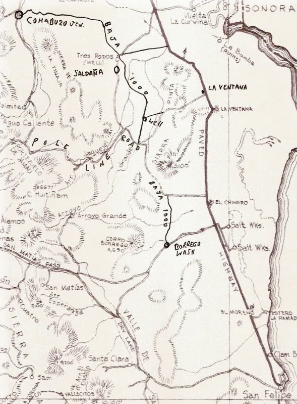
My Ventana is approximately ten (10) miles west of the former gas station (et al). Access to it is a) drive west via the La Ventana Riverbed (about
1mile south of the former gasoline station) to Arroyo Grande. Turn south and proceed to the first bona fide opening (a waterway) into the mountains.
Turn east to enter that waterway and proceed to its (approx) 90-degree turn to the right. Position yourself in the approximate center of that
intersection, look west (and ever so slightly north) and towards the upper rim of the mountain you are now facing ...and you should see an almost
square Ventana (at least two feet by two feet interior dimensions). I haven't been in there for 20 years so we must allow for an indeterminable amount
of erosion.
Bruce said he will post a pic on Kats link when he comes back to SF.
= = =
Comments: The road leading S at the pipe line is only 6 miles. The next road S is at the wells and is more than 10 and is at AG.
I will try both. I the last 20 years the roads have change quite a bit due to the mine well development.
The search will continue.
Paul
|
|
|
David K
Honored Nomad
Posts: 65561
Registered: 8-30-2002
Location: San Diego County
Member Is Offline
Mood: Have Baja Fever
|
|
On my phone but will add important data to your wonderful post.
|
|
|
David K
Honored Nomad
Posts: 65561
Registered: 8-30-2002
Location: San Diego County
Member Is Offline
Mood: Have Baja Fever
|
|
The Lost Diaz Grave
Here is the running thread on the Diaz Grave location search/ mystery (it is on the Nomad Historic Interests forum): http://forums.bajanomad.com/viewthread.php?tid=26703
The person who found the rock pile was Walter Henderson, and his story became widely known after Choral Pepper (editor/ publisher of Desert
Magazine) received a letter from Henderson in 1967 describing the hike and detailing the location.
Choral did not relate the story exactly the way Henderson wrote it when she published his story in her magazine and her books, on purpose or not. I
know this because I have the letter and have shared it with people who tried very hard to find the rock pile using Choral's magazine or book. Bruce
Barber was one of those who I shared the original letter and location paper with.
The primary error was saying La Ventana was the starting point of the hike... it was not. I would very much like to see the 'rock pile' and would like
to join with other Nomads on a search for it, this winter, perhaps? Henderson never called it Melchior Diaz' grave, and didn't know the story of it
until years after he discovered the rock pile. The grave location and story about Diaz was so similar to what he saw in Baja, he believed it could
very well be the true location.
With another Nomad's sharp eye on Google Earth, directing my search, I re-found the 'lost mission' that Choral Pepper described in her 1973 book as
being Santa Maria Magdalena. I had searched for it many times, so it was a great reward to see the site Pepper saw in 1966: http://vivabaja.com/109
To help the adventurist Nomads, I posted this major hint 2 years ago:
-------------------------------------------------------------------------------------------
Henderson (and friend) walked 2 days (limited water)...
From the parked Model A (north of today's Borrego Wash checkpoint), they walked over the saddle (divide) in the hills using the most logical route to
get to the other side (Arroyo Grande)... They found the 'rockpile' as they descended towards Arroyo Grande from the divide... about 1/4 to1/3 down.
There are 3-4 westward flowing arroyos that drop into Arroyo Grande from the Sierra Las Pintas divide... Henderson gives details as to what Arroyo
Grande looks like where the (correct) arroyo joins it, as well as details of the terrain at the site... (I am not posting until one of us Nomads can
give it another try this winter).
They spent the night in Arroyo Grande then returned to their Model A. They wanted to get further northwest to the Tinajas mountains or La Palmita
oasis... and realized they hiked from a point too far south, after the walk.
Choral Pepper (perhaps intentionally) left out some details or changed some from this letter to write her chapter... If any of you get Bruce Barber's
book ('... Of Sand and Sea'), you know he would have could found the rockpile with the intense energy and science he put into the search... but only
IF he had the correct starting point!
Tad (DesertGhost) is the other explorer who has made several trips into the Sierra Las Pintas seeking the 'rockpile'... When I discovered the original
Henderson letter and directions in Choral Pepper's collection, I thought it only fair to send them to both men because of their passion and desire to
share their adventures with us Baja history fans.
I too have a desire to find (or at least see) the 'rockpile', and it matters not if it is the 1541 grave of Melchior Diaz. Choral Pepper was dear,
sweet lady whose love for Baja and the desert inspired so many of us to just get out there and enjoy what so many keep away from... the desert!
To bring anyone up to speed on who Melchior Diaz was:
Melchior Diaz on Wikipedia
From Wikipedia, the free encyclopedia
Melchior Díaz was an early Spanish explorer of Western North America who "was a hard worker and skillful organizer and leader. He inspired confidence
in his companions and followers, and always maintained the best of order and of diligence among those who were under his charge".[1] He was involvedin
three expeditions associated with the explorations of Francisco Vazquez de Coronado.[2]
He was placed in charge of the town of San Miguel de Culiacán by Nuño de Guzmán. When in 1539, Fray Marcos de Niza returned from Pimera Alta reporting
he had seen the fabled cities of Cibola, Viceroy Antonio de Mendoza sent Diaz as the leader of a small expedition preliminarily to determine if
reports by Fray Marcos were true. Information he gained was to benefit Coronado's planned and much larger expedition. He departed on November 17,
1539.
When Diaz failed to return at the expected time, Coronado embarked without him in February 1540. Diaz and Coronado met en route, and Diaz joined
Coronado's group. Coronado then sent him on his second expedition to locate and investigate some villages reported in the area. He found the villages
and reported they did not live up to the grand descriptions that had been given. Diaz was then sent ahead by Coronado to secure feed for the
expedition's livestock.
In July, 1540, Diaz was sent to take the now-mistrusted and hated Fray Marcos back to Mexico and (say some reports) to take over leadership of the
outpost at San Geronimo (or Hieronimo) in the valley of Corazones and from there to attempt contact with the fleet of Hernando de Alarcon, which was
to be the maritime arm of Coronado's expedition. In September, 1540, he began his third expedition, traveling overland to the head of the Gulf of
California. Near the confluence of what is now the Colorado and Gila Rivers he learned from the natives that Alarcon had departed, but had left a
cache of supplies and correspondence, which he located. The message basically stated that "Francisco de Alarcón reached this place in the year '40
with three ships, having been sent in search of Francisco Vazquez Coronado by the viceroy, D. Antonio de Mendoza; and after crossing the bar at the
mouth of the river and waiting many days without obtaining any news, he was obliged to depart, because the ships were being eaten by worms".[3] Diaz
crossed the Colorado River, becoming the first person of European background to do so, and named it Rio del Tizon ("River of Embers" or "Firebrand
River") from the practice of the natives for keeping themselves warm. He was impressed with the physical strength of the natives of the area. He
explored for four days west of the Colorado, perhaps as far as the Imperial Valley.
While on this expedition (reports vary, some saying it ended further exploration, others saying it occurred while on the return) Diaz accidentally
suffered a mortal wound. He threw a lance at a dog that was attacking their sheep. The lance stuck into the ground and before he could stop, Diaz
impaled his groin on the back end of the lance. He lingered for twenty days, but died en route in January, 1541.
Because of his untimely death, we do not have the kind of memoirs commonly written by other Spanish explorers. The reports that he made in the course
of his expeditions, however, were quite detailed and contributed much to the knowledge of the area and the times for both contemporary and later
readers. His name for the Colorado River was the accepted name for almost two centuries. He reported details of Native American culture. He discovered
and reported geothermal hot springs, probably the ones near Calexico.
===============================================
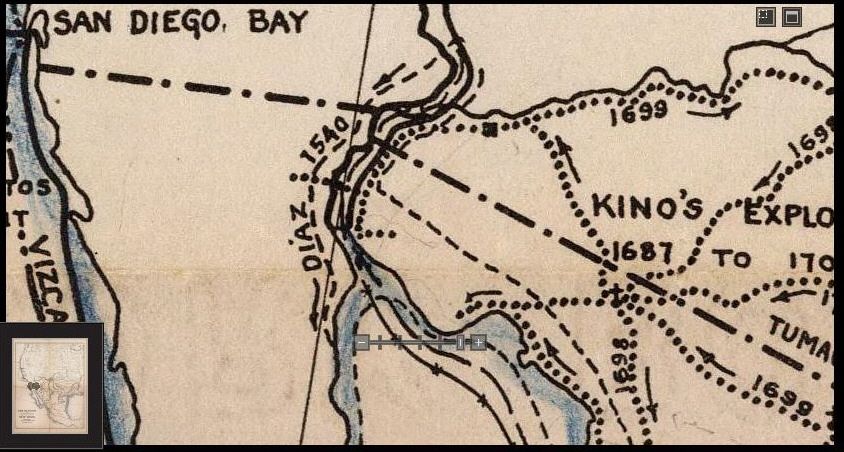
Now, if we can accept that the hot mud springs Melchior found are those near Cerro Prieto (the volcano south of Mexicali) and not the ones by the
Salton Sea... It helps place him on the peninsula...
A map of the Melchior Diaz (possible) route:
|
|
|
David K
Honored Nomad
Posts: 65561
Registered: 8-30-2002
Location: San Diego County
Member Is Offline
Mood: Have Baja Fever
|
|
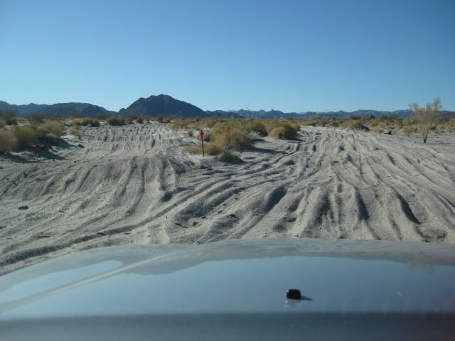
In Jan., 2012
Wednesday, we head home... But, not without some exploration into new (to me) territory.
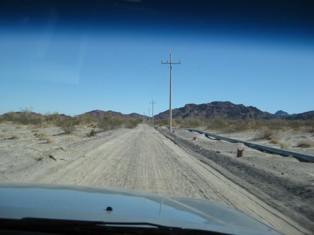
This is the water pipe that goes from Arroyo Grande to the La Fortuna gold mines, 40 miles north of San Felipe. The power lines go to the well at the
end of the pipe. The access road leaves Mex. 5 at Km. 107... just south of La Ventana.
In ~6 miles you come to the water and power lines... ~6 more miles is the end in Arroyo Grande. The Baja 1000 course was in Arroyo Grande, heading
south.
It is pretty slow going in anything but an off road racer in Arroyo Grande, for ~5 miles to where it turns east out of the arroyo.
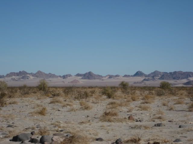
The desert is beautiful...
Like all my other Baja trips, this one has me wanting to go back... just to experience it one more time!
|
|
|
TMW
Select Nomad
Posts: 10659
Registered: 9-1-2003
Location: Bakersfield, CA
Member Is Offline
|
|
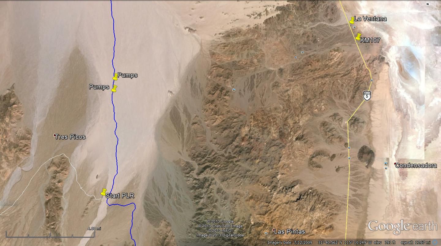
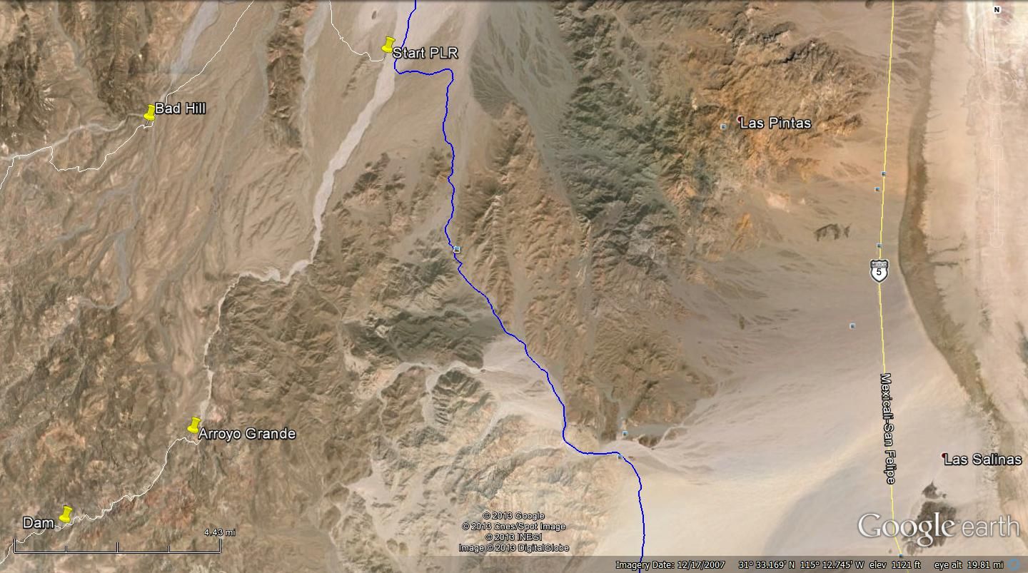
Google Earth Image of area. Blue line is SCORE race course.
|
|
|
TMW
Select Nomad
Posts: 10659
Registered: 9-1-2003
Location: Bakersfield, CA
Member Is Offline
|
|
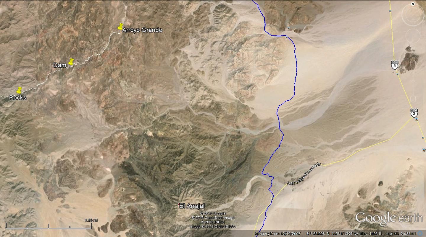
Along the SCORE Race Course.
|
|
|
David K
Honored Nomad
Posts: 65561
Registered: 8-30-2002
Location: San Diego County
Member Is Offline
Mood: Have Baja Fever
|
|
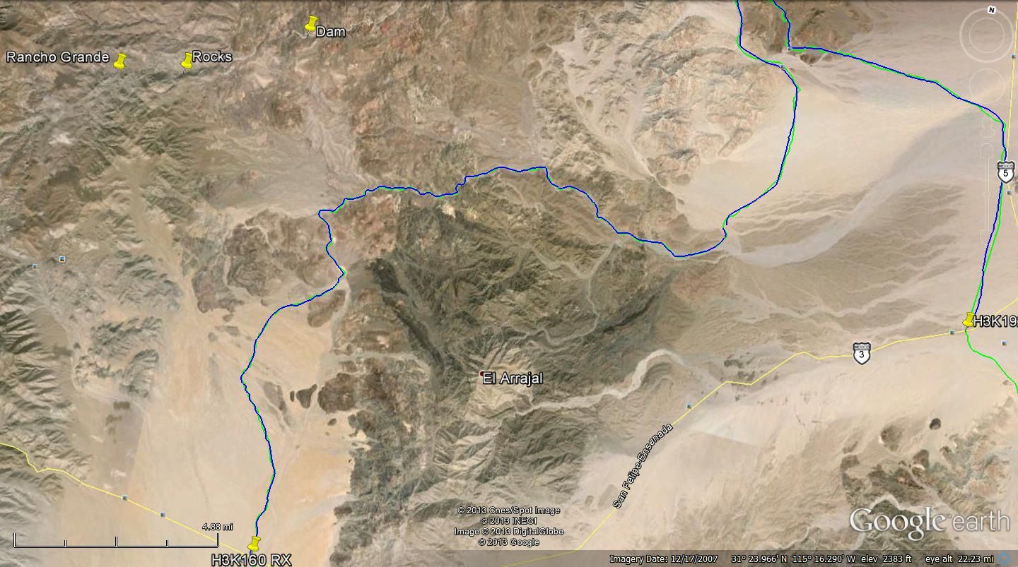
The mountain shown on the Google image above (and the newer topo maps) as 'El Arrajal', is the mountain known as 'Cerro Borrego' to Walter Henderson,
as shown on the 1962 Gulick map, and also called 'Sharp Peak' on another map from before 1950...
|
|
|
PaulW
Ultra Nomad
Posts: 3113
Registered: 5-21-2013
Member Is Offline
|
|
| Quote: | Originally posted by David K
The mountain shown on the Google image above (and the newer topo maps) as 'El Arrajal', is the mountain known as 'Cerro Borrego' to Walter Henderson,
as shown on the 1962 Gulick map, and also called 'Sharp Peak' on another map from before 1950... |
===
So much for historical reference being carried forward. I believe Cerro Borrego was misguided as it does not reflect the terrain. Borrego Wash is not
very close to that peak. Anyway Borrego is just a place and not very significant enough to be carried forward to a major summit. The Mx official map
makers apparently agree?
Yes, and it is right beside Arroyo Arrajal on the modern maps. I used that significant arroyo when I made the SF250 race map. That arroyo had little
use before the race. Probably because access from the west was not widely known and from the east the race road access is terrible.
|
|
|
TMW
Select Nomad
Posts: 10659
Registered: 9-1-2003
Location: Bakersfield, CA
Member Is Offline
|
|
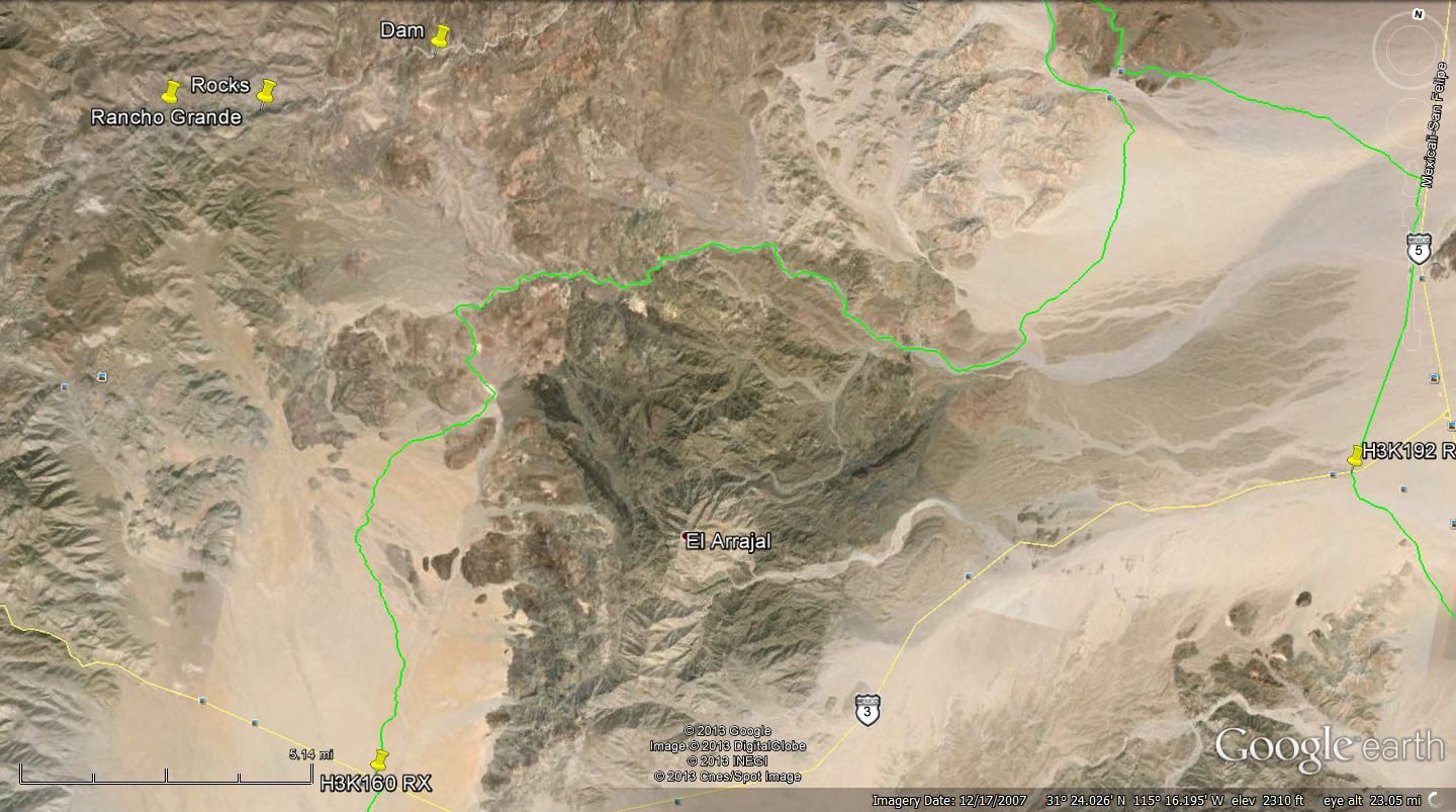
SF250 Race Course around mtn.
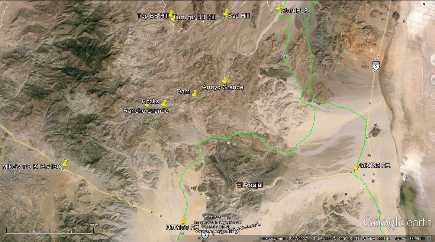
A closer view.
|
|
|
David K
Honored Nomad
Posts: 65561
Registered: 8-30-2002
Location: San Diego County
Member Is Offline
Mood: Have Baja Fever
|
|
That's a tough color line for us (red-green) color blind Nomads to pick out of the background... Blue or yellow are great, however! Thanks Tom... I do
see it, it just is a strain to find it through the mountains!
|
|
|
TMW
Select Nomad
Posts: 10659
Registered: 9-1-2003
Location: Bakersfield, CA
Member Is Offline
|
|
Just for you DK. The SF250 race was green when I down loaded it from SCORE or maybe I had to convert a Garmin file and it came out green. I don't know
how to change the color of an existing file on google earth so I just traced over the route in blue.
Closer

|
|
|
David K
Honored Nomad
Posts: 65561
Registered: 8-30-2002
Location: San Diego County
Member Is Offline
Mood: Have Baja Fever
|
|
What a pal Tom, thank you from all of us color-blind guys!
|
|
|
| Pages:
1
2 |
|


