| Pages:
1
..
11
12
13
14
15
..
25 |
Skipjack Joe
Elite Nomad

Posts: 8084
Registered: 7-12-2004
Location: Bahia Asuncion
Member Is Offline
|
|
| Quote: | Originally posted by Mark_BC
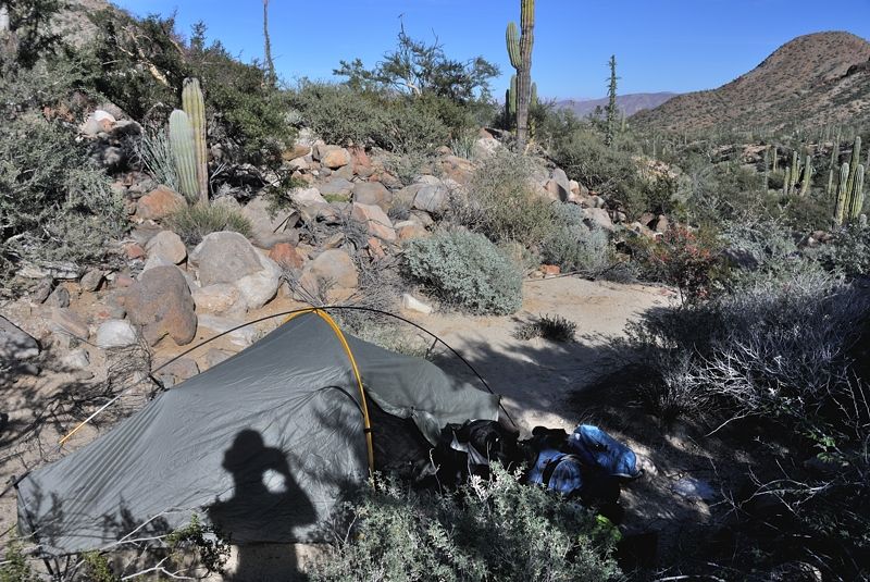
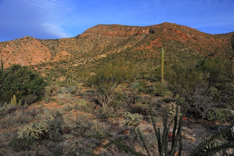
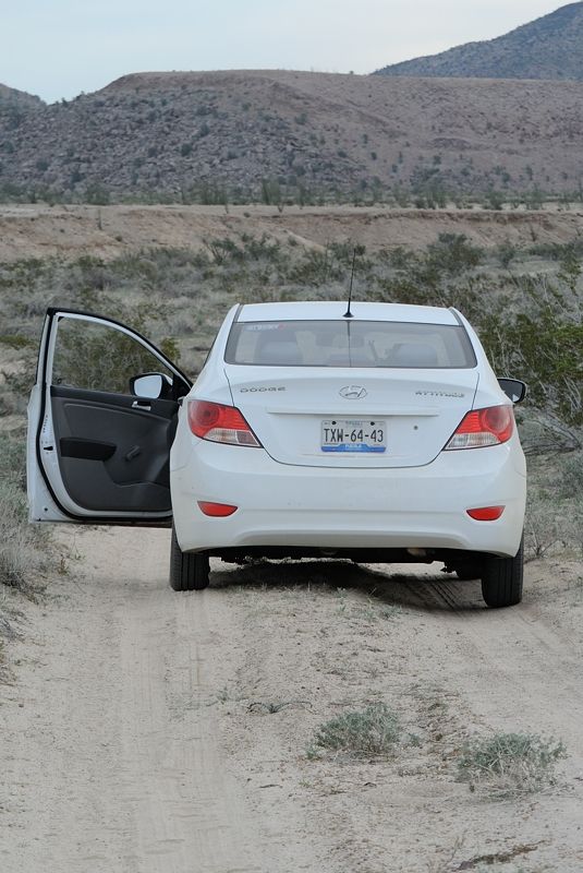
Careful where you walk. I wonder how many cows have fallen in. 29° 6.981' N 114° 1.886' W
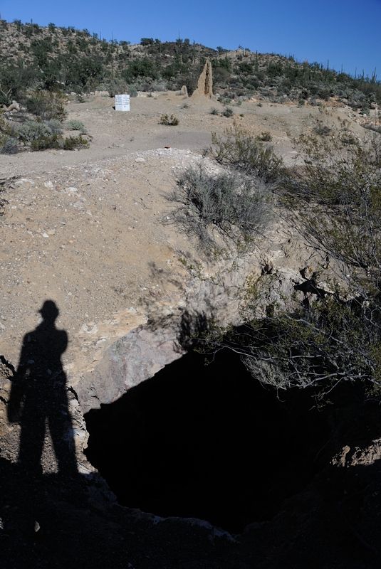
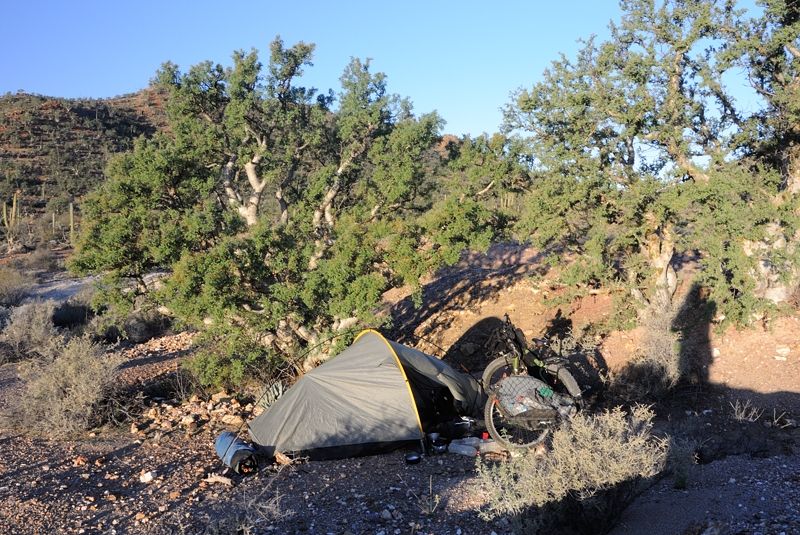
It was pretty windy and I set up camp in the most sheltered spot I could find behind a line of trees. |
This picture contains the remnants of the corner of a building that is all but gone. Maybe the Lost Mission?
That should perk up DK's ears. 
|
|
|
Skipjack Joe
Elite Nomad
Posts: 8084
Registered: 7-12-2004
Location: Bahia Asuncion
Member Is Offline
|
|
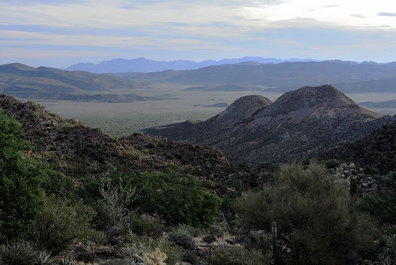
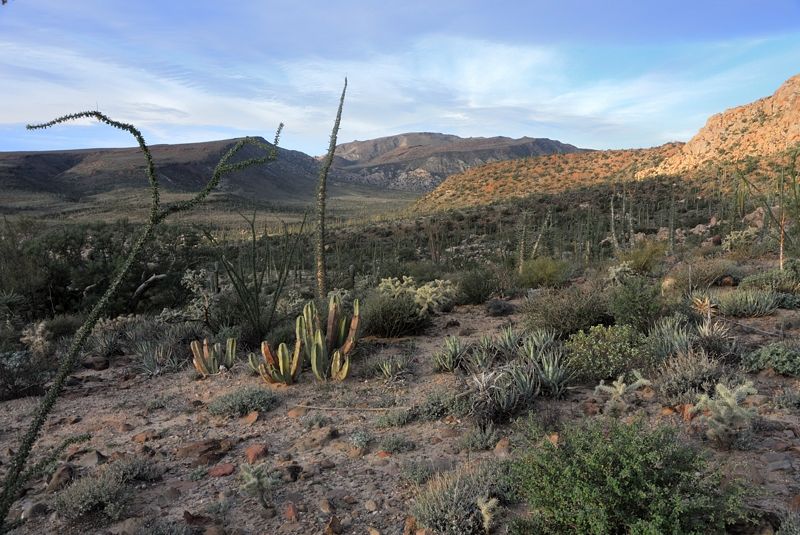
I love those panorama shots. That's some fine country in there.
|
|
|
Barry A.
Select Nomad
Posts: 10007
Registered: 11-30-2003
Location: Redding, Northern CA
Member Is Offline
Mood: optimistic
|
|
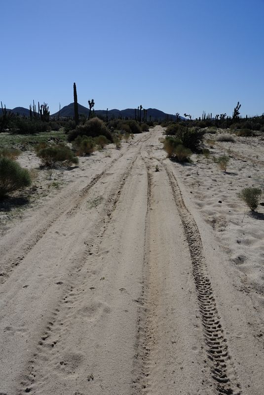
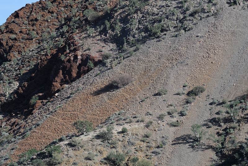
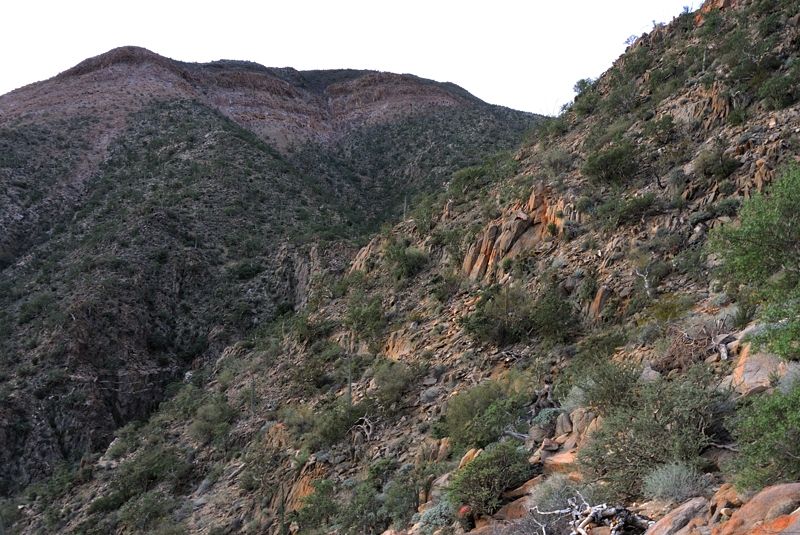
Picture #4 "looking south" shows what appears to be an old jeep-type track-------------is it actually a veh. 2-track ??
Barry
|
|
|
David K
Honored Nomad
Posts: 64476
Registered: 8-30-2002
Location: San Diego County
Member Is Offline
Mood: Have Baja Fever
|
|
| Quote: | Originally posted by Skipjack Joe
| Quote: | Originally posted by Mark_BC
Careful where you walk. I wonder how many cows have fallen in. 29° 6.981' N 114° 1.886' W
It was pretty windy and I set up camp in the most sheltered spot I could find behind a line of trees. |
This picture contains the remnants of the corner of a building that is all but gone. Maybe the Lost Mission?
That should perk up DK's ears. |
It is the remains of one of the houses at El Desengaño (gold mine from early 1900's-1930's)... maybe a bit after. In 1967, I saw several standing
adobes here. The Baja Adventure Book says there is a Model A or ? down one of the mine shafts!
|
|
|
TMW
Select Nomad
Posts: 10659
Registered: 9-1-2003
Location: Bakersfield, CA
Member Is Offline
|
|
Beautiful pictures and country, thanks.
|
|
|
Mark_BC
Nomad
Posts: 137
Registered: 12-1-2013
Location: Vancouver, BC
Member Is Offline
|
|
| Quote: | Originally posted by Barry A.
Picture #4 "looking south" shows what appears to be an old jeep-type track-------------is it actually a veh. 2-track ??
Barry |
It goes into what looked like a paddock. It looks like from GE there is another road just beyond there. There are a few tracks going various places,
it would be interesting to explore them.
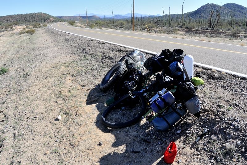
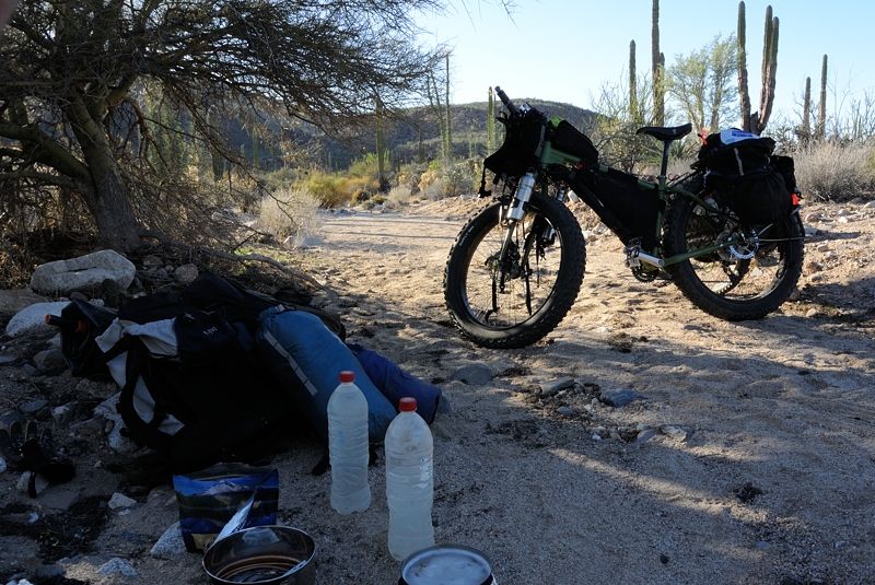
Camp in morning:
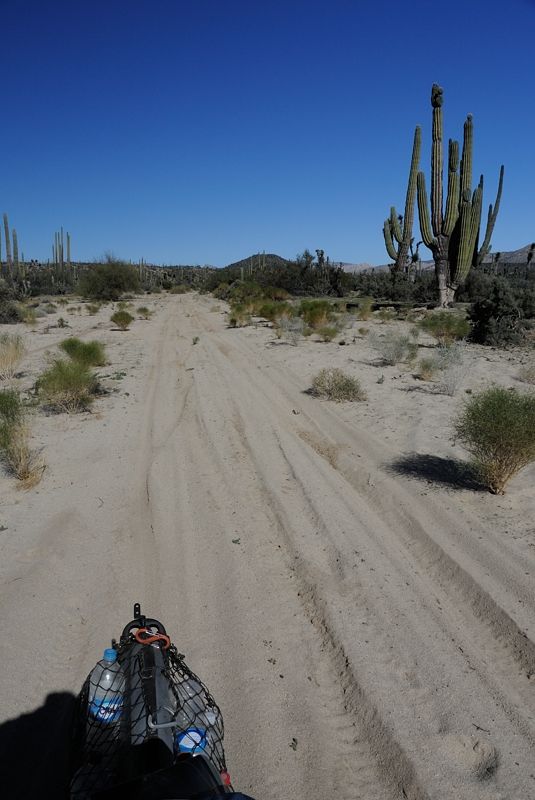
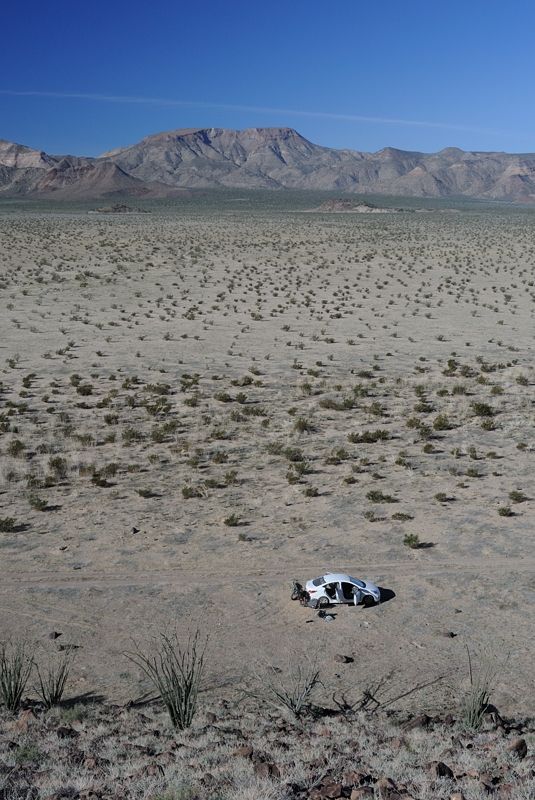
The next morning I headed over to the highway. The road got sandy but the bike can handle it. On the final wash, however, before reaching the highway,
the track was very sandy with deep wheel ruts. That made it too hard to ride, not because the wheels were sinking in, but because at low speed you
have to turn the wheel back and forth to maintain balance, but that was hitting the sides of the ruts and causing me to lose momentum. Even the
motorbike tracks suggested they were having trouble.
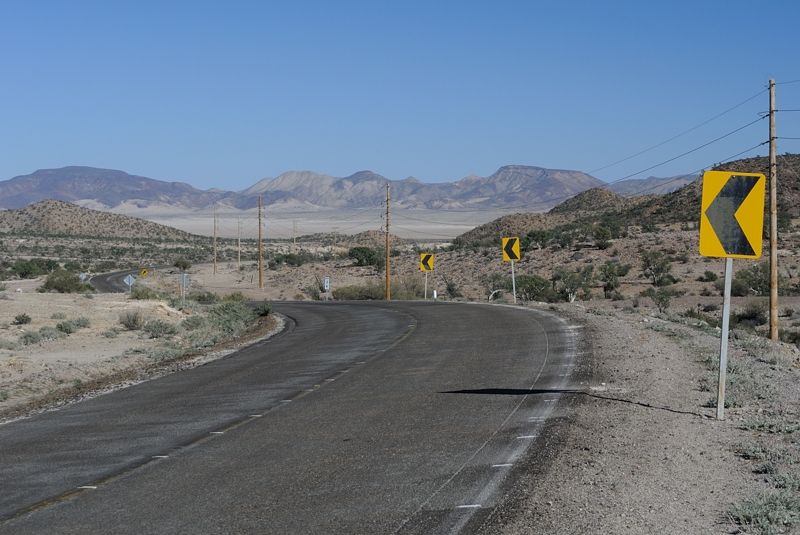
Next two shots somewhere around here: 29° 4.149' N 114° 0.512' W
Looking north:
Looking south:
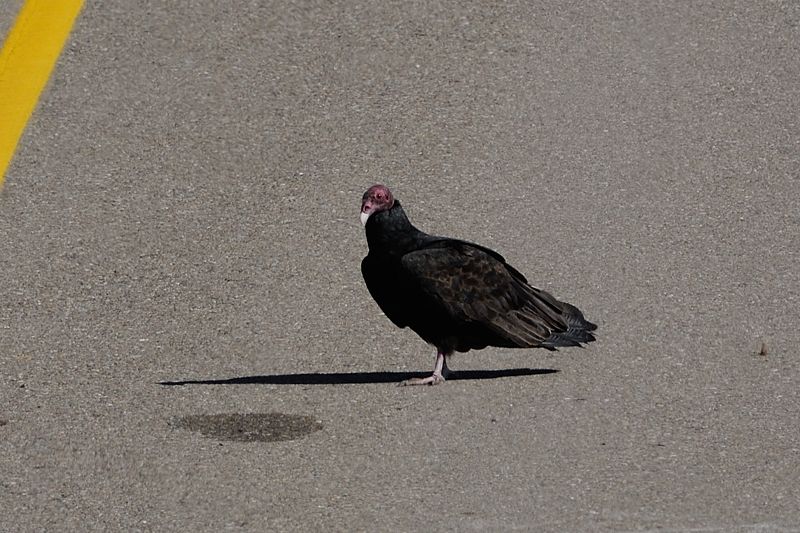
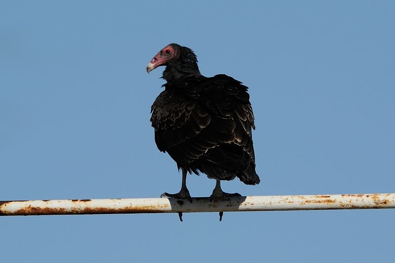
At the highway I saw this buzzard:
When I got to the highway I did something foolish and pulled out the thorns from the front tire. Of course they started hissing when I did that so I
had to change the tube, and make sure that any other thorns in the tire were removed. Next time I'll use the Stan's puncture sealing goo. I didn't
have time to sort that out this time.
29° 3.703' N 113° 59.967' W
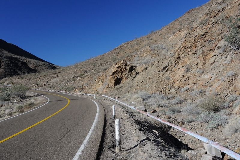
I went down the highway which seemed very slow, almost slower than the sandy tracks. Maybe not, but it was much more pleasant riding off road. I wish
I had loaded more GE into the cache of my iPhone beforehand because it turns out there are a lot more tracks in this area which would have allowed me
to avoid the highway for quite a ways. In TW's recent trip report, he went up to Yubay, and there is actually a road leading from way up near
Salsipedes that goes right by Yubay. It branches off the Salsipuedes road here: 29° 14.768' N 114° 1.248' W and goes by Yubay in this vicinity: 29°
12.450' N 114° 0.579' W. And then the road continues towards Bay of LA here: 29° 4.628' N 113° 57.989' W but eventually you have to go on the highway
before you get to the dry lakes.
This bike is great for riding through the desert. I could go about half the speed you'd go in a vehicle and in some ways it offers even more freedom
because it's easy to get over rough spots and you don't have to worry about 3000 lb of metal breaking down and leaving you stranded. I can haul a
week's worth of water with me so I'd love to explore more of these areas by bike. Just have to spend more time on GE now.
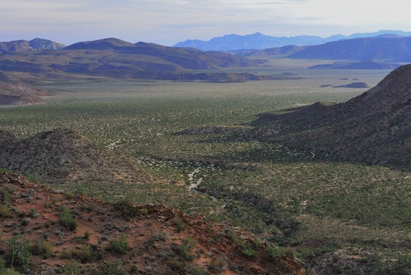
Approaching the dry lake:
I was hoping to turn off at the turnoff to Mission de San Borja but there wasn't much cover there. I was getting really tired and run down from
running the big fat tires with low pressure on the highway. I continued on a couple more km and pushed the bike 100 m off highway through the desert
to find a nice spot in a little wash:
Somewhere around: 28° 58.488' N 113° 43.026' W
That night the coyotes came by around midnight. They were on either side of my tent yipping, probably a few hundred feet away but they sure sounded
close. I was freaking out; they sound terrifying. But afterwards I checked the internet and serious attacks on adults are basically unheard of so I
was safe.
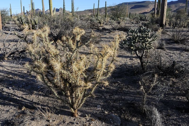
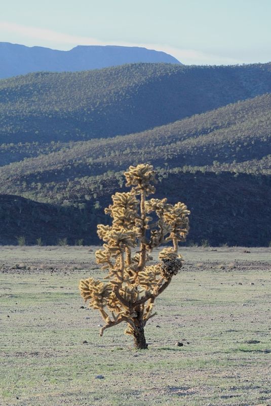
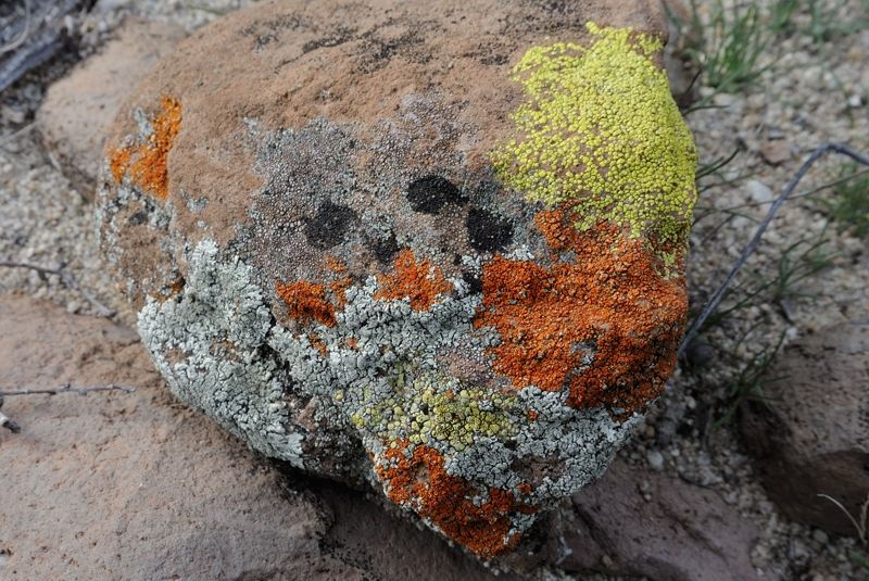
A few other cholla species to be wary of:
This is the water pipe supplying Bay of LA from a well at the dry lake. I wonder what happens if a car goes off the road and breaks it...
28° 58.434' N 113° 36.254' W
It only took an hour or so to get to the final descent into Bay of LA. 28° 58.879' N 113° 34.916' W
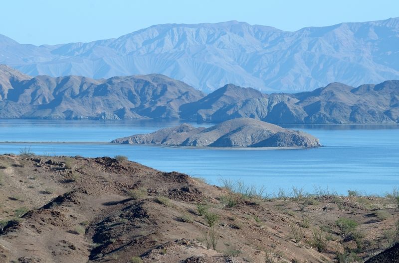
Another shot of a buzzard, at Villa Bahia:
I got in with half a litre of water left! I was going to re-organize for a couple days and then go up the dry lakes and hike in to Salsipuedes from
the eastern side to see what the terrain was like there. I didn't have the time or food to actually go down, it would just be a scoping mission.
[Edited on 1-30-2014 by Mark_BC]
|
|
|
bkbend
Senior Nomad
Posts: 693
Registered: 11-27-2003
Location: central OR or central baja
Member Is Offline
|
|
| Quote: | Originally posted by Mark_BC
This is the water pipe supplying Bay of LA from a well at the dry lake. I wonder what happens if a car goes off the road and breaks it...
|
Long lines to get water at the spring in town.
[Edited on 1-30-2014 by bkbend]
|
|
|
David K
Honored Nomad
Posts: 64476
Registered: 8-30-2002
Location: San Diego County
Member Is Offline
Mood: Have Baja Fever
|
|
Thank you Mark... Perfect report and it is so appreciated that you are sharing your adventure with us. The ability to have water for a week using that
trailer is surely what makes this kind of travel in those Baja locations possible... along with your youth and strength!
Have you considered doing sections of El Camino Real, perhaps the places where it is mostly level?
|
|
|
Mark_BC
Nomad
Posts: 137
Registered: 12-1-2013
Location: Vancouver, BC
Member Is Offline
|
|
| Quote: | Originally posted by David K
Have you considered doing sections of El Camino Real, perhaps the places where it is mostly level? |
I haven't but will look into it. I am always looking for multi-day expeditions to go on. If you want a great blog of a bike tourer check out Cass
Gilbert's While Out Riding. I did a 2 week tour of the Indian Himalayas with him several years ago and he basically spends his life riding his bike.
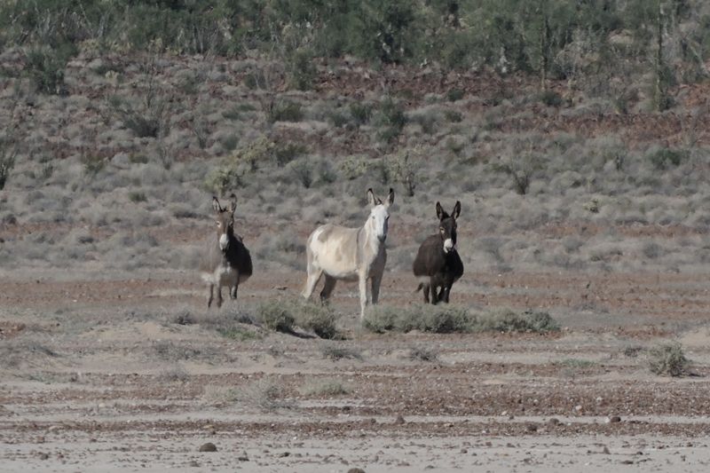
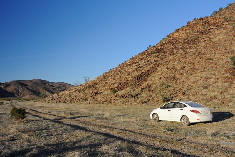
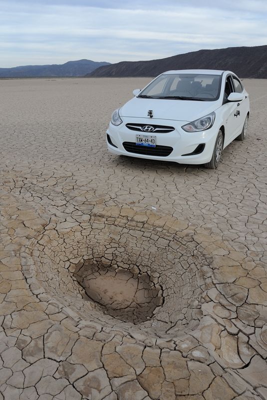
OK, last set of pictures ... I decided to try driving the car up the dry lakebeds to where I'd start hiking up to the pass in from the east. I checked
it out the previous June in the 40 degree heat so knew exactly what to expect.
Donkeys in the first dry lake bed.
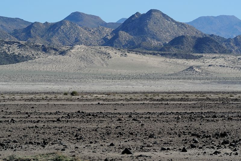
After the first lakebed the ground gets more rocky and moonscape-like. Around 29° 5.319' N 113° 45.352' W
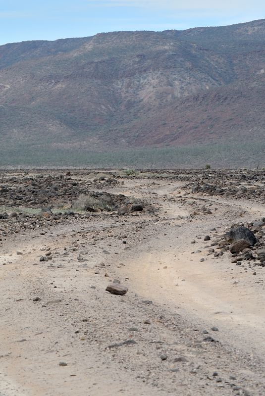
I made it across from the first to second lakebeds. The road isn't too challenging but the ground clearance of the car was very low so I had to stop
every 50 m and move rocks off the road. But I got through OK. I was worried about the sandy sections later on but it was good. If I got into trouble
coming back I'd just turn around and go backwards so the front wheel drive turns into rear wheel drive.
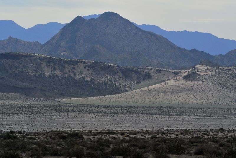
There are a few isolated cactus growing in the middle of nowhere in the lakebeds.
Campsite: 29° 16.289' N 113° 50.632' W
That night I slept in the back seat of the car.
The next morning I got ready to head across. I was going to ride to the island on the left, then ditch the bike at 29° 16.003' N 113° 52.279' W and
hike the rest of the way to the saddle left of the mountain in the middle. Over that saddle is inside the Salsipuedes drainage.
Another view of where I was going: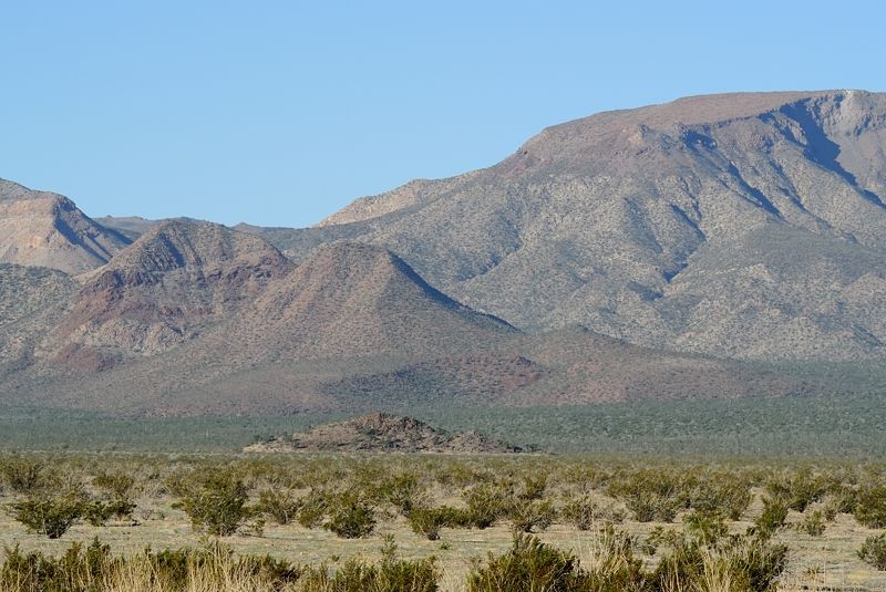
I crossed a faint jeep track about 100 m before the island, which you can actually see in GE. I left the bike on the north side of the island and got
my hiking gear together.
What it was like hiking across the lakebed:
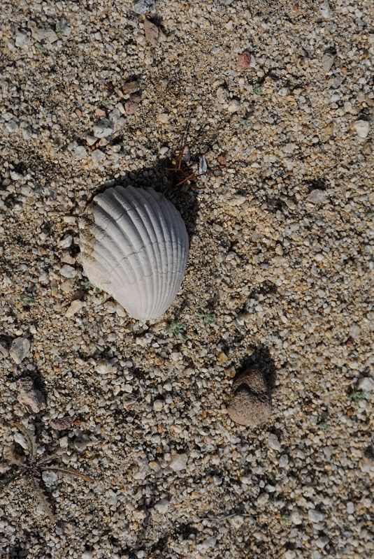
A raven came by and sat in a cactus to watch me go by. Not sure if he was just curious or waiting for me to die... I stashed two water bottles along
the way, burying them. I went past a clam shell, don't know what the story was behind that. Maybe a fresh water one from when this was a lake?
The hike was so gradual I didn't notice the elevation gain of 300 m. It was pretty easy and I got to the base of the steep section and set up camp:
Somewhere around 29° 15.304' N 113° 55.795' W
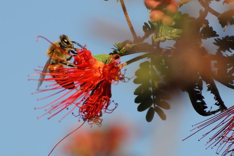
Good to see there are lots of bees in Baja. There was a lot of life here, it was really pretty desert country.
And looking across to the hill here: 29° 15.334' N 113° 55.214' W I could see switchbacks, I guessed from antelope.
That night I got really worried about the car and my bike. I noticed a slow leak in one of the car tires and I left the bike pump with my bike, along
with the tire changing equipment. So if someone stole the bike I could be screwed. And maybe the insurance didn't cover the car if it's so far away
from the highway (40 km). I decided to haul it up the hill the next morning to assess the pass and get back to my stuff quickly.
This is what the climb looked like. It was about 45 degrees most of the way with loose rocks and agaves to stab your legs if you're not careful. I was
heading straight up to the right. Around 29° 15.199' N 113° 56.026' W
After the first hill it mellowed out a little bit and continued on to the saddle. Looking north-east back to the dry lake:
At the saddle! Looking north-west towards the mountain: Around 29° 14.949' N 113° 56.488' W
And the shot we've all been waiting for: looking west to the upper Salsipuedes drainage. The terrain there is pretty mellow and I could have continued
fairly easily but I wanted to get back to the car. It looks like from GE it doesn't get a little challenging until a few km in.
At the time I thought, OK I can hike up but there's no way you could get a bike up. In thinking back, it may be possible. You'd just have to bring
lots of water which you stash at the bottom of the hill (also leave lots of extra to allow you to ride back out if you need to), preferably go with
other people, and get your gear sorted out so you can throw it on your back for hiking it up. Then plan for two days to get all your gear up to the
pass in stages. I am good at climbing hills so I could probably do it, except my knees don't like going down so with all the stages I might twist a
knee. You'd just have to be really careful and slow.
I went back down pretty fast, but carefully. I packed up and hiked back across the lakebed. As soon as I got within range I took some telephoto shots
of the island to see if the bike was OK:
Whew! That littlle blue dot left of center. And the car was still white too. I was being a little paranoid since no one had come by, but it would have
been easy to follow my tracks and take the bike. In retrospect I could have ridden it all the way up to the campsite with ease.
The rest of the day I relaxed at the car and prepared to drive back out the next morning.
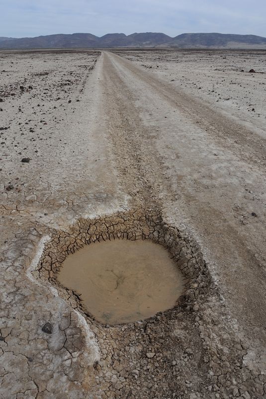
On the way back I zoomed around the salt flats and got some good videos. But you have to be careful of the potholes! Somewhere around 29° 14.327' N
113° 50.908' W
This is at the southern lake, almost back at the highway. Around 29° 3.412' N 113° 46.737' W
So in retrospect I wish I hadn't taken the car up the dry lakes, it was causing me too much worry. It would have been easy to ride the bike in, it's
only 40 km which is an easy day on those flat roads. Just get someone to drive you up the highway. And the other problem with the rental car was that
each day was burning up money, so I didn't want to commit to another couple weeks for another attempt down the canyon. Next time I'll catch a ride or
take the bus. But still, this was a great scouting trip and I'm going to come back as soon as I can organize it to try again, otherwise it'll have to
wait until the autumn when it cools down.
|
|
|
Skipjack Joe
Elite Nomad
Posts: 8084
Registered: 7-12-2004
Location: Bahia Asuncion
Member Is Offline
|
|
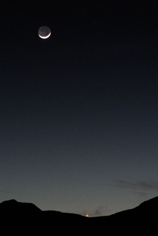
These last group of images are your best in my opinion. I especially like the moon shot.
Have you considered entering Salsipuedes from the lake just a mile north of where you came in.
29°16'2.18"N 113°55'55.68"W
I think the climb north from this spot would have been less severe.
|
|
|
Frigatebird
Nomad
Posts: 215
Registered: 9-12-2004
Location: L.A. County
Member Is Offline
Mood: Soaring
|
|
Mark_BC
Mark,
Check your U2U private messages.
Avatar courtesy of Herb 
|
|
|
Neal Johns
Super Nomad
Posts: 1687
Registered: 10-31-2002
Location: Lytle Creek, CA
Member Is Offline
Mood: In love!
|
|
The most outstanding trip report and pictures I have seen!
Wish I were 100 years younger.
Neal
My motto:
Never let a Dragon pass by without pulling its tail!
|
|
|
woody with a view
PITA Nomad
Posts: 15937
Registered: 11-8-2004
Location: Looking at the Coronado Islands
Member Is Offline
Mood: Everchangin'
|
|
yeah Mark, one of the best reports EVER here!
i'd be onboard next time with enough planning to take you to the launch area and maybe stay a night so you could place some water/supplies along your
route. sounds like a great adventure to be a part of.
|
|
|
TMW
Select Nomad
Posts: 10659
Registered: 9-1-2003
Location: Bakersfield, CA
Member Is Offline
|
|
Wow some really beautiful pictures. The Baja landscape can be so beautiful yet so dangerous.
|
|
|
David K
Honored Nomad
Posts: 64476
Registered: 8-30-2002
Location: San Diego County
Member Is Offline
Mood: Have Baja Fever
|
|
In one word: SWEET!
Central Baja is just so great. Thank you Mark, we rarely get such a view of our planet... Planet Baja! 
Edit: The sea shell was likely from the Cochimí (specially if far from auto roads).
I have seen sea shells way way far from the sea, that were not (yet) petrified.
[Edited on 1-31-2014 by David K]
|
|
|
Neal Johns
Super Nomad
Posts: 1687
Registered: 10-31-2002
Location: Lytle Creek, CA
Member Is Offline
Mood: In love!
|
|
Mark,
I can also hang with Woody for a couple of days wherever we dump you.
We will have lots of water that you can bury just in case of a retreat.
Also will give you a handheld two-way radio which should work to contact us for a mile or two. We can probably arrange for boaters that have a
FRS/GMRS radio to listen for you if they are near the mouth of Salsipuedes.
Neal
My motto:
Never let a Dragon pass by without pulling its tail!
|
|
|
Skipjack Joe
Elite Nomad
Posts: 8084
Registered: 7-12-2004
Location: Bahia Asuncion
Member Is Offline
|
|
I agree. These are real nice images. They are very inspirational.
|
|
|
Mark_BC
Nomad
Posts: 137
Registered: 12-1-2013
Location: Vancouver, BC
Member Is Offline
|
|
Thanks for all the support guys! I still have tons of video to go through, which would also make some good photos if I took screen shots. I'll try to
sort that out over the not too distant future.
Also, someone asked what filter I was using, it is the Sweetwater Guardian. A plastic thing that I would like to replace. The desalinator filter was
the Katadyn Survivor 06.
| Quote: | Originally posted by Skipjack Joe
Have you considered entering Salsipuedes from the lake just a mile north of where you came in.
29°16'2.18"N 113°55'55.68"W
I think the climb north from this spot would have been less severe. |
Hey Skipjack, I thought about that one but it looks pretty hairy entering the main canyon here: 29° 17.237' N 113° 57.989' W
Based on previous experience, if it looks at all rough on GE, it probably is very rough! But maybe with multiple people and climbing gear it would be
do-able.
|
|
|
David K
Honored Nomad
Posts: 64476
Registered: 8-30-2002
Location: San Diego County
Member Is Offline
Mood: Have Baja Fever
|
|
Thank you Mark... I wish there were more off road adventure trip reports like yours! Love them all...
|
|
|
Skipjack Joe
Elite Nomad
Posts: 8084
Registered: 7-12-2004
Location: Bahia Asuncion
Member Is Offline
|
|
| Quote: | Originally posted by Mark_BC
| Quote: | Originally posted by Skipjack Joe
Have you considered entering Salsipuedes from the lake just a mile north of where you came in.
29°16'2.18"N 113°55'55.68"W
I think the climb north from this spot would have been less severe. |
Hey Skipjack, I thought about that one but it looks pretty hairy entering the main canyon here: 29° 17.237' N 113° 57.989' W
Based on previous experience, if it looks at all rough on GE, it probably is very rough! But maybe with multiple people and climbing gear it would be
do-able. |
Ah yes, I saw that area as well. It looks like heavy boulders barricading the wash across the canyon. Didn't know how hard it would be to get past a
couple of such spots on that arm.
|
|
|
| Pages:
1
..
11
12
13
14
15
..
25 |


