| Pages:
1
..
17
18
19
20
21
..
25 |
Skipjack Joe
Elite Nomad

Posts: 8084
Registered: 7-12-2004
Location: Bahia Asuncion
Member Is Offline
|
|
Mark,
Barracuda will bite through your line, sometimes without you even feeling the bite. That may be why you lost them. Just get 6 inch wire leaders.
Barracuda do break off easily sometimes (thankfully  :lol :lol . But they are fairly good eating and still very abundant. They like flash in a lure. . But they are fairly good eating and still very abundant. They like flash in a lure.
|
|
|
Pompano
Elite Nomad
Posts: 8194
Registered: 11-14-2004
Location: Bay of Conception and Up North
Member Is Offline
Mood: Optimistic
|
|
Barracuda.
"Smoke 'em if you got 'em."
I do what the voices in my tackle box tell me.
|
|
|
woody with a view
PITA Nomad
Posts: 15937
Registered: 11-8-2004
Location: Looking at the Coronado Islands
Member Is Offline
Mood: Everchangin'
|
|
i had a barracuda dinner thursday night from fresh caught/vacuum sealed last may. tasted as good as if it was swimming that day!
|
|
|
DosMars
Nomad
Posts: 115
Registered: 12-11-2005
Member Is Offline
|
|
Try writing up your post in the notes section of your iPhone, then just copy and paste.
|
|
|
Mark_BC
Nomad
Posts: 137
Registered: 12-1-2013
Location: Vancouver, BC
Member Is Offline
|
|
Yeah that works Mark. So it seems that this spare time down here will allow me to do what I never have time to do after these trips-- write up trip
reports! Here are the first few days. And then in a few weeks I'll update with photos and GPS coordinates.
And to the discussion a few pages back, I was definitely NOT the first person to explore this area lately (read on). But the Asamblea would have been
more remote, too bad I didn't go up there... Maybe next time, with other people.
|
|
|
Mark_BC
Nomad
Posts: 137
Registered: 12-1-2013
Location: Vancouver, BC
Member Is Offline
|
|
Part 1 - Getting There
The first few days of the trip were a barely recollect-able series of critically timed schedules, meetings and travels that amazingly somehow all
managed to work out. First, like usual, I got no sleep the night before my flight as I rushed to get all my equipment and bike stuffed into the two
cardboard boxes. No matter how much I try to get stuff organized beforehand, it always turns out this way. My friend Philip pulled up at 7:30 to give
me a ride to the seabus just as I was finishing up, and I crossed into downtown Vancouver along with all the other people commuting to work like I
used to do.
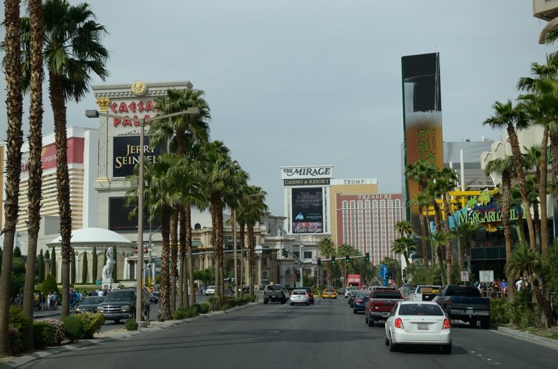
Then it was a flight to Vegas where Mark was at a conference. There we hit REI to supply up with food and stove fuel, then hit the road to San Diego,
still with only about an hour of sleep to go on. We took turns driving and got to John's place by 11 that night.
Vegas!
Ivanpah Solar Power Station, along I-15:
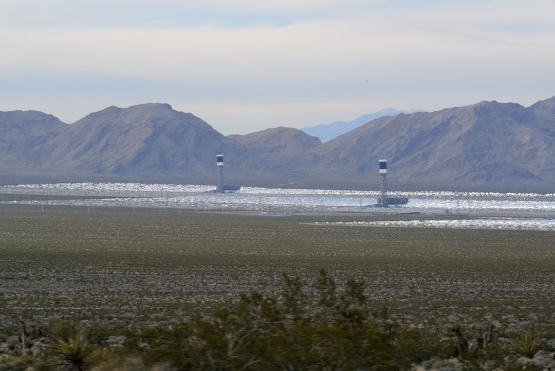
John was nice enough to offer me a ride down. I finished sorting my stuff until about 1 and then hit the sack until 5:30 when it was again time to
roll. We were out before sun up and crossed at Tecate. I managed to doze a bit until Ensenada where we hit Walmart looking for fishing lures
unsuccessfully.
Then we drove south. I took the agricultural section around San Quentin.
We found some lures at El Rosario. Beyond that I don't remember much about the trip as I was in and out of blissful slumber most of the rest of the
way to the Bay of LA turnoff. Sorry if I wasn't the most interesting travel companion, but I was operating on extreme sleep deprivation!
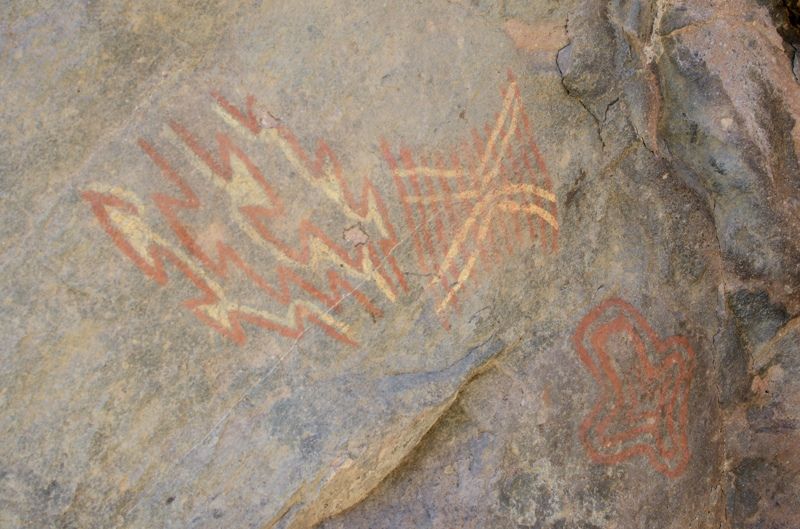
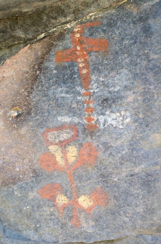
We drove up to see the Montevideo Indian paintings opposite the turnoff to the dry lakebeds, along the road to the San Borja mission we had visited
the year before (a beautiful drive I might add). They were interesting and I had a great night's sleep, finally.
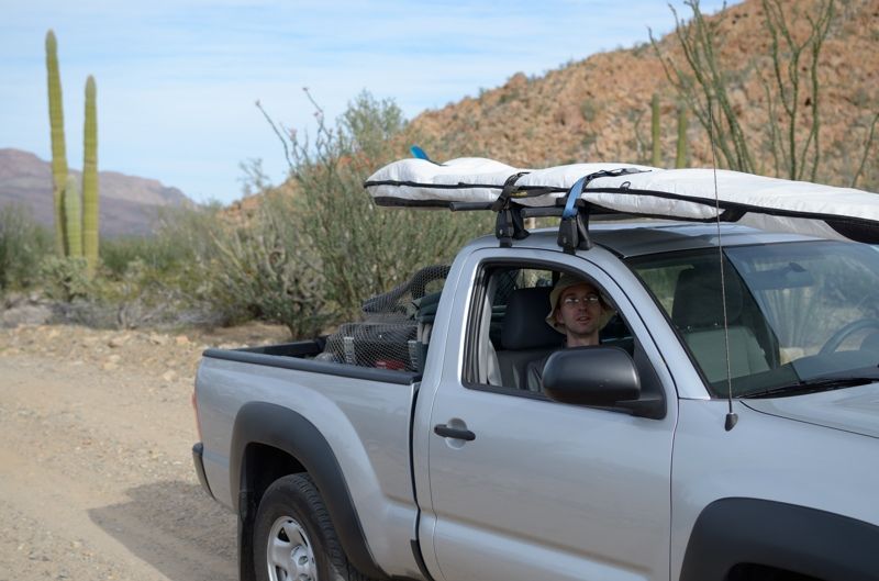
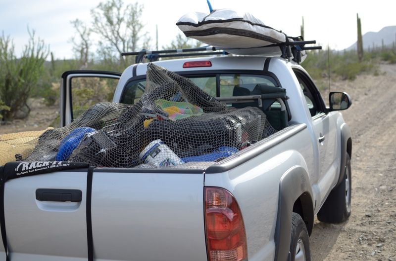
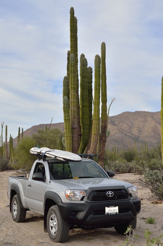
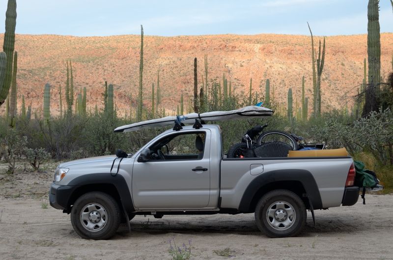
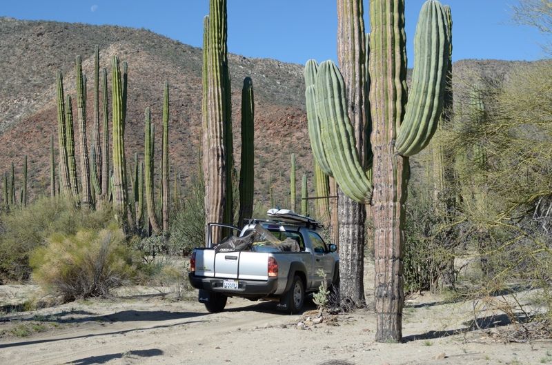
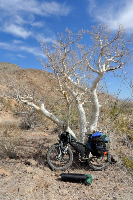
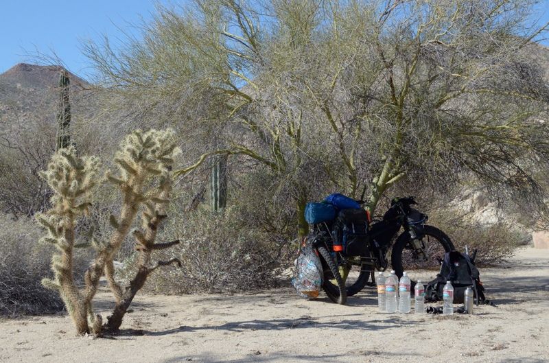
Everything fit nicely in the back of the truck:
I got a really good night's sleep on the soft sand. The temps were great and the wind didn't pick up.
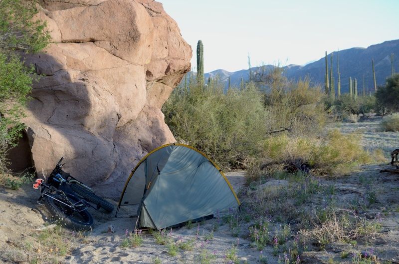
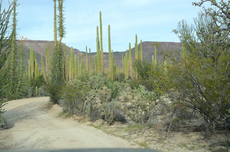
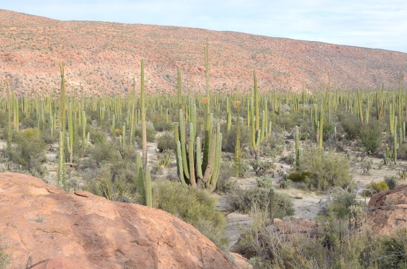
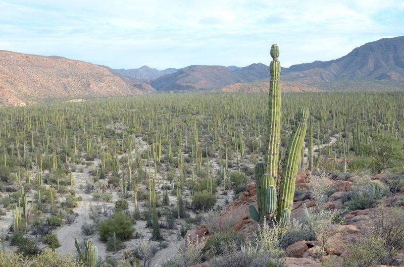
Heading back through the cactus forest:
The next morning we set off up the dry lakebed to my starting point, 35 km up the road. Half way there, at the turnoff down to Bahia Guadalupe, at the
start of the second lakebed, I buried some heavy stuff I wouldn't be needing, to retrieve after the trip.
We went to my usual staging spot and dumped a bunch of my stuff. Then we drove half way back with my bike and essential gear. That way, if he had a
flat or other mechanical problem he'd be able to walk out. We agreed that it's much more comforting to be up here with a bike than a car as a bike is
relatively easy to fix and push out if needed. But a car... not quite so easy. I then rode my bike back and camped.
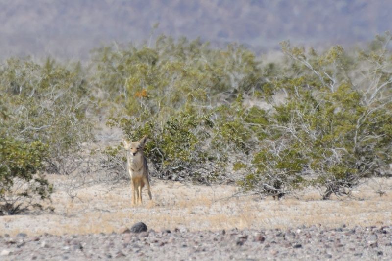
Along the way I spotted a coyote running around the dry lakebed not too far from the salt flats, and not too far from my stash! I hoped it was safe
and it was. And I was surprised to see such life in this desolate plain. I wasn't expecting any wildlife shots so the picture isn't the greatest:
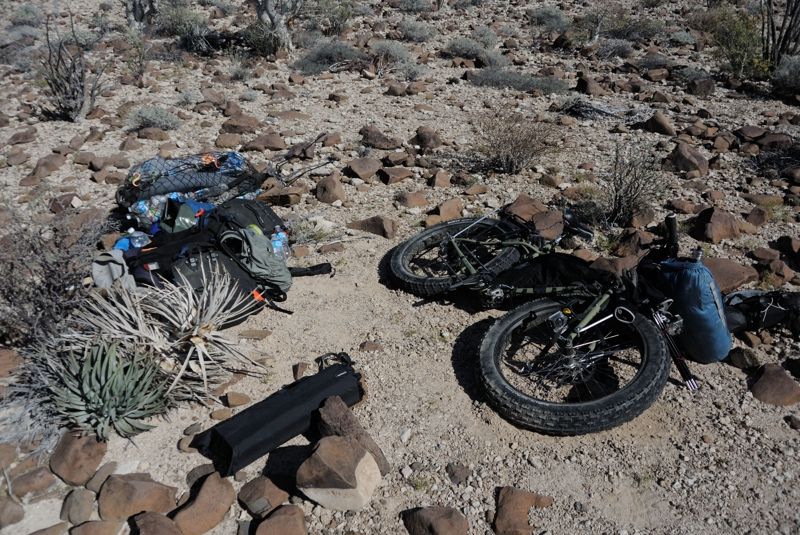
My stuff:
[Edited on 5-10-2014 by Mark_BC]
|
|
|
Mark_BC
Nomad
Posts: 137
Registered: 12-1-2013
Location: Vancouver, BC
Member Is Offline
|
|
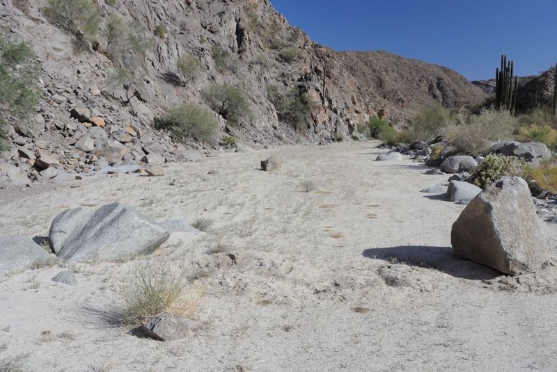
Part 2 - The Adventure Begins
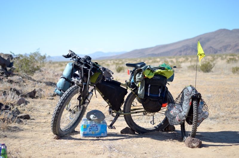
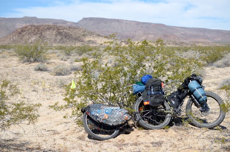
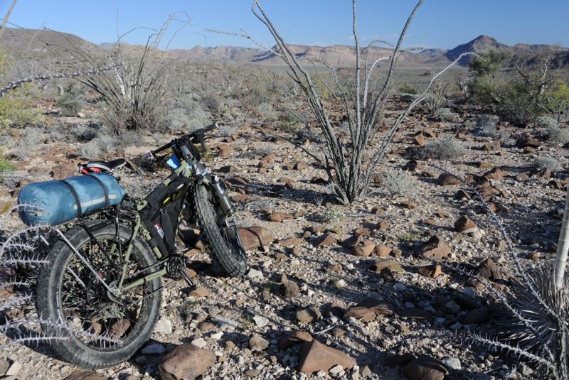
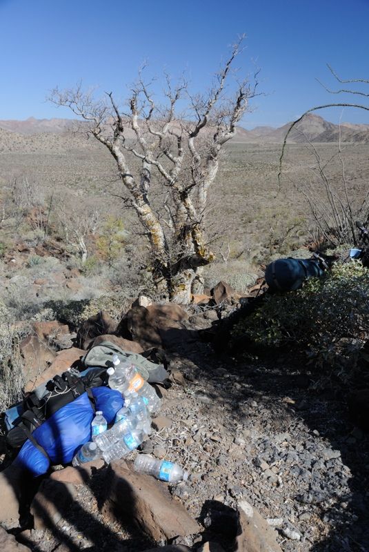
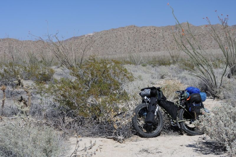
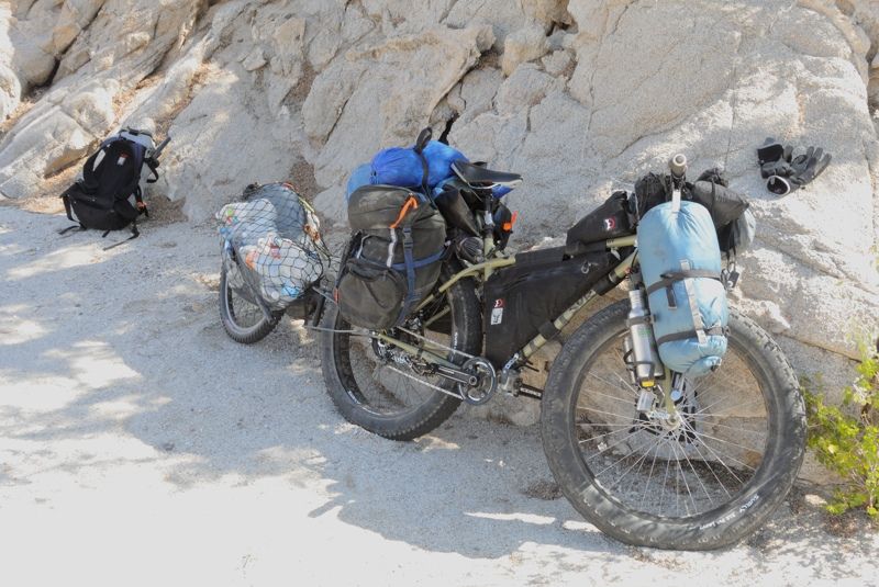
I spent the next morning getting my stuff together and finally set out across the lakebed ridiculously overloaded with 40 liters of water. I was going
to be needing it the most over the next couple days as I humped my gear over the hill into the Botica lakebed - that's how I justified it. I didn't
stash water as I decided I'd need it all, and plus it's a bit dangerous to rely on water caches if the coyotes get into it. Then you could be in
trouble at a later time when you really need it. Much safer to just take it with you.
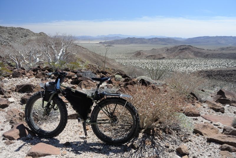
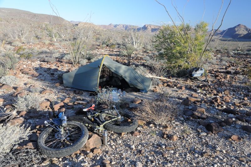
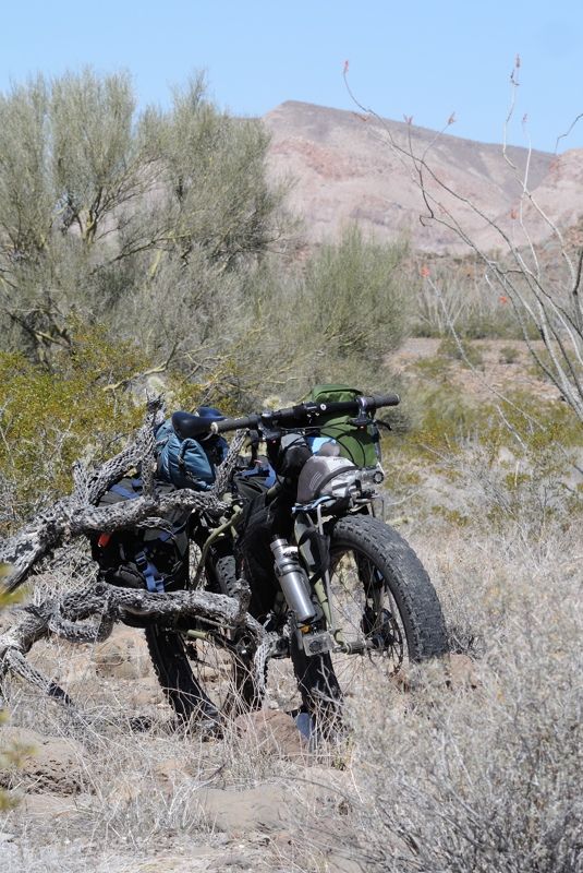
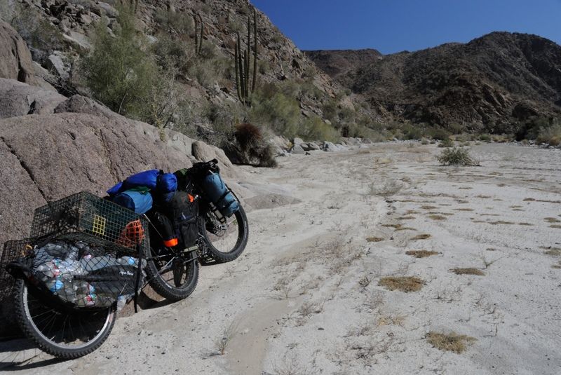
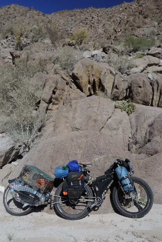
Getting loaded up, but with not even half my water: The trailer and bike jacknife into a nice V shape that offers some protection from the wind for my
tent. But I have to lock the wheels with rocks and my elastic band "parking brakes" or the whole thing can come down -- on me in my tent.
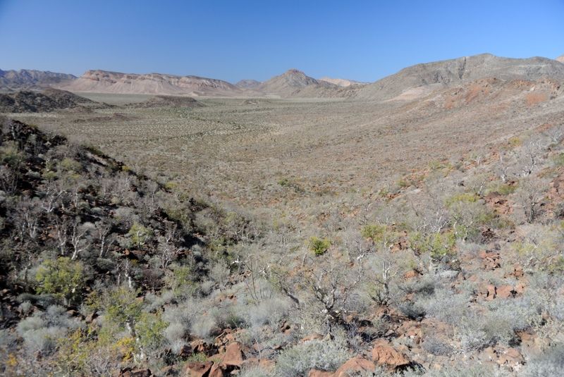
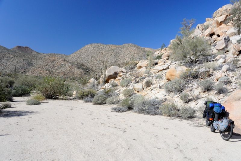
Shots looking across from the hill:
Where I would be going:
There is a faint track you can see on Google Earth that goes north, just to the east of the islands, up towards ESG's campsite (Erle Stanley Gardner)
who in the 1950's made a trip here with motorbikes and tons of gear. Back then they didn't have the modern lightweight gear I was relying on, nor
satellite tracking or Google Earth, so it was a major undertaking.
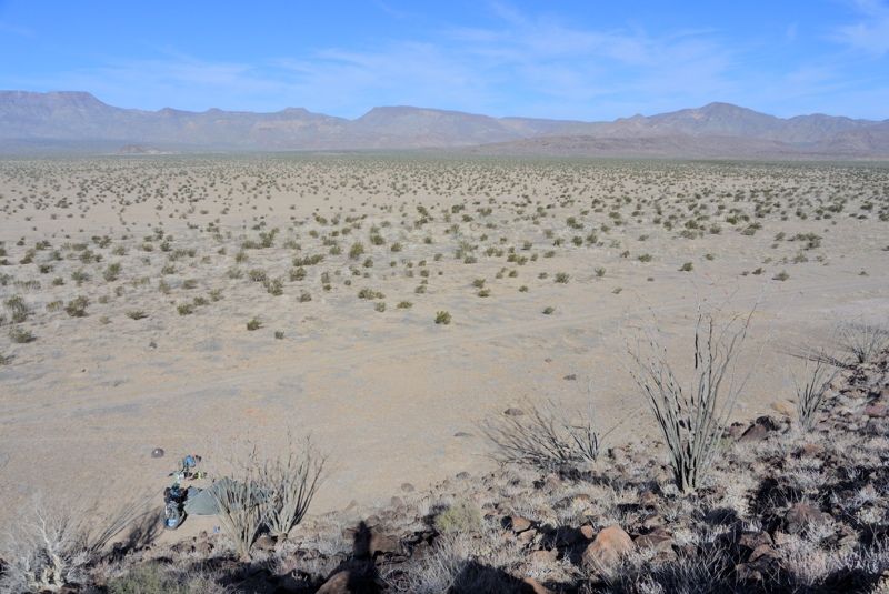
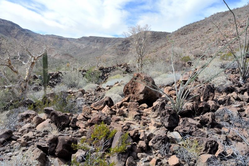
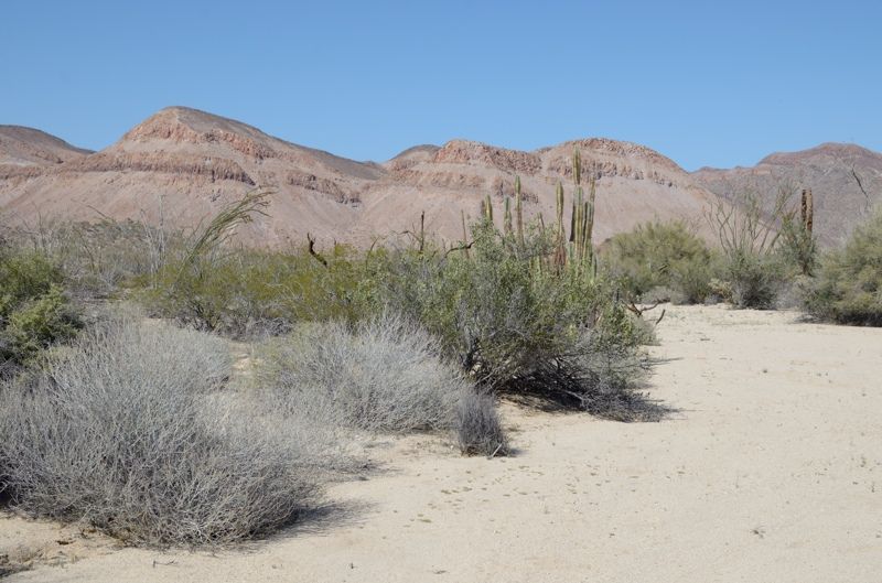
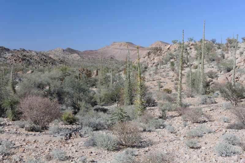
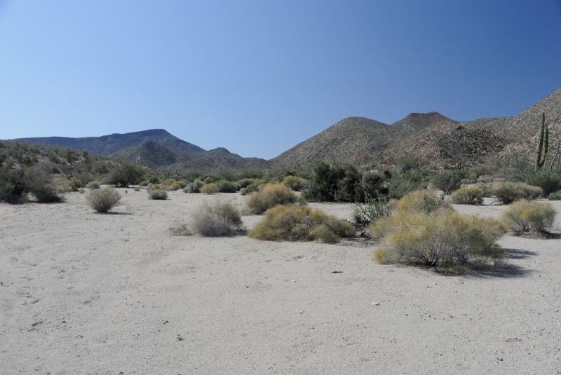
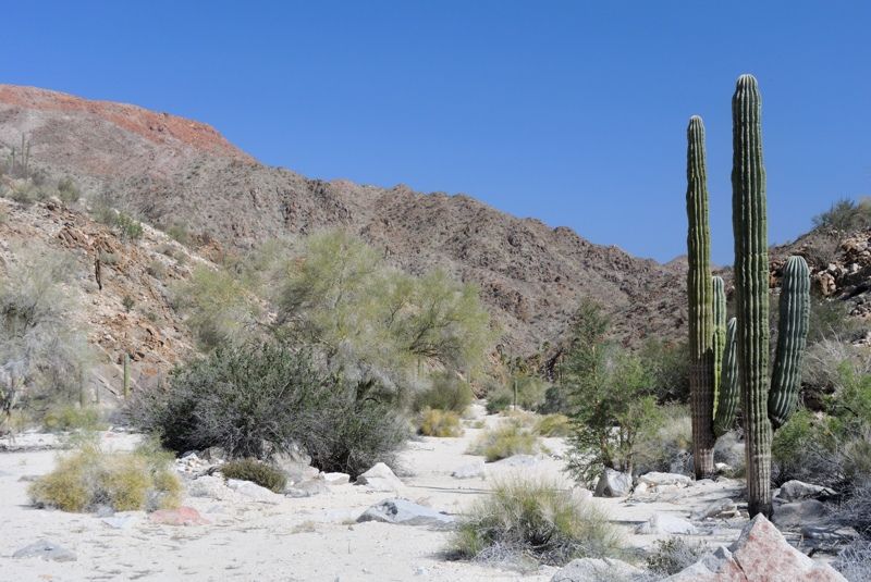
I started riding west across the lakebed, like last time, towards the southern island and the faint track 100 m to its east. There is quite a bit more
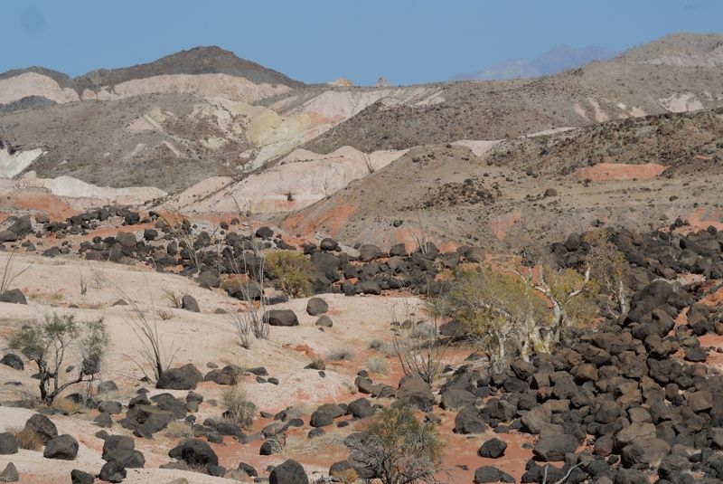
life here on this barren lakebed dominated by creosote bushes than you might think. I saw that coyote yesterday as I rode in the day before, and an
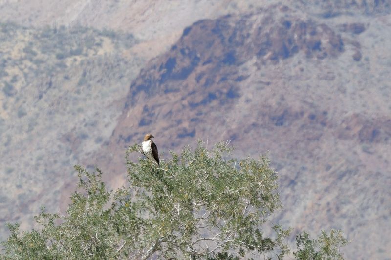
osprey in one of the trees (more like large bushes). There are hummingbirds and other birds, and lizards everywhere, along with rabbits. And the
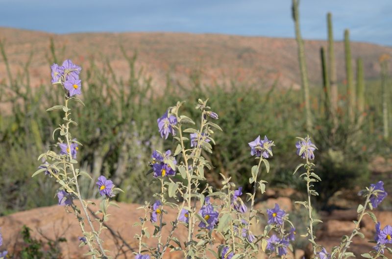
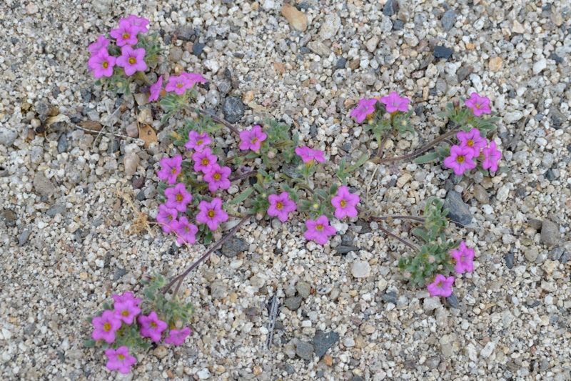
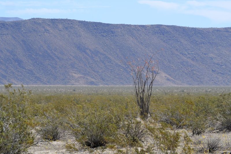
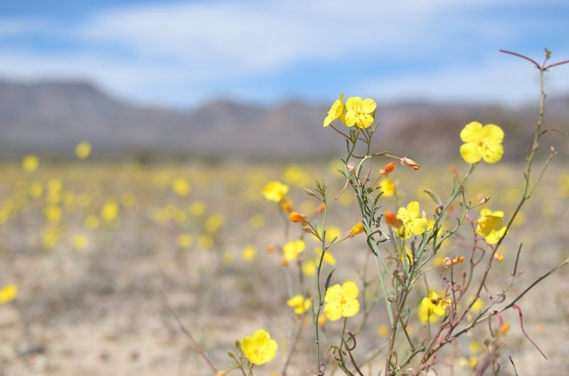
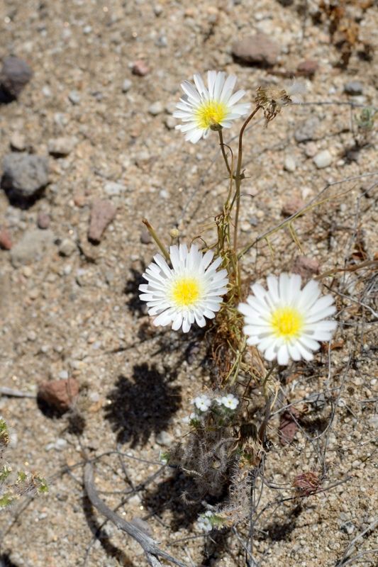
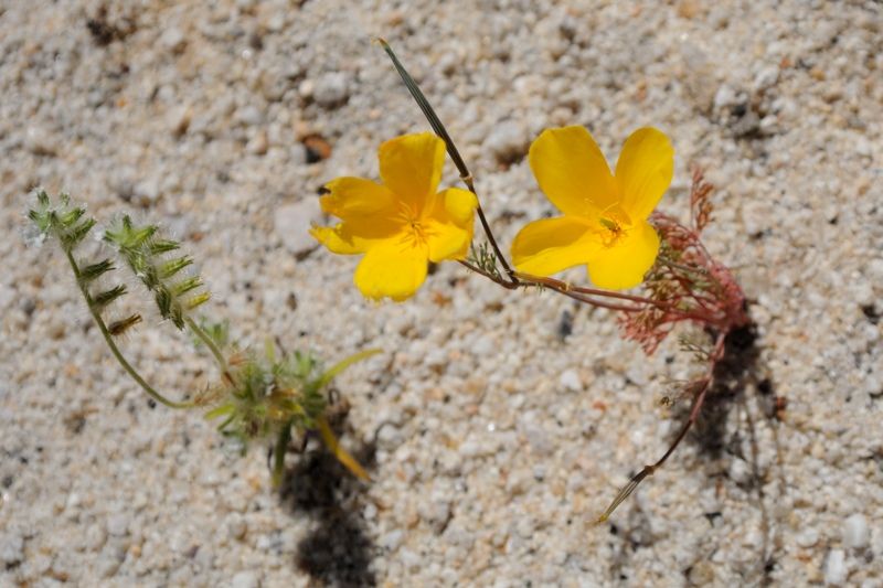
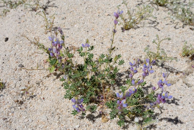
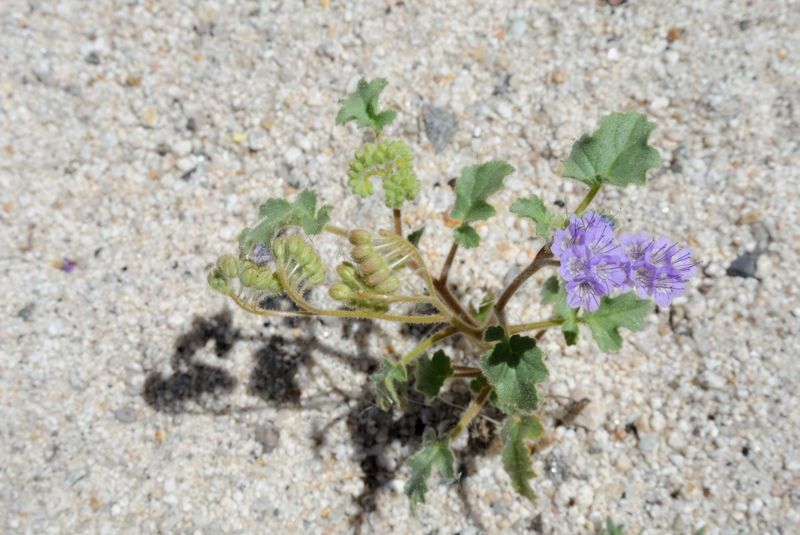
desert was in bloom too with fields of yellow and pink flowers in places; it seems to have rained a bit since I was last here a few months ago,
stimulating another spurt of life. The life is here; it just isn't overtly obvious. But it's still a pretty desolate place, at least to someone like
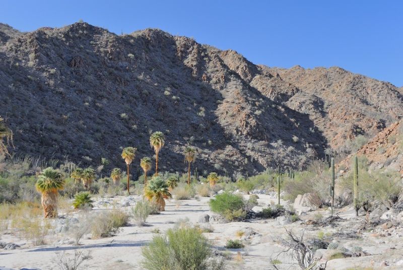
me from the lush rainforests of the Pacific Northwest. It seems hard to believe that only a few passes away are palm oases with water.
I made it across the lakebed to the track and followed this north. The incline is gradual but steady. You don't really notice it, except it got
progressively harder to ride. I was starting to overheat so took a lunch break under a tree to refresh. It wasn't super hot, maybe in the upper 20's,
but just a lot of work hauling my gear through the sand and under the blazing sun from 260 m elev at the staging area up to 390 m at my destination
for the day.
Looking back to my camp area beside the hill:
Lots of wildflowers:
There were motorbike tracks and a bit of garbage here and there revealing that people do come here. There was an old sandal that may have even been
from ESG's original expedition.
Tracks:
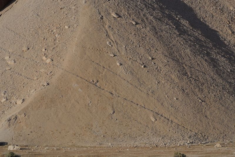
Eventually the two tire tracks turned into a wash with only motorbike tracks. I followed this until it wasn't rideable anymore and at one point in
order to avoid cactus and get up an incline I was contorting the load too much and it all went over. I cursed and then disconnected the trailer and
pushed the remaining 100 m to the base of the hill which I guessed was somewhere around ESG's camp, at 390 m.
This is the kind of terrain where the wash ended:
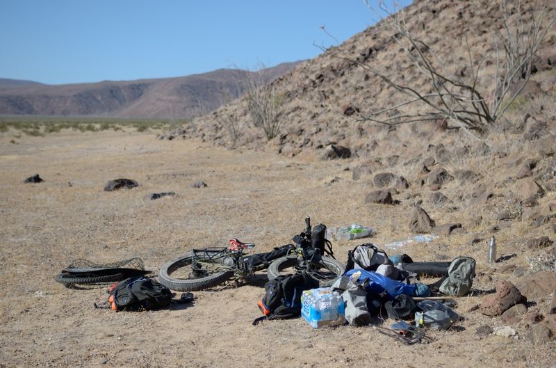
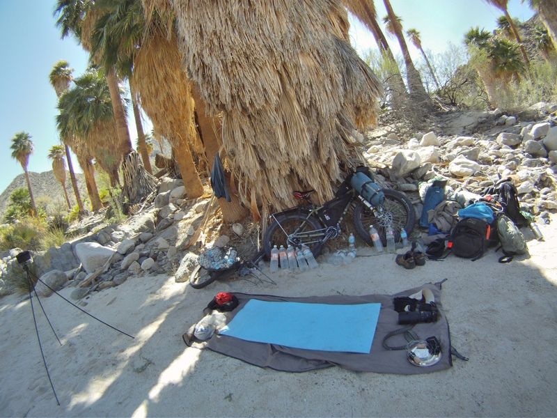
I discovered a while later that my tripod was missing. I freaked out and ran back. It was where the load fell over. You have to be careful with your
gear out here. It's easy to forget or lose stuff. I don't do a checklist when I pack up camp, except for the most important personal items. Instead I
just pack up whatever I see. Because of this I have to be very careful to not place items by themselves. When my gear comes apart, everything goes
into piles, and no small items are left by themselves. That way I can be sure that as long as I pack up everything from the piles, I have not
forgotten anything. The one exception to this is the two GPS units which by definition need to be placed by themselves, usually away from camp, and
then left. It's really easy to forget about those, which is why I always specifically check for them when leaving any location where I unpacked.
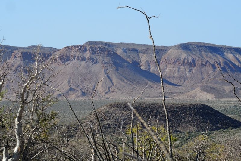
Looking towards the hill, left of center:
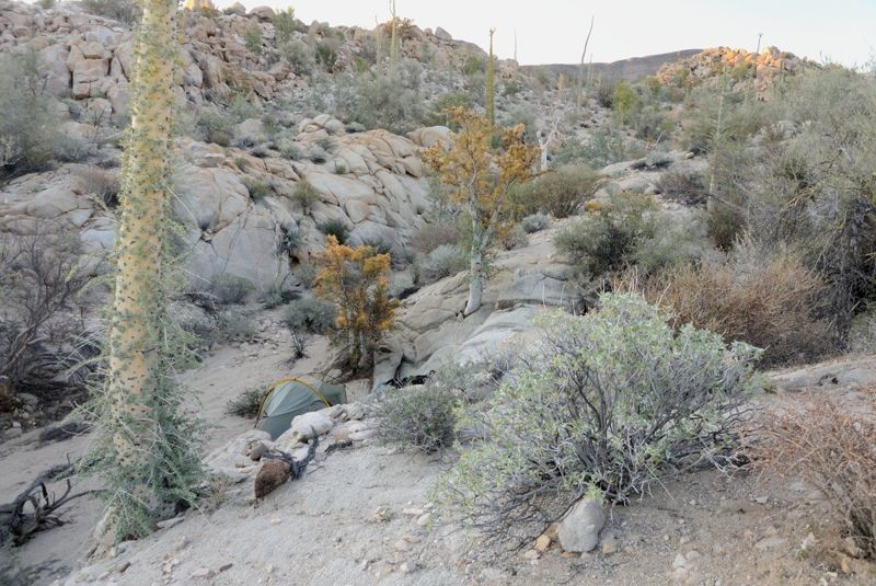
Campsite beside the elephant tree:
This is the hill I'd be climbing the next day:
I pulled out the solar panel to charge batteries, had dinner and called it a day.
[Edited on 5-11-2014 by Mark_BC]
|
|
|
Mark_BC
Nomad
Posts: 137
Registered: 12-1-2013
Location: Vancouver, BC
Member Is Offline
|
|
Part 3 - The Hill
Early morning light. This was not the hill I'd be climbing...
The next morning while packing up I noticed a pack of coyotes pretty close. When I saw them, they saw that I saw them and started walking away to the
north, up towards the hill I'd be scaling. Great, just what I wanted as I was going to stage my load and leave my food bags unattended at times.
There is a pass to get over into the Botica dry lakebed, the smallest and most northern of the three, and the one without road access. The easiest way
up to the pass is to scale the sidehill of a particular gully. I was camped on the east side of the base of the gully but decided that the easiest way
up would be on the west. So that morning I spent some time moving my gear across the rocky terrain to the base of the hill on the west side.
Look for my bike in the lower right corner:
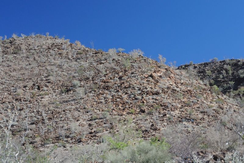
Then the real work began. I was in the full sun on a southern facing rocky slope and there was no way to avoid it. I had planned for it though; that's
why I brought all the water. I'd just have to work hard that day and get my stuff up. Thankfully, it seemed that every day of the trip thereafter
should be progressively easier, so I just powered through it. It did provide a good opportunity to charge my batteries in the sun though, between
runs:
I hiked my stuff up in 5 stages, and managed to do 4 loads to get it all up. So basically I hiked the equivalent of 4 times loaded going up and 3
times unloaded going down. Then, I was at the peak. Or, at least the end of the steep section. From here there was another half kilometer of less
steep incline and smaller rocks which enabled me to push the bike and reduce down to only two loads. Luckily, there was no sign of the coyotes.
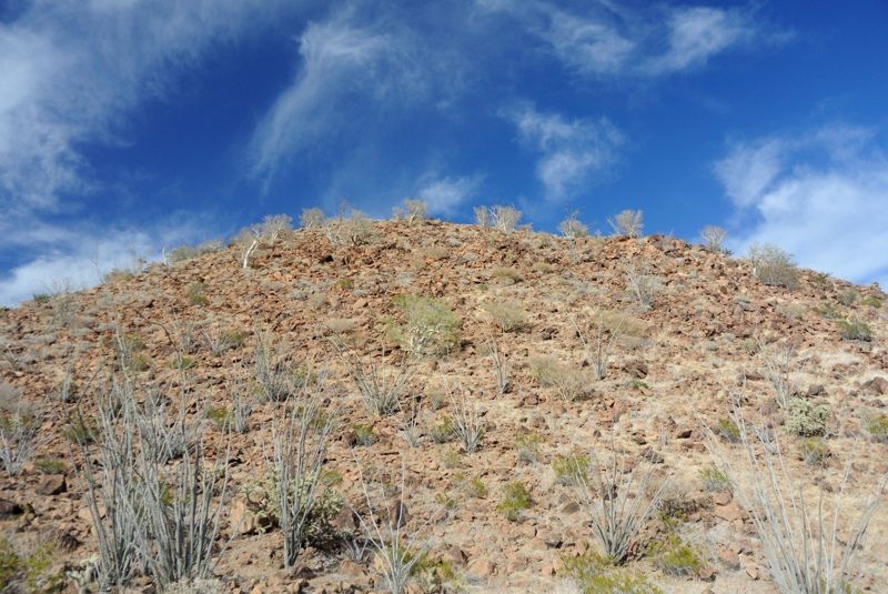
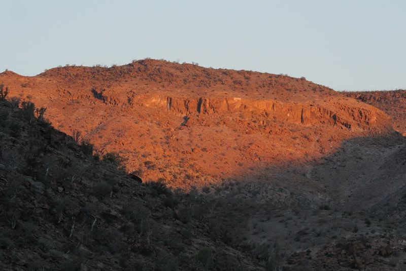
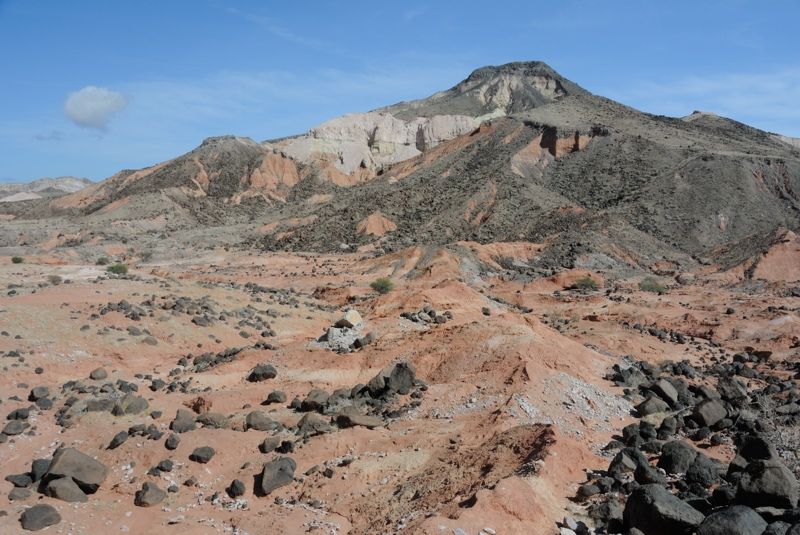
At the top of the steep section, looking back. Notice the white limestone:
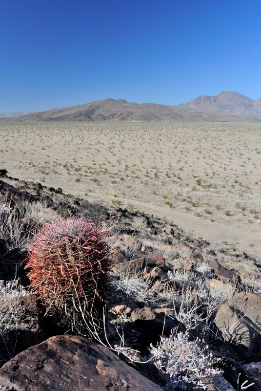
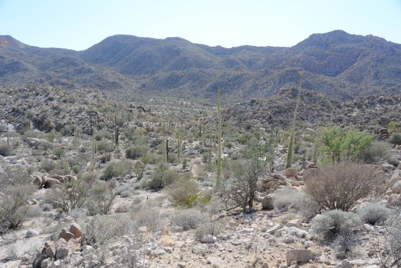
Interestingly, at the top the geology changes and there is a lot of old limestone coral reef amongst the volcanic rocks. I could see the polyp
chambers and even the tubes from calcareous tube worms. Had I not been so physically stressed I might have spent more time inspecting it for other
familiar marine creatures I used to maintain at the aquariums I worked at.
Finally I got to the actual peak around 570 m and around here I noticed a trail... In places it was more of a barely distinguishable route, but it was
definitely there. I followed it back south to see where it came from, until it started to descend down the EAST side of the gully, basically to around
where my campsite was! Doh! So I didn't need to move my gear over to the west side after all, and I could have enjoyed a relatively clear path in a
little bit of shade! Oh well, that's part of the discovery I guess.
I'm not sure where this trail came from. Was it from natives moving up and down the lakebeds? Or did ESG's party clear it to get their stuff up? Maybe
both. Either way, I was in disbelief that ESG's party could get their motorbikes and gear up that hill. I guess people were tougher back then. And the
trail is still in use today. There is the odd pink ribbon, and vegetation was trampled since the last rains. But there were no fresh tracks.
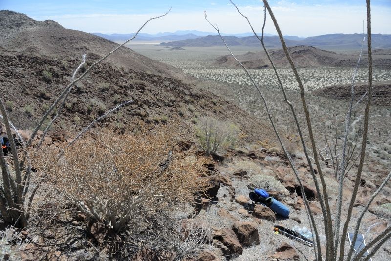
Eidsco has a couple photos up around here on Google Earth. I can confirm that yes, it does actually look like that! I looked back over the lakebed to
where I had come from and felt a sense of accomplishment from all the terrain I had covered in my last two trips, under my own power. I realized that
despite appearing harsh and desolate, as long as you have water and it isn't too hot, the terrain isn't actually very difficult or formidable, unless
of course you go climbing steep hills like I was... But even then, it wasn't too bad. No snakes or overly spiny vegetation to get in the way. Back
home it would be a major undertaking to cover that terrain through the thick wet forest. And here in the desert, when you sweat you dry off quickly,
as does any other wet gear. Back home, or in the tropics, if your gear isn't hanging out in the sunshine, it won't dry and will go mouldy. So desert
travel isn't actually too difficult as long as you plan for its challenges - lack of water, heat and spines.
I was totally beat and found a spot to camp just over the summit as it starts to descend down the Botica side. Foolishly I leaned my loaded bike up
against a dead agave which of course didn't hold. The whole thing went over and then all I heard was hissing as sharp agave spines punctured both
tires. This was a great opportunity to test out the Stan's self-sealing tire goop. You just have to rotate the tire so it collects where the puncture
is and then voila, in only a few seconds it seals itself up!
I ended up using 6 liters of water that day, which was reassuring considering all the sweating I was doing.
I went over and checked out the next day's route into Botica lakebed:
Close-up of the lakebed I'd be traversing, from right to left:
A plane flew overhead and I wondered if they could see me. They probably could but I doubt they did. That was a cold night as the wind whistled over
the pass.
[Edited on 5-20-2014 by Mark_BC]
|
|
|
Mark_BC
Nomad
Posts: 137
Registered: 12-1-2013
Location: Vancouver, BC
Member Is Offline
|
|
Part 4 - Botica
ESG's party went north across the Botica lakebed and then down the canyon out to join the main Salsipuedes drainage near the ocean. This is a fairly
direct route to the ocean that I didn't plan to take, for three reasons. It was short, and I wanted to ride a decent section of desert canyon. And it
offers no water (at least if it hasn't recently rained), with no palm oases. And there is a big cliff midway down the canyon that ESG had to scale
with some difficulty. I had no reason or desire to take that risk by myself, so my plan was to instead turn west midway across the lakebed and try to
cross over into a tributary that enters the Salsipuedes drainage quite a ways further up. From Google Earth the crossing into that drainage didn't
look too bad, but on the other hand I've found that sometimes GE doesn't reveal difficult terrain too accurately...
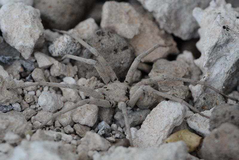
This guy crawled out from under my tent in the morning:
The next morning I firstly had the descent down the north side of the hill to contend with, which I reasoned shouldn't be nearly as difficult as the
previous day since I'd be mostly in the shade and it doesn't go down as far in elevation. Plus I had the trail to follow, which was still pretty
rocky, but easier than picking my own way across rock fields. But on the other hand, going down is always harder on my knees and back home I
frequently hike up the trendy Grouse Grind trail, an 800 m climb up the local mountain, after which you take the ski gondola back down. So I was well
trained for going up but not for down.
View midway down the hill at one of my staging areas:
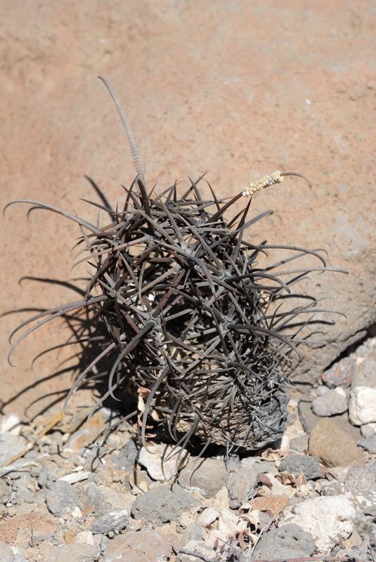
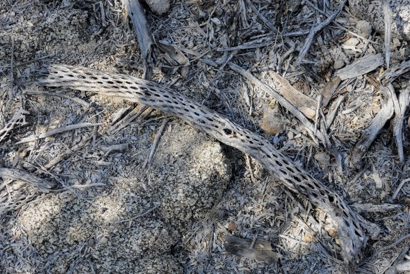
A dead hollow barrel cactus with only the spines remaining:
But I got down without issue in a few stages without tweaking my knees. I had to cross a few hundred more meters of brushy/ rocky flat ground to get
to the main sandy wash and then I could set up to ride. It was hot setting my bike up again but I got it together and I was off!
You can probably see from the times of the Spot GPS hits that I went down this wash pretty fast! It was really easy to ride, except for the odd time I
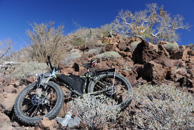
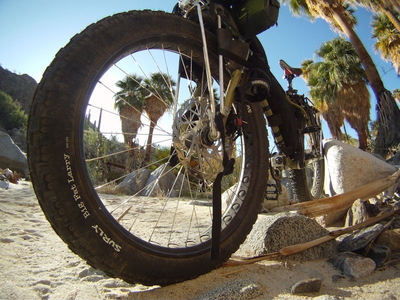
hit some loose sand and had to gun it to maintain momentum. My rear tire is a Surly Endomorph, which is "only" 4" wide. I would have liked to put a 5"
Big Fat Larry on but the trailer fork wouldn't accept that width (but I do have a BFL on the front). Although, looking at it now, I might be able to
squeeze one in there... Plus I had a lot of weight on the back tire.
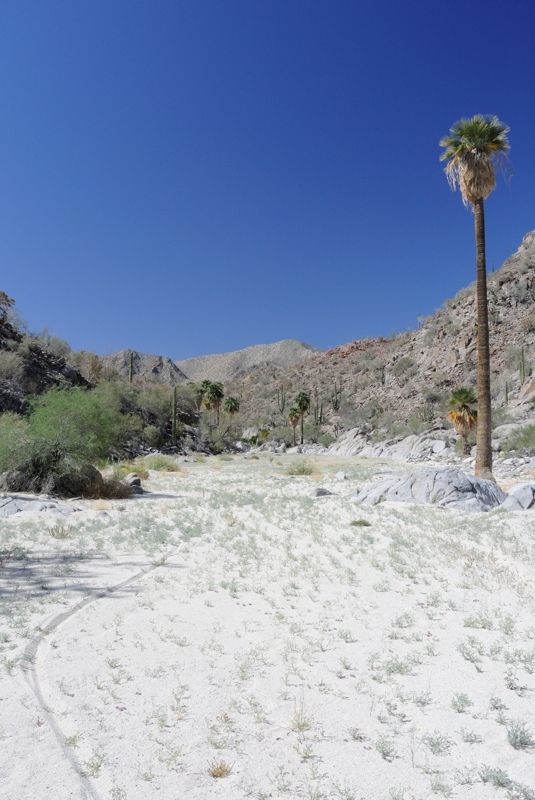
Regardless, I was cruising along at a great pace until I got to the spot where I'd turn west off the wash (430 m) and cross the real desert lakebed. I
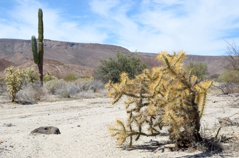
did that and discovered a lot of spines! There were quite a few chollas and their spines had blown and washed into all the nooks and crannies, ready
to poke my tires. I had goop in the tires, but I still wanted to avoid spines if possible. Plus I didn't have goop in the trailer tire which wasn't so
much of a problem since it follows in the tracks of the bike tires, which soak up all the spines first! But that's only if I go in a straight line;
otherwise, the trailer tracks its own vulnerable path.
So I ended up just carefully pushing my bike the few km to the west, and the ground would have been too steep to comfortably ride anyways. I was
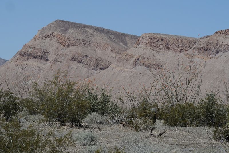
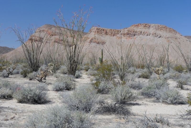
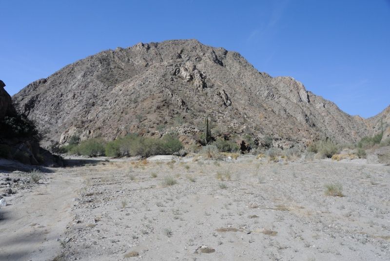
heading straight into the sun, so it was a hot crossing. To the north all along the lakebed is an impressive and picturesque mountain range offering
perspective as I went.
My plan was to aim for a little pass through the first set of hills through which the sandy wash concentrates and should be rideable. I got there no
problem and then afterwards it was a bit more tricky. I'd have to pick the correct tributary and go up this one to the location that offers the
easiest route into the Salsipuedes. It's tricky because it's always easier to go down a wash than up! Not only because you're going downhill, but also
because there is only one way to go when you go down; you can't take a wrong turn. Going up, it's easy to take the wrong tributary.
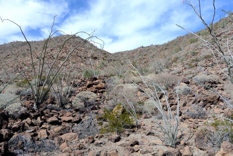
I followed this for a few km and noted that outside of these washes the terrain would be difficult to traverse, consisting of fairly large rocks and
vegetation, with these sunken sandy washes criss crossing it but at about 3 m lower elevation than the plain itself, in little mini "canyons". So I
really needed to be in the correct tributary.
Looking back at the setting sun against the northern mountains, from my little mini canyon:
I used my GPS and the few notes I had made and followed the "canyon" until I could go no further by bike (530 m). I was a little concerned because the
geology was becoming more granite boulder-dominated, like the terrain that had foiled my first attempt because it is so difficult to cross. It's
beautiful, but very difficult to traverse.
Anyways, it turns out that through either my own good navigation or from good luck, or maybe a combination of the two, I ended up exactly where I
wanted to be! Just a couple hundred meters from the pass (550 m) that was accessible via some not-too-difficult desert whacking. Not rideable, but not
difficult. And the descent down the other side didn't look too bad either, although I couldn't actually see from the pass the entire route down into
the main wash:
This is looking down a parrallel adjacent mini wash, the one to the north-west, that would have gotten me a bit closer to the pass. However, I wasn't
sure if the canyon itself had more obstacles. Worth checking out next time!
I set up camp in the little mini canyon and did an assessment. Despite these crazy trips I like going on, I am not actually a big risk taker. If there
is an unknown but potentially dangerous obstacle in my path and I don't have an alternative "out", I get very distressed and I was at the point where
this may become an issue.
So I did some math. At that point, I had used 18 liters of water, with 22 left. That was over 3.5 days, and the most water intensive days of the trip.
That was an average of 5 liters per day. The 6 liters I used on the climb day skewed that so I was probably using about 4.5 liters on an average
active day. To be safe and say that I needed 5 liters per day, that left me with 4.5 days of water left.
I went through an option matrix. My concern was two areas of potential bluffs in the Salsipuedes drainage that could send me back. Other than those,
it was clear sailing all the way to Larry's photo on GE, and if he got up there with quads then surely I could get down with a bike. So would 4.5 days
allow me enough time to get to the locations of concern and if impassable, turn around and go back down the Botica canyon to the ocean, somehow
managing that 80 ft cliff with my 50 ft of rope? The numbers worked out OK, although very tight. I reasoned that if ESG made it down that cliff with
motorbikes then I could do it with a 40 lb bike. And the potential "cliffs" in the Salsipuedes I was worrying about may even have water. The chances
of getting into trouble were remote, but still I like to have all my based covered out there because the consequences of a mistake could be serious.
I decided I should be OK and went to sleep with a little worry.
[Edited on 5-23-2014 by Mark_BC]
|
|
|
Mark_BC
Nomad
Posts: 137
Registered: 12-1-2013
Location: Vancouver, BC
Member Is Offline
|
|
Part 5 - Into Salsipuedes!
Here is a morning view of my campsite in the mini canyon:
The traverse over the pass into the Salsipuedes drainage turned out to be easier than I expected. I had to hike my stuff up to the pass, but I could
push my loaded bike and trailer all the way down, over the few hundred meters into the small sandy tributary wash, with only a few sketchy areas along
the way requiring some brute force.
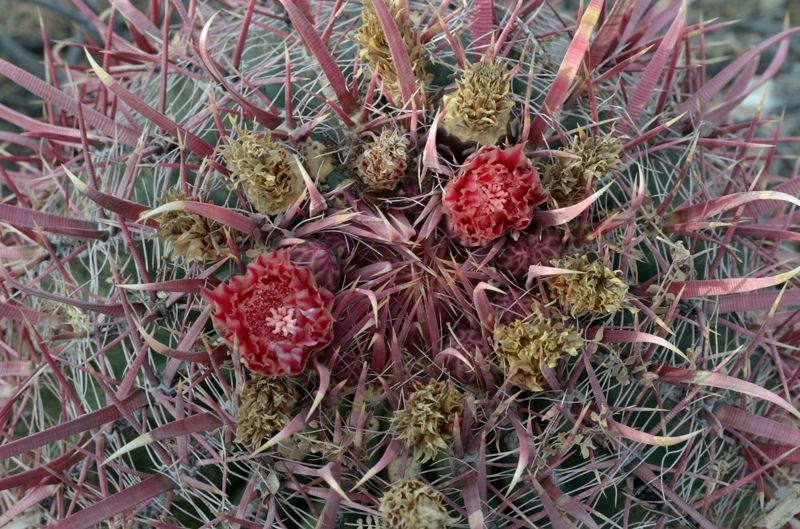
There were lots of cactus spines to watch out for though. You start to recognize the different species and the spine characteristics of each. One
lowly species has vicious long spines and is easy to miss because it is low to the ground. I managed to whack my shin into that one and it was painful
pulling those out. You have to accept that you will be stabbed multiple times out here! In retrospect I wish I had brought gaiters to help protect
against spines, as well as rattlesnakes. But I have to say, I have never seen a rattlesnake in all my travels in Baja.
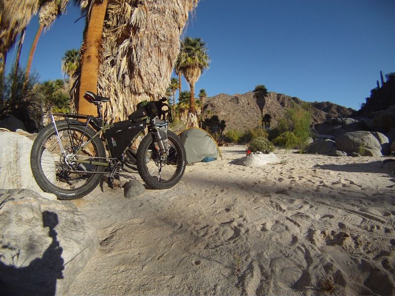
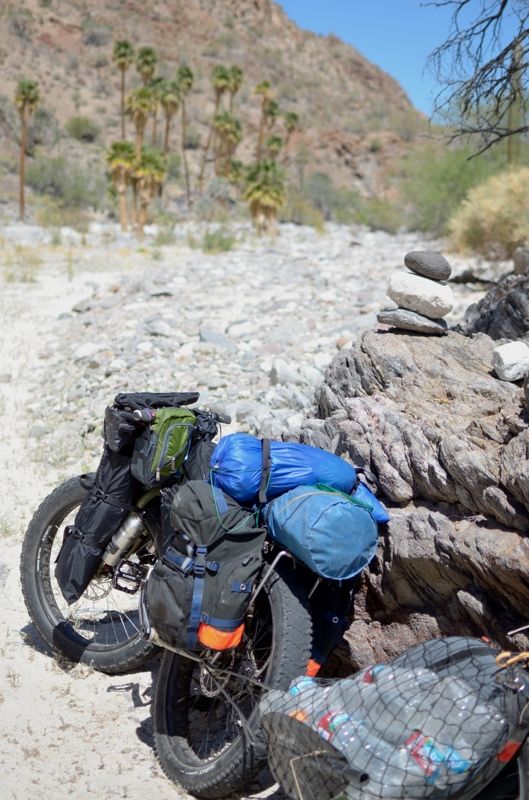
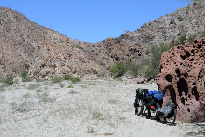
Here I am doing the final packing of my bike before hitting Salsipuedes wash!
I soon hit nice sandy wash to ride!
I was ecstatic to have made it. And immediately upon entering the little sandy side branch (I wasn't in the main wash yet) I saw something unexpected:
quad tracks! They were way up this canyon and it was reassuring because it meant that it was possible to get out to the ocean easily, since presumably
that's where it came from. This provided a great deal of relief and I set off riding down this wide tributary to the main Salsipuedes. I thought it
was a little risky though for the quad to be up here all by itself and I wondered who it was. And it seems that he was looking for a way into Botica
lakebed, as he went up the little tributary that I went down. I estimated that the tracks were a couple months old, as the big rains in December would
have washed them away, but the more recent light rains stimulated some more flower growth on them. But who knows, maybe they were older; I'm no expert
tracker (but I do want to be chased on the TV show Mantracker -- look it up). Wide wash:
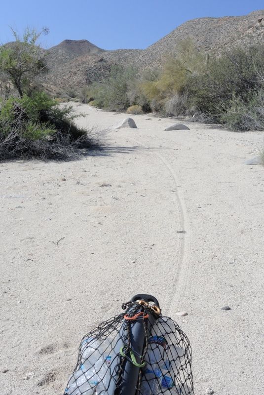
I had 3 km to cover to get to the main canyon, and the location of the first palm oasis. I would describe that ride as "exceedingly easy" and it ranks
as one of the best I have done in my travels, despite its short length. The sand was crusty and stiff, and the grade steep enough that I didn't have
to pedal! I could coast all the way down, with only the loose sand from the quad tracks to slow me. Was it going to be like this all the way to the
Sea of Cortez? I had to balance the fun of riding with the need to take photos and take in the experience, since I wouldn't be coming back up to do it
again. Keep in mind that during my whole trip, I was taking video and photos. I have Gopro'd almost the entire length if it, from various mounts on my
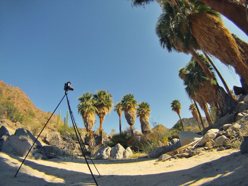
bike and body, and also taken video with my Nikon V1 which required setting up with a tripod and retrieving it afterwards. This added quite a bit to
the time, which wasn't a bad thing and probably forced me to better appreciate certain aspects of the place. I wasn't there to win a race; I was there
to explore, document, and enjoy.
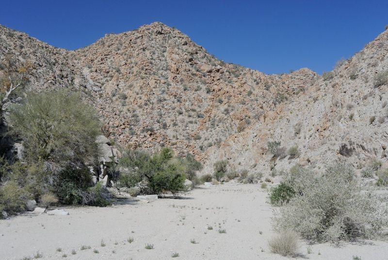
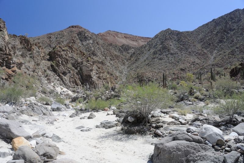
After a couple km the wide wash turned into a canyon:
You can see the quad tracks here:
The walls moved in and suddenly I was in canyon terrain. I knew the junction was coming up soon and then there it was - it was quite a sight seeing
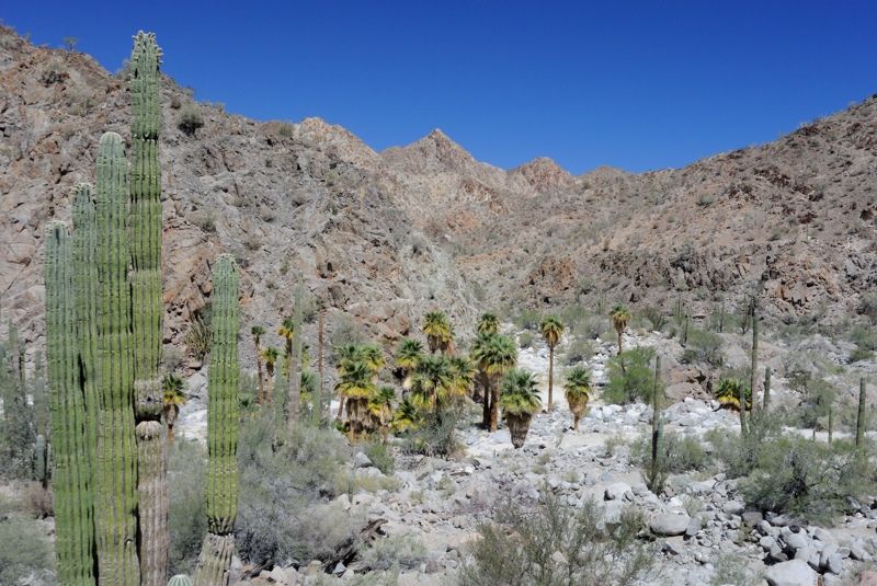
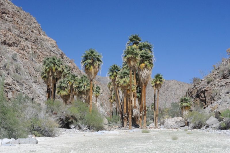
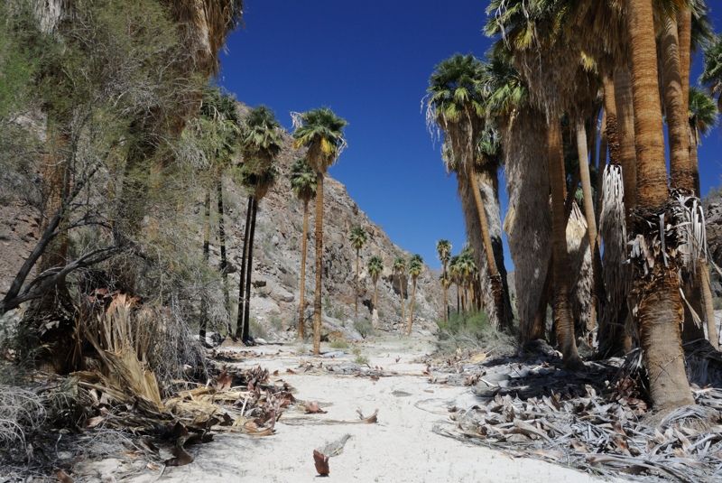
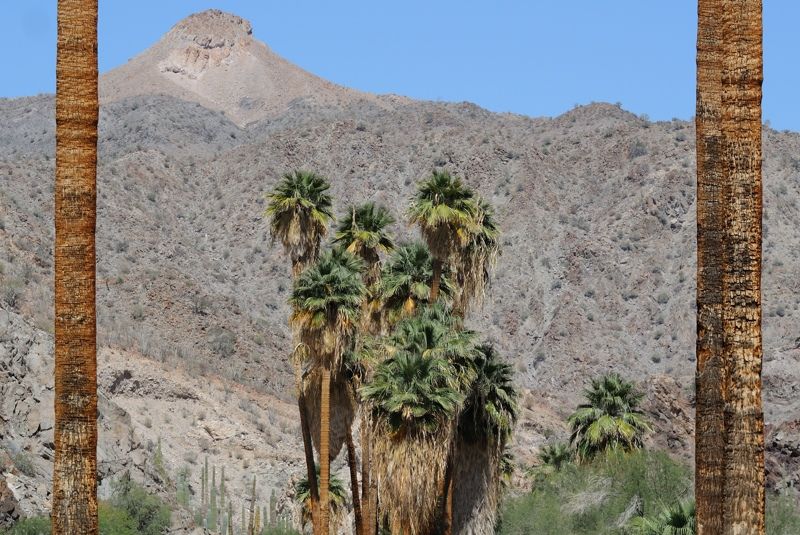
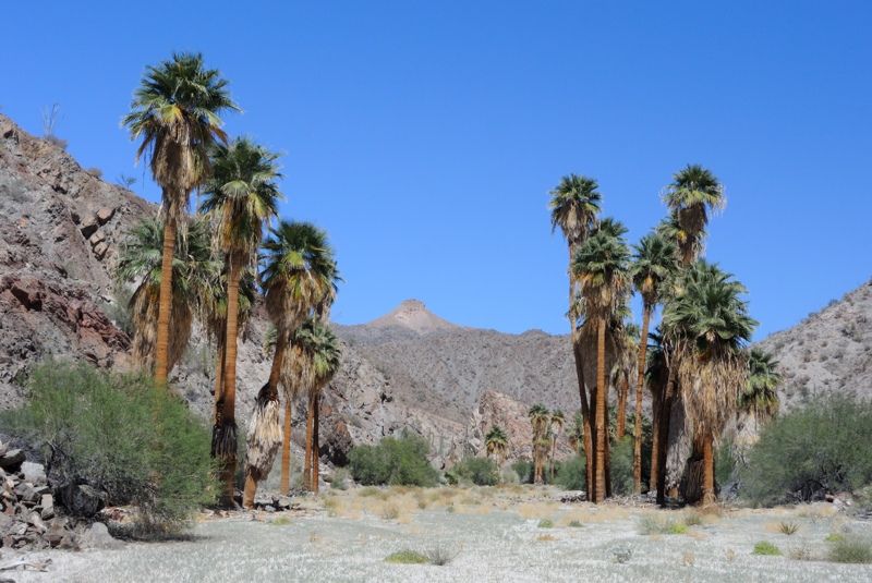
the tops of the palm trees emerge from the canyon walls off in the distance and get closer and closer. The whole experience was incredibly beautiful.
What's that I see off in the distance...
Wow!
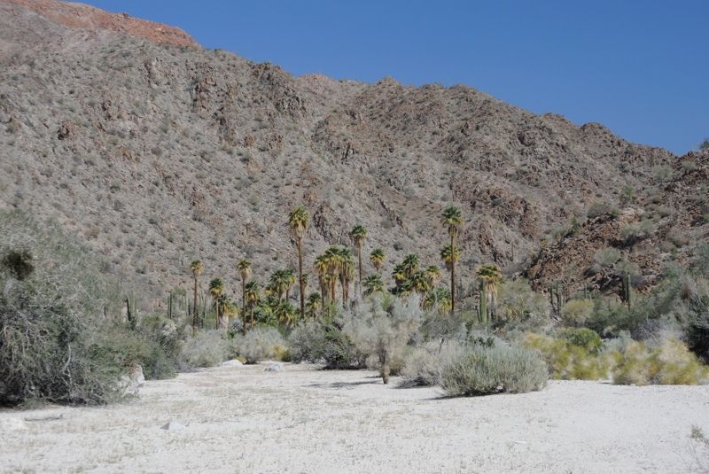
Wow again!
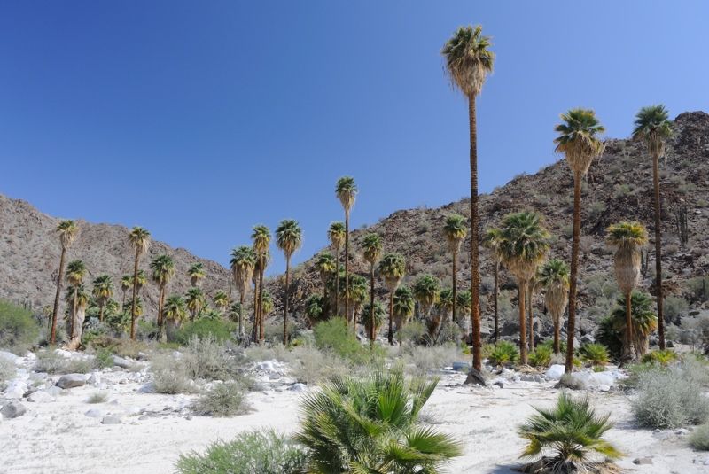
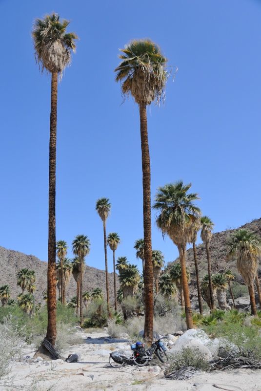
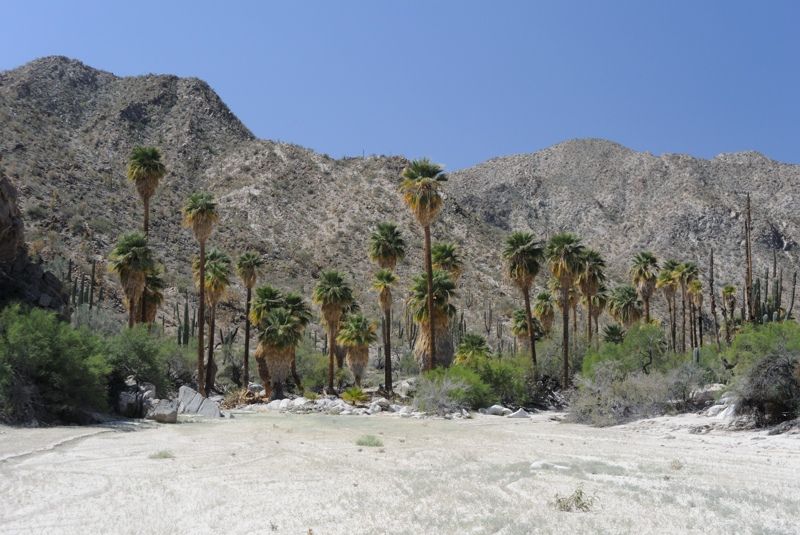
The side tributary dropped off about a meter before entering the Salsipuedes, presumably because the Salsipuedes had flown more recently. The palm
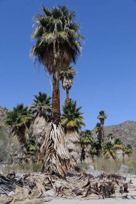
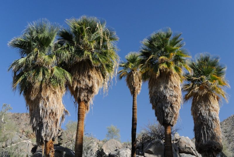
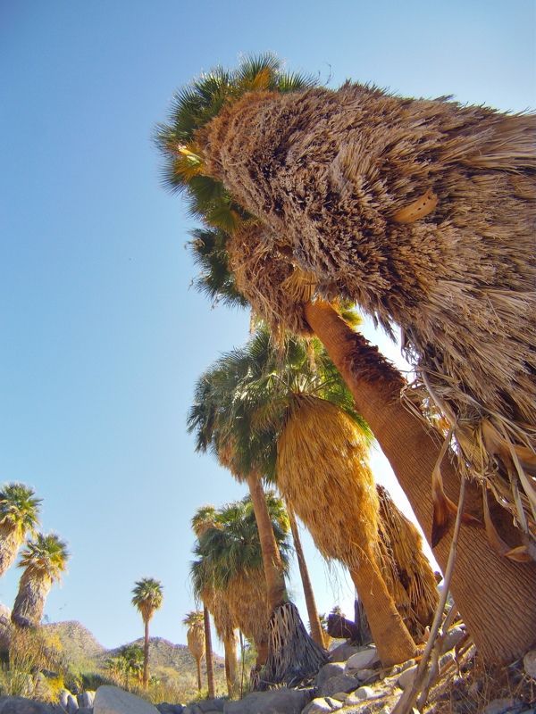
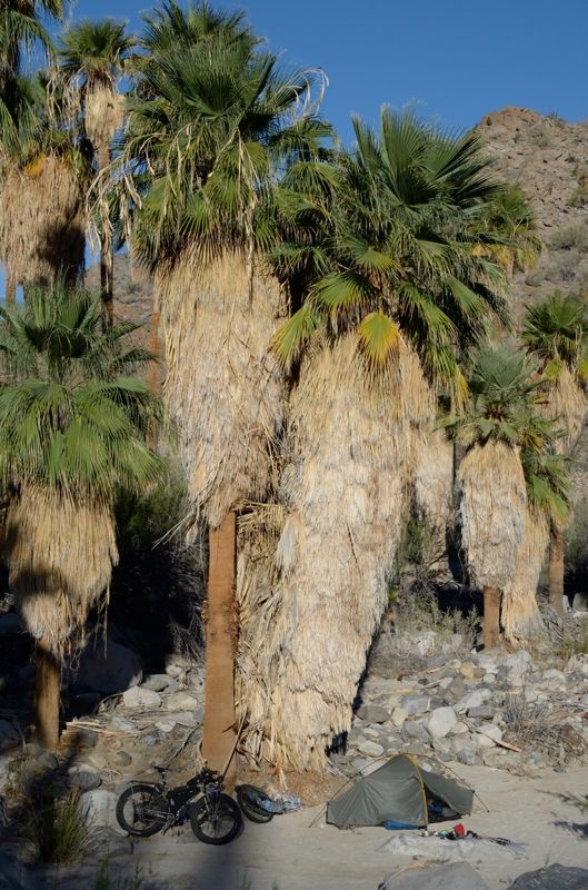
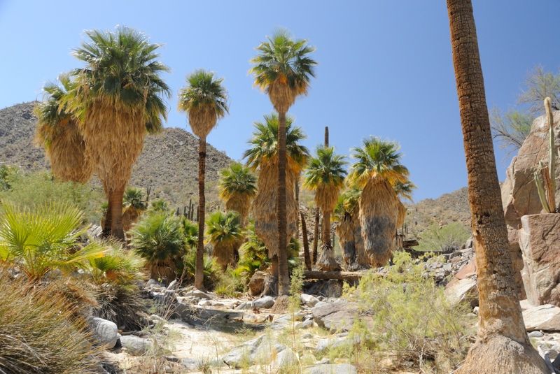
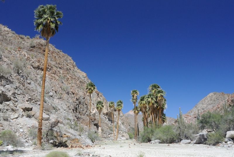
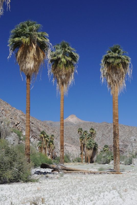
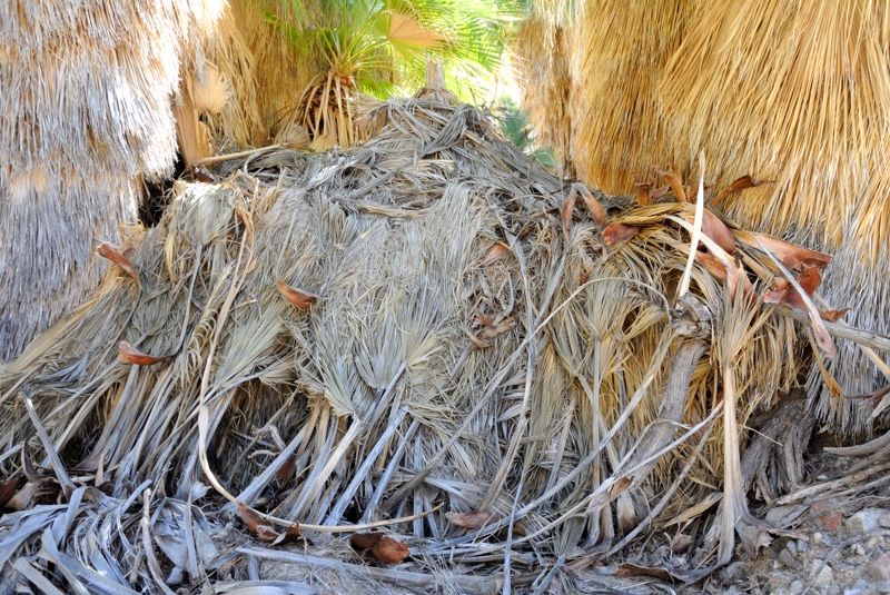
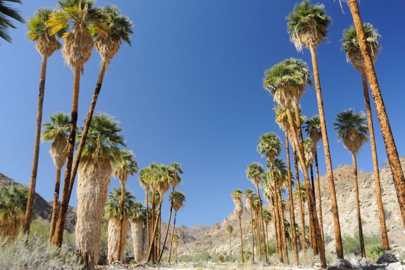
oasis was amazing, with huge dead palm fronds littering the ground.
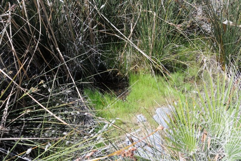
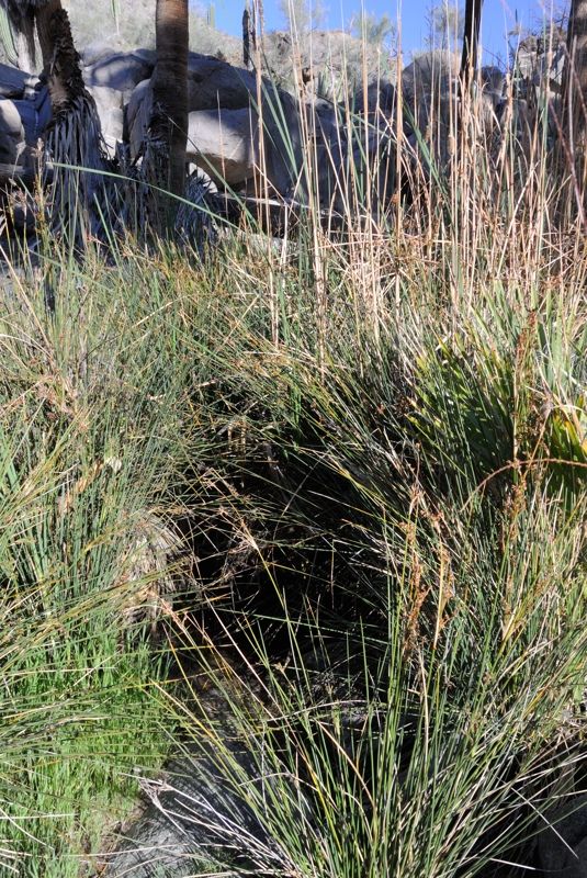
And it had sedges in one spot, signifying ground water, and further inspection revealed a little pool of standing water! Full of bees, mosquito larvae
and needle sharp sedges, but water still!
It was lunch time and I decided to spend the rest of the day there. I filtered some water, although it still tasted stagnant. I wished I had brought a
carbon filter to clean it up. I considered putting it through my seawater desalination pump but I learned from our last job at work specifying a
desalination plant down in South America that silicates can clog up the membrane, and this water looked to be hard with lots of silicates. Seawater
doesn't actually have high silicates. So I just used the water for cooking and washing clothes.
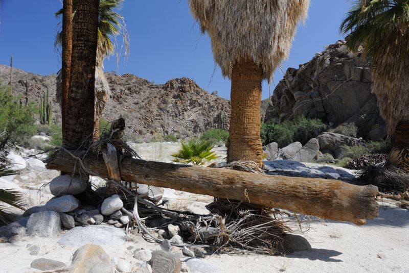
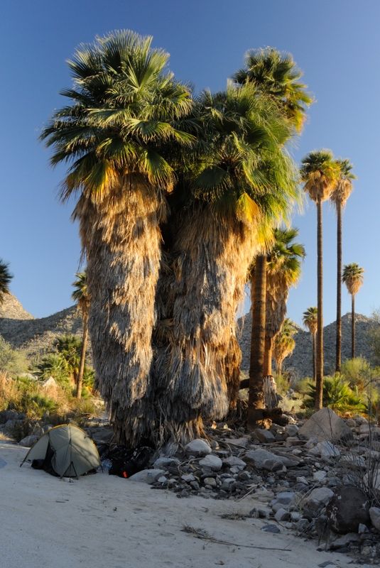
Right below the water pool is a nice sandy spot under the petticoats of a couple palms, perfectly protected from the afternoon sun and winds. Perfect!
I spent a great afternoon there relaxing and organizing, taking photos and recharging batteries, in more ways than one.
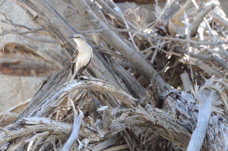
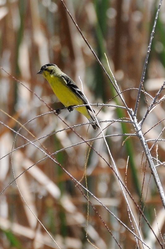
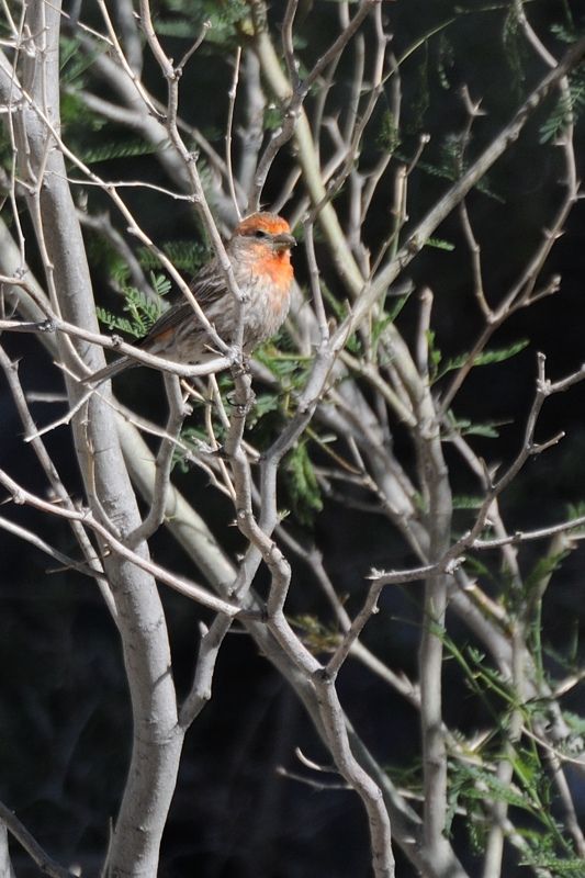
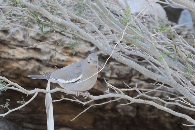
There is lots of bird life here, as one would expect in a desert oasis, which was interesting to watch. And some hawks screeched overhead, adding to
the classic desert scene.
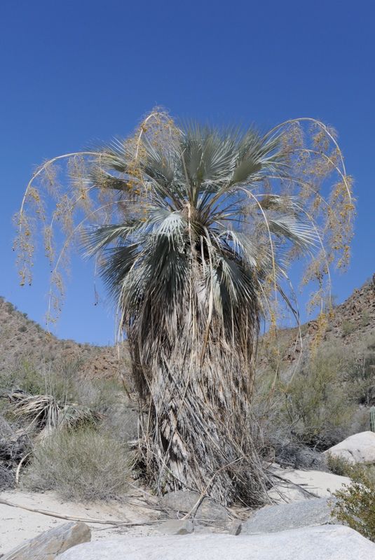
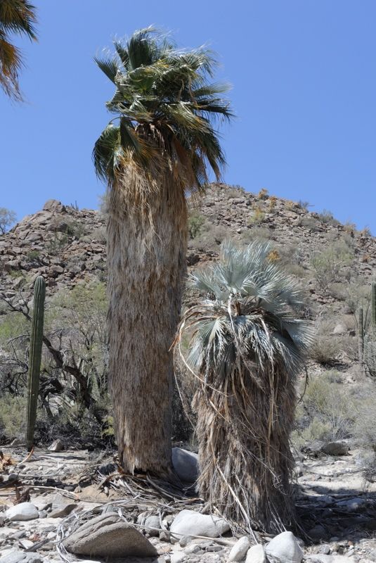
I noticed two palm species. One is the common Mexican fan palm, Washingtonia filifera. But there is another smaller one with grey leaves and different
seeds. These are the ones that grow up the rocky areas in the upper canyon. It is a Butia species; I'll have to look it up later.
Here is the two species growing together:
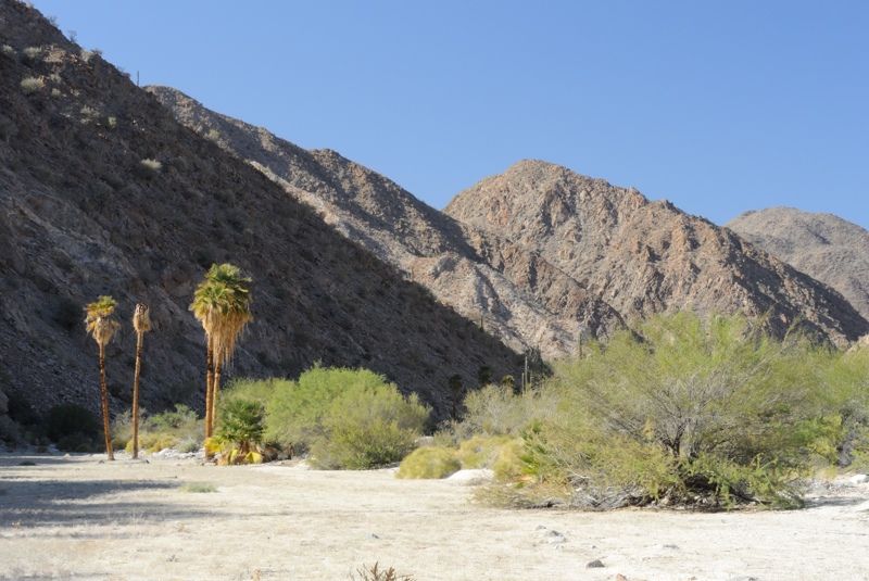
I hiked up the Salsipuedes to the next palm grove which wasn't far, although it didn't have water.
When it rains it pours:
Interesting plants growing in the sandy wash:
I decided not to see how far I could go up the main canyon before getting too rough since I was still unsure about the next potential problem area 2
km further down. I was here to enjoy myself, not push myself too hard. It was good enough that I was there.
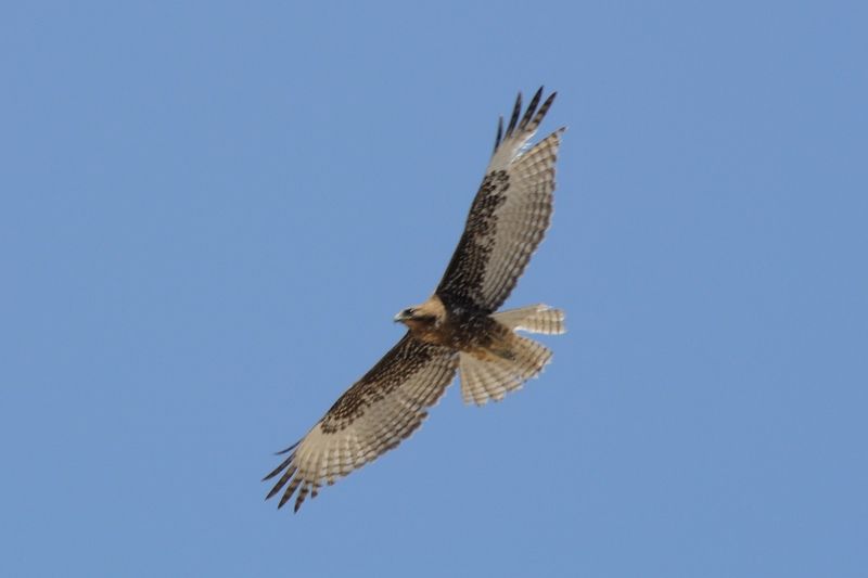
The oasis attracts lots of bird life and I had some fun trying to take photos. This hawk perched in a palm to check me out. But those raptors, they
know when you point the lens at them and fly away. I haven't yet identified it:
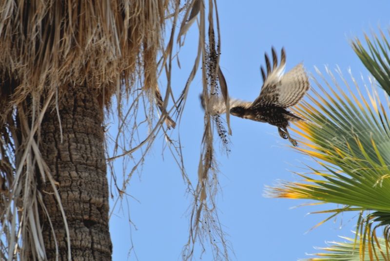
A blurry in-flight shot:
I found a better water puddle with fewer bees and more water, but more mosquito larvae:
Here is looking downstream from the oasis:
[Edited on 4-6-2014 by Mark_BC]
[Edited on 5-25-2014 by Mark_BC]
[Edited on 5-25-2014 by Mark_BC]
|
|
|
DosMars
Nomad
Posts: 115
Registered: 12-11-2005
Member Is Offline
|
|
Awesome write up so far Mark! Great to know you're back out & safe.
|
|
|
Barry A.
Select Nomad
Posts: 10007
Registered: 11-30-2003
Location: Redding, Northern CA
Member Is Offline
Mood: optimistic
|
|
Outstanding------just outstanding!!!!!
Barry
|
|
|
David K
Honored Nomad
Posts: 64479
Registered: 8-30-2002
Location: San Diego County
Member Is Offline
Mood: Have Baja Fever
|
|
A book is in your future! High adventure in Mexico's Desert Peninsula!
|
|
|
Paulina
Ultra Nomad
Posts: 3810
Registered: 8-31-2002
Location: BCN
Member Is Offline
|
|
I am enjoying your report very much, thank you for taking the time to post. I wish Herman was still around to hear about your adventures in "Get out
if you can"yon. I know he was out and about that area quite a bit.
P>*)))>{
\"Well behaved women rarely make history.\" Laurel Thatcher Ulrich
|
|
|
N2Baja
Nomad
Posts: 147
Registered: 2-12-2004
Location: San Diego
Member Is Offline
|
|
Great write up! Can't wait to see your pictures!
Forget about the danger and think of the fun.
|
|
|
ehall
Super Nomad
Posts: 1906
Registered: 3-29-2014
Location: Buckeye, Az
Member Is Offline
Mood: It's 5 o'clock somewhere
|
|
very interesting, can't wait to read the rest.
|
|
|
TMW
Select Nomad
Posts: 10659
Registered: 9-1-2003
Location: Bakersfield, CA
Member Is Offline
|
|
Excellent, keep it coming.
|
|
|
Mark_BC
Nomad
Posts: 137
Registered: 12-1-2013
Location: Vancouver, BC
Member Is Offline
|
|
Thanks guys. I have to admit, I haven't read ESG's accounts so if I have said something inaccurate about his trip let me know. I'll try to find them
when I get back, or maybe there's somewhere online I can access them here?
Yeah I'd love to write a book or even make a movie, I sure have enough material. And there are some bike travel magazines that I'm sure would have the
story. But I don't want to popularize the area too much or everyone and his dog would be there. If someone ever managed to put a road in it would
totally change the place.
Part 6 - The Palm Canyons
Yesterday, as I filtered water the little pool drained and didn't seem to recharge, so there was a limit to how much water I could take. But by
morning it had more than recharged, providing ample to allow me to filter about 5 liters to take with me.
I wasn't sure what to expect now that I was in the main canyon but based on the previous day, it promised to be good. Unfortunately, however, the
riding itself wasn't quite up to the same par, but the beauty of the palm canyon made up for it.
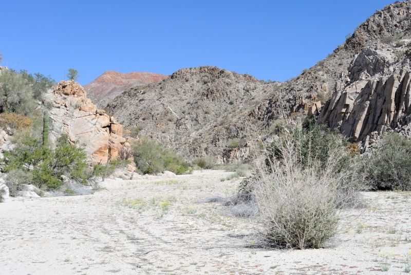
As soon as I headed out I hit tamarisk and then very shortly some rock fields that were a bit difficult to negotiate. And the sand was a lot looser
making the riding very difficult, too difficult in most places, so I had to push the bike most of the way for the first couple km to the next point of
constriction in the canyon.
It was at this place that I had been worried about potential cliffs, although after seeing the quad tracks that worry mostly went away. However, the
quad tracks were now absent, which had me pondering for a few days. They ended at the confluence with the main canyon.
I pushed my bike through the heat to that constriction which was basically just some rocks and another picturesque palm grove, with standing water
too, although of poorer quality than the first one.
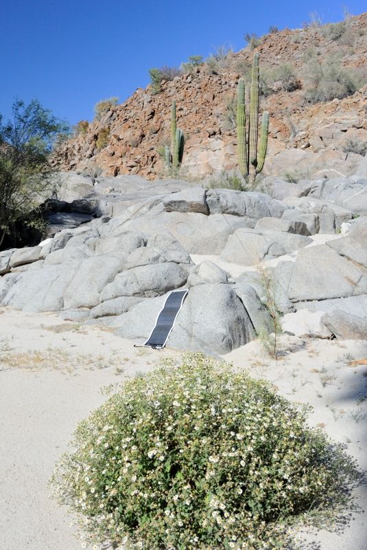
I decided to have a long lunch there and charge up my iPhone in the midday sun. It requires full overhead sun to charge. It had completely died the
previous day as I didn't realize you have to shut it off to prevent battery drain, not just put it to sleep. Thankfully, after 10 minutes it chirped,
indicating that it was charging. I left it there as I negotiated my gear down the rocks which weren't too bad, but required that I disconnect the
trailer. I explored a bit and found some antelope mandibles. By the time I was ready to move on the phone was up to 30%! Modern technology eh! On my
tiny little phone I had Google Earth cached which has detail down to individual palm trees, and you can charge it with a waterproof, roll-up solar
panel weighing less than a pound. Imagine what ESG would have thought about that. And the Spot GPS too. If you get in trouble you just push a button
and a few hours later a helicopter comes to pick you up! And my HD cameras, my bike, and packraft... I love modern technology! But you have to be
careful with it, because if it breaks you could be in trouble and be forced back to the basics. Fortunately, I had the basics covered too!
The canyon continues on after this with fewer rocks but equally difficult sand. At one point I found a rock cairn revealing that people do come here:
Some of the palm groves lining the wash are very beautiful, like manicured avenues planted along the streets in Beverly Hills.
Hard to not take photos:
The sun was hot beating down on the canyon walls. But the sand gradually improved in firmness allowing me to ride more and more, which provided some
breeze. At one point I decided to put on my Gopro chest harness. To do this I leaned my bike against a rock and took my backpack off. Then I got about
15 minutes of continuous footage as I rode down the next km.
I decided to take a break in an area of shade I encountered so I turned off the Gopro and took off my backpack... except that my backpack wasn't
there! I thought the riding felt a lot more comfortable... Damn, I forgot to put it back on way back there! I got pretty flustered and irritated by
myself. You can't let these stupid things happen out here, I chastised. But I also consoled myself in that it was hot and stressful and the mind
doesn't totally focus in those situations. So I had to hike 20 minutes back up the wash in the heat, and there was my backpack, lying out in the wide
open on the ground. How could that have slipped through my system? Now my new policy was to always look back whenever the bike gets moving from a
stop, and to always put the backpack in front of the wheels so there's no way I could forget it! All in all I probably used over half a liter of water
and wasted an hour in that little escapade.
I decided that I'd book it over to Larry's photo, and then relax a bit and maybe hike up the side of the canyon to get some higher level photos and
videos. And I'd camp there. I went by a small rock cairn at one of the curves so someone had been up here doing something. I noticed that as I went
down the canyon there were more and more fire scarred palms. The ones in the upper canyon are clear. Maybe people set them on fire.
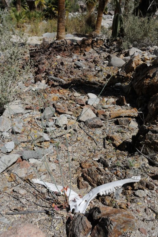
I got to the exact spot of his photo and then a little further down discovered some garbage. Then more garbage, and a shredded sleeping bag, and
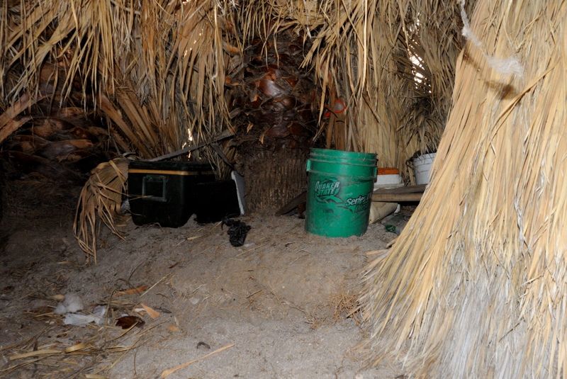
clothes. It was the remains of a camp! Someone had set up a camp there! And they knew what they were doing too. There was some of that black ABS pipe
lying around for moving water from the source to camp, and they made some pretty well constructed palm thatch huts in between the palm trees. It was a
real life Gilligan's Island. There was a rock hanging by a rope from a low branch, which I presumed was for crunching up rock samples, as I also
presumed they were prospectors.
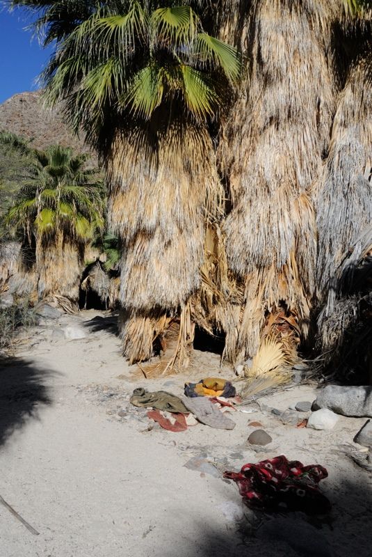
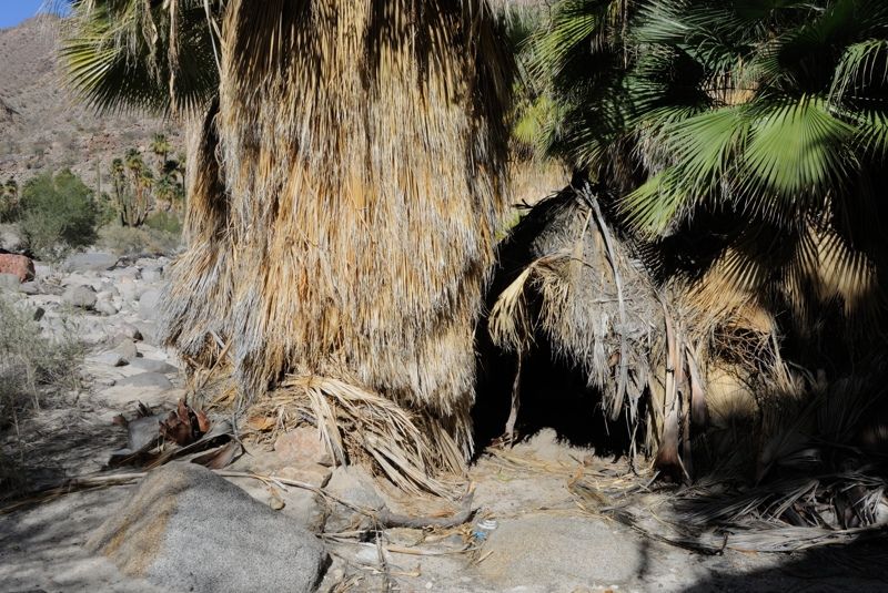
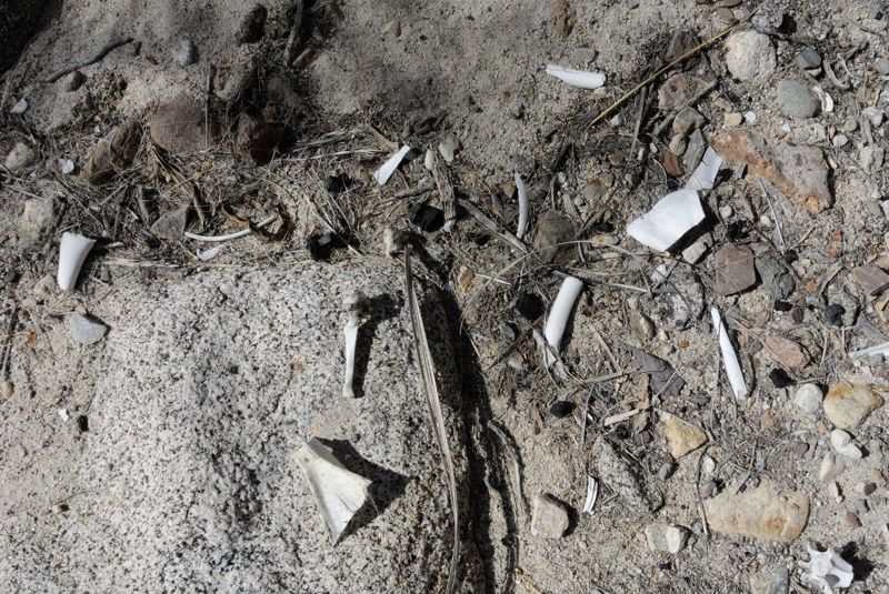
And then I noticed... bones. Oh man, they looked about people sized too. No skull or anything, but some vertebrae, long bones, and a fractured
shoulder blade strewn around in front of one of the huts. That sent a chill down my own spine.
I wondered about the possibilities. Was there foul play involved? Or did someone just not realize how dry it gets and ran out of water, with no Spot
GPS or seawater desalinator pump to save them? There were no recent tracks, and based on the date of a Powerade container (2011), it had been a few
years.
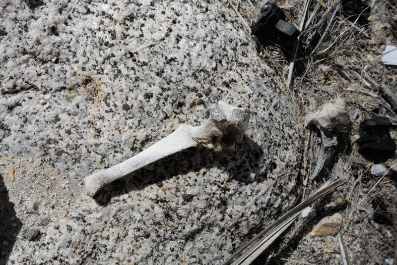
The one doubt I had about the bones was that the vertebra had a long fin on it, like you see on dolphins. I didn't think human spines had such long
fins, but I wasn't sure. But what would someone be doing with a section of dolphin up here? And how would they keep it from going bad? And why were
the bones just littered there in front of the hut? After you finish eating it you'd throw them in the garbage pile. And why did the place look like
someone just upped and left, leaving behind valuable equipment and food? And why were there no quad tracks here? Surely he'd stop to check it out. Why
would the sleeping bag be all shredded?
One likely explanation was that the bones were from an antelope they killed, as they can have the long fins on the vertebrae. I'd check the internet
after I got back to see what human vertebrae look like (I've done that and it seems they weren't human).
But that place sure gave me the creeps, and many of those questions remain unanswered. So I did a quick Spot hit and took one small can of tomato
sauce that expired that month, March of 2014, then skidaddled out of town ASAP. On my way out I passed a lobster trap half buried in the sand from the
last flood and took that too, as I'd love to have lobster at the beach! I don't know what the etiquette is about raiding abandoned camps, but this was
clearly abandoned.
I went another km to the next palm grove and set up camp. There was stuffing from the sleeping bag strewn around this far down, as the last rains
washed it down and it got hung up in the tamarisk. I looked at GE on the iPhone and found my exact location, identifying each individual palm tree
around me.
I was a little freaked out but managed to get to sleep after the gigantic buzzing bug in the petticoat of the adjacent palm tree stopped buzzing after
an hour. What would the next day bring? Would I make it to the ocean or would that wait another day? I lusted after the barracuda I hoped to catch in
a day or two.
[Edited on 5-26-2014 by Mark_BC]
|
|
|
Mark_BC
Nomad
Posts: 137
Registered: 12-1-2013
Location: Vancouver, BC
Member Is Offline
|
|
Part 7 - The Lower Canyon and Strawberry Hills
I wasted no time packing up that morning. I was at the most downstream major palm grove and after that they would begin to peter out, as the canyon
widens and the groundwater goes too deep.
Crumbling canyon walls...
I went down the next few km fairly uneventfully. The quality of the sand for riding was improving and I could ride it all. I'm not sure what the
processes are that turn loose sand into rideable crusty sand, but it didn't seem to have anything to do with the age since last flood.
I climbed a side hill and got a great video panorama if me riding down, framed by the mountains. I arrived at the Asamblea junction and hiked up it a
little ways. The sand was very firm, easily rideable. But I didn't know how rocky it got further up around the corner. I had about 3 days of water
left. I could have gone up a few km and in retrospect I wish I had tried, but I decided to play it safe and just continue on. There was no way I had
enough water to safely go up and back to that interesting oasis 8 km up, especially considering the rocks I'd encounter, and there's a good chance it
wouldn't have water as the last big one at Larry's photo didn't have standing water. Maybe next time, when there's more water. Looking up at the
junction. Salsipuedes to the left, Asamblea to the right:
I kept thinking about the quad tracks. I went through all possible entry points he could have taken to get into the upper canyon overland. It would be
great if it was possible, because that would eliminate the hurdle of the hike over the pass into Botica lakebed. But I just couldn't think of any. He
couldn't have come from Botica because there's no way he'd get over the hill, and I would have seen his tracks. There's no way he could have come from
the upper Salsipuedes as I couldn't even hike it. And I highly doubt there's a track coming in from the Yubay area, and that would entail going down
the middle Salsipuedes canyon, which from GE seemed to be pretty rocky and steep. So the only conclusion I could come to was that he came up the
canyon from the beach via boat access. And the reason I could see no more tracks was because rains in the upper Salsipuedes caused that one to flood
more recently than the wide wash I first went down just west of the Botica lakebed. But you'd think I'd see some evidence of the tracks somewhere...
but nothing, all the way to the ocean. And since there were two tracks, if he came up from the ocean then that is only one quad -- one track up and
one down. That is a risky thing to do alone, since if a quad breaks down you aren't pushing it out 25 km. A bike, sure. But not a quad. But maybe
there was more water around when he came up. Anyways, it's a mystery.
I slowly plodded down the wash as I was in no rush. The canyon opened up and the valley became wide. There are palm trunks strewn all the way down to
the ocean.
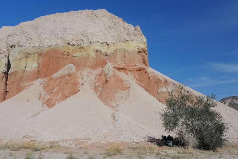
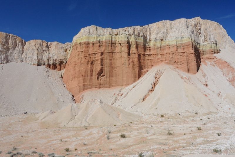
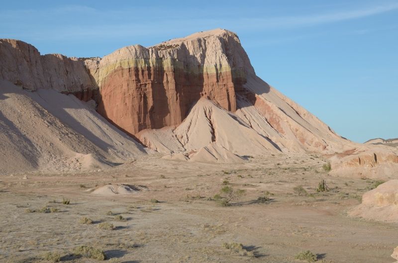
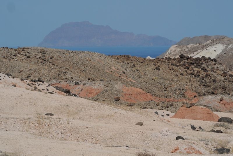
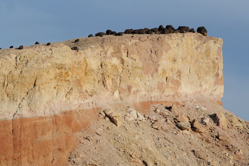
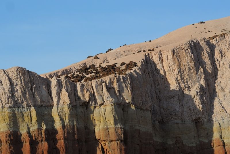
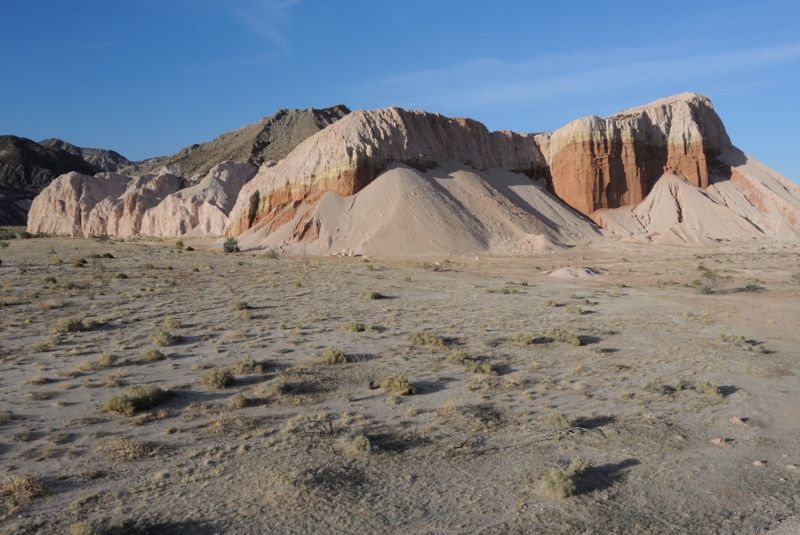
I could see off in the distance an interesting pink cliff. I was going to go by it.
Huh, that looks interesting..
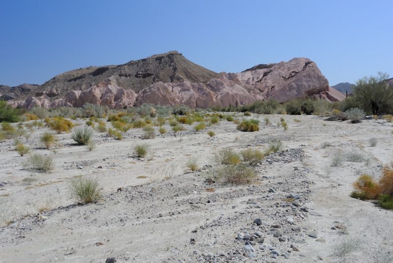
As I approached it got more and more impressive. The wash skirts by its northwestern side and I took a detour south to have a better look. Wow, that
is quite a formation! I haven't seen anything like it. It seems to be made up of two layers of sedimentary rock, one white and one pink. They are both
eroding and creating interesting talus slopes and topography at the base. I hiked around to the east and it was even more impressive. The whole
landscape there is otherworldly, like from a different planet. I could go on but maybe I'll just let the photos do the talking when I get them up.
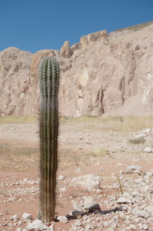
Lonely cardon by the pink cliff:
It was only lunch time but there was no way I was going to let an opportunity for evening light on that hill to go by so I decided to camp there.
There is an interesting tree at its base that has a little nook in its east side that allowed me to fit my tent in and stay in the shade all day!
Perfect! My campsite:
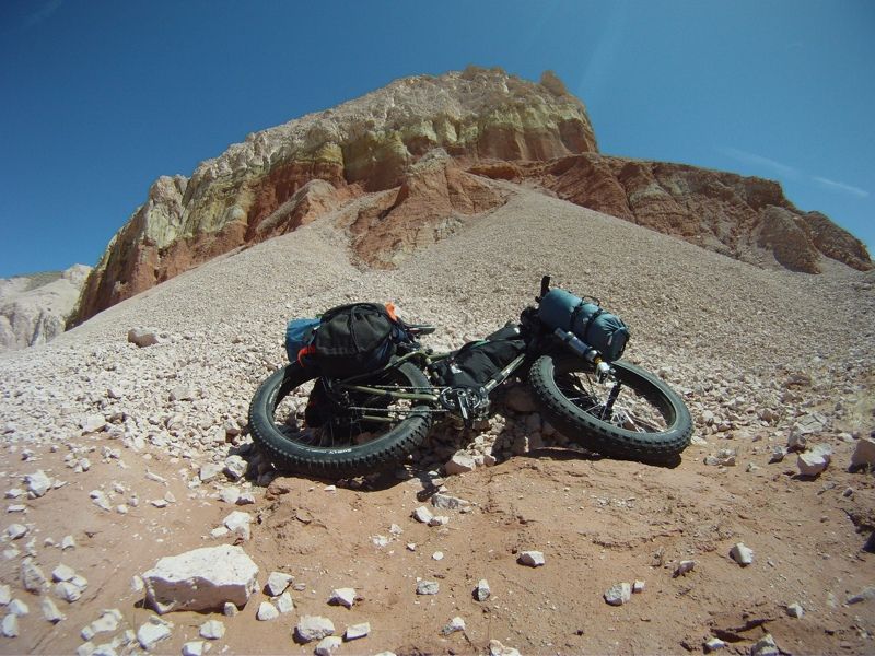
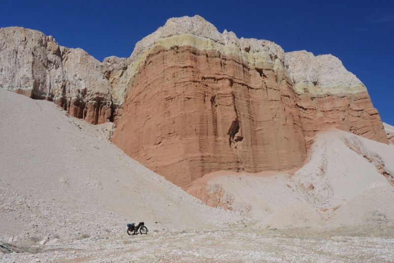
Look for my bike in this one:
I'm not sure what animal was making these tracks up the talus slope as there is nothing up there to eat:
Oh look, there's the ocean!
No don't jump!
Very interesting geology:
I noticed the ant nests and took some video of one. They seem to be common out here in the desert. It got me thinking about how the ecosystem
energetics work out here. None of the desert animals need to drink water. Instead, the water enters the ecosystem via the plants, after it rains.
Water plus carbon dioxide makes carbohydrates (sugars and woody and leafy material). This is then stored as various plant materials which the
herbivores like ants eat, even in the driest months when there's no water anywhere. The ants presumably farm the leafy material they collect, which
oxidises back into water and carbon dioxide, releasing the energy originally captured by the plants via photosynthesis, and allows the animals to
live. Then the ants get eaten by the lizards and the lizards get eaten by the coyotes, and each makes its own water via metabolism of that original
plant material. Kind of interesting how it all works to keep life moving along even when there's no water. It doesn't work for people or cows though
because our bodies aren't good at conserving water. We have to drink it.
Evening came and I went up some of the opposite hills to get a better perspective on the pink one. The light wasn't quite as good as I was hoping for
since it clouded over a bit, but still really nice.
It's at times like this that I wish I had a dedicated wide angle lens with me. I am going to have to reassess my camera choices for next trip. The
small Nikon 1 sensor isn't giving me the depth of field and dynamic range I like. It will be good for wildlife when coupled with my longer lenses
since it offers great reach, but for more normal focal lengths I think I may bite the bullet and bring along the larger DX format cameras, and gasp
even full frame!
I tried riding my bike over to the opposite hills and that was a mistake. In the first couple hundred feet I picked up dozens of spines. There were
these really irritating little spike balls all over the place. I limped the bike back with tires hissing. Hopefully the goop would seal them up OK.
I got a good night's sleep and looked forward to getting to the ocean the next day, only 5 km away.
[Edited on 5-28-2014 by Mark_BC]
|
|
|
woody with a view
PITA Nomad
Posts: 15937
Registered: 11-8-2004
Location: Looking at the Coronado Islands
Member Is Offline
Mood: Everchangin'
|
|
please edit the fotos into this thread where we can follow along. sounds like a blast. I often look at far away mountains and canyons and wonder if
anyone has ever been there.....
|
|
|
| Pages:
1
..
17
18
19
20
21
..
25 |
|


