David K
Honored Nomad

Posts: 64480
Registered: 8-30-2002
Location: San Diego County
Member Is Offline
Mood: Have Baja Fever
|
|
Hiking down the Camino Real to Los Dolores Apaté Mission (by 'ashek')
Here are the notes and photos from 'ashek' upon his return from hiking down the mountain to the 9th California mission, Nuestra Señora de los Dolores
Apaté (founded in 1721).
=====================================================
Alright,
We went, we saw, and we were a bit disappointed 
The trail off the road that leads down is very hard to find, in fact it was just bushwhacking and following cattle trails until we got to the edge and
then picked up the trail down at just before the lookout.
The lookout is nice, the trail down is in decent shape, but even a burro would have to be dismounted to make the grade up or down (its loose, steep,
and handbuilt.. well done to whoever did it back a few centuries ago).
The disappointment is with the development.
The google earth image has a rough track going from the ranch by the sea, to the crescent shaped palm grove and the ruins. In reality, its a two track
road going around the ruins, and past it, at which point it turns into an irrigation trench which goes quite a ways up the hill to the head of the
spring.
To top it off, the whole place is fenced off and gated. Pretty new development too, looks like in the last two years or so. There is some remnants of
the old irrigation canal (above ground, lined with white stones) still visible, but the fencing and recent work has taken away from the ambiance of
the place 
--------------------------------------------------------------------------------------
There are some of the mission, some of the lookouts, old aqueduct, climb down, and some of the ruins and gates. No road has been built through. Looks
like the only way to get down into that valley is just west of Los Burros, or the camino real way, which you gave the GPS info for. That part was
handbuilt, and I'd image burros do it with no load as its super steep. Whatever they brought in to do the work came from the beach.
Im not really going to write a trip report, because we spent all of 20 mins down below. The whole there and back was about 6 hours though from our
campsite (we had two kids with us, so it was done at their pace). Can be done as a day trip tho if you camp there, but I wouldn't recommend it.
It looks like the fence was put up to keep people out of the area we got to, ie, they don't expect foot traffic from the cliff side, they expect it
from the water side. I didn't get a lot of shots of the dug up drainage ditch If
you want to piece together an FYI using my info and pics thats fine, no credit necessary (as most of the info you seem to have provided).
Oh, also the note about the other mission (La Pasión) being a pig farm, i'd say its more likely a goat farm, haven't seen any pigs, but saw lots of
Goats. And La Presa itself seems to be billing itself as the mission, rather than the GPS location near the pig farm. La Presa seems to be more of an
oasis with a modern church, so they could just mean that. Anyways, thanks for the info!
email coming with pics.
PHOTOS:
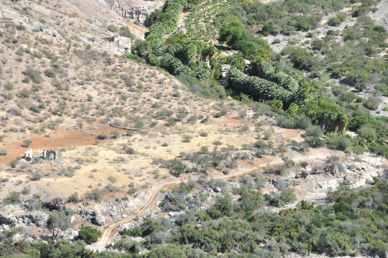
Dolores Apaté from Cliff Lookout
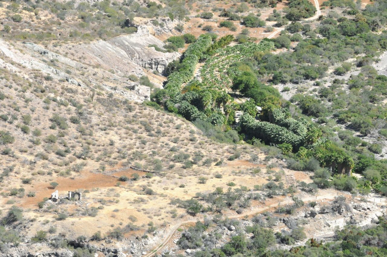
Dolores from 'official' lookout
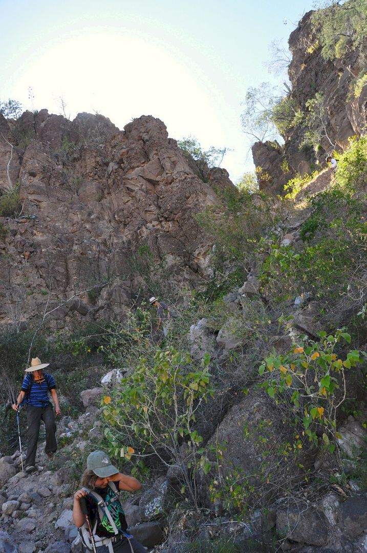
Coming down the mission road 'El Camino Real'.
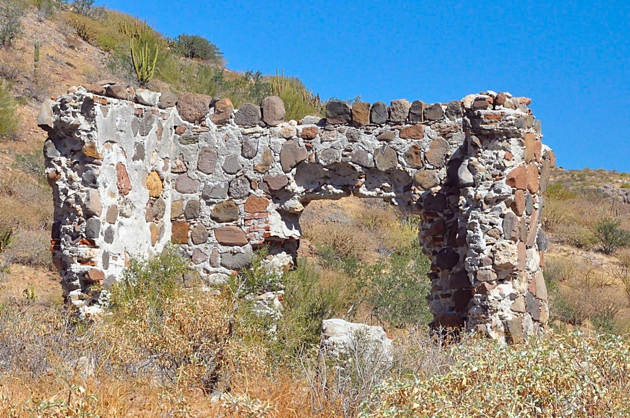
Close up at the mission
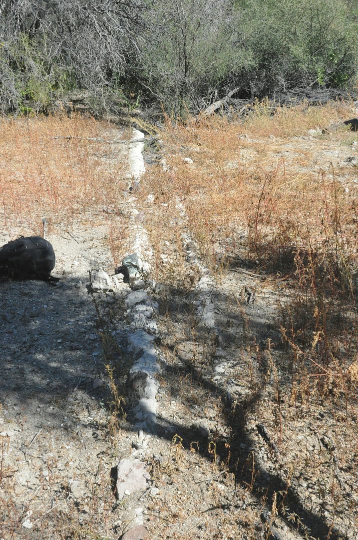
Acequia ruins (old aqueduct)
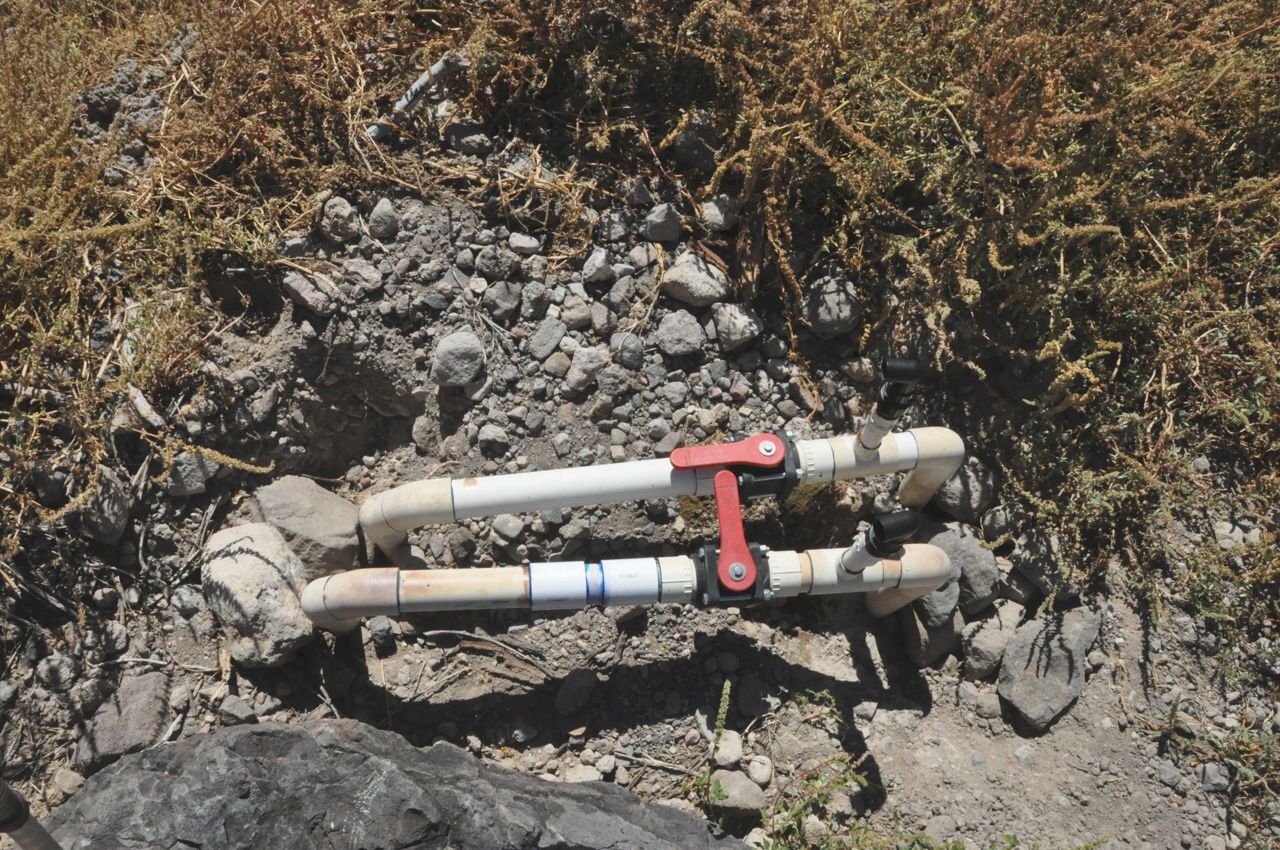
Irrigation works
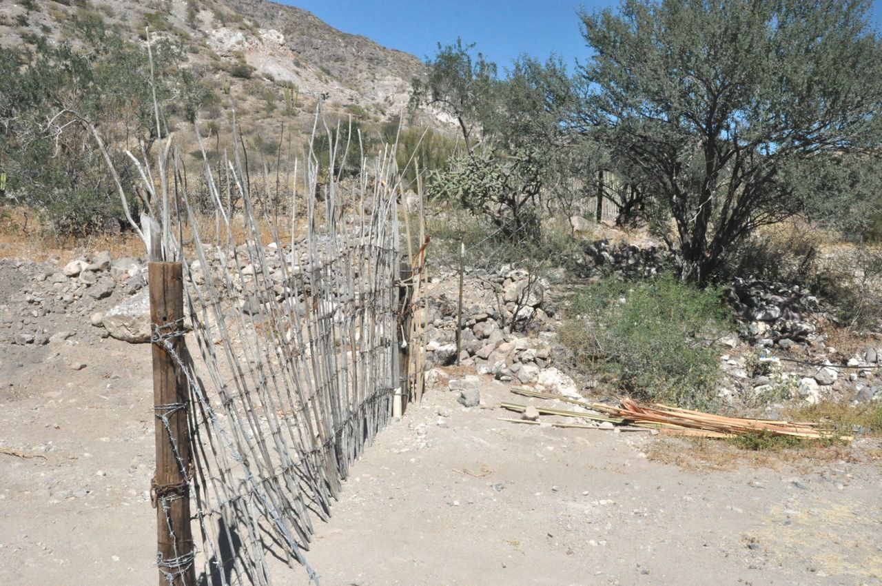
Gate on road from beach to mission.
[David K note: Dolores Apaté is one of just two missions on the peninsula that is not reached by automobile road, hiking is needed. The ranch of Los
Dolores must have off loaded any vehicles used by them by boat onto their beach.]
[Edited on 10-7-2021 by David K]
|
|
|
David K
Honored Nomad
Posts: 64480
Registered: 8-30-2002
Location: San Diego County
Member Is Offline
Mood: Have Baja Fever
|
|
More data on Los Dolores (and La Pasión) missions: http://discoverbaja.wordpress.com/2014/01/28/the-spanish-mis...
[Edited on 10-7-2021 by David K]
|
|
|
TMW
Select Nomad
Posts: 10659
Registered: 9-1-2003
Location: Bakersfield, CA
Member Is Offline
|
|
Good stuff, thanks
|
|
|
David K
Honored Nomad
Posts: 64480
Registered: 8-30-2002
Location: San Diego County
Member Is Offline
Mood: Have Baja Fever
|
|
I welcome anybody reading this to please share your mission photos and stories with us. If you don't want to or know how, I will be happy to post it
for you! Awareness is the best way to both appreciate and preserve history in Old California (Baja)!
|
|
|
David K
Honored Nomad
Posts: 64480
Registered: 8-30-2002
Location: San Diego County
Member Is Offline
Mood: Have Baja Fever
|
|
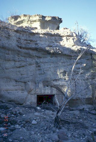
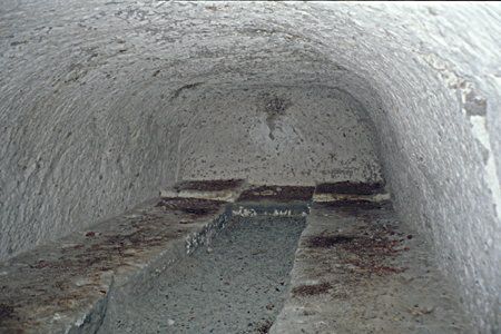
More to see at Los Dolores Mission
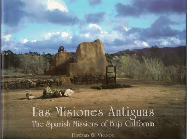
Ed Vernon ('Las Misiones Antiguas' author) sent me a couple photos showing the storage cave located just downstream from the mission, on the north
side of the canyon...
Ed's Book:
|
|
|
wilderone
Ultra Nomad
Posts: 3778
Registered: 2-9-2004
Member Is Offline
|
|
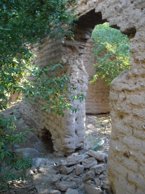
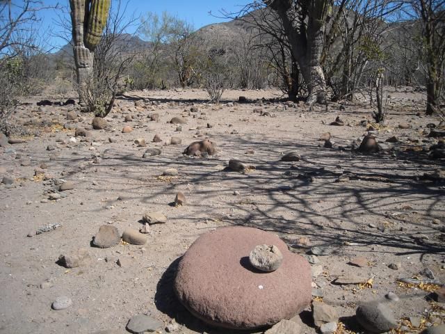
Got back from a camping excursion into the Sierra Gigantes a couple weeks ago. NE of Palo Chino there are remnants of the El Camino Real, continuing
No. then west toward El Horno. The cobblestone paving was intact in one part (didn't get a photo). Also, we (Mike Younghusband and I) encountered a
mission-era structure, which would have been on the El Camino Real route. Lots of indigenous tools, slicks, manos, shards to be found within a 10 mi.
radius of Palo Chino.
The El Camino Real is on the left. This is about 4 miles NE of Palo Chino.

Looking back where we hiked from (we are on the El Camino Real). From here it bends west to just north of El Horno.

Here is the adobe structure on the El Camino Real, about 5 mi. NE of Palo Chino
Some slicks (grinding stones) and manos in an area where there were at least a dozen.


|
|
|
David K
Honored Nomad
Posts: 64480
Registered: 8-30-2002
Location: San Diego County
Member Is Offline
Mood: Have Baja Fever
|
|
This was the last time I heard of any Nomads hiking to the 1721-1741 ruins of Mission Dolores (2-3 miles inland from the sea)...
Anybody since?
In 2017, I drove in and hiked to the edge of the canyon where I could look down and see the ruins. Photos in my Trip #6 report.
https://www.tacomaworld.com/threads/2017-baja-expedition-6-s...
|
|
|
4x4abc
Ultra Nomad
Posts: 4163
Registered: 4-24-2009
Location: La Paz, BCS
Member Is Offline
Mood: happy - always
|
|
too bad the post has no coordinates
Harald Pietschmann
|
|
|
David K
Honored Nomad
Posts: 64480
Registered: 8-30-2002
Location: San Diego County
Member Is Offline
Mood: Have Baja Fever
|
|
For what, Harald?
Let's see if this helps:
Most every place mentioned is on maps.
You have my book with the GPS for the missions (pages 214-216), and my website does too: http://vivabaja.com/missions4/
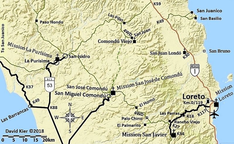
Palo Chino (in Wilderone's reply) is on the road between San Javier and San José de Comondú, and is on maps. See my Trip #2 report for additional
photos of the Palo Chino area... https://www.tacomaworld.com/threads/2017-baja-expedition-2-c...
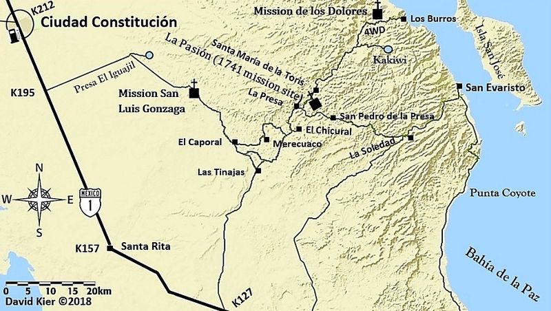
Mission Dolores Apaté: 25°03'20.1"N, 110°53'04.1"W
Mission Dolores Chillá (La Pasión): 24°53'14.1"N, 111°01'51.8"W
This site was not discussed, but is where the mission moved to in 1741.
Palo Chino: 25°57'06.8"N, 111°39'29.6"W
Palo Chino on my map:
Dolores and La Pasión on my map:
[Edited on 10-7-2021 by David K]
|
|
|
|


