| Pages:
1
2 |
TacoFeliz
Nomad

Posts: 265
Registered: 7-22-2005
Location: Here
Member Is Offline
Mood: Exploratory
|
|
Neal and Jay's Excellent Adventure
Late Spring 2014 Baja Loop
So Neal says to me Gee, Id really like to hike this one piece of the Camino Real sometime, its only a mile or two. Only 100 altitude gain he
said, without a lot of spin. Further conversation revealed the piece he was talking about was right near Tinaja Santa Maria, south and west from Bahia
de Los Angeles. Also the site of an earlier exploration we had done with John Marnell, Allan Romspert, his buddy Tim, and Neals current wife Marian
in 2009 or so. On that expedition, we found the tinaja we were looking for only after spending hours one day bushwhacking up the wrong arroyo until
the supporting cast mutinied in favor of cold beers and dinner.
Not wanting to risk a repeat performance, we traded Google Earth images and .kml files until we agreed on exactly where we were heading. This is a
VERY good idea when traveling with Neal. He has some scrambled priorities, not the least of which is that he would rather sleep in a burro wallow than
stay anywhere near water.
This spot was also near a place I had passed too many times without exploring, the wall paintings on the side of Mesa el Carmen near El Arco. OK,
were on, this time for sure! Neal roped new friends Ivan and Janet from Colorado in on the deal and we made plans to meet near Gonzaga Bay at Rancho
Grande. I conned my friend and Baja traveling buddy Stan into coming along and the plan was put into motion. From experience, he has become quite wary
when the words Neal and trip are used in the same sentence. My faithful dog Escuincle (Squink for short) completed the entourage.
We did meet at Rancho Grande, there was no gas at the Pemex or the store so we tallied up our mile ranges, fuel supplies and headed out. First stop
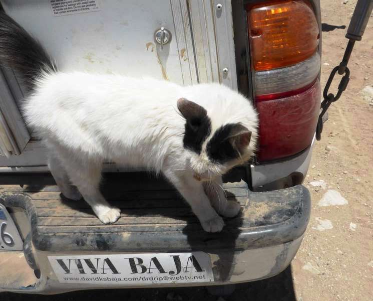
was to say hi to Coco and drop off some cat kibble. He was doing well and we swapped stories for a while and eventually said our goodbyes. On toward
Mex 1 with a short stop for Ivan to diagnose and repair a broken idler arm. OK, something broke. Now it was a real Baja trip.
After a brief bit of pavement, Ivan expressed an interest in the El Desengaño cutoff on the way to LA Bay. Neal piped up with well, if youre going
to go there, we should also swing by Tinaja Yubay, its right nearby! So we did take the cutoff. To say it is now pretty whooped out would be a
generous description. Only foundations and a claim marker remain at El Desengaño now. The old cabin and shaft ladders are long gone so its easy to go
right by, which we did. Took the Yubay cutoff and made our way to the arroyo. I had been there years before (like 25?) and didnt recognize our
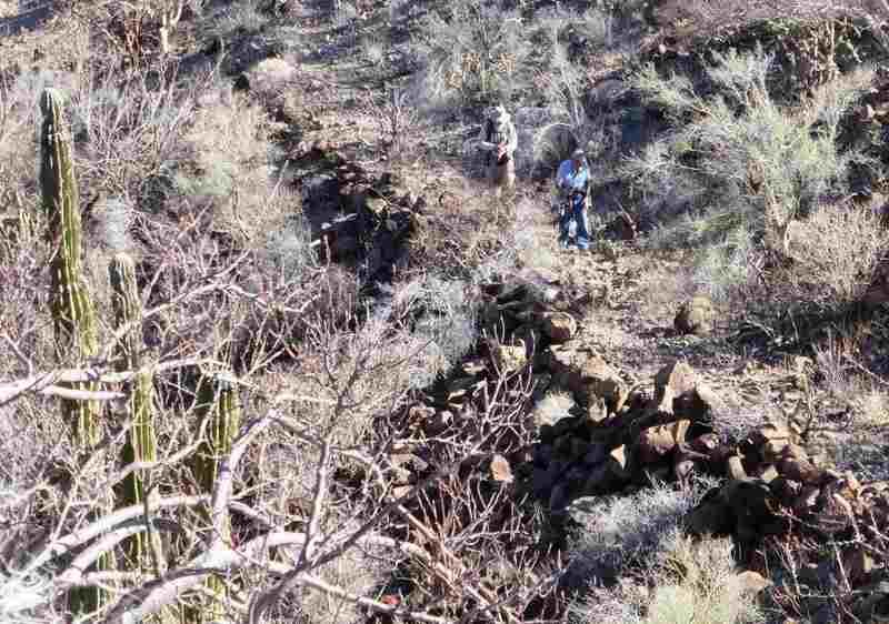
trailhead. The twenty minute walk turned into an hour plus of boulder hopping. Neal and Ivan made it to the tinaja, the rest of us wimps bailed at
various stages. Another hour passed and almost another without seeing Neal and Ivan. We hiked to the first saddle on the trail and lo and behold, here
came our two stragglers. Finally. They had found the tinaja and had kept up the hike to the pictograph site nearby. Neal got an earful from Marian
about making her (us) worry. Again. I told him we would ratchet strap his mouldering carcass to the hood if we had to drag home after he took a header
into a boulder pile. Its good to have friends.
We retraced our cutoff trail to Desengaño, took a brief look around and headed off to LA Bay and a great dinner on the water with adult beverages.
Thinking we might camp at La Gringa, we took a run down that crummy piece of washboard and found it wanting. Clearly the only good place to camp had
been fenced off and developed. A quick run back toward town put us at Daggetts for a fine overnight site with palapas and warm showers. Civilized.
Hit the Pemex, hit the market, hit the auto parts store and headed south toward Las Flores where we stopped for a couple of minutes for photos then
moved on. Taking a turn to the south about a dozen miles below Las Flores we headed off the beaten path, making a stop at Rancho Las Paredones with
its big rock wall corral. The cabin was gone, the Karmann Ghia wreck was gone. Very abandoned. Another ten miles south and we stopped at Rancho La
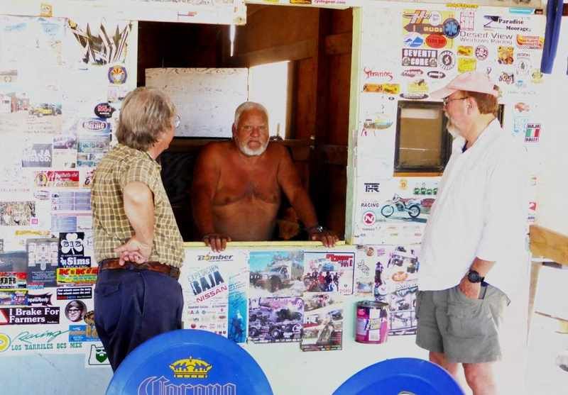
Bocana. The rancher was home so we offered him some lunch and we had a fine meal together under the only tree nearby. He told us a bit about the area
and that his family had been raising cattle in this area since his father was a boy. We talked about Tinaja Santa Maria and the trail we wanted to
explore. He wished us well and we headed on toward our trailhead, hoping to hit the correct arroyo this time.
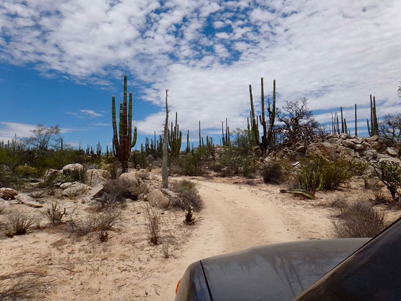
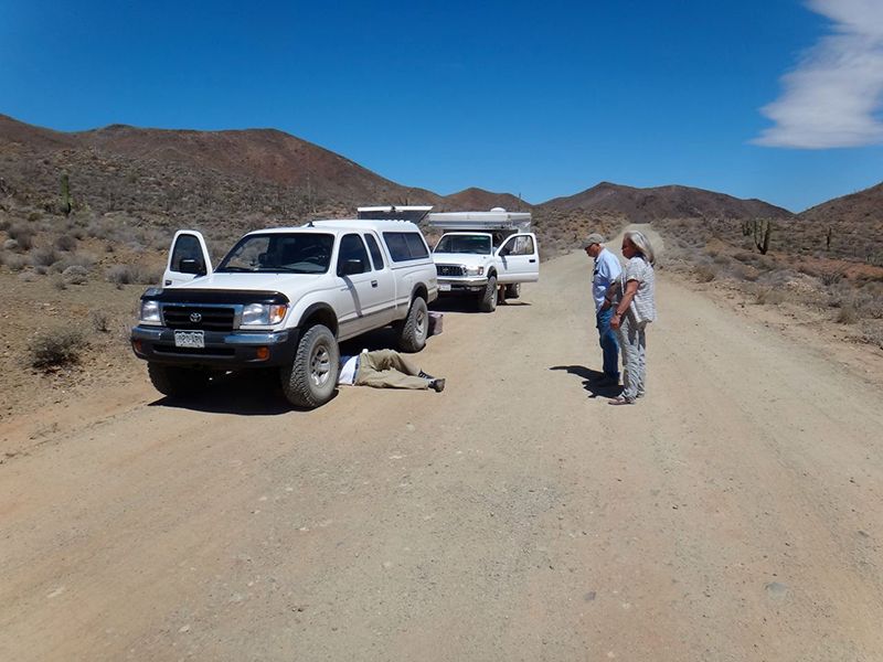
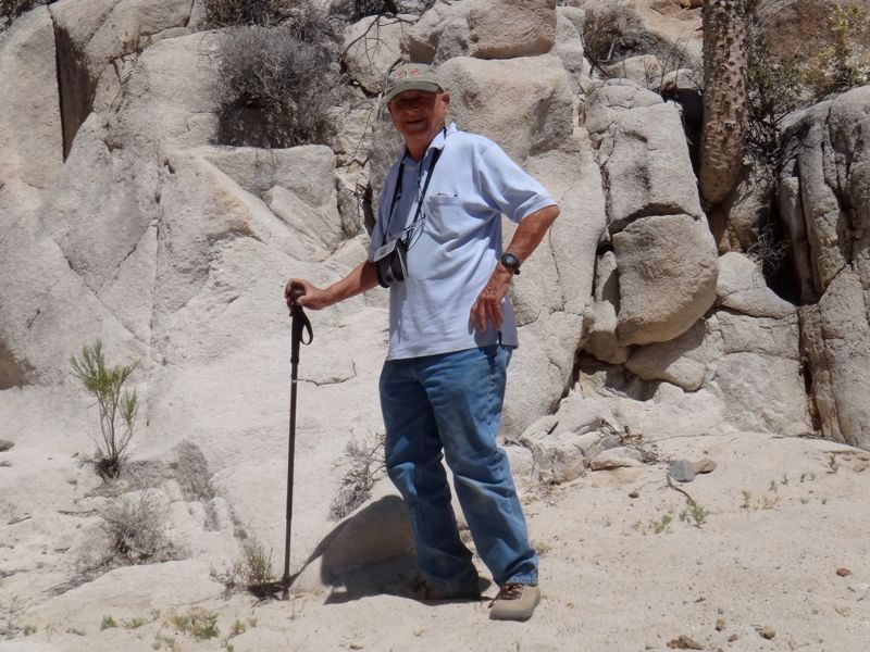
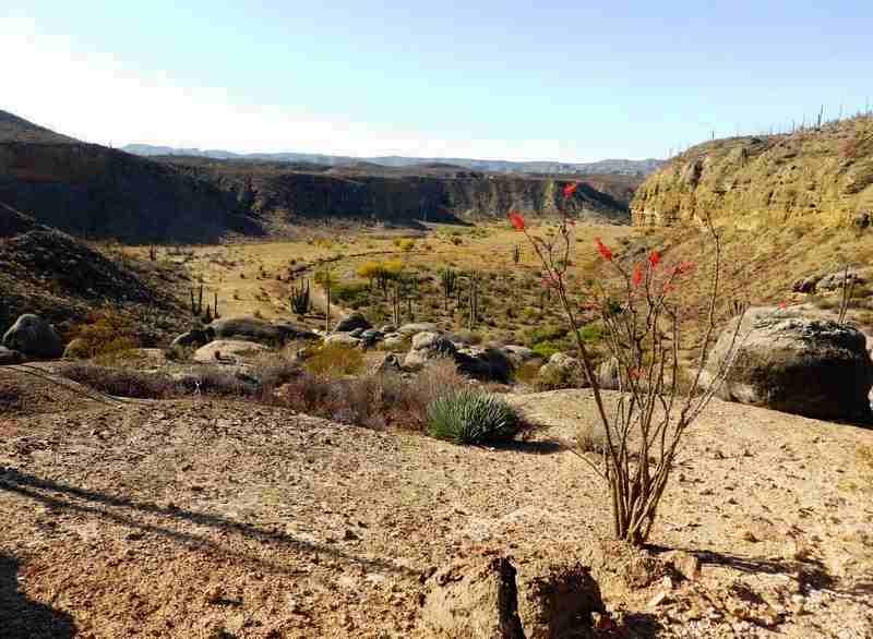
We did. The first mile was a piece of cake, firm sand, wide spaces between the cactus and few surprises. Thank you GPS and Google Earth. The going
slowed as the plants and terrain cooperated less and less. I had put my friend Stan at the wheel and he asked me Are you sure you want to do this?
more than once. I assured him I did and we carried on with Neal and Marian in the lead in their Tacoma followed by Ivan and Janet in their Tacoma and
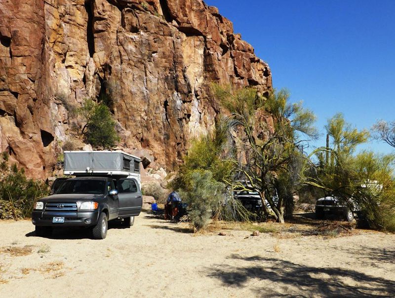
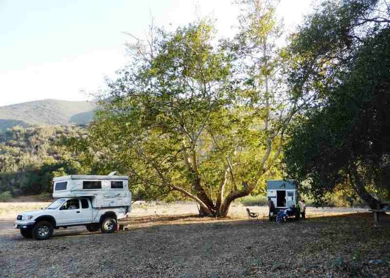
us bringing up the rear in my Tundra. We had a sizeable bit of new desert pinstriping but we did make it to our trailhead at which point it was time
for the customary safe arrival beer. Neal scouted out the Camino Real trailhead and it turned out to actually be about 25 feet from the drivers door
of my truck.
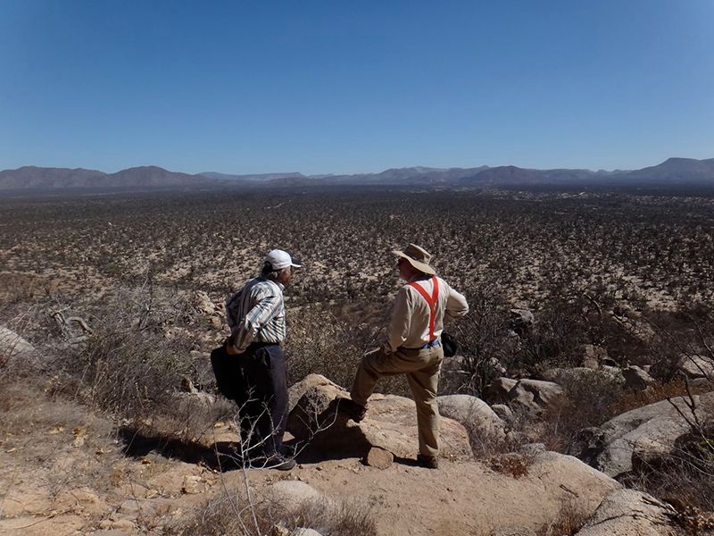
Ever eager, Neal convinced Marian, Ivan and Janet to hit the trail at 5:30am! Stan and I declined, quietly agreeing that if we had wanted to get up
before dawn to hike we would have joined the army. The hikers took off the next morning, time passed and about the time we expected to see them back I
hiked up to where the trail went over the ridge to see if there were any survivors. Janet turned up first, then Marian and finally the stragglers,
Ivan and Neal, looking more than slightly worn. Turns out the route they originally wanted to take back to camp was too overgrown and they came back
up the way they walked down. The 100 foot altitude gain spoken about had increased in a mighty way somehow.
Once everybody had a breather we made our way back down the arroyo, joined the east-west trail back toward San Francisquito and headed there for
lunch. The once unpopulated hurricane hole known by every boater that was ever in that area has been turned into an official looking marina with
cyclone fence and guard gate. The old place at the foot of the runway now has more buildings everywhere, a couple newish dirt roads and crazy prices
for lunch. A couple of us opted to eat out of our coolers and the rich folk had fish tacos for $12 per person. Too rich for my frugal blood. A
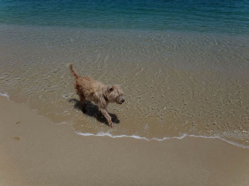
peanutbutter sandwich and a Negro Modelo would do me just fine. Squink Dog enjoyed a good shoreline romp.
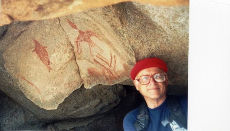
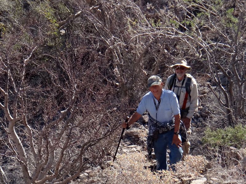
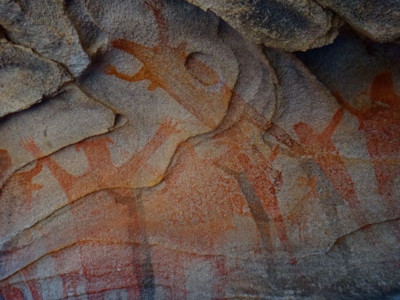
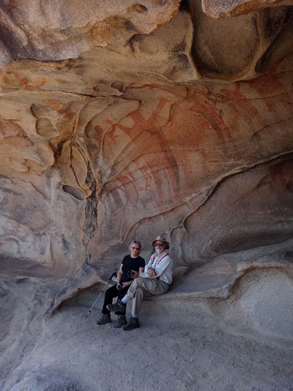
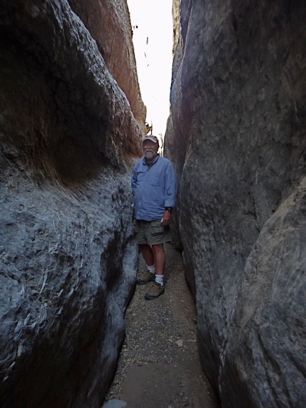
Onward to Mesa el Carmen. Easy drive, we arrived in time for coctail hour, and with enough sunlight to make an educated guess at our trail for the
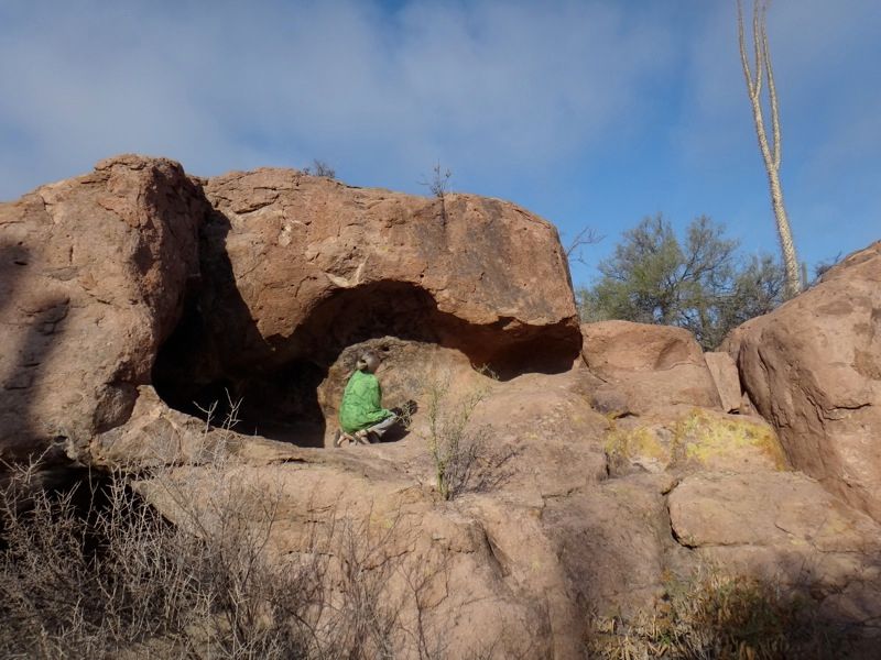
next day. Ivan had spotted the correct route and we put the plan into action in the morning. The hike up to the shallow cave turned out to be easy,
and what a reward. The wall paintings (pictographs) were outstanding, in the Grand Mural style of the paintings in the canyons below San Fernando de
la Sierra. Many photos were taken and there was some exploration of nearby shelter caves. A very, very worthwhile hike.
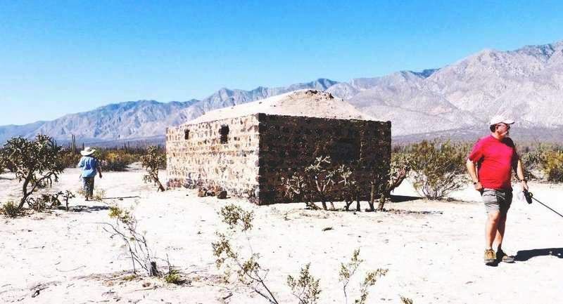
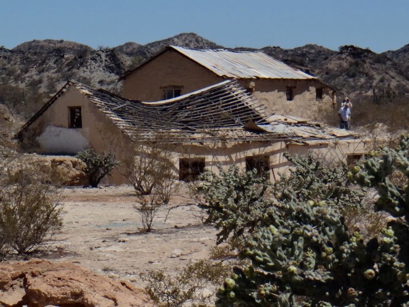
We headed toward El Arco with a brief stop at Pozo Aleman (abandoned) to take a look around. In its day it must have been quite a place. Looks a bit
rough these days except for the cemetery which is well tended.
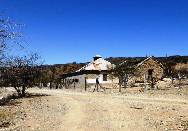
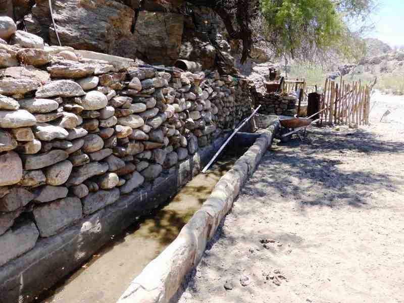
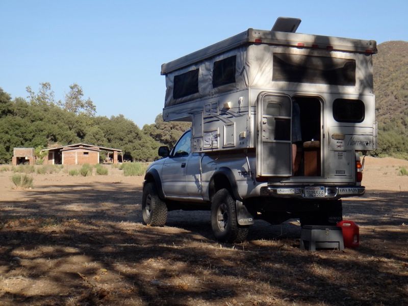
On toward Rancho Miraflores and Mision Santa Gertrudis. For Neal and Marian this was a return engagement but for the rest of us it was a spot we had
managed to miss over the years. The mission site is a beautiful spot with a small spring and a couple of ranch buildings. The caretaker opened up the
restored mission for us and gave us a bit of the history. We were glad to have taken the time to get there and took a lunch break in the shade.
Ready for a hot meal, the entourage headed for Guerrero Negro, but not before getting briefly lost in the maze of roads at El Arco. Some day Ill be
able to find the road I want on the first try but it hasnt happened yet. Dinner at the Malarrimo restaurant and hot showers in the morning.
OK, northbound now. North to Ejido Nuevo Rosarito then northeast to Mision San Borja. The compound is looking good and Jose and family are prospering.
Son Genaro and his mom graciously escorted us all over the mission and the grounds. Most of us had been there over the years but there are always
things to see and new questions to ask. Genaro has become a very knowledgeable archeologist, splitting time in his Mexicali office teaching and
exploring the Baja penninsula. A really good guy with a wealth of information and an exceptional spirit. You could sense how proud of him his parents
were even though they didnt say so out loud.
We visited until the mid-afternoon and said our goodbyes, heading out on the north road to overnight at Montevideo. The evening was beautiful with a
fine campfire. Sunrise arrived with some high fog to the north, giving everything a completely new look. We explored, took photos and eventually
headed back to LA Bay for a bit of Pemex.
The crew was now really headed home. Ivan and Janet took the El Desengaño cutoff for some solitary exploration before heading back to Colorado. The
rest of us head up the pavement then over to Las Pintas to camp overnight. Things were parched at Las Pintas and the petroglyphs are starting to be
outnumbered by the gringoglyphs. We aimed northish again in the morning, stopping in San Quintin for a small feast then up the highway to swing by
Agua Dulce, which turns out to be fenced in now with unfriendly signs, another Camino Real / Baja landmark passing into history.
Wanting to stop for the day within easy striking distance of the border, at Santo Tomas we turned toward La Bocana and looked for the old campground
David K had mentioned at some point. We found it, abandoned, and pulled up some camp chairs and enjoyed the evening. Just about dark a thrashed pickup
with two very inebriated men in it pulled up and the driver explained that this was his property and we needed to pay him $20 to stay there overnight.
I did, and somehow when Neal talked to him it turned into $24. Oh well. We thanked him for his hospitality and he and friend made their way back where
ever they called home. No idea if either one of them was actually the land owner but the situation did not look good for additional questions and
answers. Dog agreed.
Back to the border zone. Lunch at Mustafas in Valle de Guadelupe, head to the border, wait in line, spend some time in secondary. The usual. The
agent in secondary was super pleasant and without any hint of attitude, which we really appreciated.
A great trip was had by all. Good people, met new friends, visited with old ones, ate good food, few things broke, saw some new places, only got a
little lost. An excellent Baja run. Just makes me want to get back again quickly.
Jay
Edited 7/8: Added Neal's photos. No idea how the bold text ended up bold. Hmmm.
[Edited on 7-8-2014 by TacoFeliz]
|
|
|
Neal Johns
Super Nomad
Posts: 1687
Registered: 10-31-2002
Location: Lytle Creek, CA
Member Is Offline
Mood: In love!
|
|
Baja Bucket List
Friend and follow Desert Explorer Jay (Taco Feliz on the Baja Nomad board) offered to lead a laid back trip to Baja with the main goal being a mile
hike over a pristine section of the El Camino Real (a centuries old mule/foot trail connecting the Missions) about 370 miles below the border. Since I
had wanted to do this hike for some time, I jumped at the offer. Our crew consisted of three vehicles (two Tacomas and a Tundra) and six people (Jay
and his friend, Stan, Marian and me, and Ivan and Janet new DesertExplorer.org members from Colorado).
We all crossed the border separately and met at Papa Fernandezs camp on Gonzaga Bay on the east coast of Baja. The weather was perfect the whole
eight day trip. The next day we headed south and took the old, pre-pavement road to the abandoned mining town of Desengano and turned north to visit
the famous Tinaja (natural waterhole) Yubay on the El Camino Real. Well, at least I did; our Fearful Leader Jay and Ivan (who claimed this was his
favorite road) missed the turn. Current wife Marian, soon to be replaced if she does not change her ways, said over the radio Why can Neal remember
every rock and turn in Baja but cant find his way to the grocery store at home? Despite a several year drought in Baja, there was water in the
Tinaja and a large bird flew away as we approached. Back in the day, I told people it was a short, 20 minute walk to the Tinaja, but now I am ashamed
to mention the time it takes me to stumble and weave over the rock-filled dry streambed. Nevertheless, it is always a pleasant hike. Ivan and I were
the only ones that completed the walk which included visiting nearby rock art and bedrock metate grinding sites. We were gone for quite a while and
the waiting wimps were getting nervous about us being in trouble.
The next day we continued south to Bahia de Los Angeles where, after applying Rule One in Baja (gassing up any chance you get), we took a bad road
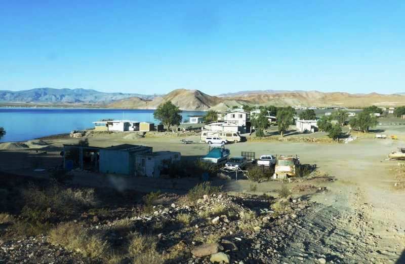
north along the coast to La Gringa (named thus because a deceased American ladys body was found there decades ago according to local folklore). Our
Fearful Leader, Jay, was not impressed with the camping spot there so we went back to camp at a more civilized palapa at Daggetts Camp on a nice sand
beach, named after an early explorer and miner of the area.
Dawn broke and we headed south toward Tinaja Santa Maria, stopping to visit the only remaining building in Los Flores, the jail. Thanks to David K for
us finding Tinaja Santa Maria on a previous trip searching for Earl Stanly Gardners photo of a rock alignment. Los Flores is the abandoned village at
the bottom of the abandoned San Juan Mine tramway. We later visited the abandoned rancho of San Pedro and the occupied rancho of La Bocana after
turning off the main road south from Bahia. La Bocana is misnamed on the Baja Almanac maps as San Pedro. We fed lunch to the vaquero/owner at La
Bocana while Jay translated his stories. His father had ranched there before him and his brother lived in the house we passed on the way down the
valley. Continuing eastward a few miles, we headed south down several interconnecting sand washes to where the El Camino Real went north over a 150
foot saddle near Tinaja Santa Maria and camped.
At 5:30 a.m. the next morning, Marian, Ivan, Janet and I started north on the El Camino Real hike. It had previously been located on Google Earth and
it was amazing to see the 150+ pound stones that were moved to one side to make the trail. Cattle and an occasional vaquero are the only users now.
The 150 foot accent was easy while we were fresh but we had decided to retrace our steps back to the vehicles and the return accent was 300 feet.
Guess who was the last straggler back up the hill? The shame, the shame, even my ancient wife beat me up the hill.
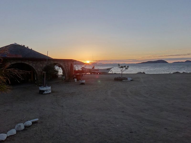
After a Mountain Dew, we headed south for a pictograph cave a few tens of miles south, stopping at San Francisquito Bay for a too expensive lunch. The
place was run down and we were the only gringos there. Proceeding to the site of the pictograph cave, we arrived just in time to camp. The next
morning we hiked up to the cave and were treated to several paintings of Grand Mural Style art. Then onward to Mission Santa Gertrudes where we
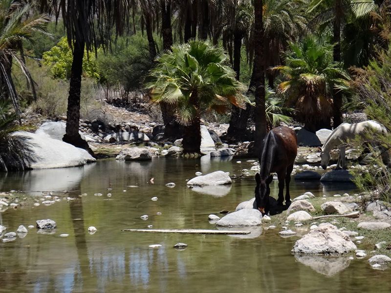
watched two horses browsing on short, sparse, grass on the edge of verdant pools. A hungry cat attached itself to our group and got fed for its
troubles. Purr, purr.
After checking out the Mission, we got lost in El Arco, regrouped and went to Guererro Negro for dinner at old faithful Malarrimo Motel where we
camped and showered. In Guererro Negro we went to several auto parts stores looking for metric bolts to repair Ivans sway bar bracket which had
parted company with the frame on one side. Finally, we were directed to the Caterpillar store where the bolts were supplied by helpful employees.
Bring your own metric bolts to Baja.
On the way to Mission San Borja we took the southeast route from Rosarito which was passable by cars but rather bumpy. Old acquaintance, Jose, and I
had a limited conversation (due to my 200 words of Spanish) while most of the crew was given a long tour of the Mission by his wife and son. Most of
his kids have flown the coop and live in town.
The next stop was the well-known pictograph site at Montevideo. Marian lost her head and took 70 pictures! After that, we camped by the cliffs and
were entertained by bird songs.
After driving out the north road, we back-tracked to Bahia de Los Angeles and gassed up before heading north toward home. Ivan left us to return on
Highway 5 via Mission Calamajue.
We took a not-so-short detour to the petroglyph site at Las Pintas south of El Rosario and found the farms on the way abandoned, probably due to the
drought since it was dry land farming. The spring above Las Pintas rocks was barely wet and no water was at the bottom. What there were at the bottom
were huge boulders imbedded with of thousands of fossil shells. There was a small spring where you enter the small valley and a pipe led to a pila
(above ground cistern) on the far side of the valley. No crops were growing. No tire tracks were evident. Baja tourism is way down due to the drug
violence in mainland Mexico although Baja is very rarely affected. It is a great spot to camp and we did.
Next, on the way north on Hwy.1, we had lunch at one of the best restaurants in Baja, Restaurant Mision Isabel. It has both locals and gringos
eating there, always a good sign. Wanting to be near the border for a Tuesday crossing at Tecate, we camped near Santo Tomas at a campground that Jay
had found on the internet and Google Earth. When we got there it turned out to have been dead for several years but was a beautiful place with empty
buildings, a dry little creek and many trees. And it was free! However at dusk, when it was too late to move, an apparently somewhat inebriated
gentleman showed up in a beat-up truck and said $24 dollars please for camping on my land. Sigh. There aint no such thing as a free lunch.
In the morning, we took Hwy. 3 from Ensenada to Tecate and had brunch at another favorite eatery: Mustafas. After several years absence, Mustafas
hot daughter was back helping dad. I hardly noticed her and I have the bruises to prove it, just ask Marian. Soon Tecate appeared and we got in line
for the border crossing. It took about 50 minutes which is somewhat more than average. Jay was sent to Secondary for further inspection and we have
not seen him since. Oh well, easy come, easy go. We are home in Lytle Creek! Another great trip was completed with no major problems of any kind.
[Edited on 7-8-2014 by Neal Johns]
My motto:
Never let a Dragon pass by without pulling its tail!
|
|
|
captkw
Ultra Nomad
Posts: 3850
Registered: 10-19-2010
Location: el charro b.c.s.
Member Is Offline
Mood: new dog/missing the old 1
|
|
baja
You Gringos are funny !!!
|
|
|
shari
Select Nomad
Posts: 13033
Registered: 3-10-2006
Location: bahia asuncion, baja sur
Member Is Offline
Mood: there is no reality except the one contained within us "Herman Hesse"
|
|
Wow wow Wow...that certainly was a most excellent baja adventure. I loved your photos and commentary. Perfect doggie name and very nice how the
fellows glasses matched the cave paintings! One of the best trip reports ever...gracias.
|
|
|
El Jefe
Super Nomad
Posts: 1027
Registered: 10-27-2003
Location: South East Cape
Member Is Offline
|
|
Excellent report. Very nicely done. Thank You!
No b-tchin\' in the Baja.
|
|
|
chuckie
Elite Nomad
Posts: 6082
Registered: 2-20-2012
Location: Kansas Prairies
Member Is Offline
Mood: Weary
|
|
Simply grand!
|
|
|
Mexitron
Ultra Nomad
Posts: 3397
Registered: 9-21-2003
Location: Fort Worth, Texas
Member Is Offline
Mood: Happy!
|
|
Wow, what a trip! Thanks for posting.
|
|
|
Skipjack Joe
Elite Nomad
Posts: 8084
Registered: 7-12-2004
Location: Bahia Asuncion
Member Is Offline
|
|
Great report. Thank you for sharing. Wish I was there (in some ways I was).
|
|
|
David K
Honored Nomad
Posts: 64491
Registered: 8-30-2002
Location: San Diego County
Member Is Offline
Mood: Have Baja Fever
|
|
Thank you Jay and Neal for a most historic and colorful trip report!!!
Did you go to the tinaja (Santa MarÃa) or just the bottom of the Camino Real grade east of it? Been there twice (first time Neal was with us in 2001)
and both times it was dry on the surface... You can see where the coyotes dig down into the sand/gravel at the base of the granite boulder to get a
drink (often known as a 'coyote well').
The photos at El Carmen are so beautiful with the morning sun! We were there in the afternoon, and not nearly as dramatic.
At Las Pintas, the few modern graffiti additions I saw in 2010 were all Spanish-language. I sure hope there wasn't any 'gringo' markings, as we are
the guests in their country!
The picnic area/ campground west of Santo Tomas is the site of the first mission of Santo Tomas. It was there from 1791 to 1794 when the mosquitoes
and mountain shade forced a move a mile east on the north side of the valley... and then it moved again in 1799 to where the town is today. The only
remains is a low bit of a wall in that field south of where you camped...
Thanks again to both of you for the dual report... If there are more photos, please post!
[Edited on 12-28-2019 by David K]
|
|
|
Whale-ista
Super Nomad
Posts: 2009
Registered: 2-18-2013
Location: San Diego
Member Is Offline
Mood: Sunny with chance of whales
|
|
Wonderful report of an amazing adventure. Thank you for sharing.
\"Probably the airplanes will bring week-enders from Los Angeles before long, and the beautiful poor bedraggled old town will bloom with a
Floridian ugliness.\" (John Steinbeck, 1940, discussing the future of La Paz, BCS, Mexico)
|
|
|
BornFisher
Super Nomad
Posts: 2103
Registered: 1-11-2005
Location: K-38 Santa Martha/Encinitas
Member Is Offline
|
|
You guys are great!! A most "excelente aventura" for sure!!!
Thanks so much for the reports and pics. Huge respect to all involved!!
|
|
|
TMW
Select Nomad
Posts: 10659
Registered: 9-1-2003
Location: Bakersfield, CA
Member Is Offline
|
|
Excellent report and beautiful pictures, thanks to you both.
|
|
|
BajaBlanca
Select Nomad
Posts: 13165
Registered: 10-28-2008
Location: La Bocana, BCS
Member Is Offline
|
|
What an adventure!
|
|
|
Kgryfon
Senior Nomad
Posts: 624
Registered: 1-27-2009
Location: East Bay, CA
Member Is Offline
|
|
Very nice - thanks for the great trip report!
|
|
|
Pappy Jon
Nomad
Posts: 494
Registered: 8-27-2003
Location: Wrong side of the Continental divide.
Member Is Offline
Mood: Temp rising.
|
|
The only thing I don't like about trip reports is finding new places to go ... with time I don't have.
[Edited on 7-9-2014 by Pappy Jon]
"The association of flowers and warm-blooded love is more than a romantic convention; it is based upon one of the great advances in the evolution
of life." Ed Abbey
|
|
|
TacoFeliz
Nomad
Posts: 265
Registered: 7-22-2005
Location: Here
Member Is Offline
Mood: Exploratory
|
|
Thanks to all for the very kind words! Glad we could share the trip a little.
DK - We did not go to the tinaja up Arroyo Santa Maria this time, as Neal, Marian and I had been to it and seen the coyote wells before. The hikers in
our group were somewhat wiped out after their early morning slog. Thanks also for pointing out the mission remains at Santo Tomas. I'll have a closer
look next time I'm in the area. The campground looked like it was pretty nice back when it was in its prime. Still, a really nice spot for an
overnight or a picnic.
|
|
|
JohnK
Junior Nomad
Posts: 69
Registered: 3-11-2012
Member Is Offline
|
|
Wonderful trip report. Thanks. So La Gringa at Bay of LA isn't an attractive camping spot anymore? When I was there a couple of years ago there were
no facilities beyond a couple of outhouses, but the location was wonderful.
|
|
|
Ateo
Elite Nomad
Posts: 5847
Registered: 7-18-2011
Member Is Offline
|
|
Excelente. Beautiful report. Great photos. Thanks for taking us along!
|
|
|
Sublimity
Junior Nomad
Posts: 27
Registered: 10-21-2010
Member Is Offline
|
|
TacoFeliz,
Great trip report...thanks for sharing! Looks/Sounds like you and Neal had a great trip, but more importantly Squinky looks happy to be back in Baja!
|
|
|
TacoFeliz
Nomad
Posts: 265
Registered: 7-22-2005
Location: Here
Member Is Offline
Mood: Exploratory
|
|
| Quote: | Originally posted by Sublimity
TacoFeliz,
Great trip report...thanks for sharing! Looks/Sounds like you and Neal had a great trip, but more importantly Squinky looks happy to be back in Baja!
|
Hey Brian - glad you enjoyed it. Next time come with us!
|
|
|
| Pages:
1
2 |