| Pages:
1
2 |
ed26
Newbie
Posts: 16
Registered: 10-14-2014
Member Is Offline
|
|
Agua Verde Road Conditions
Has anyone heard of the current road conditions out to Agua Verde after the storms?
|
|
|
StuckSucks
Super Nomad

Posts: 2306
Registered: 10-17-2013
Member Is Offline
|
|
I'd like to know as well. But worse-case, I'll be there in three weeks to find out myself. Given recent hurricane events, I'd guess it might be
slightly abused.
|
|
|
David K
Honored Nomad
Posts: 64486
Registered: 8-30-2002
Location: San Diego County
Member Is Offline
Mood: Have Baja Fever
|
|
There is the other way in, from the west... but it is more likely to take longer to reopen if it was washed out. The north road in should be fixed
quickly since that village (or pair of villages) will need it opened.
|
|
|
Kencito
Junior Nomad
Posts: 38
Registered: 12-2-2006
Member Is Offline
|
|
The AV road off the main highway is open all the way to Agua Verde, according to friends who live at Rancho San Cosme. The road was out for a couple
of days after the rain near AV but locals repaired it enough that it is now passable.
|
|
|
Ribbonslinger
Nomad
Posts: 131
Registered: 12-15-2013
Member Is Offline
|
|
We drove that road last year with a large truck and camper. Lots of blind corners and very narrow. I would recommend waiting at a wide spot and have
your partner walk ahead around the corner to see if anyone is coming. It would be a dangerous road to have to back up with a trailer or camper given
the narrow road width and reduced visibility. If you do that it is all good.
|
|
|
TMW
Select Nomad
Posts: 10659
Registered: 9-1-2003
Location: Bakersfield, CA
Member Is Offline
|
|
How far is the pavement from hwy 1?
|
|
|
StuckSucks
Super Nomad
Posts: 2306
Registered: 10-17-2013
Member Is Offline
|
|
| Quote: | Originally posted by TW
How far is the pavement from hwy 1? |
Pavement on the AV road? Please 'splain.
|
|
|
motoged
Elite Nomad
Posts: 6481
Registered: 7-31-2006
Location: Kamloops, BC
Member Is Offline
Mood: Gettin' Better
|
|
Last year I rode to Agua Verde from the highway....the pavement went as far as the last ranchos' before the cliffside road area...there were some
paved sections that had detours around them, and the pavement looked like it was the "first layer" more than a good finished paved surface (maybe a
"class b" paved surface is the plan???).
It was easy to see how heavy rains could create some erosion problems.
Don't believe everything you think....
|
|
|
bajabuddha
Banned
Posts: 4024
Registered: 4-12-2013
Location: Baja New Mexico
Member Is Offline
Mood: Always cranky unless medicated
|
|
Jimena took the road OUT. Took 'em a while to make it passable, and when they did, there were some real narrow spots. We did it that year. I'd done
it before too, and on a good day and a good road it still has a sphincter factor of at least 3.5 on the 1-to-5 scale. The last time up after Jimena
was a +4... and will probably be the last time up. I finally became just too damned MORTAL. And to think I used to jump out of perfectly good
airplanes.... my poor Better Half rode almost the entire stretch staring at the floor or the insides of her eyelids. Worth every minute when you get
to the old mission. First time there the caretaker/guide showed us the old purple robes the original Fathers wore and gave us the full nickel (5
centavo?) tour.
For first-timers, don't try hauling any type of rig up there. It's a day-trip or 4x4 back-country destination. A truck with a big camper will have
moments of HO-SHHHIII..'s at some of the grades and turns. And like all of Baja, worth the experience, even if it is just once.
And take a parachute; the Gigantes are aptly named.
I don't have a BUCKET LIST, but I do have a F***- IT LIST a mile long!
86 - 45*
|
|
|
Ribbonslinger
Nomad
Posts: 131
Registered: 12-15-2013
Member Is Offline
|
|
Pucker factor significantly decreases if don't meet any traffic coming the other way. It is like driving a logging road but you don,t have a radio.
Wait at the widespot and get someone to walk ahead to check for traffic
|
|
|
bajabuddha
Banned
Posts: 4024
Registered: 4-12-2013
Location: Baja New Mexico
Member Is Offline
Mood: Always cranky unless medicated
|
|
^ ^ ^ ........and that's a WIDE spot !! 
I don't have a BUCKET LIST, but I do have a F***- IT LIST a mile long!
86 - 45*
|
|
|
Ribbonslinger
Nomad
Posts: 131
Registered: 12-15-2013
Member Is Offline
|
|
No guts, no glory.
|
|
|
Ribbonslinger
Nomad
Posts: 131
Registered: 12-15-2013
Member Is Offline
|
|
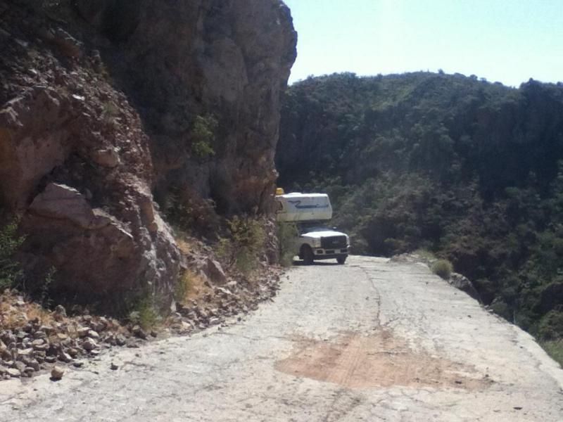
The picture shows one of the tight corners you will hit if you drive that road. Having to back up there would not be fun. I waited 100m back from
there until my wife had given me the OK to go ahead. Any BC boy use to driving logging roads will have not problems.
|
|
|
ed26
Newbie
Posts: 16
Registered: 10-14-2014
Member Is Offline
|
|
Thanks everyone for the chime in. We're going down in a squared away F250, towing zilch, so seems like we should be able to limp through.
"StuckSucks" post again if you do head down, seem like we'll be going in soon there after.
|
|
|
motoged
Elite Nomad
Posts: 6481
Registered: 7-31-2006
Location: Kamloops, BC
Member Is Offline
Mood: Gettin' Better
|
|
The road is easy....slow down for blind corners in eastern half of road....or stay at Starbucks and think it is a dangerous road...no big deal
folks
Don't believe everything you think....
|
|
|
Ribbonslinger
Nomad
Posts: 131
Registered: 12-15-2013
Member Is Offline
|
|
Nice. You the man Motoged.
|
|
|
bajabuddha
Banned
Posts: 4024
Registered: 4-12-2013
Location: Baja New Mexico
Member Is Offline
Mood: Always cranky unless medicated
|
|
I have to apologize; I wrote my post before my 5 pm martini, so it was in a fit of sobriety that I was thinking of the San Javier Mission road, sowwy.
I don't have a BUCKET LIST, but I do have a F***- IT LIST a mile long!
86 - 45*
|
|
|
chuckie
Elite Nomad
Posts: 6082
Registered: 2-20-2012
Location: Kansas Prairies
Member Is Offline
Mood: Weary
|
|
I kinda wondered.....
|
|
|
StuckSucks
Super Nomad
Posts: 2306
Registered: 10-17-2013
Member Is Offline
|
|
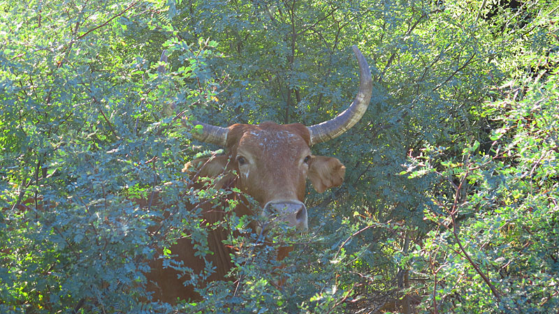
Overall, the road is a non-event: a little bumpy rocky after the pavement ends, but no big deal. I'm happy to have checked out the bay, but that said,
I'm not sure I need to go back. This was the end part of our 36-hour Baja 1000 race day, so that might have helped to curb our enthusiasm.
The paved road creates a little dam to drive across:
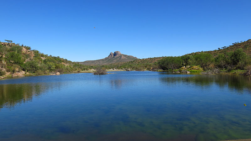
The view from the summit, looking south:
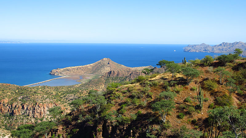
The road to Agua Verde runs along standing water from recent rains:
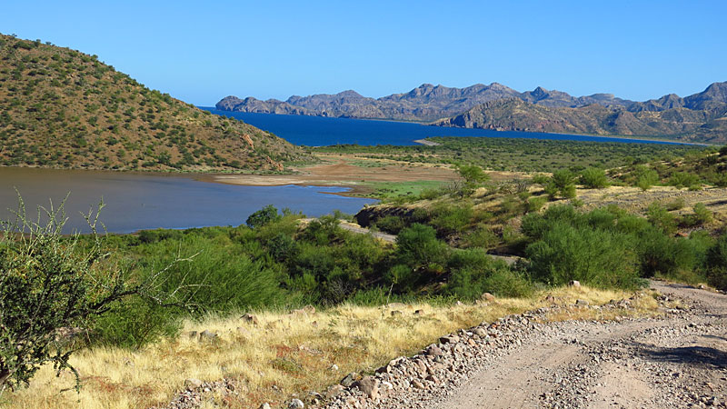
Looking north along the coast:
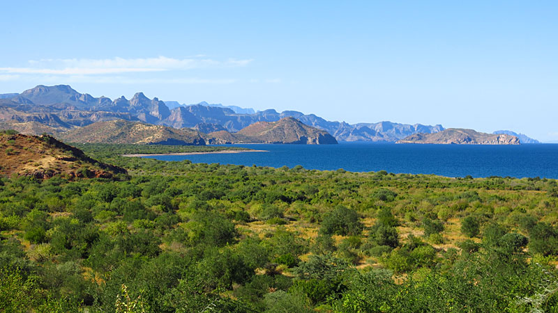
The beach at Agua Verde:
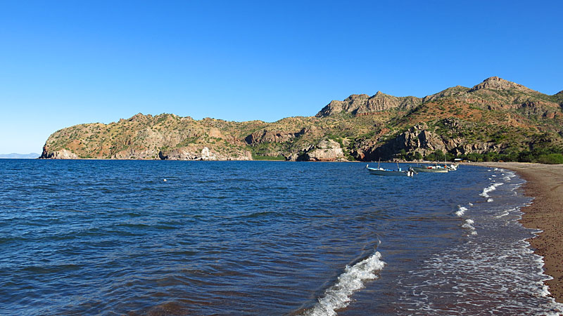
Agua Verde local:
|
|
|
StuckSucks
Super Nomad
Posts: 2306
Registered: 10-17-2013
Member Is Offline
|
|
Here's a photo sphere taken after cresting the summit:
https://www.google.com/maps/views/u/0/view/11596559755849069...
And a photo sphere on Bahia Agua Verde:
https://www.google.com/maps/views/u/0/view/11596559755849069...
Photo sphere: think Google Street View. Click and grab the photo sphere and look up, down, around. Go nuts and zoom in and out.
|
|
|
| Pages:
1
2 |


