tyguypb
Junior Nomad

Posts: 64
Registered: 11-14-2013
Member Is Offline
|
|
Hikes near La Paz/cabo/BOLA
So I just hiked tabor canyon just west of puerto Escondido. Now I am in La Paz and possibly cabo pulmo tomorrow. I hear there is some excellent hiking
down here, does anyone have any names of hikes/places to check out?
I have also heard stories of a hike in BOLA. It was a while back but a girl told me of a hike up to a "hermit dwelling" or some strange fable like
that does anyone have any info to corroborate such a legend?
David K, in your knowledge I trust
|
|
|
24baja
Senior Nomad
Posts: 951
Registered: 2-3-2009
Location: Grants Pass Oregon/Bahia de Los Angeles
Member Is Offline
Mood: Wishing we were in BOLA
|
|
Quote: Originally posted by tyguypb  | So I just hiked tabor canyon just west of puerto Escondido. Now I am in La Paz and possibly cabo pulmo tomorrow. I hear there is some excellent hiking
down here, does anyone have any names of hikes/places to check out?
I have also heard stories of a hike in BOLA. It was a while back but a girl told me of a hike up to a "hermit dwelling" or some strange fable like
that does anyone have any info to corroborate such a legend?
David K, in your knowledge I trust |
Mikes mountain is the tall mountain behind town, Mike would hike up and sleep in a cave up there. He has since passed on but you can still visit the
cave. If you search Nomads for a thread about Mikes Mountain you should find info. You can check with Carolina or George at the Museum in BOLA for
information also. Happy hiking!
|
|
|
woody with a view
PITA Nomad
Posts: 15937
Registered: 11-8-2004
Location: Looking at the Coronado Islands
Member Is Offline
Mood: Everchangin'
|
|
yeah, the route is obvious when you stand at the edge of the sea and look up. plan on a day up and the next day down!
|
|
|
David K
Honored Nomad
Posts: 64479
Registered: 8-30-2002
Location: San Diego County
Member Is Offline
Mood: Have Baja Fever
|
|
Good morning! Mike's Mountain is indeed the hike.
Lot's of photos of the hike and Mike's cave on top in this thread from 2009: http://forums.bajanomad.com/viewthread.php?tid=38400
More photos on Mike's Mountain, 2012 thread: http://forums.bajanomad.com/viewthread.php?tid=58661
|
|
|
thebajarunner
Ultra Nomad
Posts: 3687
Registered: 9-8-2003
Location: Arizona....."Free at last from crumbling Cali
Member Is Offline
Mood: muy amable
|
|
DK
how about steering him to the pools up in the Yubay area north of the LABay highway.
We used your coordinates some years back and hiked in there,
not a long hike but a real interesting change of pace for that region
|
|
|
David K
Honored Nomad
Posts: 64479
Registered: 8-30-2002
Location: San Diego County
Member Is Offline
Mood: Have Baja Fever
|
|
| Quote: Originally posted by thebajarunner | DK
how about steering him to the pools up in the Yubay area north of the LABay highway.
We used your coordinates some years back and hiked in there,
not a long hike but a real interesting change of pace for that region |
Sure thing, here are some links from posts on Tinaja de Yubay the important water hole just off the Camino Real between San Borja and Calamajue:
http://forums.bajanomad.com/viewthread.php?tid=71925 (Jan 2014)
http://forums.bajanomad.com/viewthread.php?tid=71709 (Jan 2014)
http://forums.bajanomad.com/viewthread.php?tid=69725 (Oct 2013)
http://forums.bajanomad.com/viewthread.php?tid=67747 (Jun 2013)
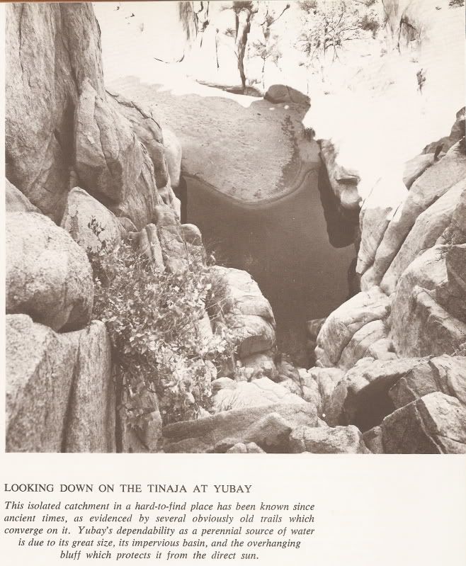
Harry Crosby photo from about 1967, looking down from high above on the rocks. Note fig tree on the right.
From my VivaBaja.com web site GPS page:
GPS DIRECTIONS TO YUBAY (WGS 84)
JCN. hwy.1 & L.A. Bay hwy. N29 02.76' W114 09.17' 0.0 mi.
TURN NORTH onto dirt road N29 04.31' W114 02.41' 7.0 mi. (approx Km. 11-12)
FORK right (left is Desengano, 0.3 mi.) N29 06.84' W114 01.65' 10.0 mi.
JCN. go right (ahead to rock palm hill, 4.2 mi.) N29 09.17' W114 01.40' 12.8 mi.
RIDGE TOP, 4WD only beyond N29 10.19' W113 59.77' 14.8 mi.
END OF ROAD in arroyo/TRAIL is straight across N29 10.29' W113 59.65' 14.9 mi.
TINAJA DE YUBAY N29 10.69' W113 59.26' 15.5 mi.
note: mileages are direct, not road miles.
(degree symbols removed in order to post here)
|
|
|
24baja
Senior Nomad
Posts: 951
Registered: 2-3-2009
Location: Grants Pass Oregon/Bahia de Los Angeles
Member Is Offline
Mood: Wishing we were in BOLA
|
|
Thanks DK we will copy them too!
|
|
|
David K
Honored Nomad
Posts: 64479
Registered: 8-30-2002
Location: San Diego County
Member Is Offline
Mood: Have Baja Fever
|
|
Of course, Baja is why we are here on Nomad, for the love of Baja or for loving Baja, either in Baja or when we can't be in Baja!
I have been in the Yubay area several times, but only hiked to the pool once, in the summer, with other Nomads (Amigos de Baja back then, 2001)... It
was me, my kids Christopher and Sarah, Mike Humfreville, El Camote (with video camera recording it), Desert Rat, and Miguelito... oh and Debra aka
Travelpearl... she almost made it!
From VivaBaja.com, 2001 Viva Baja Van Tour with Amigos:

On the trail to the historic water hole of Yubay, which is in the canyon ahead. It was very hot and dry, the (less than a) mile hike to Yubay was
undertaken by most of our group.

Tinaja de Yubay 7-2-01
Possibly the lowest level this water hole has been in some time. GPS: N29 10.69' W113 59.26' (WGS 84) elev. 2,059'. A fig tree grows from the cliff
just to my right.

At Yubay, we take a rest as El Camote videos us. But wait....where's Travelpearl???

Travelpearl's cell phone is useless in this remote desert. Perhaps the well placed Viva Baja sticker will bring assistance! Very funny Debra!

Happy to get out of Yubay alive, David K kisses a boojum

The cone shaped hill, as viewed on the return (southboud) trip from Yubay. The desert garden here is incredible!
|
|
|
24baja
Senior Nomad
Posts: 951
Registered: 2-3-2009
Location: Grants Pass Oregon/Bahia de Los Angeles
Member Is Offline
Mood: Wishing we were in BOLA
|
|
Thanks DK we will copy them too!
|
|
|
bajajudy
Elite Nomad
Posts: 6886
Registered: 10-4-2004
Location: San Jose del Cabo,BCS
Member Is Offline
|
|
Tyguy
Check your U2U
|
|
|
Elona
Junior Nomad
Posts: 71
Registered: 1-5-2015
Location: Germany
Member Is Offline
Mood: BC Addict
|
|
Beautiful Canon de la Zorra


Greetz,
Elona
|
|
|
David K
Honored Nomad
Posts: 64479
Registered: 8-30-2002
Location: San Diego County
Member Is Offline
Mood: Have Baja Fever
|
|
Excellent! Thank you Elona and welcome to Nomad! Great job with posting photos too!!
|
|
|
bajajudy
Elite Nomad
Posts: 6886
Registered: 10-4-2004
Location: San Jose del Cabo,BCS
Member Is Offline
|
|
Leona
We're these taken pre or post Odile?
|
|
|
Elona
Junior Nomad
Posts: 71
Registered: 1-5-2015
Location: Germany
Member Is Offline
Mood: BC Addict
|
|
@ David K: Many thanks 
@ bajajudy: We hiked in the Canon in March 2013 - pre Odile.
|
|
|
tyguypb
Junior Nomad
Posts: 64
Registered: 11-14-2013
Member Is Offline
|
|
hey thanks a ton for all the info, unfortunately i left Cabo Pulmo after only one night because of the awful winds and headed back up to central baja
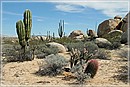
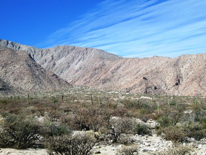
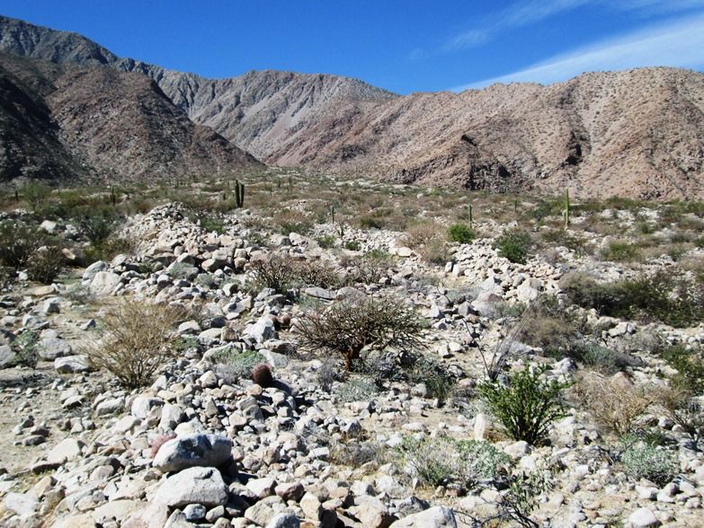
with no regrets. we ended up spending three days in the sierra de San Francisco range mule riding/hiking around checking out the paintings.
i did go to the Museum in BOLA and asked about the trail head to mikes mtn. the woman was clueless but guessed it was somewhere at the end of the
road above the museum... as it turned out i only had half a day in BOLA anyway so i couldn't do the hike. BUT! u go down there a few times a year and
now i really want to hike that mountain,
Can anyone tell me where to reach the trail head?
|
|
|
David K
Honored Nomad
Posts: 64479
Registered: 8-30-2002
Location: San Diego County
Member Is Offline
Mood: Have Baja Fever
|
|
| Quote: Originally posted by tyguypb | hey thanks a ton for all the info, unfortunately i left Cabo Pulmo after only one night because of the awful winds and headed back up to central baja
with no regrets. we ended up spending three days in the sierra de San Francisco range mule riding/hiking around checking out the paintings.
i did go to the Museum in BOLA and asked about the trail head to mikes mtn. the woman was clueless but guessed it was somewhere at the end of the
road above the museum... as it turned out i only had half a day in BOLA anyway so i couldn't do the hike. BUT! u go down there a few times a year and
now i really want to hike that mountain,
Can anyone tell me where to reach the trail head? |
It goes up from behind town, just north of the spring... and follows the ridge line from north to south, climbing up. I will try and show you on
Google Earth...
edit: I can make out the mine trail that is just west of Mike's trail and it has a few switchbacks easily seen, I am not seeing Mike's trail to show.
Perhaps Graham or another Nomad who has made the climb can help?
[Edited on 1-12-2015 by David K]
|
|
|
wilderone
Ultra Nomad
Posts: 3778
Registered: 2-9-2004
Member Is Offline
|
|
" ... we ended up spending three days in the sierra de San Francisco range mule riding/hiking around checking out the paintings"
ooooo - tell us all about this!
|
|
|
David K
Honored Nomad
Posts: 64479
Registered: 8-30-2002
Location: San Diego County
Member Is Offline
Mood: Have Baja Fever
|
|
| Quote: Originally posted by wilderone | " ... we ended up spending three days in the sierra de San Francisco range mule riding/hiking around checking out the paintings"
ooooo - tell us all about this! |
It's all posted, giant beautiful photos too: http://forums.bajanomad.com/viewthread.php?tid=77221
|
|
|
Graham
Senior Nomad
Posts: 558
Registered: 6-16-2006
Location: San Diego and DeTour, MI
Member Is Offline
|
|
The trail that Mike himself took heads up from where he had his place in that little community just north of Red Mountain and the mini rail terminus
and mine works there.... maybe just over a mile or so from the museum.
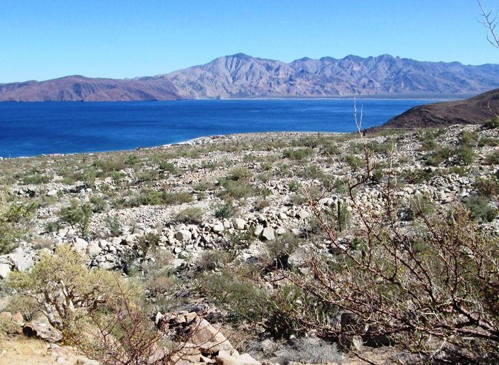
You basically head up towards an obvious long ridge leading to the summit...
I doubt if there's any trail left in the approach as you're crossing a series of debris and vegetation choked washes and tumbling boulder fields, but
if you just keep your eye on the ridge you'll eventually get there.
You're more likely to find the trail that takes you up the ridge... but the important thing is to choose a sensible route up an almost 45-degree
slope, and then when on top you just keep slogging up to the peak.
There are good views of town... even from the lower reaches...
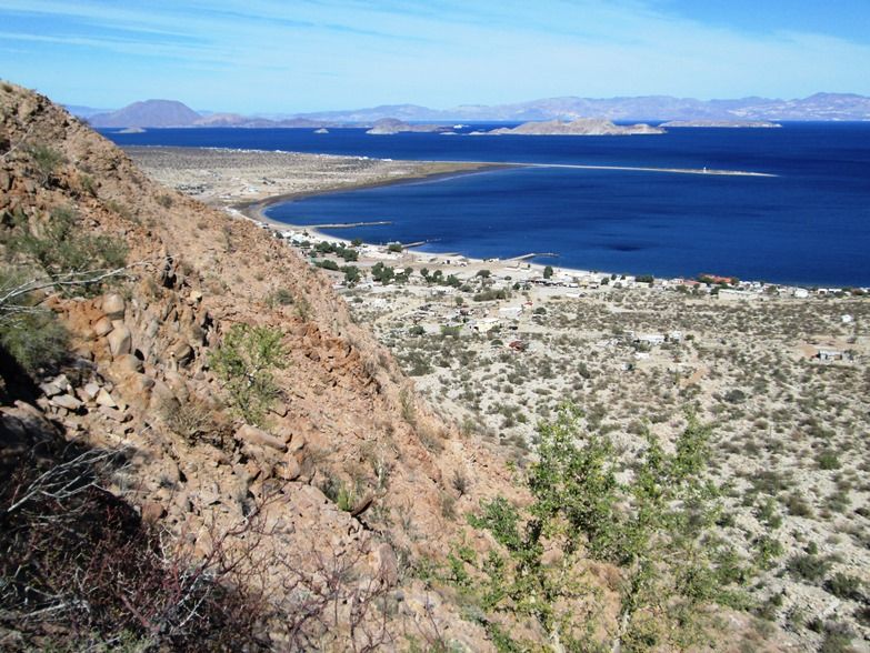
And of course you can look back down towards Red Mountain and what used to be the location of Mike's trailer.
As I recall, Mike's place was just left of center in the picture at the northern end of that group of houses. That's Red Mountain and the mine railway
scar visible on the right.
Tough but worthwhile and I'm sure "hermit" Mike will be with you as you ascend.
Good luck if you attempt it.... and enjoy one of the best views in Baja.
|
|
|
David K
Honored Nomad
Posts: 64479
Registered: 8-30-2002
Location: San Diego County
Member Is Offline
Mood: Have Baja Fever
|
|
Thank you Graham! So Mike had a direct short cut up to meet the trail from town, that followed the ridge that comes down to town, just to the north of
the town springs?
|
|
|