| Pages:
1
2
3
..
12 |
David K
Honored Nomad

Posts: 65565
Registered: 8-30-2002
Location: San Diego County
Member Is Offline
Mood: Have Baja Fever
|
|
Hwy. 5 pavement south of Gonzaga Bay Reports (2007 to 2016 added)
From Wayno 'BBBait':
On Jan. 8, 2015: Pemex at Rancho Grande is at KM 150, end of road is at KM 170.5... (170.5 - 150 = 20.5 kms.)
20.5 kms. = 12.7 miles from Gonzaga Pemex and about 60 miles from Puertecitos Jcn. where new highway construction began in late 2007. 7+ years, 60
miles = about 8 miles a year average.
Gonzaga Pemex to Hwy. 1 is about 35 miles, leaving 22 miles unpaved.
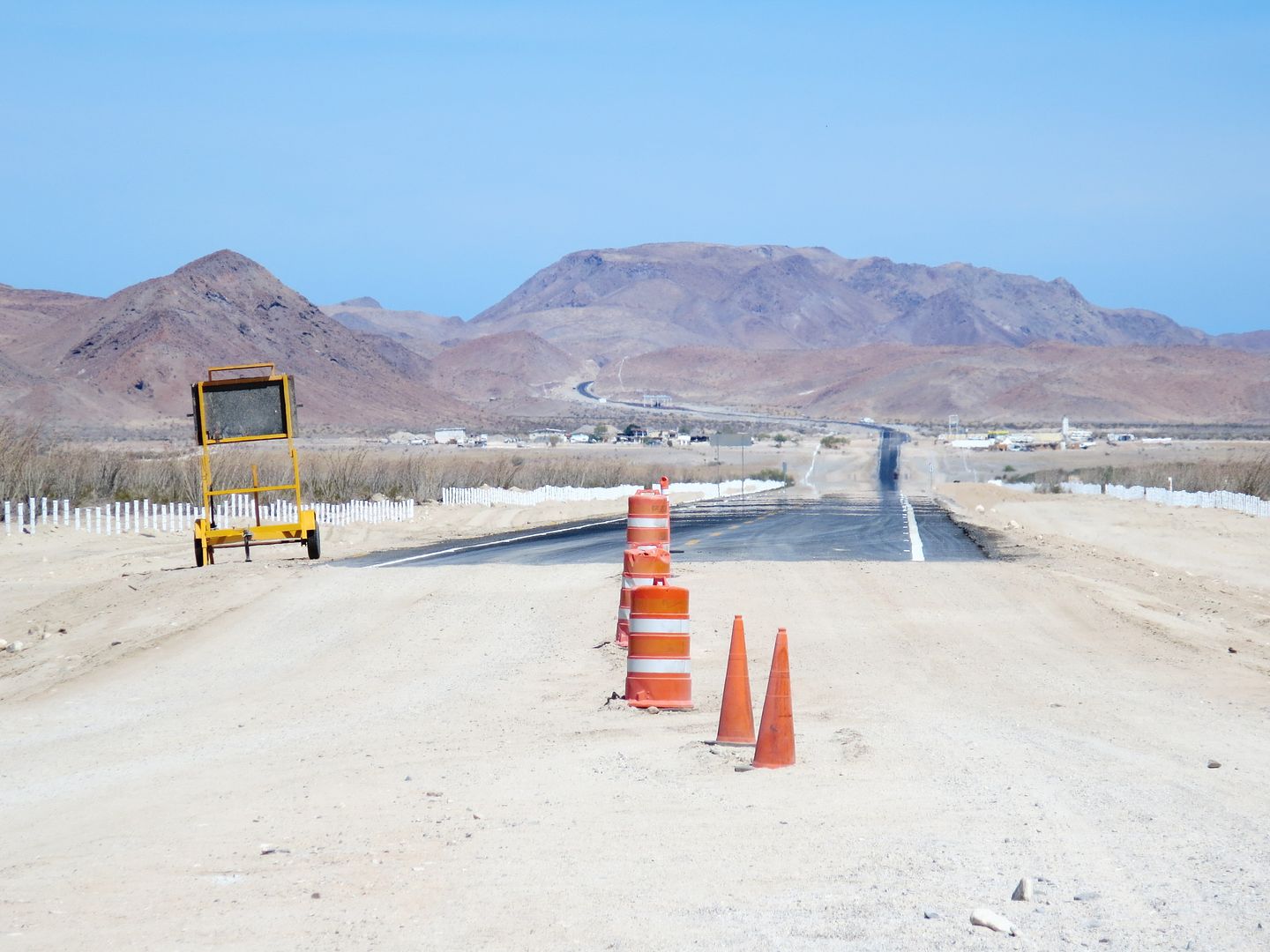
End of usable Hwy. 5 pavement on Jan. 8, 2015:
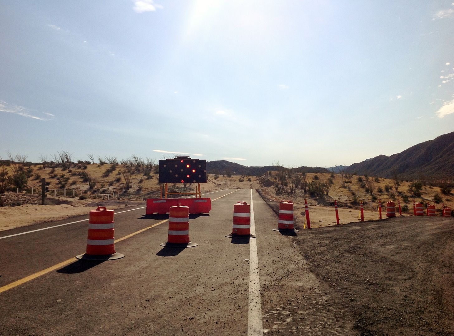
[Edited on 4-3-2016 by David K]
|
|
|
Russ
Elite Nomad
Posts: 6742
Registered: 7-4-2004
Location: Punta Chivato
Member Is Offline
|
|
So, my question is....
Are they working on the remaining 22 miles? Or are they at a Mexican stand off with the continuation of this rough section?
Bahia Concepcion where life starts...given a chance!
|
|
|
StuckSucks
Super Nomad
Posts: 2376
Registered: 10-17-2013
Location: Pacific Plate
Member Is Offline
|
|
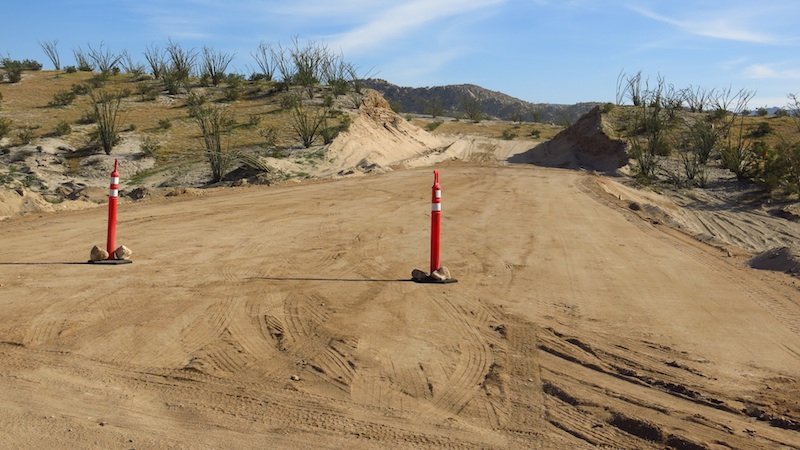
Here's the same location taken last November. Interesting, because all grading seemed to end there - the end was the end (for now).
|
|
|
David K
Honored Nomad
Posts: 65565
Registered: 8-30-2002
Location: San Diego County
Member Is Offline
Mood: Have Baja Fever
|
|
At their average of 6-8 miles a year to build this highway, you need to give them 3-4 more years.
The next issue that needs addressing is the old style, slow, narrow, dip filled San Felipe to Puertecitos section of Hwy. 5.
|
|
|
StuckSucks
Super Nomad
Posts: 2376
Registered: 10-17-2013
Location: Pacific Plate
Member Is Offline
|
|
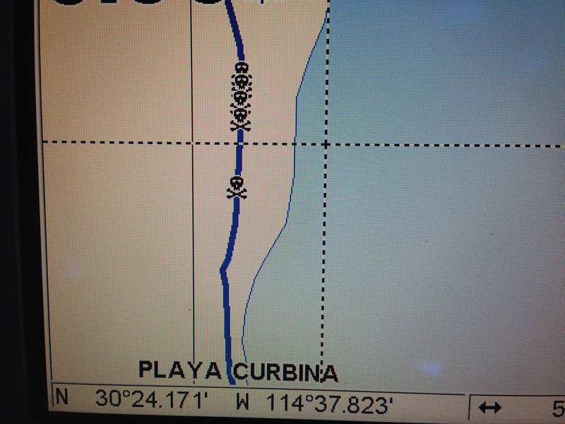
Quote: Originally posted by David K  | | The next issue that needs addressing is the old style, slow, narrow, dip filled San Felipe to Puertecitos section of Hwy. 5. |
Years ago I dealt with those killer vados by adding skull and crossbones to the GPS:
|
|
|
David K
Honored Nomad
Posts: 65565
Registered: 8-30-2002
Location: San Diego County
Member Is Offline
Mood: Have Baja Fever
|
|
Memories...

|
|
|
villafontana
Nomad
Posts: 261
Registered: 5-28-2013
Location: Tijuana, Baja California
Member Is Offline
Mood: Urgency to travel all the time in Baja!
|
|
so i went to Gonzaga Bay in 2013 and the bridge was still unusable...the road ended there. So they added another 16 miles in that time?? we got back
to SF at the end of the paved road.
[Edited on 1-15-2015 by villafontana]
|
|
|
thebajarunner
Ultra Nomad
Posts: 3755
Registered: 9-8-2003
Location: Arizona....."Free at last from crumbling Cali
Member Is Offline
Mood: muy amable
|
|
We drove it in March 2014 and the pavement ended exactly at Papa's
Thus, the 12.7 miles has been accomplished in just about 9 months.
That is much faster than the calculations above.
But, if there is no more grading then it does not bode well for getting across the next "nasty' stuff.
And, they had some devastating weather to deal with during that 12.7 miles.
I think they did quite well,
but alas, seem to have reverted to form.
|
|
|
David K
Honored Nomad
Posts: 65565
Registered: 8-30-2002
Location: San Diego County
Member Is Offline
Mood: Have Baja Fever
|
|
Hwy. 5 south from Puertecitos paving history
The following was posted on another thread in the Q & A forum, but is more useful in this road conditions forum, since we are talking history of
the progress.
In Nov. 2006, the new pavement had not yet reached Puertecitos, the highway from the late 1980's was all broken and mostly gone (too thin).
Beginning about 2002, they started repaving the road south from San Felipe and by 2005 they were halfway done. In Feb. 2007 it had reached
Puertecitos, but nothing new south of town.
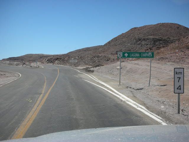
My next trip south of Puertecitos was in Sept. 2008, and the Y junction (Km. 74) was in place and the new pavement routed above town, extended for 2
miles from the junction. Exactly when this was opened, I don't know, but perhaps it was all built in 2008, so I can guess at a Jan. 2008 as a start
date for now. It is Jan. 2014 and in 6 full years, 60 miles of paved highway has been built and opened. 10 miles a year average progress to date... up
from the earlier rate of 6-7 miles a year.
================================================================
Here is the distance of paved road open from Puertecitos junction south:
In Feb. 2007: 0 miles
=======================================================
On Sept. 1, 2008: 2 miles...

========================================================
On Jan. 1, 2009: 4 miles.
[4 months added 2 miles.]
=======================================================
On July 19, 2010: 18.5 miles...
[1 year, 7 months added 16.5 miles.]
==========================================================
On July 15, 2012: 32.3 miles (Km. 126+), 15 miles north of Gonzaga Pemex...
[2 years added 13.8 miles.]
========================================================
Pemex San Luis Gonzaga at Km. 150, 47.1 miles from Puertecitos Jcn. (Km. 74).
=============================================================
From TW, Mar., 2014: 2 miles south of Pemex. (49 mi. from Puertecitos). Photo from Mando, looking north to Pemex from end of pavement:
[1 year and 8 months added 17 miles.]
=======================================================
From StuckSucks, Nov. 2014: Km. 154 (2.4 miles south of Pemex, ~51 from Puertecitos):
[8 months added 2 miles.]
=======================================================
Jan. 8, 2015 report: Pavement ends at Km. 170.5, 12.7 miles south of Pemex (Km. 150), 60 miles from Puertecitos junction (Km. 74).
[Edited on 1-15-2015 by David K]
|
|
|
villafontana
Nomad
Posts: 261
Registered: 5-28-2013
Location: Tijuana, Baja California
Member Is Offline
Mood: Urgency to travel all the time in Baja!
|
|
So David, is the big bridge usable or not?
|
|
|
David K
Honored Nomad
Posts: 65565
Registered: 8-30-2002
Location: San Diego County
Member Is Offline
Mood: Have Baja Fever
|
|
StuckSucks posted this photo in his November 2014 report, is this the bridge you are asking about (over Arroyo Santa Maria, about 5 miles south of the
Gonzaga Pemex)?
If yes, then yes... it is open along with the highway south another 7 miles past it....
|
|
|
Justbozo
Nomad
Posts: 139
Registered: 11-20-2012
Location: Lake Michigan/Bahia Concepcion
Member Is Offline
Mood: Got my little stone hut on the bay
|
|
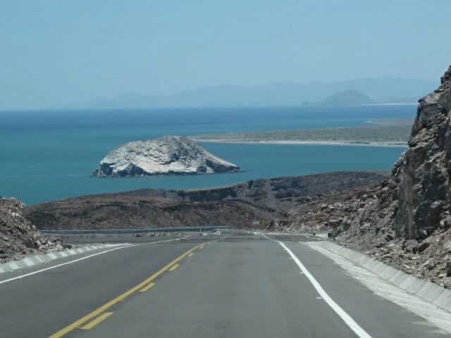
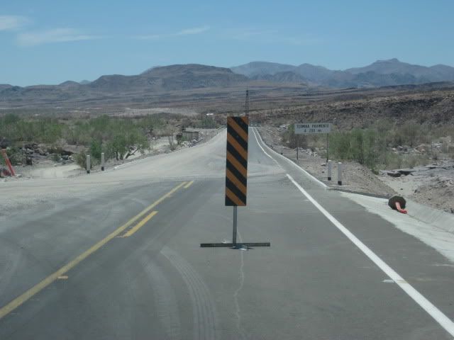
We traveled this road southbound on January 11, 2015.
The view as you first see it from the north is quite impressive.
The long, straight run downhill to the Gonzaga Pemex in the distance and then to have the road start the gradual rise into the distance and shimmer
it's way into the distant hills.
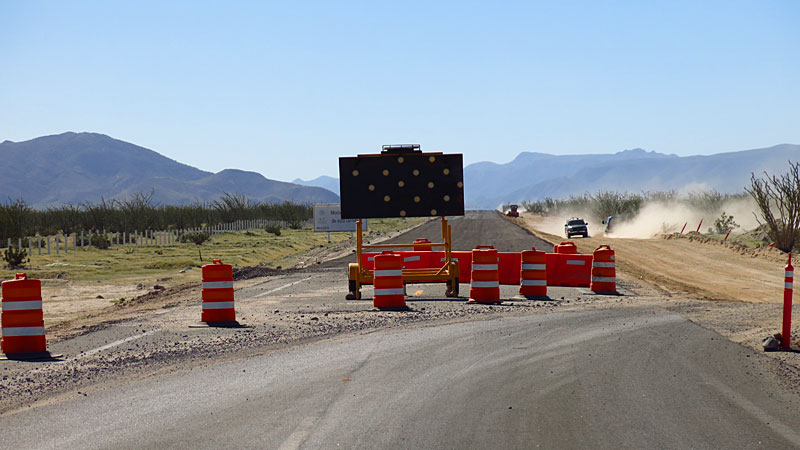
The "end is the end" yes. Nothing more going on except some curb and fence work.
The flags and stakes that we saw through the hills don't appear to be fresh.
But, Rumor has it...
|
|
|
David K
Honored Nomad
Posts: 65565
Registered: 8-30-2002
Location: San Diego County
Member Is Offline
Mood: Have Baja Fever
|
|
Thank you Justbozo... I invite anyone with updated Hwy. 5 news or photos to please add them here. Please respect the Nomad photo size limit of 800
pixels, as well.
Photobucket users, before you upload photos from your PC to Photobucket, click on that small gear and pick 640 or 800 as your upload size, click save
and that's IT! Detailed illustrations here: http://forums.bajanomad.com/viewthread.php?tid=65085
If you could zero your trip odometer at the Pemex station/ Alfonsina's road and record the mileage to the end of pavement, that would be a great
reference point. Also, as they have changed them in the past, note the Kilometer marker at the Pemex or close to it... and the last kilometer marker
on the pavement south.
Thank you!
|
|
|
TMW
Select Nomad
Posts: 10659
Registered: 9-1-2003
Location: Bakersfield, CA
Member Is Offline
|
|
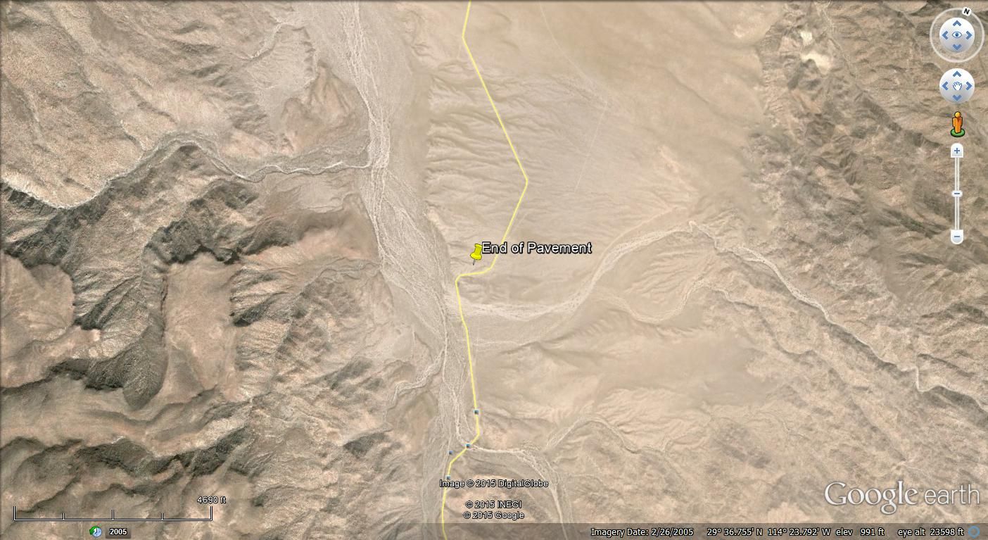
Here is the end of pavement on Google Earth.
29-36.7840x114-23.900
|
|
|
John M
Super Nomad
Posts: 1924
Registered: 9-3-2003
Location: California High Desert
Member Is Offline
|
|
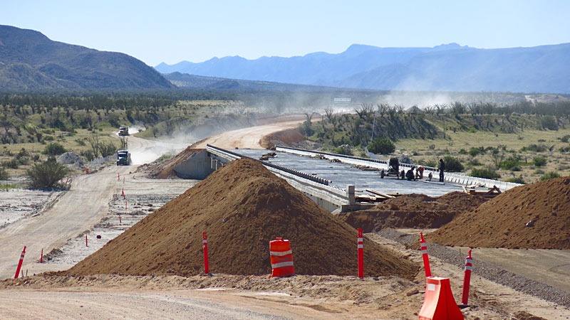
End of Pavement to Coco's
About ten miles of old road remain, of course the hilly and rocky sections are still there.
The news (good news for those seeking more pavement) is that we saw a fellow doing some surveying just beyond the end of paved section. In spite of
the fact we saw only a lone guy working, the next section improvement may be under way.
John M
|
|
|
Justbozo
Nomad
Posts: 139
Registered: 11-20-2012
Location: Lake Michigan/Bahia Concepcion
Member Is Offline
Mood: Got my little stone hut on the bay
|
|
KM 170 was the last marker and the road went on approx 1/2 KM farther. Pemex to end of pavement was approx 12 1/2 Miles?
|
|
|
redhilltown
Super Nomad
Posts: 1130
Registered: 1-24-2009
Location: Long Beach, CA
Member Is Offline
|
|
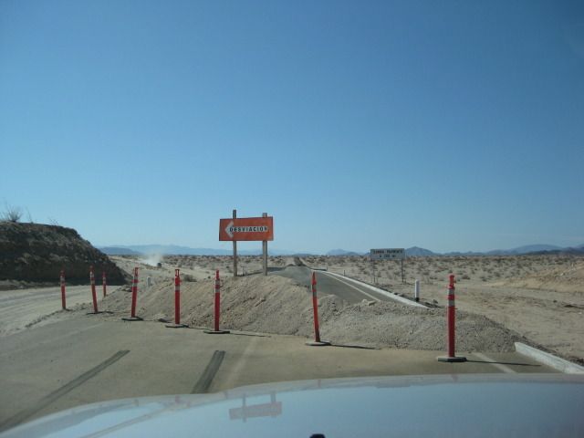
| Quote: Originally posted by David K | From Wayno 'BBBait':
On Jan. 8, 2015: Pemex at Rancho Grande is at KM 150, end of road is at KM 170.5... (170.5 - 150 = 20.5 kms.)
20.5 kms. = 12.7 miles from Gonzaga Pemex and about 60 miles from Puertecitos Jcn. where new highway construction began in late 2007. 7+ years, 60
miles = about 8 miles a year average.
Gonzaga Pemex to Hwy. 1 is about 35 miles, leaving 22 miles unpaved.
Hmmmmm...This pic shows a working electronic sign, new bright red cones, and an obvious detour... are you SURE this is Mexico? 
[Edited on 1-30-2015 by redhilltown] |
|
|
|
Cliffy
Super Nomad
Posts: 1000
Registered: 12-19-2013
Member Is Offline
|
|
As a comparison here in N Arizona when Hiway 89 collapsed they paved a bypass route of about 25 miles of sandy somewhat graded road in 5 months. That
includes bar ditches and fencing. With what the Mexicans have to work with and where they have to do it I think they do pretty well out in the middle
of God knows no where.
I wouldn't want to be responsible for 1200 miles of roadbed down that peninsula.
|
|
|
StuckSucks
Super Nomad
Posts: 2376
Registered: 10-17-2013
Location: Pacific Plate
Member Is Offline
|
|
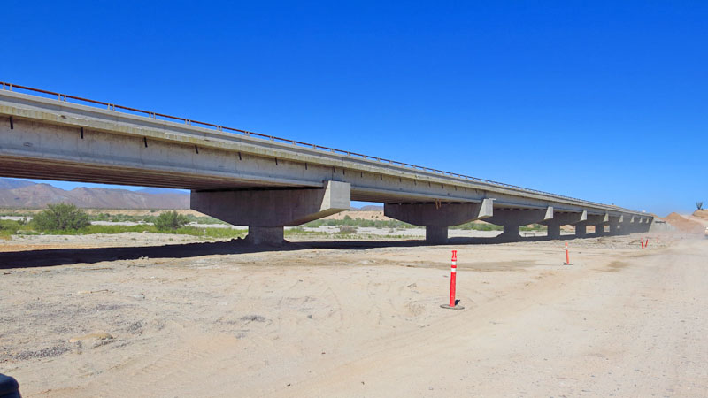
I suppose this is irrelevant now, but here's a shot of the underside of the Santa Maria bridge back in November.
|
|
|
BajaGringo
Ultra Nomad
Posts: 3922
Registered: 8-24-2006
Location: La Chorera
Member Is Offline
Mood: Let's have a BBQ!
|
|
I have spoken to a few different people who recently took that route. All complained about the really poor condition of the unfinished road section
right now as it appears that the recent rains, traffic and lack of attention have taken a toll. If you decide to go that route, be sure to have good
tires, a good spare, air down and DRIVE SLOWLY.
If you are in an RV or towing a boat/trailer, DRIVE SLOWLY X3.
YMMV...
|
|
|
| Pages:
1
2
3
..
12 |


