| Pages:
1
2
3
..
9 |
David K
Honored Nomad

Posts: 64478
Registered: 8-30-2002
Location: San Diego County
Member Is Offline
Mood: Have Baja Fever
|
|
2015 Nomad 'Hike for Walter Henderson's Rock-Pile' (Lost Diaz Grave Mystery)
Walter Henderson in the 1930's drove his Model A Ford, south of La Ventana on the old San Felipe road, then west near El Chinero as far into the
Sierra Pintas as he could and he then hiked northwest in the direction of the Sierra Tinajas (his original goal). After reaching the divide of the
desert range, he and his friend followed the twisting, narrow wash down to Arroyo Grande. About 1/4 to 1/3 of the way down, they found a large oval
pile of rocks, one side coated with desert varnish. There was no other sign of man in the entire region, other than this. Once in Arroyo Grande they
camped, realizing they began their hike too far south of their goal, so they returned to the Model A by going up Arroyo Grande and crossing back to
the east side, near the base of Borrego Mountain (El Arrajal).
Later, Henderson read the story of Spanish explorer Melchior Diaz, one of the support teams for Coronado in 1540, seeking Cibola the cities of gold.
Diaz crossed the Colorado River from near Yuma or further up... found the mud volcanoes of either the Salton area or Cerro Prieto and tried to regroup
with Captain Fernando de Alacron who sailed up the Colorado and left a message for Diaz. Melchior Diaz injured himself with his lance in a bizarre
way and died some days later. Where he was buried is a mystery. But his grave would have been important and as tradition, he would have been buried
with his possessions. Melchior Diaz was the first European to set foot in California traveling by land, but without solid evidence he was on the west
side of the Colorado River, he doesn't get all the glory he should receive.
Years after their hike in Baja, Walter Henderson read about Melchior Diaz in theNarratives of Castaneda and it describes the site of Diaz
grave so well, Henderson was sure he had found it. Efforts to get an expedition to return failed to materialize and the Mexican government said
Henderson would have to pay for an elaborate expedition with cooks, guides, mules, etc. when he implored them to find and protect the important site.
Before Henderson died, he gave his directions and memories to Desert Magazine editor, Choral Pepper in a letter of 1967. Choral tried to create
interest by writing about the mystery in her magazine and her 1973 Baja book.
Perhaps the rock pile has been found and looted or maybe it was nothing at all? The fun is finding that same rock pile that was seen 80 years ago...
and maybe from almost 500 years ago?
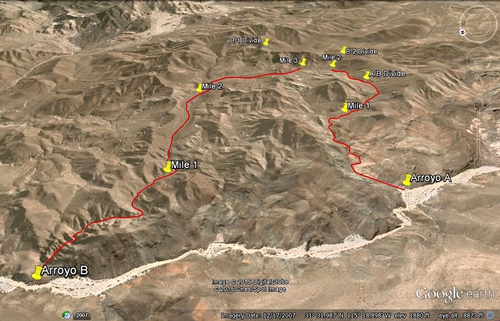
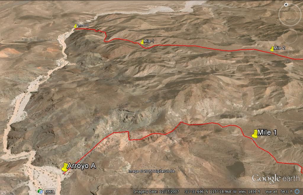
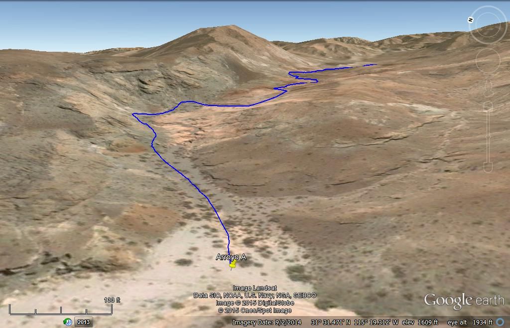
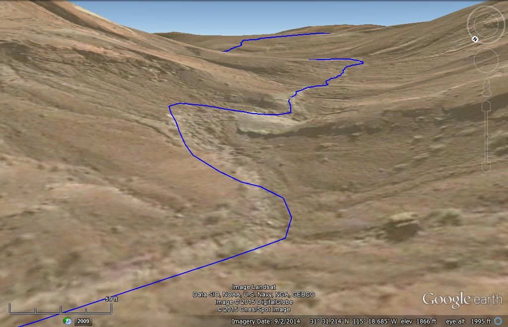
Here is my plan, based on Henderson's letter and details for where to seek the rock-pile... Go up Arroyo B, 3.2 miles, back down Arroyo A 2 miles (if
nothing is found in B) and return to starting point, 2 miles down Arroyo Grande....
View is to the east from above Arroyo Grande. Measurements are up from A. Grande, 3.2 miles using B and 2.0 miles using A. It is 2 miles from A to B
in A. Grande.
[Edited on 3-17-2015 by David K]
|
|
|
David K
Honored Nomad
Posts: 64478
Registered: 8-30-2002
Location: San Diego County
Member Is Offline
Mood: Have Baja Fever
|
|
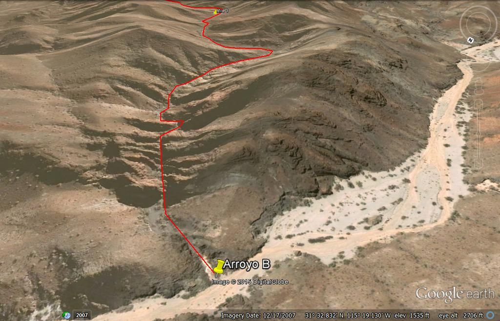
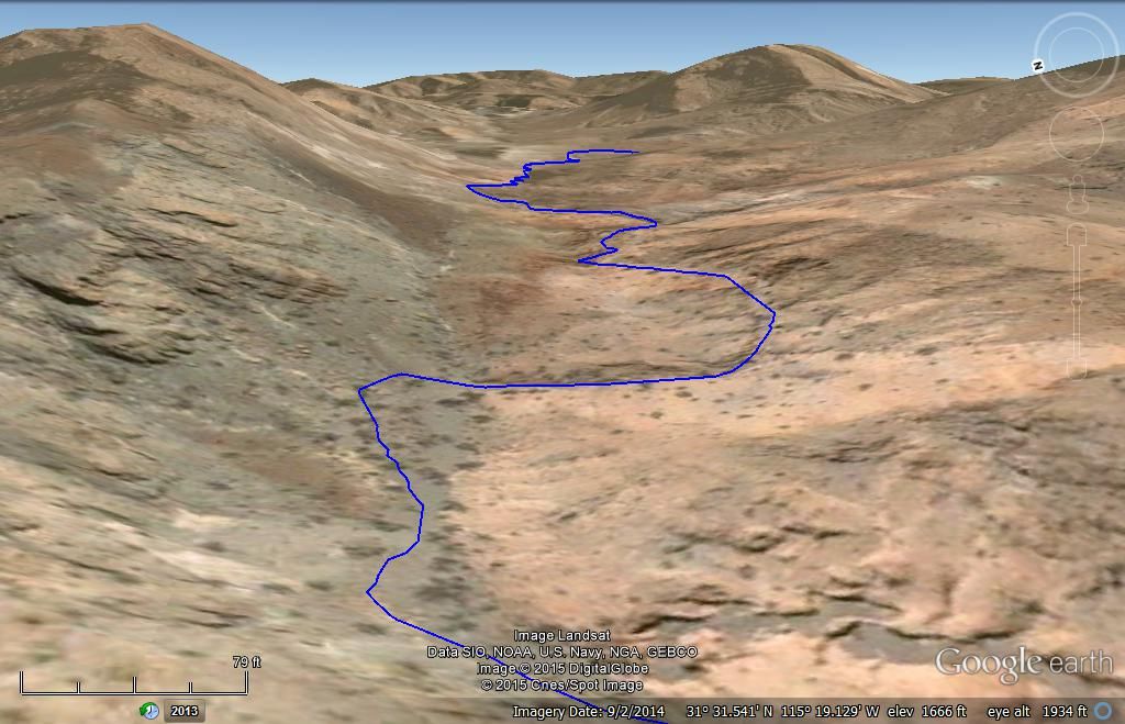
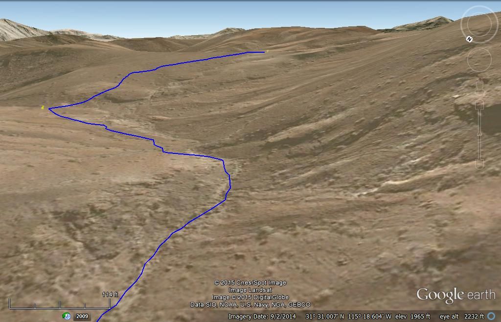
Flying over, full hike route, if B is empty...
EDIT: That rough looking area in the lowest part of B has an impassable waterfall... so hike will begin at Arroyo A and the top of A is just 2 miles
from Arroyo Grande going up.
UPDATE: Removing some images of Arroyo B route since that one is eliminated as being impassable.
Arroyo A from Mile 1 back to Mile 0, Arroyo Grande:
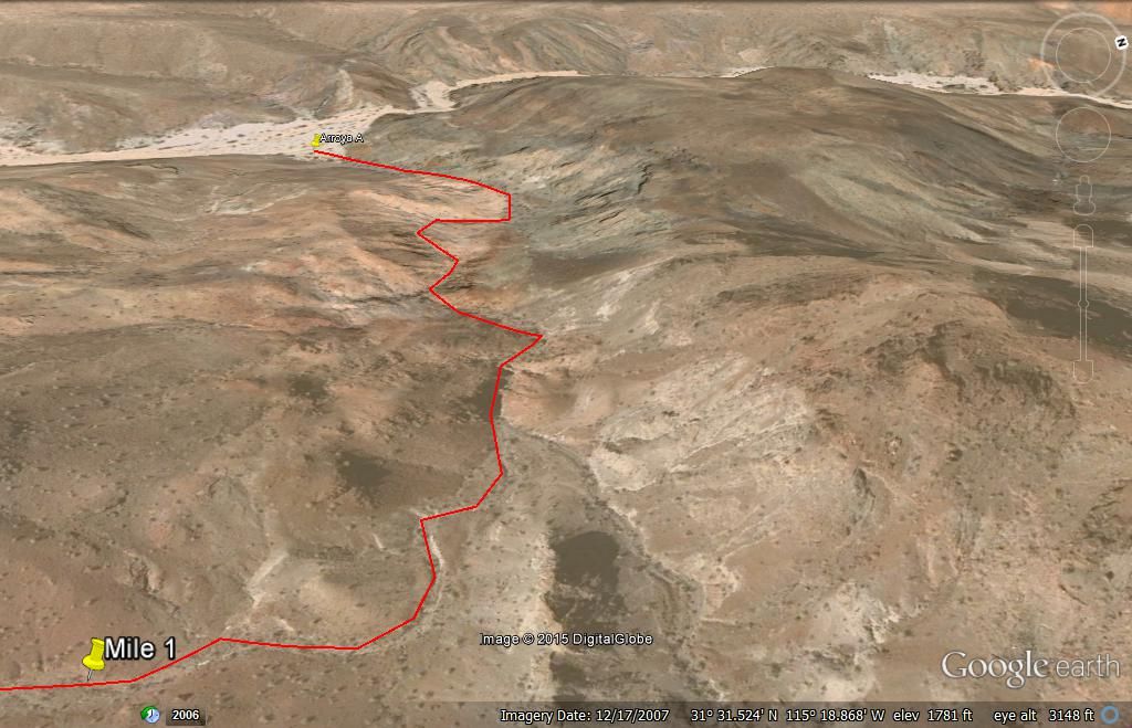
Overall...
Looking West:
Looking North A to B:
See below for Bing images of Arroyo A...
[Edited on 3-21-2015 by David K]
|
|
|
PaulW
Ultra Nomad
Posts: 3005
Registered: 5-21-2013
Member Is Offline
|
|
Good job
Saved me a ton of time
|
|
|
PaulW
Ultra Nomad
Posts: 3005
Registered: 5-21-2013
Member Is Offline
|
|
Ok
Arroyo A = Wash 4 = Tom-11
Arroyo B = Wash 2 = Tom-5
Revised My GPS accordingly. Now I can park in the correct place.
Used degrees for A cuz I did not trust your conversion.
|
|
|
AKgringo
Elite Nomad
Posts: 5805
Registered: 9-20-2014
Location: Anchorage, AK (no mas!)
Member Is Online
Mood: Retireded
|
|
Hope you are successful in your quest, it will be an adventure any way it works out.
I was just wondering, what time of year do you plan on doing the trip?
If you are not living on the edge, you are taking up too much space!
"Could do better if he tried!" Report card comments from most of my grade school teachers. Sadly, still true!
|
|
|
David K
Honored Nomad
Posts: 64478
Registered: 8-30-2002
Location: San Diego County
Member Is Offline
Mood: Have Baja Fever
|
|
Quote: Originally posted by AKgringo  | Hope you are successful in your quest, it will be an adventure any way it works out.
I was just wondering, what time of year do you plan on doing the trip? |
Easter Sunday after Pole Line Road Run with Ken Cooke, hike on Monday... Rattlesnakes beware!
|
|
|
Ken Cooke
Elite Nomad
Posts: 8921
Registered: 2-9-2004
Location: Riverside, CA
Member Is Offline
Mood: Black Trans Lives Matter
|
|
Do you think a Jeep would make it back in there? Jeeps and Model A's are two completely different animals.

|
|
|
PaulW
Ultra Nomad
Posts: 3005
Registered: 5-21-2013
Member Is Offline
|
|
====
Arroyo Grande or model A park place are easy for a stock 4wd SUV. Most air down for the sand. We see all kinds of rigs in there.
No obstacles, but driving up the bank is done in two places in AG.
PW
[Edited on 3-14-2015 by PaulW]
|
|
|
David K
Honored Nomad
Posts: 64478
Registered: 8-30-2002
Location: San Diego County
Member Is Offline
Mood: Have Baja Fever
|
|
The letter from Walter Henderson of May 31, 1967 was buried in the big box of letters and photos given to me by Choral Pepper from her Desert Magazine
years... I know she would be happy that it continues to inspire folks to get outdoors and explore Baja and the desert!
|
|
|
David K
Honored Nomad
Posts: 64478
Registered: 8-30-2002
Location: San Diego County
Member Is Offline
Mood: Have Baja Fever
|
|
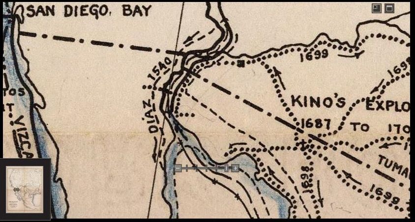
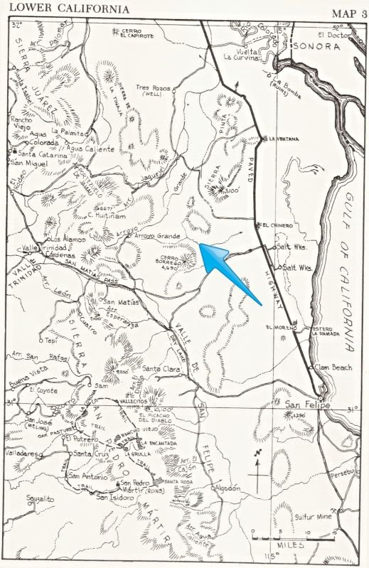
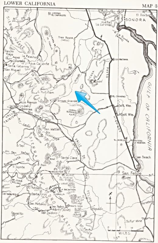
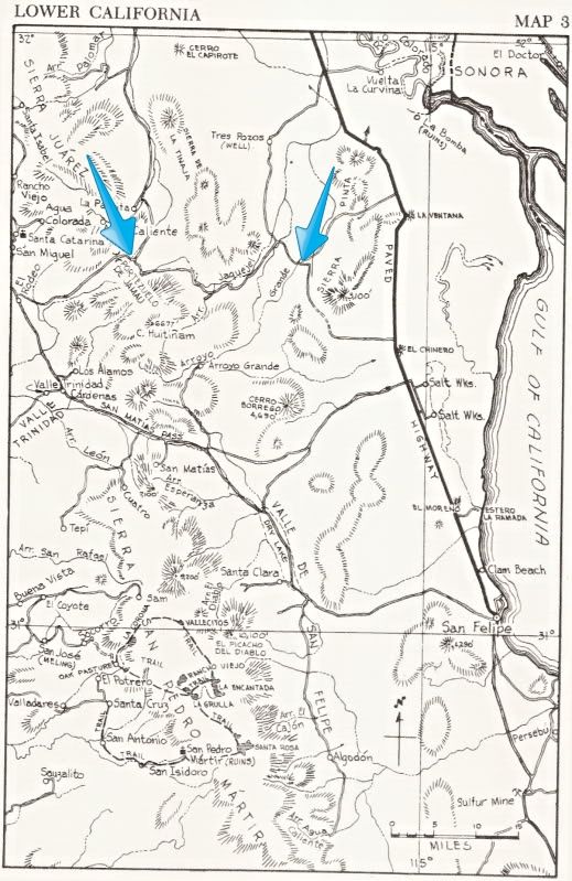
At least one map indicates we are searching on the correct side of the gulf!
|
|
|
David K
Honored Nomad
Posts: 64478
Registered: 8-30-2002
Location: San Diego County
Member Is Offline
Mood: Have Baja Fever
|
|
OK, that helps to know... joining me after Ken's Pole Line Road run:
Tom (TMW)
Karl (Fernweh)
Vern (El Vergel)
Harald (4x4abc)?
Mick (MICK)?
Joining us in spirit will be 'bajalou'!
(posted earlier in the Pole Line Road thread):
This would be Sunday afternoon we go to the Arroyo B junction with Arroyo Grande... GPS (WGS84) in decimal degrees:
31.54925, -115.31957 OR in decimal minutes: 31 degrees 32.955'N 115 degrees 19.174'W
If we discover that is not a possible wash, due to waterfalls. cliffs, etc. not matching the Henderson letter, there is a second good wash, Arroyo A:
31.524526, -115.32323 OR 31 degrees 31.454'N, 115 degrees 19.408'W
The hike would probably be Monday morning, 4 hours (in and out) so we could be done by noon... naturally, it is Baja, and I am flexible and this is in
good fun as our Santa Isabel lost mission hike was in 2011.
Lots of water, snake bite kit, cameras, GPS are what we need to enjoy and record the discovery.
El Vergel (Vern) plans on joining us Sunday night or Monday morning.
[Edited on 3-21-2015 by David K]
|
|
|
David K
Honored Nomad
Posts: 64478
Registered: 8-30-2002
Location: San Diego County
Member Is Offline
Mood: Have Baja Fever
|
|
The 1981 article by Choral Pepper in Desert Magazine is on page 52:
http://www.dezertmagazine.com/mine/1981DM08/index.html
Choral changes a few details from the letter, but near the end, she includes some of the location information that was in the 1967 letter.
The hike did not begin at La Ventana, as Pepper writes. They drove some 20 miles south, near El Chinero, then headed west to the base of the hills.
That is where the hike began.
Another error is that Pepper said they found the rock-pile on the second day, while heading back to the Model A from Arroyo Grande. Actually, they
found the rock-pile about noon on the first day hiking, after leaving the Model A early in the morning.
The above two changes is what threw previous searches for the rock-pile by Bruce Barber who devoted a big part of his book to the Diaz Grave search...
|
|
|
David K
Honored Nomad
Posts: 64478
Registered: 8-30-2002
Location: San Diego County
Member Is Offline
Mood: Have Baja Fever
|
|
GPS settings for the hike...
I have a base eTrex and an eTrex Legend with a Baja topographic map in it.
There are 4 waypoints entered for the hike... naturally, these are approximate depending on the ground surface and we are just on a fun hike to see if
we can find the same pile of rocks seen in the 1930's that caused much excitement with Walter Henderson, Choral Pepper, 'DesertGhost' (Tad), and Bruce
Barber... perhaps many others?
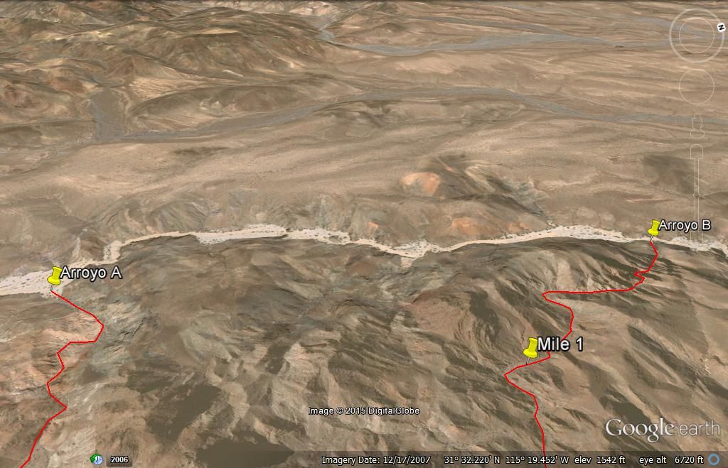
The hike might begin at the junction of 'Arroyo B' and Arroyo Grande. Arroyo B is 3 miles long to Divide 1 or 3.4 miles long to Divide 2 (this is the
top of the Sierra Pinta range...
HOLD! Just got a detailed email from PaulW, he hiked some of the area yesterday... and reports Arroyo B is impassable due to a waterfall/
cliff less than 1/2 mile up from Arroyo Grande.
We may move the hike down to Arroyo A, come up it, if no rock-pile, go over the A/B divide into the B Arroyo upper end and look there. The downside,
is no loop hike, walking back out the way we went in. Still other places to explore... and the distance from camp to the top of Arroyo A is only 1.6
miles... and about a mile more down into Arroyo B area to check. This is provided that water fall wasn't so bad back in 1930 and Henderson did get out
that way.
Thank you Nomad desert explorers and specially TW and PaulW for so much great recon work!
[Edited on 3-20-2015 by David K]
|
|
|
David K
Honored Nomad
Posts: 64478
Registered: 8-30-2002
Location: San Diego County
Member Is Offline
Mood: Have Baja Fever
|
|
OK, just some notes...
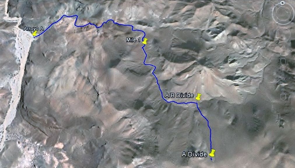
New hike starting at Arroyo A (elev. 1,565'). N31-31.454', W115-19.408'
Mile 1 up Arroyo A is at 1,813'
Mile 1.6 is the divide between A and B and is at 1,980'
Mile 2.0 is the top of A and the Sierra Pinta divide at 2,115'
The 'rock-pile' was 1/4 to 1/3 down the wash from the divide towards Arroyo Grande putting it at Mile 1.3 to 1.5 if that was correct and this is the
correct wash Henderson used.
Getting to Arroyo A by 4WD:
0.0 Hwy. 5, Km. 107 (1 km. south of La Ventana), go west.
6.0 Water Pipe Road, turn west.
12.2 Fork, go left (southwest).
12.8 Well/ Pump, turn south (Score road/ Arroyo Grande)
Keep towards right side of wide arroyo for less whoops.
17.7 Pole Line Road from Ensenada drops into Arroyo Grande here.
Arroyo Grande now between high sides and soon enters mountain canyon.
25.2 Arroyo B junction... continue south in Arroyo Grande.
27.2 Arroyo A junction N31-31.454', W115-19.408'
[Edited on 3-20-2015 by David K]
|
|
|
PaulW
Ultra Nomad
Posts: 3005
Registered: 5-21-2013
Member Is Offline
|
|
Guys please make a real GPS track. I have been using a Lowrance IFinder set at to make a breadcrumb every 0.01 mile. Resolution is great when zooming
way in. Then I have the setting to allow merging breadcrumbs when the coords are the same to save memory.
Any hiker hand held can get quite similar results.
Does anyone have a Garmin Oregon or Montana? They are the modern match for my IFinder. One of these days I will get confident enough to take the
Montana and leave the IFinder home because I believe the Montana is a better unit. Steep learning curve just like the IFinder was.
Other settings should be to use Datum WGS84.
Anybody that makes the hiking GPS track please send me your hike track after the trip . Tracks contain a waypoint with every breadcrumb so I have
little interest in waypoints except for the start and something unusual like my waterfall or a picture. When I take pics I make a WP and add info on
my note pad for reference after the hike. Paper notes! Ha!! If your GPS has a track distance traveled - add that to your note.
Anyway when I get the tracks I will choose or merge them for a final file for us to share.
Paul
|
|
|
David K
Honored Nomad
Posts: 64478
Registered: 8-30-2002
Location: San Diego County
Member Is Offline
Mood: Have Baja Fever
|
|
Thanks Paul, I have only the base Garmin eTrex and the eTrex Legend (from 2000 & 2003), and the Legend has the Baja Norte topo map in it. However,
it has a semi-difficult toggle that makes it hard to use or useless, so I will have both. Sadly, I may not be able to do much more than note waypoints
along the way, on a notepad like you. Yes, Map Datum is set to WGS84, the factory setting, and Google Earth setting.
Hopefully another on the trip has a more technical knowledge and can make a track. The hike is easy to see on Google Earth, and Arroyo A is only 2
miles to the top (divide). I really though Arroyo B looked perfect from Henderson's description, but if that waterfall looks like it has been there
for 100 or more years, and there is no way around it, in the canyon, that was not Henderson's route.
For you armchair Baja explorers, I will be sharing Walter Henderson's 1967 letter here, so you can get a feel for the passion he had that the
rock-pile was important. Choral Pepper used his letter to write a chapter in her 1973 Baja book, the 1981 Desert Magazine, and her unpublished last
book (which I have shared chapters of here on Nomad since 2004).
|
|
|
David K
Honored Nomad
Posts: 64478
Registered: 8-30-2002
Location: San Diego County
Member Is Offline
Mood: Have Baja Fever
|
|
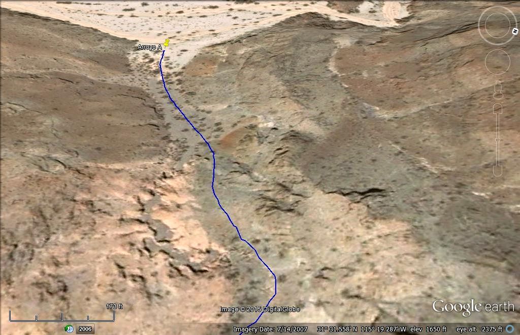
2 miles up Arroyo A from Arroyo Grande to Divide
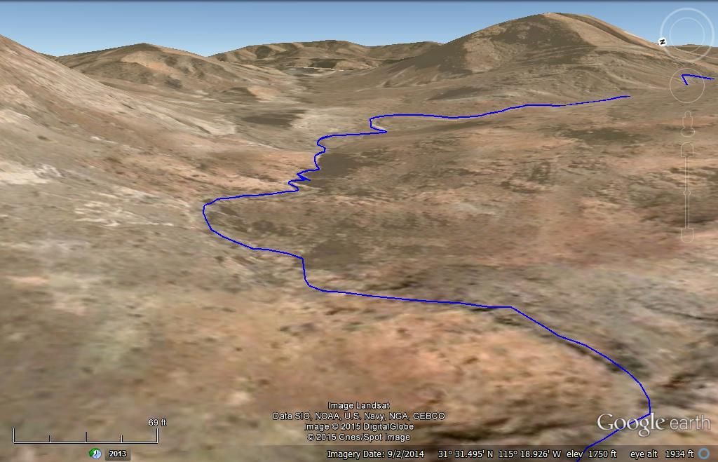
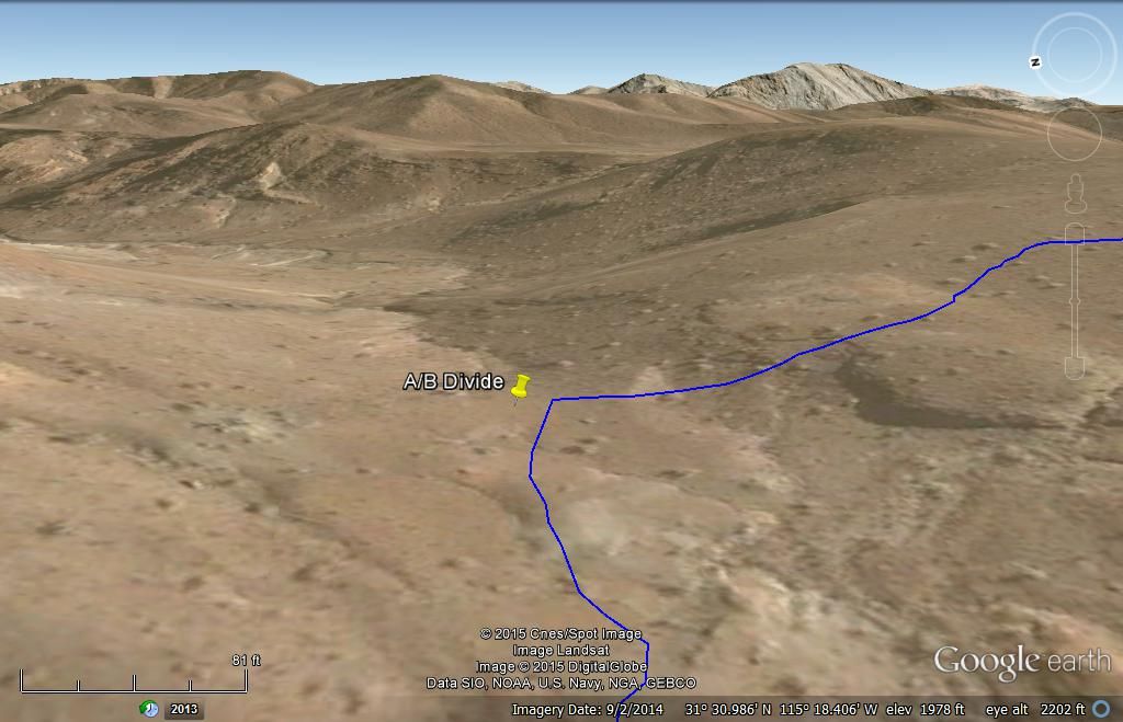
A/B Divide looking into Upper end of Arroyo B
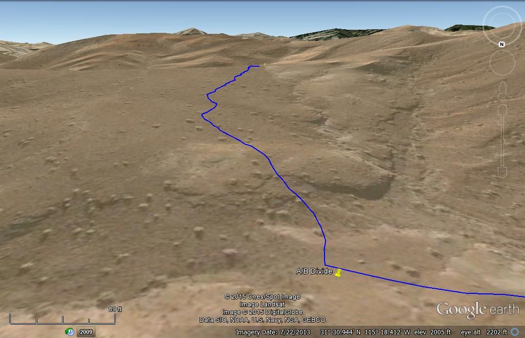
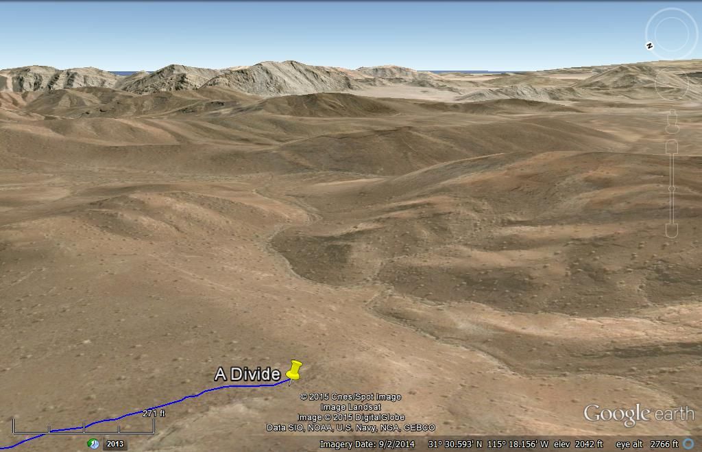
Top of Sierra Pinta, and view down long valley towards San Felipe... is this the way Walter Henderson walked 80 years ago???
|
|
|
David K
Honored Nomad
Posts: 64478
Registered: 8-30-2002
Location: San Diego County
Member Is Offline
Mood: Have Baja Fever
|
|
Walter Henderson
Here is where Walter describes he parked the Model A, at the base of the Sierra Pinta, and they began the hike northeast (towards the Sierra La
Tinaja)...
Here (below) is the top of 'Arroyo A' that Henderson may have reached about noon... 10 miles by foot from Model A...
===========================================================
Here is the section of the Pole Line Road Ken Cooke is leading the tour of... if he doesn't go the last 4 miles to Arroyo Grande, he will turn north
for Tres Pozos (Ejido Saldana region), as in the past:
|
|
|
David K
Honored Nomad
Posts: 64478
Registered: 8-30-2002
Location: San Diego County
Member Is Offline
Mood: Have Baja Fever
|
|
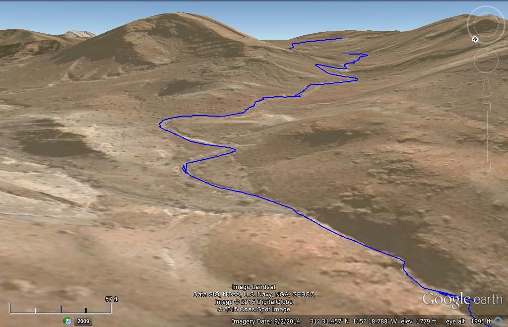
Arroyo A waterfall???
TW reports that Arroyo A has a dam and a cliff of sorts that may hinder passage upstream?
On Google Earth, the cliff is not readily noticed... I did a zoom in and compared to TWs photos (his Wash #11 is my Arroyo A). Red arrow points to the
possible dam location, and my blue line may still be a pathway around it to the north?
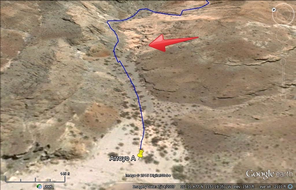
Start of Arroyo A:


The big question... can we go past the dam or can we go around it as my path line shows...
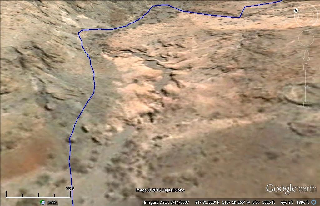
Looking back towards Arroyo Grande:
Melchior Diaz is not making it easy for us to find him!!!
Well, if it was easy, it would have been found already!!!
We go do this, not because it is easy, but because it is hard! 
|
|
|
XRPhlang
Nomad
Posts: 111
Registered: 10-12-2007
Location: Central Coast
Member Is Offline
Mood: Taco me.
|
|
That's me and Harley (orange dog) in Tom's pictures. I believe my impression of that waterfall at the time was that it might be passible. I only
turned around because I felt like it was getting late and it was about the 5th, or 6th one we'd been up that afternoon. Of course if we knew about all
of DK's research then, we would have given it more time I think.
If someone didn't mind bringing along an extension ladder, it might be useful getting up and down some of those waterfalls. Just sayin'
bontempscreolecafe.com
|
|
|
| Pages:
1
2
3
..
9 |
|


