| Pages:
1
2 |
David K
Honored Nomad

Posts: 64491
Registered: 8-30-2002
Location: San Diego County
Member Is Offline
Mood: Have Baja Fever
|
|
The Old Baja Road, before pavement... Baja Bound
Thank you to Baja Bound Insurance for publishing this story on the condition and location of the old road vs. the new (1973) highway. Photos of the
old road and maps showing it compared to the new highway are included.
HERE: http://www.bajabound.com/bajaadventures/bajatravel/the_old_b...
Captions for the photos from top to bottom:
1) The original Cuesta del Infierno east of San Ignacio, Cliff Cross Photo ~1969
2) The old road near Vizcaino, 2009
3) The old road near Bahia Concepcion, 2009
4) The old road at crossing of Punta Abreojos highway, 2012
5) The author in 1966 traveling the old road
*) 4 Maps show the new road compared to the old
|
|
|
BeemerDan
Nomad
Posts: 187
Registered: 1-13-2011
Location: Port Orchard Wa
Member Is Offline
|
|
Thanks for posting this DK
In the 1st pic it looks like a Jeep PU with a Alaskan camper on back, I had one years ago on the back of a Chevy Silverado.
Then I got two foot-itis sold it for a bigger rig, and now regret it
|
|
|
StuckSucks
Super Nomad
Posts: 2307
Registered: 10-17-2013
Member Is Offline
|
|
A fun read, thanks. I would have loved to have tackled Highway 1 in the 60s.
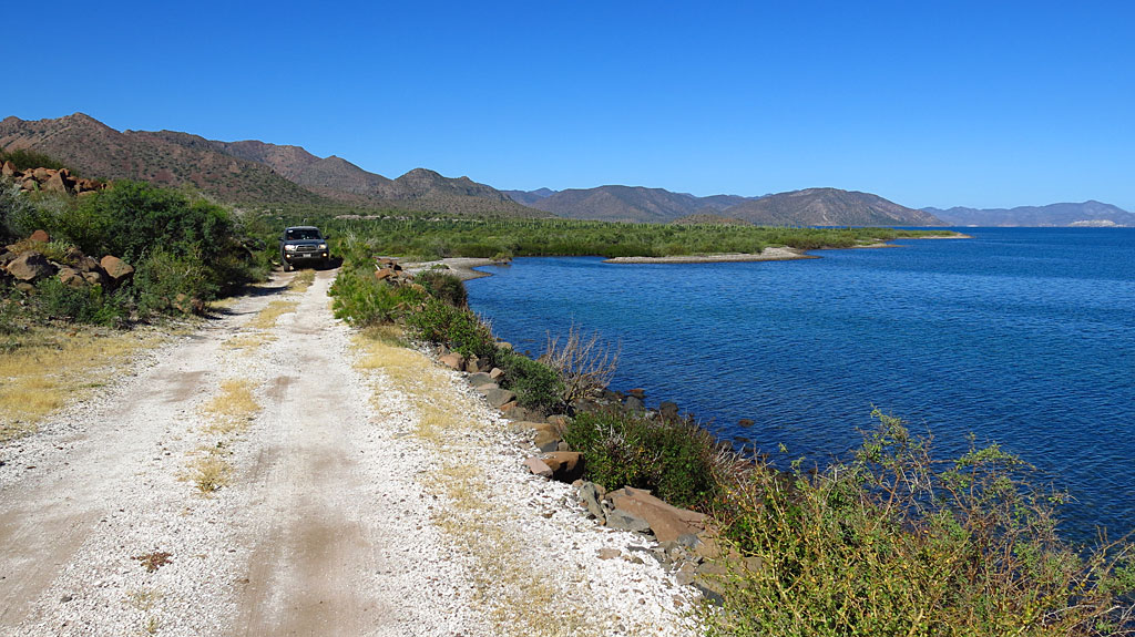
I was driving on this old road along the southern end of Bahía Concepción - could this be an early road alignment?
|
|
|
Vince
Nomad
Posts: 445
Registered: 10-17-2006
Location: Coronado
Member Is Offline
|
|
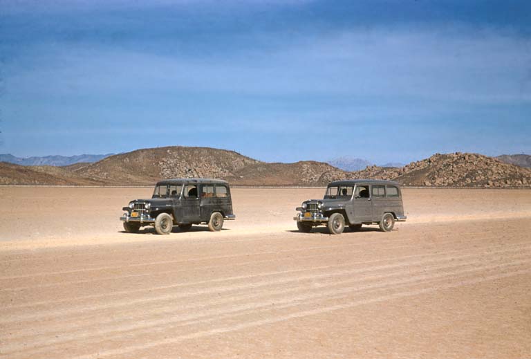
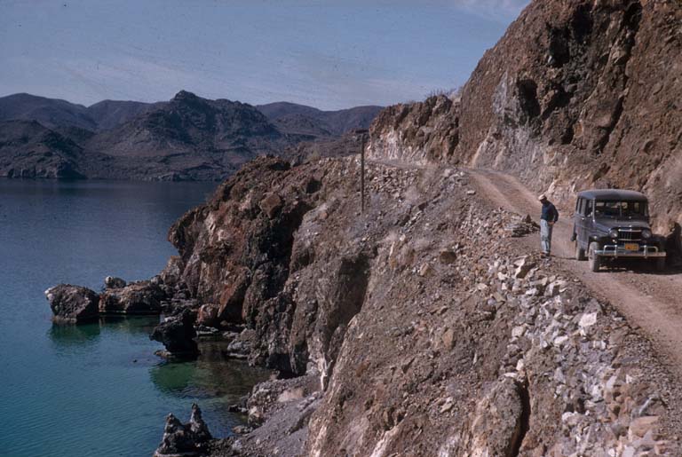
One of the fun aspects of driving the old road before it was paved was when you met a vehicle coming the opposite way you would both stop and chat
awhile about what is ahead or behind. There was only room for one car so it was a necessity. All very congenial and easy to get help if needed.
|
|
|
Bob53
Senior Nomad
Posts: 661
Registered: 2-24-2014
Location: Fallbrook, CA & Bahia de los Angeles
Member Is Offline
|
|
Good read! Thanks, David.
The bitterness of poor quality remains long after the sweetness of low price is forgotten.
|
|
|
David K
Honored Nomad
Posts: 64491
Registered: 8-30-2002
Location: San Diego County
Member Is Offline
Mood: Have Baja Fever
|
|
Glad you are enjoying it guys!
StuckSucks: Yes, that is probably the old main highway... other parts of it are carved into the rock face along the bay and some parts actually have
water over the road at high tide... just like it did in 1966!
Here's a Choral Pepper photo of the old road at Bahia Concepcion (the new highway is higher up and rocks from its construction cover some of the old
road)...

Vince: Yes, traffic was so light, passing another vehicle was a rare thing. You always waved, but typically you also stopped to inquire about road
conditions ahead. The road was often bracketed by cactus, cliffs, or the sea, so one car would need to back up to some place that allowed passing!
This was Highway One, before the years 1971 to Dec. 1973 when most of it was constructed (from Camalu to Constitucion).
Bob: Thank you!
There are other great stories in the Baja Bound Newsletter too!... One with historical interest:
Don Johnson at the Serinidad with John Wayne and others: http://www.bajabound.com/bajaadventures/bajastoryteller/donj...
[Edited on 3-19-2015 by David K]
|
|
|
David K
Honored Nomad
Posts: 64491
Registered: 8-30-2002
Location: San Diego County
Member Is Offline
Mood: Have Baja Fever
|
|
Do any old timers have photos of the old main Baja road? Anyone with newer photos of the original route to La Paz?
Here are photos along the old road from Howard Gulick...
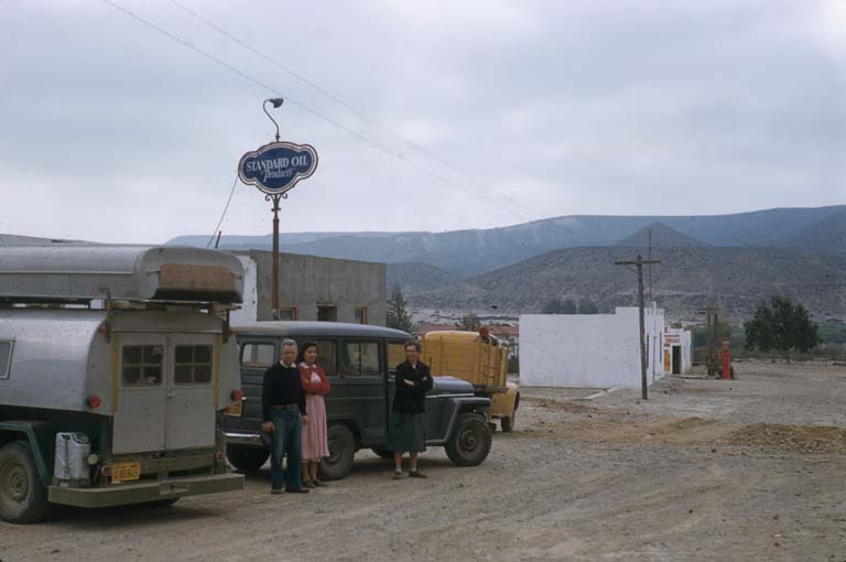
El Rosario, 1956 where Baja Cactus is now. Before Pemex, it was a Standard Oil station.
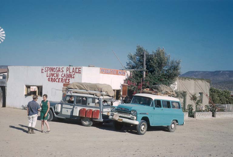
Mama Espinoza's Union Oil station in 1960.
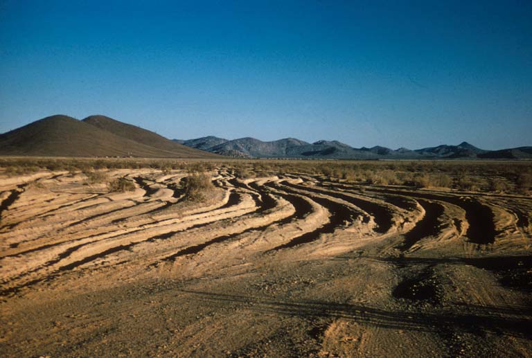
Laguna Chapala Silt Beds 1965, worst part of the entire drive to La Paz.
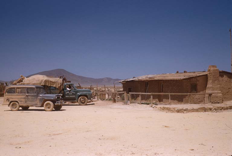
Rancho Laguna Chapala (Arturo Grosso, Mama Espinoza's brother) 1955
Laguna Chapala, fastest mile on the old road! 1956
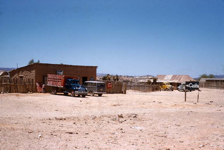
Punta Prieta 'Gas Station', 1955
Santa Rosalia, 1953
Mulege 1953
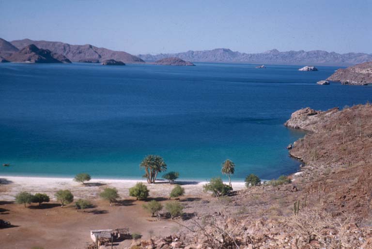
Bahia Concepcion, 1957
El Coyote, 1952
To see more of Howard Gulick's Baja photos: http://libraries.ucsd.edu/speccoll/baja/gulick/index.html
|
|
|
ehall
Super Nomad
Posts: 1906
Registered: 3-29-2014
Location: Buckeye, Az
Member Is Offline
Mood: It's 5 o'clock somewhere
|
|
Those are some great pictures
|
|
|
David K
Honored Nomad
Posts: 64491
Registered: 8-30-2002
Location: San Diego County
Member Is Offline
Mood: Have Baja Fever
|
|
Yes, aren't they great!
Howard Gulick was an engineer for the City of Glendale (L.A. area) and he was a detail-holic (like me, lol) for accuracy in Baja... He began traveling
by Jeep (Willys) Wagon after WWII to explore every road and even rode burros on parts of El Camino Real to make accurate maps and road logs. He
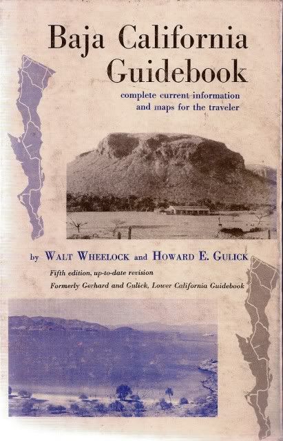
partnered with Peter Gerhard, a noted historian who lived in Mexico to create the Lower California Guidebook, c1956, 58, 62, 70. A book so complete
and information packed, it far outlived its authors and is still valuable today. Walt Wheelock, also worked for City of Glendale, was turned onto Baja
as well, created the La Siesta Press, and produced several small guidebooks on Baja and the outdoors. Wheelock updated Gulick's guidebook in 1975 to
include the new Transpeninsular Highway, and renamed the book, 'Baja California Guidebook'.
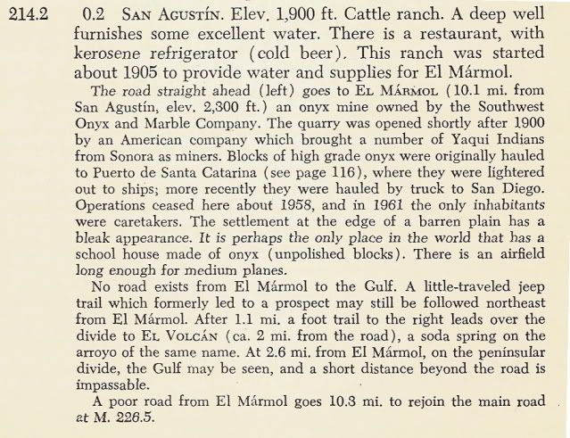
Howard's maps from 1962 edition are viewable online: http://biology.fullerton.edu/biol517dje/maps/baja_1962.html
(click on the peninsula where you want to see the close up map)
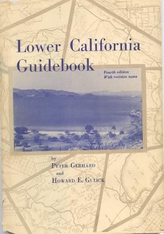
Here's a sample of the details from the 1962 edition:
When traveling in Baja with my parents, I got to read the guidebook as we neared the next point of interest. The names and history of Baja were
imprinted before I was 9 years old.
I was inspired by Howard Gulick as a kid, and even met him and got his autograph on my copy of the guidebook. I also met Walt Wheelock many years
later and discussed the publishing of Howard's large scale hand drawn maps (the ones in the book are abbreviations, yet are still some of the best
ever made.
|
|
|
StuckSucks
Super Nomad
Posts: 2307
Registered: 10-17-2013
Member Is Offline
|
|
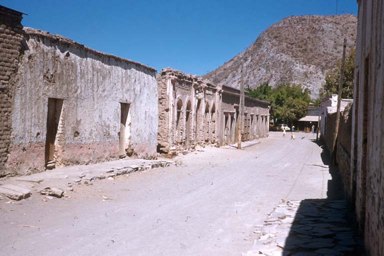
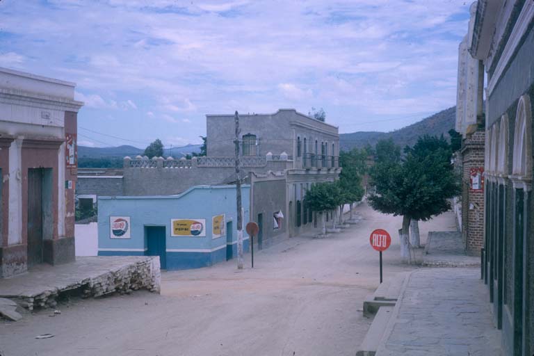
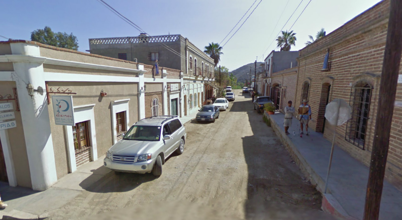
Found the same street in Todos Santos as one of Howard's photos (October 12, 1964 ). Compare at the buildings on the left side, past the stop sign:
|
|
|
David K
Honored Nomad
Posts: 64491
Registered: 8-30-2002
Location: San Diego County
Member Is Offline
Mood: Have Baja Fever
|
|
Very cool!
Of the people who made Baja so appealing in print, Howard Gulick is at the top, or in the top group of the list!
Others I would include who inspired us to travel south, and choose the 'danger'!:
Ray Cannon
Erle Stanley Gardner
Choral Pepper
Tom Miller
Cliff Cross
Mike McMahan
Walt Peterson
Jim Hunter
Graham Mackintosh
Harry Crosby
Other notable authors:
Fred Hoctor
Bruce Berger
Max Miller
Greg Niemann
Joseph Krutch
Ben Hunter
Arnold Senterfitt
Marv Patchen
I think all serious Baja fanatics should read or have their books to satisfy the addiction we have... when we can't actually be there!
|
|
|
Vince
Nomad
Posts: 445
Registered: 10-17-2006
Location: Coronado
Member Is Offline
|
|
Boy, you hit the jackpot on those old photos. They represent many thousands of words and are so clear. I always love the one of Coyote Bay. We used
to camp on that beach, coming in by boat in early '60's and we watched those trucks come down the hill on that switchback road and drive on toward
Mulege. It took them 2 hours to clear the hill on the north side of the bay.
|
|
|
David K
Honored Nomad
Posts: 64491
Registered: 8-30-2002
Location: San Diego County
Member Is Offline
Mood: Have Baja Fever
|
|
Hi Vince... there were others, including El Requeson with the sand spit, but they refused to show when I linked them here. You will enjoy going to the
Gulick images page and looking at them all!
Baja is a time machine!
|
|
|
Udo
Elite Nomad
Posts: 6323
Registered: 4-26-2008
Location: Black Hills, SD/Ensenada/San Felipe
Member Is Offline
Mood: TEQUILA!
|
|
Thanks for the historic photos, DK.
All of my old photos in the mid 60s were burned up in my house fire 5 years ago.
You brought back some great memories, especially that photo of Mama Espinoza's restaurant and gas station.
I remember her restaurant for offering lobster burritos, which was the staple of El Rosario at that time. That restaurant/gasolinera stayed the same
through the 70's.
Udo
Youth is wasted on the young!
|
|
|
David K
Honored Nomad
Posts: 64491
Registered: 8-30-2002
Location: San Diego County
Member Is Offline
Mood: Have Baja Fever
|
|
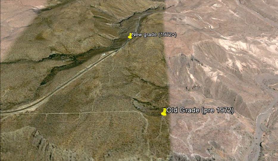
Finding the old Baja main road...
El Rosario to San Ignacio:
There are many places you can see, drive on the old road where Hwy. 1 isn't on top of it. Much of the distance, the old road is within a mile or two
of the new. The old road served as a pilot road and to bring supplies in to the construction crew. However, the main road of the 1960's went from
Rosarito south then southeast to El Arco then south to El Tablon (which is just east of Vizcaino). The new highway was built south to north here and
headed from near El Tablon NW to Guerrero Negro the north to Rosarito. The northbound crews did not meet the southbound crews until San Ignacito (just
10 km. or so south of Santa Ynez).
San Ignacio to just past Bahia Concepcion:
The old and new roads are very close if not the same location. Along Bahia Concepcion, the old road was closer to the water, even dipping in the water
at high tide while much of the new graded road (since 1970) was higher up or more inland... and was paved in 1972.
Bahia Concepcion to Insurgentes:
The old road cut across Baja through Comondu then south. The new highway goes south to Loreto and on to Ligui before crossing west to Insurgentes.
Insurgentes to La Paz: Since the late 50's when the long straight roadbed was made, the tow roads are the same. However, in 1966 pavement began about
100 miles north of La Paz. 50 miles short of the point it reached in 1961.
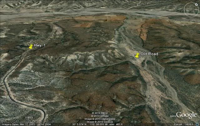
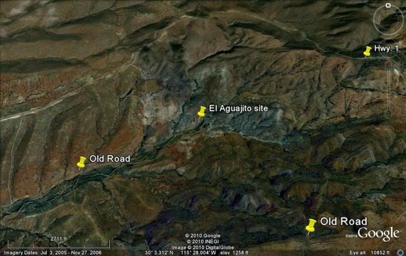
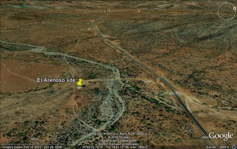
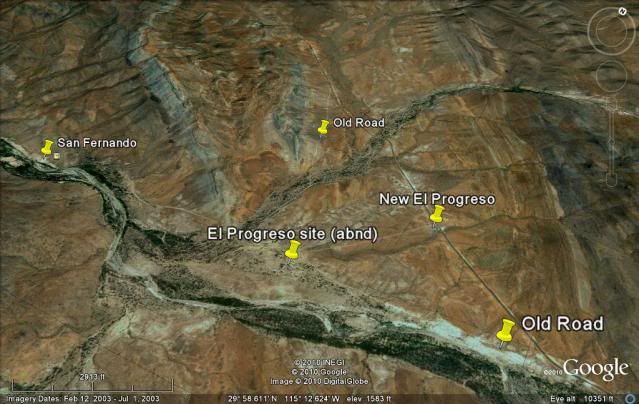
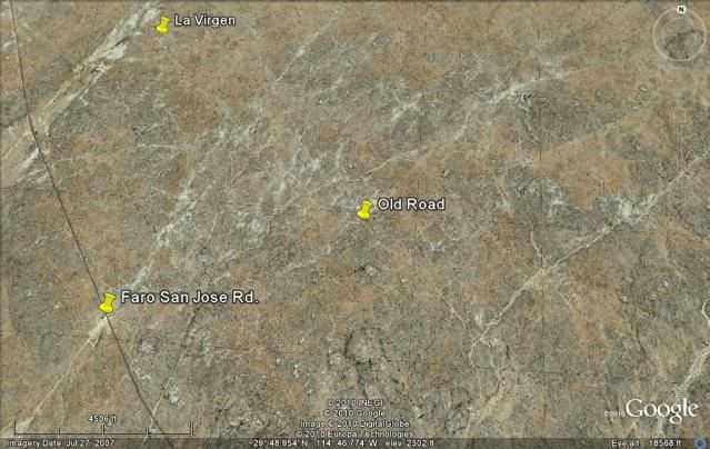
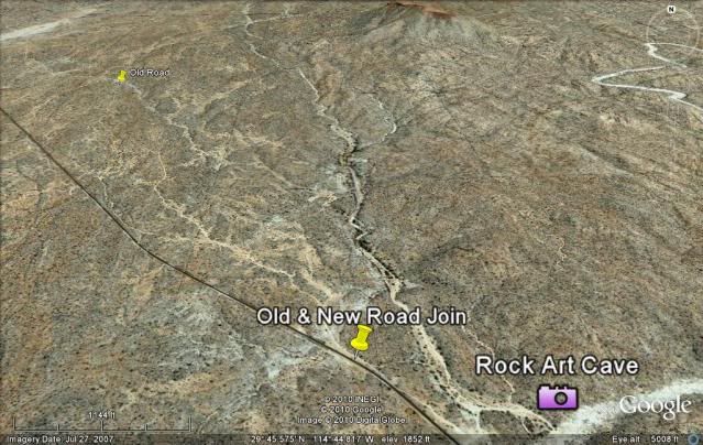
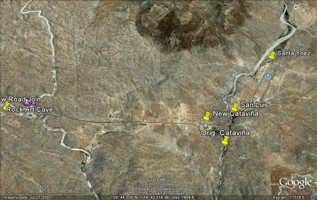
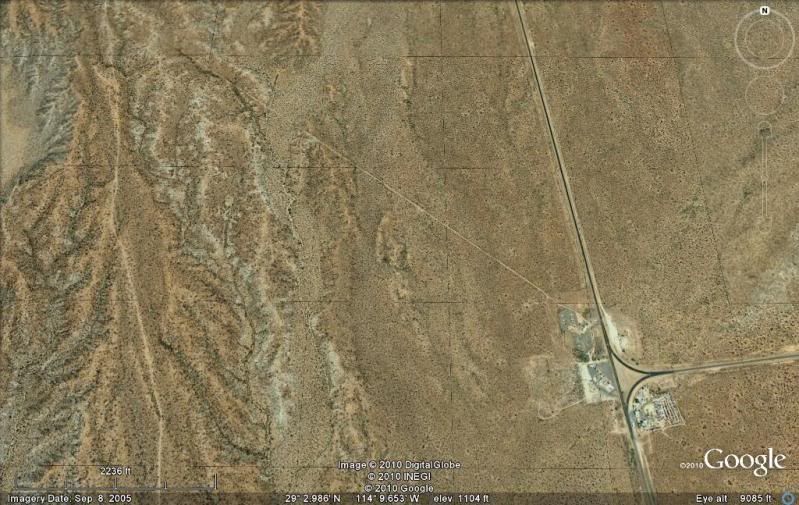
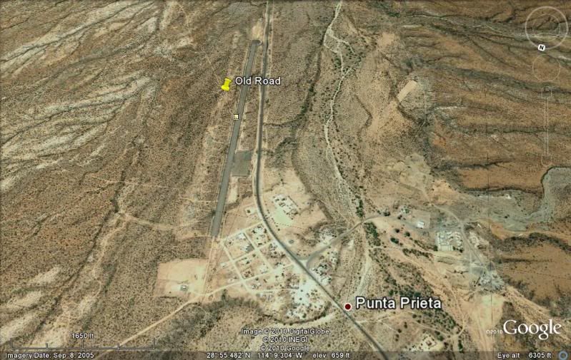
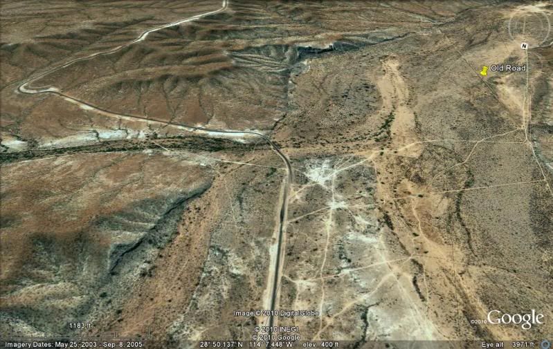
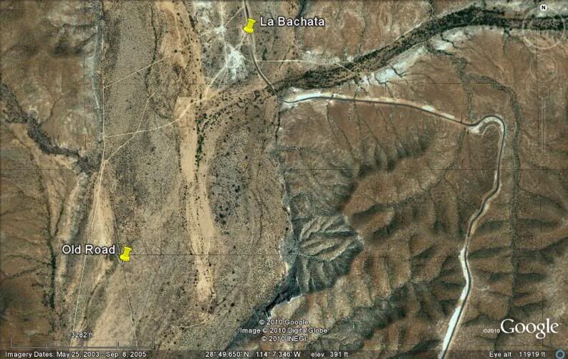
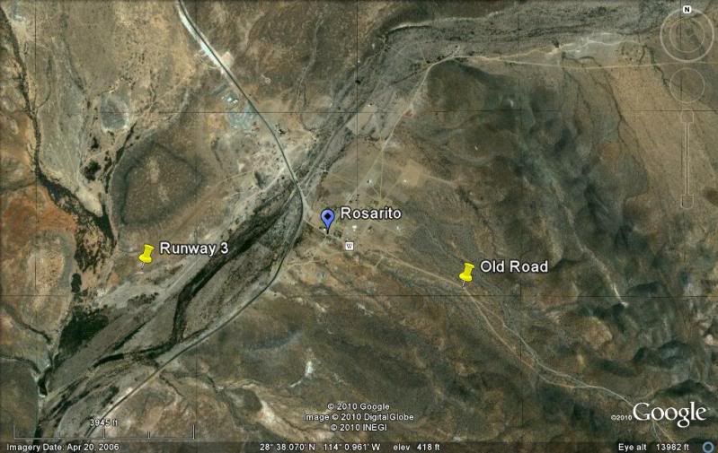
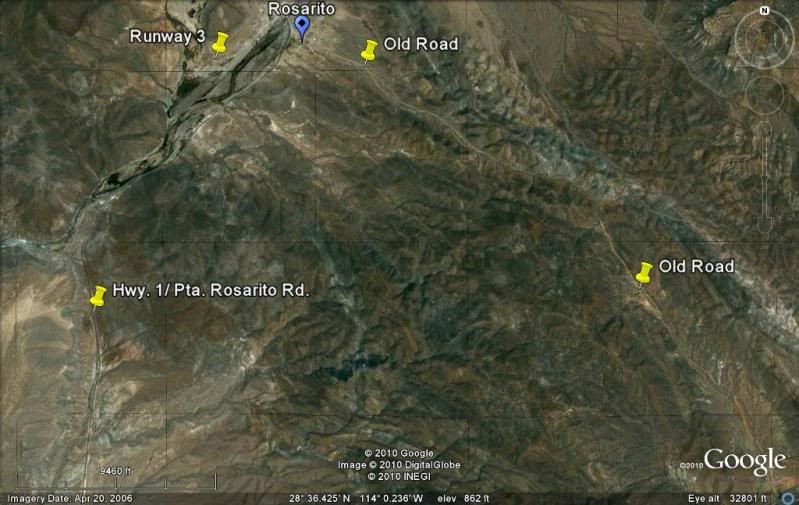
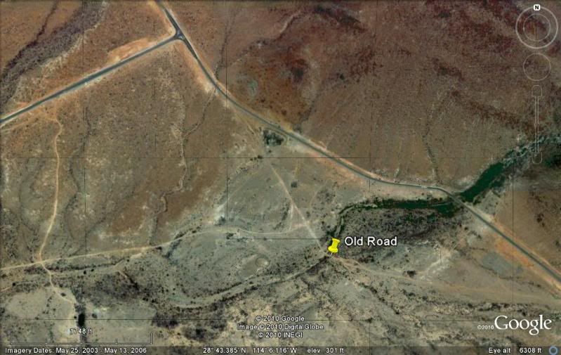
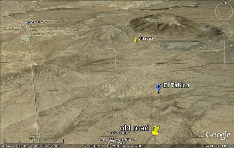
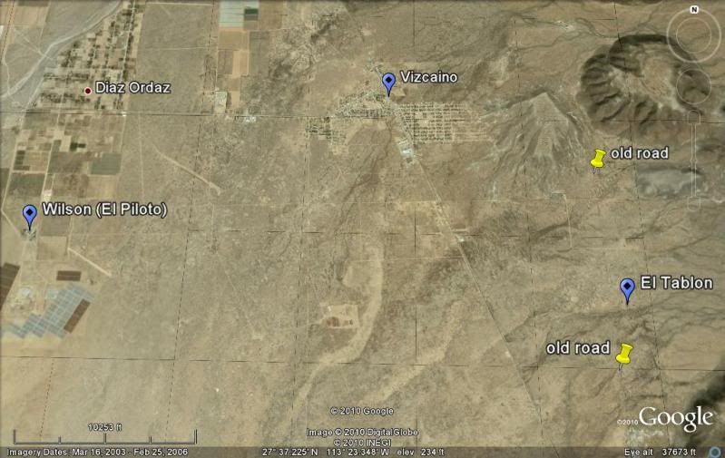
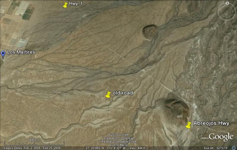
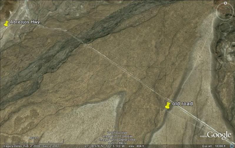
Some samples of my satellite maps showing the two roads (note the compass in the top right corner, as the images are pointed in different directions):
Leaving El Rosario valley:
El Aguajito:
El Arenoso:
El Progreso:
Penjamo:
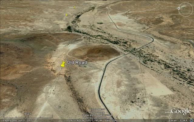
Guayaquil:
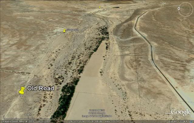
Sonora:
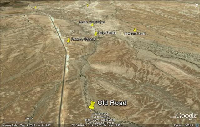
Agua Dulce:
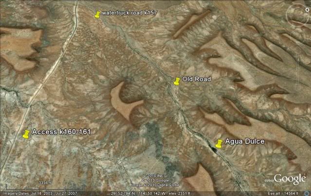
La Virgen:
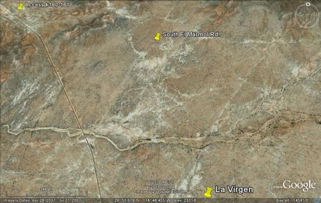
Catavina:
Pedregoso (boulder hill):
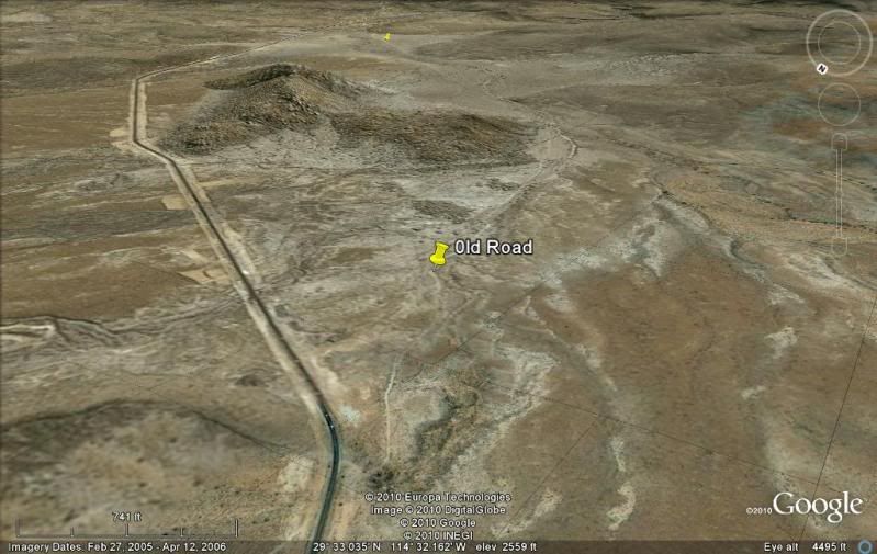
South Chapala:
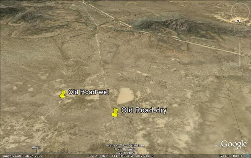
South Portezuelo (old road on left):
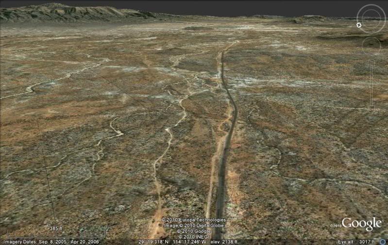
El Crucero (south of El Crucero, that is not the old road on the left):
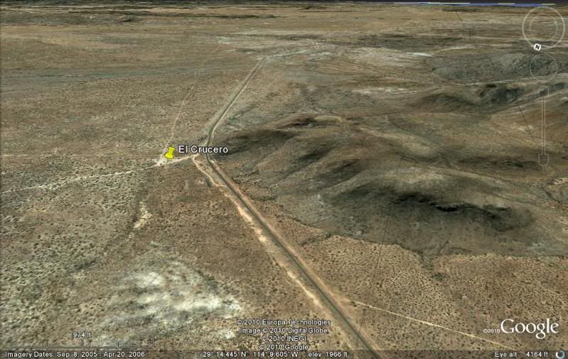
Old L.A. Bay Jcn.:
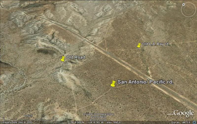
New L.A. Bay Jcn.: (old road on far left):
Punta Prieta:
La Bachata/Juarez (old road on right, new climbs hill on left):
Rosarito Split old/new:
Santa Rosalillita Jcn.:
Vizcaino/ El Tablon:
Crossing Abreojos Hwy.:
East of San Ignacio, the original Cuesta del Infierno and the new:
|
|
|
gueribo
Nomad
Posts: 458
Registered: 10-16-2014
Member Is Offline
|
|
Love the photo of the street in Mulege!
|
|
|
blackwolfmt
Senior Nomad
Posts: 802
Registered: 1-18-2014
Location: On The Beach With A Blackwolf
Member Is Offline
Mood: dreamin of Riden out a hurricane in Baja
|
|
Yeah DK thanks for those pics I can see what my grampa saw when he was there in the 50's no wonder they spent alot of
time there looks like it was really peaceful
So understand dont waste your time always searching for those wasted years
face up and make your stand and realize that your living in the golden years
|
|
|
wessongroup
Platinum Nomad
Posts: 21152
Registered: 8-9-2009
Location: Mission Viejo
Member Is Offline
Mood: Suicide Hot line ... please hold
|
|
Thanks .. when it used to be, nothing fancy 
[Edited on 3-26-2015 by wessongroup]
|
|
|
David K
Honored Nomad
Posts: 64491
Registered: 8-30-2002
Location: San Diego County
Member Is Offline
Mood: Have Baja Fever
|
|
Old Roads are time machines in Baja...
|
|
|
güéribo
Nomad
Posts: 239
Registered: 10-17-2014
Member Is Offline
|
|
Great thread. Thanks for the vintage photos.
|
|
|
| Pages:
1
2 |


