| Pages:
1
2
3
4
..
12 |
Emerson
Junior Nomad

Posts: 42
Registered: 6-24-2013
Member Is Offline
|
|
Great Report, superb pictures.
I wish to travel this route again soon, before its "gated", more...
[Edited on 4-9-2015 by Emerson]
|
|
|
David K
Honored Nomad
Posts: 64479
Registered: 8-30-2002
Location: San Diego County
Member Is Offline
Mood: Have Baja Fever
|
|
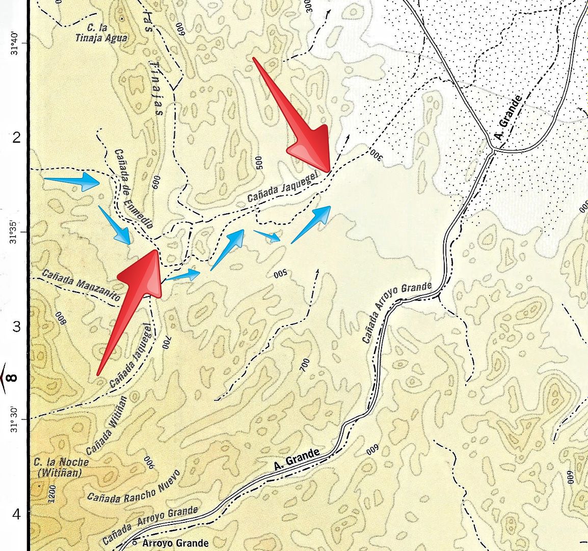
Here is a map that shows Basketball Hill (left big red arrow) and our camp site Sunday night (right big arrow)... Blue arrows are our drive Sunday
afternoon.
|
|
|
Ateo
Elite Nomad
Posts: 5847
Registered: 7-18-2011
Member Is Offline
|
|
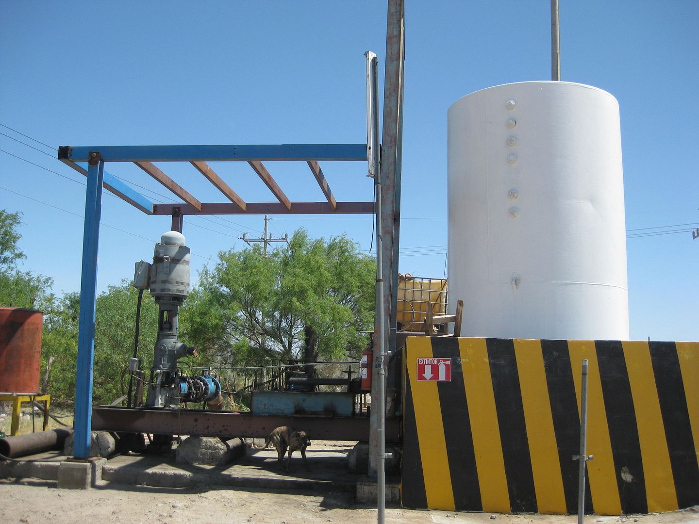
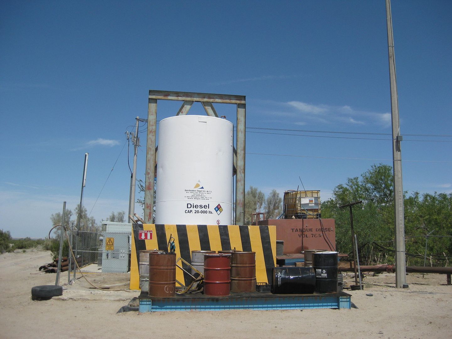
What's up with the white tank? What large water vehicle is gonna make it out there to supply the tank? Just curious. Great report and keep the
photos coming.
|
|
|
David K
Honored Nomad
Posts: 64479
Registered: 8-30-2002
Location: San Diego County
Member Is Offline
Mood: Have Baja Fever
|
|
DAY 3, MONDAY APRIL 6, 2015
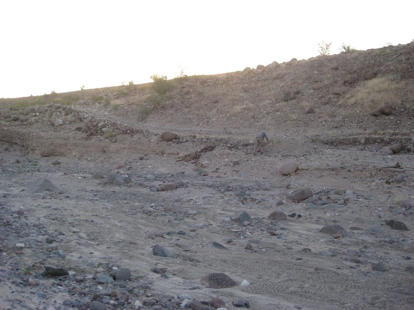
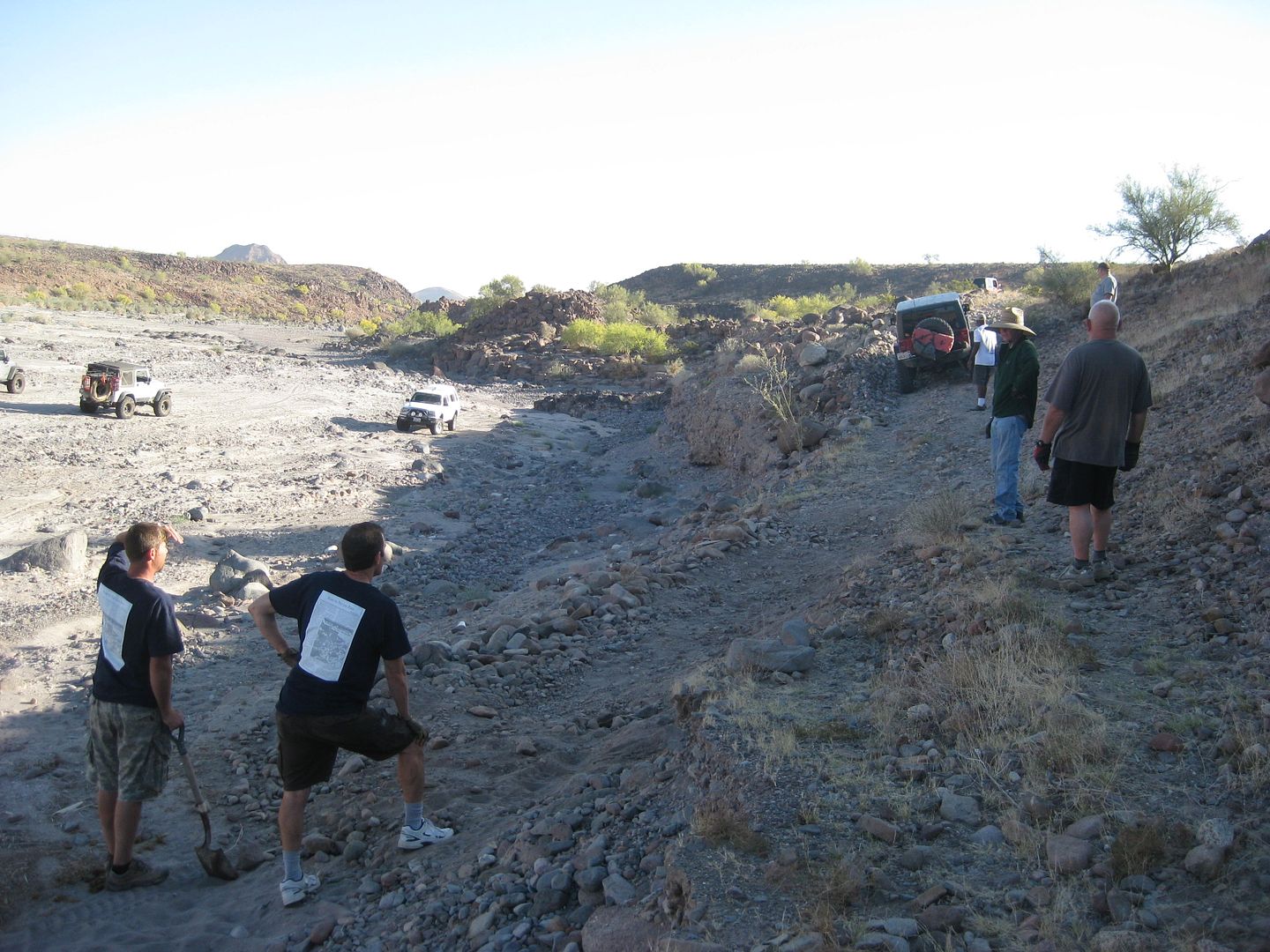
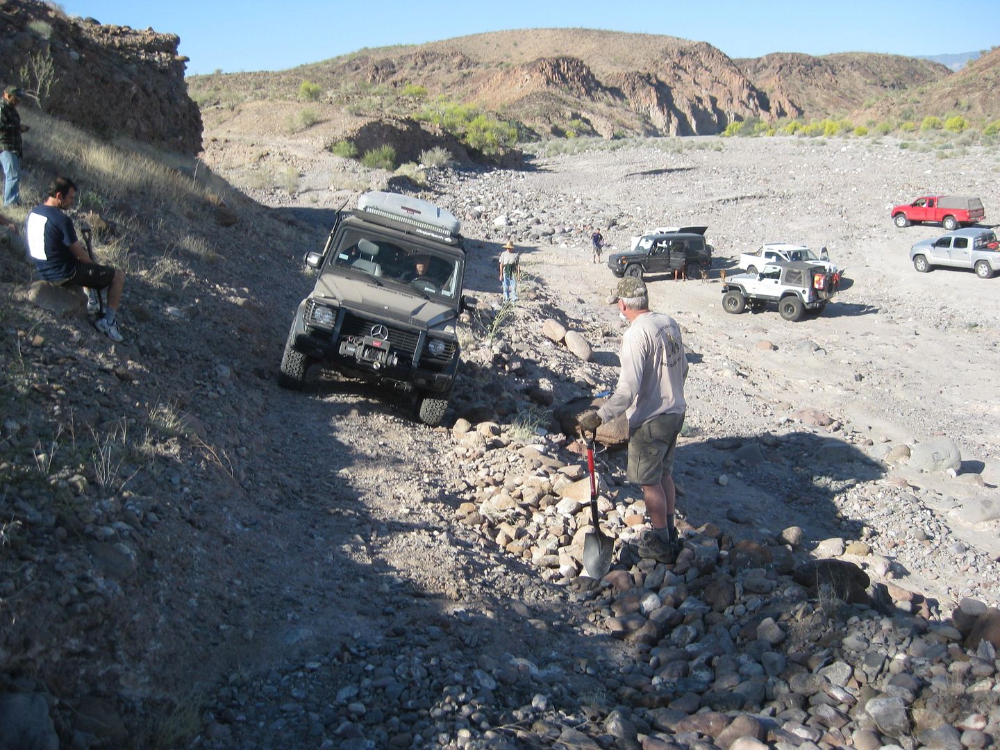
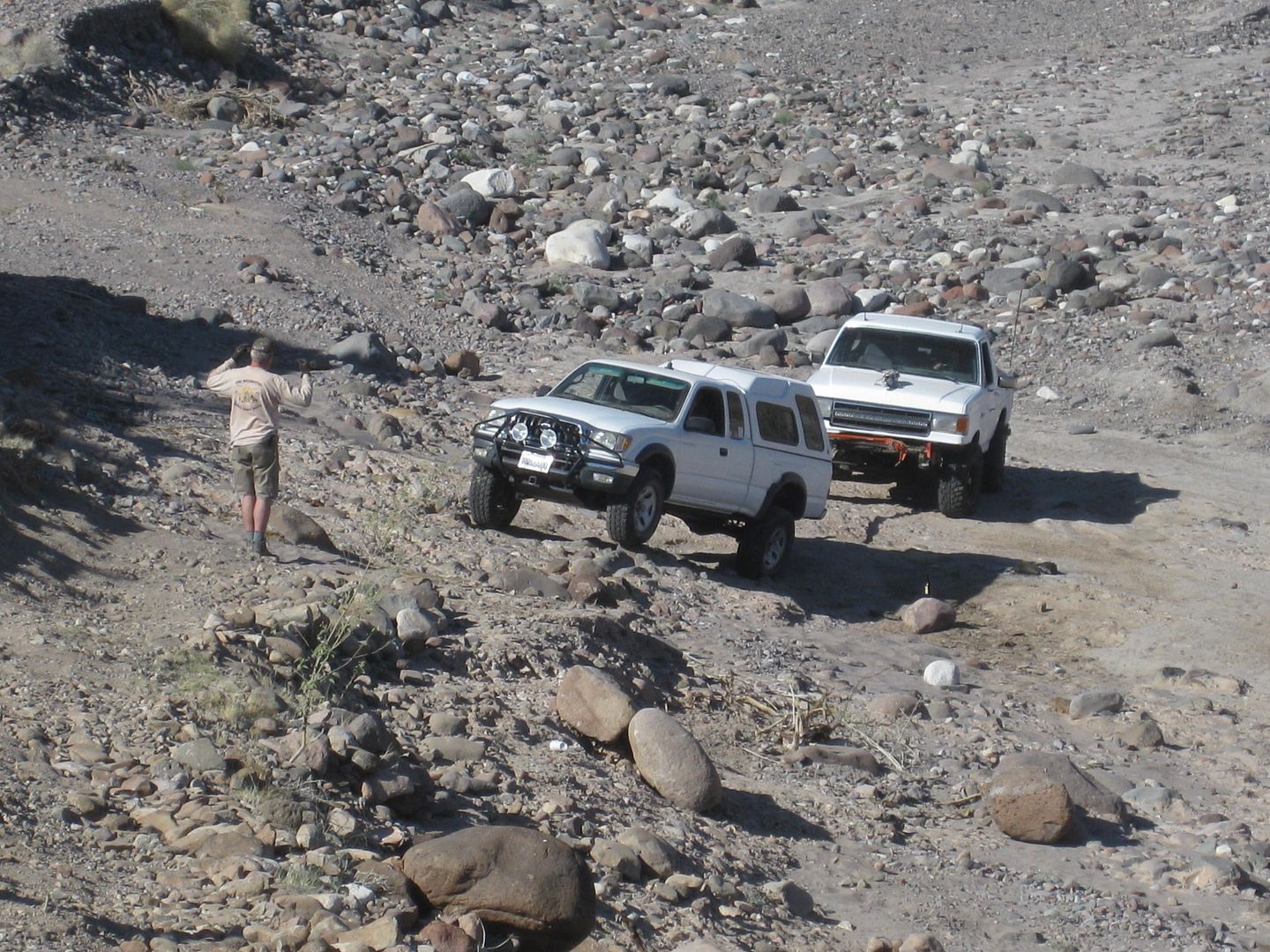
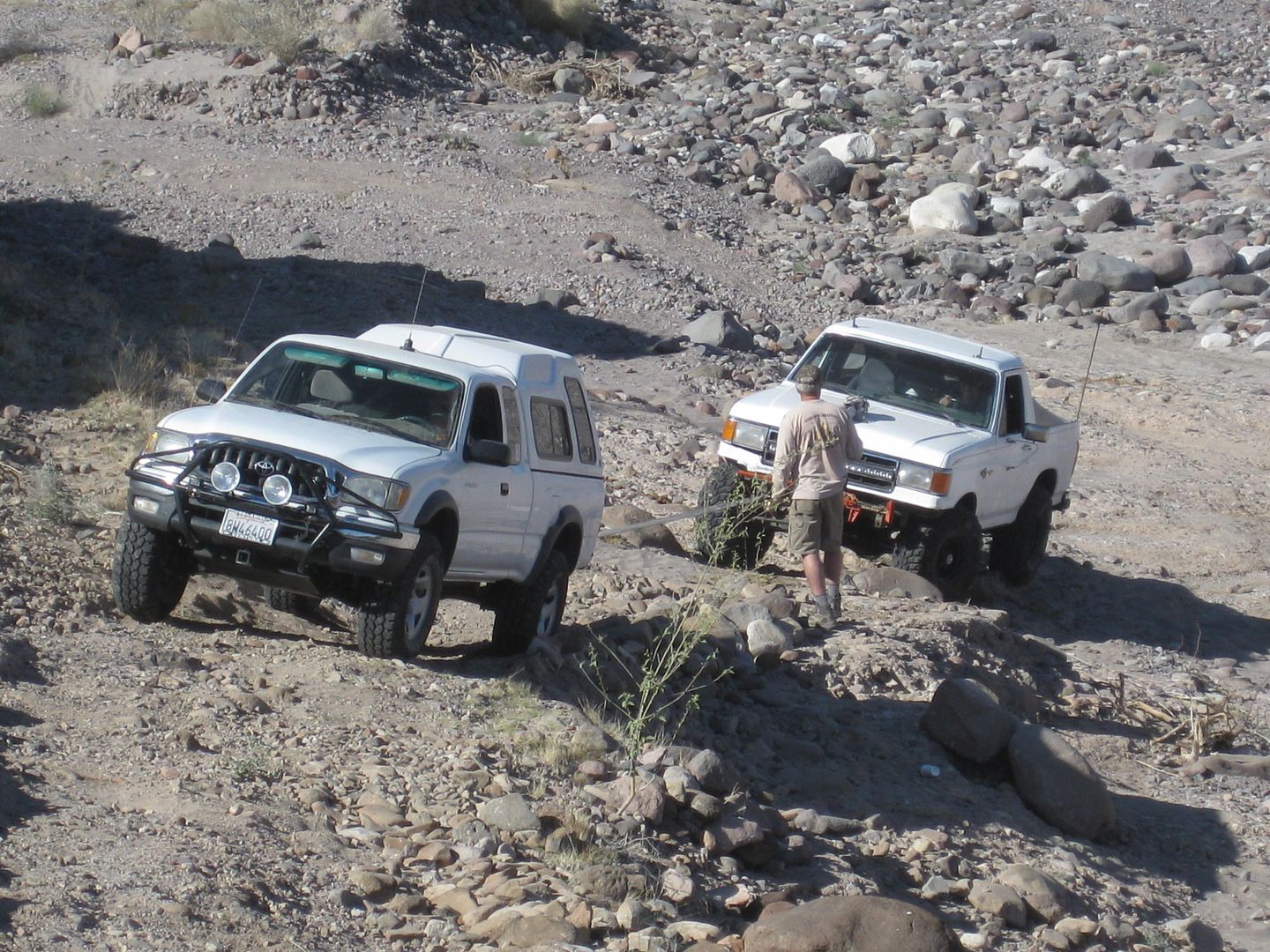
As soon as it is light enough to see, we confirm what was discovered last night. The Pole Line Road climbs back out of Arroyo Jaquegel soon after it
dropped into it, but the bottom of the grade out has been washed away. We see tracks (probably from PaulW a week or so earlier) who came from the
east, and easily dropped into the arroyo. However, we needed to make a road that the Ford could be pulled up!
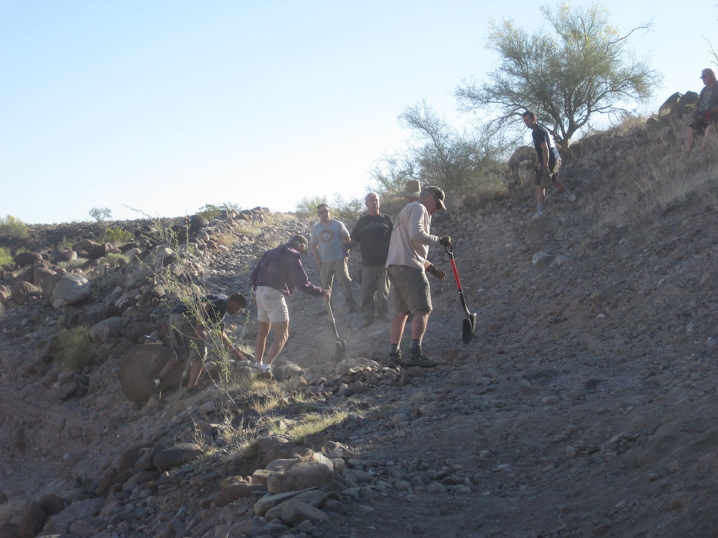
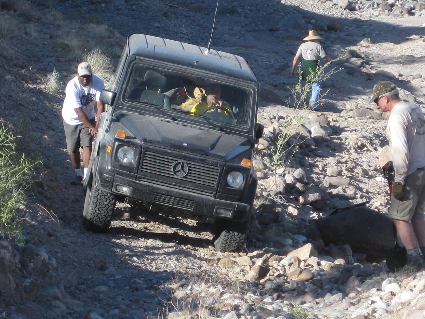
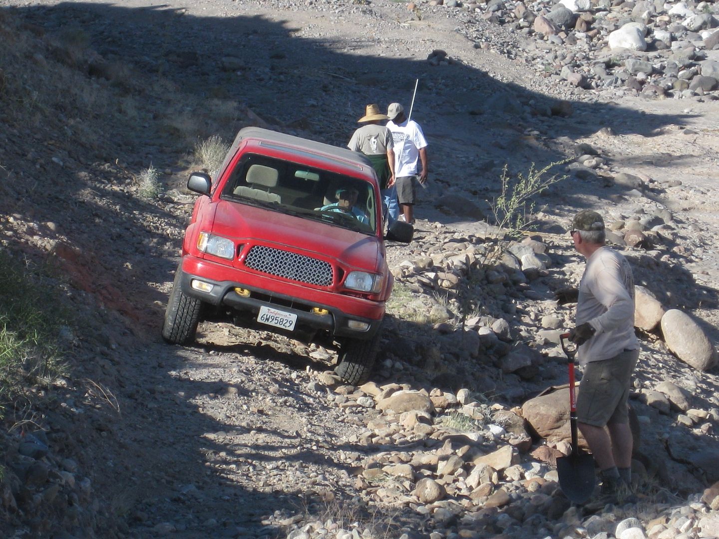
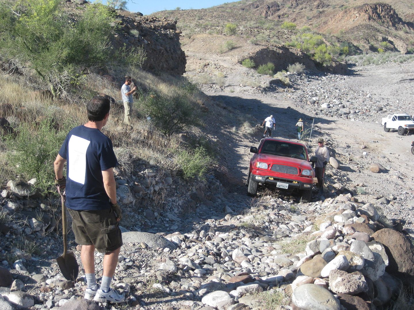
Wil was working on moving rocks before most of us were out of our sleeping bags. It wasnt long before more of the gang pitched in with shovels,
hammers, and gloved hands. The Baja Nomads built a road to join the existing road to the bottom of the wash where the Bronco waited.
There was a lot of discussion and committee about how to get the Bronco up the grade. One idea was to have a Rubicon pull it to the bottom, then
another with a winch to bring it up over the new road work (the most dangerous part). However, when all the Rubicons came up, and then the two
Mercedes V-8 4x4s, TW (TMW) took it upon himself and became the hero with his Tacoma and not only pulled the Bronco to the base of the grade, but all
the way to the top! At one point, TWs tires were slipping off the loose rock roadbed and could have rolled off into the arroyo. With dozens of eyes
and lots of loud yells, we didnt let him die that day! At the top, the Nissan Diesel truck took over the towing on mostly level terrain to the T
Intersection where we parted.
Kens Pole Line Only group would turn left to exit out to Highway 5 at the sand dunes via Ejido Saldaña (as he had done on previous runs) instead of
taking the route to La Ventana via the water pump well station.
Those of us going on the hike to find Walter Hendersons 1930s discovered Rock-Pile (and perhaps the lost grave of Melchior Diaz, 1541) turned right
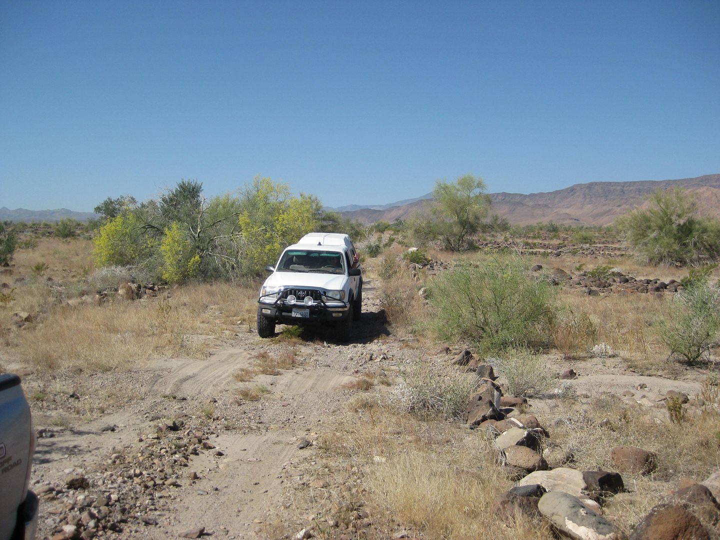
at the T Junction, drove past one last telephone pole and reached Arroyo Grande in 4.3 miles. There we, (Frigatebird (Joe), TW (Tom), 4x4abc (Harald)
, Fernwah (Karl), and I (David), turned right (south) and drove up Arroyo Grande into the canyon to a predetermined side wash that fit the description
given by Walter Henderson in a 1967 letter to Choral Pepper of Desert Magazine.
While we drove south in the sandy wash, Ken Cooke and crew ran out of road in Arroyo Jaquegel and could not find it to get to Ejido Saldaña and a
graded road out to Hwy. 5, towing the Bronco. This we did not learn of until the following day, and confirmed by reading about that on the Baja Nomad
forums after getting home.
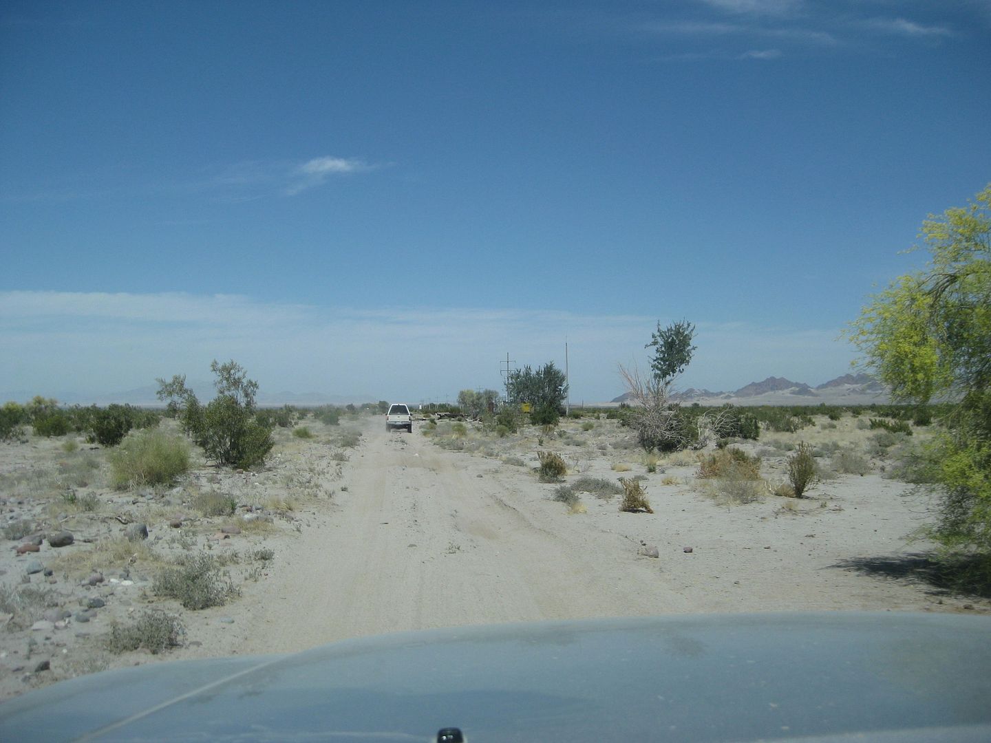
Here is the road log for Day 3:
Mile 20.6, Camp location, bottom of washed out grade east, reconstructed by energetic members of our group. Left camp 8:50 am.
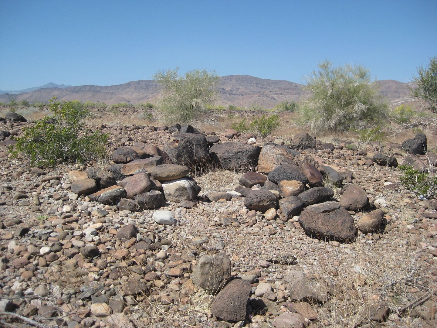
Mile 24.6, T Junction, turn right. Lots of 1942 cans and rock shelters (Indian or just our boys work?). The road is fairly wide and level coming to
the T Junction and could have been a landing strip, easily. The left turn road used to go to Ejido Saldaña, but the flash floods of recent years has
erased it.
Just after making the right turn at the T Junction, the road drops down into a wash, and used to climb up the opposite side, but that too is washed
out. A detour route stays in the wash a bit longer before climbing out to the right and goes back south to rejoin with the original route.
Mile 24.9, climb out of wash to right, steep grade with loose rocks, lockers or A-TRAC may be needed.
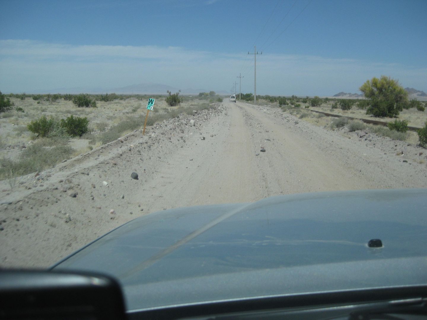
Mile 25.1, 10:45 am, return to original Pole Line Road, turn left (east).
A final cut short telephone pole is passed as the road rounds the tip of a pointy range of hills. Ahead are a couple of switch backs across a shallow
arroyo.
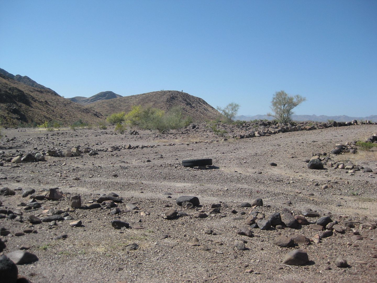
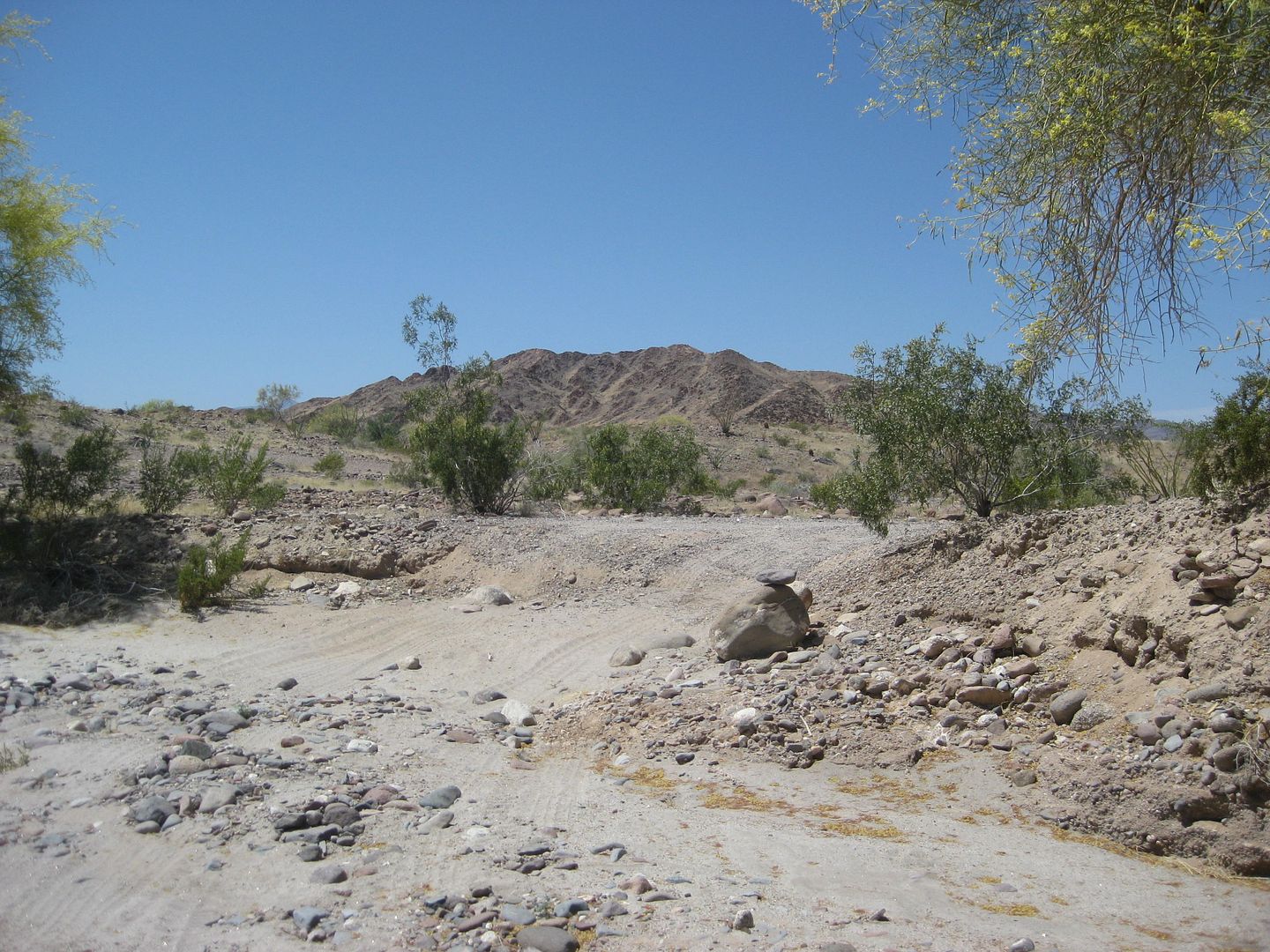
Mile 28.9, 11:23 am, Arroyo Grande, elev. 803.
Left goes 5.3 to the wells and waterline out to the gold mines next to Hwy. 5. From there it is 12.5 miles on easy, graded road to Hwy. 5, at Km.
106.5, just south of La Ventana café and rest stop.
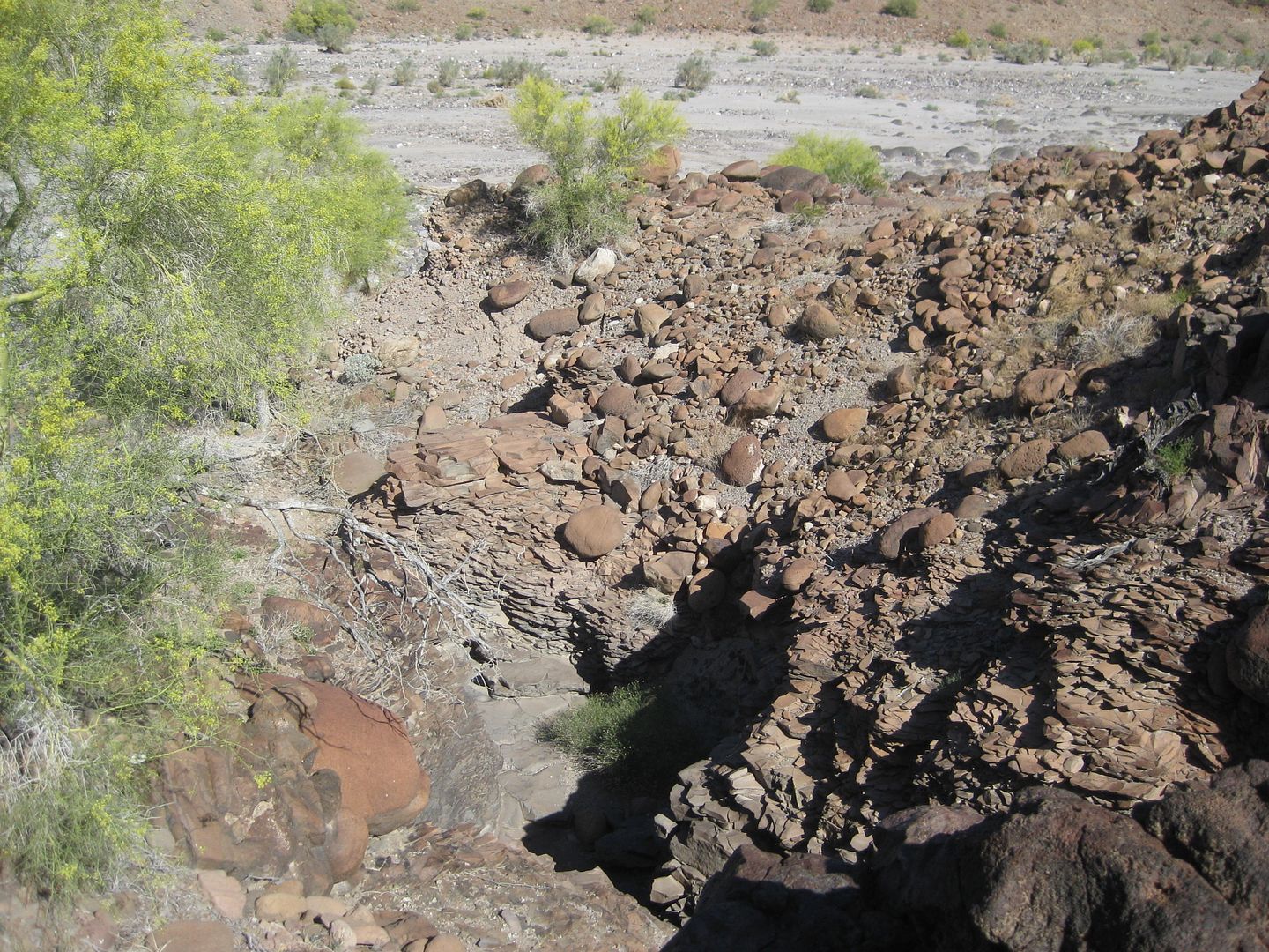
Right goes up Arroyo Grande for many miles, passing interesting cliffs, side canyons, and more!
Stay Tuned for the next part!
Wil working on making a ramp so his Bronco can be pulled out of the arroyo.
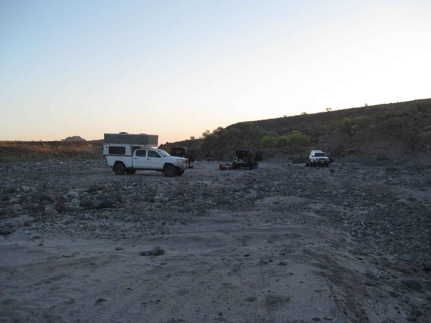
Frigatebird, Ken Cooke, and TW's camp sites, as seen from mine.
4x4abc and Fernwah's campsites.
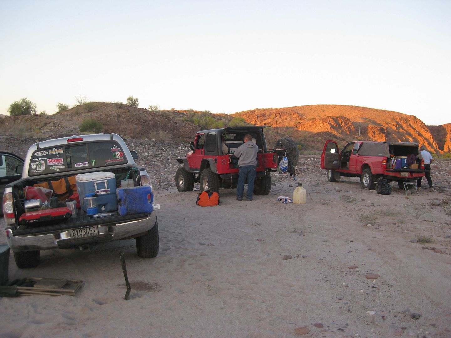
ehall's and Mike's camps, and part of mine.
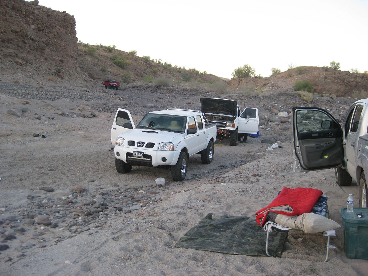
The rest of my camp and the Nissan of Larry (BajaTrailRider) with the Bronco of Wil, behind.
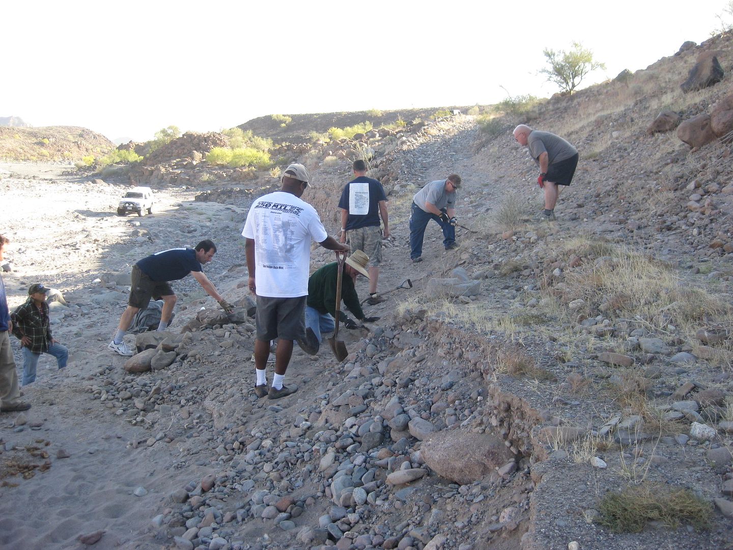
Nomad Construction Crew fixing the 1942 road.
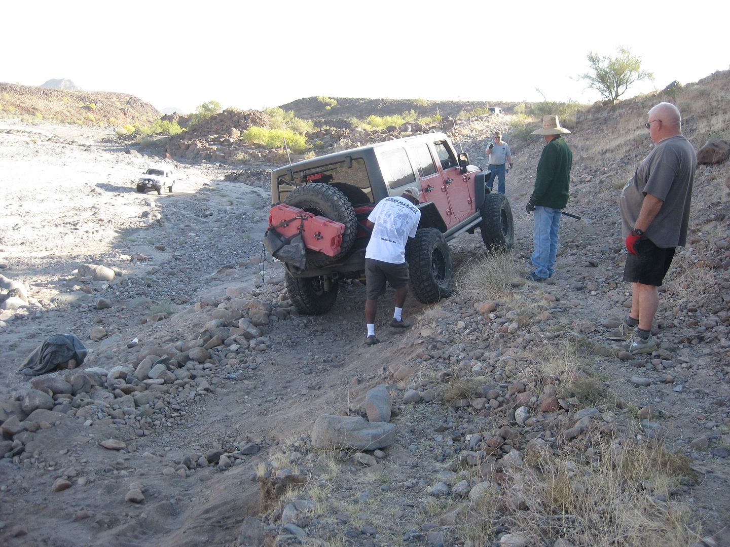
It worked!
But, it had a few places to be improved for the Bronco pull.
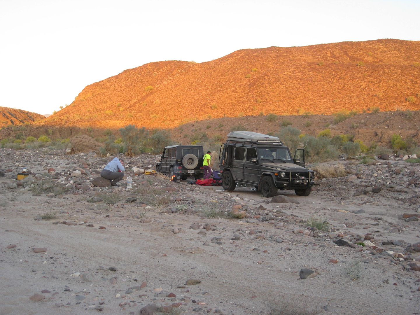
Karl (Fernwah)
Harald (4x4abc)
Mike
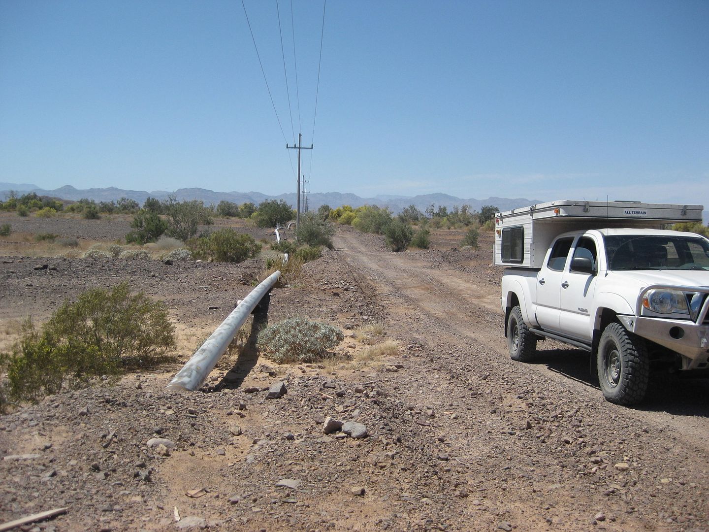
Our hero, TW and the mighty Tacoma TRD Off Road!
At the top was this gully just left of the road...
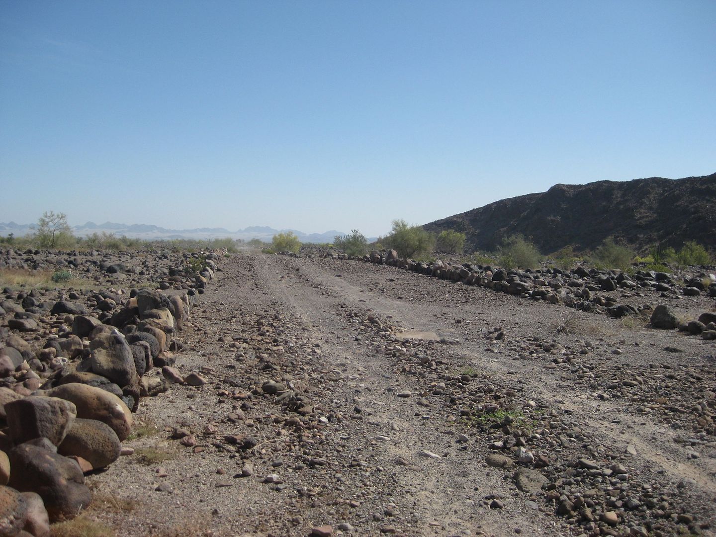
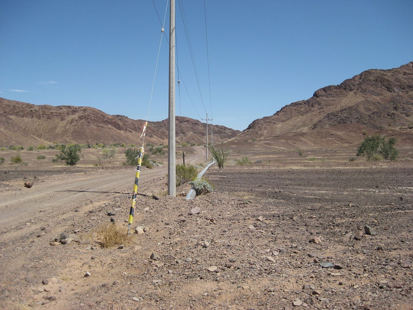
1942 runway? The Pole Line Road nearing the T Junction.
T Junction/Intersection
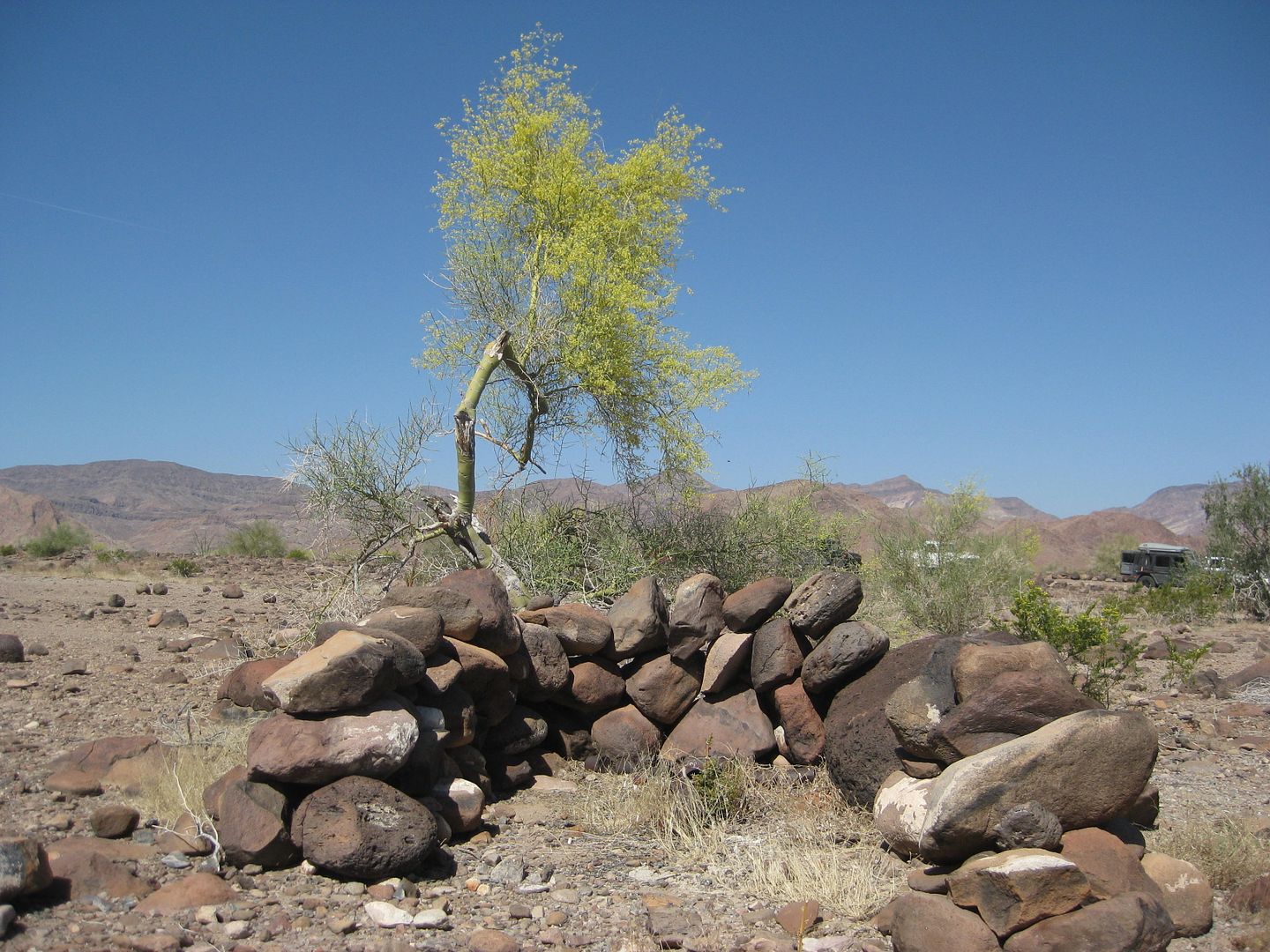
Rock Shelter
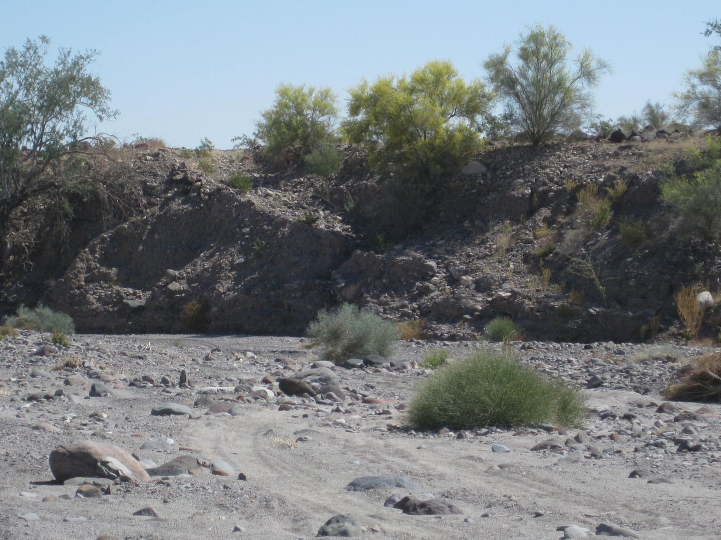
Look across the wash, that's the original Pole Line Road climbing out. Detour goes to the left about 1,000 feet before climbing out.
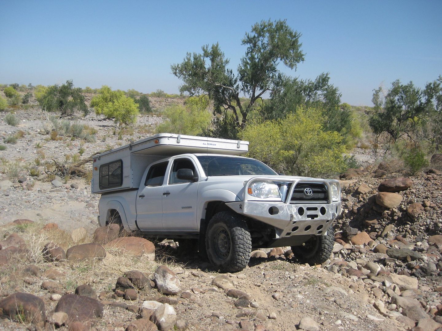
Frigatebird's Tacoma
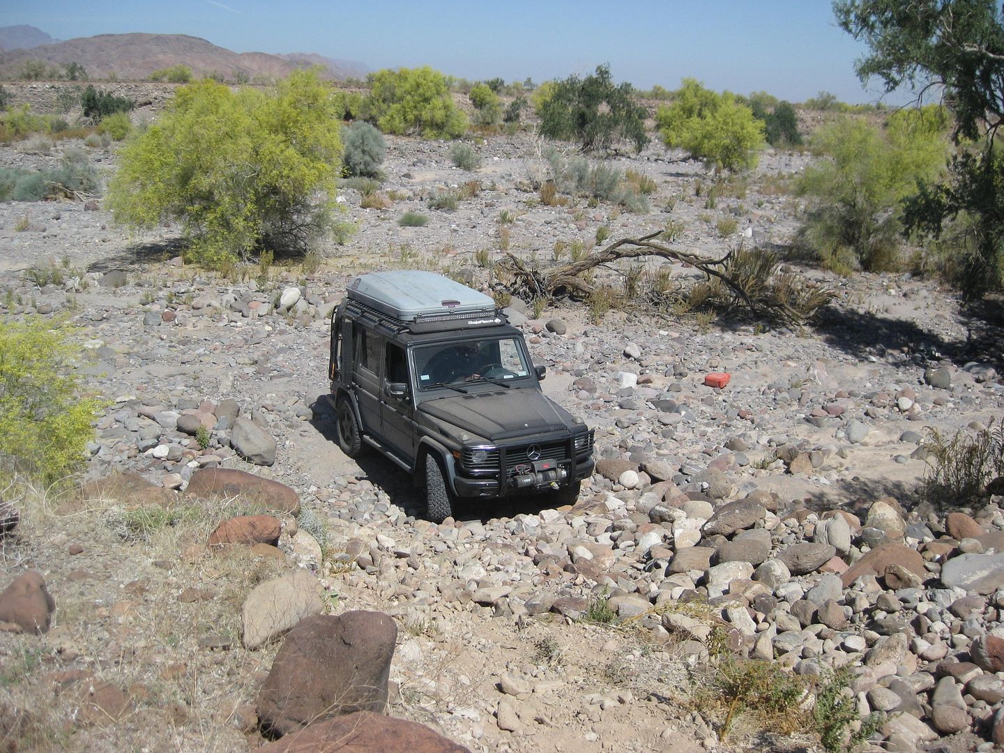
Fernwah's Mercedes 4x4
The final telephone pole we saw.
At Arroyo Grande looking west at the end of the Pole Line Road, for us. The 1942 pole line crossed Arroyo Grande and headed for San Felipe. On the
east side of the arroyo, SCORE uses the Pole Line Road to exit Arroyo Grande and head for Borrego Pits on Hwy. 3. The phone line road headed east to
the San Felipe 'new' road, going south from Mexicali (made in 1942 by the U.S.). That was called the 'Radar Road' back then.
The following are photos were taken Tuesday on the way out to Hwy. 5. The Henderson Hike/ Lost Diaz Grave Expedition will be in a separate post with a
link from here.
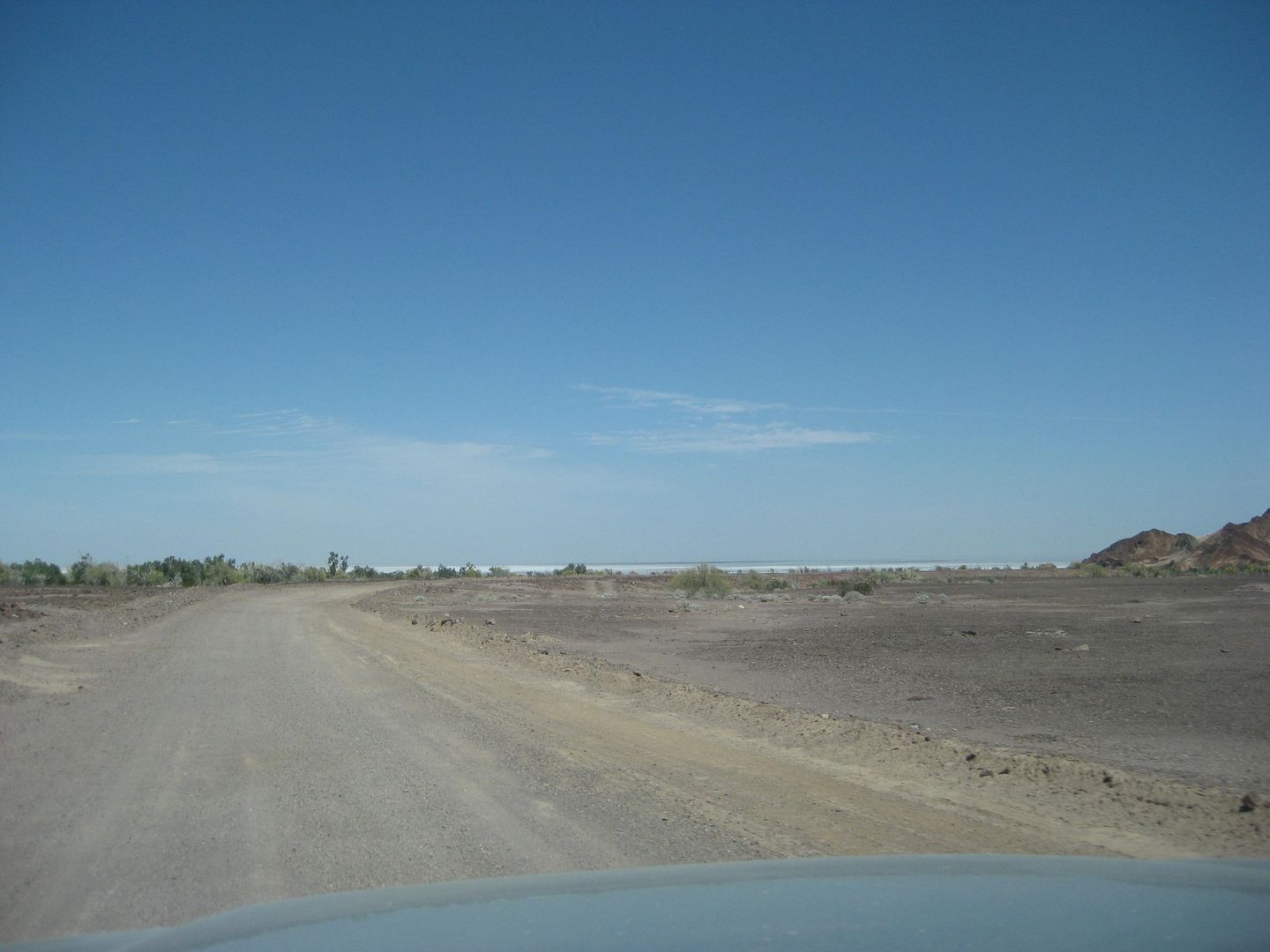
The top end of the Gulf of California is seen as we near Hwy. 5.
Thank you for joining us on this adventure... maps coming soon...
The second part of the trip was to search for a pile of rocks that may have been the grave of Spanish explorer Melchior Diaz, buried on Jan. 8, 1541.
The grave has never been found, but presumed by many to be in Sonora. The others in his party reported sites found in Baja California and if his grave
was in Baja it would confirm Diaz was the first Spaniard to walk to California.
Day 3 Monday PM and Day 4 (Tuesday) report is here: http://forums.bajanomad.com/viewthread.php?tid=78057
[Edited on 4-18-2015 by David K]
|
|
|
PaulW
Ultra Nomad
Posts: 3005
Registered: 5-21-2013
Member Is Offline
|
|
In that same area we noticed lots of discarded black plastic poly pipe. So at one time a rancher had tried to make something out of the water
resource. The white tank is fairly high relative altitude compared to the green area a distance to the south at a lower elevation. Times obviously
have changed.
PW
Quote: Originally posted by Ateo  | | What's up with the white tank? What large water vehicle is gonna make it out there to supply the tank? Just curious. Great report and keep the
photos coming. |
|
|
|
David K
Honored Nomad
Posts: 64479
Registered: 8-30-2002
Location: San Diego County
Member Is Offline
Mood: Have Baja Fever
|
|
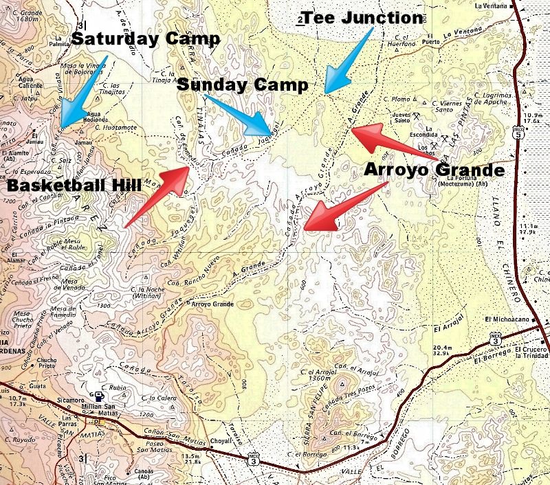
The two red arrows pointing to Arroyo Grande:
The northern arrow points to where the Pole Line Road reached the big arroyo and the southern arrow is where we camped Monday night and hiked.
[Edited on 4-11-2015 by David K]
|
|
|
PaulW
Ultra Nomad
Posts: 3005
Registered: 5-21-2013
Member Is Offline
|
|
| Quote: Originally posted by David K | DAY 3, MONDAY APRIL 6, 2015
As soon as it is light enough to see, we confirm what was discovered last night. The Pole Line Road climbs back out of Arroyo Jaquegel soon after it
dropped into it, but the bottom of the grade out has been washed away. We see tracks (probably from PaulW a week or so earlier) who came from the
east, and easily dropped into the arroyo. However, we needed to make a road that the Ford could be pulled up!
Wil was working on moving rocks before most of us were out of our sleeping bags. It wasnt long before more of the gang pitched in with shovels,
hammers, and gloved hands. The Baja Nomads built a road to join the existing road to the bottom of the wash where the Bronco waited.
There was a lot of discussion and committee about how to get the Bronco up the grade. One idea was to have a Rubicon pull it to the bottom, then
another with a winch to bring it up over the new road work (the most dangerous part). However, when all the Rubicons came up, and then the two
Mercedes V-8 4x4s, TW (TMW) took it upon himself and became the hero with his Tacoma and not only pulled the Bronco to the base of the grade, but all
the way to the top! At one point, TWs tires were slipping off the loose rock roadbed and could have rolled off into the arroyo. With dozens of eyes
and lots of loud yells, we didnt let him die that day! At the top, the Nissan Diesel truck took over the towing on mostly level terrain to the T
Intersection where we parted.
Big snip...
|
= = =
I am impressed with all the effort you all did. - Good job.
We did have difficulty at the bottom of the grade. Bad camber and rocks to the right. Some went to the right over the rocks and other took the off
camber. Went well.
We did have two other areas of note that you all did not even have issues.
Remember the very steep bank you all went down to get into the very rocky wash. That passage took 3/4 of an hour to get all 7 of us thru. Very slow
in the rocks and no traction to get up the bank. Timid drivers added to the slowness.
The other issue was I missed the turn up a steep bank, and drove past the turn out of the wash. Duh, I zoomed in on my GPS and sure enough I missed
the track. You all came down that hill and probably did not even notice it except that it is a steep place.
BTW we never saw any tracks for our trip so we heavily used the GPS. The turn out of AG was not apparent, The flagging at the turn is down to just
stubs.
Sorry to interrupt the dialog. Carry on.
Paul
|
|
|
bajatrailrider
Super Nomad
Posts: 2423
Registered: 1-24-2015
Location: Mexico
Member Is Offline
Mood: Happy
|
|
Special thanks to Ken for his hard work to make this trip happen.We had a great time.Also to set the record.The distributor that broke on Wils
Bronco.Is a aftermarket Hi performence non ford part.MADE IN CHINA choose and loose.Also David your book I could not put it down once I started
reading it.

|
|
|
ehall
Super Nomad
Posts: 1906
Registered: 3-29-2014
Location: Buckeye, Az
Member Is Offline
Mood: It's 5 o'clock somewhere
|
|
Hey, that looks alot like a jeep at the top of the hill waiting for a road to be built for everyone else. Hahaha
|
|
|
PaulW
Ultra Nomad
Posts: 3005
Registered: 5-21-2013
Member Is Offline
|
|
The pictures are great. When doing the trip in one day very little time was available for pics. I will send the link to the SF guys so they can relive
the trip.
Next year I will try to get thru AG Ha.
Paul
[Edited on 4-10-2015 by PaulW]
|
|
|
4x4abc
Ultra Nomad
Posts: 4163
Registered: 4-24-2009
Location: La Paz, BCS
Member Is Offline
Mood: happy - always
|
|
found a wonderful group photo in my collection
Harald Pietschmann
|
|
|
Ken Cooke
Elite Nomad
Posts: 8921
Registered: 2-9-2004
Location: Riverside, CA
Member Is Offline
Mood: Black Trans Lives Matter
|
|
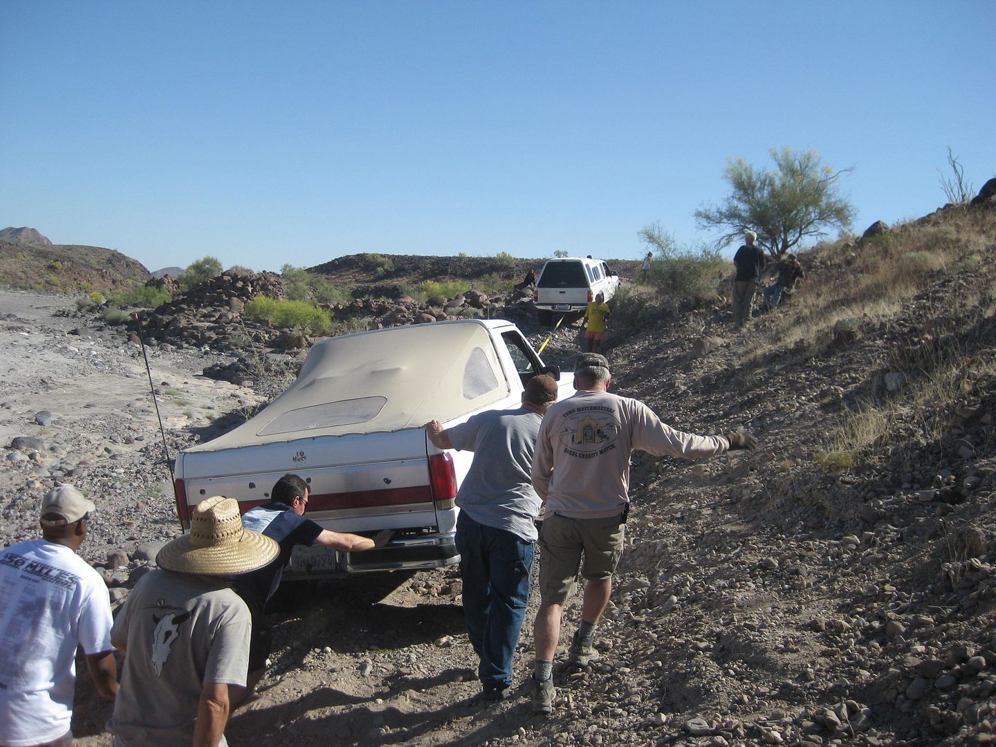
The "Skateboard Ramp" obstacle
| Quote: Originally posted by PaulW | Remember the very steep bank you all went down to get into the very rocky wash. That passage took 3/4 of an hour to get all 7 of us thru. Very slow
in the rocks and no traction to get up the bank. Timid drivers added to the slowness.
|
That is near where we camped the 2nd night. That obstacle is a blast driving down!
|
|
|
TMW
Select Nomad
Posts: 10659
Registered: 9-1-2003
Location: Bakersfield, CA
Member Is Offline
|
|
The pictures tell the story. Lots of fun. Thanks again to Chuck as he did the spotting and kept me in line. Ken put together another great PLR run
with lots of the unexpected all the way to the end.
|
|
|
David K
Honored Nomad
Posts: 64479
Registered: 8-30-2002
Location: San Diego County
Member Is Offline
Mood: Have Baja Fever
|
|
| Quote: Originally posted by ehall | Hey, that looks alot like a jeep at the top of the hill waiting for a road to be built for everyone else. Hahaha
|
You are so correct! Your Jeep and driving skills are Numero Uno!
|
|
|
David K
Honored Nomad
Posts: 64479
Registered: 8-30-2002
Location: San Diego County
Member Is Offline
Mood: Have Baja Fever
|
|
Glad you enjoyed it! We wanted folks to easily visualize the actual way all the California missions were founded, from Loreto and out in all
directions.
|
|
|
ehall
Super Nomad
Posts: 1906
Registered: 3-29-2014
Location: Buckeye, Az
Member Is Offline
Mood: It's 5 o'clock somewhere
|
|
I also enjoyed your book. Passing it around at work now.
|
|
|
JohnK
Junior Nomad
Posts: 69
Registered: 3-11-2012
Member Is Offline
|
|
Great Adventure! Great Post! A question: When on roads like that, do you air down? I've got a Tacoma and a pop-up camper. Always wonder what to do
when I go from Coco's down to the 1.
|
|
|
David K
Honored Nomad
Posts: 64479
Registered: 8-30-2002
Location: San Diego County
Member Is Offline
Mood: Have Baja Fever
|
|
| Quote: Originally posted by JohnK | | Great Adventure! Great Post! A question: When on roads like that, do you air down? I've got a Tacoma and a pop-up camper. Always wonder what to do
when I go from Coco's down to the 1. |
Yes, nobody got a flat on the Pole Line Road as everyone aired down. I had probably the cheapest tires of all, as well (Pep Boys Dakota ATs). Normal
pressure of 34 psi dropped to 25 for the run and dropped to 18 for the sand in Arroyo Grande. Others ran mostly 15-20 psi on the PLR run.
|
|
|
4x4abc
Ultra Nomad
Posts: 4163
Registered: 4-24-2009
Location: La Paz, BCS
Member Is Offline
Mood: happy - always
|
|
general rules for airing down are as follows:
lets say your normal air pressure is 30 psi (check what your truck manufacturer recommends)
"off-road" go down 1/3 of normal = 20 psi (leaving pavement to medium duty off-road like pole line road)
"mud, sand and snow" go down another 1/3 = 10 psi (soft sand, severe duty off-road like Rubicon Trail)
"emergency" go to 50% of the last setting = 5 psi (stuck at the beach, very steep hill climbs)
and no, the tire will not come off the wheel with low psi unless you do something stupid
rules for soft sand etc
you should air up as soon as conditions change - however, if your compressor just broke down, you can still drive on pavement to the next gas station
on 10 psi tires. Just don't drive faster than 40 mph and not longer than 1 hour
[Edited on 4-10-2015 by 4x4abc]
Harald Pietschmann
|
|
|
Taco de Baja
Super Nomad
Posts: 1913
Registered: 4-14-2004
Location: Behind the Orange Curtain, CA
Member Is Offline
Mood: Dreamin' of Baja
|
|
| Quote: Originally posted by David K |
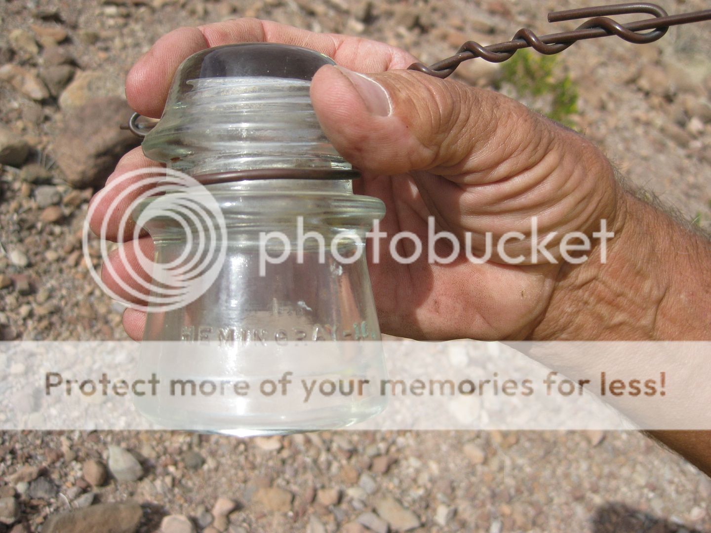
An insulator with wire... it reads...
On one side: HEMINGRAY-16.
On the opposite side: MADE IN U.S.A. 1-41
January, 1941 and installed in June, 1942 as best we know at the moment. Harald thinks he can dig up more data on the history of the line and the
road construction.
|
Thanks for sharing a great trip report.
In all my drives through Baja, that was one of the nastiest roads I have been on, not the worst, but right up there. 
Just a minor correction on the Hemingray insulator.
The 1 is a mold number, not a month. The 41 is a year; but you also need to check if there are any dots after the 41. 1 dot = 1942, 2 dots = 1943, 6
dots = 1947, etc.
For decoding other numbers seen on Hemingray insulators go here: http://www.hemingray.info/database/mold-datecodes.html
Truth generally lies in the coordination of antagonistic opinions
-Herbert Spencer
|
|
|
| Pages:
1
2
3
4
..
12 |


