| Pages:
1
2
3 |
David K
Honored Nomad

Posts: 65501
Registered: 8-30-2002
Location: San Diego County
Member Is Offline
Mood: Have Baja Fever
|
|
Spanish era military button article (link added)
Cool question... will respond more later. U.S. forces used ships and occupied or did battle in port towns in the south.
Travel back then by land was likely still on El Camino Real, which is east of Laguna Chapala near Coco's Corner as it ran between Calamajue and Santa
Maria and San Fernando de Velicata.
*The OP removed his post, but the article has popped back up so I grabbed the link to share here and on my Facebook Group: https://www.academia.edu/9891437/A_Military_Button_from_Baja...
[Edited on 12-5-2021 by David K]
|
|
|
David K
Honored Nomad
Posts: 65501
Registered: 8-30-2002
Location: San Diego County
Member Is Offline
Mood: Have Baja Fever
|
|
Quote: Originally posted by Lancesf  | I wonder if the military itinerary followed the Camino Real in some parts but not in others. Here is what I was thinking.
The mission roads are the best route to use if you want to travel north and south and feel compelled to stop at all the missions, but not necessarily
the best route overall. This might be especially true of the stretch between Calmajue and Santa Maria.
The route of the highway is the best route to use traveling north to south if you have wheeled vehicles, wagons/cars.
But what was the best route for people who were travelling by horse and/or mule and didn't need to stop at all the missions?
|
The missions were located at good water sources. El Camino Real went from water source to water source. All people and animals need water, so the
missions and springs and tinajas were needed stopping points. Remember, by foot or hoof, the typical distance covered was only 12-25 miles per day,
specially when traveling in groups.
The Camino Real was a main route of travel at least to the early 1900's, as documented by Arthur North in his 1910 book, 'Camp and Camino in Lower
California'. The mines of the late 1800's and 1900's caused the need for more roads and eventually truck roads that began to criss-cross the
peninsula.
Are you researching Mexican troop movement or American? The Mexican resistance in southern Baja California was small and traveled between Mulegé and
San José del Cabo and resisted the gringo invasion well. However, the comandante/ governor at La Paz peacefully surrendered and the American flag was
raised there and the population who had been ignored by Mexico City for all of their lives, welcomed the chance to be part of the United States. When
we gave Baja back to Mexico at the end of the war, many in La Paz chose to relocate to Alta California.
American forces arrived by ship and was small in size.
|
|
|
fdt
Ultra Nomad
Posts: 4059
Registered: 9-7-2003
Location: Tijuana, Baja California
Member Is Offline
Mood: Yeah, what if it all goes right
|
|
Why thanks, that was very nice of you!
A well informed Baja California traveler is a smart Baja California traveler!
|
|
|
David K
Honored Nomad
Posts: 65501
Registered: 8-30-2002
Location: San Diego County
Member Is Offline
Mood: Have Baja Fever
|
|
That is quite a detailed article and interesting to read! Thank you for sharing it...
It seems that the button is Spanish and not Mexican, made in the 1700's?
Maybe I didn't understand the the reason for thinking it was post 1822 (Mexican period)... but regardless, it is still an interesting find.
The location was at a spring in the Arroyo Santo Dominguito. The ranch that was there in the 1960's was called Agua de Refugio (Gerhard & Gulick,
1962). It previously was called 'El Buen Paso' (Gerhard & Gulick, 1956 & 1958).
Any place with water was important in a desert... and Indians and later Spanish then Mexicans would visit or live there.
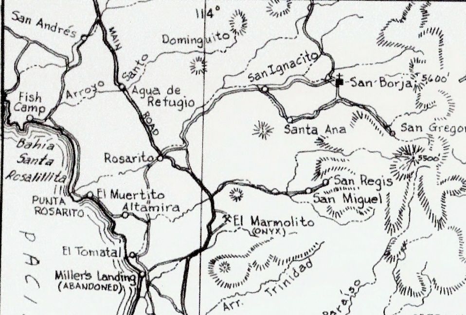
1962 Map
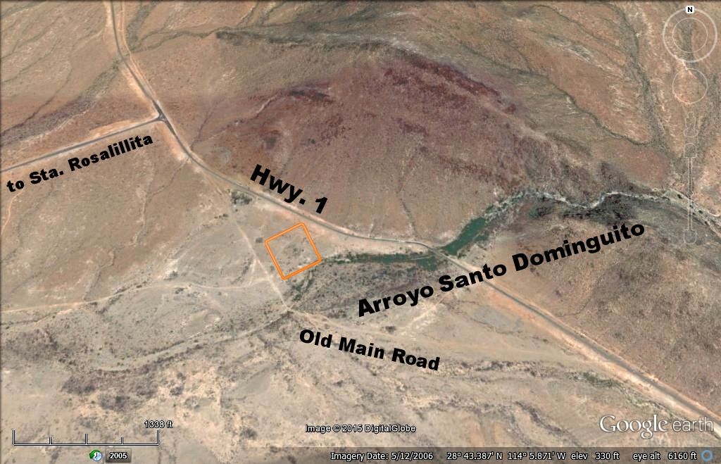
Today, the arroyo where Rancho Agua de Refugio was located, is just south of the paved road to Santa Rosalillita junction.
Here is a 2006 satellite image with labels added. The square area is my guess what the rancho was located.
On the 1930 map, it has both a Santo Dominguito and an Agua de Refugio, but not at the same place (arrows)...
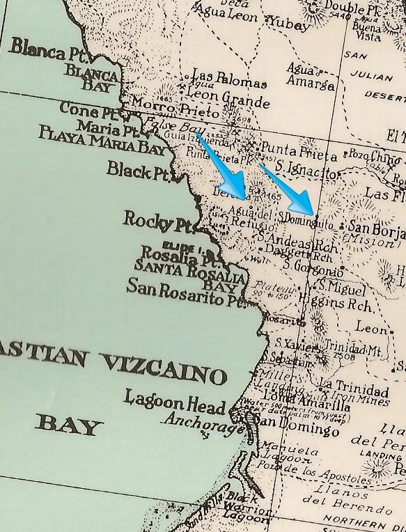
[Edited on 10-30-2021 by David K]
|
|
|
David K
Honored Nomad
Posts: 65501
Registered: 8-30-2002
Location: San Diego County
Member Is Offline
Mood: Have Baja Fever
|
|
Keep on researching indeed!
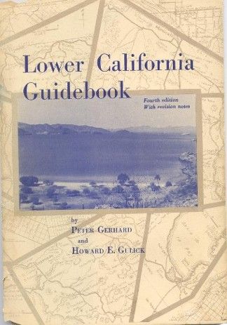
The Lower California Guidebook (4 editions '56/'58/'62/'67, additional printings '64/'70) is a must have for any student of Baja history, specially of
conditions in the mid 1900's. However, the authors were great in researching past history at many of the sites logged in the book. Get the '62-'70
printings as they are the same, in '67 some update notes were added to the front of the book is the only difference between the 3rd and 4th
editions.
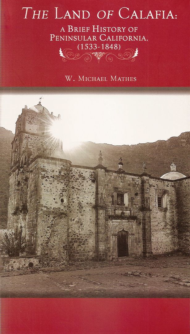
Dr. Mathes was an extremely passionate lover of Baja history (I can relate to that)... However, there were some things he wrote or passed
along from others that were not so correct. At least one Baja Nomad member was on his final tour of the missions he did for CAREM, and said he was
non-stop info guide as they traveled along, in English and then in Spanish. The amount of writing, books, and lectures Dr. Mathes performed would be
hard to beat! Here is Dr. Mathes' final book (he was kind enough to autograph it to me):
Because the rare locations of water in central Baja, that mandated any routes of travel pass through them. Any travel west, then north from
San Borja would go to Agua de Refugio. Just as all travel north from San Borja would go to Tinaja de Yubay on the second day out.
Here is the route of Padre Linck in February, 1766 seeking new mission sites beyond San Borja (numbers along the route are the dates in February, 1766
from Linck's diary):
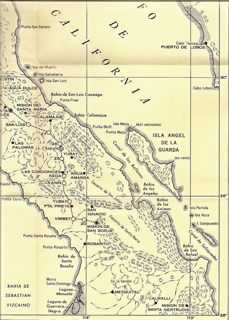
VIMBET (San José de Vimbet) was likely the water source of this discussion, Agua de Refugio. Linck would later discover Velicatá (which would
become a mission in 1769 called San Fernando) and revisit Calamajué on April 12, 1766 (first discovered by Padre Consag in 1753). More on Calamajué
mission here:
http://www.discoverbaja.com/2014/08/17/the-spanish-missions-...
|
|
|
David K
Honored Nomad
Posts: 65501
Registered: 8-30-2002
Location: San Diego County
Member Is Offline
Mood: Have Baja Fever
|
|
Sure, here you go...
fyi, on your Photobucket page, see where it says 'SHARE LINKS' in the top right region, next to the photo? Click on the third link, called IMG. Now it
is auto-copied in your mouse... just paste that IMG link here on Nomad, as I did above.
[Edited on 4-21-2015 by David K]
|
|
|
4x4abc
Ultra Nomad
Posts: 4455
Registered: 4-24-2009
Location: La Paz, BCS
Member Is Offline
Mood: happy - always
|
|
what is the significance of the question marks on the Padre Linck map?
Harald Pietschmann
|
|
|
David K
Honored Nomad
Posts: 65501
Registered: 8-30-2002
Location: San Diego County
Member Is Offline
Mood: Have Baja Fever
|
|
You will also notice a second 'Yubay' on the map. The true Yubay is the north of San Borja one.
The Burrus (Linck) map is not accurate is some respects... the location of Chapala is too far south and the locations of Yubay, Calamajué, Agua Amarga
are too far north. San Ignacio (San Ignacito today) is also wrong, as it is west of San Borja... for that matter San Borja is too far west... as it is
in the center of the peninsula, slightly closer to the gulf.
|
|
|
David K
Honored Nomad
Posts: 65501
Registered: 8-30-2002
Location: San Diego County
Member Is Offline
Mood: Have Baja Fever
|
|
Good job on posting the maps!
Where did you get the Tinaja names from?
Don't put a lot of weight on any maps drawn before Howard Gulick accurately mapped all the roads he drove in the late 1940's, 1950's and early 60's.
Agua Leon was mentioned in Howard Hale's book, 'Long Walk to Muleg�' (an adventure done in 1921) as a water hole they couldn't find (using
Goldbaum's map). They did come upon a construction crew building a mine road at Leon Grande (15 kilometers south of Agua Leon, they were told). Leon
Grande had plenty of cool, clear water and that was quite a relief to Hale, his companion, and their mules!
The new road was an amazing bit of construction that started and ended in nowhere, in Hale's words. He gives the distance from Leon Grande to Punta
Prieta as 15 + kilometers. South of the village of Punta Prieta, the road was badly un-repaired and while it once may have offered passage to wagons,
it no longer did.
[the road work likely was to connect Leon Grande mines to Bahia de los Angeles for shipment of the gold.]
Here are the sites as shown on Goldbaum's map, plus Tinaja de Yubay and Laguna Chapala.
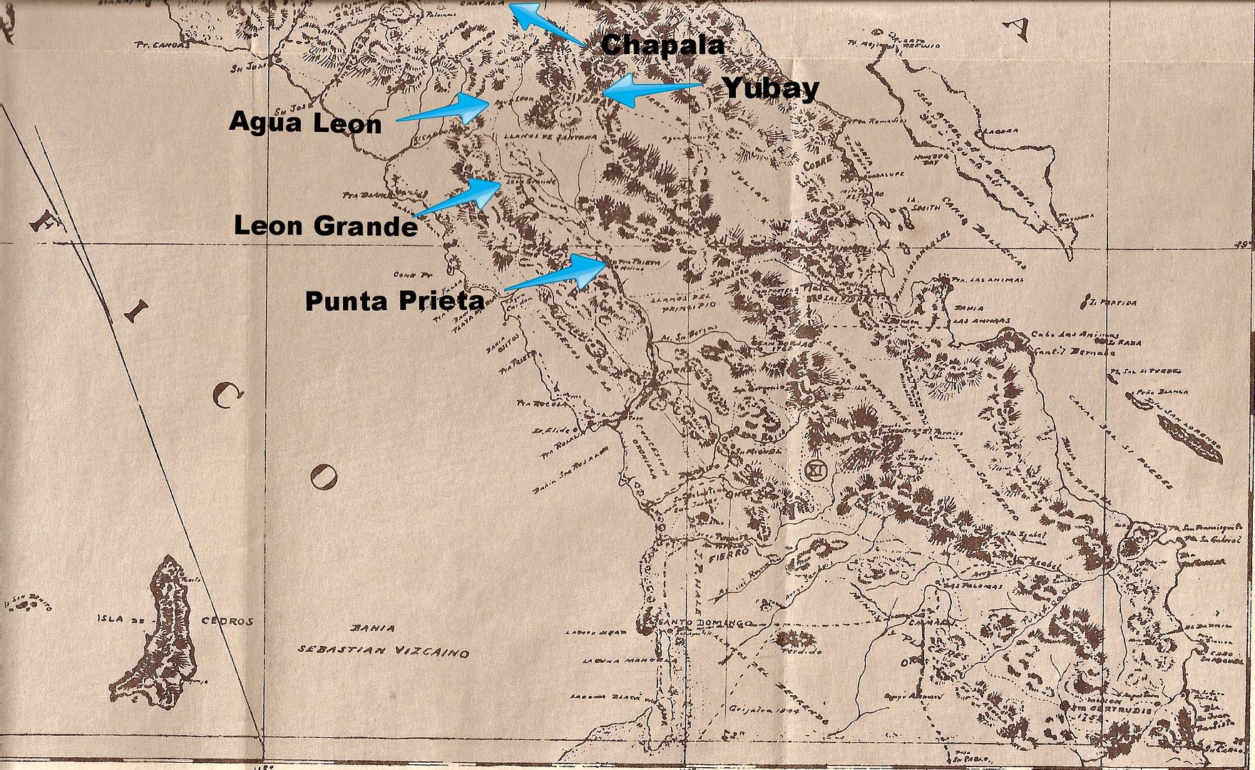
[Edited on 10-30-2021 by David K]
|
|
|
elbeau
Nomad
Posts: 256
Registered: 3-2-2011
Location: Austin, TX
Member Is Offline
|
|
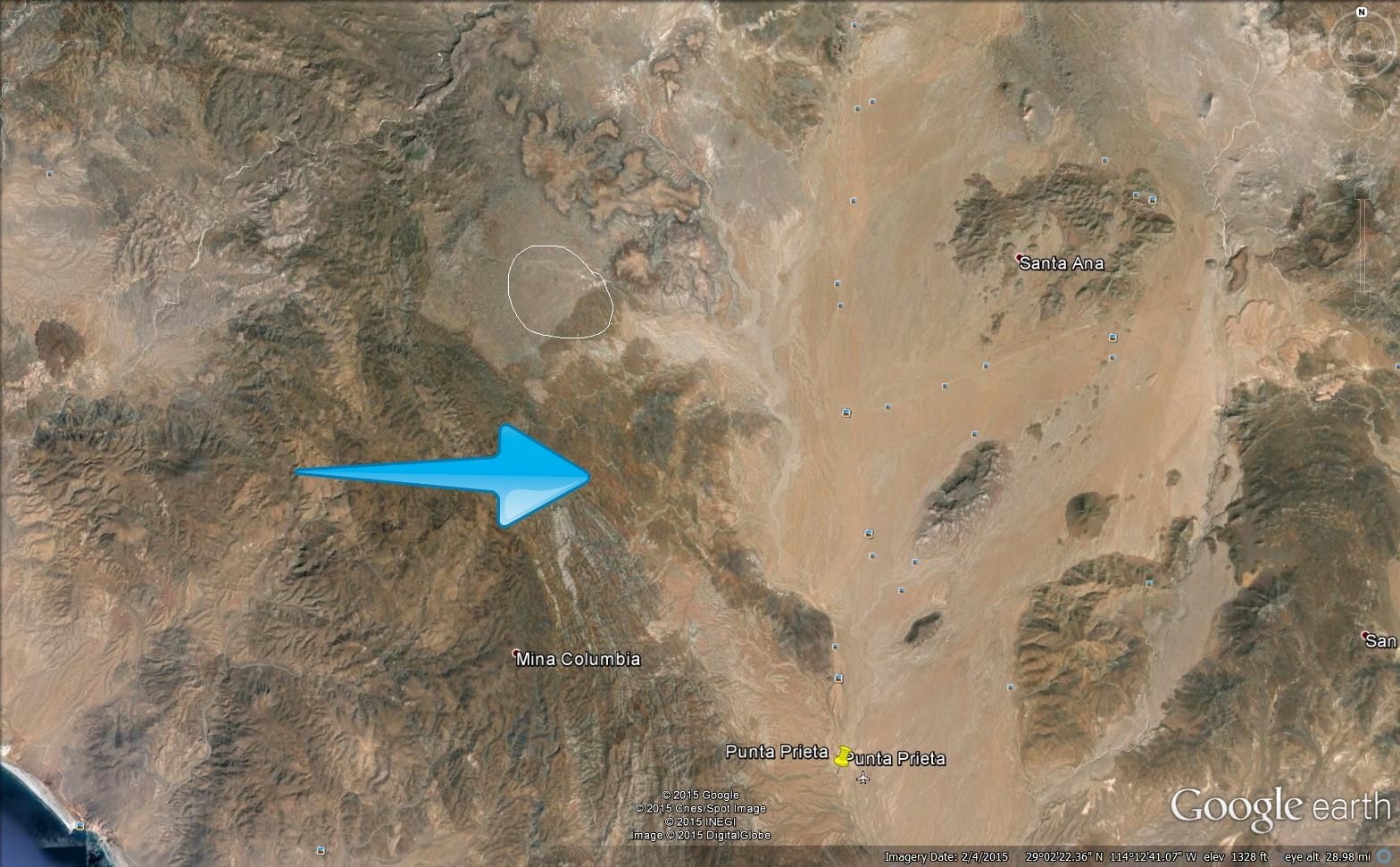
I doubt this will be much help, but the only other thing I've noted as a route near that area comes from a map from "Journey of the Flame", an
historical fiction novel. It's labeled "Arrow's Flight" on the map. I've read the book but don't have it in front of me right now.
Can anybody remember what "Arrow's Flight" referenced in the book? It looks like the narrowest point from coast-to-coast on the northern peninsula.

I little ways SSE of the place where the button was found is La Angostura. Eric Ritter's comments about his archaeological work there implies that La
Angostura was a well-traveled east/west corridor before and during mission times. (http://www.xaguaro.com/MemoriasCD/page3/styled-32/styled-49/...). It seems like it would be natural for Spanish-era people to travel north from
La Angostura through the area where the button was found as they pushed the mission system northward. Basically the same route the road follows
today.
|
|
|
David K
Honored Nomad
Posts: 65501
Registered: 8-30-2002
Location: San Diego County
Member Is Offline
Mood: Have Baja Fever
|
|
The peninsula is so narrow, an Indian's arrow could fly across the peninsula there. 
|
|
|
David K
Honored Nomad
Posts: 65501
Registered: 8-30-2002
Location: San Diego County
Member Is Offline
Mood: Have Baja Fever
|
|
Punta Prieta and Laguna Chapala are easy to see, but we need a better spot for Leon Grande, I think?
Hale was told Agua Leon to Leon Grande was 15 kms (mas o menos), he then walked from Leon Grande to Punta Prieta and said it was at least 15 kms. (9+
miles), perhaps a bit more. In any case, that still puts Leon Grande closer to the halfway point between Agua Leon and Punta Prieta, than way close to
one and way far from the other, yes?
The overall distance from Punta Prieta to Agua Leon is close to 30 kms (~19 miles) per Hale's book.
This is a very interesting area of study. Leon Grande was an important town for a time, and nothing much is found on it nor any roads on maps going
towards it, north from Punta Prieta...??
|
|
|
David K
Honored Nomad
Posts: 65501
Registered: 8-30-2002
Location: San Diego County
Member Is Offline
Mood: Have Baja Fever
|
|
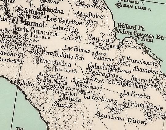
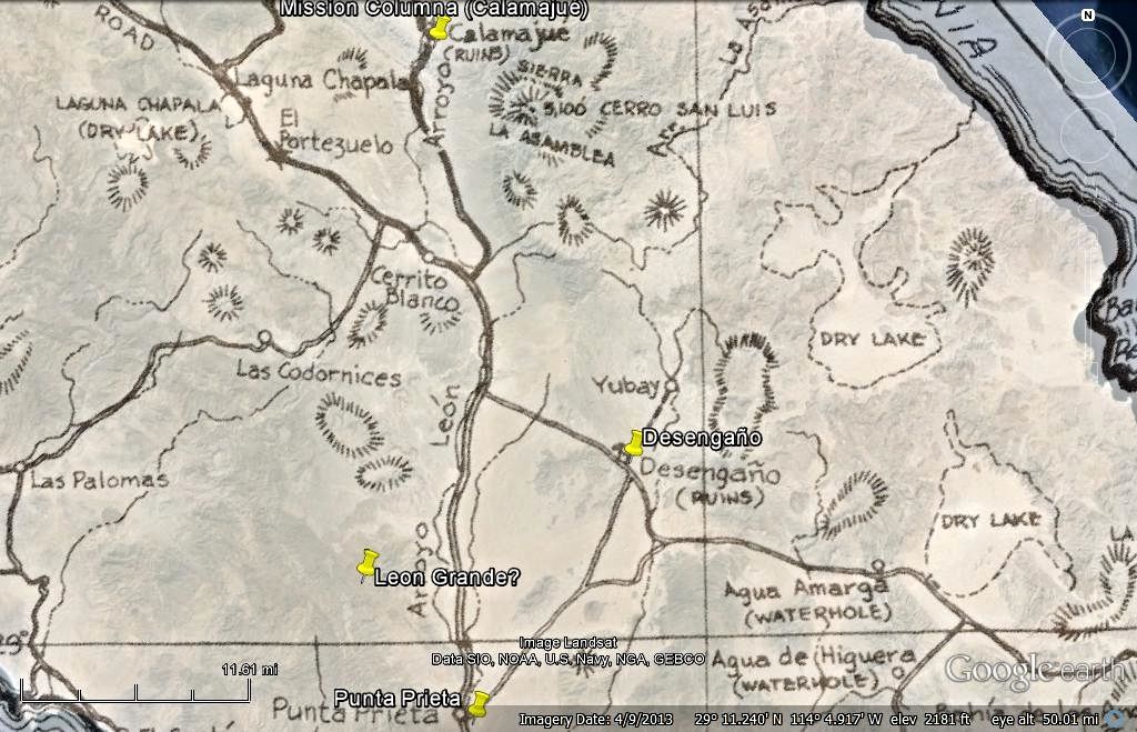
Keep up the historical sleuthing! Here's the 1930 map of the region. Chapala is 'Laguna Seca' on the map...
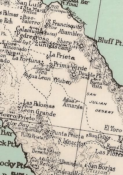
The map is way off on the location of Calamajué, and it shows the arroyo from it flowing to the bay by Punta Final instead of to the 50' (Bluffs 50'
to 100'). Yubay and Agua Amarga are also too far north and west. Even with some placement errors, it is a great map because it is loaded with place
names... Including Agua Leon and Leon Grande, etc.
[Edited on 4-24-2015 by David K]
|
|
|
güéribo
Nomad
Posts: 239
Registered: 10-17-2014
Member Is Offline
|
|
This is how he dropped his button:

|
|
|
David K
Honored Nomad
Posts: 65501
Registered: 8-30-2002
Location: San Diego County
Member Is Offline
Mood: Have Baja Fever
|
|
LEON GRANDE on 1971 Map
Thanks to Harald's sharp eye!
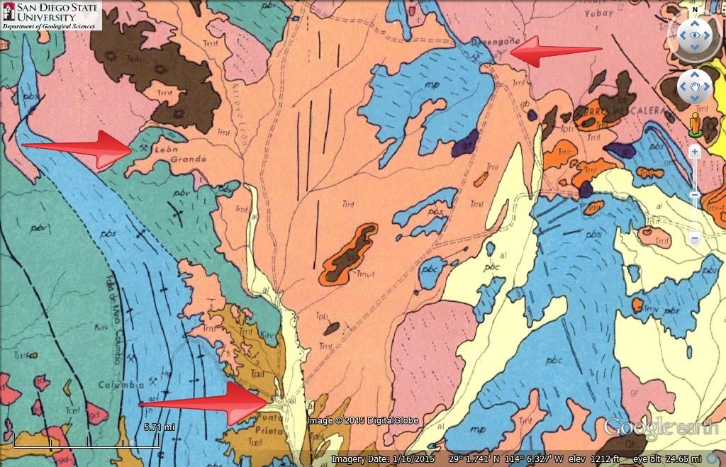
Leon Grande, Punta Prieta and Desenga�o pointed out... The distance from Punta Prieta to Leon Grande measures approx. 12 miles/ 19 kms.
[Edited on 10-30-2021 by David K]
|
|
|
David K
Honored Nomad
Posts: 65501
Registered: 8-30-2002
Location: San Diego County
Member Is Offline
Mood: Have Baja Fever
|
|
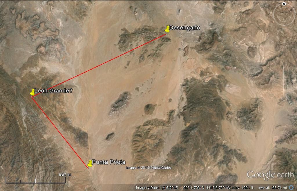
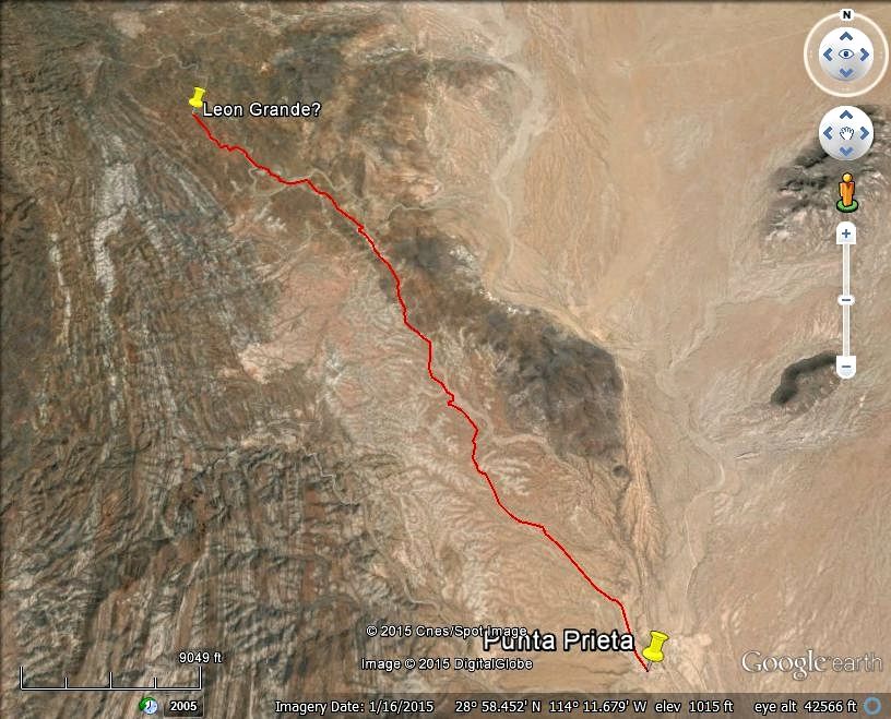
Your distance scale bar is not on the GE image, so hard to place it exactly. I spot it as 11 miles from Punta Prieta and 14 miles from Desengaño.
Desengaño is easy to spot as it has the X shape airport just NE of the mine town. Can you triangulate? I will give it a whirl...
|
|
|
David K
Honored Nomad
Posts: 65501
Registered: 8-30-2002
Location: San Diego County
Member Is Offline
Mood: Have Baja Fever
|
|
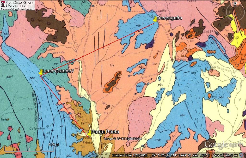
Measure Lines:
Punta Prieta to Leon Grande: 9 miles
Desenga�o to Leon Grande: 14 miles
When I looked on the sat image of where Leon Grande is on the geo map, nothing is there. So, looks like the buildings and mine at the end of the road,
north from Punta Prieta is Leon Grande (?)!
----------------------------------------------------------------------------------------------------------------------------------------------------

[Edited on 10-30-2021 by David K]
|
|
|
David K
Honored Nomad
Posts: 65501
Registered: 8-30-2002
Location: San Diego County
Member Is Offline
Mood: Have Baja Fever
|
|
Aqu�!
LEON GRANDE:
[Edited on 10-30-2021 by David K]
|
|
|
4x4abc
Ultra Nomad
Posts: 4455
Registered: 4-24-2009
Location: La Paz, BCS
Member Is Offline
Mood: happy - always
|
|
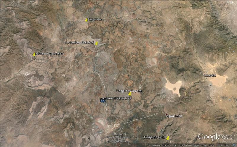
so, we have 2 options for the Leon Grande mine:

and three for Agua Leon:

the southernmost water source is my favorite - it is in Arroyo Leon
the next one north is in Arr Leoncito
the northernmost is in Arr Cordonices
[Edited on 4-28-2015 by 4x4abc]
Harald Pietschmann
|
|
|
David K
Honored Nomad
Posts: 65501
Registered: 8-30-2002
Location: San Diego County
Member Is Offline
Mood: Have Baja Fever
|
|
Leon Grande on 1962 Gulick Map
The Leon Grande mine, at the end of the road north from Punta Prieta was spotted on Google Earth. Here is an overlay of the 1962 Lower California
Guidebook map #7 and zoomed in, on the Google Earth map with push pins on various known sites seen from space. The extreme accuracy of Howard Gulick's
hand drawn maps is amazing.
Leon Grande is 6.2 miles west from the L.A. Bay junction (Parador Punta Prieta) on a heading of 80�, as the crows fly. The road to it goes north
from Punta Prieta village from the north end of the older dirt airstrip, west of Hwy. 1, just north of the village site at the end of the paved side
road.
On the Gulick map, the old main road is shown, and it is exactly 1 mile west of the highway. From Punta Prieta village to Leon Grande, it is 9 miles
as the crows fly, and about 10.2 auto road miles. Howard Hale guessed the distance at 15+ kilometers (9+ miles) when he walked it in 1921. I think we
are good?
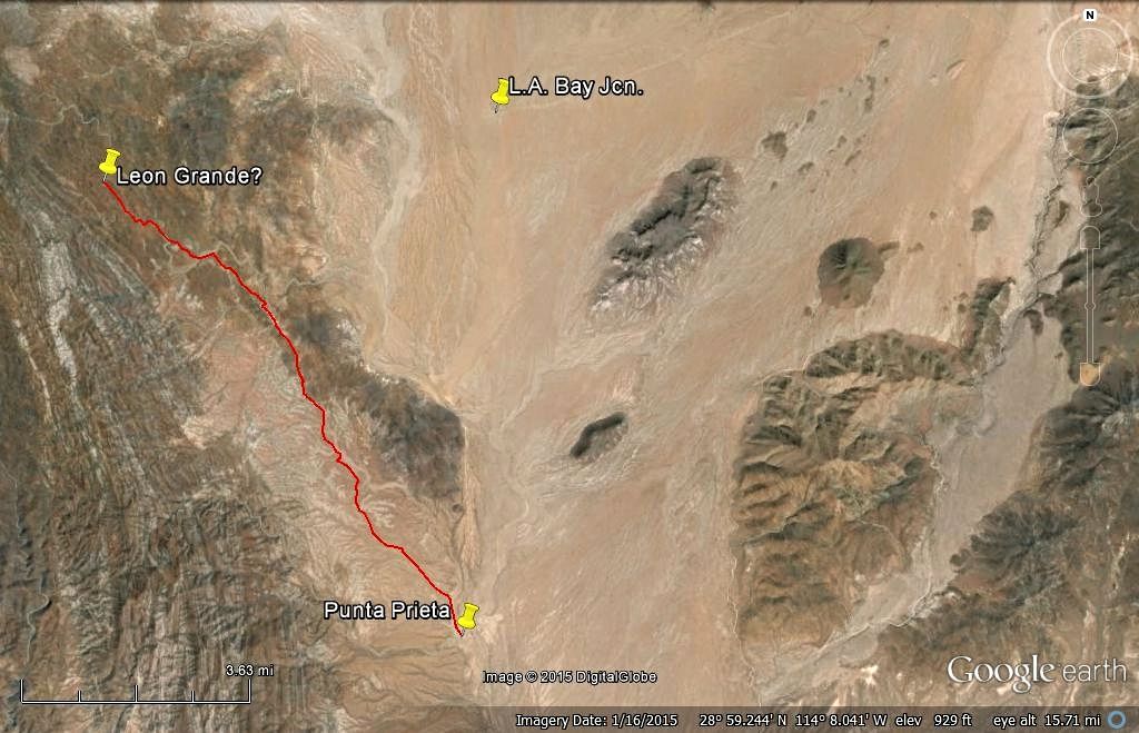
Line is the auto road to Leon Grande from Punta Prieta, 10.2 miles long.
[Edited on 10-30-2021 by David K]
|
|
|
| Pages:
1
2
3 |
|


