| Pages:
1
2
3
..
6 |
David K
Honored Nomad

Posts: 64505
Registered: 8-30-2002
Location: San Diego County
Member Is Online
Mood: Have Baja Fever
|
|
To Baja California Sur: JULY 2015 (MANY PHOTOS)
PHOTOLESS (except for maps) REPORT: http://forums.bajanomad.com/viewthread.php?tid=79744
The following is my trip report with details and photos. I will be adding to this first post as I write the report and download the photos.
Part 1 covers Sunday-Tuesday (San Diego County to Shell Island, south of San Felipe).
The next parts will take us on to Gonzaga Bay, Coco's Corner, Laguna Chapala, San Ignacio, Mulegé, Bahía Concepción and back north. I have lot's of
details on the highway condition and route.
From July 19 to July 27, Elizabeth ('Baja Angel' on Nomad) and I returned to the beautiful Bahia Concepcion of South Baja California. This was the
fifth time camping on the beautiful, desert bay for Elizabeth. The previous times (2007, 2009, and twice in 2012) were all wonderful and each inspired
us to make the over 600 mile trip once again.
2015 would be different, and while there were many great moments, a few not-so-great ones really took the some joy out of this vacation! We both love
Baja California a lot, and nothing will keep us away from the magnificent peninsula. Sometimes you just run out of luck for a perfect trip, and it was
just our time!
Sunday, July 19: We get on the road at 8:14 am, arrive El Centro at 10:30 am and turn south for Calexico/Mexicali. Just inside the border (Red light/
Green light) we pull over to the left, facing the white INM building (first building on the left, inside Mexico). INM is the immigration department
where one obtains a tourist card, called an FMM. This is similar to a visa, and is requested for trips beyond the border zone or any trips longer than
72 hours in the border zone. The FMM is free for up to a 7 day visit and is 330 pesos (US$22) for up to 180 days. The exchange rate was around 15.00
pesos per dollar for this trip. The process was easy park, walk in the office with your passport, fill the form, pay the fee (if over 7 day duration
trip), your passport is stamped and a receipt is issued. In the past, the fee needed to be paid at a bank, and that could be problematic if there was
no open bank teller window nearby. Since 2012, the INM office has been able to collect the fee. The INM officer was friendly and because he needed to
go get change, it was maybe a twenty minute process. We left INM at 11:16 am.
On the way out of Mexicali, we stopped to pick up some beer. Tecate Light, Dos Equis, and Tecate Titanium (a new 5.5% alcohol brew) and some
complementary ice was obtained. 28 cans of beer was 340 pesos (US$22.67). The highway to San Felipe was excellent, of the 125 miles about 1/3 is four
lanes wide and the rest is the newer, wide 2 lanes with paved shoulders that could double as bike lanes. A military operated drug and gun checkpoint
is just south of the Highway 3 (Ensenada road) junction, 95 miles from Mexicali/ 30 miles from San Felipe. We are waved through with smiles all
around, which is typical. Sometimes, usually northbound, we are asked to get out so they can look for any of the forbidden items (guns, ammo, illegal
drugs).
The gas station 7 miles north of San Felipe, by the Rockadile sign, was where I topped the tank. The price of 87 octane /Magna gasoline was 13.57
pesos/liter. That works out to about US$3.45/gallon (about 30-50 cents cheaper than in California). We left the station at 1:55 pm and headed south.
The traffic circle in the center of San Felipe is where you turn right to head south. The first 6 miles (10 kms.) is on the airport road to where a
left turn is made for Highway 5 to continue south. This point is Km. 0, 10 kilometers south of the traffic circle in San Felipe. We go south about 16
miles from the airport road (or 22 from San Felipe).
Our first night camp on the beach that I call Shell Island, as it is a barrier island beach that is separated from the desert by a lagoon that is
under water at the highest tides, and muddy much of the other times. The beach is accessed by four wheel drive and there are two sandy roads to it,
south of the Rancho Percebu road which is between the Km. 20 & 21 markers.

Elizabeth spots whale bones near our camp.
Camp is set up at 3:30 pm, about 45 minutes after arriving. The temperature is 86° and we had some rain on the drive down and again after the tent
was put up and later that night we got more rain, but nothing heavy.

The Coleman Instant tent has been fantastic for us.
Monday, July 20: A perfect, beautiful day! 88° and just a few clouds over the Sierra San Pedro Martir, to the west. We decide to spend another full
day before heading to Baja Sur as the weather is ideal.


The Coleman Instant sun shade is also great and I have it put up before Elizabeth is out of the tent. She approves! Shade is critical when camping in
Baja, especially in the summer.

More bones, these were much smaller, hopefully not a vaquita (an endangered porpoise).

Shell Island, near the north end, looking south.

Our camp near the lagoon side, protected from wind by the sand dunes.
Tuesday, July 21: A perfect, beautiful day, again! 92° and no clouds in the sky.

We take a daily drive at low tide to see if anything interesting is exposed by the huge gulf tides.

The usual, sand dollars and sea shells.

Getting that Baja Feeling!

Tern eggs are often out on the open beach, but these were in the dunes with some protection. They were huge compared to the parent bird!


Part 2: Coming soon!
[Edited on 7-2-2020 by David K]
|
|
|
David K
Honored Nomad
Posts: 64505
Registered: 8-30-2002
Location: San Diego County
Member Is Online
Mood: Have Baja Fever
|
|
Part 2: Wednesday AM, to Laguna Chapala...
Wednesday, July 22: Perfect day, again but the day you leave is typically the best weather day, so we were not surprised! We leave our beach camp at
8:00 am, and once we are off the beach we have the tires aired-up at 8:30. Deflating tire pressure is needed in such deep sand with a heavy load in
the truck to prevent spinning the tires and getting stuck. An electric tire pump is used to refill them, and takes about 16 minutes for the four tires
to go from 15 psi (back) or 20 psi (front) to the normal street 34 psi.


Diablo Mountain (Baja's highest, over 10,100 feet above sea level), Wednesday morning.


Looking towards the island/beach from the road out to Hwy. 5 at Km. 26.

The Puertecitos road junction is at Km. 74.5, and we pass it at 9:30 am, 52 miles from the San Felipe traffic circle, 30 miles south of Shell Island
road. The Puertecitos roadbed was constructed in 1982 and then paved several years later. It is an old style rural road, very narrow, with many steep
dips across arroyos (usually dry washes). It cannot be driven at high speed because of these sudden surprise dips (vados). The paving was originally
so thin, it was in ruins by the late 1990s. It was repaved around 2005-2006.


The view point of the Enchanted Islands, around Km. 100.
The highway south of Puertecitos is a totally different story. It is a wide, two lane road with paved shoulders, bridges and culverts instead of dips,
and a higher speed limit. This new highway construction began in 2007 and has progressed south an average of 12 kilometers a year, so far. The
pavement ends 96 kilometers (almost 60 miles) south of Puertecitos currently, and has for the past half year. New construction is ongoing as they
blast through mountains for the final 20 some miles to Highway 1 at Laguna Chapala. The alignment is slightly different than of the current road for
part of the way. It will be about 2 miles west of Coco's Corner.
A military checkpoint is located at Km. 148 (in the Gonzaga Bay area), and we are waved through with smiles. We stop at the gas station located at the
road to Alfonsina's Resort, Gonzaga Bay, at Km. 150. The time was 10:30 am. Here gas was slightly different price than all others in Baja, at 14.08
pesos/liter (US$3.57/gallon). Less than 10 gallons tops my tank. On our return trip north, four days later, the station was closed. Never pass an open
station without enough gas to reach the next one! Just past the Alfonsina's road is the Rancho Grande airstrip and road on the left and their market
on the right. The market has ice, liquor, food and behind it is a tire shop. We get some ice and beer and leave Rancho Grande at 10:53 am.


5 miles south, Km. 158, the highway crosses the large Santa Maria riverbed near the junction with Arroyo Las Arrastras. A paved exit and parking area
with a construction monument overlooks the large bridge from the north rim. On the trip north we stop here for photos. At Km. 162 is a sign Rancho Las
Palmitas on the west and Punta Final on the east. Las Palmitas is an oasis 4 miles west along El Camino Real, the California mission trail.


Las Arrastras well, and highway construction south, in the distance, west of Coco�s Corner.

The end of pavement is reached past the Kilometer 170 marker, 12.7 miles from Rancho Grande/ Alfonsina's Pemex. This begins an area of huge granite
boulders for the next 6 miles to Las Arrastras, the site of a gold ore mill and a former ranch. The foundations remain, and in the arroyo below are
the stone mills (arrastras) and well. The highway construction uses the well to fill water trucks. Here the new highway route leaves the former road
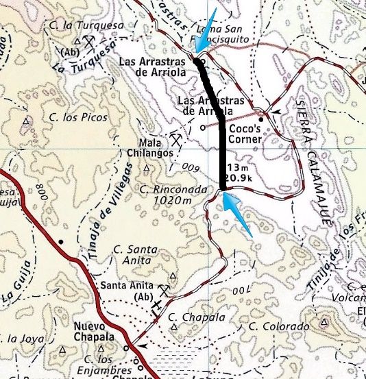
and heads straight south. The current road curves east and goes to Coco's Corner, 3.8 miles from Las Arrastras.
We arrive at Coco's Corner at 11:48 am and have a nice visit with Coco and enjoy cold Pacific beer (he also sells Corona). Coco is a landmark here for
over 20 years. Diabetes has caused him to lose both legs, but he manages to get around and has an ATV and truck modified for him to drive. He is close
to 80 now, and is in high spirit. When I asked him about the new highway bypassing his corner, he expressed pleasure in not having the noise a highway
would bring. Coco said the new road is 2.5 kilometers west (1.5 miles). Other visitors arrived and after some photos, we were on our way at 12:27 pm.


The Kragen HID plastic lights are not Baja tough!
New highway construction was reached 3.7 miles from Coco's and lasted for 3 miles. They crews are taking down whole mountains from the top to create a
straight as possible alignment. It may be several years before the last 20 some miles to Highway 1 is completed? The current road is very rough, being
used for construction vehicles, trucks, and anyone else. With my heavy load of camping gear and ice chests, I had to slow to 10 miles an hour for some
of the distance over the mountain from Coco's to Laguna Chapala. 13 miles from Coco's Corner/ 23 miles on dirt, we arrived at Highway 1 at 1:03 pm. I
aired up the tires (dropped them to 25 psi for the rocky road to prevent flats), and we had some snacks and beer. Southbound at 1:30 pm.
MAP showing the Coco's Corner bypass route for the new highway (black heavy line, between the blue arrows)...
Part 3: Coming Soon!
[Edited on 7-2-2020 by David K]
|
|
|
AKgringo
Elite Nomad
Posts: 5820
Registered: 9-20-2014
Location: Anchorage, AK (no mas!)
Member Is Online
Mood: Retireded
|
|
Thanks for the post Dave, lots of details, and more to come.
I thought you were going to be on the road a little longer, bit a quick trip is better than just wishing you were there.
Be honest now, how was it to go that long with limited Nomad connection? Any withdrawal symptoms?
If you are not living on the edge, you are taking up too much space!
"Could do better if he tried!" Report card comments from most of my grade school teachers. Sadly, still true!
|
|
|
David K
Honored Nomad
Posts: 64505
Registered: 8-30-2002
Location: San Diego County
Member Is Online
Mood: Have Baja Fever
|
|
Quote: Originally posted by AKgringo  | Thanks for the post Dave, lots of details, and more to come.
I thought you were going to be on the road a little longer, bit a quick trip is better than just wishing you were there.
Be honest now, how was it to go that long with limited Nomad connection? Any withdrawal symptoms? |
Thanks AK, we have a 2 week vacation and if it wasn't for some of the stuff you will soon read in this report, we may have stayed south a bit longer
than 9 days. However, the main idea was rest for Baja Angel with not a lot of off roading. I am fine off of Nomad when I am in Baja. Baja Nomad is the
best place to be close to Baja, when you are not in Baja. When I am in Baja, I am getting my fix!

|
|
|
David K
Honored Nomad
Posts: 64505
Registered: 8-30-2002
Location: San Diego County
Member Is Online
Mood: Have Baja Fever
|
|
Las Arrastras de Arriola 2015
It is very possible that this historic site and gold mill, founded by Arturo Grosso (of Laguna Chapala fame), may be destroyed when the new highway
comes through. Here are the photos I took of the abandoned ranch last week. It is located ahead, where the graded dirt road makes a curve left and the
driveway to the east (original dirt road) is lined with tires half buried in the dirt.


|
|
|
Pablito1
Junior Nomad
Posts: 56
Registered: 4-24-2011
Member Is Offline
|
|
Thanks for the very good post. We really enjoyed it especially seeing Coco. I haven't seen him for several years and he seems to be doing good.
Regards, Pablo
|
|
|
Maron
Nomad
Posts: 458
Registered: 4-14-2014
Member Is Offline
|
|
Super reports and lots of good info. Can't wait for the next chapters.
Thanks
|
|
|
David K
Honored Nomad
Posts: 64505
Registered: 8-30-2002
Location: San Diego County
Member Is Online
Mood: Have Baja Fever
|
|
Part 3: Laguna Chapala to San Ignacio

El Portezuelo, the pass between the Laguna Chapala valley and the desert south. In July, 1973, while the new road being built, my folks and I stopped
here for photos.
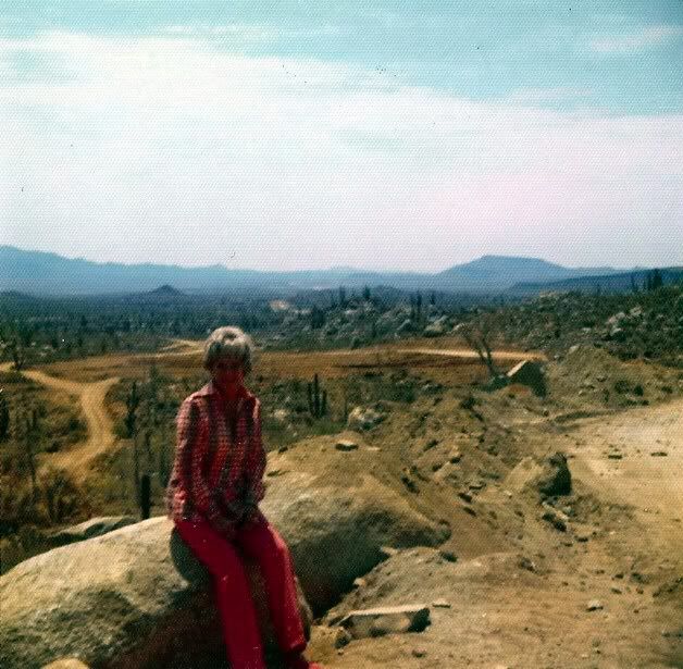
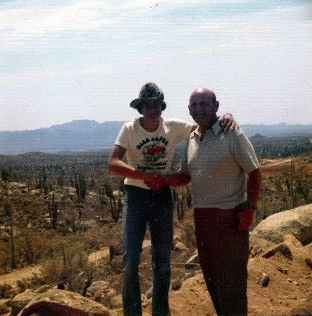
Hey, who's that skinny 15 year old with a Dick Cepek, Baja Proven shirt on?

The Bah�a de los Angeles junction (former Parador Punta Prieta) is passed 30 miles from Laguna Chapala, at 1:59 pm.

A vendor sells gas from cans in front of the abandoned parador building and former gas station (blue truck on right).

Just south, on the east side of the highway is a large fenced area with a sign advertising a future Pemex gas station and Los Pinos market.
At 2:40 pm we arrive at Nuevo Rosarito and pull over to the left to have a meal at Mauricio's Restaurant. Elizabeth ordered the fried chicken dinner
and I had the breaded fish dinner, we both drank the Jamaica (Hah-My-Kah) tea. This is a sweet tea, also called Hibiscus Tea made from the dried
Roselle flower. It is very similar to cranberry in taste. More at: https://en.wikipedia.org/wiki/Roselle_(plant)#Beverage . My fish dinner was
excellent, and Elizabeth liked her meal, too. The chicken leg was huge, so we guessed it was a rooster of extra-large size!
On the road again at 3:33 pm and the narrow Baja highway begins with a section of newer, wide paving with shoulders 20 kilometers or so. A military
checkpoint is reached at the El Tomatal road junction and it is all smiles as we are waved through. At Km. 95, about 27 miles from Nuevo Rosarito is a
Pemex gas station and the town of Villa Jesus Maria (new signs call the town Valle Jesus Maria). Down the long straight highway we fly and wiz past a
truck stopped on the road with a man signaling us. I hit the brakes and back up to see what he needs. His fuel pump is bad and asks if we can seek out
his friends at the cattle office (across from the airport road) several miles south, to come help. Happy to assist, we find the office and deliver the
message.


20 miles from Jesus Maria is the 140 foot tall eagle monument, built on the 28° Latitude Line to mark the completion of the Trans-peninsular Highway
on December 1, 1973.
South of the line is the newest Mexican state of Baja California Sur (1974), and a change to Mountain Time so we lose an hour on the clock (but regain
it on the trip north). The highway has a slight curve right and full stop sign in front of the INM office and agricultural station. We are asked if we
have any fruits or vegetables and then asked for 20 pesos to proceed and drive over a missing line that is to kill any bugs from the north that may be
under the truck.
There is no request to see our FMM Tourist Cards, as had been the case on many trips south before. Last trip in 2012, the INM officer just looked out
from his open door and waved us on, from the stop sign. 2001, 2007, and 2009 trips all asked to see the official paper here, southbound. 2 miles from
the state border/ Eagle Monument is the junction into downtown Guerrero Negro at 4:26 pm Pacific time/ 5:26 pm Mountain time. The highway curves to
the southeast for many miles and the kilometer markers now are set south to north, in reverse from the northern state.
About 47 miles from the Eagle Monument is the town of Vizcaino and our next fuel stop, about 190 miles from the last, at Gonzaga Bay. My truck is
getting over 16 mpg, and considering the heavy load, speed, dirt section at lower pressure, this is fine. 600 pesos (US$40) tops the tank (44.2
liters/ 11.7 gallons).
SAN IGNACIO:


44 more miles and after a military check is passed through, we arrive at the oasis town of San Ignacio, it is 7:10 pm Mountain time. No matter if you
need to go into the town or not, if this is your first time, do turn right off the highway on the paved side road into town (across from the gas
station, by the whale bones). It is less than 2 miles to the town plaza and mission church, with a crossing of the San Ignacio River along the way.
This large body of water comes out of the desert rocks just east, and disappears just west of the crossing. This oasis was a huge Indian settlement
and 11th California mission, founded in 1728.
The giant church made of 4 foot thick blocks of rock, was built in the late 1700s and is one of the finest Spanish missions to survive the years.
Following the independence war of 1810-1821, the Spanish period ended in Baja California. The Mexican government allowed the mission to continue for
the local population, and did so until 1840. The building was used after that year as a parish church, and has been preserved with informative signs
in English and Spanish.
Continue just past the mission and see a new motel in a large grass field, called the La Huerta. A well-stocked market is located at the entrance, and
sells ice. The motel was very good, comfortable bed, air conditioning, ceiling fan, and reasonably priced at 550 pesos for a single bed (just under
US$40 at a 14:1 exchange). Three remotes (TV, AC, and Fan) in a box, are provided with a refundable 100 peso deposit. Life is good and we sleep well.
Hotel La Huerta hotel.lahuertabcs@outlook.es Tel. 154-0116
PHOTOS:


Thursday, July 23: I get up first and take advantage of the morning sun on the front of the mission to get some photos while my bride of 7 years
enjoys the rest, on her well-deserved work vacation. A small cafe facing the plaza by the mission advertises a breakfast of hot cakes, ham and eggs.
After checking out, we go there and have a really good breakfast with coffee (180 pesos for both of us). We leave San Ignacio at 11:10 am following a
walking tour of the mission with Elizabeth and buying a handmade purse from the lady in the mission, along with a donation to the mission.

Above: Mission as seen from the motel grounds entrance.
Photos of the mission and some of San Ignacio town:


Above: A small inn and book shop that has a long history in San Ignacio, near the northeast corner of the plaza.


Stay Tuned for the next part...
[Edited on 7-2-2020 by David K]
|
|
|
desertcpl
Super Nomad
Posts: 2394
Registered: 10-26-2008
Location: yuma,az
Member Is Offline
|
|
very nice
|
|
|
TMW
Select Nomad
Posts: 10659
Registered: 9-1-2003
Location: Bakersfield, CA
Member Is Offline
|
|
Excellent David, thanks.
|
|
|
StuckSucks
Super Nomad
Posts: 2307
Registered: 10-17-2013
Member Is Offline
|
|
Enjoying the photos and write-up - thanks!
|
|
|
wiltonh
Nomad
Posts: 300
Registered: 2-2-2007
Member Is Offline
|
|
We always stop at San Ignacio. We were there for the grand opening of the little store near the new hotel.
Your pictures of the square reminded me of the day I purchased a Telcel card for my unlocked iPhone. The store was on the East side of the square.
That fixed the no internet problem at least when we were in a town.
Thanks for all the pictures.
[Edited on 7-30-2015 by wiltonh]
|
|
|
ehall
Super Nomad
Posts: 1906
Registered: 3-29-2014
Location: Buckeye, Az
Member Is Offline
Mood: It's 5 o'clock somewhere
|
|
Nice report. Great pictures. Are they pumping water at arras tar for construction. The well was covered and not being used in May .
|
|
|
David K
Honored Nomad
Posts: 64505
Registered: 8-30-2002
Location: San Diego County
Member Is Online
Mood: Have Baja Fever
|
|
| Quote: Originally posted by ehall | | Nice report. Great pictures. Are they pumping water at 'Arrastras' for construction. The well was covered and not being used in May .
|
Yes, there is a diesel generator on a trailer, just left of the well.

Also just left of this photo shot is a road made down the arroyo for water trucks and construction... and the road heads south towards where you see
the dust from the mountain cutting... that is about 3-4 miles south and 1.5 miles west of Coco's. See the map in Part 2.
Just left of the well, a generator and construction road heading south.
[Edited on 7-30-2015 by David K]
|
|
|
ehall
Super Nomad
Posts: 1906
Registered: 3-29-2014
Location: Buckeye, Az
Member Is Offline
Mood: It's 5 o'clock somewhere
|
|
San Ignacio looks beautiful. Definitely going to check it out next time.
|
|
|
David K
Honored Nomad
Posts: 64505
Registered: 8-30-2002
Location: San Diego County
Member Is Online
Mood: Have Baja Fever
|
|
Part 4: To Mulegé and Bahía Concepción (Thu-Sat)
We pass through Santa Rosalia at 12:14 pm, 45 miles from San Ignacio. There was a dirt detour along some highway work, less than 2 miles long, about
midway between the two towns. We arrive in Mulegé (Moo-la-HAY) at 12:55 pm, 37 miles from Santa Rosalia, and take the left fork under the
castle-style wall, into town. A one pump gas station is 0.2 mile from Hwy. 1, and I top the tank here. Gasoline (Magna only) is the standard 13.57
pesos per liter.
Passing through town we soon are along the river or estuary. The new concrete road ends 1.6 miles from the Pemex station. The unpaved street continues
for 0.3 mile to the El Patrón Restaurant on the water. The sign says open, and I really hope we come back when we are hungry, because it was so good
in 2007 and 2009, but closed in 2012.


We are anxious to get on to our camp on Bahia Concepcion, so we head on south and plan to buy some block ice at the plant located across from the
other gas station south of town. Block ice lasts so much longer than the cube ice sold at most stores in Baja. We are disappointed to find the ice
plant no longer in business (the building front is still there). A family has a small beer and bag ice business, so we buy 5 bags of ice and 8 cans of
Dos Equis beer, total 192 pesos. We leave at 1:40 pm.
I find the dirt road leading to Santa Barbara Cove and the gate is wide open so we proceed to check out a possible spot. Very soon we come to a truck
and boat trailer heading out and are told it is private property and not a camping beach. Great, that saved us from a few rough miles of driving.
Next, we go to El Requesón. This is an island with a sand spit that connects to the island at low tide with small palapas on the water's edge. The
sand spit suffered some storm or current erosion and appears to be too low currently to connect. The same palapa or their locations we used in 2007
and earlier I used in 1985 and 1976 are there, and still just above the high tide line. The road to El Requesón now has a large paved ramp off the
highway and any vehicle can get to that beach. Even an 18 wheeler was down there! Too crowded, no vacant palapas, so we go 'next door' to La Perla and
camp at the same place we did in 2009 and twice in 2012. It was 2:21 pm, and other than a day use family, nobody else was there. Awesome!


We set up the tent first, throw in it our close bags and pillows, and then jump in the beautiful bay water. It was warm but cooler than last time,
actually it was perfect! The day time temperature was in the mid-90s and felt great.
While floating in the water, we see the typical thunder clouds building up to the southwest, then suddenly we see a downpour out in the bay, and can
actually hear the rain hitting the sea with great force! All seems to be moving to either side of us, so no panic yet. When some big drops begin
dropping around us in the water and the wind picks up, I get out and add lines to secure the tent. Knowing these afternoon showers are generally
brief, I wasn't too concerned that it wouldn't be much of a problem.
Elizabeth got out of the water as it began really raining steady. We both took advantage of the natural shower and rinsed off before sitting down
inside the palapa to wait out the rain. It got harder and harder, the wind got stronger, a large waterfall was pouring off the a mesa a couple miles
west, the rain began to blow in sideways, hitting us in the face, as we huddle well under the palapa. The tent is really being pushed on by the
strong, tornado-like wind and we can see that the close bags are pressed into the sides, and may be getting wet. Nothing we can do than wait it out.
We estimate the rain event lasted about an hour, and it and the wind moved on. We survived the cloud-burst, but inside the tent, our clothes and
pillows were soaked! We had a fire and hoped for a better day tomorrow. A car drove up in the dark and a little old lady named Rosa walked up to
collect the camping fee (100 pesos). It was buggy as we were on the beach and even saw millions of crawling bugs come out of the sand around the fire.
It reminded Elizabeth of an Indiana Jones movie!
Elizabeth made the best of it for the time, but she was not going to sleep outside that night, and had a comfortable night in the Tacoma. She tried to
get me to join her, but I was sure I needed to lay down, so I set up my cot in the palapa, with citronella candles and deet applied (yes, many
mosquitos). I actually slept well, unaware the mosquitos were not annoyed by my preventative measures.
Friday, July 24: I wake up early and notice that my lips are feeling weird and there is a puffiness under one of my eyes. The deet and candles were
not 100% effective and I am guessing I look like the Elephant Man somewhat? I go to the Tacoma passenger window, Elizabeth is awake and I do my best
Quasimodo impersonation. Other than the mosquitos, I slept fine, and Elizabeth was very happy she slept in the truck!
The day is beautiful and sunny. I string up some clotheslines and we basically spend the day drying everything that got wet, with some time swimming
in the bay also.


A wind gust did come up suddenly, but calmed down later.


Several years ago, an �artist� outlined the lava on this mountainside. Most of his white paint has faded. It looks like he was seeing coral or
seaweed and a whale swimming up?

We decide this would be our last night camping here and will pack it up in the morning (Saturday).
More to come!!!
[Edited on 7-2-2020 by David K]
|
|
|
desertcpl
Super Nomad
Posts: 2394
Registered: 10-26-2008
Location: yuma,az
Member Is Offline
|
|
thanks David,, bring back many memories
|
|
|
BooJumMan
Senior Nomad
Posts: 876
Registered: 8-11-2007
Location: San Diego
Member Is Offline
|
|
HAHA! "Funny" story about the mosquitoes! DOH! Enjoying the pix, Thanks DK
|
|
|
bajabuddha
Banned
Posts: 4024
Registered: 4-12-2013
Location: Baja New Mexico
Member Is Offline
Mood: Always cranky unless medicated
|
|
Were either of my outhouses still standing at all at La Perla?
I don't have a BUCKET LIST, but I do have a F***- IT LIST a mile long!
86 - 45*
|
|
|
mtgoat666
Select Nomad
Posts: 17357
Registered: 9-16-2006
Location: San Diego
Member Is Offline
Mood: Hot n spicy
|
|
Your intro said something bad ruined your trip? What was it? I tried skimming thru your report to find out, but it got a bit long, and Had too many
photos and was loading too slowly to wee the the details
Can you publish an abstract?
|
|
|
| Pages:
1
2
3
..
6 |
|