| Pages:
1
2 |
David K
Honored Nomad

Posts: 64480
Registered: 8-30-2002
Location: San Diego County
Member Is Offline
Mood: Have Baja Fever
|
|
Old Auto Club Baja Maps... decoded!
From the 1920's to 2010 the Automobile Club of Southern California has produced travel maps of Baja California. After almost 100 years, they ended the
tradition.
I recently aquired some vintage Baja maps, and I am happy to share here for my Baja amigos to enjoy a look into the past!
I have three editions, unmarked, like new.
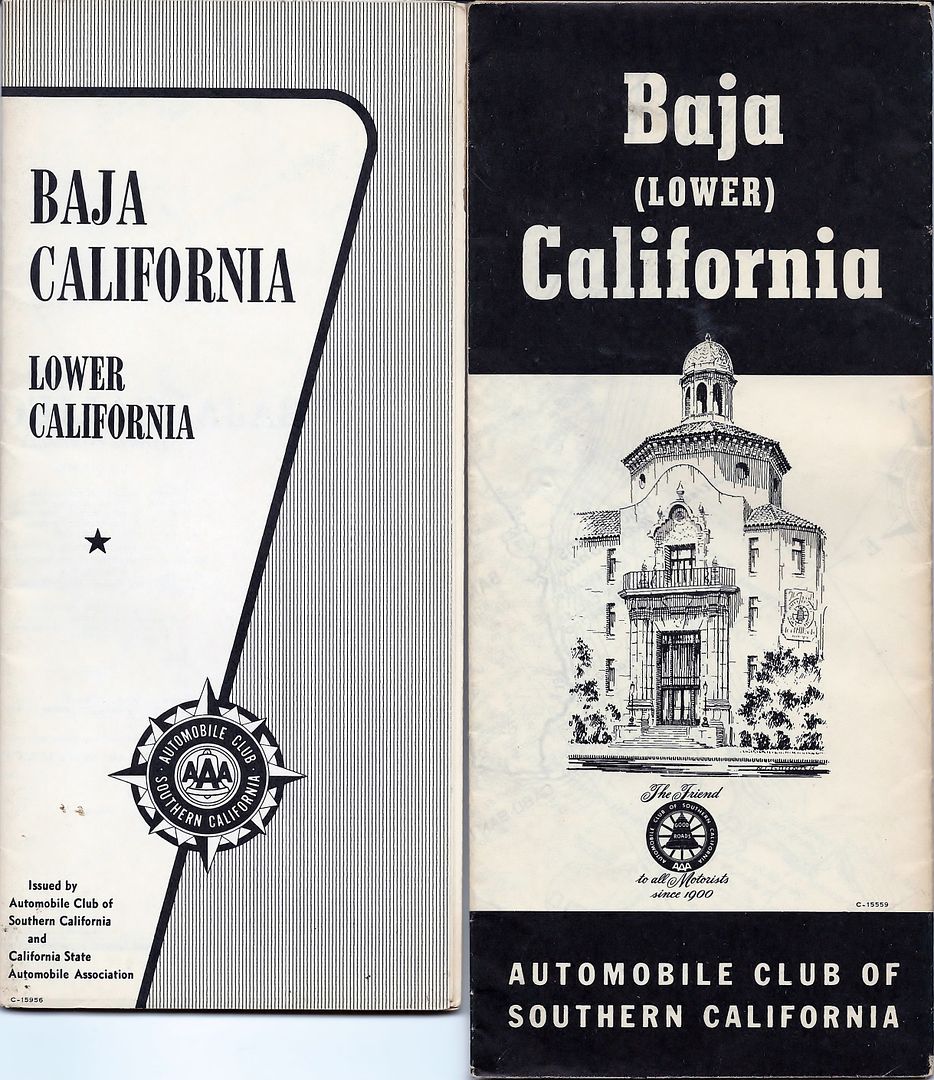
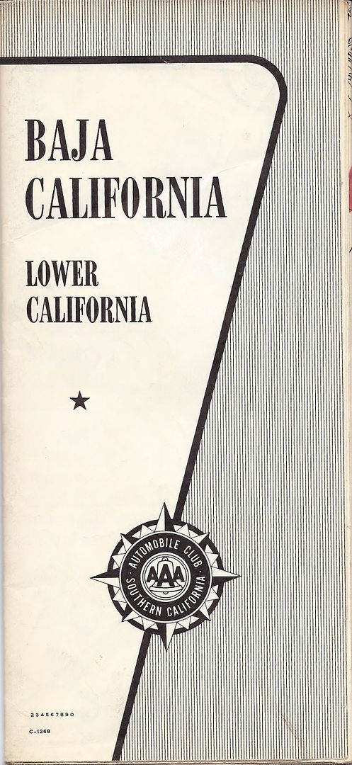
Before the 1970's, the club used a secret copyright date code to hide the date! A simple Google search revealed the decoding secret!!
Some maps had the C - before the code, and some did not.
15559 is the date of this map, and it is scrambled so that 15 is the day, 55 is the year (reversed), and 9 is the month: Sept. 15, 1955 (yes, I know
55 works out without reversing, but that is the deal on other years).
15 is the day, 95 is 1959 (95=59), and 6 is the month: June 15, 1959.
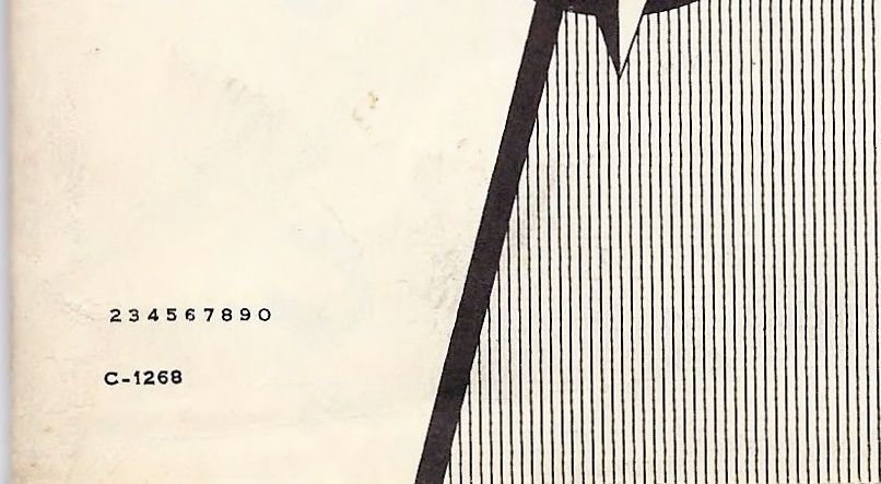
Now, everyone can get this, right? 1268= August 1, 1962.
Next, I will scan these three old guy and you can see how the auto club showed the wilds of Baja up to 60 years ago!
[Edited on 8-25-2022 by David K]
|
|
|
BigBearRider
Super Nomad
Posts: 1299
Registered: 4-30-2015
Location: Big Bear, Punta Chivato, and Cabo
Member Is Offline
Mood: 
|
|
I'm looking forward to this! I have a AAA map from 2007 or thereabout, and it is my favorite map. It was also my dogs favorite, so she took some
bites out of it.
|
|
|
David K
Honored Nomad
Posts: 64480
Registered: 8-30-2002
Location: San Diego County
Member Is Offline
Mood: Have Baja Fever
|
|
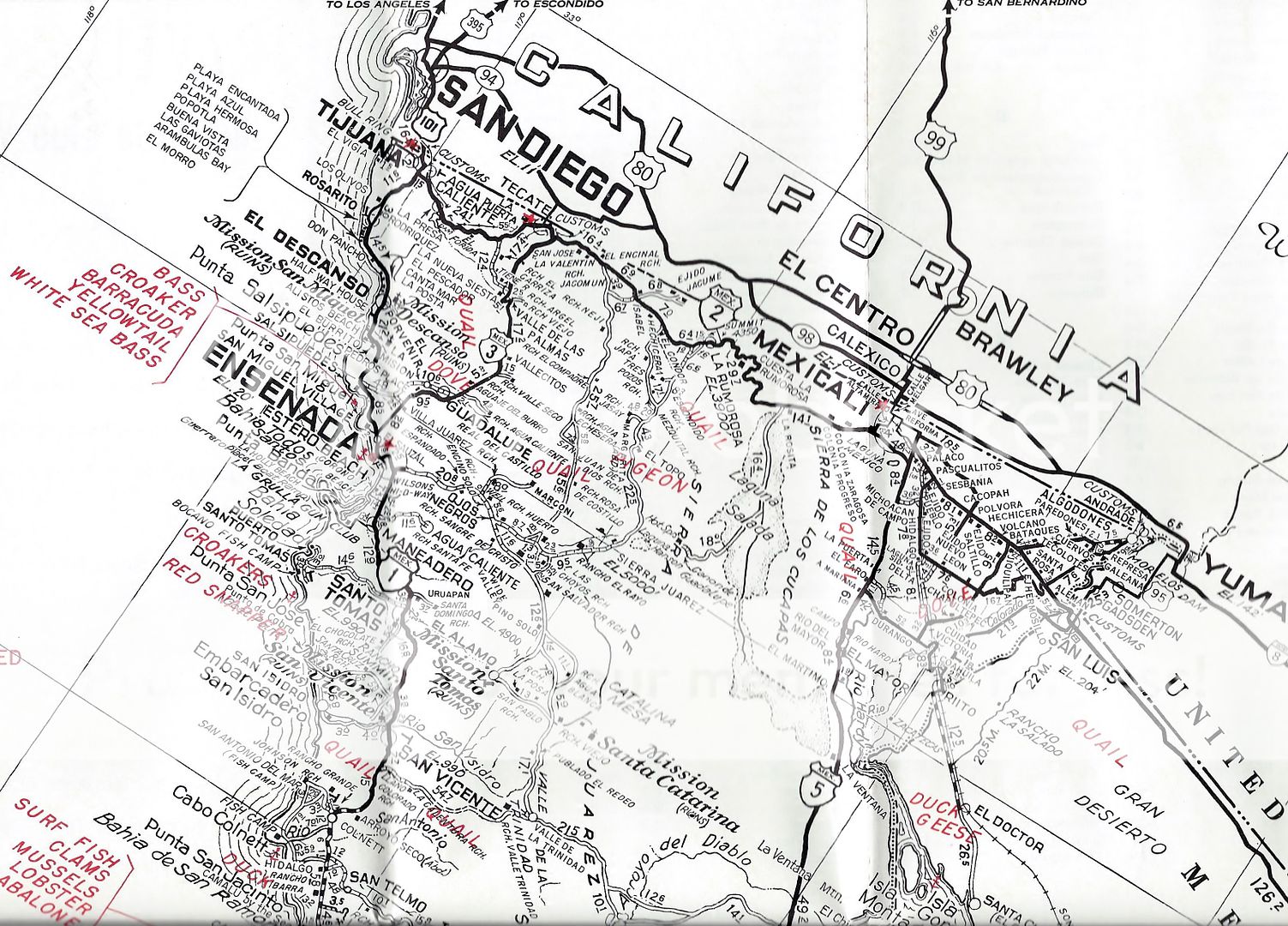
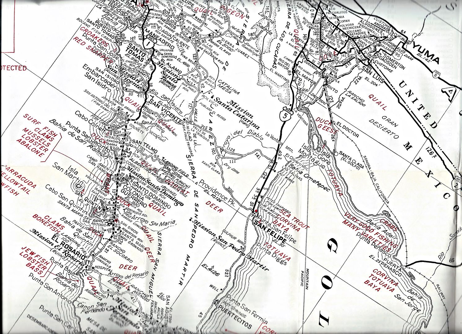
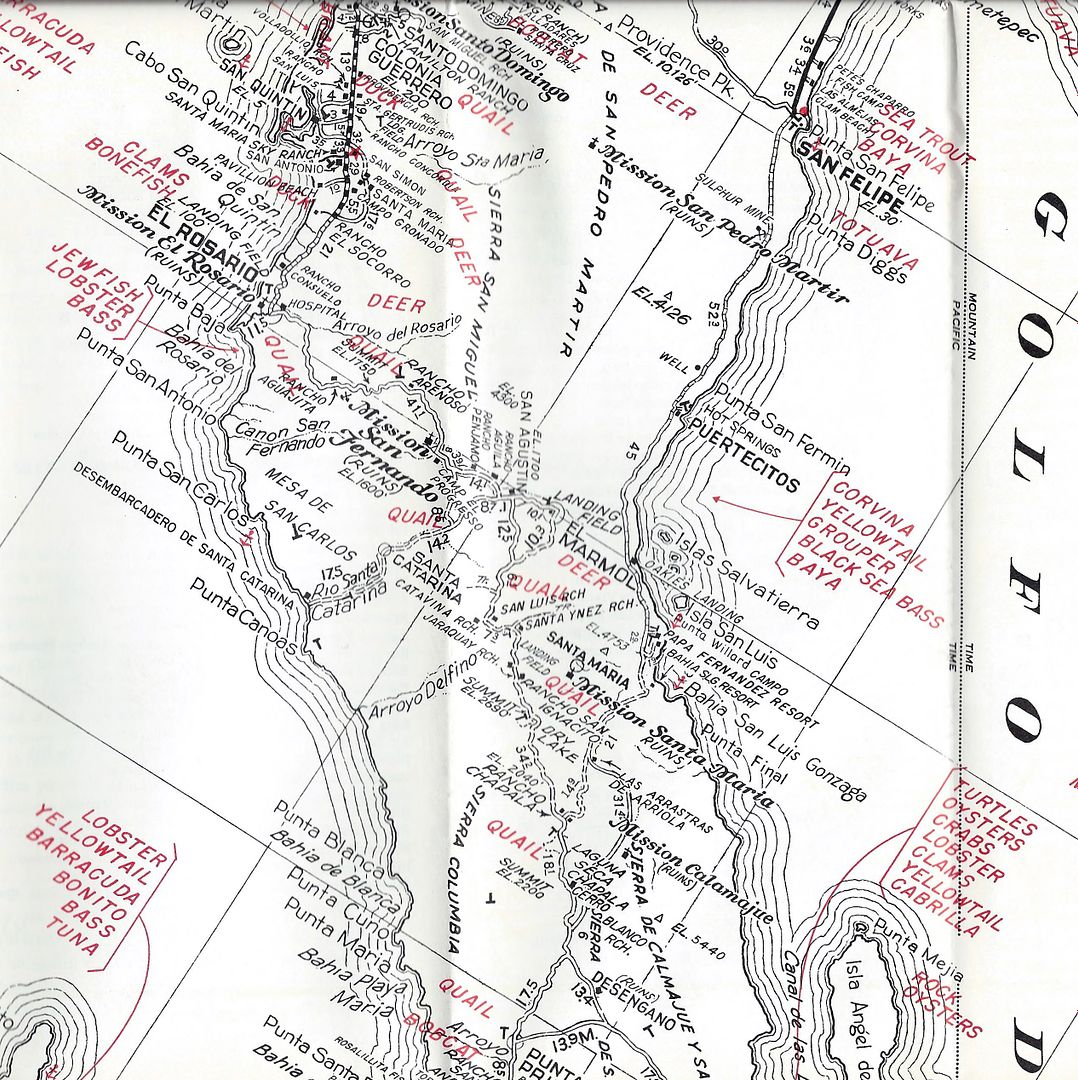
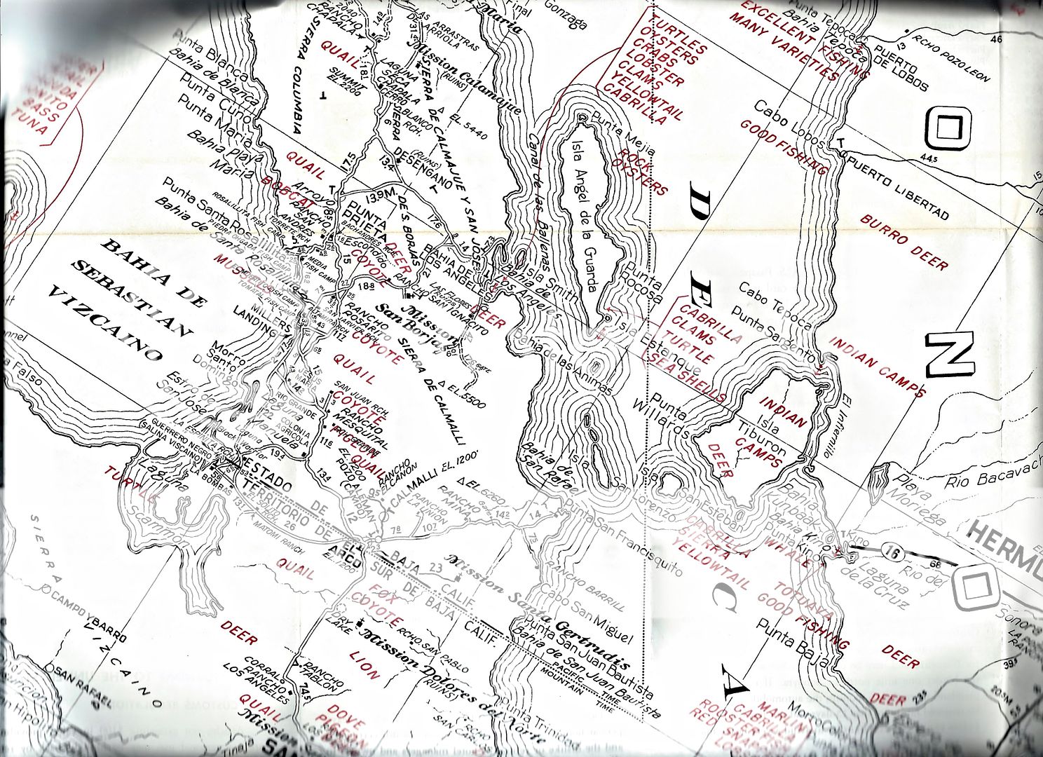
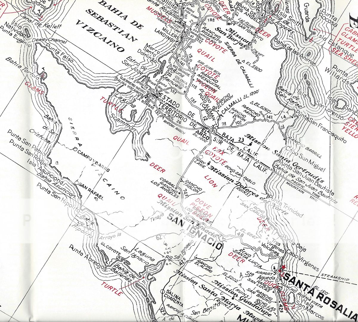
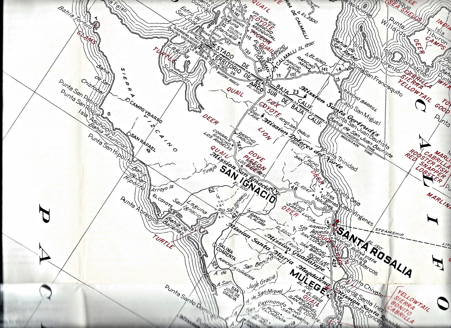
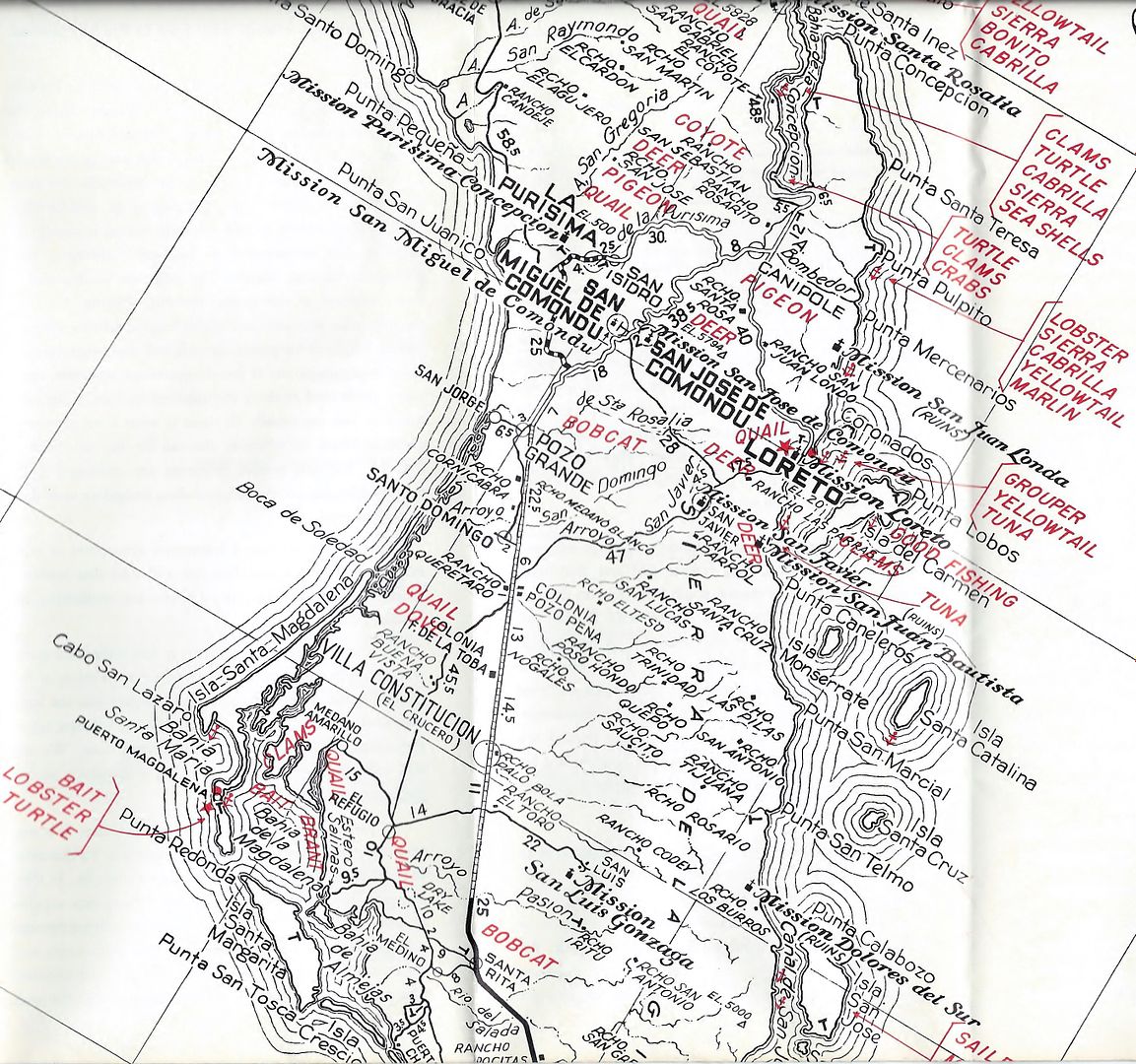
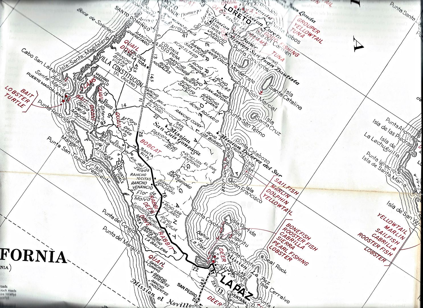
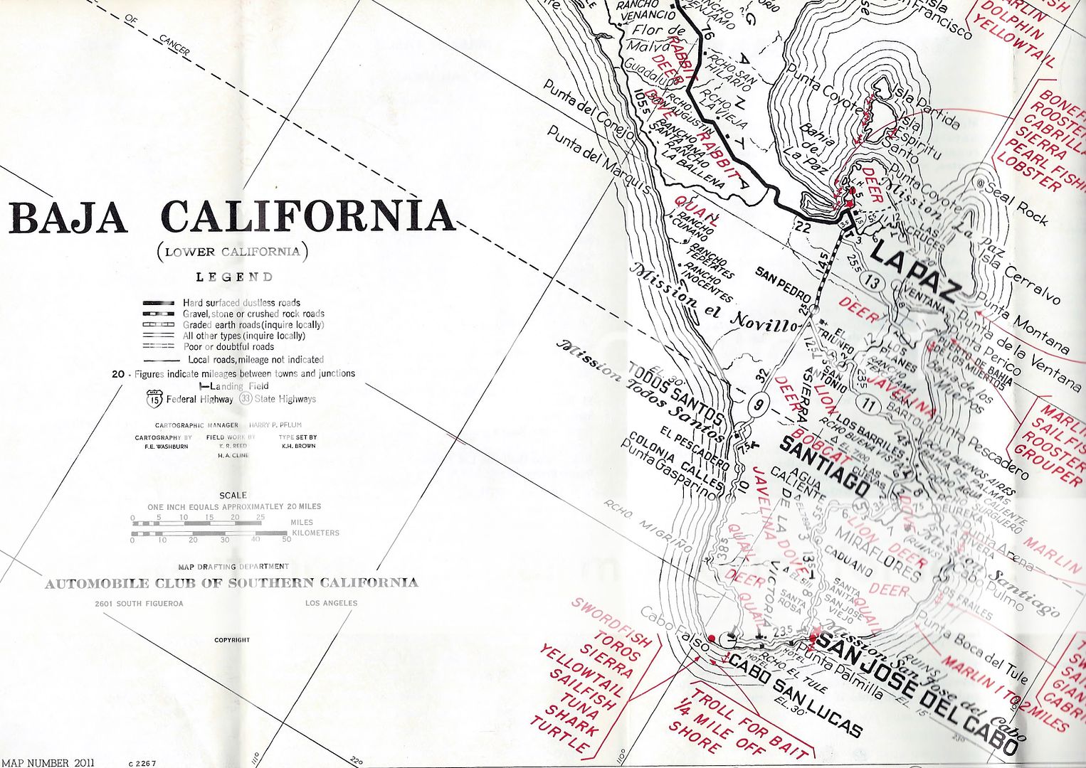
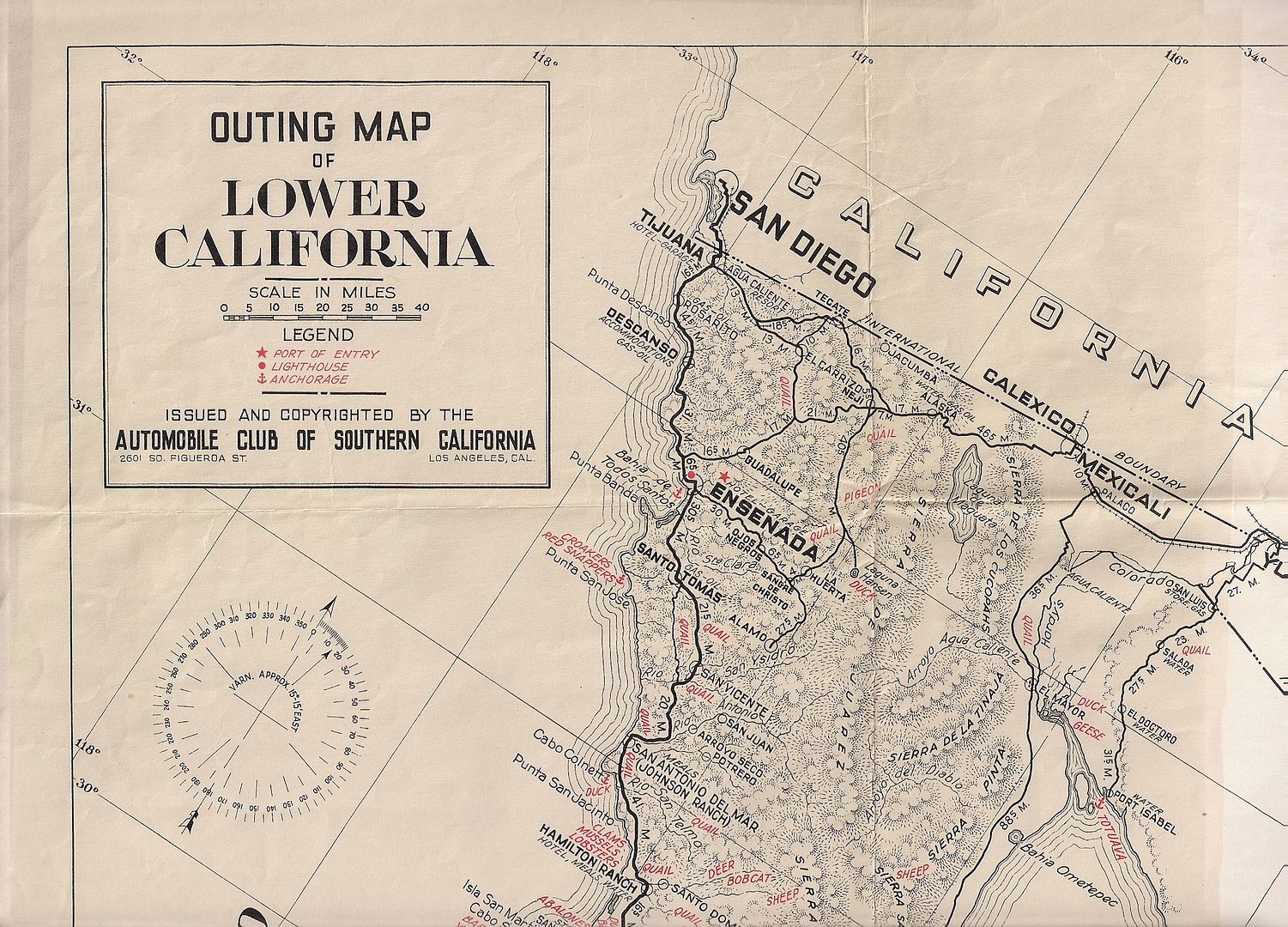
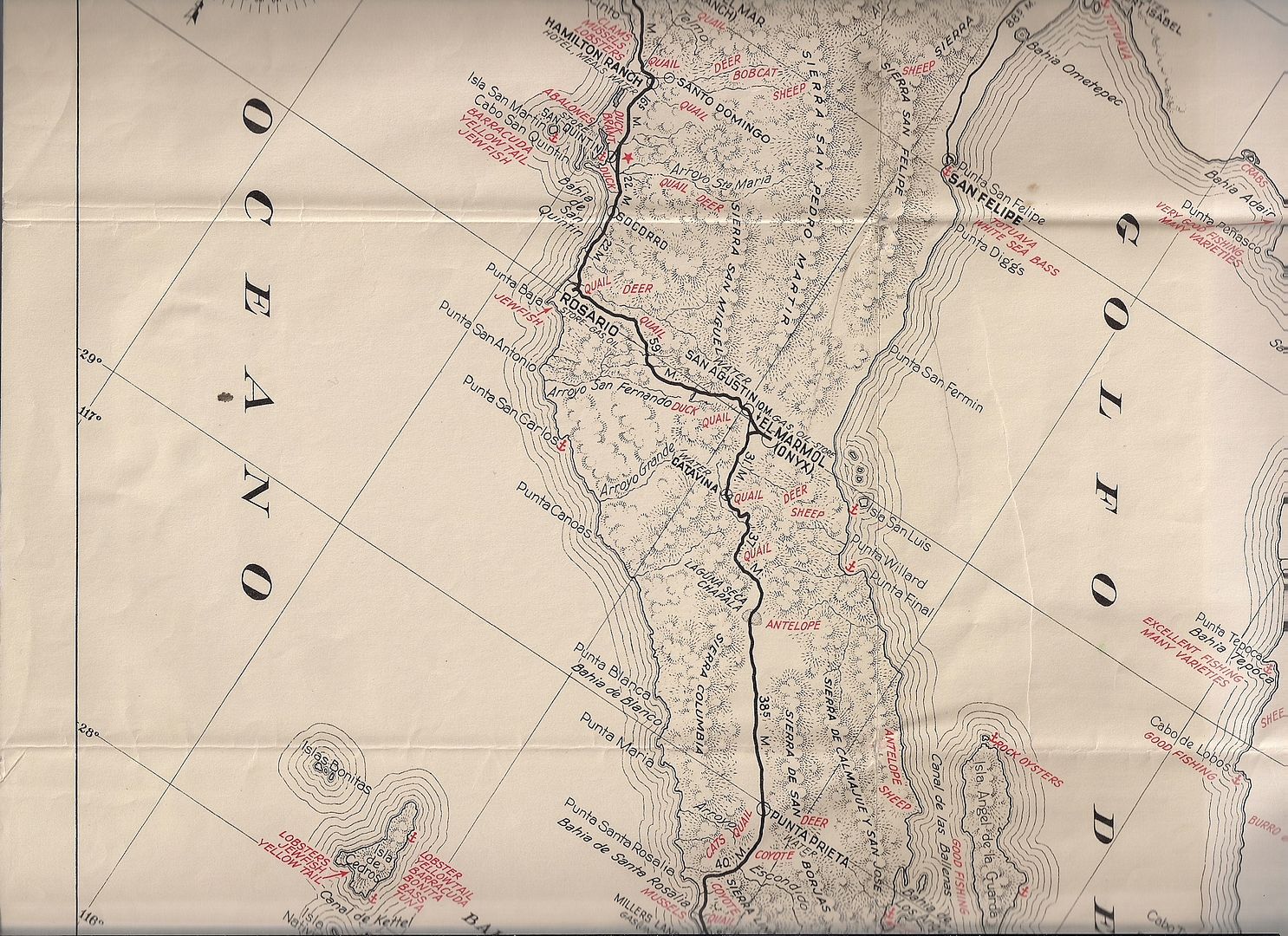
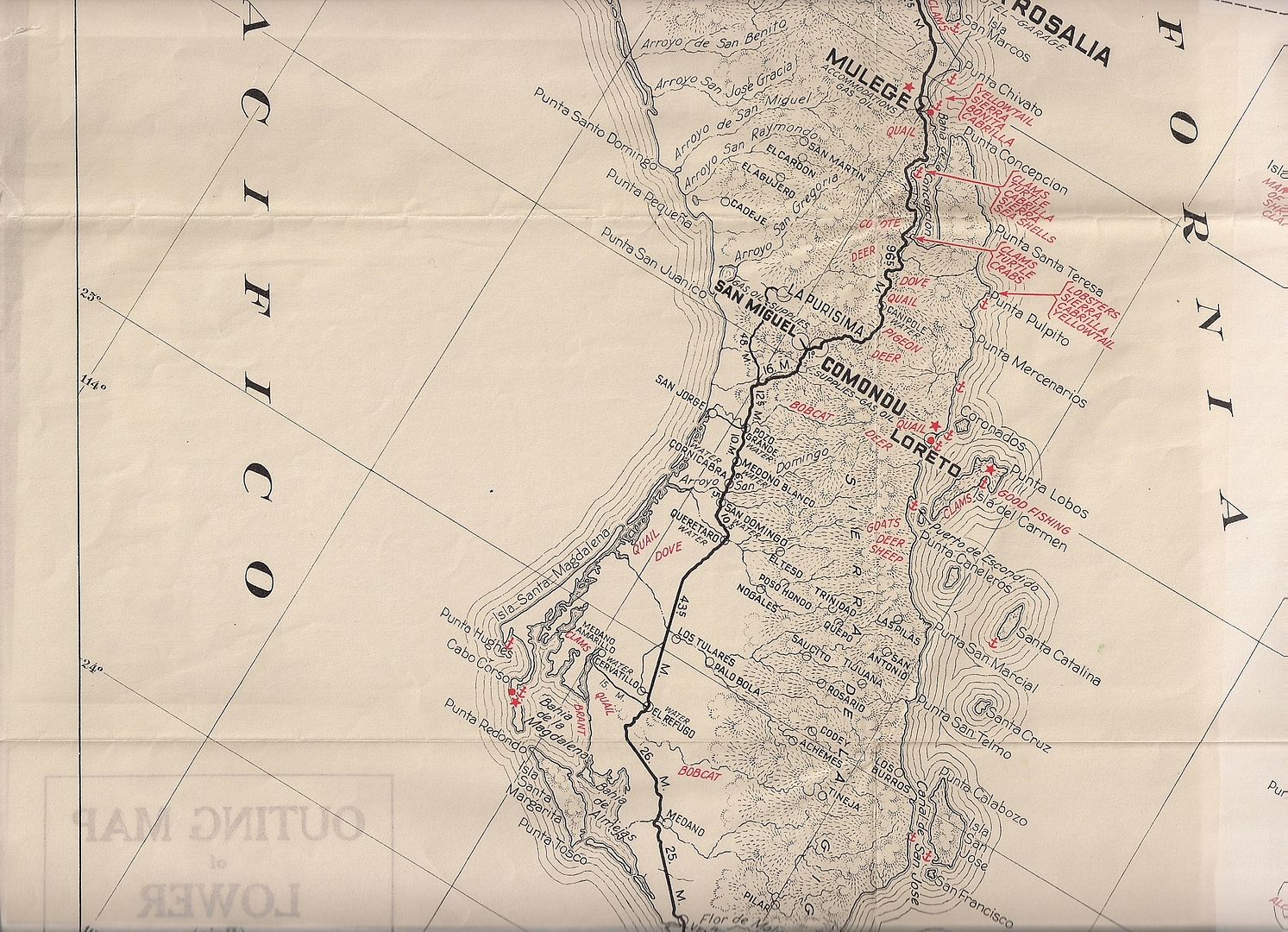
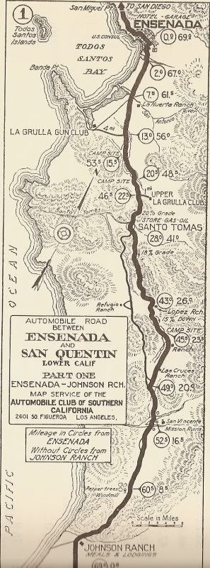
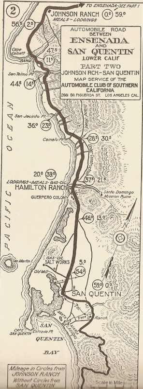
The 1962 Edition, in 9 parts
Shared here for historic interest and education. Narrow pieces of the map are missing between the scans, this is just an overview. I can scan
requested areas that may not appear below... let me know. I will follow up with the 1959 and 1955 versions in the near future.
[Edited on 8-25-2022 by David K]
|
|
|
David K
Honored Nomad
Posts: 64480
Registered: 8-30-2002
Location: San Diego County
Member Is Offline
Mood: Have Baja Fever
|
|
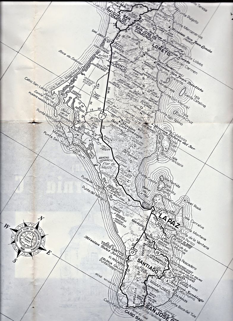
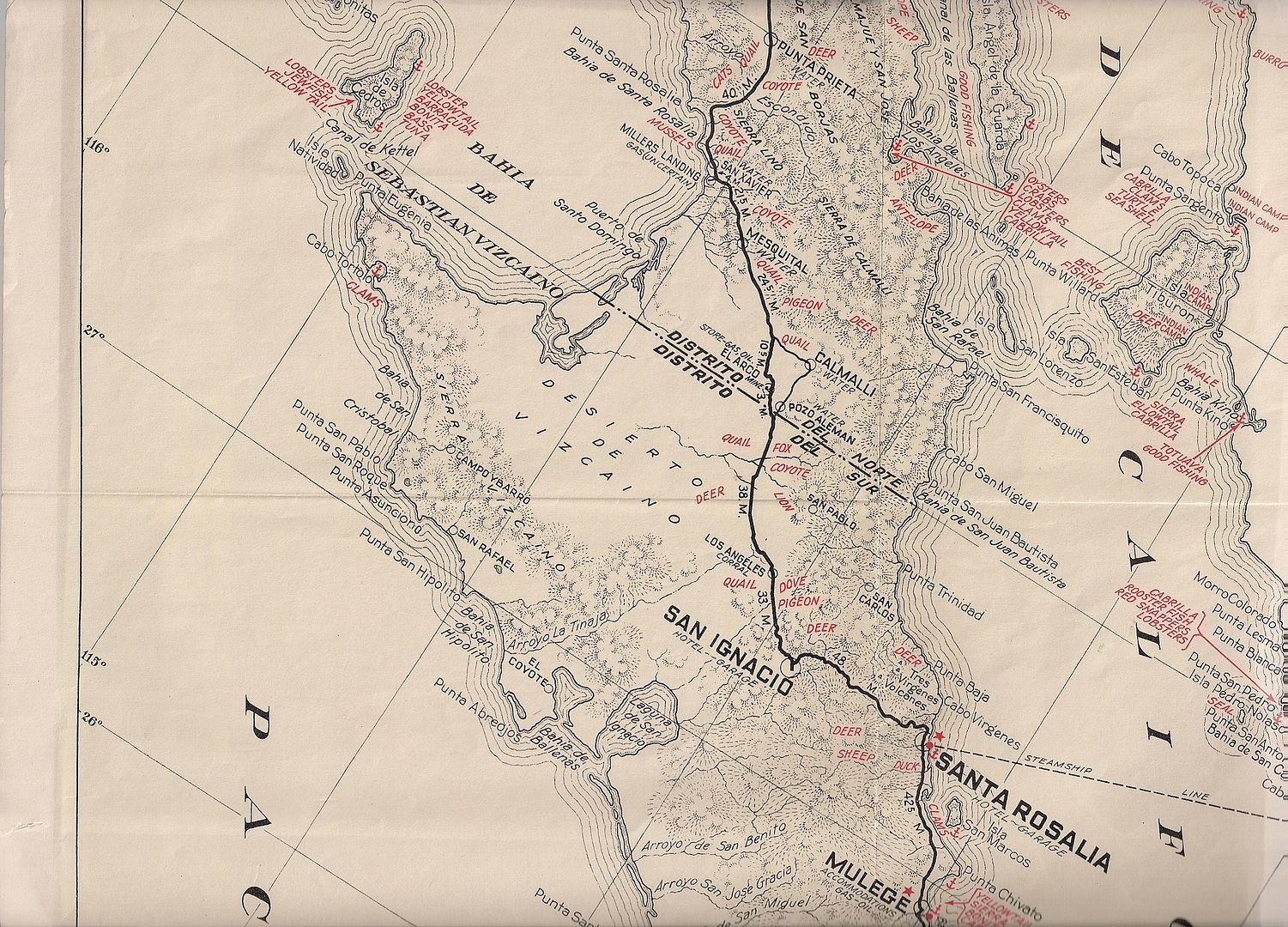
1955 Baja Map in 3 parts...
Of interest, no distinction of paved vs. unpaved roads shown. Except in the very north and for a few miles north from La Paz, all roads are unpaved.
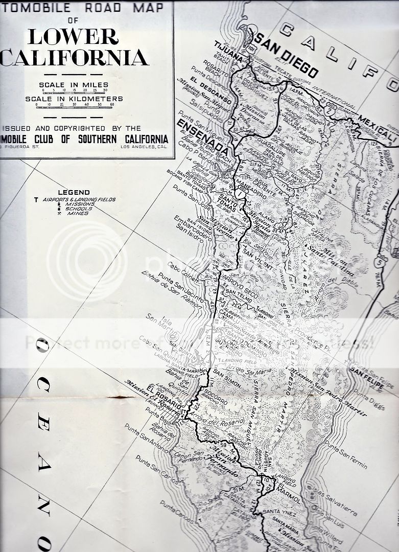
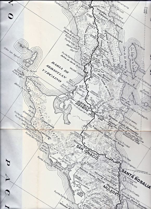
Close ups of any areas by request!
|
|
|
Bob H
Elite Nomad
Posts: 5867
Registered: 8-19-2003
Location: San Diego
Member Is Offline
|
|
Really cool to see these old maps. Thanks David!!
The SAME boiling water that softens the potato hardens the egg. It's about what you are made of NOT the circumstance.
|
|
|
Hook
Elite Nomad
Posts: 9006
Registered: 3-13-2004
Location: Sonora
Member Is Offline
Mood: Inquisitive
|
|
You are the King of Maps, David. It is most appreciated.
|
|
|
David K
Honored Nomad
Posts: 64480
Registered: 8-30-2002
Location: San Diego County
Member Is Offline
Mood: Have Baja Fever
|
|
El gusto es mio! To have these treasures and not share them would be a crime!
I have been lucky and blessed with obtaining many Baja subject publications form the past 100+ years. They only do me good here in my office, but
on-line, other Baja fanatics may enjoy them.
The 1959 AAA map is similar to the 1962 one, but fewer roads. I will add that in the near future.
|
|
|
David K
Honored Nomad
Posts: 64480
Registered: 8-30-2002
Location: San Diego County
Member Is Offline
Mood: Have Baja Fever
|
|
If anyone is interested in seeing the '59 map, or close ups of any of the other two, just ask.
|
|
|
David K
Honored Nomad
Posts: 64480
Registered: 8-30-2002
Location: San Diego County
Member Is Offline
Mood: Have Baja Fever
|
|
I have scanned the areas at the folds of the 1962 map to cover the few miles of peninsula that got missed with the 5 original scans... so added 4 more
scans to that post.
Of historical interest, the auto club was great at promoting Baja as a place for hunting, fishing, and California mission exploring. However, they
have added a few more missions than actually existed:
1) Mission Calamajué: this was not a separate mission from Santa María, just the first location for that mission.
2) Mission Dolores del Norte: this location is near the visita ruins of San Pablo (east of Vizcaino), but never a mission on its own. Dolores del
Norte was an early name for what would become Mission San Gertrudis, upon its founding in 1752. 'Dolores del Norte' only existed on paper and maps
before Santa Gertrudis was founded.
3) Mission Santa Maria Magdalena (near Mulegé on AAA map): the ruins at this location (west of Palo Blanco/ Pta. Chivato) were never a mission, but a
visita or farm station of Mulegé, called La Magdalena. Arthur North in 1906, knew of a 'paper mission' (like Dolores del Norte) the Jesuits proposed,
called Santa Maria Magdalena, and presumed this Magdalena was that one. His error was carried on for the next 100 years.
4) Mission San Juan Londa (Londo): The AAA map places this at the site of San Bruno near the coast, an early failed mission (1683-1685). San Juan
Bautista de Londo was a visita church ruin and is just off Hwy. 1 at Rancho San Juan Londo.
5) Mission San Miguel de Comondu: This was never a mission, just a very prosperous visita of San Javier... just 2 miles from a visita of San Jose de
Comondu, to which the 1708 Comondu mission was moved, in 1736. San Miguel then became a visita of Comondu.
6) Mission el Novillo: South of La Paz, east of San Pedro, was a church ruin called El Novillo. It was never a mission.
Finally, the mission at Todos Santos was originally named 'Santa Rosa de las Palmas' founded at the visita of Todos Santos. When the Pilar de la Paz
mission was moved to Todos Santos from La Paz Bay (1748), it ended the Santa Rosa mission there. While officially it was still Mission Pilar de la
Paz, it was almost always called 'Todos Santos after that.
|
|
|
Ken Bondy
Ultra Nomad
Posts: 3326
Registered: 12-13-2002
Member Is Offline
Mood: Mellow
|
|
Great stuff David, thank you!
carpe diem!
|
|
|
David K
Honored Nomad
Posts: 64480
Registered: 8-30-2002
Location: San Diego County
Member Is Offline
Mood: Have Baja Fever
|
|
De nada Ken... I guess I like these old maps so much because they give us a look back in time to the way it was when we first traveled to Baja?
The 1962 AAA map shows the ratio of paved vs. dirt roads. When I first traveled to La Paz and Cabo San Lucas by Jeep, in 1966, that was all the
pavement there was, except about 10 miles was paved going south from La Paz that year and they were working on the new roadbed to a point between San
Bartolo and Los Barriles, and that is where the grading ended. Can you imagine driving to Los Barriles and on to Cabo San Lucas on a one lane Jeep
trail?
We came back north to La Paz from Cabo through Todos Santos, and the one lane dirt road didn't become a graded 2 lane road until Todos Santos.
The past is getting further away each year, and only these maps can continue to tell the story once those of us who were lucky enough to have
experienced pre-pavement Baja are all gone!
|
|
|
David K
Honored Nomad
Posts: 64480
Registered: 8-30-2002
Location: San Diego County
Member Is Offline
Mood: Have Baja Fever
|
|
Try and envision what travel was like before 1972, when you didn't see pavement until you were about 100 miles from La Paz!
The highway south ended near Colonet and then began inching south in 1970... made it to Colonia Guerrero in '72 and San Quintin before the big push
began in '73... San Quintin to Santa Rosalia!
|
|
|
TMW
Select Nomad
Posts: 10659
Registered: 9-1-2003
Location: Bakersfield, CA
Member Is Offline
|
|
The auto club map I have has the code 03324 so that makes
it a 4-03-23 map year. April 03, 1923. Right?
|
|
|
David K
Honored Nomad
Posts: 64480
Registered: 8-30-2002
Location: San Diego County
Member Is Offline
Mood: Have Baja Fever
|
|
Please share that... I am not sure if the code goes back that far. Are they strip maps to San Quintin? Please scan! I have a 1920's map also... I will
dig it out.
|
|
|
ehall
Super Nomad
Posts: 1906
Registered: 3-29-2014
Location: Buckeye, Az
Member Is Offline
Mood: It's 5 o'clock somewhere
|
|
Those maps are awesome. Thanks for posting
|
|
|
TMW
Select Nomad
Posts: 10659
Registered: 9-1-2003
Location: Bakersfield, CA
Member Is Offline
|
|
It's one big fold up map. It came with the Auto Club book dated 1930.

[Edited on 11-29-2015 by TMW]
|
|
|
Jack Swords
Super Nomad
Posts: 1094
Registered: 8-30-2002
Location: Nipomo, CA/La Paz, BCS
Member Is Offline
|
|
David, I believe I sent you several photos of the "mission" at Rancho Novillo. It has fallen down completely now. Interestingly, it is at the base
of the mountain called La Trinchera which has, at the top of the hill, El Zalate, which is acknowledged as a ranch or garden for the mission at La
Paz. Hiking to the site one can find pottery shards and stone walls and a couple of surviving mango and guava trees growing adjacent to the stream.
I'll try to find photos on my 3 hard drives (or perhaps you have a better system than I do).
|
|
|
Mexitron
Ultra Nomad
Posts: 3397
Registered: 9-21-2003
Location: Fort Worth, Texas
Member Is Offline
Mood: Happy!
|
|
Missed this thread, cool maps David, you da man!
|
|
|
David K
Honored Nomad
Posts: 64480
Registered: 8-30-2002
Location: San Diego County
Member Is Offline
Mood: Have Baja Fever
|
|
Tom, that is awesome... amazing the Auto Club has used the same base map with only a few changes right through the 1960's from 1930!
I will add the earlier map series I have from the 20's.
Hi Jack, I will add the El Novillo ruins photos.
Mexitron, bumping up threads awakens new interest in Baja history!
|
|
|
David K
Honored Nomad
Posts: 64480
Registered: 8-30-2002
Location: San Diego County
Member Is Offline
Mood: Have Baja Fever
|
|
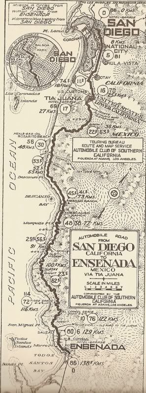
1927 Auto Club Baja Map
From the border to El Rosario (almost)!
|
|
|
| Pages:
1
2 |