| Pages:
1
2
3 |
geoffff
Senior Nomad

Posts: 715
Registered: 1-15-2009
Member Is Offline
|
|
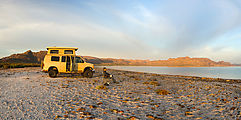
10 Days in Baja (2016)
Here's a write-up of my road trip I made few weeks ago (early March).
The following might seem like an odd collection of destinations for ten days in Baja, but this was my 8th Baja trip -- and it's more fulfilling for me
to try to not repeat places I've already explored.
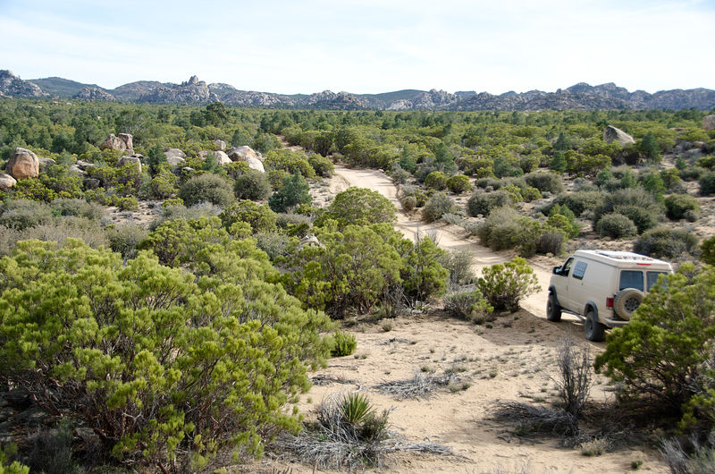
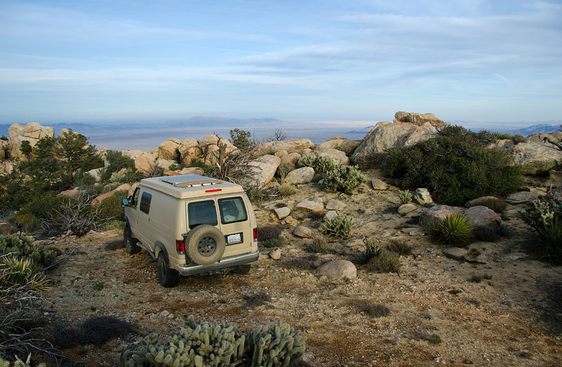
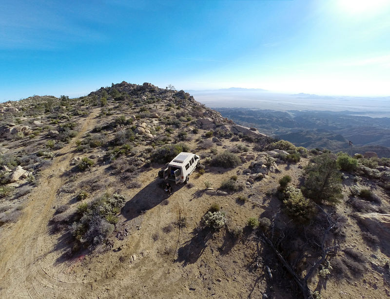
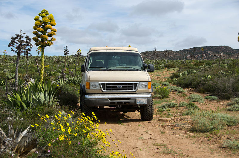
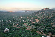
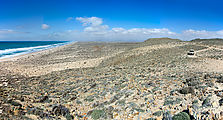
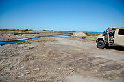
Laguna Hanson
The road south to Laguna Hanson was scenic -- a peaceful and easy drive. I enjoyed watching the landscape slowly change as I climbed my way up to
Laguna Hanson, from desert to low bushes, and finally into forests of tall pine trees.
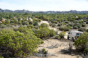  
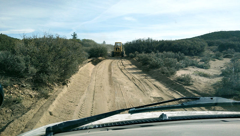
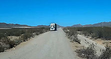
At one point the road became delightfully smooth and pillow soft. Soon I arrived behind the grader that had just been resurfacing my lovely road!
Passing the grader was tricky as the driver couldn't easily see or hear me.
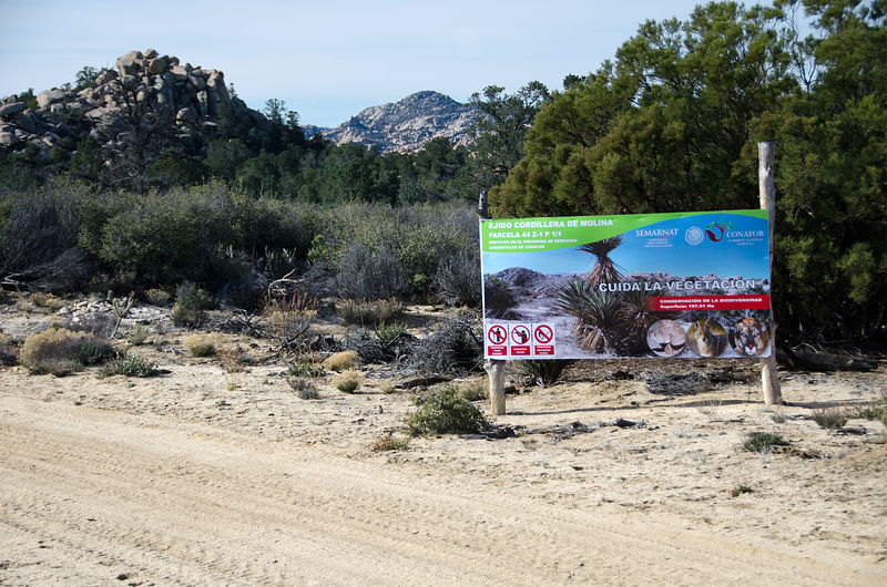
The only minor irritation that intruded on the natural beauty of the area was all the signs!
 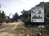 
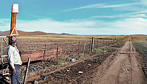
Entering the park (Parque Nacional Constituci�n), I found I had the whole place to myself. No one was manning the entry booths, and other than the
grader and a few pickup trucks that passed on the road, I encountered no people, tourists or otherwise.
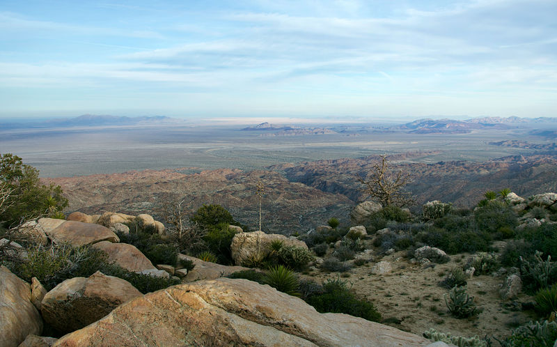
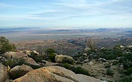
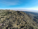
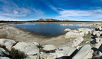
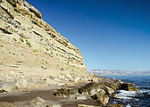
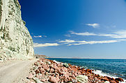
Laguna Salada Viewpoint
After reaching Laguna Hanson, I turned left to drive out to a viewpoint I had earlier scouted as a possible campsite. This track went east to
escarpments at the very edge of the Ju�rez mountains. Here I could look out over Laguna Salada, and even get a glimpse of the Gulf of California way
off in the distance. [gps:32.0457,-115.7950]
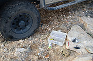
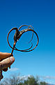
And then I suffered my first (and only) flat tire of the trip - punctured by a cactus spine! Easy fix.
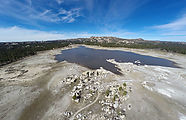
The next morning I found an even better view spot next door [gps:32.0396,-115.7962]:
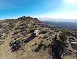 
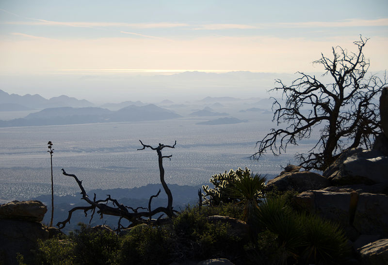
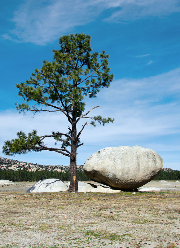
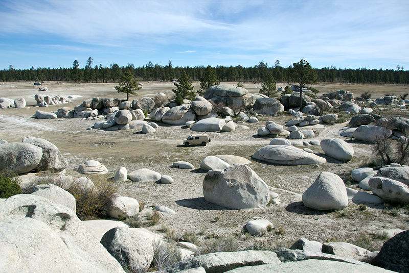
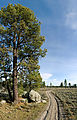
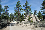
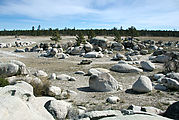
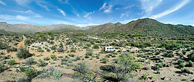
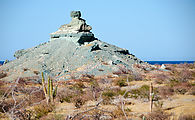
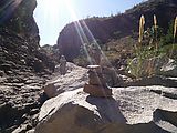
Laguna Hanson
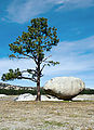
It's a surreal landscape, peppered with giant boulders left naked out on the plain, along with the occasional pine tree.
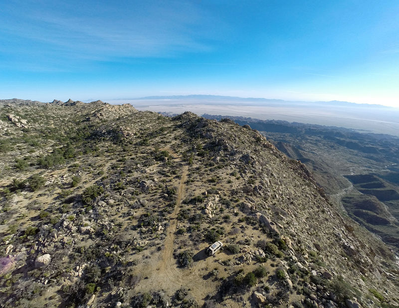
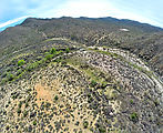
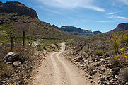
San Isidoro & Petroglyph Park Loop
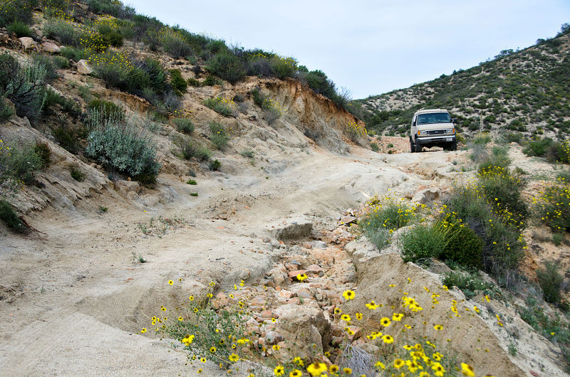
Inspired by this thread here on bajanomad, I decided to try driving the loop out to the San Isidoro visita site, and then down to DavidK's Petroglyph Park.
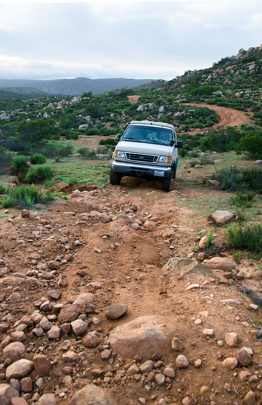
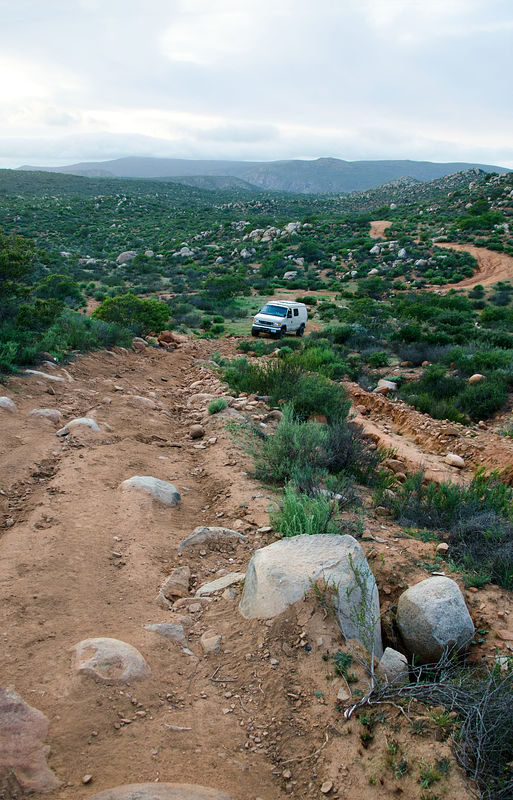
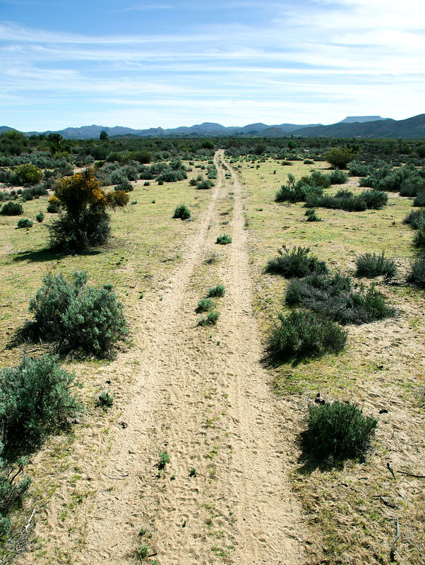
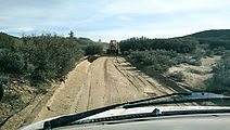
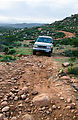
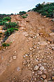
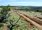
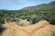
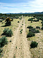
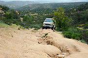
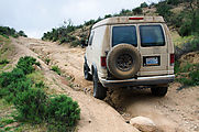
The roads were often eroded & slow going. I found myself celebrating whenever I managed to exceed 10 MPH in my van, which wasn't often. My stats
show I averaged just about 9 MPH. Makes me a bit envious of motorbike riders.
First of all, I started my journey with a little confusion. The thing is, I love my geeky toys -- dashboard computer and GPS -- and so I let myself be
lulled into the rookie mistake of letting Google Maps plot my route. (Yeah, really!) This meant rather than starting from Highway 1 at the village of
San Isidro, I was a few miles north at La Esperanza, where I found myself wandering around some farmer's fields trying to find some long-gone road.
Now if I were in the USA, someone would have come out and yelled at me for intruding on his private property. But I was in Mexico, were everyone I've
ever met is super nice. A farmer saw me driving back and forth next to his fields and drove out blinking his headlights to see what was up with me. He
was very nice. When I explained my quest in my poor Spanish, he shrugged amiably, indicating he don't know exactly what I was looking for, but sure --
go for it! And he opened up the gate to his fields for me.
After wandering about for a little while longer, I eventually found my way south to the correct road. Well, at least here I saw multiple tire tracks,
so I was confident it must be a real thoroughfare! It was slow going, with some parts eroded so badly as to require 4x4. About 10 miles in, I
stopped to camp for the night. [gps:30.6719,-115.8081]
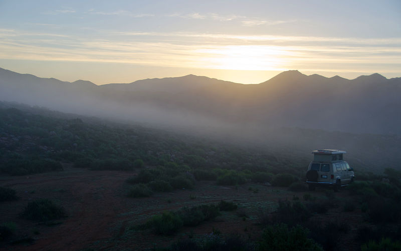
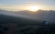
The next morning was beautiful, with low clouds I had never seen before in Baja. These were hypnotic to watch, as they rolled over the hills down past
my campsite. Apparently morning fog and low clouds are common in this region, brought by moisture blowing in from the Pacific.
On the move again, I bumped along, passing the grazing grasslands called Nueva York, and then worked my way up a steep incline to the top of Mesa el
Barreal.
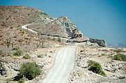
Visita San Isidoro
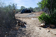
Finally, I reached the turnoff to the 3-mile spur road north to the San Isidoro site. I was surprised to see that this road seemed heavily used. There
was some kind of hovel made of sticks and tarps just off the road, showing signs of recent use. [gps:30.7259,-115.5350]
Heading north, I passed by several other living and work structures, as well as some recently cleared land being made ready for some kind of planting.
But I ran into no people anywhere. (It was a Saturday.)
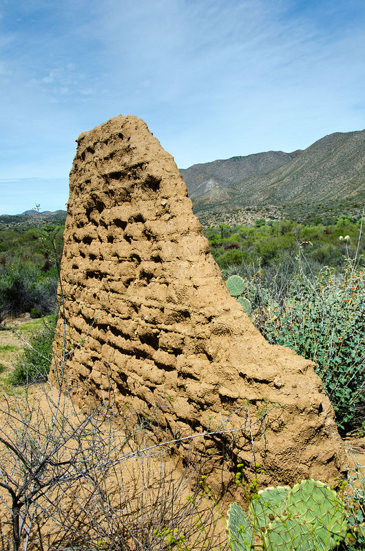
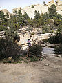
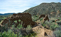
The road ended at the river, where there was an encampment. I hiked across the river (El Horno) to explore the San Isidoro site and its
melting adobe walls. [gps:30.7641,-115.5469]
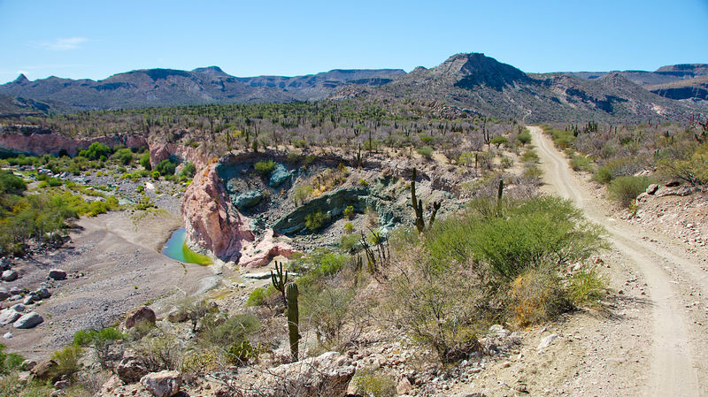
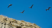
Back out of the San Isidoro spur, I continued on my clockwise my loop, following this "road" south through Sierra San Miguel. Through all the roads in
this region, I encountered not a single other vehicle. I did meet a few friendly cowboys on horseback, though!
 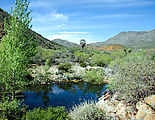      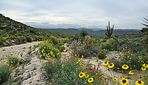
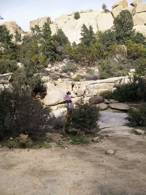
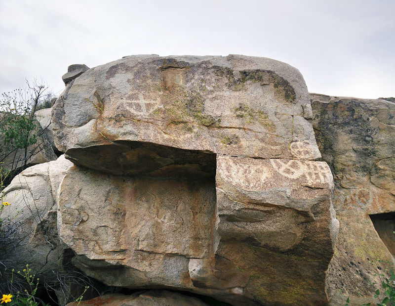
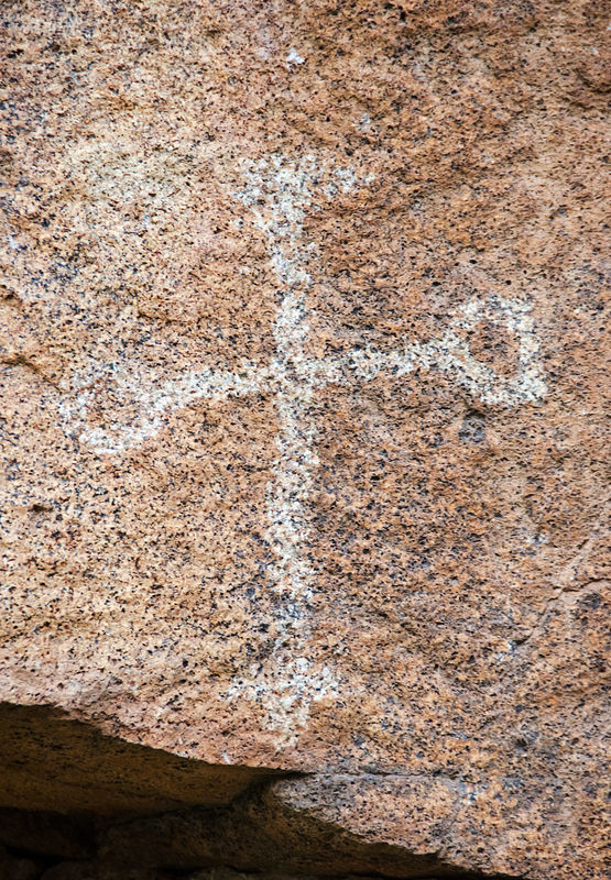
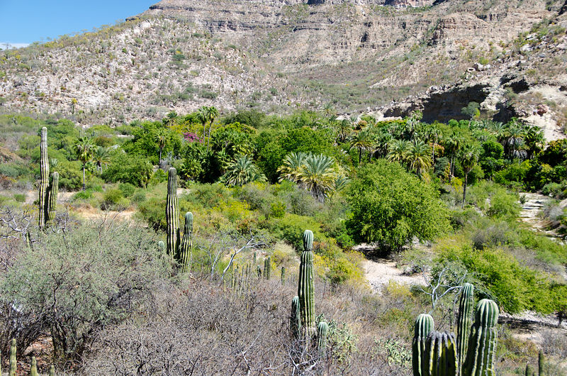
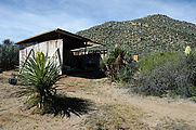
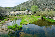
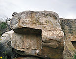
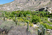
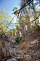
Petroglyph Park
Just before sundown, I reached DavidK's Petroglyph Park, and camped for the night on a lush grassy clearing by a stream. In the morning, mockingbirds
entertained me with an endless repertoire of birdcalls. The skies were overcast, and I felt the slightest drizzle coming down. This weather seemed
very un-Baja!
Across the stream, are some rocks with petroglyphs. There is one large panel and a few smaller ones to find. [gps:30.4032,-115.5563]
 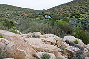  
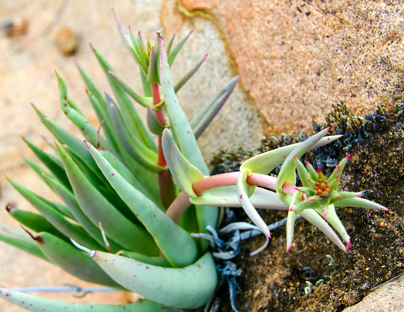
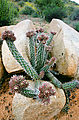
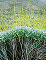
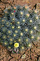
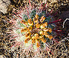
I also generally enjoyed poking around the stream and exploring the alien (to me!) plants in the cool air.
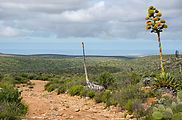
The next morning, I completed the loop, heading west back to Highway 1.
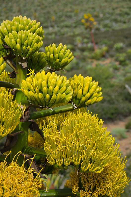
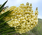
Rolling hills covered in flowering agaves, led down to the west coast.
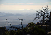
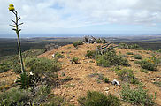
I made a small detour to try a road (4x4 needed) I spotted climbing a little hill, which turned out to be a former communications tower site with an
excellent view of Bah�a Santa Mar�a and the west coast. [gps:30.3633,-115.7279]
   
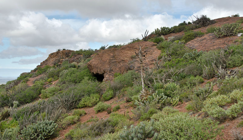
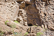
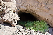
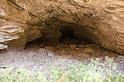
Nearby I spotted something up there on the hill. A shrine perhaps? No, someone was apparently living up there. A tortilla was still sitting out there
on a camping stove! I would have liked to explore a cave I noticed just below the top of the hill, but as I approached I saw a bunch of stuff inside.
I didn't want to bother whoever might be living inside.
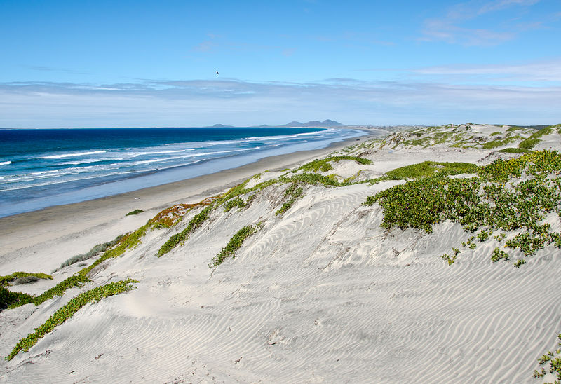
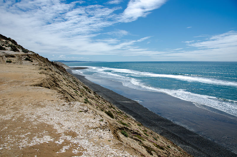
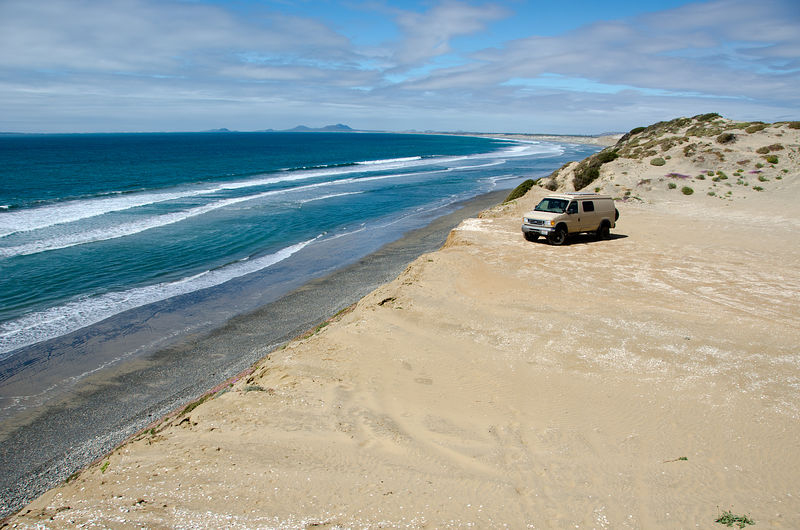
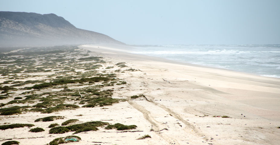
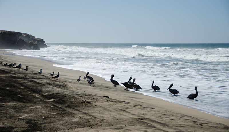
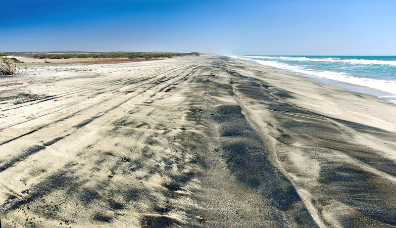
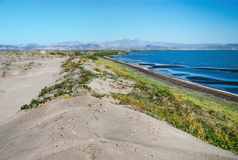
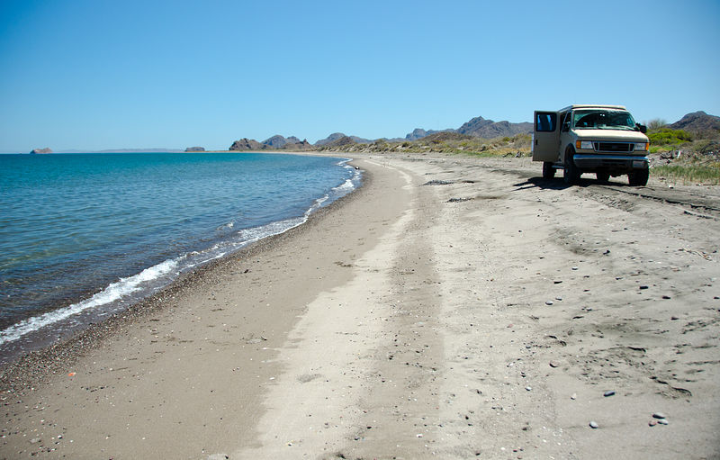
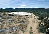
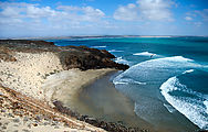
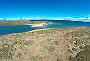
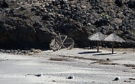
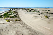
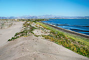
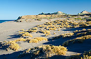
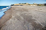
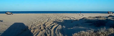
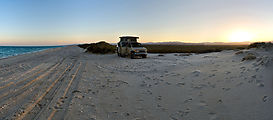
Dunes and Beach
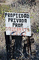
My loop ended at the beachside community of Nueva Odisea on Highway 1. By now I was ready for a swim in the ocean! Unfortunately, after driving around
town for a while, I still couldn't figure out how to get to the beach without going through areas signed as private property, so I headed out of town
and explored the dunes of El Pabell�n. Many vehicle tracks head from the highway out to these dunes, but end just before the beach, which can be up
to 70 ft below the dunes. [gps:30.3494,-115.8393]
 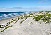 
Here is where I ended up swimming, after a nice steep climb down the crumbly hill. [gps:30.3268,-115.8287]
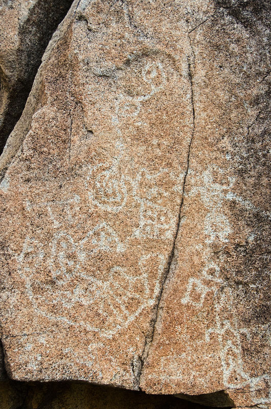
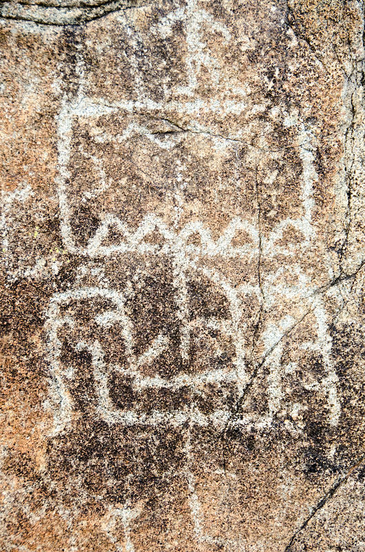
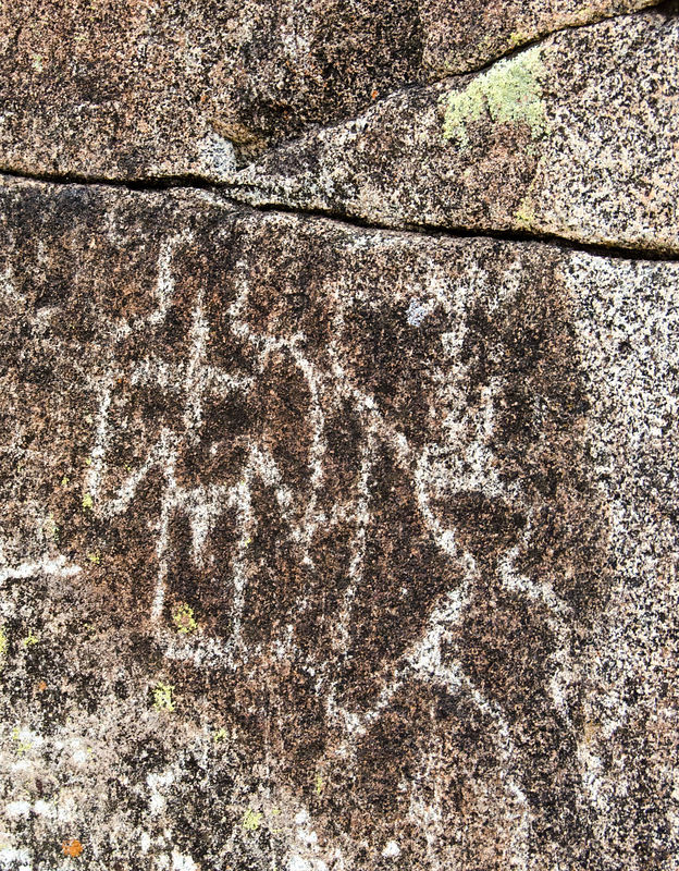
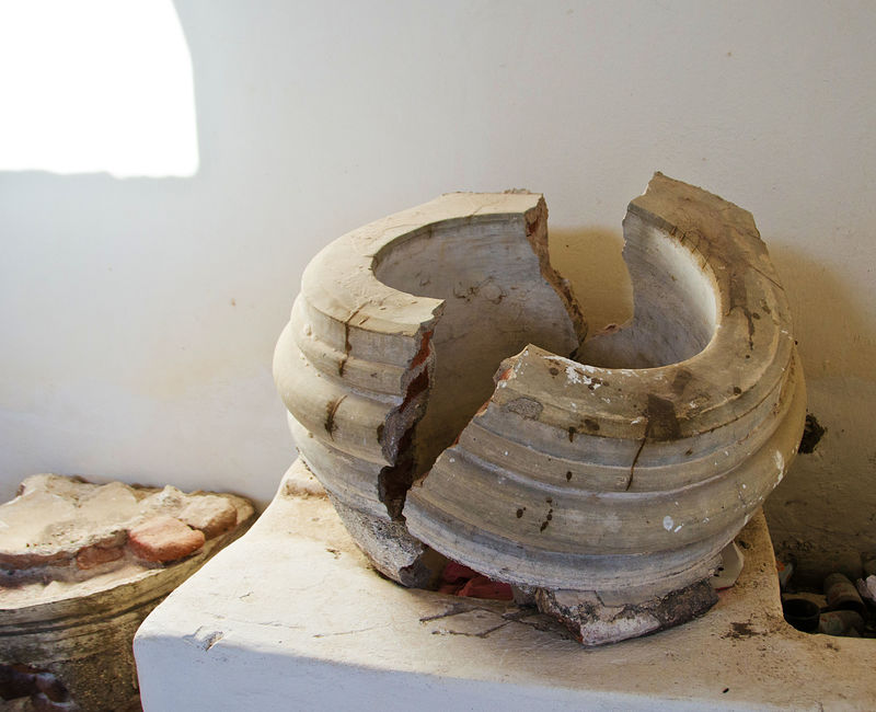
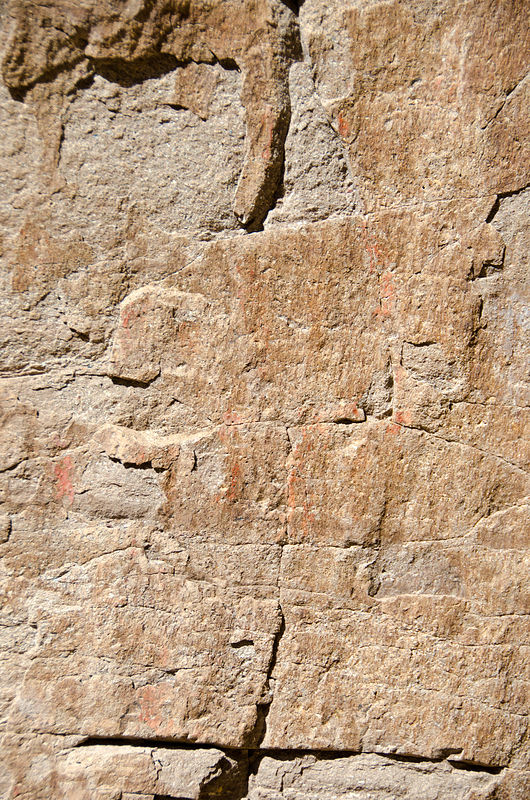
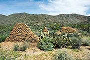
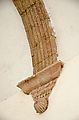
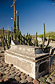
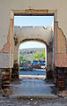
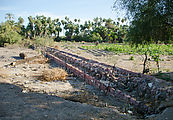
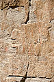
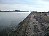
San Fernando Velicat�
     
The nearby petroglyphs and pictographs
          
Aqueduct remains
 
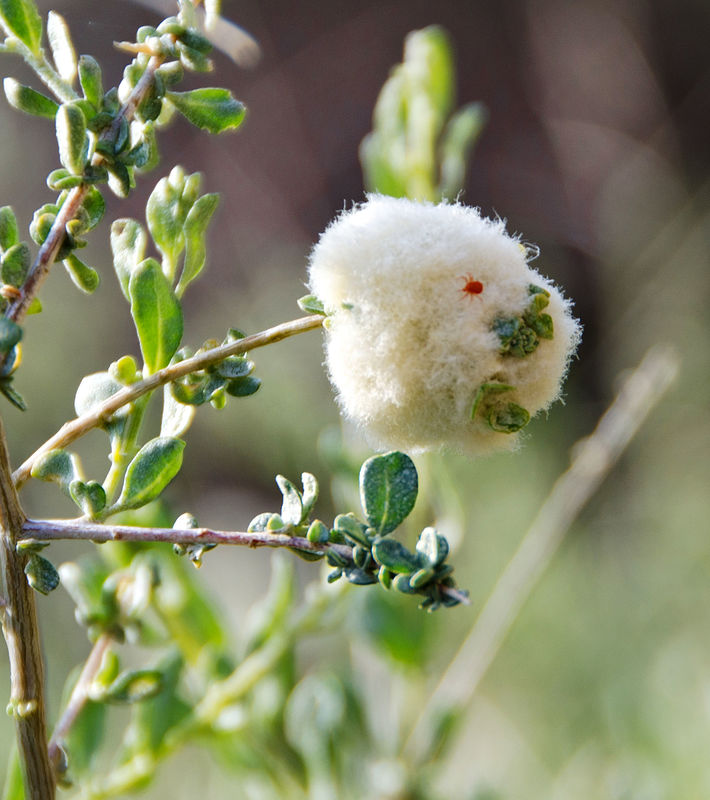
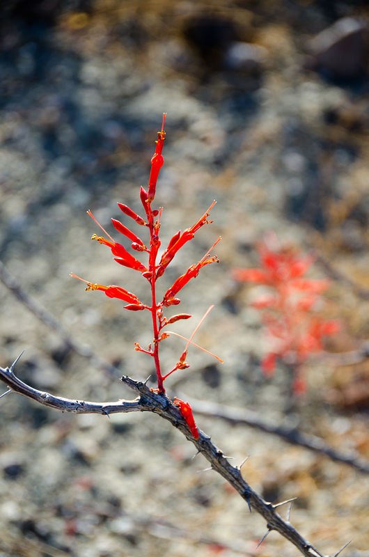
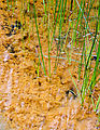
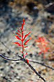
I was entranced by a little red mite running round his white puffball of a gall on this plant:

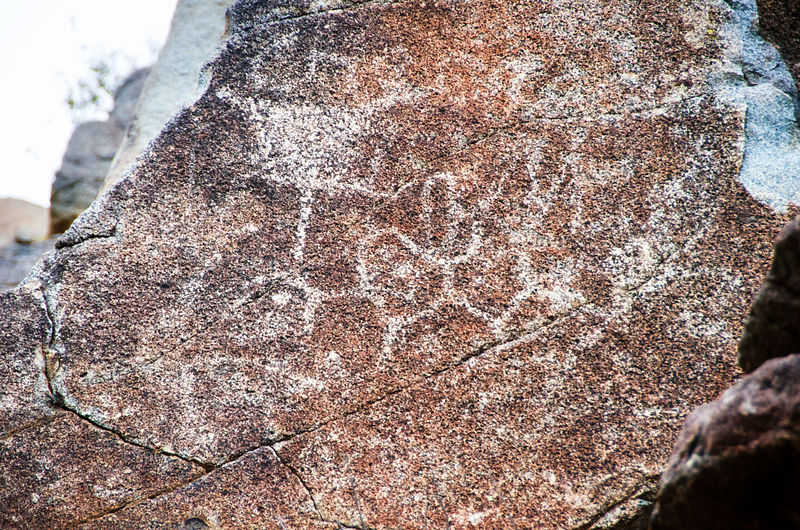
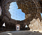
Catavi�a
I finally checked out the Catavi�a pictographs. I've driven past this site perhaps ten times over the years but I've never stopped in to see them.
I've always been afraid it would be a big production of tourists, guides, and gift shops. Well, this time I finally investigated this rock art.
While there were plenty of signs and trail markings, I saw no people around! And the pictographs inside the Catavi�a cave were surprisingly good.
[gps:29.7512,-114.7447]
    
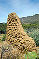
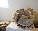
I explored this ruin of a dome at Catavi�a, still signed as "OPEN: Museum - Gallery". [gps:29.7547,-114.7477]
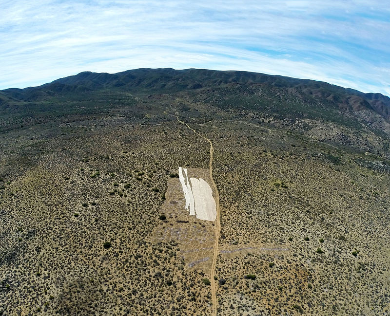
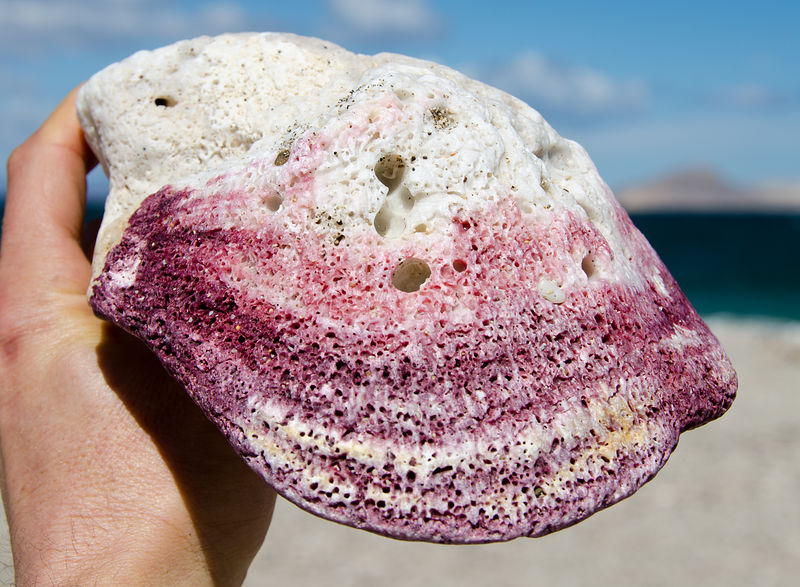
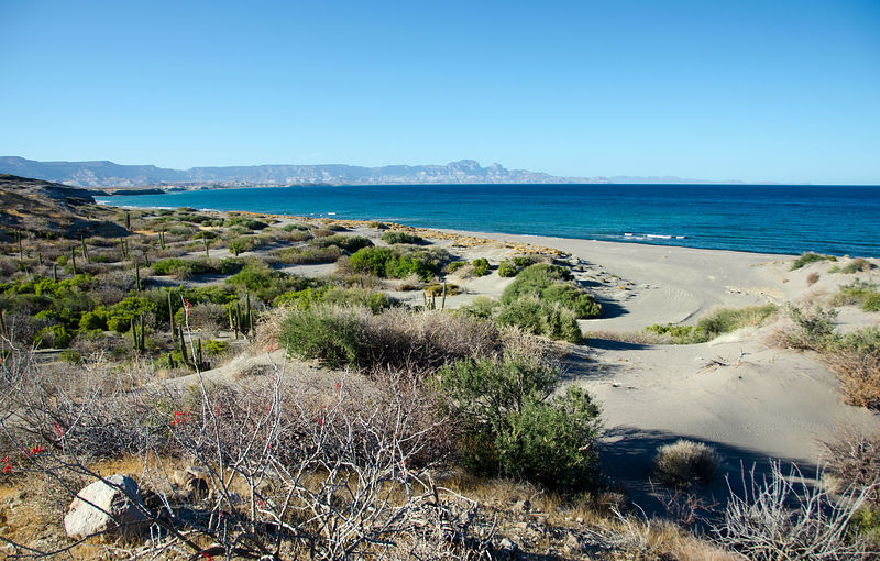
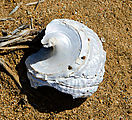
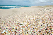
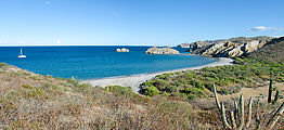
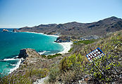
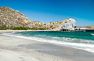
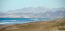
Playa Pacheco & Santo Domingo
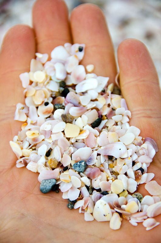
Next stop was the "pink sand" beach of Playa Pacheco, which is made up of fragments of lavender and yellow shells, giving it a gray-pink (peach,
perhaps?) color. This continues steadily to the north for another 15 miles. [gps:28.2786,-114.1121]
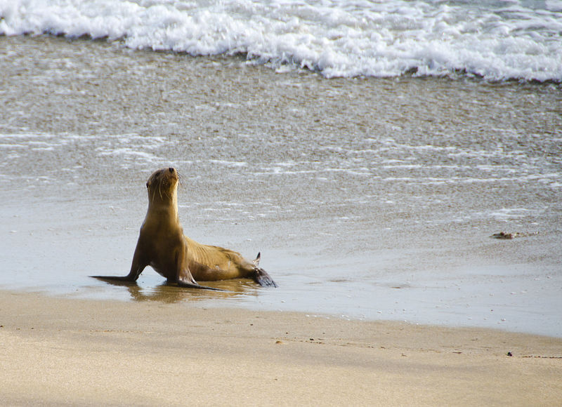
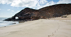
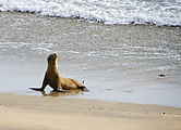
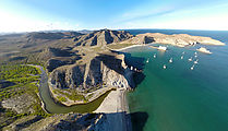
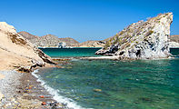
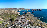
To the south are cliffside roads along Morro Santo Domingo. [gps:28.2654,-114.1167]
There is an arch here at the rocky point. I didn't stay long to explore, as I encountered a colony of sleeping sea lions and I didn't want to disturb
them. [gps:28.2434,-114.1128]
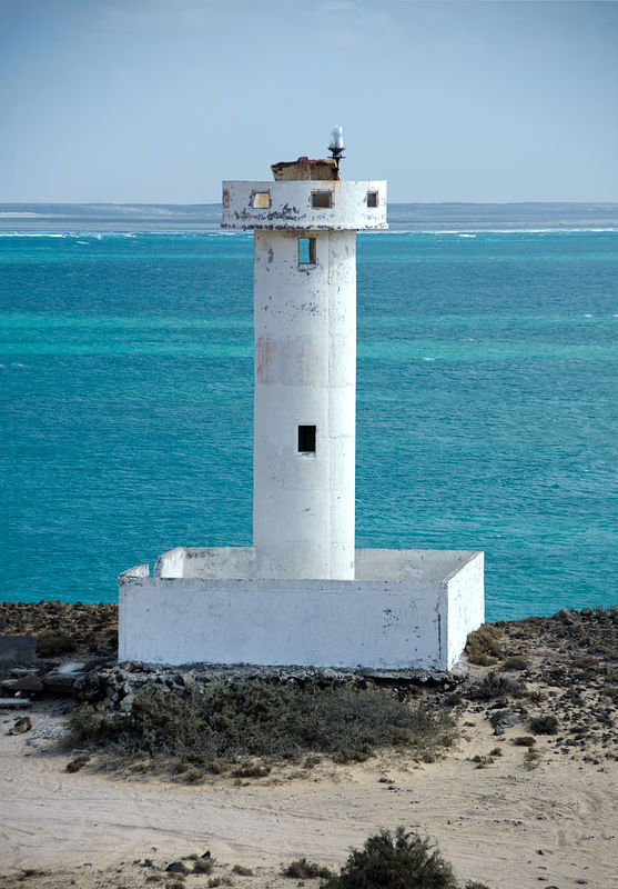
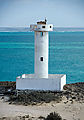
A lighthouse stands at Punta Morro Santo Domingo. Most plants here are covered with green lichen. [gps:28.2403,-114.1031]
Cerro La Bulonera is a nearby hill with a steep vehicle track leading to the top, with a fantastic 360-degree view of the area. Fantastic gale-force
winds, too! [gps:28.2535,-114.1045]
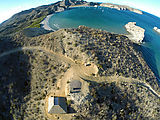
San Marcos and Punta Chivato
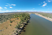
Moving on, I next investigated the Punta Chivato peninsula. At San Marcos, there are ruins of an old sugar mill next to the estuary, Estero San
Marcos. [gps:27.1137,-112.0705]
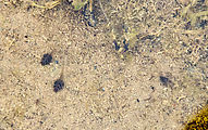
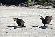
These seeds with claws (Proboscidea althaeifolia "devils claw") grabbed my ankles and held on to hitchhike with me as I walked.
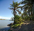
This palm grove is a perfect shady hideout by the water. [gps:27.1173,-112.0654]
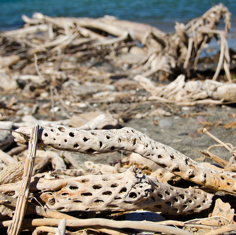
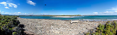
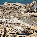
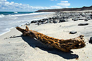
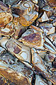
A collection of driftwood (including cactus wood) at the mouth of the estuary [gps:27.1222,-112.0554]
East of the estuary are a few miles of nice empty white sand beaches. [gps:27.1201,-112.0311]
And farther east is Ensenada el Muerto [gps:27.0959,-111.9919]
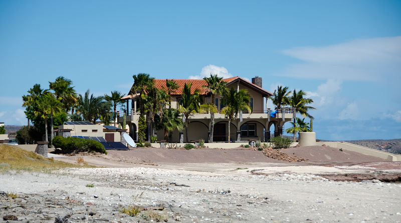
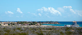
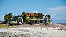
Finally I came to Punta Chivato, which is crowded with fancy houses. And an airstrip. I quickly moved on. [gps:27.0804,-111.9779]
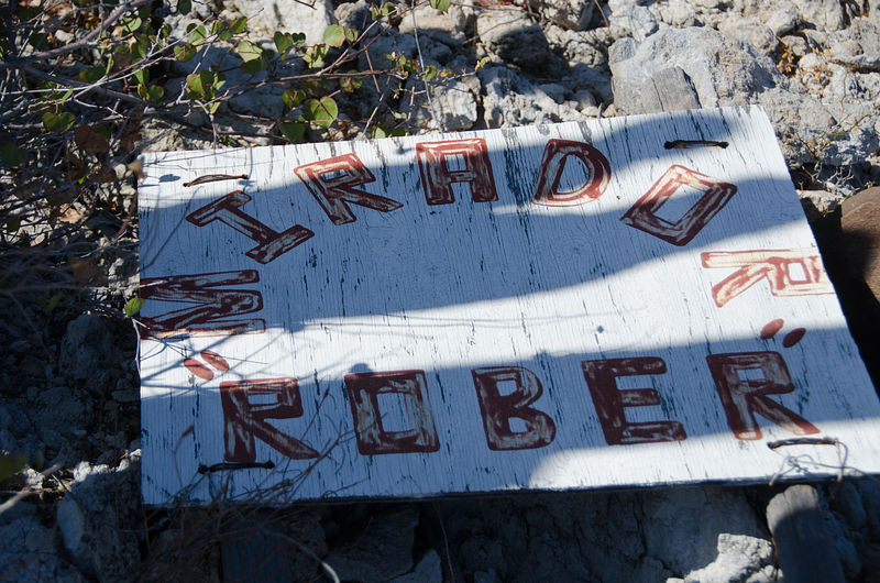
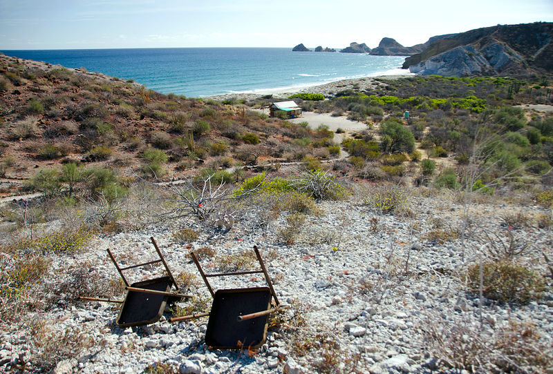
San B
OK, you know what I'm talking about here, but I'm going to refer to this place as only "San B" here in this post because the people who camp there
indicated that they don't want the word to get out about it. I don't like to camp in places with people, and therefore this place isn't really my
scene, anyway. But I wanted to check it out. And yes, it was beautiful.
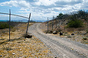
I encountered several campers on the main beach, some of whom told me they stay for months camping in this spot.
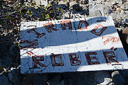
There are also a smattering of houses, many roads to bulldozed sites of future houses, and fences with private property signs. Some of the fences seem
to have been cut open at some point, and I found signs lying face down in the dirt. Torn down, perhaps?
The bay appears to be a popular mooring spot for sailboats.
A smaller windy beach is just to the north, and there are also more beaches to the south -- but vehicle access may be blocked.
A hilltop trail provides stunning views along the beaches to the south.
There is a hike in this area, going inland about a mile up into what I've been told is called "Surprise Canyon". I won't give away the surprise here.
The canyon hike is a real scratchy bushwhack. I'm so glad I brought long pants!
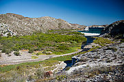 
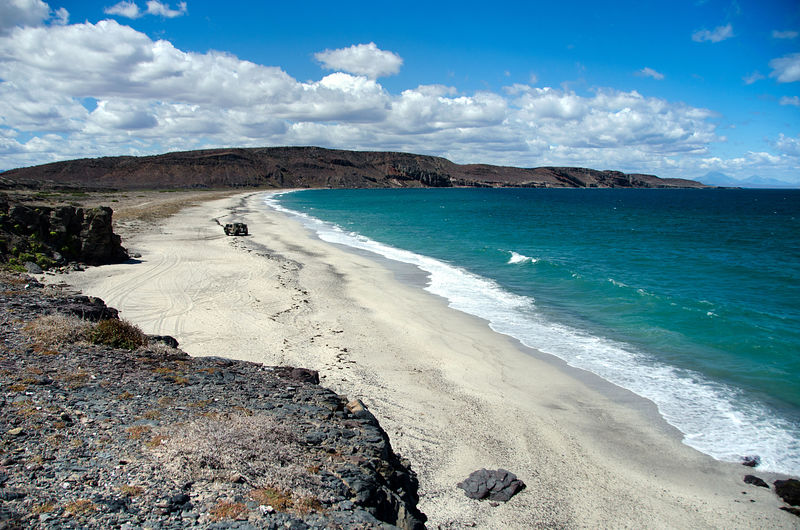
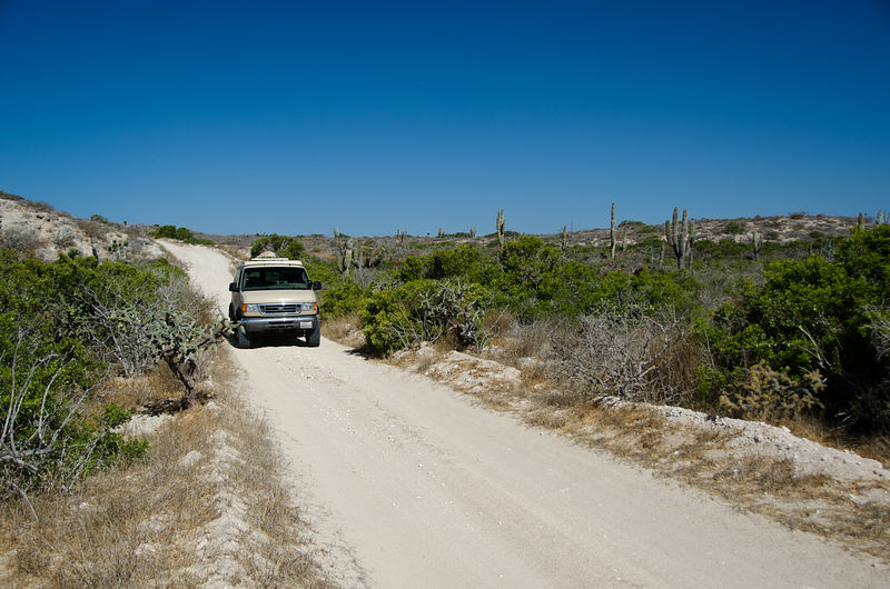
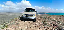
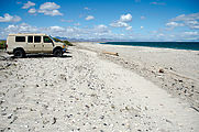
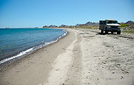
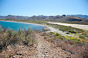
Punta Conejo

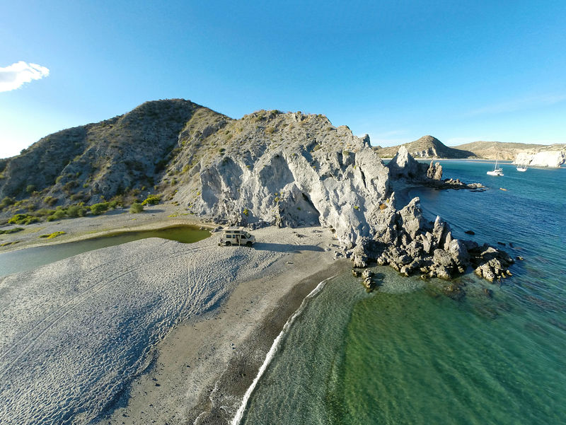
My next excursion was over to Punta Conejo on the Pacific side. I explored the sandy beaches in this area, and about 15 miles south.
There is plenty of empty beach down here, interspersed with the occasional house or fishing camp. I spent the night at El Datilar, a spot with beach
access through the dunes just north of Punta Conejo. [gps:24.1038,-111.0362]
   
El Conejo [gps:24.0717,-111.0068]
   
Wandering the beach road south...
     
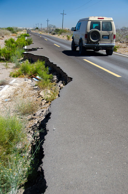
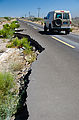
Finally, I went back northeast to Highway 1 via Conquista Agraria, where I met upon this freshly constructed paved road! Unfortunately it was already
badly washed out from erosion. [gps:23.9819,-110.7968]
[end of part 1]
[Edited on 4-25-2019 by geoffff]
|
|
|
geoffff
Senior Nomad
Posts: 715
Registered: 1-15-2009
Member Is Offline
|
|
La Paz to San Evaristo and Misión San Luis Gonzaga
My final loop adventure was back over on the Gulf side, where I drove along the coast north from La Paz to San Evaristo, and then west through the
mountains, past the mission San Luis Gonzaga, and finally back out to paved Highway 1.
Peninsula el Mogote
First I checked out Peninsula el Mogote, a large sandspit northwest of La Paz. Satellite imagery shows that the east end of this peninsula is being
developed into resorts (with a golf course!), but the "neck" on the west end where it connects to the mainland is still undeveloped dunes with only a
graded dirt access road. [gps:24.1776,-110.4294]
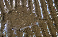
While the north side of Mogote is sandy beaches, the south side is mud flats. I spotted these curious prints in the mud that looked suspiciously like
rays. [gps:24.1742,-110.4156]
Driving North
The first 25 miles of the road heading northwest along the shore from La Paz is paved -- all the way to the busy mining town of San Juan de la Costa.
San Juan de la Costa
At San Juan de la Costa, public traffic (myself included) is diverted from the nice road, which is henceforth reserved for use only by the busy mining
facility in town. The public must continue north via a rougher road segregated from mining traffic. After finding the sign in town for this road, I
immediately encountered a washed out bridge and had to detour around. [gps:24.3643,-110.6823]
 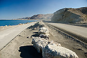
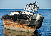
I passed this shipwreck at Punta el Junco [gps:24.4085,-110.6929]
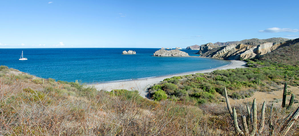
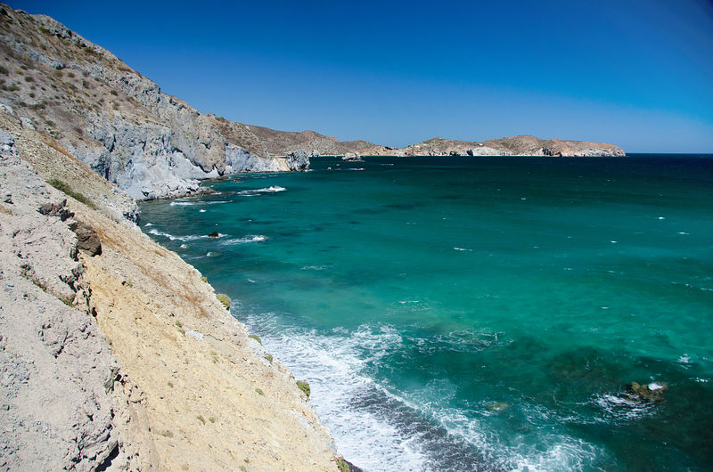
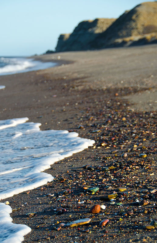
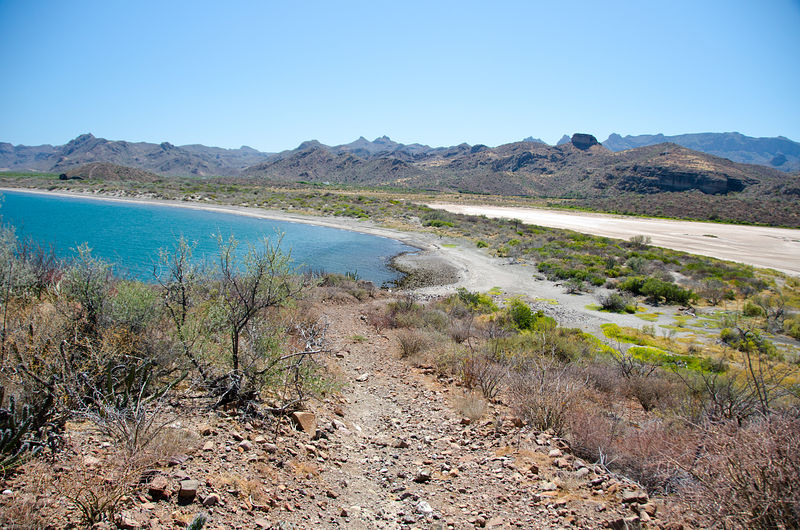
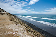
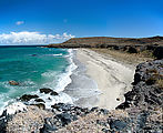
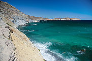
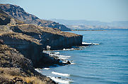
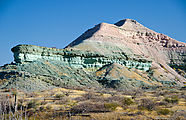
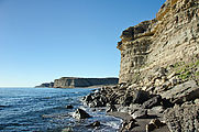
Las Animas
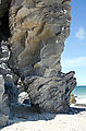
At Las Animas, the landscape gets interesting with dramatically eroding cliffs of pink and green colored rock. I camped here for the night.
[gps:24.5022,-110.7193]
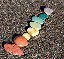
The beach
Even the pebbles on the beach come in all colors of the rainbow (well, except for blue).
 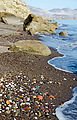 
Hiking under the crumbling cliffs at the south end of the beach. [gps:24.496748,-110.713446]
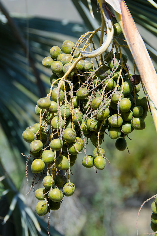
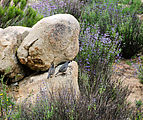
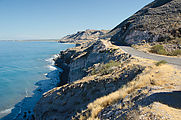
Flora
I spent the morning driving the rest of the way up the coast to San Evaristo, detouring to investigate every beach I passed. I found plenty of nice
private sandy beaches in this area.
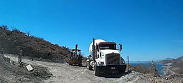
At Cerro Colorado, the mountains press up against the shore, and the road is squeezed in among the colorful boulders that fall from the cliffs. Then
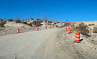
there is a deviation as the road turns inland to steeply wind up over Mesa Botafuego. I met up with some road construction here -- they were laying
down some concrete on the steepest parts of this primarily dirt road. [gps:24.7654,-110.6672]
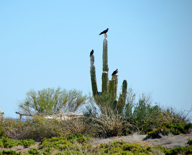
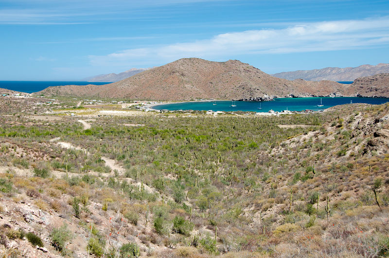
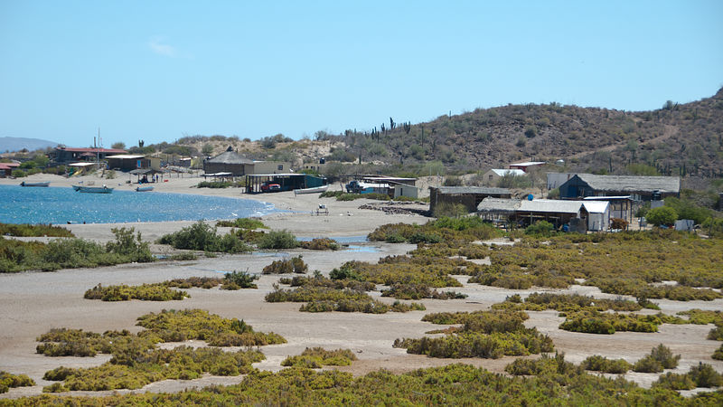
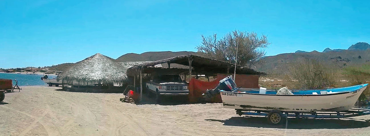
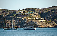
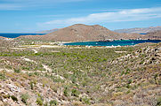
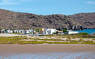
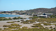
San Evaristo
San Evaristo is a cheery little village at the northern end of this coastal road north from La Paz.
Driving into town and right up onto the beach, I was met by shouts of friendly surprise by a group of guys sitting around a table under an awning.
They did their best to draw me in to hang out with them. I'm not a natural being the center of attention, but I did stay a while, doing my best to
chat in Spanish. I ended up giving everyone a tour of my camper. I also inquired about the condition of the road inland from here, and was told it was
rough but definitely passable with my vehicle. [gps:24.9091,-110.7099]
There is a large salt processing plant just north of town, but I didn't visit that.
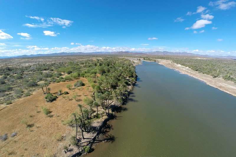
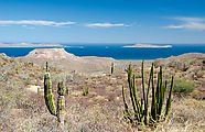
Road Inland from San Evaristo
After a lunch break, I drove the inland road, heading west towards San Luis Gonzaga and then on to Highway 1.
The road is initially steep and eroded as it heads up into the mountains -- but should be no problem for a high clearance 4x4. Soon I had a nice view
looking back to the coast I'd just left, and the islands beyond.
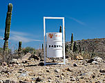
For some reason, elaborate trash cans had been placed every kilometer or so along this road.
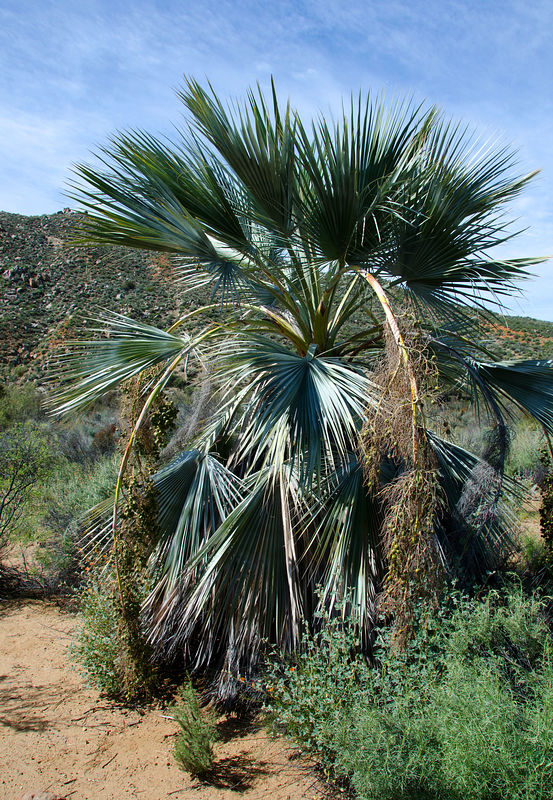
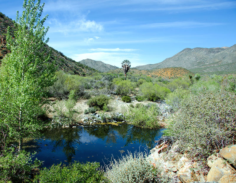
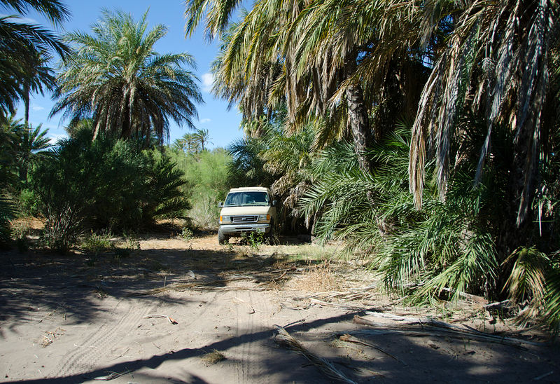
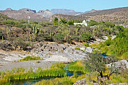
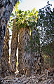
This road through dry rugged mountainous country follows a narrow strip of canyon bottom green oasis. This lush spot, named El Bosque, appropriately
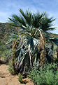
has a forest of palm trees. [gps:24.8392,-110.7745]
Just west of the village of La Soledad is this colorful scene, of water with pink and green rocks.

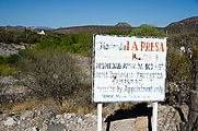
More lushness at Hacienda La Presa / Misíon Dolores. [gps:24.8684,-111.0594]
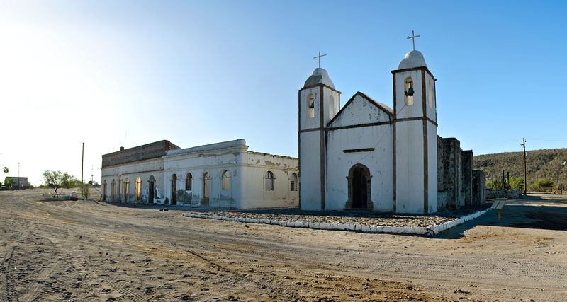
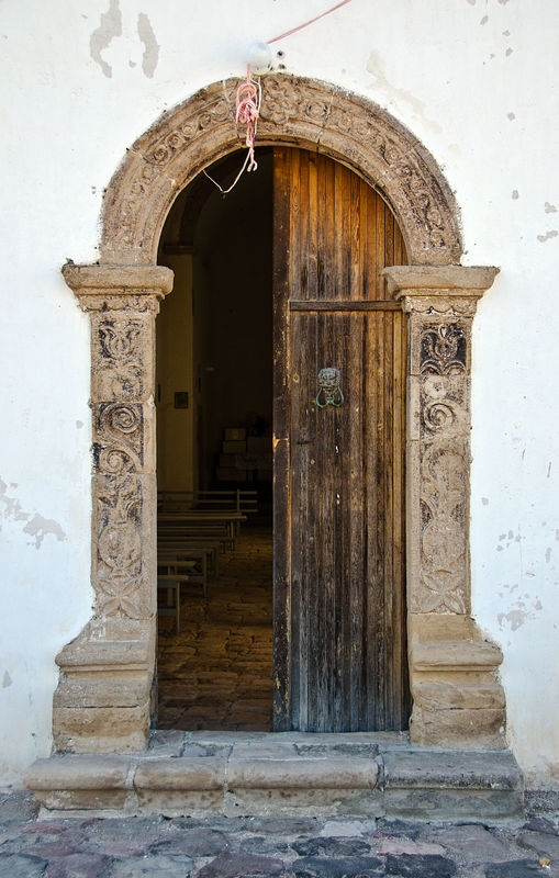
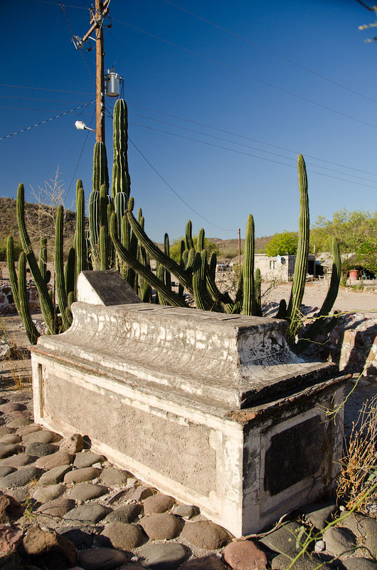
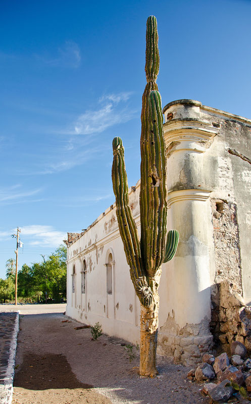
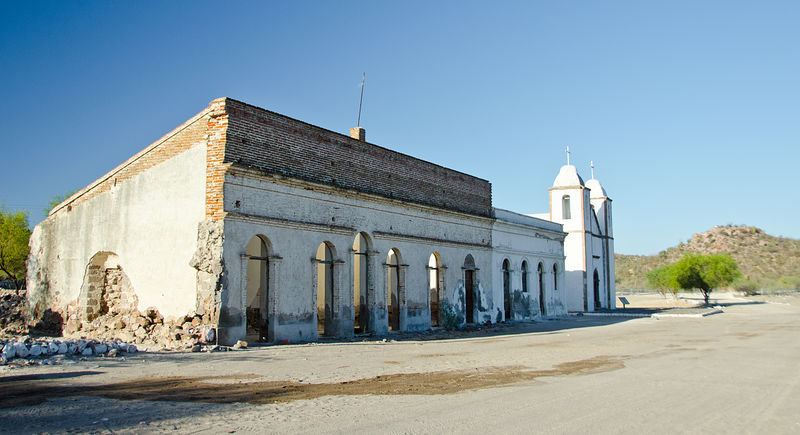
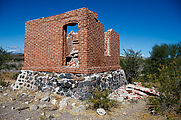
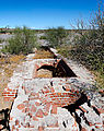
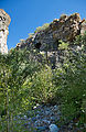
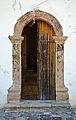
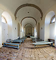
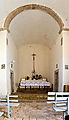
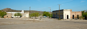
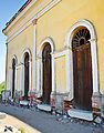
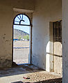
San Luis Gonzaga
After finding a quiet spot to camp for the night, I arrived the next morning at the mission San Luis Gonzaga. [gps:24.9079,-111.2893]
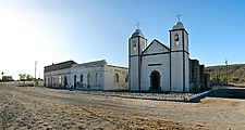      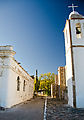  
The area is still an active village. I arrived to find a cheery morning scene, with the sounds of birds chittering, families chatting, and a man
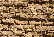
singing while he worked. The church is accompanied by a few other old buildings, elaborate brick structures which are still beautiful in their decay.
Playa Luigi
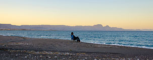
I arrived back at Highway 1, and it was time to start working my way north again. Before reaching Loreto, I stopped for a swim break at Playa Luigi.
[gps:25.7509,-111.2794]
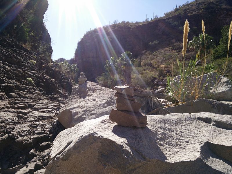
Road to San Javier
At Loreto, I took a detour inland along the road to San Javier to try to track down the "Painted Cave of Loreto" I had read about in one of my old Baja books. I pulled off the San Javier road just at the point where the pavement ends, and started walking west along the river
wash, and scouted around with my binoculars. I never did find much in the way of cave paintings here, but I did get excited when I noticed some
cairns. I started following them, and they led me on a trail following what seemed to be the old San Javier road. After about a mile, the cairns lead
me into a pretty little oasis of water and palm trees. [gps:25.9713,-111.4793]
I did spot a cave -- a tiny one! I climbed the rock face and went inside. There was black smoke residue on the ceiling, and I spotted faintest traces
of red painting on the rock outside. This little cave discovery of mine couldn't be the one from my book, but I still enjoyed my little adventure.
Driving North, Highway 1
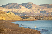
I camped for the night at the southeast end of Bahía Concepcíon, the only spot I know on the bay that isn't crowded with campers.
[gps:26.5667,-111.6932]
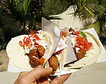
Passing Guerrero Negro, I ventured back into civilization to recharge with some fish tacos from roadside food truck. Yum!
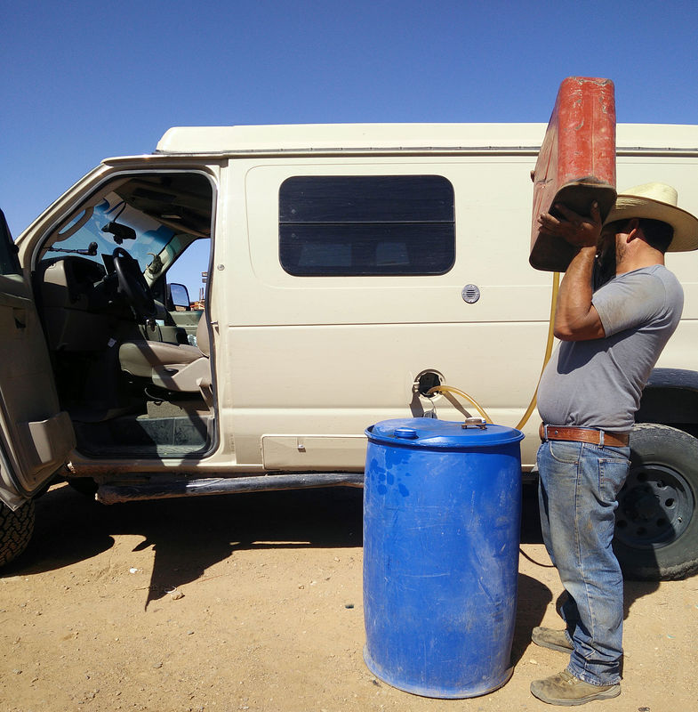
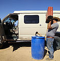
I regretted not filling up with gasoline while passing through Guerrero Negro. I ended up having to buy fuel from a guy selling it from barrels at
Lonchería Mary in Punta Prieta. I calculated that it cost me about USD $1/gallon extra, but that's so much better than going back to Guerrero Negro,
over an hour behind me. [gps:28.9326,-114.1619]
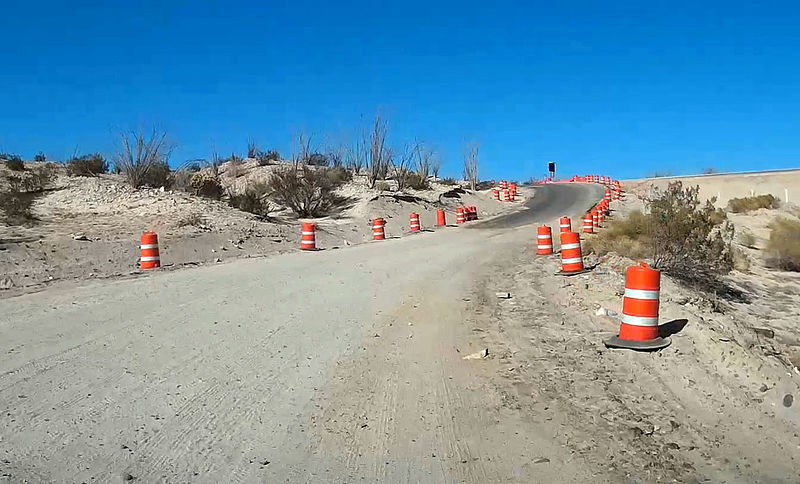
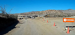
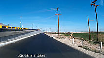
Driving North, Highway 5
Rather than slogging through all the towns of northwest Baja California after Highway 1 reaches El Rosario, I decided to head northeast and take
Highway 5 north to the border.
Only 24 miles remain unpaved! Once I reached pavement and achieved the posted 110 KPH speed limit, I reviewed nostalgic memories of a decade past,
when it would take me multiple days driving (and nights of camping) to work my way along this same northeast coast of Baja. It took me a little over
an hour to drive from the start of pavement north of Coco's Corner to Percebú near San Felipe.
Pavement starts here: [gps:29.6179,-114.4015]
Sand Island at Percebú
For my last night in Baja, I camped at Sand Island, a favorite repeat camping spot of mine. Thanks, DavidK, for sharing this with me!
It was high tide, but I still managed to cross the mud flats. Arriving on the sand bar, I saw this sad disabled Jeep getting towed down (off?) the
beach by some guys in a pickup truck and a long rope. The couple in the Jeep did not look happy.
Back to Mexicali
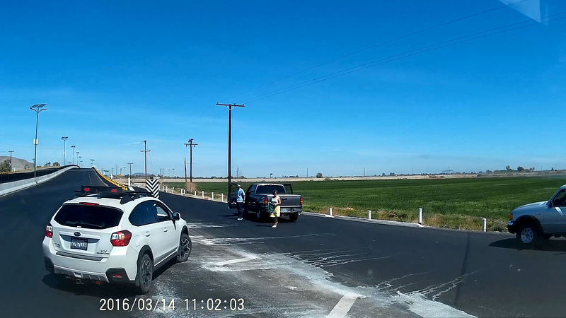
It was time to go home. I drove the rest of Highway 5, north through San Felipe and then on to Mexicali.
On the way, I encountered some stopped cars just before a bridge, and people waving me down. Apparently a (live?) power line had just fallen to a
level just feet above the road surface. Wow, that would have been horrible to hit at speed! I am so thankful for the warning. And luckily there was a
low road that bypassed the bridge now blocked by the power line.
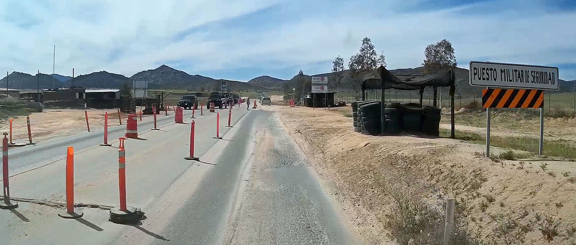
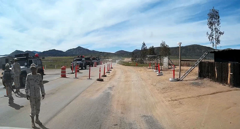
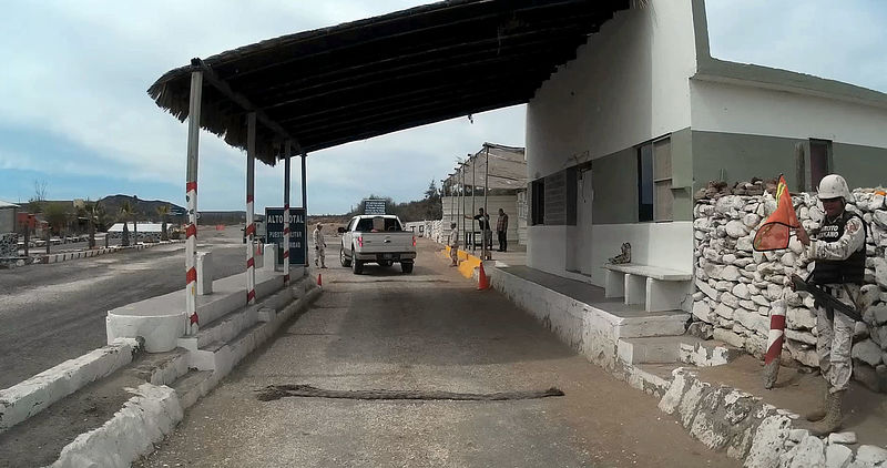
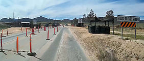
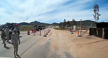
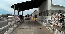
Military Checkpoints
I remember when these military checkpoints used to be somewhat scary to me, but now that I've experienced almost 100 of them in my life, I've gotten
comfortable with them.
It seems I'm always asked where I'm coming from ("¿De donde va?") or where I'm going ("¿A donde va?"), so I've learned to always have simple answers
to these questions ready in mind (I usually just name the previous/next town), even if the real answer is somewhat complicated. Unfortunately I
somehow always seem to miss that first word in the soldiers' questions, so I'm never quite sure if they're asking me about where I'm coming
from or going to.
I've learned that producing my map (Baja Almanac) and talking about my trip plans or asking a question is a good distraction for the soldiers, but they don't seem to actually know
much about the local area they're stationed in.
And if there's anything you'd prefer soldiers not to see, I'd say just put it in your pocket! They have never searched my person.
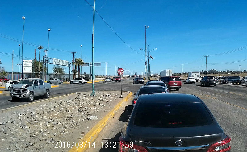
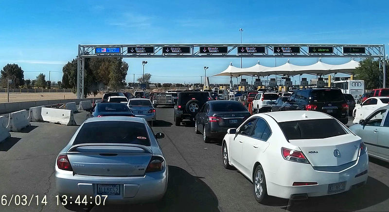
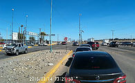
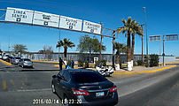
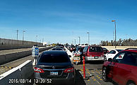
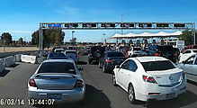
Border Crossing
Leaving Mexico, I crossed the border at the "Calexico East" again.
Though I have never bothered to do so in the past, this time I decided to see what it would take to be a good boy and actually return my FMM documents
to Mexican immigration. It was somewhat confusing -- here is what I did: I approached the border crossing driving eastbound, passing by all the cars
queued up in the left-hand lane, and (following the example of other drivers) made a left turn from the middle lane (in front of the waiting vehicles)
into the border complex. Watch out, this intersection is chaotic! There is a motorcycle police officer watching this whole process, silently condoning
the crazy traffic. At the next stop I turned left again, cutting through the line of exiting cars so I could get into the parking area. I then walked
north to the immigration office to return my FMM.
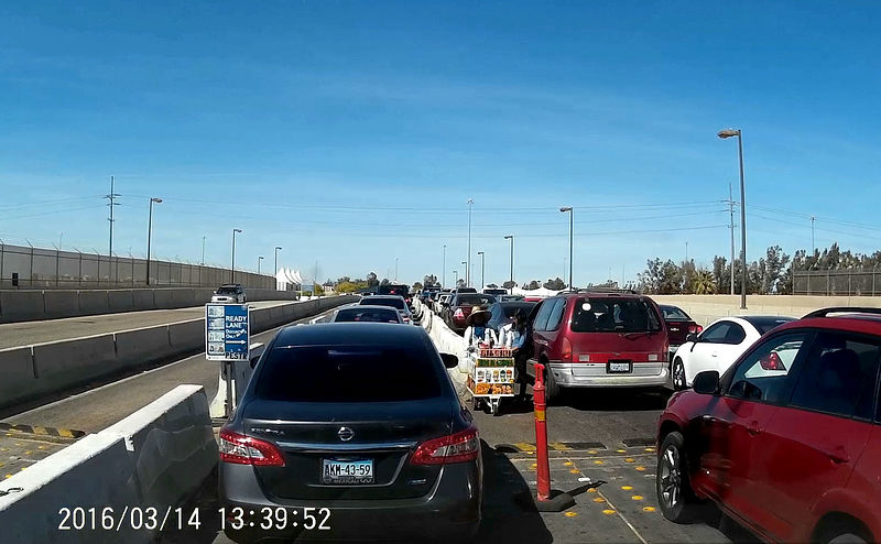
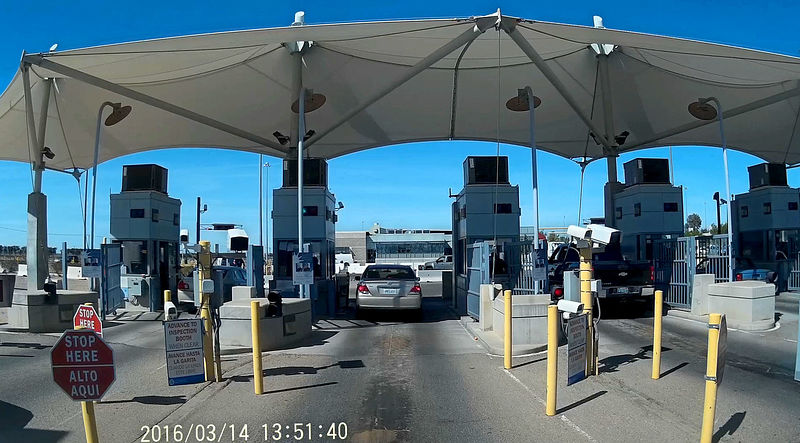
With this completed, I drove out of the complex to start over again. I drove a block west so I could U-turn back into the line of cars waiting to
exit. I picked this longest line because I had just a plain old passport rather than any special expedited entry documents. Some other cars passed me
on the right, perhaps going to other special immigration lanes or to what seemed to be some kind of informal car-wash area. Perhaps I should have
headed right as well, but I stayed in the longest / slowest lane and this lane fed into an area marked "Ready Lane". A sign now specified that I must
have special documents (RFID-enabled cards). My passport was not listed here as one of the allowed options, but I was now trapped in this lane by a
concrete lane barrier. Oh well. In any case, the US immigration agent didn't seem bothered when I presented him my lowly passport.
Whew!
I have this whole story (with a few more details) here on my website: http://octopup.org/baja2016
-- Geoff
[Edited on 3-31-2016 by geoffff]
|
|
|
Pacifico
Super Nomad
Posts: 1299
Registered: 5-26-2008
Member Is Offline
|
|
GREAT trip report!!! Thanks for taking the time to post it!
"Plan your life as if you are going to live forever. Live your life as if you are going to die tomorrow." - Carlos Fiesta
|
|
|
woody with a view
PITA Nomad
Posts: 15940
Registered: 11-8-2004
Location: Looking at the Coronado Islands
Member Is Offline
Mood: Everchangin'
|
|
now that's a report!
|
|
|
BigBearRider
Super Nomad
Posts: 1299
Registered: 4-30-2015
Location: Big Bear, Punta Chivato, and Cabo
Member Is Offline
Mood: 
|
|
Fantastic. The smaller pics made it very easy to read. I like it. Thanks for posting.
|
|
|
David K
Honored Nomad
Posts: 65537
Registered: 8-30-2002
Location: San Diego County
Member Is Offline
Mood: Have Baja Fever
|
|
A+ report!
Thank you for sharing.
I will take more in after work tonight.
|
|
|
ehall
Super Nomad
Posts: 1906
Registered: 3-29-2014
Location: Buckeye, Az
Member Is Offline
Mood: It's 5 o'clock somewhere
|
|
wow. Great pictures.
|
|
|
chuckie
Elite Nomad
Posts: 6082
Registered: 2-20-2012
Location: Kansas Prairies
Member Is Offline
Mood: Weary
|
|
Thanks Brought back memories, started me digging for old Photos!
|
|
|
AKgringo
Elite Nomad
Posts: 6339
Registered: 9-20-2014
Location: Anchorage, AK (no mas!)
Member Is Offline
Mood: Retireded
|
|
That is my kind of trip, the journey IS the destination!
Thanks for all of the details, I am going to have to revisit this thread to absorb more of it before my next trip.
If you are not living on the edge, you are taking up too much space!
"Could do better if he tried!" Report card comments from most of my grade school teachers. Sadly, still true!
|
|
|
Elona
Junior Nomad
Posts: 71
Registered: 1-5-2015
Location: Germany
Member Is Offline
Mood: BC Addict
|
|
Outstanding  . .
Saludos
Elona
 |
|
|
AKgringo
Elite Nomad
Posts: 6339
Registered: 9-20-2014
Location: Anchorage, AK (no mas!)
Member Is Offline
Mood: Retireded
|
|
I just visited your website, http://octopup.org/baja There is a whole world of information that I have not checked out before!
If you are not living on the edge, you are taking up too much space!
"Could do better if he tried!" Report card comments from most of my grade school teachers. Sadly, still true!
|
|
|
Bajaboy
Ultra Nomad
Posts: 4375
Registered: 10-9-2003
Location: Bahia Asuncion, BCS, Mexico
Member Is Offline
|
|
Excellent report! I've been to most of those places so thanks for the trip down memory lane.
|
|
|
willardguy
Elite Nomad
Posts: 6451
Registered: 9-19-2009
Member Is Offline
|
|
trip report deluxe!
and as david says, "any publicity is good publicity" 
|
|
|
VegasNick
Junior Nomad
Posts: 75
Registered: 4-14-2015
Member Is Offline
|
|
Awesome report! I will add some of these to our October trip!
|
|
|
fdt
Ultra Nomad
Posts: 4059
Registered: 9-7-2003
Location: Tijuana, Baja California
Member Is Offline
Mood: Yeah, what if it all goes right
|
|
Thanks, what a wonderful trip.
A well informed Baja California traveler is a smart Baja California traveler!
|
|
|
BajaBlanca
Select Nomad
Posts: 13247
Registered: 10-28-2008
Location: La Bocana, BCS
Member Is Offline
|
|
no words can adequately describe the amazing detail you provided-both in print and in photos!
thanks so much...I love the plant shots.
Did you meet our friends Linda and Rob in Aguja?
|
|
|
geoffff
Senior Nomad
Posts: 715
Registered: 1-15-2009
Member Is Offline
|
|
Thank you, BajaBlanca!
Looks like I drove right past there, but no -- no dropping in on anyone
-- Geoff
|
|
|
David K
Honored Nomad
Posts: 65537
Registered: 8-30-2002
Location: San Diego County
Member Is Offline
Mood: Have Baja Fever
|
|
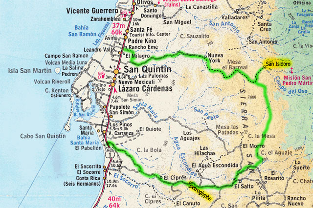
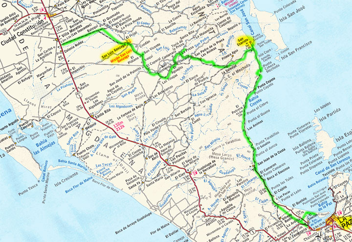
Geoff, how was the road west from Petroglyph Park and on down the mountain for you in the van?
In 2005, it was pretty rough going... only motorcycle tracks on the old road. El Cipres was abandoned. Seems all traffic for the mountain ranches was
coming up from Km. 103, longer but easier? Here's my map from 2005:

|
|
|
Genecag
Nomad
Posts: 118
Registered: 6-13-2011
Location: San Diego, TJ, La Paz
Member Is Offline
|
|
Wow, great report and thanks for sharing. I learn so much from the trip reports. Baja Nomads are a wealth of information!!!!
Make it a Great Day!!
|
|
|
willardguy
Elite Nomad
Posts: 6451
Registered: 9-19-2009
Member Is Offline
|
|
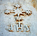
this was a great trip report but im a little disappointed one of the shell island photo's mysteriously disappeared! david, do believe this gesture was
either jesuit or franciscan in orgin?..........
|
|
|
| Pages:
1
2
3 |
|