| Pages:
1
2
3 |
David K
Honored Nomad

Posts: 65510
Registered: 8-30-2002
Location: San Diego County
Member Is Offline
Mood: Have Baja Fever
|
|
5 DAYS IN BAJA (July 2016): Shell Island, Hwy. #5 to #1, Mission San Fernando, El Rosario, Free FMM details.
DAY 1 (Thursday, July 7, 2016)
Hello Amigos,
We had some vacation time and love camping on the beach when the weather (and water) is warm! June or July is never too hot for us on the gulf coast
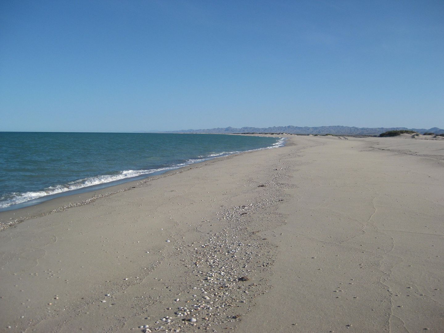
of Baja! Our favorite beach that is only a day's drive away (6 hours) is Shell Island, about 20 miles south of San Felipe. It is a barrier island sand
dune that is surrounded by water at the highest monthly tides. Getting to it other times may require slogging through slimy sea mud! This helps
preserve the beach as a rare, undeveloped and natural camping area. That is just what we like... peaceful, remote camping. We bring everything we
need... and we don't need much!
We pack up the truck and get out of town by 8:30 Thursday morning (in this case, Escondido north of San Diego). Heading to El Centro was easy then
south through Calexico and into Baja at Mexicali (west/downtown). With a lot of discussion that there is need for all trips into northern Baja
requiring the "Tourist Card" (FMM), a type of visa for Americans to get, no matter where or how long a trip lasts, we pull over just across the border
(on the left) at the INM office. There is a FREE tourist card for up to 7 days in Mexico and a PAY one (about $25 US) for up to 180 days.
The officer speaks perfect English and explains that the FREE FMM must be returned to their office when you leave Mexico (to prove you didn't stay
longer). However, the PAY one does NOT need to be returned (as you can keep it for any trips south for the next 180 days). Now, to get back to the INM
office in Mexicali or Tijuana may be quite an ordeal because of city traffic and finding your way from there to the end of the line, to drive into the
U.S. We planned to return through Tecate, a much smaller border town with easy access to the INM office, which is on the entrance to Mexico street.
Not sure how long before we can get back to Baja, we get the FREE ones and see how that works out.
The INM officer scanned and stamped our passports, had us fill out the two-piece FMM, and gave us one part and he kept the other. We were on our way
in about 10 minutes. Not one other person stopped to get the FMM while we were there. Nowhere in the next 5 days did anyone ask to see the FMM on our
trip. However, we were good to go if it was requested!
Driving south, the road to San Felipe is well signed, but be careful of the lane one sign points to as you approach a bridge... you need to go up the
bridge, which is the next lane to the left!
We arrive at the El Dorado Pemex station, about 13 miles north of San Felipe and fill up. The price is 12.90 pesos per liter and the exchange rate is
17.30 pesos per dollar. I suspect this pump reads high, but that is typical in many stations, some believe. Next time, I will go to the newer Pemex a
few more miles down the highway. It is 1:30 pm (5 hrs. from Escondido) and we are right on schedule.
The road south from San Felipe to Puertecitos is in pretty bad shape with several holes now, and still a few steep dips... Max speed 50 mph. Our beach
access is by Km. 26 and we go into 4WD... the beach is only 1.5 miles away, but there is still some water and mud from the higher New Moon tides of a
couple days ago... We slime through it with not too much mess and arrive on the beach about 2 pm. Our camping spot is a couple miles down the beach
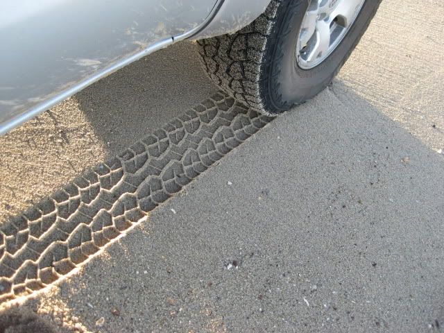
and requires deflating the tires (as the Tacoma is heavy with two full ice chests and camping gear). Dropping from 34 psi to 20 psi does the trick
(sometimes 15 or even 10 psi is required, depending on conditions and tire type). I am running Hankook DynaPro ATM tires and they are excellent in
sand.
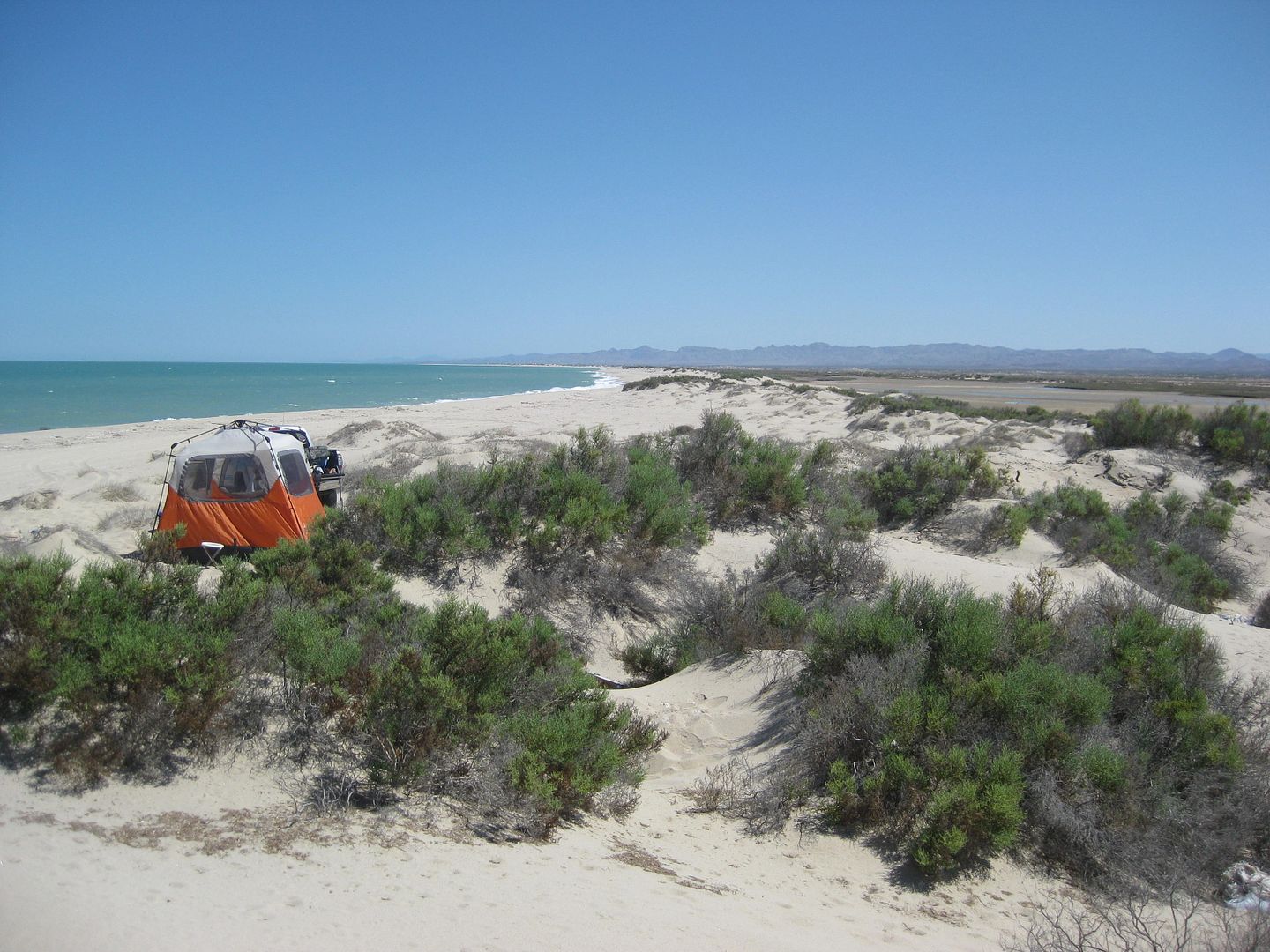
We are at our spot and setting up at 2:30pm.
The temperature was 100° crossing the desert, but only 95° on the beach. There is a strong south breeze and it makes getting into the water for a
swim tough with short, slapping waves at high tide. We walk across Shell Island and take a swim in the calm lagoon on the other side... this is often
called Laguna Percebu or Estero Percebu.
The next two days, the midday high temp was only 88° and a much calmer breeze... PERFECT!
In the next installment, I will show you the shrimp boats working offshore and some small jellyfish I have never seen there before.
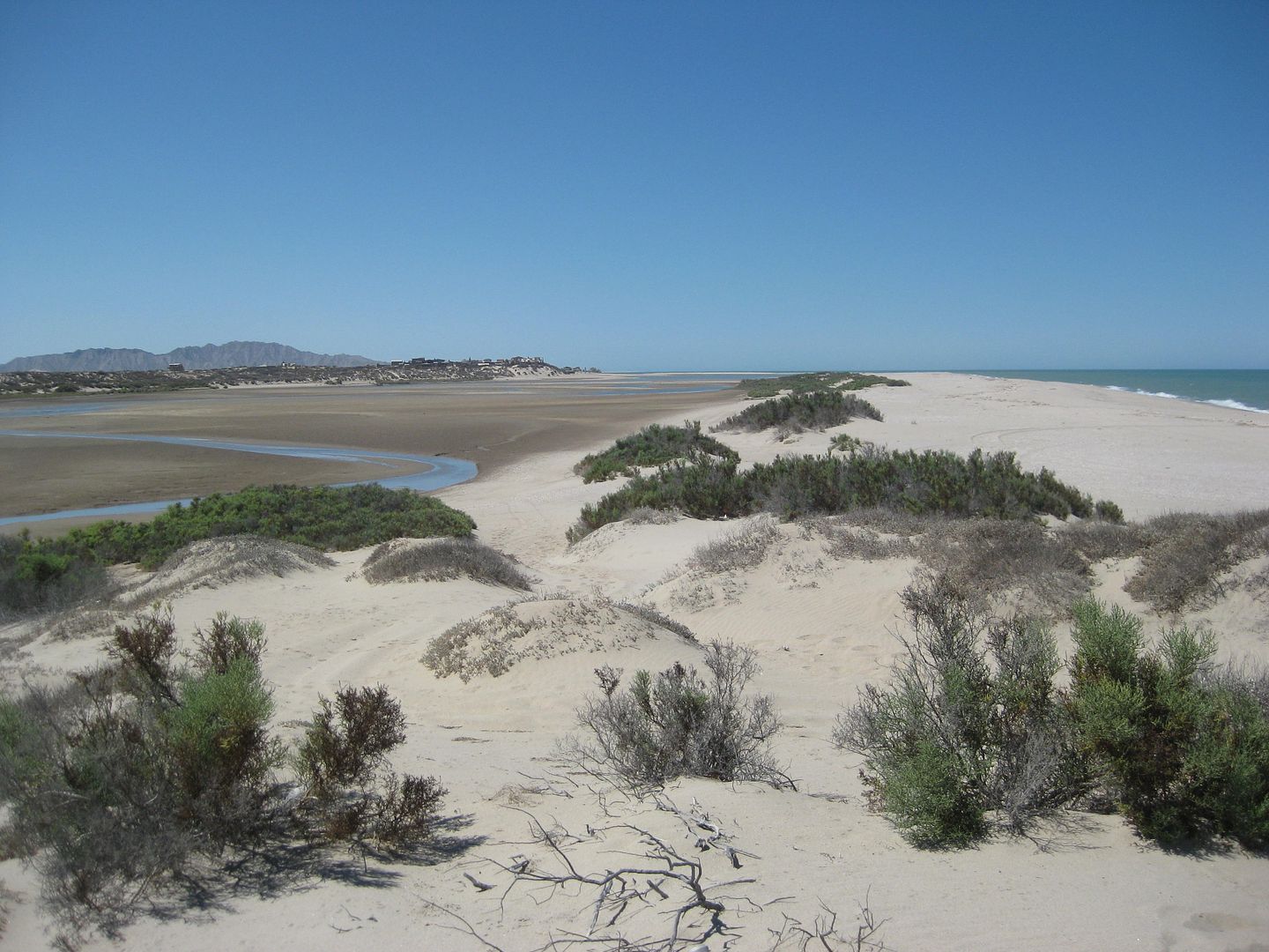
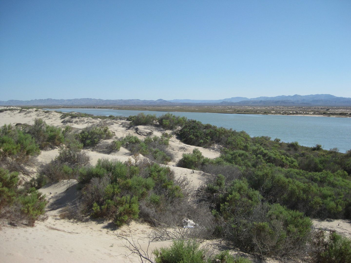
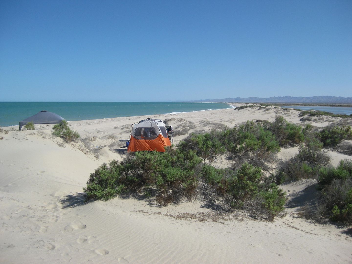
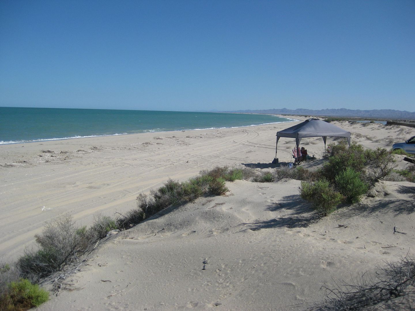
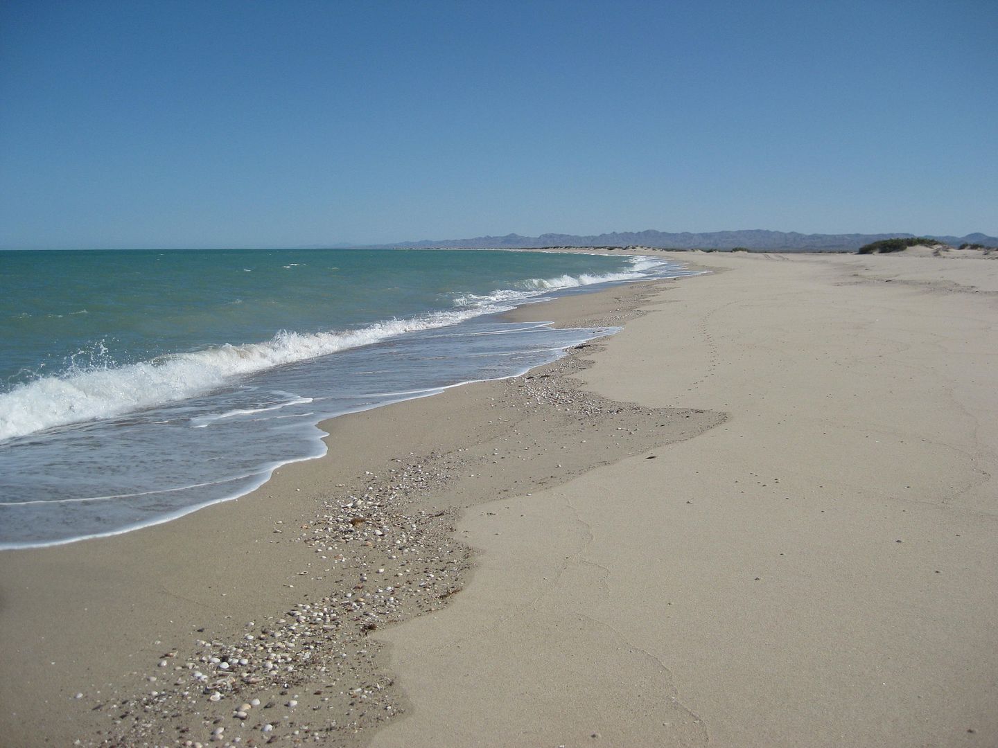
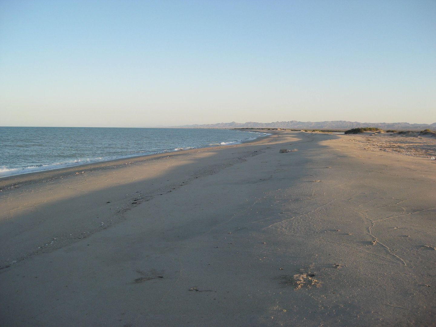
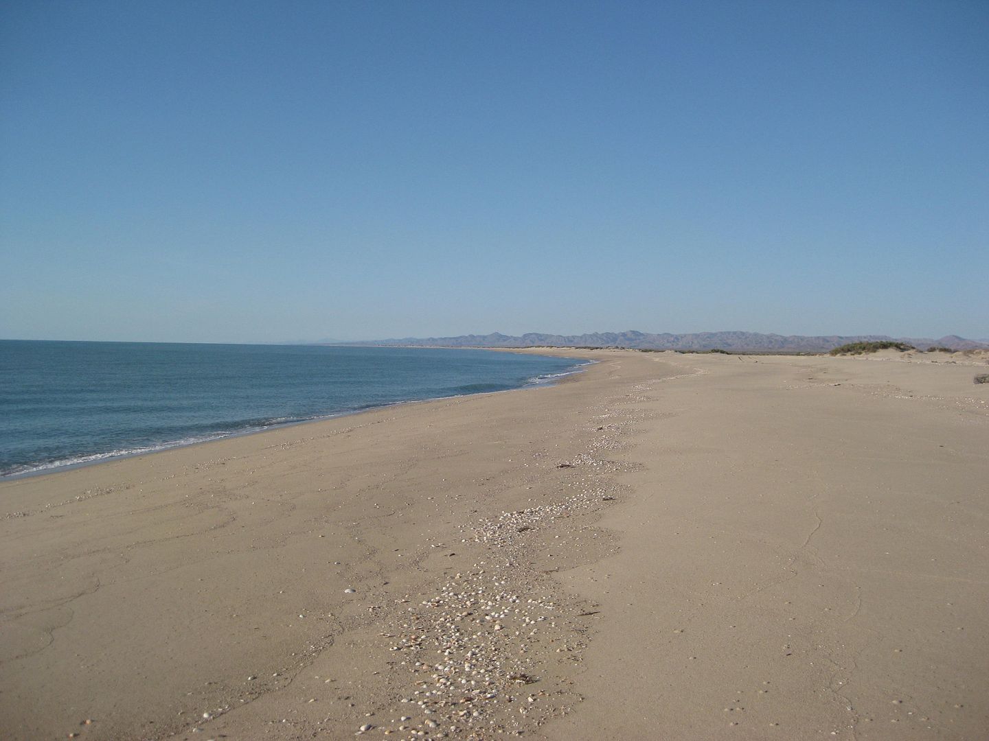
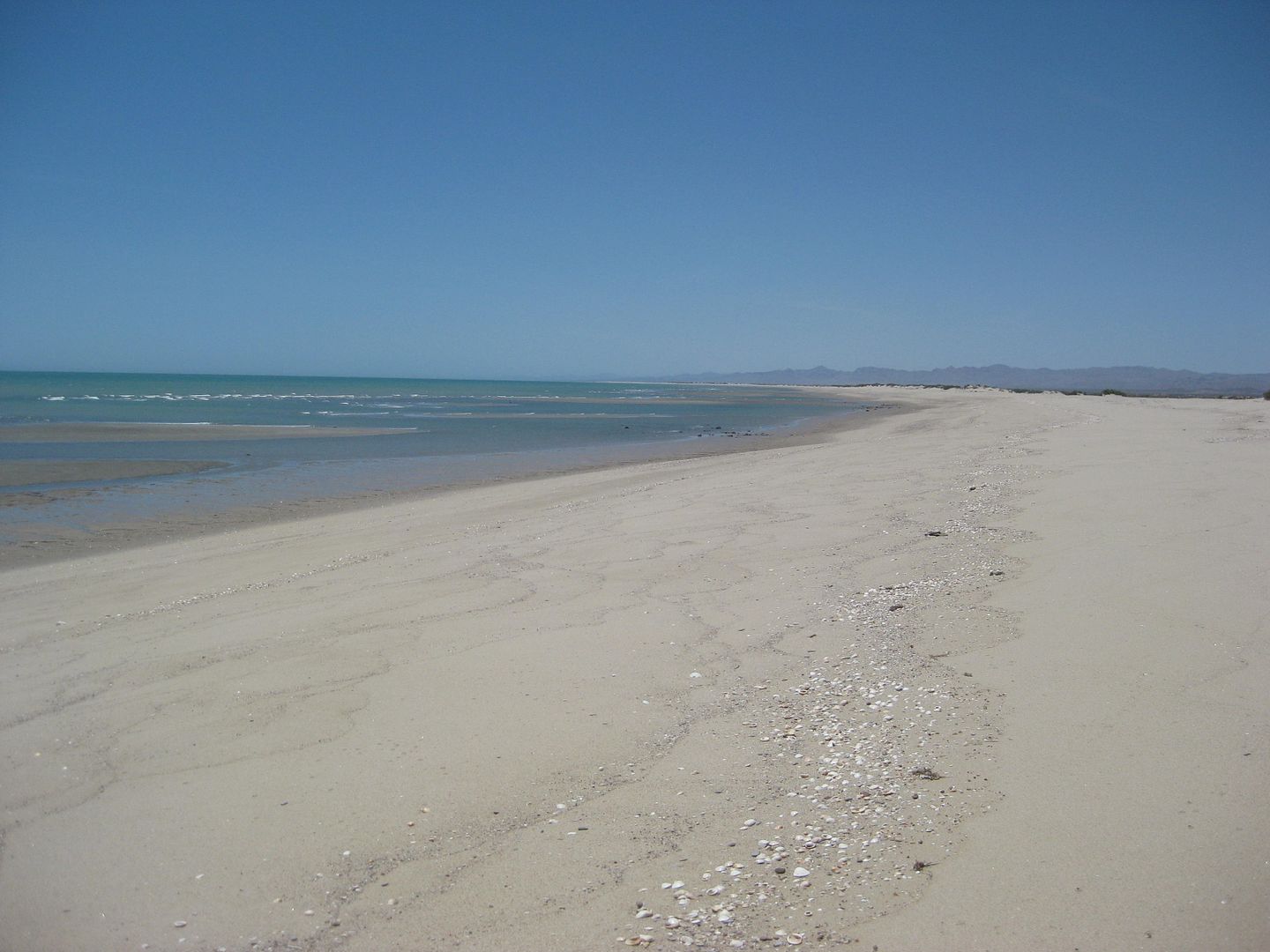
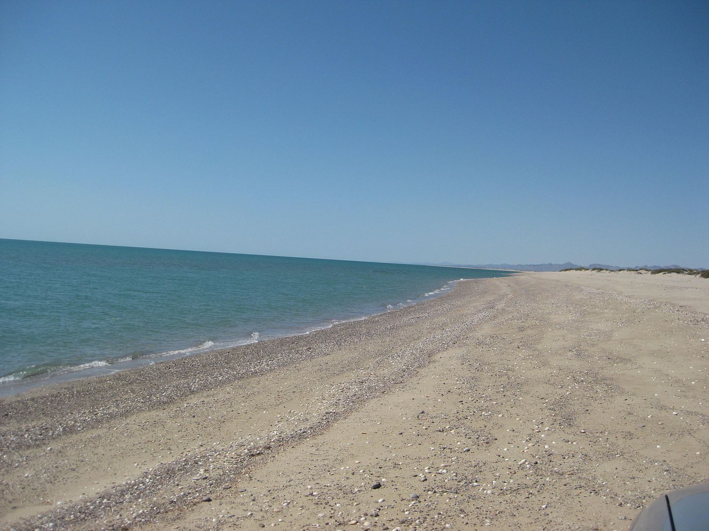
Here are some photos on Shell Island:
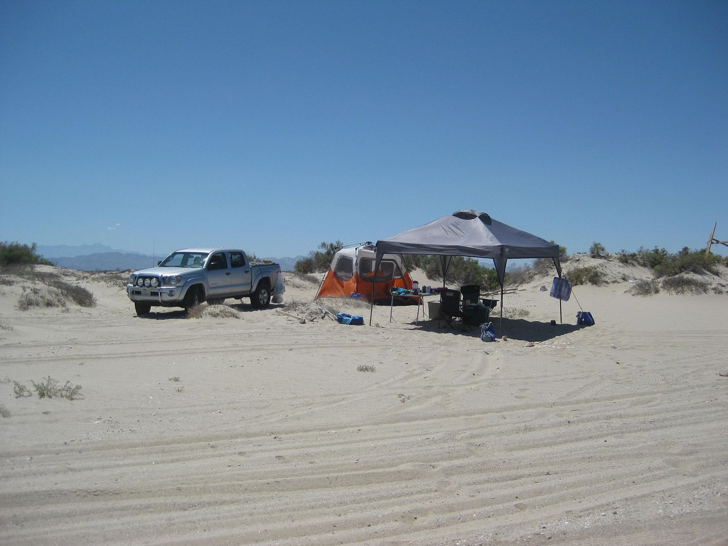
Camp set up

View south
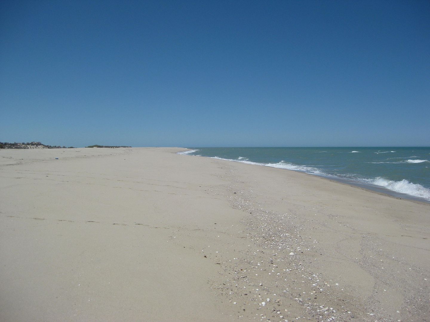
View north
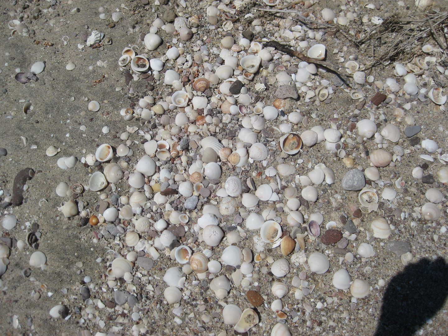
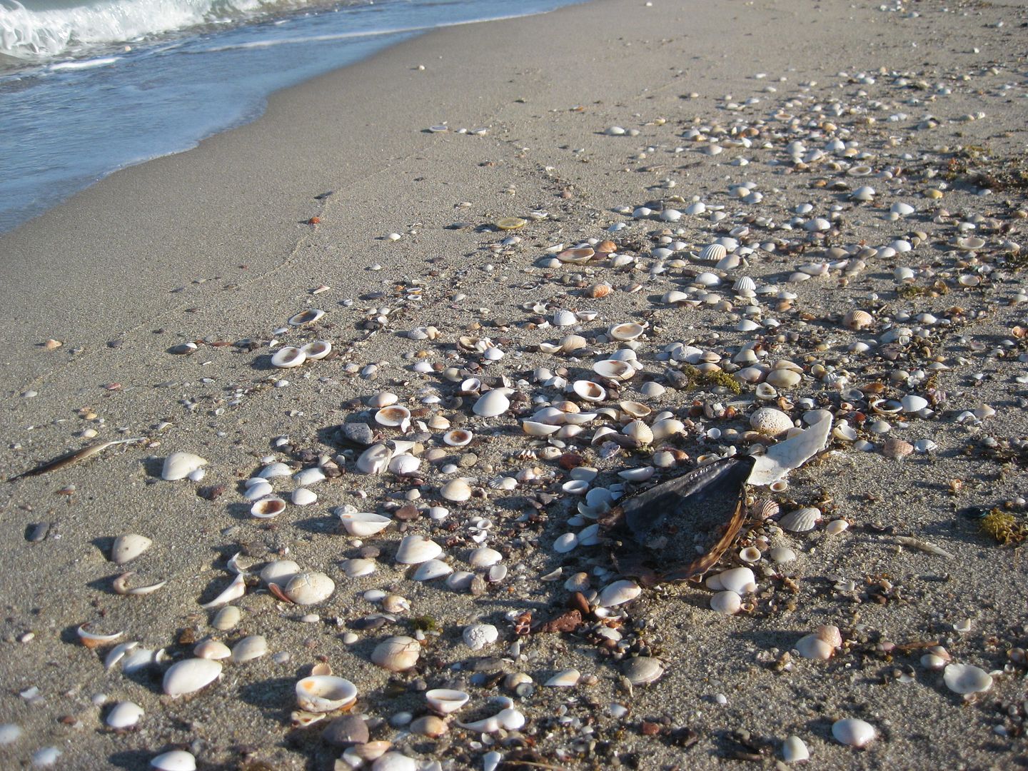
Shells are the reason for the name... and it is not just a beach, but an island!
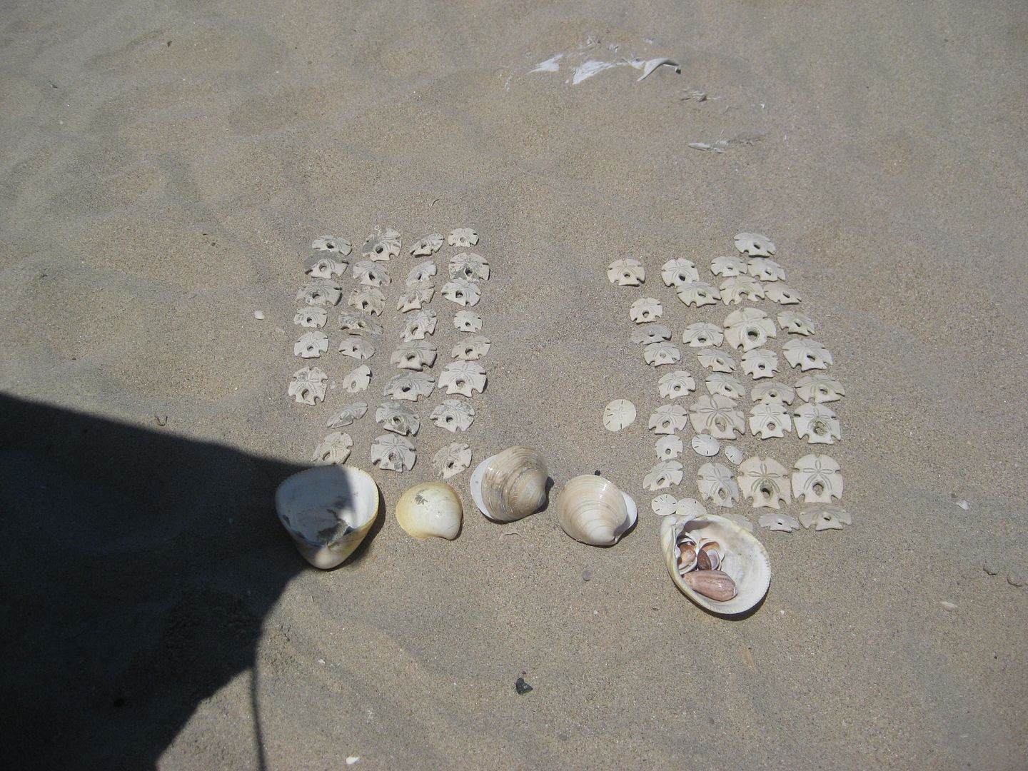
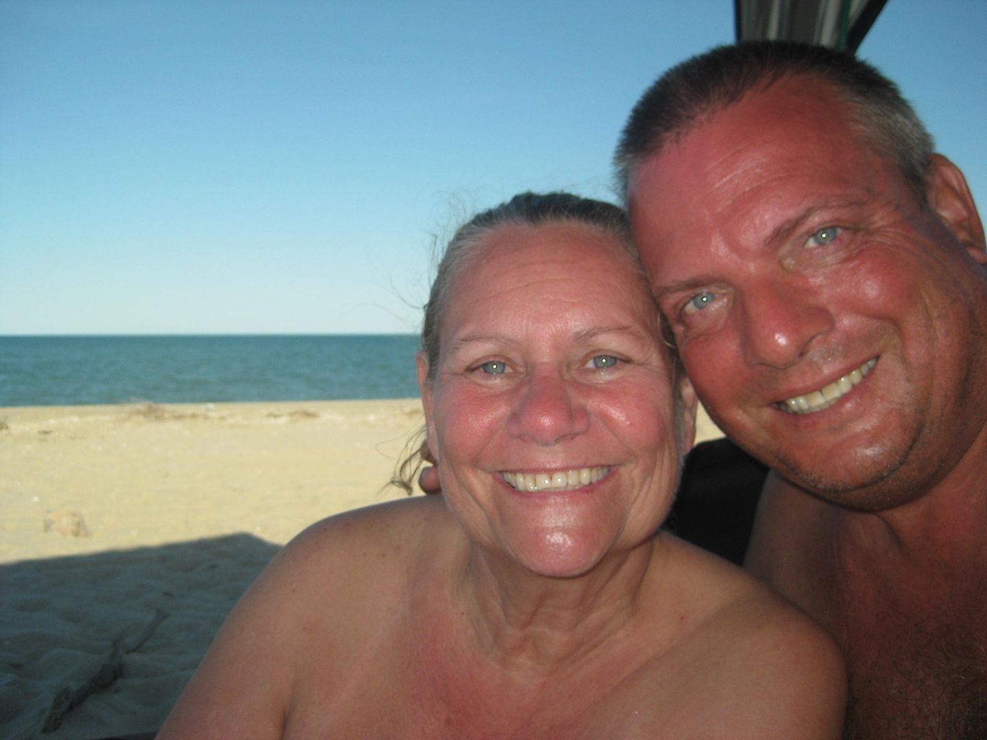
Elizabeth and I compare our low tide sanddollar and shell collection and we are about even!
View north at low tide, lagoon side.
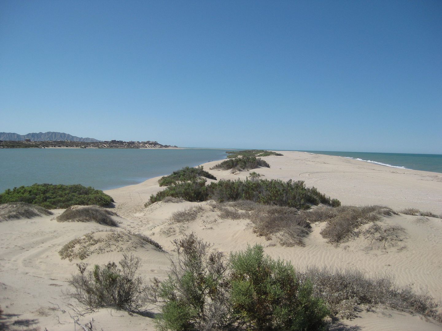
High tide!
View from the island to Baja, high tide (see Diablo Mountain?)
View south, low tide.
High tide.
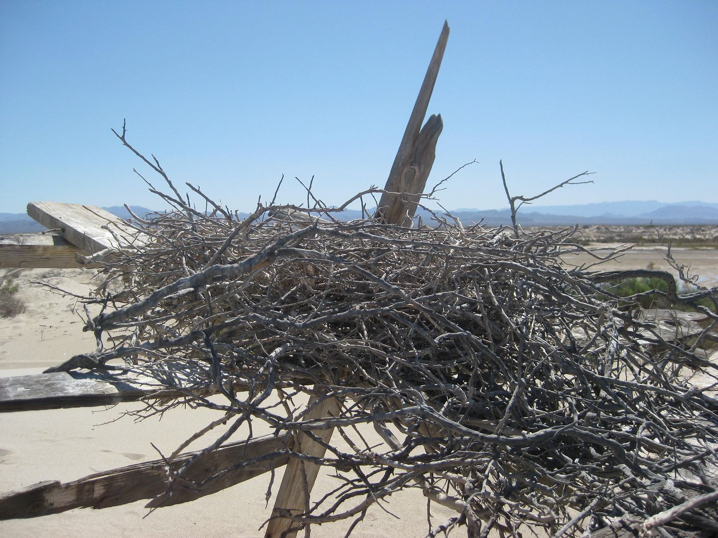
Osprey nest on a fisherman's shack remains.
MORE DAYS TO COME... stay tuned!
[Edited on 5-23-2020 by David K]
|
|
|
willardguy
Elite Nomad
Posts: 6451
Registered: 9-19-2009
Member Is Offline
|
|
did the shell island locals leave any new message's for you?...
|
|
|
dtbushpilot
Ultra Nomad
Posts: 3296
Registered: 1-11-2007
Location: Buena Vista BCS
Member Is Offline
Mood: Tranquilo
|
|
Excellent trip report David, thanks for sharing.
"Life is tough".....It's even tougher if you're stupid.....
|
|
|
AKgringo
Elite Nomad
Posts: 6334
Registered: 9-20-2014
Location: Anchorage, AK (no mas!)
Member Is Offline
Mood: Retireded
|
|
I'm going to look for that beach on my next trip, Looking forward to part #2!
I did not know that Hankook was making an ATM tire now. It must be handy to check your air pressure and the exchange rate at the same time!
If you are not living on the edge, you are taking up too much space!
"Could do better if he tried!" Report card comments from most of my grade school teachers. Sadly, still true!
|
|
|
TMW
Select Nomad
Posts: 10659
Registered: 9-1-2003
Location: Bakersfield, CA
Member Is Offline
|
|
Thanks DK, good stuff.
|
|
|
Maron
Nomad
Posts: 458
Registered: 4-14-2014
Member Is Offline
|
|
Nice report and super photos
Thks
|
|
|
David K
Honored Nomad
Posts: 65510
Registered: 8-30-2002
Location: San Diego County
Member Is Offline
Mood: Have Baja Fever
|
|
PART 2 (Days 2,3)
The weather was great, 88° and a light breeze out of the north, then east.
We did a lot of relaxing and swimming/ floating when the tide was halfway in or higher.
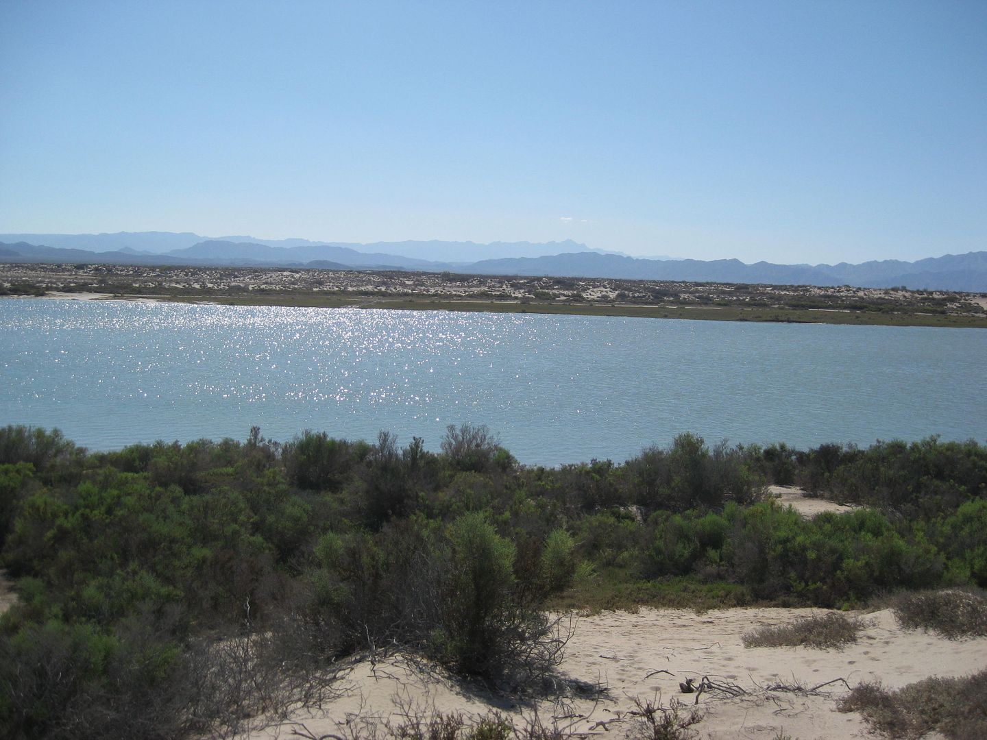
As it was, that would be in the morning to around 9 and then again after noon. At low tide, the 14-18 foot average tide height takes the sea so far
away and you can walk a mile and only be ankle deep! Twice a day the tide is high and twice it is low... A lot of gravity is at work in the upper Gulf
of California!
From the photos I posted above, and the next ones, you can get an idea of how fast the sea level changes... every day!
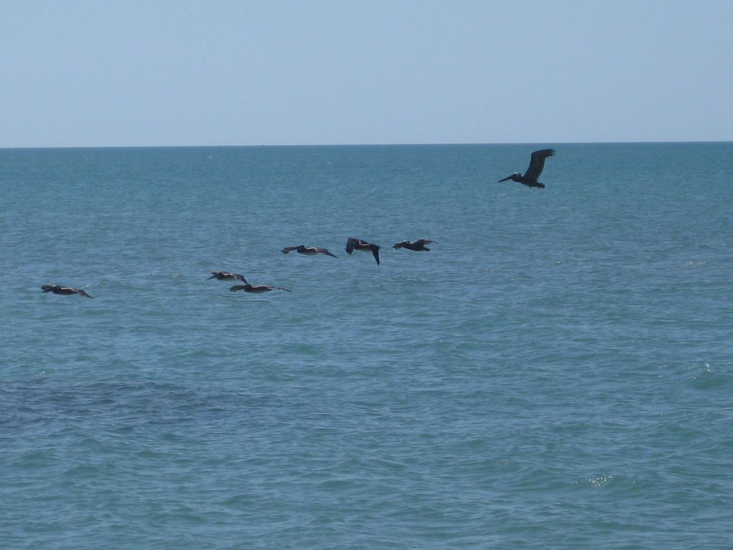
This is as crowded as it gets, even on most holidays, unless some fellow Nomads come along (like Ken Cooke and edm-1 have)!
One of the locals!
Each day as the moon goes from New to Quarter phase, the tides are less extreme, then get bigger as the Full moon approaches.
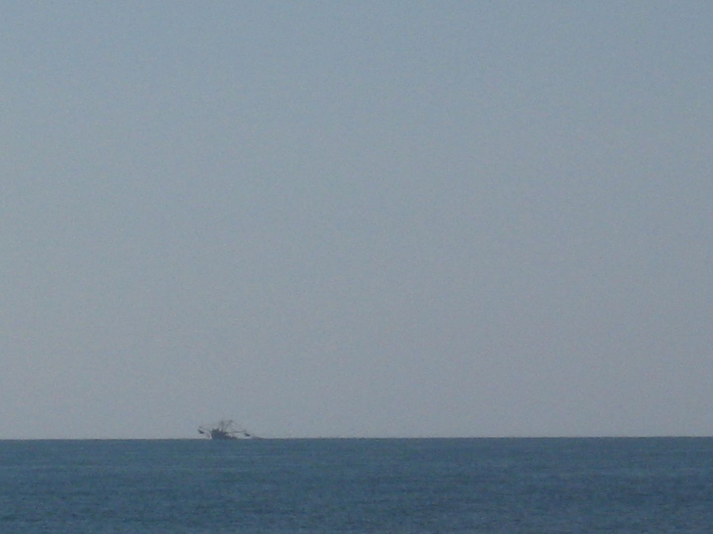
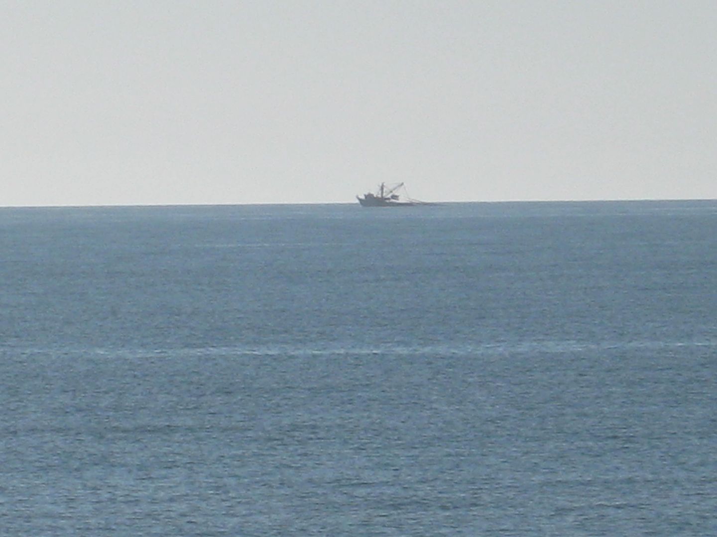
Netting for shrimp a couple miles offshore.
Low tide (it can go out much further).
Something New???
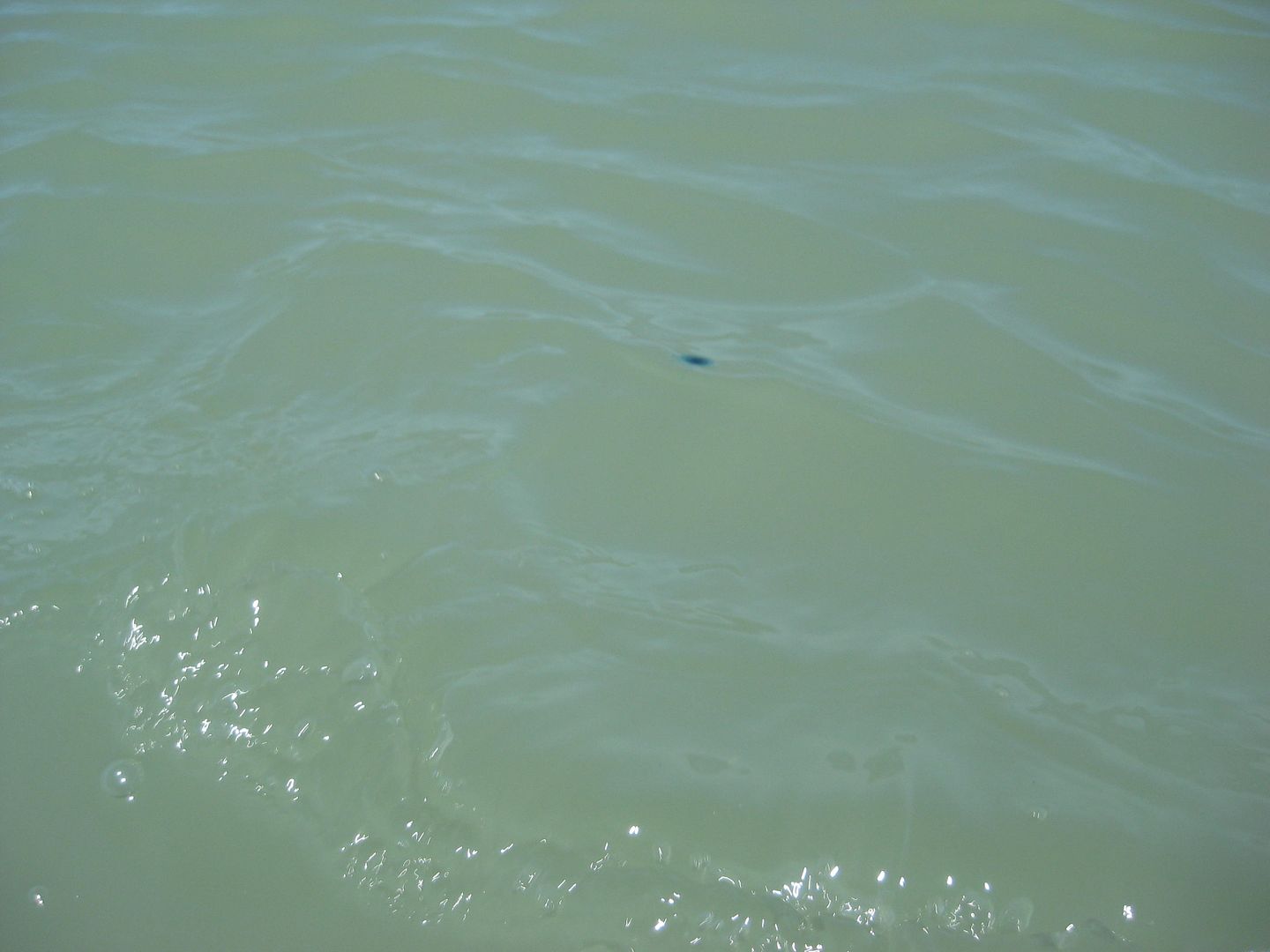
About the size of a 10 peso coin... near shore at high tide.
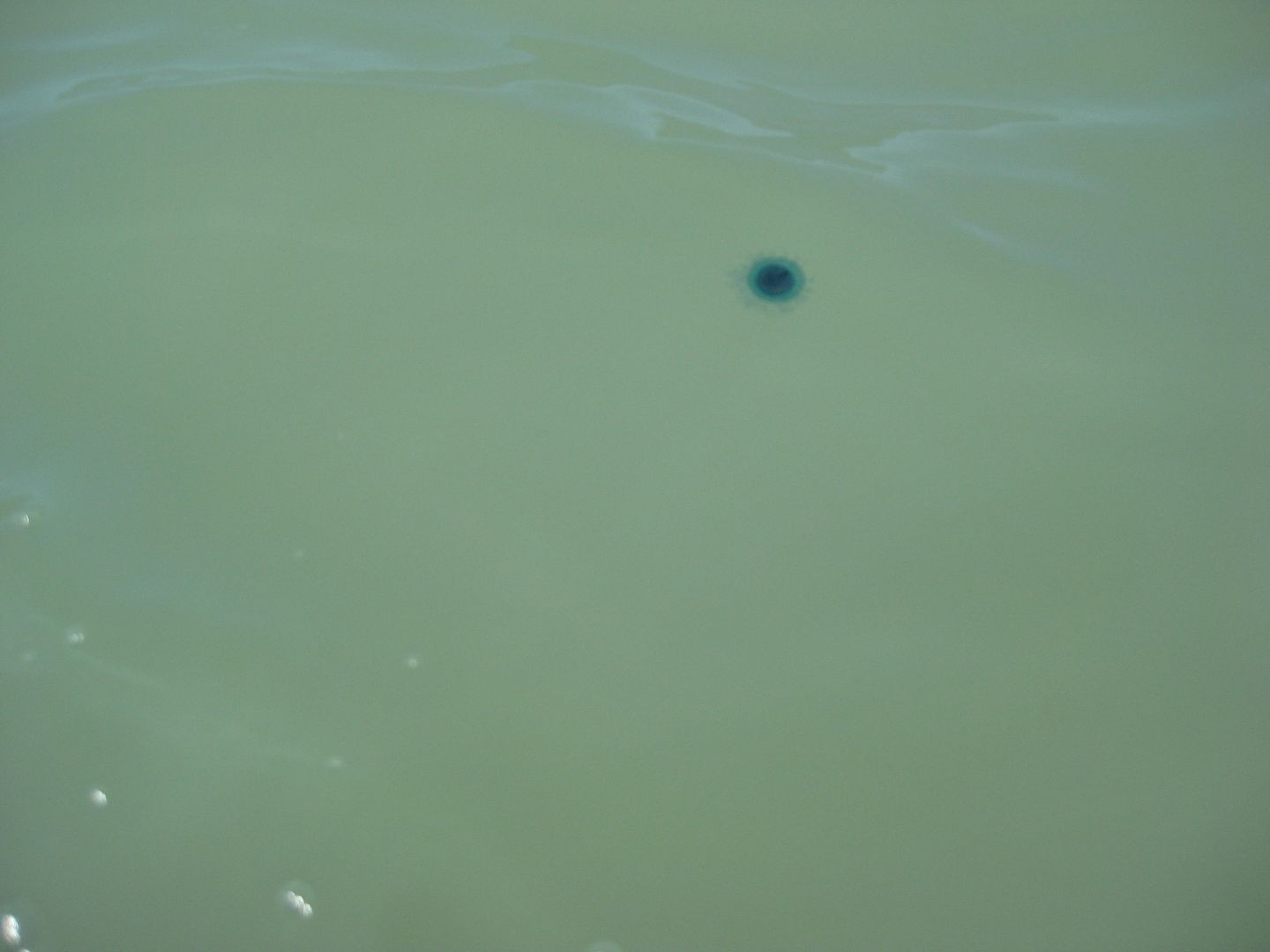
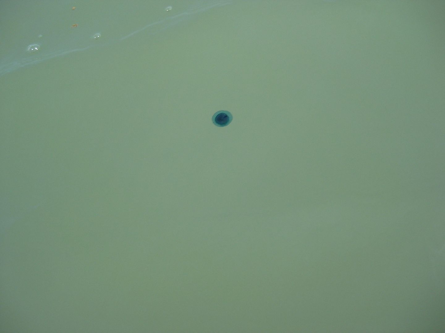
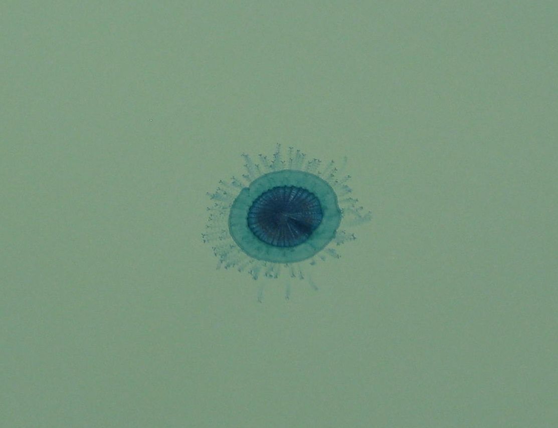
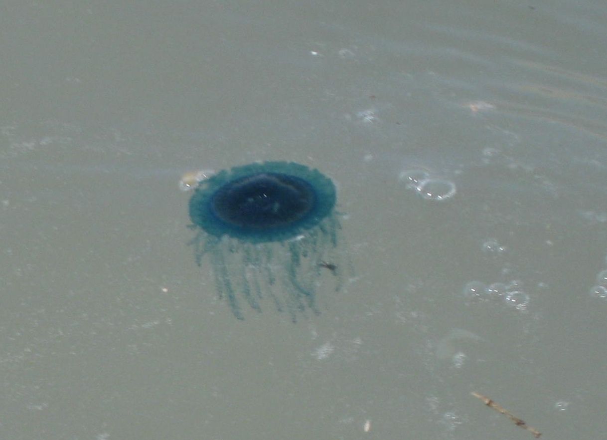
I had never seen any jellyfish on Shell Island in nearly 40 years of camping there. As I would find out (this morning), these were not true jellyfish
but floating marine organisms... Here is the answer from Dr. Hans Bertsch (author of Sea of Cortez Marine Invertebrates and a new book mentioned in
his reply):
Dear David,
Thanks for the photos of Porpita porpita (Linnaeus, 1758); Phylum Cnidaria, Class Hydrozoa, Family Porpitidae. Although it is in the same family
as the infamous man-of-war Physalia, it is not really dangerous to humans. Both are pelagic, frequently washing ashore when the winds are right. It
is obviously in my new, in galleys, book, Invertebrados Marinos del Noroeste de México.... Porpita is called "Blue Button," or "Botón Azul." The
shrimpers probably had nothing to do with the beaching of Porpita; winds. You just have to be at the right place at the right time.
From Wiki:
Porpita porpita From Wikipedia, the free encyclopedia Porpita porpita Porpita porpita.jpg
Blue Button Scientific classification Kingdom: Animalia Subkingdom: Eumetazoa Phylum: Cnidaria Class: Hydrozoa Order: Anthomedusae Suborder: Capitata
Family: Porpitidae Genus: Porpita Species: P. porpita
Binomial name Porpita porpita (Linnaeus, 1758)
Although it is superficially similar to a jellyfish, each apparent individual is actually a colony of hydrozoan polyps. The blue button is a
Chondrophore, which is a group of cnidarians that also includes Velella and Porpema. The chondrophores are similar to the better-known siphonophores,
which includes the Portuguese Man o' War. Characteristics[edit]
The blue button lives on the surface of the sea and consists of two main parts: the float and the hydroid colony. The hard golden-brown float is
round, almost flat, and about one inch wide. The hydroid colony, which can range from bright blue turquoise to yellow, resembles tentacles like those
of the jellyfish.[5] Each strand has numerous branchlets, each of which ends in knobs of stinging cells called nematocysts.
The blue button sting is not powerful but may cause irritation to human skin.[2] The blue button itself is a passive drifter, and is part of the
neustonic food web. It is preyed on by the sea slug Glaucus atlanticus (sea swallow or blue glaucus) and violet sea-snails of the genus Janthina.[6]
It competes with other drifters for food and mainly feeds on copepods and crustacean larvae.[7]
The blue button has a single mouth located beneath the float, which is used for both the intake of prey and the expulsion of wastes.
[Edited on 5-23-2020 by David K]
|
|
|
Udo
Elite Nomad
Posts: 6364
Registered: 4-26-2008
Location: Black Hills, SD/Ensenada/San Felipe
Member Is Offline
Mood: TEQUILA!
|
|
WOW!
What a great trip report, DK. One can tell that you are a professional writer.
Hey, are you sure you did not just copy some of your old photos on this post?
You COULD have fooled us.
Udo
Youth is wasted on the young!
|
|
|
David K
Honored Nomad
Posts: 65510
Registered: 8-30-2002
Location: San Diego County
Member Is Offline
Mood: Have Baja Fever
|
|
Quote: Originally posted by AKgringo  | I'm going to look for that beach on my next trip, Looking forward to part #2!
I did not know that Hankook was making an ATM tire now. It must be handy to check your air pressure and the exchange rate at the same time!
|
I bought this set at Discount Tires... Pep Boys also sells them... and other Hankook distributors. Mine are 265/75-16 (32"), about an inch taller than
the stock 265/70-16 tires.
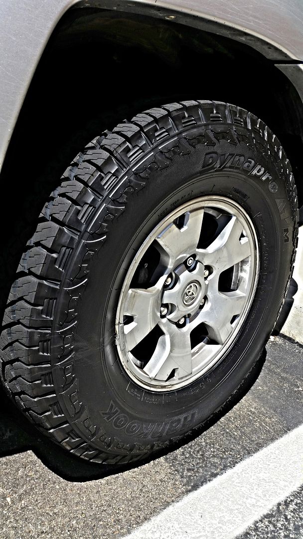
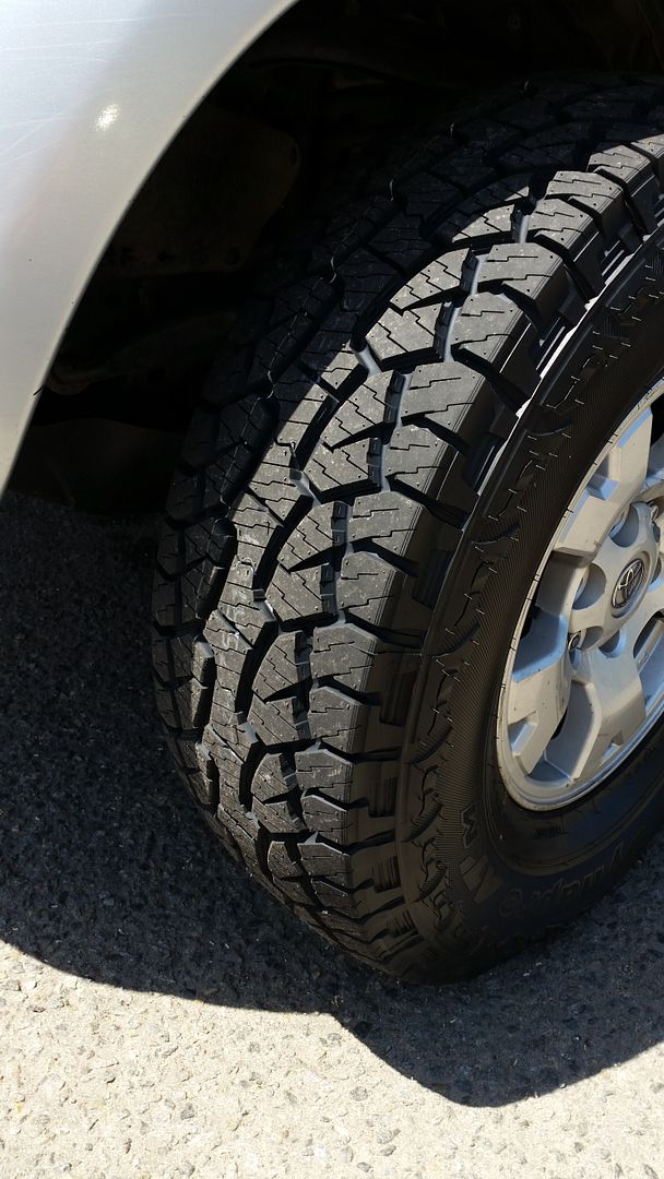
I have run BFGs, Cooper Discoverer (ATR and STT), Toyos (Open Country AT), and Definity Dakota ATs (Pep Boys). I have run the Hankook ATMs before...
they are inexpensive (under $150), quiet on the highway, great in sand, mud, snow... really cannot complain.
|
|
|
David K
Honored Nomad
Posts: 65510
Registered: 8-30-2002
Location: San Diego County
Member Is Offline
Mood: Have Baja Fever
|
|
| Quote: Originally posted by Udo | WOW!
What a great trip report, DK. One can tell that you are a professional writer.
Hey, are you sure you did not just copy some of your old photos on this post?
You COULD have fooled us. |
hah hah nope, all new photos of Shell Island (yes, it has looked great since I first camped there in 1978). Sharing it with Baja Nomads and Amigos and
the rising sea levels (that occur at every high tide, lol) has not changed the place in the least.
Sometimes there are dead porpoise or whales washed up... sometimes a local fishing group will trash an area (they can bring the stuff in full, but
can't remove the stuff when empty)??? !!! Overall, it remains perfect for us.
|
|
|
mtgoat666
Platinum Nomad
Posts: 20874
Registered: 9-16-2006
Location: San Diego
Member Is Offline
Mood: Hot n spicy
|
|
Why so few pictures of the toyota? No longer feeling the love?
|
|
|
David K
Honored Nomad
Posts: 65510
Registered: 8-30-2002
Location: San Diego County
Member Is Offline
Mood: Have Baja Fever
|
|
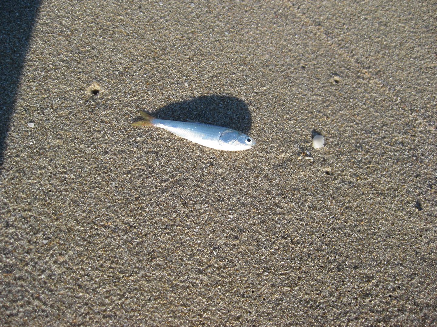
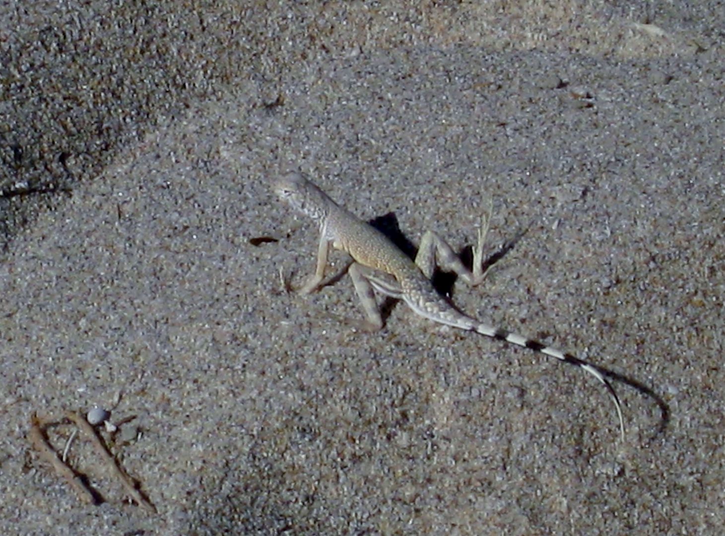
This fellow popped onto the beach, still alive... I put him back and watched him swim off.
We love it here, on Shell Island, in Baja!
|
|
|
David K
Honored Nomad
Posts: 65510
Registered: 8-30-2002
Location: San Diego County
Member Is Offline
Mood: Have Baja Fever
|
|
PART 3 Sunday, July 10, 2016
We get camp taken down, and loaded up by 9:10 am...
Driving south... hate to leave... but we got enough sun and our friend BajaCactus/ Antonio may be in El Rosario and we would like to visit with him.
We are off the beach, refill the tires to 34 psi, head to the Ejido Delicias (Km. 35-36) stores and get a half block of ice and a bag of cubes to add
to our ice chest (we condensed the two to one this morning). 10:00 am
They are both Coleman Extreme 5 Day chests. One was for beer and water bottles (1 10lb. block and two 10 lb. bags of crushed) + 30 cans of beer
(Tecate Light) and lots of water bottles... The other was for meat & cheese, milk, OJ, more water bottles (pre-frozen) and had 2 blocks and one
bag of ice. I drained the melted water out of the food box except for a few inches at the bottom. The beer chest with only 1 block, I left the melted
water remain. This was a test... I was sure the drained box would have more ice (2 blocks vs. 1, opened less often, etc.). The beer chest was new, but
still 5- day rated... the temps were near 90° each day and we left them in the truck bed only covered by folded tarps. The beer chest with undrained
water had twice the size of block ice (1 block) as the food chest (2 blocks) had left after 3.5 days of un-ideal conditions!It was a good lesson. I
had heard pros and cons of both drain and leave the water in there. Obviously, with food, you may need to drain when driving so the sloshing liquid
doesn't make a mess of your food. We use snap lid containers or double zip lock bags to keep out the water.
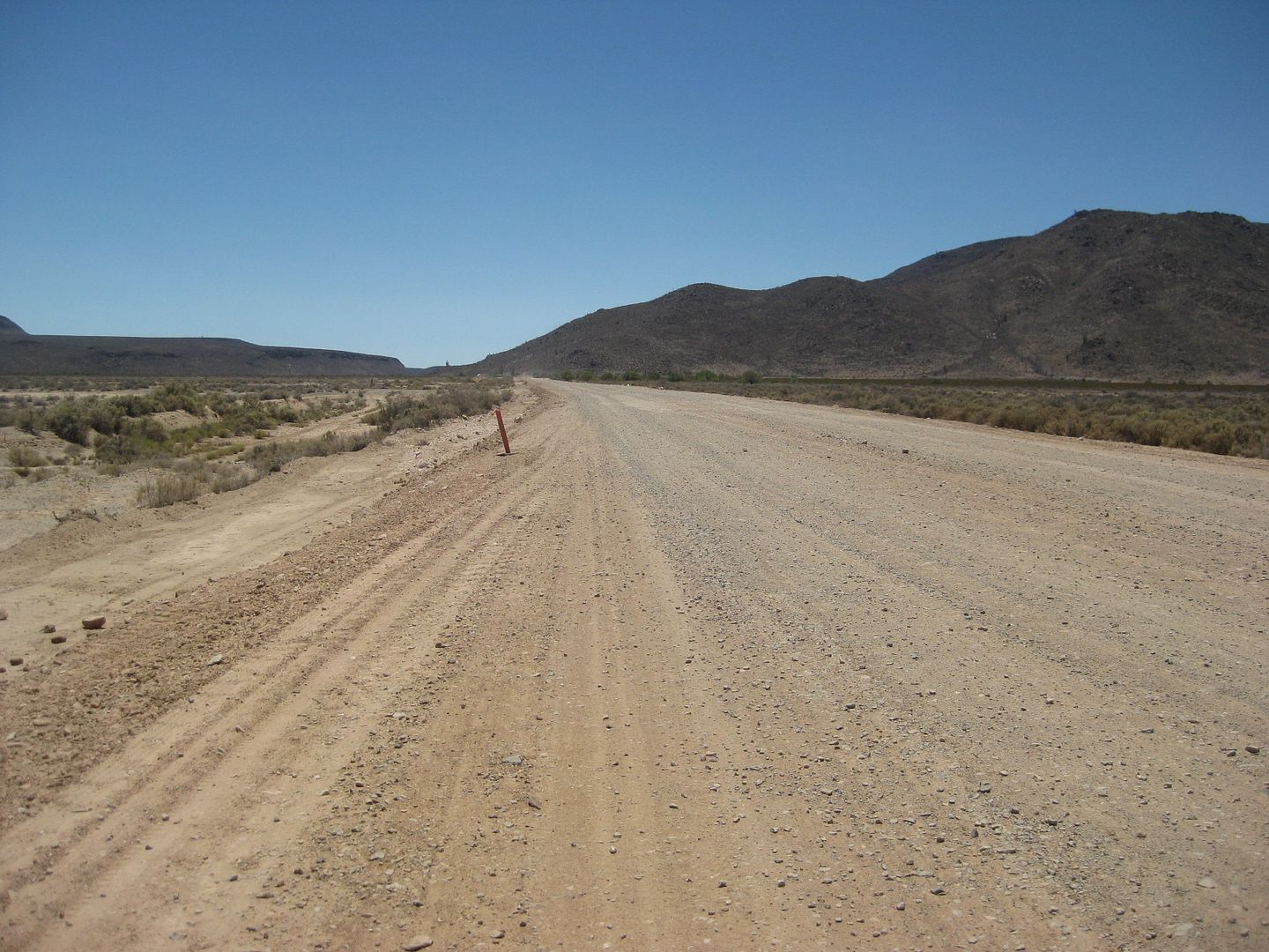
The road to Puertecitos is pretty rough for pavement, but not as bad as it was in 2006-7 before they recoated it.
Km. 60 is Arroyo Matomi road (34 miles west to the waterfall).
Km. 74.5 Puertecitos Jcn. 10:30 am
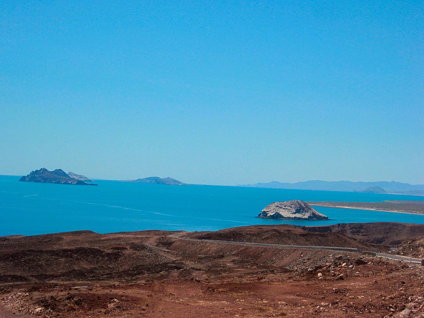
Km. 99 is the view pullout for the Enchanted Islands. We leave at 11:07 after having sandwiches.
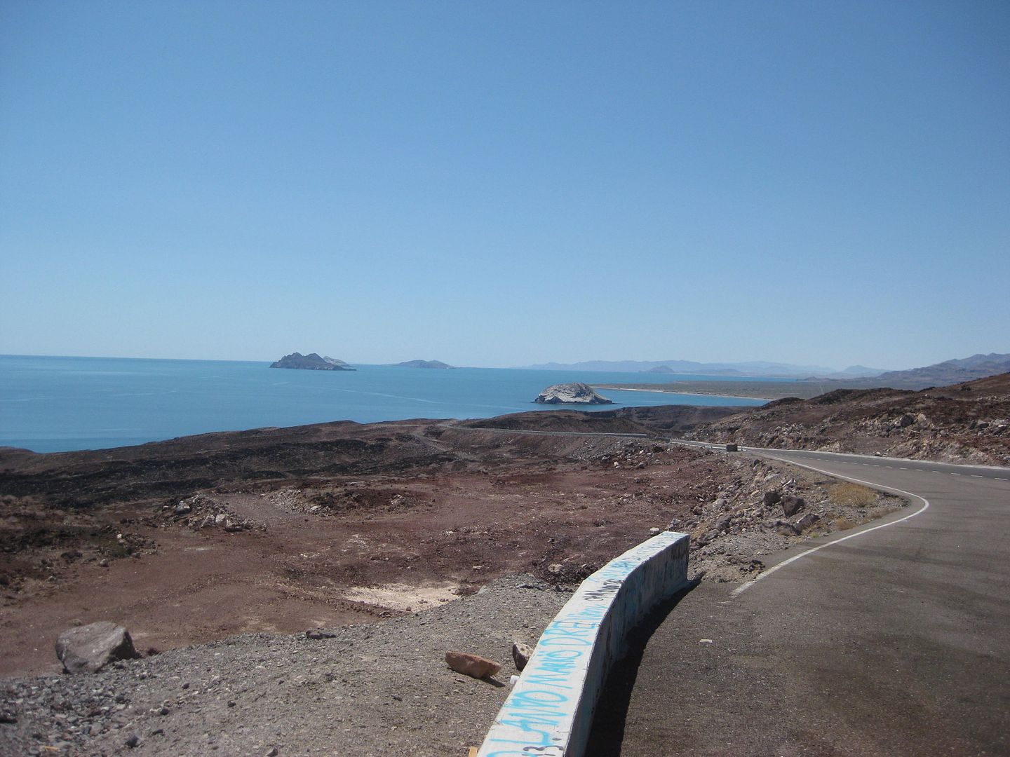
Rest area, Km. 99, 15 miles south of the Puertecitos Junction (Km. 74.5)
Km. 147 is the Pemex and across the way, the Rancho Grande store. 11:38 am. (This was Km. 150 last year).
The Campo Beluga road is 1.2 miles south (Km. 149). A news note, Alfonsina's son (Roman) no longer owns that Pemex, it was sold to a group that runs
several Pemex stations in Baja.
Km. 159 (7.2 mi from Pemex) Las Palmitas road has some activity on it.. a ranch or ?? This was the access to the El Camino Real trail to Mission Santa
María and the oasis of Las Palmitas.
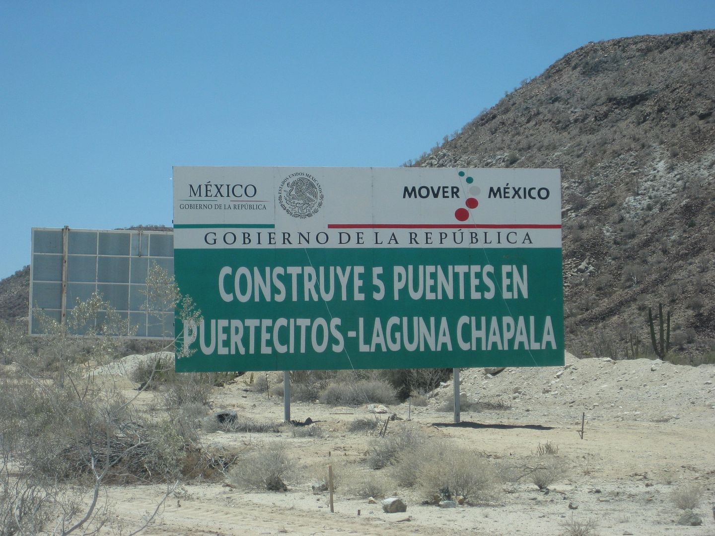
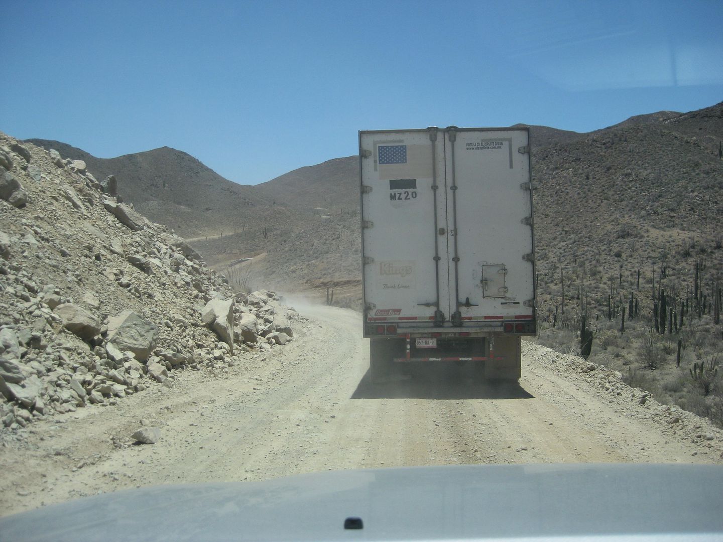
END OF PAVEMENT 7-10-16 (same as it was in Jan. 2015). Now Km. 167.5, 12.4 miles south of the Pemex. It is 11:50 am
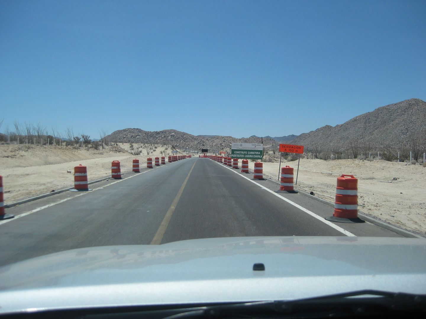
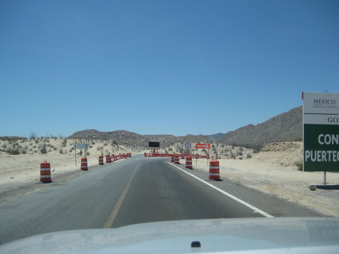
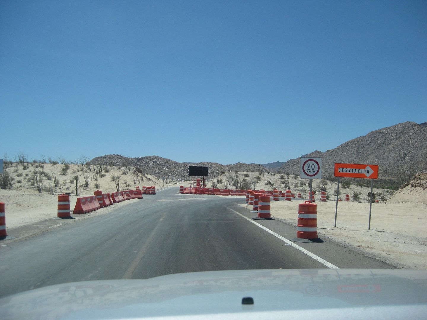
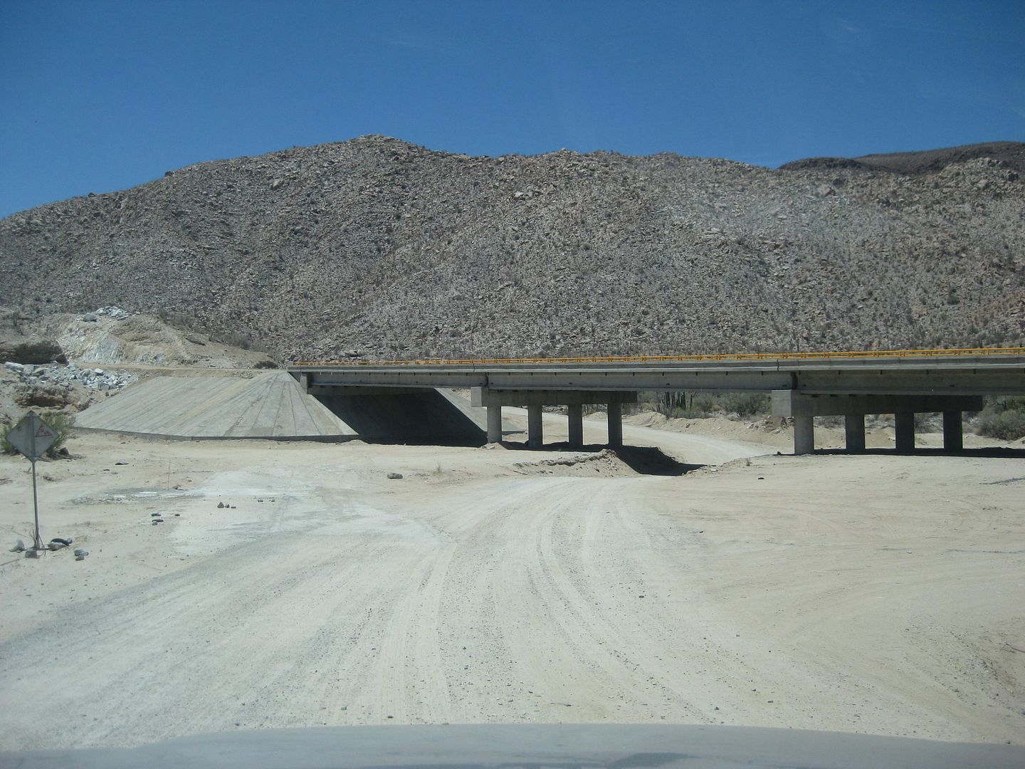
We see about three completed bridges... and many just started bridges and little else change in the canyon since 12 months ago.
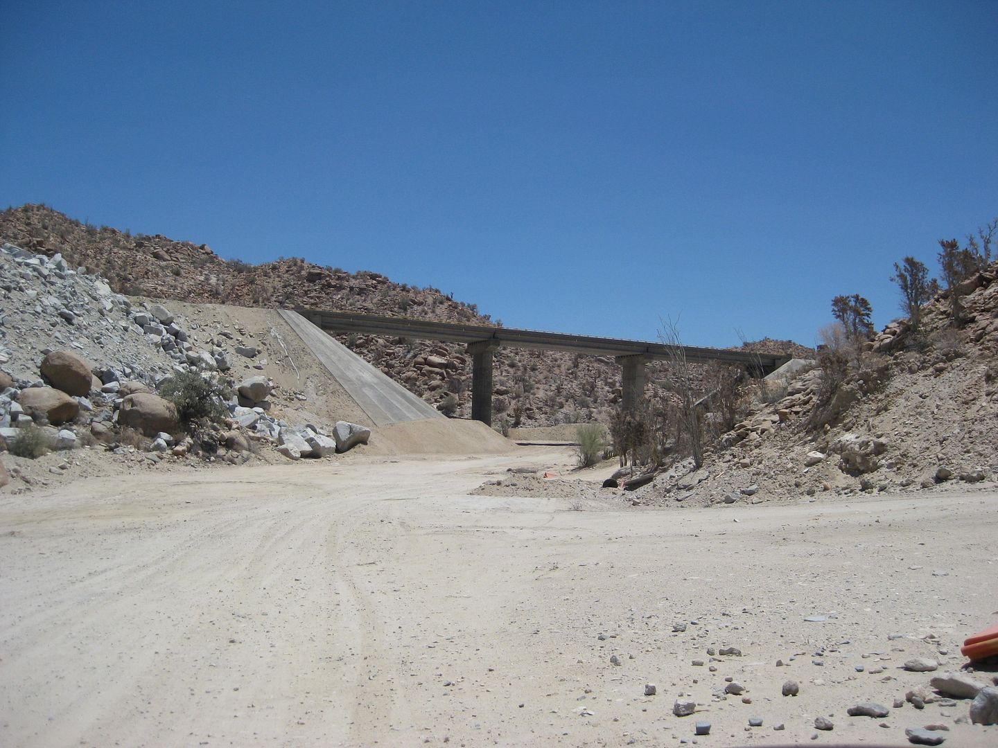
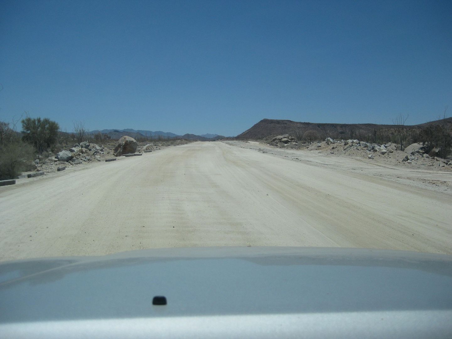
A short section of new highway roadbed just north of Las Arrastras.
Las Arrastras historic site (see my July 2015 trip report) is currently a road construction camp... 18. 5 miles from Gonzaga Pemex. 12:07 pm. The new
highway heads straight south from here (or will when open) while the old road curves to the left and heads for Coco's Corner.
Mile 22.5 from Pemex is Coco's Corner. 12:17 pm. See my 2015 report for photos of Coco and his corner.
Mile 27.2 come along new road construction in the canyon. The past 4.7 miles from Coco's are the roughest of all the miles.
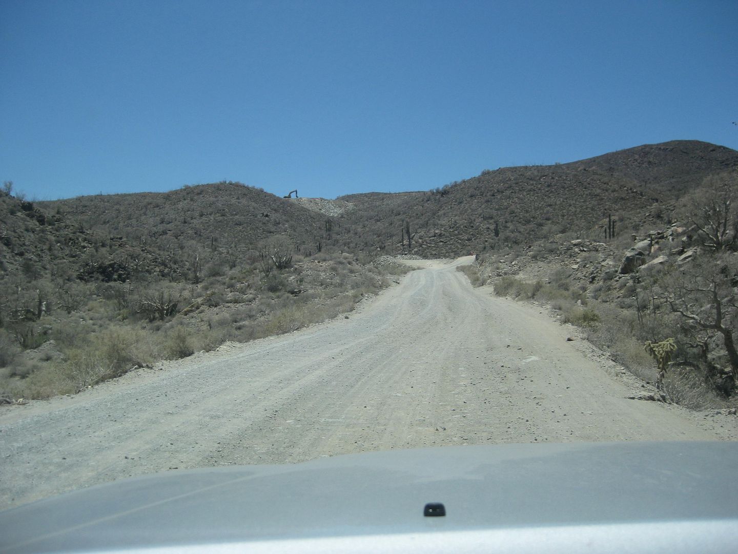

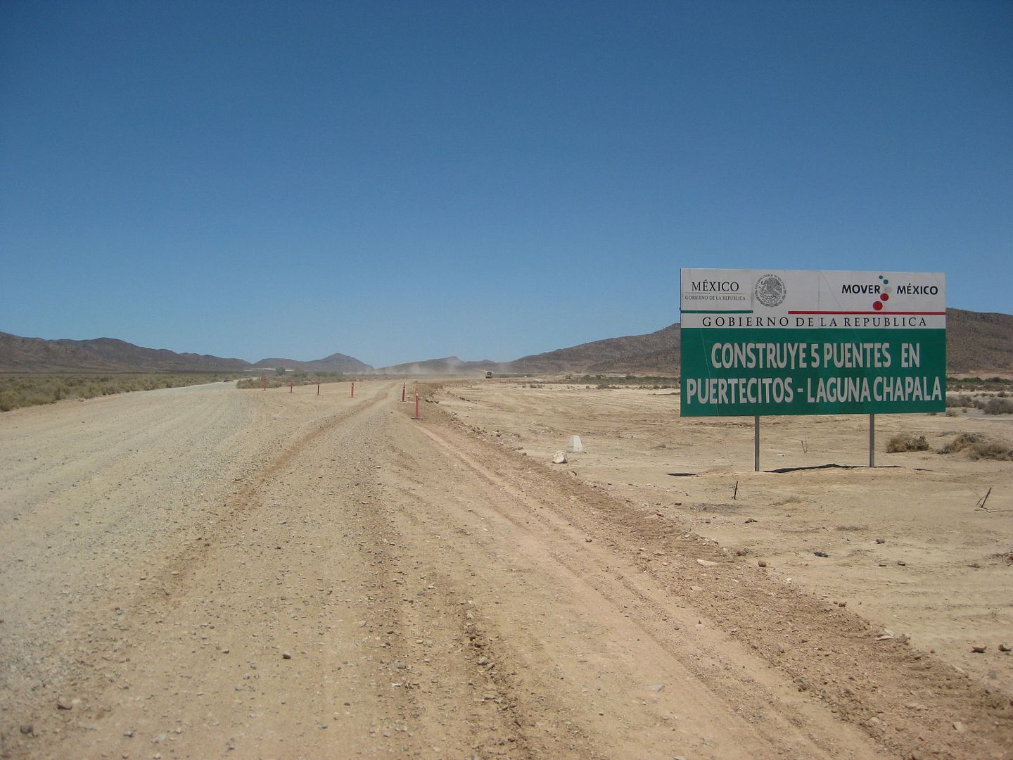
Hwy. 1 straight ahead.
No work was in progress except for a water truck we saw driving on the new roadbed, across the Chapala Valley, where it is a bit south of the old
road.
HWY. 1 Laguna Chapala 35.4 miles from Gonzaga Pemex. 23.0 unpaved miles. 1:03 pm
These are odometer corrected mileages (if they appear a little different than earlier mileage figures). I am seriously into accuracy!
MORE TO COME! MISSION SAN FERNANDO...
[Edited on 5-23-2020 by David K]
|
|
|
Bajaboy
Ultra Nomad
Posts: 4375
Registered: 10-9-2003
Location: Bahia Asuncion, BCS, Mexico
Member Is Offline
|
|
Glad to see you in Baja.
I have the same ice chest as you. I prefer to freeze one gallon milk jugs. I put a bathroom towel on top. We used it on our trip to Sierra de San
Francisco and still had 1/3 of the milk jug frozen after three days.
Look forward to the rest of the report.
|
|
|
David K
Honored Nomad
Posts: 65510
Registered: 8-30-2002
Location: San Diego County
Member Is Offline
Mood: Have Baja Fever
|
|
Thank you Zac.
More of Day 4 still to go... and Day 5... with the process of turning in the FREE FMM at INM (Tecate).
In the last two photos above... the bottom one is looking towards Hwy. 1 but the one just above it is looking back towards Gonzaga. It is where the
new roadbed splits from the old and stays over towards the hills going across the valley... and they both come back together again.
|
|
|
David K
Honored Nomad
Posts: 65510
Registered: 8-30-2002
Location: San Diego County
Member Is Offline
Mood: Have Baja Fever
|
|
| Quote: Originally posted by seasider | Absorbing and detailed report, as usual. Its interesting to note that despite all the publicity you have made of the beauty and attraction of shell
island;it always seems to be a nice quiet getaway for you, and close to the border.
I plan to order your excellent new book, and will most likely read it when I am on my next kayaking adventure in Baja. Cheers! |
Thank you!
Yes, that "Shell Island" is well publicized here (even mentioned in a Moon guidebook), it's special beauty is all because of two things:
1) Difficult to get to 4WD needed (deep sand and much of the month due to tides, mud) [Bad roads bring good people].
2) Backcountry camping with NO FACILITIES (only what Nature provided is already there) does not appeal to everyone!
|
|
|
ehall
Super Nomad
Posts: 1906
Registered: 3-29-2014
Location: Buckeye, Az
Member Is Offline
Mood: It's 5 o'clock somewhere
|
|
Great pics and report David. Good luck on the weather huh. I'll take 88 deg. Any day.
|
|
|
chuckie
Elite Nomad
Posts: 6082
Registered: 2-20-2012
Location: Kansas Prairies
Member Is Offline
Mood: Weary
|
|
Nice trip report, looks like you had fun! Thanks..I have been running the same Hankook tires for almost two years on Ol Smokey. Baja, Saskatchewan,
all over the US..street, mud, snow, rocks gravel...Excellent performance and they seem to wear like Iron...Smokey keeps on trukin, headed for 400,000
miles...Last tank 22MPG, uses no oil. not beautiful anymore tho..
|
|
|
bajapedro
Nomad
Posts: 152
Registered: 3-2-2016
Member Is Offline
|
|
shell island
Cool trip.
Shell Island is truly a pretty cool place.
We have a house in Rancho Percebu and are able to walk onto the North point of Shell Island at low tide.
Not justs shell there, but ofter can find whale bones and dolphins skeletons too.
David, when your back there next time, should you every want to borrow my house, let me know. I also keep a 2 person kayak there in my garage to
paddle around the lagoon at high tide, if you ever want to use it.
|
|
|
David K
Honored Nomad
Posts: 65510
Registered: 8-30-2002
Location: San Diego County
Member Is Offline
Mood: Have Baja Fever
|
|
| Quote: Originally posted by bajapedro | Cool trip.
Shell Island is truly a pretty cool place.
We have a house in Rancho Percebu and are able to walk onto the North point of Shell Island at low tide.
Not justs shell there, but ofter can find whale bones and dolphins skeletons too.
David, when your back there next time, should you every want to borrow my house, let me know. I also keep a 2 person kayak there in my garage to
paddle around the lagoon at high tide, if you ever want to use it. |
Shell Island, June 2006:
That is so so kind of you to offer! Thank you!! While we are still 'young enough' to tent camp, we will... but health issues may cause a change in
that someday (sadly). A home at Percebu or Bahía Santa María would be ideal to be as close to our beloved island, as possible!

[Edited on 1-11-2021 by David K]
|
|
|
| Pages:
1
2
3 |
|


