| Pages:
1
2
3
4
5
6 |
BornFisher
Super Nomad

Posts: 2103
Registered: 1-11-2005
Location: K-38 Santa Martha/Encinitas
Member Is Offline
|
|
Great report, great photos!!
Want to hear more details about the stuck vehicle (tire pressure?).
Love the dutch oven pizza.
Love the ladies eating a slice of watermelon while the guys are under the FJ!!
Looking forward to more, hope it will be as fun as this ride has been so far!!
"When you catch a fish, you open the door of happiness."
|
|
|
4x4abc
Ultra Nomad
Posts: 4163
Registered: 4-24-2009
Location: La Paz, BCS
Member Is Offline
Mood: happy - always
|
|
great stuff, David.
Love the fact that the seasoned traveler has only the essentials (the driver and beer) - whereas the others are loaded like they came straight from an
overland show.
And David, 20 psi for the beach is 10 psi too many.
Please tell us more about the rock art at the south end of Bahia Concepcion
Harald Pietschmann
|
|
|
David K
Honored Nomad
Posts: 64478
Registered: 8-30-2002
Location: San Diego County
Member Is Offline
Mood: Have Baja Fever
|
|
Quote: Originally posted by BornFisher  | Great report, great photos!!
Want to hear more details about the stuck vehicle (tire pressure?).
Love the dutch oven pizza.
Love the ladies eating a slice of watermelon while the guys are under the FJ!!
Looking forward to more, hope it will be as fun as this ride has been so far!! |
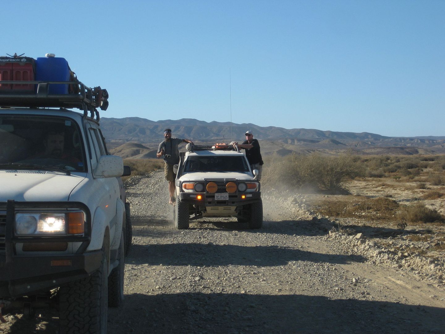
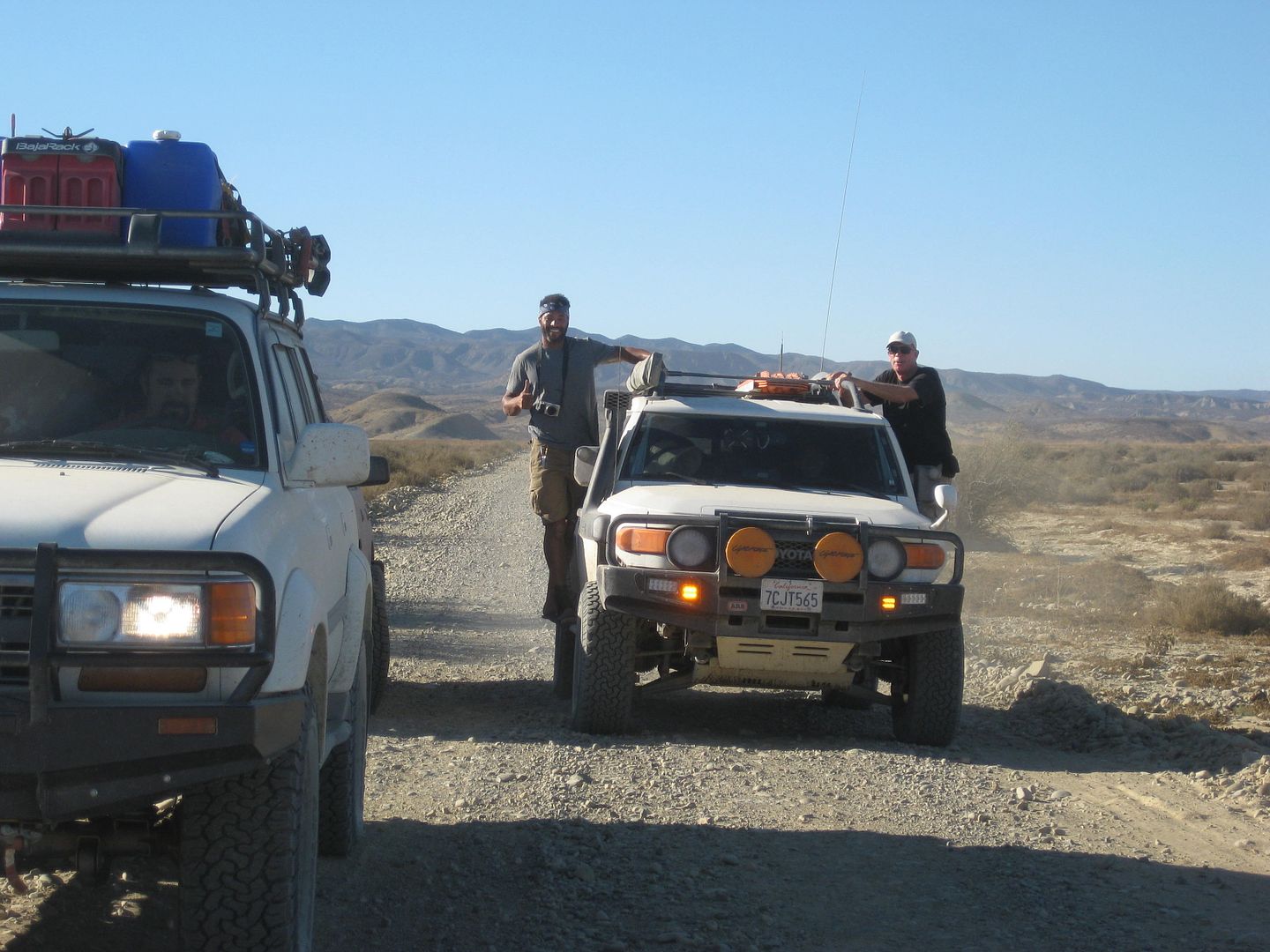
The stuck vehicle was Christine's 4Runner driven by Nick. It was lead vehicle and took the direct route over a mud flat and when it crossed the creek/
tidal channel the rear end sunk in. We all had deflated the tires for dirt road, but I don't know what the 4Runner was running at. Ham's FJ Cruiser
quickly pulled him out after we drove around the mud hole just a few hundred feet further inland.
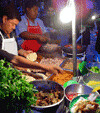
The Dutch oven pizza was at Las Pintas (Day 9 of 11)
The watermelon was purchased by Pat to share with everyone on the highway in Santa Rosalia, across from the Pro One auto parts store in Santa Rosalia.
Jesse's Land Cruiser and my Tacoma parked in front of the fruit market and the 4Runner and FJ parked in front of the auto parts store. They needed a
bolt for the FJ's rear axle stabilizer (or ?) as the stock one fell out somewhere. The auto parts in San Ignacio (by the whale bones) didn't have the
correct size bolt, but Santa Rosalia did.
More coming, yes each day was fun and different... Baja kept on giving and now I am sharing the gift of Baja for others to enjoy.
Pat added some of his photos onto Facebook, not sure if this link works for everyone: https://www.facebook.com/permalink.php?story_fbid=1676555809...
|
|
|
David K
Honored Nomad
Posts: 64478
Registered: 8-30-2002
Location: San Diego County
Member Is Offline
Mood: Have Baja Fever
|
|
| Quote: Originally posted by 4x4abc | great stuff, David.
Love the fact that the seasoned traveler has only the essentials (the driver and beer) - whereas the others are loaded like they came straight from an
overland show.
And David, 20 psi for the beach is 10 psi too many.
Please tell us more about the rock art at the south end of Bahia Concepcion |
Hi Harald,
20 psi worked just fine to float on top the sand with my heavily loaded Tacoma on Hankook Dynapro ATM tires. BFG All Terrains with their 3 ply
sidewall need to drop to 10 psi, as do mud terrain type tires to get good floatation.
The drive to find the rock art (Arroyo los Pintados) is what I am going to post next... The site was published in Erle Stanley Gardner's Off the
Beaten Track in Baja (1967) and Pompano and others on Nomad have been there and taken photos. They are here on Nomad.
Glad you are enjoying... and yes, I told the guys they wouldn't be using the Max Trax, but they had everything and the trip was a total success. Nick
is an engineer and quite the mechanic... even with his tool box well stocked, he didn't have a torque wrench, but that was resolved at the Pro One
auto parts in Vizcaíno on the trip north (to deal with the Land Cruiser axle nut, if needed... more on that later in the story).
|
|
|
David K
Honored Nomad
Posts: 64478
Registered: 8-30-2002
Location: San Diego County
Member Is Offline
Mood: Have Baja Fever
|
|
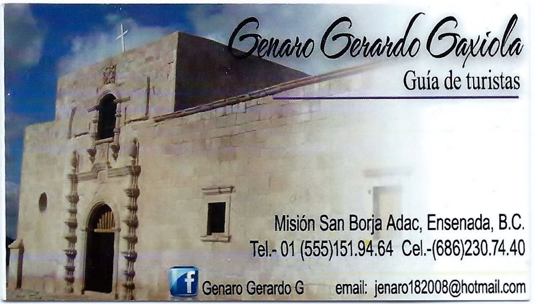
Mission San Borja area tours
Here is the card for José's son Genaro. Anyone who wishes to arrange a mule or other multi-day tour of the area, like to the San Juan mine, can send a
message to José via the email on the card...
|
|
|
Udo
Elite Nomad
Posts: 6321
Registered: 4-26-2008
Location: Black Hills, SD/Ensenada/San Felipe
Member Is Offline
Mood: TEQUILA!
|
|
WOW...David!
This is the traveling that Baja travelers dream of.
Udo
Youth is wasted on the young!
|
|
|
David K
Honored Nomad
Posts: 64478
Registered: 8-30-2002
Location: San Diego County
Member Is Offline
Mood: Have Baja Fever
|
|
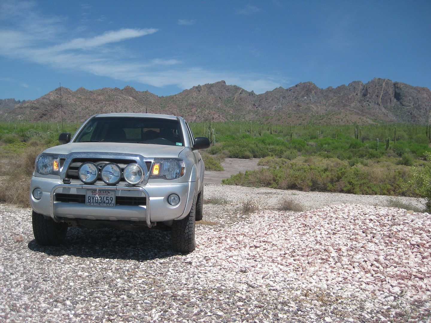
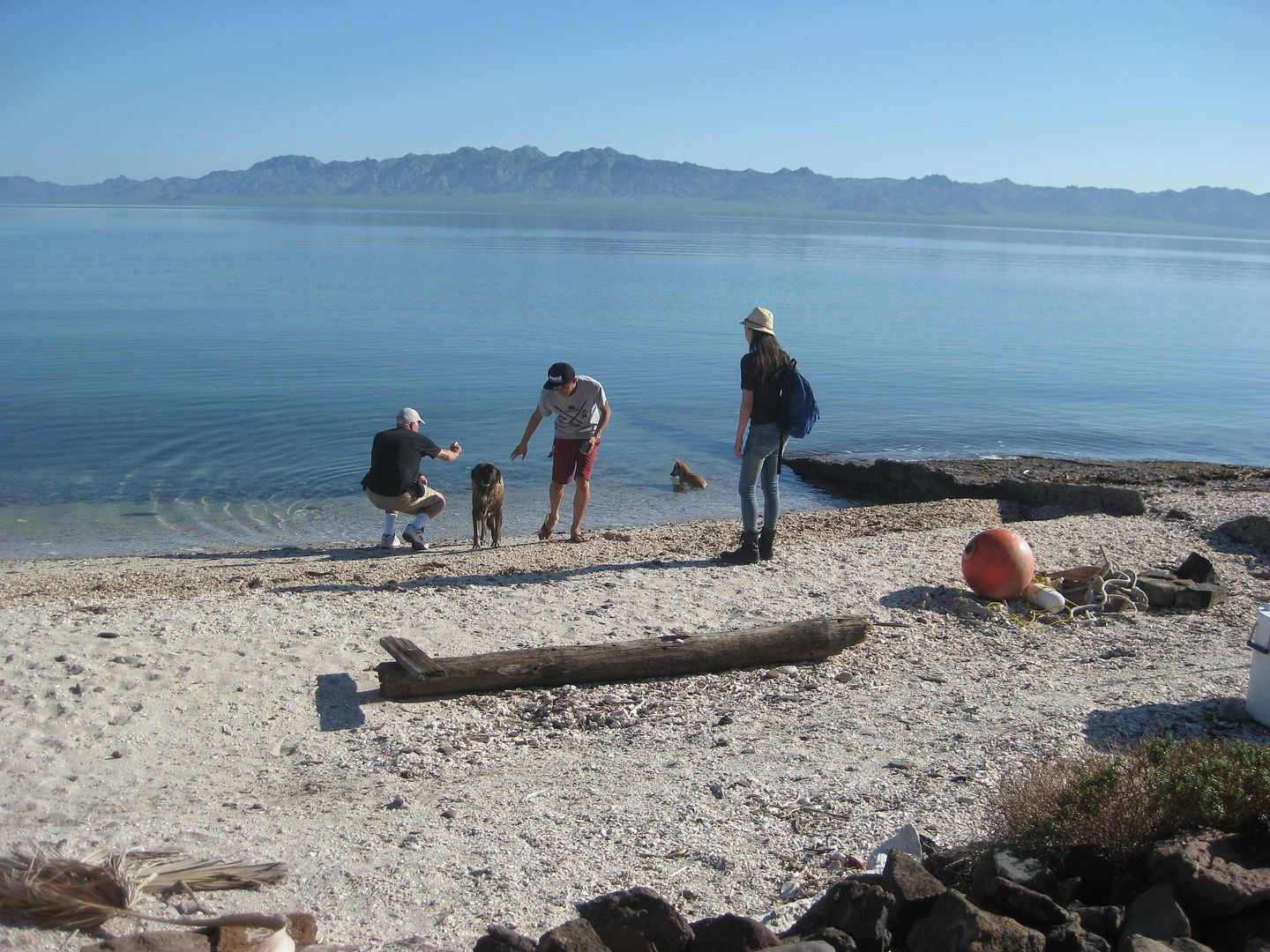
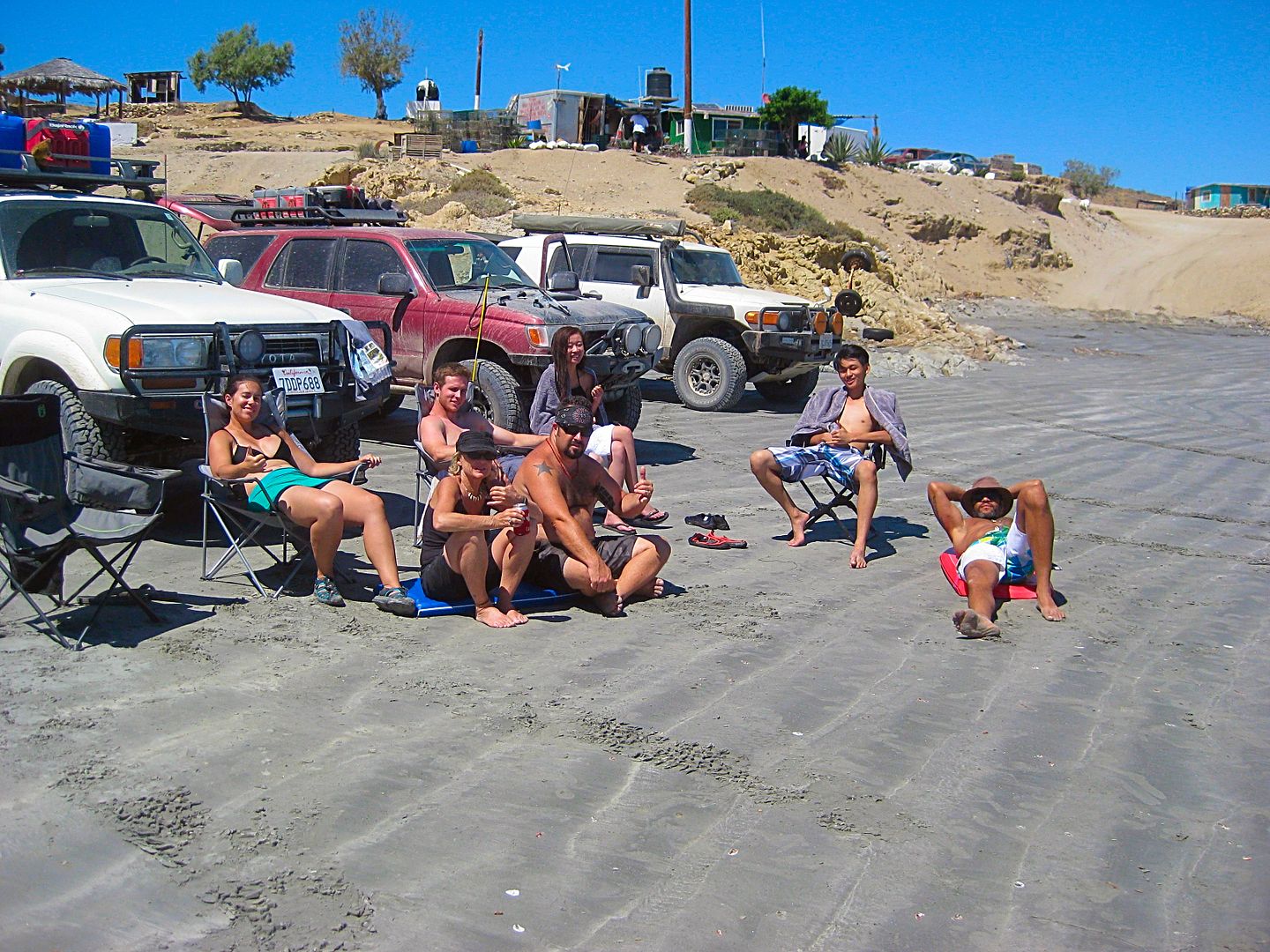
DAY 6 (Wed. Sept. 14, 2016)
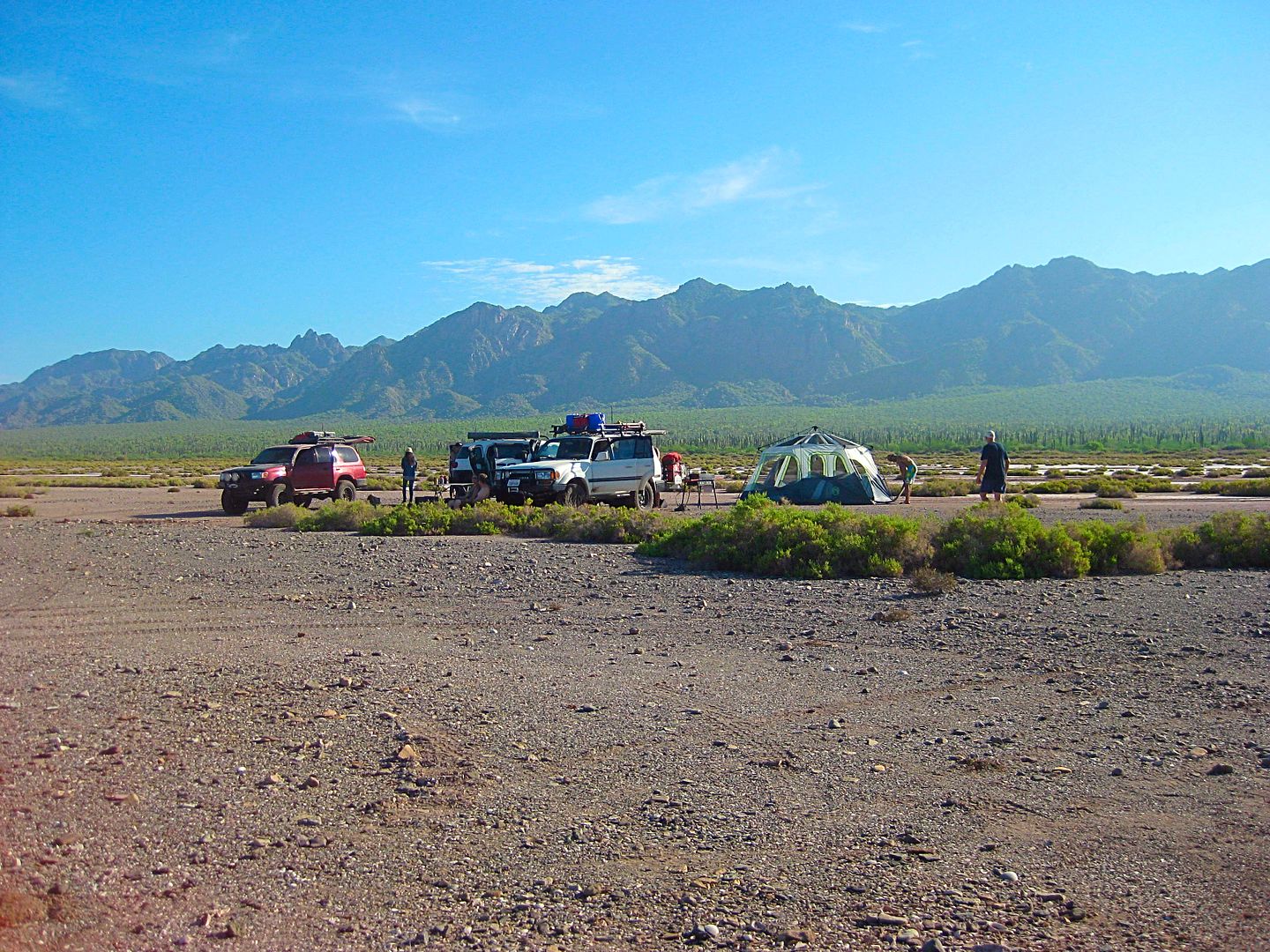
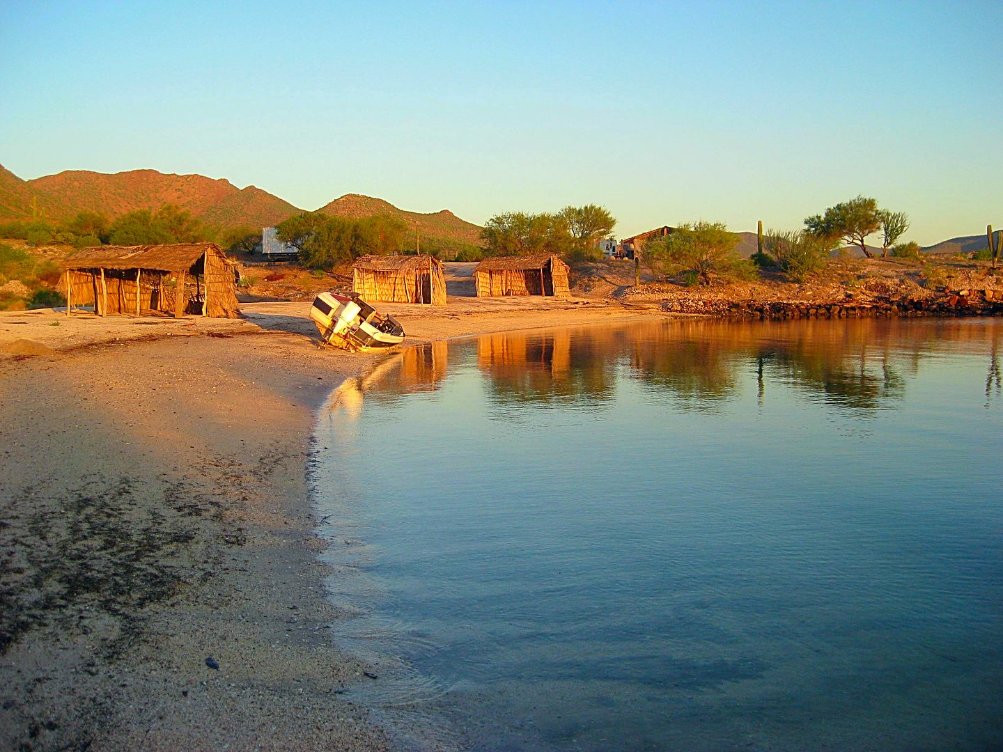
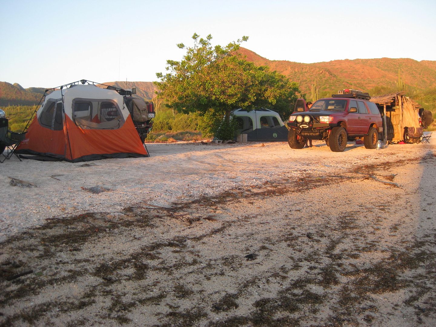
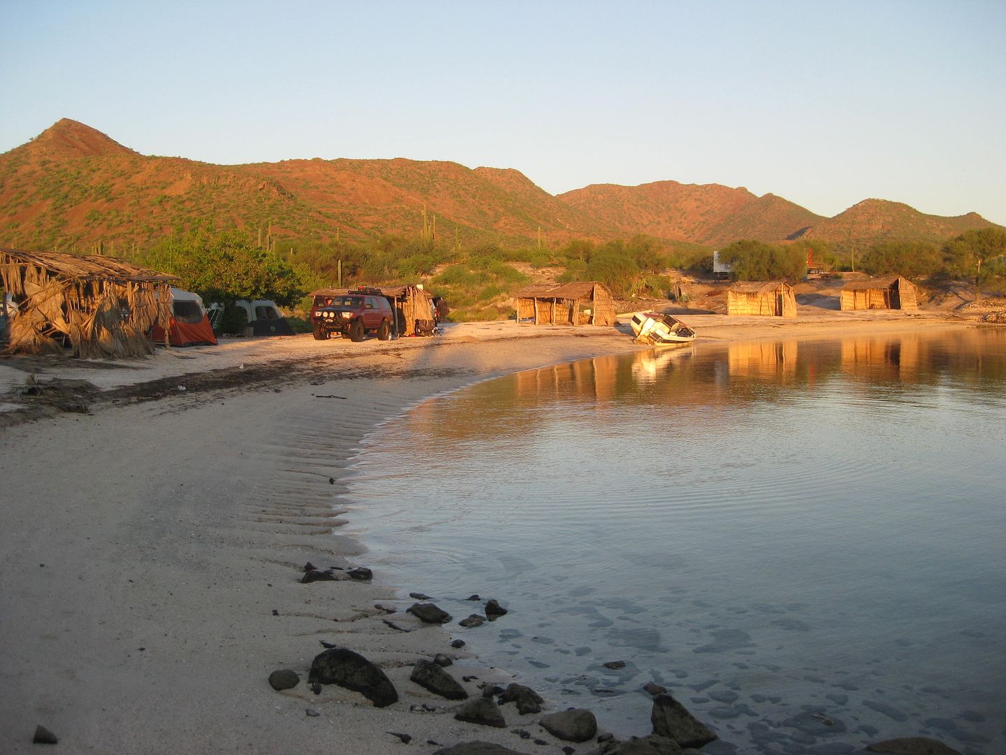
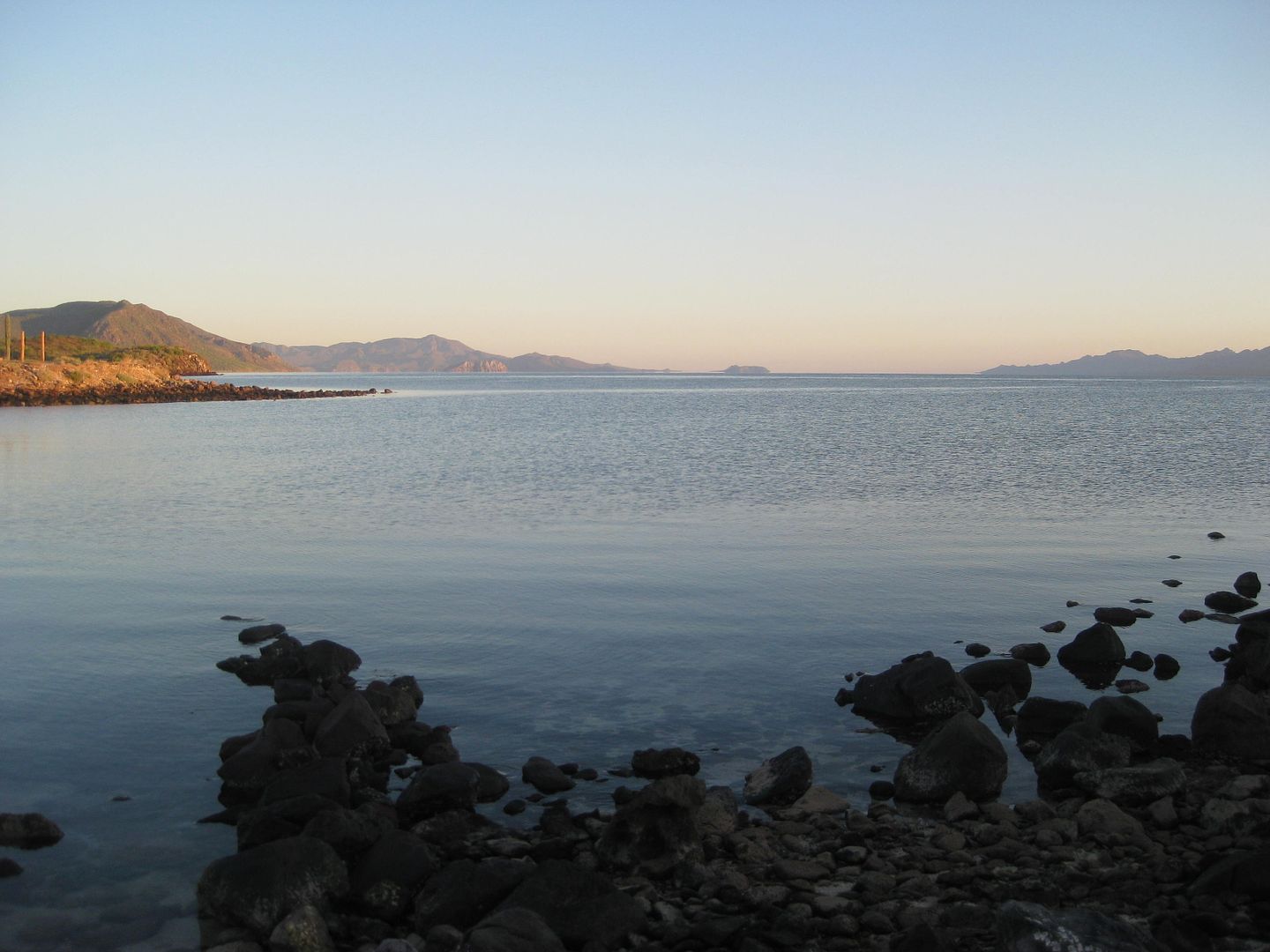
We are camped on a salt flat-like area not far from the shore of the bay... a narrow line of low shrub is all that is between us and the water, a few
hundred feet away. Chef Jesse makes us an egg, bacon, and cheese scramble which we devoured with pleasure! It was a long, tough night drive so we were
not in any hurry to get up, and the breakfast was greatly appreciated. My passenger, Pat, likes fresh-brewed coffee and I have my camp stove set up
each morning for him to percolate a pot. He has brought Starbucks, and it was quite good even for me as a not so big coffee drinker.
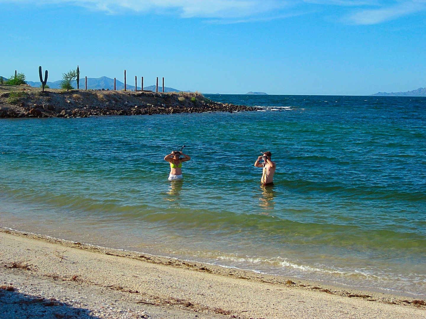
We all walk to the shore and Nick goes snorkeling in the warm water. A puffer fish calmly swims to us (see it in Ham's video). We are finally heading
back south at 12:45pm heading back. I should mention that the road north of Amorales (where we camped) is very overgrown and not been used in ages
except perhaps for motorcycles! All of us got tons of "Baja pin stripes" last night! In the video, you can see the brush lit by Ham's amber lamps that
we drove through, twice. [I got my truck 'clayed' in a detail job two days ago to remove the scratches. Only one was too deep to rub out.]
In my notes, I note that we passed through a fence gate 4.8 miles southbound from camp at 1:21 pm (closing it after we all pass through, of course).
We pass a Ford Courier or Ranger truck coming north on the road driven by a rancher, friendly waves are exchanged... and we admire that his truck is
2WD and travels frequently on what we would call a 4WD only road... LOL!
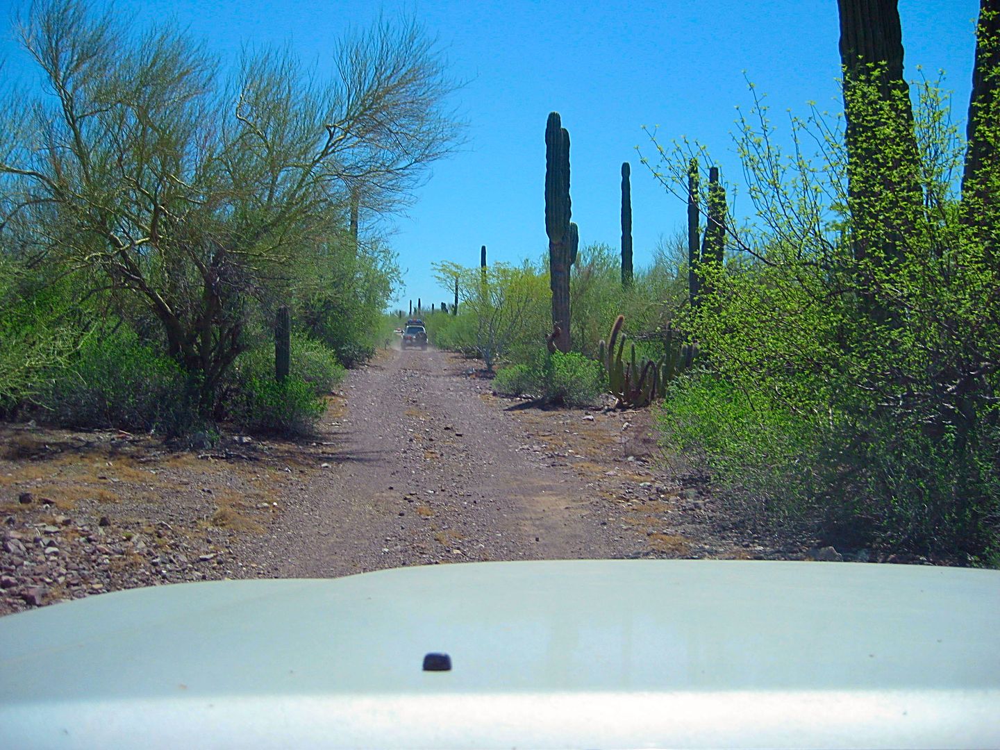
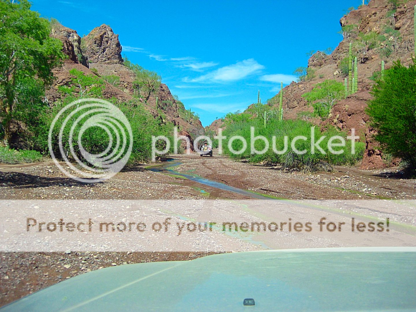
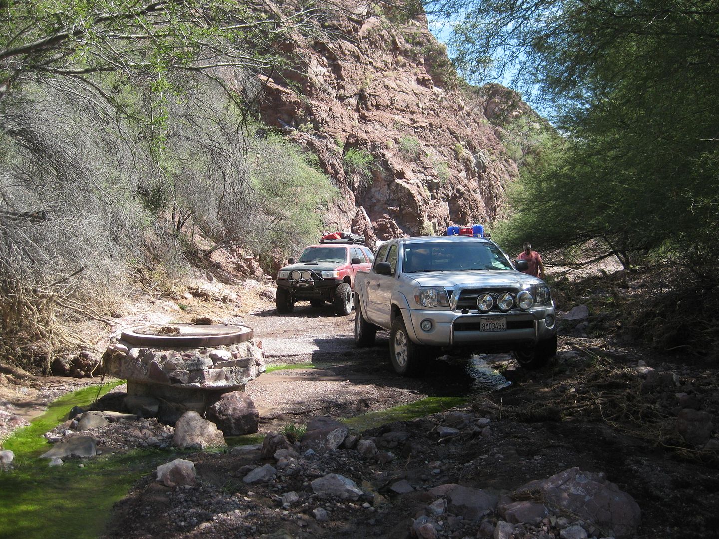
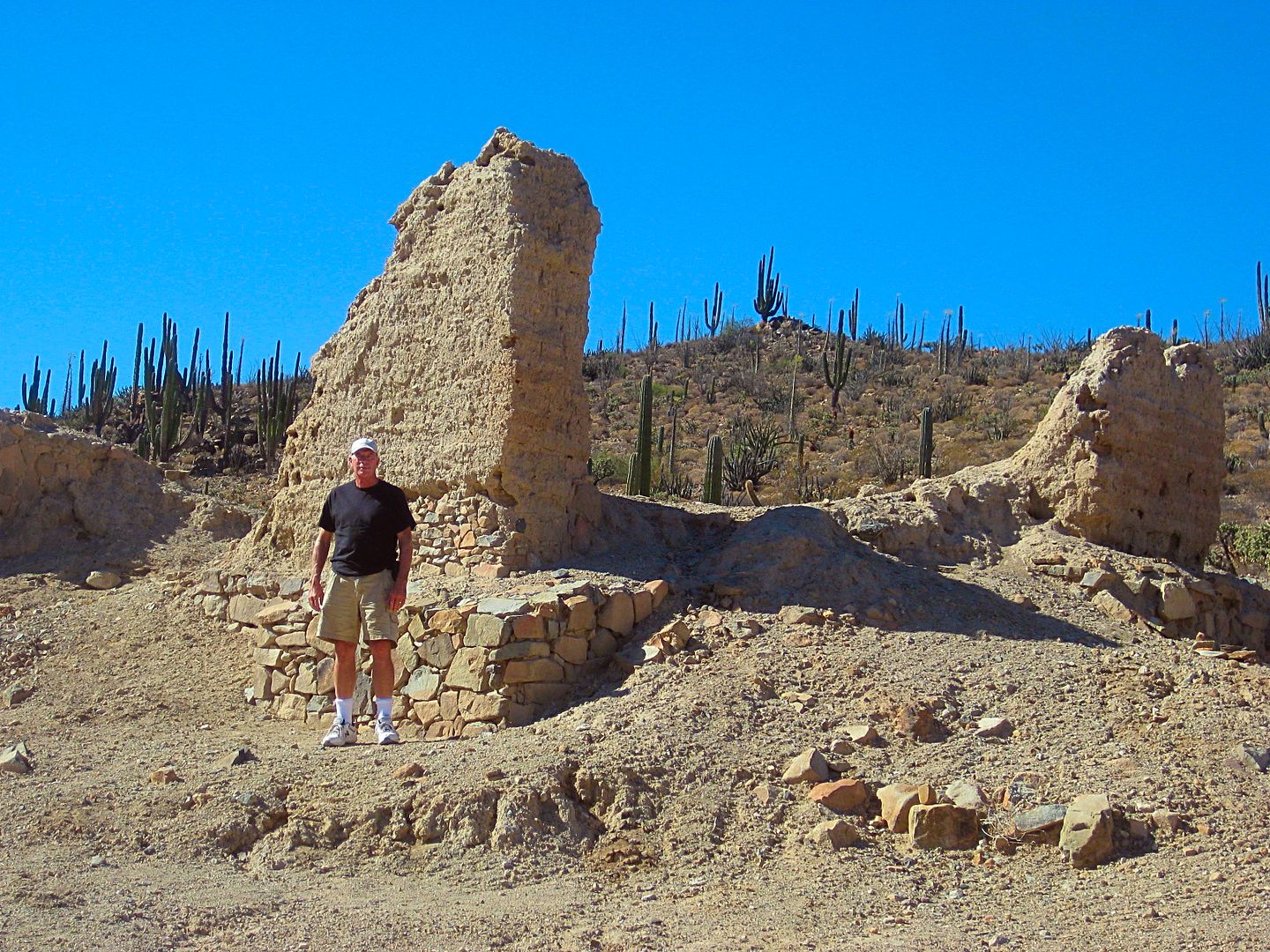
We reach the Arroyo los Pintados 'road' at Mile 10.4 from camp... and there are no tracks, just the arroyo north of the Three Musketeer cardón cacti.
There is a fork in the wash in 0.7 mile and I take the left branch (which was correct for the painted cliff), but the wash route becomes difficult and
we turn around after 0.4 mile and head for the right branch... and sure enough I see tire ruts, so we think we are on the correct route. I did not
have the GPS for the painted cliff, and was just winging it. Where we ended up going was fascinating and proves that in Baja, all roads go someplace
interesting!
Well, the right branch road climbs out of the arroyo and there is a steep down-and-up gully. Nick is lead rig and it takes him a few tries... we toss
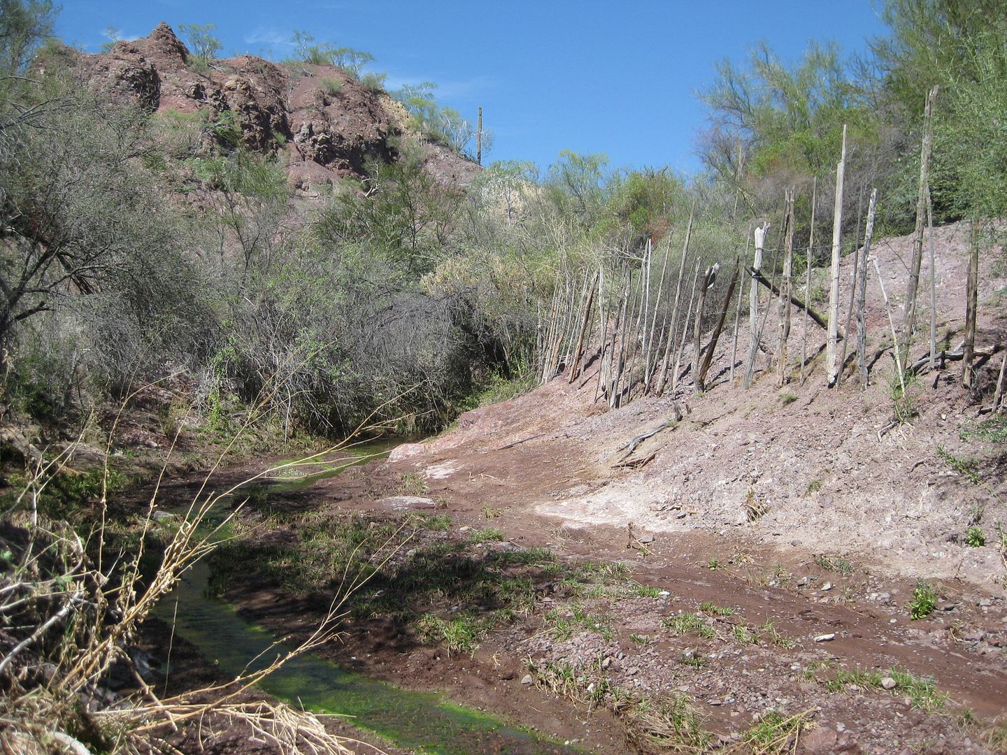
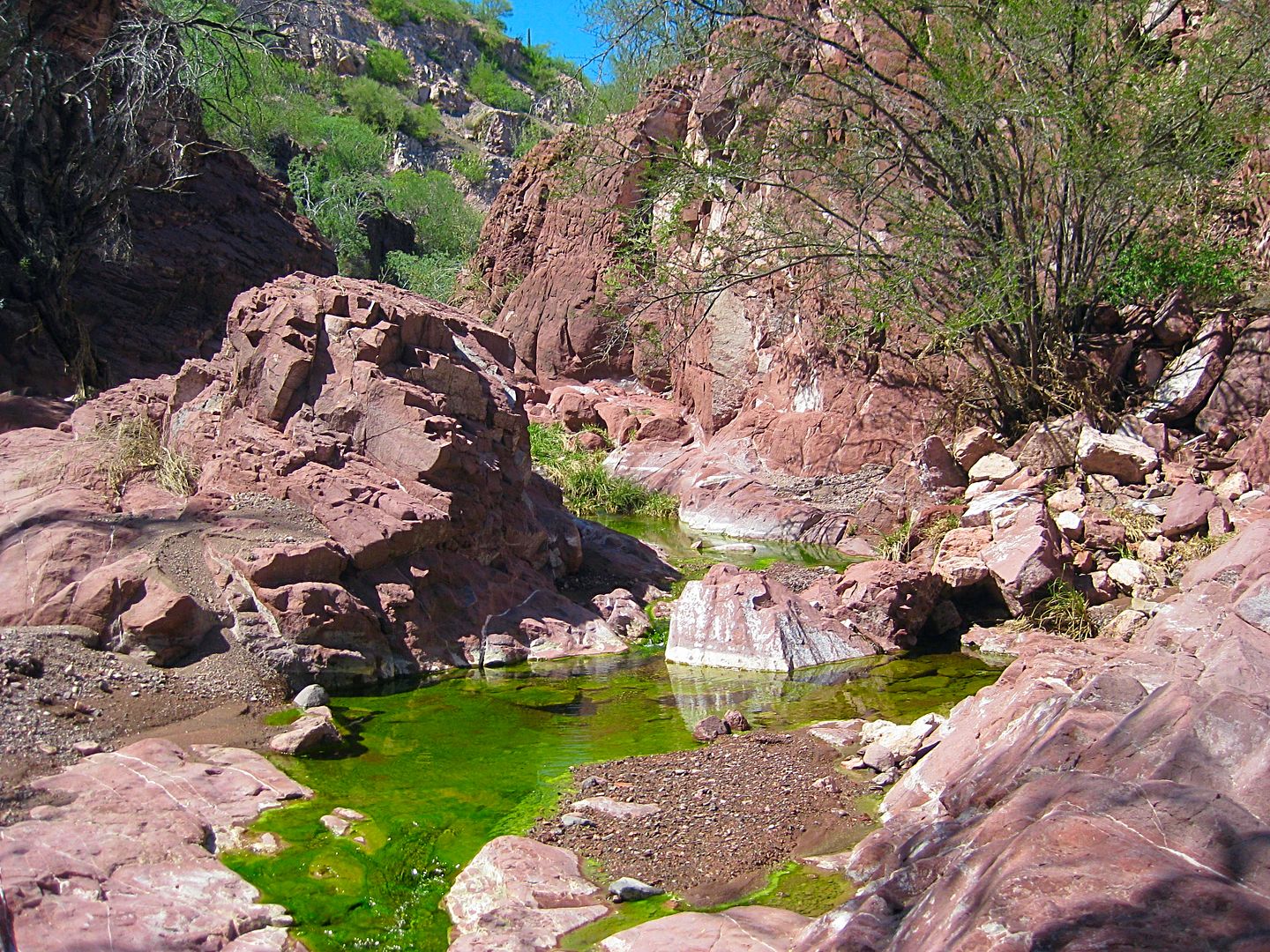
in some rocks to help us bigger vehicles not bottom-out the rear end. We drop into another arroyo (Tres MarÃas) and go up it and soon are in a
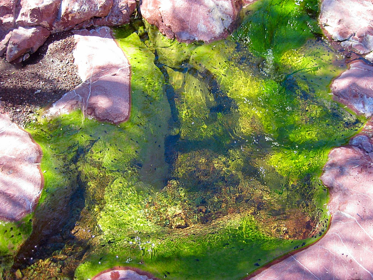
running stream! I love seeing water in the desert and it shows you (if you get away from main roads and into the backcountry) how the Indians could
survive in an otherwise waterless land.
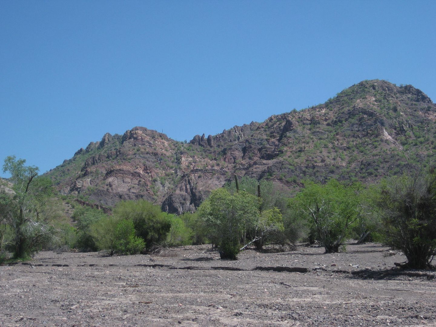
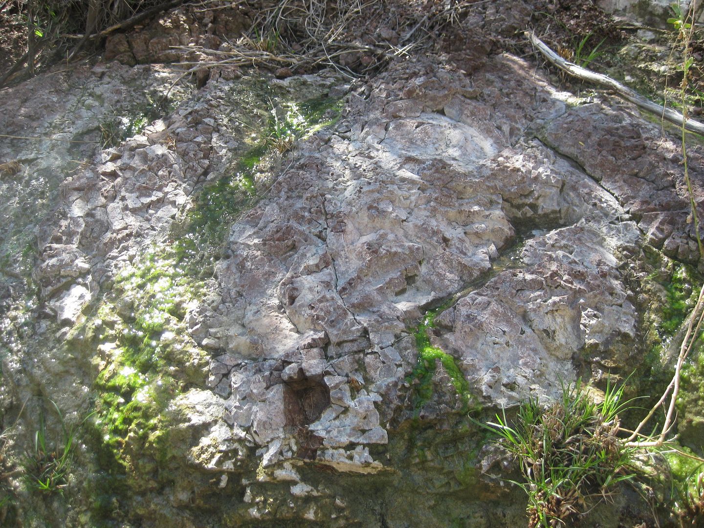
Where the canyon narrows and further driving is halted we see what looks like a man-hole plate on top of a well, a few feet higher than the arroyo
floor. There is a concrete foundation on the side of the arroyo and just ahead is a side ravine (that the water is coming from) with a fence along the
side of the slope... very odd? We walk to see where the water is pouring out of solid rock and it is an amazing place (to me)!
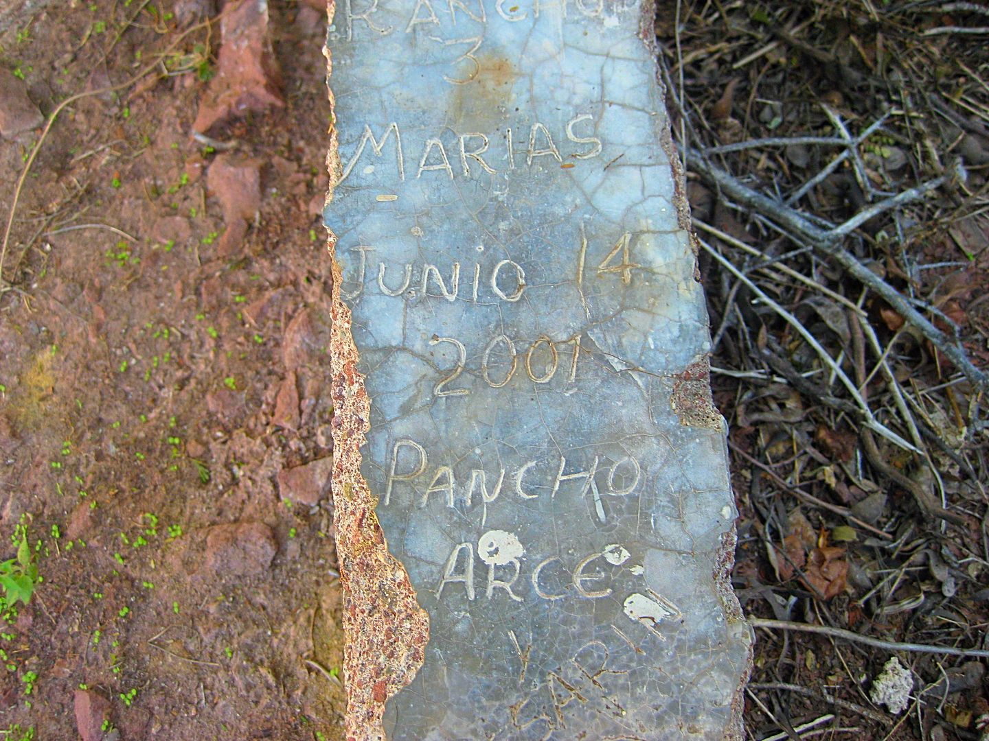
Investigating the concrete foundation, we read it is from 'Pancho Arce, June 14, 2001' and this is (was) 'Rancho Tres MarÃas'. We are about 4 miles
from the bay shore road (it seems a lot longer).
Coming back, Ham spots an old road that will allow us to avoid the deep gully and we turn left out of Arroyo Tres MarÃas and cross over to Arroyo
Luis (on the Almanac map). Ham had spent weeks downloading GoogleEarth images of the area of Baja we hoped to see and had a screen in his FJ with the
GPS of his truck and that is how he found the cut across road! We reached the bay shore road about 5 miles from Rancho Tres MarÃas site. We were back
at Highway One in 7.2 more miles, on the same road we took the day before.
Before I get into the next part of Day 6 (Campo La Perla), here are maps and photos...
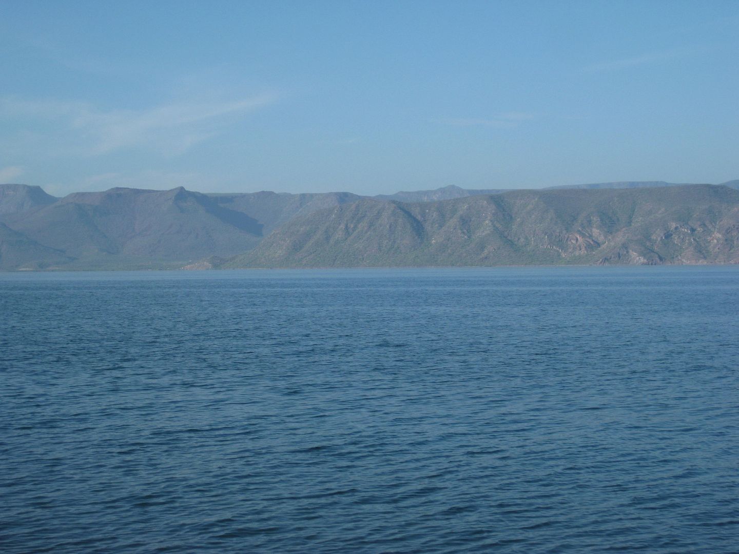
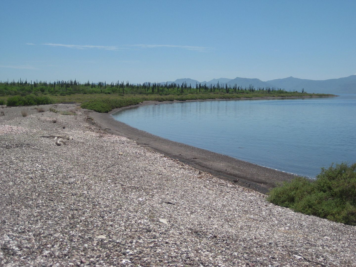
The beach at Punta Amolares:
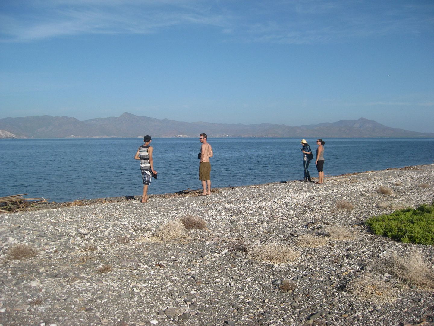
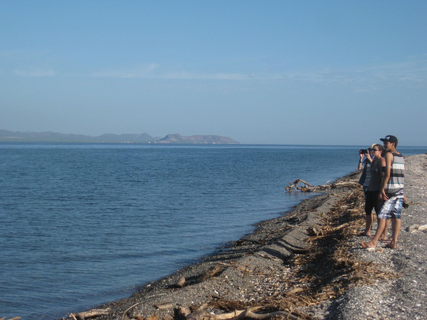
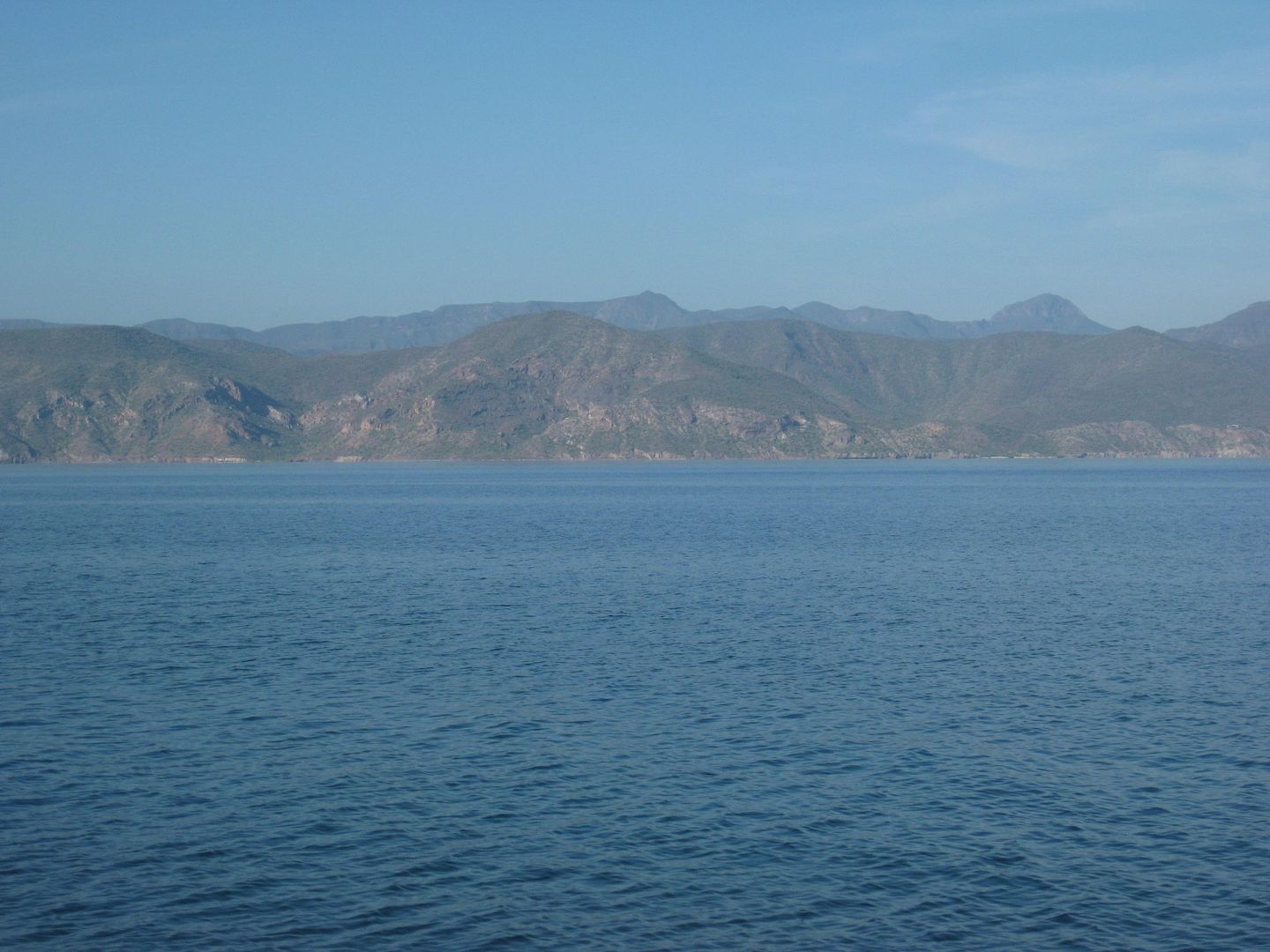
Looking across the bay:
Our camp:
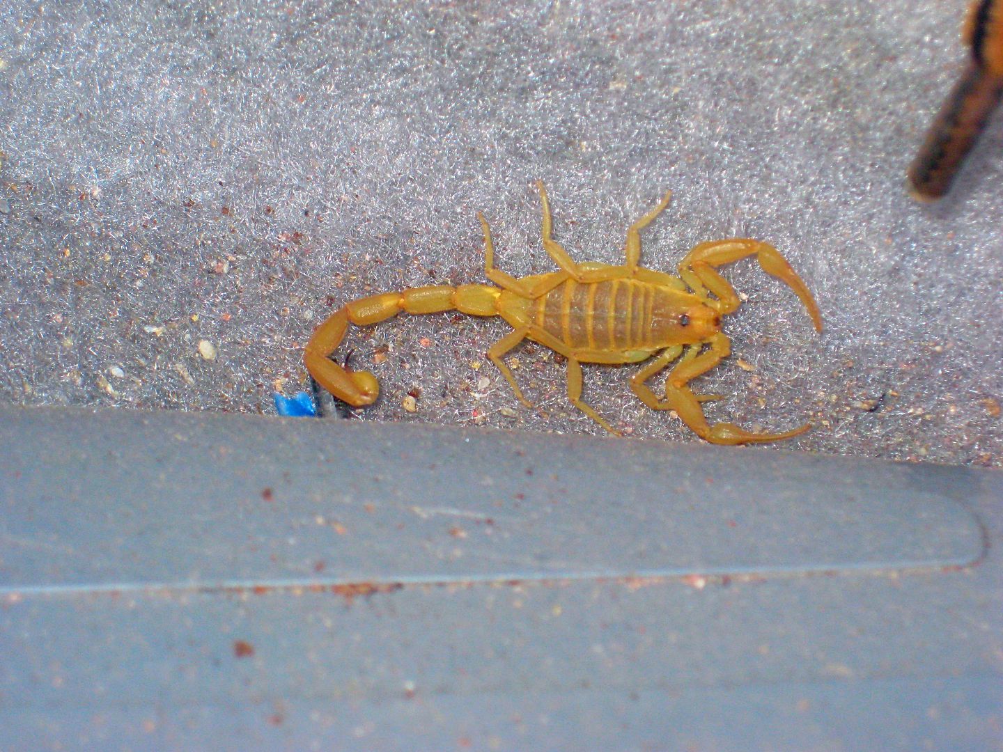
A surprise INSIDE my truck!!!
Jesse's Land Cruiser:
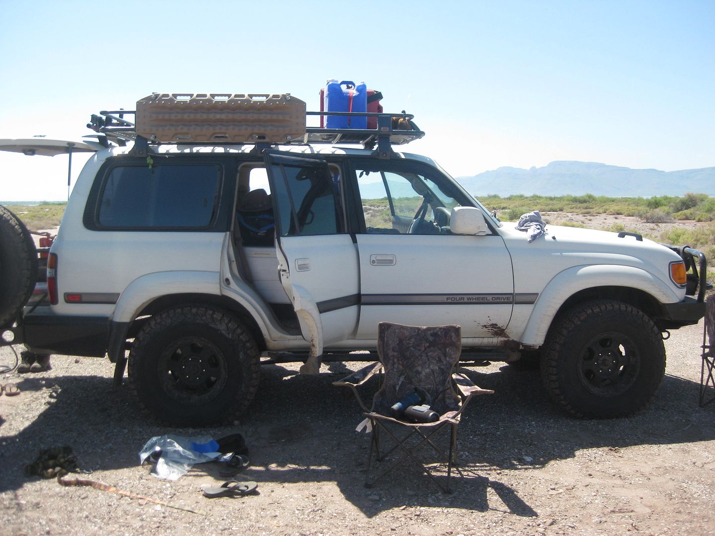
One more walk to the water...
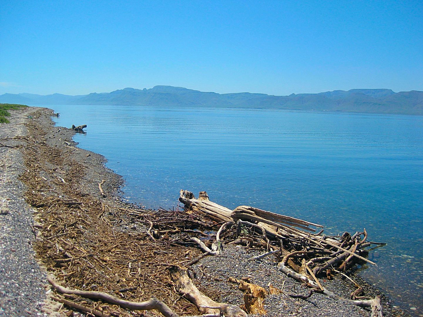
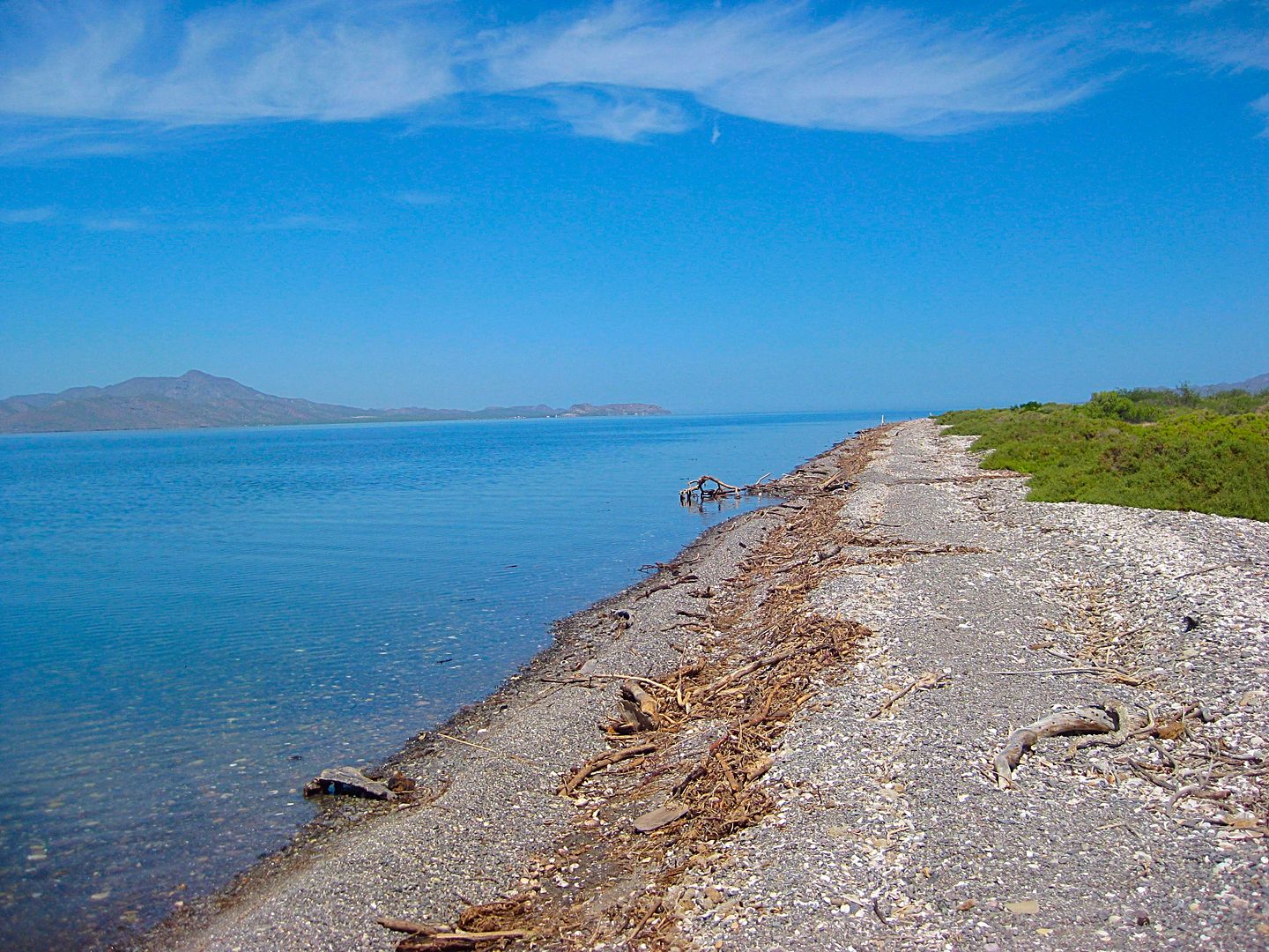
Our camp from the near the water...
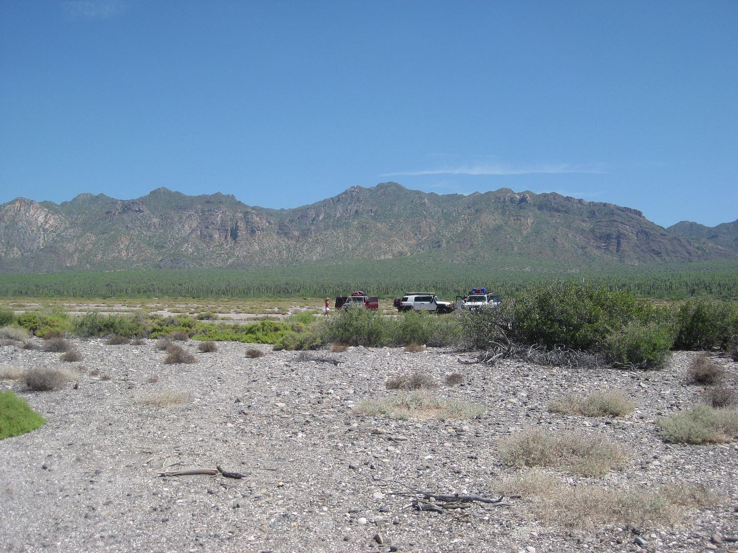
The drive back south...
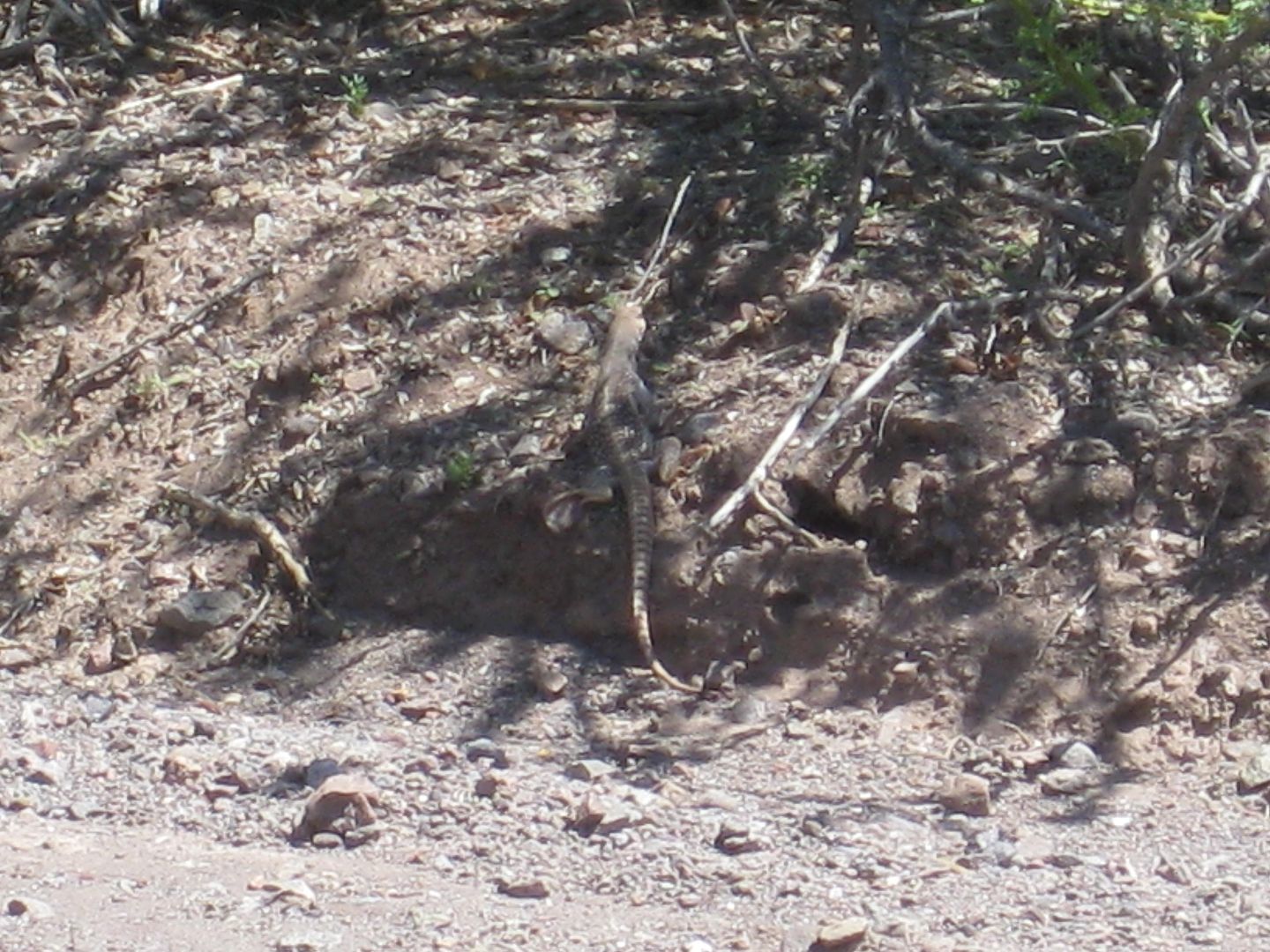
Big lizard...
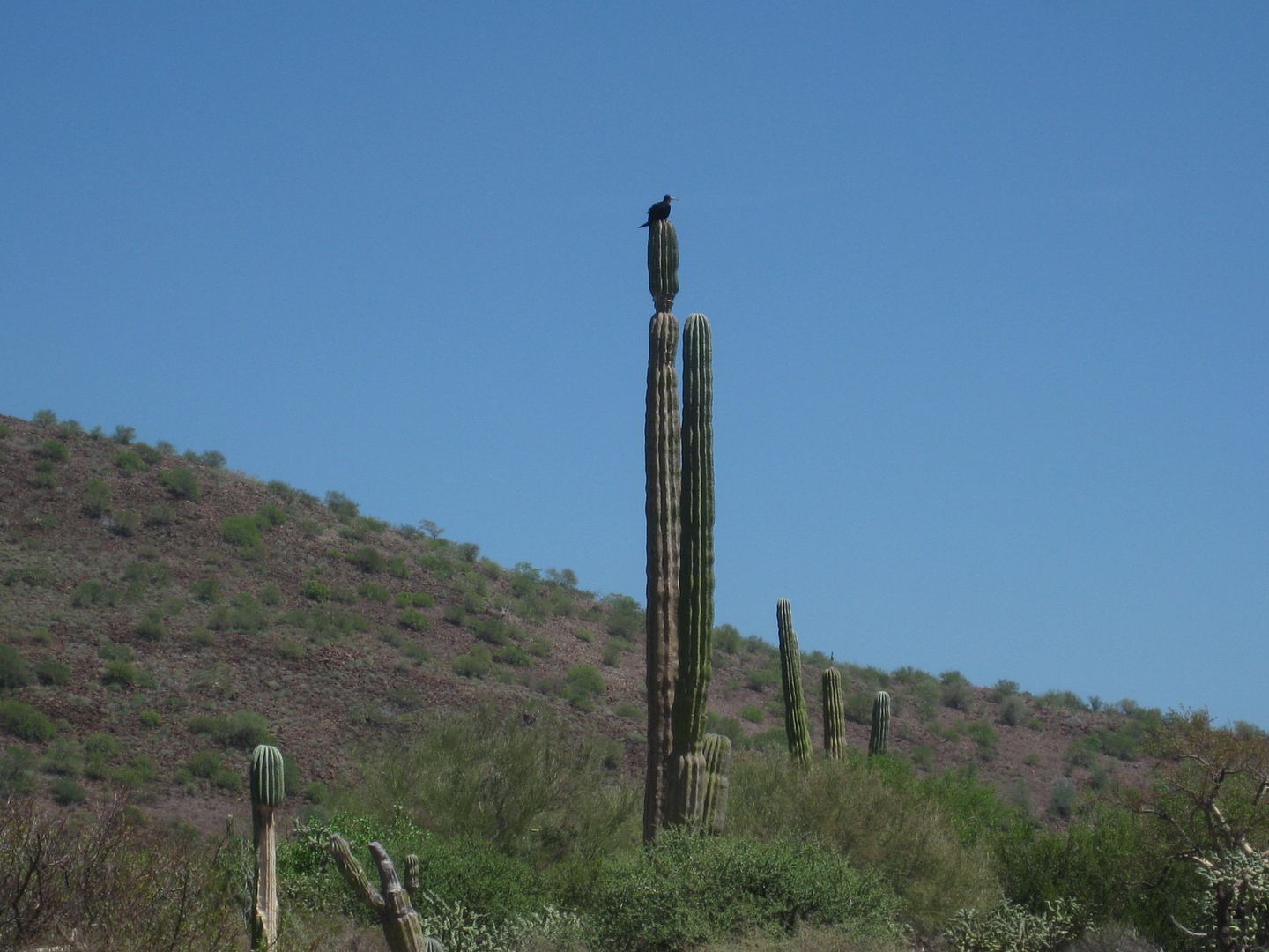
Osprey on cardón:
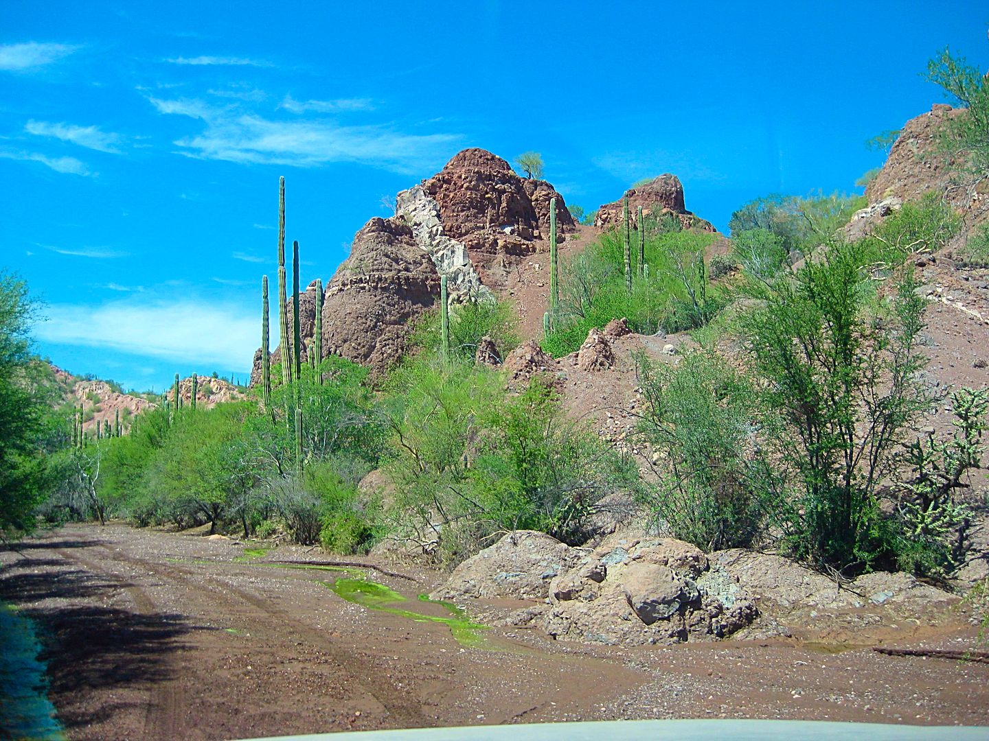
Arroyo Tres MarÃas:
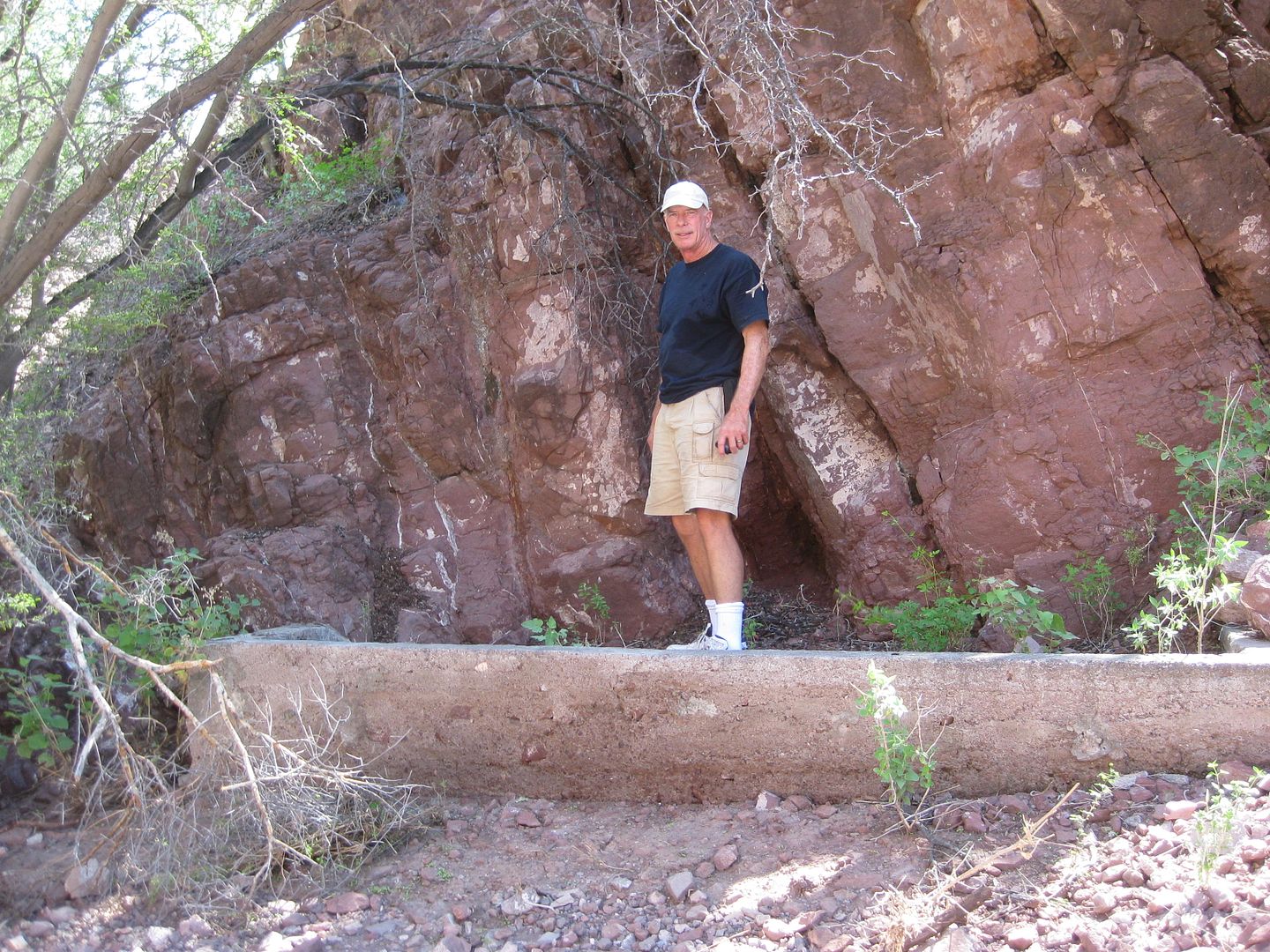
Pat on the foundation.
MAPS:
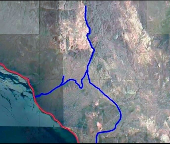
Ham's GPS track. Note the short left fork, which was the correct direction for Los Pintados.
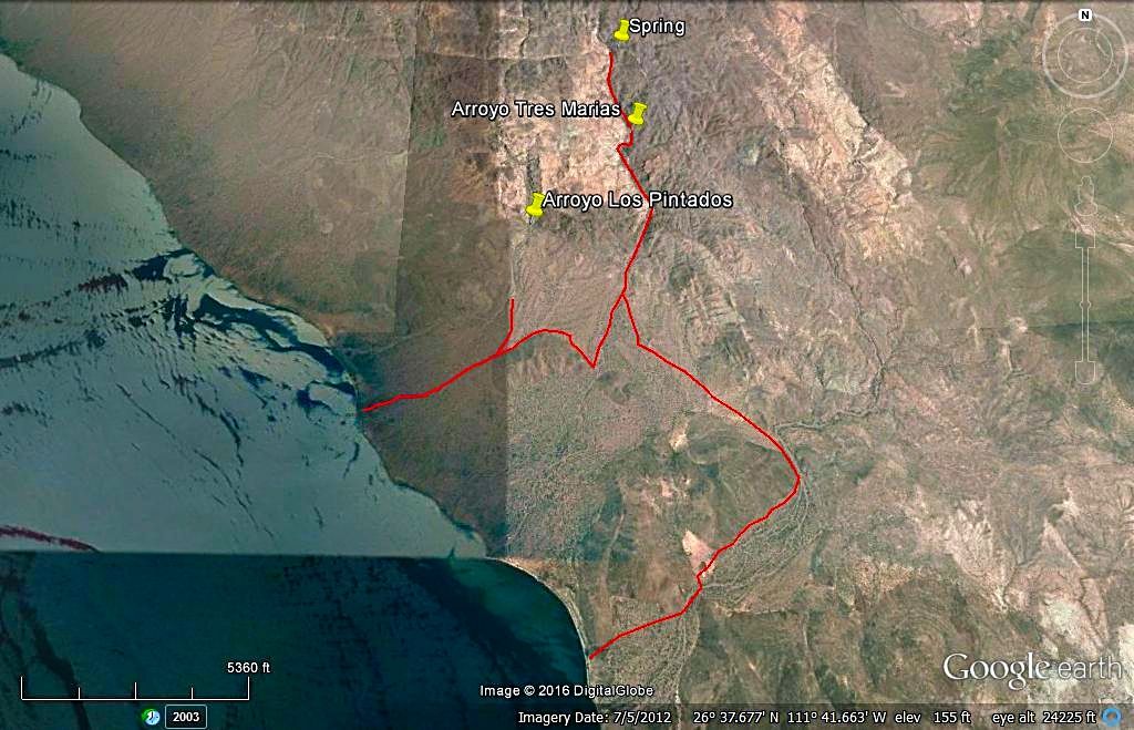
I traced the roads on GE, where we returned to the bay shore road was just south of the road I traced.
Red arrows for drive in and blue for drive out.
========================================================================
To be continued...
[Edited on 3-13-2019 by David K]
|
|
|
Ateo
Elite Nomad
Posts: 5847
Registered: 7-18-2011
Member Is Offline
|
|
Thanks for posting. Enjoying the trip.
|
|
|
David K
Honored Nomad
Posts: 64478
Registered: 8-30-2002
Location: San Diego County
Member Is Offline
Mood: Have Baja Fever
|
|
DAY 6 Continued... and DAY 7 (Thur. Sept. 15, 2016):
We reach Hwy. 1 (just north of Km. 74) and fill up our tires to street pressure (35 psi for my Tacoma on the Hankooks). We turn right and head north.
We have a late afternoon on a sandy beach, at Campo La Perla. The place was deserted and the hurricane only did some damage to one palapa.
A room with a view...
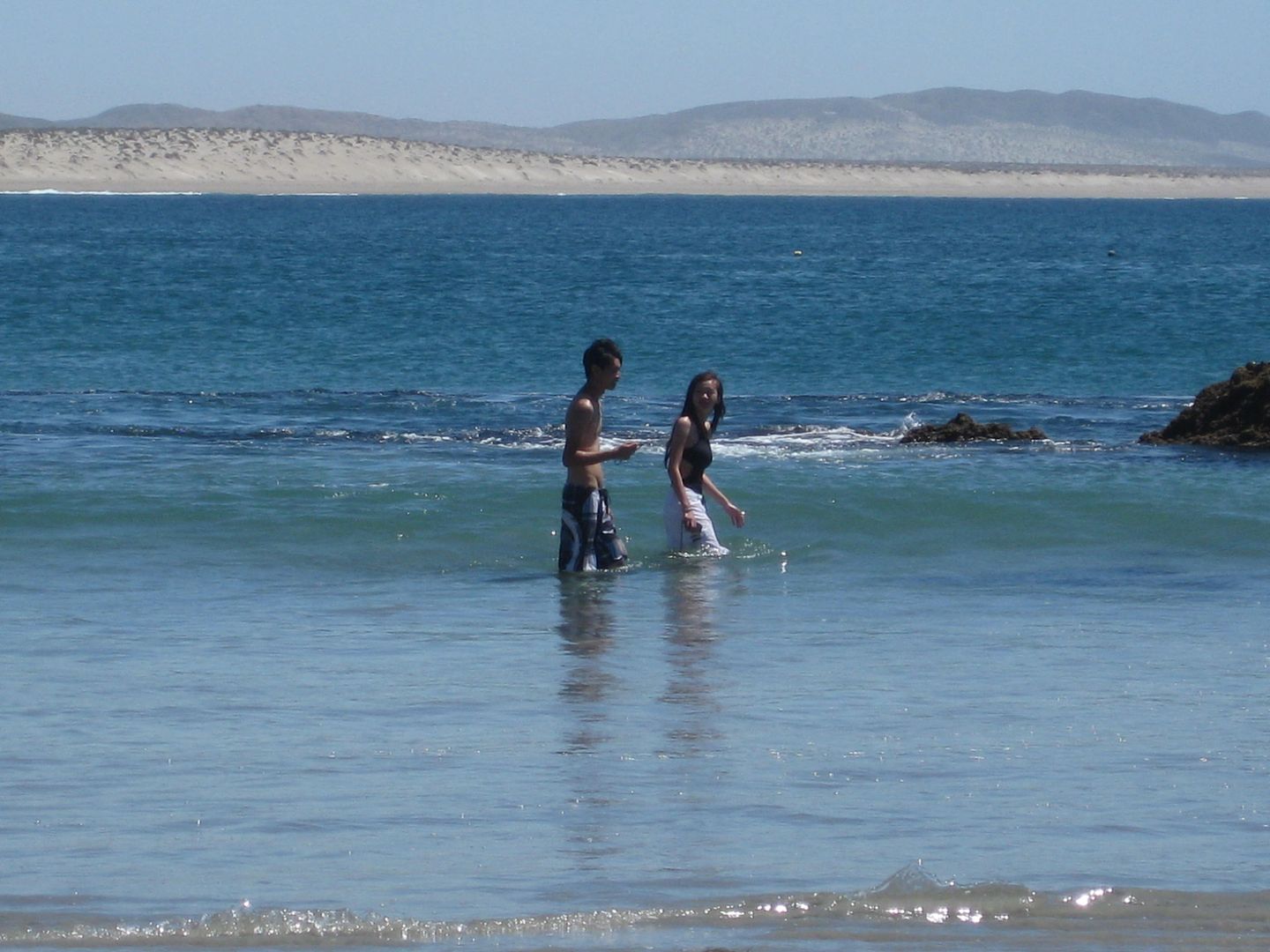
Nick and Christine are the first to get in the bay...
============================================================================
Thursday Morning...
El Requeson...
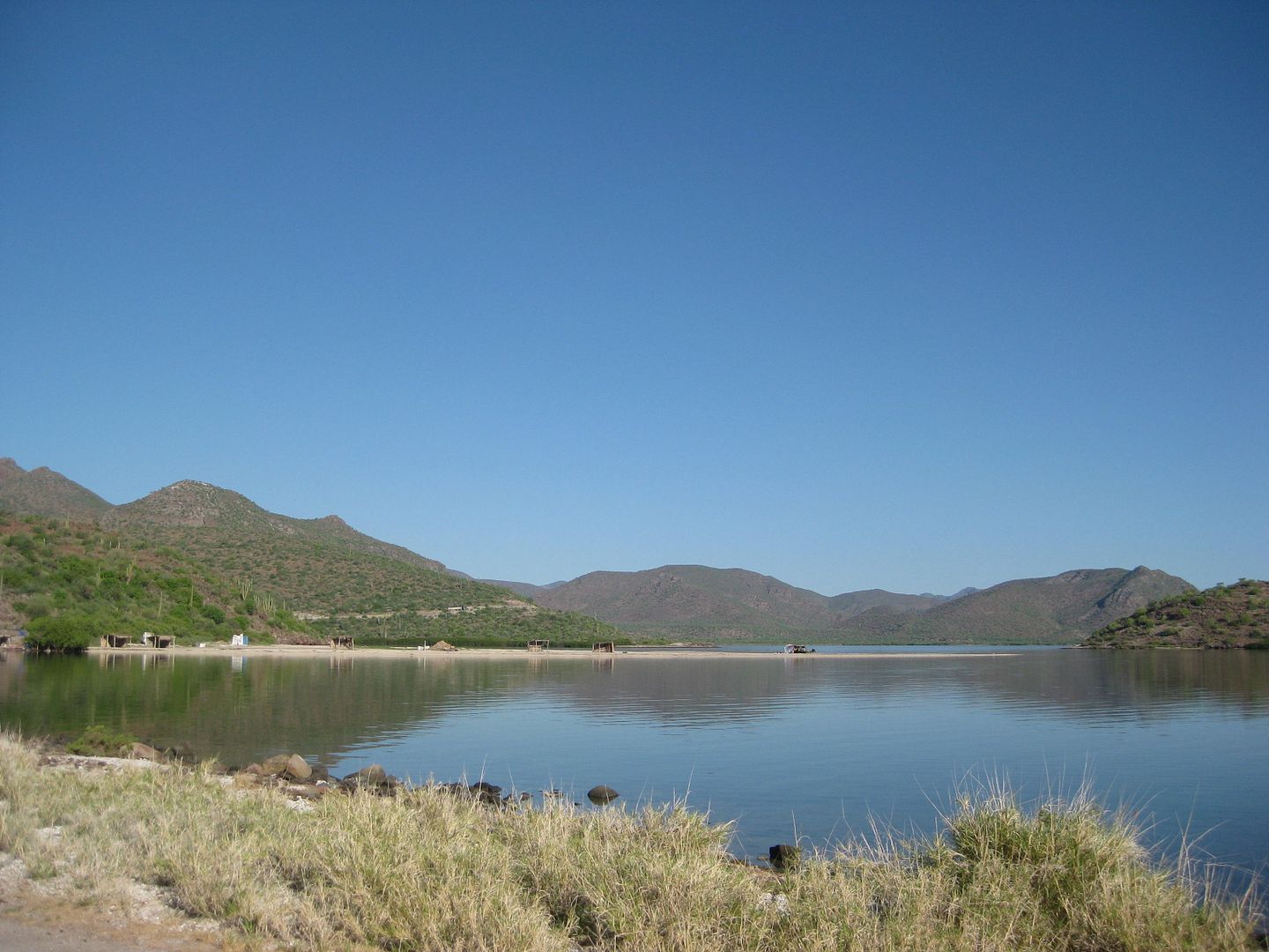
Isla el Requeson...
We stop in at Playa Buenaventura to check in with Nathan, Mark, and Olivia...
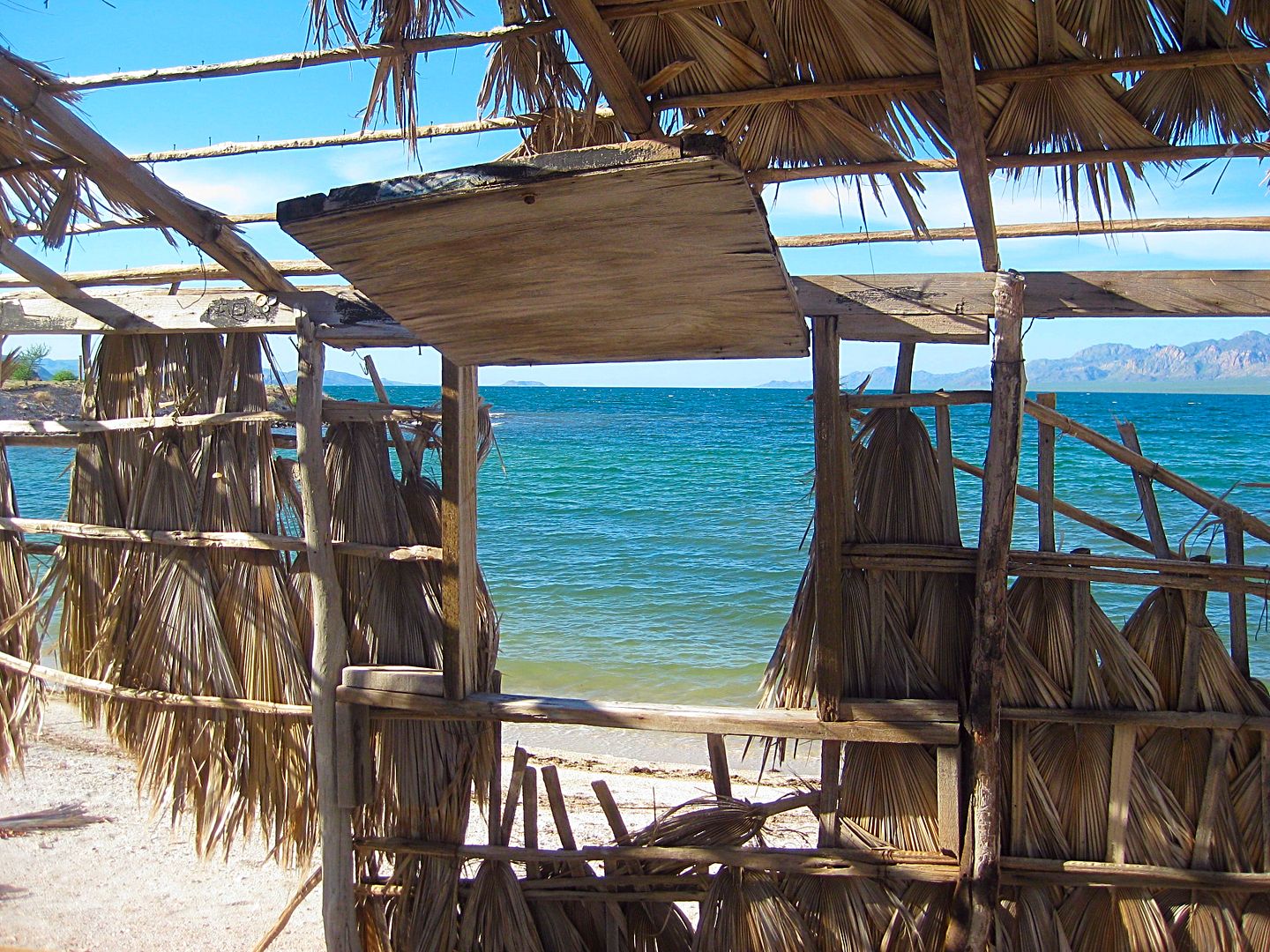
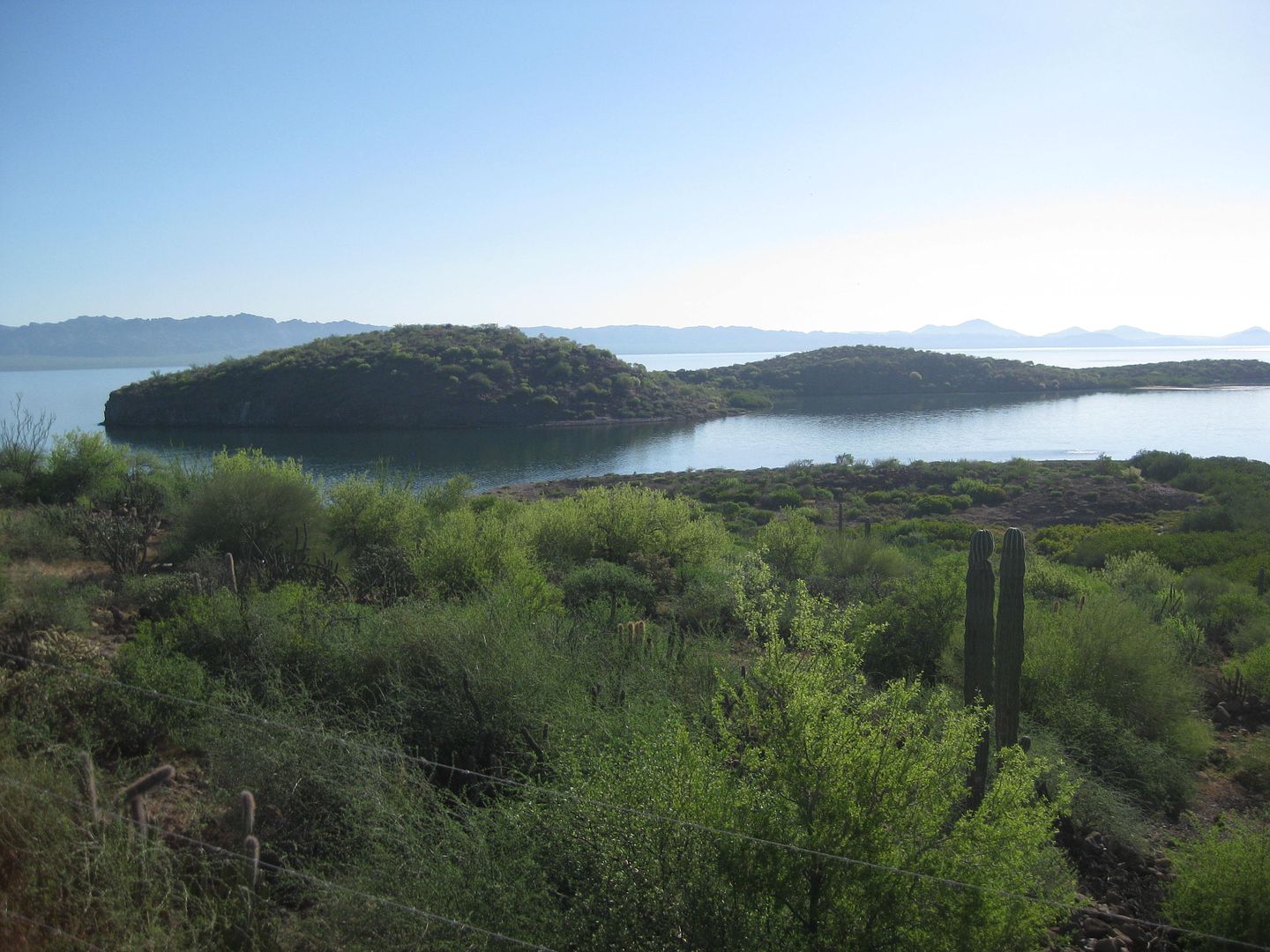
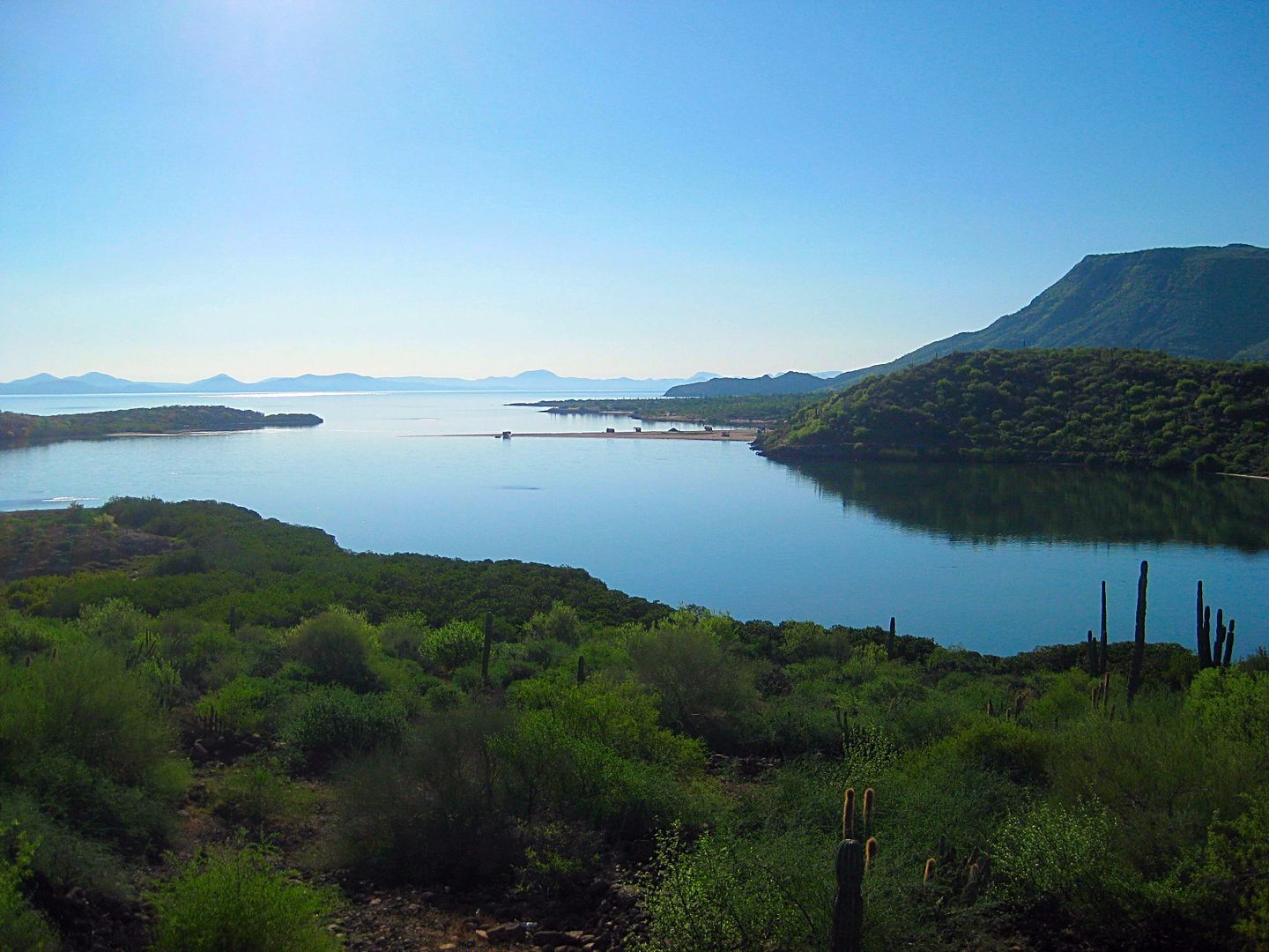
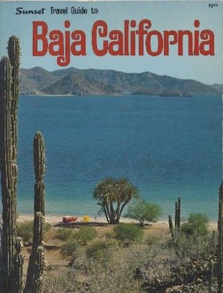
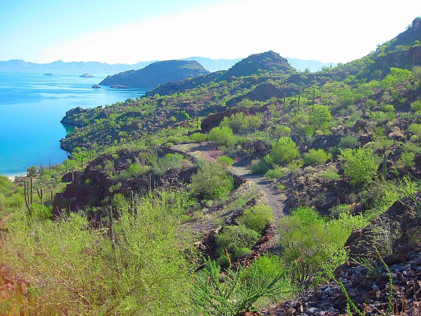
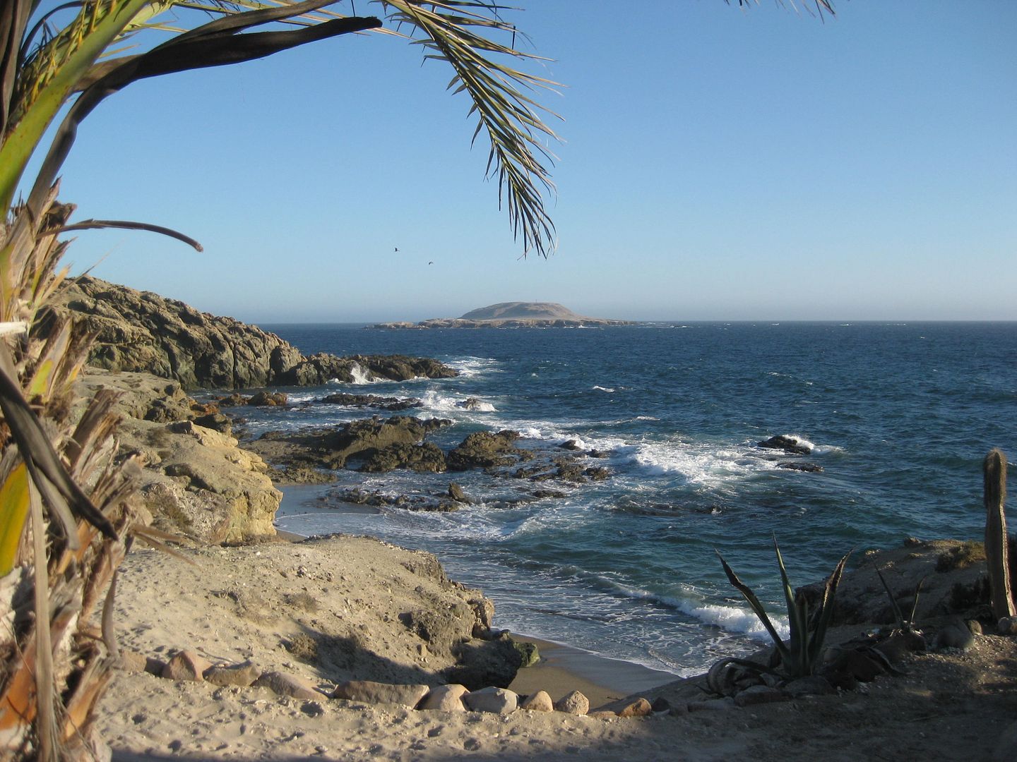
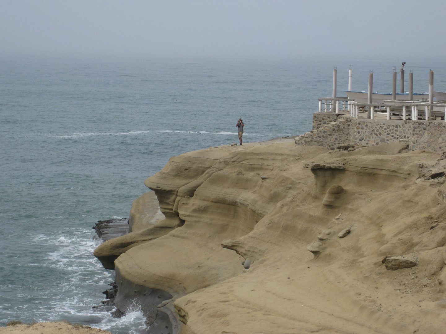
Heading north for Mulegé, we pull over to get some premium shots of Bahia el Coyote (a small bay in Bahia Concepcion), those famous sea level palm
trees (photos of them just above the sea date back to the 1940s), and it is a premium photo location, used for book covers over the past 40 years...
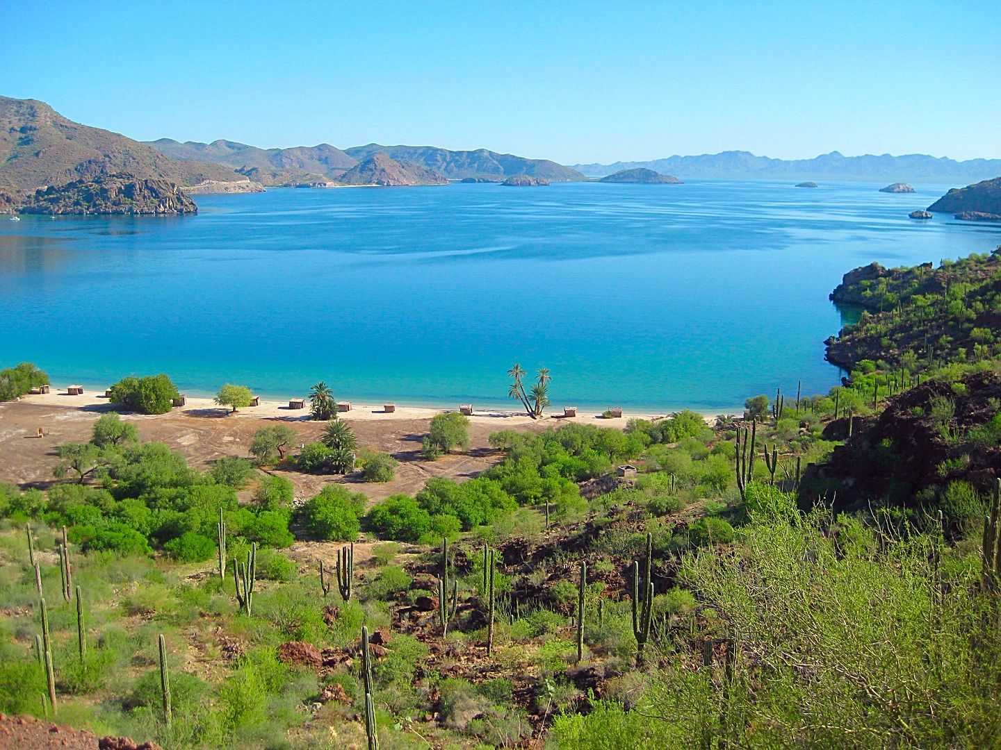
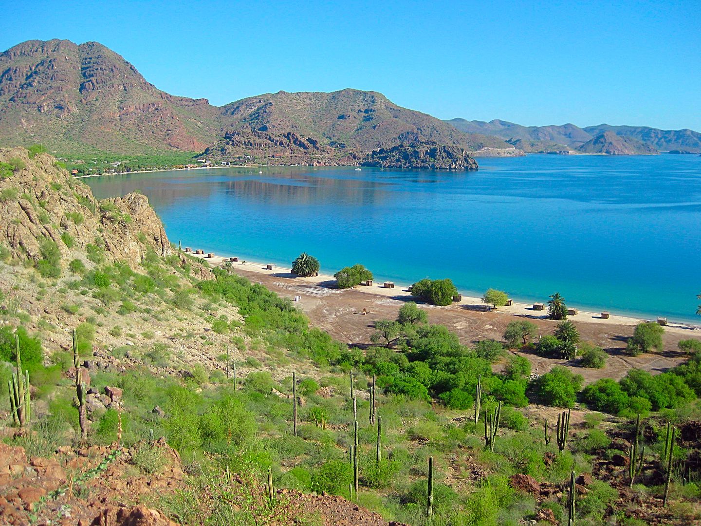
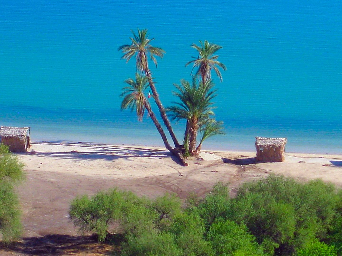
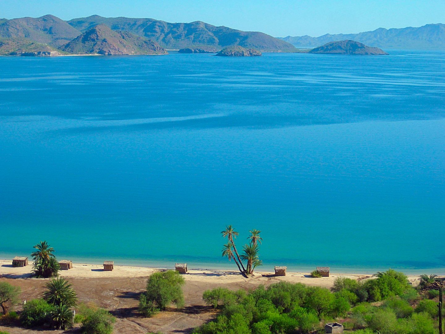
1971 book cover:
The pre-paved highway main road to La Paz...
We go into old town Mulegé to get some ice and anything else needed and to show the Baja newbies what it looks like there. On the highway heading
north, we have a couple of detours from the hurricane of the previous week but are not an issue for any car.
BANDITOS!!! ???
Between Santa Rosalia and San Ignacio, between the big grades, was a van on the left with children and a woman. They were waving for help, holding an
empty water gallon bottle and a siphon hose, yelling "gasolina"!
It looked much like the scam reported near El Rosario, but I radioed the others it seemed okay and it was up to them if they wanted to stop (it was a
busy highway). They opted to get a dose of good Karma and pulled over to help... providing the van with three gallons of Premium (as the backup fuel
for the super-charged Land Cruiser I-6 engine). After giving gas, I told the woman, who kept her face hidden with a scarf, that we wanted them to
start the van and we would follow them to San Ignacio to make sure they got there safely. She refused, coming up with excuses and saying her husband
had "papers" she was waiting for, yadda yadda yadda. I asked her if she was sick (TB?) and that is why she had her face covered. She said yes, but
most likely it was because of all the filming and photos many were taking of her!
We topped our tanks at San Ignacio and pulled across the highway for some carne quesadillas. They were so good we asked for another round... sadly, we
cleaned her out of meat on the first order!
The highway to Punta Abreojos was the worst paved road of the trip, filled with potholes for much of the distance. We went to the end of town and came
back on the malecon paved street, then turned left to use the salt flat road to La Bocana and on to Bahia Asuncion (our goal for today).
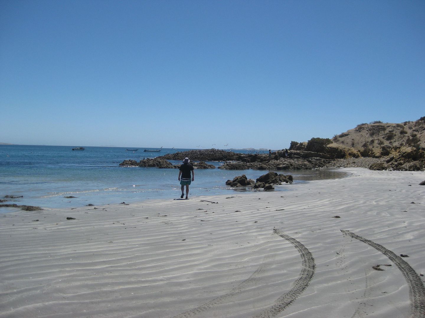
Beach at Punta Abreojos.
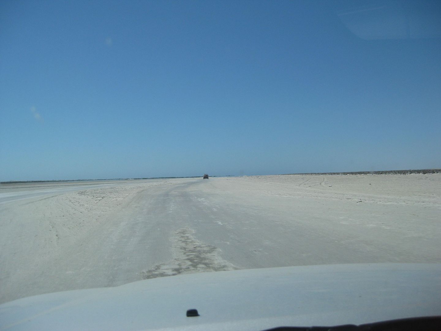
Salt flat road (thank goodness the sea level hasn't risen, yet!)
Ham is leading the way and misses the correct route through La Bocana, and we tour the town dump!
Passing through San Hipolito.
We next pass through Punta Prieta, and I note how much the village has grown since I was last through here in 2007.
Between Punta Prieta and Bahia Asuncion, Jesse (in the Land Cruiser) is hearing a front end noise. I stop, and as he rolls in behind me, I can see his
wheel wobble a bit!
Out comes the jack and the tire indeed is wobbling when manually shaken. Jesse had a private mechanic put a new bearing in that wheel... and as Nick
soon discovered, left out important washers!!! Nick tightens it up and it remains good for the next two days. On the way north, we stop in that great
Pro One auto parts store in Vizcaíno and they have a kit of the two washers that Jesse's mechanic forgot to replace! We stop in two days at El Crucero
and Jesse correctly installs the washer and lock washer and uses a torque wrench (bought at Pro One also) to correctly tighten the axle nut.
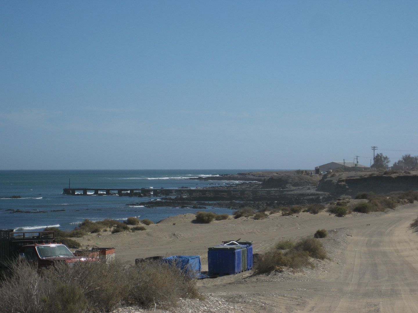
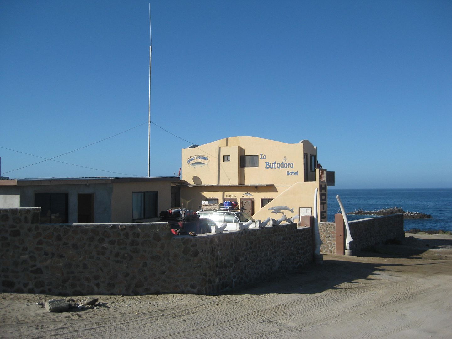
We arrive at Juan & Shari's La Bufadora Inn (Bahia Asuncion)...
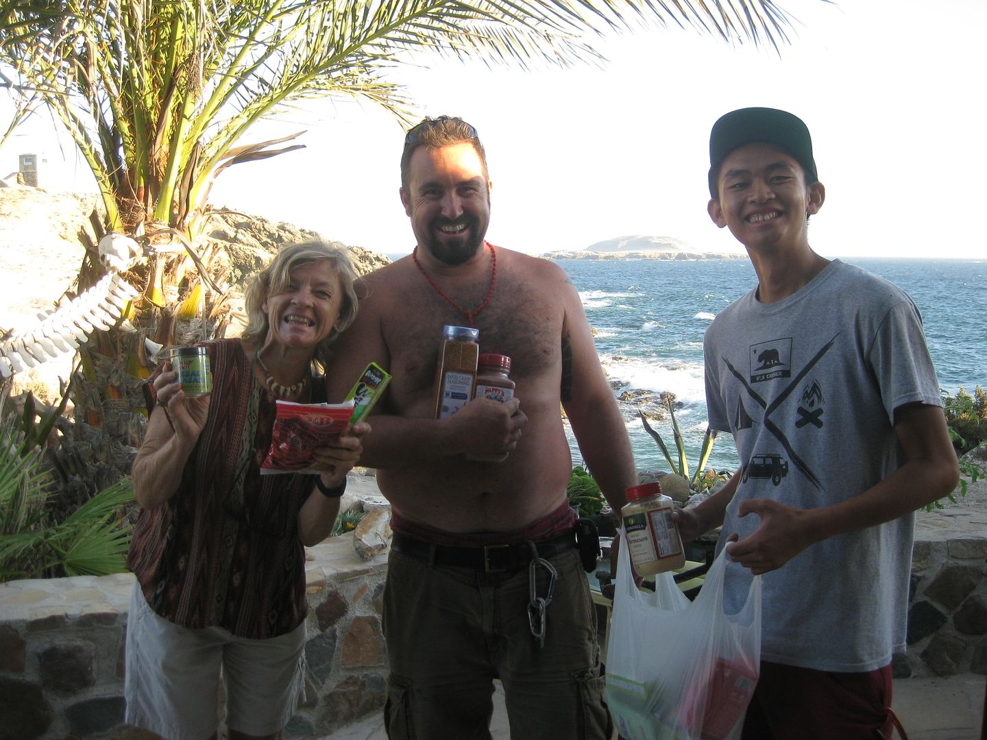
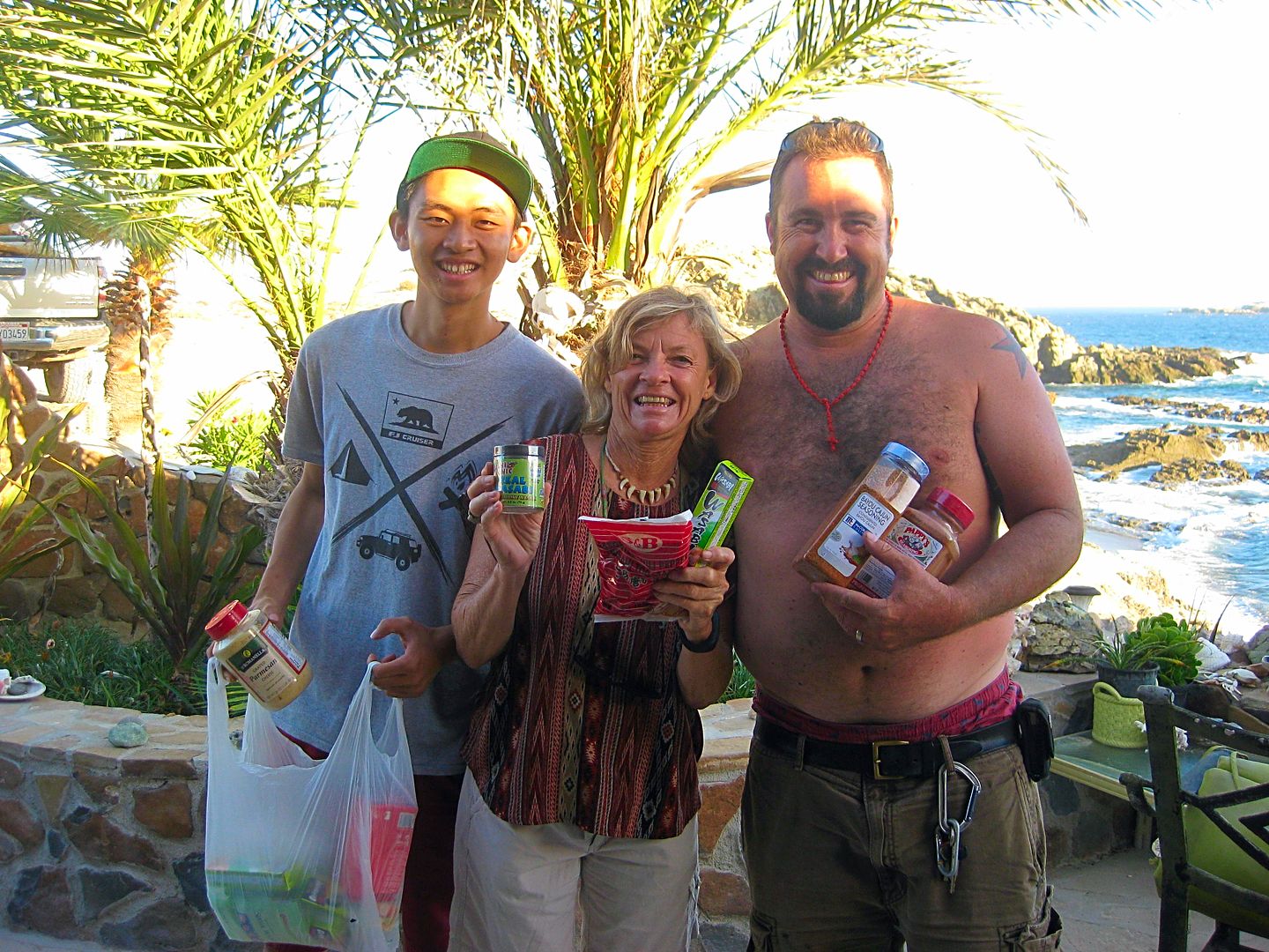
Jesse had communicated with Shari on Facebook before the trip and asked her what she would like from up north... and delivered them to her.
After seeing the incredible rooms, we all elect to stay in the rooms at Shari's instead of camping at the campground. A big meal is planned for the
next night. We stay in Asuncion two nights.
Viva Baja!
It is the eve of Mexican Independence and we join Shari going into town to celebrate. The night was a hit with lots of good cultural exchange between
our group and the people of Asuncion. Jesse had the best tamales and incredible empanadas served on the street. See Ham's video for more of the fiesta
that included fireworks, the first year they replaced gunfire, Shari tells us!
===================================================================
Continued with Day 7 (Friday) at Playa Loma, San Roque, Fossil hills, and food feast that night!
[Edited on 9-24-2016 by David K]
|
|
|
David K
Honored Nomad
Posts: 64478
Registered: 8-30-2002
Location: San Diego County
Member Is Offline
Mood: Have Baja Fever
|
|
DAY 8 (Friday, Sept. 16... Independence Day 2016)
We head out with Shari to go to the surfer's beach, Playa Loma, on the way to San Roque.
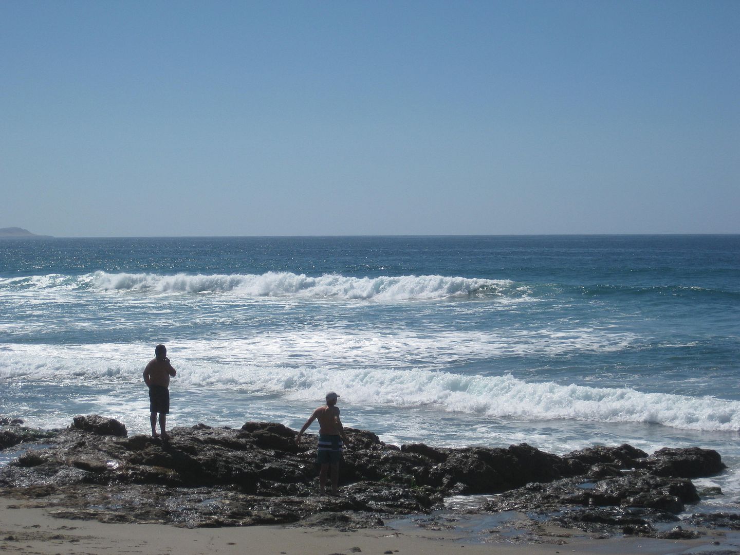
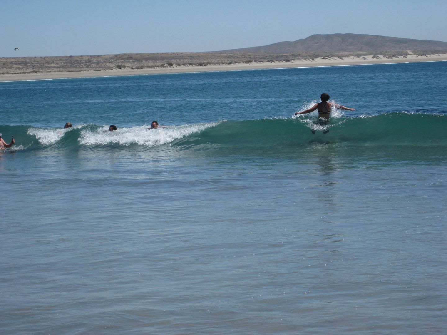
See Ham's video for more. Nick catches some waves along with the local boys.
San Roque...
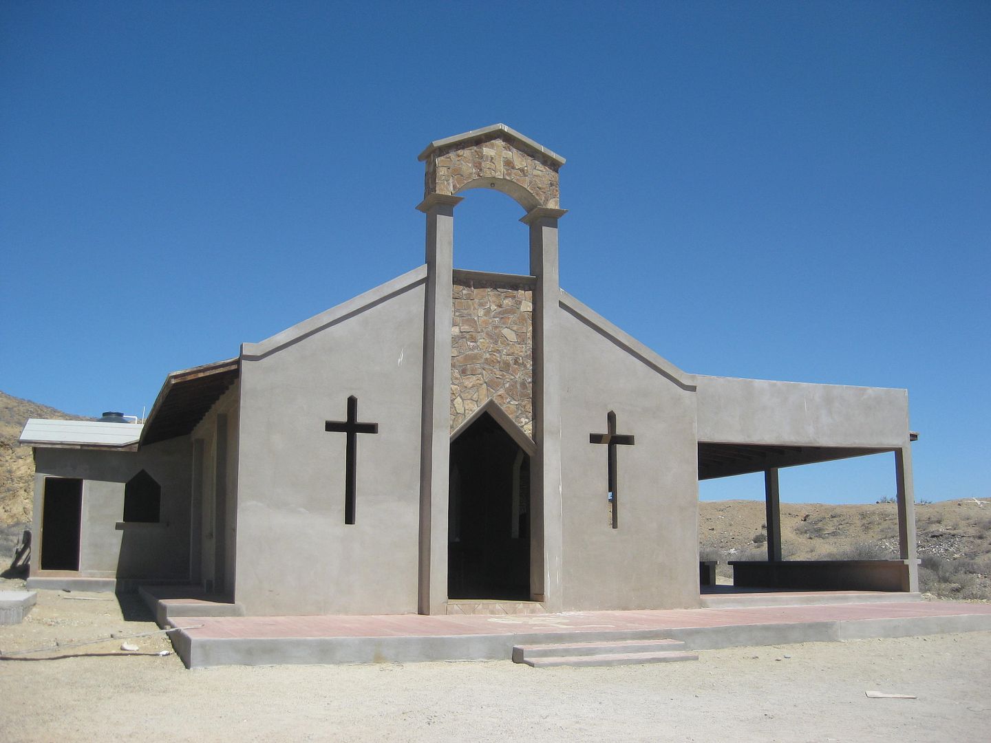
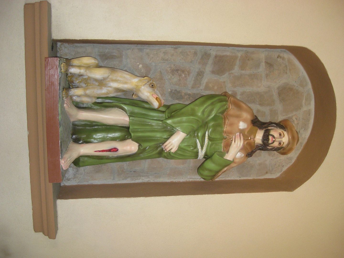
The once ruined church has been brought back to life!
Neither Ham or his sister, Jerry, know how to swim... so they get lessons and have a blast!
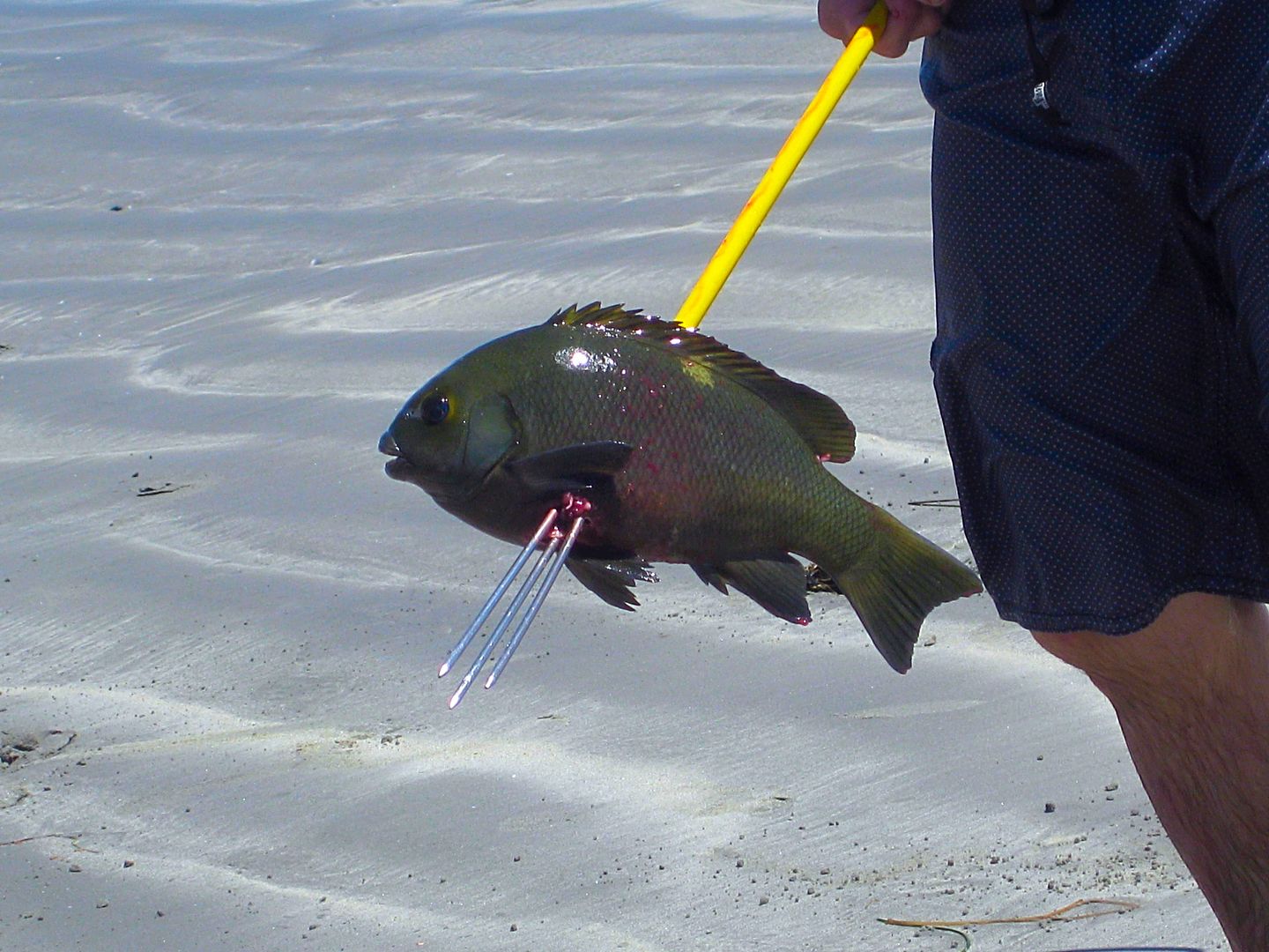
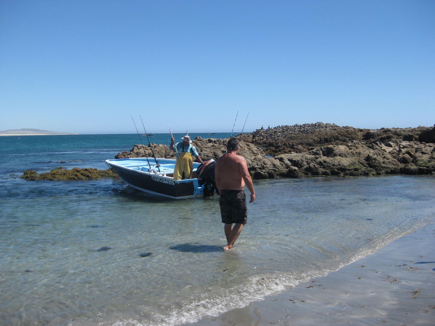
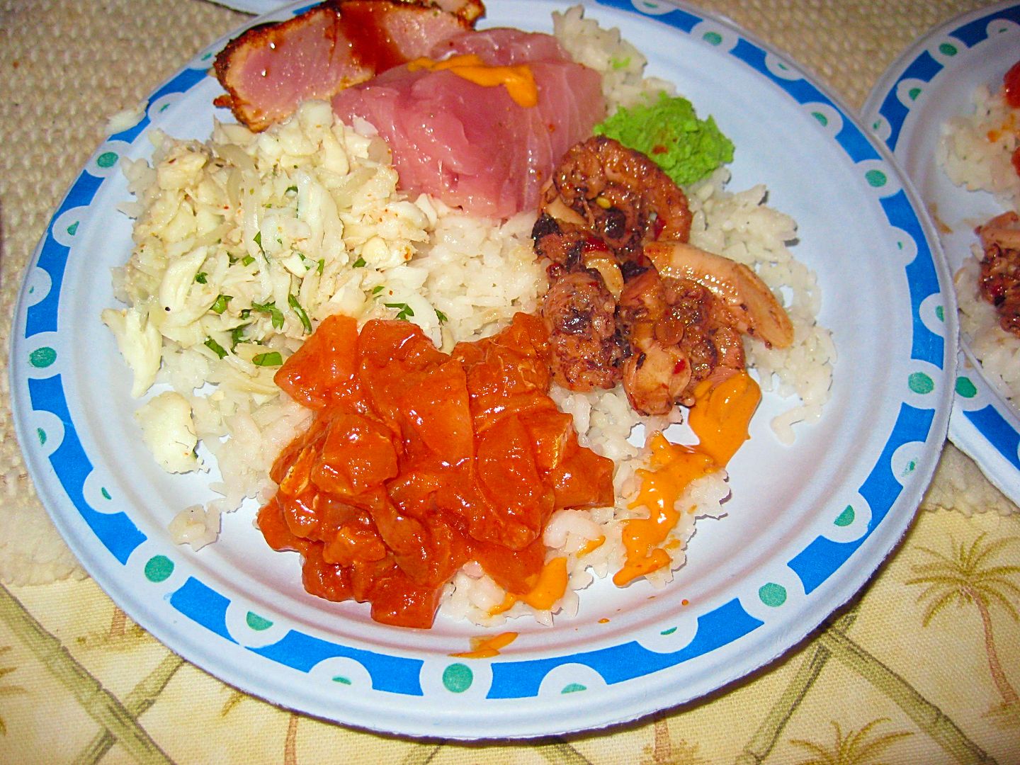
Dinner is delivered! I buy one of the yellowtail just caught so Jesse and Shari have the makings for fresh sashimi!
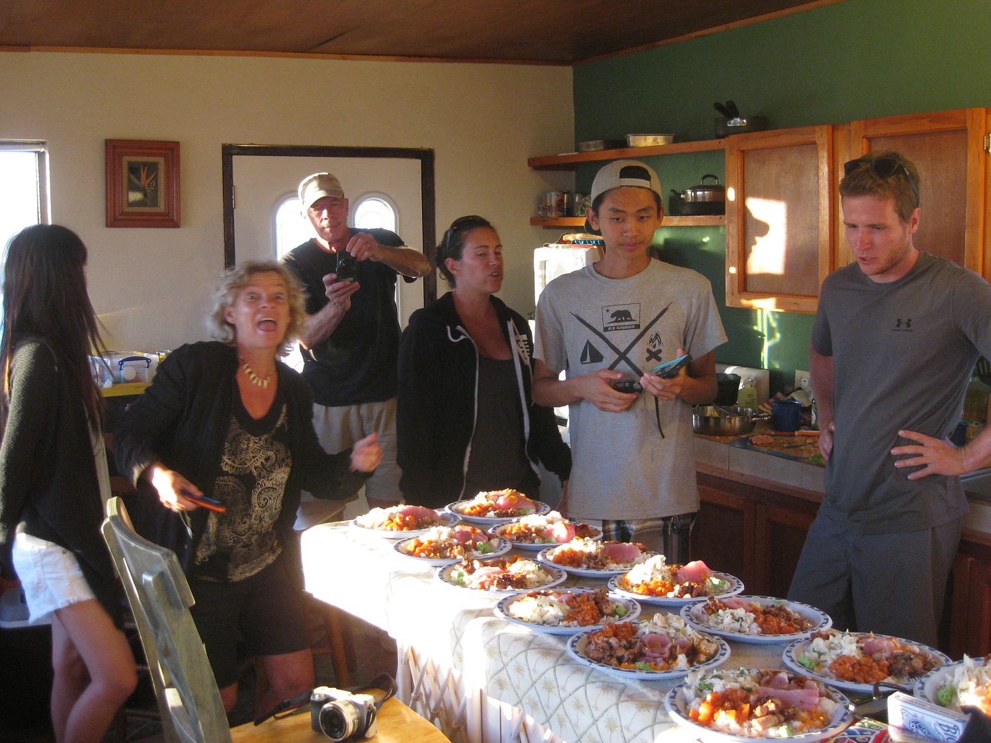
What is amazing as to how professional Jesse whips up a multi sushi meal for 13 people with several different seafood ingredients from Shari and Juan
and the boat at San Roque. Can you tell Shari is happy?
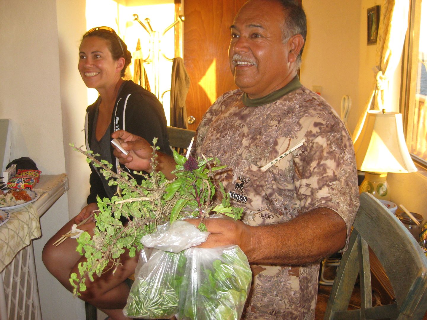
The owner of the Asuncion restaurant (Mari) Tomás and his family join us. He brings fresh herbs and assists the prep.
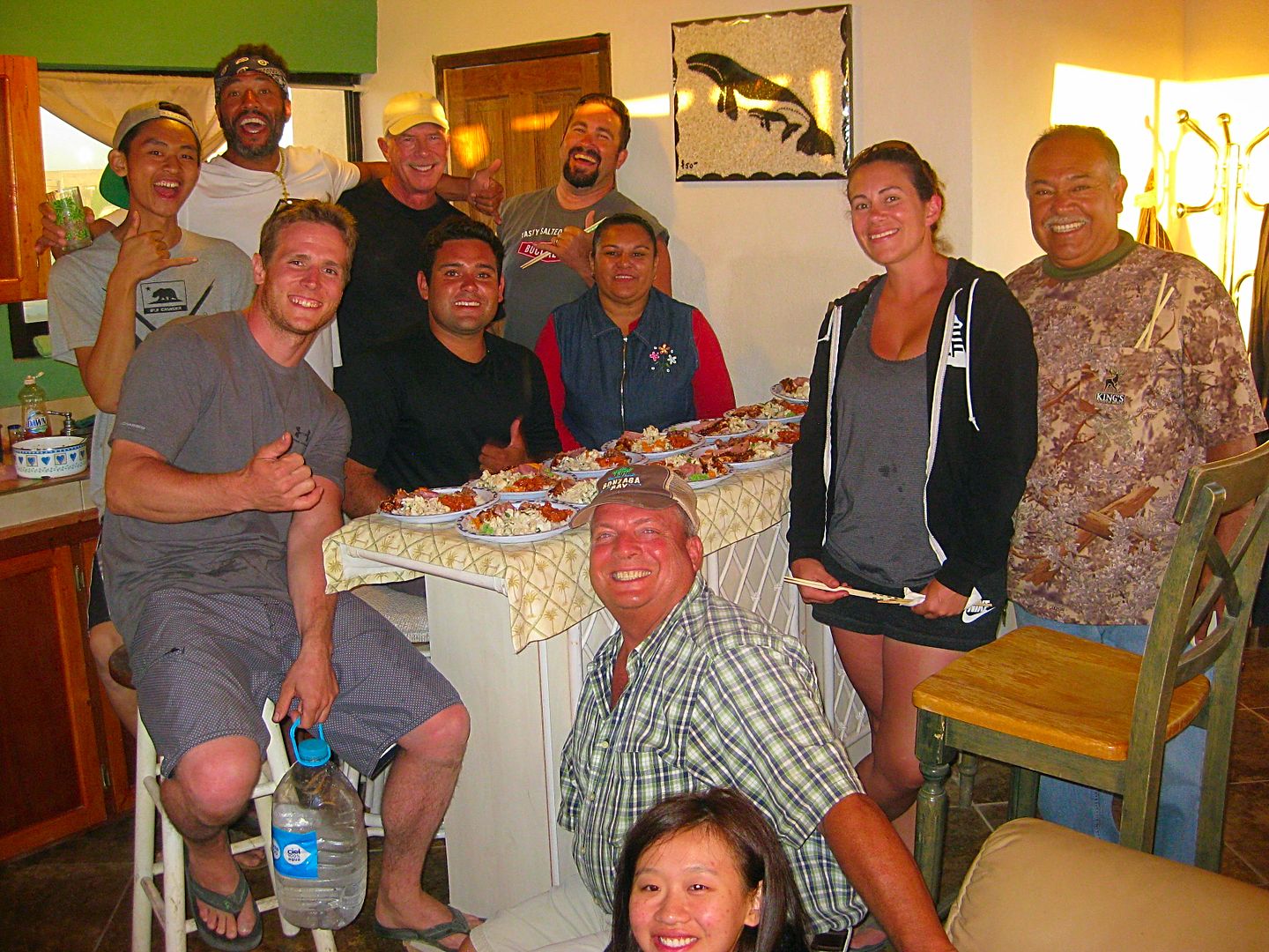
We eat and party well... then a second wonderful sleep at La Bufadora Inn. I am in the Rock room (where Baja Angel and I stayed in 2012, last time
here). Thank you, Shari!
I think there may be future visitors or even homeowners for Asuncion from this group!
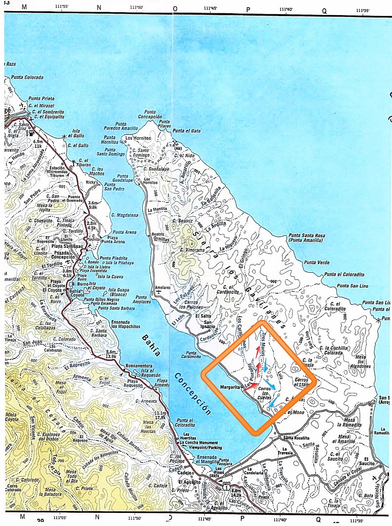
Here is a map of the Vizcaino Peninsula in central-west Baja California, and the road to Asuncion from Highway 1 (the town of Vizcaino is at the
junction). The road is all paved since this map was made. San Roque is just a few miles up the coast from Bahia Asuncion.
A big day driving north to the Las Pintas Fossil Grotto is next!
|
|
|
wessongroup
Platinum Nomad
Posts: 21152
Registered: 8-9-2009
Location: Mission Viejo
Member Is Offline
Mood: Suicide Hot line ... please hold
|
|
Thanks much ... enjoyed it a lot 
|
|
|
David K
Honored Nomad
Posts: 64478
Registered: 8-30-2002
Location: San Diego County
Member Is Offline
Mood: Have Baja Fever
|
|
De nada... still 3 more days to show (Two missions, Las Pintas, La Lobera, and Ron's oyster farm near San Quintin)...
|
|
|
mtgoat666
Select Nomad
Posts: 17289
Registered: 9-16-2006
Location: San Diego
Member Is Offline
Mood: Hot n spicy
|
|
Is this THE palm tree? It looks like the rising sea level killed the tree that used to be next to it. Also, the tree today looks much unhealthier
relative to Sunset picture, salt stress, eh?

|
|
|
wessongroup
Platinum Nomad
Posts: 21152
Registered: 8-9-2009
Location: Mission Viejo
Member Is Offline
Mood: Suicide Hot line ... please hold
|
|
Way cool ... the "green" is something
|
|
|
David K
Honored Nomad
Posts: 64478
Registered: 8-30-2002
Location: San Diego County
Member Is Offline
Mood: Have Baja Fever
|
|
It was pretty to see!
|
|
|
TacoFeliz
Nomad
Posts: 265
Registered: 7-22-2005
Location: Here
Member Is Offline
Mood: Exploratory
|
|
Super nice job on the trip and report David! Looking forward to the next installments.
Self-report: slight case of Baja Fever here...
|
|
|
David K
Honored Nomad
Posts: 64478
Registered: 8-30-2002
Location: San Diego County
Member Is Offline
Mood: Have Baja Fever
|
|
DAY 9 (SAT. SEPT. 17, 2016)
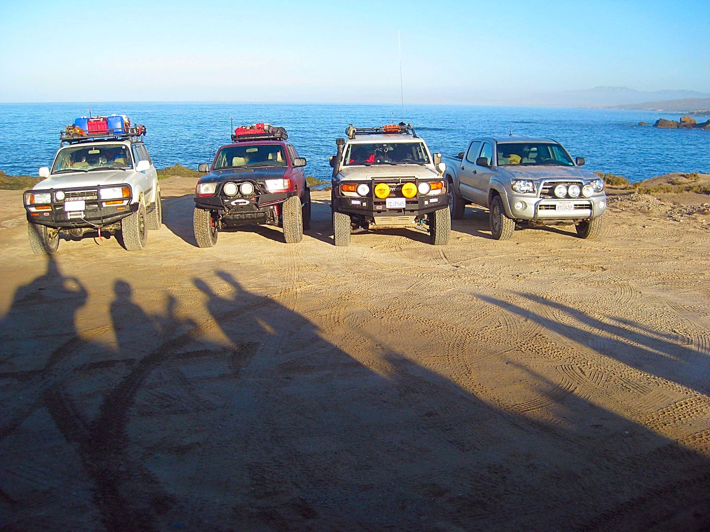
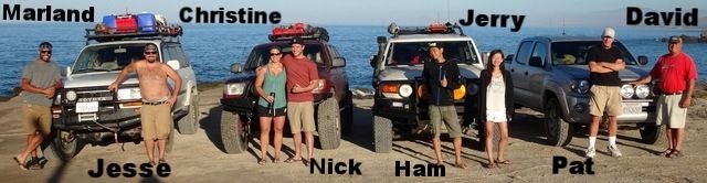
Shari has up line-up our Toyotas for a leaving photo. We exchange hugs and I think some of my friends will be back...
Shari's photo with names added:
The new Pemex at Bahia Asuncion gets our business, but since they have no air line (I found out the day before when I topped my tank), we did air back
up at Shari's with our own pumps.
The paved road from Asuncion to Hwy. 1 at Vizcaino is excellent (in 2012 there was a section of pot holes) and makes the drive easy, for a change.
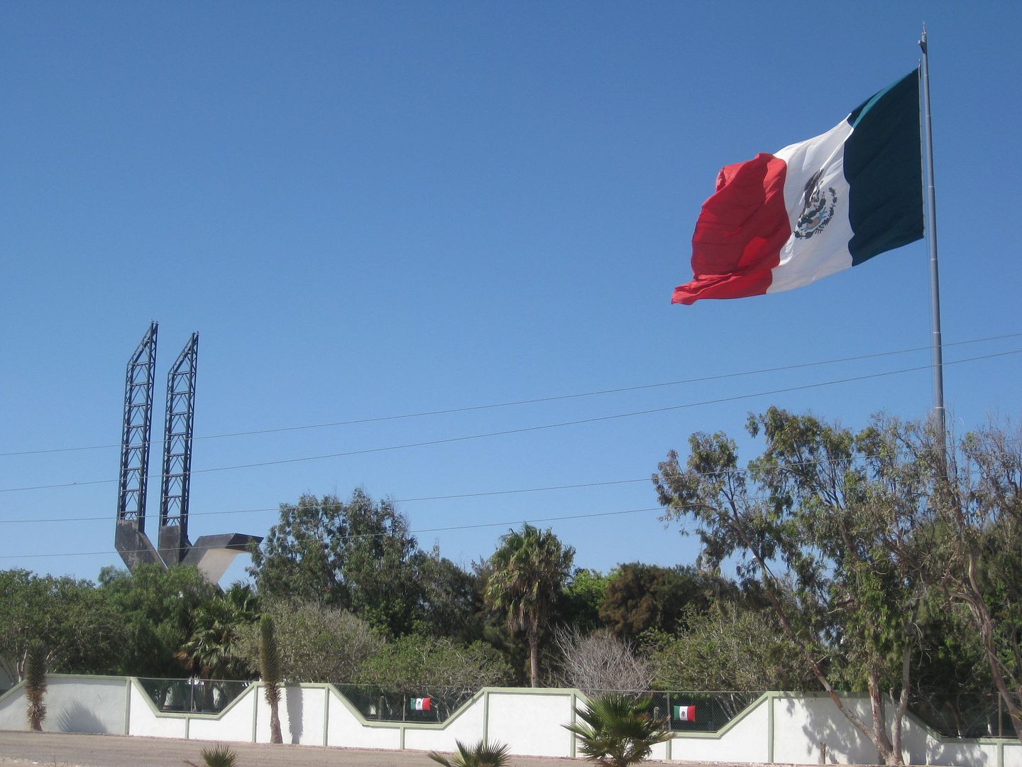
At the Eagle Monument (near Guerrero Negro) state border, there is a big stop sign for the INM office inspection, but nobody is there to look at the
tourist cards we purchased. We stop for some photos of the 140 foot tall eagle, constructed to commemorate the completion of paved Highway One on
December 1, 1973. The president of Mexico was here to "cut the ribbon". Now, a military base has set up at the monument and trees block much of it
from view. It was supposed to be a museum (there's and underground room) of Baja history there, and many donated items to display (including some from
the late Mama Espinoza). Who knows what happened to all of them?
The 28° North Parallel of latitude and border between the two states that make up the peninsula of Baja California.
Looking south after passing the monument...
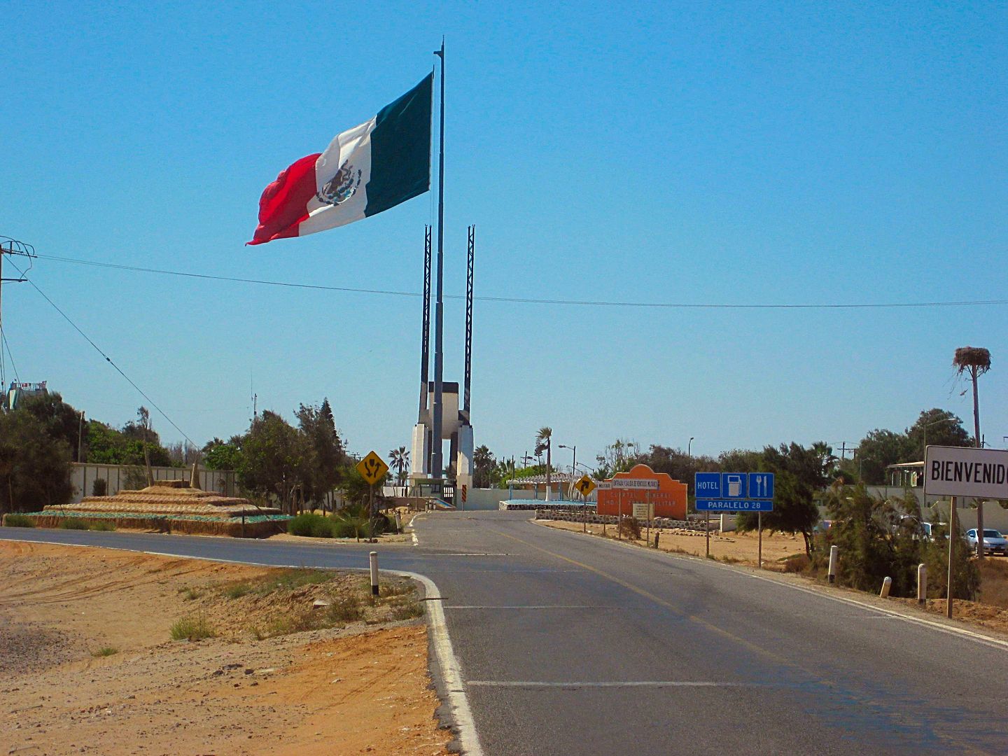
We are in the state of Baja California and back on Pacific Time (so we get back the hour we lost driving south).
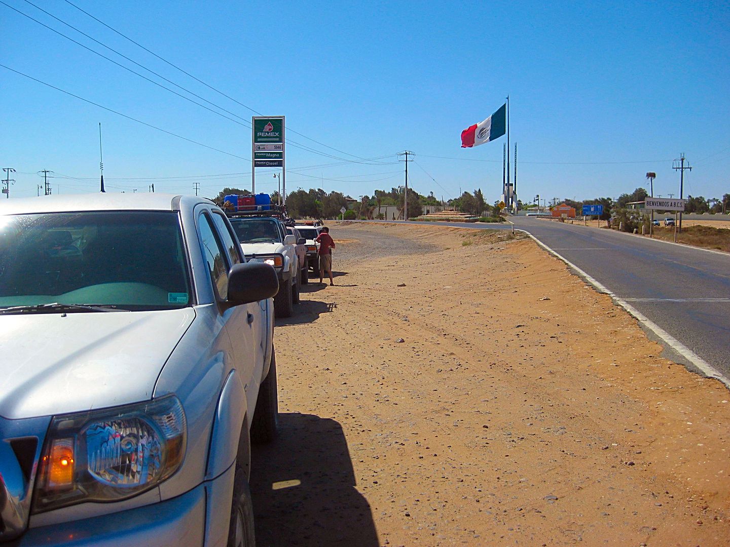
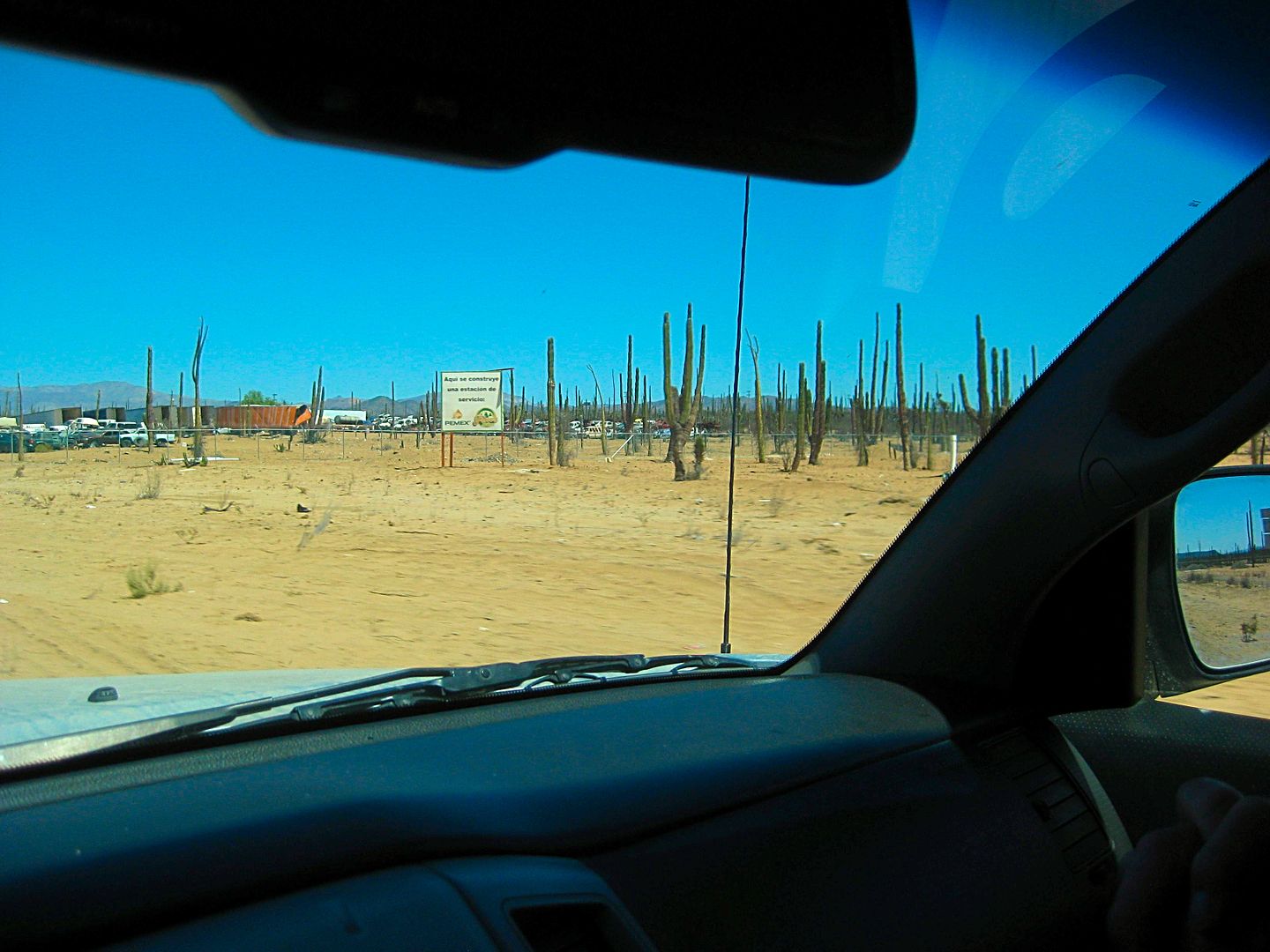
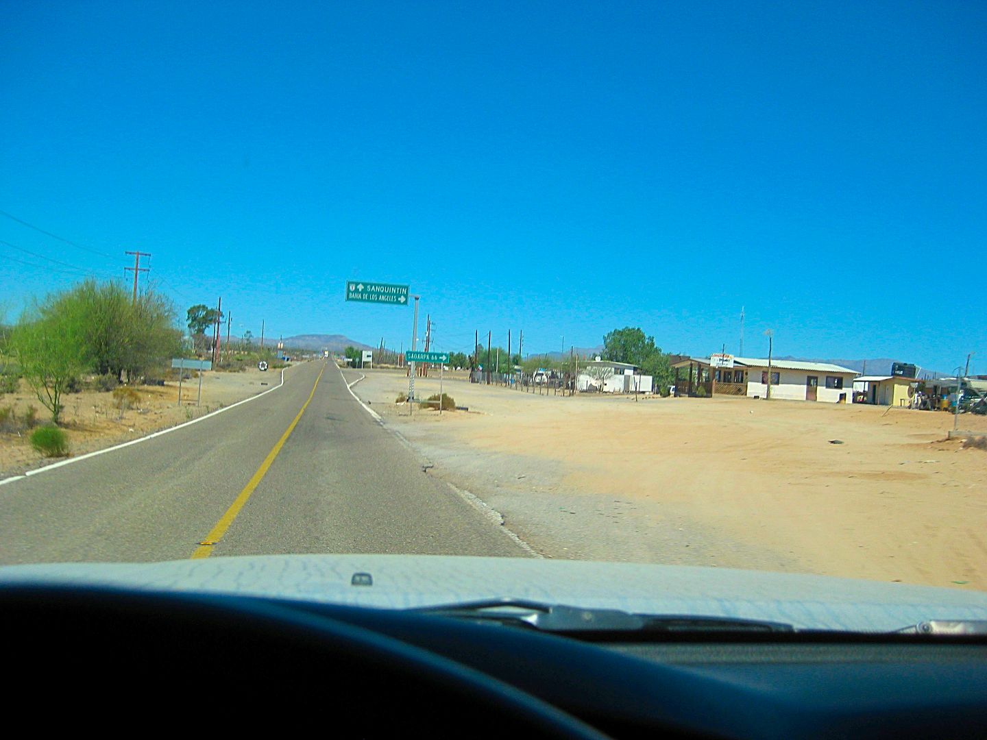
The junction to Bahia de los Angeles (the power lines from Guerrero Negro head east for the bay here). No new work yet on the future Pemex station
signed (to the right of my truck in the photo above this one).
We had decided to take a lunch break, and the pull off at El Crucero came up at about 12:30. This is where we reached pavement coming south from
Gonzaga Bay and Calamajué mission on Day 2. As I mentioned on that day, the ranch at El Crucero (located just out of sight from the highway) was
abandoned. Here is the road north from El Crucero (a major pit area when the Baja 1000 passes this place).
Before the road from Laguna Chapala to Puerto Calamajué was built in 1983, this was the south end of "Hwy. 5" south from San Felipe!
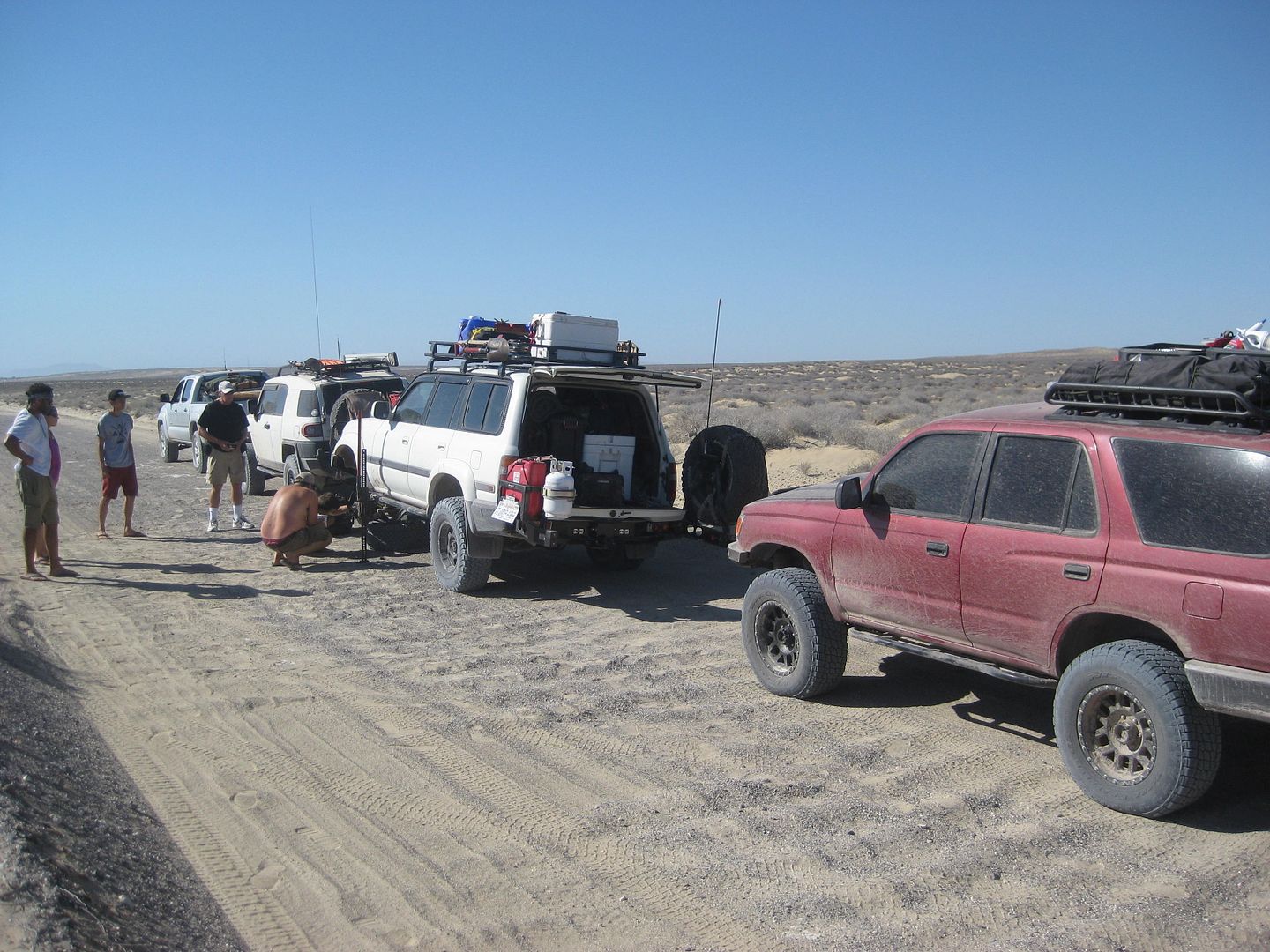
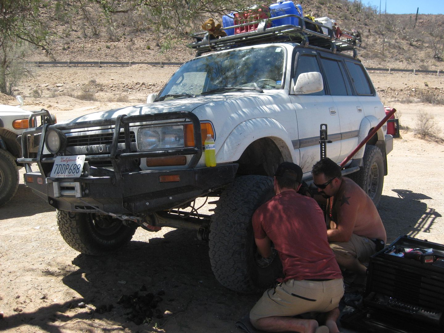
There is one tree at El Crucero, so we gather around it... Jesse has begun feeling the front hub acting up so they use the opportunity to install the
washers they bought at Pro One in Vizcaino to replace those left out by Jesse's mechanic when he had a new bearing installed before the trip.
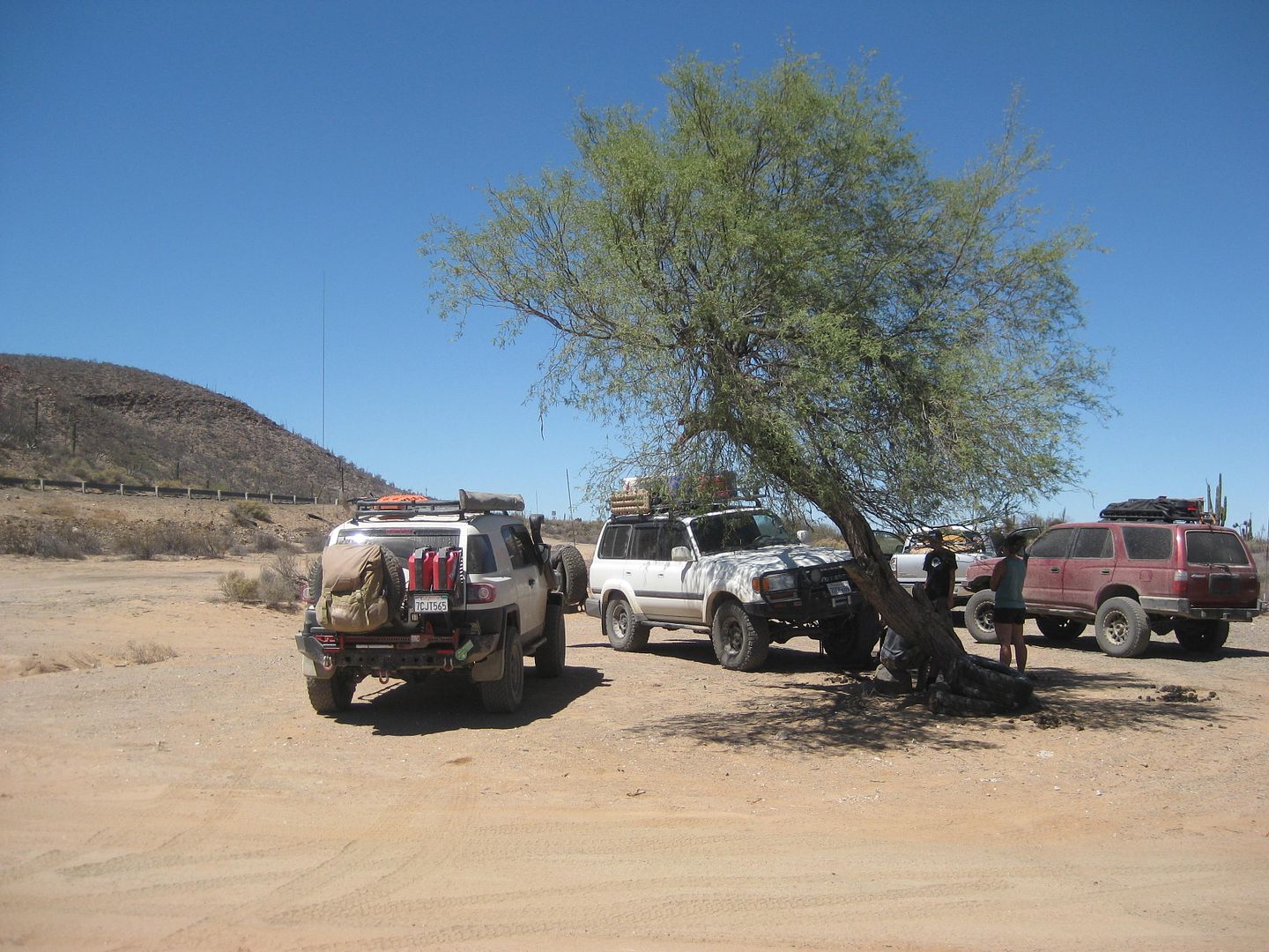
Note Hwy. 1 in the background where it bends around the base of a hill.
We pass slowly through Cataviña and make a stop at Rancho Sonora (by the El Marmol junction) to look at and maybe buy some onyx curios (wind chimes,
figurines, gifts).
Next, a brief stop at the new military checkpoint at San Agustin (located by the long ago abandoned Pemex station).
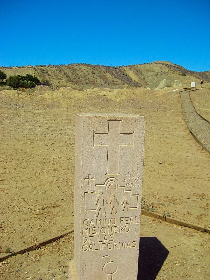
At the abandoned El Progreso Café we turn left for the 2.5 mile dirt road to see Mission San Fernando de Velicatá, the first California mission
founded by Junípero Serra in May 1769 on his long journey from Loreto to occupy the ports of San Diego and Monterey, for the King of Spain.
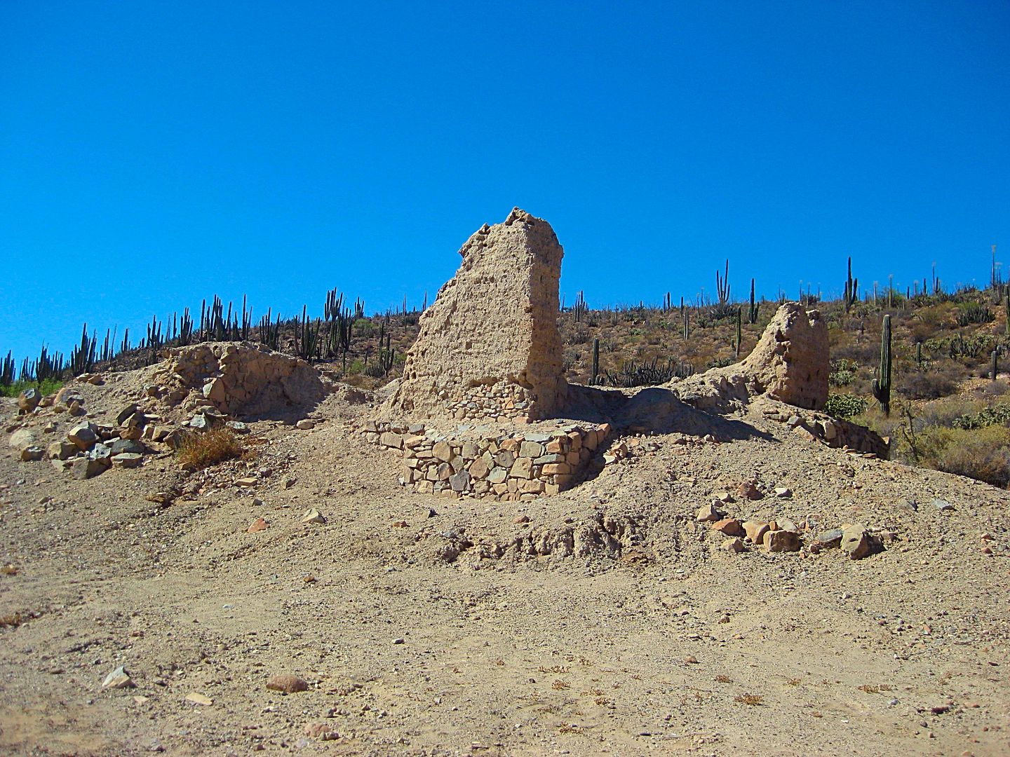
Pat at San Fernando.
The goal for this afternoon is the fossil grotto and petroglyph site of Las Pintas. I had not been there since my birthday in 2010... and I would turn
a year older on this trip at the same location!
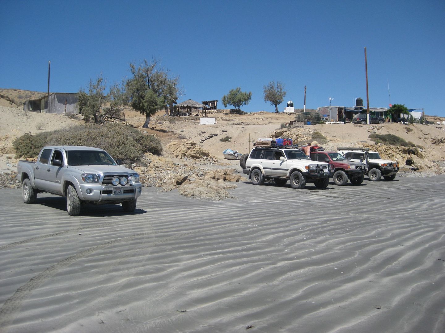
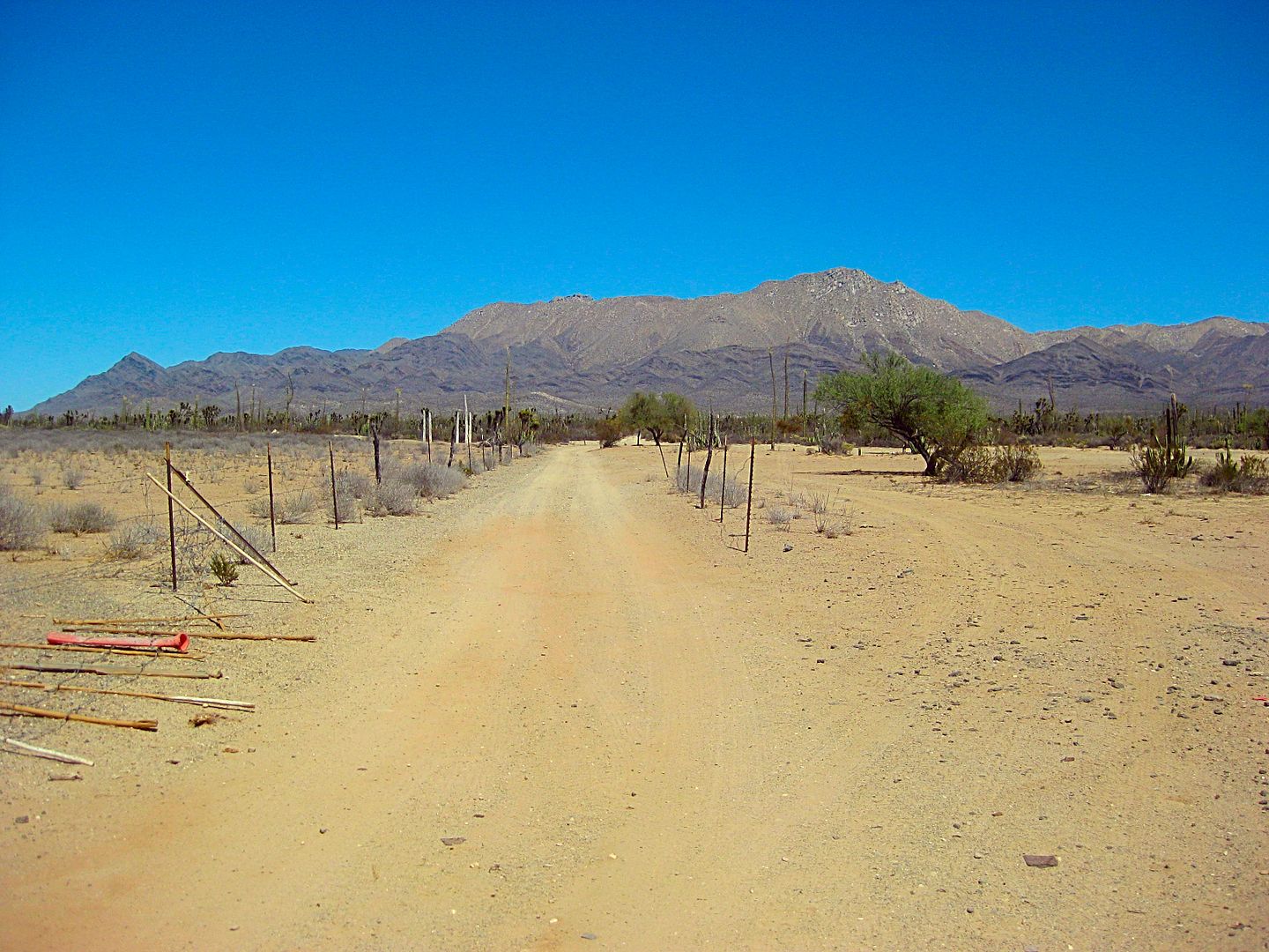
The road we need to use is the one for Punta San Carlos, at Km. 80. We stop there to deflate the tires and it is just over 17 fast miles to the Las
Pintas side road. The others want to do some video recording along the way.
The road to Las Pintas (7 miles long) is far far dustier (silt) than 6 years ago.. and less used, too. There was some new ranch oriented building near
the site, but we saw nobody else in there.
It is getting late, and we decide to camp at the lower end and let the others explore as much as they can before it is dark, plus any time in the
morning before we leave for San Quintin.
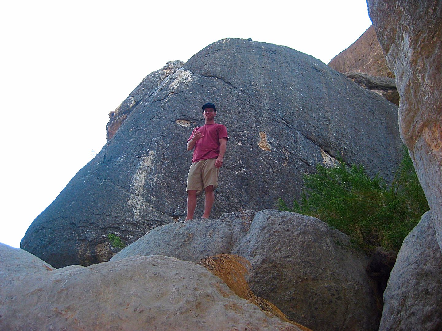
Nick gets up the boulders with ease.
I begin documenting as much as I can get to while there is still enough light. I first came to Las Pintas in 2000 and have been back many times. Each
time seeing new things, it is that impressive a site.
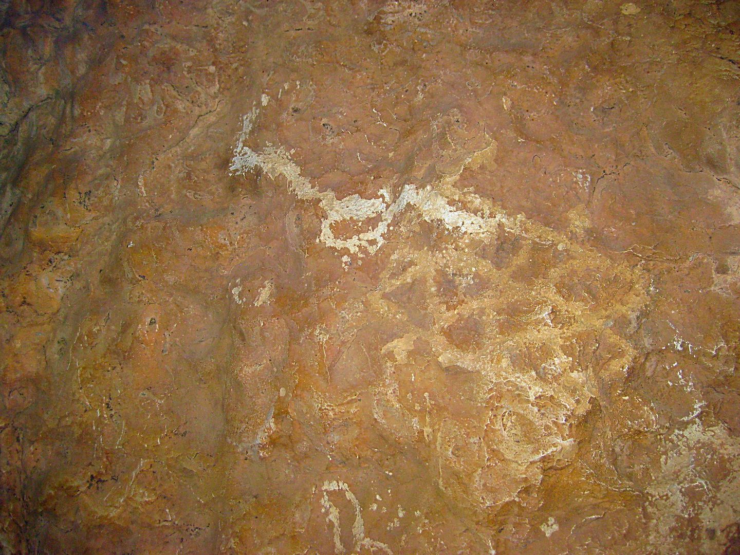
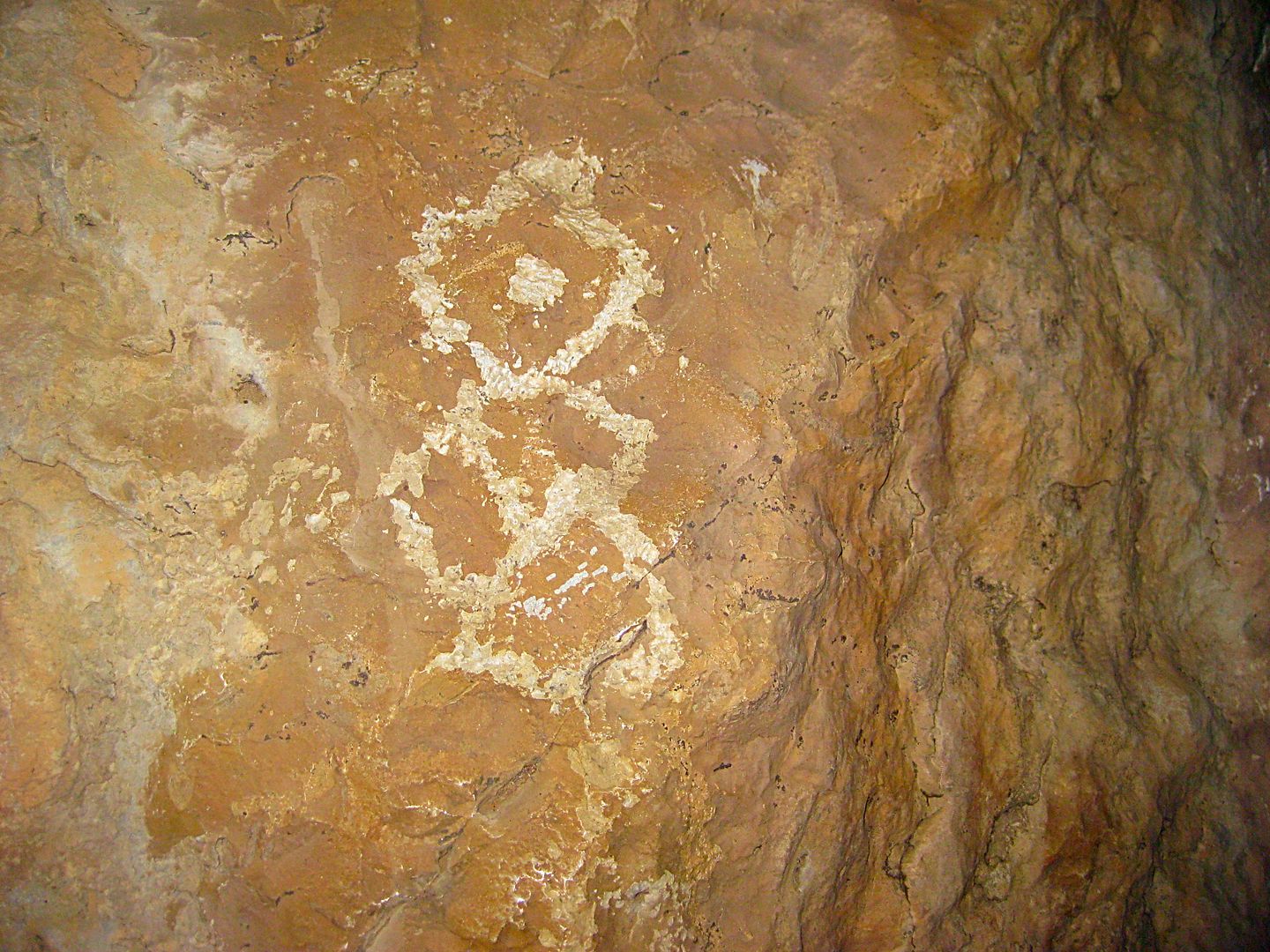
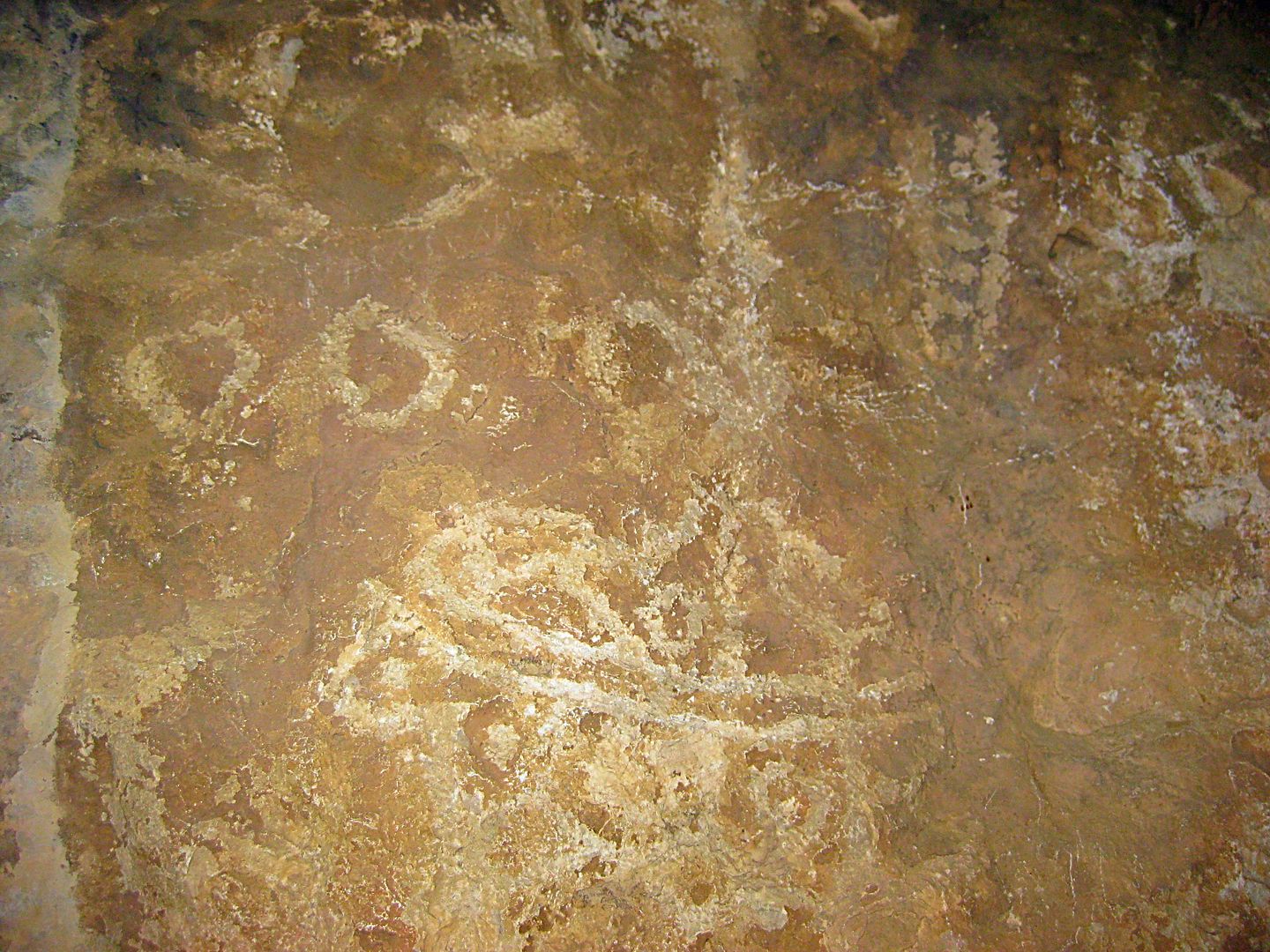
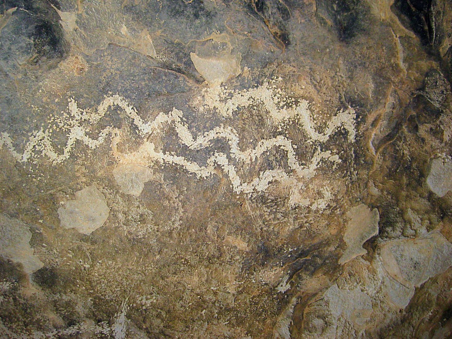
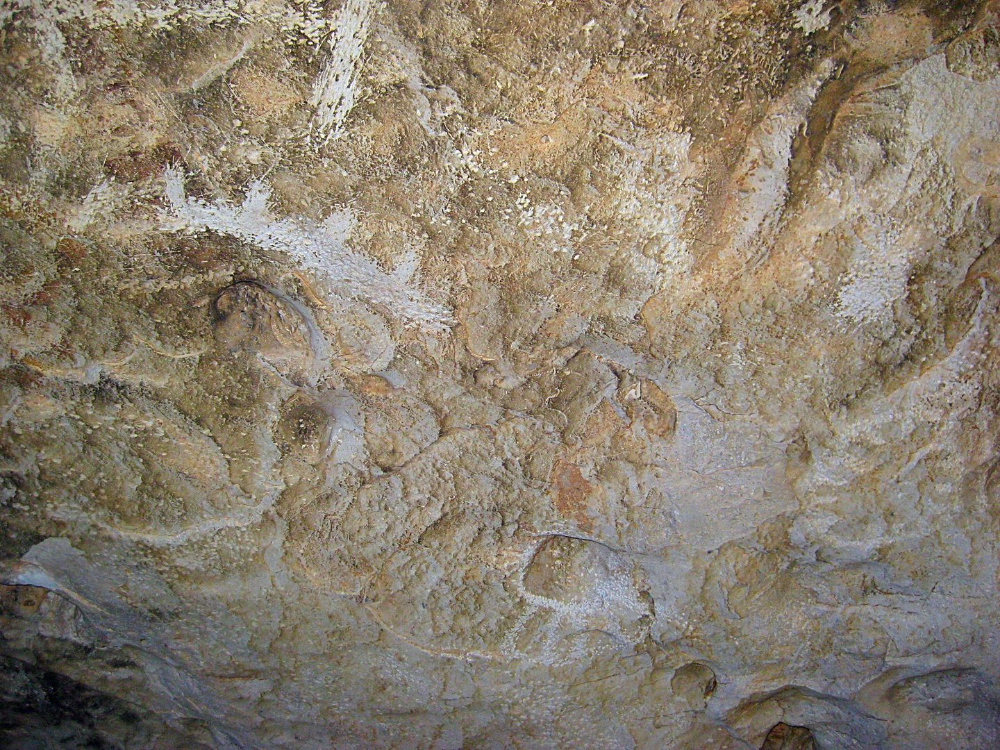
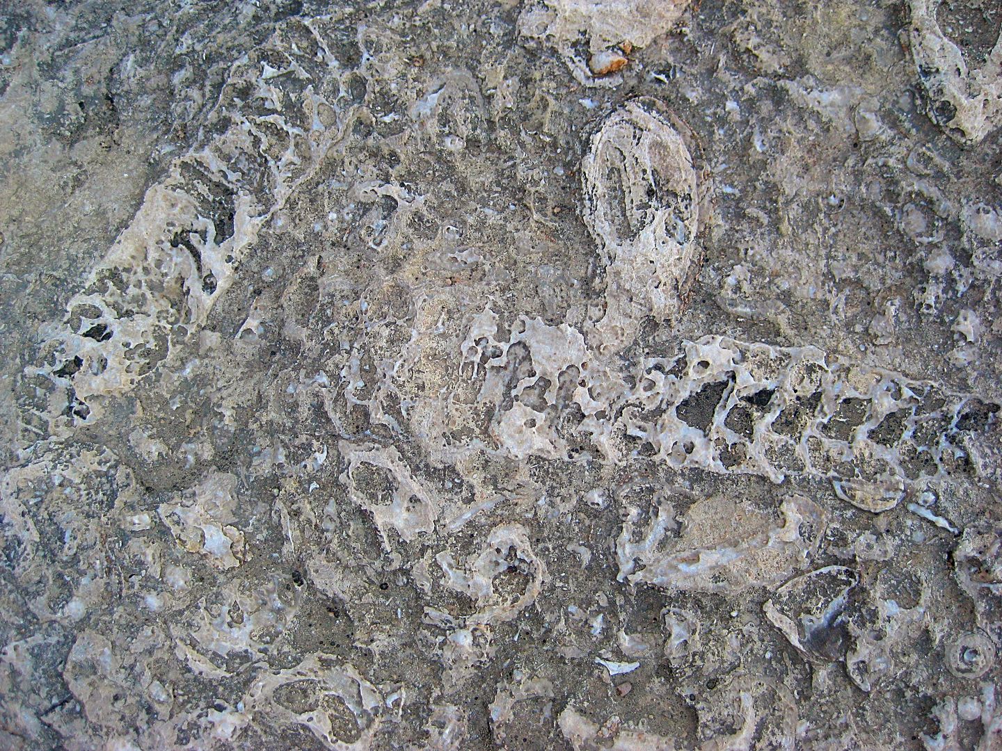
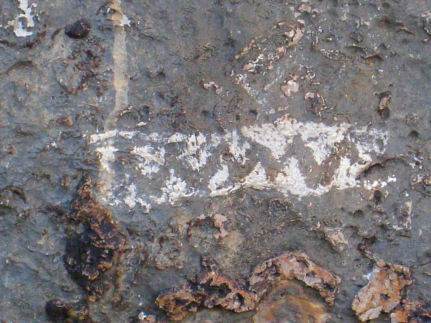
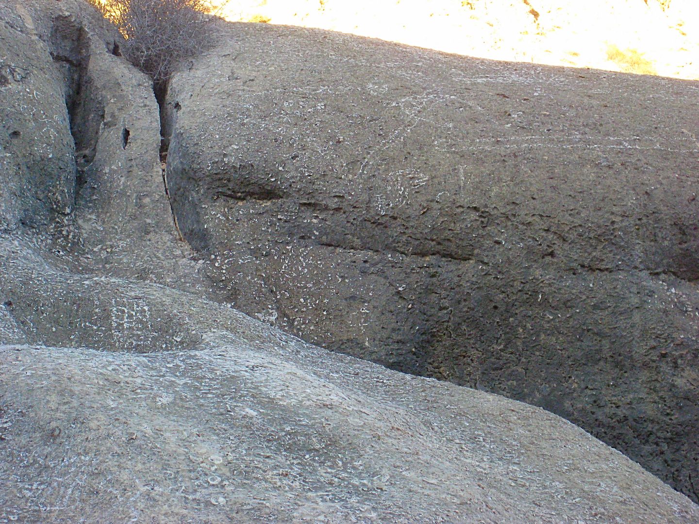
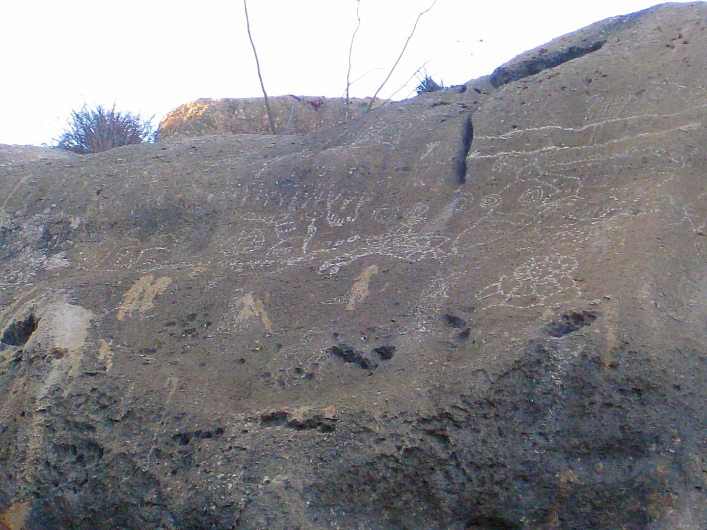
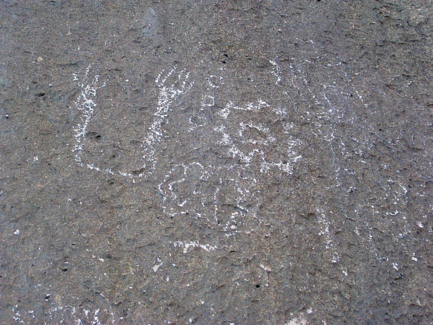
The rock art at Las Pintas may be some of the oldest on the peninsula, dating from 1000 to 3,000 years ago. [Gloria Garvin, Seven Rock Art Sites in
Baja California, edited by Clement Meighan,1978].
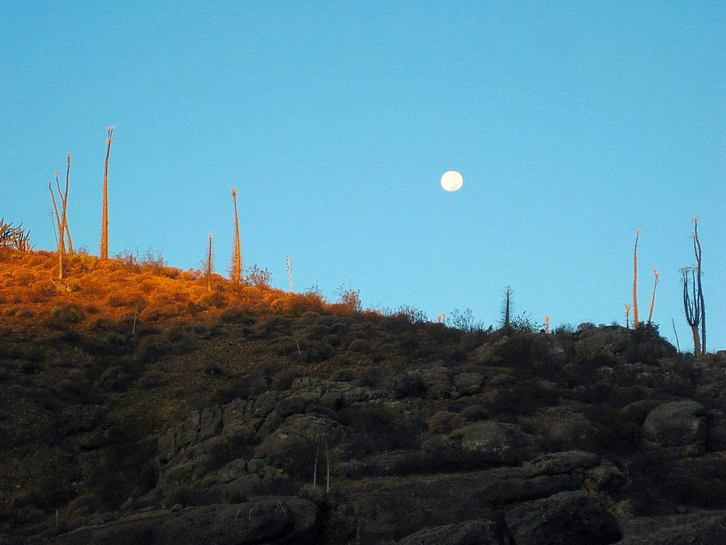
It is a fantastic evening... no wind, no bugs, just a perfect camp night in Baja!
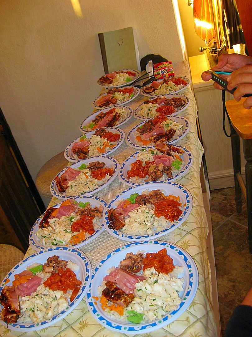
Chef Jesse makes each of us a Dutch Oven Pizza! Amazing!!! See it in Ham's video. It is a great campfire night.
==============================================================
|
|
|
4x4abc
Ultra Nomad
Posts: 4163
Registered: 4-24-2009
Location: La Paz, BCS
Member Is Offline
Mood: happy - always
|
|
the wheel bearing story
wheel bearings need grease for lubrication and a certain preload that keeps the rollers at predetermined distance
if the preload is not kept, the surface hardening of the bearing parts (rollers and races) is destroyed.
Retightening the bearings will get you home or to a shop. There they must be replaced for a safe future (your's).
driving home to California with the damaged bearings? That might be stretching your luck.
Harald Pietschmann
|
|
|
David K
Honored Nomad
Posts: 64478
Registered: 8-30-2002
Location: San Diego County
Member Is Offline
Mood: Have Baja Fever
|
|
Nick was on top of it, Jesse got home ok. I am sure he gave hell to the mechanic who left out the two washers!
|
|
|
David K
Honored Nomad
Posts: 64478
Registered: 8-30-2002
Location: San Diego County
Member Is Offline
Mood: Have Baja Fever
|
|
DAY 10 (Sunday Sept. 18, 2016) Part 1
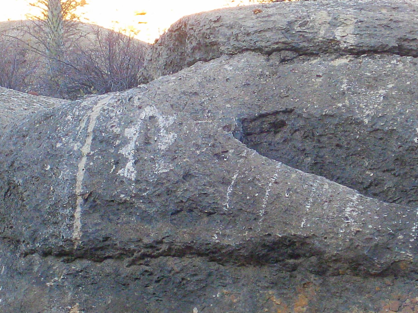
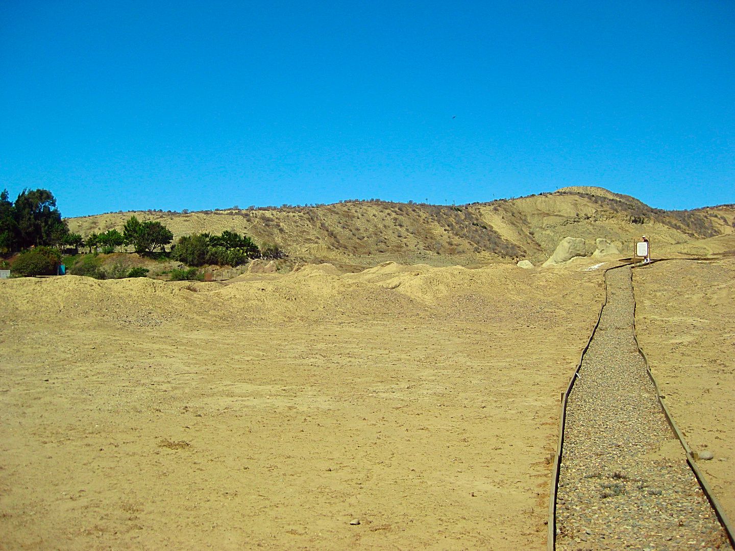
It is a glorious day in Baja, at an ancient aboriginal shaman ritual site, maybe 2000 years or more old, what could be better... and it was my
birthday, too! The fossils of oysters and other sea creatures are everywhere, as well... Talk about real sea level rising! We are 20 miles away from
and 1,000 feet higher than today's ocean.
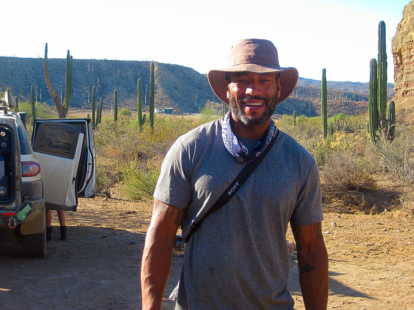
Greeting me was our resident Hollywood actor, Marland Burke ...
Back to Hwy. 1 at Km. 80 (14 miles from El Rosario) we stop to do a final airing up of our tires. It takes about 15 minutes overall, as we all have
fast air pumps.
Pat wants to see as many missions as possible and it just so happens that one is just a block from the highway in downtown El Rosario!
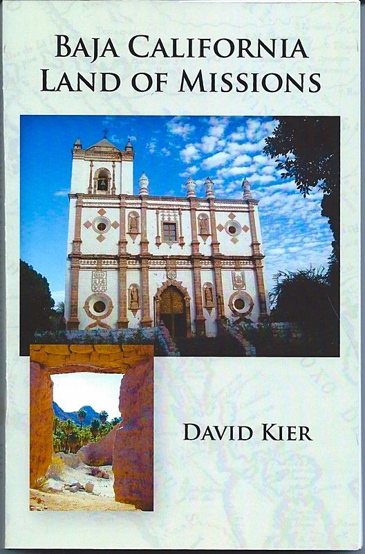
El Rosario was the first Dominican founded California mission, July 24, 1774 by Padre Francisco Galistéo. The story of this and the other 27 missions
of Baja California are all told in my new book (published Feb. 2016) 'Baja California Land of Missions' available from the publisher at www.oldmissions.com (free U.S. shipping, no tax added) or from distributors such as Sunbelt, Discover Baja Travel Club, Mission San Luis Rey,
Amazon.com, Barnes & Noble, etc. Thank you for your support of my historical research in the land that was California first!
Each vehicle in this Baja Extreme tour received a complimentary copy as my token of appreciation for trusting me to show them Baja places so few go to
and making these 11 days a blast to travel.
I am happy to discuss Baja via email or PM anytime!
We drive a short distance more and stop at the Baja Cactus Pemex station in El Rosario for a final fill up to reach the border. The price was
consistent all through Baja on this trip. At the exchange rate we got pesos at, a week before the trip (17.805: dollar), the price per gallon of 87
octane Magna was $2.97. I took on 13.4 gallons since Villa Jesus Maria (246 miles) and my mileage was 18.2 MPG, which was great considering the heavy
load and four wheeling into and out of Las Pintas. It has to do with using pure gasoline and not the ethanol diluted stuff we have in California!
Leaving El Rosario, we climb the steep grade to the top of the mesa and a military checkpoint (the last one of the trip)... 6 miles from El Rosario is
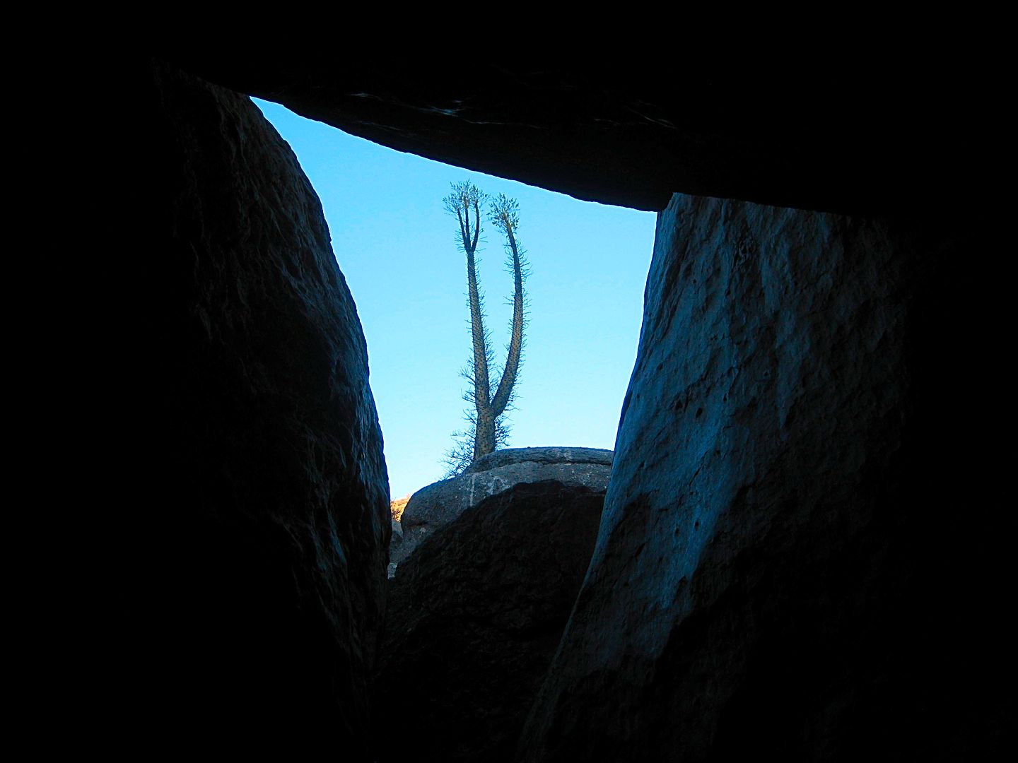
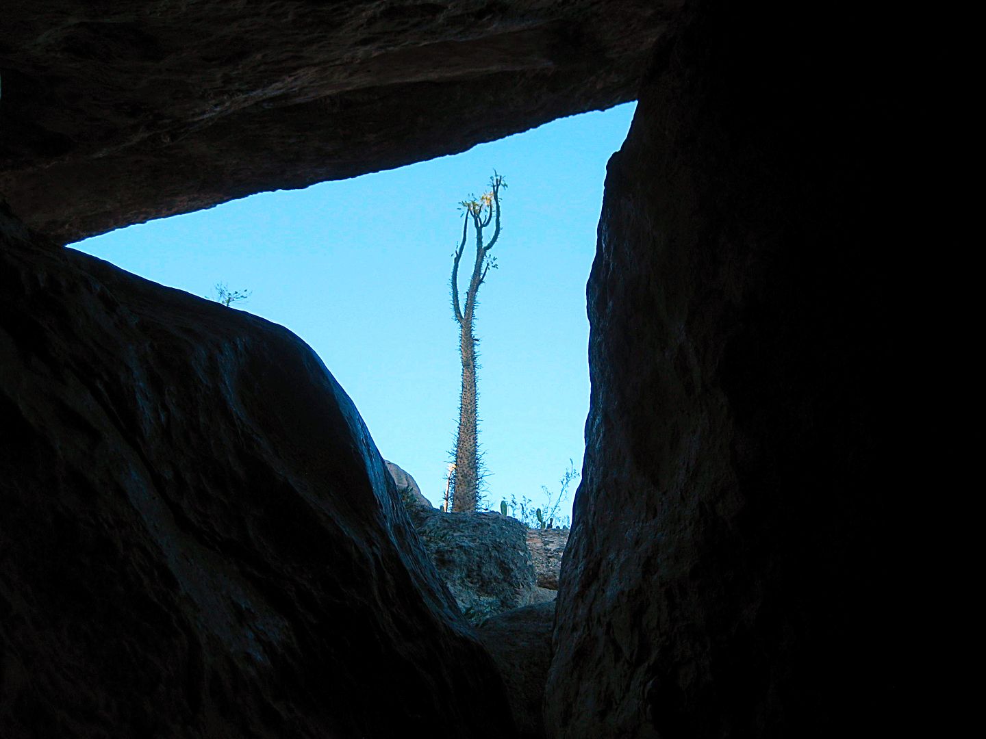
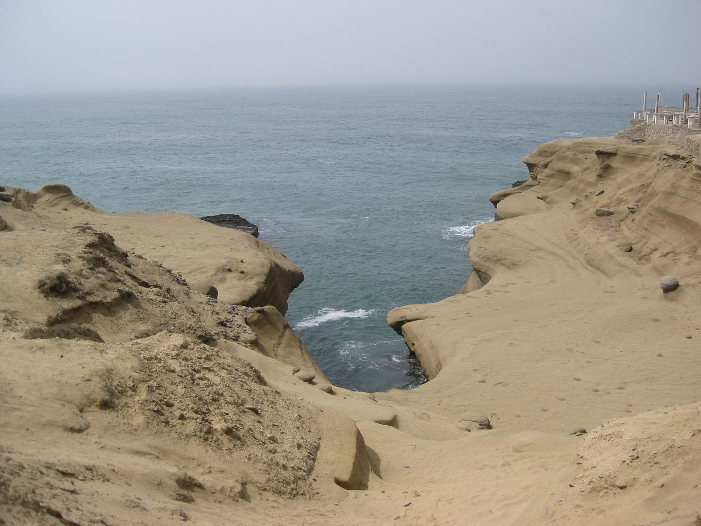
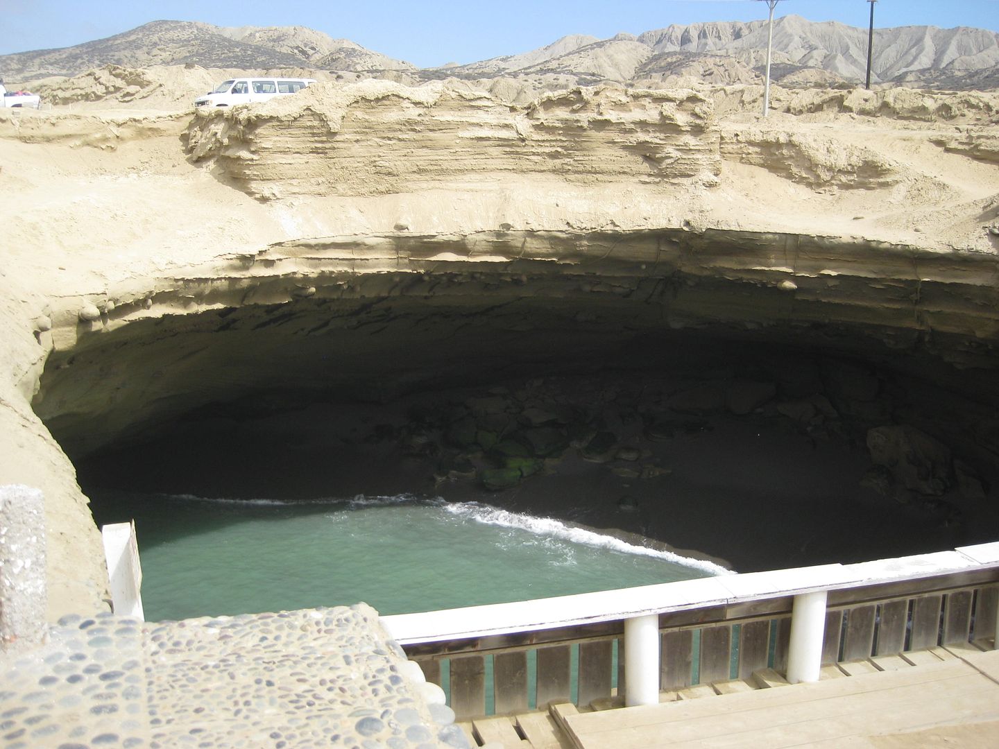
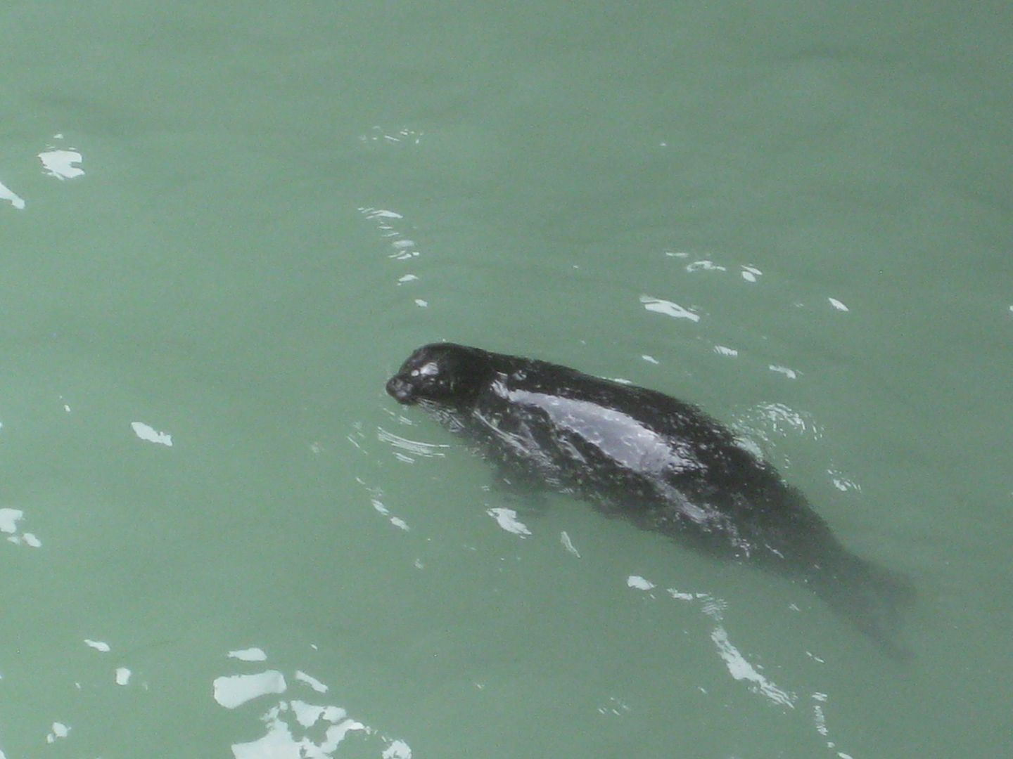
the signed road to La Lobera, the sea lion crater. It is 3 miles of very dusty driving and there is a rough detour at the arroyo crossing... passenger
cars should no longer attempt this road. The seafood project has been abandoned here... the strong swells damage the intake pipes needed to circulate
fresh sea water to the abalone, lobster, and other things being raised here... in the structure just beyond the crater.
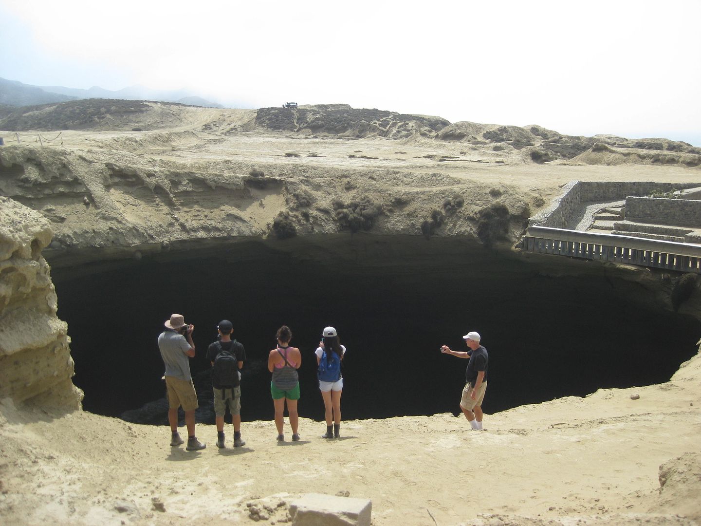
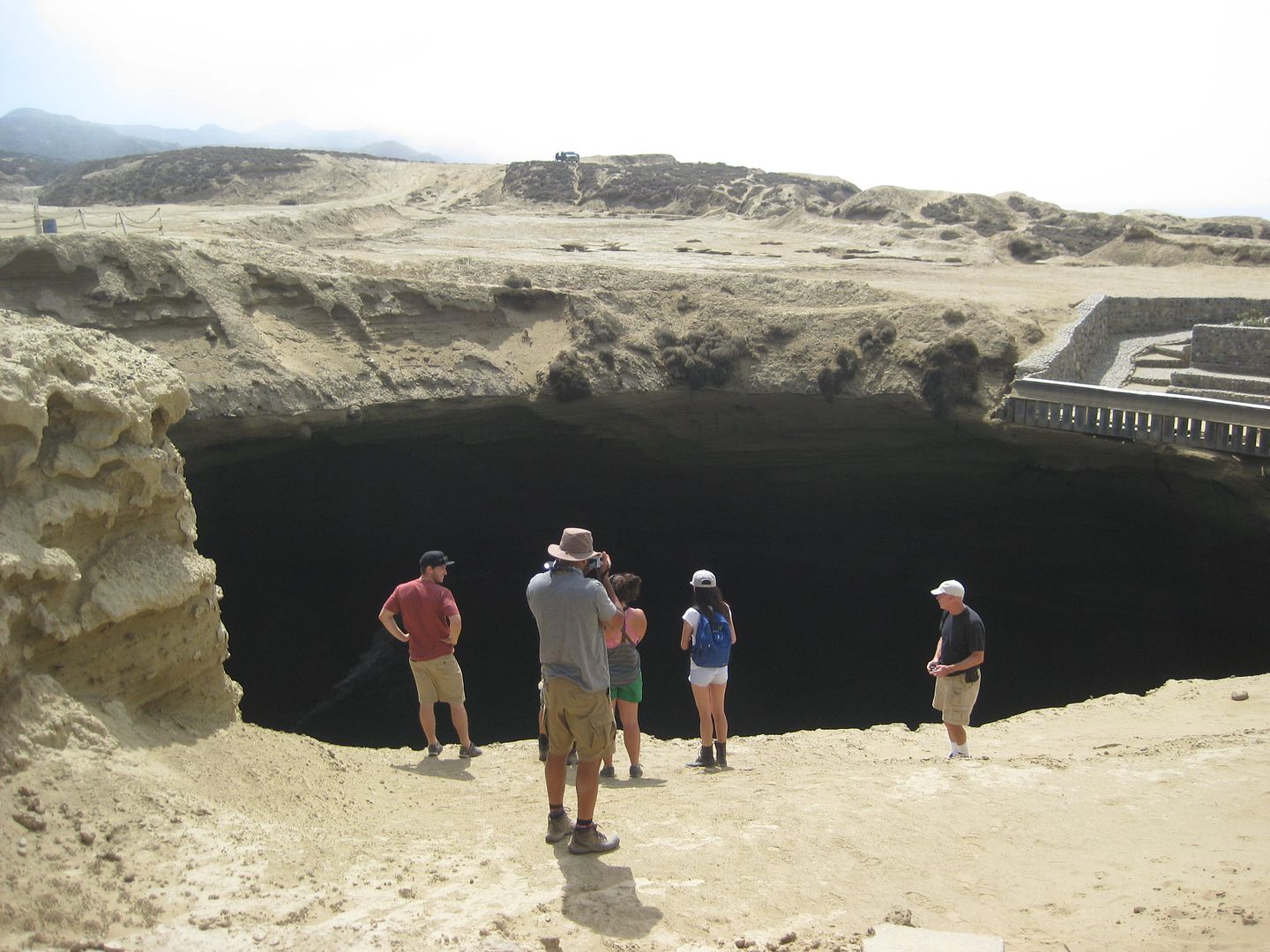
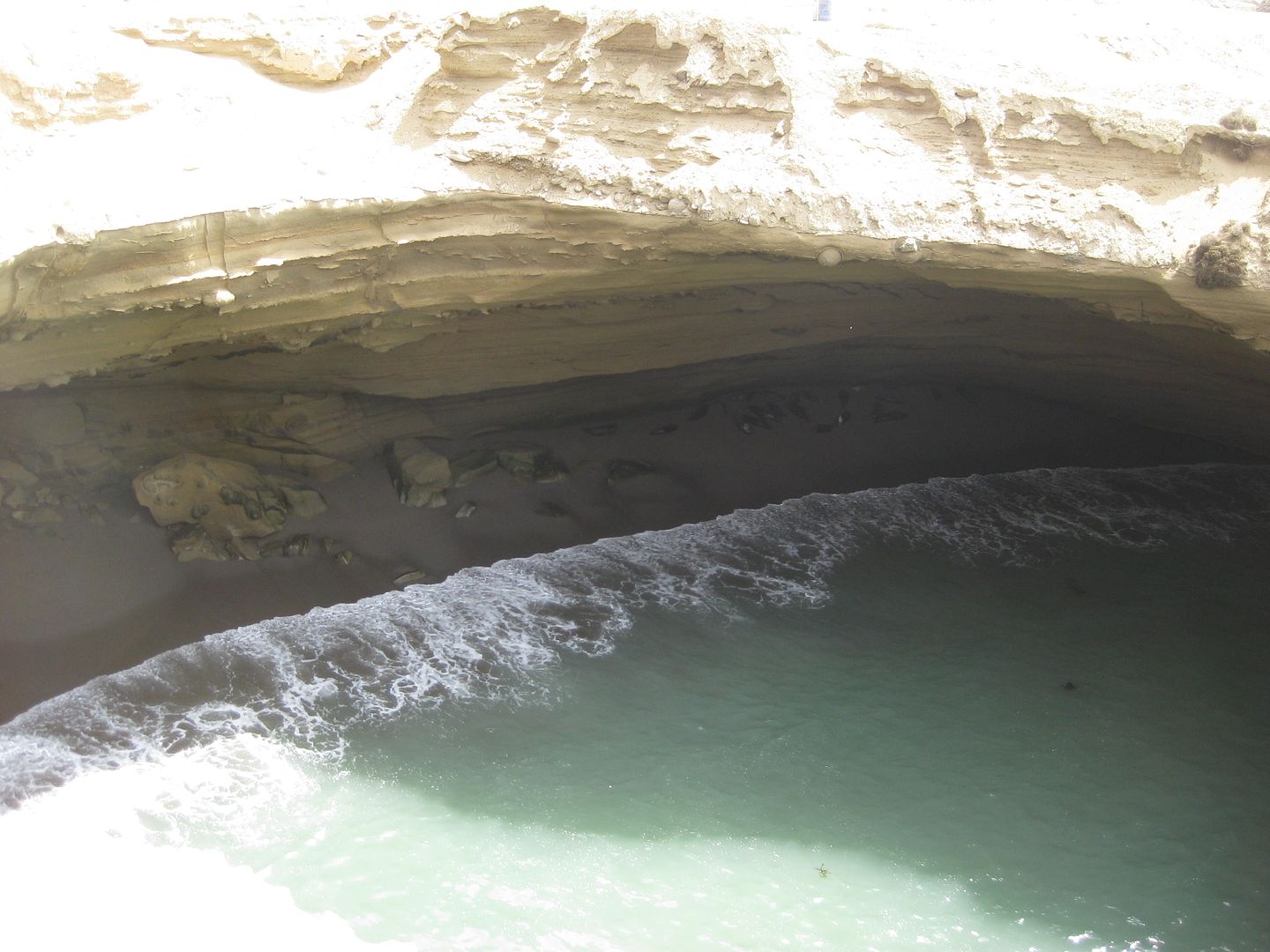
The cave leading into the crater is below here.
Coming up next... to San Quintin and Ron Hoff's Oyster Farm and Limpet Project...
|
|
|
| Pages:
1
2
3
4
5
6 |
|