| Pages:
1
2 |
Bajaboi
Newbie
Posts: 12
Registered: 12-10-2016
Member Is Offline
|
|
New road signs at Puerto San Francisquito
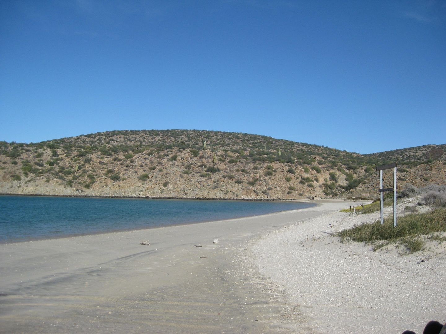
Hola a todos!
Me and the gf just made it back from our road trip from San Jose, CA to Puerto San Francisquito; going down we drove to Ensenada and stayed the first
night at Vinas del Tigre, 15 min off the HWY 1 on the old Ensenada-Tijuana libre road. Plenty of little cabins and camping available with bathrooms.
Ask about their in-house winery tour and special Mezcal! http://www.vinasdeltigre.com/
We then crossed over to San Felipe via HWY 3 and HWY 5 and re-fueled there. The road from Ensenada to San Felipe was pretty decent with some potholes
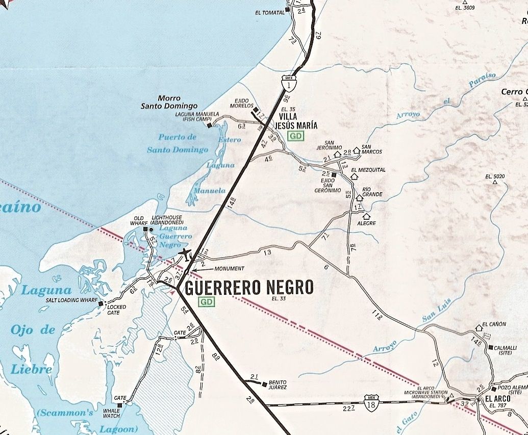
right before arriving at HWY 5. We pushed all the way to Guerrero Negro on HWY 5 and refueled there. The road from San Felipe to Guerrero was
excellent with only a 20 mile portion offroad. We pushed all the way to Puerto SF through El Arco and arrived around 11pm. The road from El Arco to
PSF was in some of the best conditions that I've ever seen it.
Here are the new signs we worked on while staying there; hope this helps folks!
  
[Edited on 4-23-2017 by Bajaboi]
|
|
|
Bajazly
Senior Nomad

Posts: 992
Registered: 6-4-2015
Location: Goodbye Cali and Hello San Felipe
Member Is Offline
Mood: More Relaxed Everyday
|
|
Why for did you go thru GN to get to SF instead of B of LA? Did you go home that way to make a loopish out of it? Sounds like an extremely long day
from Ensenada.
|
|
|
David K
Honored Nomad
Posts: 64480
Registered: 8-30-2002
Location: San Diego County
Member Is Offline
Mood: Have Baja Fever
|
|
The El Arco to San Francisquito dirt road is like a super highway. The L.A. Bay to San Francisquito road has good sections and a few slow sections,
but is rockier and not all 40-50 mph stuff like the road through El Arco from Guerrero Negro.
|
|
|
Bajazly
Senior Nomad
Posts: 992
Registered: 6-4-2015
Location: Goodbye Cali and Hello San Felipe
Member Is Offline
Mood: More Relaxed Everyday
|
|
I don't know, in November coming up from the south, granted, the road was in the best shape I've ever seen it up until the left turn north at SF.
After that is was a little rougher, and darker, but from there up to San Rafeal we averaged over 40 and 2 days later when we headed north from SR, we
were just over an hour to pavement. B of LA just cut off so much road travel down Mx1.
|
|
|
Bajaboi
Newbie
Posts: 12
Registered: 12-10-2016
Member Is Offline
|
|
Most of it was due to timing; since we were coming all the way from the Bay Area, and we departed late Thursday evening, we didn't reach Ensenada
until 4am; we then left Ensenada around 11am and since the plan was to push all the way to PSF, I'm much more familiar with the El Arco road at night;
timing wise, we only lose about an hour going all the way to Guerrero Negro and stopping there for gas vs going through the Bahia LA road at night.
We did take the LA Bay road on the return trip, and it wasn't as bad as I remember it; I think if I was traveling during the day, I would probably use
that road, but since it isn't as heavily traveled, I'm more hesitant in case of an issue.
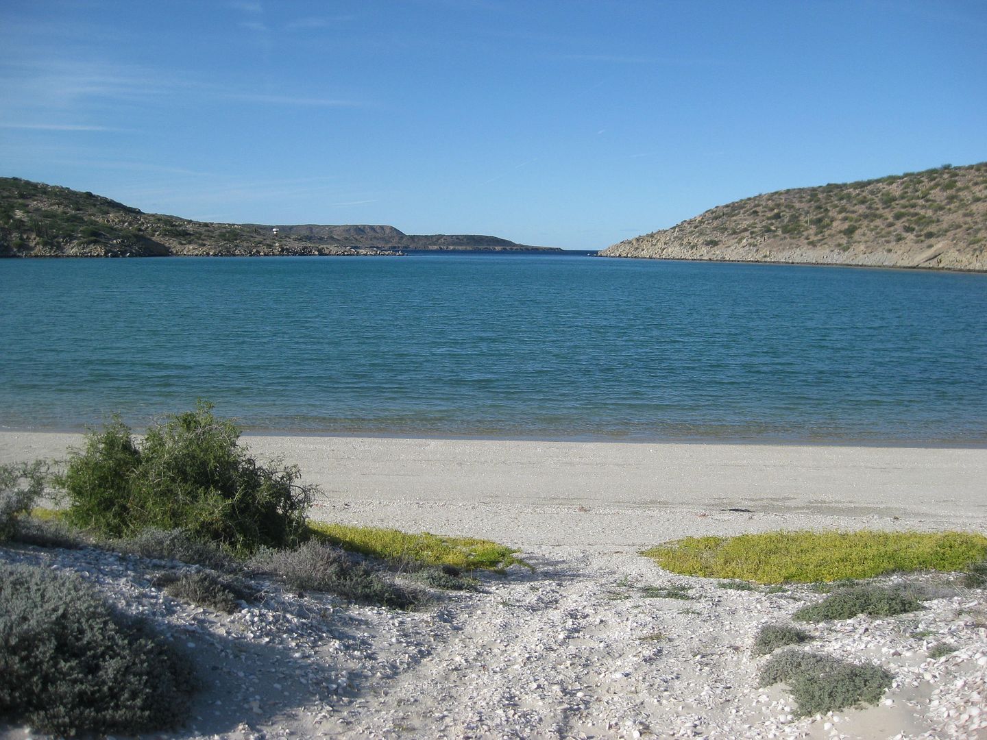
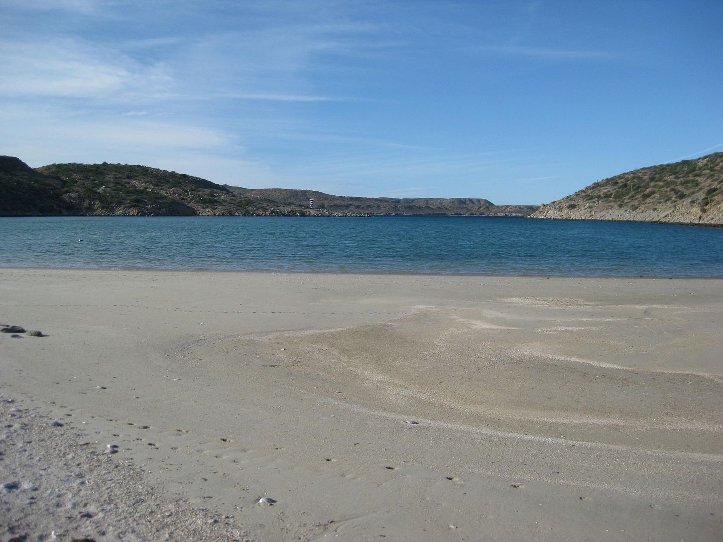
Here is one of our camping spots on the trip 

|
|
|
Bajazly
Senior Nomad
Posts: 992
Registered: 6-4-2015
Location: Goodbye Cali and Hello San Felipe
Member Is Offline
Mood: More Relaxed Everyday
|
|
Try going thru Mexicali next time. You can head over Tahatchapi down 15, 215 to 10 and down the Salton Sea. Nicer drive with less traffic and Mexicali
is a breeze to get thru.
|
|
|
Bajaboi
Newbie
Posts: 12
Registered: 12-10-2016
Member Is Offline
|
|
Mexicali was our original route, but right before leaving the Bay Area I found out that my grandparents were in Ensenada because of their
deteriorating health issues, so we ended up driving via Ensenada so that I could spend some time with them.
Mexicali pass will probably be my next trip down.
|
|
|
David K
Honored Nomad
Posts: 64480
Registered: 8-30-2002
Location: San Diego County
Member Is Offline
Mood: Have Baja Fever
|
|
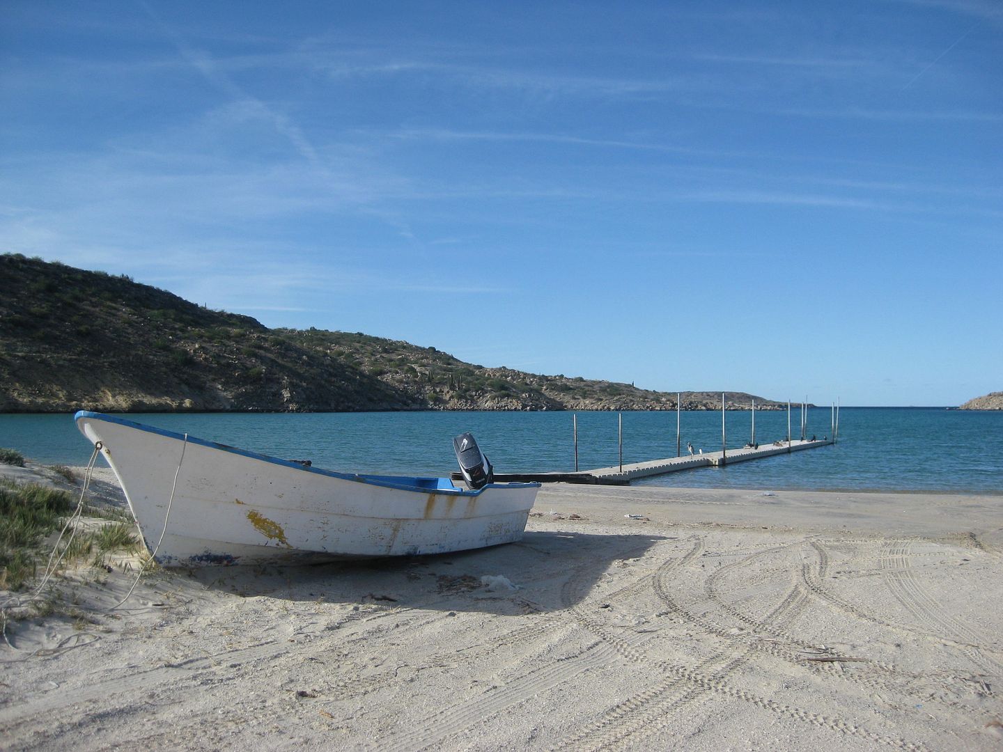
Here are my photos of the signs and beyond:
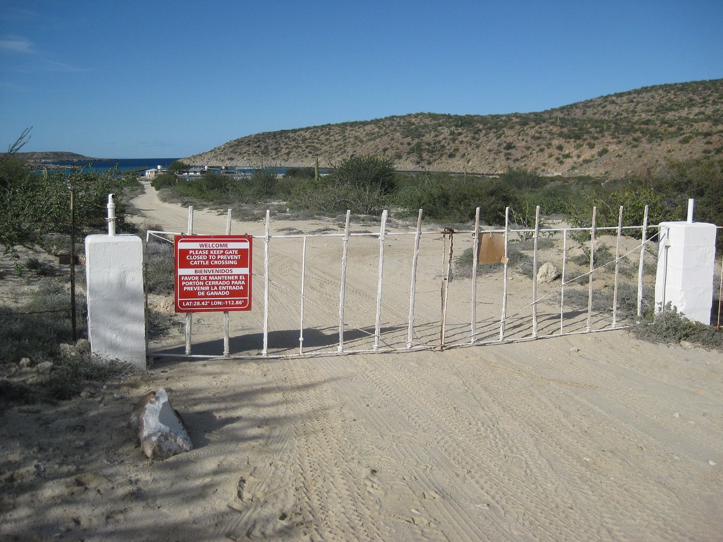
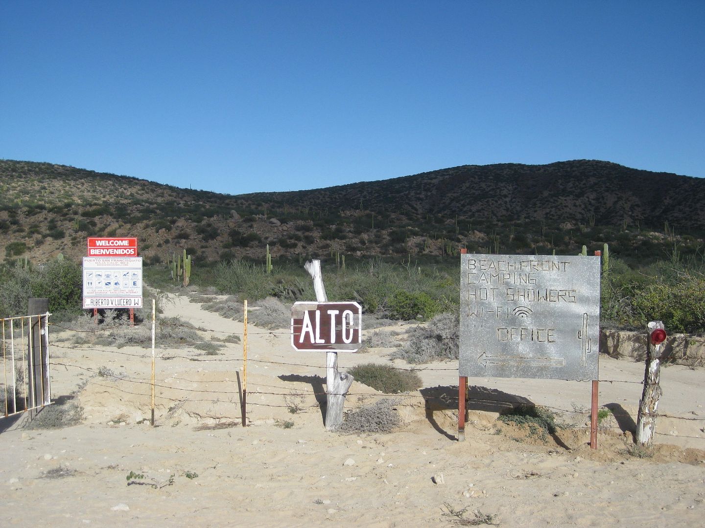
and what's past the gate...
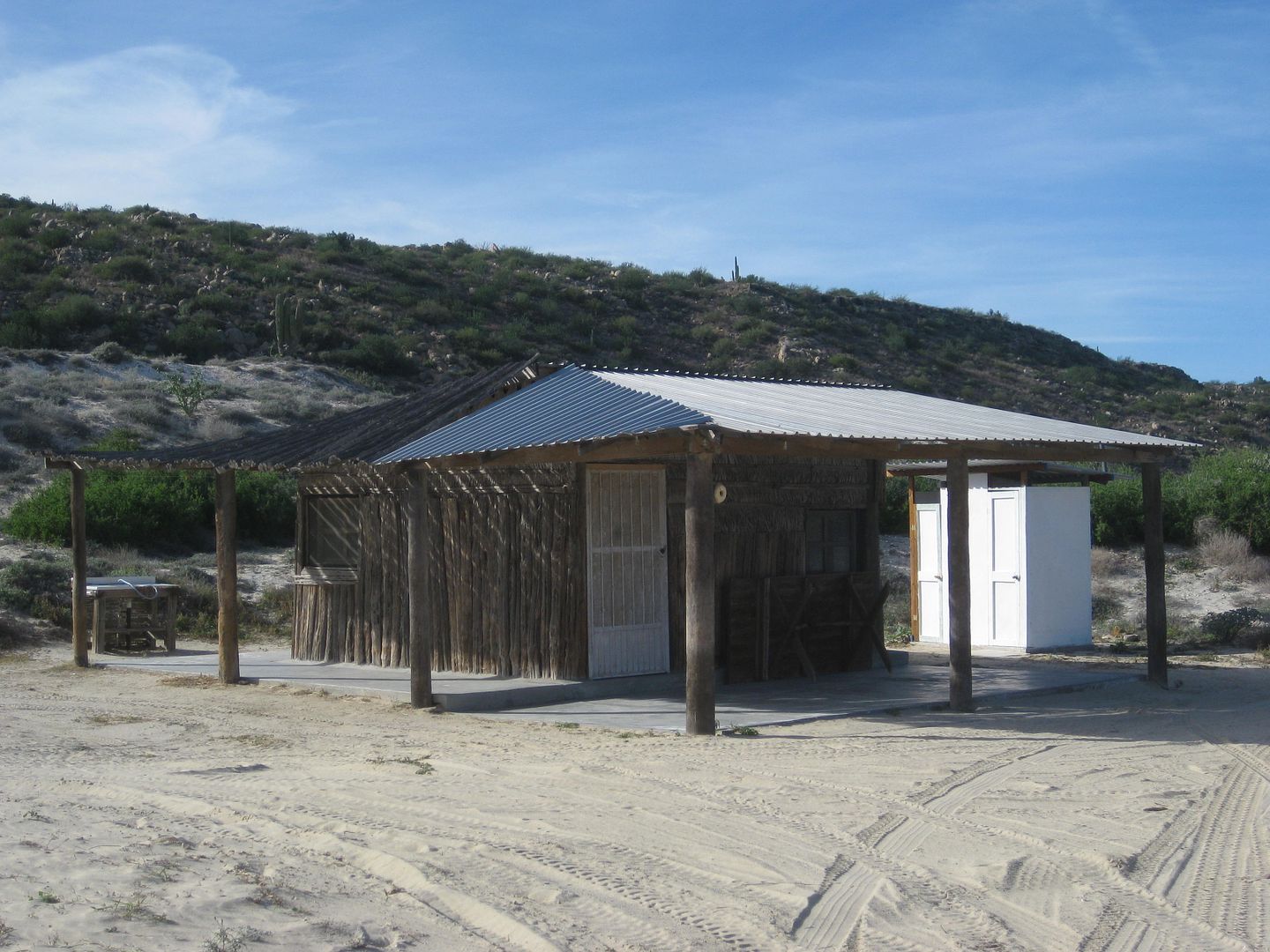
The Cabana ($40/night)
(Photo of the house has been removed, as it was NOT the house owned by Beto that rents for $100, I was informed via email from the person who said
she owns the house and pier)
Camping is $10/pp with the use of shower and toilets.
Prices quoted from Beto on Jan. 1, 2017.
[Edited on 5-4-2021 by David K]
|
|
|
Bajazly
Senior Nomad
Posts: 992
Registered: 6-4-2015
Location: Goodbye Cali and Hello San Felipe
Member Is Offline
Mood: More Relaxed Everyday
|
|
What's the camping like? On the beach or is there a developed spot up off the beach?
|
|
|
Bajaboi
Newbie
Posts: 12
Registered: 12-10-2016
Member Is Offline
|
|
Awesome pictures, David! Glad you were able to make it to PSF!
@ Bajazly, the camping situation is pretty flexible; if it's a low tide you're welcome to camp right on the beach; some sleeper trucks just back up
right next to the water but it's a bit nicer just above the tideline; there are also certain areas that have been designated if you want a little more
privacy and it's in the busy season.
I've also added Puerto San Francisquito to Google Maps and uploaded a few pictures, including some of the drone fotos that I captured on my trip that
might help give a bit more perspective to the area.
You can now type in Puerto San Francisquito, Baja Mexico in Gmaps and it will come up, or if you can utilize this quick link: https://goo.gl/maps/pqaz6puvcrk
|
|
|
David K
Honored Nomad
Posts: 64480
Registered: 8-30-2002
Location: San Diego County
Member Is Offline
Mood: Have Baja Fever
|
|
Thank you Bajaboi... I hope they show your land off well and encourage people to go there. A cantina with cold Pacificos and fish tacos would be
great, too! LOL
As for the camping, I did not see any palapas by the beach, so it seems to be just 'open camping' (bring your own shade and tent). I am not sure where
the toilets and advertised hot showers were for the campers, but perhaps the white building near the cabana? I saw an outhouse by the cabana, are
there flush toilets inside? Trash cans would also be a good idea (with latching or rock-on lid to keep coyotes out), I didn't see.
[Edited on 1-7-2017 by David K]
|
|
|
Bajaboi
Newbie
Posts: 12
Registered: 12-10-2016
Member Is Offline
|
|
The small structure in your 3rd picture are two flushing toilets, and then the white bigger building to the west of the cabaña are the showers and
additional flushing toilets.
|
|
|
David K
Honored Nomad
Posts: 64480
Registered: 8-30-2002
Location: San Diego County
Member Is Offline
Mood: Have Baja Fever
|
|
Quote: Originally posted by Bajaboi  | | The small structure in your 3rd picture are two flushing toilets, and then the white bigger building to the west of the cabaña are the showers and
additional flushing toilets. |
Thank you!
|
|
|
honda tom
Nomad
Posts: 493
Registered: 8-28-2003
Location: middle calif
Member Is Offline
|
|
bajaboi, sometime try this route.......
fill up at villa jesus maria and head east out of town. 12 miles in watch for roads heading SE, after 12 miles SE head east into El Arco. These dirt
roads are smooth and fast, and they cut off many miles from the hwy 1- el arco rd junction. The roads are clearly marked on the AAA and Baja almanac
maps. Cuts off about 23 miles and a much better view. ranches and farms, water etc.
|
|
|
David K
Honored Nomad
Posts: 64480
Registered: 8-30-2002
Location: San Diego County
Member Is Offline
Mood: Have Baja Fever
|
|
| Quote: Originally posted by honda tom | bajaboi, sometime try this route.......
fill up at villa jesus maria and head east out of town. 12 miles in watch for roads heading SE, after 12 miles SE head east into El Arco. These dirt
roads are smooth and fast, and they cut off many miles from the hwy 1- el arco rd junction. The roads are clearly marked on the AAA and Baja almanac
maps. Cuts off about 23 miles and a much better view. ranches and farms, water etc. |
You would be on much of the original Baja main road from Ensenada to La Paz, as well!
[Edited on 5-4-2021 by David K]
|
|
|
Bajaboi
Newbie
Posts: 12
Registered: 12-10-2016
Member Is Offline
|
|
@ Honda Tom; Thanks for suggesting that route! I don't think I've been on those roads since I was 10 or so, so I will definitely try them out on the
next trip!
A lot of the times when we come from the North, we stop in Guerrero to purchase the majority of our fresh veggies and produce to bring to my dad,
which is why we normally go the slightly longer route.
|
|
|
honda tom
Nomad
Posts: 493
Registered: 8-28-2003
Location: middle calif
Member Is Offline
|
|
Forgot to mention... your dad is a great guy! Always feel welcome there. Very accommodating and knowledgeable. In the 90's when Chary ran the
"resort" at San Fran we always felt welcome, great food, drinks, fair prices and smiles. things went downhill after the sons owner came to run the
place. then after a big storm a few years back it seemed it would not recover.
1 night 4 of us pulled up on motorcycles and asked for a palapa, they pointed us out to the only 1 with a roof. We walked out to find it full of sand
and no cots. we went back and asked about cots, nobody got up and 1 of them said "you should go see Beto". I had no idea what this meant. ( I had
purchased fuel from your father in the past but didn't catch a name) , She said again "Betos place" this time pointing to the north. I said "over by
the boats", she said "yes Beto".
We rode over and opened the gate (it was now about 8 or 9 pm) The 4 of us rode up not knowing what was going to happen. Your dad came out, opened a
small block house, turned on a water heater for the shower room, even pulled out a gas bar b que for us and said see you in the morning.
Hes got some great stories about the shark fishing there (in the 80's I think it was)
|
|
|
Terrapin
Newbie
Posts: 5
Registered: 12-19-2016
Member Is Offline
|
|
Bajaboi - my daughter and I were camped there for a couple days in late December when you were visiting your dad. I saw the drone overhead and meant
to ask if it was yours but we hit the road super early on the day we left to make some long miles... Great hospitality. If you have any footage or
static shots of our camp that you could share that would be awesome.
   
|
|
|
Pappy Jon
Nomad
Posts: 494
Registered: 8-27-2003
Location: Wrong side of the Continental divide.
Member Is Offline
Mood: Temp rising.
|
|
This is good info. I've been the in area several times, but I've always been confused where to go. I guess I just need to go through the gate.
"The association of flowers and warm-blooded love is more than a romantic convention; it is based upon one of the great advances in the evolution
of life." Ed Abbey
|
|
|
Mexico Matt
Newbie
Posts: 2
Registered: 2-28-2017
Member Is Offline
|
|
Is there food and fuel at Beto's? Head their on bikes in a week. Also, has anyone riden up from San Ignacio via Trinidad?
|
|
|
| Pages:
1
2 |


