| Pages:
1
2
3
4
5 |
BigBearRider
Super Nomad

Posts: 1299
Registered: 4-30-2015
Location: Big Bear, Punta Chivato, and Cabo
Member Is Offline
Mood: 
|
|
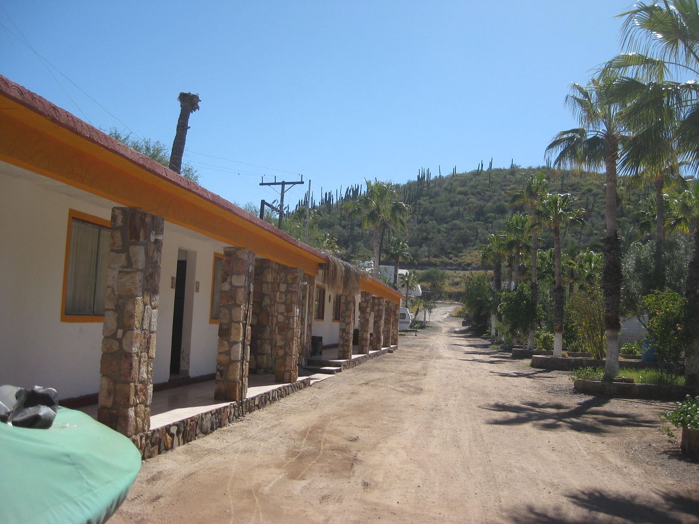
Nice to see the Chivato pics! Sad about the old hotel.
|
|
|
fishbuck
Banned
Posts: 5318
Registered: 8-31-2006
Member Is Offline
|
|
"A ship in harbor is safe, but that is not what ships are built for." J. A. Shedd.
A clever person solves a problem. A wise person avoids it. – Albert Einstein
"Life's a Beach... and then you Fly!" Fishbuck
|
|
|
fishbuck
Banned
Posts: 5318
Registered: 8-31-2006
Member Is Offline
|
|
Wow yeah. I had to go back and look. I think I have stayed in the rooms in the pic.
"A ship in harbor is safe, but that is not what ships are built for." J. A. Shedd.
A clever person solves a problem. A wise person avoids it. – Albert Einstein
"Life's a Beach... and then you Fly!" Fishbuck
|
|
|
David K
Honored Nomad
Posts: 64476
Registered: 8-30-2002
Location: San Diego County
Member Is Offline
Mood: Have Baja Fever
|
|
This weekend (tomorrow+) I will get much more posted... It just gets better and better!
Rain coming down sideways right now here in North County San Diego!
Teaser:
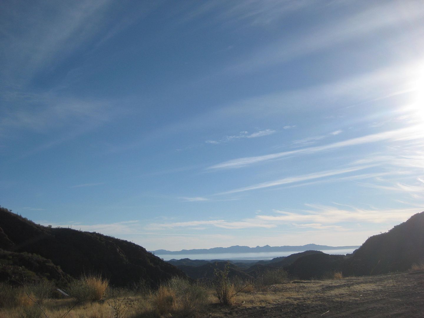
First view of Comondú canyon from the road from Loreto/San Javier:
Isn't Baja SUPER!
[Edited on 2-18-2017 by David K]
|
|
|
David K
Honored Nomad
Posts: 64476
Registered: 8-30-2002
Location: San Diego County
Member Is Offline
Mood: Have Baja Fever
|
|
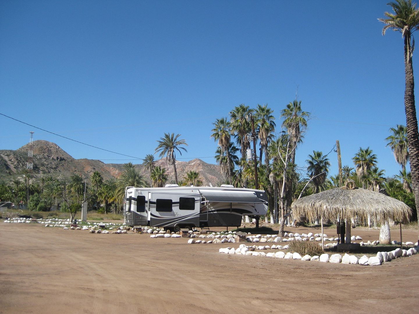
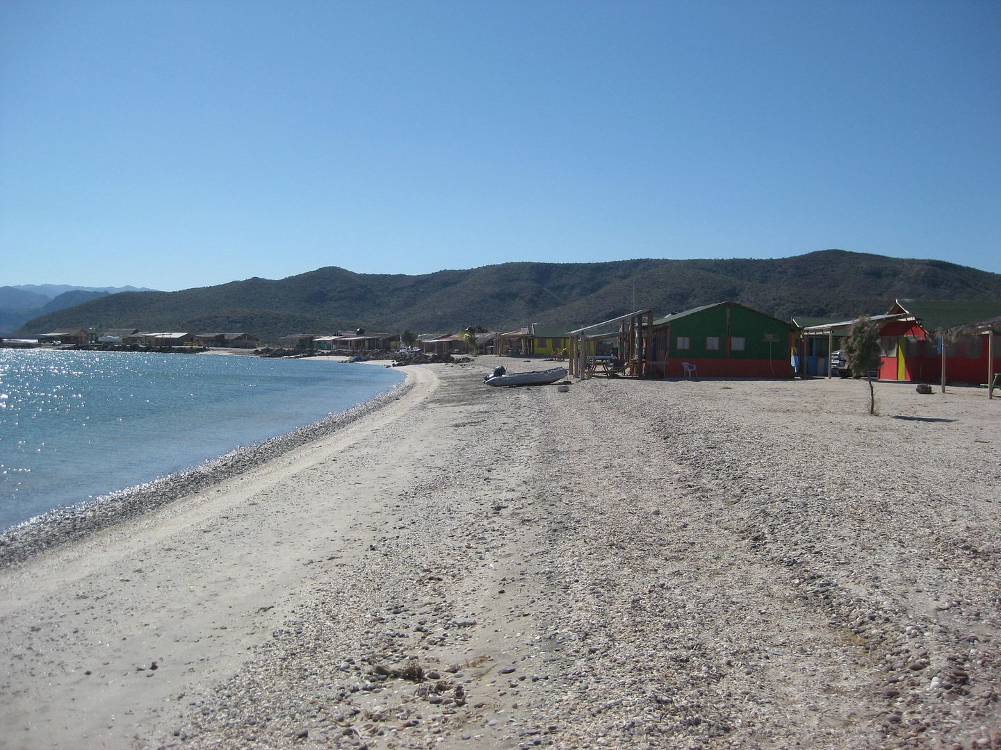
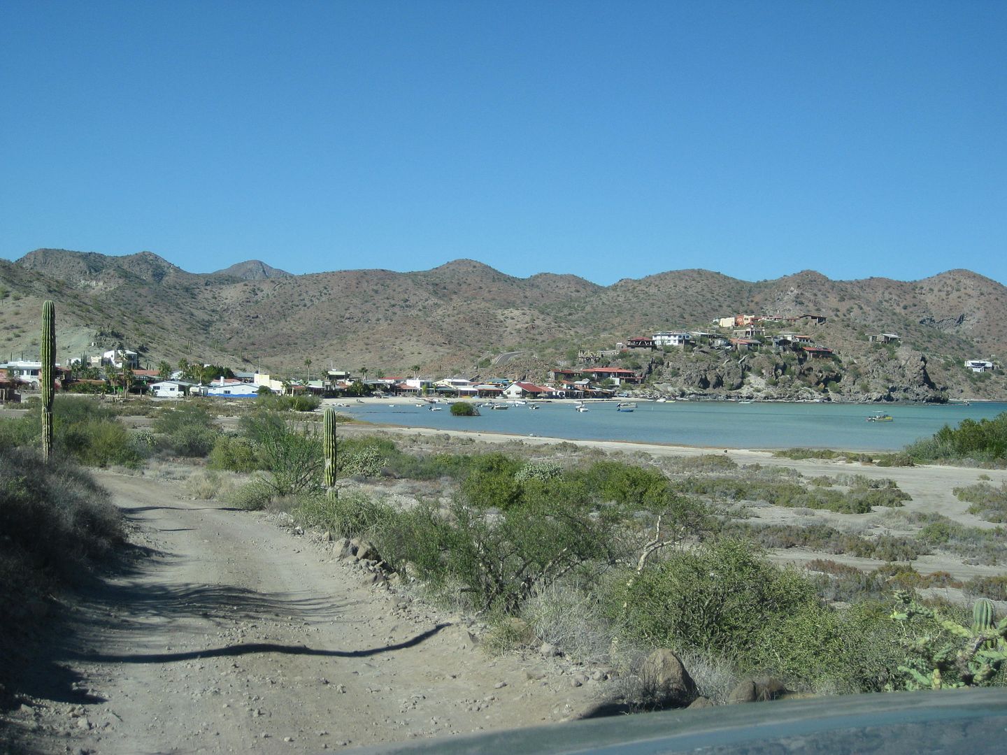
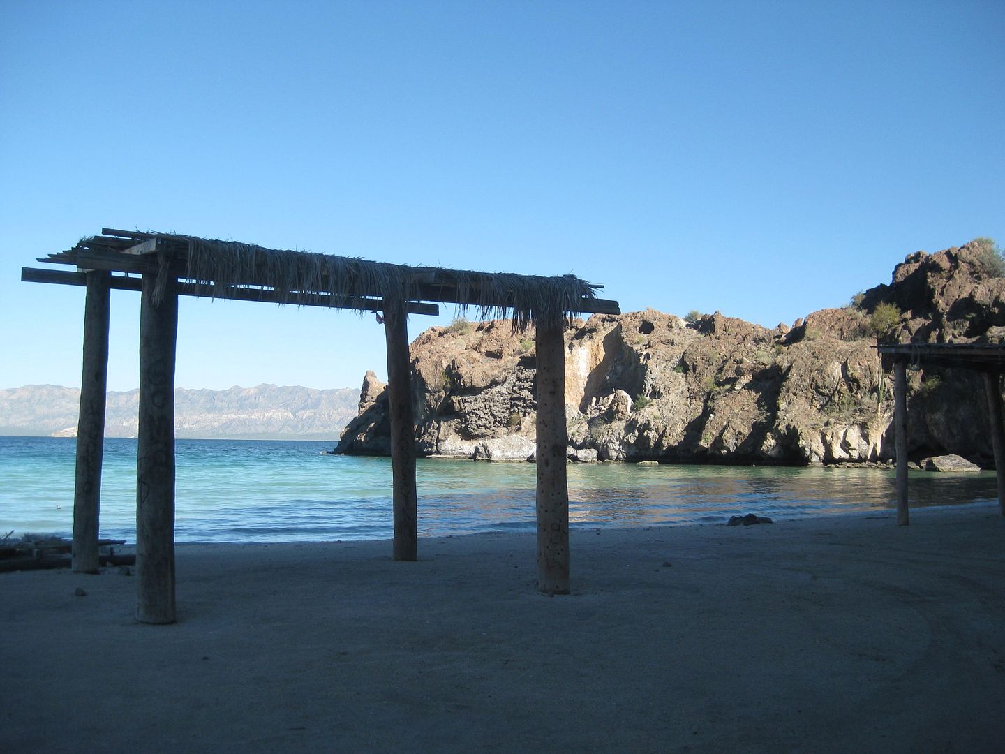
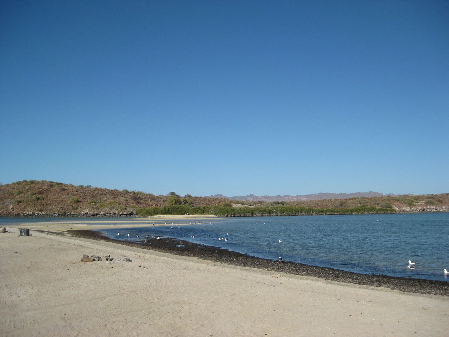
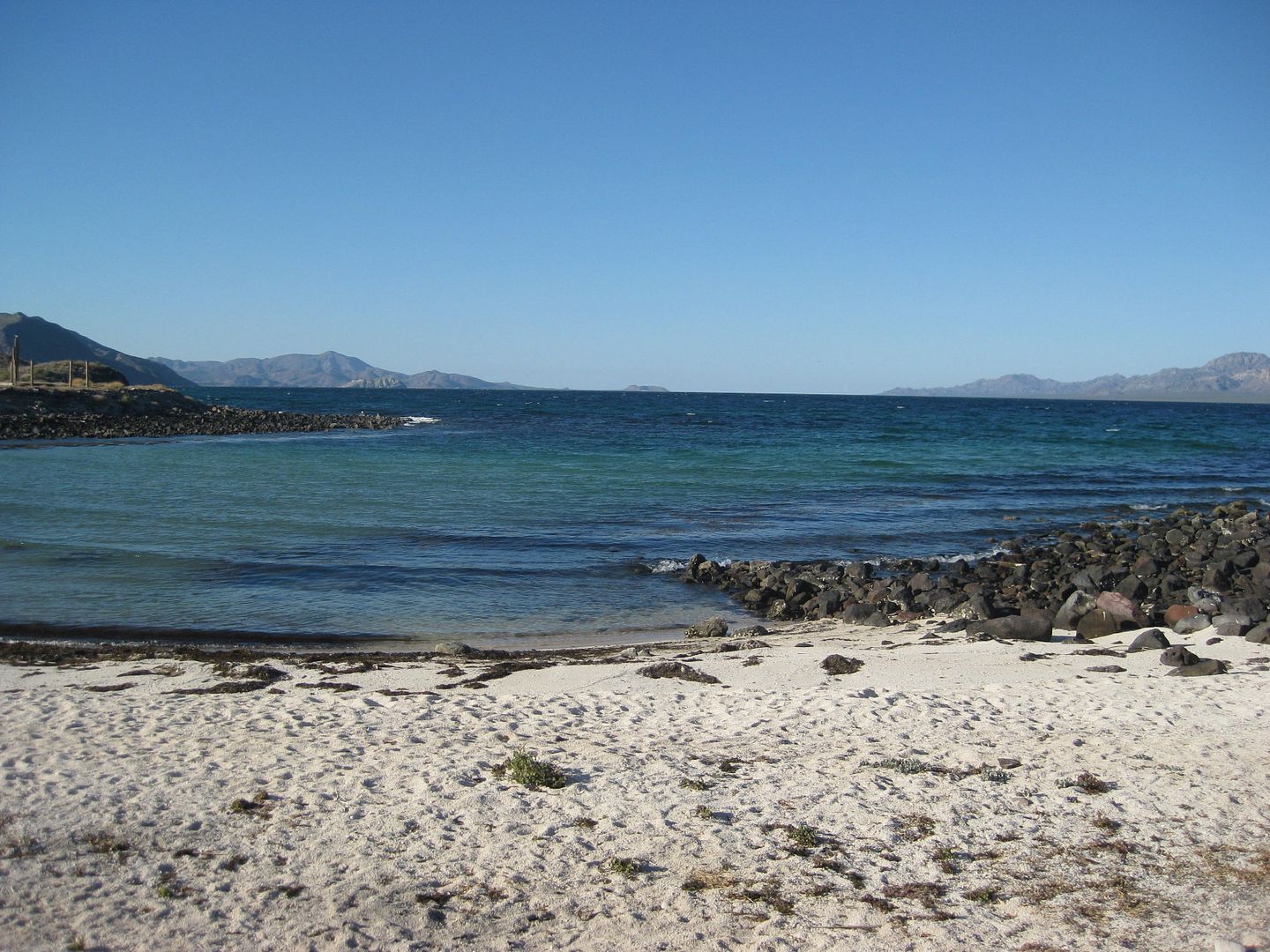
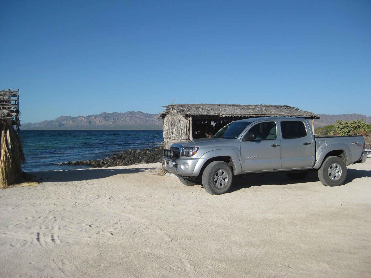
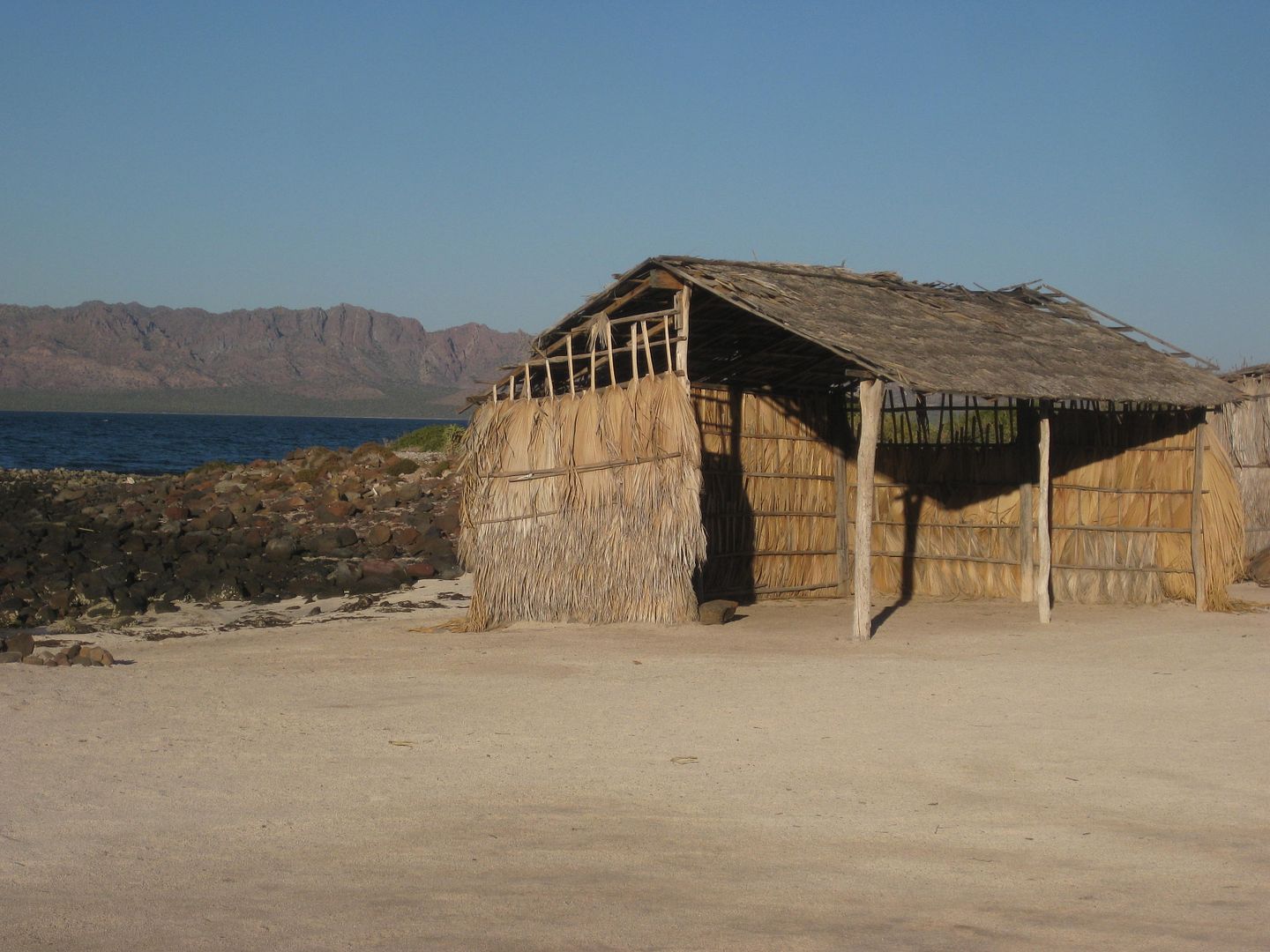
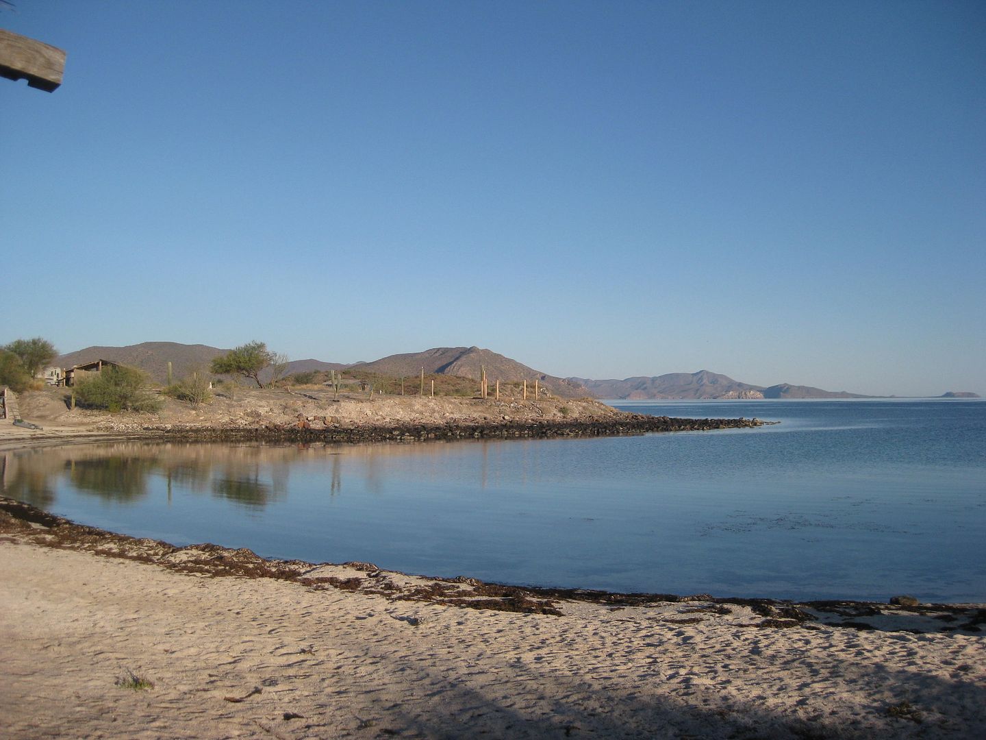
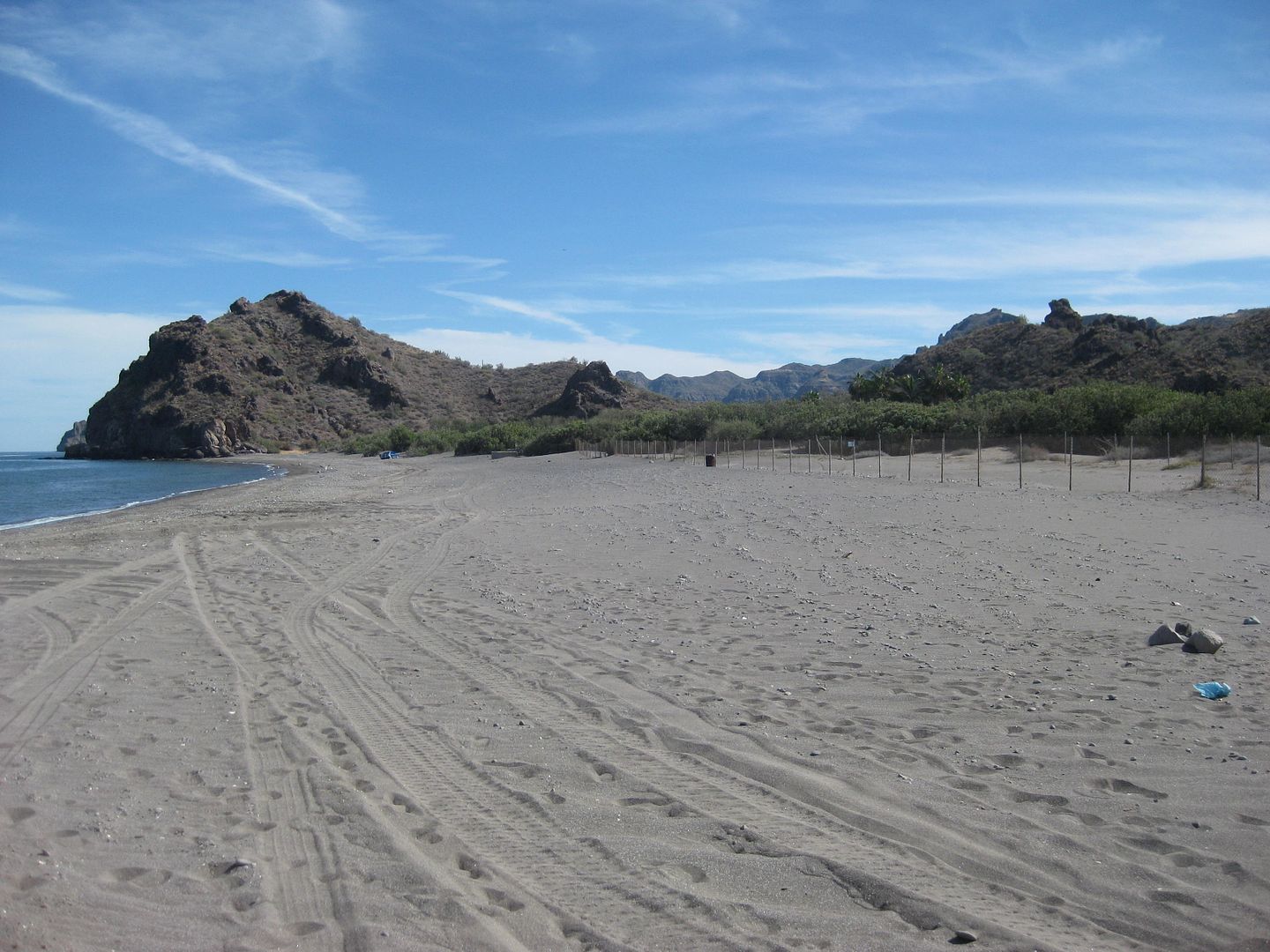
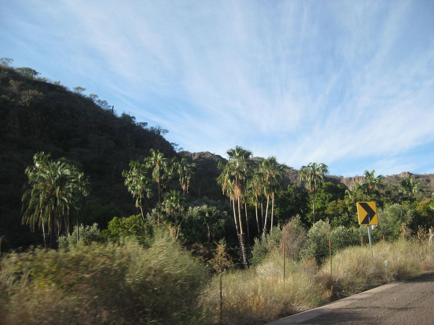
DAY 3: Mulegé Area and Bahía Concepción (most of)
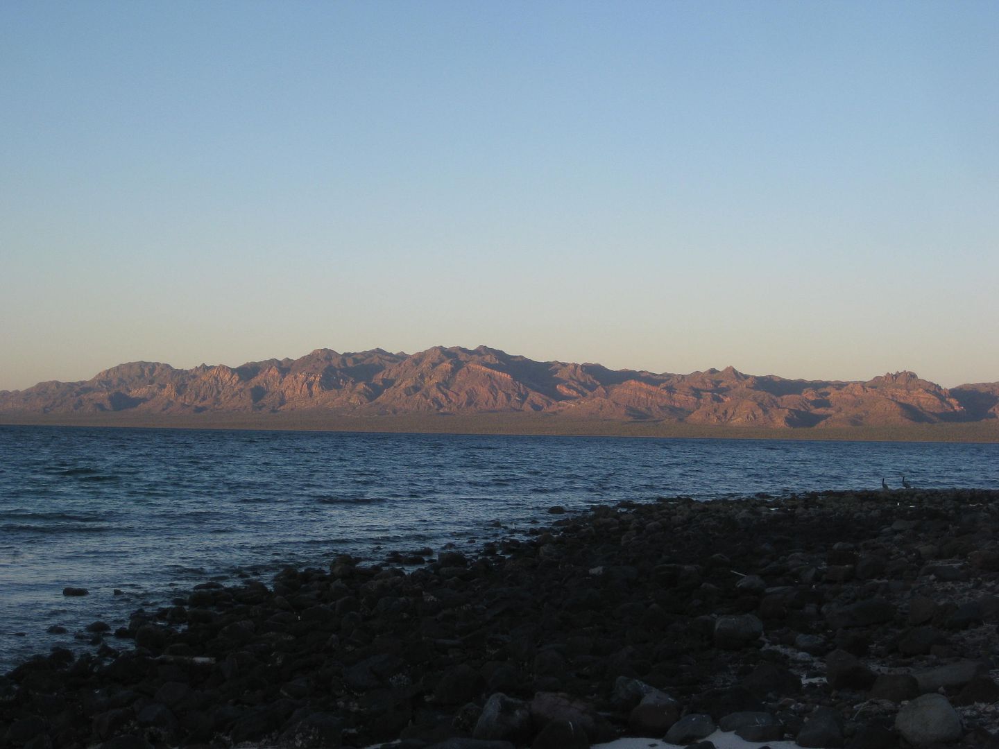
It is Wednesday morning, Feb. 1, 2017, and it was a quiet wind-free night at Punta Chivato (Shell Beach). Thanks again to Russ for the hospitality and
ATV ride around the area, yesterday. I was up at sunrise to take a photo, as Russ does here, but there were no clouds for the big ball of fire to
illuminate, so no photo.
I got on the road at 8:45 am (MST) and drove the approx. 8 miles back to the highway at Palo Verde to begin the next section of note and photo
taking...
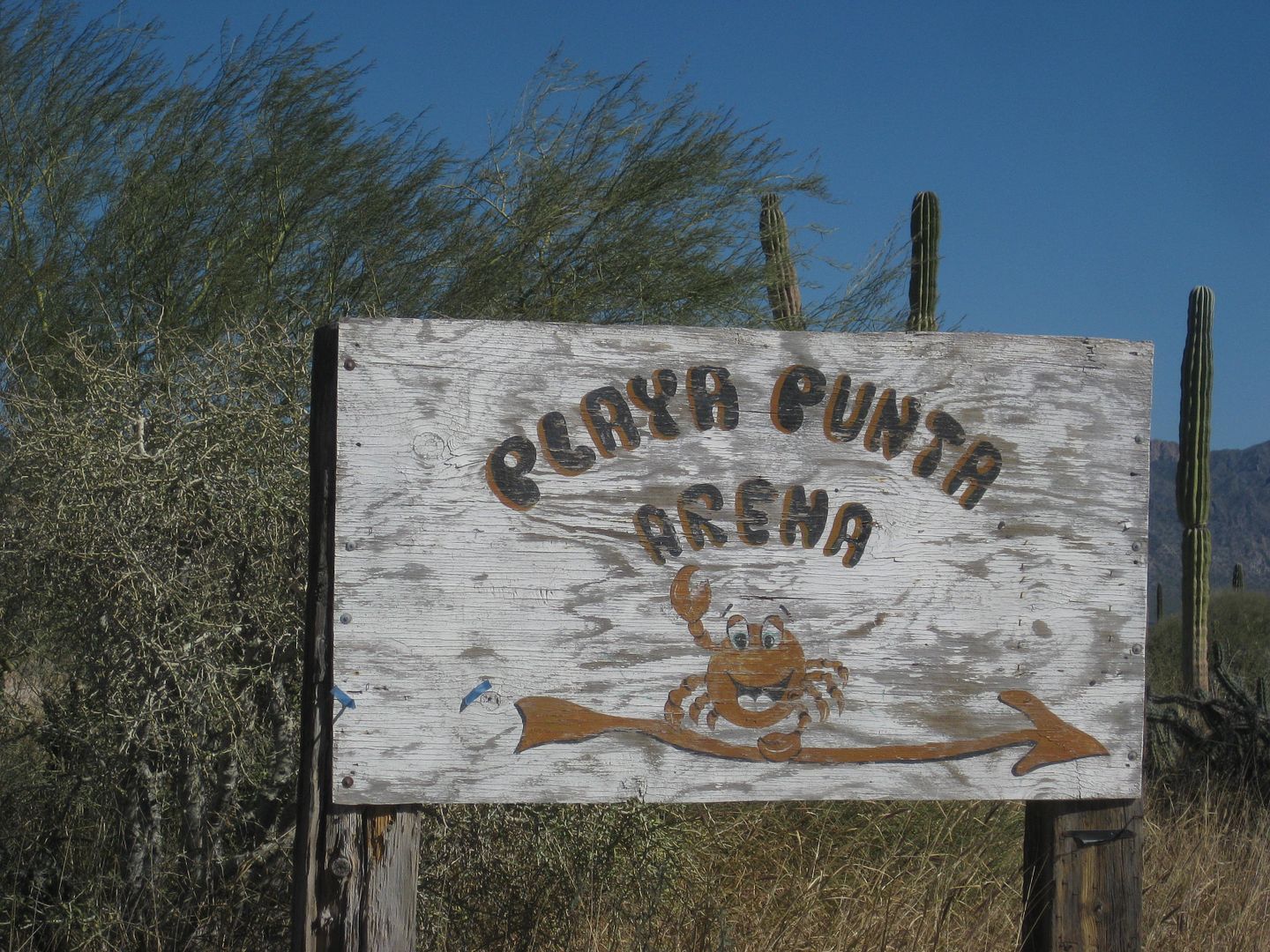
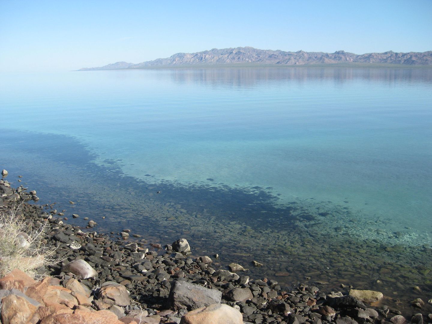
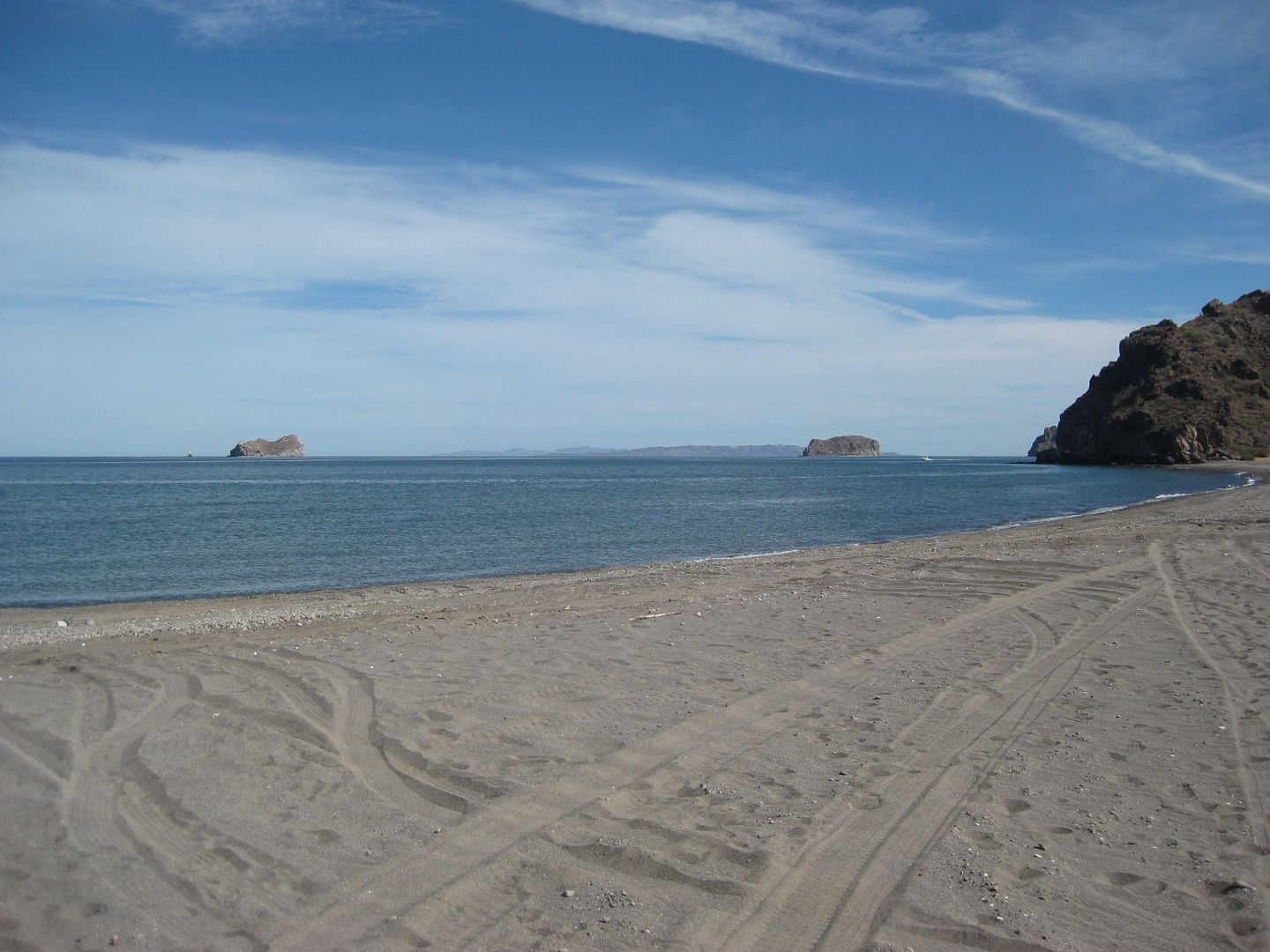
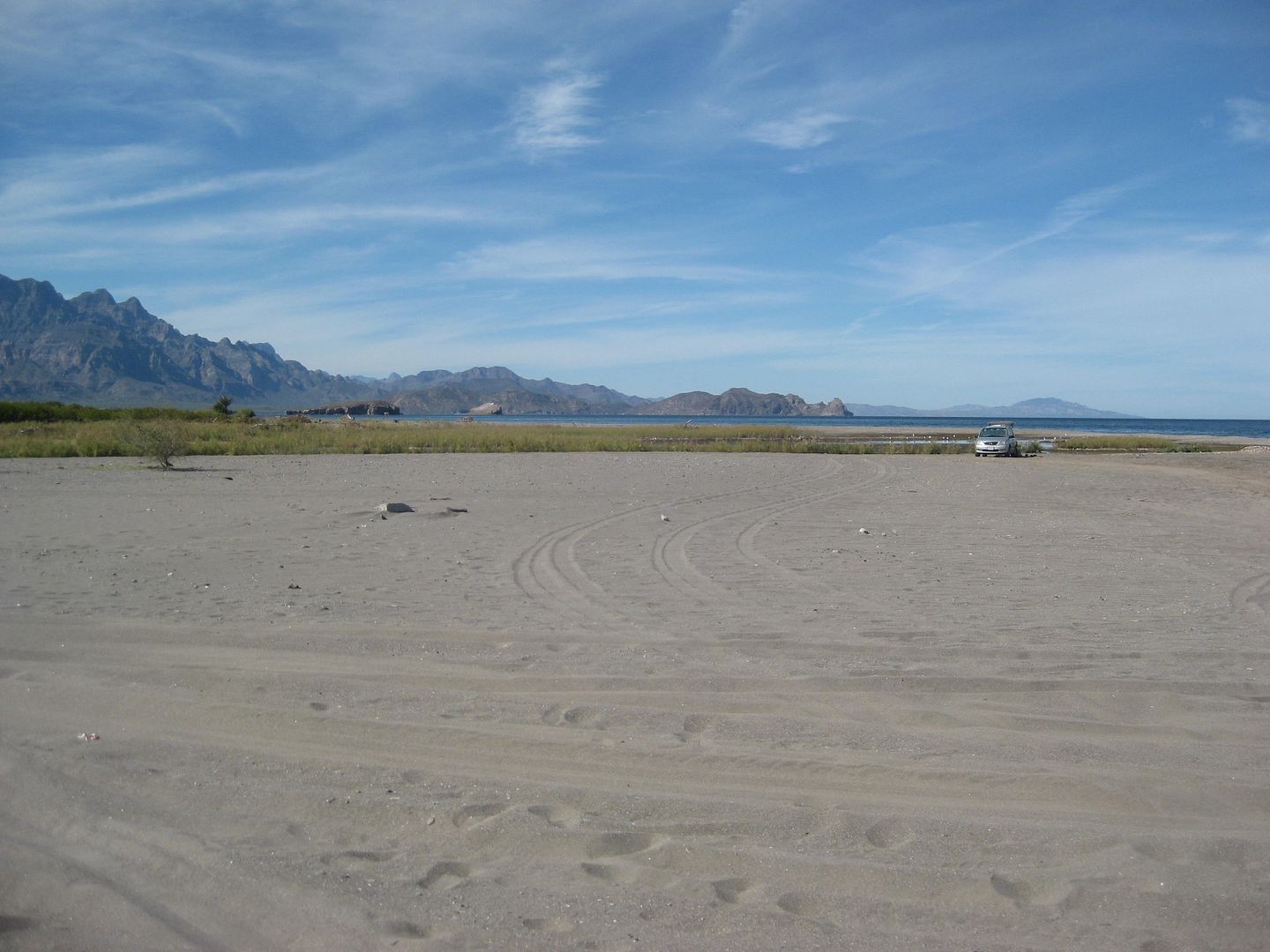
SANTA INES (Km. 155.5)
2.8 miles in there is an unsigned fork. To the left, in 0.2 mi. is a fishermen's home or camp and what appears to be an area for camping. But, you
cannot see the water (low sand dunes) from there. Going back to the fork, and taking the right branch went 1/2 mile to a parking area next to a
beautiful beach... 3.3 miles from the highway.
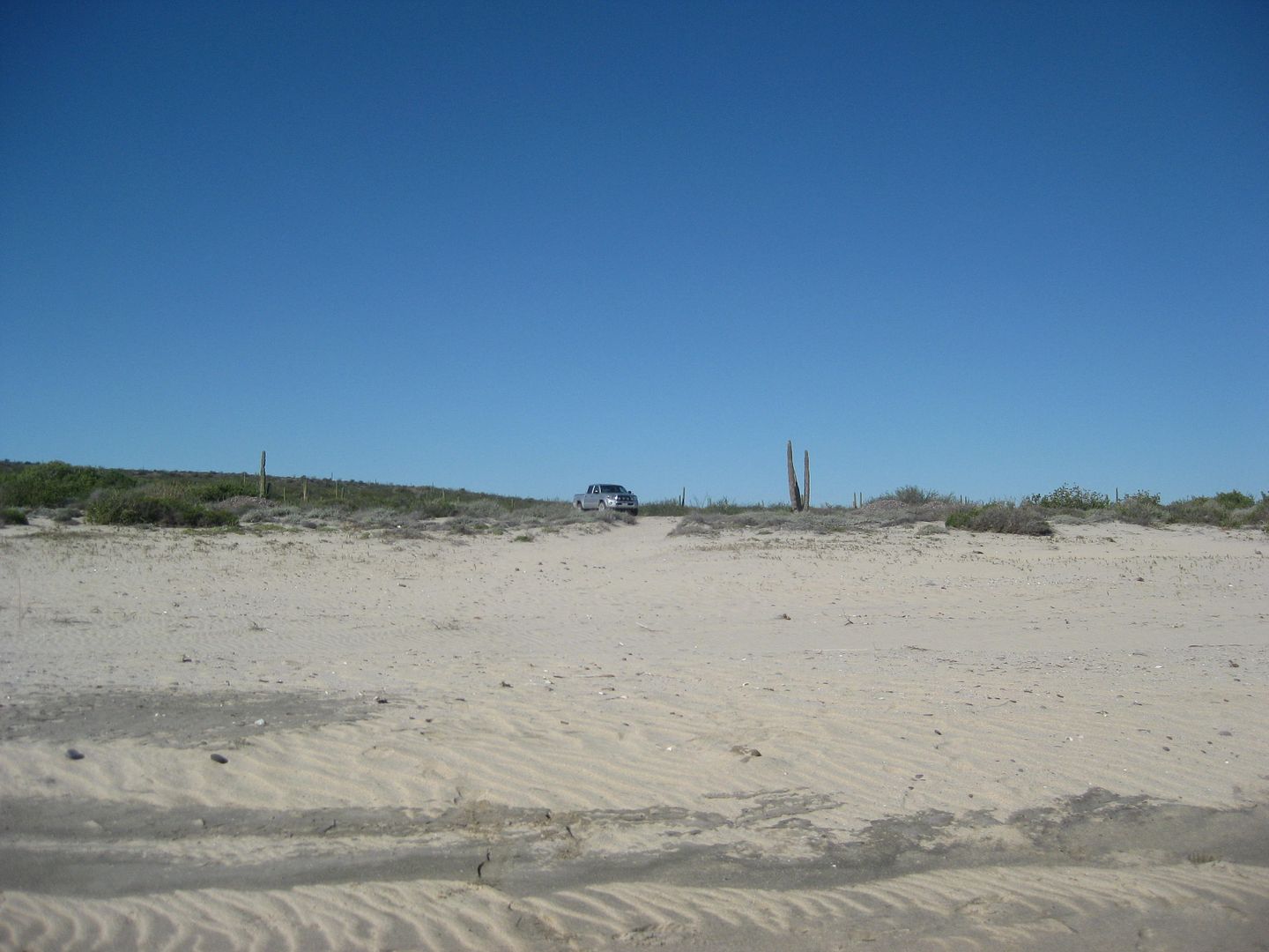
Perfect! However, there are stories of robberies, here in the past. So a little danger with paradise!
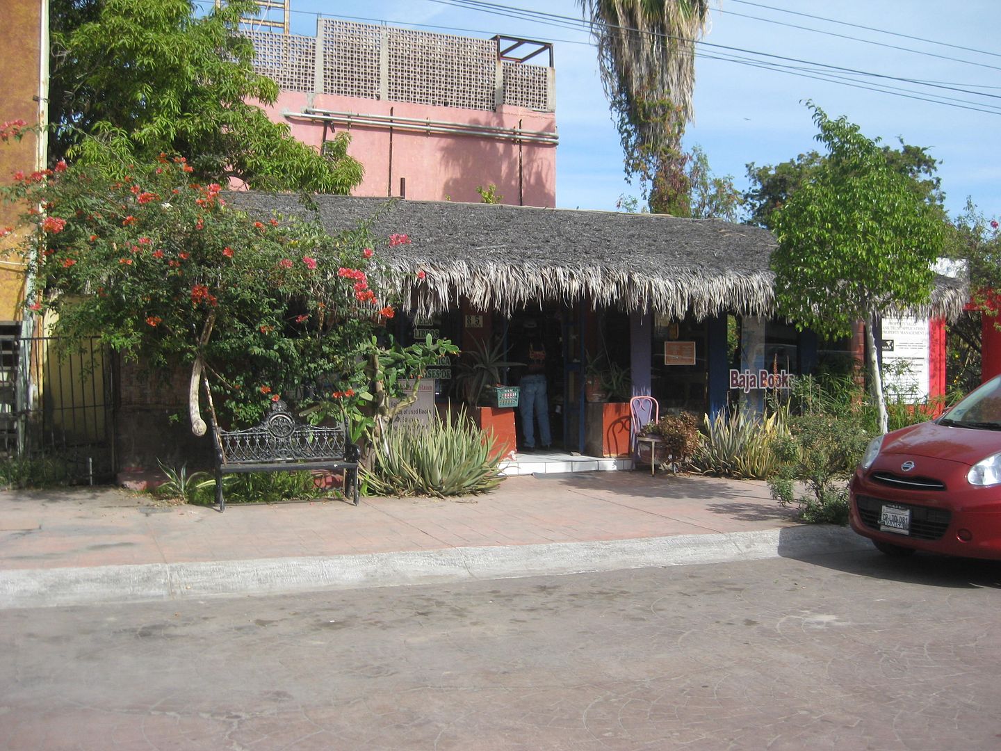
On to Mulegé:

Through town and on the north river road.

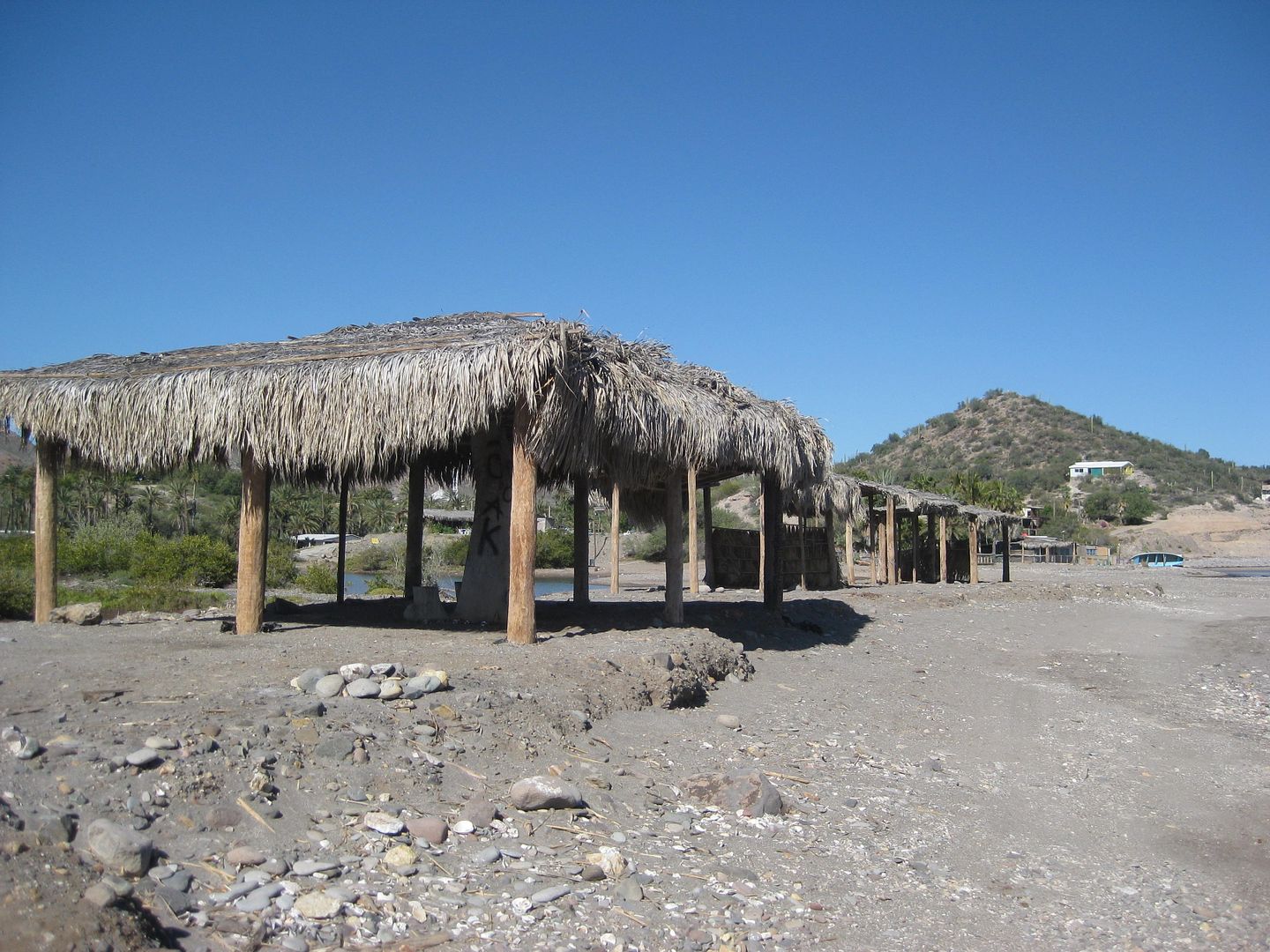
Some palapas on the bench between the river and gulf.
El Patron restaurant (end of the north road) was closed (sign said open at 11), but just west, was Casa de Pancho Villa restaurant. WHAT A GREAT
PLACE! Willy Airstream (Richard) had recommended it. I had a shrimp omelet with fries, fresh squeezed OJ and coffee, all for just 95 pesos...
=US$4.75. They had wifi so I could check emails and Nomad while waiting. Met a traveler there who, later came to Loreto two days and attended my book
signing.
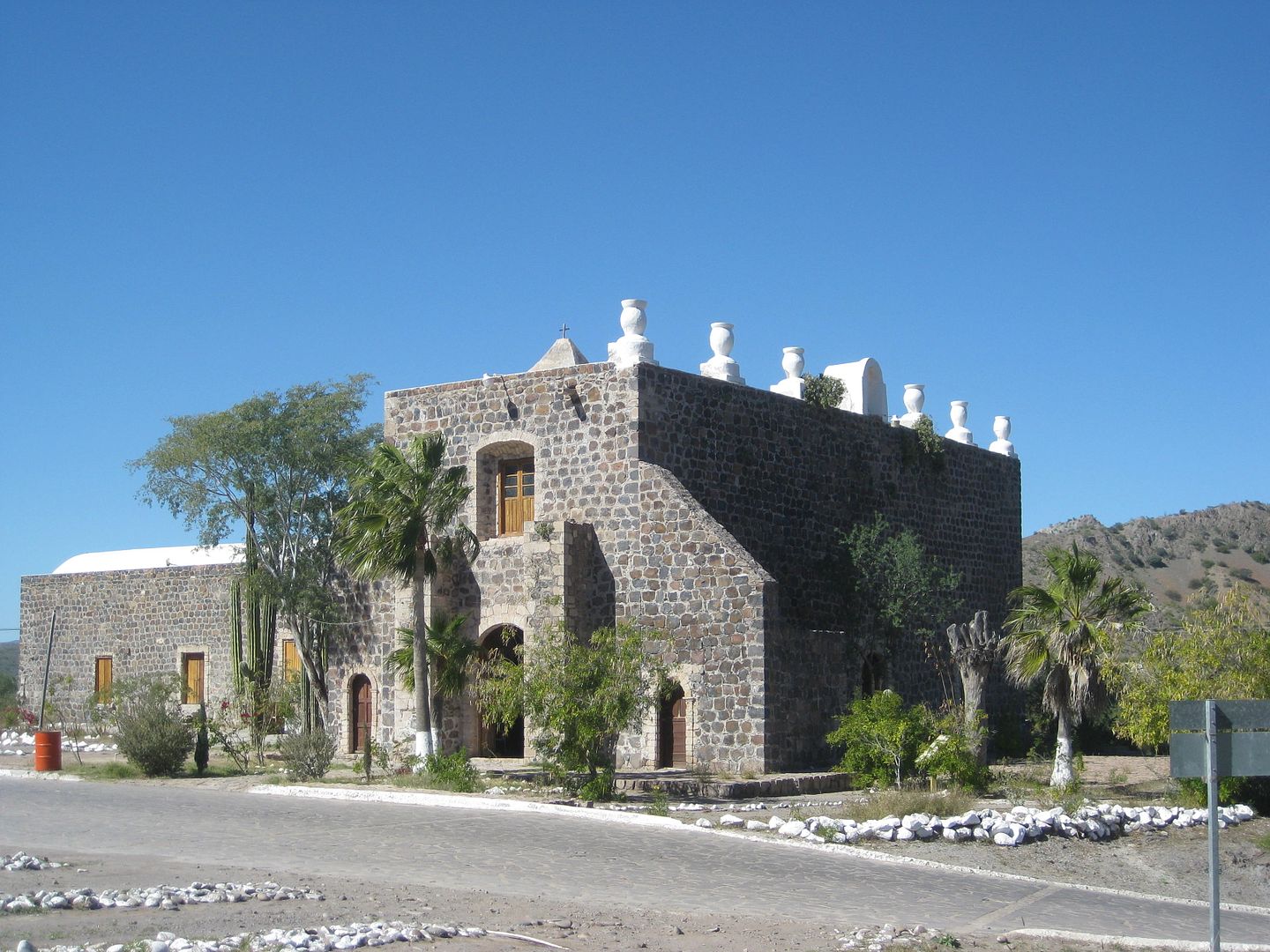
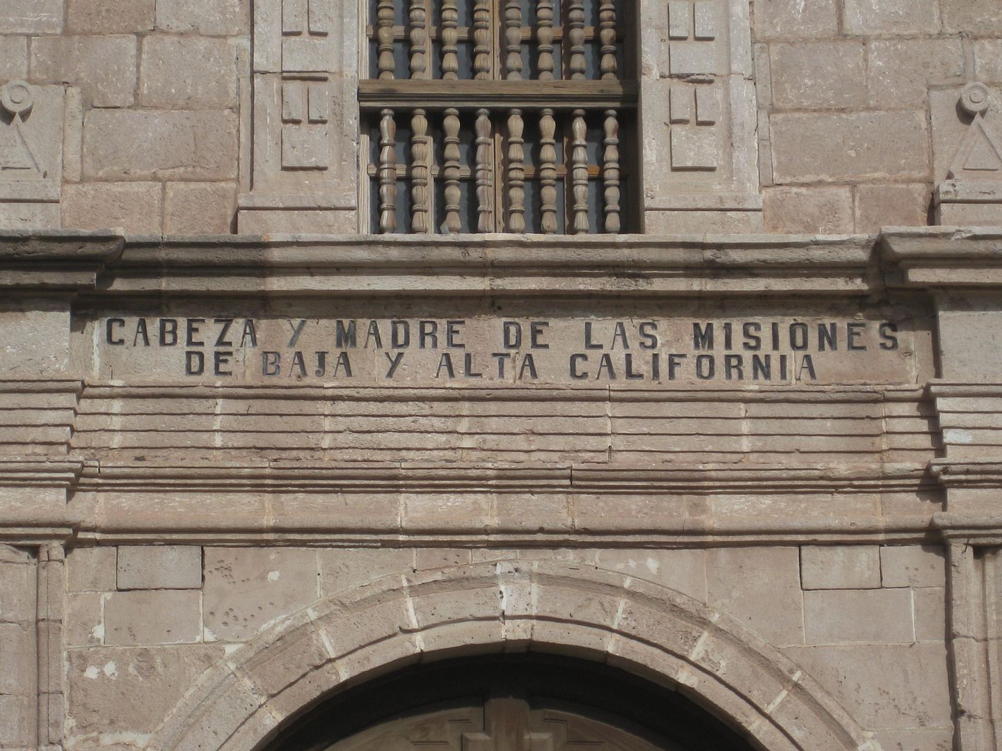
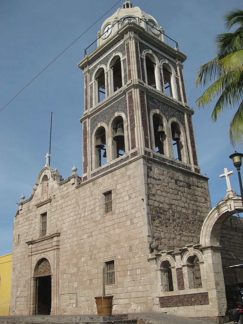
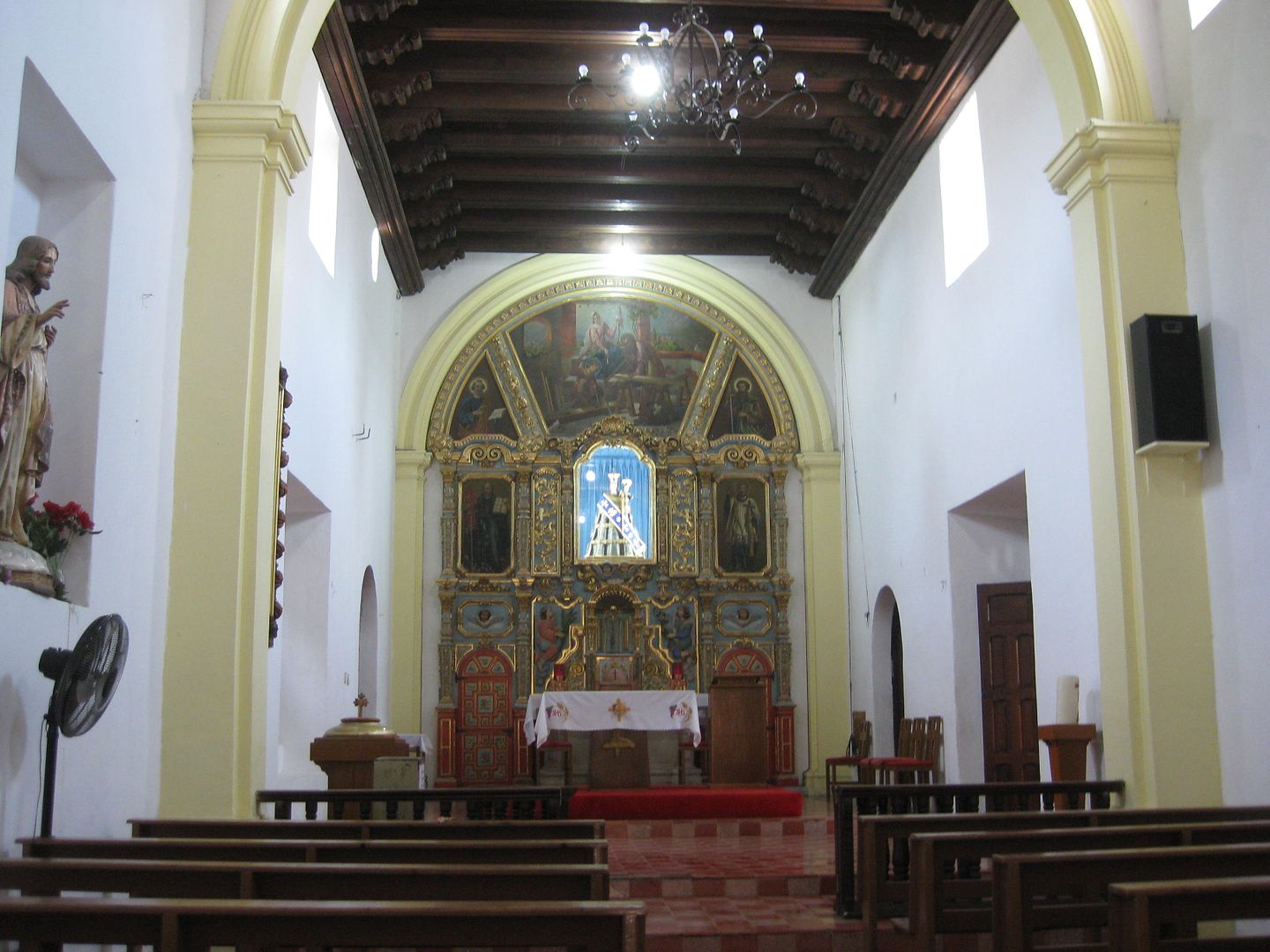
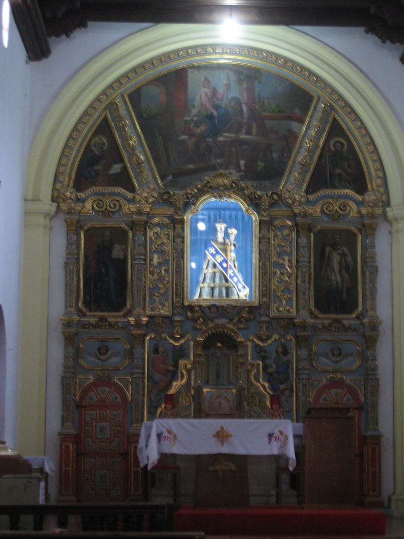
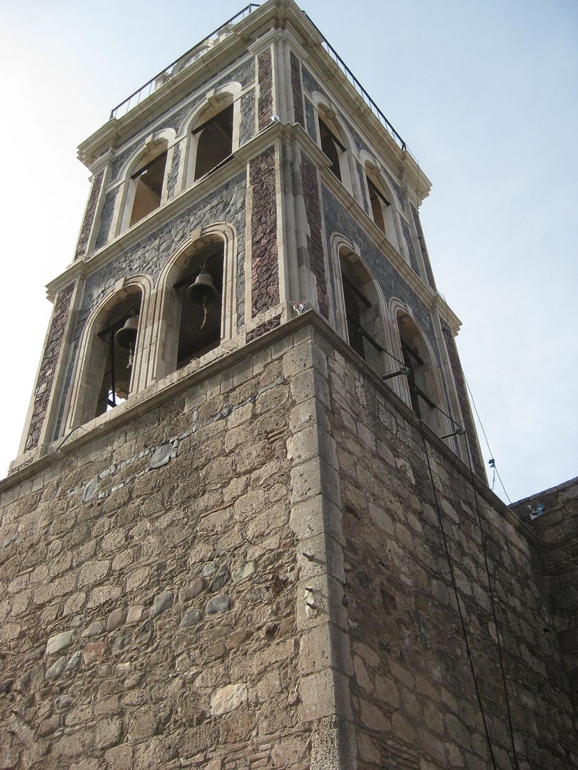
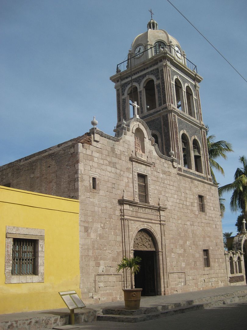
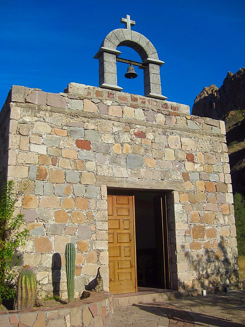
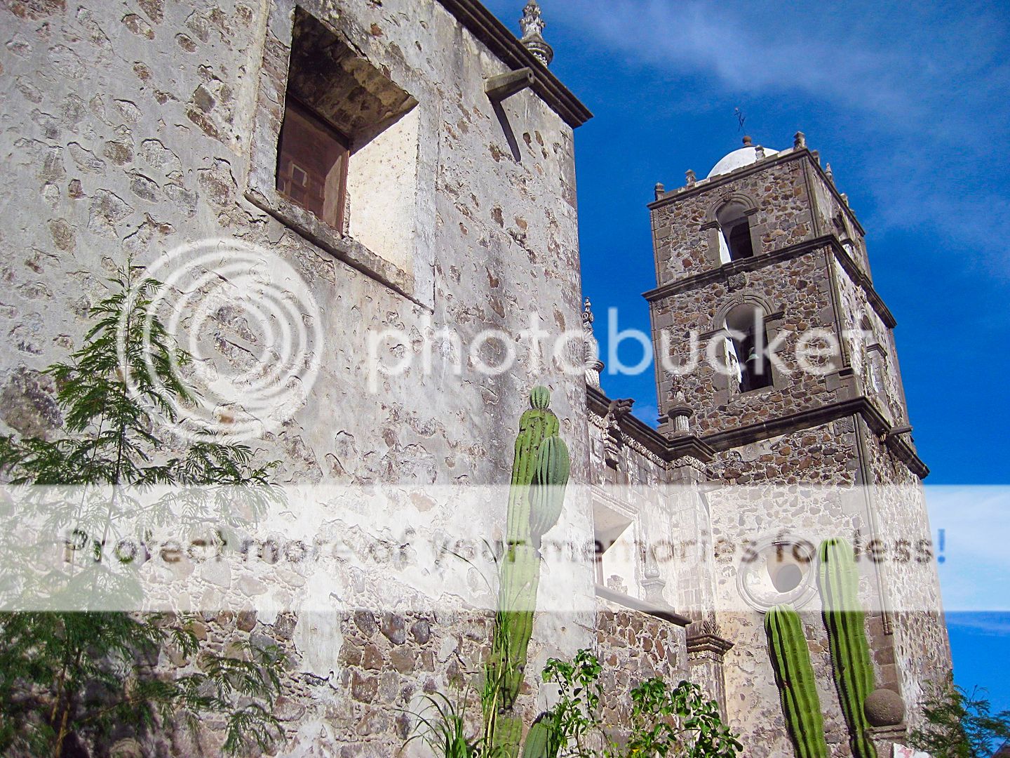
The 4th California Mission, Santa Rosalía de Mulegé, founded in 1705.
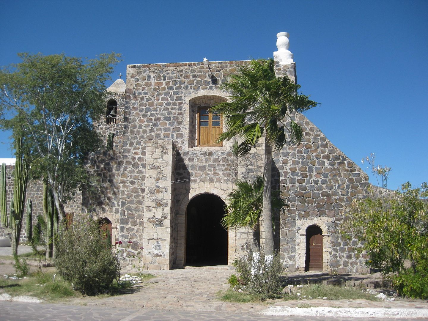
The stone church was built in 1766, just before all the Jesuits were removed from the New World.
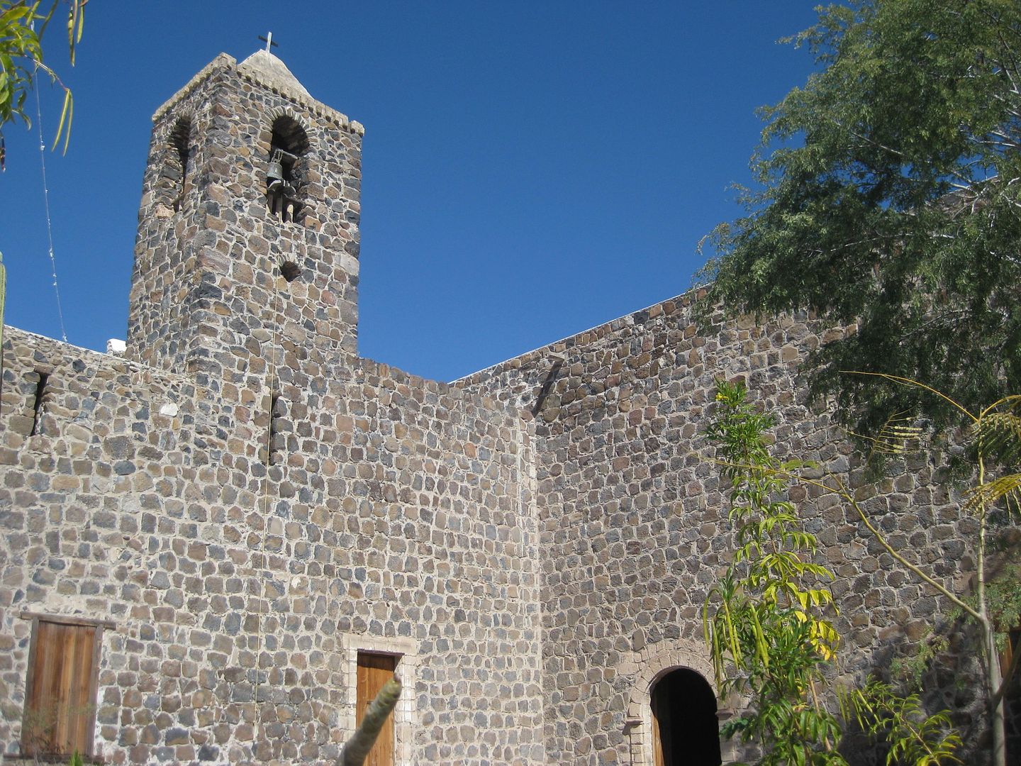
The mission site is reached from the south side of the bridge over the river at Km. 134, and a paved road turns left and goes under the bridge to the
mission.
More Mulegé from along the south side of the river...
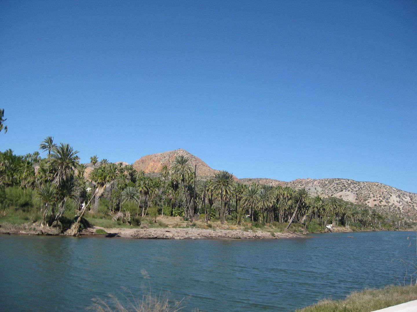
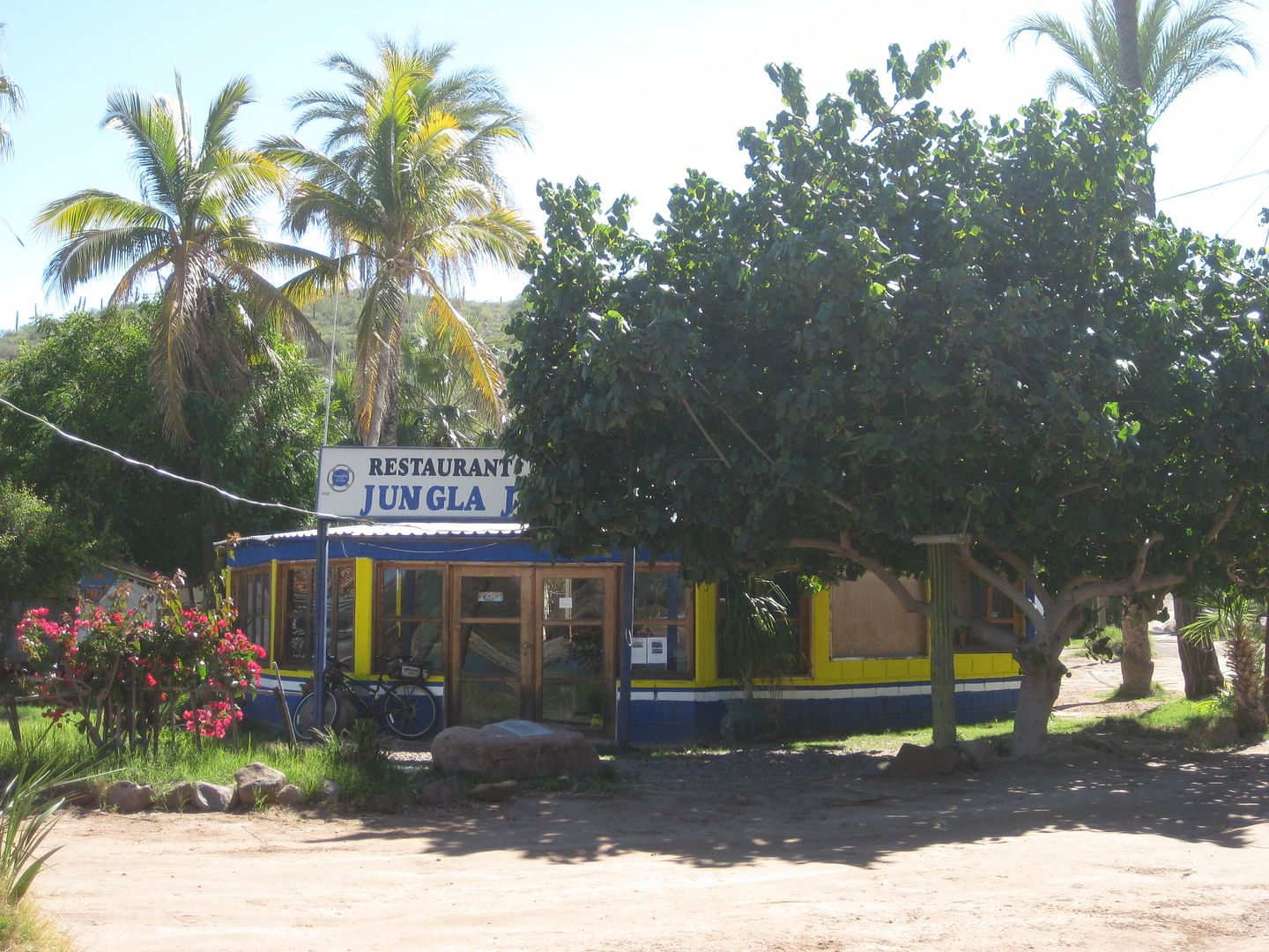
Km. 133 Jungla Jim's (was busy).
Cuesta Real (hotel & RV park). Km. 132/133
Villa María Isabel RV Park. Km. 132+
The Hotel Serenidad (Km. 131+) was pretty quiet looking. Such a big place, and almost no clients in sight. The airstrip looked okay, a bit wet still
maybe (it rained a week earlier).
The Pemex station is at Km. 130, and I am pretty sure the pumps here are rigged to short the amount pumped by about 15%. I didn't need a lot today,
but in a few days, it was more evident when I returned.
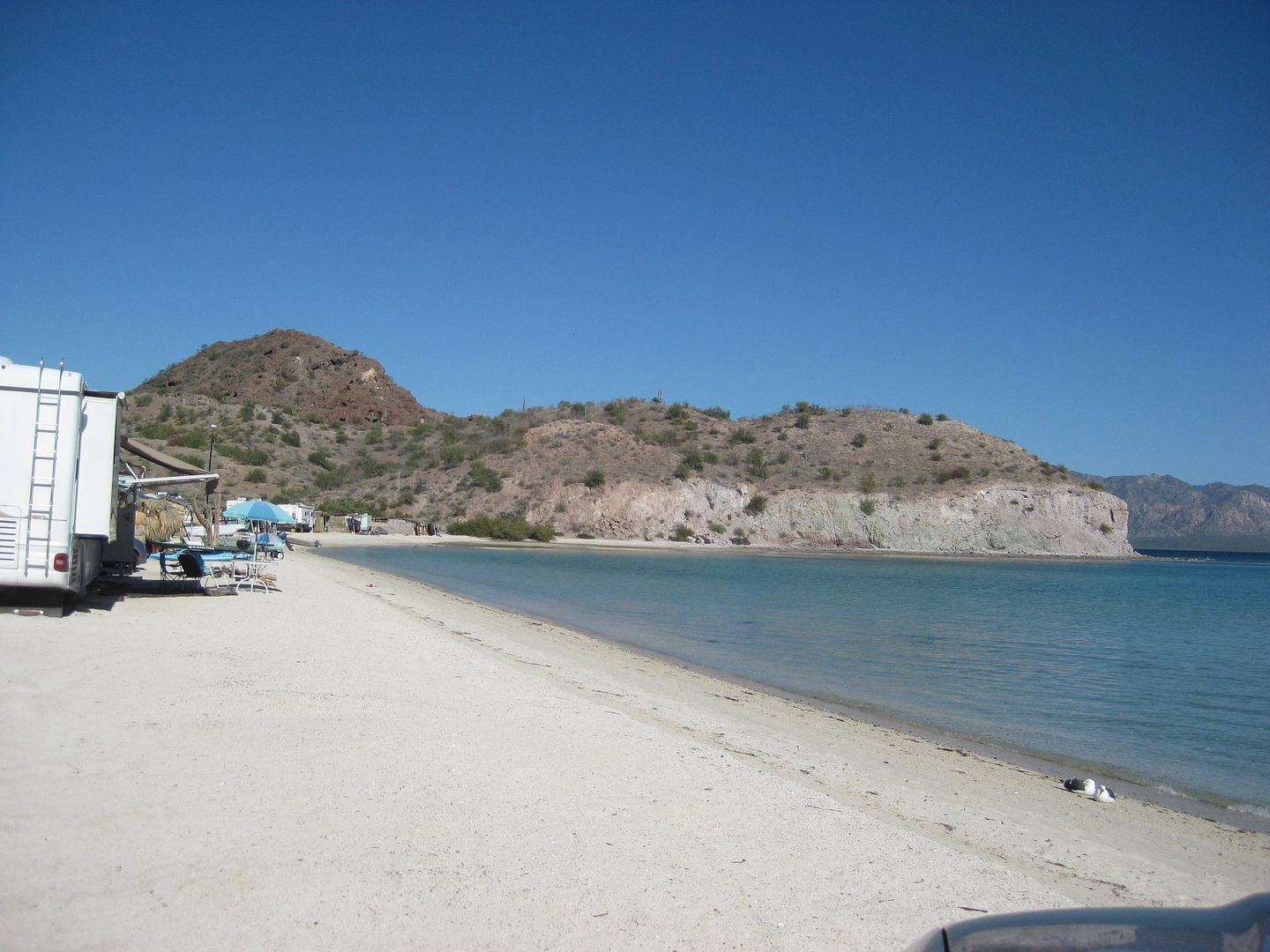
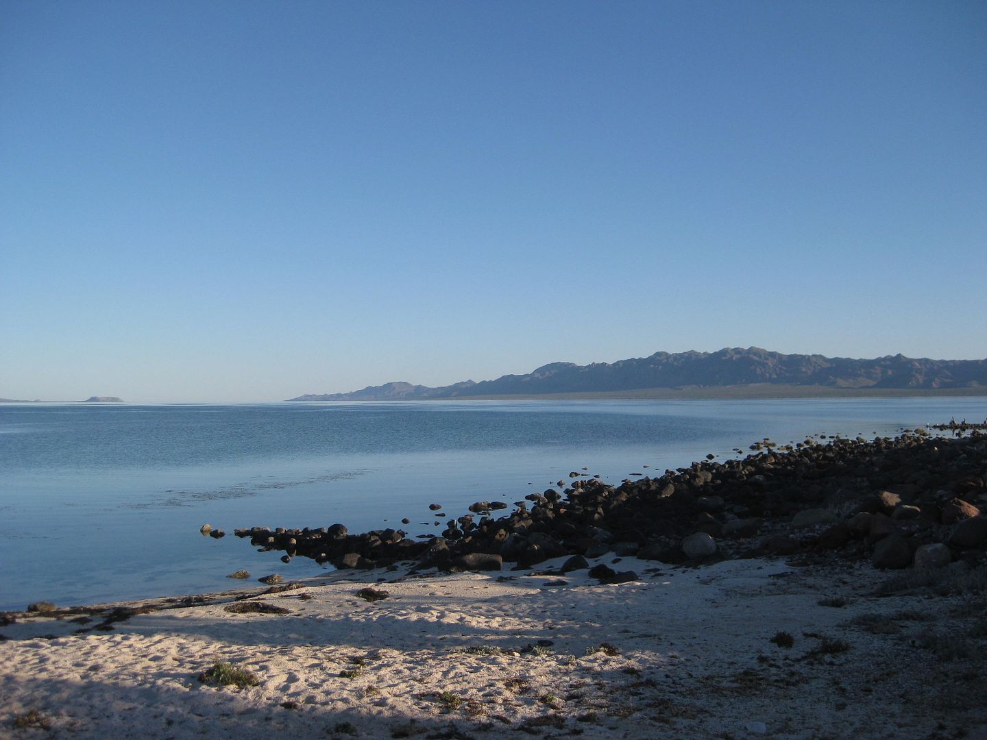
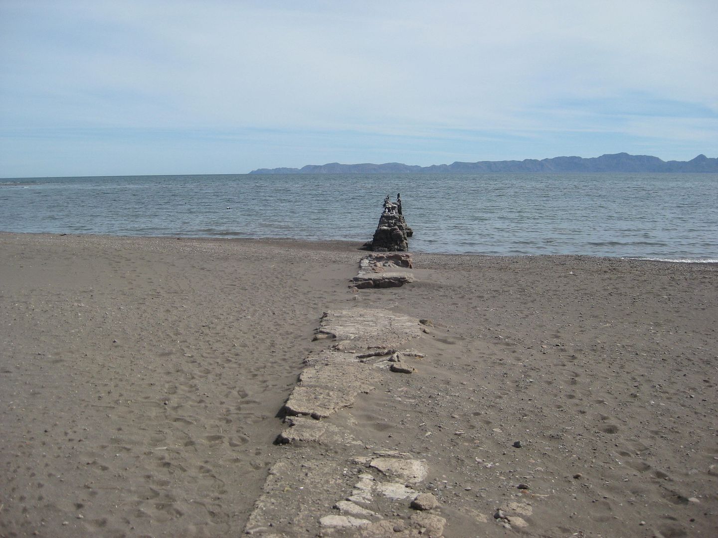
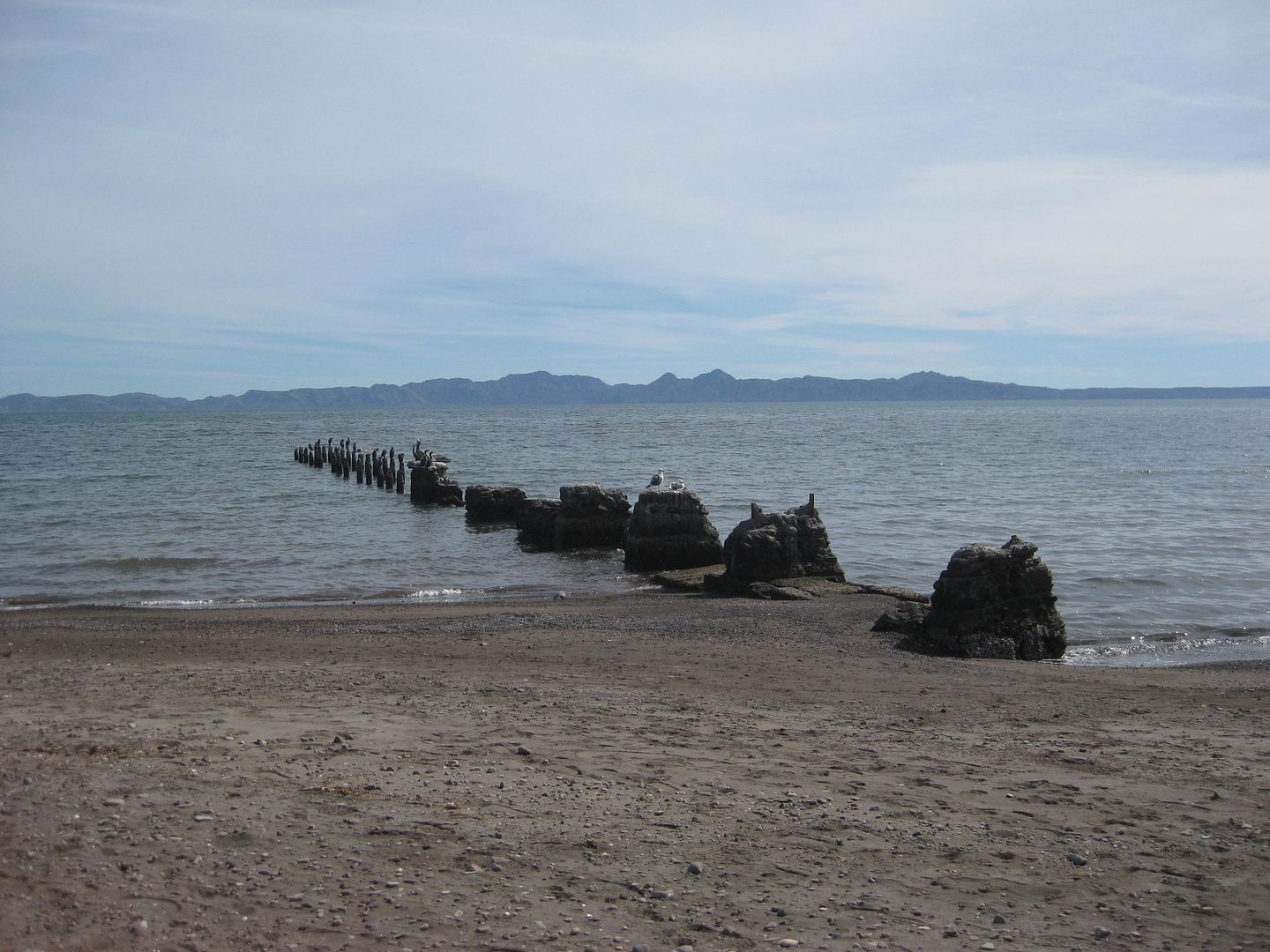
Here are a few Bahía Concepción shots:
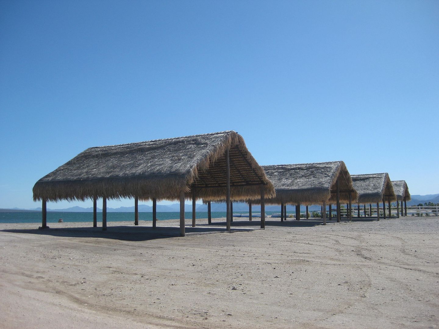
Playa Brisas del Mar
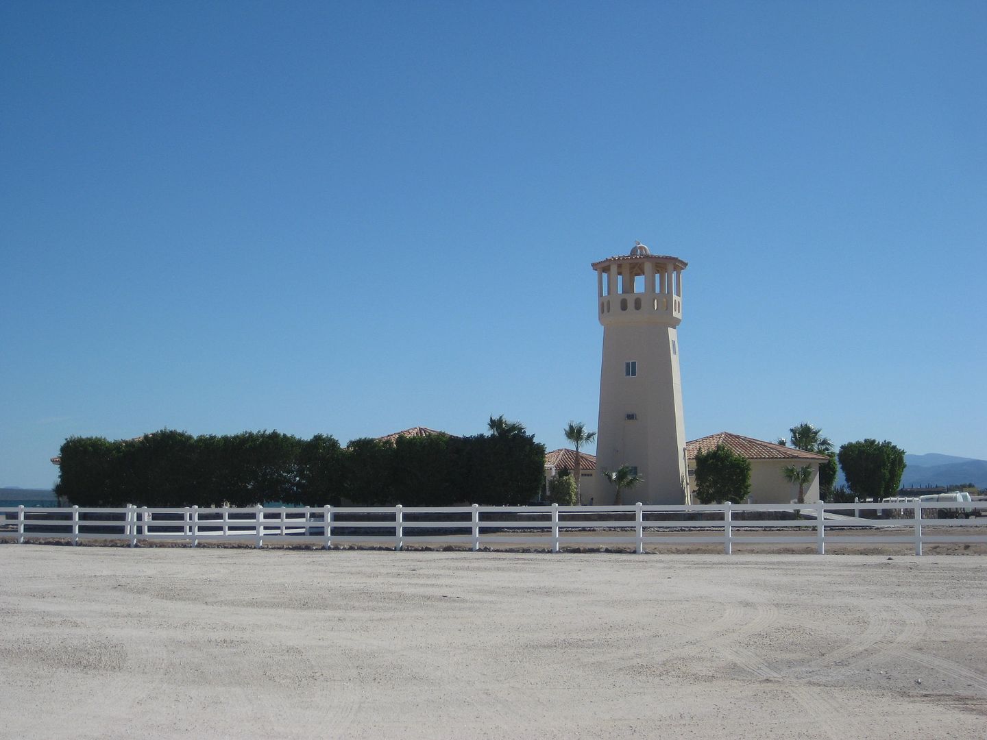
Playa Frambes Lighthouse Resort (Bob & Susan on Nomad)
Los Narranjos bungalos for rent (300 pesos).
Playa Santispac and most the other places were wall to wall snowbirds (90% Canadian).
MORE COMING...
|
|
|
David K
Honored Nomad
Posts: 64476
Registered: 8-30-2002
Location: San Diego County
Member Is Offline
Mood: Have Baja Fever
|
|
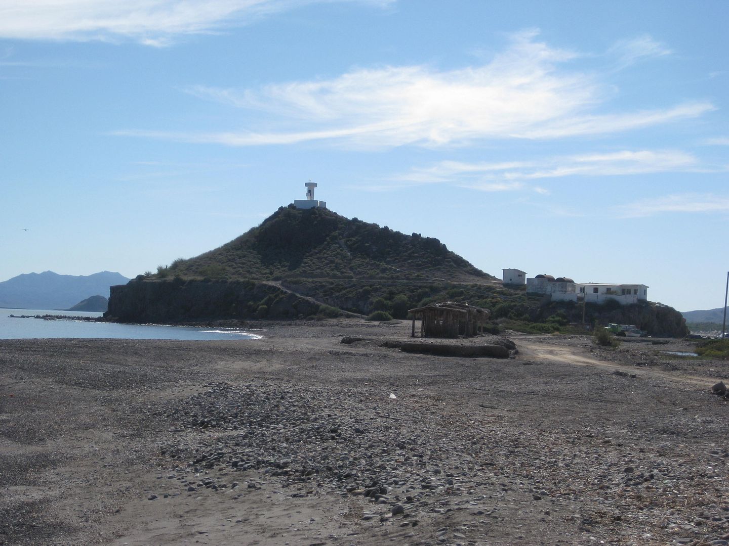
Leaving Santispac. The mangrove below is where the hot springs of Santispac are... in the mud.
Playa Escondida (Km. 111+)
The road back to the highway from Playa Escondida
Playa Los Cocos (Km. 110.5)
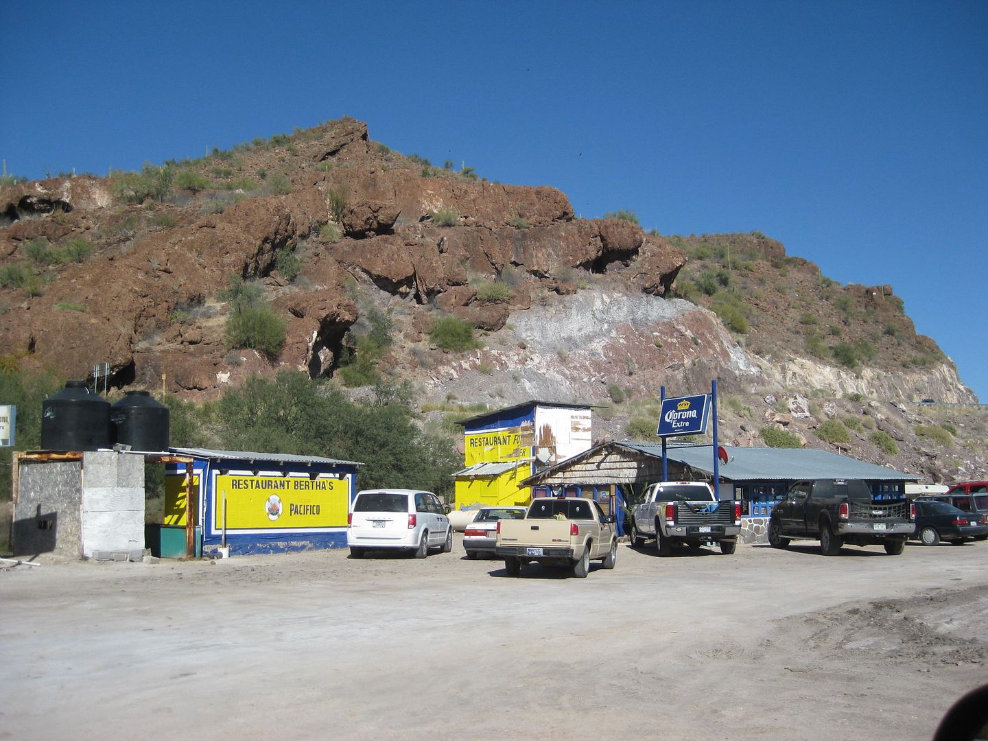
Betha's Restaurant/Playa El Burro (Km. 108.5)
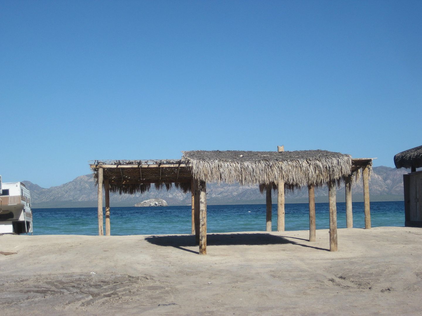
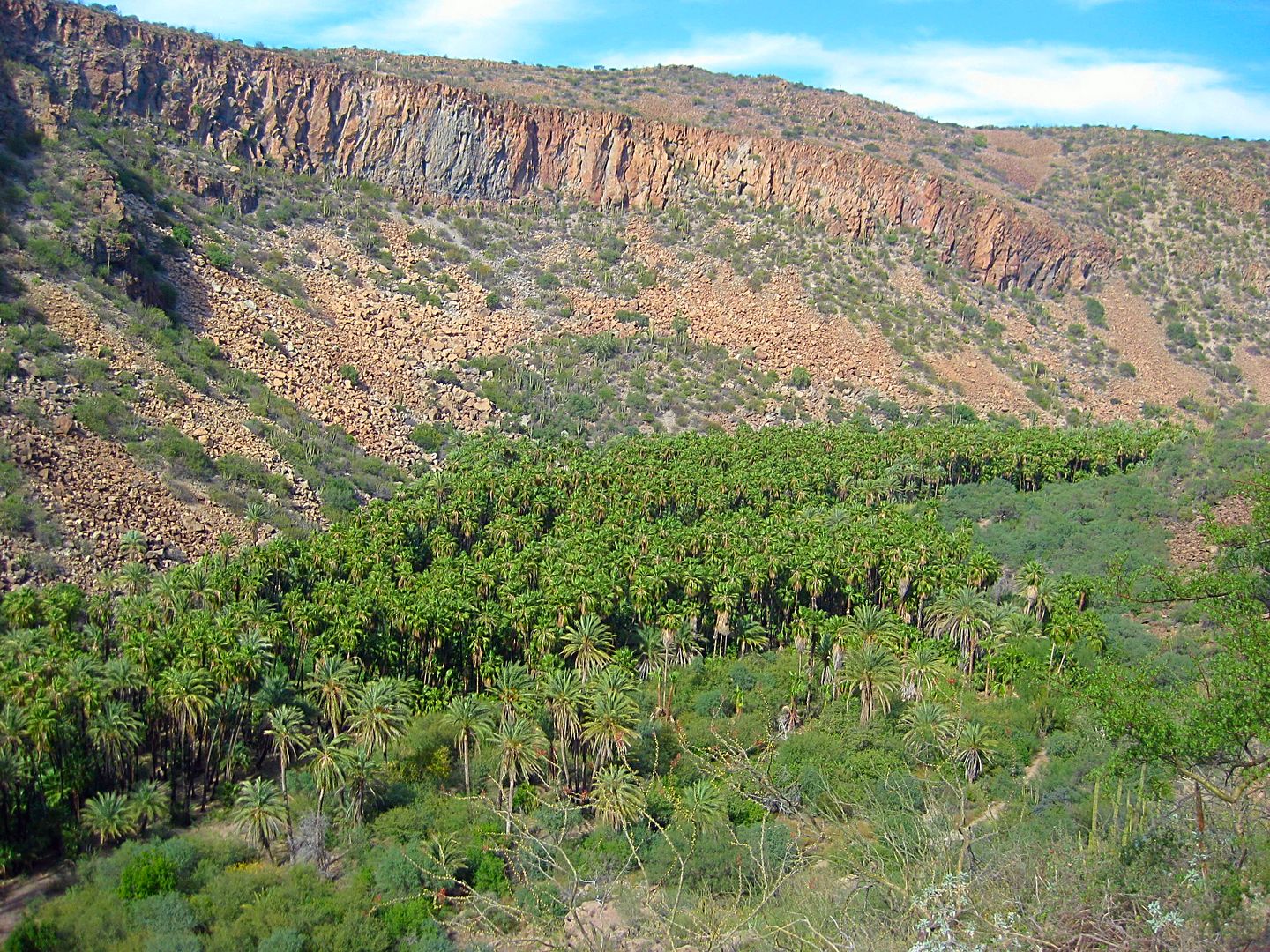
EL COYOTE, Km. 107 (Famous sea level palms):
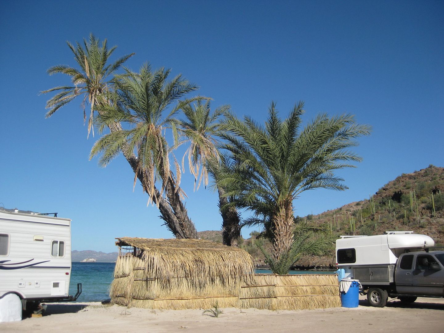
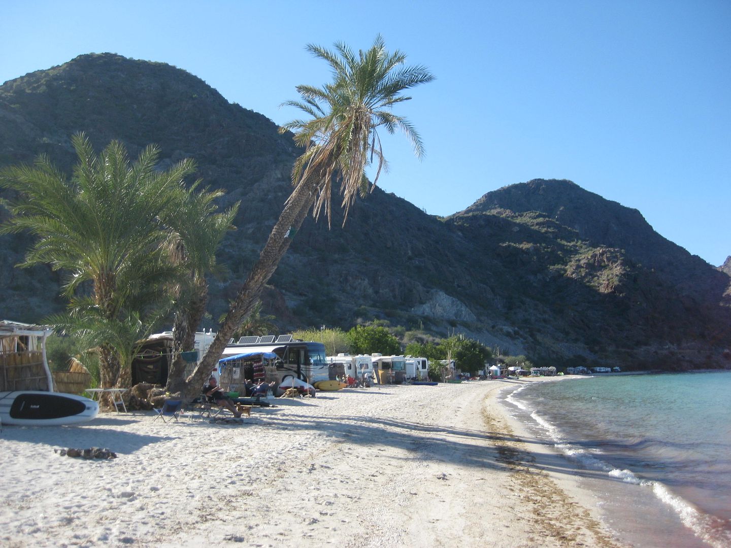
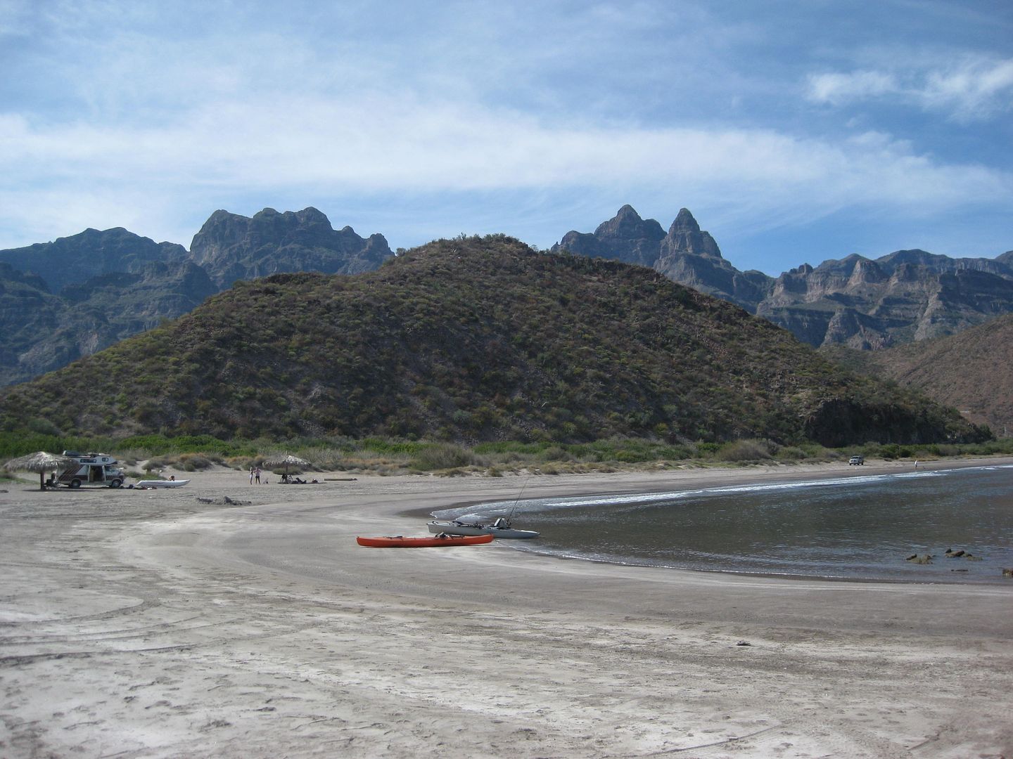
PLAYA BUENAVENTURA, Km. 93+ (Mark & Olivia's):
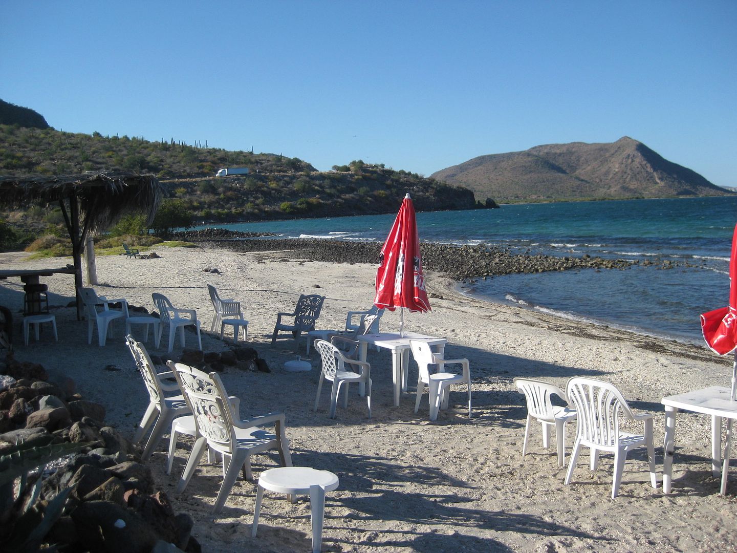
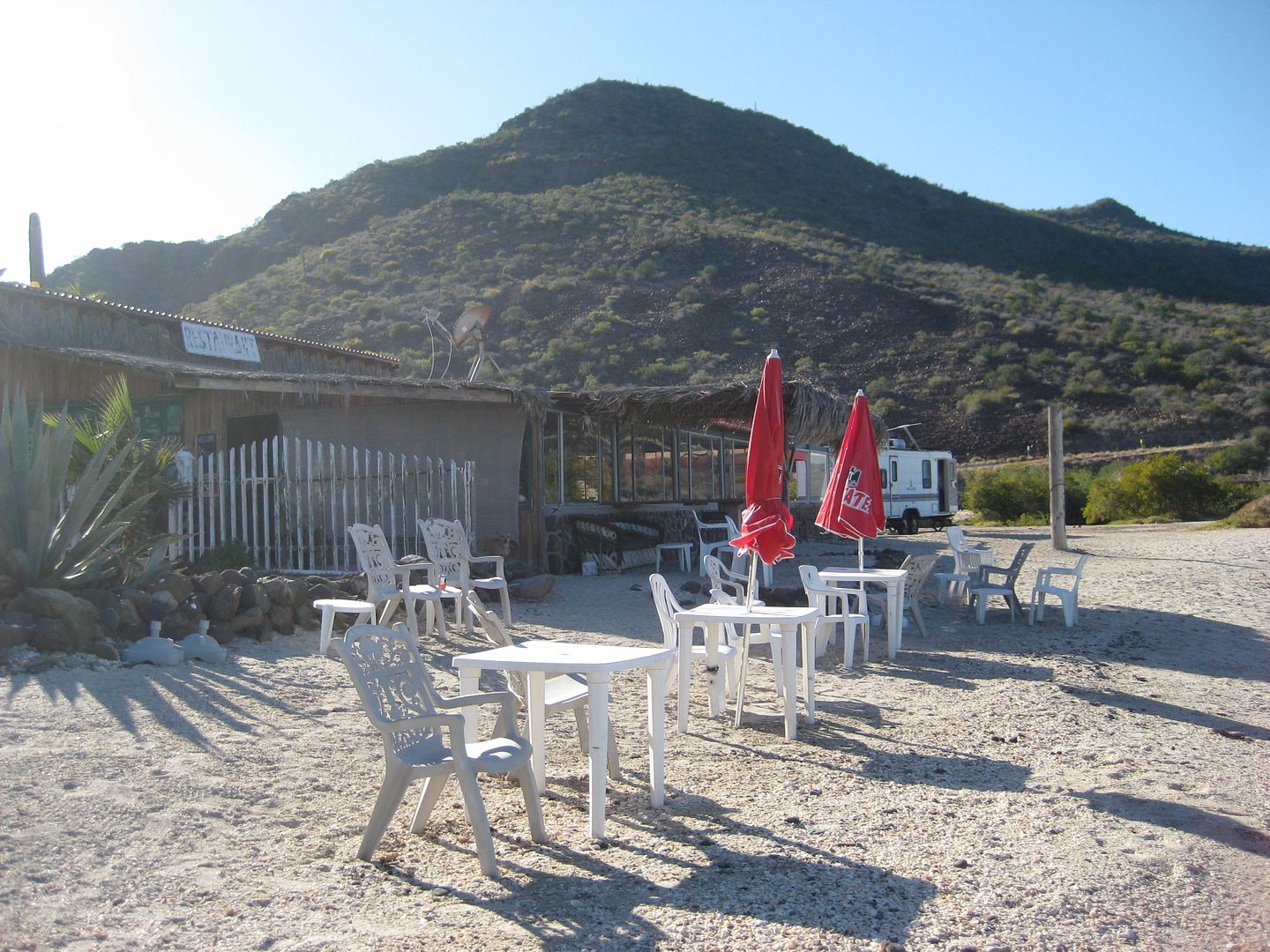
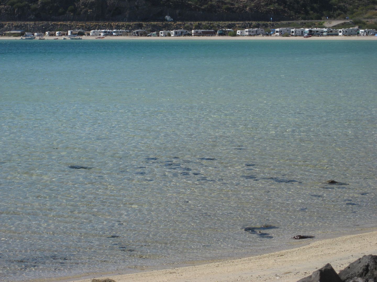
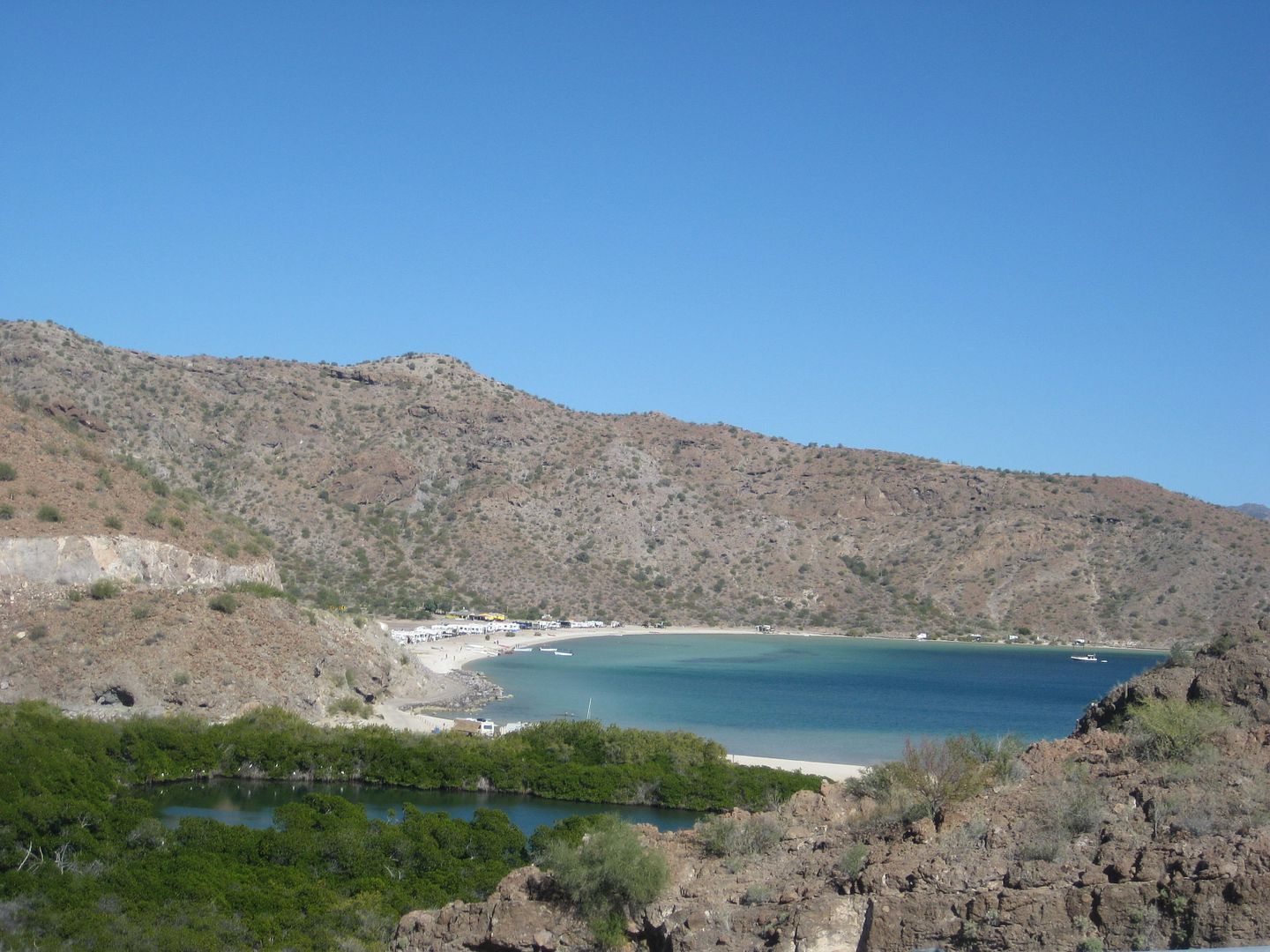
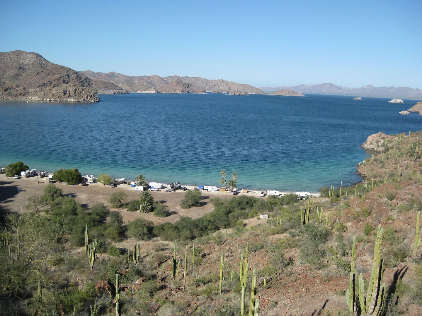
EL REQUESON (Km. 92, to the left):
LA PERLA (Km. 92, to the right):
Camping fee, 100 pesos.
End of DAY 3.
|
|
|
blackwolfmt
Senior Nomad
Posts: 802
Registered: 1-18-2014
Location: On The Beach With A Blackwolf
Member Is Offline
Mood: dreamin of Riden out a hurricane in Baja
|
|
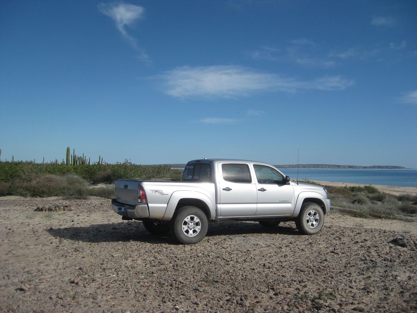
Lks like u were hittin the quite places DK,, what camera were u using for all the pics ?
So understand dont waste your time always searching for those wasted years
face up and make your stand and realize that your living in the golden years
|
|
|
Cardon
Nomad
Posts: 241
Registered: 4-23-2004
Location: Salt Lake City
Member Is Offline
|
|
I think he used a Canon Powershot sd1100 is which first came out in 2001. The camera is ok but all the shots are a little bit soft and should be run
through photoshop or lightroom to clean them up.
Even photos from the most expensive Canon and Nikon cameras can use a little bit of clean up.
|
|
|
David K
Honored Nomad
Posts: 64476
Registered: 8-30-2002
Location: San Diego County
Member Is Offline
Mood: Have Baja Fever
|
|
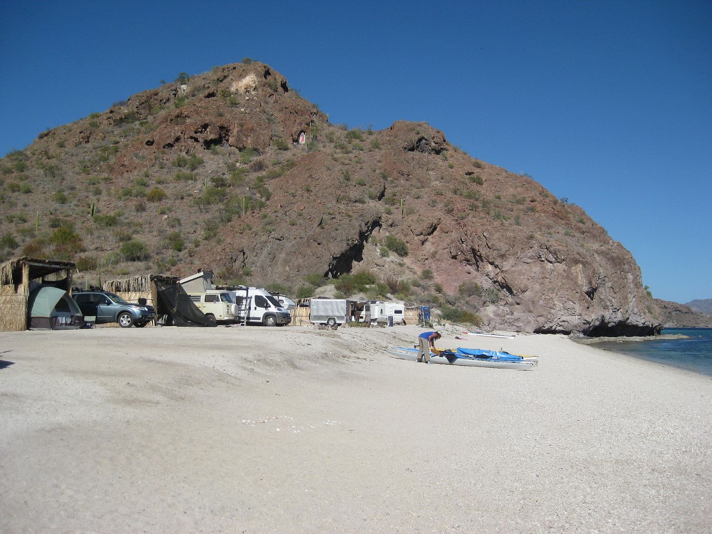
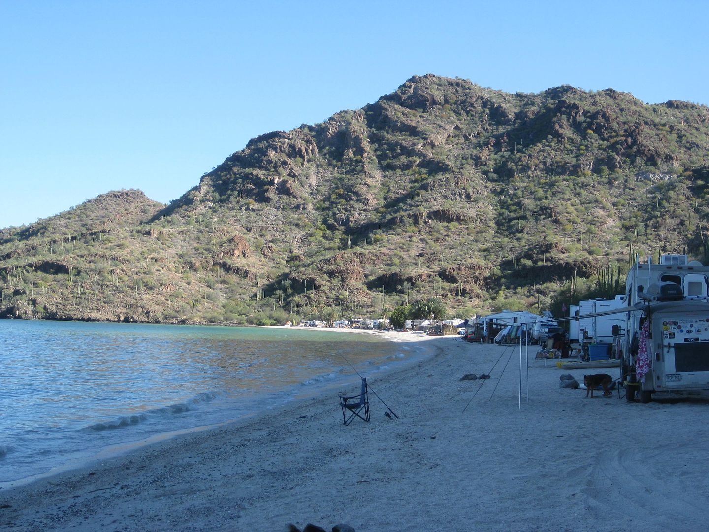
DAY 4, Thursday Feb. 2 (Groundhog sees his shadow)
It was a pleasant night at La Perla. I introduced myself to the one other camper, at the north palapa. A man named Serg from Quebec and his wife
(didn't see her that day). He bought one of my books. Serg had been there for many days or weeks, very content. Beats winter in the Great White North,
eh?
I was on the road at 9:45 am...
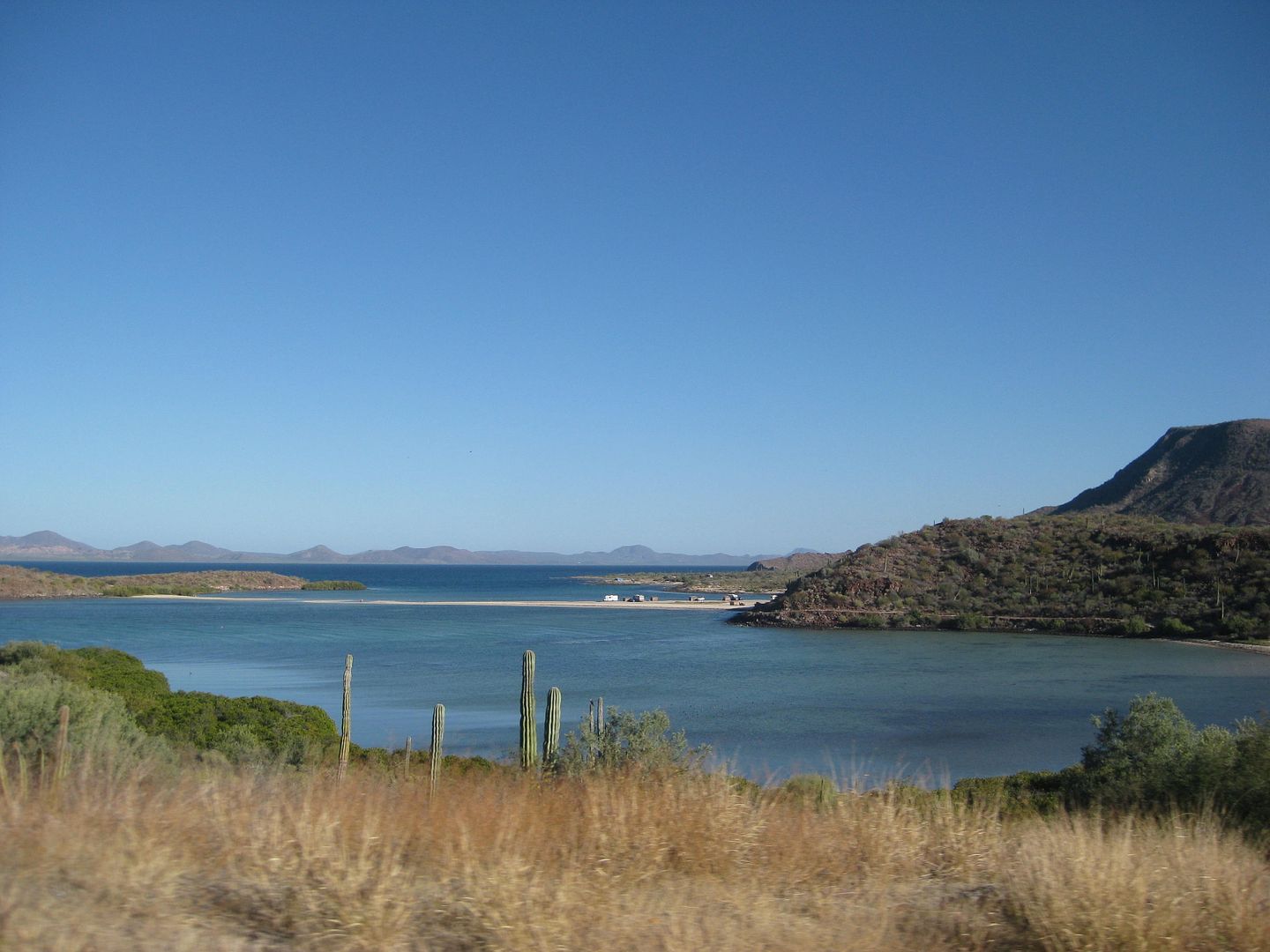
One more camping beach is just south...
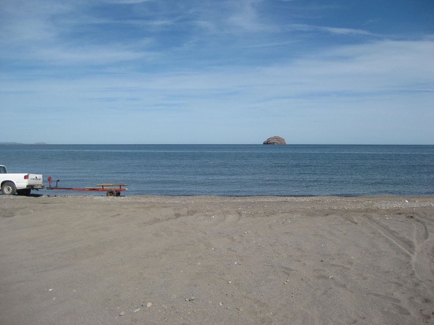
Playa Armenta (Km. 90+ and 89+)
[the + means about 1/4 kilometer from the marker, or just out of sight]
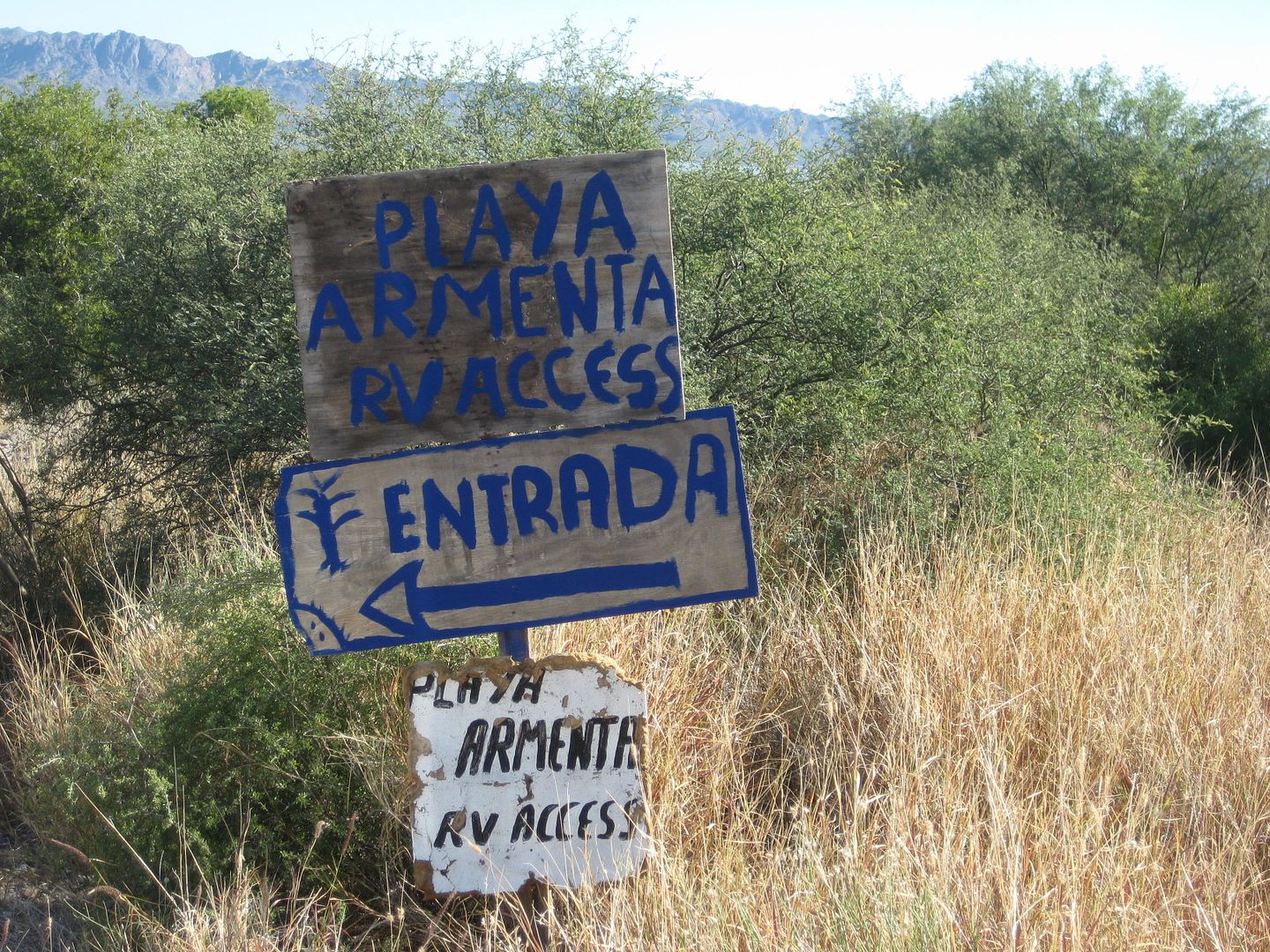
It is about a kilometer (0.6 mi.) drive in from the north entrance, on the original road to La Paz.
Heading south, I wanted to see San Nicolas. Heard lots about it and seen Nomad photos in the past... Nomad 'Vgabndo' (Perry) used to have a place
there. He gave Baja Nomad the term "Peace, Love, and Fish Tacos" as our motto.

The junction for San Nicolas is just past the Rosarito restaurant and along the runway built during the construction of Hwy. 1 through here about
1970-1971. It is just south of Km. 62.


Flash flood(s) have really cut through here in the recent past.
It is 10.6 miles to the beach from Hwy. 1 on fairly good graded road, complete with highway signs and kilometer posts. A 'Chuy's Sportfishing' sign is
in the village area. Nothing looked like a camping area or any rooms (or at least signs), so back out to the highway.
At Km. 59+ is the graded road west to San Isidro and La Purísima. This road I will be traveling in a few more days is NOT maintained and should be
avoided by most, only trucks and SUVs, as it is very rough. Only a few miles near Hwy. 1 (here) are smooth and fast. Flash floods and rain of the past
couple of years has been hard on the roads in Baja Sur.
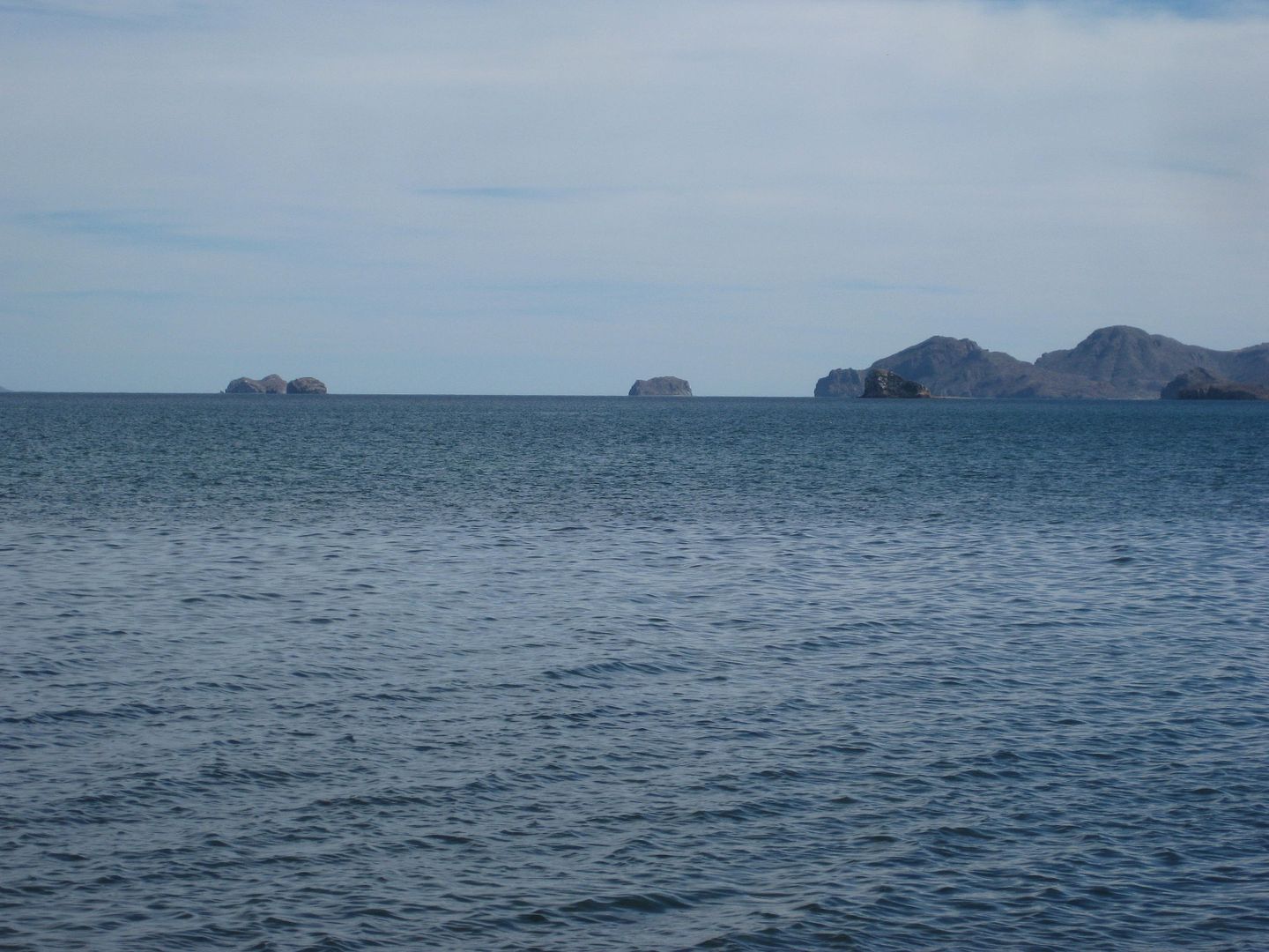
The next coastal area I wanted to see was San Juanico and San Basilio. There are two roads in. The first is unsigned at Km. 48.5 and the second has a
big sign (Km. 40) the reads to NOT use this road, go north to Km. 49.
I would see later that this Km. 40 road is chained closed on the east end and is for the use of the property owner of San Basilio, all are welcome to
San Basilio, but use the natural arroyo road at Km. 48.5. So back north I go up Hwy. 1, 5 miles...


There is an unsigned fork at Mile 6.8. The left fork goes 2.4 miles more to the fishing village of San Juanico. No camping facility or rooms were
seen.

Back to the fork, and going on the right fork (and keep right in 1 mile at another fork) in just 1.5 miles met up with the graded road from Km. 40,
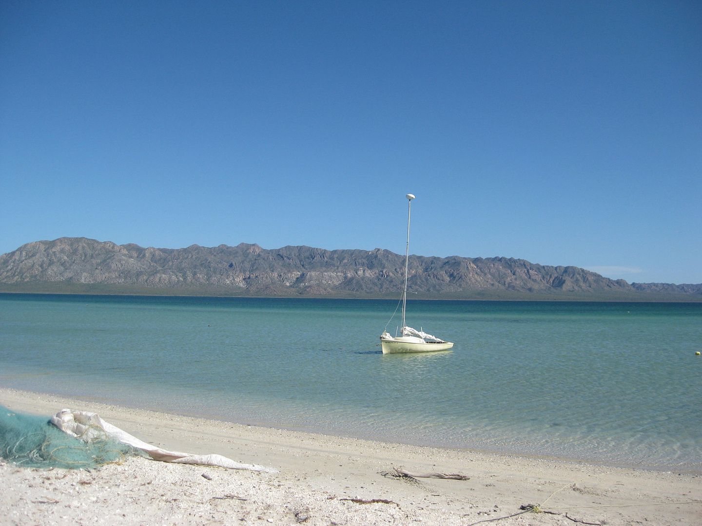
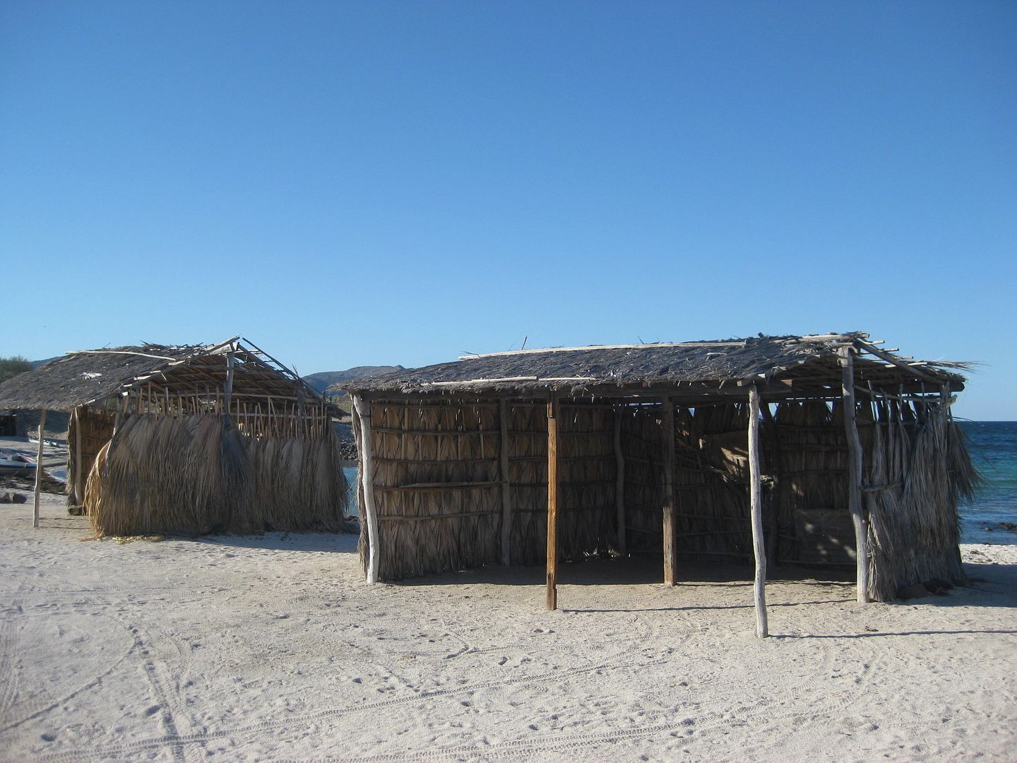
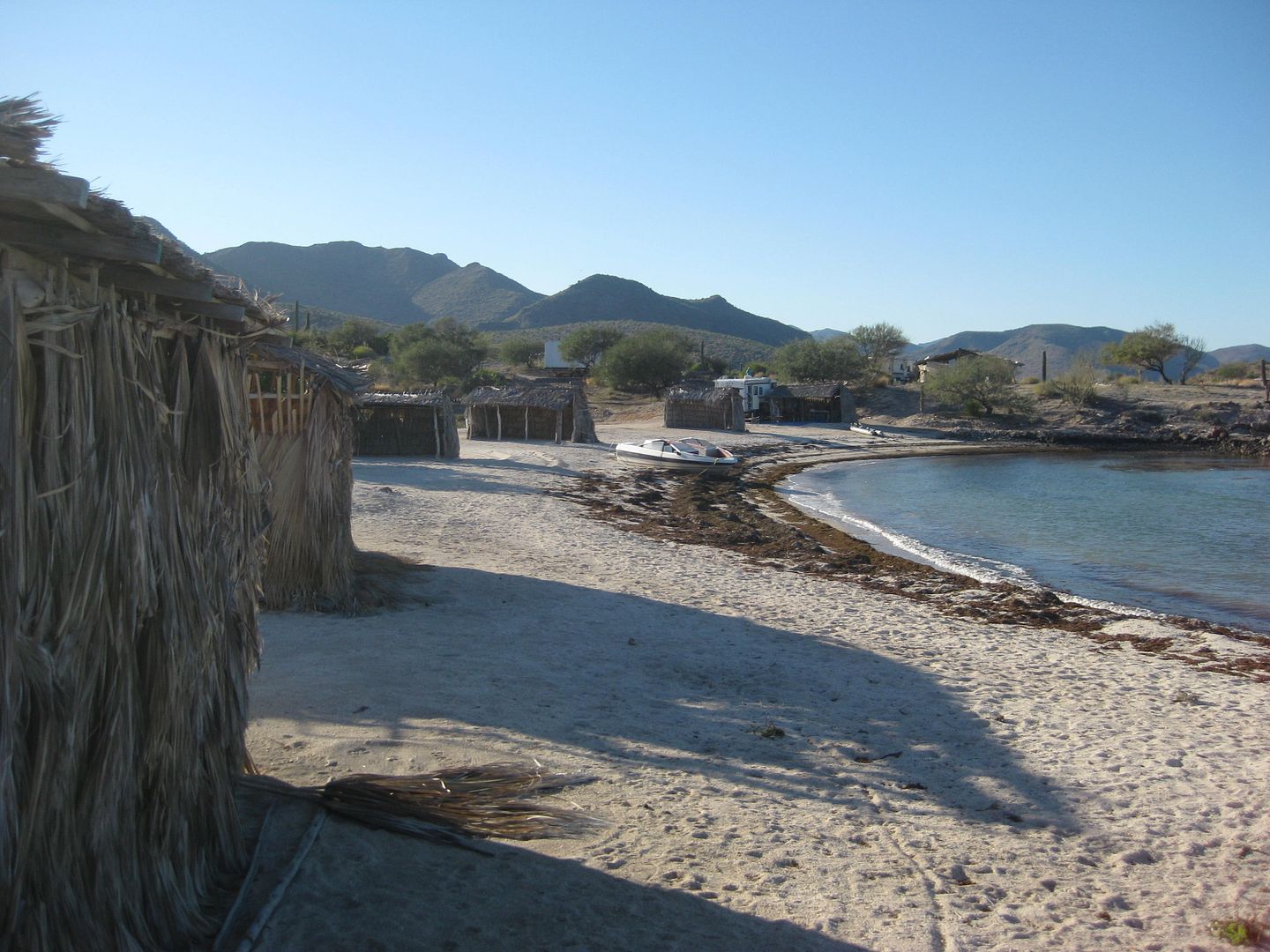
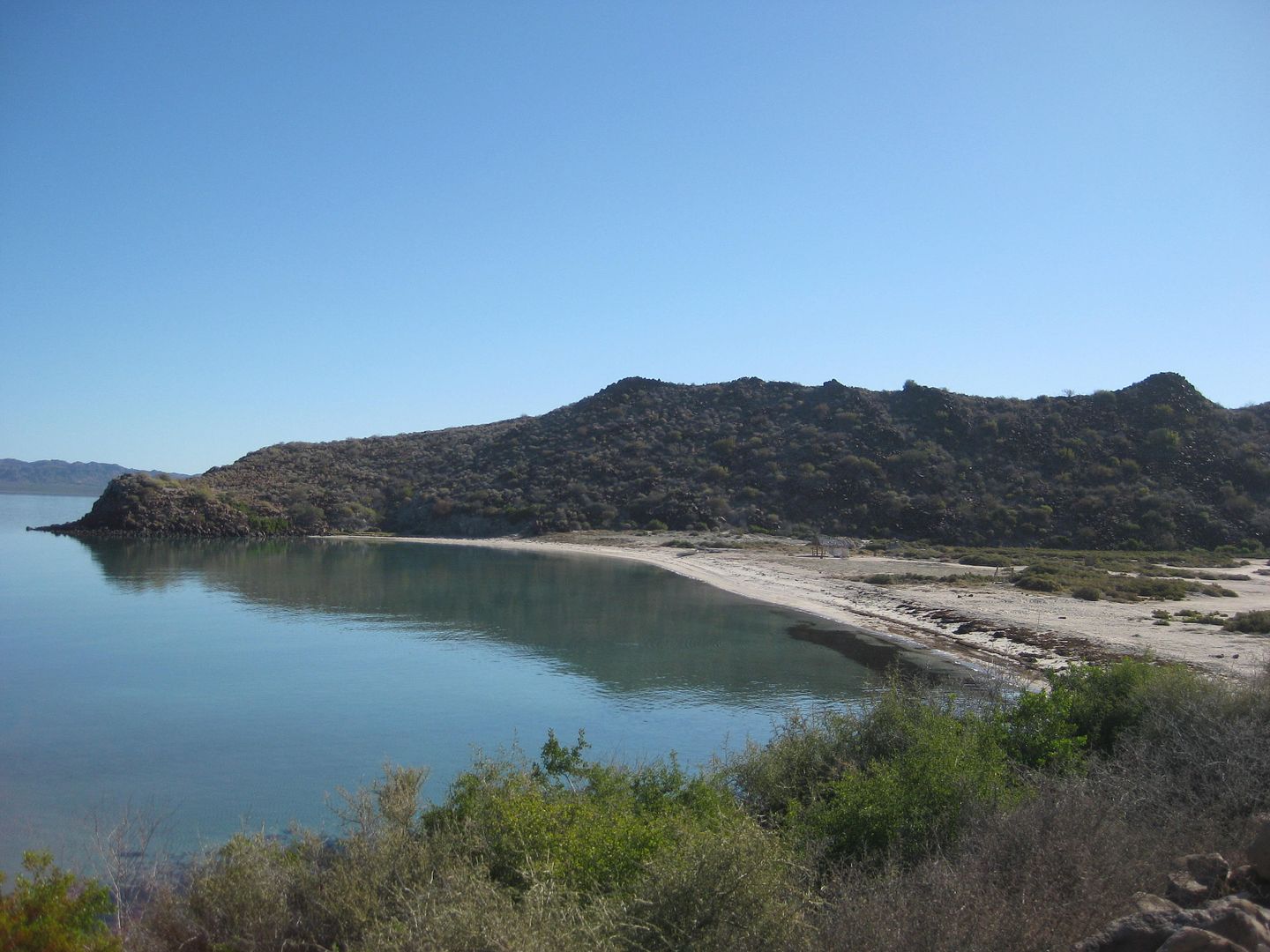
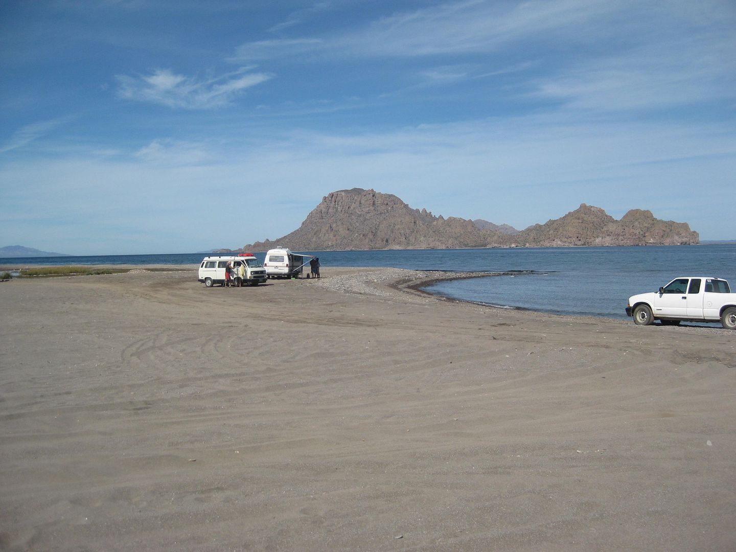
and was chained closed. A San Basilio property guard met me where these burros were and told me I could camp ahead, no problema.

3.3 miles from the fork, or 10 miles from Hwy. 1 is a cattle guard crossing and a fork. I could see many campers to the right, so I first went left
about 1/2 mile to a deserted beach:

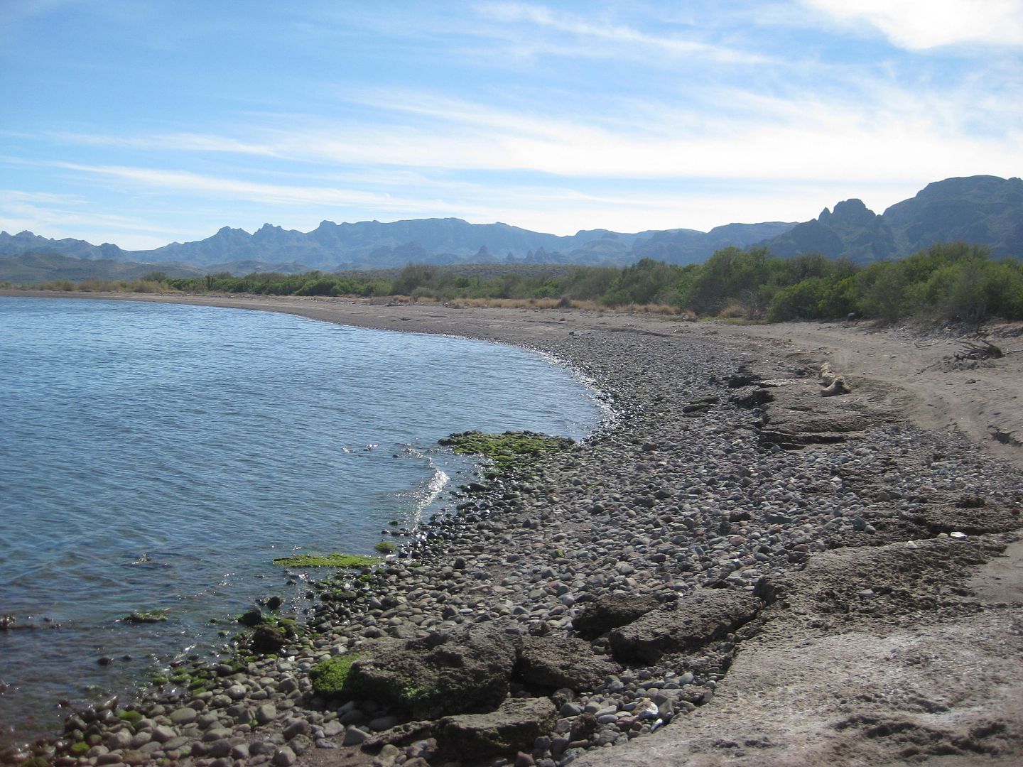
San Basilio north beach.

The left end after the sand part.
The road to this beach continues up a hill to the private home area. I went back to see the other beach, on the bay with yachts offshore. It is 1/2
mile from the cattle guard fork to the south beach.


San Basilio south beach.
I took photos and made a U-turn and left. Other vehicles were on the beach, note tracks.
Back out to the highway and southbound again.
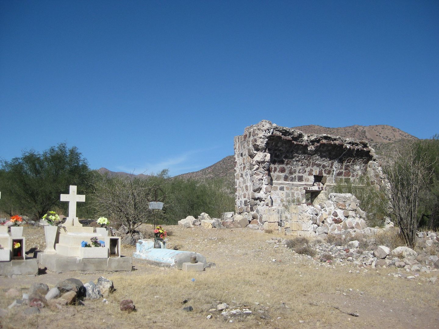
Just south of Km. 30 is a signed road right to the mission site of San Juan Londó, an important visita (mission visiting station/ chapel) of the
Loreto mission from around 1705 and later attached to the Comondú mission.
You go just 0.4 mile, and park between the ruins and a ranch. A cemetary is next to the site.
At Km. 26+ is a road that leads east towards San Bruno, the oldest Spanish ruins in California (1683-1685) where an attempt to establish a mission and
colony was made.
The military checkpoint is at Km. 24. The did not even look at southbound cars.
Approaching Loreto...
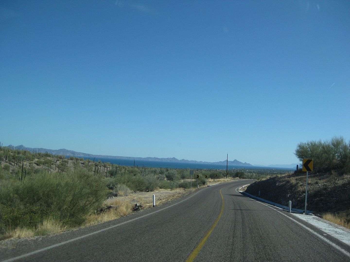
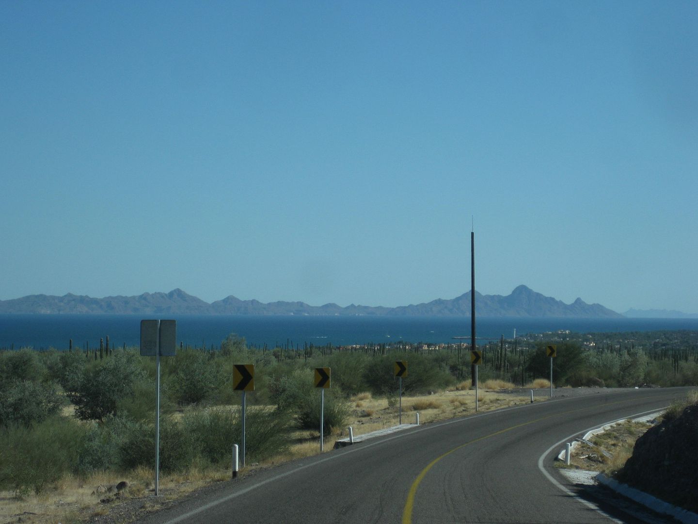
The first missson and capital of California (Baja & Alta)...
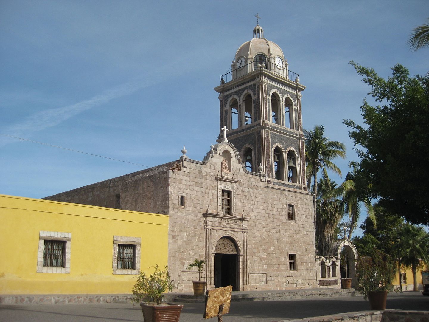
Here is El Caballo Blanco, Jeannie's bookstore, she had asked I bring her 15 books when she heard I was going to be in Loreto and if I could give a
lecture on the missions the following night. If you haven't seen my book yet: www.oldmissions.com is where the publisher sells it (also on my personal site www.vivabaja.com I am pretty proud of my baby, it is now in its third printing.
I got a room at the Hotel Angra for 830 pesos (=$41.50), it has secured parking in front of the rooms, which are in a courtyard of sorts. It was nice,
had wifi, and a continental breakfast was included.
The place is new, the room is nice. The only gripe was a neighbor's rooster was crowing at midnight the first night and barking dog was active the
next night. Neither were the management's fault, of course.
END of DAY 4.
To be continued!
[Edited on 2-18-2017 by David K]
|
|
|
David K
Honored Nomad
Posts: 64476
Registered: 8-30-2002
Location: San Diego County
Member Is Offline
Mood: Have Baja Fever
|
|
Thanks, just a little Canon PowerShot SD1100 IS. I have had it for several years.
|
|
|
David K
Honored Nomad
Posts: 64476
Registered: 8-30-2002
Location: San Diego County
Member Is Offline
Mood: Have Baja Fever
|
|
Quote: Originally posted by Cardon  | I think he used a Canon Powershot sd1100 is which first came out in 2001. The camera is ok but all the shots are a little bit soft and should be run
through photoshop or lightroom to clean them up.
Even photos from the most expensive Canon and Nikon cameras can use a little bit of clean up. |
I agree... I run some photos through the photo enhancer on Photobucket sometimes.
|
|
|
Cliffy
Senior Nomad
Posts: 983
Registered: 12-19-2013
Member Is Offline
|
|
Amazing!
You chose your position in life today by what YOU did yesterday
|
|
|
David K
Honored Nomad
Posts: 64476
Registered: 8-30-2002
Location: San Diego County
Member Is Offline
Mood: Have Baja Fever
|
|
DAY 5 Fri. Feb. 3, 2017
Today I explore around Loreto.
I first want to say what a great dinner I had the previous night with Baja Nomad 'ncampion' who picked me up at the hotel and took me to Orlando's. A
winner, for sure! I had the Cilantro Fish plate and Nick had the Mango Fish plate. Ice cold Pacificos made it a complete meal with chips and salsa.
Okay, so first thing is, being a history guy, I wanted to see what came of the first fishing resort in town, from the 1950s, the Flying Sportsman
Lodge. It had the town's first pier in front. It was the cover of the famous Ray Cannon book, The Sea of Cortez:

That book was published in 1966.
The pier in 2017
On south to see any camping possibilities between Loreto and where the highway begins to climb the sierra and leave the gulf coast for La Paz.
Km. 117+ is the paved highway west to San Javier, where I will go tomorrow. This is about 1 mile south of Loreto's entrance road.
Km. 99.5 View Parking
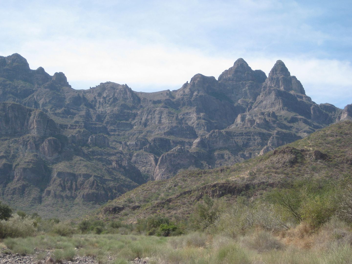
The Sierra Giganta.
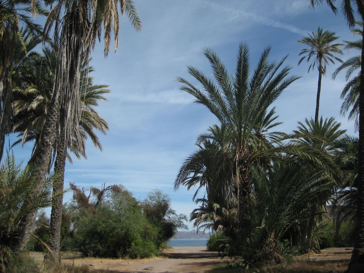
Palm grove near the beach, just south of Juncalito, Km. 97.
The beach, some campers.
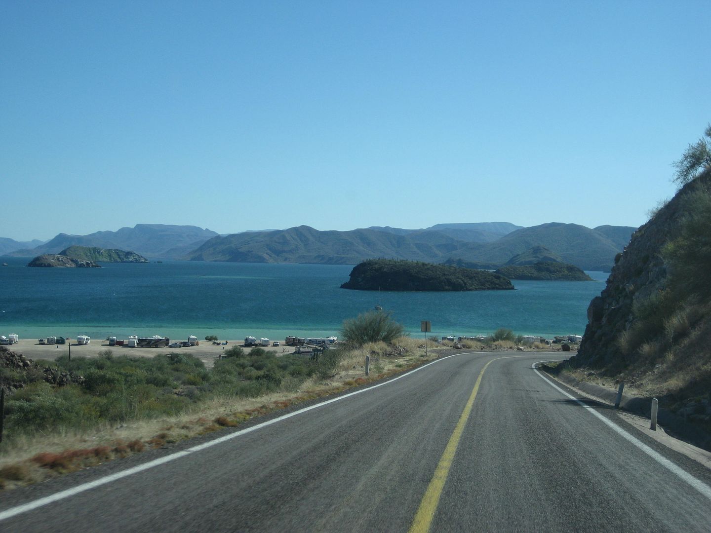
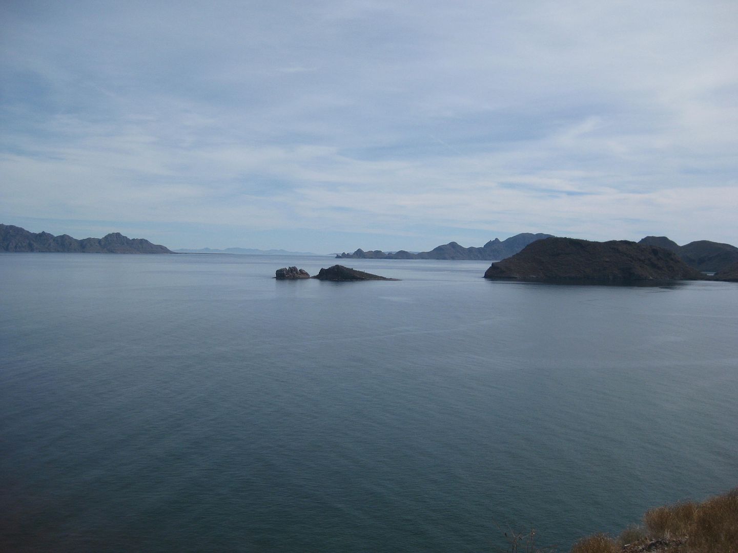
Puerto Escondido Paved road near Km. 94
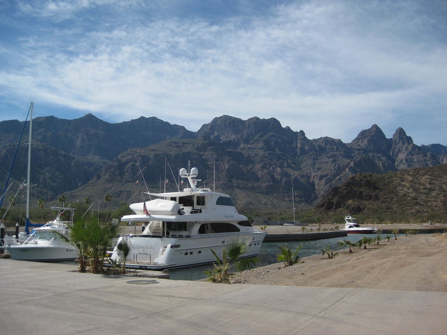
Yacht Harbor
The harbor is a mile+ in. Closer to the highway is the Tripui Hotel and RV Park. They offer lawn camping. Very friendly. Camping is $10/pp, RV with
hookups is $20/pp and a hotel room is 1,290 pesos (=$64.50).
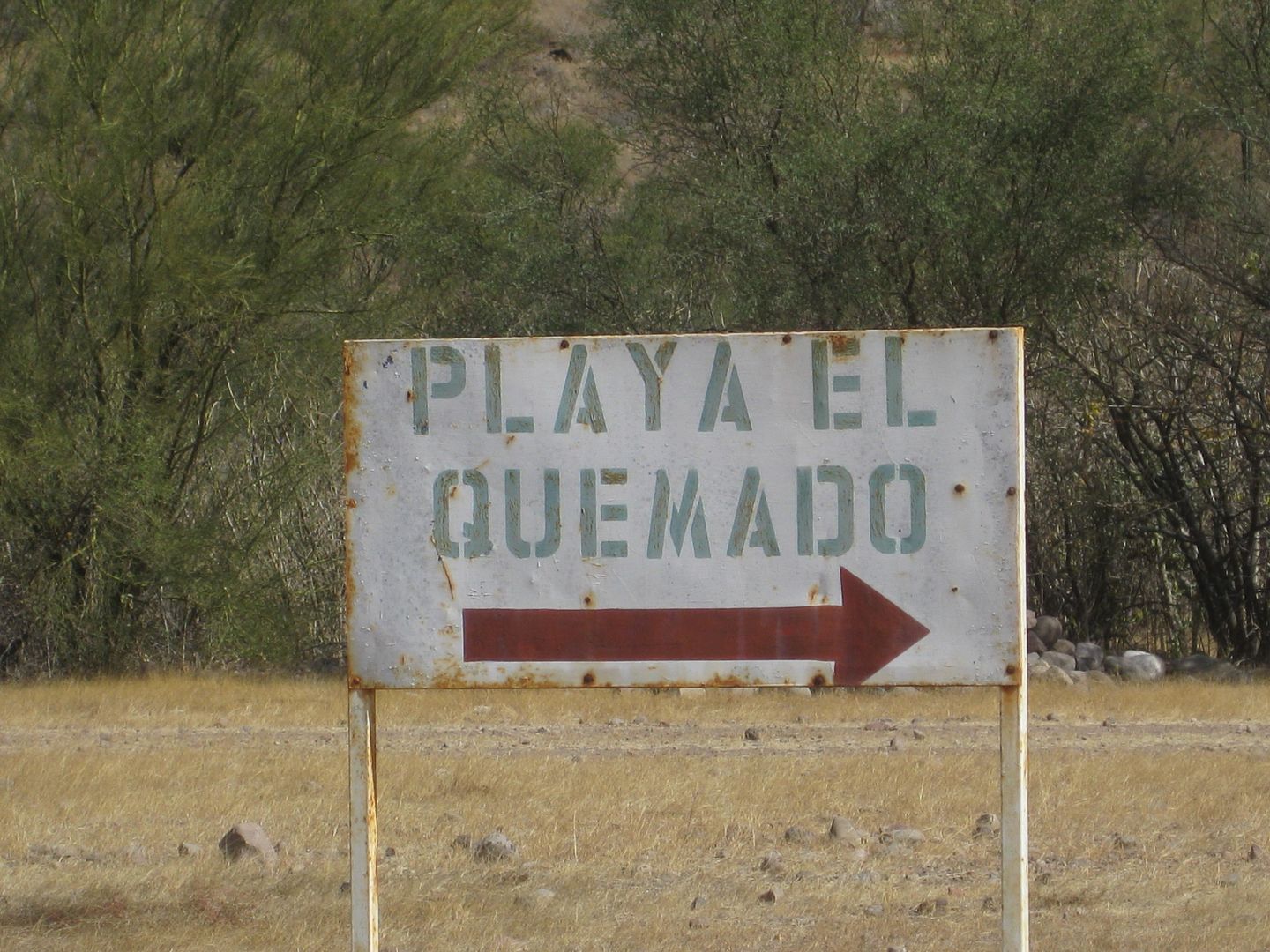
A bit closer to the highway from Tripui complex is an unsigned dirt road south. It seems to be a secret area but not really, as every spot was
occupied by snowbird campers! A sign along the way reads Playa El Quemado. It is 1.5 miles to the mostly rocky beach and spots along the beach between
sand hills with brush extend a half mile to the south.
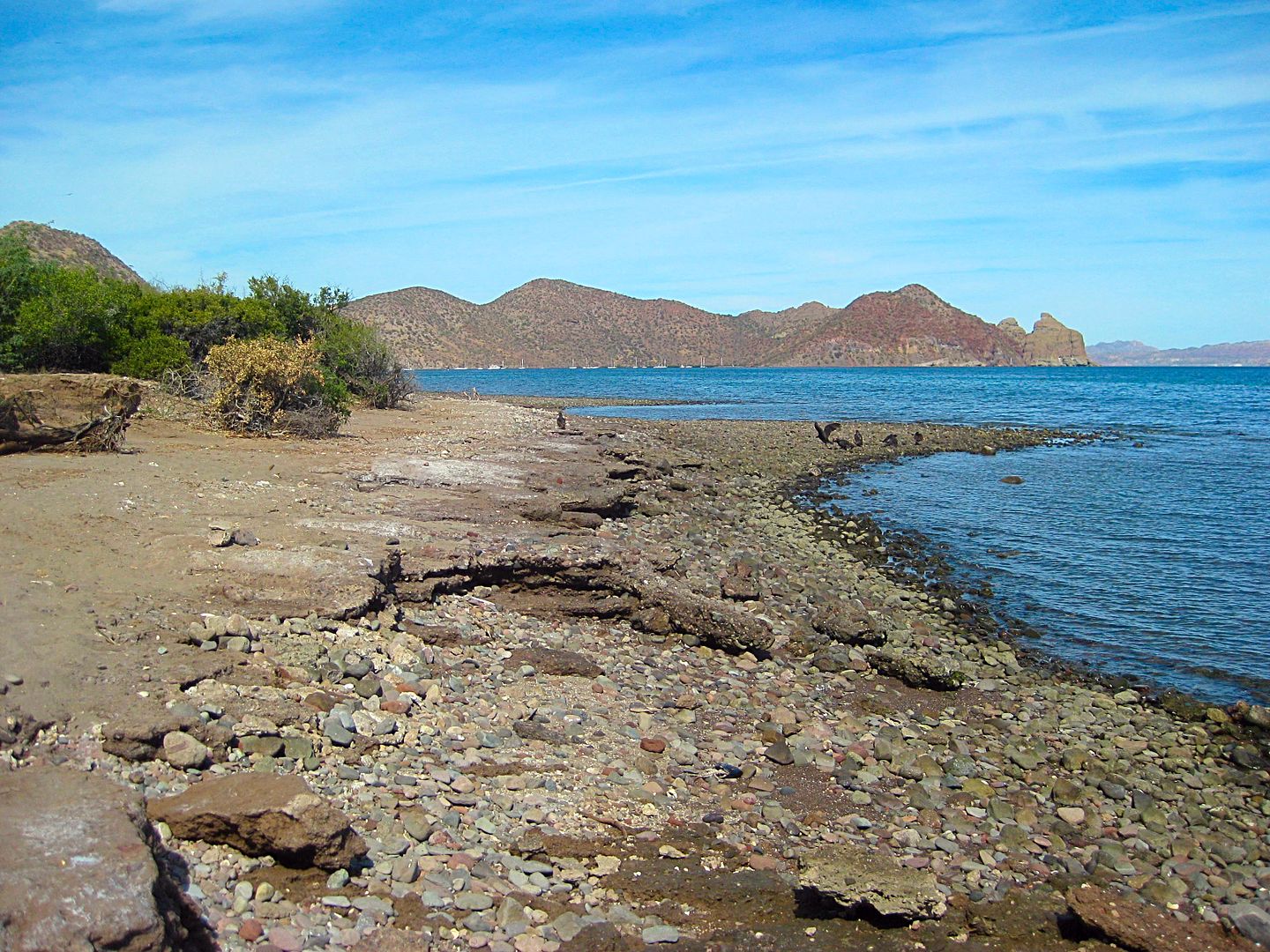
Km. 84+ Ligüí, a small town on the left. Turn off highway at the school, before the road begins the uphill climb.
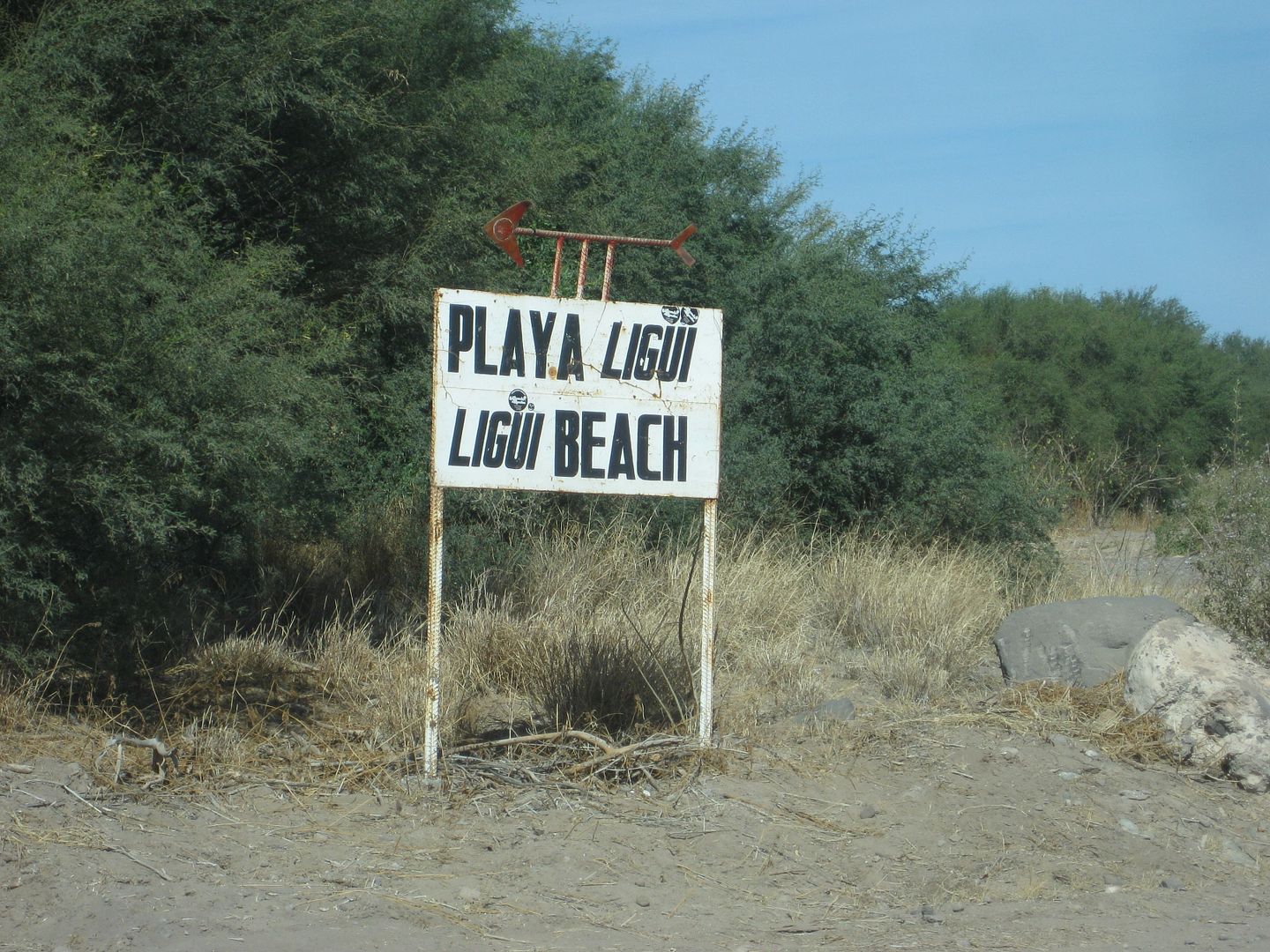
The road left was badly mangled by a flash flood and the white cross and white painted rocks outlining the mission memorial site has been destroyed
since my previous visit here, in 2012.
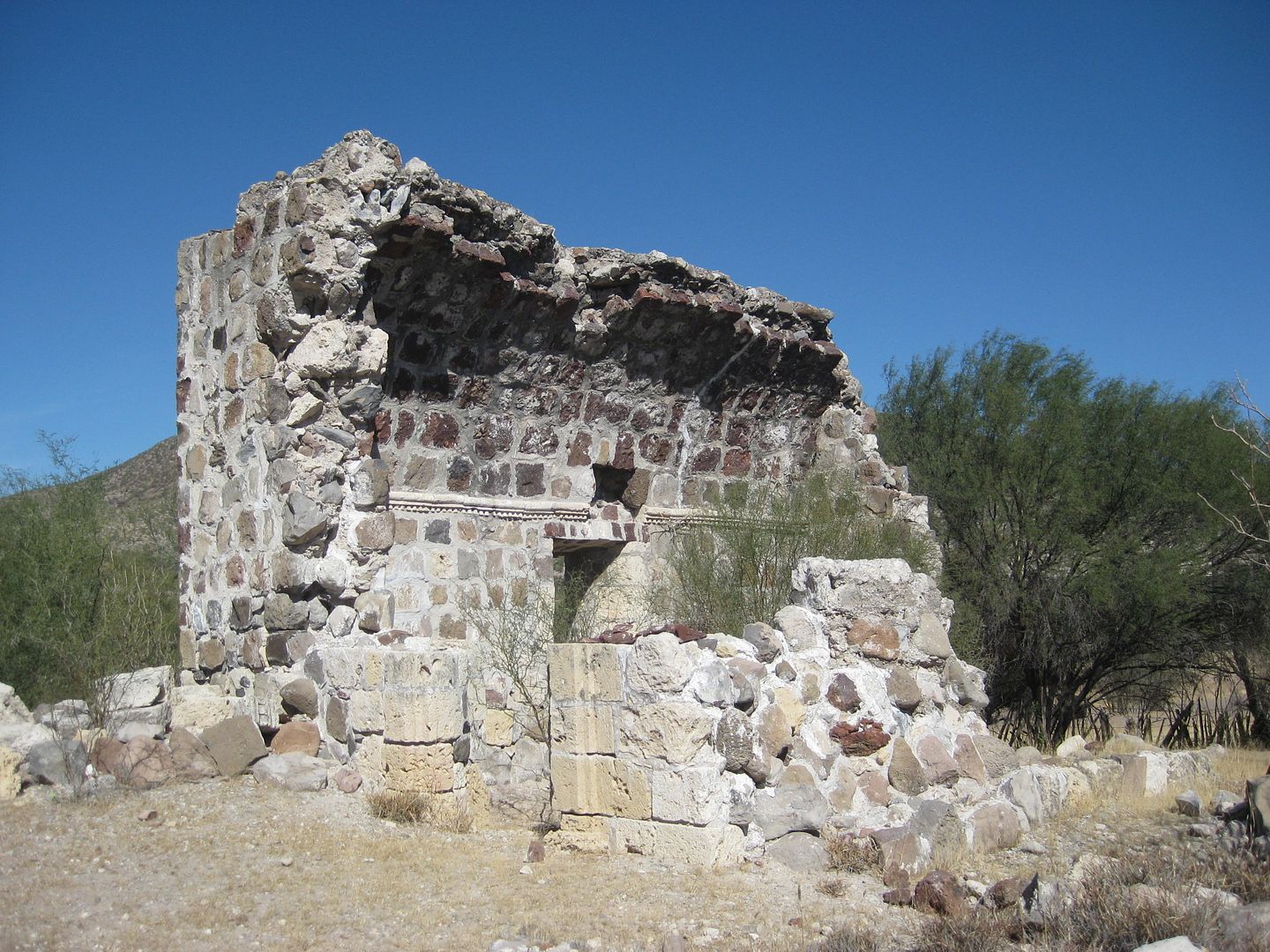
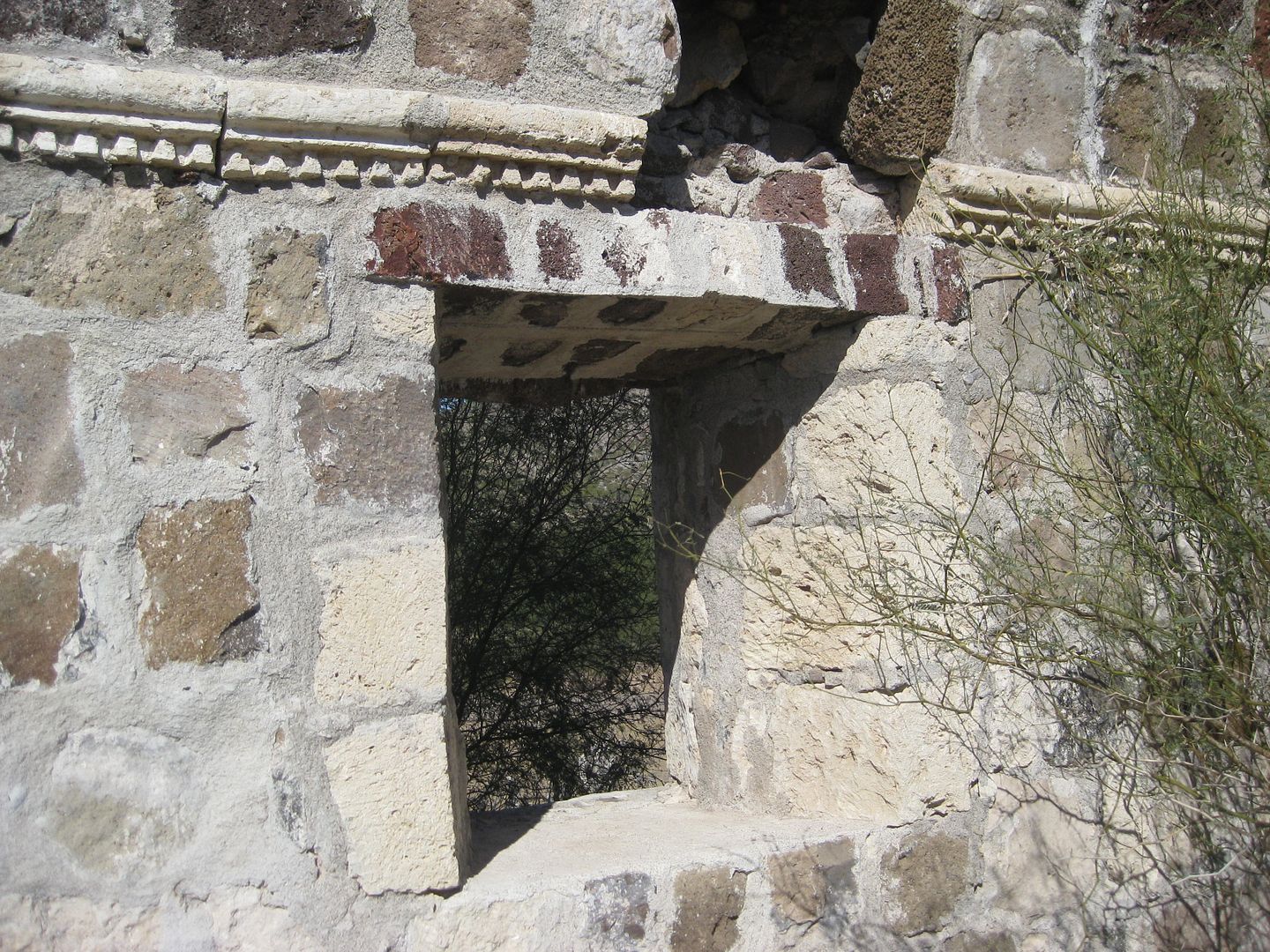
The mission was once next to the arroyo but was swallowed up by an enlarged arroyo by 2001. Mission San Juan Bautista de Ligüí was the third
California mission, founded in 1705, and the first one to be abandoned, in 1721. The location was never good, other than lots of Indians living there.
Where the mission was originally, now in a sandy arroyo, by the road.
The best way to the beach now is to go right at the sign (0.4 mi. from highway) and then left following down the arroyo. The beach no longer has any
palapas, as it did in the past. It is 0.5 mi. from the fork (0.9 from the highway).
Here's a panorama series going from right to left:
The right fork goes south 1.3 miles to the town of Ensenada Blanca. Sadly, the beach on their bay is now cut off and behind a security gate. You must
be a guest of the nearby Danzante Resort to pass to see the water or beach. How sad. The village was here long before that resort.
Back to Loreto and later go to the bookstore. It was a full house and met many. The fellow I met in Mulegé was there, as was ncampion and even our
famous Nomad, Mike Younghusband who (in 2010) walked over 1,000 miles down the peninsula with his burro, Don-Kay (following the lead made in 1997 by
Graham Mackintosh and his burro, Misión). Here is that adventure: http://forums.bajanomad.com/viewthread.php?tid=47853
Mike wants to join me tomorrow to San Javier and beyond to show me something really cool... Stay Tuned!
[Edited on 2-19-2017 by David K]
|
|
|
TMW
Select Nomad
Posts: 10659
Registered: 9-1-2003
Location: Bakersfield, CA
Member Is Offline
|
|
This gets better and better, thanks.
|
|
|
mickeykreg
Junior Nomad
Posts: 33
Registered: 11-17-2005
Location: Salt Lake City
Member Is Offline
|
|
I also met Serg at Perla. Thought I'd mention Pedro at San Rafael showed us your book and spoke fondly of it and you. Cool trip, will be watching for
updates.
|
|
|
fishbuck
Banned
Posts: 5318
Registered: 8-31-2006
Member Is Offline
|
|
Spectacular!
"A ship in harbor is safe, but that is not what ships are built for." J. A. Shedd.
A clever person solves a problem. A wise person avoids it. – Albert Einstein
"Life's a Beach... and then you Fly!" Fishbuck
|
|
|
David K
Honored Nomad
Posts: 64476
Registered: 8-30-2002
Location: San Diego County
Member Is Offline
Mood: Have Baja Fever
|
|
| Quote: Originally posted by mickeykreg | | I also met Serg at Perla. Thought I'd mention Pedro at San Rafael showed us your book and spoke fondly of it and you. Cool trip, will be watching for
updates. |
Funny what a small world Baja is!
Pancho, yes he is a really nice guy. I gave him a couple books so he could make some money. He needs a new battery to have power at night.
|
|
|
ncampion
Super Nomad
Posts: 1238
Registered: 4-15-2006
Location: Loreto
Member Is Offline
Mood: Retired and Loving it
|
|
Good to see you again David, you do know how to explore Baja. BTW the beach at Playa El Quemado is called Rattlesnake by locals. Took a ride down
there after you left and it was packed, never saw it so full. Guess it has been discovered.
Living Large in Loreto. Off-grid and happy.
|
|
|
David K
Honored Nomad
Posts: 64476
Registered: 8-30-2002
Location: San Diego County
Member Is Offline
Mood: Have Baja Fever
|
|
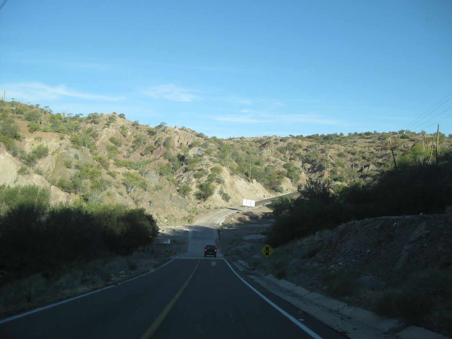
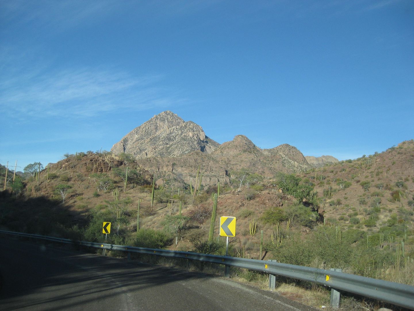
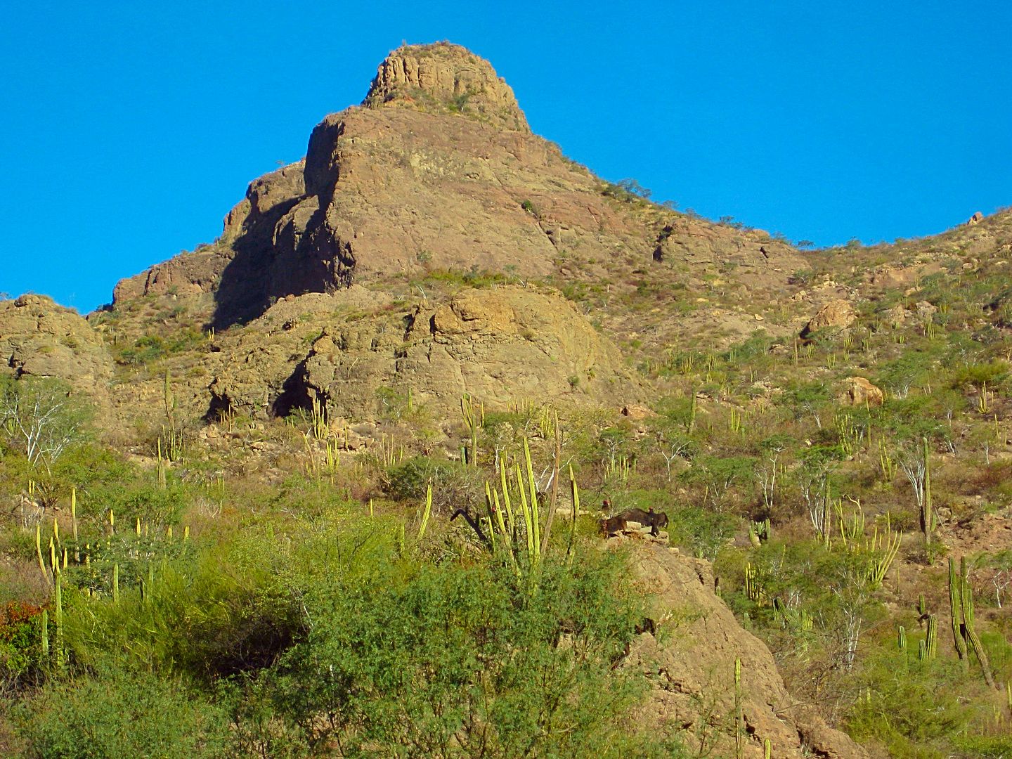
DAY 6-A: Sat. Feb. 4, 2017 Loreto to San Javier
Mike Younghusband meets me at the Pemex station, right across the street from my hotel entrance at 8 am. After topping my tank, I follow Mike as we
head west, into the Sierra Giganta mountains.
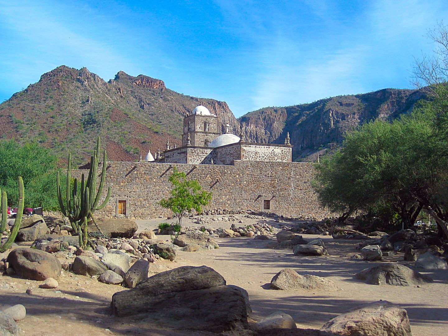
If you get a chance to read Padre Piccolo's diaries of how he founded Mission San Javier, in 1699, it gives a connection to what it was like before
bulldozers and dynamite!
I first traveled to San Javier in July 1973 on the original auto road blasted through in the 1950s and again in 1976. Only a mule or burro could bring
supplies from Loreto before then, traveling on the first leg of El Camino Real, the Jesuit mission road connecting the missions that would be built
throughout this land that many still thought was an island.
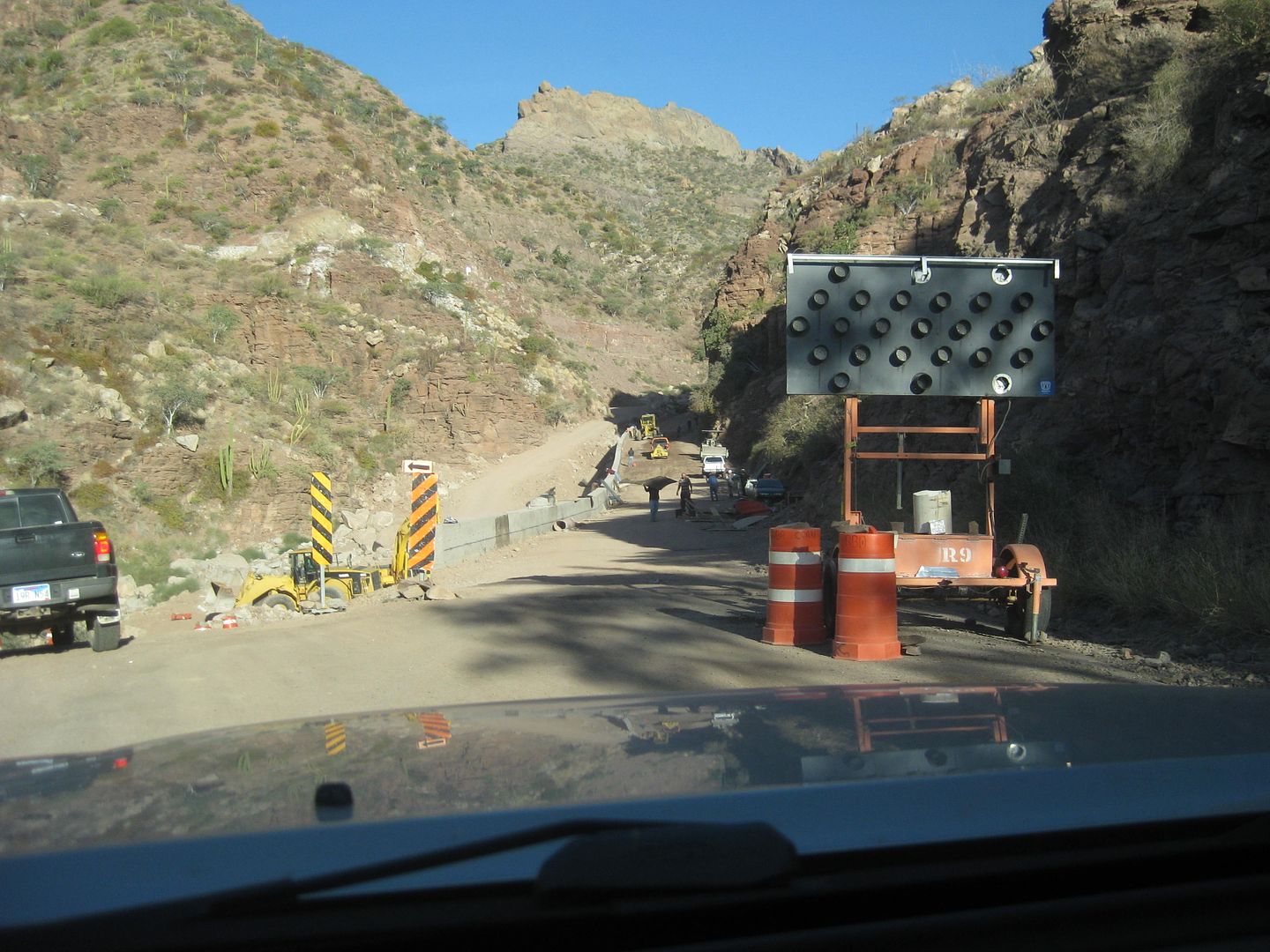
Now, a modern highway has been built up the mountain. In 2009, it was completed about half the distance, when I was last up this way. Now, flash
floods try to take it out, but crews are on top of things and are improving damaged areas.
Km. 18 Rancho Las Parras, on the left, has a nice chapel across the highway.
Km. 24.5 is Rancho Nuevo, on the left. Here, Mike introduces me to "Bule" who arranges for anyone to go on a mule ride adventure.
Km. 25.5 is Rancho Viejo, on the right. This was the first location of Mission San Francisco Javier de Biaundo from May 11, 1699 to 1710, when Padre
Juan de Ugarte moved it 5 miles south.
Km. 27.5 Unsigned junction with road to San José Comondú, 26 miles.
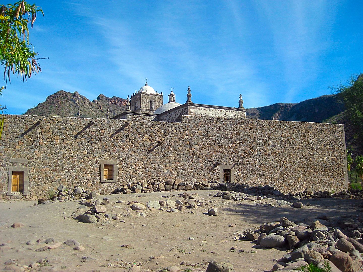
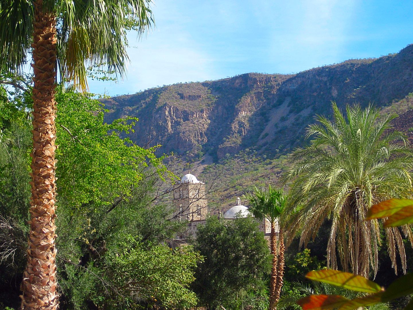
Km. 34 SAN JAVIER
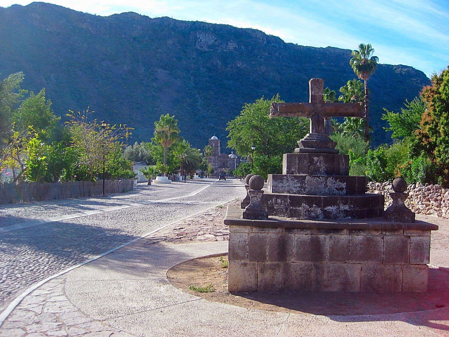
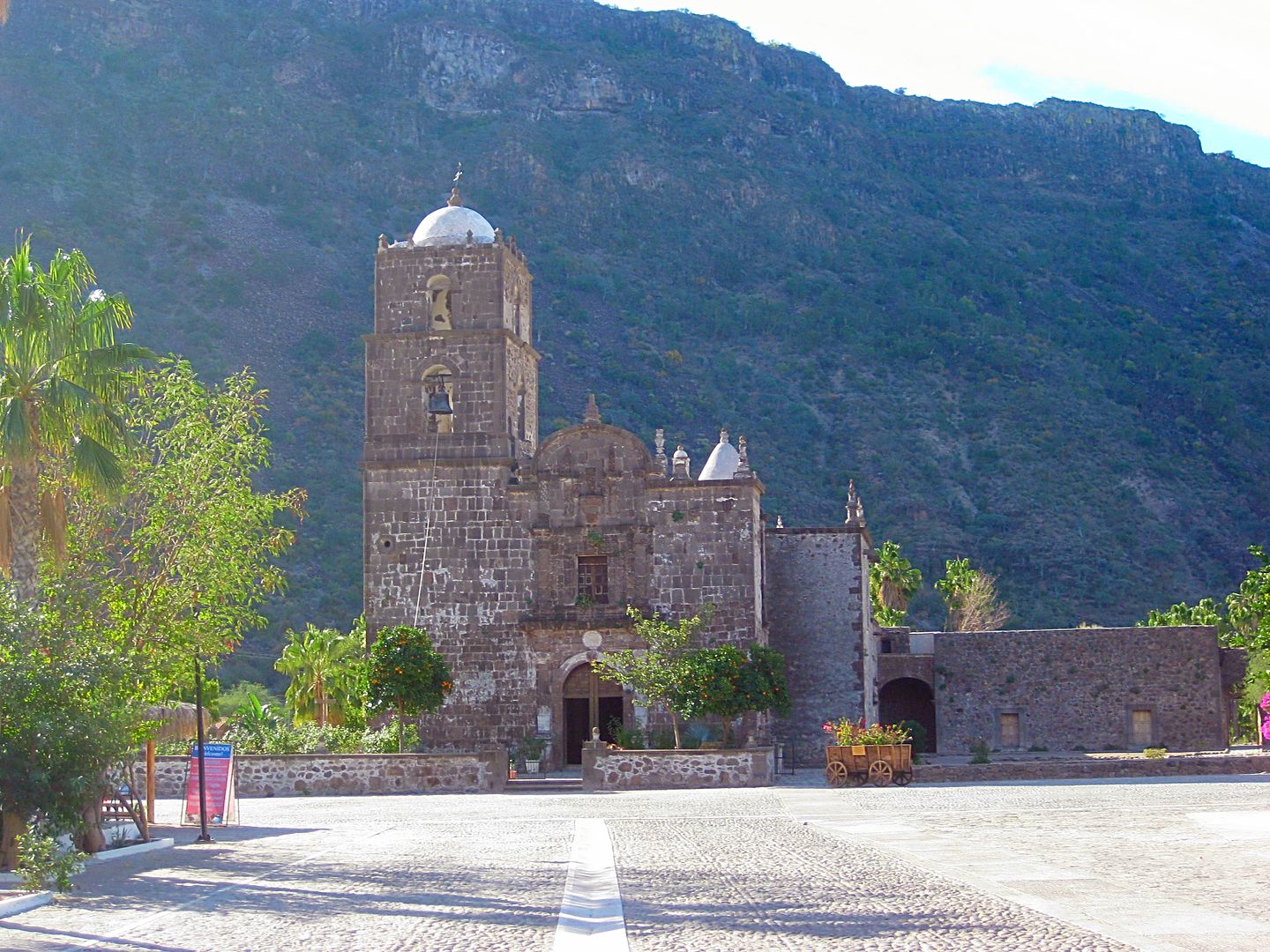
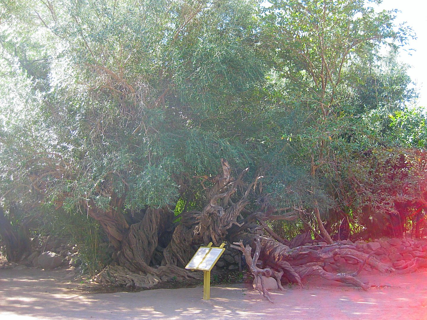
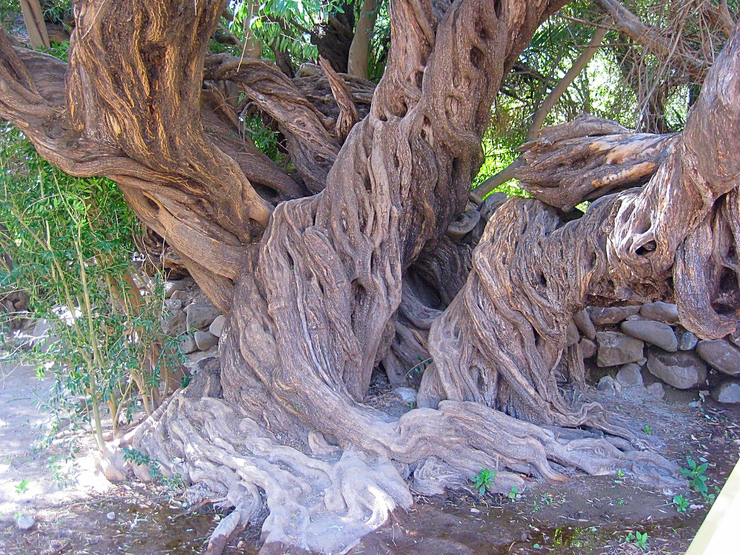
Mike shows me the trail to the back side of the mission and we follow the water canal and see the old old olive tree.
We have quesadillas at the little restaurant on the west side of the street near the mission and then head north 4 miles to the Comondú junction, and
I say goodbye to pavement for the next many hours!
To Be Continued!
|
|
|
David K
Honored Nomad
Posts: 64476
Registered: 8-30-2002
Location: San Diego County
Member Is Offline
Mood: Have Baja Fever
|
|
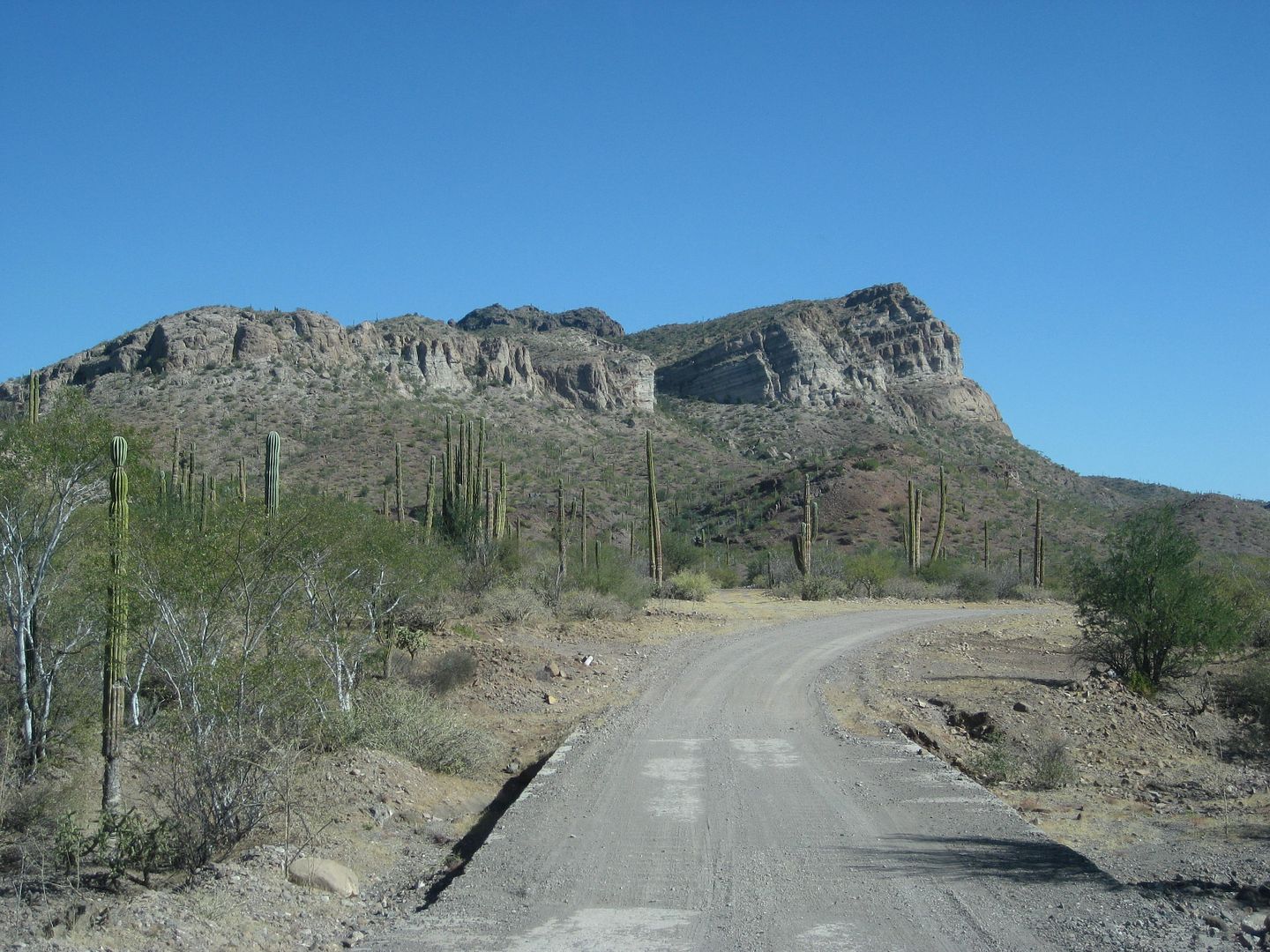
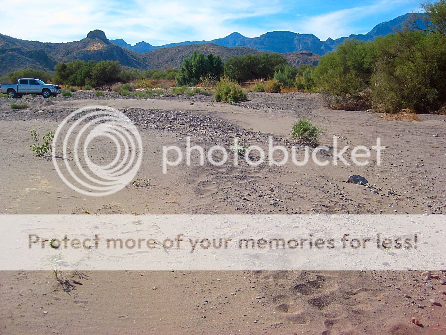
DAY 6-B The Indian Camp
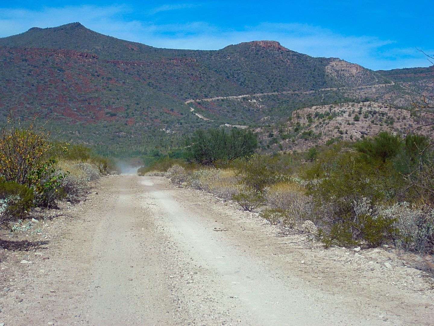
The road between San Javier and Comondú is not bad for a few miles, but do you see that grade ahead? That is pretty rough and coming down the other
side to El Horno is even rougher. I used 4WD about halfway up that grade. To help going down the other side, I used low range for improved
gear-brake-assist. From El Horno to Comondú, the road was good again. See road log, below.
Mike wanted to show me something he and Wilderone discovered while looking for petroglyphs during their mule trip through the area.
We parked and went hiking along an abandoned road.
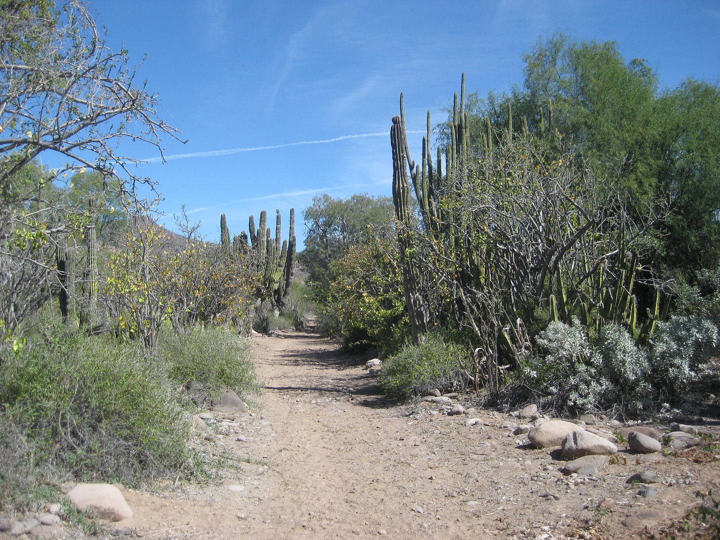
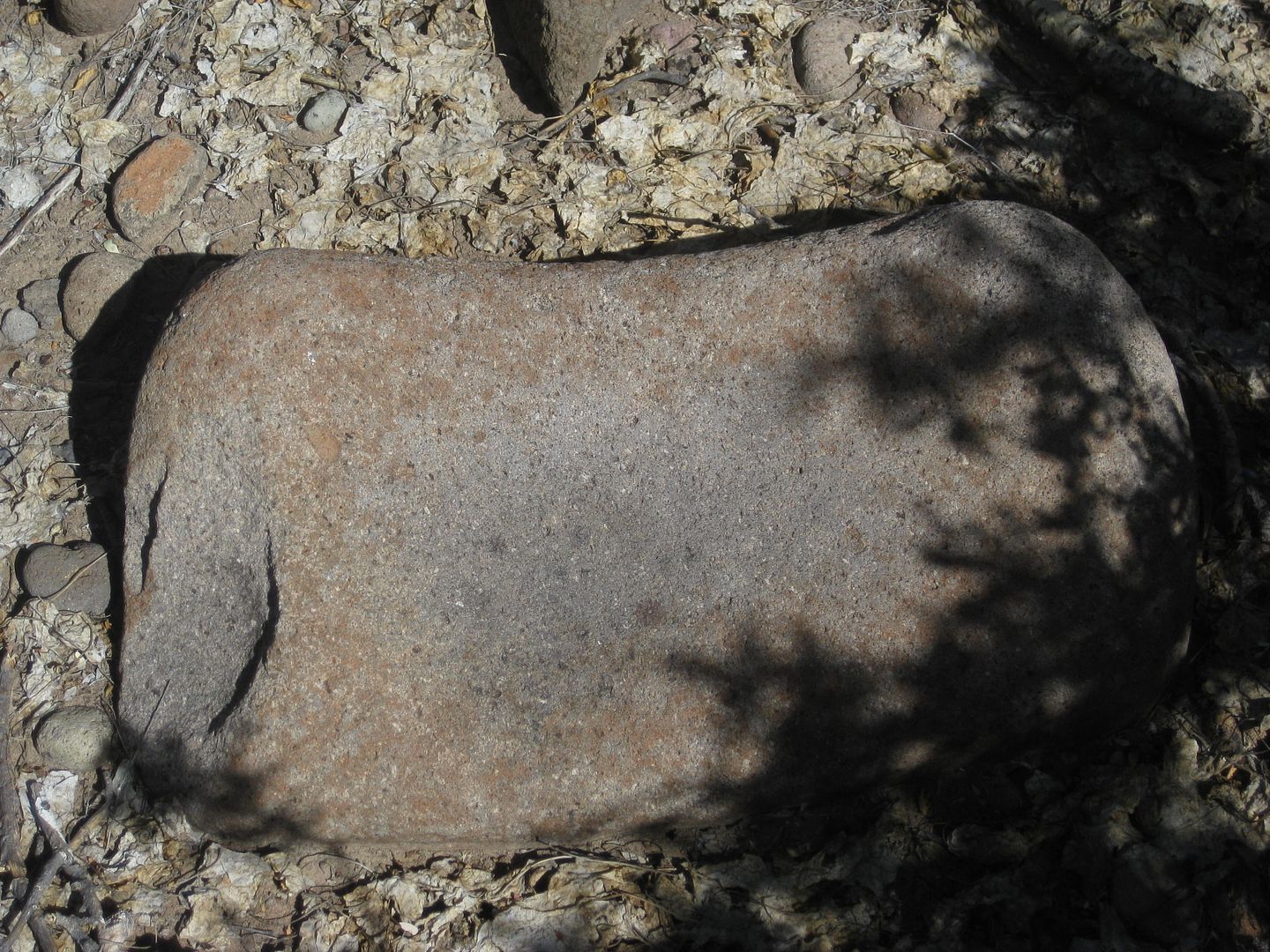
Mike found the spot, it was a large flat area, above the arroyo, where a whole village may have been, based on the number of metates (grinding stones
and bowls)... https://en.wikipedia.org/wiki/Metate
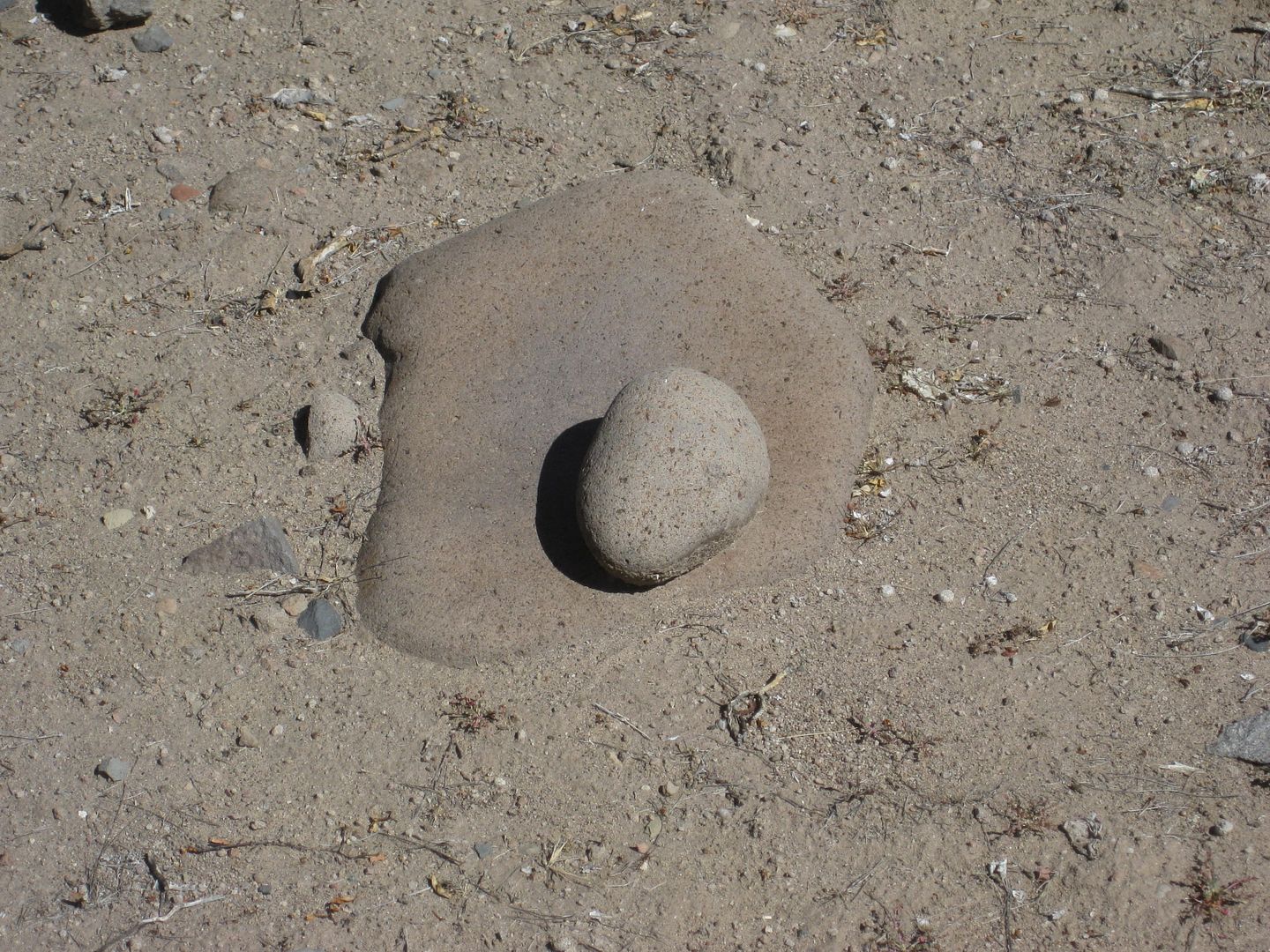
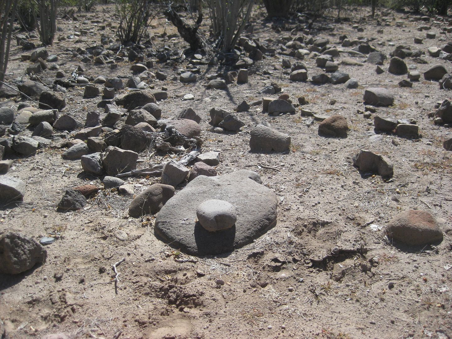
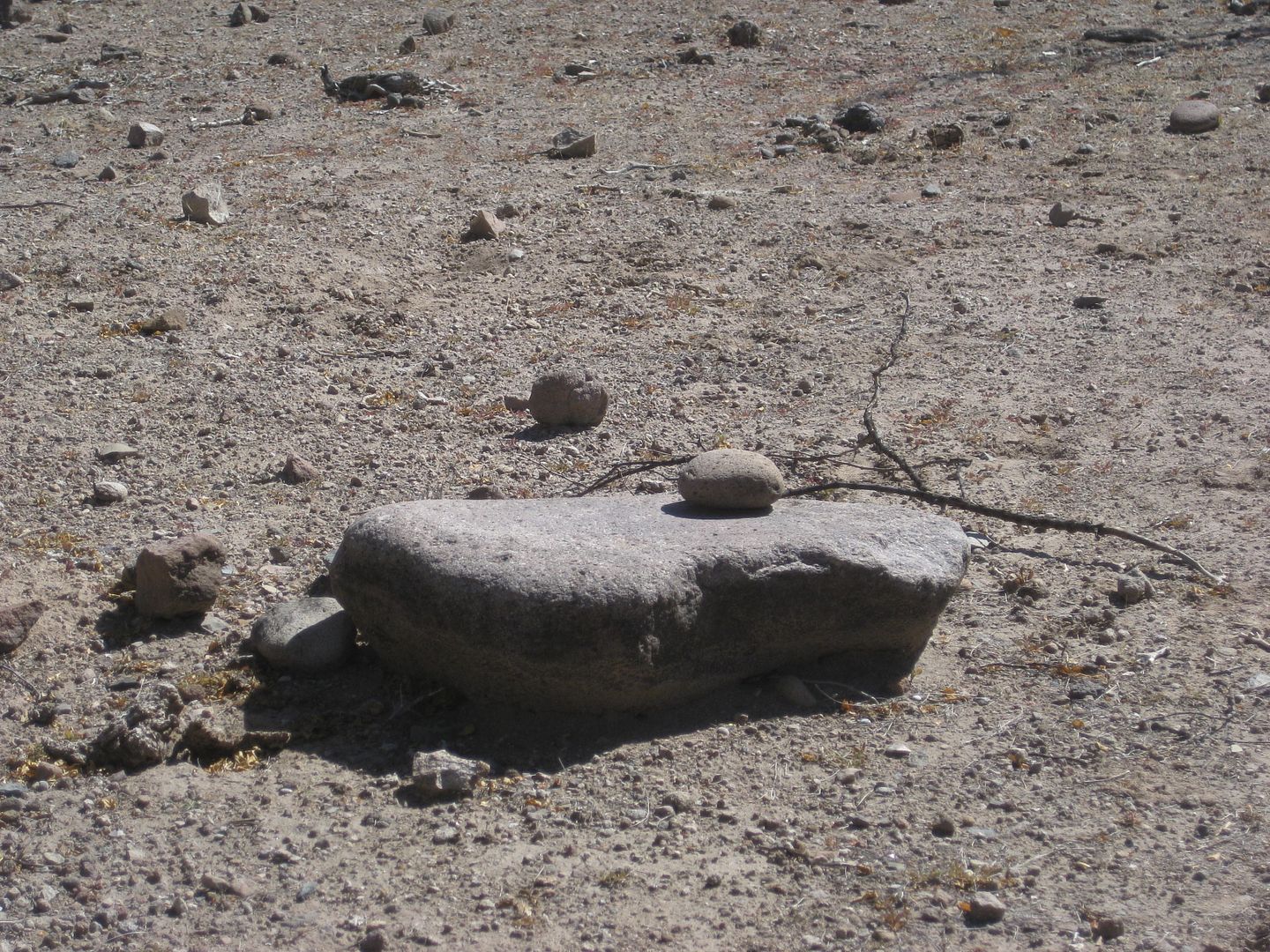
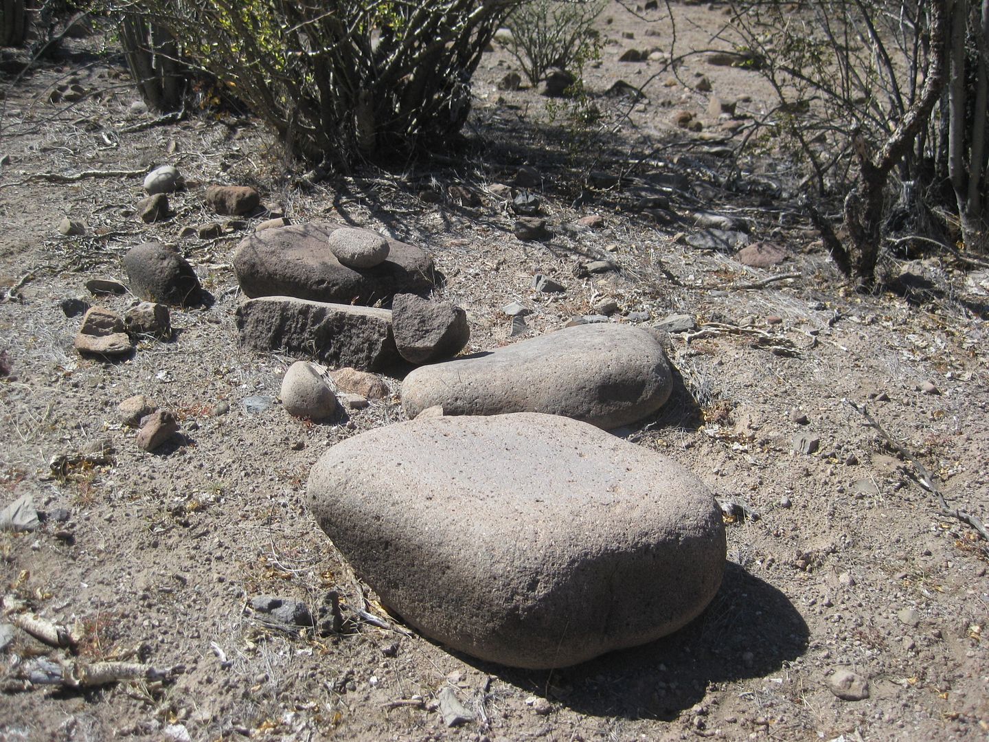
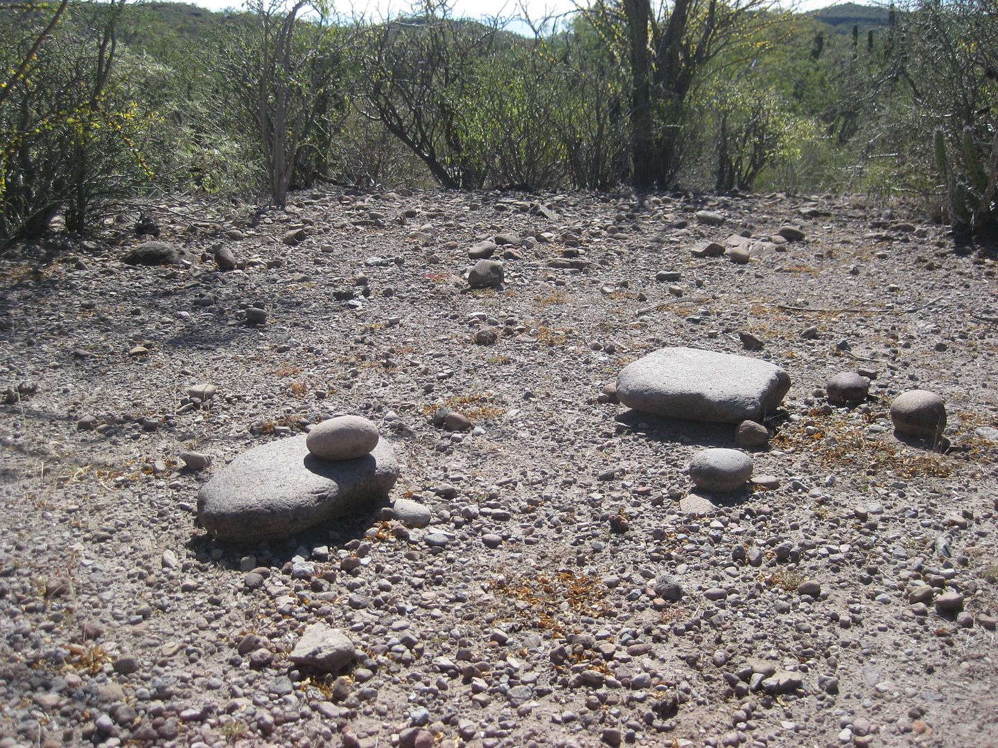
VERY COOL! Baja is the best at taking us back in time!!
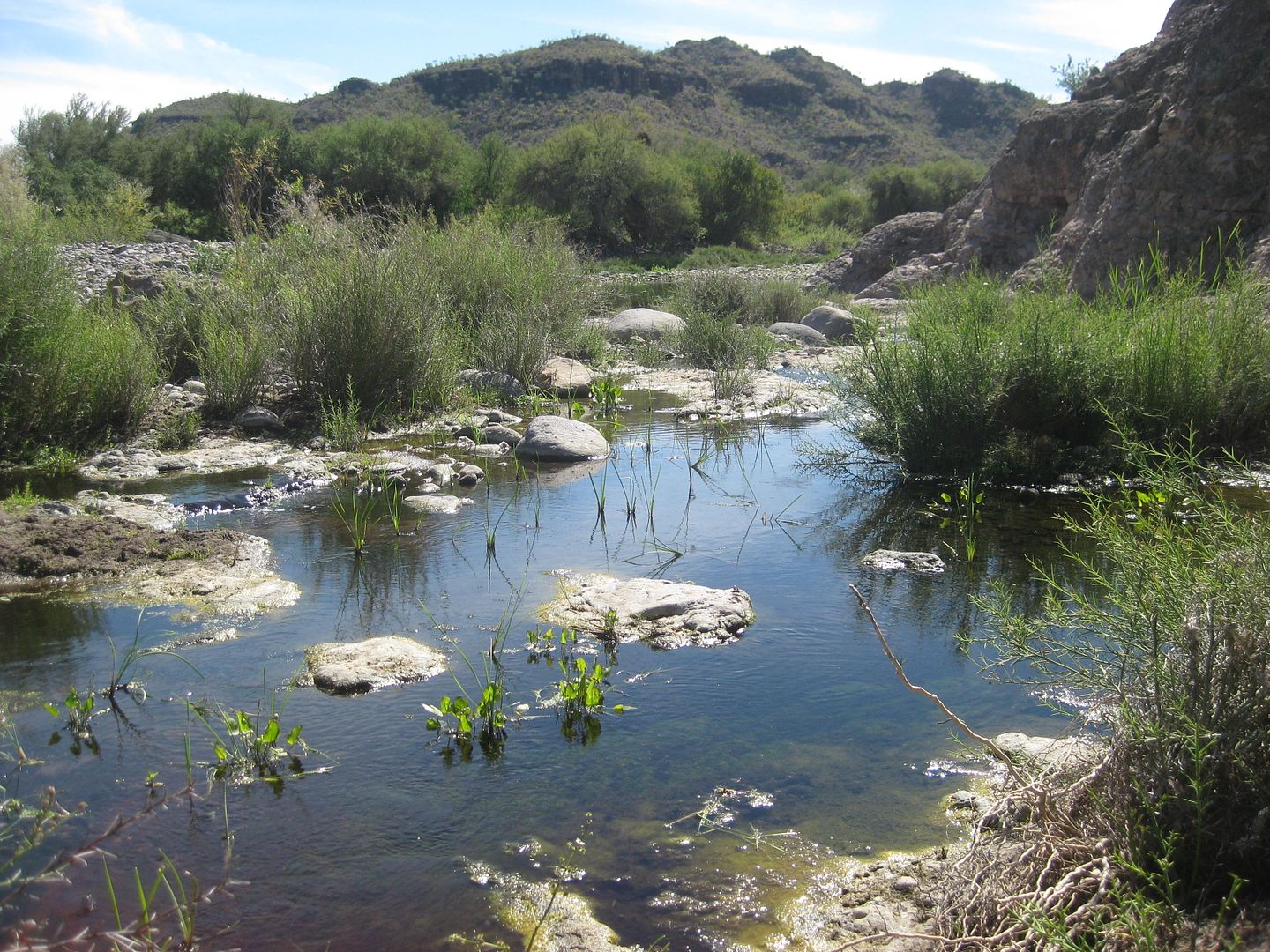
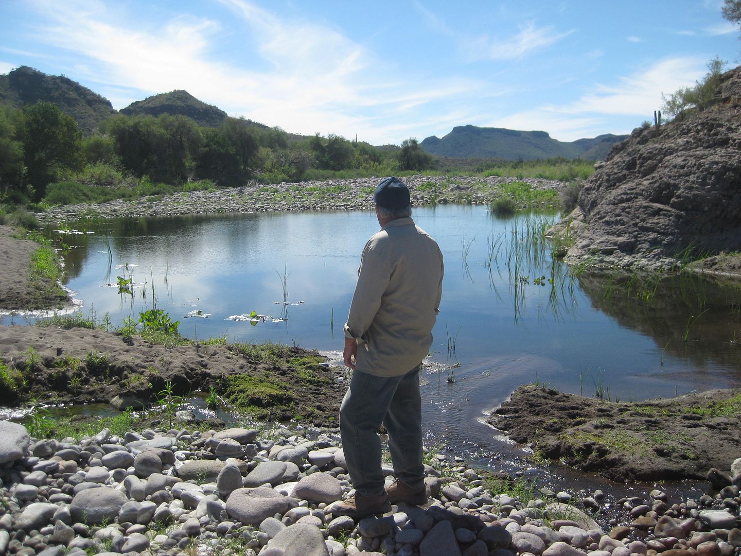
Later, we took a walk to this stream before Mike returned to Loreto and I continued on to Comondú.
|
|
|
| Pages:
1
2
3
4
5 |
|


