| Pages:
1
2
3
4
5 |
Cliffy
Senior Nomad

Posts: 984
Registered: 12-19-2013
Member Is Offline
|
|
I made one trip many years ago to BOLA just as the entire desert from the turn inland all the way to BOLA was in full bloom. Pinks, blues, whites,
orange, a regular kaleidoscope of colors at every turn for many miles. Unfortunately I've never caught that bloom again. It's something I have never
forgotten.
You chose your position in life today by what YOU did yesterday
|
|
|
bajaandy
Senior Nomad
Posts: 769
Registered: 2-7-2004
Location: North County
Member Is Offline
Mood: Adventurous
|
|
Brilliant photo essay David! Well done. While it's always fun to make this kind of a trip with others, there's just something about going it alone
sometimes. Nice work.
[Edited on 2-22-2017 by bajaandy]
subvert the dominant paradigm
"If you travel with a man, you must either fall out with him or make him your good friend."
JBL Noel
|
|
|
David K
Honored Nomad
Posts: 64490
Registered: 8-30-2002
Location: San Diego County
Member Is Offline
Mood: Have Baja Fever
|
|
10-4 Andy... I would rather not go alone, but Baja Angel has a 'real job' so she couldn't get away, plus all the rough road bouncing is not fun for
her as it is for me, sadly. This actually is a project for me that I am doing and I hope to make something really great from my notes and photos that
everyone can take advantage of or enjoy.
Snap photos of everything Cliffy, if you can!
|
|
|
joerover
Banned
Posts: 676
Registered: 2-3-2011
Location: earth
Member Is Offline
Mood: sleepy
|
|
I sort of get the idea where the rock art is. Do you have any GPS info or something that would help a stumblebunny like me find it.
[Edited on 2-22-2017 by joerover]
[Edited on 2-22-2017 by joerover]
the fat lady is breeding
which means
The fat ladys are breeding
|
|
|
David K
Honored Nomad
Posts: 64490
Registered: 8-30-2002
Location: San Diego County
Member Is Offline
Mood: Have Baja Fever
|
|
Quote: Originally posted by joerover  | I sort of get the idea where the rock art is. Do you have any GPS info or something that would help a stumblebunny like me find it.
|
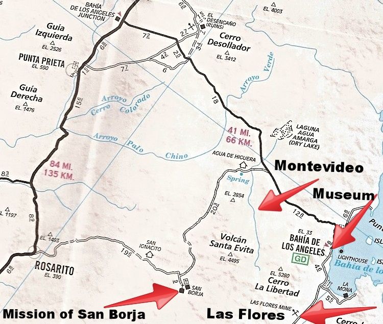
2 miles south from the L.A. Bay highway on the San Borja road (at Km. 45), then east for 5.8 miles.
[Edited on 2-22-2017 by David K]
|
|
|
joerover
Banned
Posts: 676
Registered: 2-3-2011
Location: earth
Member Is Offline
Mood: sleepy
|
|
I am planning another bicycle trip. This looks like a good place to stop along the way. Because I am on a bicycle I can not carry as much water as
people in pickups can. This is why I asked for GPS Coordinates. Is there a road or perhaps the river bed is a road? Depart San Borja and turn right
2 miles before Bahia De Los Angles road? My time in the area will be limited by water. You mentioned sulfer at the spring? If there is reliable
water in the area I would likely hike around for 3 or so days
 [/URL] [/URL]
[Edited on 2-21-2017 by David K][/rquote]
[Edited on 2-22-2017 by joerover]
[Edited on 2-22-2017 by joerover]
the fat lady is breeding
which means
The fat ladys are breeding
|
|
|
David K
Honored Nomad
Posts: 64490
Registered: 8-30-2002
Location: San Diego County
Member Is Offline
Mood: Have Baja Fever
|
|
I really think you need a support truck. Especially when you are this unfamiliar with the area. I have one more day to finish the trip report.
So rather than the reposting the photos and the maps, maybe start a new thread on your bike riding questions. It is interesting, for sure.
You don't need a GPS because the road goes to it, but it has been posted on Nomad before. Here is what I recorded a couple weeks ago: Lat: N
28°54.7495'
Lon: W 113°43.2674'
I provided the road log with the mileages... here it is again:
ROAD LOG:
0.0 San Borja
0.8 Junction: Left to Rosarito, ahead to L.A. Bay.
17.6 Fork, left via Agua de Higuera.
18.2 Agua de Higuera (ranch, sulfur water spring)
18.5 Junction with road from 17.6.
20.0 Road right to Montevideo (4WD only), 5.8 miles. Major rock art site.
22.0 L.A. Bay Highway Km. 45. L.A. Bay is 13 miles to the right.
The spring at the ranch is stinky sulfur water and ugly looking too. They probably have a good well there? The road to the rock art is deep sand. You
must have a fat tire bike or will need to walk it the 12 miles round trip. NO water in there at the site.
Feel free to email or u2u me questions, as well!
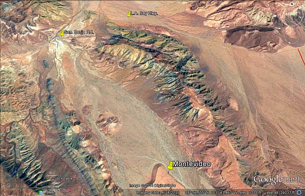
My inReach track (note Montevideo and SanBorja):
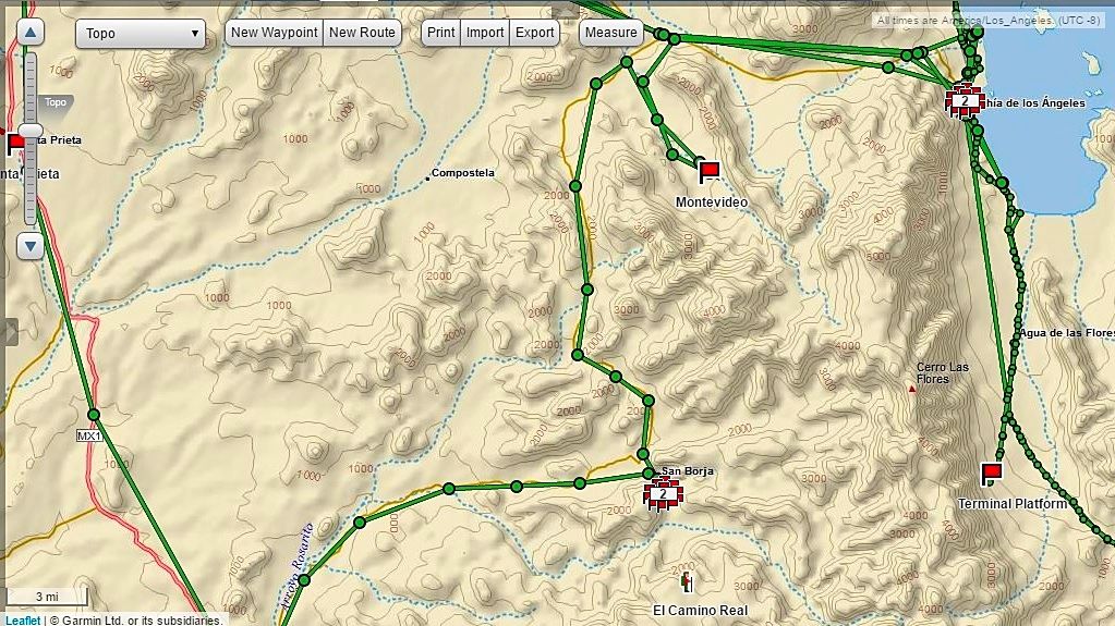
Google Earth of Montevideo, the San Borja road and the L.A. Bay highway are pinned.
[Edited on 6-1-2018 by David K]
|
|
|
BajaTed
Senior Nomad
Posts: 859
Registered: 5-2-2010
Location: Bajamar
Member Is Offline
|
|
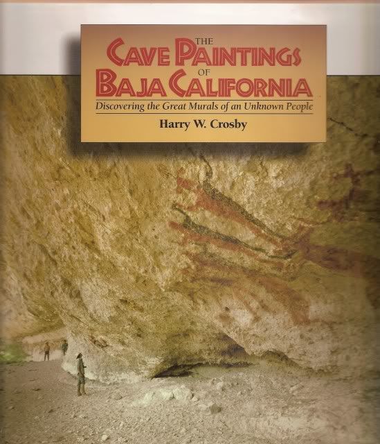
David,
Gotta ask; how did the rock drawings get their various colors? The shapes of course are another story
Es Todo Bueno
|
|
|
bkbend
Senior Nomad
Posts: 693
Registered: 11-27-2003
Location: central OR or central baja
Member Is Offline
|
|
| Quote: Originally posted by Cliffy | | I made one trip many years ago to BOLA just as the entire desert from the turn inland all the way to BOLA was in full bloom. Pinks, blues, whites,
orange, a regular kaleidoscope of colors at every turn for many miles. Unfortunately I've never caught that bloom again. It's something I have never
forgotten. |
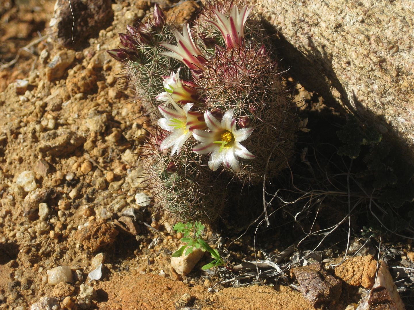
It's been seven years since this much green and flowers around Bahia. Catch it now or it may be another seven years.
|
|
|
joerover
Banned
Posts: 676
Registered: 2-3-2011
Location: earth
Member Is Offline
Mood: sleepy
|
|
that is what I wanted to know, where it is and is there any water? Thanks for your help.
| Quote: Originally posted by David K | : Lat: N 28°54.7495'
Lon: W 113°43.2674'
The spring at the ranch is stinky sulfur water and ugly looking too. They probably have a good well there? The road to the rock art is deep sand. You
must have a fat tire bike or will need to walk it the 12 miles round trip. NO water in there at the site.
[Edited on 2-22-2017 by David K] |
the fat lady is breeding
which means
The fat ladys are breeding
|
|
|
David K
Honored Nomad
Posts: 64490
Registered: 8-30-2002
Location: San Diego County
Member Is Offline
Mood: Have Baja Fever
|
|
| Quote: Originally posted by BajaTed | David,
Gotta ask; how did the rock drawings get their various colors? The shapes of course are another story
|
I think it was different mineral rocks and lava, ground with water... I remember Damien (character in 'Bajo California: The Limit of Time') showing
that process to make red and black.
I will check Harry Crosby's book and see if there are other answers.
|
|
|
David K
Honored Nomad
Posts: 64490
Registered: 8-30-2002
Location: San Diego County
Member Is Offline
Mood: Have Baja Fever
|
|
DAY 10: Wednesday Feb. 8, 2017: L.A. Bay to Home + GOLD MINE
I got an even earlier start for the 475 mile drive home, 7:20 am.
The kilometer markers on the L.A. Bay highway, at various points, are noted in my log book.
Km. 66 Sailboat monument/ traffic circle/ La Gringa road, L.A. Bay.
Km. 65 Pemex gas station
Km. 45 San Borja Road
Km. 38.5 Road north to Bahía Guadalupe and Los Candeleros
Km. 29 (approx. location) El Camino Real crossing.
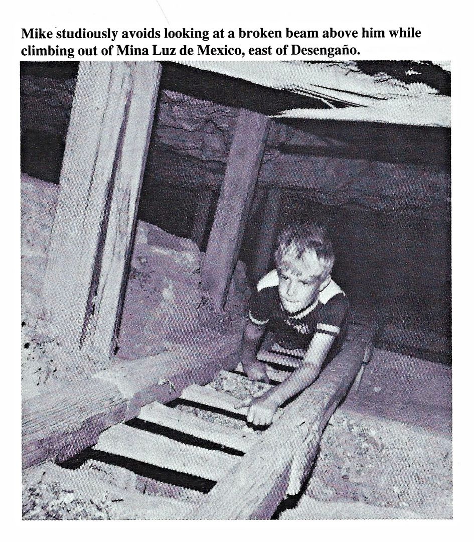
Km. 18 Road north to Luz de Mexico gold mine (2.9 to 3.5 mi.)
Km. 15.5 Road north through fence meets original L.A. Bay road, in Arroyo Yubay.
Km. 11.5+ Road north to El Desengaño gold mine and Tinaja de Yubay access.
Km. 0 Hwy. 1, (former) Parador Punta Prieta.
Baja Nomad member 'Mothership' but known to us as 'Mando' suggested I would enjoy seeing Luz de Mexico. It is deserted, wide-open, and you might even
find some "color" if you poke around.
The road (Km. 18) has white posts on each side with private property written on it. Most of Baja is private property. If they don't want visitors,
they have a locked gate or a keep out/ do not enter sign.
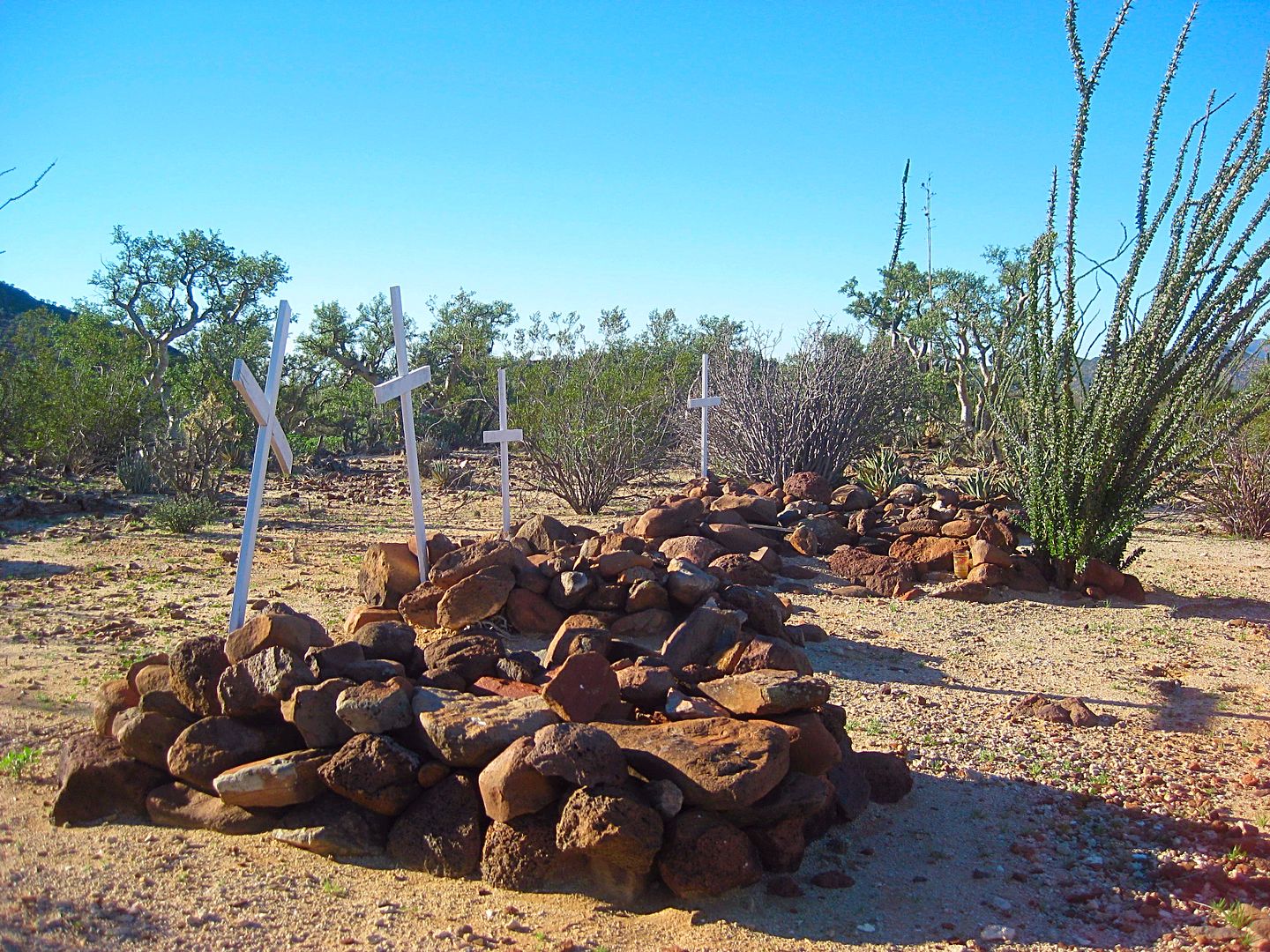
Nobody was there, just these guardians along the road near the mine:
There are several shafts, following the gold vein, along a kilometer going west from the first mine shaft. The photos here are all looking down... not
sideways. BE CAREFUL... don't bring dogs! I could NOT see the bottom of most of these mines!!!
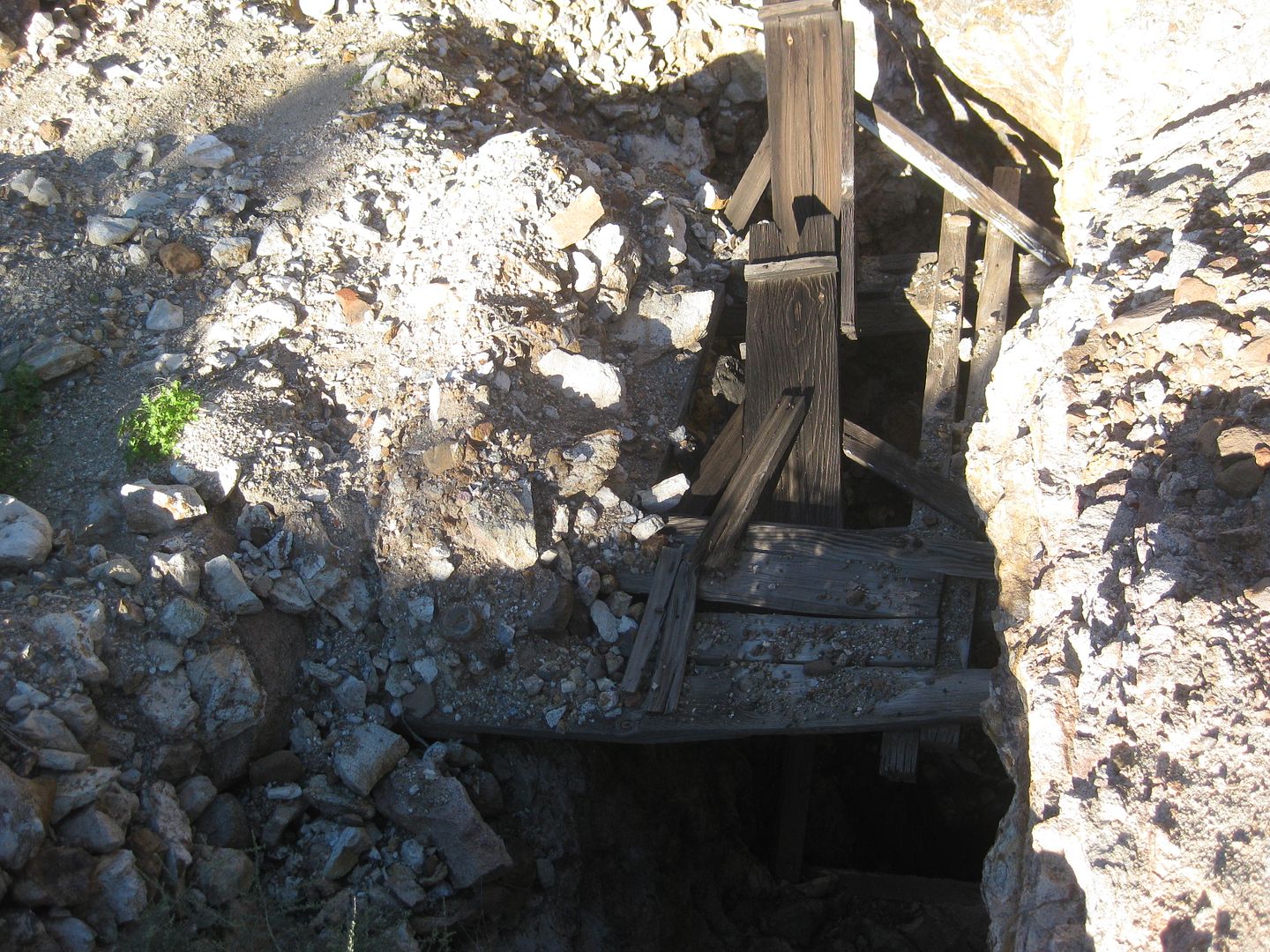
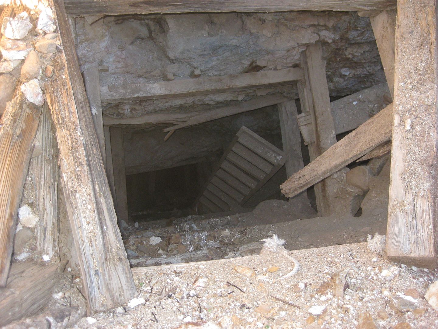
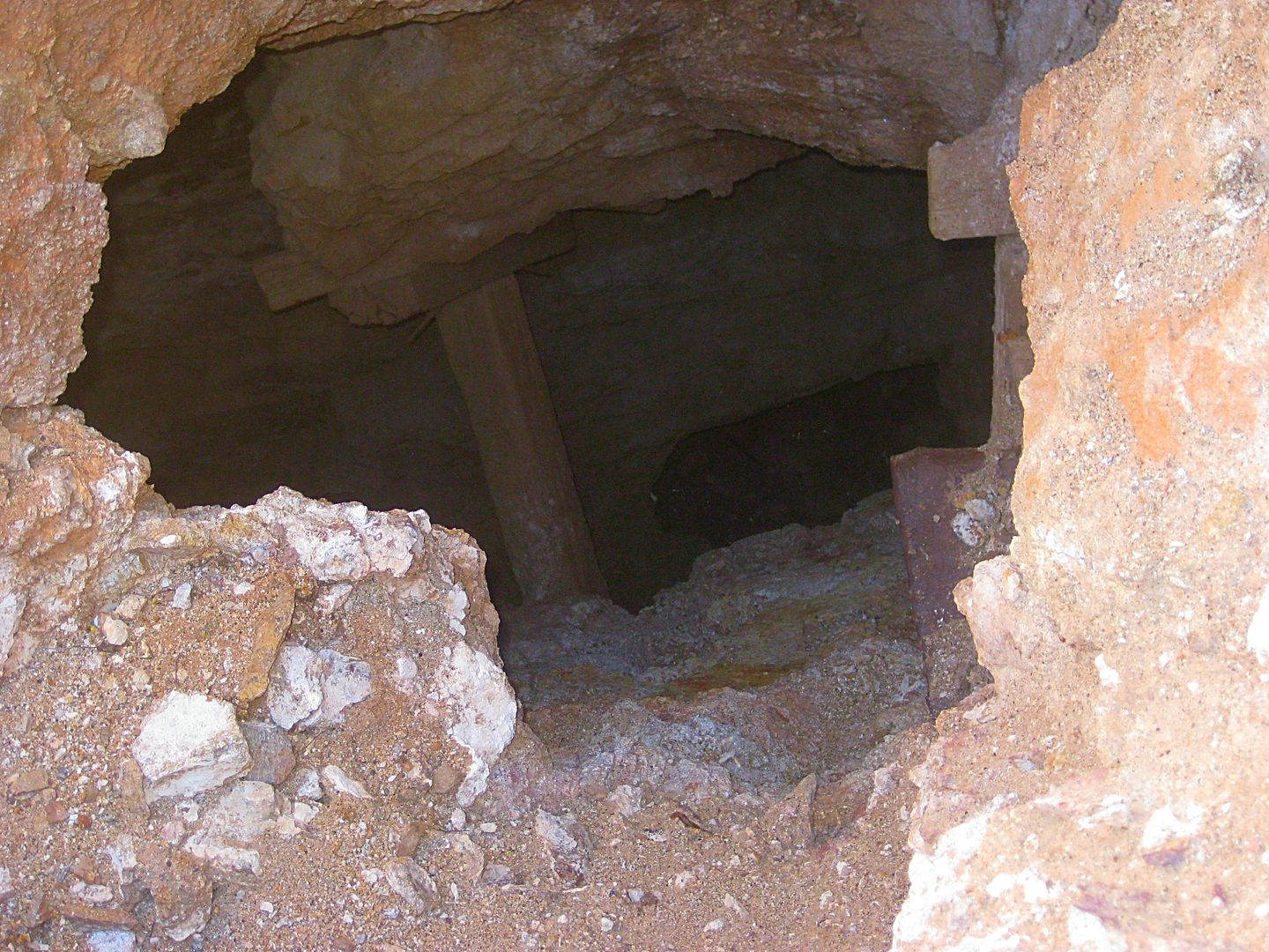
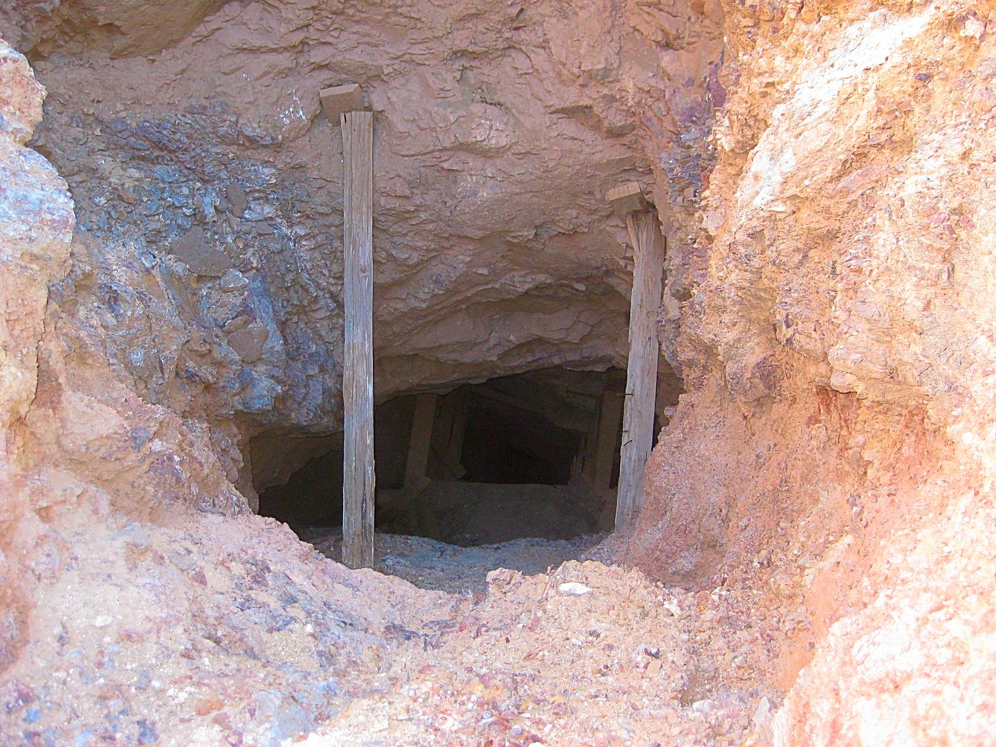
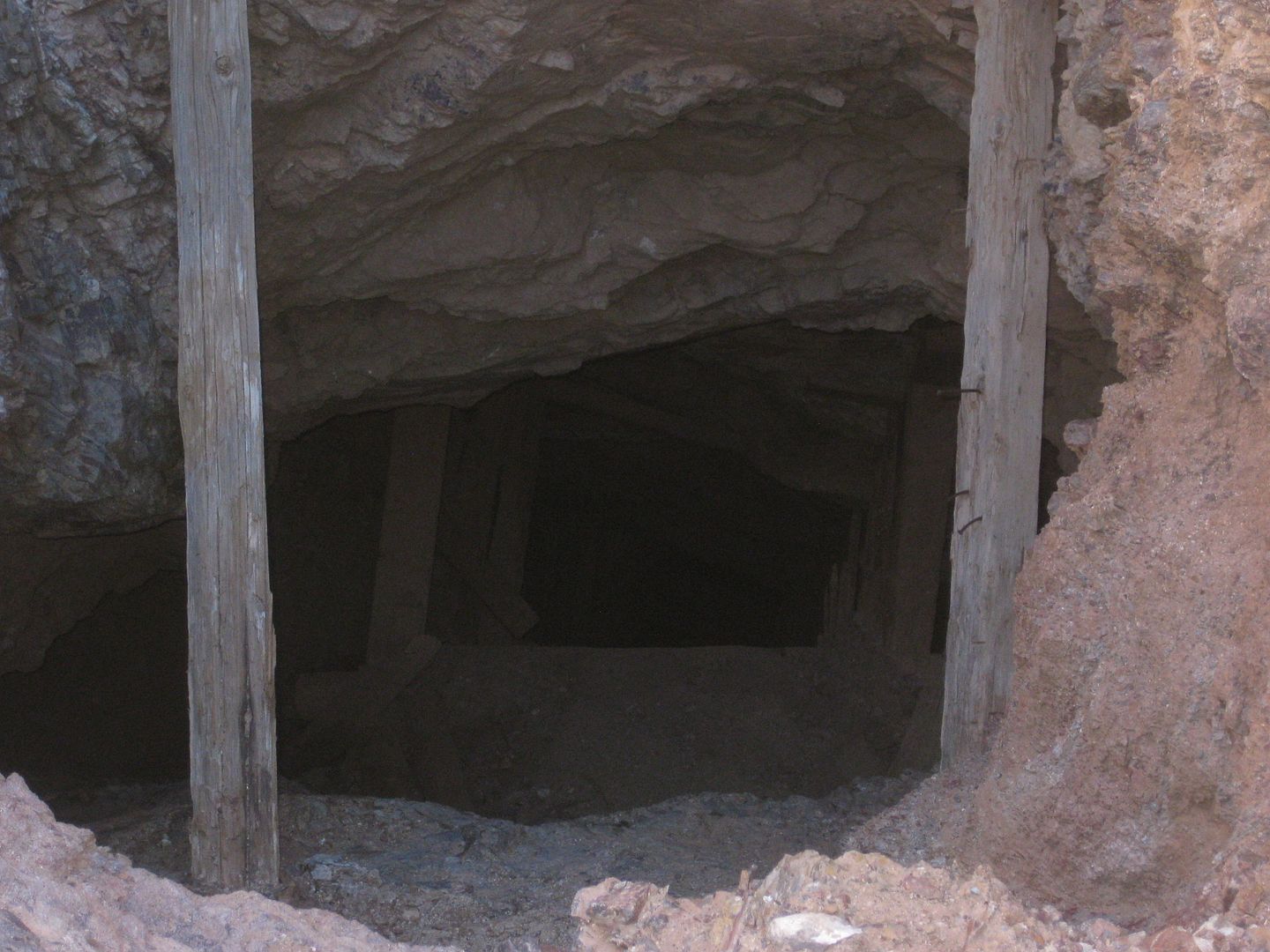
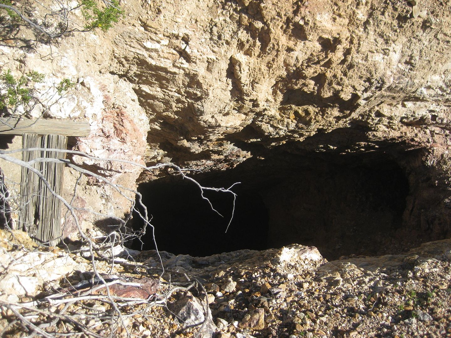
That was awesome!!!
There is a photo in Walt Petersen's Baja Adventure book taken here... I will post it later.
It is 30 miles on Highway One to the Highway Five junction, at Laguna Chapala.
A few miles before Chapala is a viewpoint looking back south to where I just was, on the Baja Highway!...
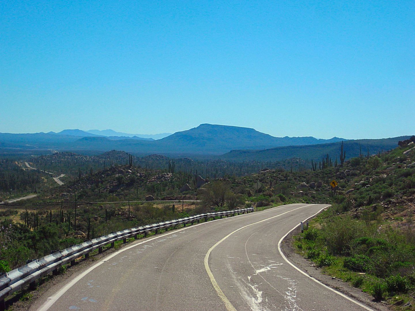
Life is a Highway... for me, the Baja Highway is the best, to get us to those interesting places sooner than it took our fathers and grandfathers who
had to drive hundreds of miles on dirt roads before 1973 when Highway One was completed.
I got to Chapala at 10:15 am and the 23 dirt miles north towards Gonzaga was easy.
Coco's Corner at 10:44 am.
On the pavement at 11:09 am.
Gonzaga Bay Pemex at 11:22 am.
At the viewpoint parking by La Costilla (Km. 84) I met Lenin Sartillo who rode his bike north from La Paz and was headed for Mexicali. We chatted, and
when missions came up, he said he was looking at a book on missions, several days ago. I showed him one of my books, and he said THAT is the book! He
was at Pancho's (Bahía San Rafael) and Pancho showed him my book there. Small world... I gave him an autographed copy and wished him well on his trip
back home to Mexico City. He has a Facebook page and he made it home.
San Felipe was at 1:47 pm.
I took the toll road to Tecate from south of Mexicali. The three tolls were 73 pesos, 23 pesos, and 67 pesos.
At the Tecate Border at 5:15 pm. NO LINE. Drove right up to the inspector's booth. Asked me a few typical questions and what was in my ice chest. That
was it, 10 awesome days in Baja, 1,946 miles, and 0 problems but endless Baja magic and fun!
You should go!
VIVA BAJA
I will be heading back in a week or so, to research another section of Baja and compile my collected data so all of you will have detailed road and
location data for 2017.
|
|
|
El Vergel
Nomad
Posts: 197
Registered: 8-27-2003
Location: San Felipe - Puertecitos Rd., Km. 35 and Santa Mon
Member Is Offline
|
|
Very, very cool! Thanks for the best Trip Report, DK. Awesome stuff!
|
|
|
Cliffy
Senior Nomad
Posts: 984
Registered: 12-19-2013
Member Is Offline
|
|
Pioneering as a vanguard for the masses in modern times!
Strange how things change over the decades but in fact, remain the same.
It's all in ones viewpoint.
Cool report. The photos are fantastic.
Old mines scare the hell out of me! :-) :-)
I don't go underground. Lived through too many earthquakes in Los Angeles.
You chose your position in life today by what YOU did yesterday
|
|
|
David K
Honored Nomad
Posts: 64490
Registered: 8-30-2002
Location: San Diego County
Member Is Offline
Mood: Have Baja Fever
|
|
Thank you!
I am thrilled to do this, naturally.
The goal is to travel the roads that we would use to get to destinations and points of interest in Baja then report on the roads and what is there.
Along the way, I will note places we may want to visit. Such as: taco shops, gas stations, hotels, points of interest.
Leaving for the next research trip in a week or so. Weather dictates where I will focus on. I think you guys will like the final product that will
come of this work! Until it is created, enjoy the trip reports that will come each month when I return.
These research trips are made possible by the support of the official sponsor of Baja Nomad and a great company, Baja Bound Insurance.
Visiting Baja should be fun, easy, and safe. It is for us and it can be for you. Knowing what is down that road will help you decide to go and plan
your own Baja adventure or a relaxing vacation.
These roads have been in guidebooks or on maps, but the auto club stopped map research 10 years ago and the Baja Almanac is nearly 8 years old.
Guidebooks such as The Magnificent Peninsula, The Baja Adventure Book, The Baja Book series and others are all many years old. Time for fresh data and
thanks to the Internet, easily revised and expanded.
I hope those of you who like to know more about Baja will enjoy my book, Baja California Land of Missions, now in its third printing: www.oldmissions.com and www.vivabaja.com The publisher offers free U.S. shipping and no added sales tax.
Thank you!
[Edited on 2-23-2017 by David K]
|
|
|
David K
Honored Nomad
Posts: 64490
Registered: 8-30-2002
Location: San Diego County
Member Is Offline
Mood: Have Baja Fever
|
|
Baja Adventures can be real, not just in books!
From the 1987 Baja Adventure Book by Walt Peterson:
2017 (different ladder or different shaft):
|
|
|
Cliffy
Senior Nomad
Posts: 984
Registered: 12-19-2013
Member Is Offline
|
|
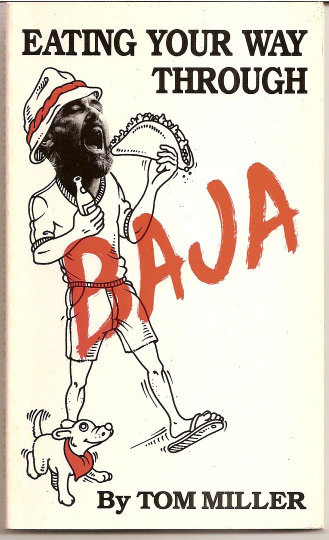
Let us not forget- "Eating Your Way Through Baja" Great book for its time. I've got a copy buried somewhere.
You chose your position in life today by what YOU did yesterday
|
|
|
David K
Honored Nomad
Posts: 64490
Registered: 8-30-2002
Location: San Diego County
Member Is Offline
Mood: Have Baja Fever
|
|
| Quote: Originally posted by Cliffy | | Let us not forget- "Eating Your Way Through Baja" Great book for its time. I've got a copy buried somewhere. |
As long as there are Nomads like you and me, who can bridge the generation between dirt and paved roads, we won't forget!
|
|
|
Marc
Ultra Nomad
Posts: 2747
Registered: 5-15-2010
Location: San Francisco & Palm Springs
Member Is Offline
Mood: Waiting
|
|
Did it two weeks ago. Had a blast!
|
|
|
Gscott
Junior Nomad
Posts: 70
Registered: 1-23-2017
Member Is Offline
|
|
Found this thanks to the bump.
Enjoyed the report DK. Fun too because I was in Loreto in January and visited San Javier, Mulege and a few of the same spots along the way. I'm going
back in November, so much more to see!
Thanks for sharing and I look forward to more!
[Edited on 8-10-2017 by Gscott]
|
|
|
| Pages:
1
2
3
4
5 |