| Pages:
1
2 |
degoma
Junior Nomad

Posts: 64
Registered: 7-21-2009
Location: Mojave, CA
Member Is Offline
|
|
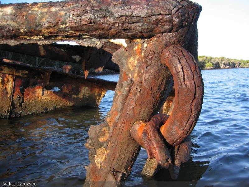
Calamajue, Pto. Chale, Pto. Gato
All the recent talk about the road to Tembibichi inspired us to have a ‘look-see’.
In the mid 70’s I made several solo rowing trips (16’ Swampscott Dory) along that coast. On one of them I was winded in on the exposed beach at
San Carlos (appx 2.5 miles N of Pto. Gato). There I met Solomon de la Toba whose ranch was just in from the beach. Although he had a panga (eski
boat I think) with a small outboard, his dug out sailing canoa was still on the beach (high up). While waiting for calmer seas I helped him fix his
gasoline pump engine, saw some of the ranch operation, hiked to Pto. Gato/ Tembibichi and had a very interesting time of it.
Trip duration: February 4th through the 24th,2017
Departure point: Green Valley, CA (about 15 miles southwest of Palmdale)
Vehicle: 1992 Ford F250 Diesel Extra Cab 4x4 (aka, ‘Toothache’)
Crew: The two of us and our dog Max.
Border crossing: Mexicali East
We discovered a great spot to camp that put us within an hour of the border: Salton Sea State Recreation Area…Corbina Campgroud. It appeared that
there is no charge to camp there. It’s a nice spot one minute off the road with bathrooms and even a shower. Quiet but for the trains (oh this
railroad earth!)
The plan was to cross at the old port of entry but signs warned of construction delays so we went to the east port instead. There was no wait to
cross; at the first inspection area a pleasant inspector took a glance in the back of the camper and said, “have a nice trip”. Then, just like at
Tijuana; where do you park for immigration? I asked the inspector; he points down the road without much explanation.
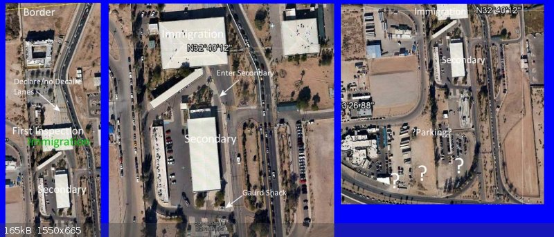
In a very short distance comes ‘secondary’. One never wants to voluntarily pull into such a place but nor did I want to end up shuttled onto some
viaducto and have a hard time getting back. It looked very deserted, so, I took a deep breath and pulled in; parking all the way down near the guard
shack. I asked the guard if it would be OK to park while we went to Immigration. He said OK but seemed not quite sure it really was. That made two
of us. As we started walking a car towing a travel trailer stopped on the street by the shack and apparently got permission to pull into the narrow
parking area west of secondary. It looked awkward.
I had purchased and printed out our tourist cards online via this link provided by danaeb: https://www.inm.gob.mx/fmme/publico/en/solicitud.html . Handed the forms to the immigration lady thinking I did pretty well…until she frowned.
This is too small she said, there’s not enough room for my stamp. Where is your receipt? Oh, ah, I didn’t print that out. She looked up at me,
“you didn’t print that out”, her eyes getting wide as she spoke (this is all in Spanish of course). Errr, well, I have an image of it on my
laptop in the truck. Un momento she said, going into another office.
She came back with a small stack of tourist forms. Look at these she said, plopping them on the counter. Coffee stains, incorrect dates, names
spelled wrong, printed way too small, bad passport numbers…it was all right there. We can make a new form for no charge if people have their
receipt. The best thing is to just fill out the form and pay here. But look I said, it wasn’t my idea to put all that up on the internet for people
to use…that was your government’s idea. Well, I guess it’s OK she said, but I still think it’s easier here.
She managed to get the stamp on the small forms after all and reminded me to print the receipt next time. She was very pleasant the whole time and
quite helpful really. I asked her about the parking… down at the corner on the right side around the bend, you will see cars in there.
After somehow ending up on the road to San Luis we recovered and had an uneventful cruise into San Felipe North Beach. I did not do my home work on a
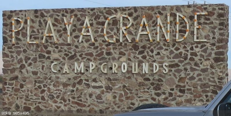
good place for a simple overnight camp (I know, Shell Beach!) so we took a chance on, ‘Play Grande’.
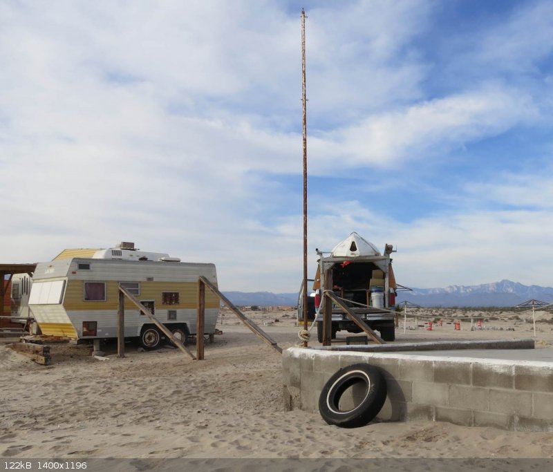
1.5 miles down the wash board road we come to orange cones at the entrance to a small compound of trailers with a care takers camper. We see nothing
resembling a campground. After a few minutes of dog barking, Gorge comes out to greet us and move the cones. Sure he says, you can camp anywhere you
please as he swings his arm around what amounts to a large parking area for the trailers… most of the time there is no one here…like now he
exclaimed.
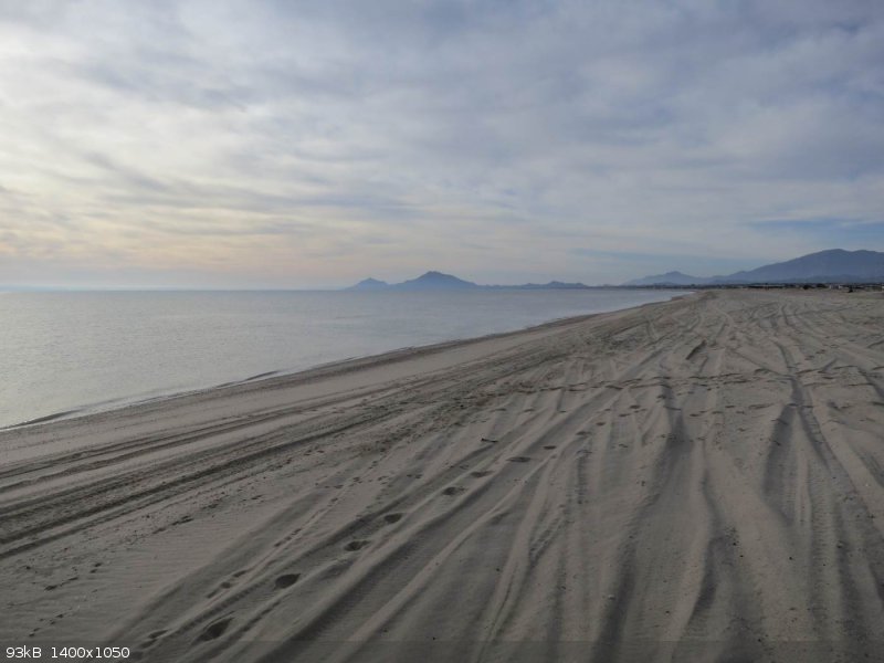
How about something on the beach I ask. That too he says. And it was just what we were looking for, a quiet spot to have dinner, walk on the beach
and spend the night listening to the waves. It even had moderately clean unlighted bathrooms…all this for $10.
Here’s the address for this little hidden jewel:
31° 10’ 11.36” N 114° 53’ 26.23” W
Not so early in the morning we take on a bit more fuel in San Felipe and roll south. It doesn’t seem like much has change on the first 50 or 60
miles of road since last year. I think someone in the highway department should make a basic decision: is this supposed to be a paved road or not?
Lunch time happened at Huerfanito’s. We took the turn marked, ‘Campo Tano’ drove a little way and made breakfast/lunch. After the lunch we
went out to the camp and had the pleasure of meeting Don Tano. He made us feel very welcome…explaining that we could camp anywhere…an American
couple had recently camped on the beach to the south for a month he said.
Things were buzzing in the camp which seemed very, “tribal” to me. Don Tano has created a subdivision that stretches from essentially the highway
to the sea. All the papers are in order he said. They were busy building the requisite amenities…bathrooms/showers, restaurant/bar, observation
deck, and more. He told me that his day job was painting lines on the new highway and I guess he gets some fishing in as well. The fishing was as
good as he’s ever seen it he said. He’s one busy guy at 70 something.
Rancho Grande refreshed our ice supply and the gas station was open across the highway. So far and for the rest of the trip the peso was trading
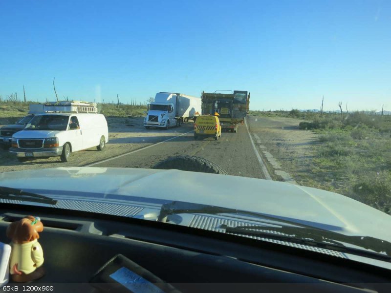
between18.5-20.5. Diesel ran from17.2-17.68/liter. I think it was 19.5 there. On the dirt section a tandem tractor trailer rig with very long
trailers had managed to jack knife every which way blocking the road. Traffic was diverted up to the new road bed for a short distance. Nice while
it lasted.
Planning to go to highway 1 via the Calamajue Wash we turned off before Coco’s Corner, drove about 5 miles and made camp. Some trip we’ll just
spend the whole time listening to the silence and soaking in the beauty of the desert in that area. Man is it nice!
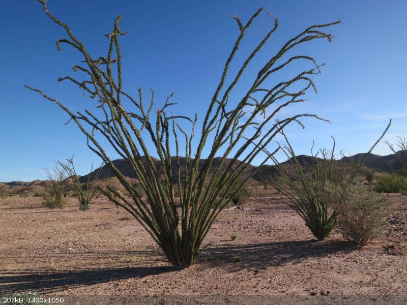
Next morning after some local hiking we made our way up to the beginning of the narrow part. Some day we will check out the mission site there. We
did notice what appeared to be large middens in that area. I guess when that day comes we will also have been out to the port of Calamajue. Sigh, so
many places to see, so little time.
The trip through the narrows was much gentler than the last time (7 or 8 years ago). I guess some of the recent hurricanes have leveled things out.
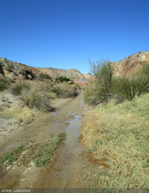
As we were exiting the narrows there was a broken off sign laying in the wash. In Spanish, it said something like, ‘Federal property, entry without
permission prohibited’. This was an unusually nice sign, about 48” wide by 36” tall made of white fluted twin wall ¼” plastic sheet with
machine cut (or a very steady hand) red lettering.
It wasn’t very old judging by the shininess and relative lack of off road decals/bumper stickers. I would have taken a picture but it was so eerie
seeing a sign like that out there that I had a moment of paranoia during which I reasoned: if there is a picture of this sign on my camera, the
plausibility of denial will be nil.
You might ask, “which way was it facing”? That was my thought at first, then I realized…what in the heck difference would it make...permission
from who, where, when, why? Maybe one of you reader can shed some light on this unsettling discovery.
Out of the wash up on the high ground we discovered the road was in a state of extreme, ‘hummocieness’. Even at 5 mph the induced roll was, at
times, almost enough to make me seasick. Spent time along there wondering what kind of shocks (without going crazy) might knock some of that out. I
know, the boat…it is way up there but realize it only weighs 95 lbs.
Once we hit highway 1 and aired up we had a fantasy of making it to Ojo de Liebre that night. A short lived one:
[looks like there might be a limit of 8 attachments so more to follow later]
|
|
|
David K
Honored Nomad
Posts: 64557
Registered: 8-30-2002
Location: San Diego County
Member Is Offline
Mood: Have Baja Fever
|
|
Oh, very nice trip report!
Campo Tano looked only like a commercial fishing camp without any amenities for camping, like palapas or bathrooms? Maybe I will take another look?
The mission is up on a terrace across from where you drop into the wash.
The sign was pointing south, so you will have already "trespassed" if you came down from Coco's Corner. Very ineffective!
Great to read a nicely detailed report, thank you!
|
|
|
degoma
Junior Nomad
Posts: 64
Registered: 7-21-2009
Location: Mojave, CA
Member Is Offline
|
|
Thank you David!
So, what is that sign all about? Who puts those up and why? Where and how would you get permission? All that just pops into my head...I guess I
don't really need answers...I mean..really now, who are they kidding?
South along the beach are the skeletal remains of palapas. To get to that beach you have to drive right into their compound so not many folks would
be accidentally driving out there.
I came across this looking for more info on Campo Trano:
https://www.youtube.com/watch?v=A2h614-fPoY
|
|
|
David K
Honored Nomad
Posts: 64557
Registered: 8-30-2002
Location: San Diego County
Member Is Offline
Mood: Have Baja Fever
|
|
The sign I spotted by turning my head to look back, last September.
It is an old road, dating back almost 60 years... the former Hwy. 5 before 1983... I think the sign is just an effort to keep motorcycles or racing
trucks from tearing up the arroyo bottom? But, by whom?
There is no population or patrols to enforce any such thing... and if they really wanted nobody in there, then posting a sign at the north entrance
would maybe mean they are serious, you think?
As for Tano, that nice sign he has was there before the pavement got that far, so for nothing to have been constructed yet... or if a storm blew them
down... who knows?
|
|
|
degoma
Junior Nomad
Posts: 64
Registered: 7-21-2009
Location: Mojave, CA
Member Is Offline
|
|
Yes, I would think a sign closer to a main highway but like you say, even that wouldn't stop very many people.
The Tano Tribe is really working out there now! He did say that when they sell lots all of the facilities including the beach would be restricted to
lot owners only.
|
|
|
David K
Honored Nomad
Posts: 64557
Registered: 8-30-2002
Location: San Diego County
Member Is Offline
Mood: Have Baja Fever
|
|
A sign where you take the right fork off the Puerto Calamamjué road and one just below the mission access road, since it is the canyon itself that is
the area of protection [they think is needed]. We all know that any one flash flood will erase all signs of man and do far more damage. Please, more
trip report!
|
|
|
y2kbaja
Newbie
Posts: 19
Registered: 2-2-2017
Member Is Offline
|
|
How was Calamajue? Passable and fun or deep water and whooped out not fun? We might go that way in a couple of weeks.
|
|
|
Bajazly
Senior Nomad
Posts: 999
Registered: 6-4-2015
Location: Goodbye Cali and Hello San Felipe
Member Is Offline
Mood: More Relaxed Everyday
|
|
Quote: Originally posted by y2kbaja  | | How was Calamajue? Passable and fun or deep water and whooped out not fun? We might go that way in a couple of weeks. |
A couple of weeks ago it was just water and sand, nothing required 4x4 and all smooth thru the canyon. Once up on the mesa there are some whoops here
and there but towards Coco's it gets smooth again. There may be a very little route finding in the narrows but if you hit something that is not just
road, you could either wheel thru it or back up a few hundred feet and take the alternate route. You can't get lost as you are in the narrows.
|
|
|
y2kbaja
Newbie
Posts: 19
Registered: 2-2-2017
Member Is Offline
|
|
| Quote: Originally posted by Bajazly | | Quote: Originally posted by y2kbaja | | How was Calamajue? Passable and fun or deep water and whooped out not fun? We might go that way in a couple of weeks. |
A couple of weeks ago it was just water and sand, nothing required 4x4 and all smooth thru the canyon. Once up on the mesa there are some whoops here
and there but towards Coco's it gets smooth again. There may be a very little route finding in the narrows but if you hit something that is not just
road, you could either wheel thru it or back up a few hundred feet and take the alternate route. You can't get lost as you are in the narrows.
|
Thanks. Changing my route now. Last time I was in there was the last time the 1000 went thu (07?). The sand and water were pretty deep.
|
|
|
David K
Honored Nomad
Posts: 64557
Registered: 8-30-2002
Location: San Diego County
Member Is Offline
Mood: Have Baja Fever
|
|
Went through in July 2012 and again in Sept. 2016, both times super easy, 2WD... water not deep... one puddle.
|
|
|
degoma
Junior Nomad
Posts: 64
Registered: 7-21-2009
Location: Mojave, CA
Member Is Offline
|
|
Continued...Pto. Chale
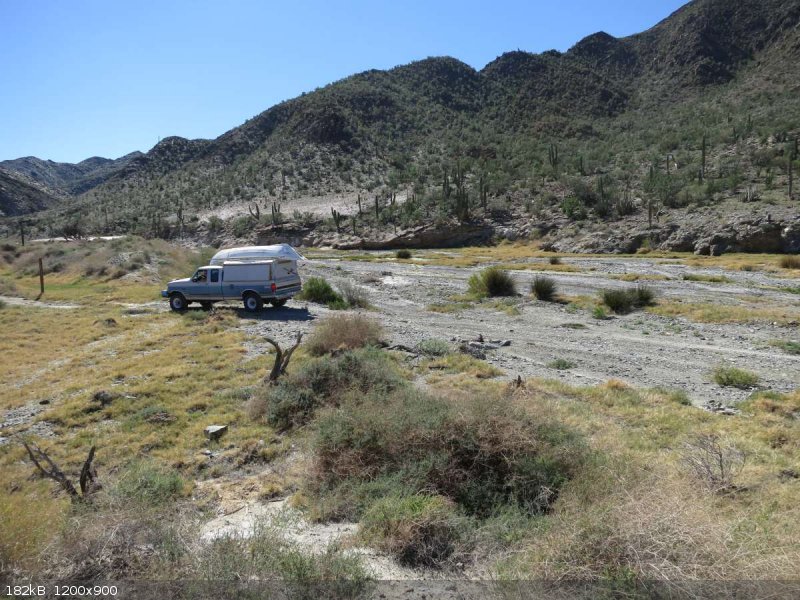
Once we hit highway 1 and aired up we had a fantasy of making it to Ojo de Liebre that night. A short lived one:
When we are finally allowed to get around that piece of equipment it’s apparent we won’t be camping at Ojo de Liebre. Our alternate camp is one
we’ve used before in the hills east of Rosarito. We go about 4 or 5 miles off the highway and use the, ‘road off a road’ method to arrive at
our camp.
The next morning we have breakfast and a shower at Mario’s restaurant (just past the Eagle Monument). Nice clean showers with plenty of hot water
were about $3.50. Good sliced fruit dish, just average huevos rancheros, good internet connection and attentive service. On the return trip we
stopped for a late lunch and don’t think we would do that again. Showers/internet and maybe breakfast will be enough thank you Mario.
Have yet to see any ships loading ore at the new pier in Santa Rosalia but the mine parking lot is full of cars and the place is humming. Same poor
excuse for a road as you come into town.
We spent the night in Loreto with friends, did some shopping in the morning then headed for Pto. Chale.
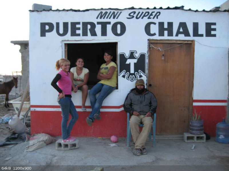
For over 16 years most these winter trips have included a week or so camping on Isla Cresciente.
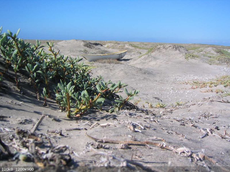
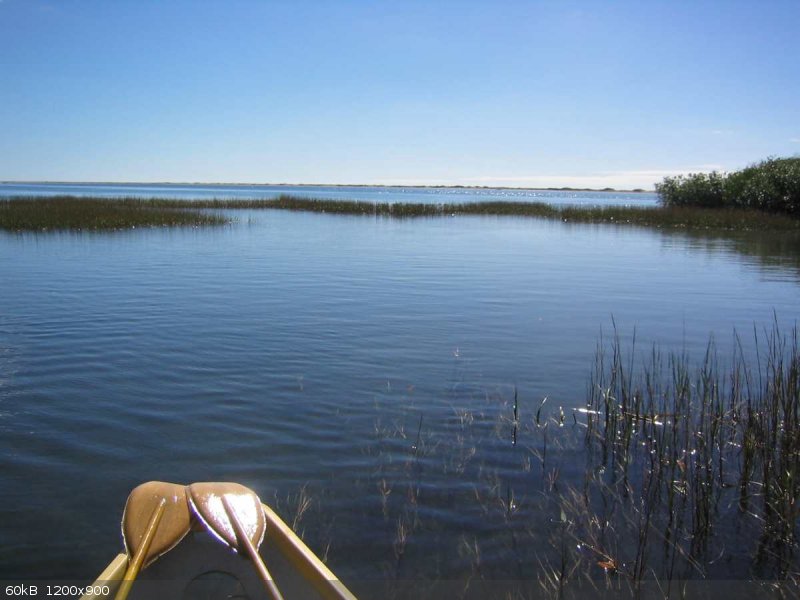
We load up the boat and row over.
All these years we’ve left the truck with the same family.
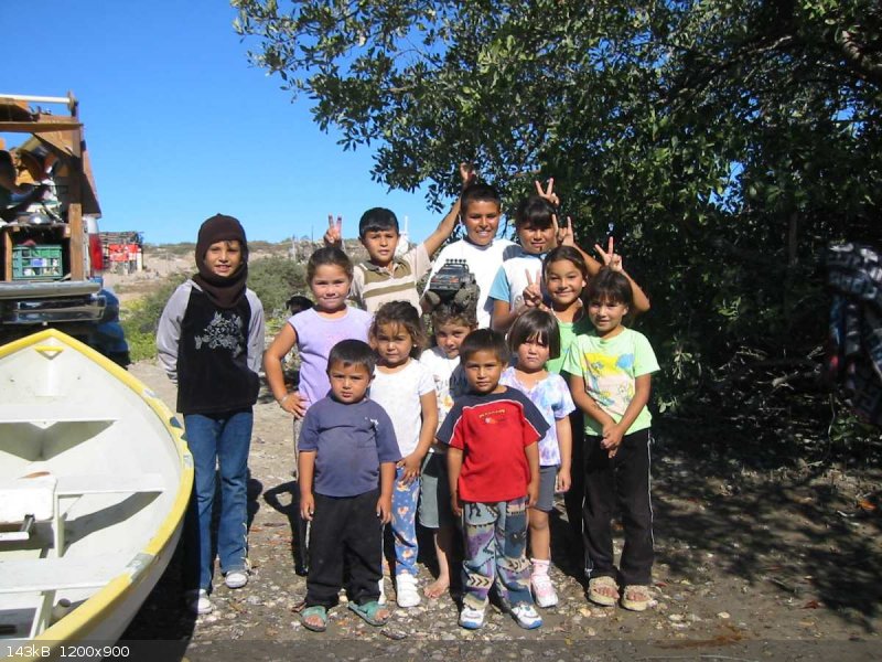
Most of the kids in this picture now have their own children! This year we didn’t visit the Isla but wanted to see everyone and drop off the photos
from last year.
---next---Pto. Gato
|
|
|
David K
Honored Nomad
Posts: 64557
Registered: 8-30-2002
Location: San Diego County
Member Is Offline
Mood: Have Baja Fever
|
|
Very cool!
There was a ship being loaded at the new (Santa Rosalia north) mine pier on Jan. 31... The conveyor belt was taking the ore all the way out to the
ship.
|
|
|
KurtG
Super Nomad
Posts: 1202
Registered: 1-27-2004
Location: California Central Coast
Member Is Offline
Mood: Press On Regardless!!
|
|
What was the road condition to Tembibichi? Would I have any problem doing it in my 2000 4wd Explorer. 16" tires, Toyo Open Country HT, not real off
road tread but brand new so lots of tread. I'll be back in Baja in a couple of weeks and would like to do that drive as well as San Luis
Gonzaga/Evaristo/La Paz.
Thanks,
Kurt
|
|
|
degoma
Junior Nomad
Posts: 64
Registered: 7-21-2009
Location: Mojave, CA
Member Is Offline
|
|
I don't think you would have much trouble. It's more a ground clearance issue than tires. Within a day or so I'll finish up this post with more road
details.
Bruce
|
|
|
KurtG
Super Nomad
Posts: 1202
Registered: 1-27-2004
Location: California Central Coast
Member Is Offline
Mood: Press On Regardless!!
|
|
| Quote: Originally posted by degoma | I don't think you would have much trouble. It's more a ground clearance issue than tires. Within a day or so I'll finish up this post with more road
details.
Bruce |
Thanks, I've done some pretty rough Baja roads with the Explorer but am well aware of its limits.
|
|
|
degoma
Junior Nomad
Posts: 64
Registered: 7-21-2009
Location: Mojave, CA
Member Is Offline
|
|
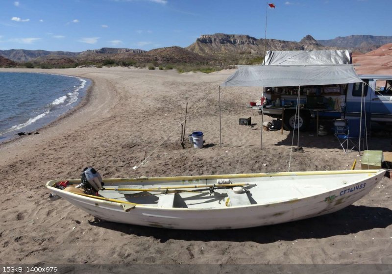
Puerto Gato
Back to Cd. Constitución for some hot showers and a good night’s sleep at Palapa 206 (just outside of town at km 206) where there’s plenty of RV
parking, good internet and reasonable priced nice rooms.
Armed with maps .kmz files and Ozi Explorer (loaded with lots of Google Earth screen shots) we leave highway 1 at 10:00: destination Tembibichi. All
of this was a nice exercise which no doubt will be helpful for some lesser explored places (if there are any left) but it certainly wasn’t necessary
for this run. One block south of the Ley super market turn left and drive about 60 miles. 
If you were not GPS equipped, about the only confusion might be at the settlement of ‘Ley Federal de Aguas Numero Cinco’. You need to go
thru/around this little town and then be on essentially the same heading as you were before…just maybe 10 degrees east (a tad more sun in your
face).
I guess we are just slow…didn’t get to the beach in front of the village until 18:00 although there was a 45 minute lunch break to marvel at the
stone corral.
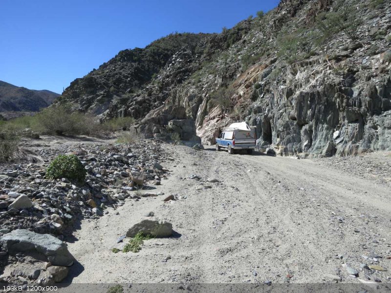
The descent from on high down to the arroyo that leads to Tembibichi is only 1.3 miles (2.2% of the trip) but it sure leaves a big impression! A
wheel base any longer than mine (159”) would start to be a problem in the tight turns. Some of these turns appear dangerously eroded. If you are
in a short wheel base vehicle you might not even notice this since you can stay very comfortably close to the uphill side. At one turn I did a small
back-up to try and keep that left rear further from the edge. Other than that, and some fairly big drop-offs where concrete paving ended there was no
problem.
We camped directly in front of the village then the next morning drove app. 3.5 miles to Puerto Gato and made camp for 9 days.
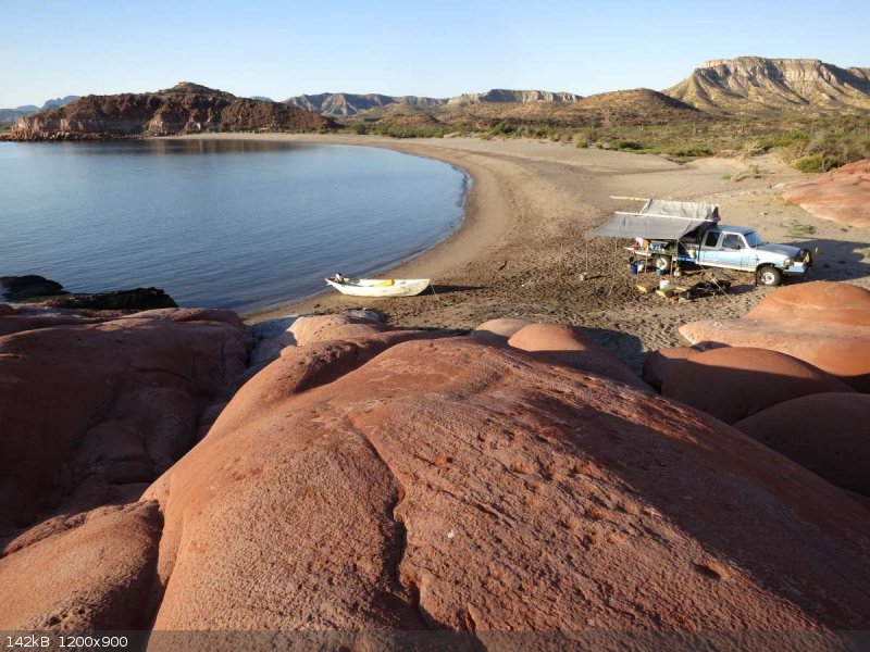
The breakfast patio.
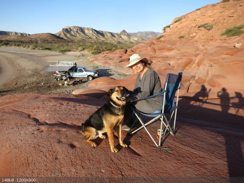
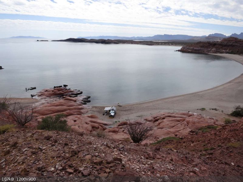
And what a camp it was!
(continued mas tarde)
[Edited on 3-3-2017 by degoma]
|
|
|
elgatoloco
Ultra Nomad
Posts: 4328
Registered: 11-19-2002
Location: Yes
Member Is Offline
|
|
Wow! Very nice. You guys know how to live. Years ago we flew down to La Paz for the 1000 finish on Screaming Airlines and I took lots of aerial photos
and saw the roads and checked the maps and looked again at the photos of the roads going down the side and wondered about the pucker factor on the
decent. 
MAGA
Making Attorneys Get Attorneys
|
|
|
KurtG
Super Nomad
Posts: 1202
Registered: 1-27-2004
Location: California Central Coast
Member Is Offline
Mood: Press On Regardless!!
|
|
I will be in that area in a couple of weeks and would love to have another vehicle accompany me. Any takers? I'm an experienced, sort of minimalist,
camper and my 4wd is in good condition. Also would like to try the back road to Agua Verde and then plan to drive San Luis Gonzaga/Evaristo/La Paz.
My schedule is a little flexible but plan to be in Mulege/Loreto arount 3/18-20 then have 10-14 more days before heading north again. Will also be
back in the area after Semana Santa.
|
|
|
degoma
Junior Nomad
Posts: 64
Registered: 7-21-2009
Location: Mojave, CA
Member Is Offline
|
|
Puerto Gato Continued
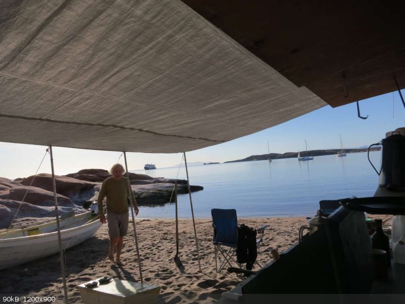
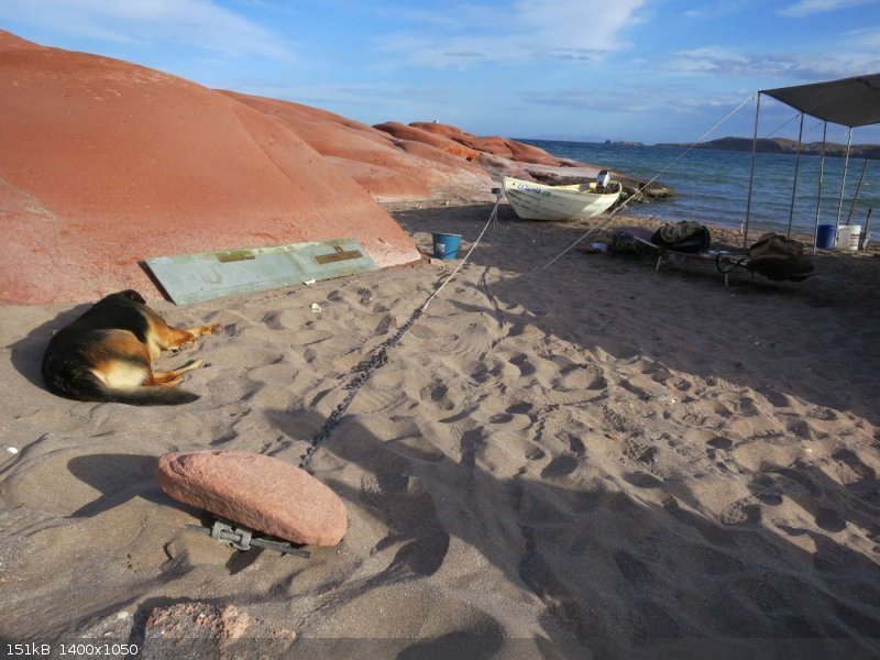
Looking at the photos of our camp you could get the impression that we were completely alone on that beach. And it’s true; we had no land based
visitors during the 9 days with the exception of Francisco. Francisco, or Pancho as he’s known is the grandson of Solomon de la Toba; the rancher I
met so many years ago. He lives on the same ranch a few miles north at San Carlos.
We had coffee a few mornings and talked about the old days when to get anything meant a long boat ride (or an even longer mule ride) to Loreto or
sometimes La Paz. Now, with the road, they drive to town once a month for supplies.
Visitors from the sea however were another story. Somewhere, in the back of my brain, I knew that Pto. Gato was a popular anchorage. Just the same,
while planning the trip and driving in it never occurred to me that we would end up in a crowed spot.
A sailboat arrived around noon on our first day and by sundown there were 3 anchored…in front of our camp. We were not, “alone” again until the
last few days when threat of a Norte caused everyone to seek a safer spot.
It’s a great place if you are into boat watching…and I certainly am a boat enthusiast. We soon adjusted to a rhythm of sorts; around 10:00
anchor chains rattle and some boats leave; a while later shore parties arrive for hiking and beach combing and then around 14:00 anchor chains rattle
as new arrivals stake out their spots.
Boaters are friendly folks and we had some interesting conversations with a number of them. There was one woman however, who marched up to our camp
camera in hand and complained that she could not get a good picture of the red rocks because of where we were camped. Really I said… we are having
a similar problem getting a good picture of the bay!
One afternoon when there were about 5 sailboats in the bay, the luxury motor yacht, ‘Japimana’, all 108 feet of her, with multiple radars spinning
slid silently into the bay followed by some serious anchor chain rattling. An aircraft carrier entering the bay would have a similar affect.
This baby can move up to 8, yes 8 guests, 525 nautical miles at a cruising speed of 24 kts before her 4,800 horses need a little something to drink
(4,400 gallons of diesel). If there were 8 guests on board only two chose to come ashore.
We were hiking down the beach as their launch reached the beach. A young Asiatic couple walked toward the desert. The Zodiac driver was securing
the launch and did not look up as we passed. He could double for The Incredible Hulk so I gathered he had other duties as well.
The ‘Hulk’ shadowed the couple at a discrete distance as they made their way toward the red rocks. At this point the latent ‘paparazzi’ in me
dictated that I sit down so as to better stabilize my binoculars. They moved around the rocks like people not accustomed to that sort of activity.
When they came down onto the beach again it was at the back of our boat. They stopped and stood right there, gazing at our camp, then the fellow
reached down, and I’m not making this up, and stroked the propeller of my two horse power Honda outboard. Was he heir to a Honda fortune?
That evening, without even requesting it, we had a demonstration of what the sound system on a boat of that sort is capable of. Yea, let’s disco!
There was a light show as well. All around the boat at the water line strobe like lights were flashing making the boat look even more like the alien
thing it was. Gay groaned and said, “Are they going to do this every night?” No, they won’t be here in the morning as they probably have to be
in Pto. Vallarta tomorrow I replied. Sure enough, around 01:00 the clanking of heavy anchor chain wakes us up as the Japimana prepares to get
underway.
I’m dreaming; anchor chain is rattling and a voice is saying, they’re back, the Japimana is back. I sit up, it’s 06:30, Gay points to the
outer bay; see, they’re back. It’s big alright but it’s not the Japi. I grab the bino’s…oh, I see….it’s a cruise ship! On the upper
deck a yoga class is underway.
Around 07:30 they raise the anchor and move in to a new spot closer to shore. Half hour later a large rubber boat comes into shore about 500’ from
us. Four or five people who look like, ‘staff’ jump out and start walking around up on the beach; some kind of a meeting I speculate. Next thing
you know they are on their way back to the mother ship. Then,15 minutes later back, this time with only three people. As two people start unloading
big ice chests, chairs, shades and who knows what else, the third person walks toward our camp.
Jeremy came over to let us know what was going on and, incredibly, make sure we were OK with it. We are going to bring some people ashore for hiking
and beach combing then lunch on the beach. Are we too close to your camp? I told him it looked like a reasonable distance and we were fine with it.
Are you sure he asked….we can move it further down the beach or even over to one of the other beaches; you were here first. I told him we were very
impressed with the consideration they were showing us and that it was not a problem.
What are you bringing anyway, 20 or 30 people I asked? He looked at me, then at Gay and said, ah, no… closer to 70. Thank you for your
understanding; if there is anything that you need; beer, wine, ice, meat or vegetables, just come out to the ship and we’ll fix you right up.
The rubber boat went back to the ship leaving a pile of stuff on the beach. As we were trying to imagine what it would be like with 70 people all
attempting to take good pictures of the red rocks, the rubber boat set off from the mother ship again. Brace yourself I thought, here comes the first
assault. Surprisingly there were only two and they proceeded to re-load all that stuff then headed for a beach across the bay. What was that all
about us wondered? Is the supply offer still good? Gay reminded me of one thing we could use.
As we went out for our morning row I swung us by the huge swim/launch platform at the stern. As several crewman stood by, I backed the dory close to
the platform; “Alright, just give us your WiFi code and nobody get’s hurt!”. We all had a laugh and I learned they only have a local area
network…no WiFi. Guess they don’t call it ‘The Uncruise’ for nothing.
https://www.uncruise.com/destinations/mexico-cruises
In the early afternoon, having recovered her shore parties, the ‘Uncruise” weighed anchor and motored off for adventure elsewhere. We were
reflecting on how much more ‘natural’ sail boats look in a remote harbor when yet another motor yacht rounded the point. The Aft Pilothouse 68’
Nordhaven came in surprisingly close to shore and dropped a quiet anchor. It looks like a tug boat Gay said. Shhhhh, sound travels, don’t let the
owner hear that!
Later that day we met the Swiss owner when he came ashore for the requisite photo of red rocks. He complimented us on our camp (guess he found a way
to get a good picture) explaining that in a younger day he and his wife camped like us (In a Unimog of course).
The days literally sailed by, filled with rowing, hiking, fishing, snorkeling, reading, boat watching and just lying in the warm sand; in other words,
a rather typical vacation (aside from the boat watching) in Baja California.
(to be continued…the road out….gulp)
[Edited on 3-5-2017 by degoma]
|
|
|
David K
Honored Nomad
Posts: 64557
Registered: 8-30-2002
Location: San Diego County
Member Is Offline
Mood: Have Baja Fever
|
|
Thanks!
|
|
|
| Pages:
1
2 |
|


