mojo_norte
Senior Nomad

Posts: 725
Registered: 2-14-2006
Member Is Offline
|
|
The road North of Pt. Conejo ?
Does it follow the coast ?
Nice Camping ?
|
|
|
bajalinda
Senior Nomad
Posts: 551
Registered: 6-7-2008
Location: Pacific Coast, BCS
Member Is Offline
|
|
Yes, it follows the coast up to Puerto Chale. About 10 miles or so north of Conejo it goes inland a bit to get around the estero there at the very
small (and aptly named) pueblito of El Estero, then goes back to the coast.
Beautiful camping especially north of El Estero on the west side of the south end of Mag Bay - on the spit of land at the south end of the bay.
[Edited on 3-8-2017 by bajalinda]
|
|
|
MMc
Super Nomad
Posts: 1679
Registered: 6-29-2011
Member Is Offline
Mood: Current
|
|
Nope! it's full of nasty thing that should be left alone. Go forth at your own parallel.
"Never teach a pig to sing it frustrates you and annoys the pig" - W.C.Fields
|
|
|
mickeykreg
Junior Nomad
Posts: 33
Registered: 11-17-2005
Location: Salt Lake City
Member Is Offline
|
|
In January we went about 3-4 miles north then turned around.
Conejo was amazing enough!
|
|
|
BajaBlanca
Select Nomad
Posts: 13165
Registered: 10-28-2008
Location: La Bocana, BCS
Member Is Offline
|
|
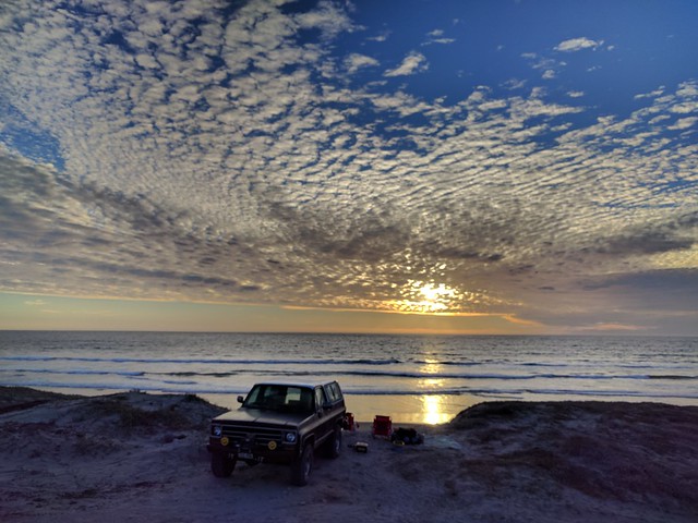
wow
what a gorgeous photograph!
|
|
|
TMW
Select Nomad
Posts: 10659
Registered: 9-1-2003
Location: Bakersfield, CA
Member Is Offline
|
|
The usual Baja 1000 course follows a route about 10KM out of Santa Rita down to Arroyo Guadalupe then the coast down turning east near Ley Federal
Agria Dos in the Baja Almanac toward La Paz.
|
|
|
BFS
Senior Nomad
Posts: 520
Registered: 9-28-2006
Location: Todos Santos
Member Is Offline
|
|
It really goes all the way to Chale?
Wow.
How about a map?
thanks.
|
|
|
bajalinda
Senior Nomad
Posts: 551
Registered: 6-7-2008
Location: Pacific Coast, BCS
Member Is Offline
|
|
BFS - I'm in the middle of a family visit right now - will post more but realistically it won't be til next week.
|
|
|
bajalinda
Senior Nomad
Posts: 551
Registered: 6-7-2008
Location: Pacific Coast, BCS
Member Is Offline
|
|
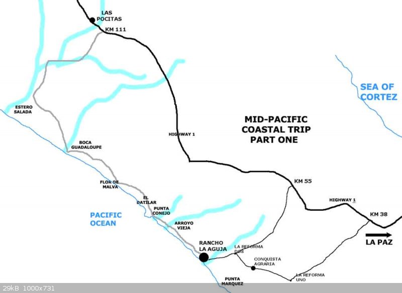
OK BFS, here ya go..... this map shows the road north of Pt. Conejo as far as Estero Salado where you will find the small village of El Estero. From
there you can opt to return to the highway and join it at Las Pocitas, or you can continue north to Puerto Chale. I know the map in The Baja Almanac
shows the road north of the estero as a mere track, but it is more than a track - the fishermen use it to go north. I would suggest that you ask the
people in El Estero (I know them, they are good people) about the condition of the road north and then decide what you want to do.
|
|
|
BFS
Senior Nomad
Posts: 520
Registered: 9-28-2006
Location: Todos Santos
Member Is Offline
|
|
Wow, thanks for that. Will have to give it a try.
|
|
|
StuckSucks
Super Nomad
Posts: 2306
Registered: 10-17-2013
Member Is Offline
|
|
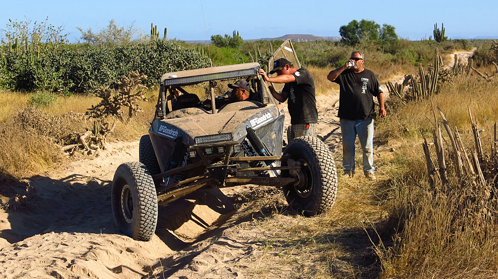
Intel from November 2014. The 1000 ran south thru there. North of Conejo the road was pretty torn up, so we jumped onto the beach and drove north to
Guadalupe that way (our rescue base camp):
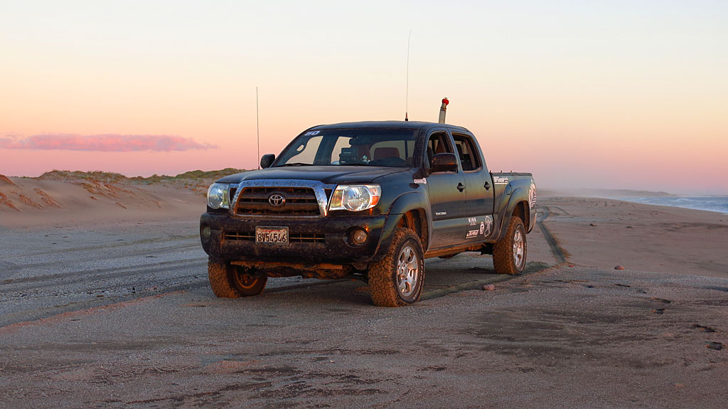
This is what the road looks like along the coast - sand and silt and whoops:
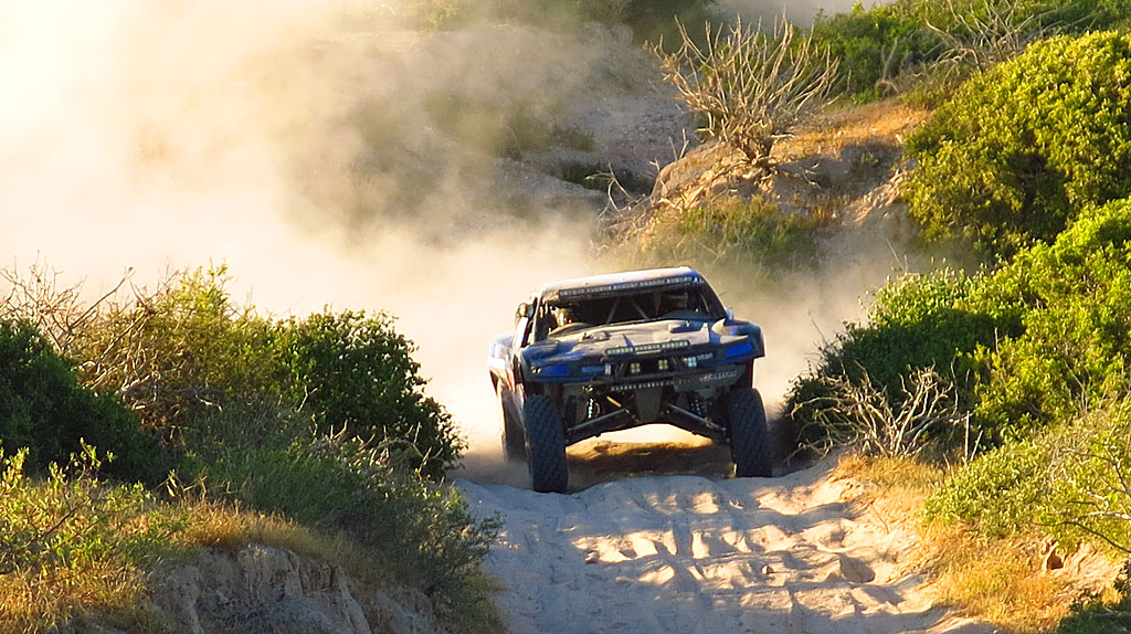
Rescuing our brand new Class 10 car the next morning in the silt, south of Estero Salada - from there, we exited to Highway 1 at Las Pocitas :
|
|
|
bajalinda
Senior Nomad
Posts: 551
Registered: 6-7-2008
Location: Pacific Coast, BCS
Member Is Offline
|
|
De nada, BFS.
StuckSucks - looks like you had a heck of a time there. November 2014 would have been roughly 2 months after Hurricane Odile rolled over the
peninsula. The roads were a mess everywhere, so I imagine that Baja 1000 was a doozy.
|
|
|


