| Pages:
1
2
3
..
5 |
David K
Honored Nomad

Posts: 64479
Registered: 8-30-2002
Location: San Diego County
Member Is Offline
Mood: Have Baja Fever
|
|
TRIP #3 (MAR 2017) Mexicali-San Felipe; SPM Eastside Canyons; Chapala to San Quintin.
EDIT: Report & Photos sized for message boards and no watermarks are here: https://www.tacomaworld.com/threads/2017-baja-expedition-3-m...
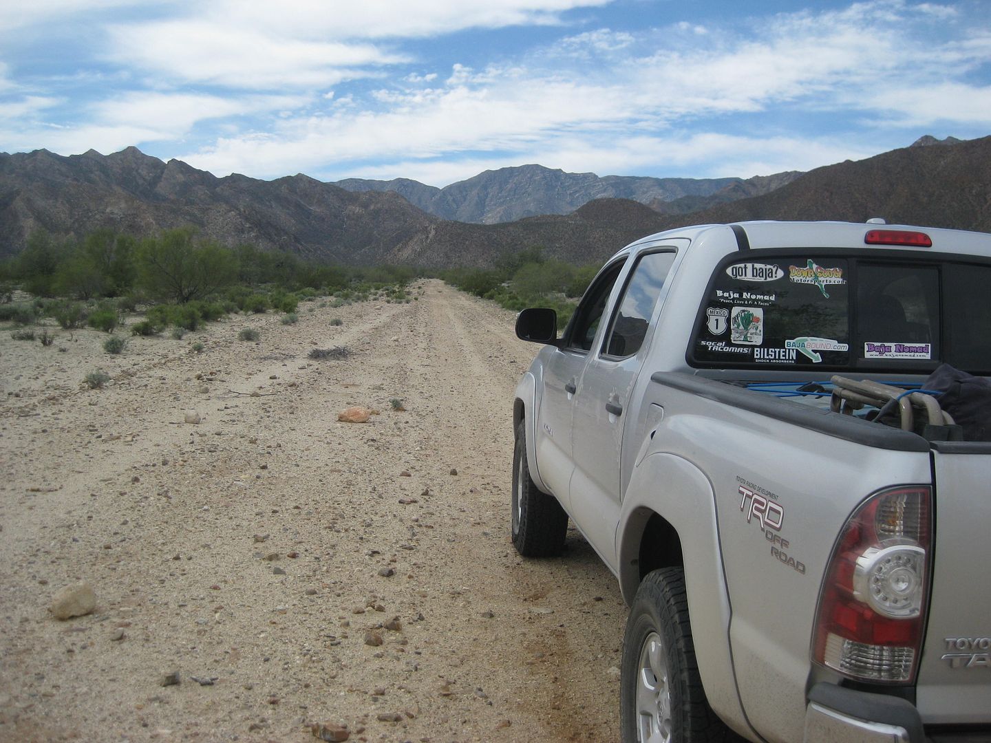
Thursday March 2, 2017
Bought pesos for the trip at the money exchange in Calexico in the Auto Zone parking lot. The exchange today was 18.80 pesos per dollar. It was 20.20
last month and 20.00 the month before.
Crossed into Mexico at the downtown Mexicali border. Purchased a new 180-day FMM tourist card for 500 pesos. Confirmed with the INM officer that it
was good for multiple trips and that it did not need to be returned to INM when leaving Mexico.
Noted mileages and kilometer markers on Hwy. 5 to San Felipe. GPS spotted Pemex stations (outside of the city), campgrounds, and points of interest.
The following are just my notes and not embellished or how they will appear in the final publication.
Km. 0 is at the San Luis Rio Colorado (Hwy. 2) split from Hwy. 5, 4.9 miles from the border. This is where you cross the railroad tracks a final time.
Km. 8 is the Toll Road (2-D) to Tecate exit.
Km. 23 the highway is west from the volcano, Cerro Prieto.
Km. 38 is the Hwy. 4 junction (access to El Golfo de Santa Clara).
Km. 48.5 is the north access to Campo Mosqueda on the Rio Hardy river (3.3 miles)
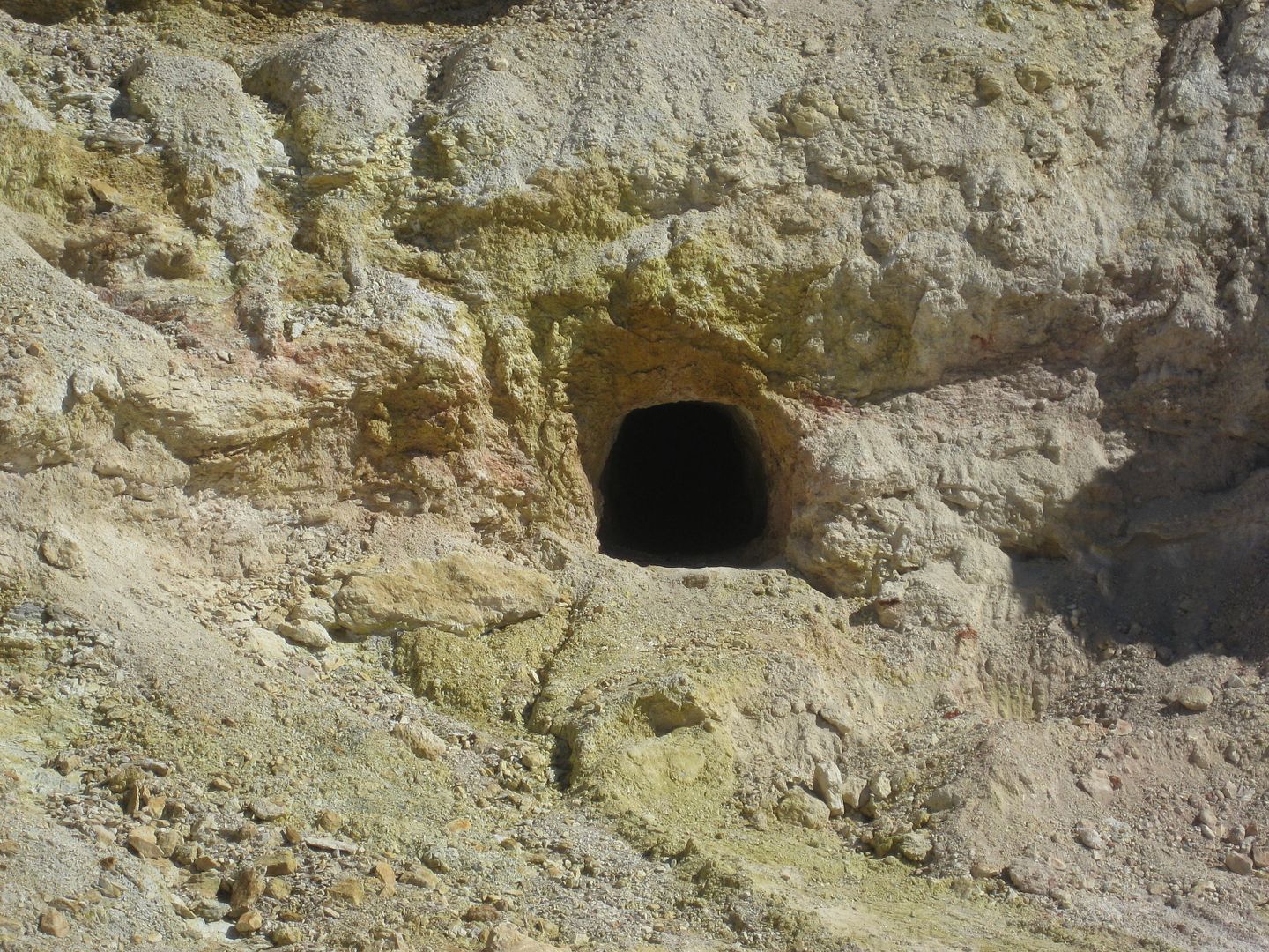
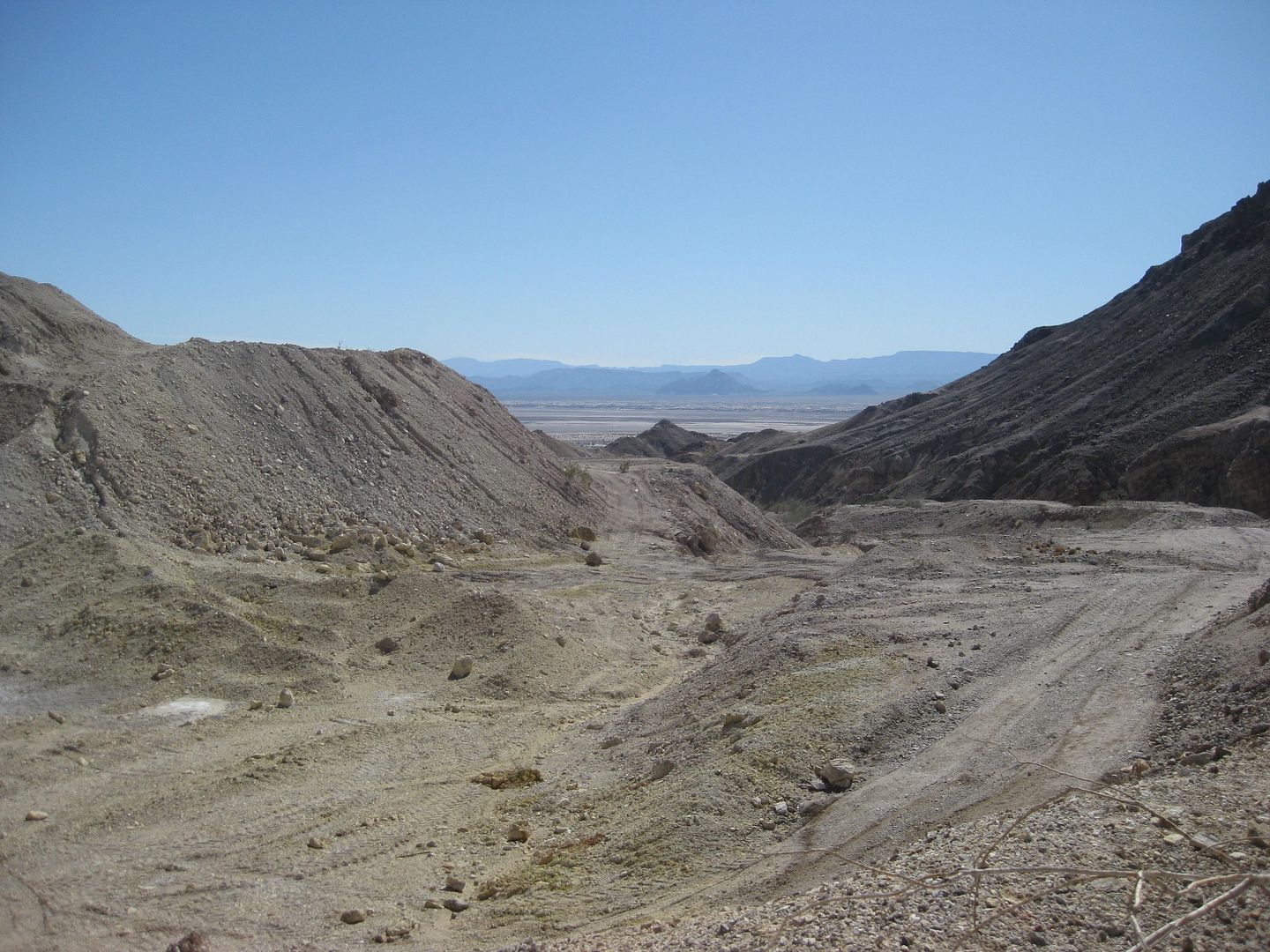
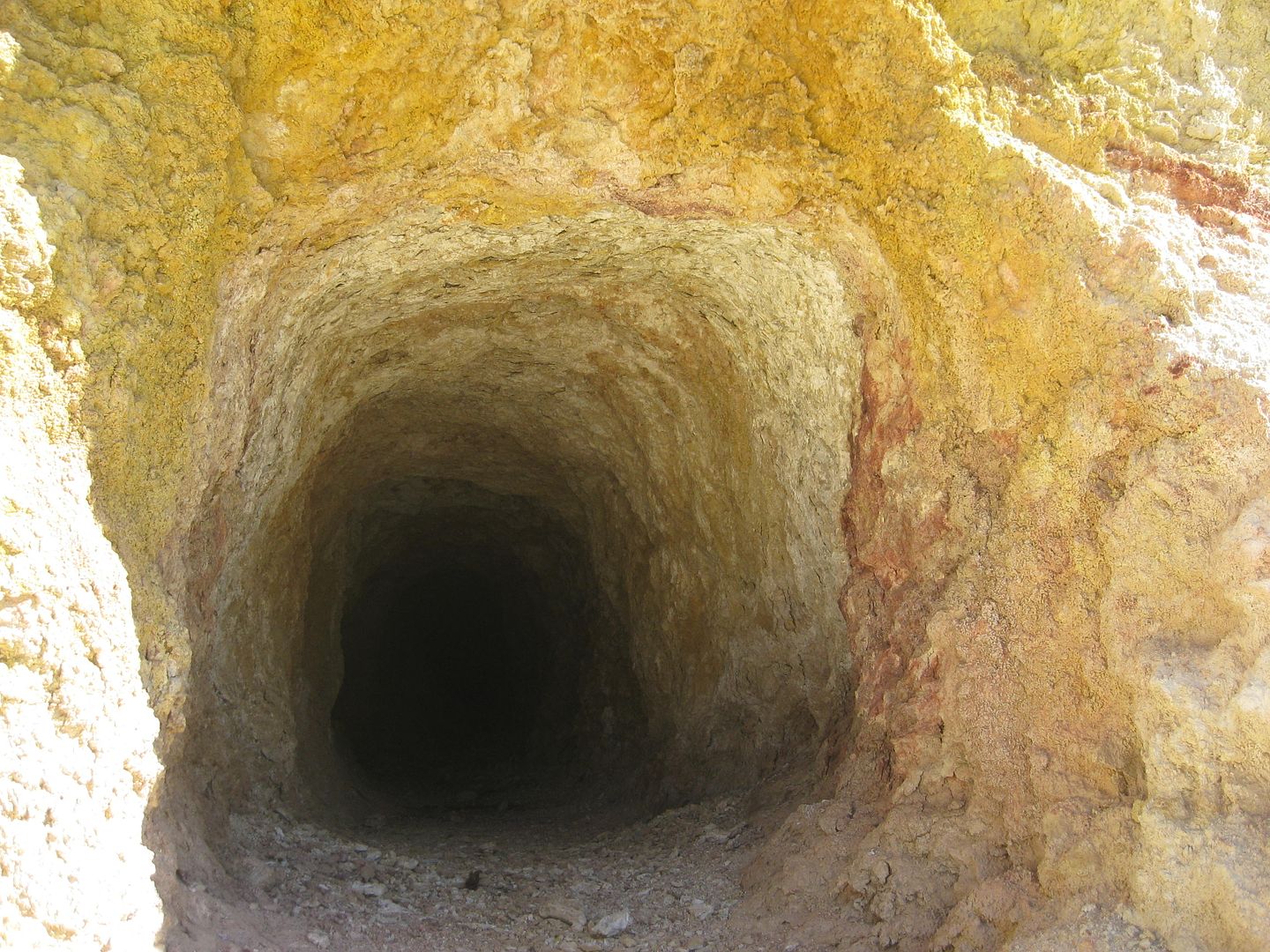
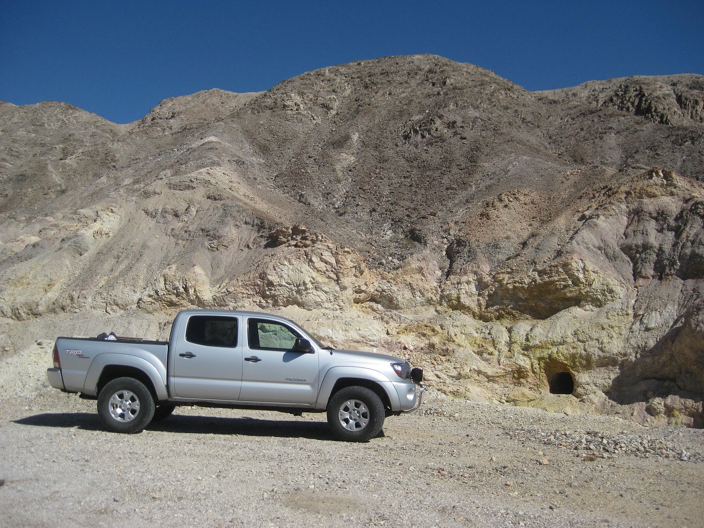
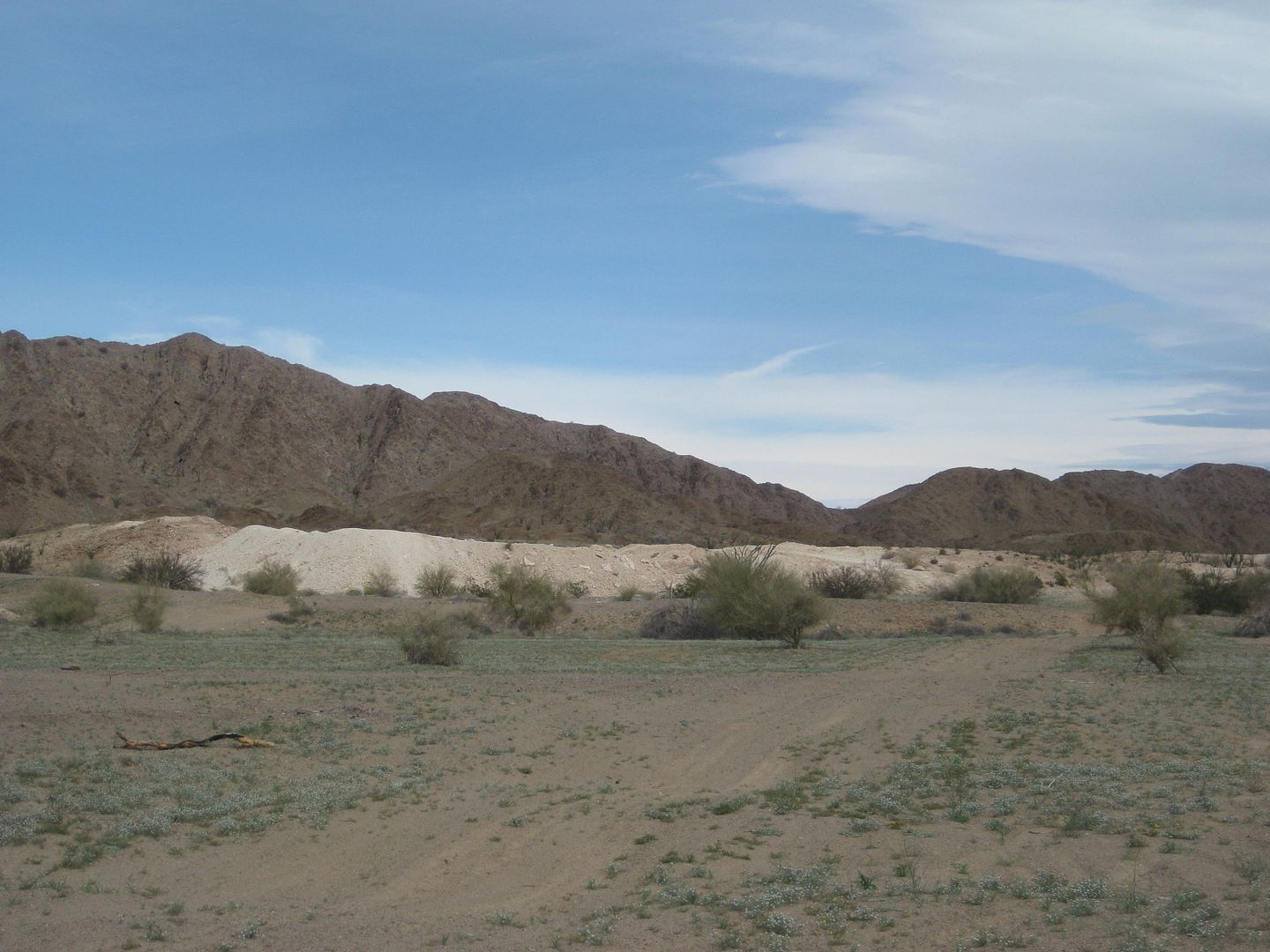
Km. 49 is a graded, but rough road west over the mountain to Laguna Salada and an abandoned Sulfur Mine (7 mi., take right fork at mi. 3.7).
Km. 53.5 is south access to Campo Mosqueda (1.3 mi.). It passes tow other campos going in.
Km. 55+ Campo El Mayor
Km. 74+ Failed canal from the 1980s made to fill Laguna Salada.
Km. 86.5+ Ejido Saldaña road, right.
Km. 105 La Ventana, store, rest area.
Km. 126 La Fortuna Gold Mine entrance.
Km. 136+ El Chinero, historic hill.
Km. 140.5 Hwy. 3 junction.
Km. 141.5 Military Checkpoint
Km. 160 Begin 4 lane highway.
Km. 171.5 Villas Cortez (2.4 mi.). Palapas, pool, nice looking! But, no in-vehicle camping (RVs or out of your truck). You must unload at a turnaround
loading spot, carry your things across the sand 100 feet to a palapa, then park your vehicle even further away, behind a building (out-of-sight).
Three camp signs follow, but are either chained up or are not for camping, just lot leasing: San Marino, Don Abel, Campo Amigos.
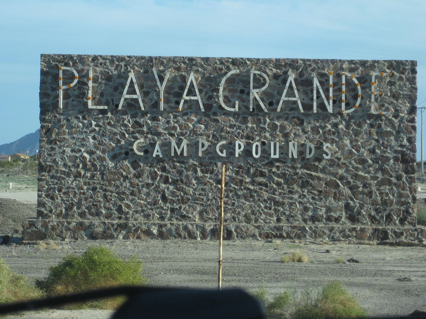
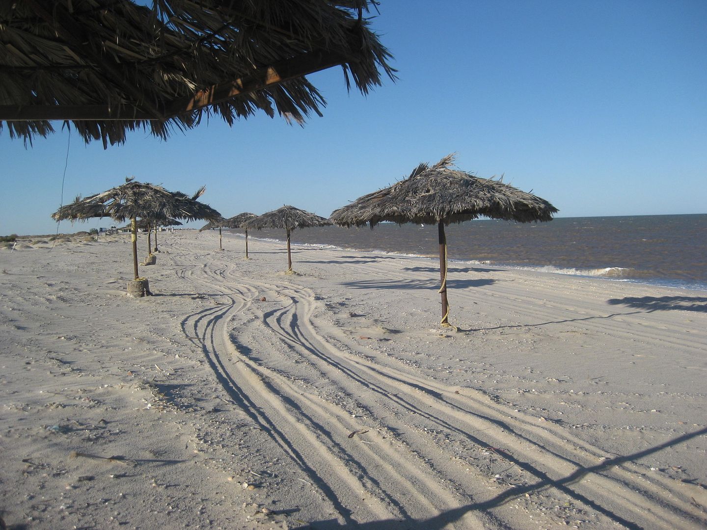
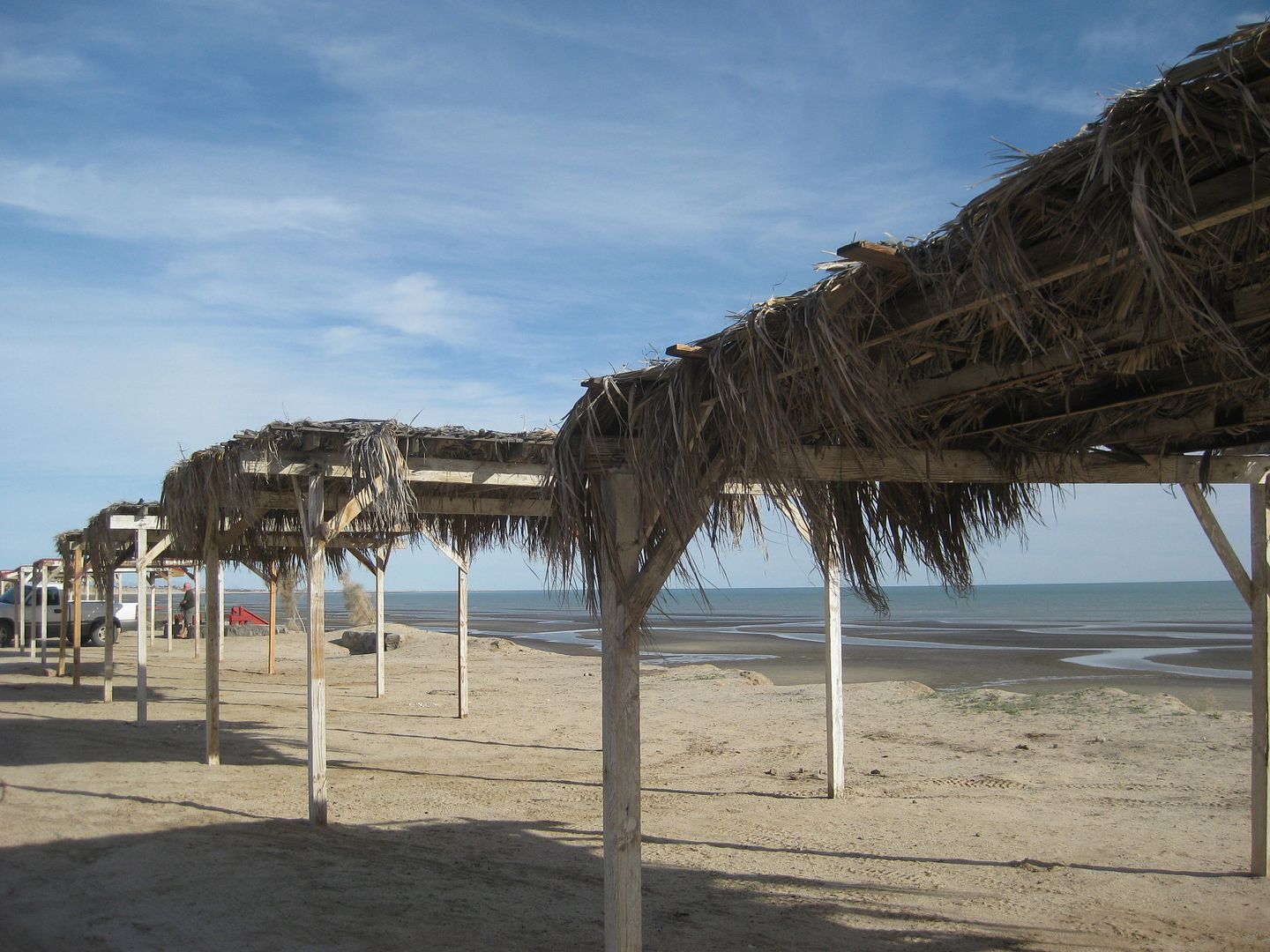
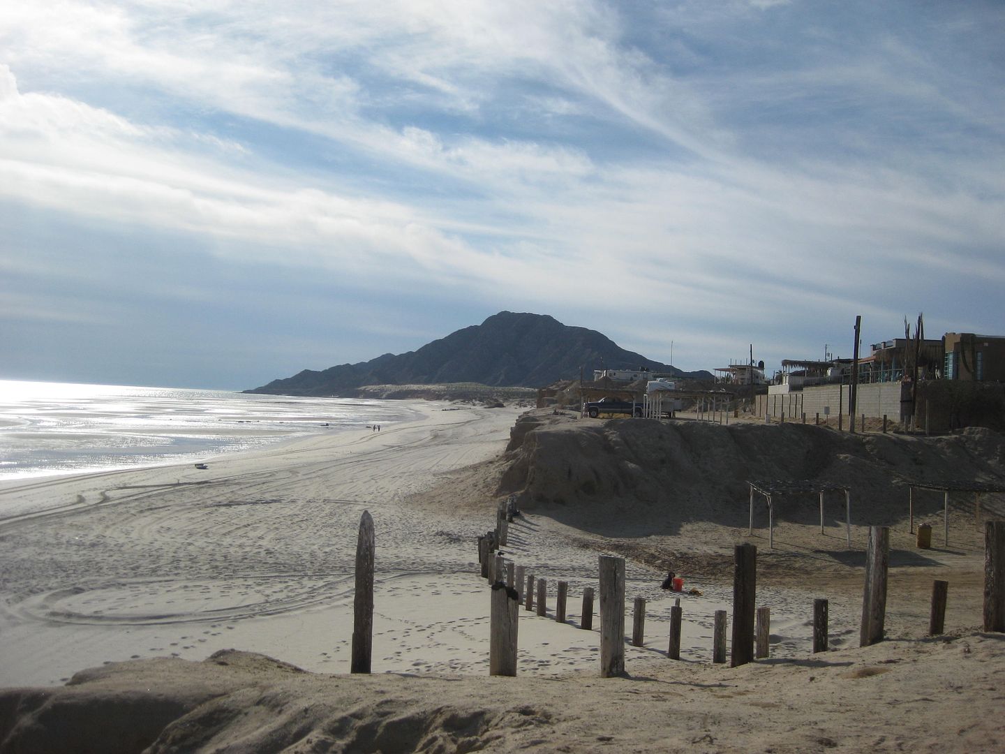
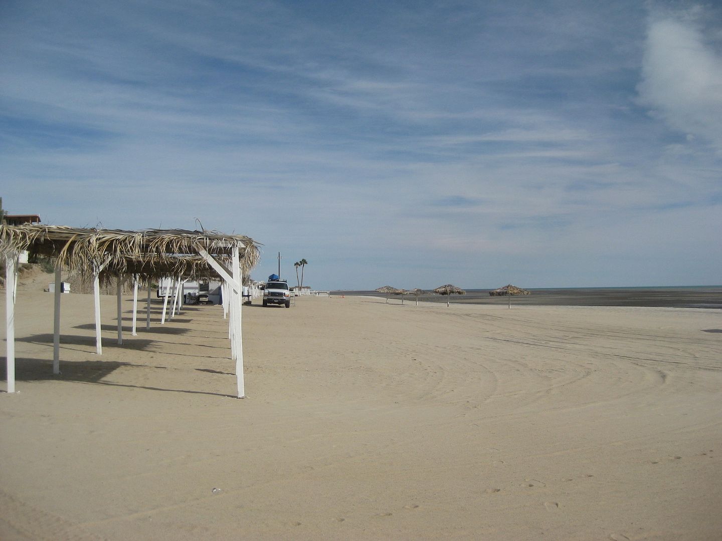
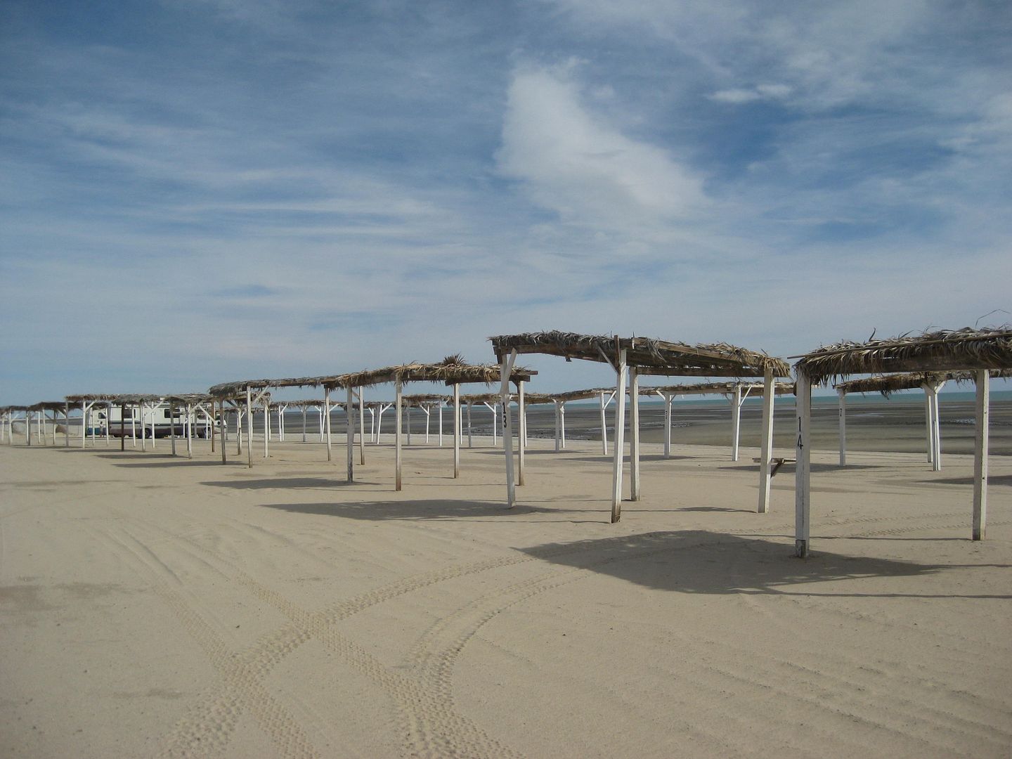
Km. 173.5 Playa Grande (1.9 mi.) Palapa camping.
I am running out of daylight, the wind is blowing too hard to have a nice camping night, so I get a room at the Hotel Diamante (Km. 185.5) for 480
pesos. Next time, I will try the Blue Sky... which is just a bit north.
I go into San Felipe, get some fish tacos and Pacificos, and all is good.
Tomorrow, I will cover the San Felipe to Pete's Camp to Playa Grande campos.
Here are the DAY 1 Thursday photos:
I will add captions later and answer any questions.
Sulfur Mine:
Campo Mosqueda:
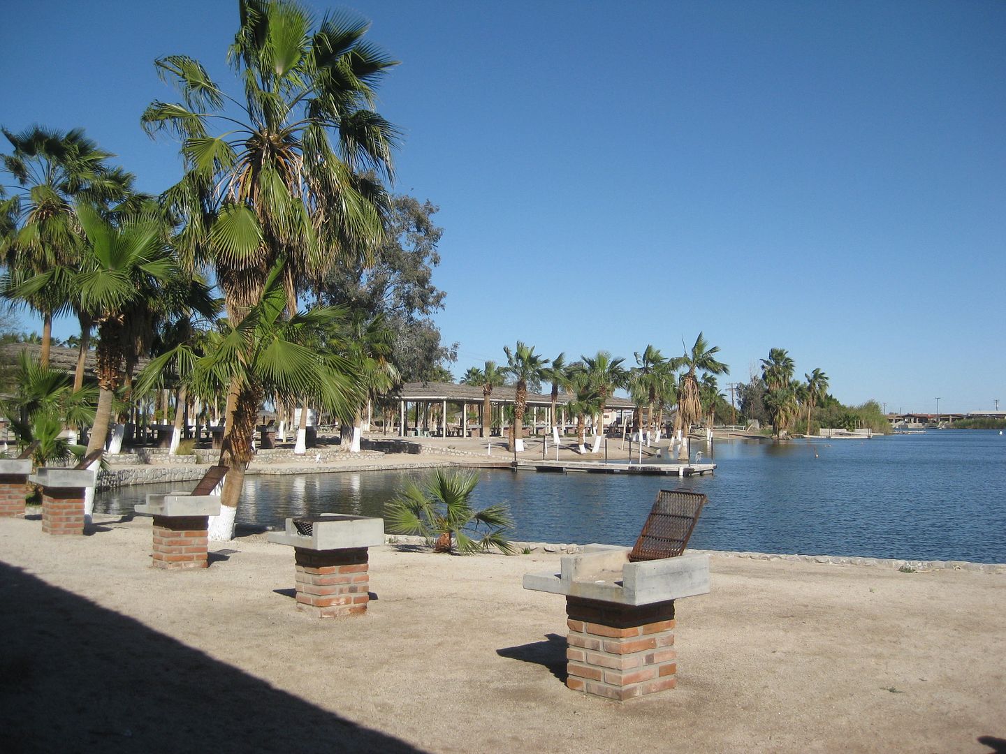
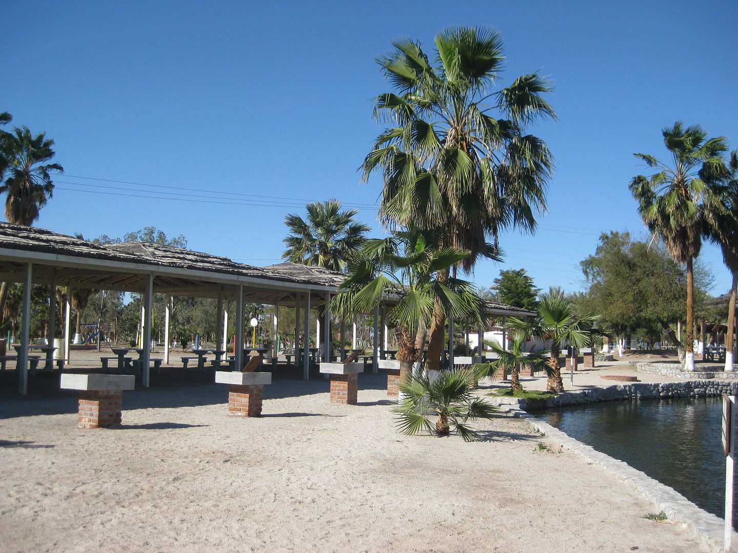
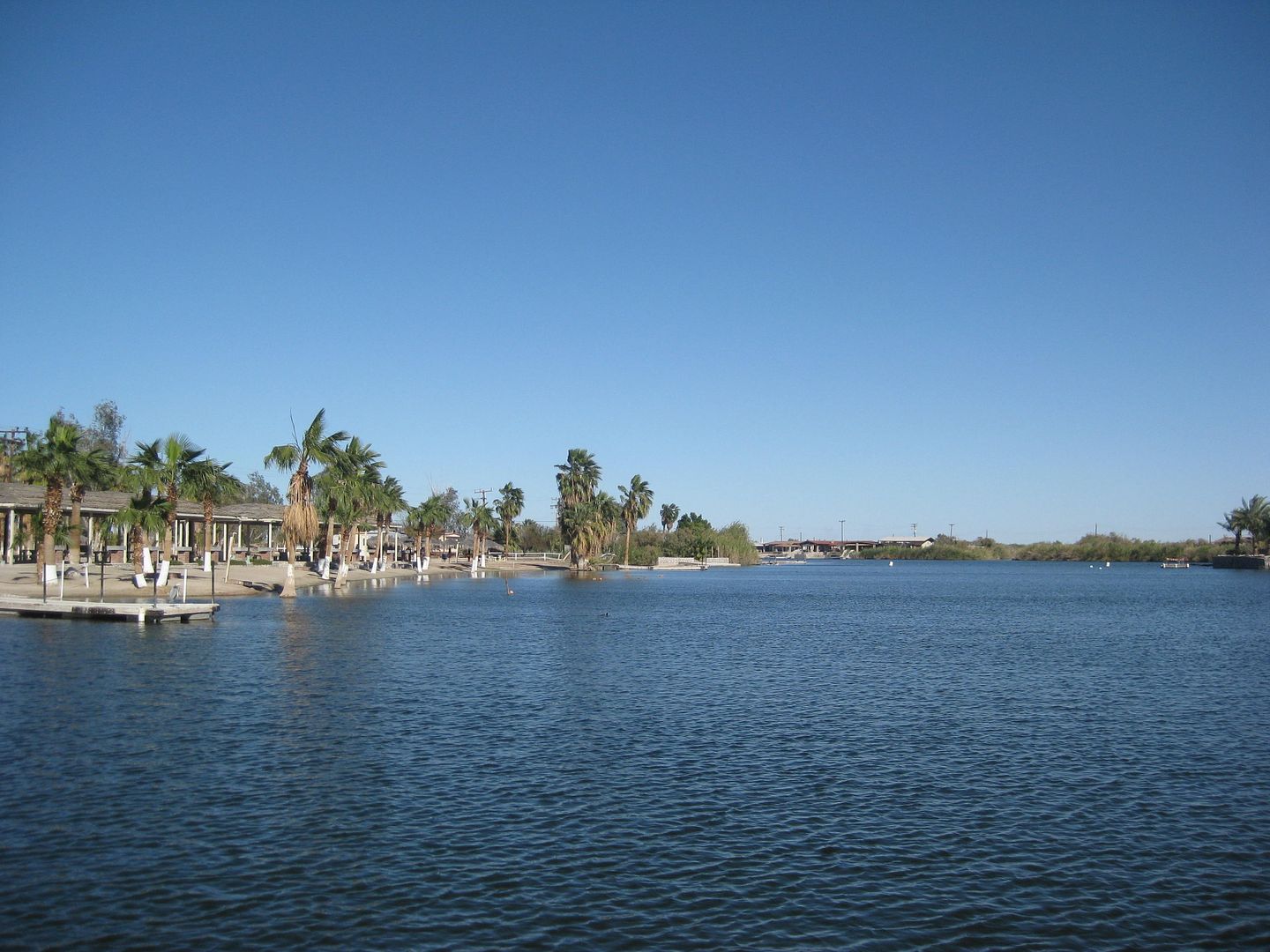
Playa Grande:
Villas Cortez (as close as you can drive to palapas to unload):
More coming. Stay tuned for Day 2, Friday...
[Edited on 6-5-2021 by David K]
|
|
|
David K
Honored Nomad
Posts: 64479
Registered: 8-30-2002
Location: San Diego County
Member Is Offline
Mood: Have Baja Fever
|
|
Oh, when I am done with this, I will update the Baja Nomad Kilometer Marker thread, too!
|
|
|
BAJA.DESERT.RAT
Senior Nomad
Posts: 977
Registered: 11-5-2009
Location: BAJA SUR
Member Is Offline
|
|
thanks for the post, great pictures as always and mileage markers.
is this really a trip into the future ? ha-ha just kidding. look at the date..
BIEN SALUD, DA RAT
|
|
|
David K
Honored Nomad
Posts: 64479
Registered: 8-30-2002
Location: San Diego County
Member Is Offline
Mood: Have Baja Fever
|
|
Friday March 3, 2017 Day 2 of 7
OK, so you may have caught my comment about the Hotel Diamante in that next time I will go to the Blue Sky motel, just north on the same side of the
highway.
When I got to the hotel, after dinner, Thursday night... I was the only customer, I think... I asked for a quiet room as I was pretty tired from the
day's long drive and research. I got the next to the last room, way down in the far corner of the back building courtyard. Nice! It was a simple room,
had Spanish only TV, but the bed was fine.
After I was in bed, a car pulled up (a couple) and went into the room RIGHT next door, the corner room. Then their TV goes on, etc. etc. The whole
complex is empty so the lady at the front desk puts client #2 next door.
Wait, it gets better...
About 10 pm (and I want to be asleep), 2 more cars pull up next to my truck, they go upstairs, and in the room right above mine goes a family with
small kids who begin to stomp on the floor and run back and forth above my bed! Their friends in the room next door have a baby, which naturally
cries. I look around the rest of the hotel rooms and parking and nobody else is there! I get dressed and go up the stairs to where the family inside
the room with the doors open sees me and I ask them to please have their toddler stop running back and forth (at 10:30pm) so I can sleep.
Thankfully, they do, and I get to sleep! The logic of the lady to jam all the guests into adjoining rooms and get happy returning customers does
escape me!
Next time Blue Sky (if it is too windy to camp)! I later that day, met a couple at breakfast who were staying there, and they seemed to like the Blue
Sky.
-----------------------------------------------------------------------------------------------------------------
OK Friday Morning... I drive south from the Hotel Diamante to the entrance arch of San Felipe to record all the campos that are actual camping places
and other points of interest to travelers:
So you understand my kilometer marker notes:
If the point is right at or within visual sight of a kilometer marker, that will be what is given: Km. 179 (for example).
If it is about 1/4 kilometer after then it will have a + sign added: Km. 180+ (for example).
If it is approx. halfway between two markers, then a .5 is added: Km. 177.5 (for example).
If 3/4 a kilometer after, then a + sign is added after the .5: Km. 181.5+ (for example).
I am not sure if I will amend the notes for the plus sign to maybe .2 and .7 making sure we are all on the same page that this is approx. and could be
a couple hundred feet + or - from the exact kilometer point.
ROAD LOG NOTES (going north):
Km. 189.5+ San Felipe Entrance Arches
Km. 184+ Campo El Pescador (entrance closed)
Km. 184 PEMEX (on west side)
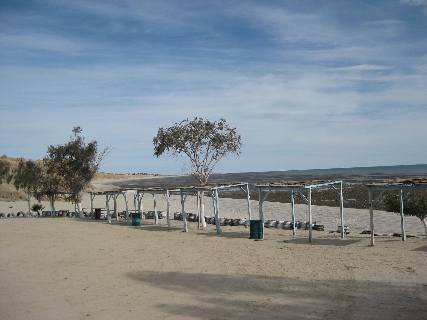
Km. 183 Playas del Sol (1.1 mi.) Palapas www.playasdelsol@live.com.mex is posted.
Km. 182 Campo Ocotillos (not camping, lots for lease)
Km. 181.5+ Pai Pai Campo (0.9 mi.) Beach only.
Km. 181 Colonia Morelos (Valle Chico/ Agua Caliente/ Matomí access) Road. San Felipe Storage.
Km. 180+ Campo Los Compadres (0.9 in) Many palapas overlooking beach or arroyo.
Km. 179 Playa del Oro entrance. Road-Runner Restaurant/ Deli. GOOD FOOD! Had a nice breakfast here, many cars in front.
Km. 178.5+ PEMEX STATION (on west side)
Km. 177.5 Pete's Camp El Paraiso (1.0 mi. to restaurant, 1.1 to palapas)
Km. 173.5 Playa Grande (see Day 1 post for details).
From Highway 5, I take the Colonia Morelos Road (at Km. 181):
There are kilometer posts on this road, but don't go the entire distance to Agua Caliente Canyon road.
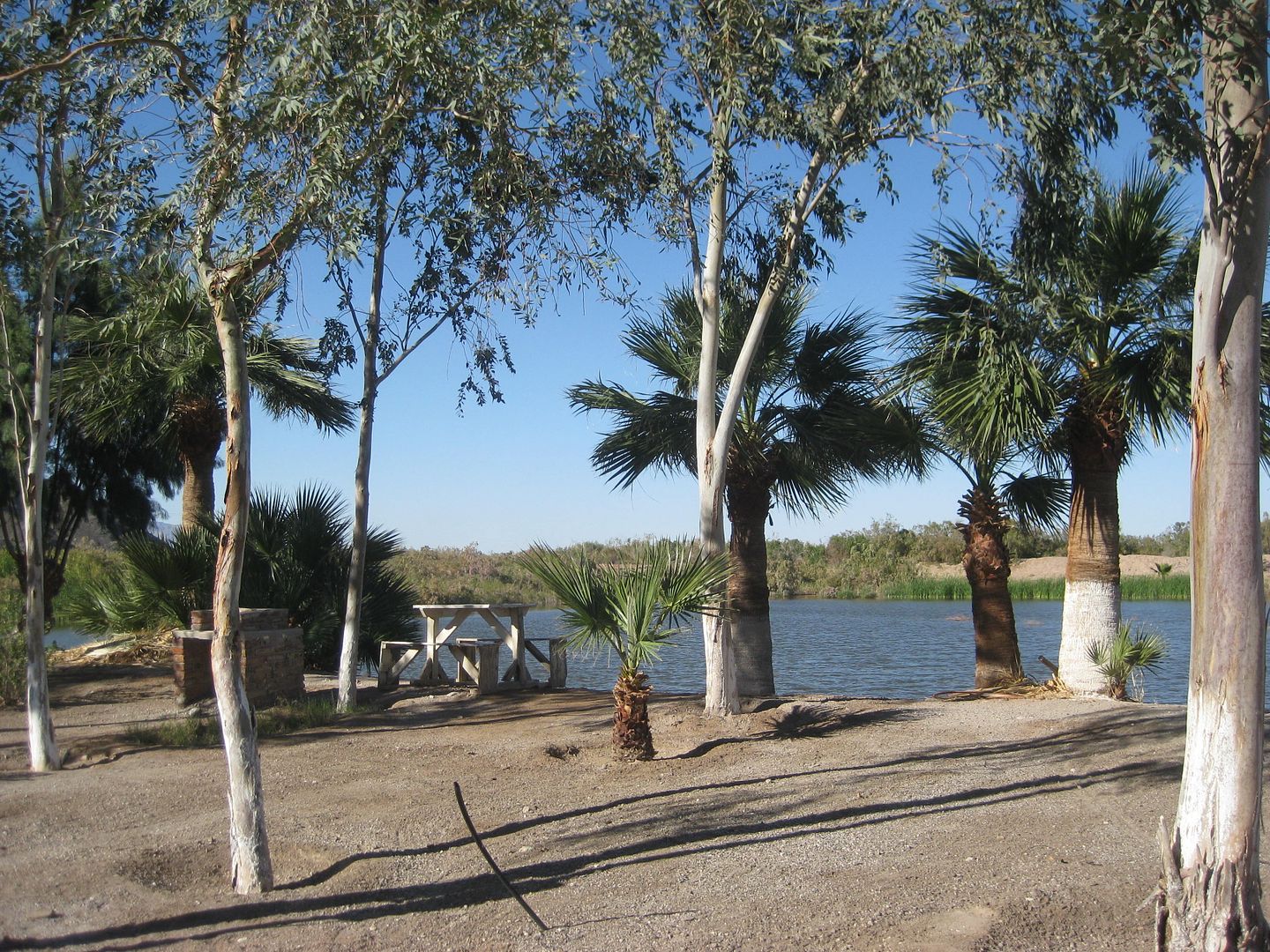
First, the beach campo photos taken Friday...
Playas del Sol:
Campo Los Compadres:
Pete's Camp El Paraiso:
|
|
|
David K
Honored Nomad
Posts: 64479
Registered: 8-30-2002
Location: San Diego County
Member Is Offline
Mood: Have Baja Fever
|
|
Colonia Morelia Road: Km. 181
This road leaves Mex. 1 about 5 miles north of the San Felipe arches and is the replacement road for what was the new Zoo Road that now passes through
the El Dorado Ranch residential zone. That road is at Km. 178.5 and is signed for residential use only.
MILE:
0.0 Highway 1 (Km. 181) Signed: Colonia Morelia 60 km.
4.2 (Km. 7) Junction with Km. 178.5 private road.
5.1 Junction with original Ensenada-San Felipe road (left goes to Km. 189+)
12.5 Cattle Guard
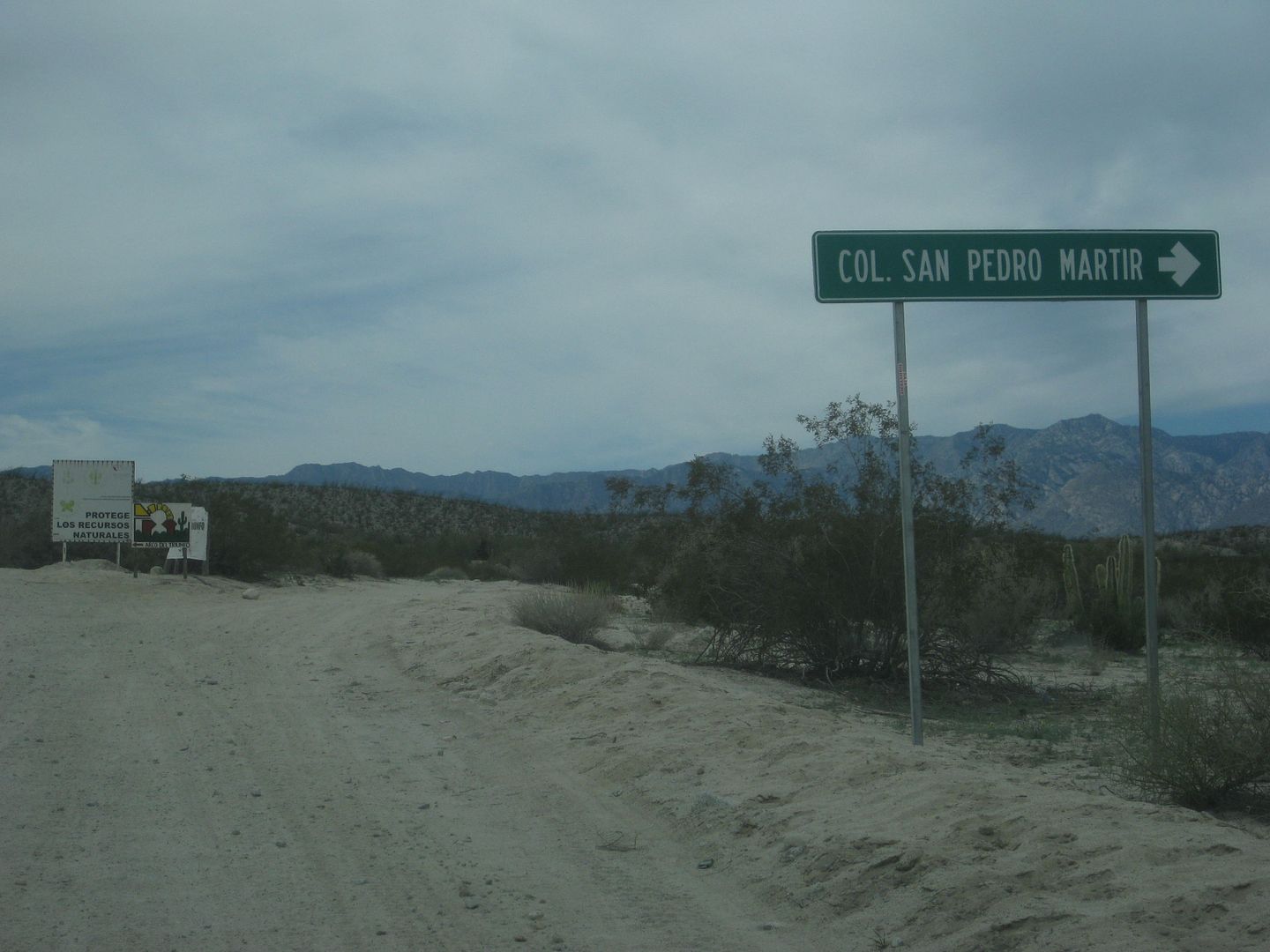
12.8 Major Fork: Right to Diablo Dry Lake/ Left to continue into Valle Chico.
19.5 Unsigned road right (to Rancho El Cajon?).
24.6 Rockpile at road to left.
25.9 Cattle Guard
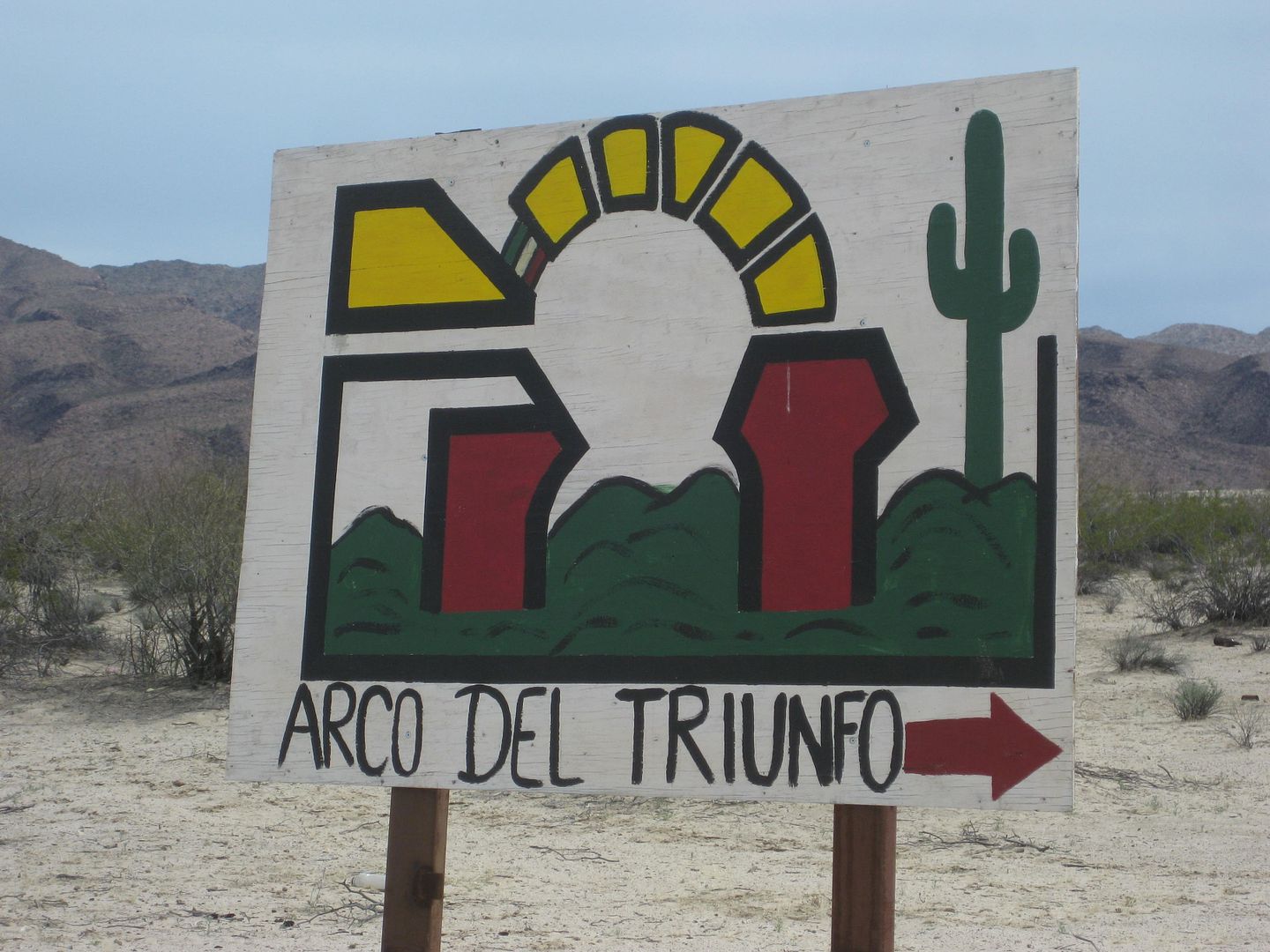
26.0 (Km. 42) Road right to Arco de Triunfo, rehab facility.
29.6 Cattle Guard
31.5 Junction: Ahead to Rancho Algodon and old Valle Chico road on north. Left to continue south:
36.4 Abandoned Farm Project, on left. (Linda Vista on some maps)
37.2 (km. 60) where Colonia Morelia is supposed to be!
38.2 Cattle Guard
39.4 Enter abandoned farm ejido village (Plan Nacional Agrario/ Agua Caliente).
39.6 Ranch house surrounded by fence and trees. Major fork here. To right side (north side) of ranch, the road goes west to Agua Caliente Canyon. To
left, and stay along the east side fence of the ranch on the southbound road to continue south.
A side trip to Agua Caliente Canyon, goes from the ranch, onto a former airstrip for the ejido, enters the canyon at Mile 2.0, passes a metal water
tank at mile 2.2, Comes to a gate at Mile 2.4 (petroglyph viewing), and goes to Miles 2.6 mile where the road was washed out. A track has been blazed
to the left that does continue but going solo I had to resist trying to get to the hot springs today!
PHOTOS:
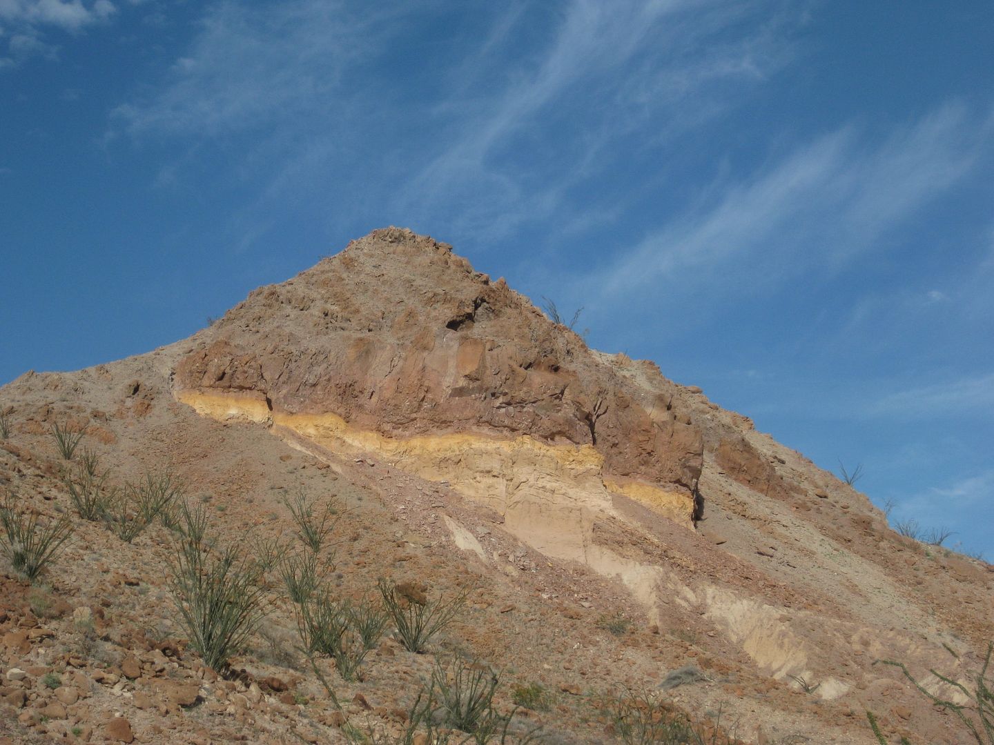
Diablo Mountain.
Fork at Mile 12.8
Sign at Mile 26.0
Ditched airport runway Plan Nacional Agrario (Agua Caliente Canyon road)
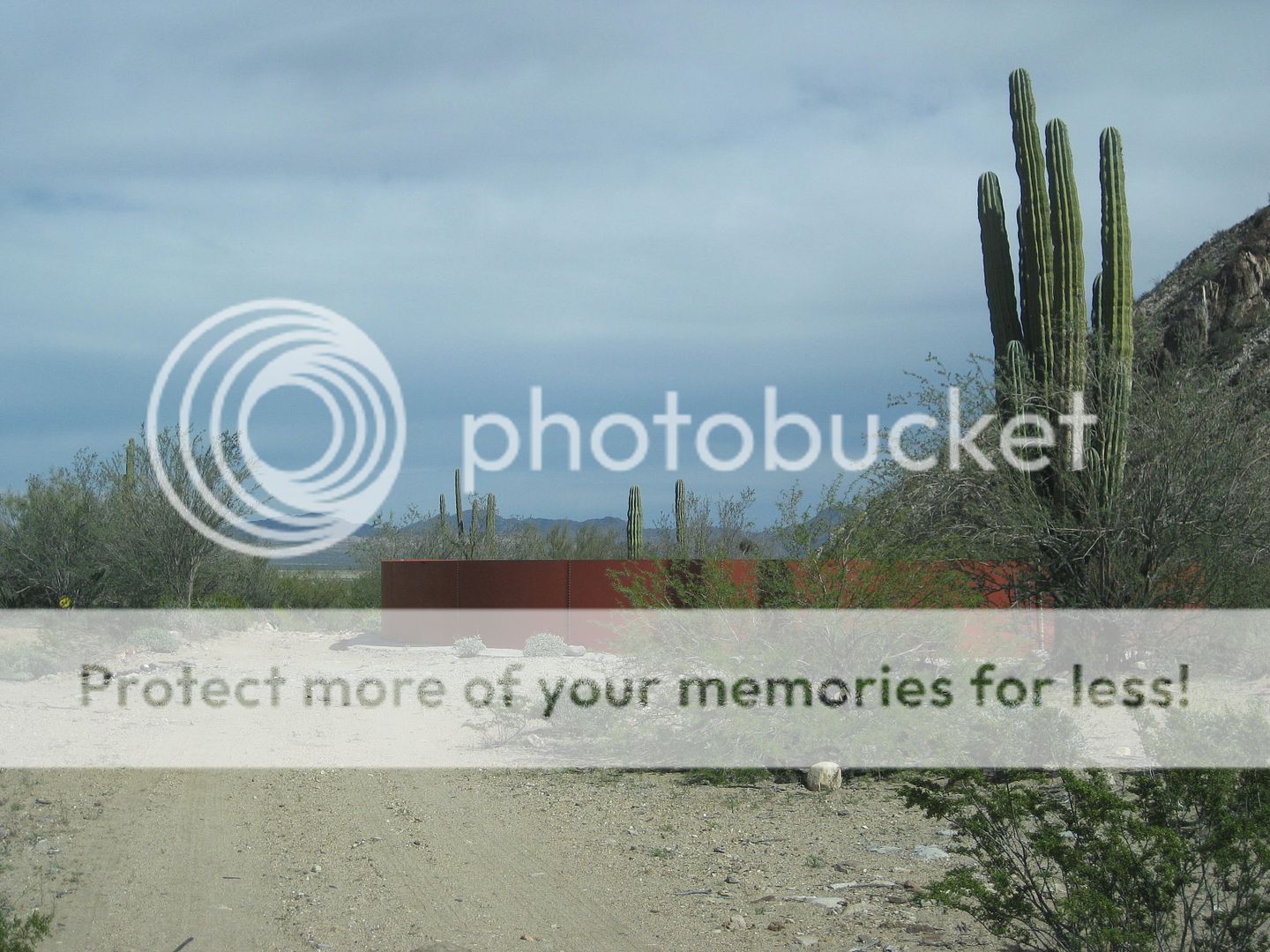
Water Tank at Mile 2.2, looking east.
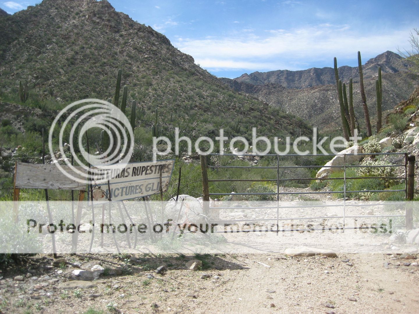
Gate at Mile 2.4 on Agua Caliente Road. Petroglyphs are across canyon to the south of here...
SEE THEM?
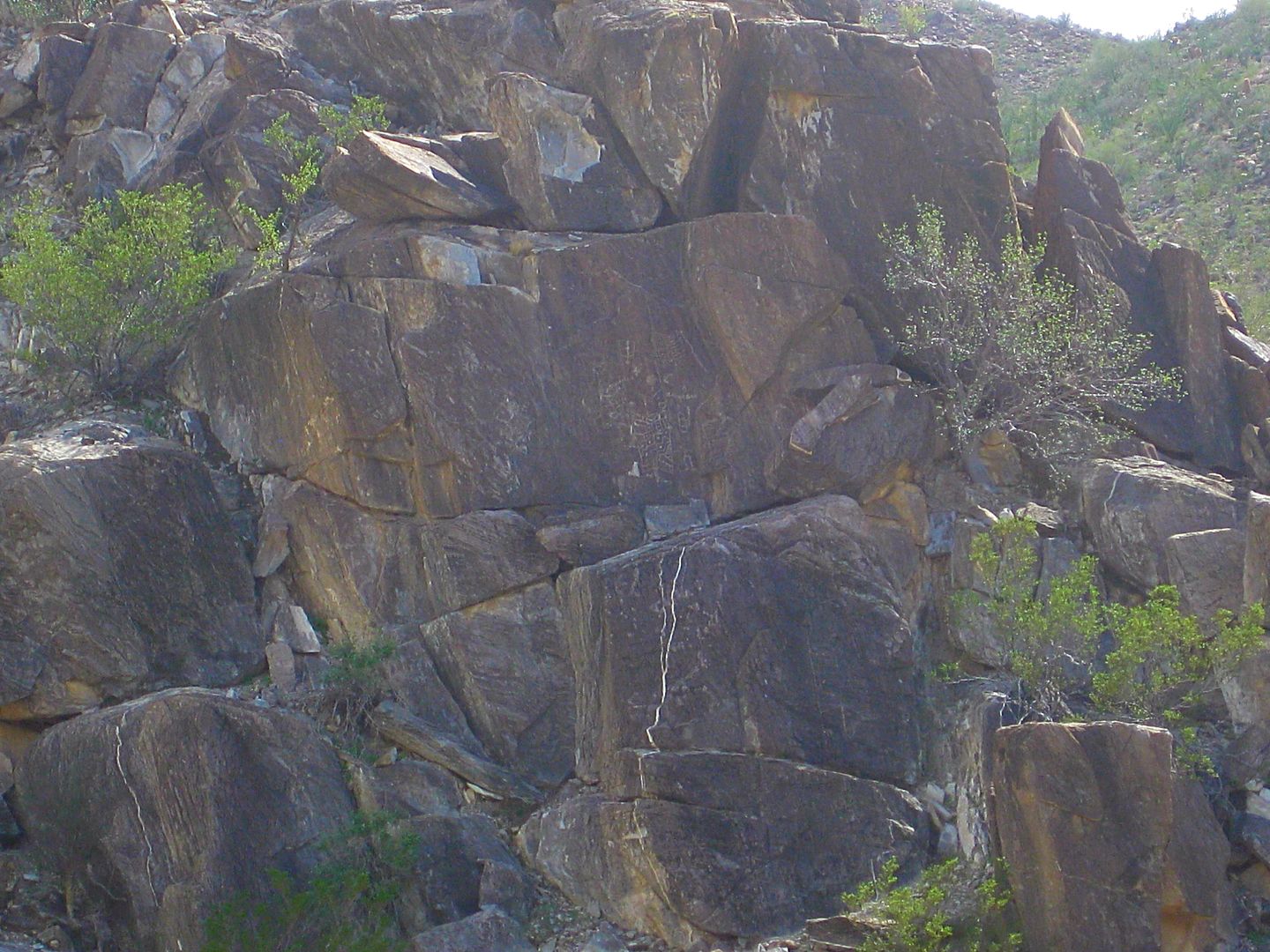
HOW ABOUT NOW?
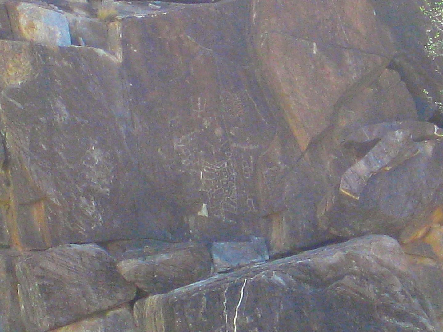
MAX ZOOM! 
OK, through the gate I go, hoping to get to the hot springs for a soak tonight!
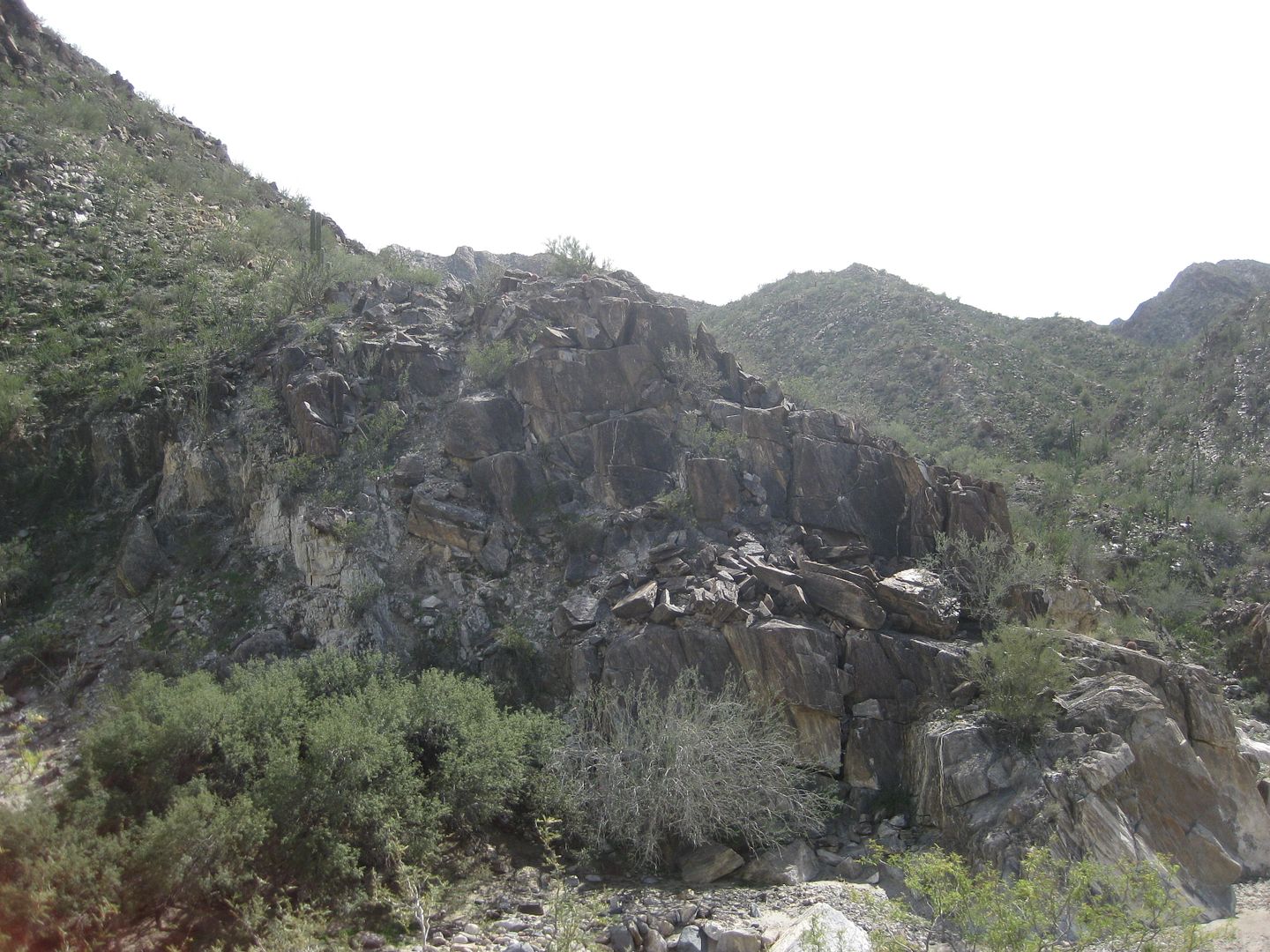
Agua Caliente Canyon stream... near end of road.
Where road used to cross arroyo again.
Looking back at the road, dead end!
South from The Ranch in the former ejido village...
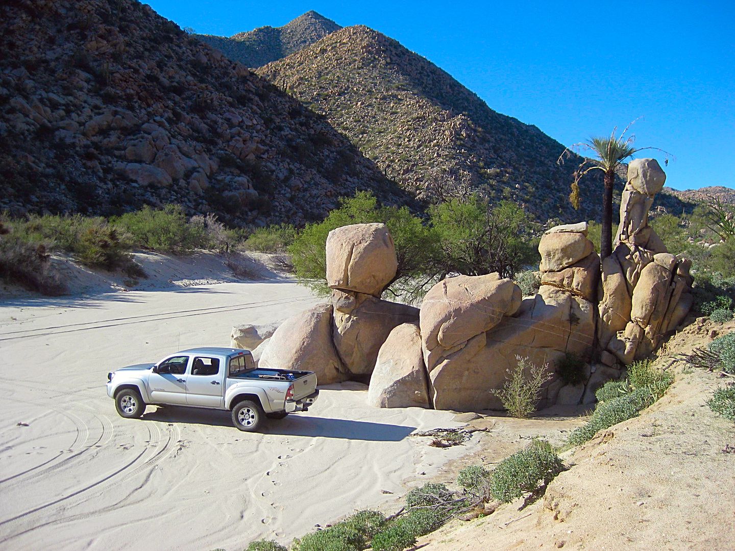
Back at the Ranch (Mile 39.6 from Hwy. 5), reset odometer to 0.0 and head south:
MILE:
1.7 Corner of fenced area, road to left. Continue south.
5.4 FORK. Matomí left, Berrendo straight. Going straight to Cañon Berrendo:
5.5 Rancho Carricitos corral on right. Tracks go west towards Carrizo Canyon. Continue south.
6.9 Track right to Berrendo. Ahead goes to Parral Canyon. Go right.
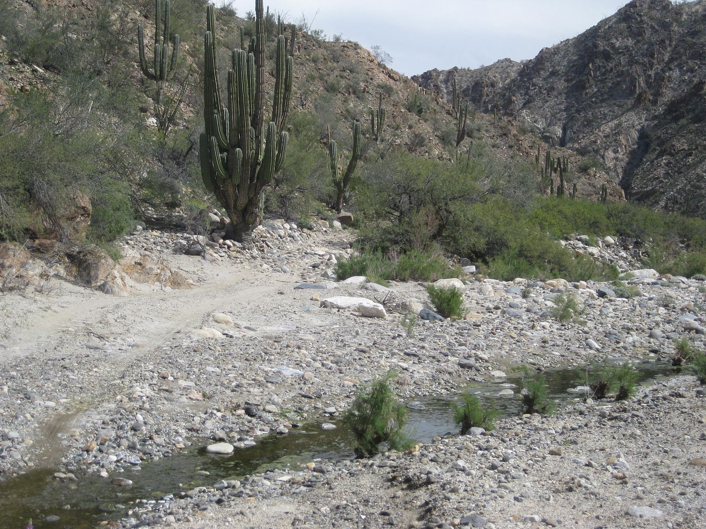
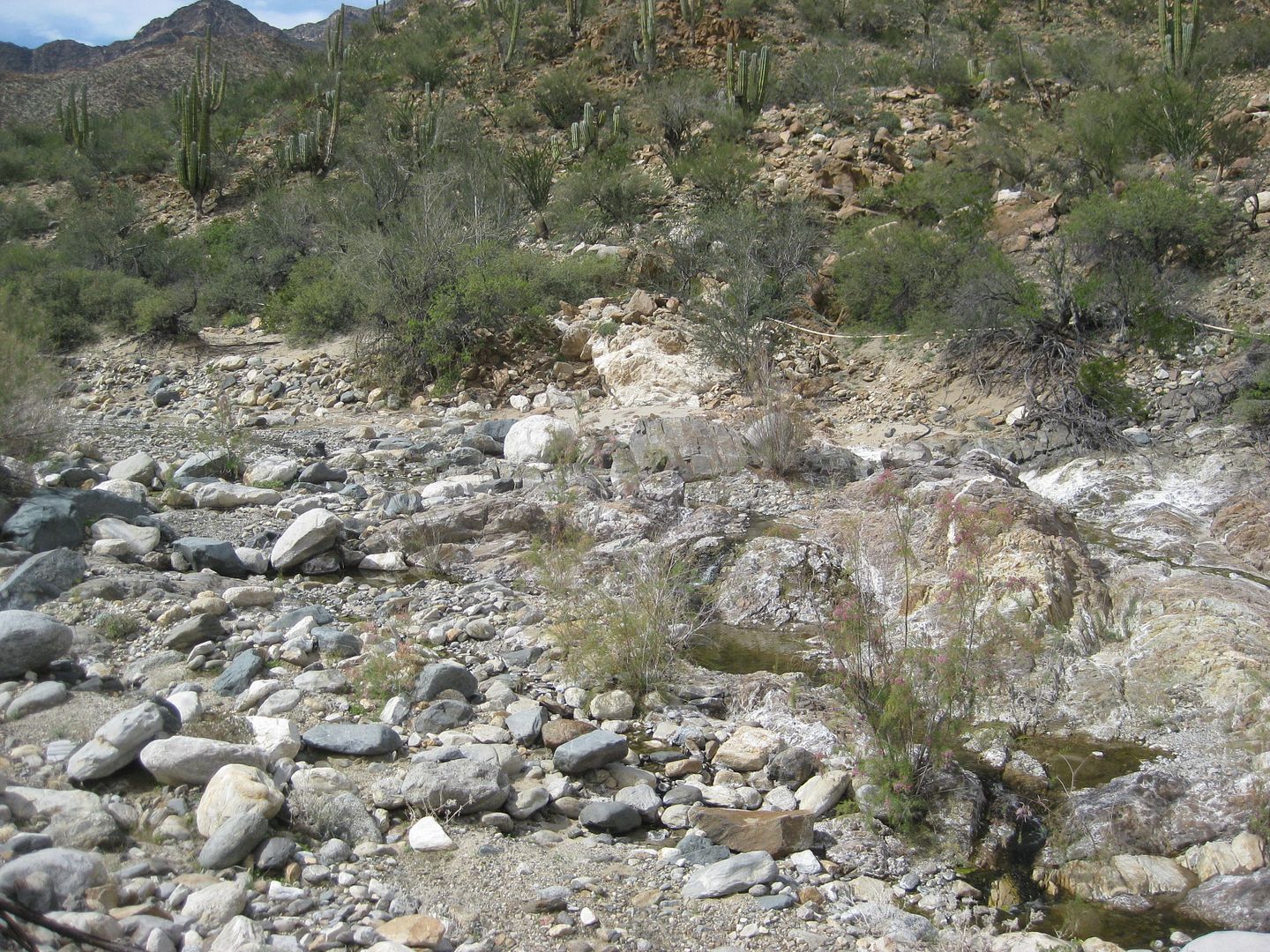
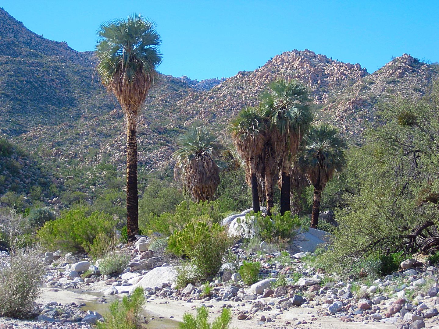
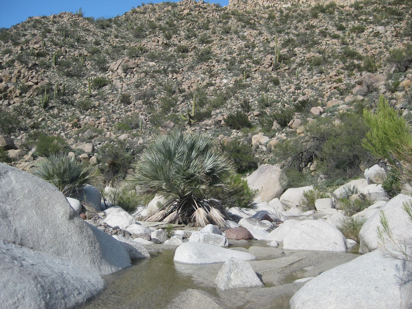
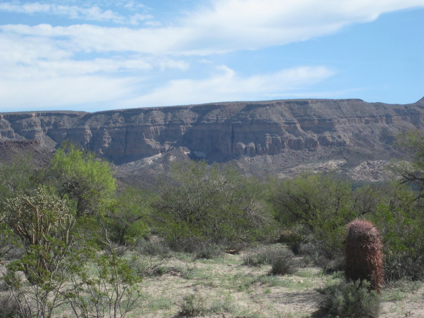
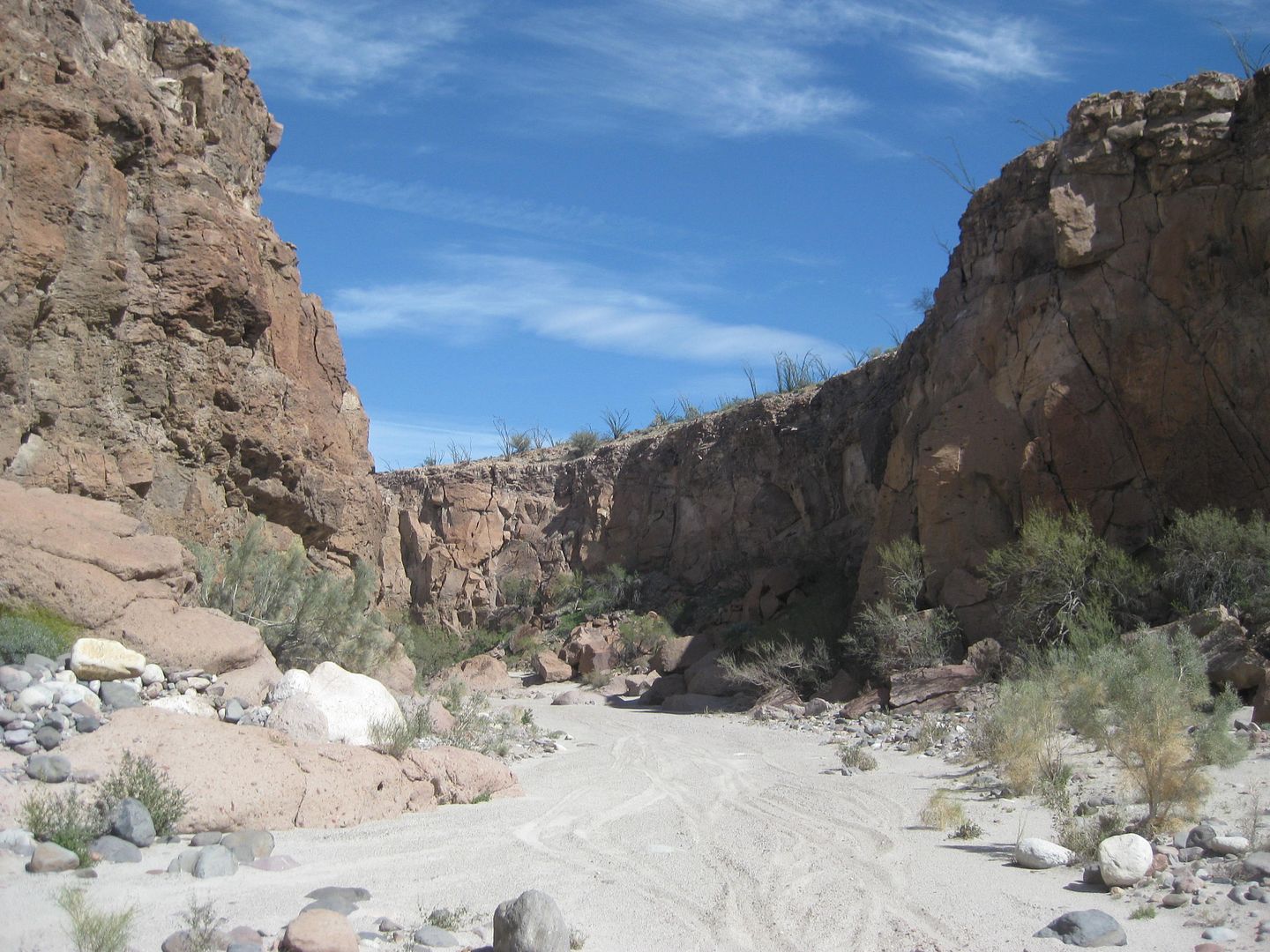
9.3 End of drive. A fence and cable across the canyon is nearly covered with sand. The canyon just ahead of here is choked with boulders. No need to
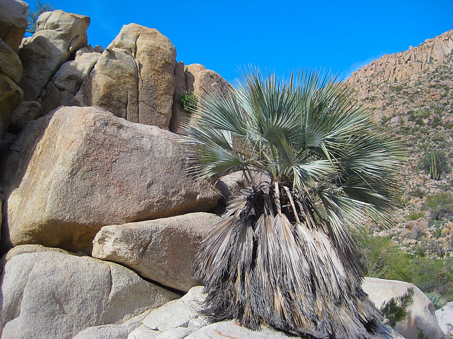
go further. I hike into the canyon a short distance. Running water and blue palms make this an attractive location. Blue palms also grow high up on
the cliff side in the granite boulders.
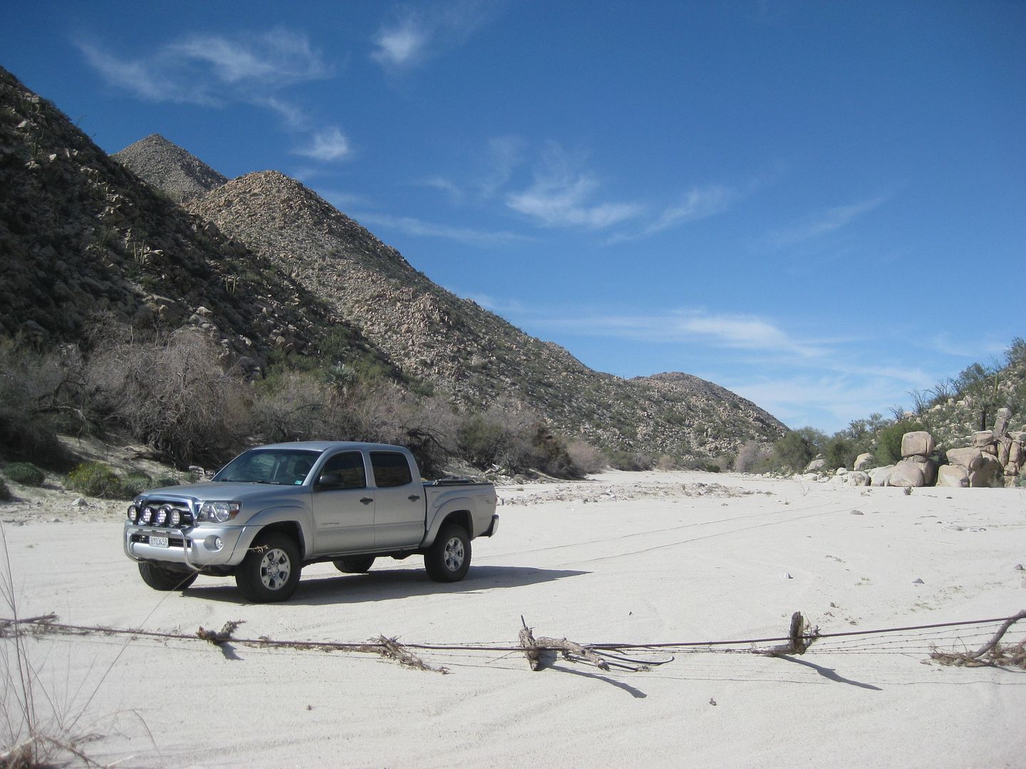
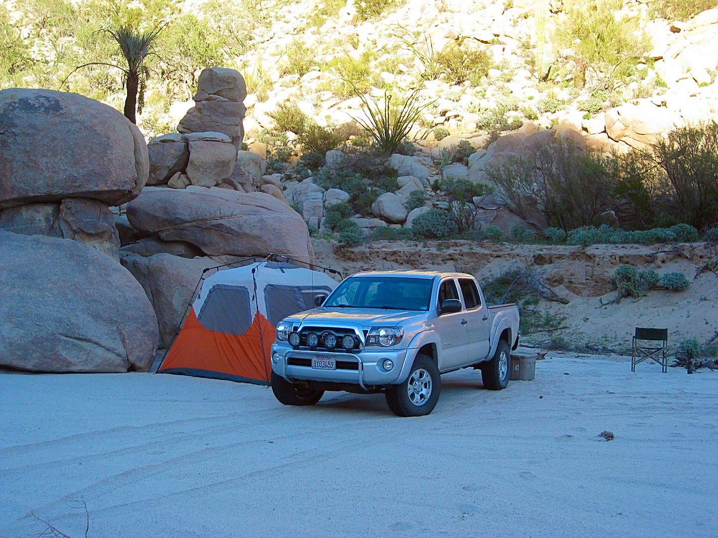
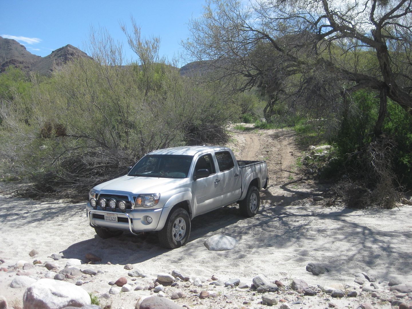
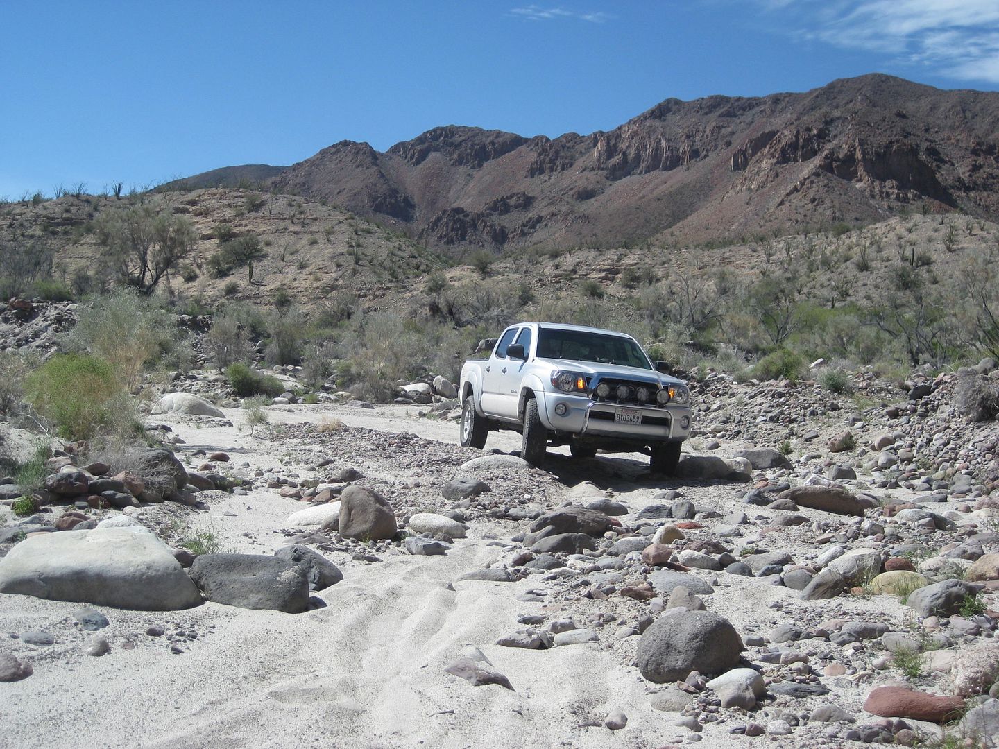
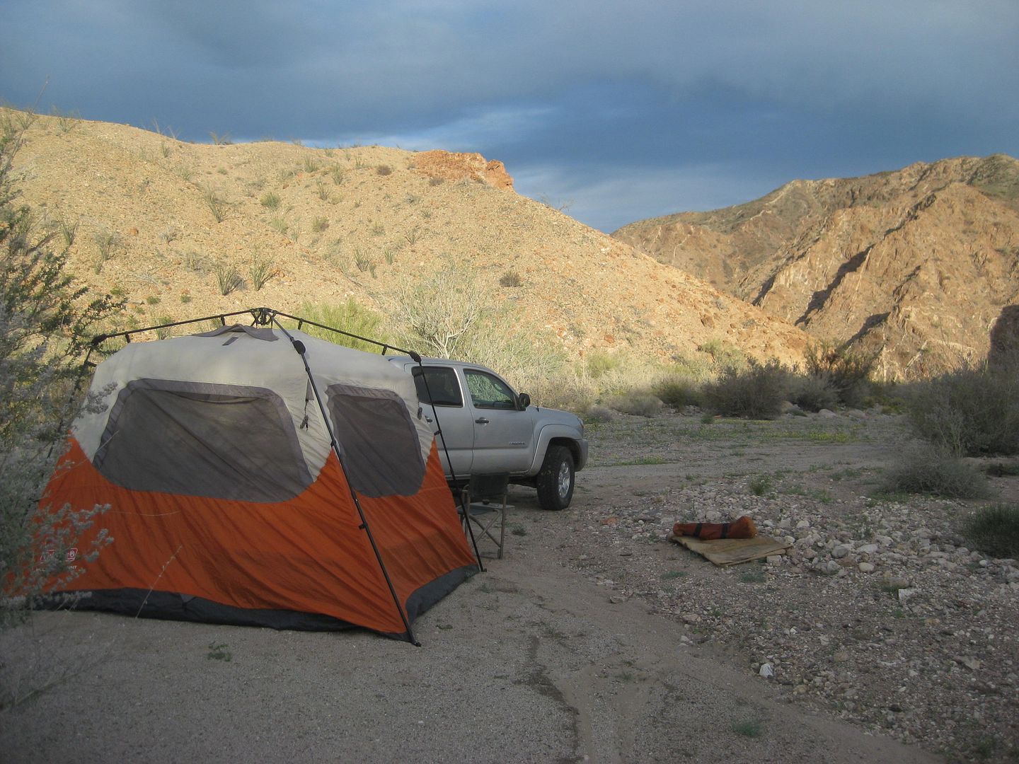
After my hike, I drove a short distance and make camp on the white sand arroyo. A great location!
PHOTOS:
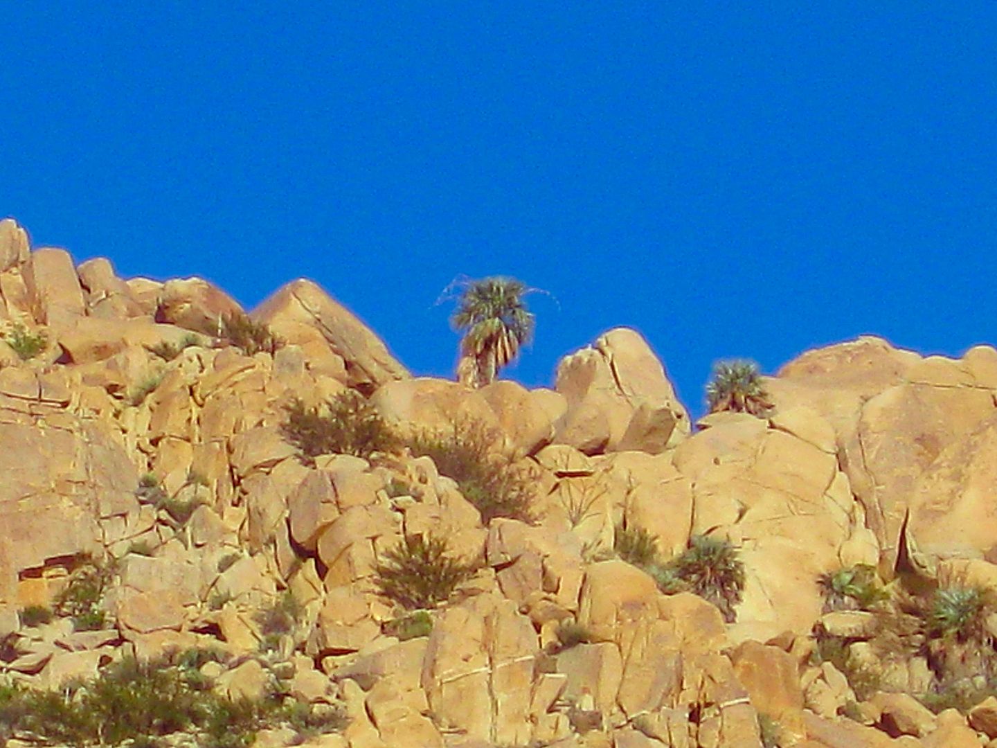
Cañon el Berrendo
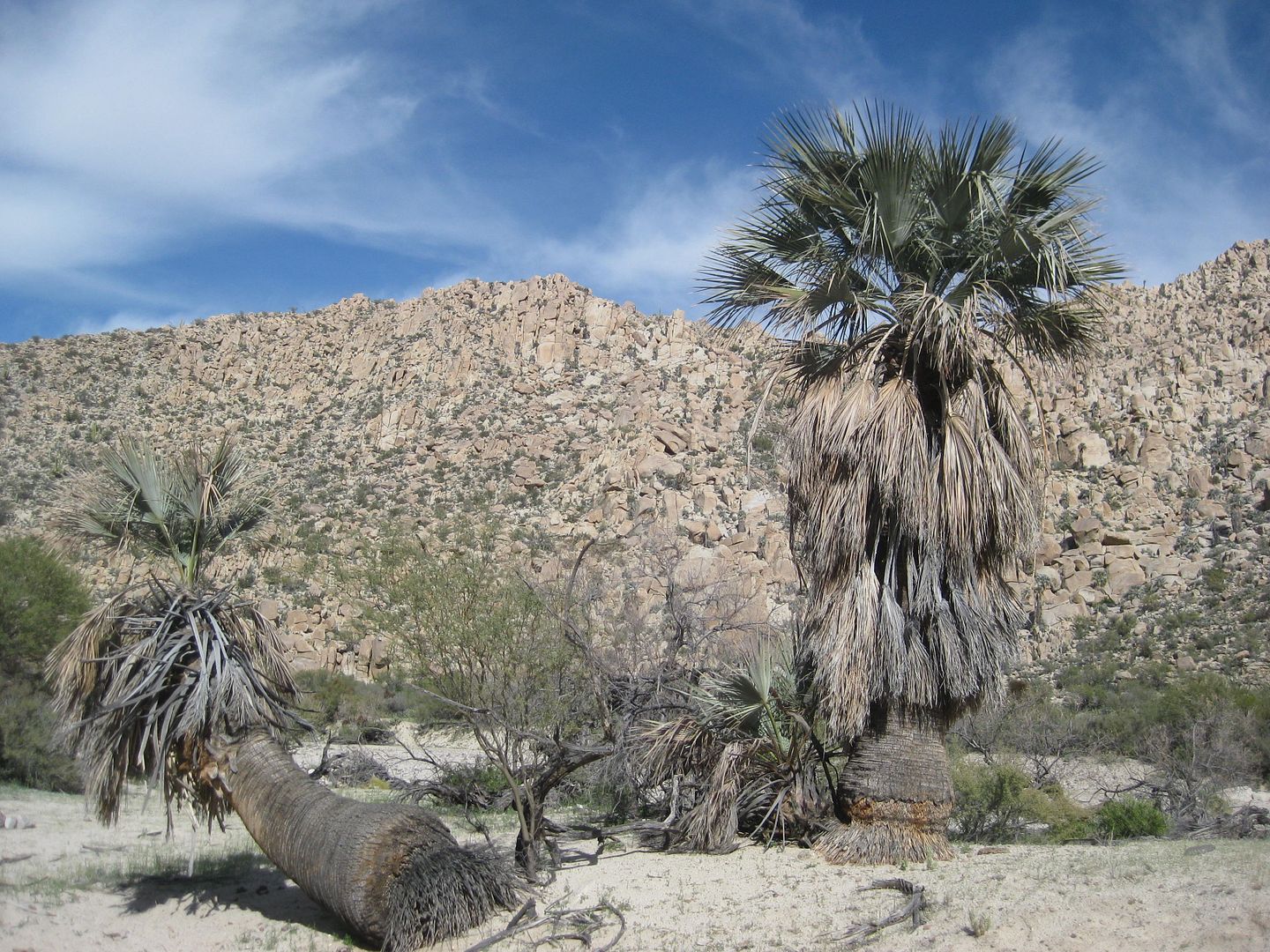
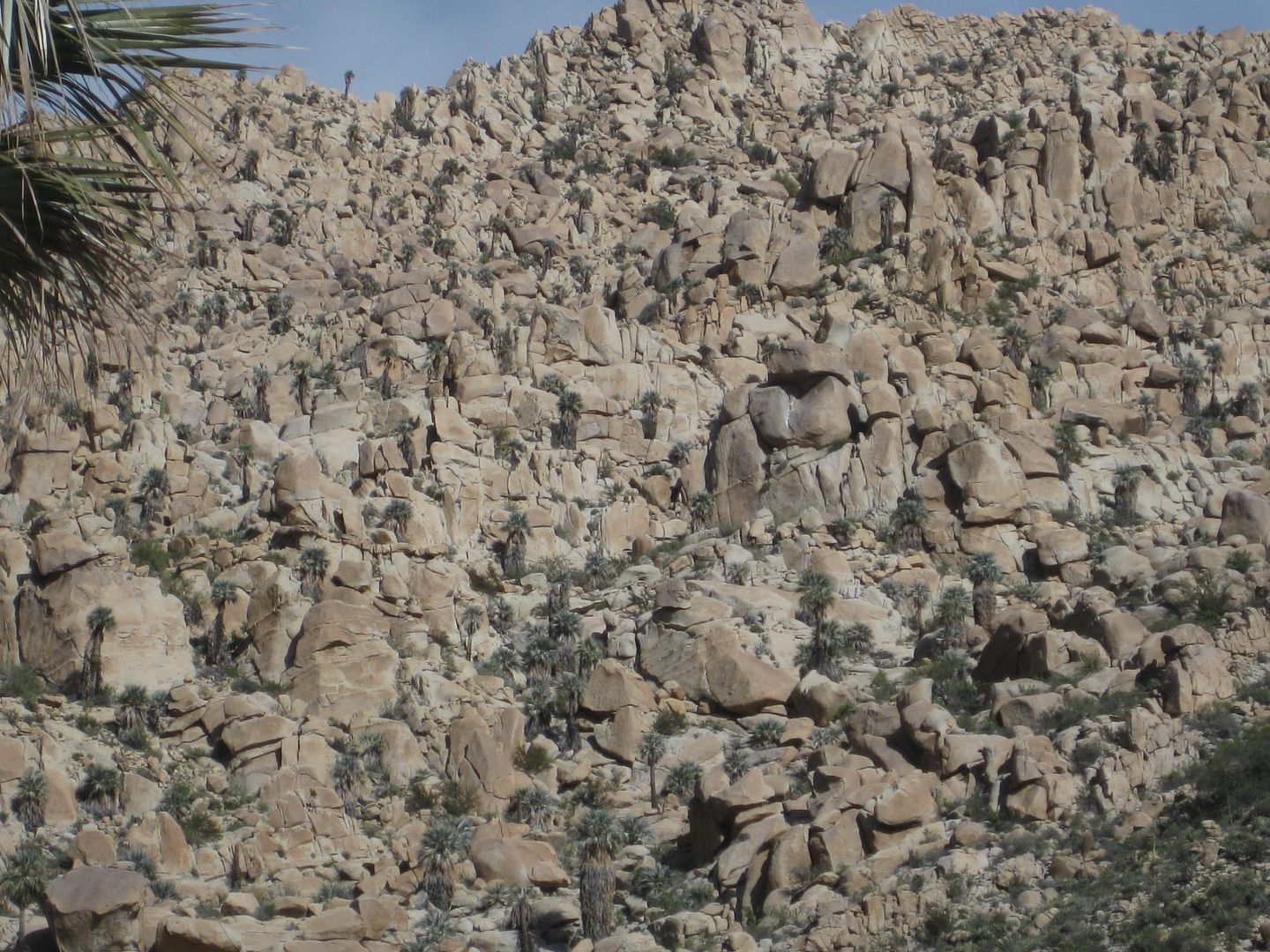
LOOK CLOSELY and see the blue palms way up there!
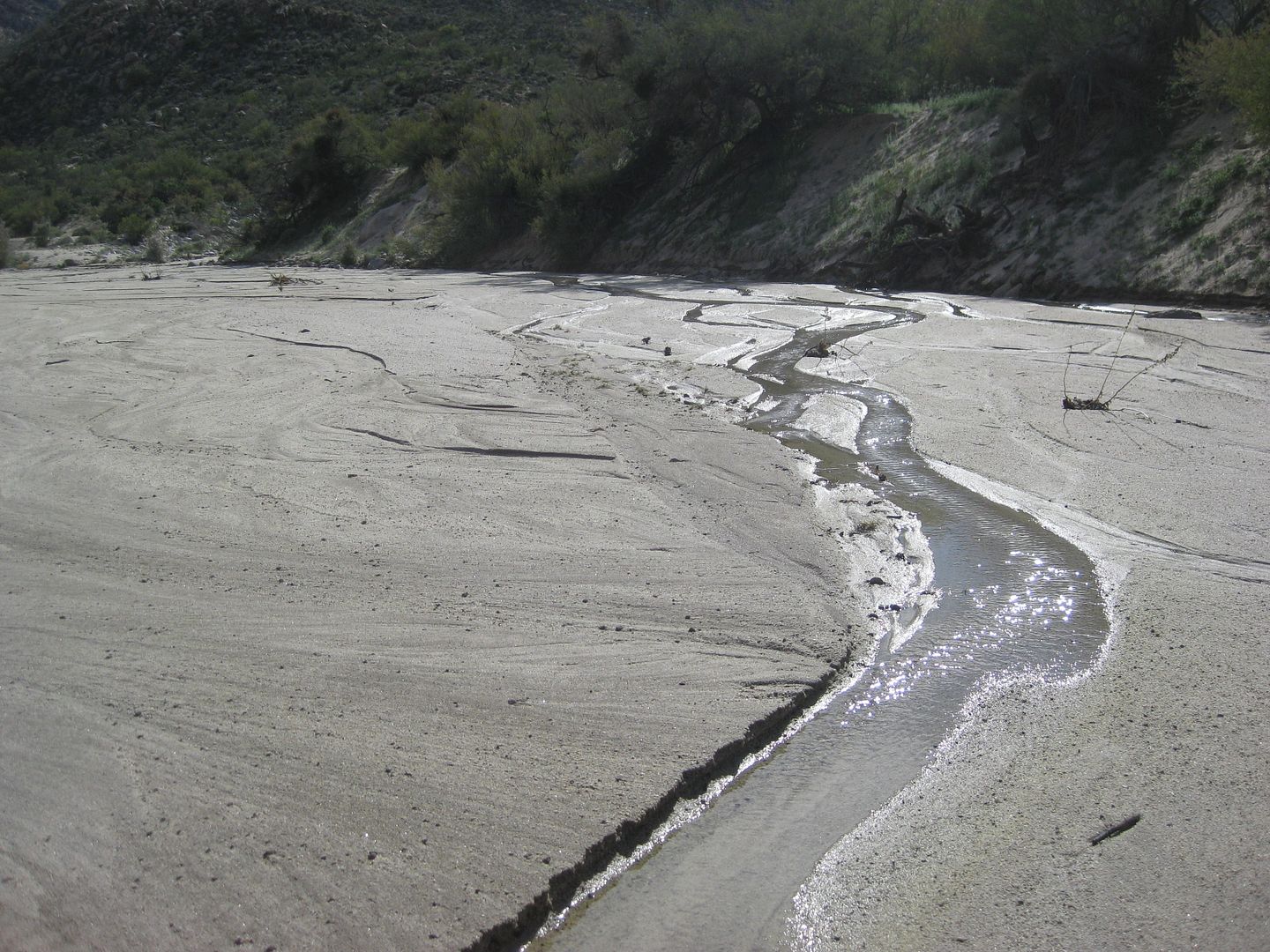
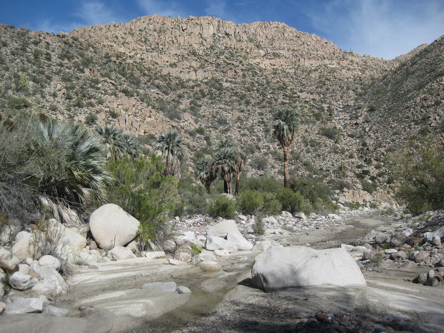
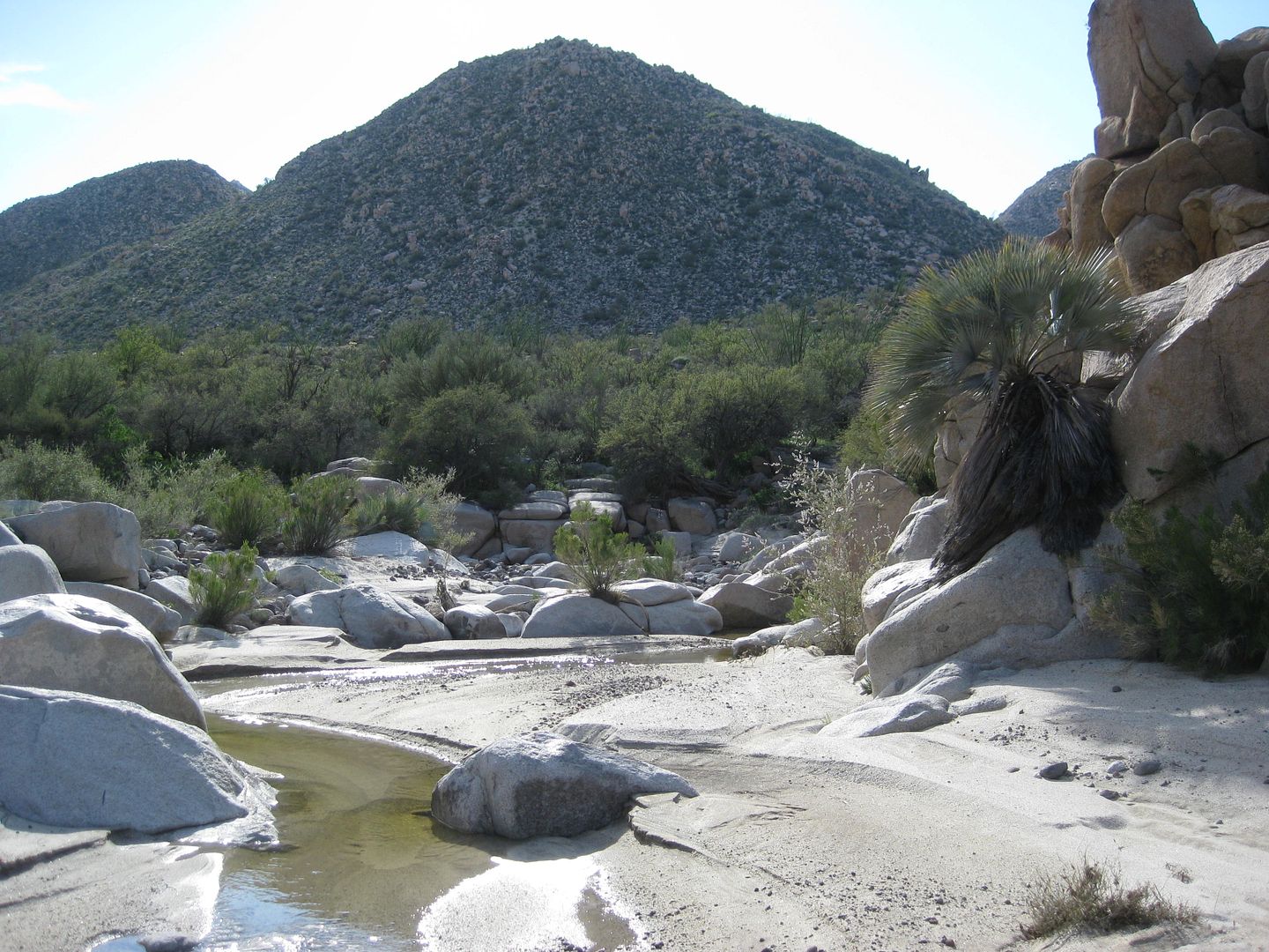
My camp location Friday night.
I zoom in on the top of the canyon to look at the blue palms...
Campfire time:
Goodnight from a very special (like so many others) Baja place!
SATURDAY, DAY 3, coming up next!
[Edited on 3-12-2017 by David K]
|
|
|
blackwolfmt
Senior Nomad
Posts: 802
Registered: 1-18-2014
Location: On The Beach With A Blackwolf
Member Is Offline
Mood: dreamin of Riden out a hurricane in Baja
|
|
Nice,, lks really peaceful
So understand dont waste your time always searching for those wasted years
face up and make your stand and realize that your living in the golden years
|
|
|
David K
Honored Nomad
Posts: 64479
Registered: 8-30-2002
Location: San Diego County
Member Is Offline
Mood: Have Baja Fever
|
|
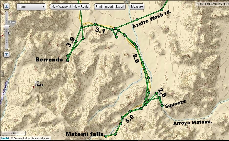
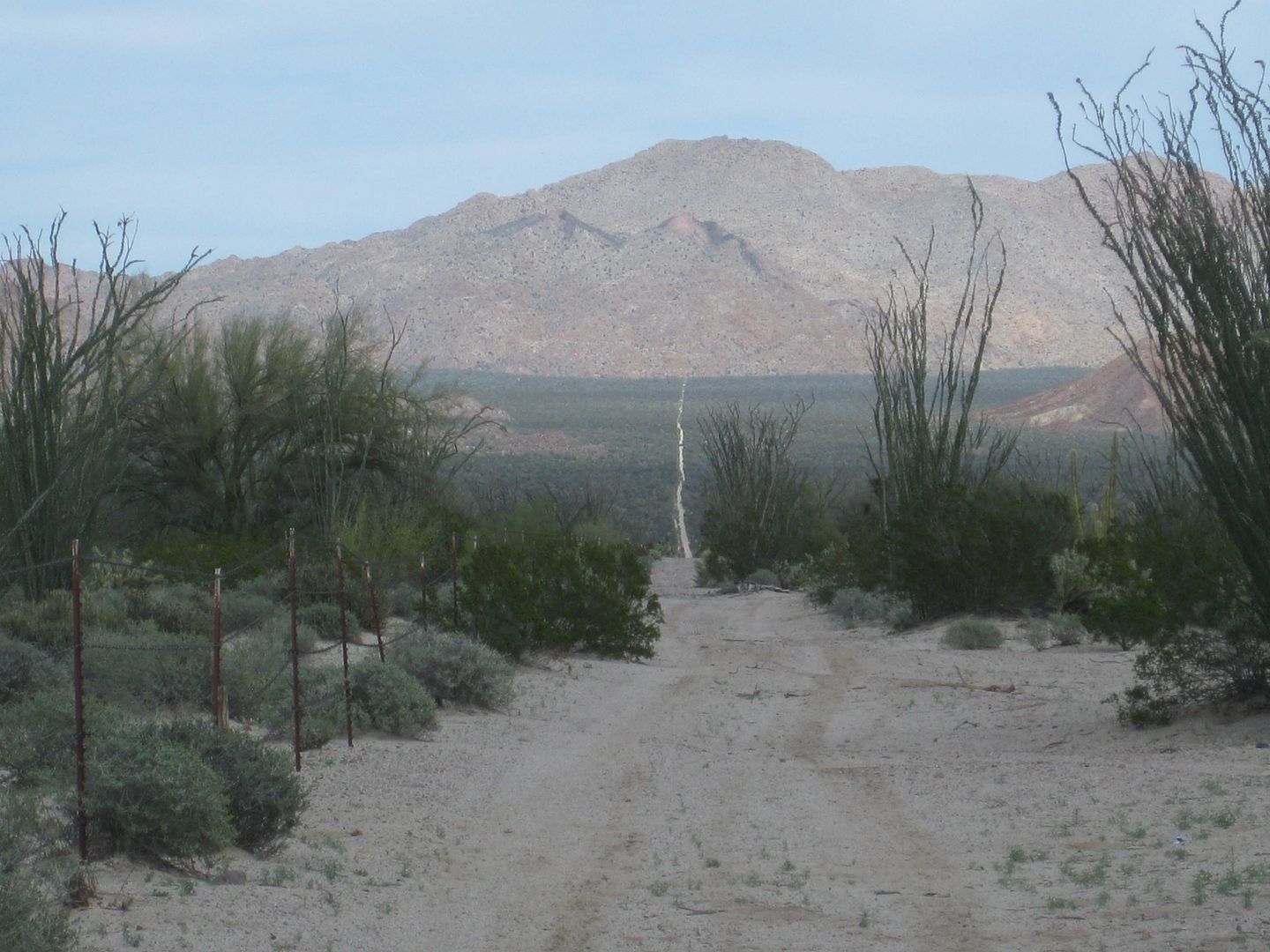
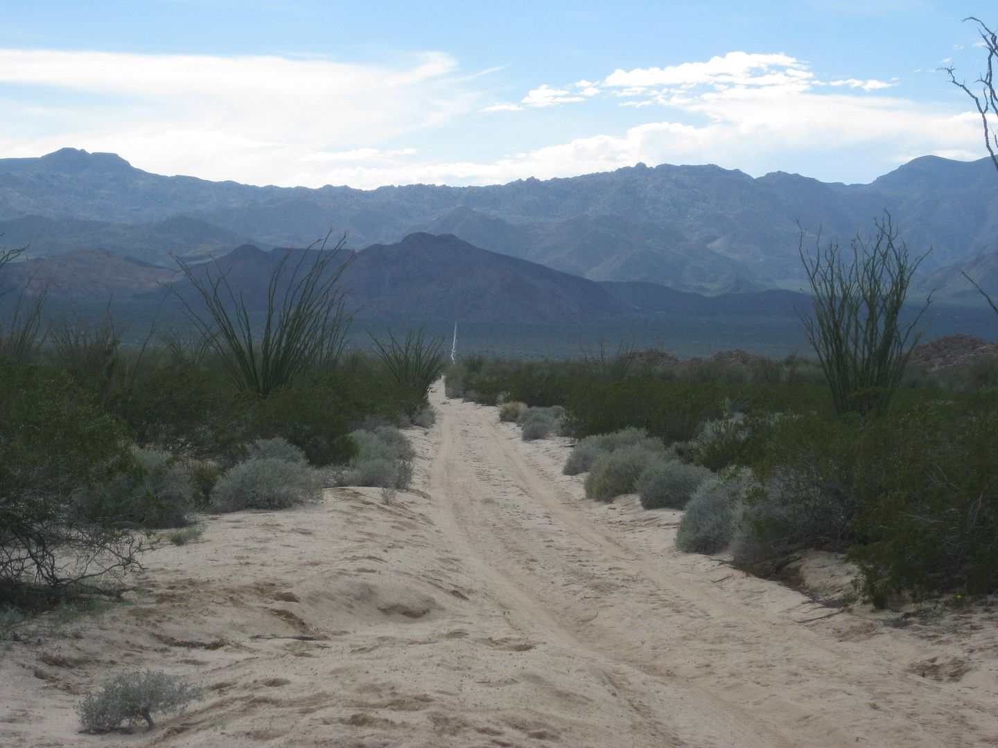
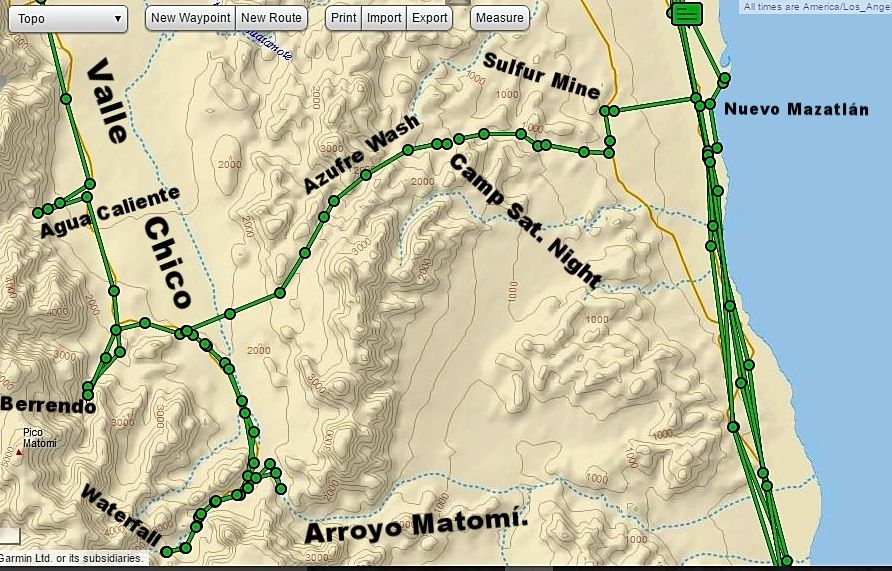
Map showing Berrendo, Matomí, Azufre Wash routes Day 3 and 4...
Mileages between roads and end of drive points.
|
|
|
blackwolfmt
Senior Nomad
Posts: 802
Registered: 1-18-2014
Location: On The Beach With A Blackwolf
Member Is Offline
Mood: dreamin of Riden out a hurricane in Baja
|
|
Curios what the Image date is when I look at that area from Goog Earth ??? say San Felipe
So understand dont waste your time always searching for those wasted years
face up and make your stand and realize that your living in the golden years
|
|
|
PaulW
Ultra Nomad
Posts: 3005
Registered: 5-21-2013
Member Is Offline
|
|
SF date is 5/25/14
Out by the mountains the dates vary. Typical is 11/09/03
Not sure if the dates are correct?
|
|
|
David K
Honored Nomad
Posts: 64479
Registered: 8-30-2002
Location: San Diego County
Member Is Offline
Mood: Have Baja Fever
|
|
The Image Date is given at the bottom of the screen... San Felipe is in 2014. I see May and September dates just now going around town.
Berrendo Canyon, where I camped was Sept 2009.
Matomi was Dec. 2014... but that area is not clear.
Bing sometimes uses newer images... I will check.
I couldn't find image dates for Bing, Aerial or Bird's Eye (different images).
Their image at Gonzaga Bay is from early 2013, when the bridge by Papa Fernandez' was under construction. Google Earth is newer with the bridge over
Arroyo Santa Maria completed (Punta Final road).
[Edited on 3-11-2017 by David K]
|
|
|
PaulW
Ultra Nomad
Posts: 3005
Registered: 5-21-2013
Member Is Offline
|
|
Interesting that the fence is down in Berrenda. Makes it nice to skip the walk to the blue palm side canyon. Agua Caliente remains about the same for
several years.
Thanks for the fresh pictures.
|
|
|
blackwolfmt
Senior Nomad
Posts: 802
Registered: 1-18-2014
Location: On The Beach With A Blackwolf
Member Is Offline
Mood: dreamin of Riden out a hurricane in Baja
|
|
Quote: Originally posted by David K  |
The Image Date is given at the bottom of the screen... San Felipe is in 2014. I see May and September dates just now going around town.
Berrendo Canyon, where I camped was Sept 2009.
Matomi was Dec. 2014... but that area is not clear.
Bing sometimes uses newer images... I will check. |
Gracia's Amigos
So understand dont waste your time always searching for those wasted years
face up and make your stand and realize that your living in the golden years
|
|
|
David K
Honored Nomad
Posts: 64479
Registered: 8-30-2002
Location: San Diego County
Member Is Offline
Mood: Have Baja Fever
|
|
| Quote: Originally posted by PaulW | Interesting that the fence is down in Berrenda. Makes it nice to skip the walk to the blue palm side canyon. Agua Caliente remains about the same for
several years.
Thanks for the fresh pictures. |
Well, not taken down, just all the sand that flowed out of Berrendo covered it up and or pushed it sideways. It is still topped by a steel cable.
Too bad that amount of sand didn't come down Matomí and cover the boulders in the narrows instead of taking it away from there!
|
|
|
fishbuck
Banned
Posts: 5318
Registered: 8-31-2006
Member Is Offline
|
|
So cool...
"A ship in harbor is safe, but that is not what ships are built for." J. A. Shedd.
A clever person solves a problem. A wise person avoids it. – Albert Einstein
"Life's a Beach... and then you Fly!" Fishbuck
|
|
|
David K
Honored Nomad
Posts: 64479
Registered: 8-30-2002
Location: San Diego County
Member Is Offline
Mood: Have Baja Fever
|
|
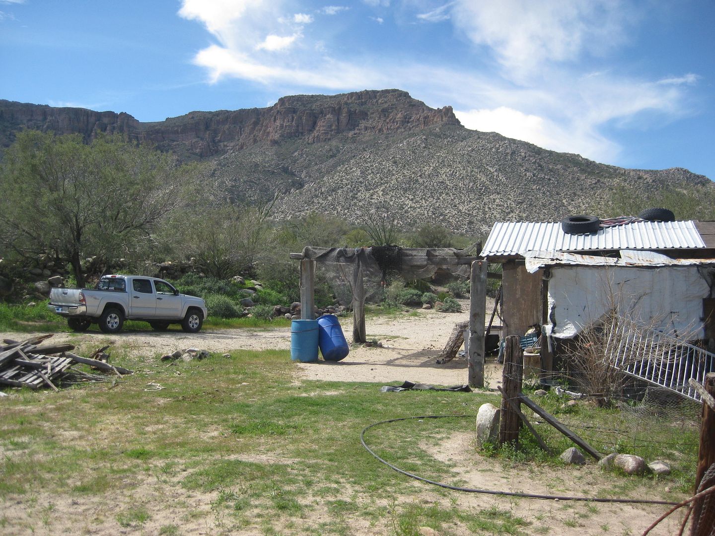
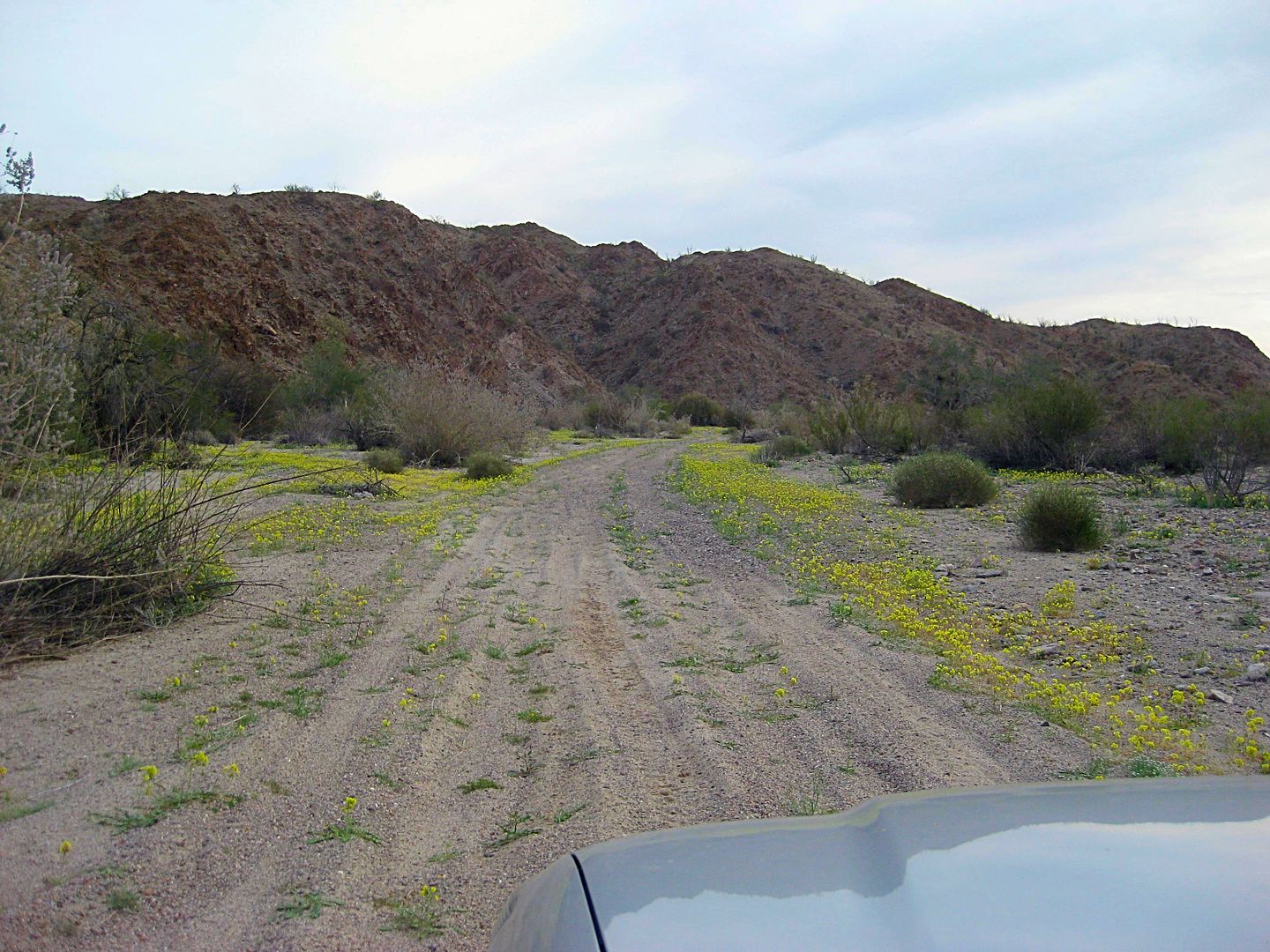
Saturday March 4, 2017: TO MATOMI CANYON
Matomí is one of those special places in Baja to many.
It is one of the few arroyos that has been used as a travel corridor into the mountains over 30 miles long.
In the 1962 edition of the Lower California Guidebook, it mentions that four-wheel-drive vehicles may follow Arroyo Matomí for a considerable
distance. Arnold, owner of the Del Mar Café in San Felipe told my parents about a waterfall fed pool in an oasis at the far end of Arroyo
Matomí. That was in 1967... He even drew notes in our Lower California Guidebook to show it.
I was hooked on getting to Matomí since I was 9 years old! I finally did, but not until I had my own 4WD vehicle and was 21 years old (December of
1978), but I could not get to the waterfall as the river (flash flood) was flowing. I returned 6 months later and got there! I have been back to
Matomí several more times, but the last was in 2006.
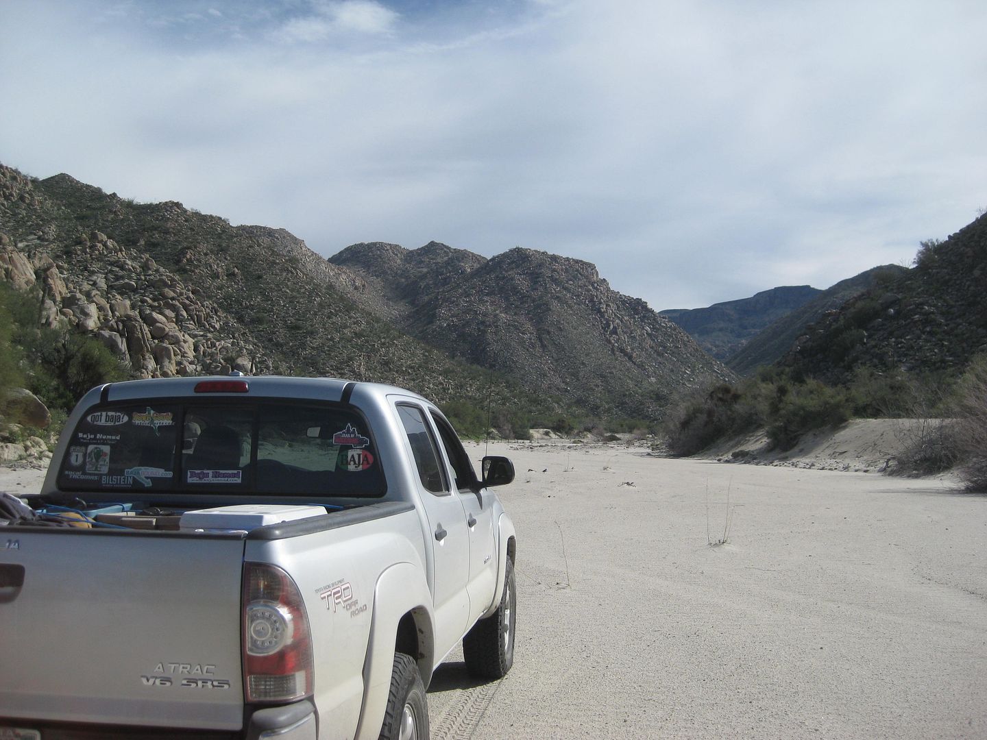
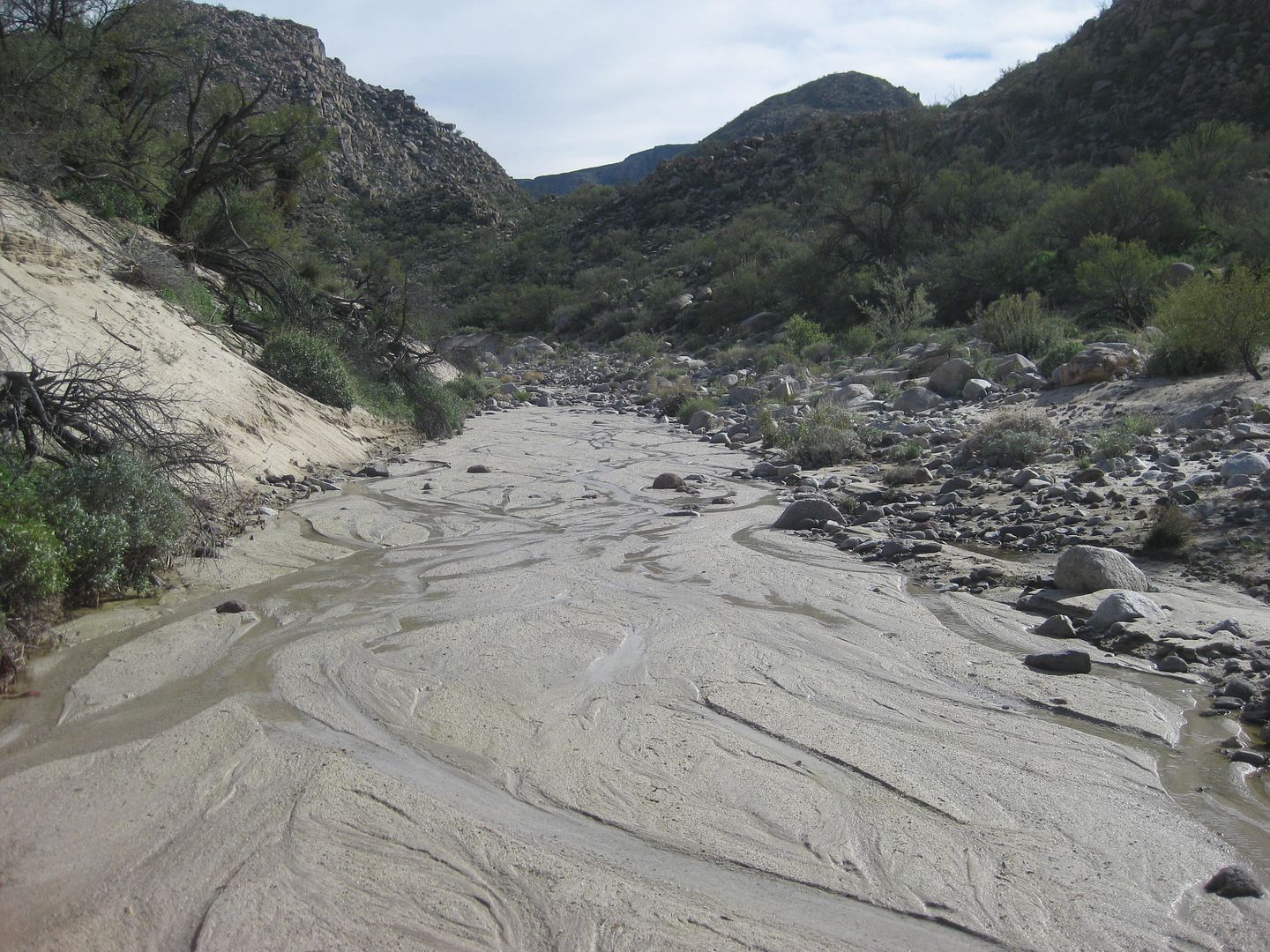
Saturday morning, Cañon El Berrendo, 7:53 am.
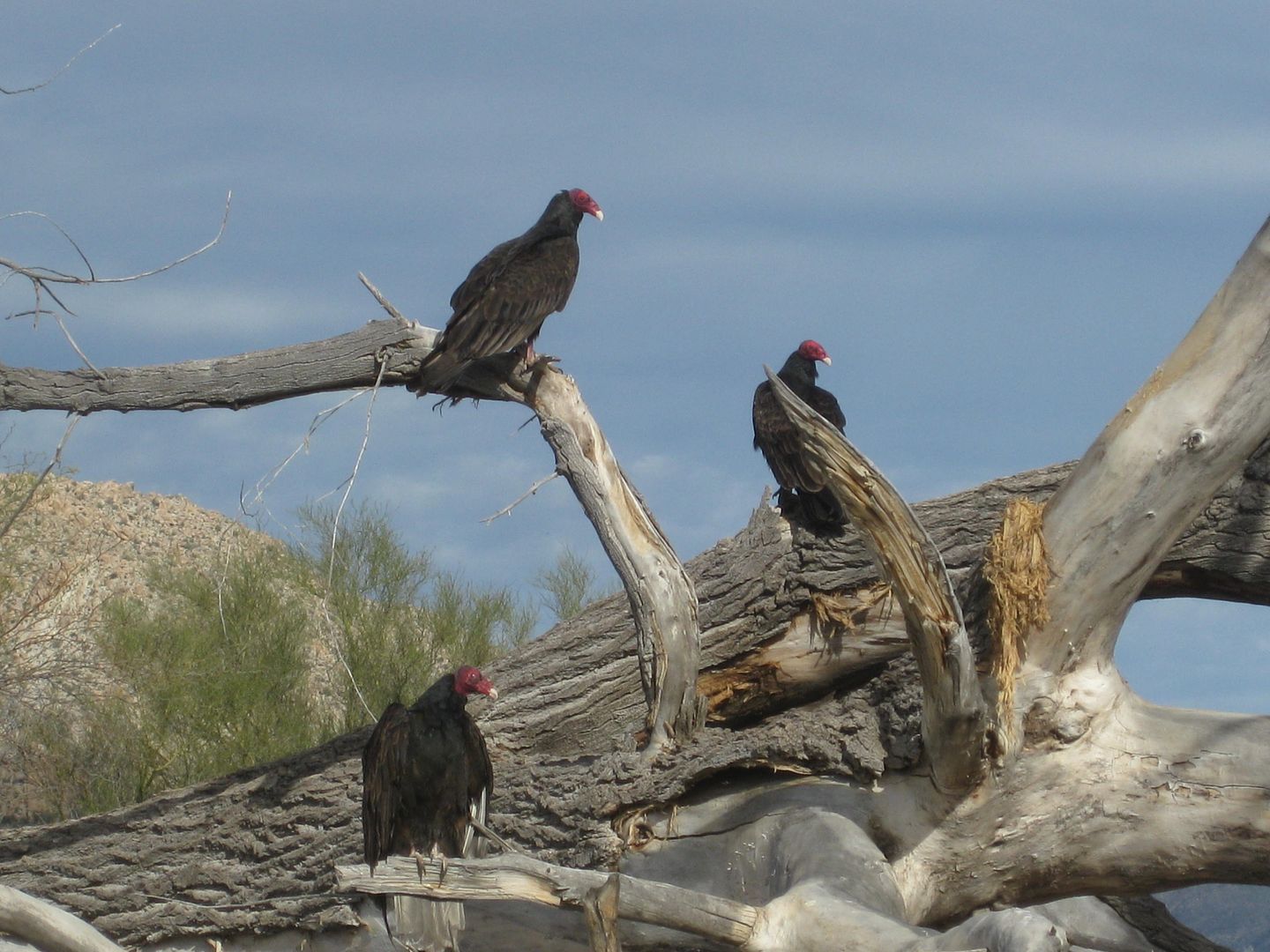
I had a great night's sleep and was up to enjoy the silence of the canyon broken only by the sounds of birds beginning their day. Made a fire to sit
by while having breakfast. Soon enough, I had camp packed and loaded onto my Tacoma and was driving down the white sand arroyo to my next goal.
It was almost 4 miles to get back to the Valle Chico-Matomí road (by Rancho Carricitos).
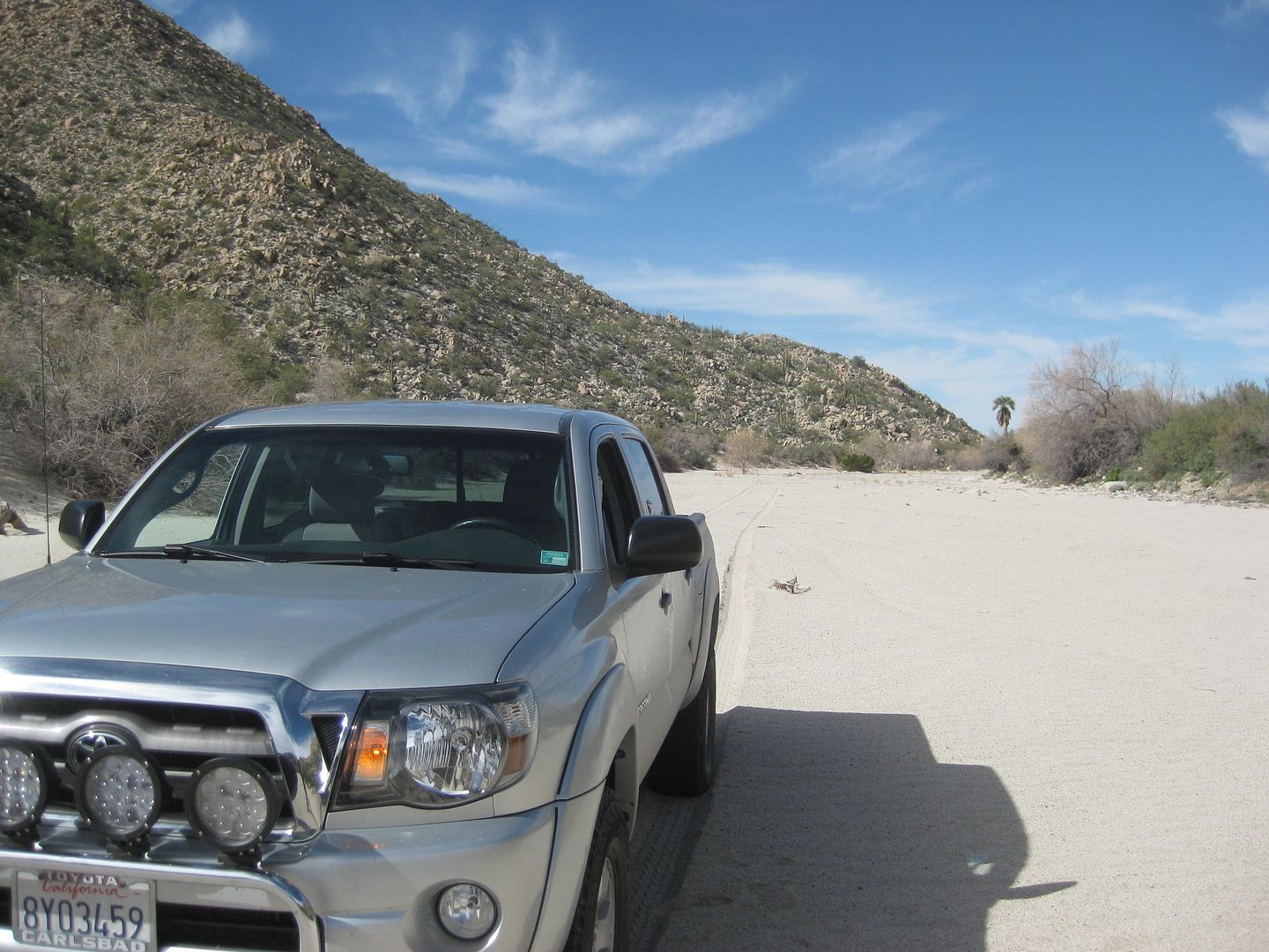
Reset odometer to 0.0 at Matomí/Berrendo junction.
Road Mile
2.7 Corner of fenced area, fenceline road goes left (north).
2.8 Fork, the well-worn road goes left (and I assume this to be the Azufre Wash route, so I go right. However, after a mile going south (and a text
message from StuckSucks on the inReach satellite device) I turn back and go back to Mile 2.8 and take the left fork.
3.1 Azufre Wash (Cañada el Parral) road, along fence, heads east across the valley. This goes 23 miles to the old Puertecitos road, just south of the
Sulfur (Azufre) Mine.
The Matomí bound road now begins over four miserable miles of cross-grain and moguls (whoops) driving.
7.6 Cattle Guard, new fence.
10.8 Top of Matomí Canyon ridge. Road begins steep descent to arroyo floor.
11.1 Arroyo Matomí. Main traffic went left 29 miles to Hwy. 5 (but blocked to most vehicles in only 2.8 miles, now). Rancho Matomí (and the
waterfall) is 5 miles to the right... very difficult driving and has not been used recently.
PHOTOS:
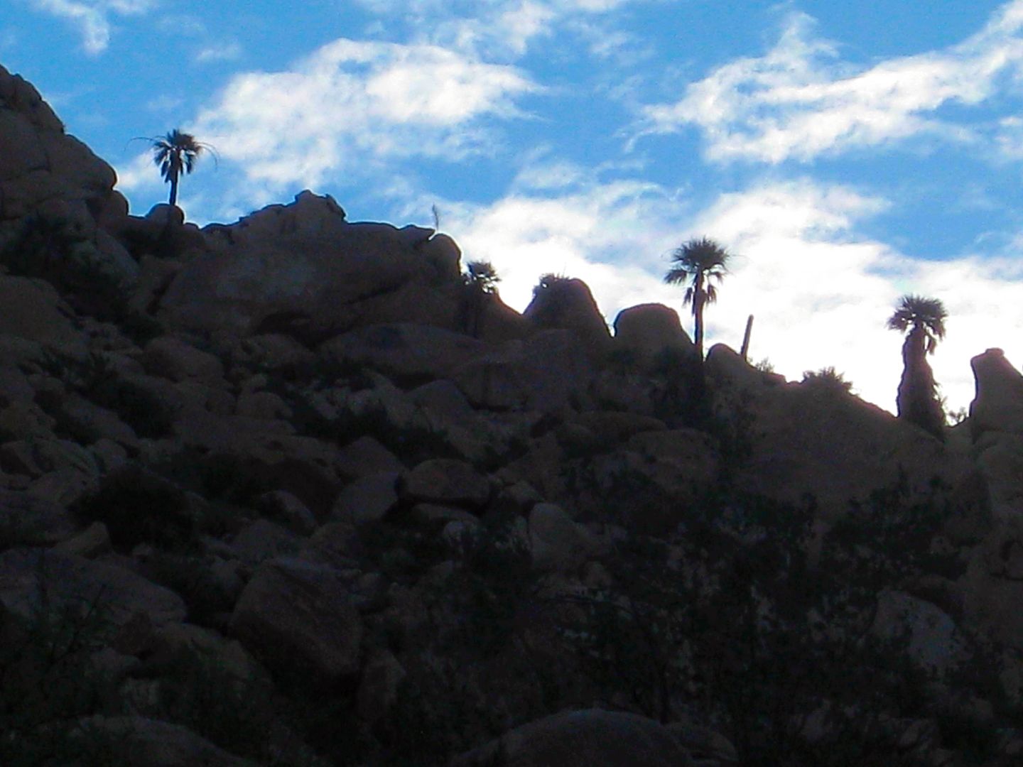
Bye bye Berrendo!
Top of Matomí Canyon entrance grade/ south end of Valle Chico.
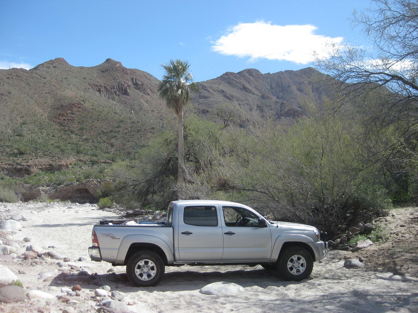
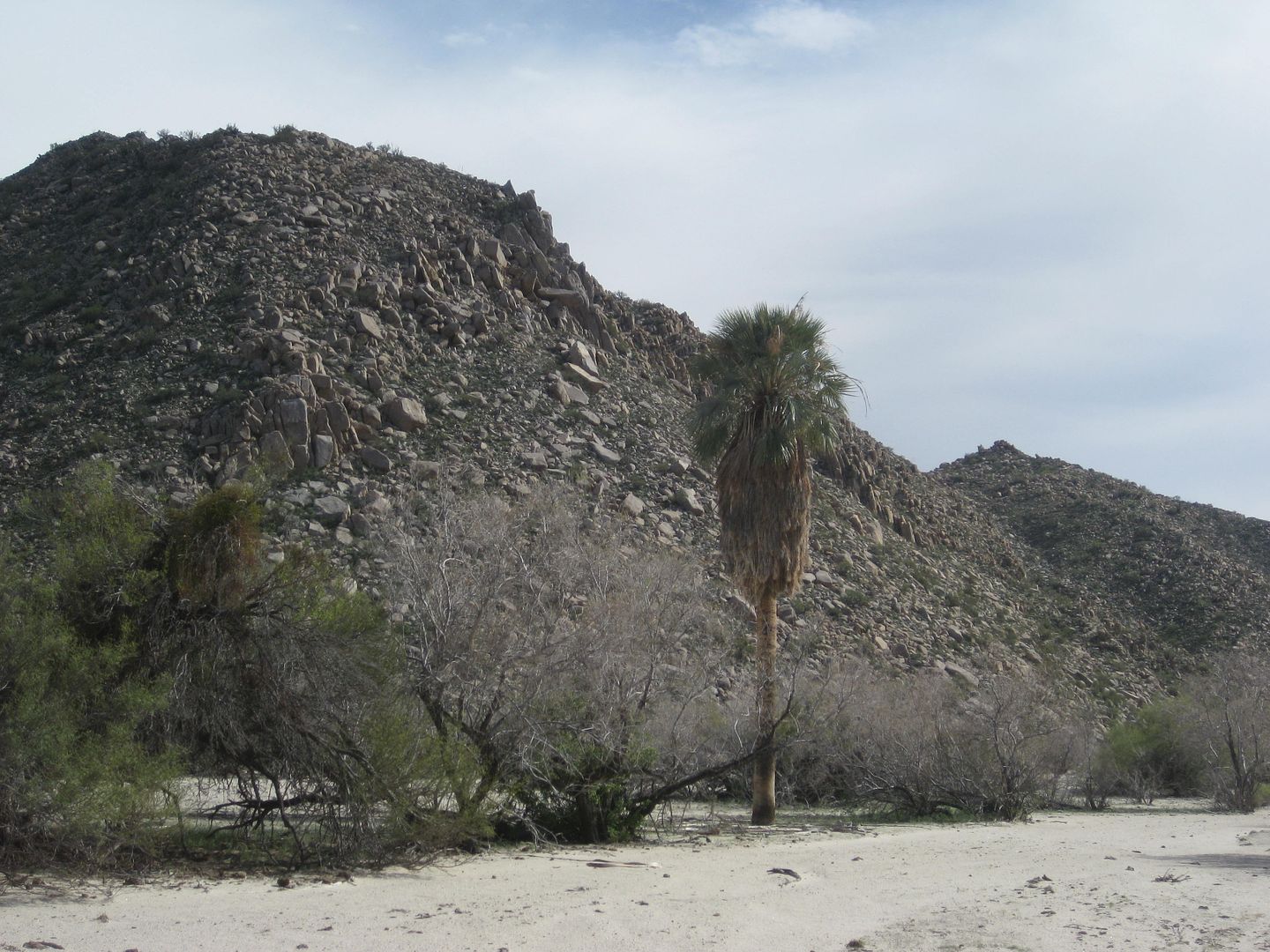
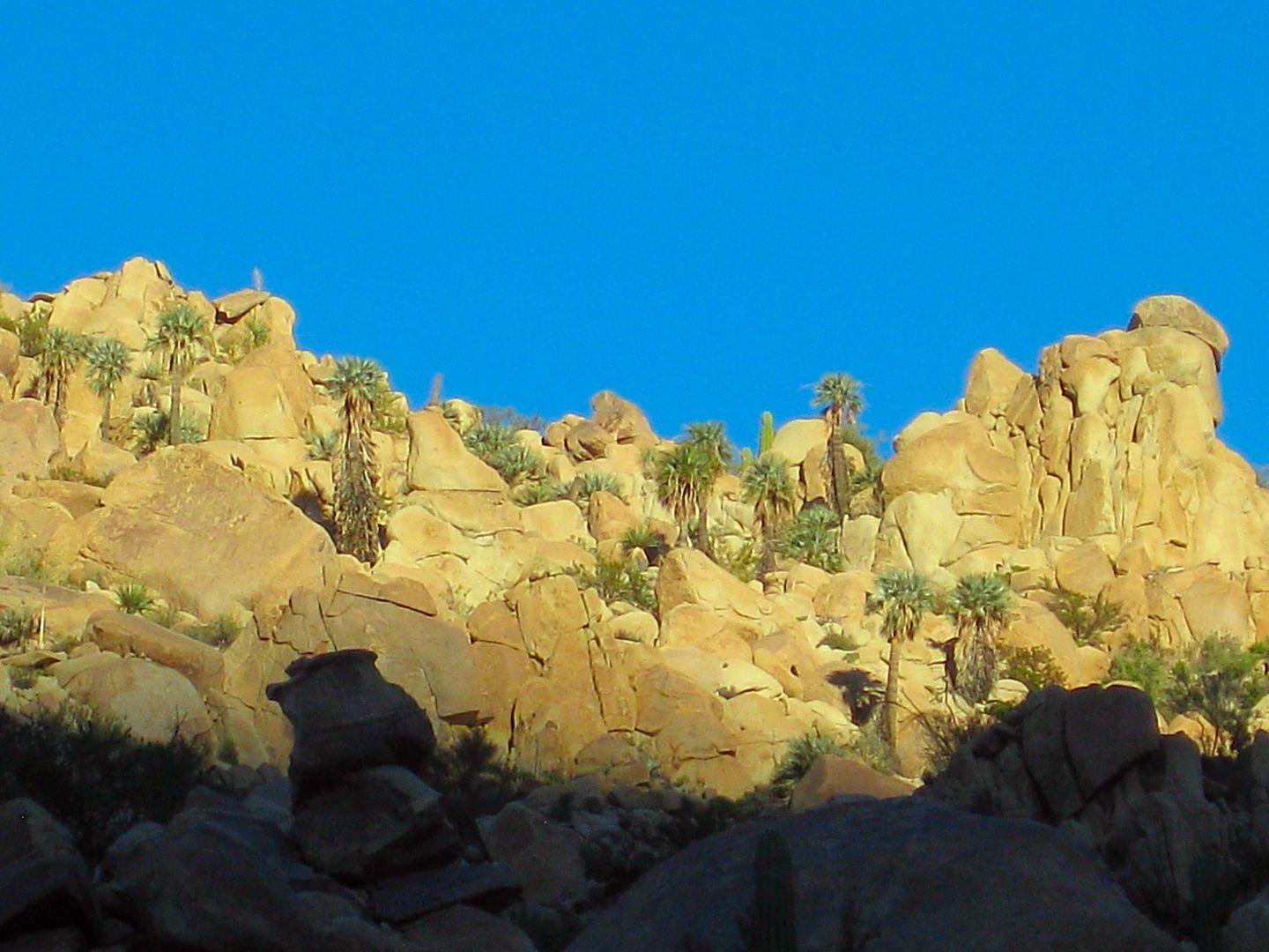
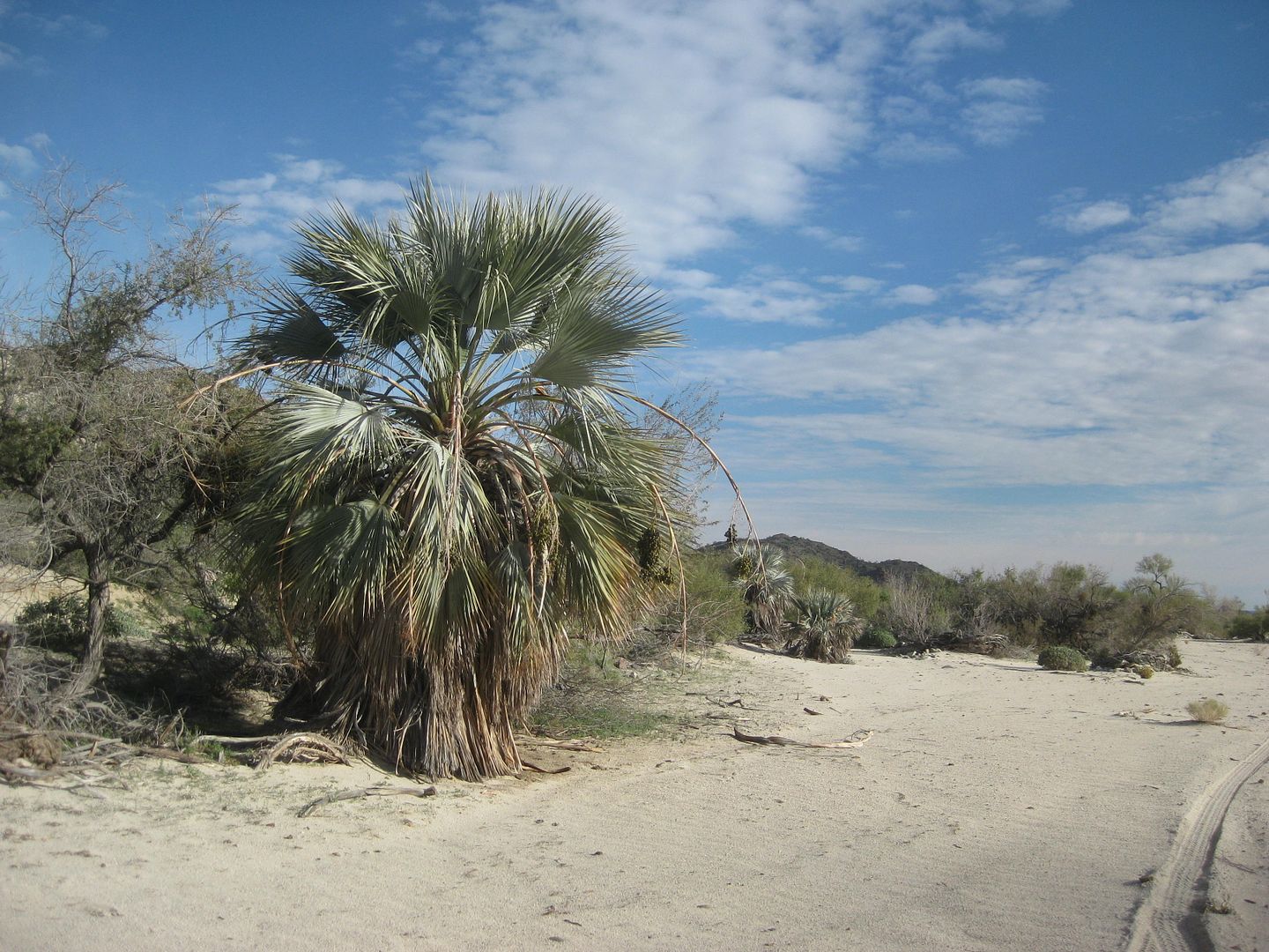
First Matomí palm.
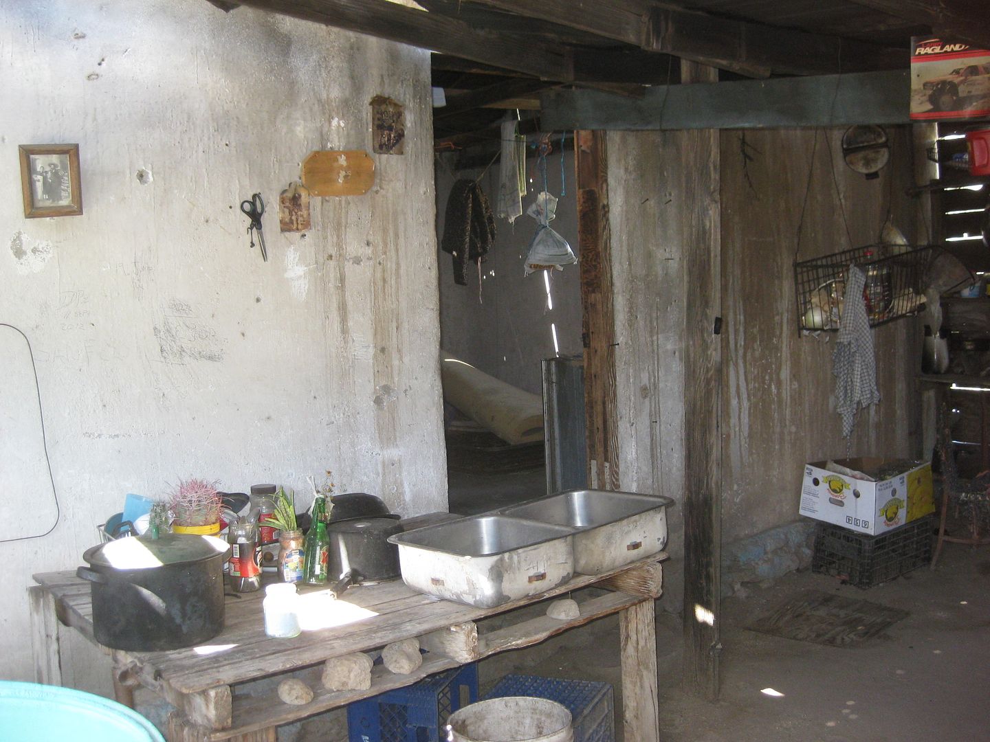
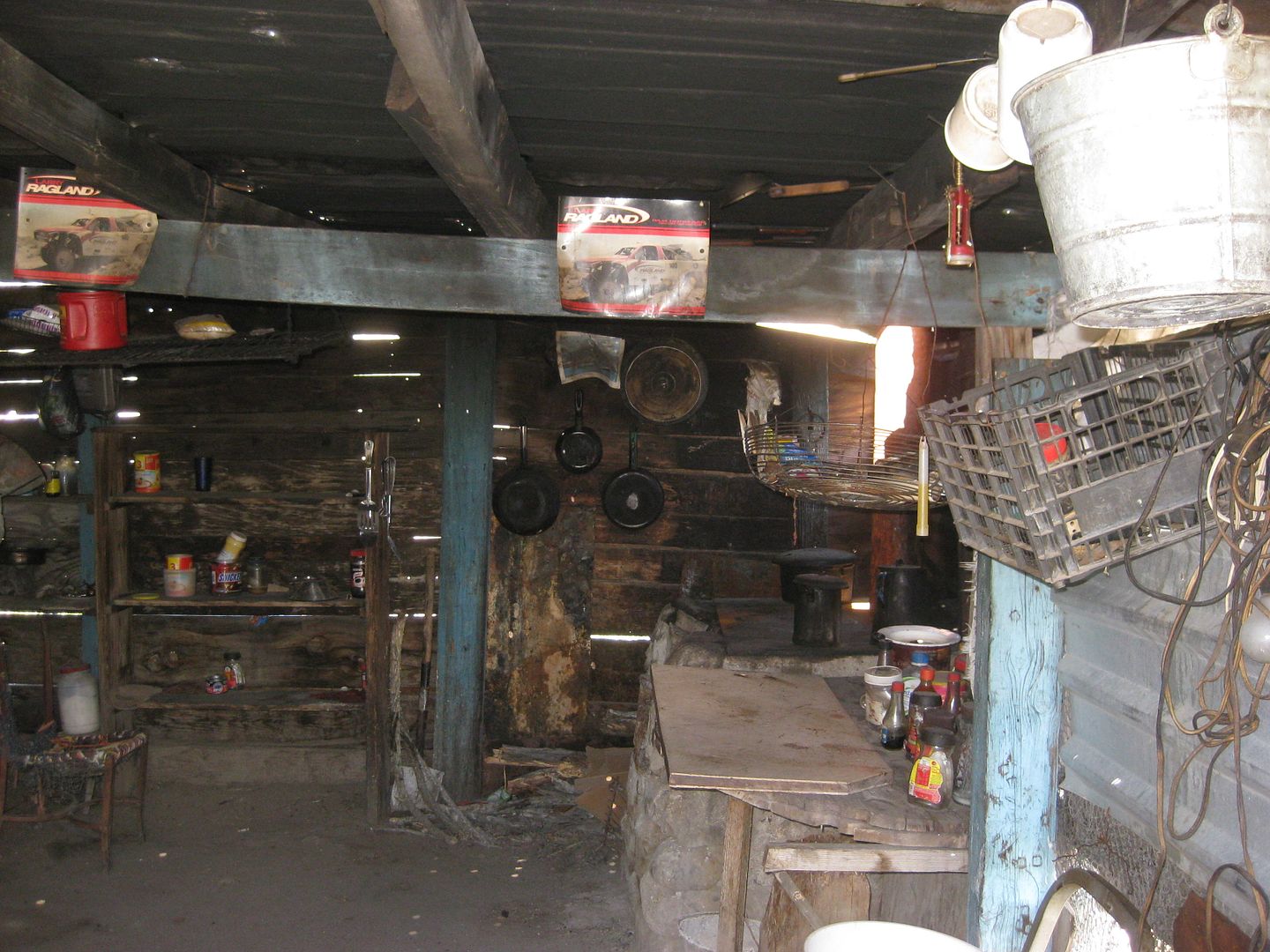
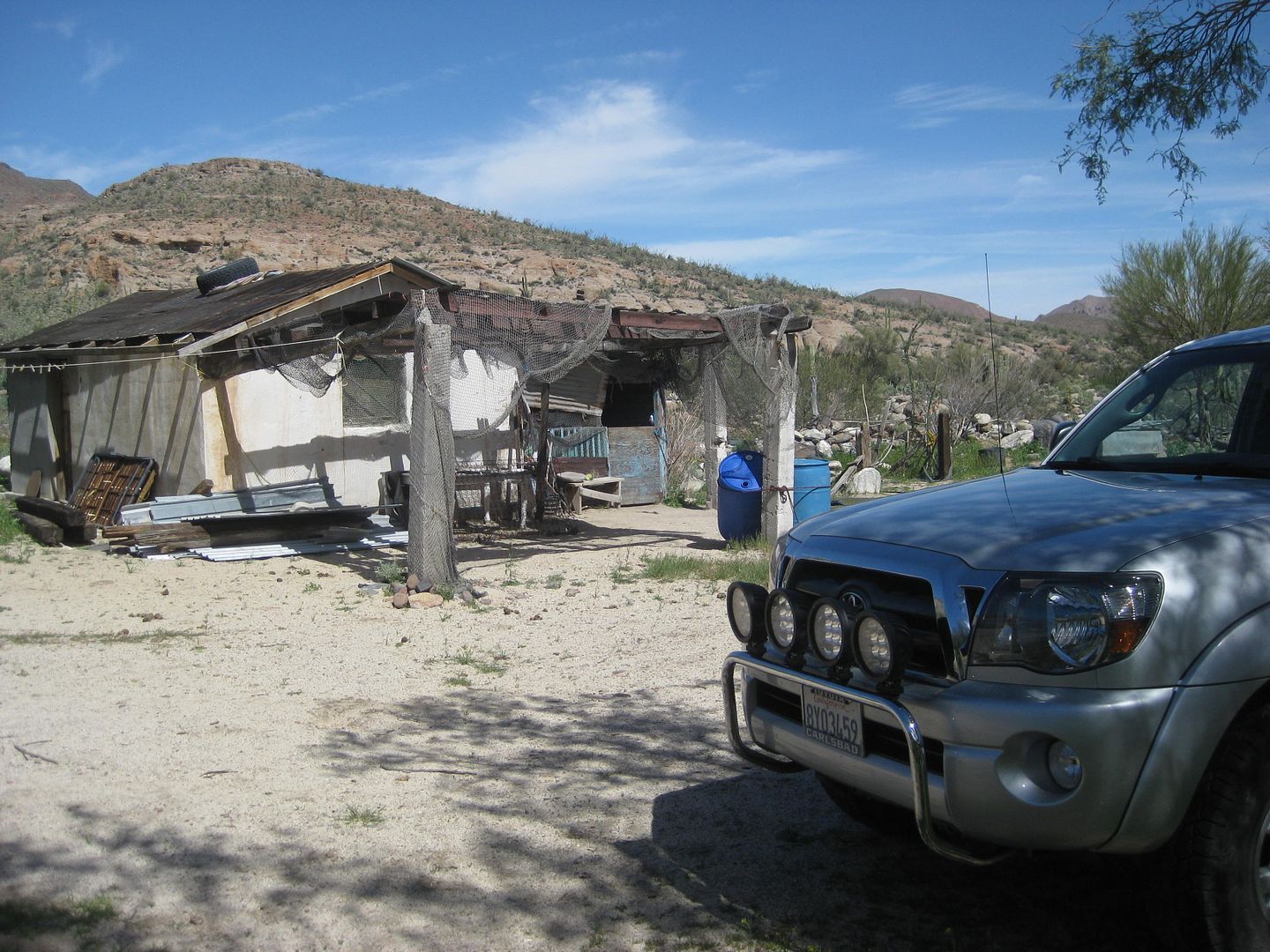
Abandoned (or unoccupied) Rancho Matomí.
The oasis waterfall fed pool is down a path from east of the house.
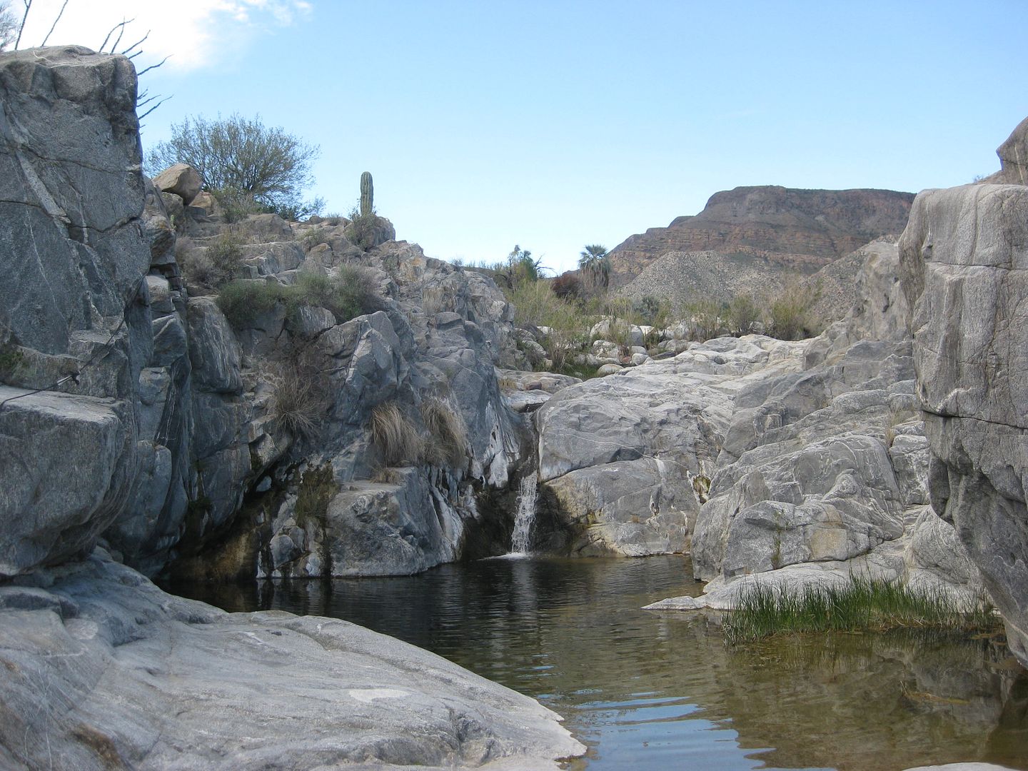
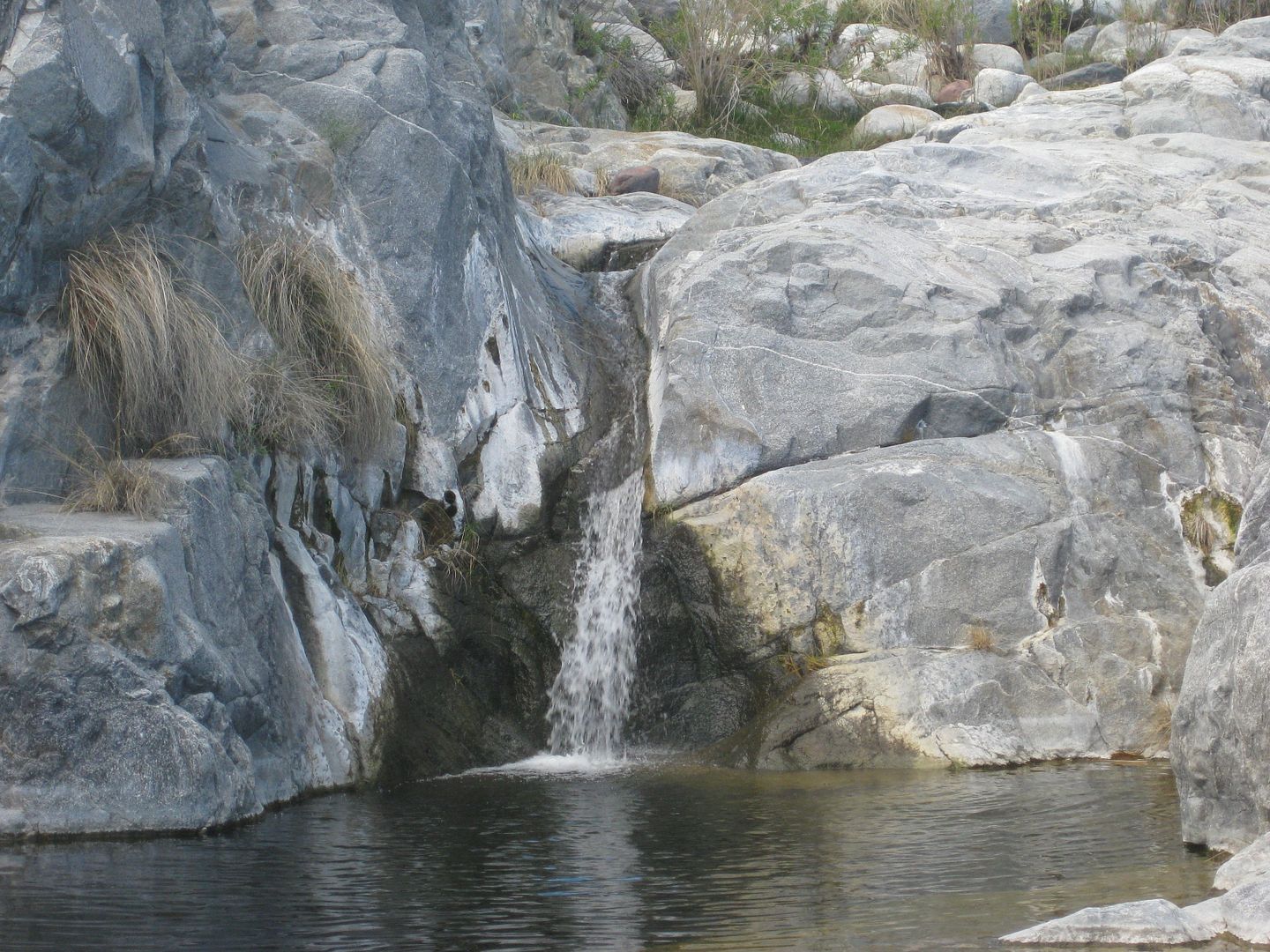
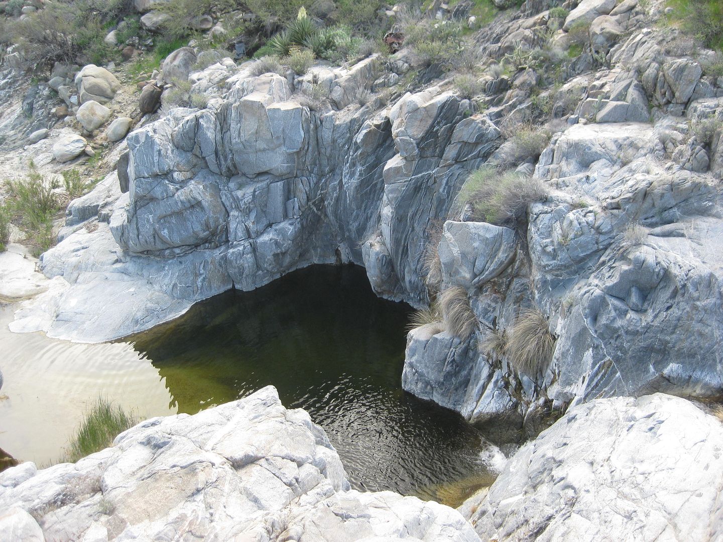
From above.
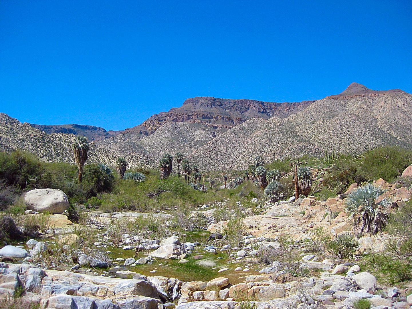
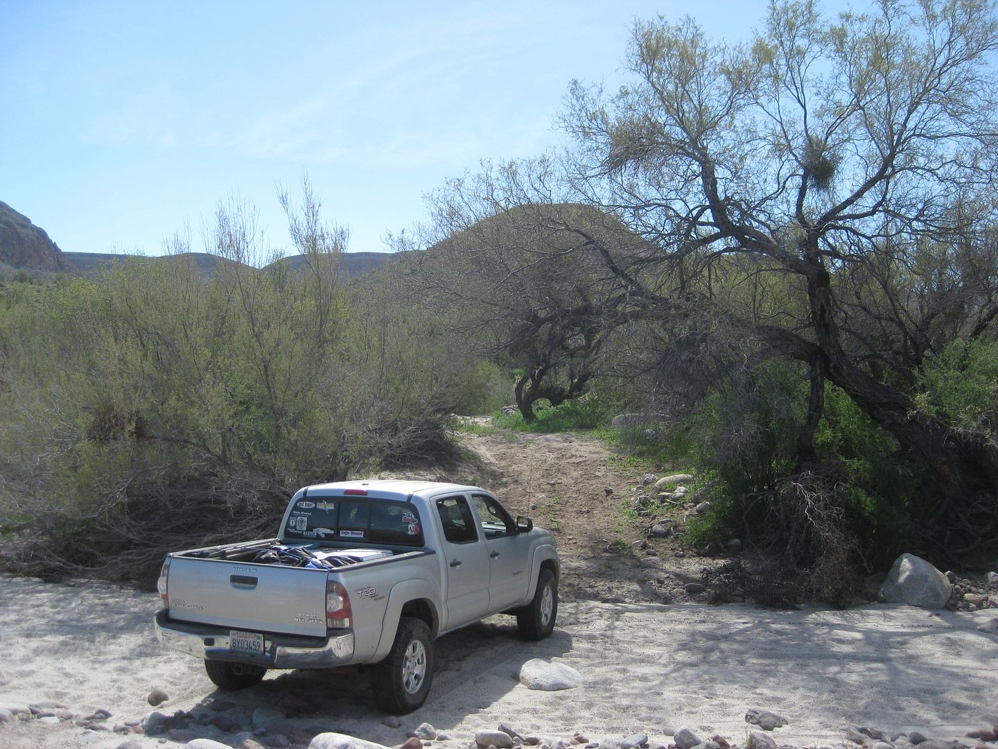
The arroyo west from the waterfall.
Looking into the ranch house:
Time to leave, 11:41 am.
Where a flash flood almost took my Subaru in 1978!

The goal for me was to go see the natural arch, 9 miles on a side wash south from Arroyo Matomí, and eventually be on the Puertecitos highway.
The first narrow pass heading east.
When vehicle tracks end and only motorcycle tracks are seen, I begin to get concerned, but remain hopeful!
DAMN!
I walk ahead to see if there is any chance if I make a ramp to clear the first block, to have a clear path...
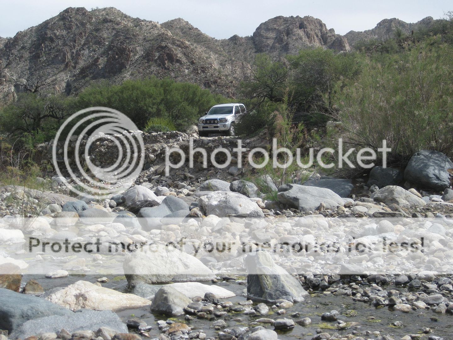
Looking back to where I parked, I head to the Matomí Squeeze (narrows).
It doesn't get better.
The sand level at the squeeze is also a few feet lower than my last time driving through here, making the gap narrower.
Looking back to the rock garden from the east side of the squeeze.
BUMMER!
I drive back to the steep grade out of the canyon to Valle Chico...
This is pretty steep with a ledge. Lockers or traction control here to prevent tire spin and further road damage.
My revised goal is now to use Cañada el Parral (Azufre Wash/ Crazy Horse Canyon) to cross over to the Puertecitos road. I will revisit the sulfur
mine, as well.
STAY TUNED! More coming...
|
|
|
David K
Honored Nomad
Posts: 64479
Registered: 8-30-2002
Location: San Diego County
Member Is Offline
Mood: Have Baja Fever
|
|
Saturday: Matomí to Azufre Wash
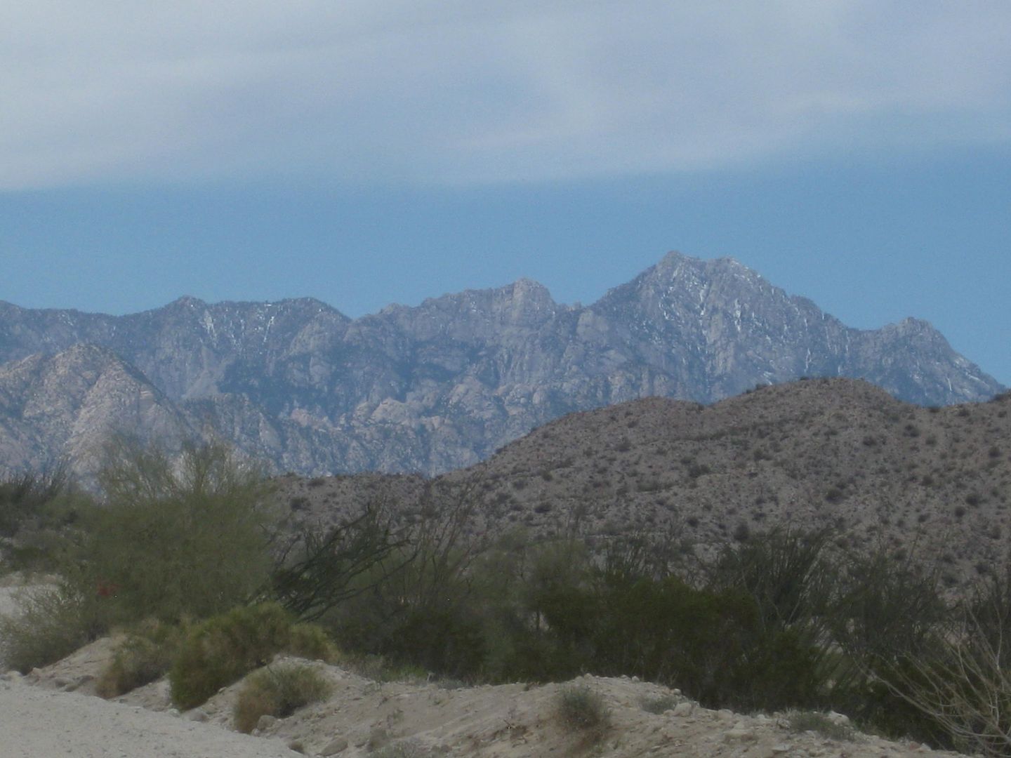
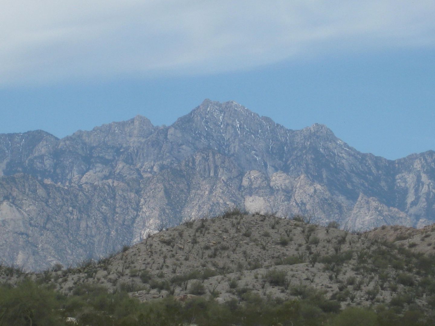
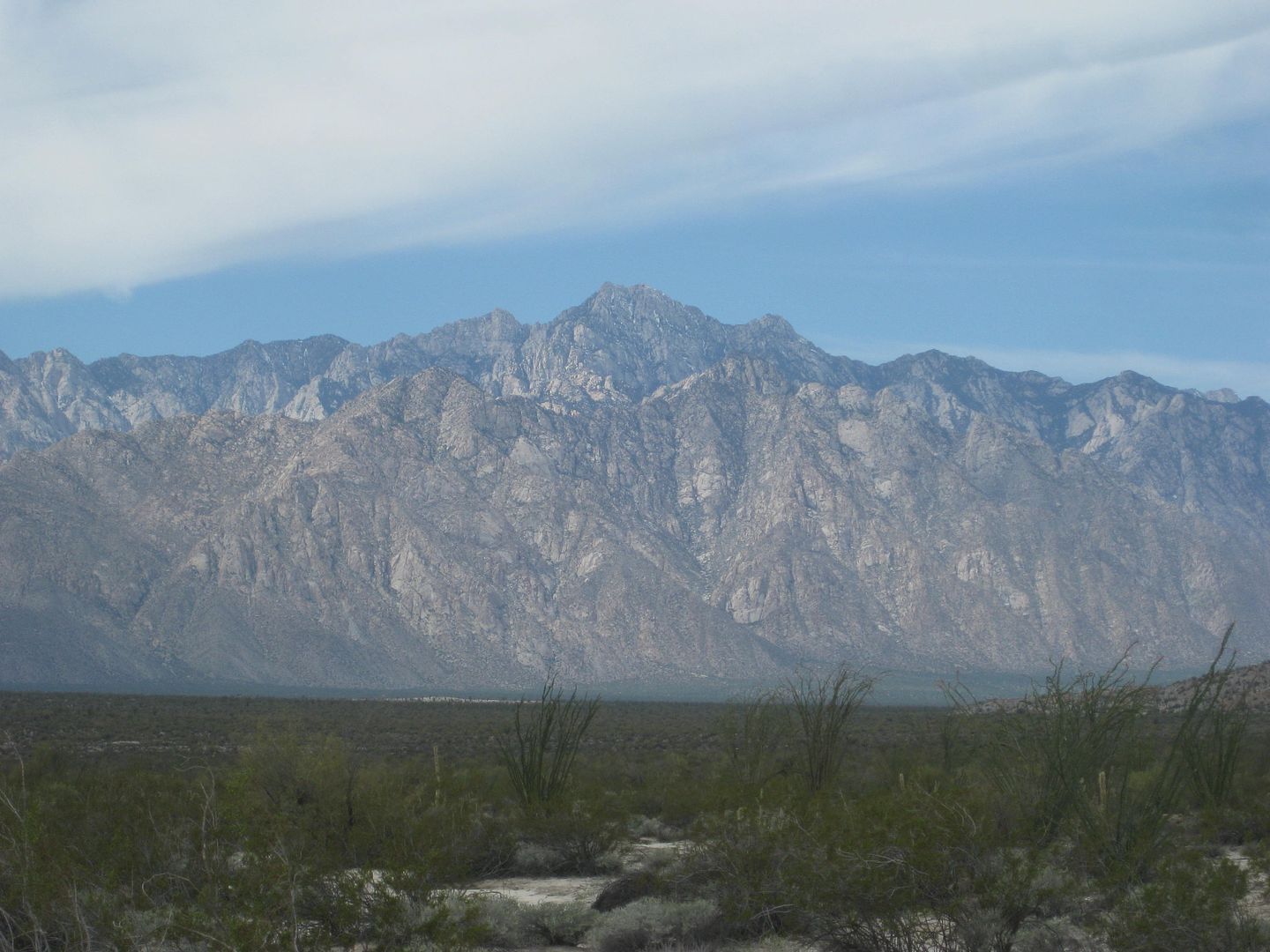
Here's Mount Diablo (Baja's highest mountain, 10, 154') from the south end of Valle Chico.
So, those 4 miles of moguls are seriously annoying... but without an exit through the Matomí narrows, I have no other choice.
8 miles from Arroyo Matomí I arrive at the cross-valley fence line which is the route into Cañada el Parral (what SCORE calls Azufre Wash and Bruce
Barber calls Crazy Horse Canyon, in his book "Of Sea and Sand").
Looking East
It is over 4 miles to the other side of the valley.
Looking back west.
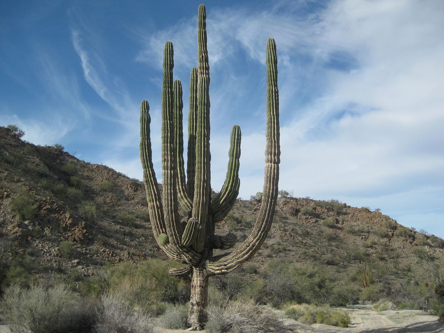
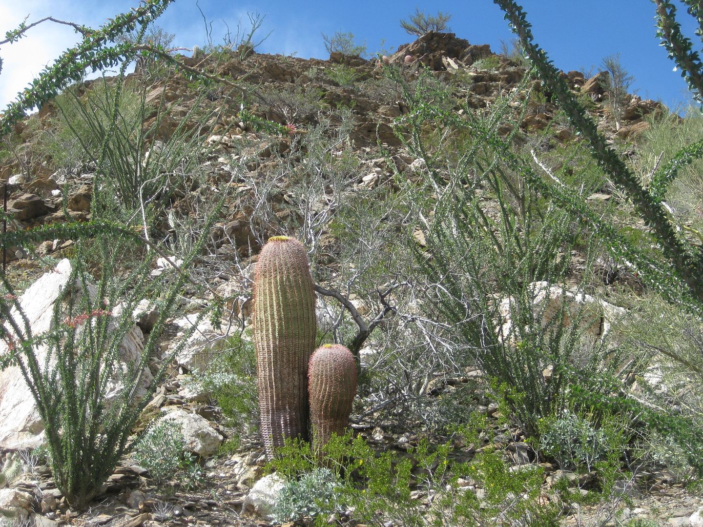
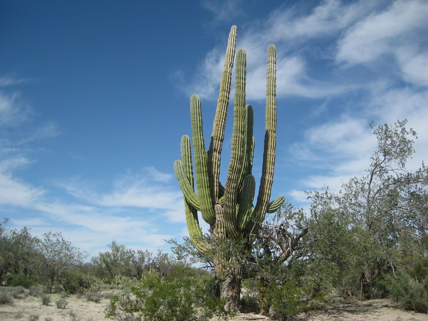
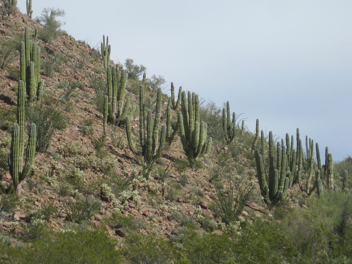
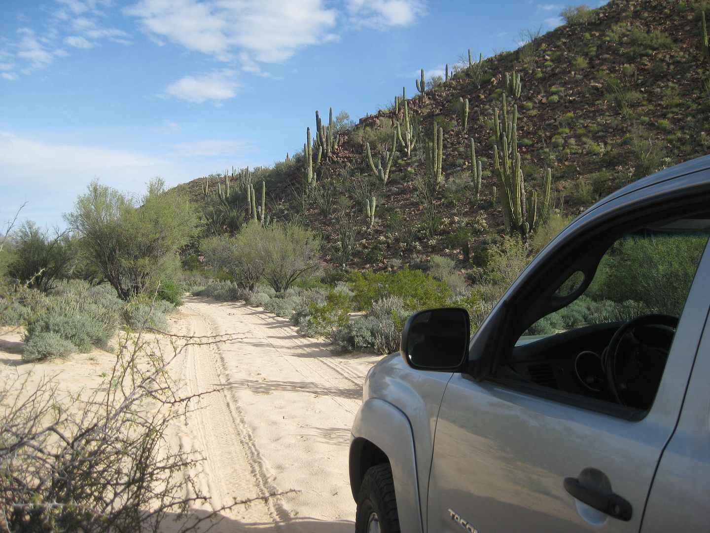
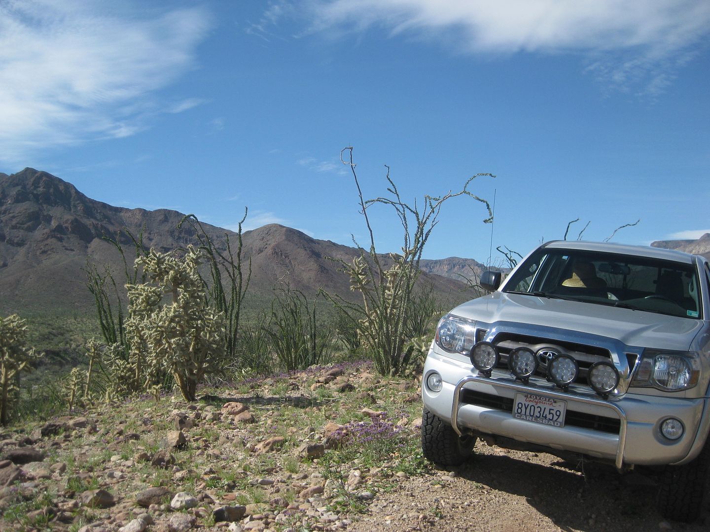
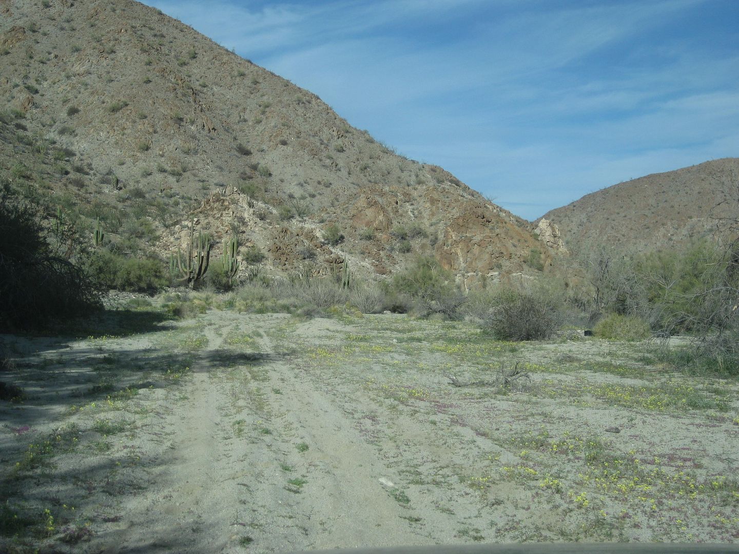
Some nice cardón catus trees in the pass.
The high point of the pass through the hills is 6 miles from the Matomí road, elevation 2,270'. The pass or canyon is a very gentle drop from Valle
Chico to the Sulfur Mine area.
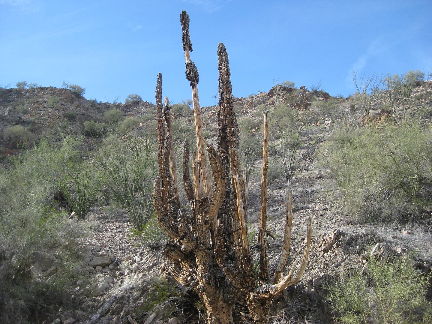
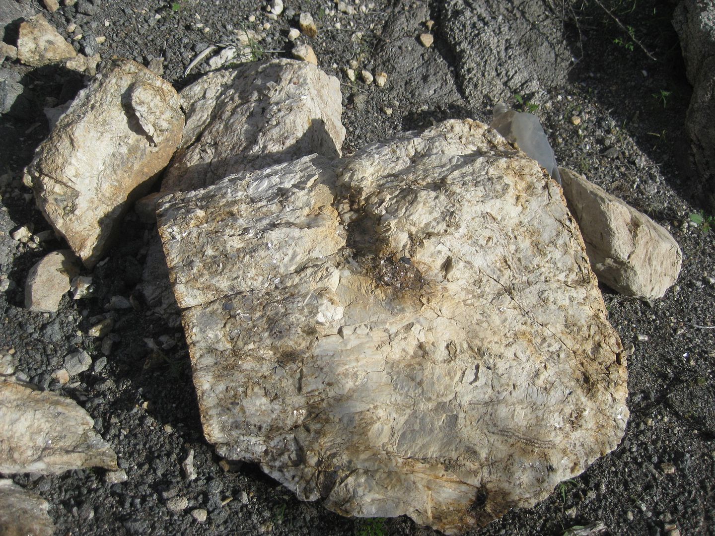
A cardón after it dies.
Neat geology!
While there are some moguls near the west end of Azufre Wash, it is mostly easy driving.
I make camp at Mile 15.0 from the Matomí road.
The evening is warmer than it was at Berrendo, as I am closer to the sea and lower in elevation. There are a few mosquitos at sundown. I have Deet!
This is my 3rd night away from home and second-night tent camping. I enjoy texting with my wife and with a few Nomad friends as I have a nice
campfire. An old pallet was nearby, and that helped me pick this spot.
So, it was windy anytime I was not in a narrow part of the canyon, and the desert was in bloom... I am getting a case of allergy or a cold. Both act
the same on me. I send an email to Baja Cactus Motel and Antonio answers, he will be there the next night. Great, I want to bring him up to speed on
this new Baja Bound project, give him a couple more books he can sell to raise money for his emergency rescue service https://www.facebook.com/HalconesdelDesierto and have a comfortable place to sleep and have hot showers.
Good Night from Azufre Wash!
|
|
|
David K
Honored Nomad
Posts: 64479
Registered: 8-30-2002
Location: San Diego County
Member Is Offline
Mood: Have Baja Fever
|
|
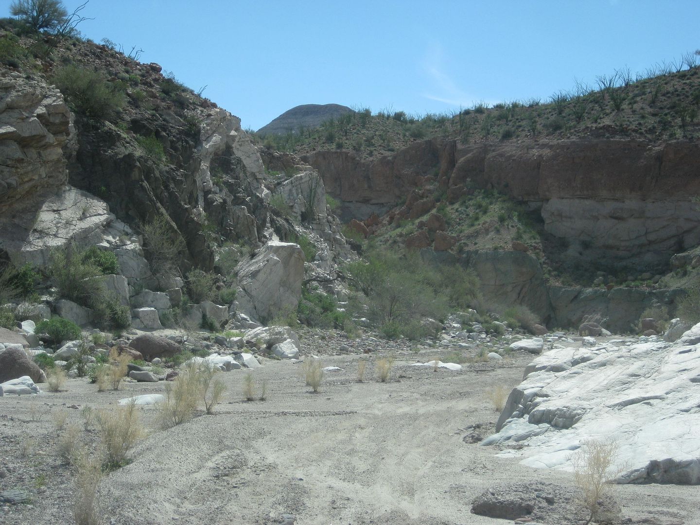
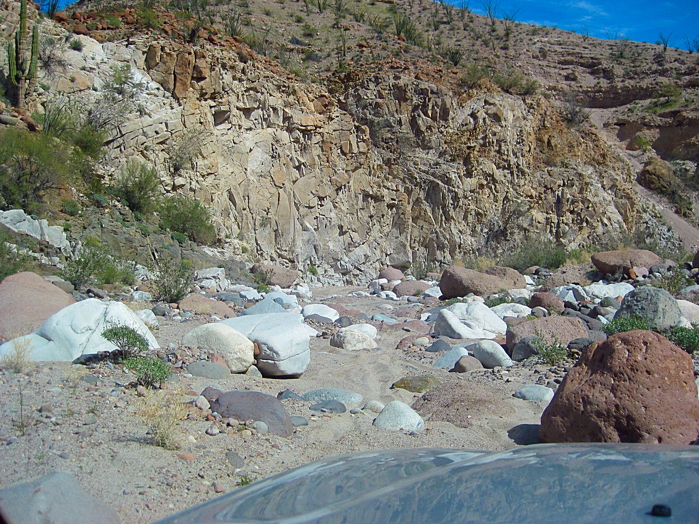
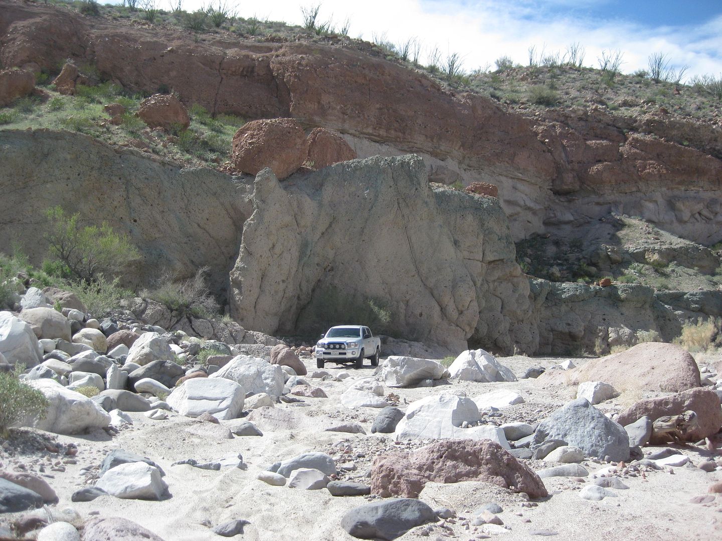
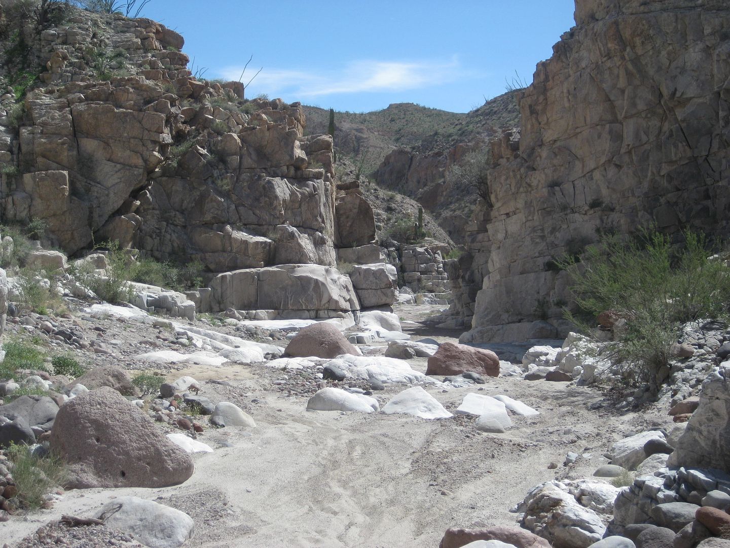
Sunday March 5, 2017 Sulfur Mine, La Poma Lunch, and on to Hwy. 1.
I was packed up and rolling at 8:43 am.
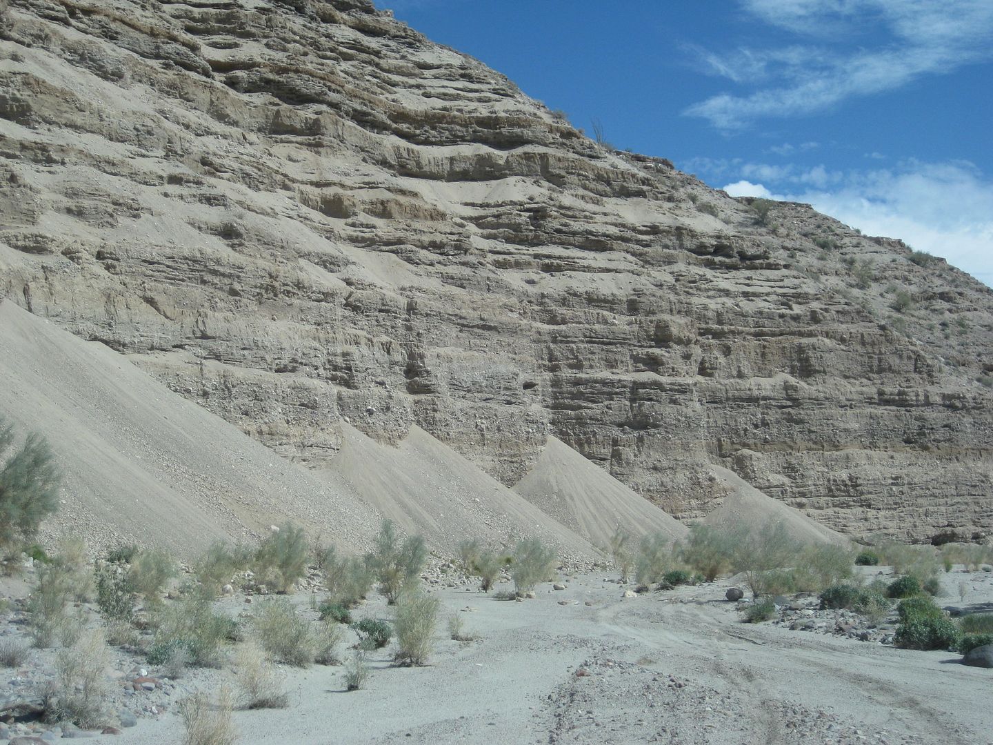
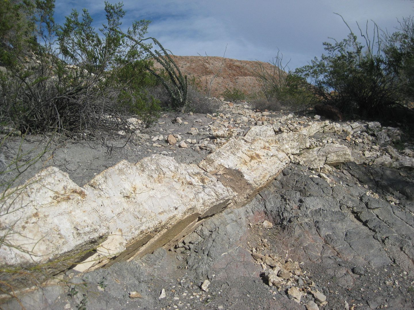
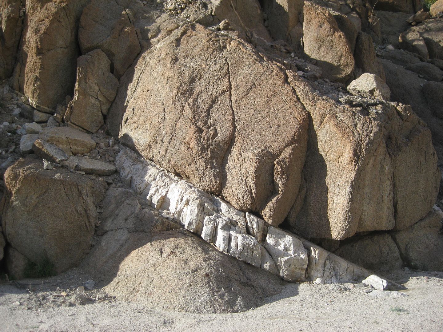
Soon, I came to the folding rock layers I have photographed since my first time through Cañada el Parral (1978).
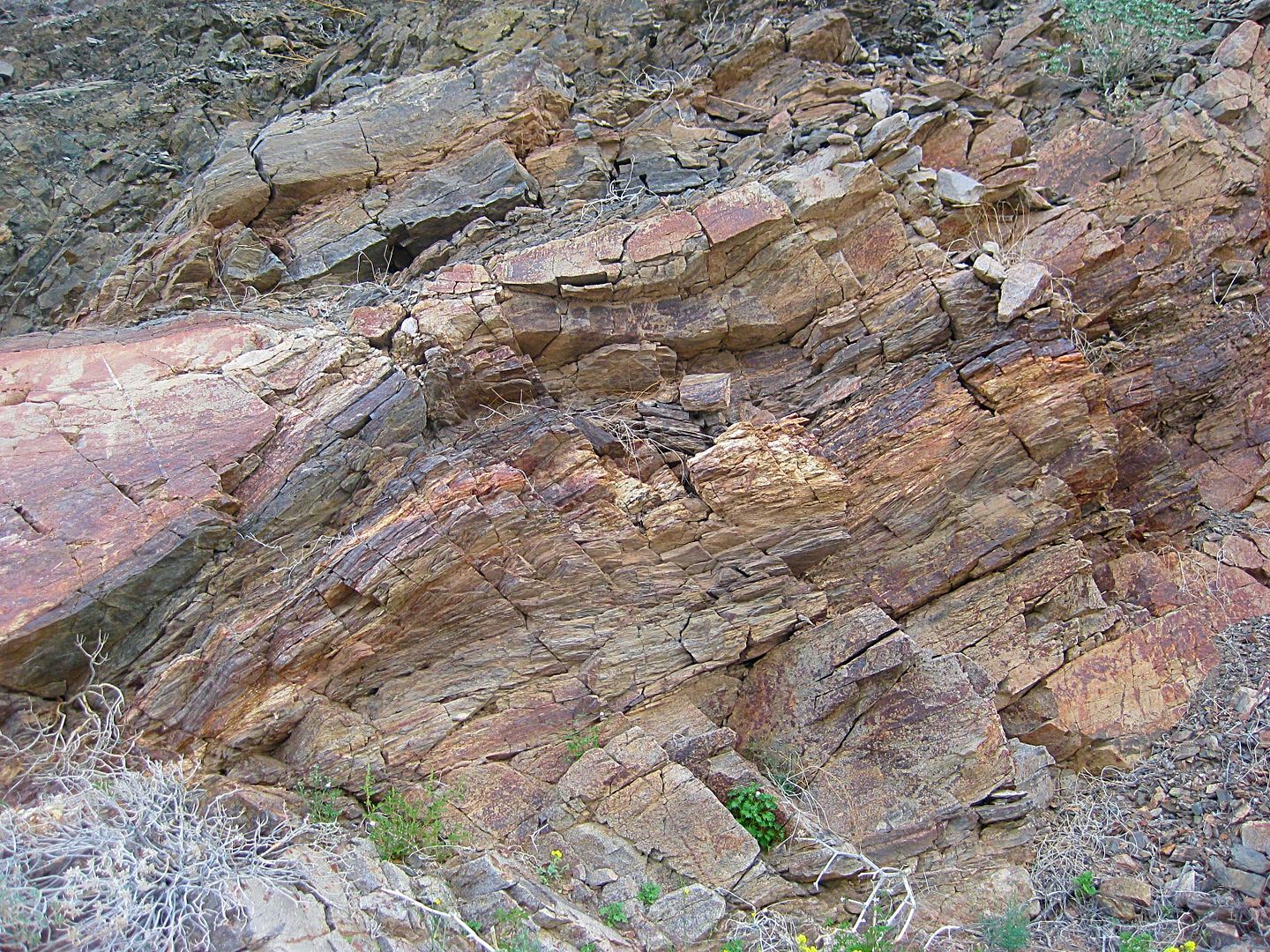
2017

2006

GeoRock explains on our 2004 Matomí tour.

Jim Todd, a traveling friend. 1978
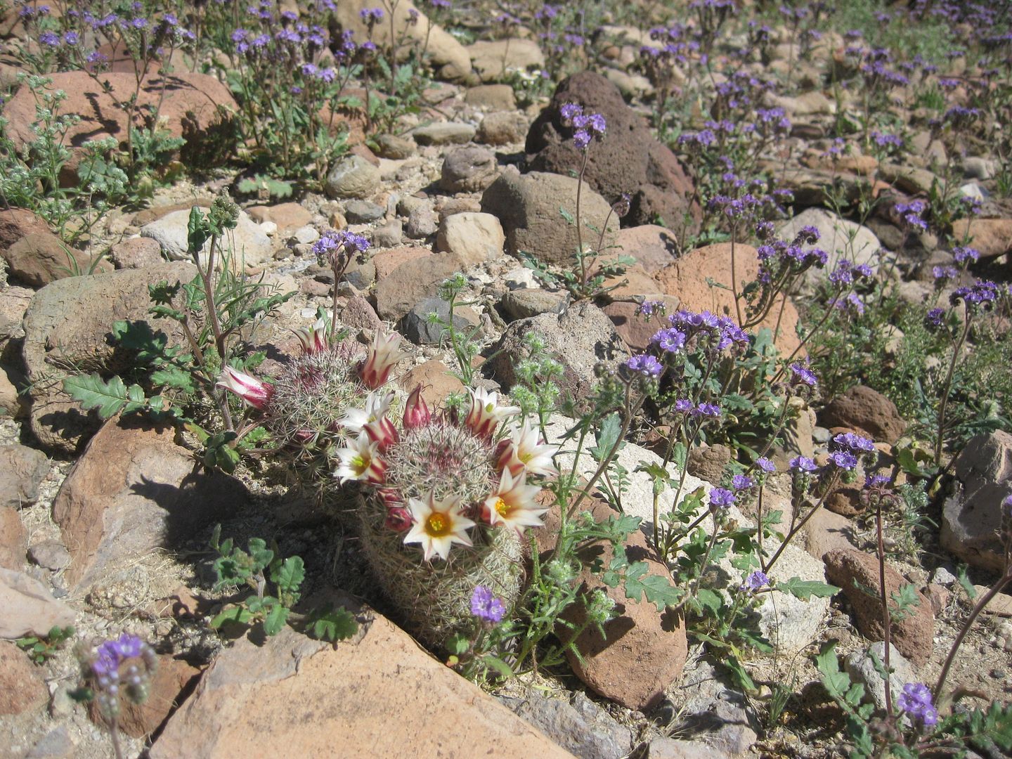
The desert is in color.
Just when I thought I was home free...
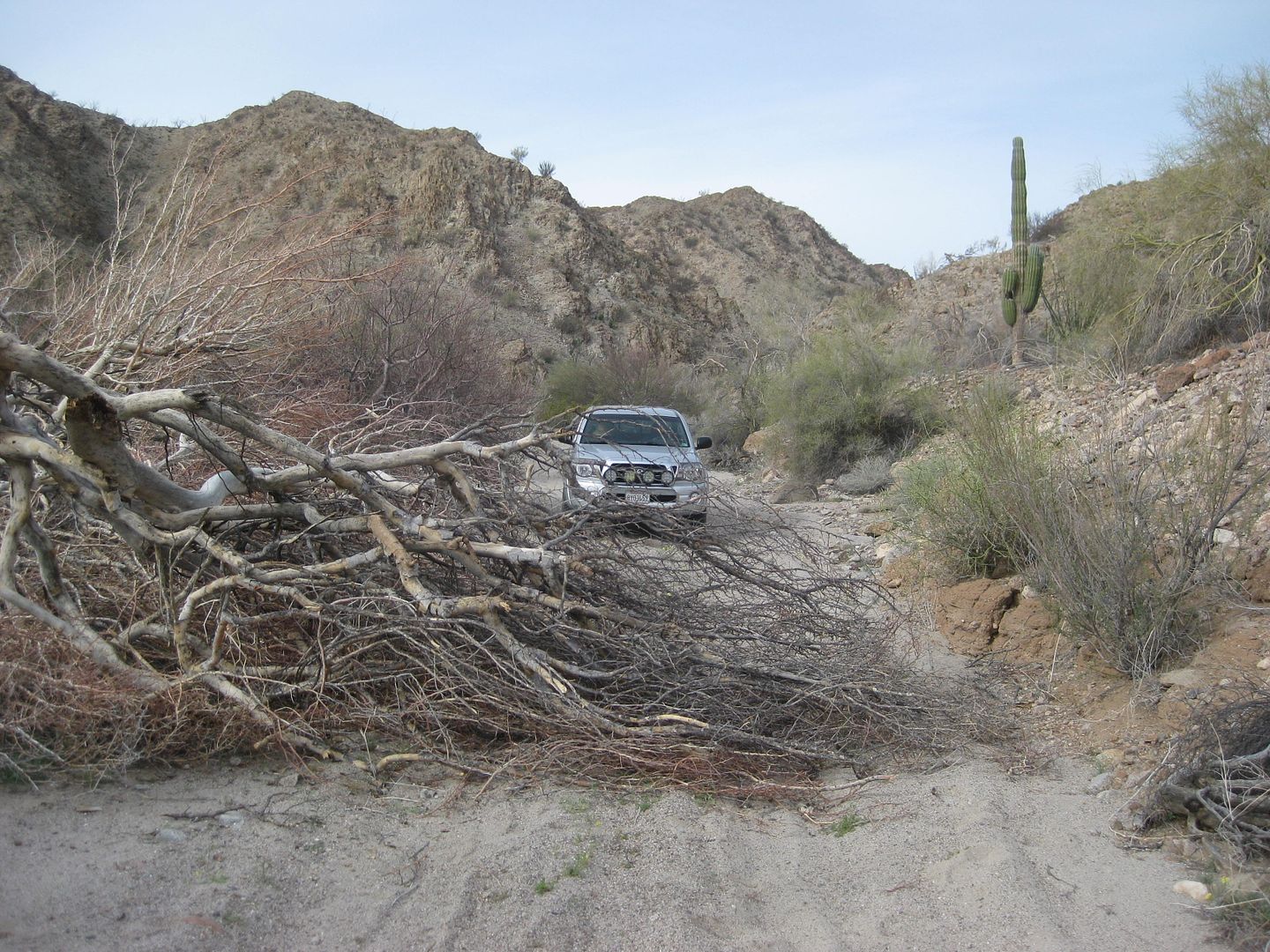
There was no way around the tree, in the road. Quad tracks on the other side made a U-turn. It had to be dealt with!
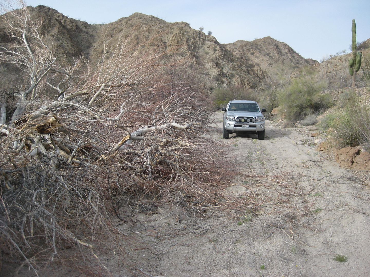
Done!
I reach the old Puertecitos road 23.3 miles from the Valle Chico-Matomí road and turn left (north) to visit the Sulfur Mine. A major landmark before
the newer road was built in 1982, that stayed closer to the coast.
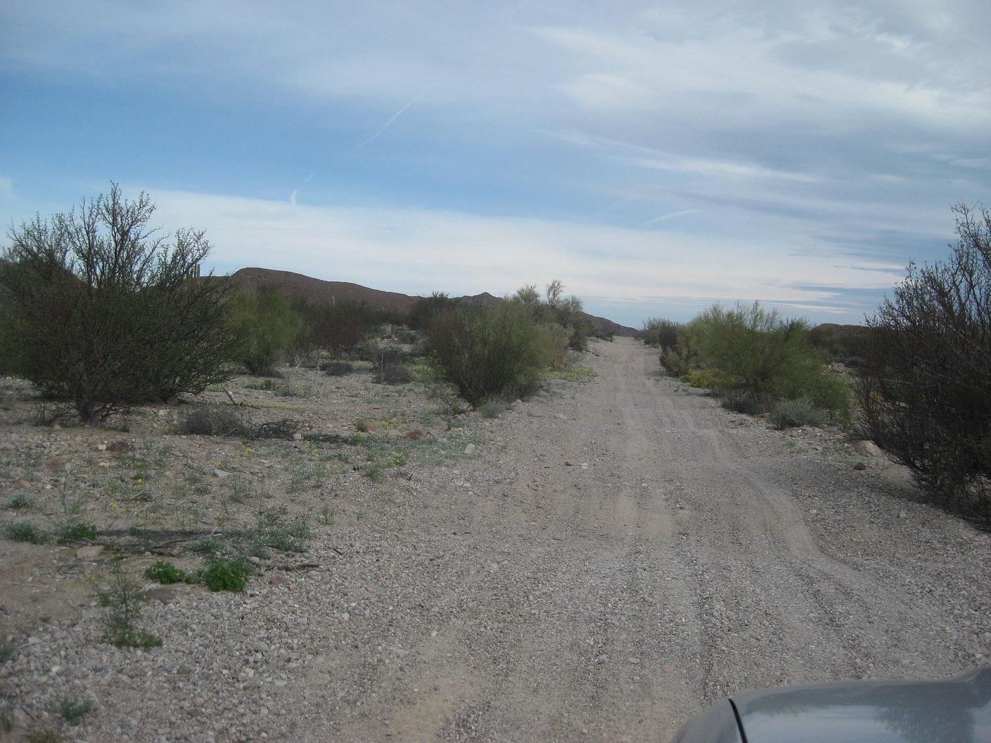
From the Azufre Wash junction, going north:
Mile 1.3 cross old airstrip runway and later road to Campo La Roca (joins Nuevo Mazatlan road in a mile)
Mile 1.7 Nuevo Mazatlan road (4 miles to Hwy. 5 at almost Km. 32)
Mile 1.9 Sulfur Mine area... about a half mile all around from here was mined for sulfur.
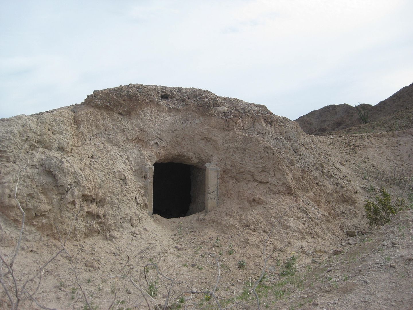
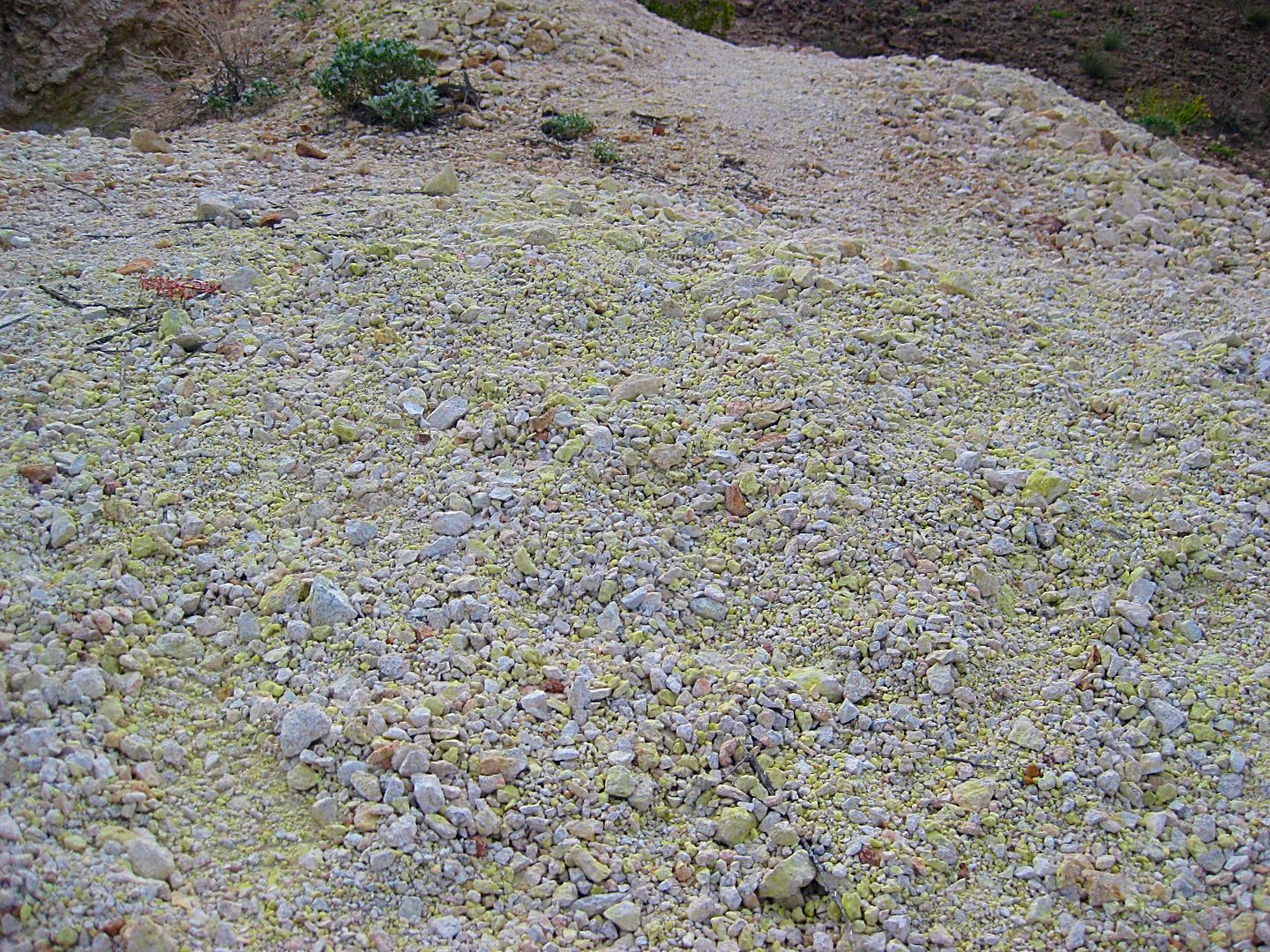
Sulfur was mined here to the 1950s. Before 1956, the sulfur mine and Agua de Chale (Nuevo Mazatlan now) was the end of the automobile road from San
Felipe.
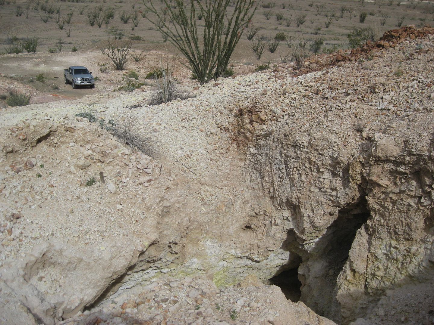
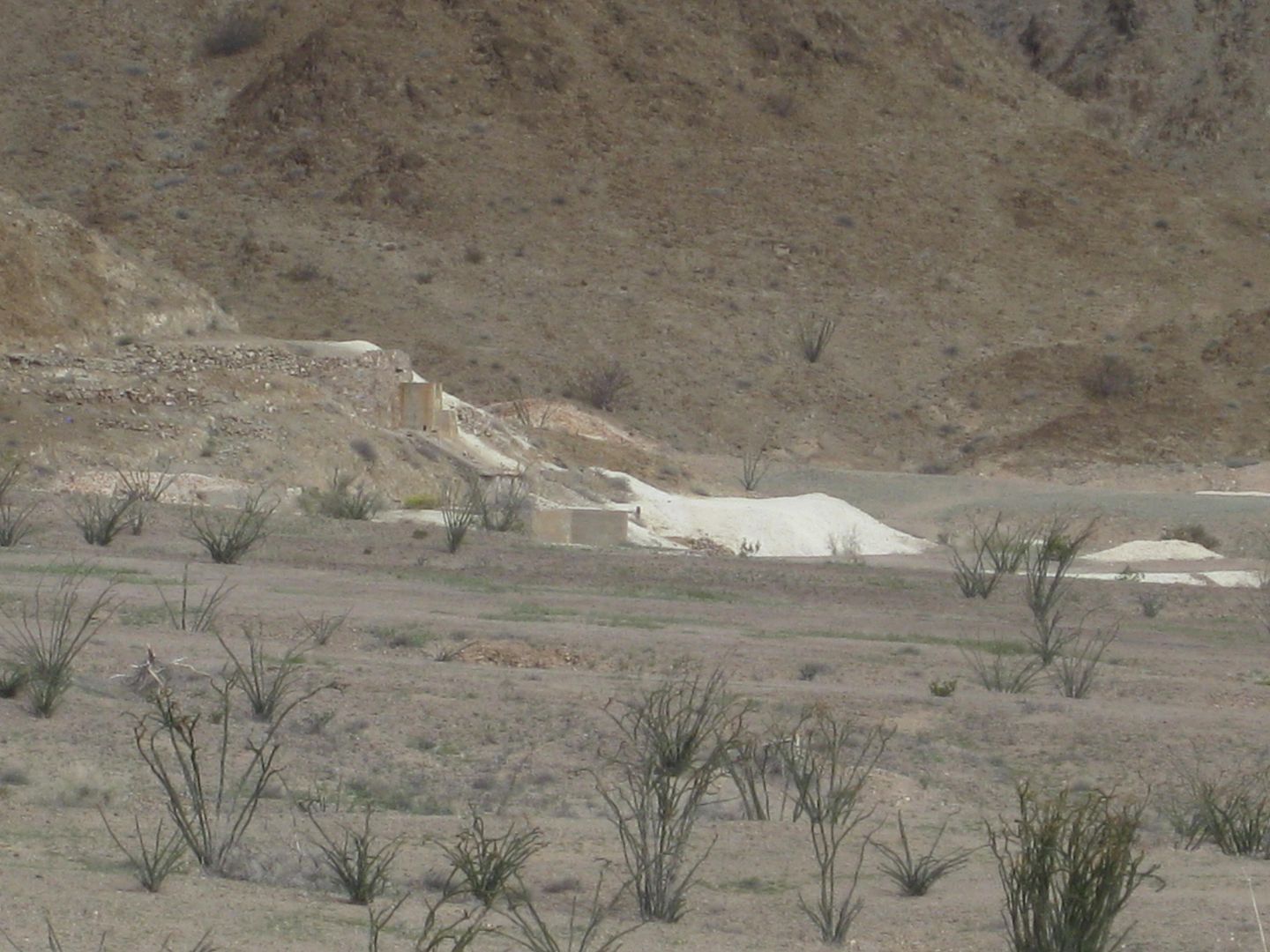
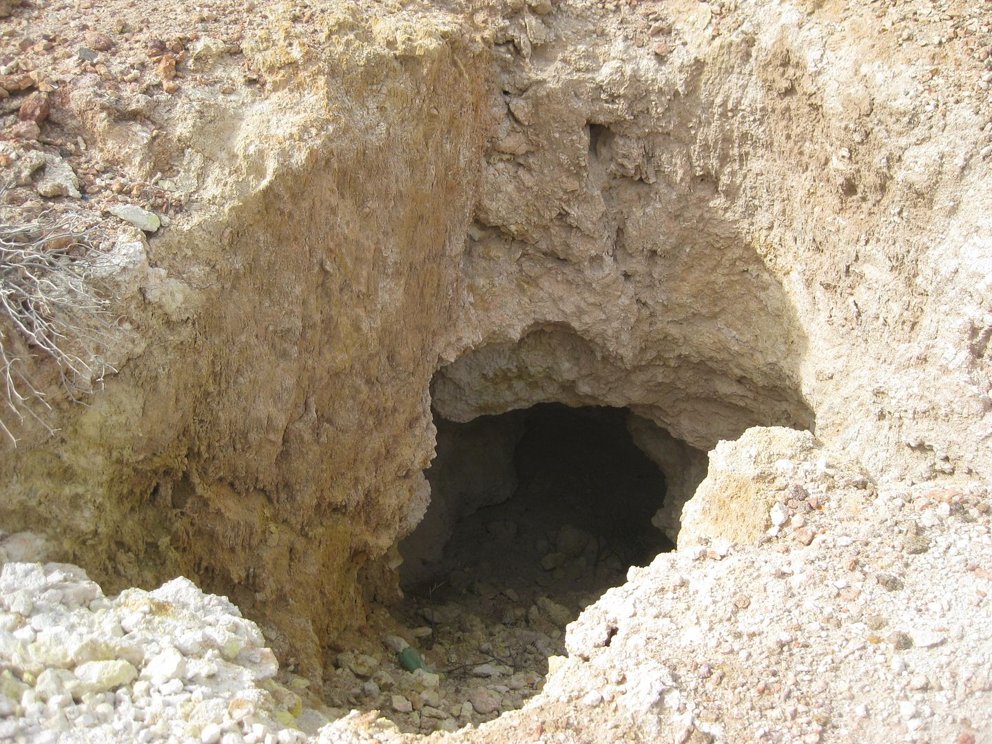
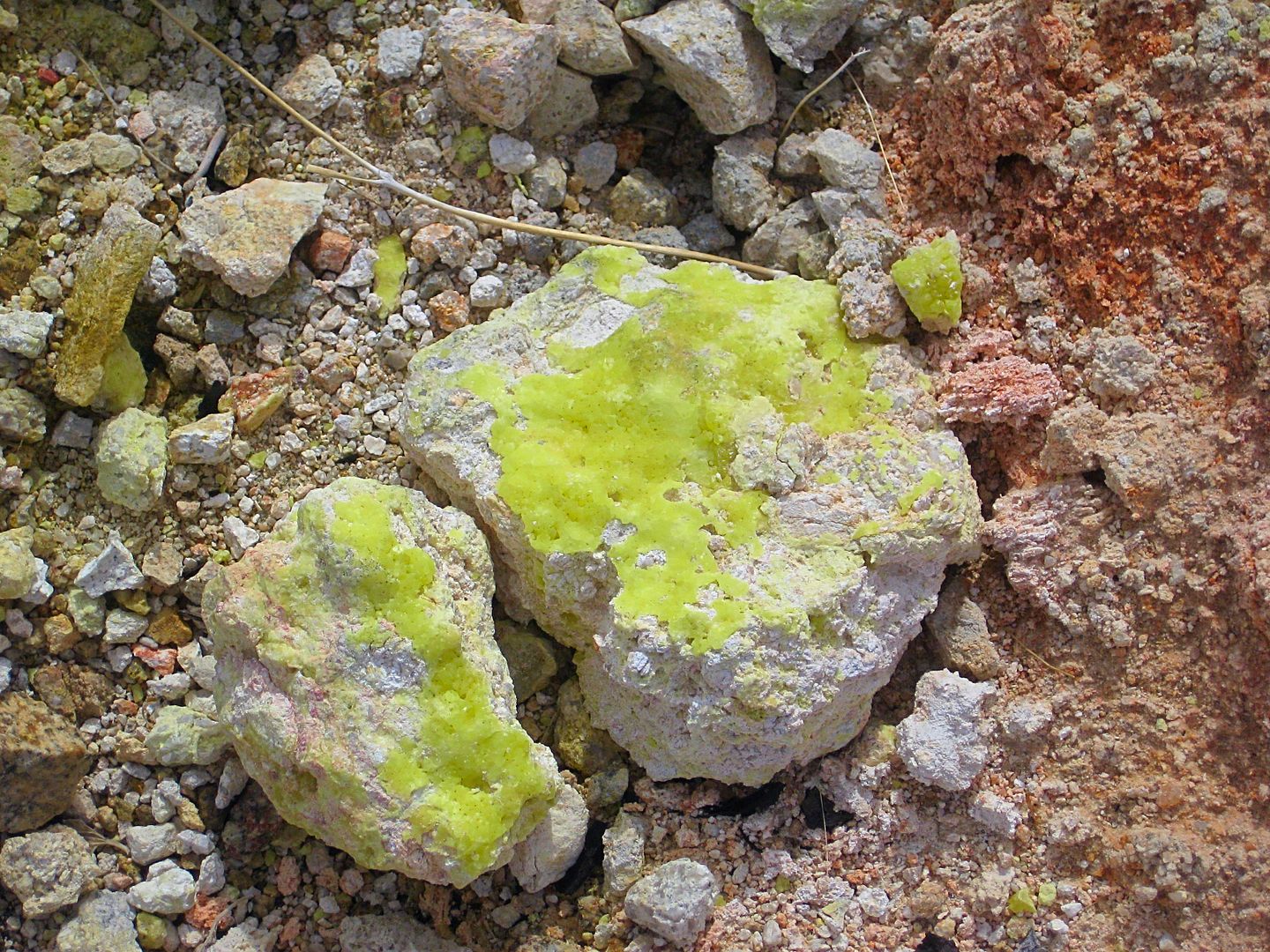
Sulfur is used to make gunpowder, matches, fertilizer, and is a rock that burns when ignited with a match and emits a deadly gas. So no campfires
here!

From the sulfur mine, take the road east towards Nuevo Mazatlán (Km. 32).
When I reach the highway near Km. 32, I bring my tires back up to 34 psi from 24 psi, which worked great at off-road traction and rock-puncture
resistance.
I was under a half tank of fuel and debated to drive the 25 miles north to San Felipe or take a chance on the Pemex being open in Puertecitos or
Gonzaga. In Baja, everything works out, so I turned south.
At Colonia Delicias market (Km. 36) I got some bags of ice a few cans of beer.
At Puertecitos (turn off the highway at the paved fork, at Km. 74.5) I got gasoline. The attendant says they are open every day to 8 pm. It was 700
pesos for 43.4 liters. I had traveled 156 miles since filling up in San Felipe, with most of that off road driving, maybe 50 miles in 4WD.
Leaving the gas station via the old road I took this photo of Puertecitos (at low tide):
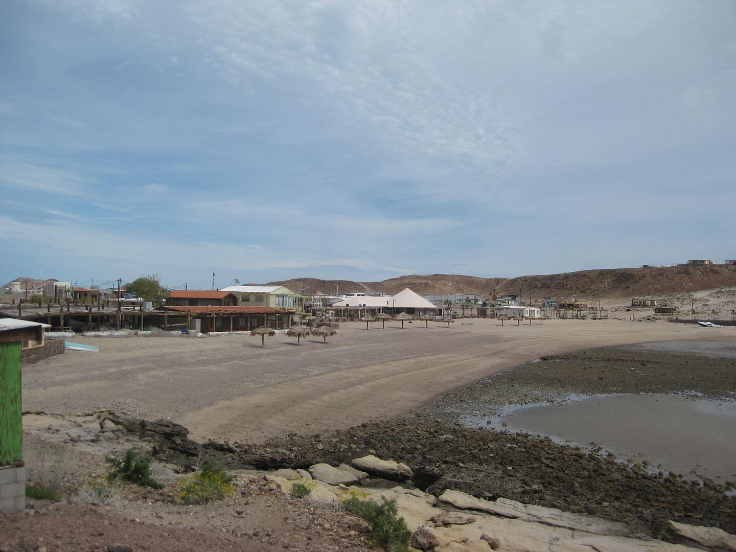
The paved road is rejoined at Km. 76.5+, at the Pez (Fish) Market.
Km. 133.5 is the road to La Poma, restaurant, camping palapas, lots for lease. Camping is $10 US and the owner will add the tarp to the frame when you
arrive. Good idea to preserve the life of the tarps.


My lunch was great... halibut! With beer + tip, 300 pesos
I was at La Poma from 11:30-12:37 Sunday. The only customer.
The owner is the brother of the owner of Punta Bufeo, which has a small motel and landing strip for pilots... 2 kilometers south. They are related to
Papa Fernandez, as well.
From here I drive south to Hwy. 1 then north to El Rosario and a bit of heaven at Baja Cactus Motel. Details in my next installment... Stay tuned!
[Edited on 3-12-2017 by David K]
|
|
|
TMW
Select Nomad
Posts: 10659
Registered: 9-1-2003
Location: Bakersfield, CA
Member Is Offline
|
|
Things just get better and better, thanks.
|
|
|
David K
Honored Nomad
Posts: 64479
Registered: 8-30-2002
Location: San Diego County
Member Is Offline
Mood: Have Baja Fever
|
|
I hope to keep showing how so many places there are in Baja that are well worth visiting.
More notes and photos still to come!
|
|
|
wessongroup
Platinum Nomad
Posts: 21152
Registered: 8-9-2009
Location: Mission Viejo
Member Is Offline
Mood: Suicide Hot line ... please hold
|
|

|
|
|
| Pages:
1
2
3
..
5 |
|


