| Pages:
1
2
3
4
5 |
Barry A.
Select Nomad

Posts: 10007
Registered: 11-30-2003
Location: Redding, Northern CA
Member Is Offline
Mood: optimistic
|
|
Very good stuff, David. I camped at the exact same spot as you in Barrendo Canyon many, many years ago before there was any fence or cable across the
wash. My first trip into Barrendo Canyon was about 1961+ - with my wife and daughter, and Edward "Bud" Bernhard, Myron Smith, as well as other's.
It is an enchanting place that I have returned too many times. You are doing good work, and the results are great!!! Many thanks.
[Edited on 3-12-2017 by Barry A.]
|
|
|
David K
Honored Nomad
Posts: 64480
Registered: 8-30-2002
Location: San Diego County
Member Is Offline
Mood: Have Baja Fever
|
|
Sunday Afternoon: Gonzaga to El Rosario
Just like last month, last year, all of 2015, and back to January 2014, the paved road driving still ends 20.5 kilometers (12.7 miles) south of the
Gonzaga Pemex and that is about 10 miles (10.2) north of Coco's Corner and another 12.9 miles to Hwy. 1 for 23 total unpaved miles.
The unpaved condition was improved over February in that the rocky 4 miles just south of Coco's had been scraped over by a grader. It was just less
than an hour from Gonzaga Bay to Highway 1 (Laguna Chapala) in my Tacoma.
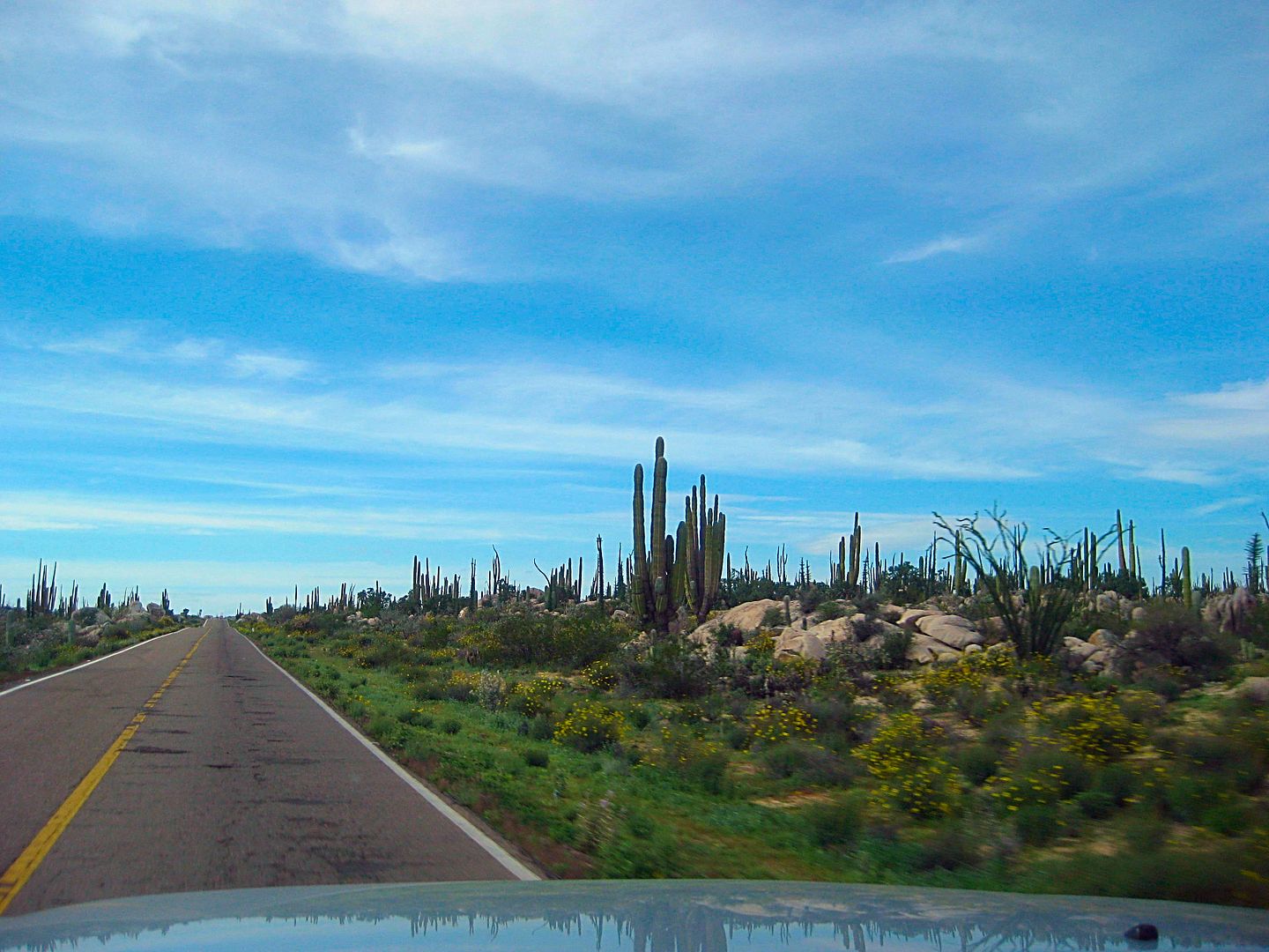
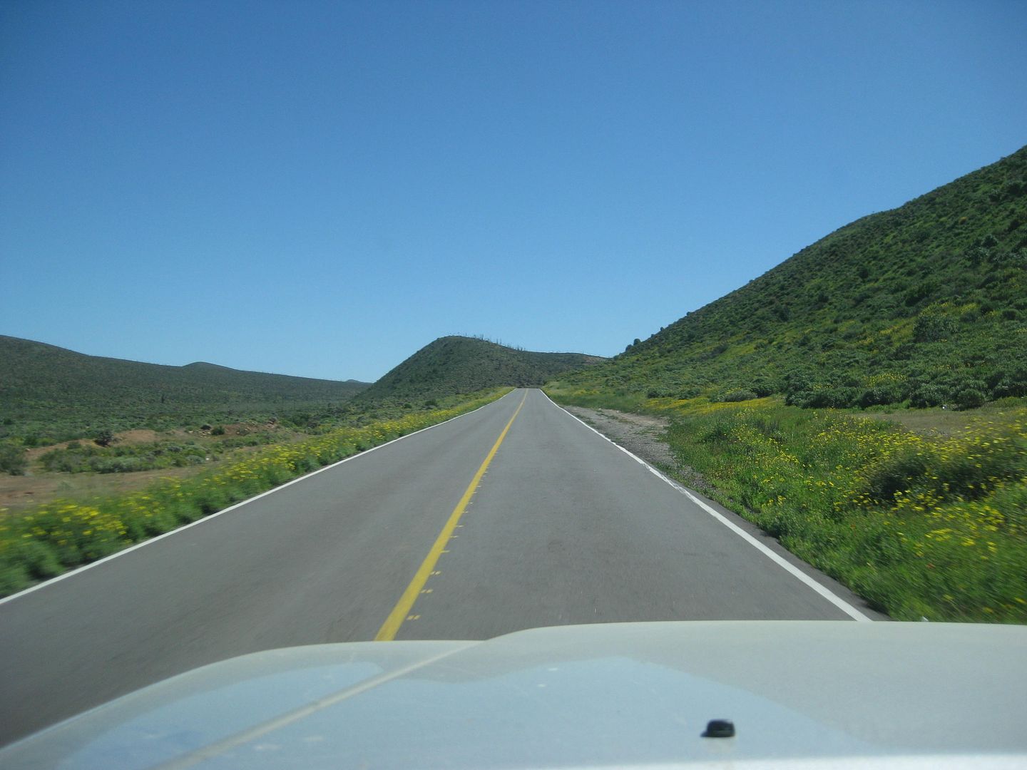
Highway 1 from Chapala to Cataviña/ Santa Ynez has a lot of potholes to dodge currently. One road crew was a couple miles south of Santa Ynez
shoveling black top into the holes. Without a roller, this will be a short-lived solution.
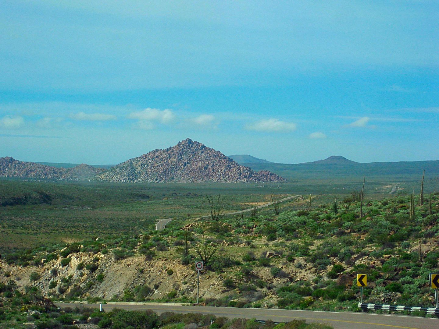
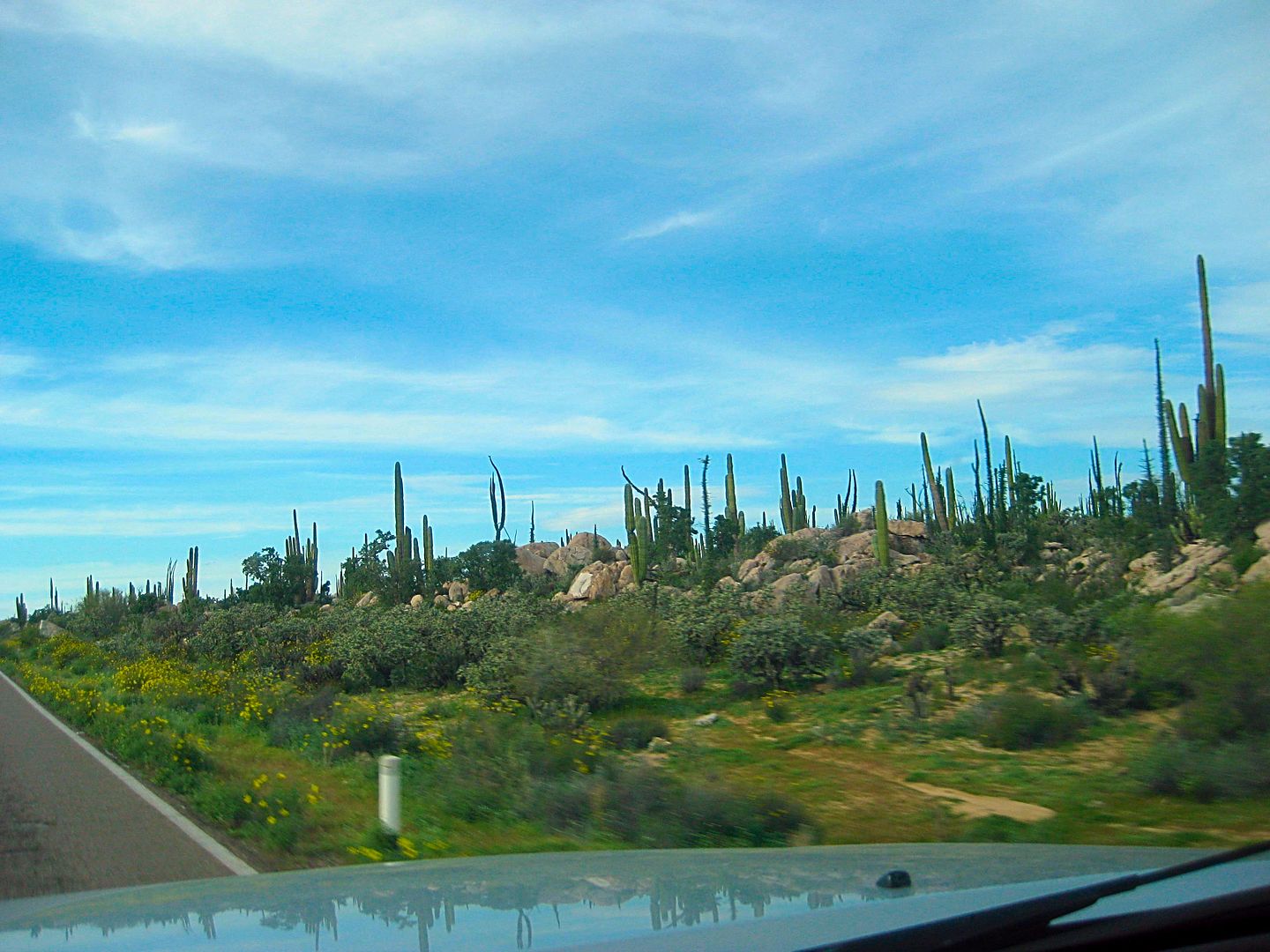
I take a photo of El Pedregoso, the boulder mountain midway between Chapala and Cataviña. It is passed at Km. 210.
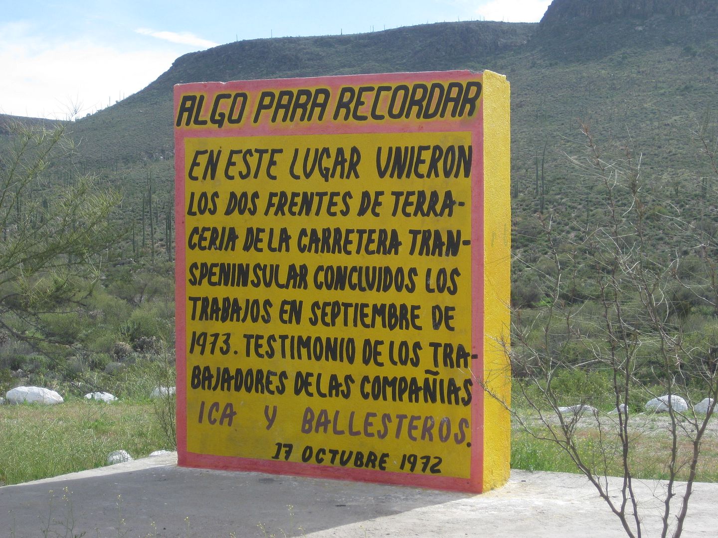
At Km. 191.5, and across the highway from the new San Ignacito restaurant, is the monument to the meeting of construction crews, in September 1973,
building the transpeninsular highway. Crews going south from San Quintin and crews coming north from San Ignacio met at this point. The official
plaque that was on this concrete monument was stolen some time ago. The memory is preserved by this sign the new restaurant owner made, he only got
the year of the plaque dedication wrong.
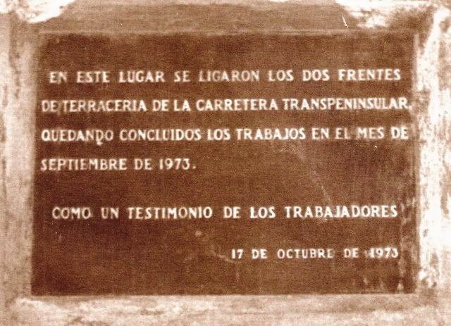
The original plaque of Oct. 17, 1973:
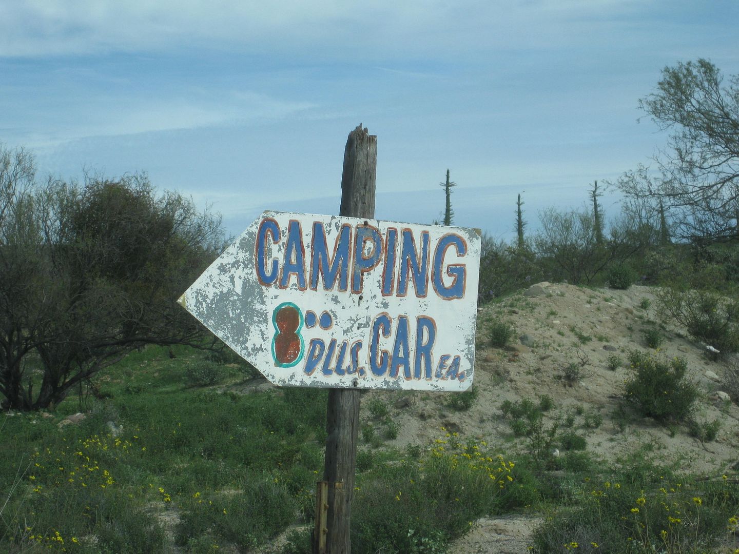
It's 32 miles from Laguna Chapala (Km. 233+) to the side road for Rancho Santa Ynez/Inez/Inés just after Km. 181. It is 0.7 mi. to the campground and
ranch/ restaurant of Santa Inez/Ynez/Inés (spelling depends on what sign you read). The road to the ranch was paved in 1973 as was the airport runway
here. The driveway is lined with white painted rocks. Wide open camping is popular here and Matilda's cooking was always a treat at the restaurant.
The pavement is mostly gone now. Santa Ynez was a major checkpoint of the first several Baja off-road races (1967-1973) and occasionally of some of
the newer ones when the course runs this way.
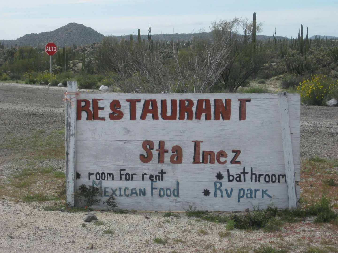
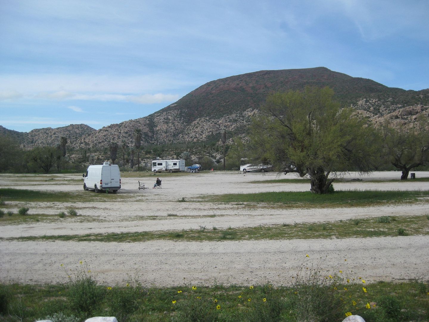
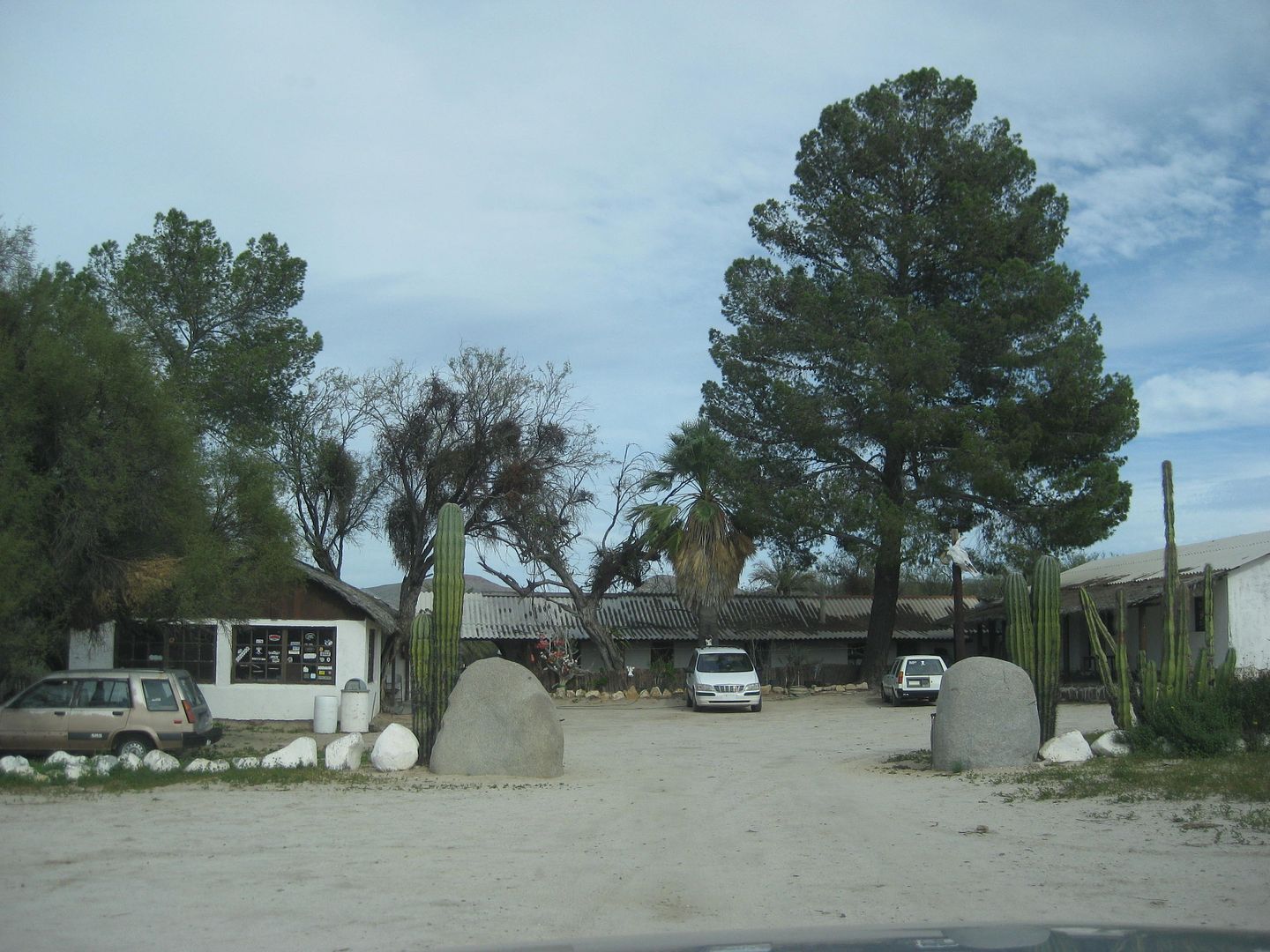
The place (Ranch, Restaurant, Bunk rooms) looked all closed up. A couple was walking from their camper towards the restaurant when I asked them if it
was ever open while they were there. They said it was always open and good... to which I had to say it was closed now.
Back out to Highway 1...
The south arroyo crossing is being worked on, and was dry this day.
Enter Cataviña, a town that didn't exist before 1974. Here, a hotel (now called the Misión Cataviña) and a 'parador' (across the highway) was built
to service the needs of highway travelers were nothing much existed before. A Pemex station, cafeteria, showers, sunken room air conditioned rest area
and an RV Park nearby were all part of the parador complex. Other than the hotel, all the rest of it has been abandoned.
At Km. 179+, a local began to bring cans of gasoline from El Rosario to sell here, and that continues to this day. The cost currently is US$5 per
gallon. That $1.75 additional price over Pemex's price covers the businessman's time and effort to make a 150-mile round-trip to bring gasoline to
this spot.
At Km. 179 is the Cabañas Linda motel. Reviews in years past have not been kind.
Leave Cataviña, northbound.
The north Arroyo crossing near Km. 176.5 (also being rebuilt due to past flooding).
Km. 176 is the parking area for the painted cave site (which is on top of a boulder hill, requiring a bit of a climb.
More to come!...
[Edited on 3-14-2019 by David K]
|
|
|
bkbend
Senior Nomad
Posts: 693
Registered: 11-27-2003
Location: central OR or central baja
Member Is Offline
|
|
Thanks for all the updates. I wandered around that sulfur mine many years ago with my kids and soon after I returned home I had to fly on business.
I happened to wear the same shoes to the airport that I wore at the mine and at security they sent my shoes through a second scanner picking up some
sulfur residue. I had some explaining to do but it was a small town airport and I knew one of the security guards and one of the TSA workers so I was
able to get my shoes back without too much delay.
|
|
|
David K
Honored Nomad
Posts: 64480
Registered: 8-30-2002
Location: San Diego County
Member Is Offline
Mood: Have Baja Fever
|
|
Quote: Originally posted by bkbend  | | Thanks for all the updates. I wandered around that sulfur mine many years ago with my kids and soon after I returned home I had to fly on business.
I happened to wear the same shoes to the airport that I wore at the mine and at security they sent my shoes through a second scanner picking up some
sulfur residue. I had some explaining to do but it was a small town airport and I knew one of the security guards and one of the TSA workers so I was
able to get my shoes back without too much delay. |
That's a GREAT story!
|
|
|
David K
Honored Nomad
Posts: 64480
Registered: 8-30-2002
Location: San Diego County
Member Is Offline
Mood: Have Baja Fever
|
|
Here are some of my road notes I scratched down driving north from Cataviña.
Km. 168 Faro San José road (signed to Rancho El Marmolito 38 km.).
Km. 166.5 New La Virgen shrine
Km. 160.5+ New Agua Dulce access
Km. 158 Water truck access road from 1973 highway construction to Agua Dulce.
Km. 149+ Rancho Sonora, onyx gifts
Km. 149 El Marmól road (15 km.)
Km. 145 San Agustín (abandoned Pemex station, military checkpoint [not today], abandoned highway maintenance facility, RV park).
Km. 121+ El Progreso, an abandoned café at the road to Mission San Fernando (2.5 mi.)
I arrive in El Rosario, about 4:30, I think. I check in at Baja Cactus Motel (next to the Pemex station, Km. 57+). Antonio (the owner of the motel and
Pemex station, and founder of the emergency rescue service in El Rosario) has not arrived from Tijuana as of yet. The newer deluxe rooms are taken,
but the recently remodeled economy rooms are available. The beds are comfortable and all is good.
My super halibut fish meal at La Poma, a few hours ago, is still fresh in my mind and I can skip dinner this night... a few crackers and beer is
enough. Antonio's cable TV has English channels.
Sunday is in the books! Tomorrow, I will explore around El Rosario, make notes of the restaurants, motels, stores, etc. I will also go to the beach
and look for petrified wood in the hills where a dinosaur skeleton was discovered and transplanted to the San Diego Natural History Museum, back in
the 60's.
Stay tuned for lot's more on Monday, Tuesday, and Wednesday!
[Edited on 3-13-2017 by David K]
|
|
|
David K
Honored Nomad
Posts: 64480
Registered: 8-30-2002
Location: San Diego County
Member Is Offline
Mood: Have Baja Fever
|
|
DAY 5: March 6, 2017 Monday EL ROSARIO, a settlement older than the United States!
First off, I top my gas tank, which is just below half full. The price for Magna at Baja Cactus Pemex is 16.09 pesos/liter ($3.24/gallon @ 18.80
pesos: dollar).
My fuel mileage from Puertecitos (192 miles) is 17 mpg.
This morning, I record motels, markets and restaurants along Hwy. 1 going through El Rosario. There are more, actually, there are so many. Not all are
open in the morning. Going southbound through El Rosario:
Km. 56.5+ Wence Market
Km. 57 Car Wash El Popeye
Km. 57+ PEMEX
Km. 57+ Baja Cactus Motel
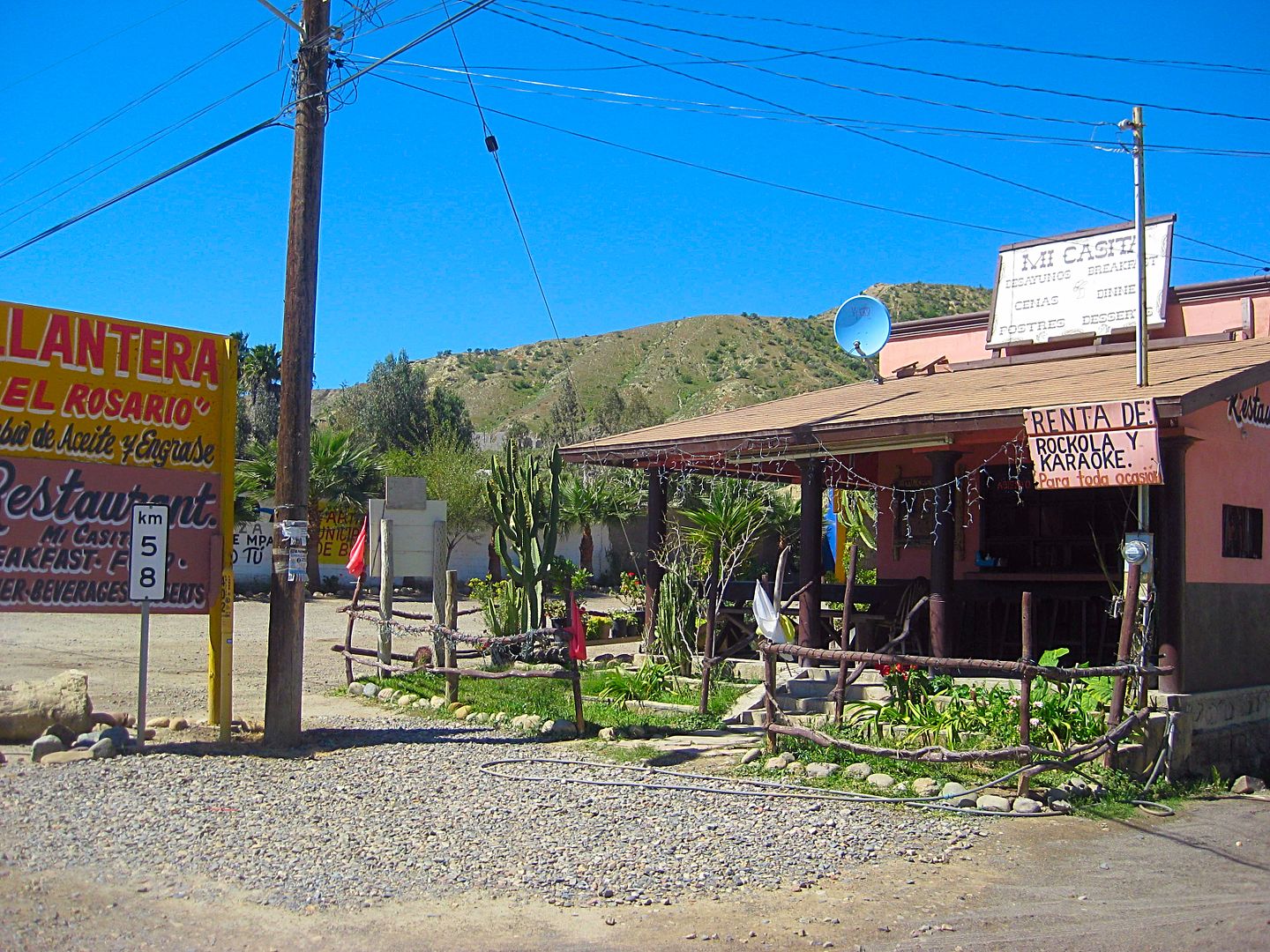
Km. 57+ Las Cabañas Motel
Km. 57+ Mama Espinoza's Restaurant
Km. 57.5 Highway turns left. To the right is the road to El Rosario de Abajo (1802 mission location) and on to the coast.
Km. 57.5+ Oxxo Market, El Grullense Restaurant/Pizza
Km. 58 Mi Casita Restaurant, Town Plaza, Police Station
Km. 58.5 Mi Pueblito Restaurant
Km. 58.5 Concrete street left to Mission El Rosario, 1774.
Km. 58.5 Taqueria El Rosario (Tacos)
Km. 58.5+ Restaurant Sinahi, Motel Sinahi, RV Park Sinahi
Km. 59 Loncheria El Faro
Km. 59.5 Restaurant La Pasadita
Km. 60.5 Baja's Best Bed & Breakfast/ Restaurant
Km. 60.5 Turista Motel, Valentino's Restaurant
I have breakfast at Baja's Best, owned by Ed Lusk. He has the best quality chorizo for breakfast burritos.
PHOTOS:
The first Dominican Baja California Mission, founded on July 24, 1774:

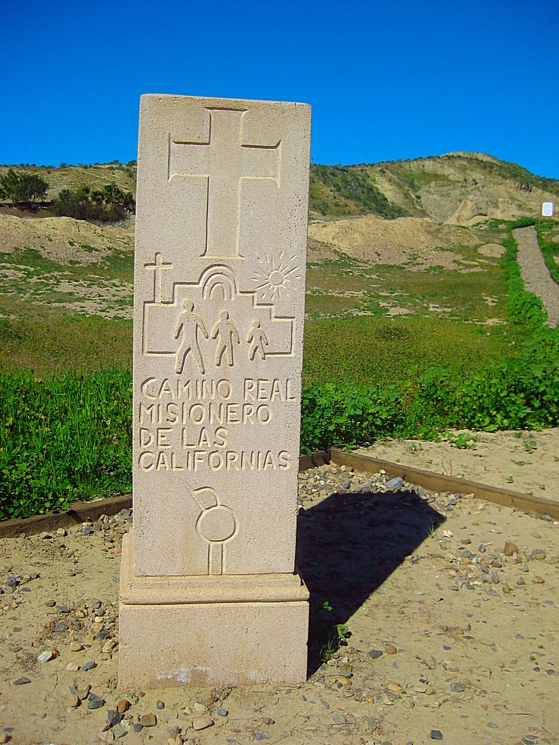
El Camino Real, the first "highway" through California (Baja and Alta).

The Rosario mission was a large complex of buildings. The site is made into a park with walkways, signs (in Spanish) explaining each area, and a view
of the large valley. In 1802, the spring located in the gully here suddenly dried up and forced the padres to relocate the mission about 2 miles to
the west, and closer to the river.
Just west (northbound) of the mission street, is Km. 58 at this restaurant and a tire repair next door.
More to come...
[Edited on 3-14-2019 by David K]
|
|
|
David K
Honored Nomad
Posts: 64480
Registered: 8-30-2002
Location: San Diego County
Member Is Offline
Mood: Have Baja Fever
|
|
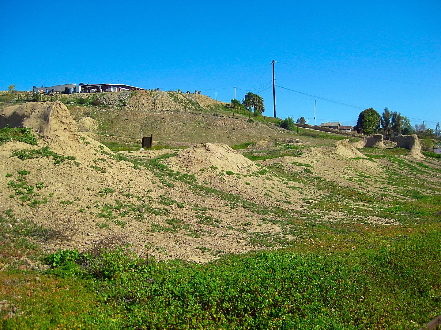
El Rosario de Abajo, La Bocana Beach, Petrified Forest
Next, I am off to investigate is the old town of El Rosario de Abajo (Lower El Rosario). This is where the mission moved in 1802 and the post-mission
town was primarily located. With the coming of automobiles, a second Rosario developed along the route that in 1973 would become a paved highway. The
newer town was called El Rosario de Arriba (Upper El Rosario) to distinguish it from the older town, across the river and 2 miles west.
Set odometer to 0.0 at the sharp curve in Hwy. 1, across from Mama Espinoza' Restaurant and drive west.
In a couple hundred feet the street to the left was the main road to Abajo, but traffic has mainly gone to a new crossing ahead.
0.4 End of paved (concrete) road surface.
0.8 Fork. Right to Las Palapas recreation area, 0.6 mi. The road beyond once went to Diamante Del Mar project. Road now badly damaged by rains. Go
left.
1.2 Junction in the middle of the river valley. Left is route back to Hwy. 1. Ahead to continue on.
1.9 ADB Market, center of town of El Rosario de Abajo.
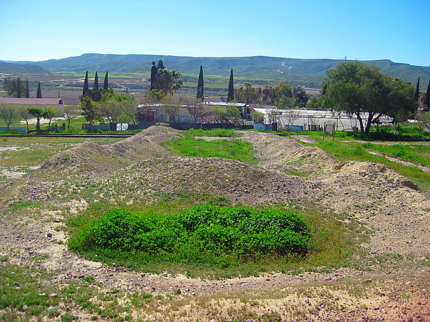
2.0 Mission Ruins, on the right. Park setting, signs. Mission moved to this spot in 1802.
2.9 Fork. Left goes south to Agua Blanca, San Antonio, San Carlos. Go right.
3.3 Junction. Left goes to Punta Baja (7 miles). Go straight ahead.
5.3 Parking for beach of La Bocana.
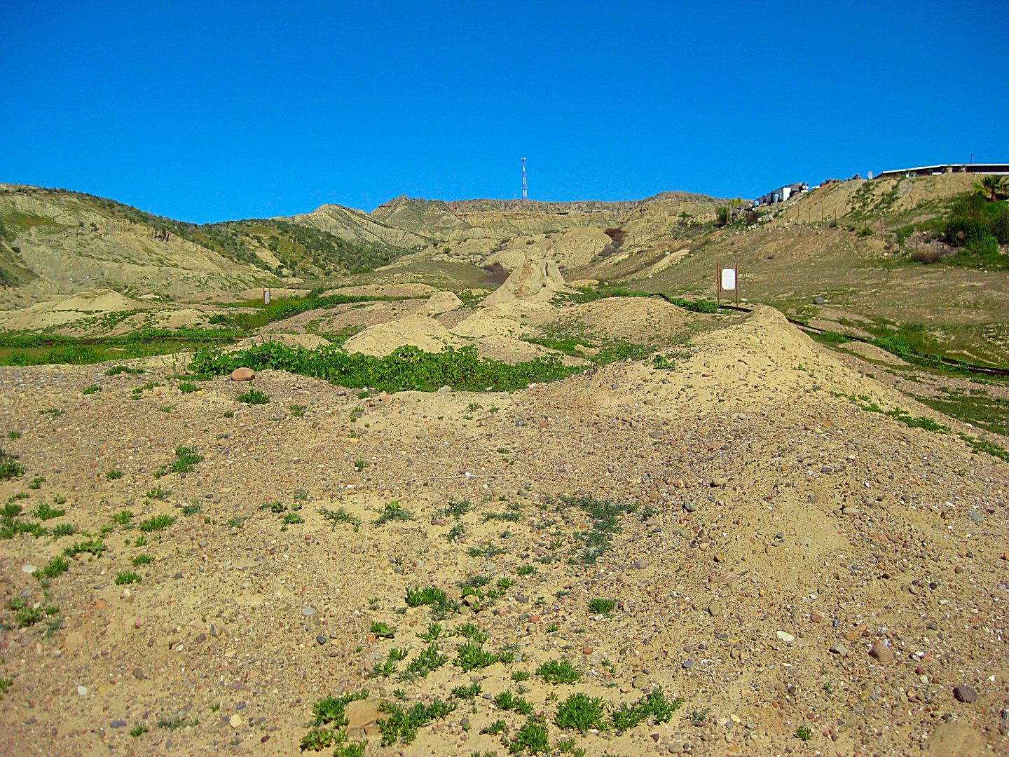
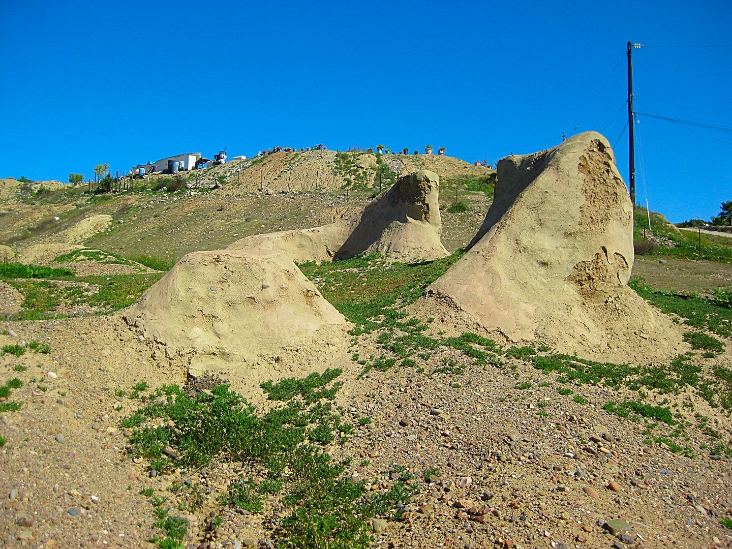
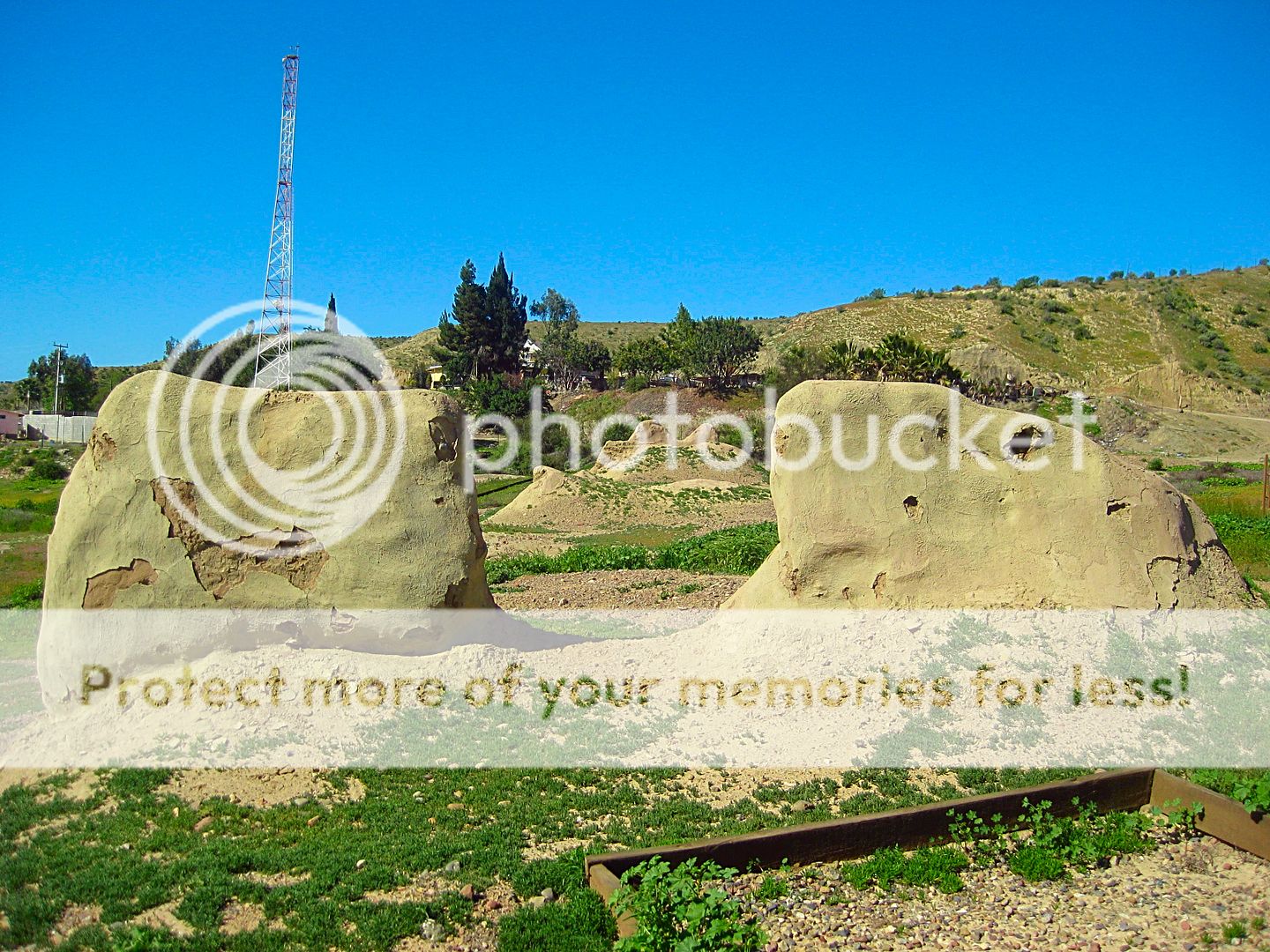
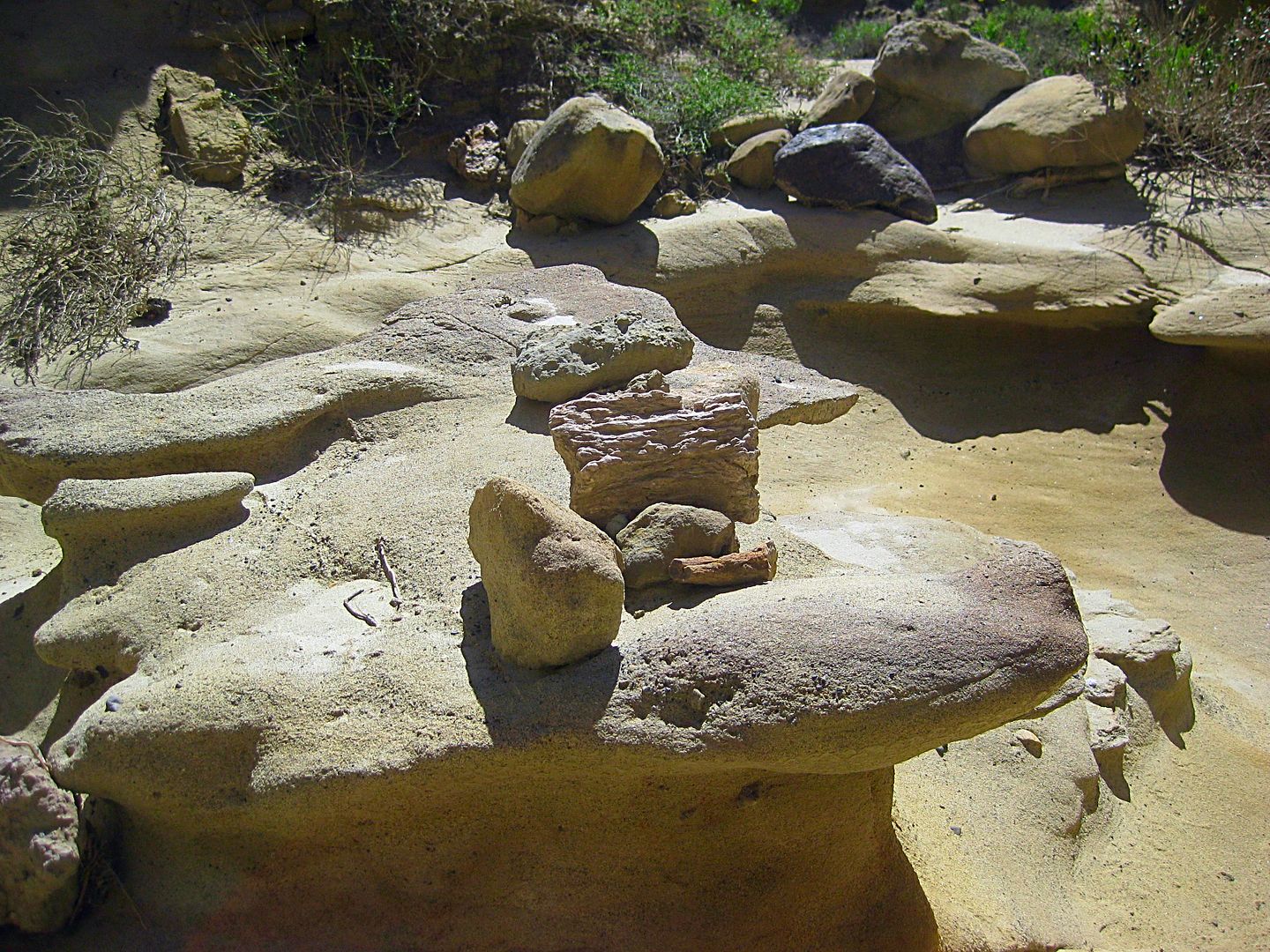
A drive north then turning into the hills goes 2.3 miles to the edge of a small canyon. A hike into the canyon will take you through a prehistoric
forest (using your imagination). Petrified wood is scattered about. Look but do not remove.
I drive back into town on the former Diamante Del Mar high road, but it is not maintained and large gullies in the road make travel a challenge. 4WD
and large tires only. La Palapas is passed returning to town.
Photos:

El Rosario de Abajo ruins as seen from the road.

La Bocana Beach
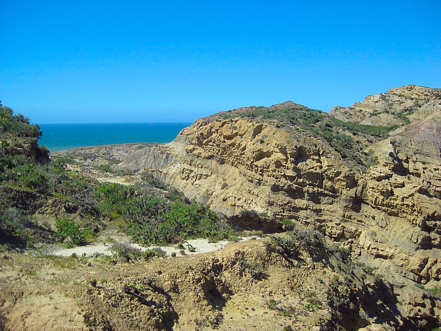
Just over 2 miles north from the beach are the canyons that cut through a former forest, whose trees have turned to stone.
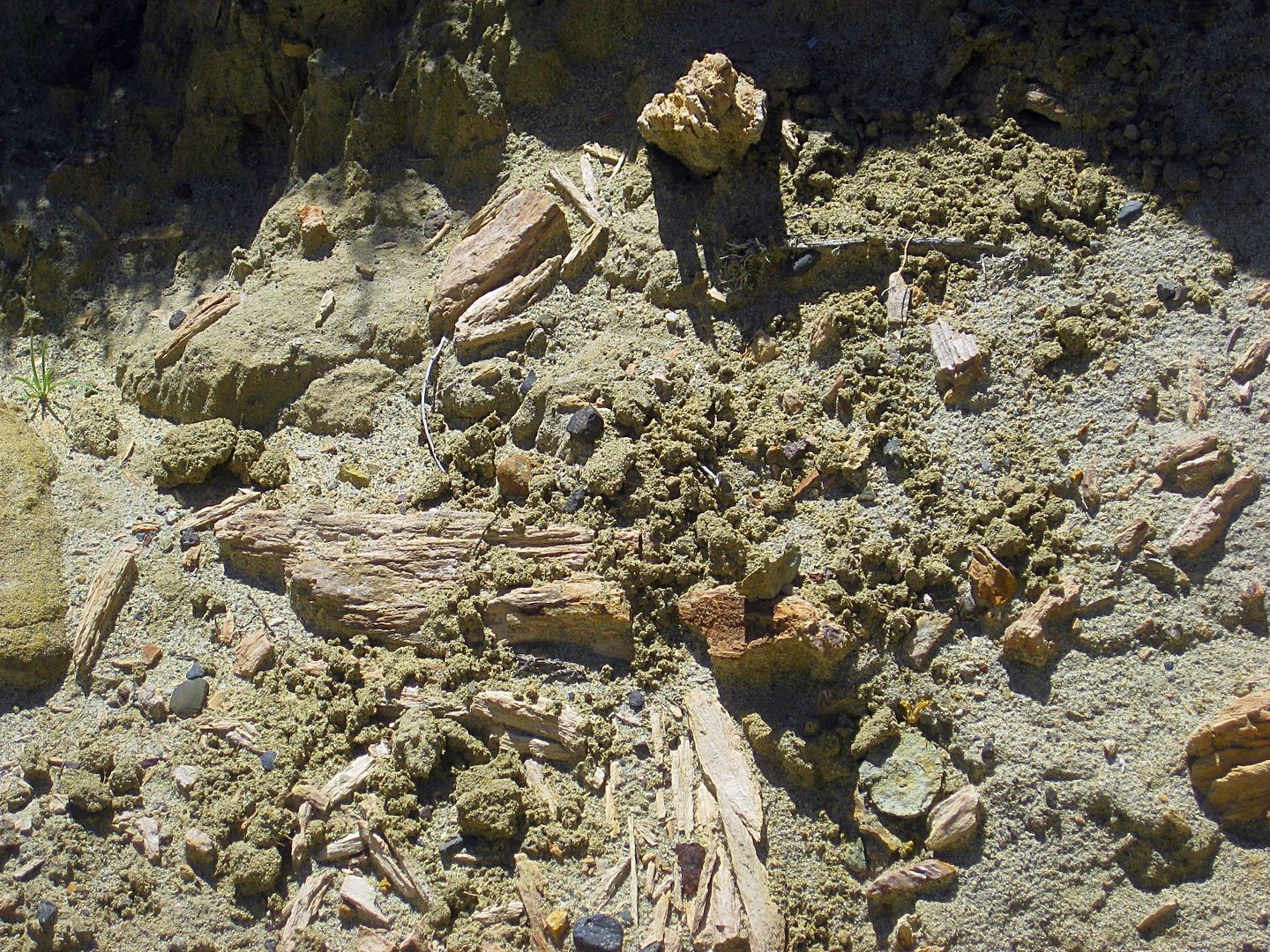
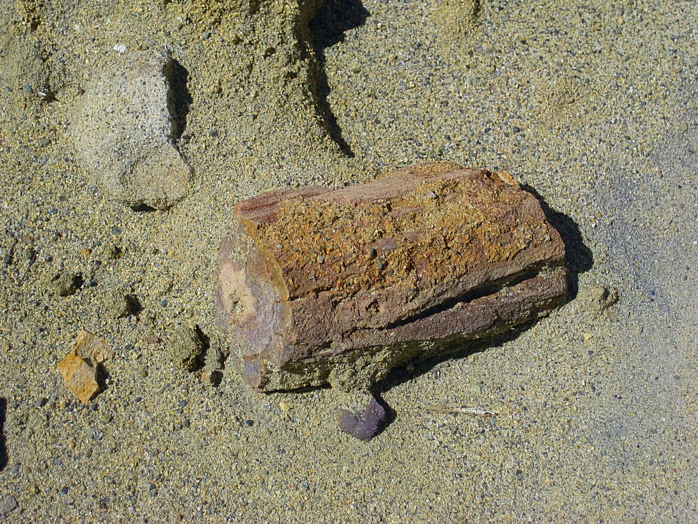
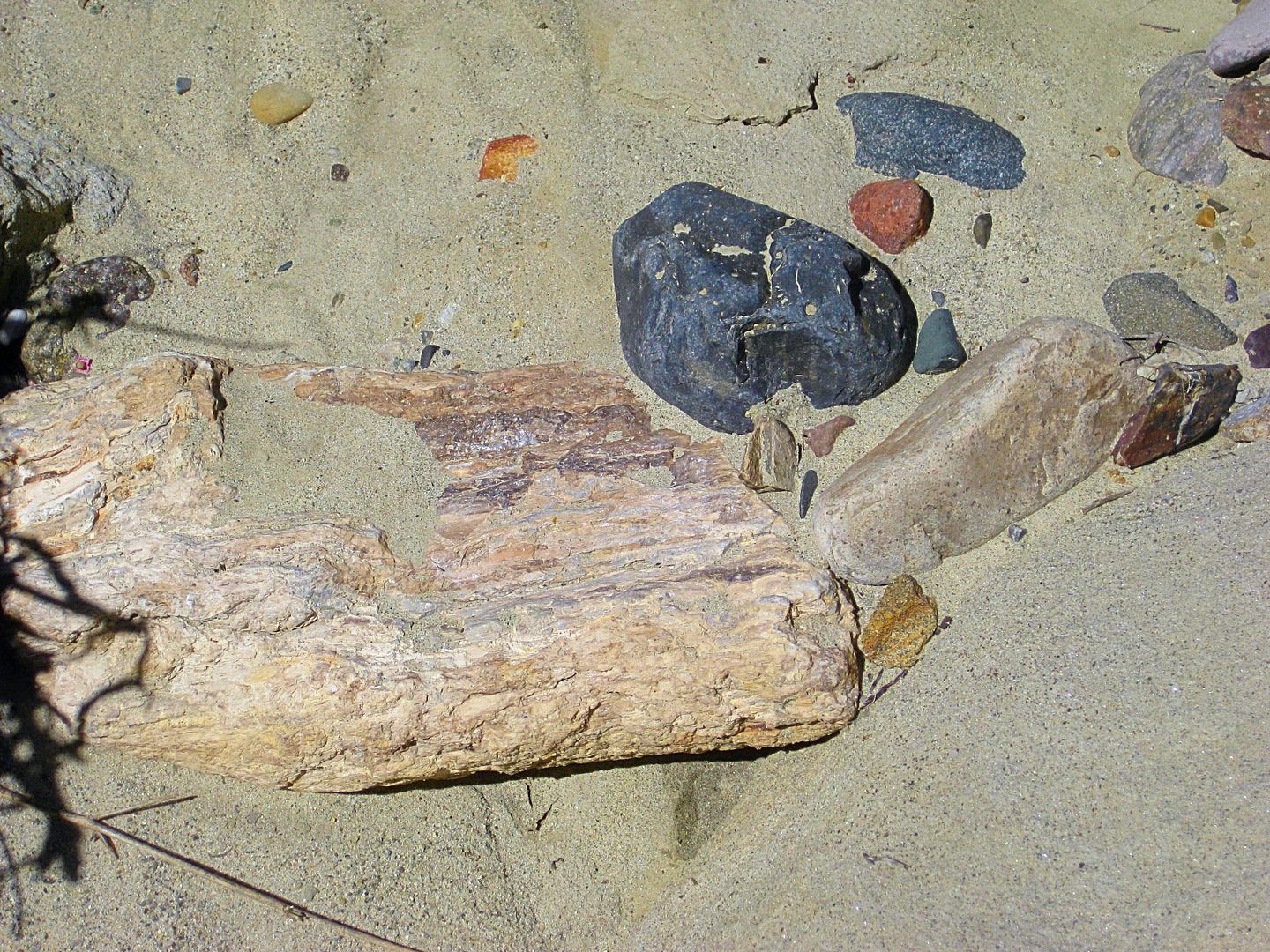

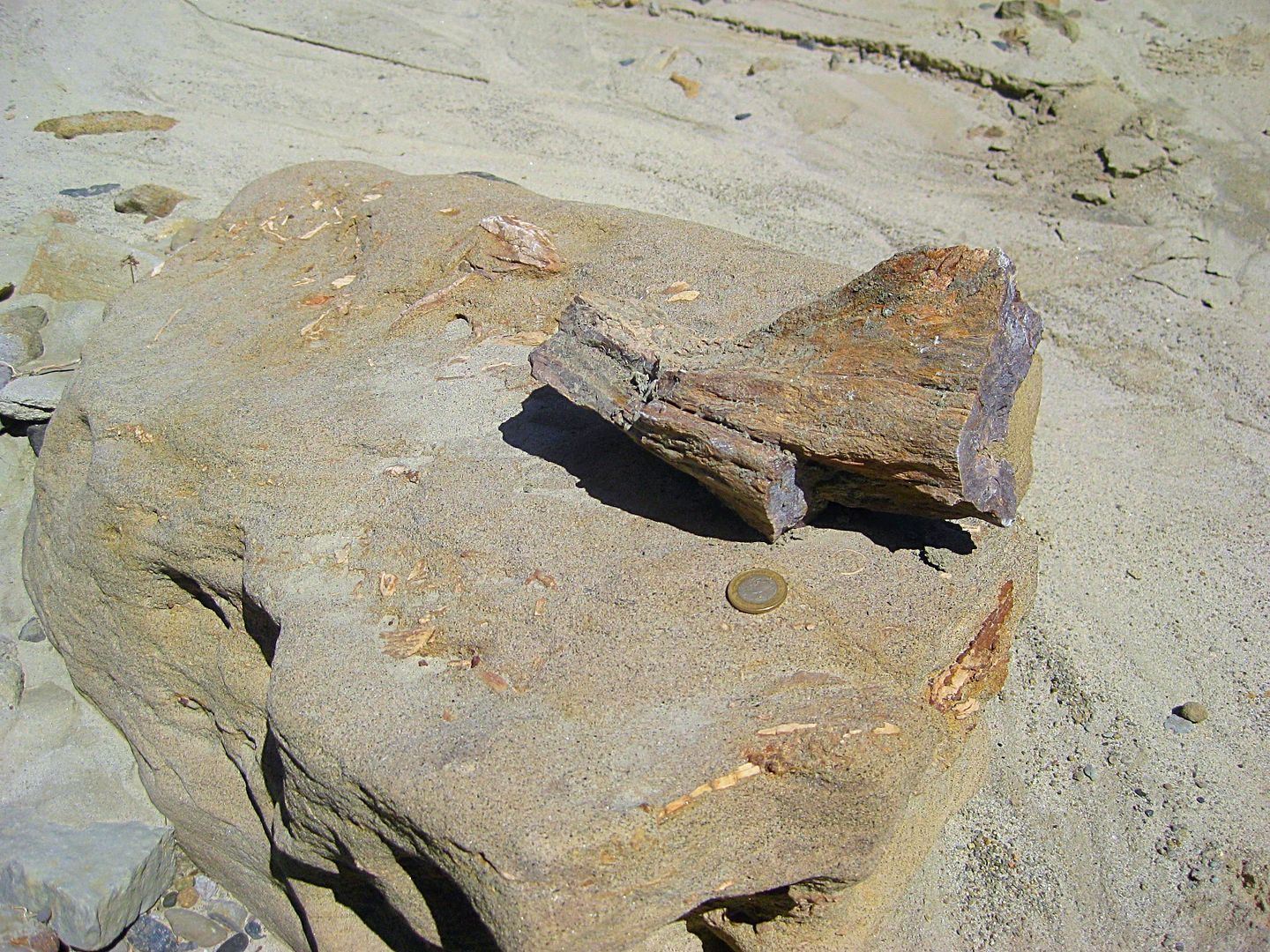
A Mexican coin added for scale.
Returning back to Baja Cactus Motel, I find Antonio. He is a busy man having been part of an emergency rescue after midnight (an off-road motorcycle
tour member hurt), as well as his two businesses in town.
We get together for dinner that evening at La Pasadita with Isela and daughter Itzel, who is doing fine and growing fast since her heart surgery of
2010: http://forums.bajanomad.com/viewthread.php?tid=48946
After dinner, we stopped at the Hot Dog stand (very busy place) between the La Pasadita and Sinahi restaurants. There Isela asked for several cups to
go, of a hot Mexican dessert drink, that is similar in concept to hot chocolate, thick and hot. It is called Champurrado and was quite good. https://en.wikipedia.org/wiki/Champurrado
Monday is now in the bucket! Two more days in Baja...
|
|
|
StuckSucks
Super Nomad
Posts: 2306
Registered: 10-17-2013
Member Is Offline
|
|
Excellent photos as always. After following the tracker, it's fun to see Terra-based photos to connect the dots.
|
|
|
David K
Honored Nomad
Posts: 64480
Registered: 8-30-2002
Location: San Diego County
Member Is Offline
Mood: Have Baja Fever
|
|
10-4!
I am glad to have my Nomad friends out there following me and chatting as I am by the campfire or in my tent... via satellite!
I will work on Day 6 and 7 to wrap up the trip report... Day 6, I go to a hidden camping establishment in a cardón forest and to see what remains at
San Juan de Dios.
|
|
|
David K
Honored Nomad
Posts: 64480
Registered: 8-30-2002
Location: San Diego County
Member Is Offline
Mood: Have Baja Fever
|
|
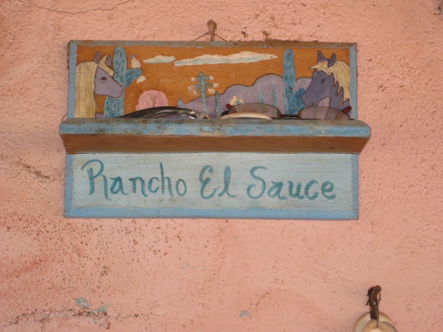
DAY 6: Tuesday Mar. 7, 2017 RANCHO EL SAUCE
To have some interesting side trips for the new map-guide, I asked Antonio about a place I had heard Doug and family talk about and show photos of
back in November 2006: http://forums.bajanomad.com/viewthread.php?tid=21098
I had wondered about this 'recreation' place, and with some rough directions and only the name of the owner to use as a name (Señor Alcides and
daughter Clarissa), off I went...
Km. 82+ (15.5 miles southbound from El Rosario Pemex) turn right on unmarked road. Just a mile from the highway, I stopped to well, stretch my legs,
and I saw dust and a truck racing towards me. I just waited until it arrived. It was a cammo painted army pickup with four machine gun toting soldiers
in back. It pulled up along side and infront partially to block me from making a run for it! Once they were satisfied I wasn't waiting for a drug
plane to land, they turned around and headed back to the highway.
1.7 mi from highway you merge with a parallel route and soon go downhill from the side of Mesa la Sepultrura and into Arroyo El Sauce where you curve
left, upstream. This is the route of El Camino Real between Mission San Fernando and El Rosario.
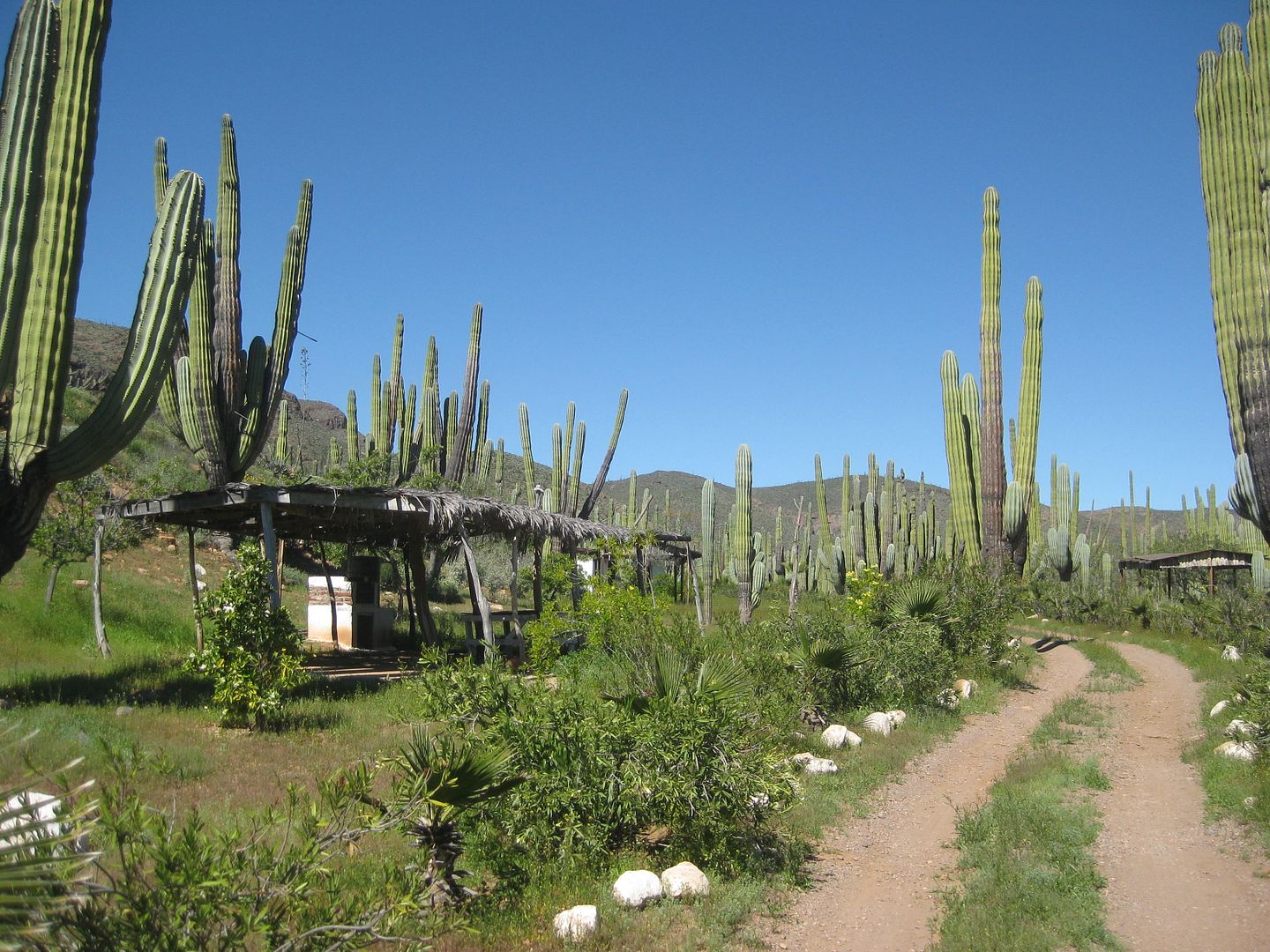
5.7 mi from Hwy. 1 arrive at the palapas and a pool is to the left (empty).
6.3 mi from Hwy. 1 arrive at Rancho El Sauce. Cabins rent for 300 pesos (bring bedding) and palapas are free off season. Perhaps 100-200 pesos during
busy times?
Two caretakers gladly show me the rooms, the other pools and were happy to have me tell my American amigos to come here to camp.
This is truly one of those Baja suprises...
The desert is green and flowers were blooming along Hwy. 1.
A interesting boojum tree along the road to El Sauce. See Doug's photo of it, over 10 years ago.
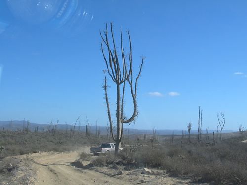
In 2006, we can see how 10 years has changed other boojums, as well.
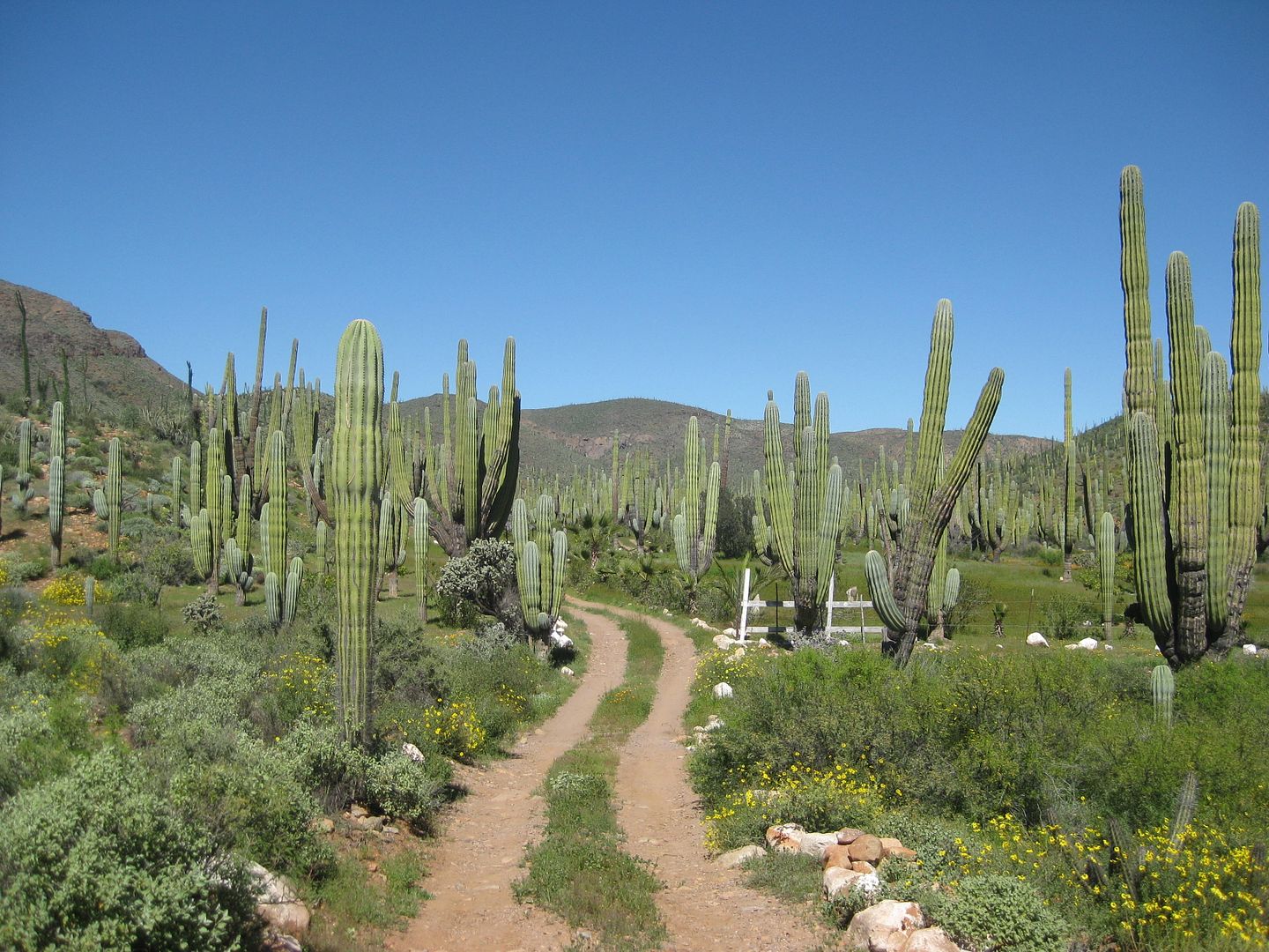
Entering Rancho El Sauce
Camping palapas
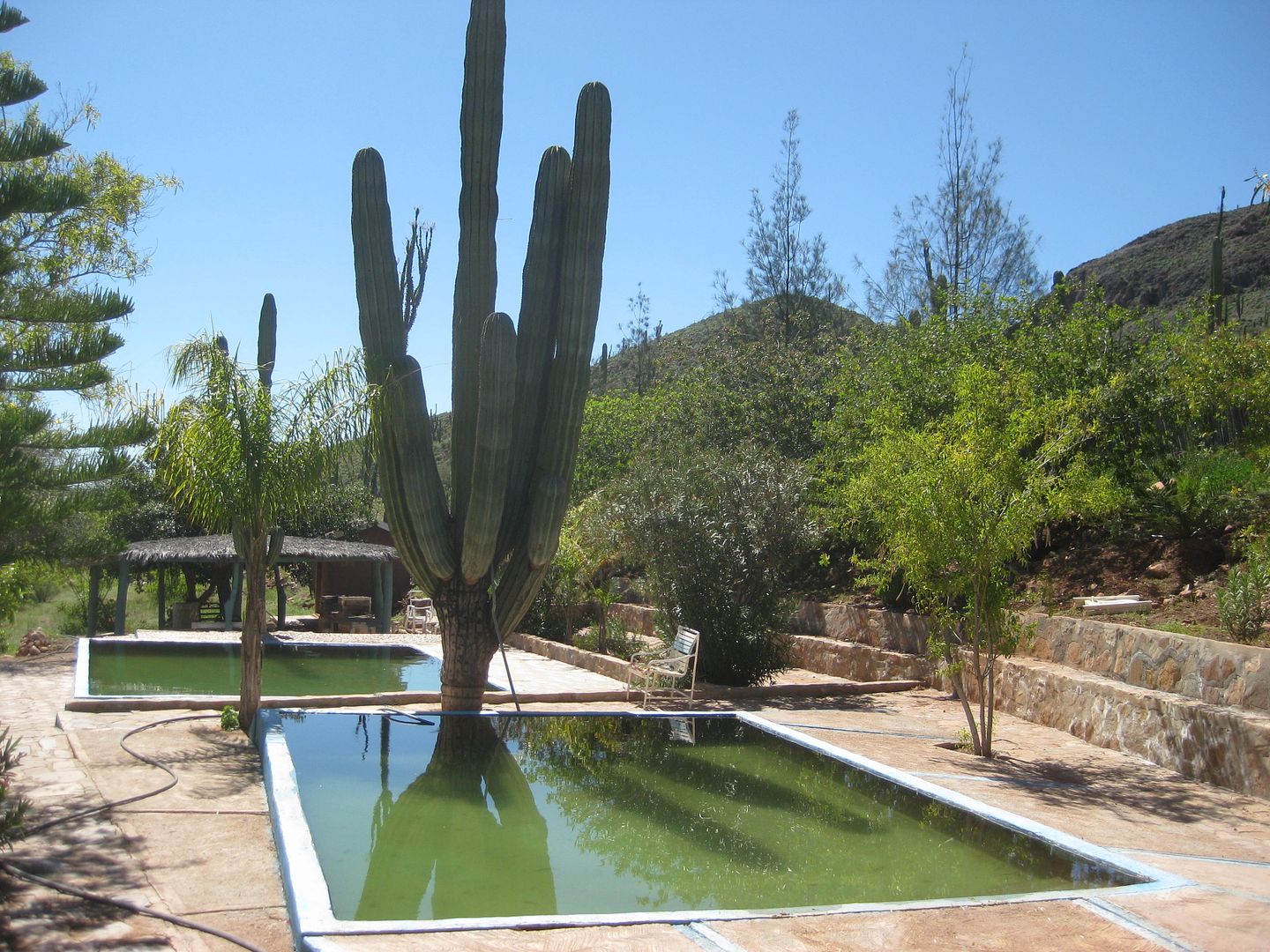
The spring provides excellent water, I am told.
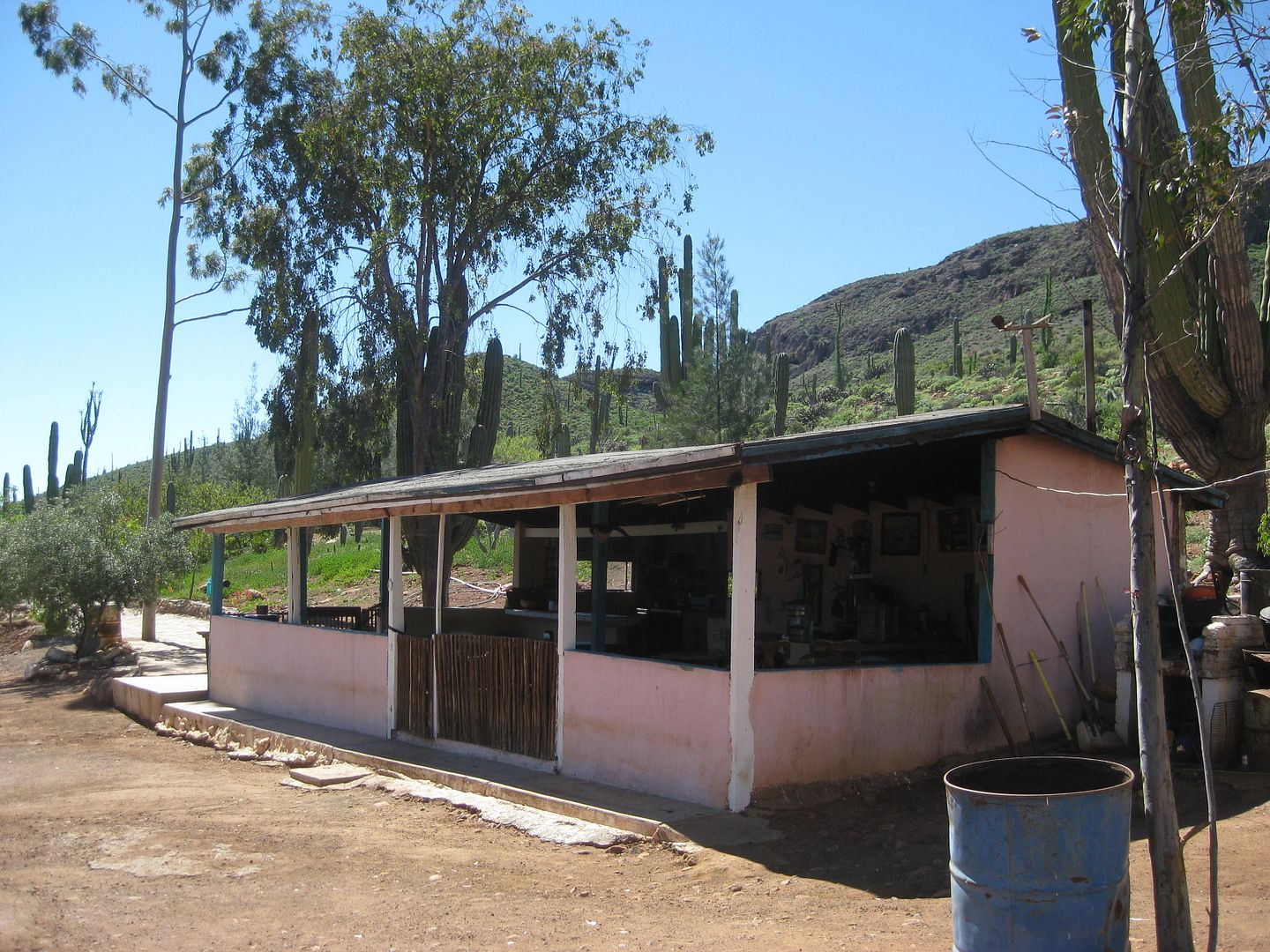
The kitchen.
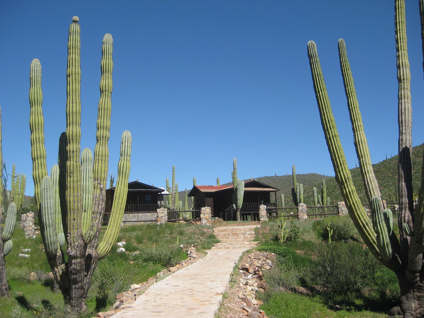
Path to the cabins
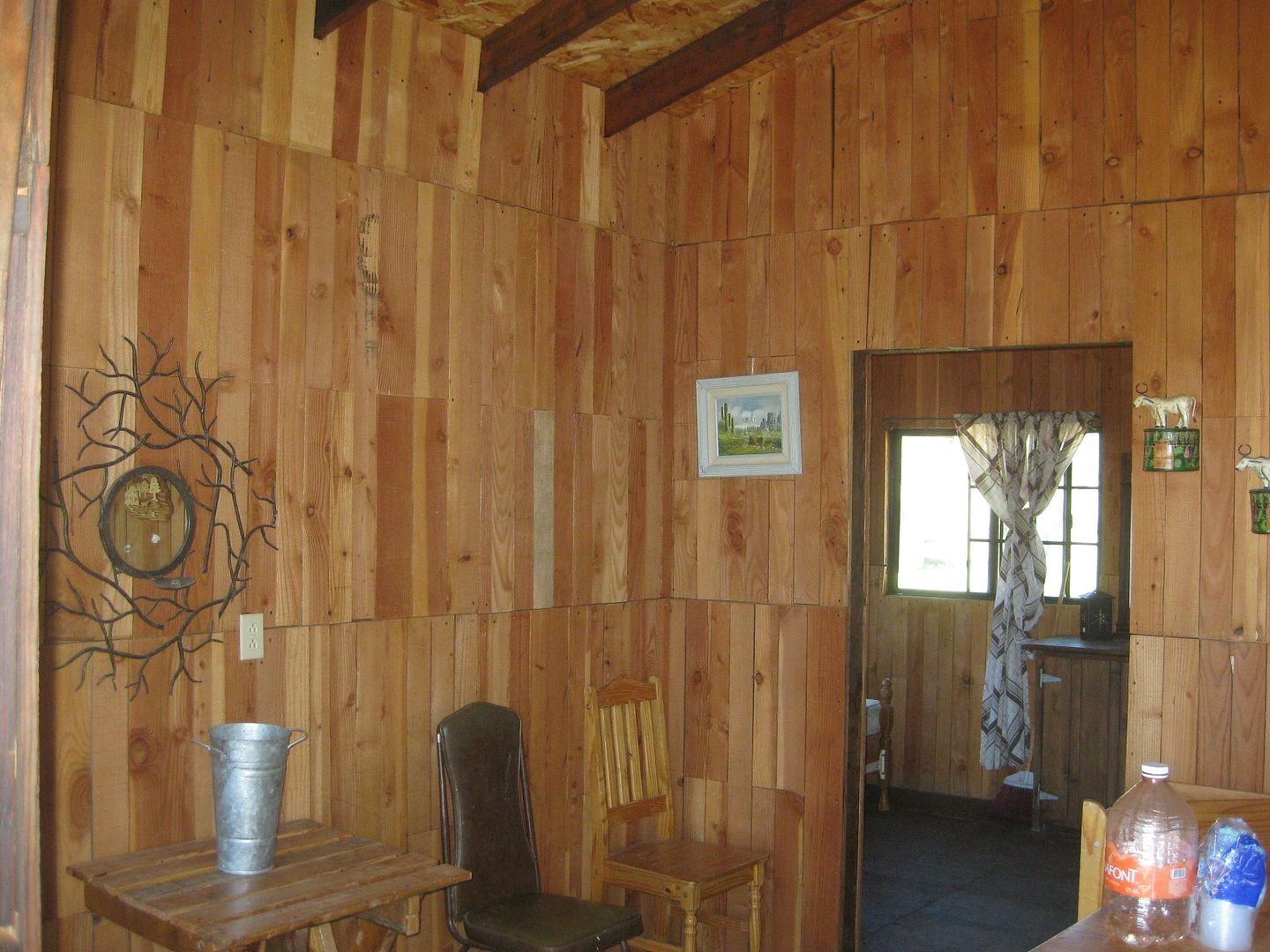
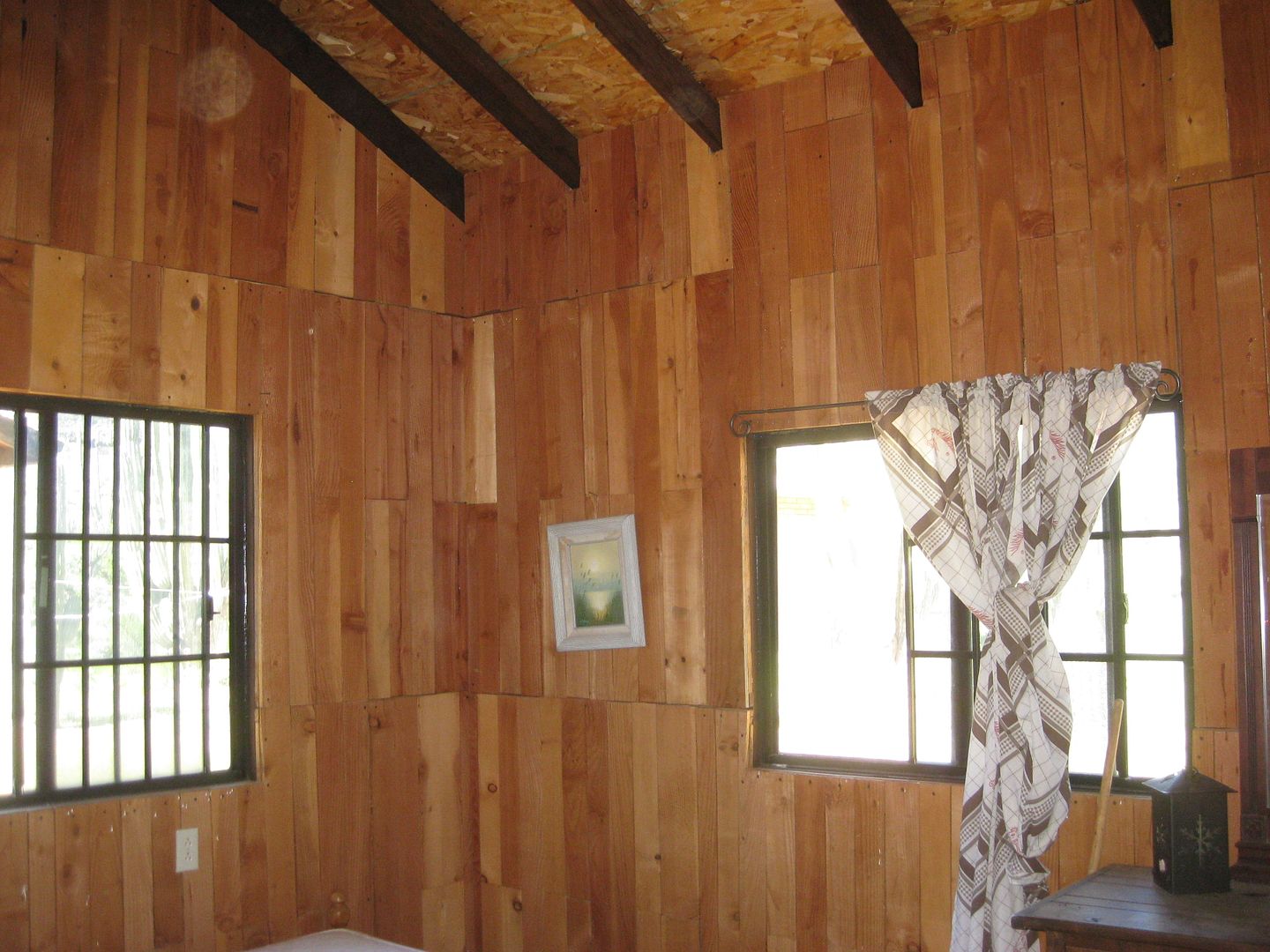
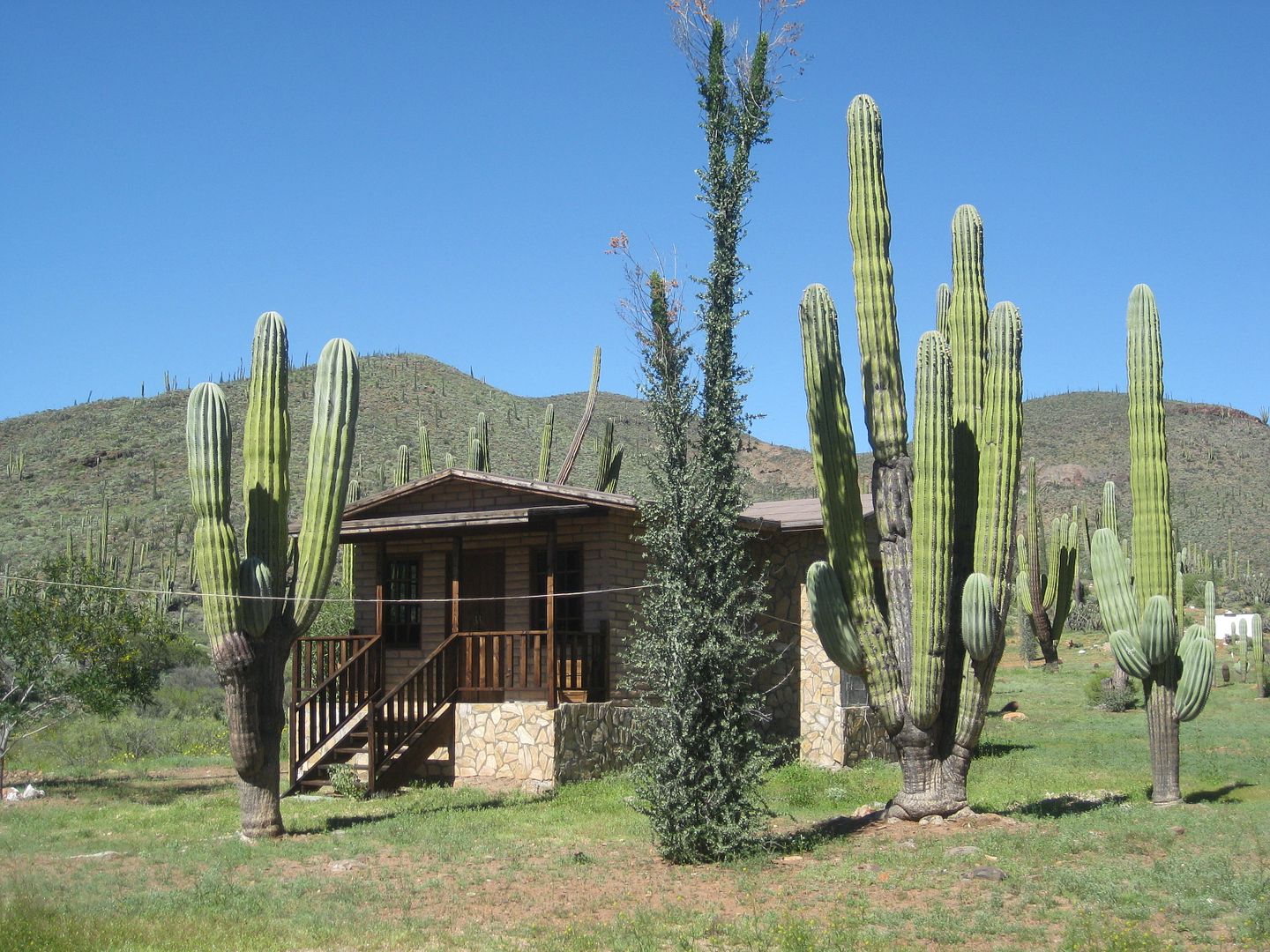
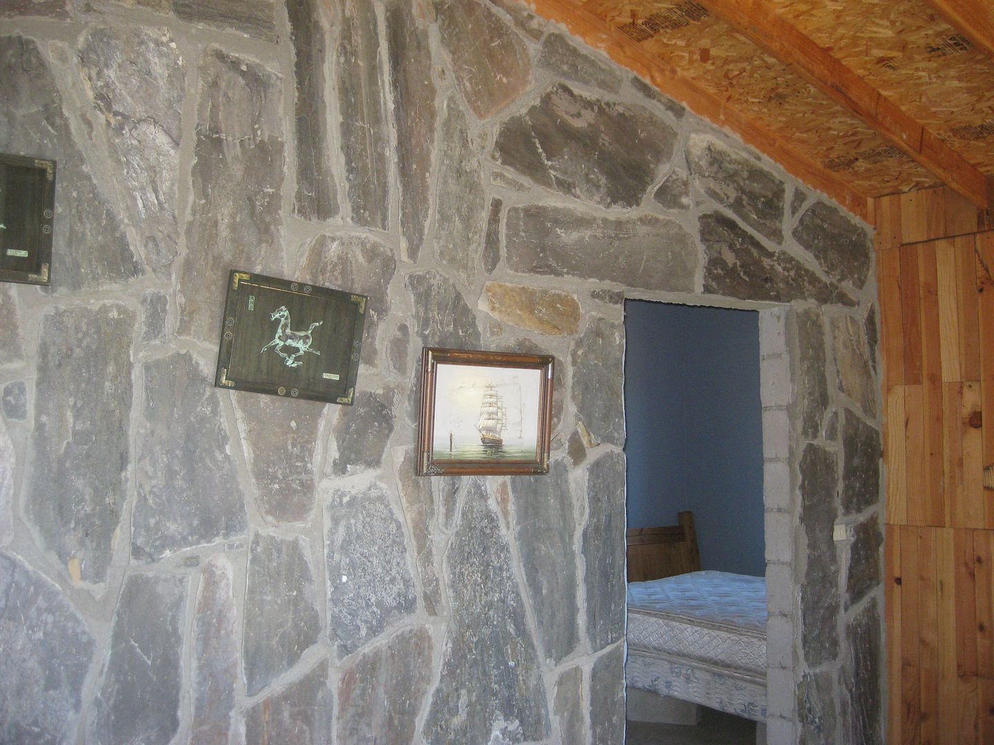
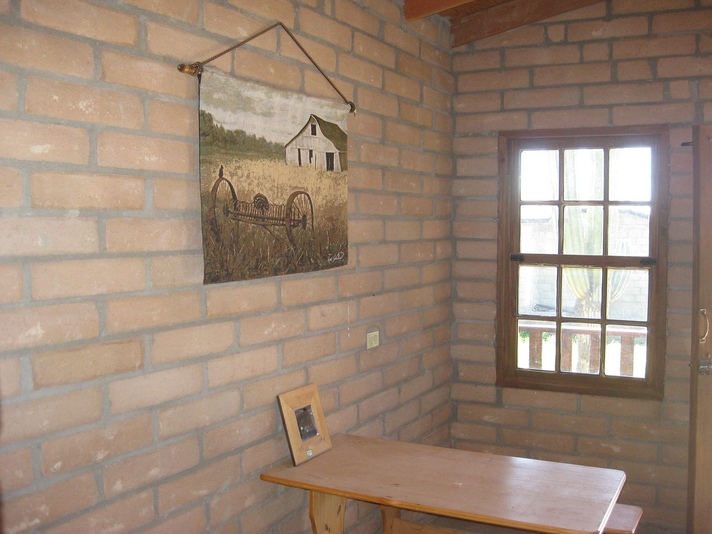
Solar electricty, hot water, and solitude from the rest of the world. Need a place to hide out?
Next: San Juan de Dios...
|
|
|
norte
Super Nomad
Posts: 1163
Registered: 10-8-2008
Member Is Offline
|
|
The water in those pools looks pretty gross.
[Edited on 3-22-2017 by BajaNomad]
|
|
|
David K
Honored Nomad
Posts: 64480
Registered: 8-30-2002
Location: San Diego County
Member Is Offline
Mood: Have Baja Fever
|
|
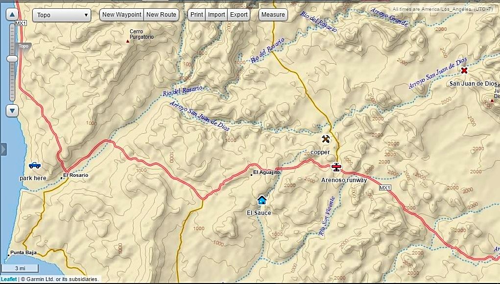
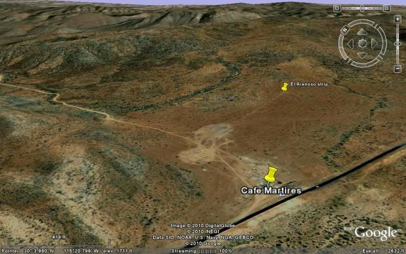
Map of my El Rosario area side trips
1) Park here (truck) is where I hike to the petrified forest
2) El Sauce (house) is the palapa and cabin recreation site.
3) San Juan de Dios (X) is the mission-era ruin.
4) Arenoso runway is the former strip behind the Sacrificio Restaurant/ Rancho Los Martires road (San Juan de Dios road) Km. 103+
[Edited on 3-15-2017 by David K]
|
|
|
David K
Honored Nomad
Posts: 64480
Registered: 8-30-2002
Location: San Diego County
Member Is Offline
Mood: Have Baja Fever
|
|
Norte, the water was clear, but the green slime on the floor would likely be due to lack of chlorine? They also had 5 straight days of rain recently,
so who knows if that is mostly rain or spring water?
|
|
|
David K
Honored Nomad
Posts: 64480
Registered: 8-30-2002
Location: San Diego County
Member Is Offline
Mood: Have Baja Fever
|
|
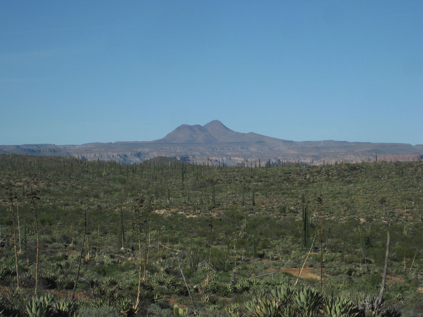
To San Juan de Dios
Here is the GPS map with track lines to get an idea of the route the road uses from Km. 103 on Hwy. 1 (ex-El Arenoso Runway), past the El Sauzalito
copper mine town (now a new ranch) and on.
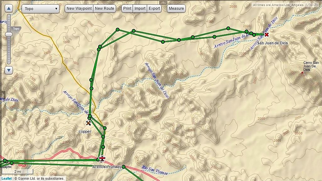
The red dots are true locations, the red lines are connecting the dots, but do not follow over the actual road, always.
|
|
|
aguachico
Senior Nomad
Posts: 602
Registered: 3-23-2007
Location: tijuana
Member Is Offline
Mood: logic cannot get thru to the illogical
|
|
Beautiful.
The logic behind piling guests in the same area, something I have experienced, is to make it easier to clean the rooms.
The power of a $50 peso note and requesting not to put other people may or may not work.. Has for me.
I have had to confront groups of teens at hotels. Once in GN and the other in valle Lupe. The great thing about Mexican people is how understanding
they are to their elder's need to peace and quiet. Parties are for noise)just join the party), but both times when I asked the groups to be
respectful of those trying to sleep, they immediately apologized and lowered the noise.
|
|
|
wessongroup
Platinum Nomad
Posts: 21152
Registered: 8-9-2009
Location: Mission Viejo
Member Is Offline
Mood: Suicide Hot line ... please hold
|
|
Enjoying the ride .... And those blue, blue sky's are just great 
|
|
|
David K
Honored Nomad
Posts: 64480
Registered: 8-30-2002
Location: San Diego County
Member Is Offline
Mood: Have Baja Fever
|
|
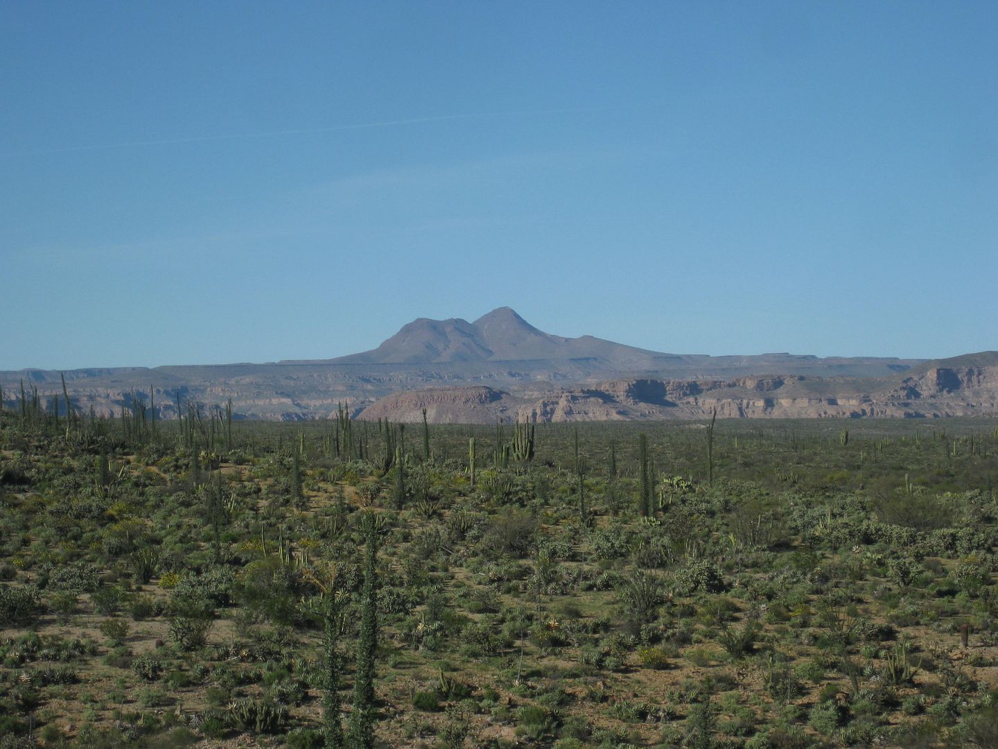
Km. 103 to San Juan de Dios, 22 miles.
Back out to Highway 1 at Km. 82+ I turn right (southbound) for my next excursion... to see what happened at San Juan de Dios.
Just 500 feet past the Km. 103 marker is the trucker restaurant El Sacrificio (at the signed road for Los Martires), on the left. Turn in here and go
uphill past the restaurant. To the right was an airport runway used during the construction of Hwy. 1 in 1973... named El Arenoso, after the old ranch
a few more miles down the road.
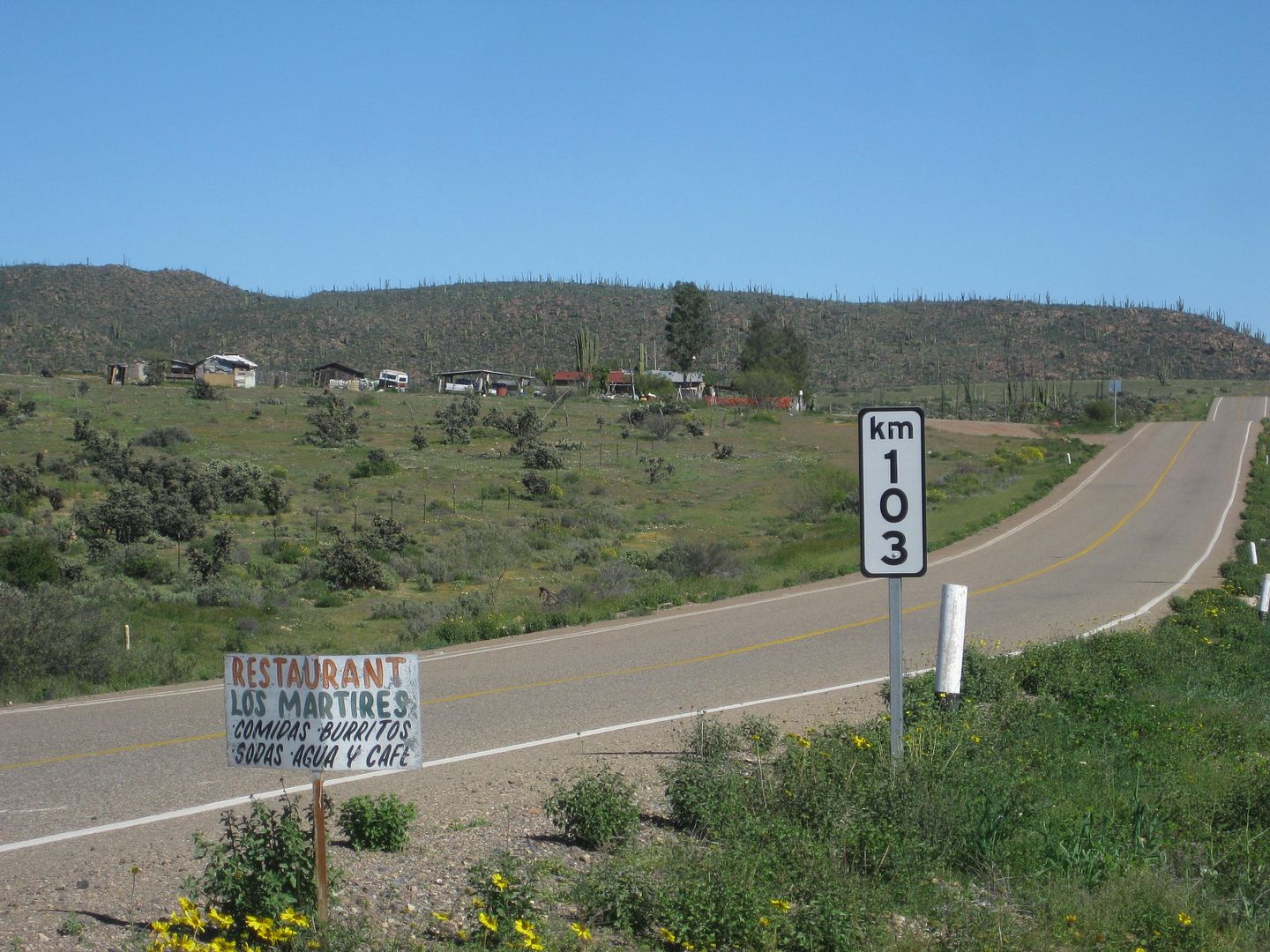
Set odometer to 0.0 at Hwy. 1 and the El Sacrificio (Martires turnoff) restaurant.
2.4 Fork, go left.
3.5 El Sauzalito Copper Mine. New Ranch built upon old town site.
4.8 Arroyo San Juan de Dios crossing (dry this time)
5.1 Fork: left to El Rosario via La Vibora, go right.
5.3 Fork: left to Los Martires and beyond, go right.
8.6 Fork, go right.
10.5 Road left to ranch.
10.7 Road in from left to ranch.
13.2 Pila (water tank) 'San Sebastian'
15.5 Fork, go left (gate on right fork).
16.9 Fork: left to El Sauce de Carter, go right.
20.1 Gate, close behind you.
21.5 Gate 'Rancho Las Palmas', close behind you.
21.7 Cross Arroyo San Juan de Dios. Rancho Las Palmas on left. Park on right across from water tank to visit ruins.
Cerro Matomí (the waterfall I was at three days ago is just the other side!)
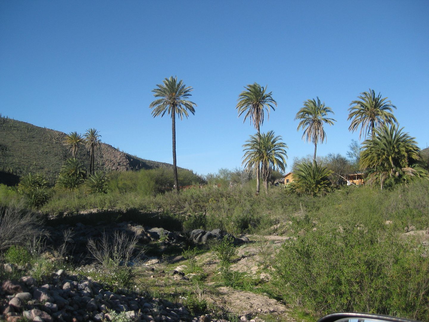
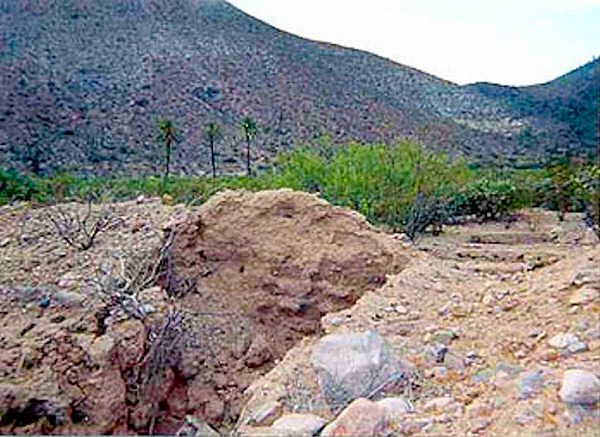
Rancho Las Palmas at San Juan de Dios, from arroyo crossing.
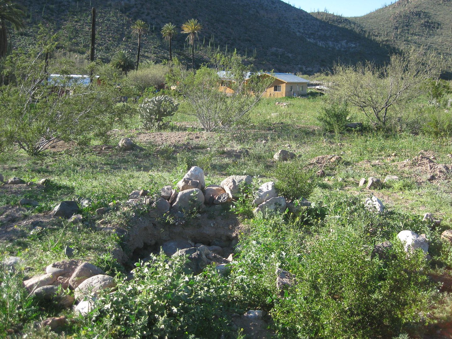
Ruins unearthed with ranch behind.
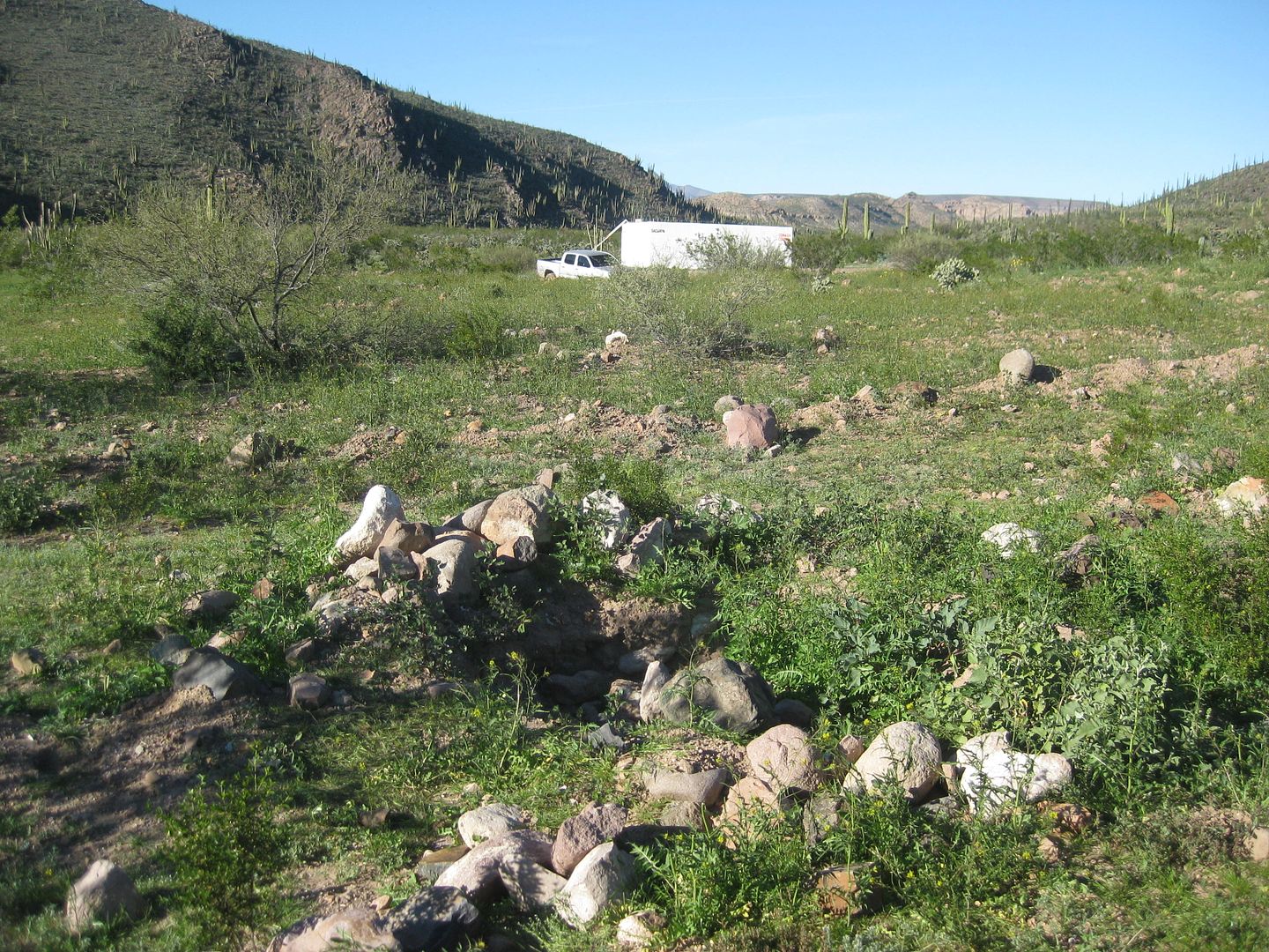
Looking north from ruins to my truck and water tank along road.
BEFORE:
Jack Swords photo of 2003.
AFTER:
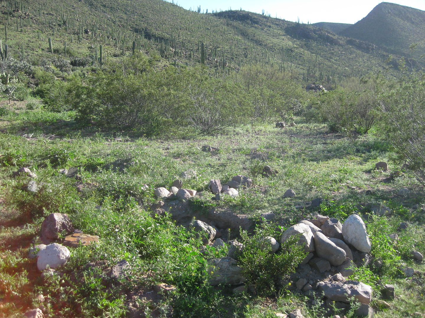
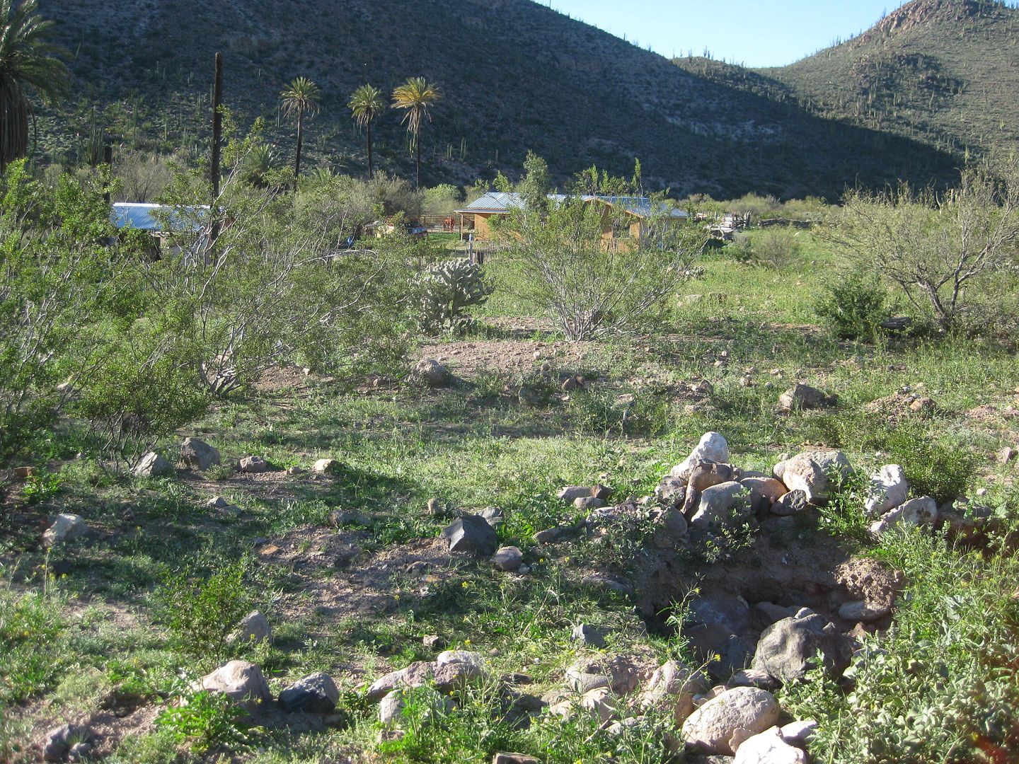
Looking south from the ruins. Rancher told me there is a mission period wall in the cardón cactus area. 2017
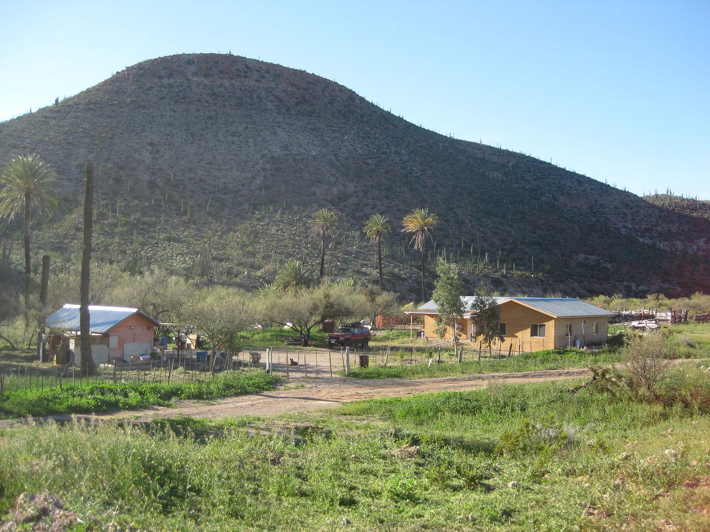
Rancho Las Palmas.
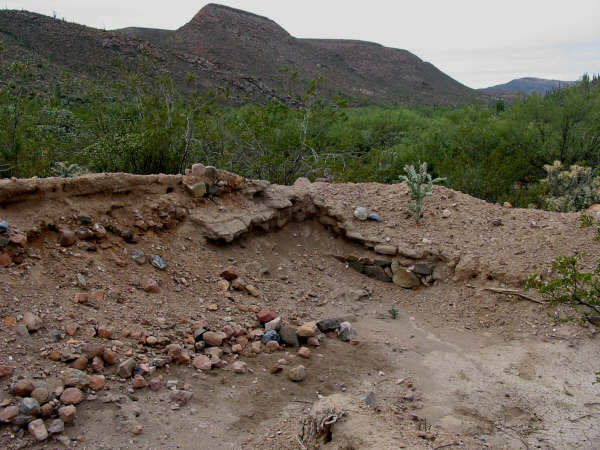
The resident there (Alfonso Duerte Espinoza) told me it was Sony Espinoza who bladed over the mission visita ruins in 2006. It was a very sad incident
indeed. No reason for the destruction. Nothing has been done on the land since no crops planted. On smal part of a covered-over room has been opened
back up.
BEFORE:
2000
AFTER:
2017
|
|
|
David K
Honored Nomad
Posts: 64480
Registered: 8-30-2002
Location: San Diego County
Member Is Offline
Mood: Have Baja Fever
|
|
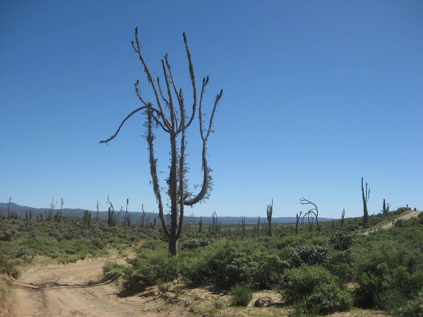
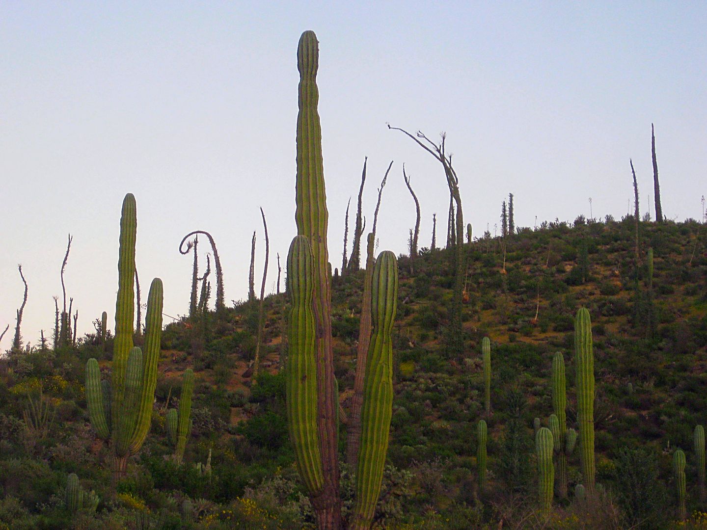
Returning to El Rosario, I was enjoying the boojum trees and cardón cacti...
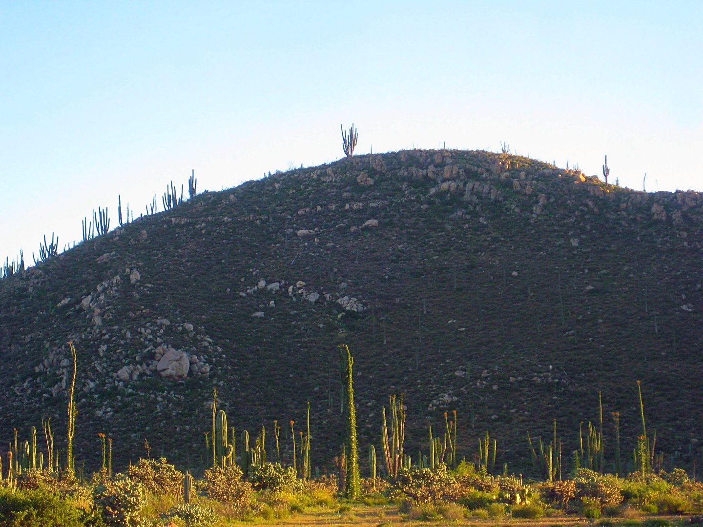
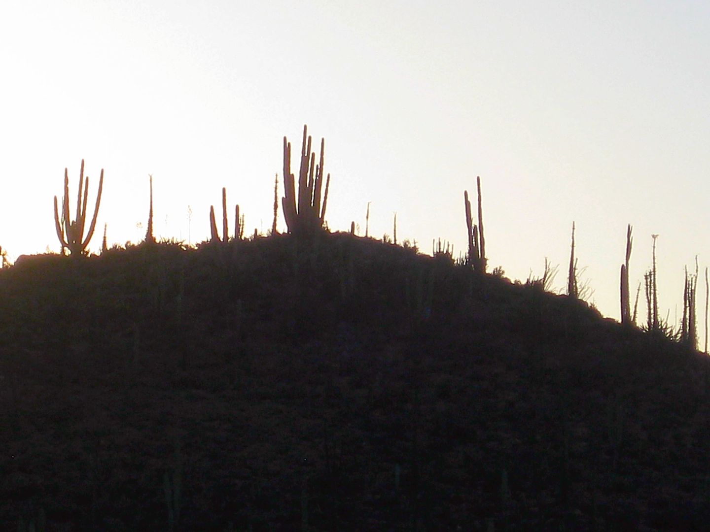
StuckSucks sent me the sundown time for my location, and I think this is the photo I took just then.
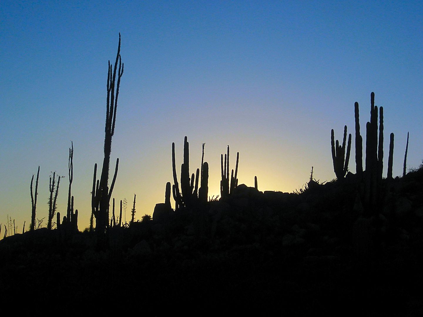
There's the screensaver shot!
Goodnight from Planet Baja!
One Day Remains!
|
|
|
David K
Honored Nomad
Posts: 64480
Registered: 8-30-2002
Location: San Diego County
Member Is Offline
Mood: Have Baja Fever
|
|
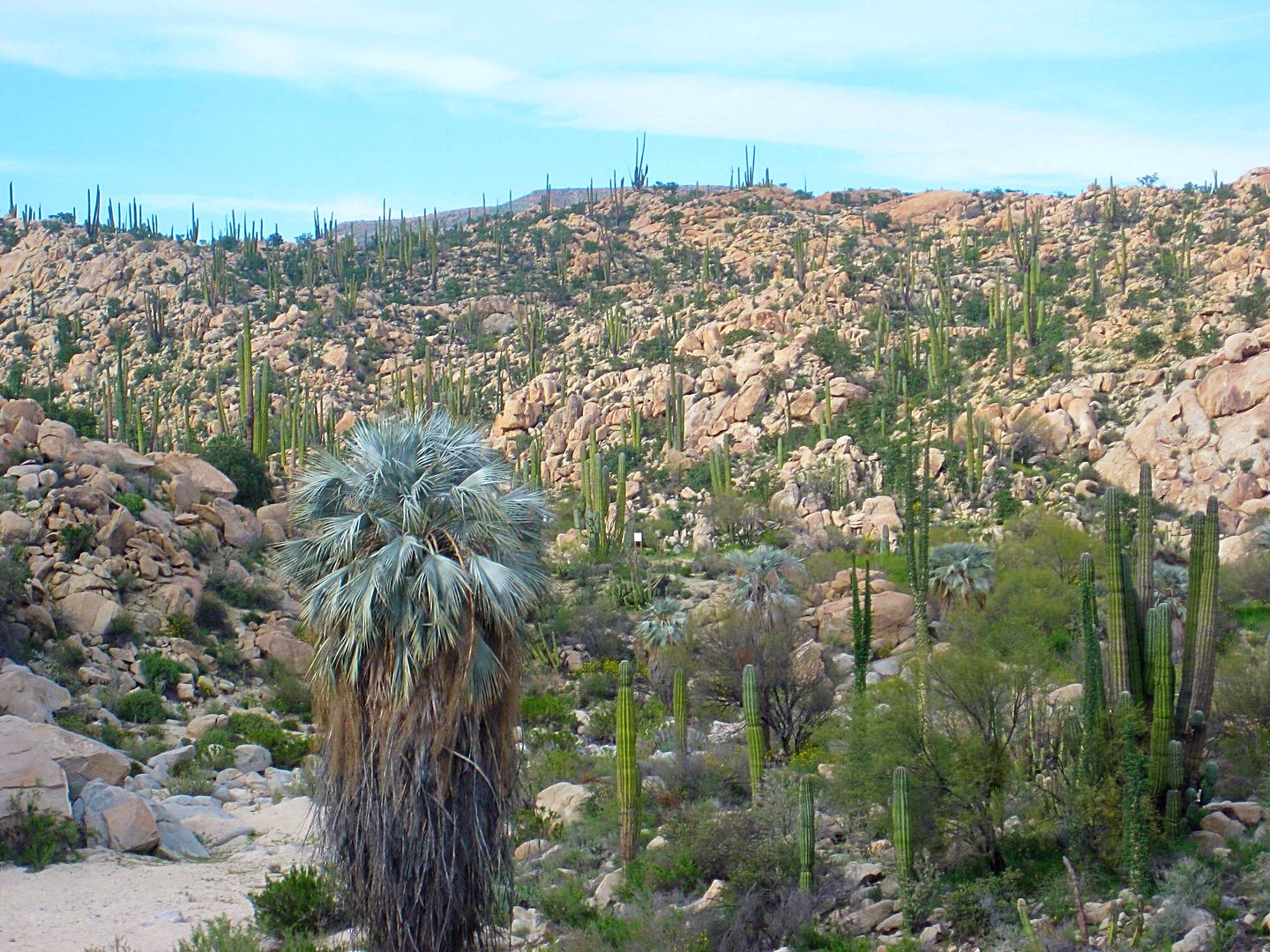
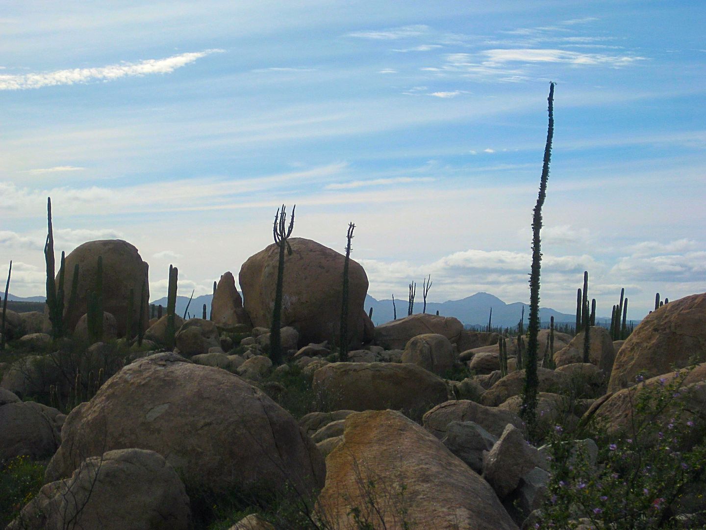
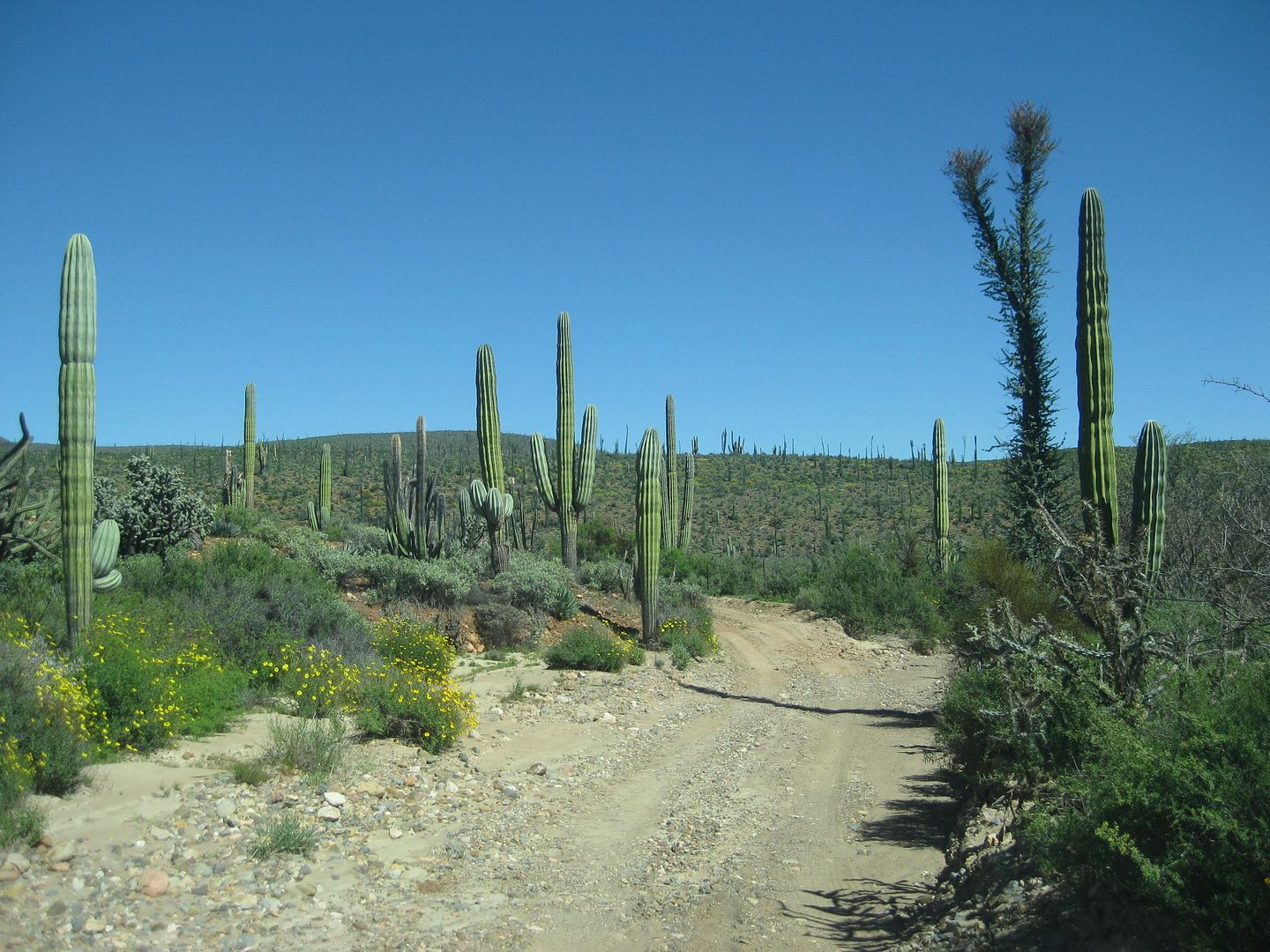
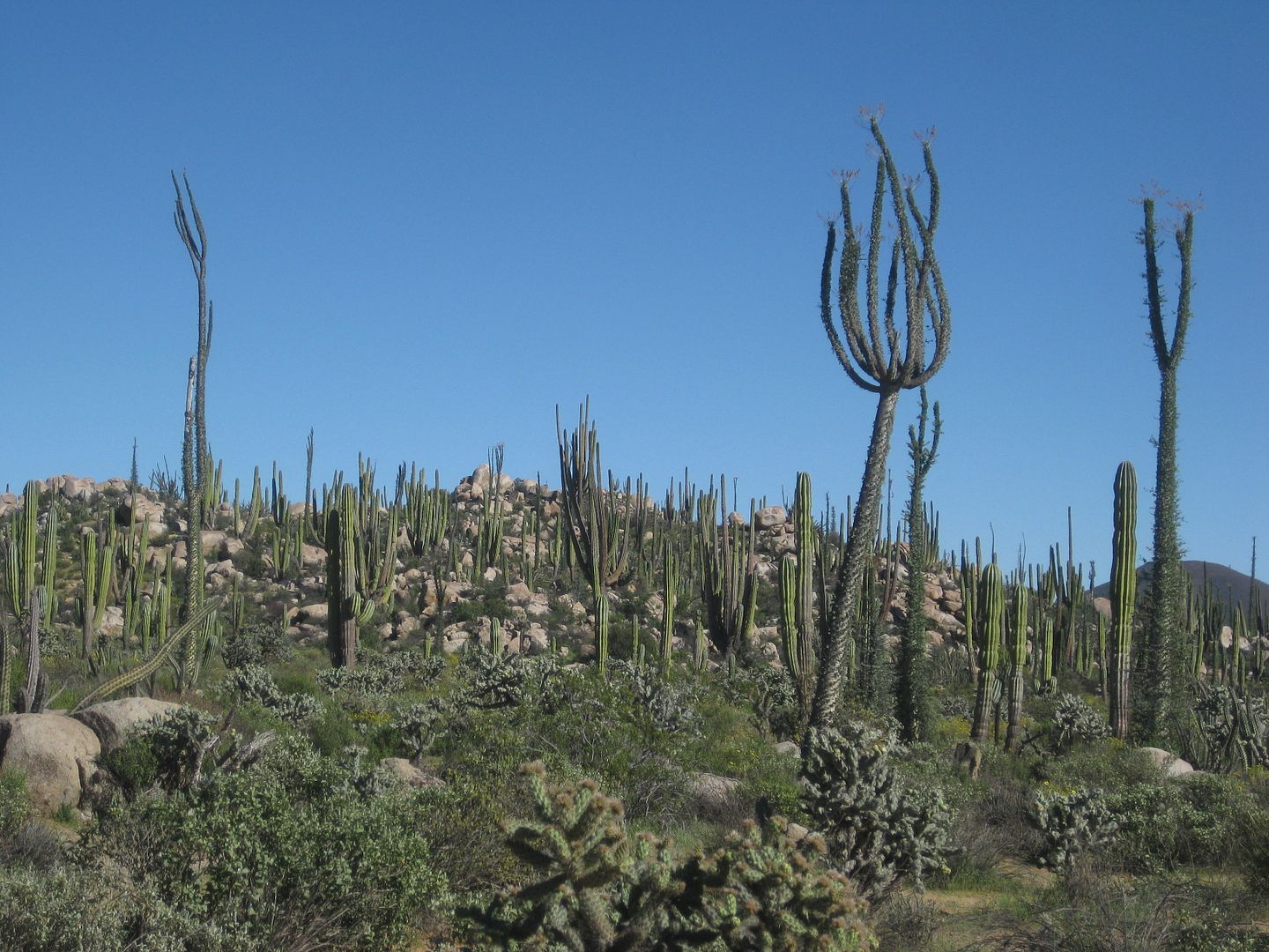
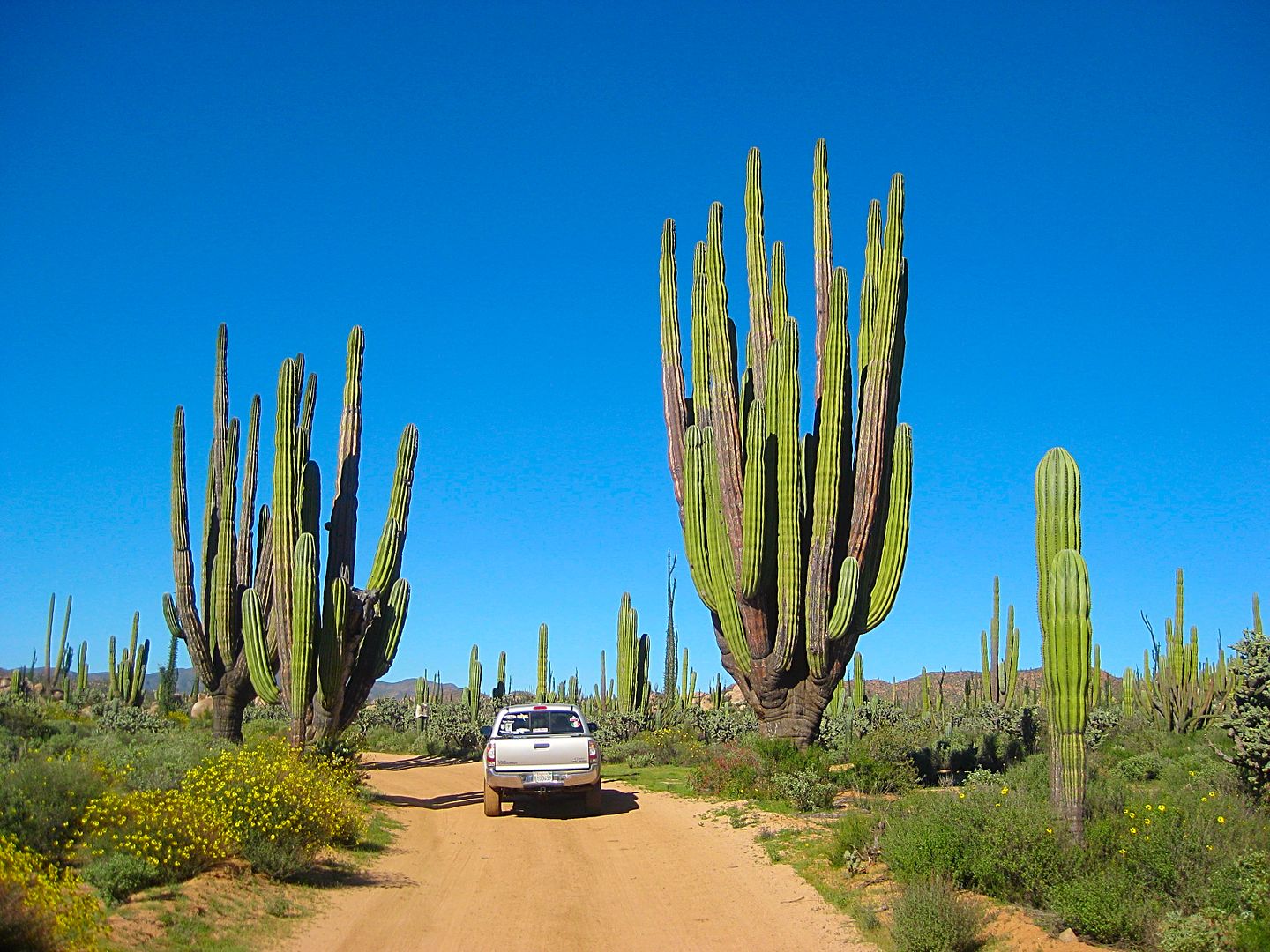
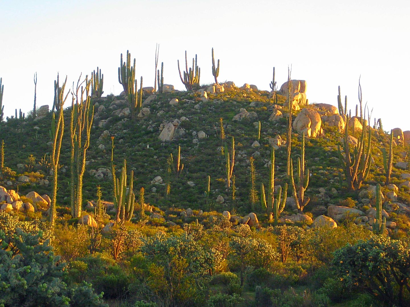
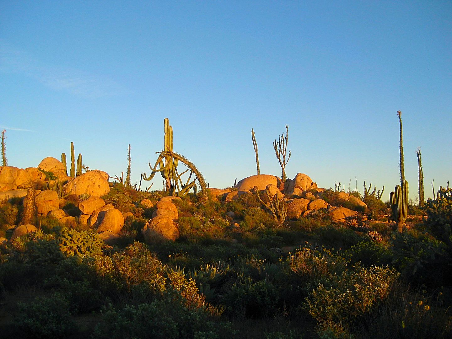
The cactus garden along the San Juan de Dios road is one of Baja's best!
The final Day trip home report is next, with a couple side trips included...
|
|
|
David K
Honored Nomad
Posts: 64480
Registered: 8-30-2002
Location: San Diego County
Member Is Offline
Mood: Have Baja Fever
|
|
OK, had an irrigation job today, so I will wrap this up with the last day DAY 7 photos and report, very soon!
San Quintin, Santo Tomás, Maneadero, and Tecate for the win!
|
|
|
| Pages:
1
2
3
4
5 |
|


