| Pages:
1
2
3
4 |
JZ
Elite Nomad

Posts: 9234
Registered: 10-3-2003
Member Is Online
|
|
Tell me about the route you would take to ride bikes from the border to Cabo
Want to go mostly in the dirt and have a chase truck following most of it, or at least semi close.
I'd prefer to start on the East side and go down through Coco's.
Time frame would be late November. Would go with my 13yo and 15yo. Both are intermediate to advanced riders.
What are the major way points?
[Edited on 4-16-2017 by JZ]
|
|
|
David K
Honored Nomad
Posts: 64480
Registered: 8-30-2002
Location: San Diego County
Member Is Offline
Mood: Have Baja Fever
|
|
First Leg:
Closest to Mexicali would be down Laguna Salada, Cohabuzo Jcn., near Tres Pozos to the dunes or further to La Ventana or stay on Score road to El
Chinero. Then a bunch of highway down to Coco's Corner and on to Hwy. 1. Or at San Felipe go west to Valle Chico then to Matomi and out to the 5
(chase can stay on 5 and wait for you at Matomi wash crossing).
Or
La Rumorosa south past Laguna Hanson to Valle de Trinidad to near San Vicente and south. The 7 Sisters coast road can avoid 200 paved miles.
That's a couple ideas for Baja norte half. Is this what kind of routes you are seeking?
|
|
|
TedZark
Nomad
Posts: 171
Registered: 10-31-2014
Member Is Offline
|
|
I am curious about that road. Can you tell me where to find it? Follow it from where to where?
Thank you!
|
|
|
David K
Honored Nomad
Posts: 64480
Registered: 8-30-2002
Location: San Diego County
Member Is Offline
Mood: Have Baja Fever
|
|
Santa Catarina road (jcn. with Hwy. 1 near Guayaquil) to the Santa Rosalillita paved road. There are 4 other roads between Hwy. 1 and the coastal road
between those two.
|
|
|
LukeJobbins
Nomad
Posts: 196
Registered: 3-11-2014
Location: Lemoore, Ca
Member Is Offline
|
|
You can go south to the wall past santa rosalillita. Takes a bit more out of pavement travel.
Its not the east side, but i regularly take the coast dirt road from santo tomas all the way to san quintin. Then a few miles on pavement to the road
to 7 sisters all the way to the wall and most of the pavement is avoided on decent dirt roads with lots of fun sections half way down baja.
You can check out old baja 1000 or norra mex rally maps for trails and dirt roads also.
|
|
|
ehall
Super Nomad
Posts: 1906
Registered: 3-29-2014
Location: Buckeye, Az
Member Is Offline
Mood: It's 5 o'clock somewhere
|
|
https://sites.google.com/site/gpskevin/gpskevin-ride-calenda... A friend of mine went on this last year. Gps kevin was nice enough to leave
maps and gps tracks for all to use.
|
|
|
TedZark
Nomad
Posts: 171
Registered: 10-31-2014
Member Is Offline
|
|
Thank you David, Luke and ehall. A new adventure awaits!
|
|
|
TMW
Select Nomad
Posts: 10659
Registered: 9-1-2003
Location: Bakersfield, CA
Member Is Offline
|
|
What size bikes and how big is the gas tanks. I would assume they are 4 strokes.
|
|
|
TMW
Select Nomad
Posts: 10659
Registered: 9-1-2003
Location: Bakersfield, CA
Member Is Offline
|
|
Since you are asking what routes to take I assume you are not that familiar with Baja dirt roads. If that is correct you will need to study maps such
as the Baja almanac and plot your course, especially gas stops. There are gps tracks available or you can go to Google Earth and trace your route and
save it to your PC and convert it to a gps route with GPS Visualizer. http://www.gpsvisualizer.com/
There are some pretty simple routes to take that would be hard to get lost on. Like the 7 sisters DK mentioned, LA Bay to El Arco or Vizcaino, San
Ignacio to San Juanico and La Purisima to the San Javier Mission.
[Edited on 4-16-2017 by TMW]
|
|
|
chippy
Super Nomad
Posts: 1697
Registered: 2-2-2010
Member Is Offline
|
|
From Constitucion south you can either take the east route via Evaristo to La Paz or the west along the coast to Todos Santos.
|
|
|
JZ
Elite Nomad
Posts: 9234
Registered: 10-3-2003
Member Is Online
|
|
Quote: Originally posted by TMW  | Since you are asking what routes to take I assume you are not that familiar with Baja dirt roads. If that is correct you will need to study maps such
as the Baja almanac and plot your course, especially gas stops. There are gps tracks available or you can go to Google Earth and trace your route and
save it to your PC and convert it to a gps route with GPS Visualizer. http://www.gpsvisualizer.com/
There are some pretty simple routes to take that would be hard to get lost on. Like the 7 sisters DK mentioned, LA Bay to El Arco or Vizcaino, San
Ignacio to San Juanico and La Purisima to the San Javier Mission.
[Edited on 4-16-2017 by TMW] |
We rode from Gonazaga to Bahia de Los Angles and then on to San Fransquito and back out to Hwy 1 last year. With a couple side trips. Put the bikes
on the truck and drove down to San Rosilia and over the ferry to San Carlos and rode up the coast of Sonora a bit.
I use MotionX for the maps and GPS. Set and download the way-points from Google Earth into MotionX. It's the best setup I've seen.
But that said, yeah I'm not super familiar with that many roads. Know Baja better by boat. But, I've been reading about the Seven Sisters today and
that's what we are gonna do I think.
Any more advice is appreciated.
|
|
|
JZ
Elite Nomad
Posts: 9234
Registered: 10-3-2003
Member Is Online
|
|
Exactly what I was looking for.
|
|
|
David K
Honored Nomad
Posts: 64480
Registered: 8-30-2002
Location: San Diego County
Member Is Offline
Mood: Have Baja Fever
|
|
My road log down the remote coast (7 Sisters) from 2007, and it did go past Sta. Rosalillita and the wall (Pta. Rosarito), is at www.vivabaja.com/707 . Look for a fresh road log soon, as 10 years was a while ago!
[Edited on 4-16-2017 by David K]
|
|
|
JZ
Elite Nomad
Posts: 9234
Registered: 10-3-2003
Member Is Online
|
|
| Quote: Originally posted by chippy | | From Constitucion south you can either take the east route via Evaristo to La Paz or the west along the coast to Todos Santos.
|
I've been to Evaristo twice via boat and once driving from there to La Paz. Fun road.
Would you say that's better or the West coast? Never done it.
|
|
|
chippy
Super Nomad
Posts: 1697
Registered: 2-2-2010
Member Is Offline
|
|
I did the west route in March 2017. It was fun alot empty beaches and what looked to me(not a moto guy) as fun dirt bike riding? I like both!
|
|
|
Sweetwater
Senior Nomad
Posts: 915
Registered: 11-26-2010
Member Is Offline
Mood: chilly today hot tomale
|
|
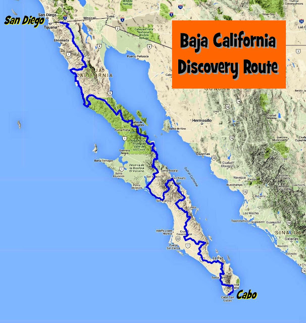
Wow, I've been on some of that route but none of the northwestern pieces. A sag wagon would be a stupendous asset. My only concern is how much time
that map spends on the rocky ridge that splits Baja. Those are time, energy and mechanical consuming sections to ride.
Everbody\'s preachin\' at me that we all wanna git to heaven, trouble is, nobody wants to die to git there.-BB King
Reality is what does not go away when you stop believing in it. -Philip K Dick
Nothing is worse than active ignorance. Johann Wolfgang von Goethe(1749-1832, German writer, artist and politician)
When choosing between two evils, I always like to try the one I\'ve never tried before. - Mae West
Experience is what keeps a man who makes the same mistake twice from admitting it the third time around.
|
|
|
JZ
Elite Nomad
Posts: 9234
Registered: 10-3-2003
Member Is Online
|
|
Thinking about riding El Rosario to Santa Rosaliíta at the end of May to check it out. Drive down to El Rosario, unload and ride where the dirt
starts. Have the truck follow.
How rough is the 7 sisters road down to Santa Rosaliíta. What's the best spot(s) to stop and camp? Probably can only ride two days (maybe 3), so
wondering if Santa Rosalitia is too far or cut back over to Hwy 1 sooner?
|
|
|
David K
Honored Nomad
Posts: 64480
Registered: 8-30-2002
Location: San Diego County
Member Is Offline
Mood: Have Baja Fever
|
|
In the link I gave, our 2 day drive is detailed. We camped by Punta Lobos.
|
|
|
JZ
Elite Nomad
Posts: 9234
Registered: 10-3-2003
Member Is Online
|
|
Yeah, I read it. How slow was the going?
|
|
|
mcnut
Nomad
Posts: 177
Registered: 12-9-2013
Location: Dammeron Valley, UT
Member Is Offline
|
|
Firstly, the one and only gpskevin route in Baja (02.3 Shortcut) I have tried (3/12/17) was DOA after pulling up to a manned/guarded gate and obvious
no trespassing signs after just 1 1/2 miles, YMMV.
Also in an interesting 180 deg about face, Kevin is now charging for the GPS info. You would need to know the backstory from the ADVRider forum to
understand just how hypocritical this change is.
Bruce
|
|
|
BajaNomad
|
Thread Moved
4-17-2017 at 02:38 AM |
| Pages:
1
2
3
4 |


