| Pages:
1
2
3
4 |
David K
Honored Nomad

Posts: 64479
Registered: 8-30-2002
Location: San Diego County
Member Is Online
Mood: Have Baja Fever
|
|
TRIP # 4 (April 2017): Valle Trinidad, San Quintín, "7 Sisters" region: Puerto Santa Catarina to Laguna Manuela.
EDIT: Report & Photos sized for message boards and no watermarks are here: https://www.tacomaworld.com/threads/2017-baja-expedition-4-v...
I just returned last night from seven days of continued research and driving in some of Baja's most interesting or challenging areas. This makes the
fourth trip of road data and traveler's service info gathering to possibly create a new travel guide to the 'best of Baja' (if long drives, dirt
roads, camping, exploring, and occasional motels stops is your thing).
When I return from these trips, I post many photos and details here on Baja Nomad to give my friends a look at some places that may be new to them or
places they have been to in the past, for a current view.
Here is the outline of this 2017 project: http://forums.bajanomad.com/viewthread.php?tid=85982
If you are new to Nomad or just have not seen the previous three reports, here are the links to them.
WARNING: Viewing my photos or reading the details MAY CAUSE BAJA FEVER!
TRIP #1 (Jan. 2017) San Felipe to L.A. Bay to Punta San Francisquito: http://forums.bajanomad.com/viewthread.php?tid=85374
TRIP #2 (Feb. 2017) San Ignacio to Loreto to San Javier, Comondú, La Purísima, San Borja, Luz de Mexico: http://forums.bajanomad.com/viewthread.php?tid=85756
TRIP #3 (Mar. 2017) Mexicali to San Felipe to Valle Chico to Matomí + Chapala to El Rosario (and San Juan de Díos & El Sauce): http://forums.bajanomad.com/viewthread.php?tid=85989
=====================================================================
TRIP #4
DAY 1 Wed. Apr. 19:
On the road at 8:25 am, arrive at Calexico at 11:25 am.
Buy pesos at 17.70: Dollar
Note to supplement the previous trip: Km. 51.5+ Campo Sonora is closed.
Take Hwy. 3 (Ensenada highway) west.
Km. 195 Military Checkpoint (just west of Hwy. 5).
Km. 179.5 Borrego pit area, race road crosses highway.
Km. 163 & 162.5 Road to SW to the top end of Diablo Dry Lake, signed 'Colonia San Pedro Mártir'.
Km. 152.5 Road north to Rancho Arroyo Grande (may be closed by locked gate)
Km. 151 San Matias Pass. Original road to San Felipe to left.
Km. 141 San Matias village. At least three eating places along the highway.
Km. 137.5 Road south to Mike's Sky Rancho (31 kms./20 miles).
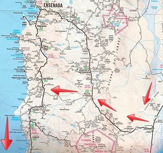
Km. 120* Valle de Trinidad, paved entrance, Pemex station.
* no sign seen, the Pemex station gave me the km. number.
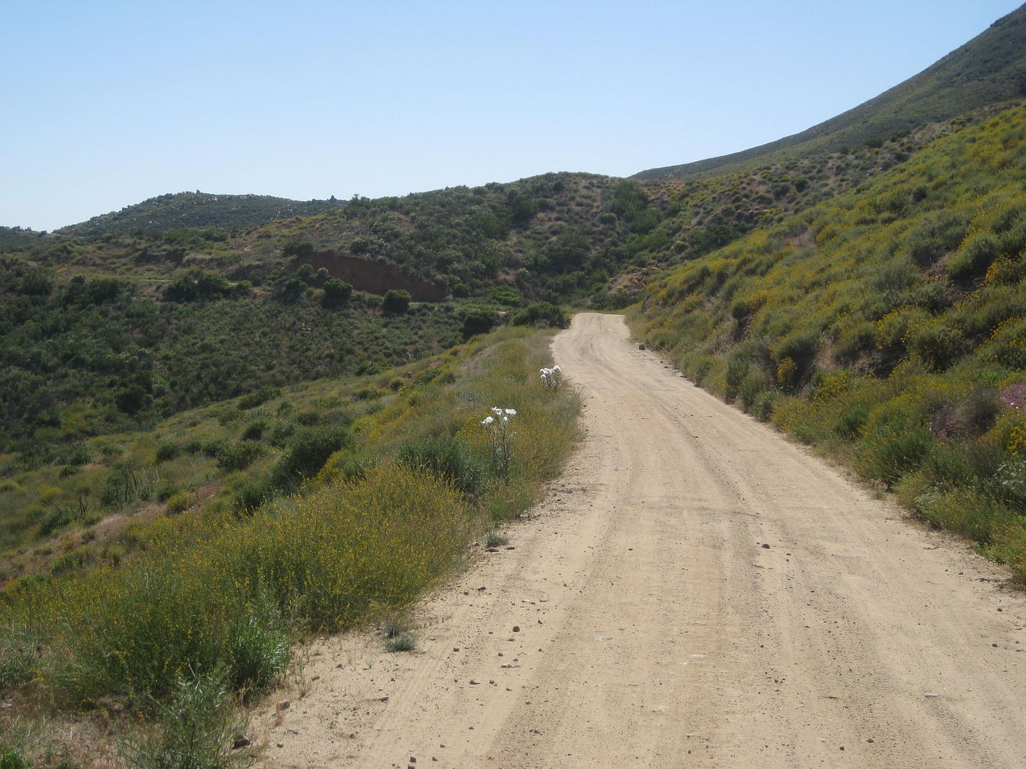
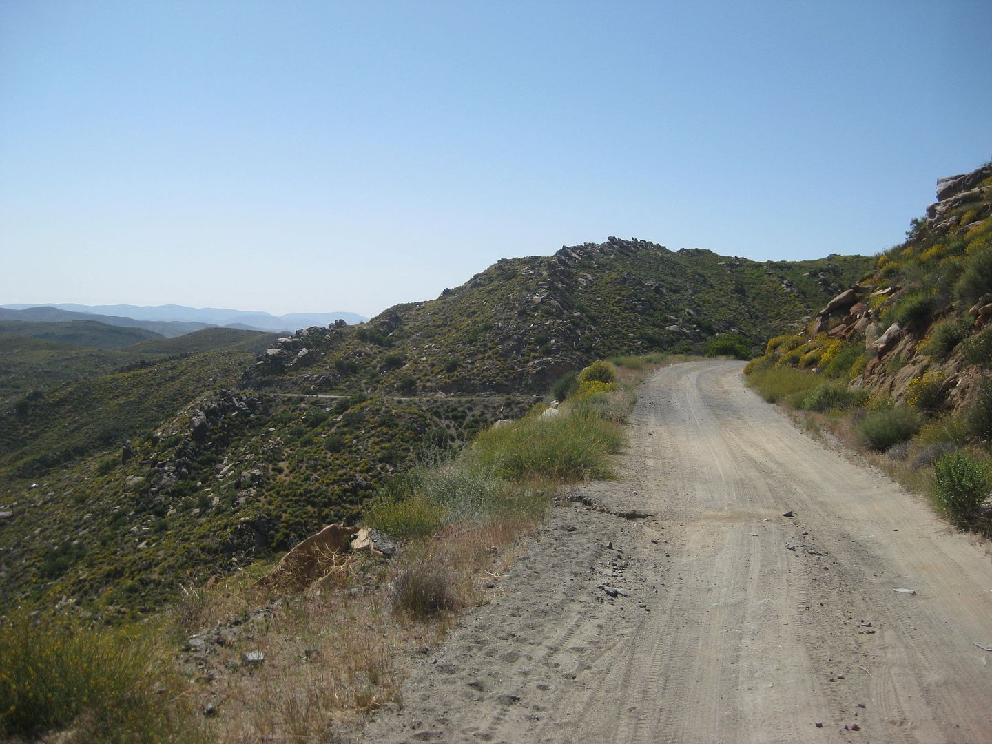
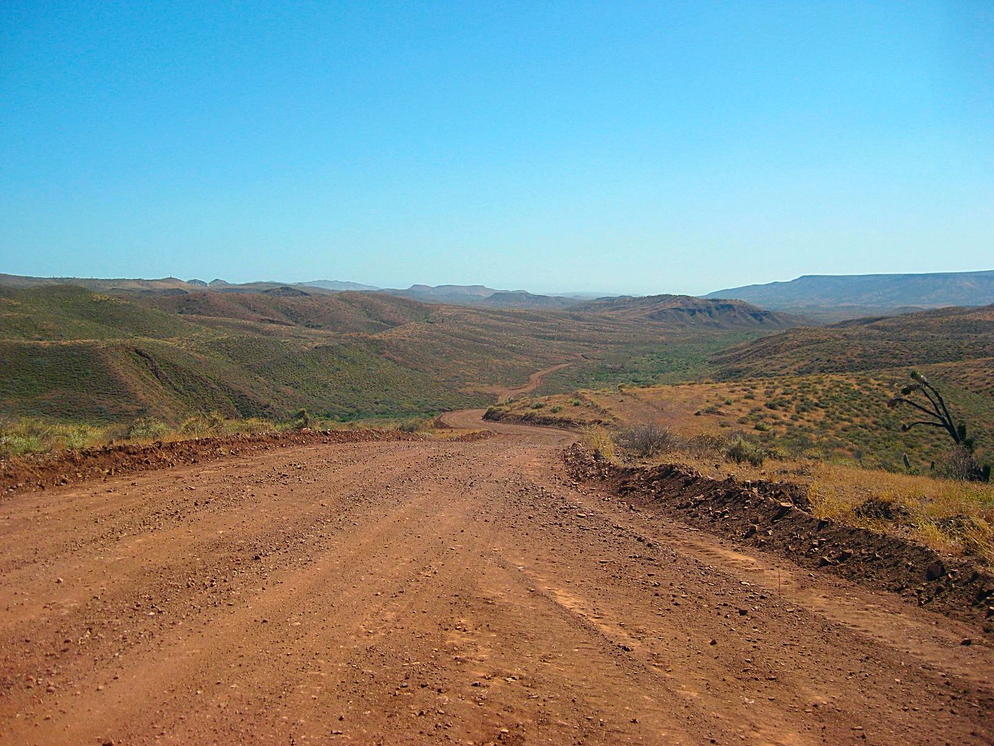
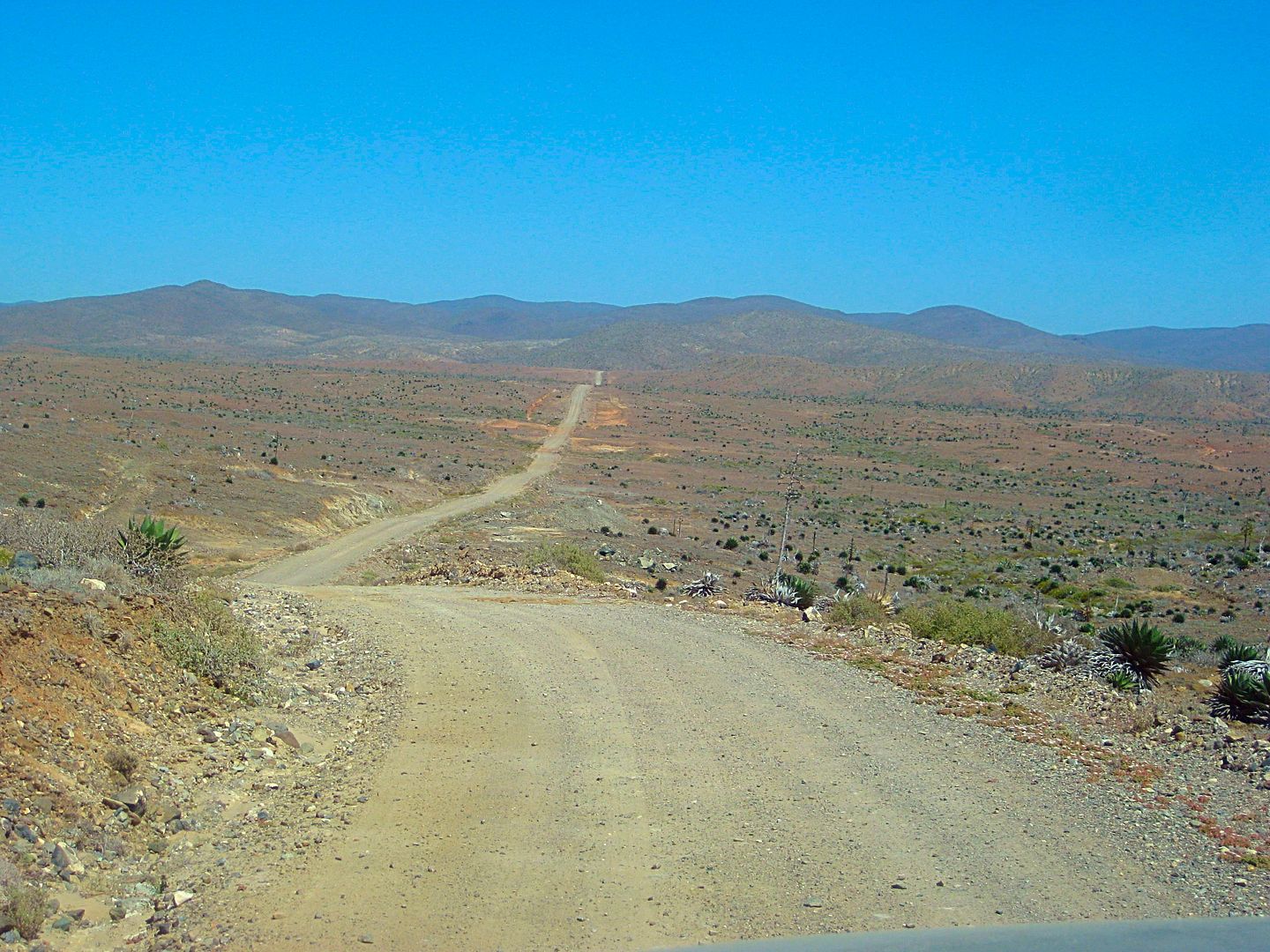
From here, I take the dirt road that crosses the hills to Highway 1, just south of San Vicente. There are a few turns to get started on the correct
road (I won't detail them unless requested) and then it is up and down for a total of 40 miles from Hwy. 3 to Hwy. 1. Took me about 2 hours to drive.
2WD road, but not for motorhomes or Porsches!
Highway 1 is reached at 4:30 pm (Hwy. 1, Km. 103).
I book south to San Quintin, take the 'new' paved road west at Km. 1 for the OLD MILL, and the road is already potholed!
The Old Mill hotel and restaurant is 3.2 miles from Hwy. 1.
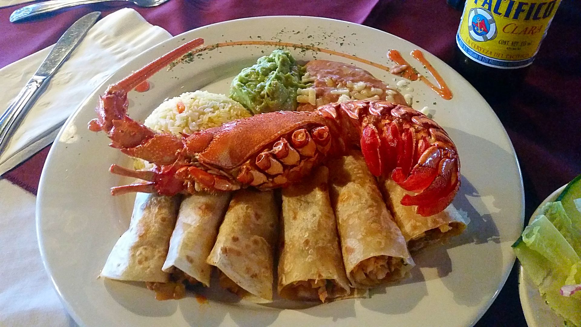
I have a delicious LOBSTER burrito plate, with soup and salad and a Pacifico for 230 pesos (U.S. $13)!
I arrive at El Rosario, where the nicest bed and pillows await at Baja Cactus Motel.
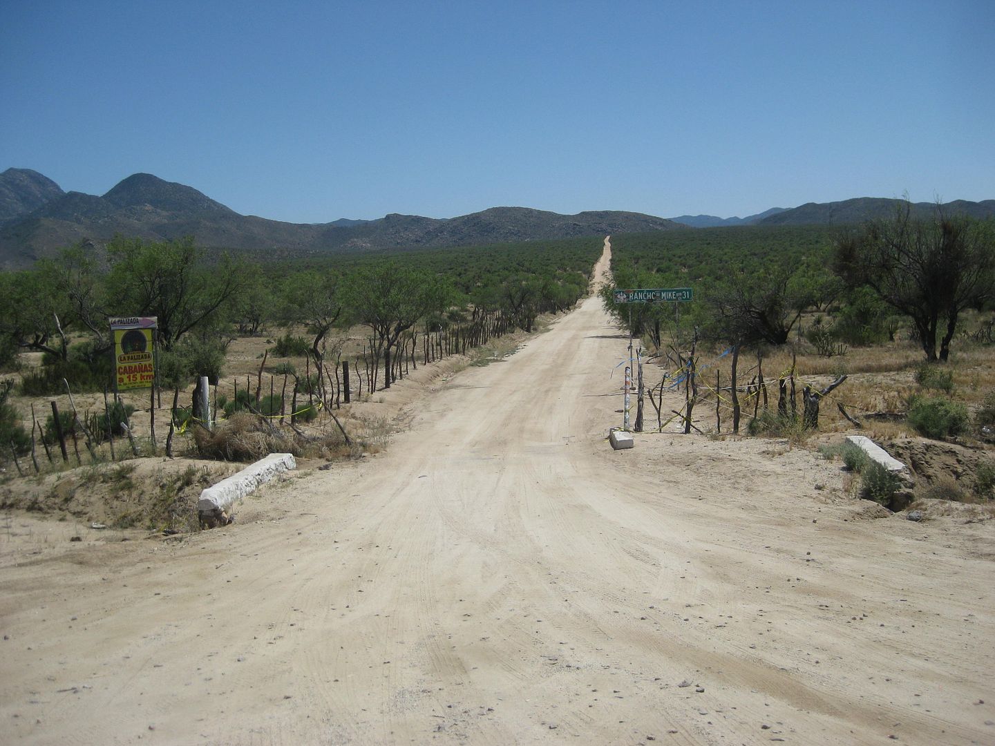
Mike's Sky Rancho Road
Over the hills to Hwy. 1
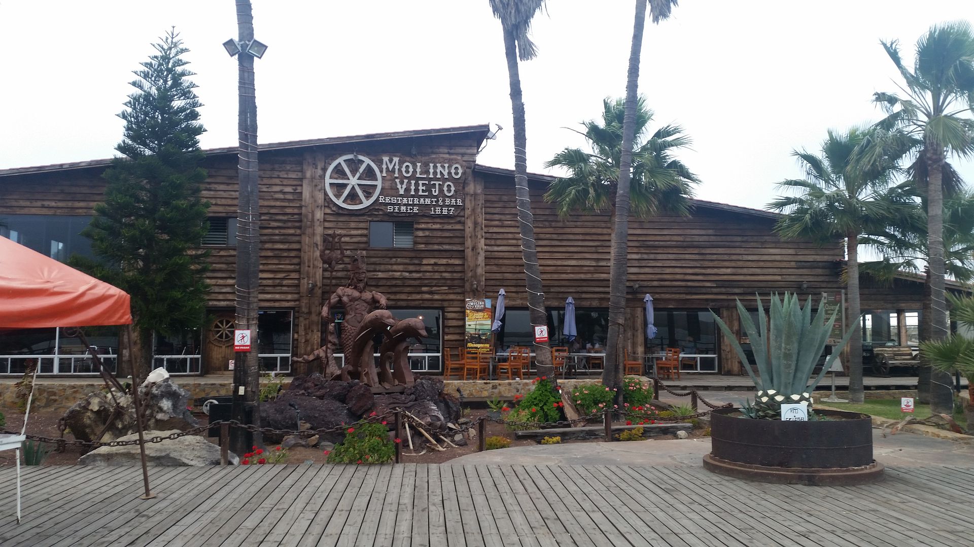
The Old Mill (Molino Viejo)
This is just the beginning of a dose of BAJA, oh yaaaaa!
To be continued with Days 2-7...
[Edited on 6-5-2021 by David K]
|
|
|
blackwolfmt
Senior Nomad
Posts: 802
Registered: 1-18-2014
Location: On The Beach With A Blackwolf
Member Is Offline
Mood: dreamin of Riden out a hurricane in Baja
|
|
Nice DK splurging for din din Lks Yummy
So understand dont waste your time always searching for those wasted years
face up and make your stand and realize that your living in the golden years
|
|
|
BigBearRider
Super Nomad
Posts: 1299
Registered: 4-30-2015
Location: Big Bear, Punta Chivato, and Cabo
Member Is Offline
Mood: 
|
|
Nice!
|
|
|
David K
Honored Nomad
Posts: 64479
Registered: 8-30-2002
Location: San Diego County
Member Is Online
Mood: Have Baja Fever
|
|
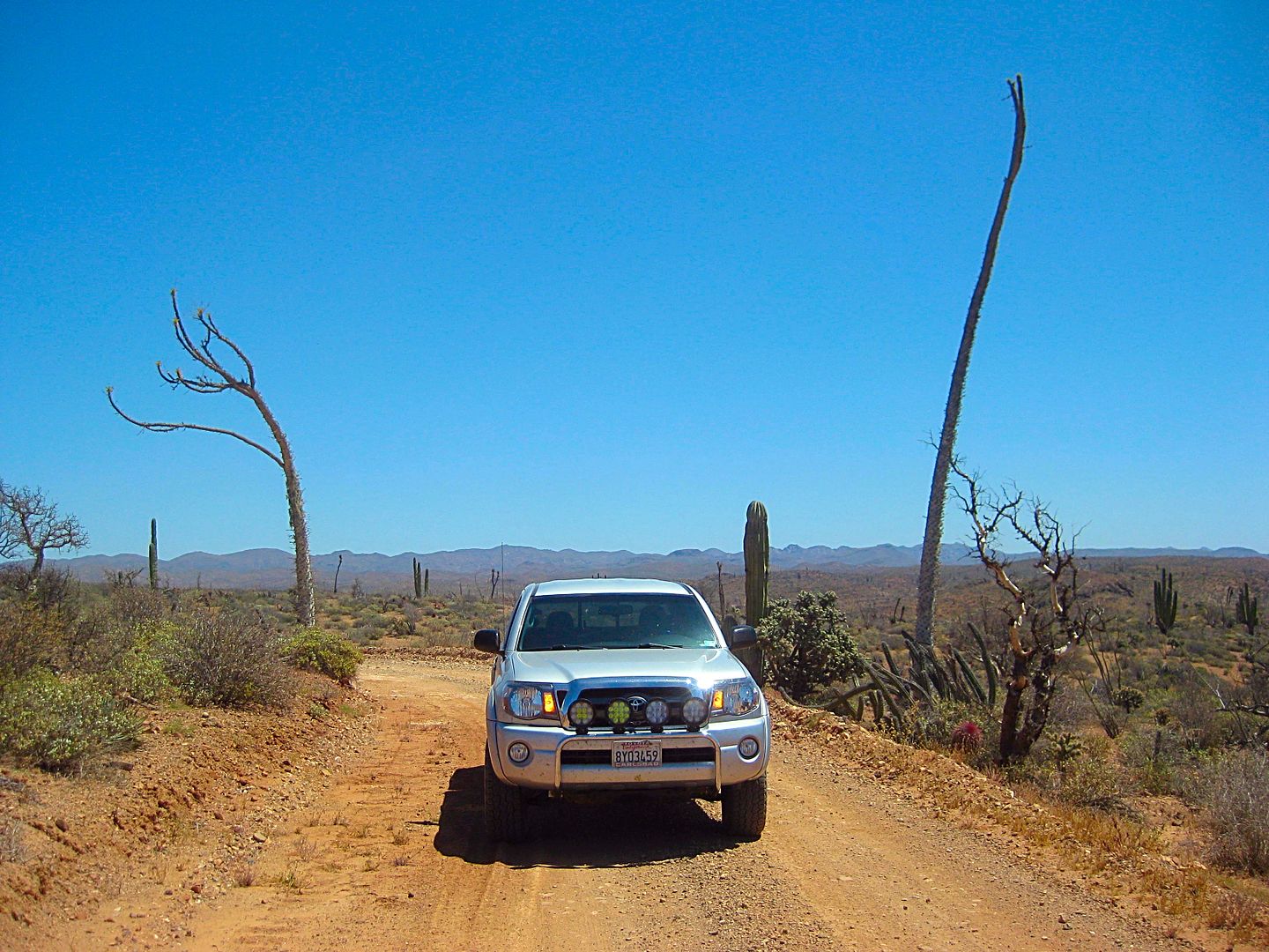
DAY 2 (THU APR 20)
My lobster burritos from last night were still providing energy and I was ready to get down into the 'Never-Never' of Baja! (Never-Never means no
paved roads, no cell phone service, and not much civilization)
On the road at 8:30 after topping my tank and my extra 5-gallon can. 87 octane gas here was $3.459/ gallon. I averaged 17.7 mpg for the 287 miles
traveled yesterday. Starting today, my truck now has mostly ethanol-free gas in the tank. That usually bumps up my mileage 1-2 mpg. However,
off-roading and four wheeling will knock that gain down.
Last month I made notes on the points of interest and road junctions between El Rosario and Laguna Chapala (~100 miles south, where Hwy. 5 from San
Felipe meet Hwy. 1). I knew there were more points I wanted to add... Here they are:
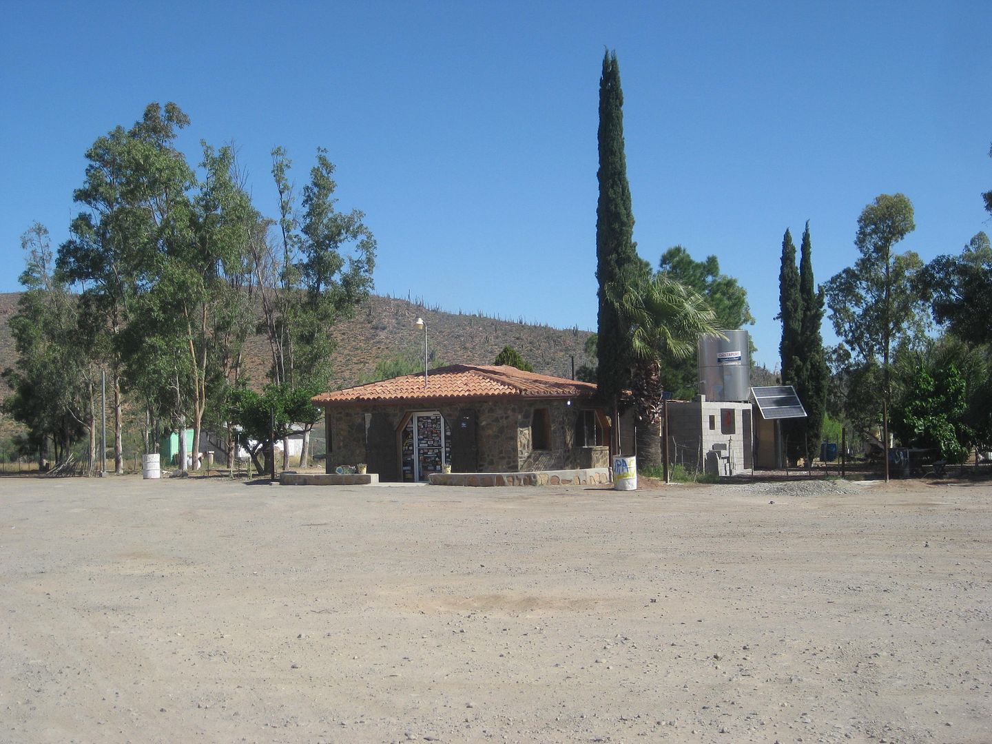
Km. 108+ Loncheria El Descanso (popular with truckers, for meals and tire repair)
Km. 116.5 Monument to Hector the young truck driver killed on this curve.
Km. 129 Café La Pasadita (a newer place)
Km. 131 Rancho Los Cuates tire repair.
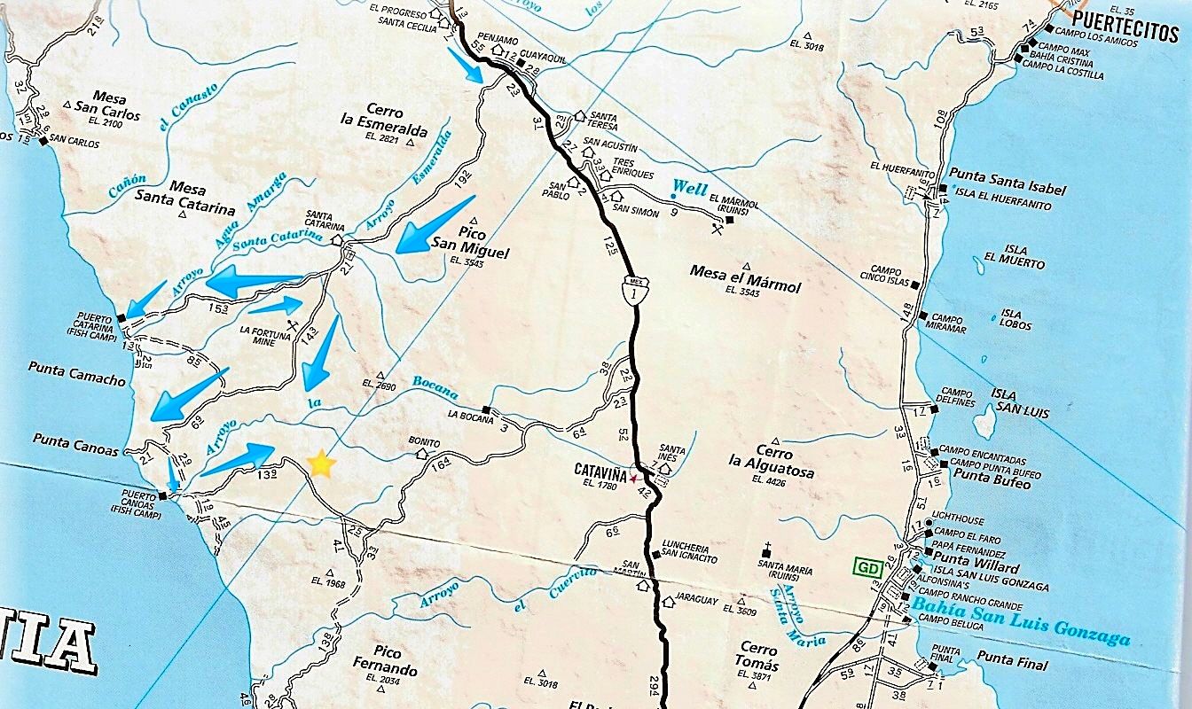
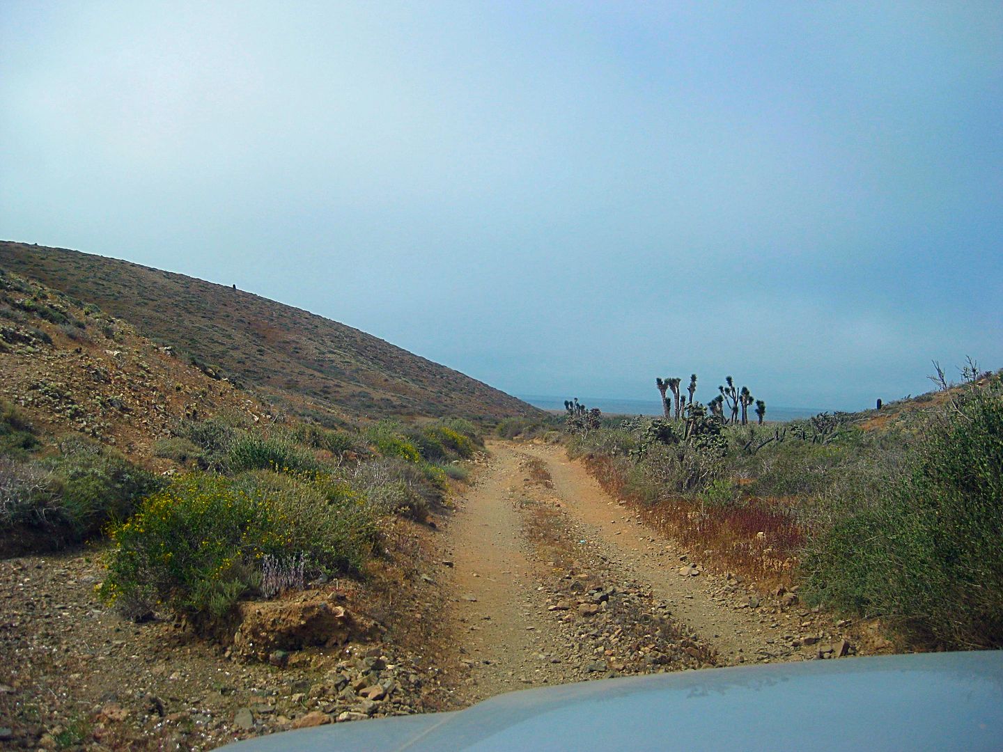
Km. 132+ Road south to Puerto Santa Catarina, Puerto Canoas, and south.
Km. 132.5 Road north to Guayaquil, 0.5 mi. A ghost town where a delegation office, schools and weekday housing for area ranch children, and an
airstrip once existed. The town was created around 1970 and the town's 50-80 people expected the new paved highway to pass right through their little
place to provide prosperity. In mid-1973, the highway engineers put the highway up on the ridge, a half mile away and that placed Guayaquil out of
sight of travelers.
Since I am bound for the remote Pacific region, I return to Km. 132+ and drop my tire pressure once again (I dropped it for the 40 dirt miles between
Valle de Trinidad and Hwy. 1, yesterday).
Dropping tire pressure has three major effects, one is that the ride is softer as some of the bouncing is absorbed in the tires. The other, more
important reasons are flats due to sharp rocks are greatly reduced as the tires can wrap around, rather than force a sharp rock into its tread.
Traction is enhanced as softer tires can climb/ grab without slipping and float on sand much better. I don't lower them as much as others, but
dropping the normal 34 psi to 24 psi seems to work very well. Of the hundreds of dirt, rocky miles, not one flat (that came later, on the highway, at
full pressure)!
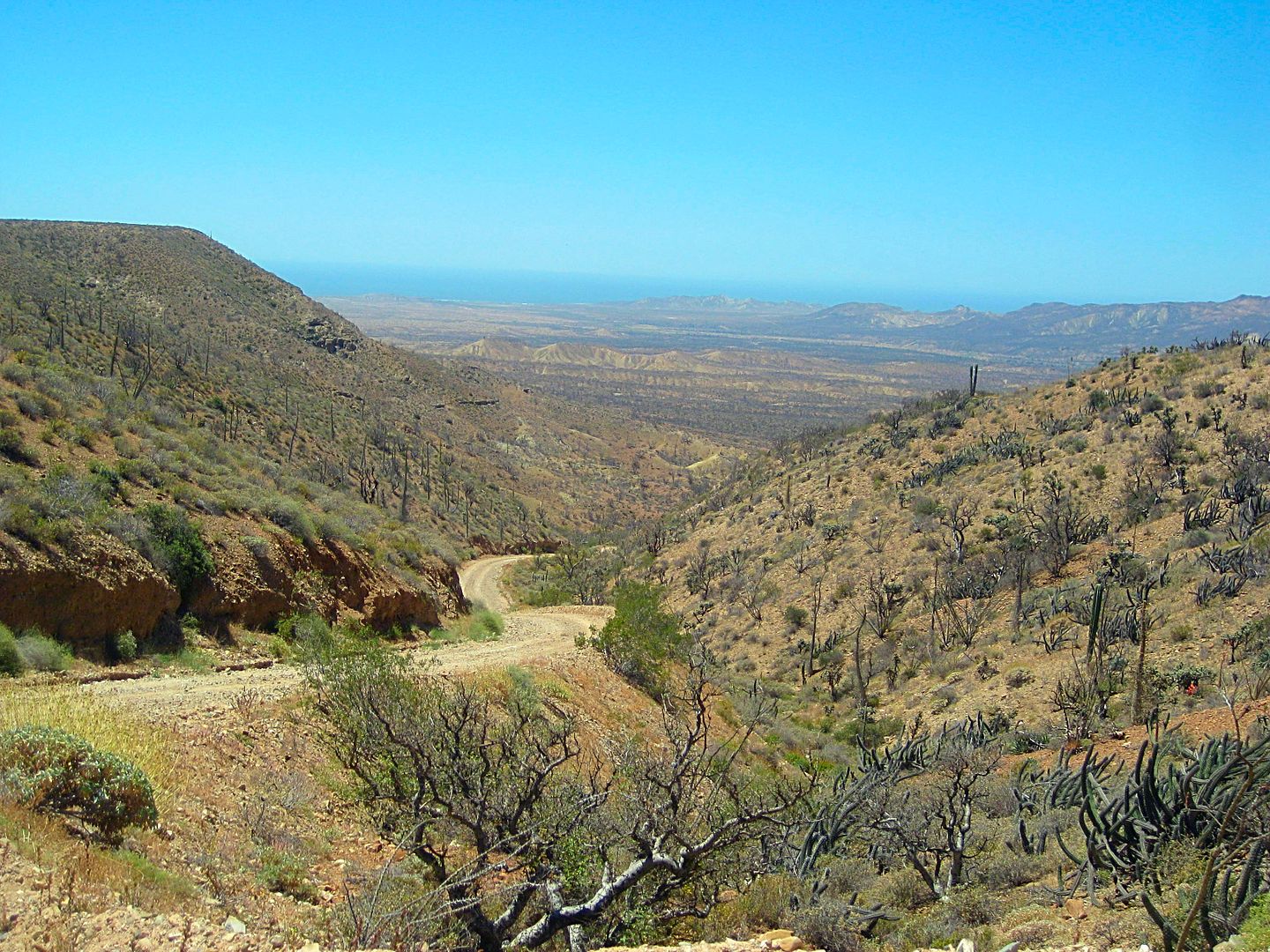
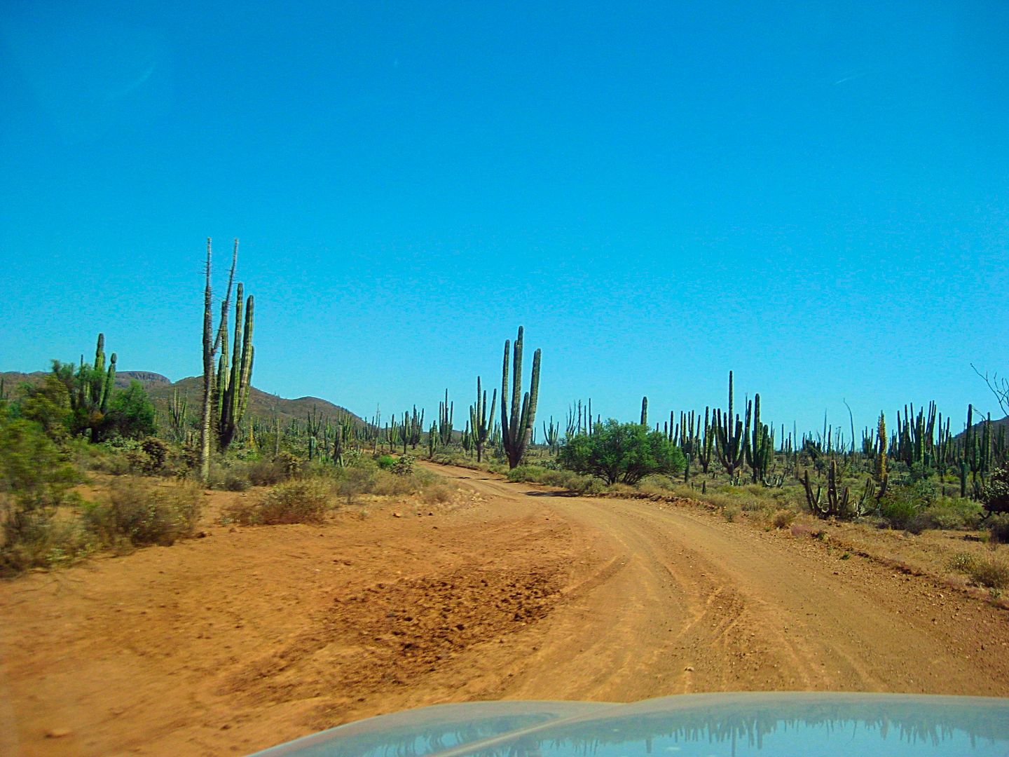
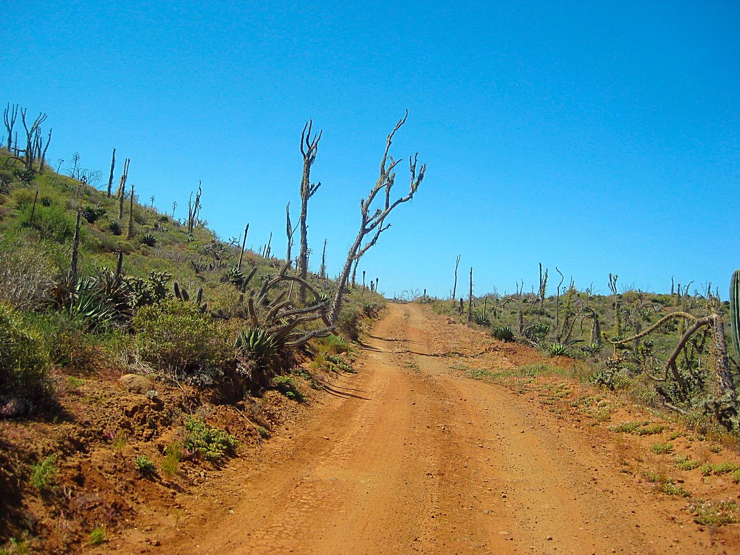
The roads into Puerto Santa Catarina and most of the way to Puerto Canoas were excellent, and that's considering the extremely wet winter and spring
we just had that has damaged so many other roads in Baja.
It was 10:38 am when I was on my way in the dirt.
On the highways, I use the kilometer markers to help everyone locate a point. But, on the dirt roads (most don't have markers, or they aren't
consistent) I have no choice but to use my trip odometer. While my odometer is a bit slow on the highway (I am running 1" taller than stock tires),
when I drop the pressure they seem to be pretty close to correct (on the dirt roads with kilometer markers, my odometer matched them).
However, many of you may have vehicles with less-than-accurate odometers, so the mileages are just an approximate location spot to help you find
points.
0.0 Hwy. 1 Km. 132+ (Signed for Santa Catarina) 10:38 am.
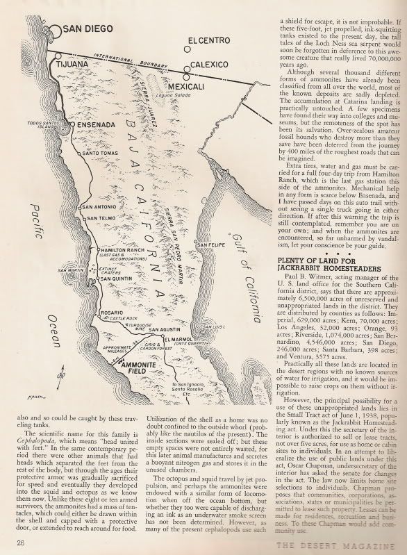
7.0 Road in from the left was the original route to Puerto Santa Catarina from El Mármol, whose blocks of onyx were transported to the coast and
placed on ships using a very difficult looking system! The system was used from the early 1900s to maybe the 1940s when an automobile road allowed
trucks to ship the onyx to San Diego.
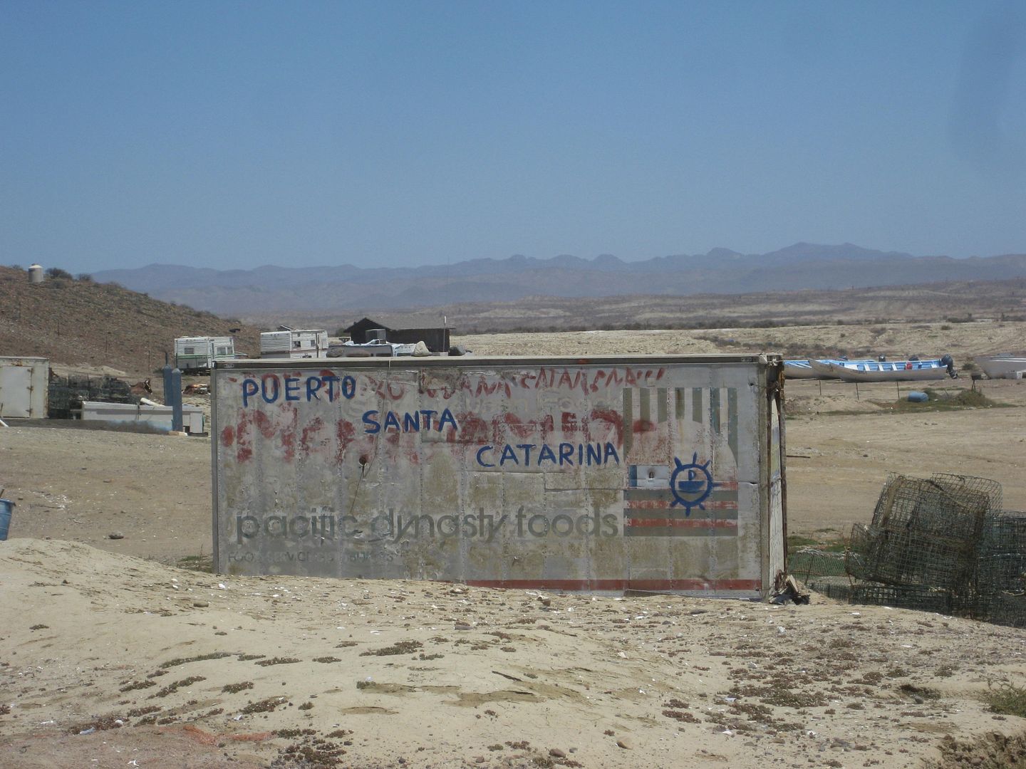
18.4 Santa Catarina, a ranching settlement. It was once much bigger!
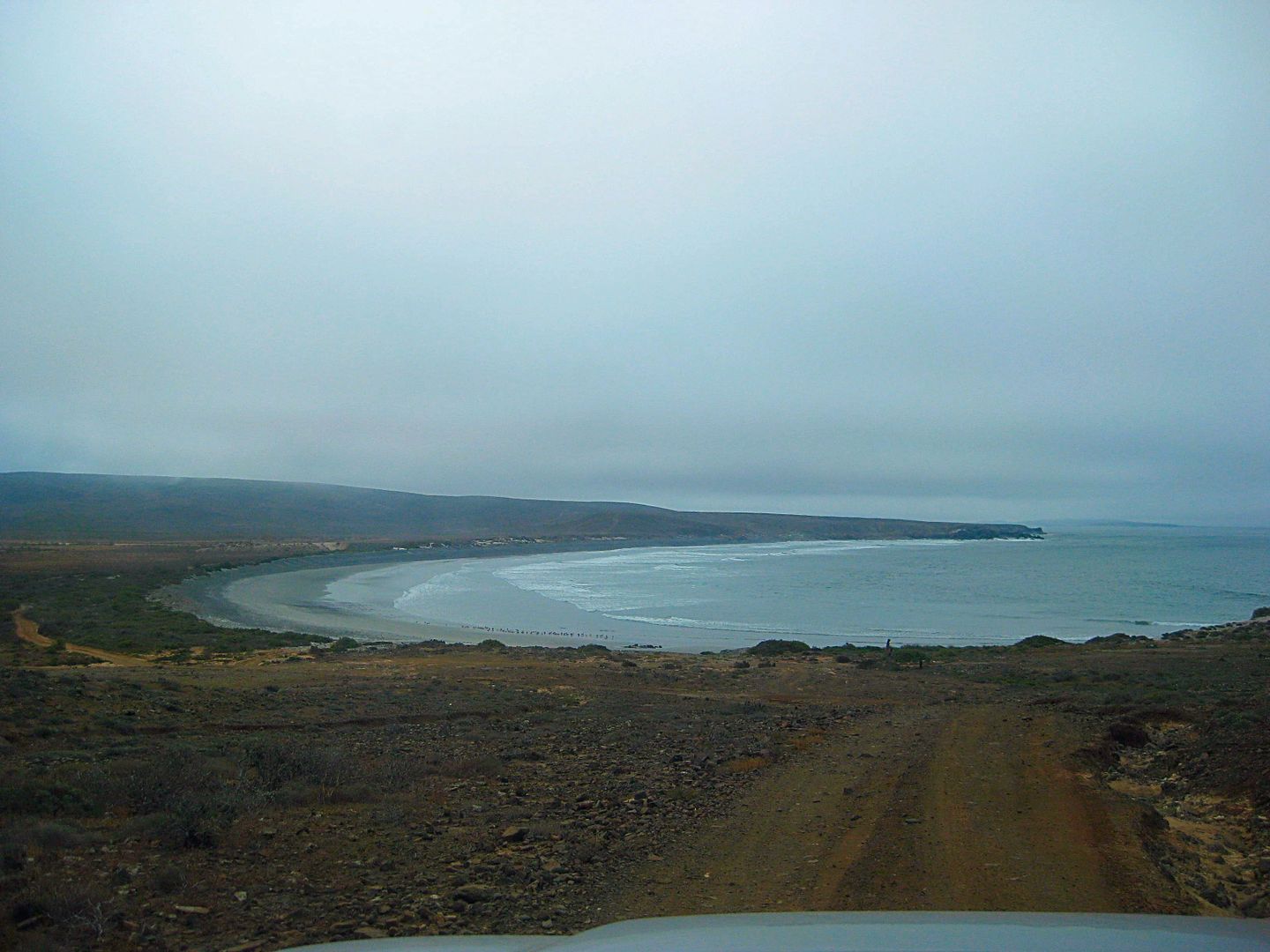
20.3 FORK: Puerto Canoas left, Puerto Santa Catarina right. 11:25 am. The right branch travels high on a ridge offering great vistas of the
surrounding country and the Pacific coast (hidden by clouds or fog) before dropping down to the large arroyo valley. A farm's gated entrance is 11.2
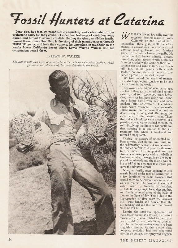
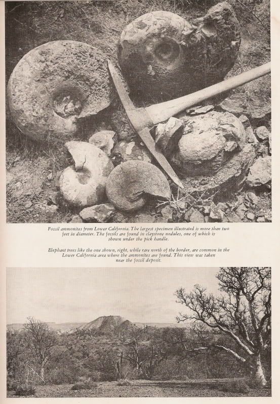
miles from the fork and the famous ammonite hill was nearby. Ammonites are fossil snails found in great quantity at one time, near here. One is on
display in Mama Espinoza's Restaurant, El Rosario.
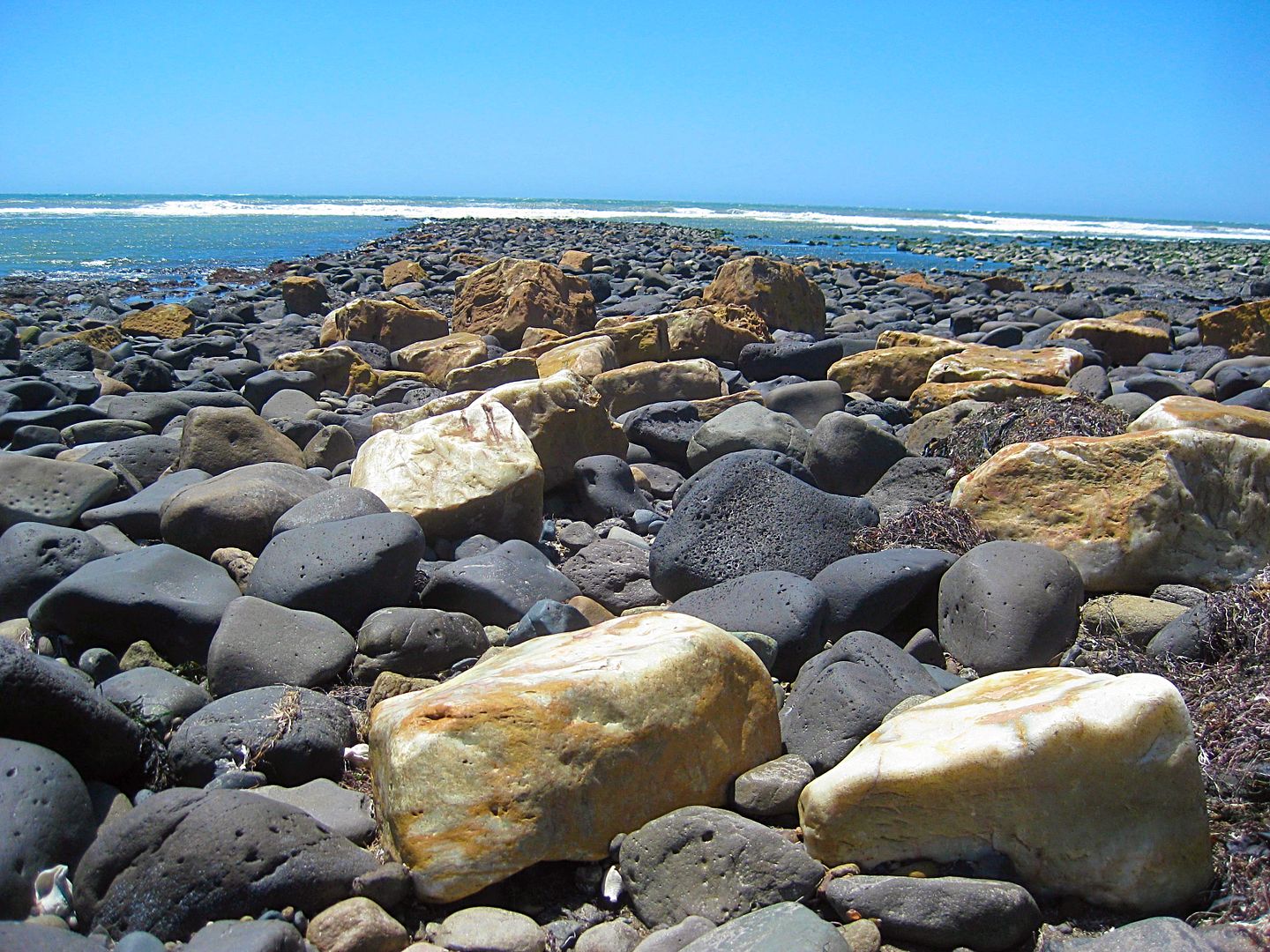
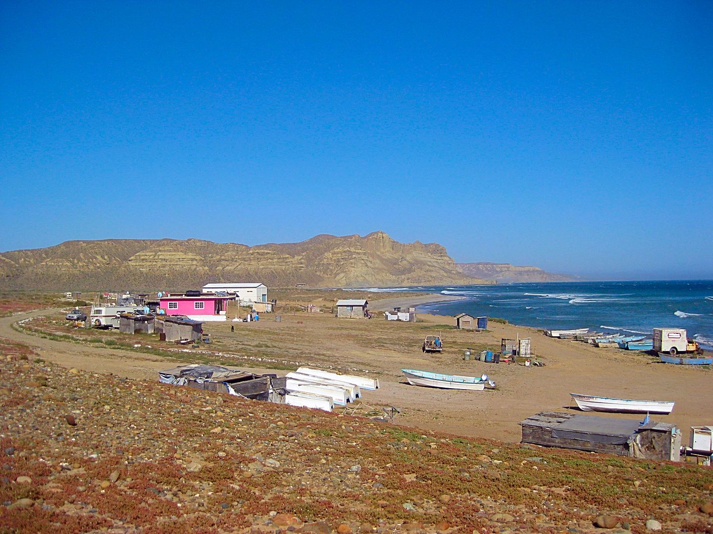
37.0 (16.7 miles from the fork) is the fish camp and landing of Puerto Santa Catarina. Many blocks of onyx are littered about on the tidal rocks. It
is 12:45 pm and the time includes photo stops and a short walk to try and find fossils to photograph (removing fossils is illegal for foreignors).
Photos:
Loncheria El Descanso (Km. 108+)
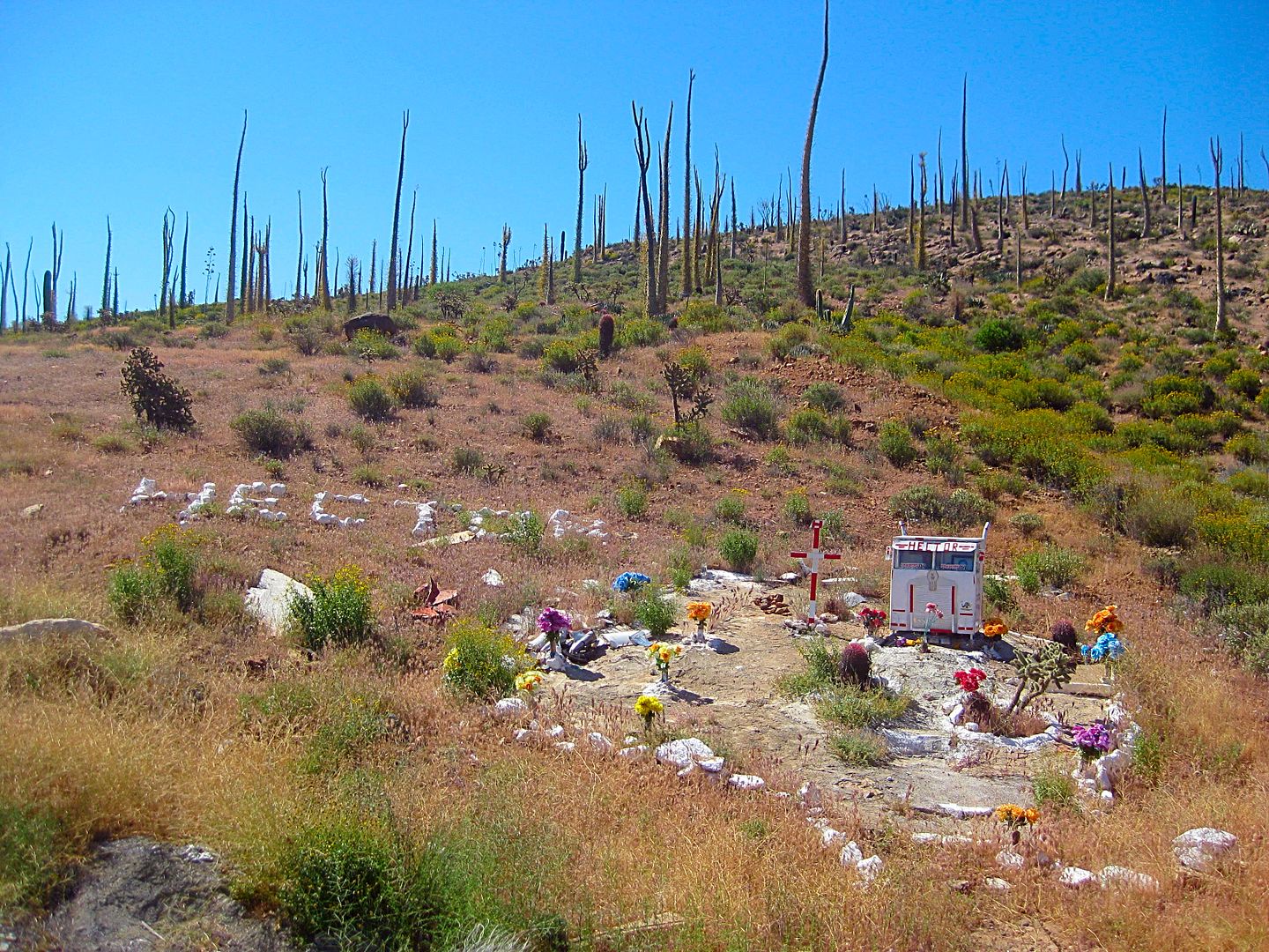
Monument to Hector (Km. 116.5). The boojum trees seem to me to be keeping watch over him, like angels.
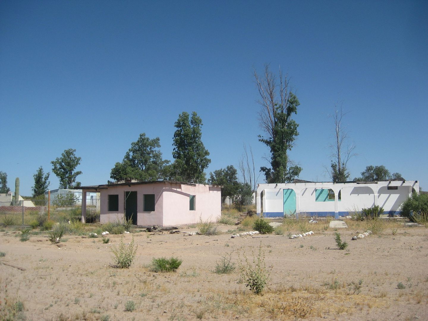
Guayaquil (Km. 132.5 & 0.5 mi north)
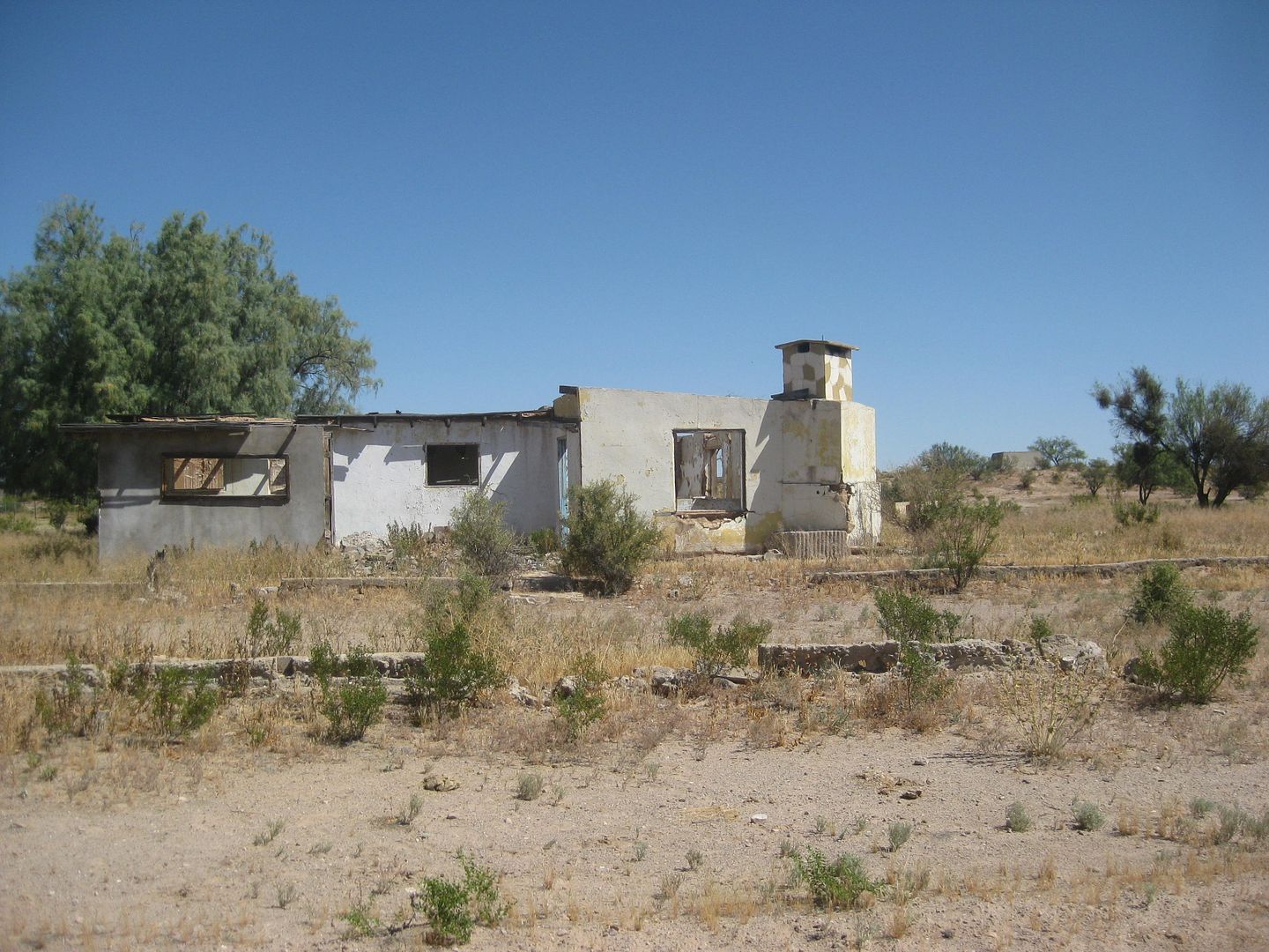
Guayaquil
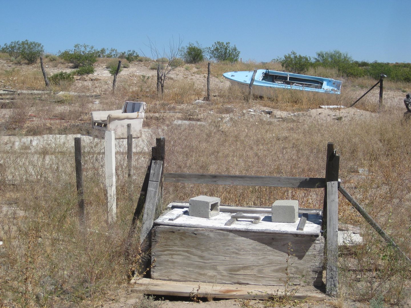
Guayaquil... with all that anyone in Baja needs, water from the well, a sofa to relax and a boat to go fishing!
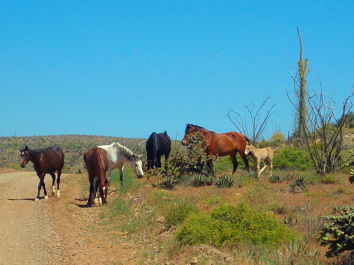
I saw many wild (free roaming) horses on this trip.
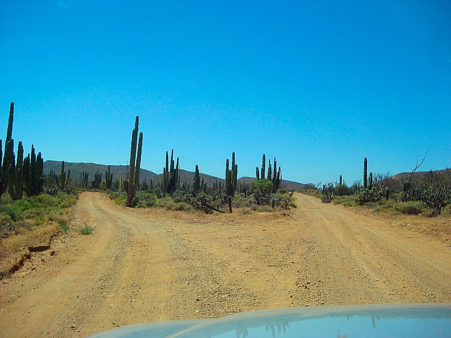
A sample of the nice road... nice if you like good roads!
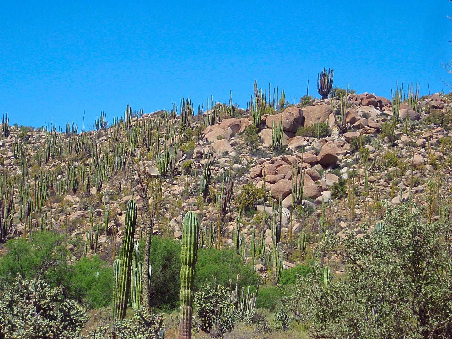
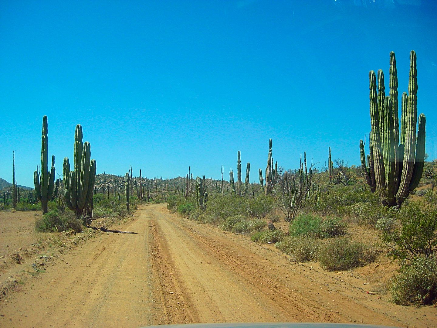
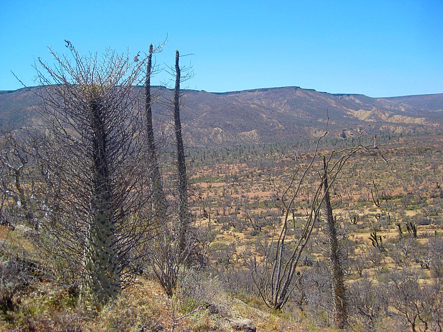
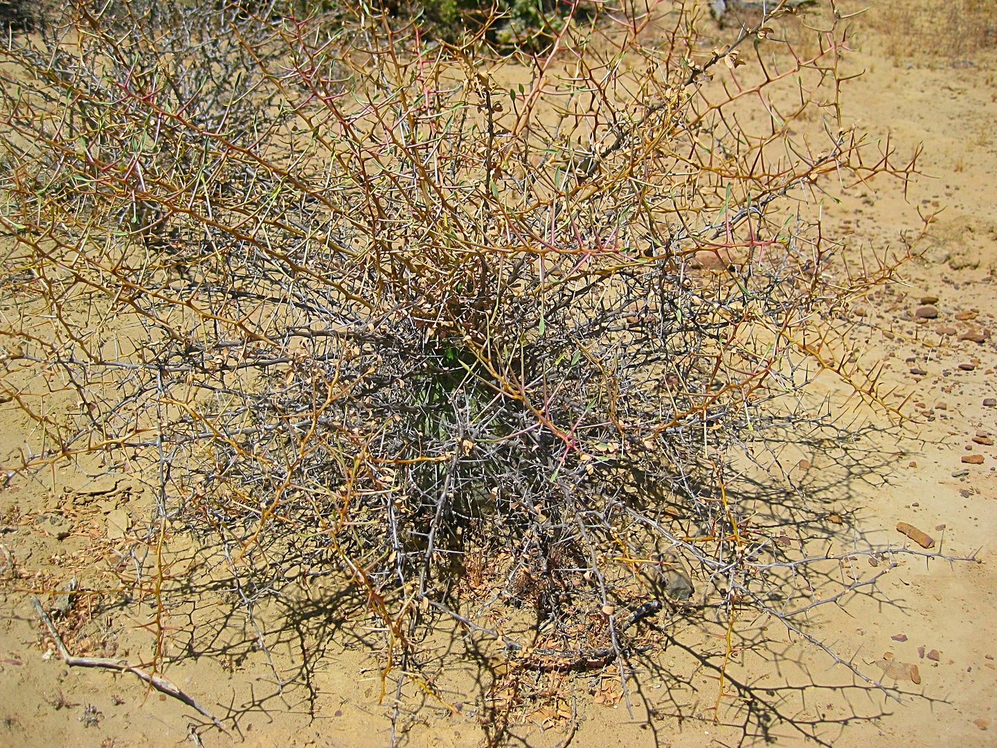
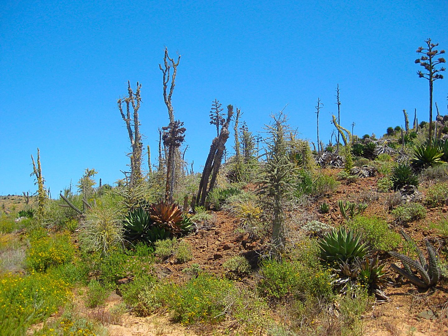
Such a great living museum of desert vegetation!
A couple of baby Elephant Trees.
The Fork: Canoas left, Santa Catarina right. (Mile 16.7)
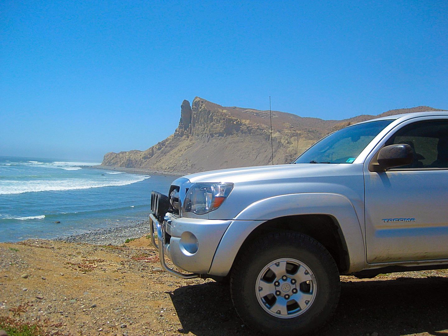
Oh, I didn't forget... so many of you love to see my Tacoma having fun!
Dropping off the ridge and down to the arroyo valley.
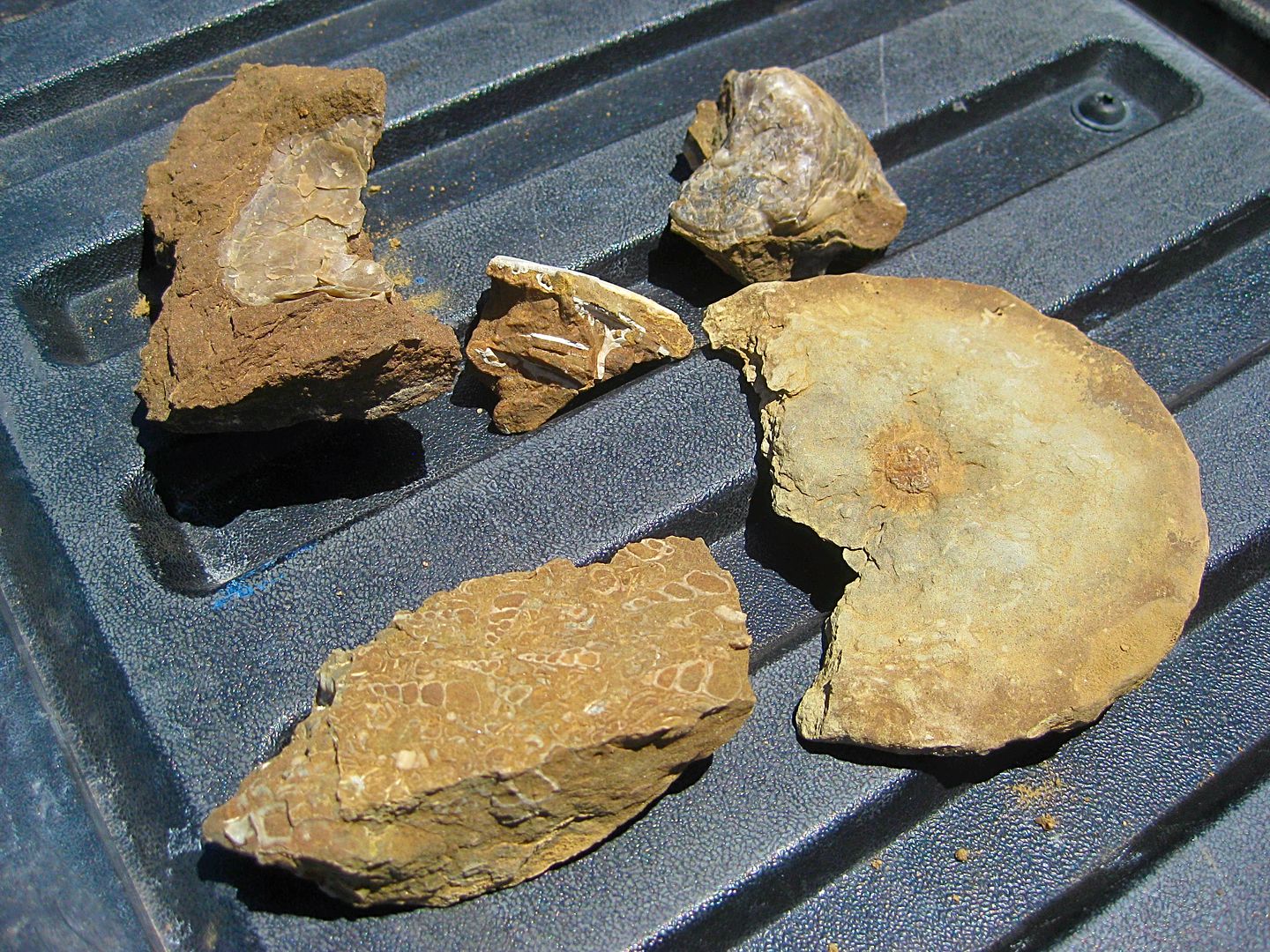
It didn't take me very long to find these. I am not sure if the round thing is a portion of a small ammonite, but it made me happy to find and photo.
I stopped when heading back at another spot and hiked for a while, but no luck finding any more fossils.
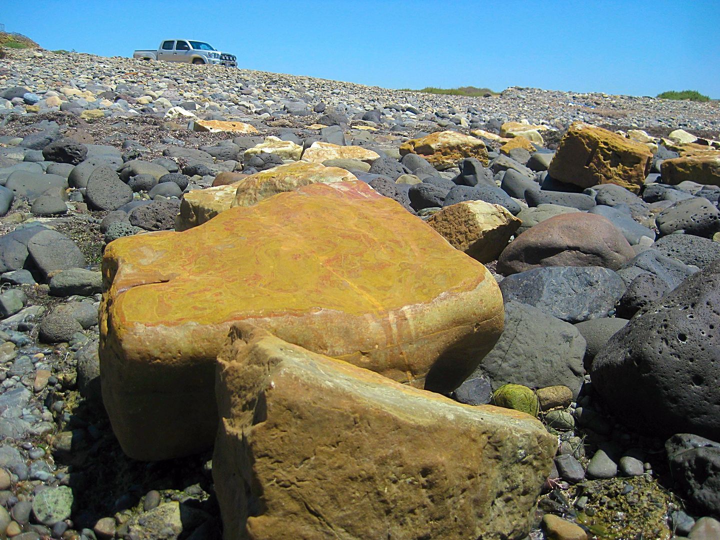
Come at low tide to see the onyx blocks that missed getting on the boat.
May 1948 issue of Desert Magazine:
======================================================================
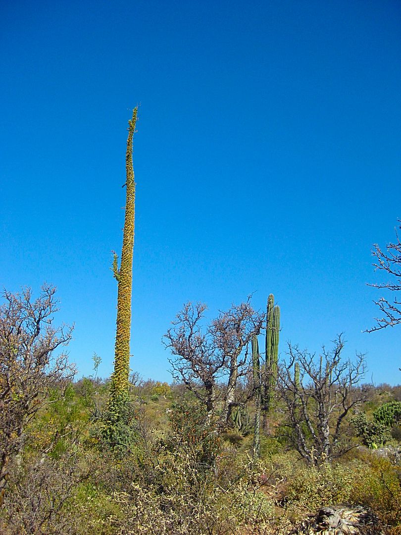
Can you tell I like boojums? In Spanish, they are known as Cirios (candles).
I spot a tiny boojum tree, surrounded by thorny branches for protection...
Someday, perhaps hundreds of years from now, this could grow to 60 feet!
Next, the road to Puerto Canoas... stay tuned!
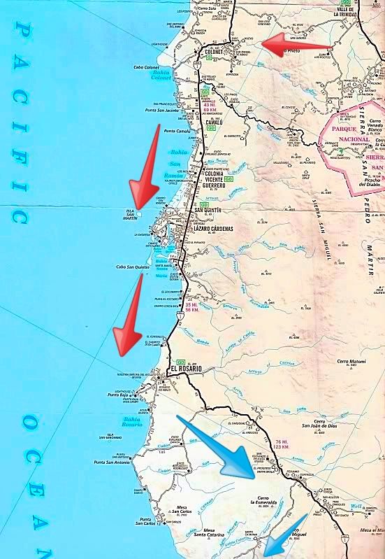
Red=Wed. Blue=Thur.
Old photo of the onyx loading at Santa Catarina...
[Edited on 4-27-2017 by David K]

|
|
|
bajatrailrider
Super Nomad
Posts: 2423
Registered: 1-24-2015
Location: Mexico
Member Is Offline
Mood: Happy
|
|
Thank you so much for your story,writing on Baja. Also thank you for stopping by other day. For lunch and leaving me your book on baja. On your next
trip I promised to show you many roads,trails not on any maps.
|
|
|
ehall
Super Nomad
Posts: 1906
Registered: 3-29-2014
Location: Buckeye, Az
Member Is Offline
Mood: It's 5 o'clock somewhere
|
|
Very nice trip report. I was going to ask you why you spent 2 hours in san Vicente. lol.
|
|
|
BornFisher
Super Nomad
Posts: 2103
Registered: 1-11-2005
Location: K-38 Santa Martha/Encinitas
Member Is Offline
|
|
Looking forward to more!
"When you catch a fish, you open the door of happiness."
|
|
|
Bajaboy
Ultra Nomad
Posts: 4375
Registered: 10-9-2003
Location: Bahia Asuncion, BCS, Mexico
Member Is Offline
|
|
Nice report! Any suggestions of surf spots
|
|
|
TMW
Select Nomad
Posts: 10659
Registered: 9-1-2003
Location: Bakersfield, CA
Member Is Offline
|
|
Excellent report DK and the pictures are great.
|
|
|
Paco Facullo
Super Nomad
Posts: 1301
Registered: 1-21-2017
Location: Here now
Member Is Offline
Mood: Abiding ..........
|
|
Excellent !!!!!
Makes my heart yearn......
|
|
|
David K
Honored Nomad
Posts: 64479
Registered: 8-30-2002
Location: San Diego County
Member Is Online
Mood: Have Baja Fever
|
|
Quote: Originally posted by bajatrailrider  | | Thank you so much for your story,writing on Baja. Also thank you for stopping by other day. For lunch and leaving me your book on baja. On your next
trip I promised to show you many roads,trails not on any maps. |
It was fun to visit with you again Larry. Thank you for the hospitality and the great lunch Alma made us. Enjoy the book, Baja California Land of
Missions!
|
|
|
David K
Honored Nomad
Posts: 64479
Registered: 8-30-2002
Location: San Diego County
Member Is Online
Mood: Have Baja Fever
|
|
Larry is too kind, hard to say goodbye to nice people. As it turned out, I had 0 wait at the border, drove right to the booth, so thanks to
bajatrailrider for the delay. It is more fun in San Vicente than in a border line!!
I will continue with the trip report soon. At Discount Tire now getting the tire replaced that was punctured on Hwy. 1, 2 am Monday!
|
|
|
David K
Honored Nomad
Posts: 64479
Registered: 8-30-2002
Location: San Diego County
Member Is Online
Mood: Have Baja Fever
|
|
DAY 2 (THU APR 20) continued...
As you can see from the map, there is a short cut road between Catarina and Canoas. We drove it in 2007, the last time I traveled this area. Well, I
couldn't find where it met the road I was on (it 2007, the junction was 1.0 mile from the fish camp. Looking at Google earth, it now goes right into
the fish camp, and there was no connector outside of the camp, that I briefly searched for.
No problema, I wanted to look more for the Ammonite hill, which is supposed to be a few miles from the beach. Walt Peterson (1980s Baja Adventure
Book) puts it 6.7 miles from the beach. Howard Gulick (1960s Lower California Guidebook) puts it at 4.8 miles. Now, the road alignment is likely
different and maybe there is more than one ammonite hill, but close is good enough, usually! That fancy gate entrance for the farm is 5.5 miles from
the beach, today. The few fossils I did find where near Gulick's point. On the way out, I hiked to and climbed a hill closer to Peterson's point and
found nothing.
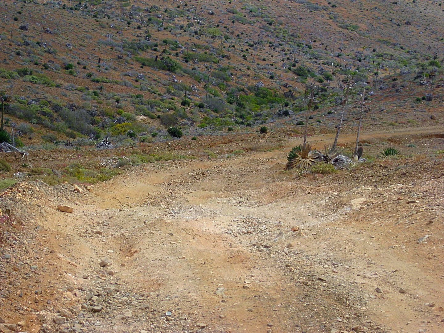
Back at the fork (20.3 miles from Hwy. 1) I head on the left branch towards Puerto Canoas, a small fish camp a few miles south (actually more east) of
Punta Canoas.
0.0 Fork
4.4 Mina La Fortuna gated entrance.
8.9 Fork, lesser used graded road to the left. Go right. (Left fork goes to Evangelina Copper Mine, per Baja Almanac)
13.6 Junction with the shortcut road to Puerto Santa Catarina (10 mi).
18.4 Fork. Go left, south. Ahead (right) goes to the coast and the mesa of Punta Canoas.
23.6 A graded road coming from inland joins this road. Puerto Canoas fish camp is 1/2 mile ahead.
24.1 (44.4 mi from Hwy. 1) Puerto Canoas
It is 4:10 pm and very windy! Camping near here is out of the question, in a tent. I continue on...
0.0 Puerto Canoas
0.5 Take the graded road (straight ahead or right fork).
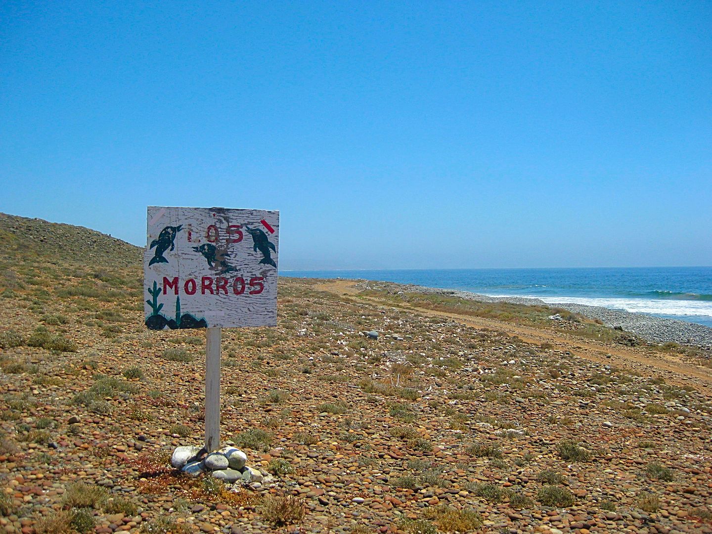
1.3 Come to a cross road. Ahead are a windmill and water trough. Turn sharp right (south). A sign is here for Lazaro and Los Morros, to the south.
2.0 Important Fork. The grader has scraped the right branch, and this is the route south closest to the coast. However, in 2007, the left (inland
road) was the primary road and we didn't even notice the coast road (which we wanted to drive).
Now, it is windy, and I know the inland road would have better shelter possibilities, in addition to the history that we camped in there with Roy 'The
squarecircle', in 2007. I go left... and end up going past where we camped as it was still windy at that point.
This once graded main road was now abandoned, slow, and needed 4WD a couple times on the steep up-grade. I camped in a nice clear spot on the top of
the hills. No more wind. It seemed great! It wasn't until my tent was up that hoards of gnats took a liking to me. I have DEET, but the smell is less
than enjoyable to have around your face. They did not bite but were just annoying.
I lit one of my fire logs but took refuge in my tent as the flying tiny devils did not rest at sundown.
CREEPY... I realize that this spot is only about 2 miles from where Gary Patton vanished from his 4Runner... The next day, I passed the ranch road,
down which Gary's Toyota was found. Gary vanished in September 2013. Here is the thread on Gary Patton: http://forums.bajanomad.com/viewthread.php?tid=69117
PHOTOS:
The Canoas Road
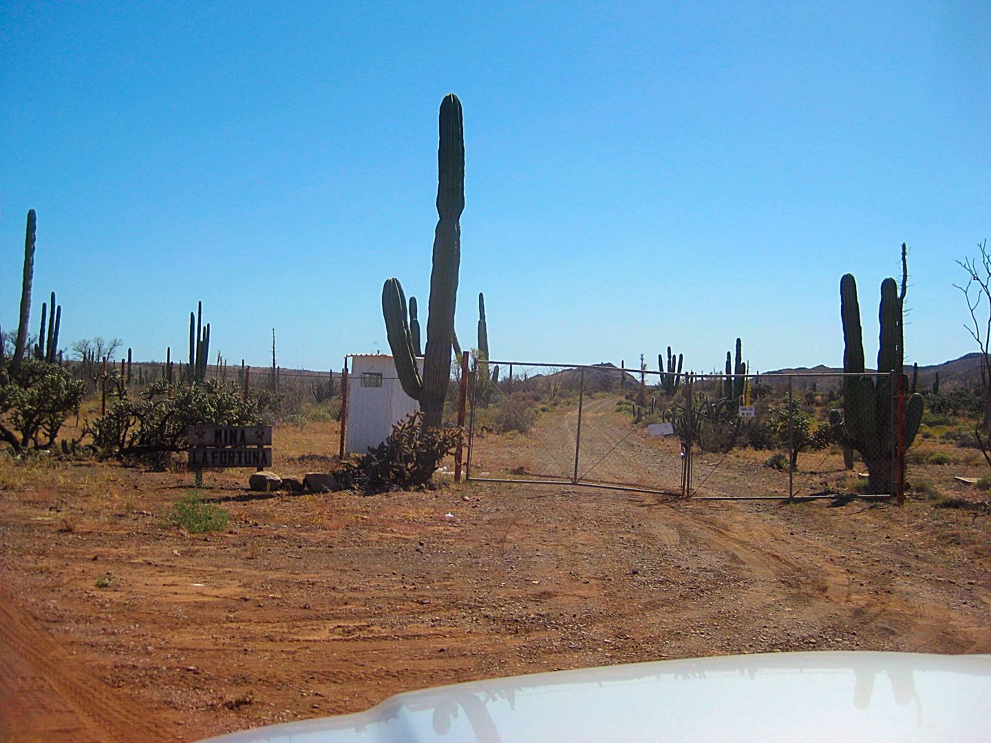
La Fortuna Mine Entrance Gate
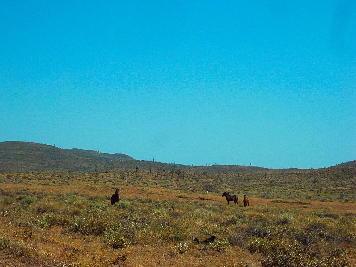
More 'wild' horses
The Canoas road was pretty good until it got to the bottom of these hills and the rainy season of recent months had done some erosion damage. A
pleasant change was the amount of silt (fine, talcum-like dust) was greatly reduced from before. There is a mini silt canyon the road goes in, and
while there was plenty of puffs of dust. none enveloped my car, covered my windshield, etc. as in the past or typical of Baja's silt beds.
Puerto Canoas

Signs are rare, but can be helpful. This one was 1.3 mi inland from Canoas, on the road heading southward. Lazaro must be the ranch in Arroyo Lazaro,
6 miles south? Los Morros is 10 miles south. I will see them tomorrow when I came in from the south.
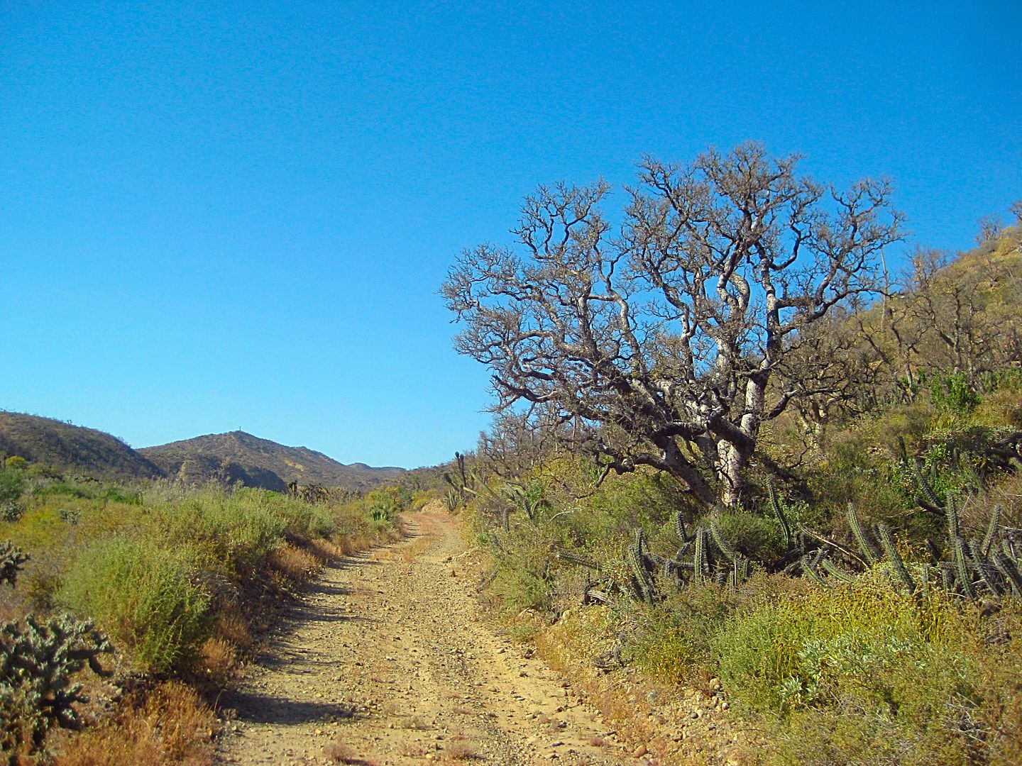
Traveling up the now abandoned, inland road past this elephant tree.
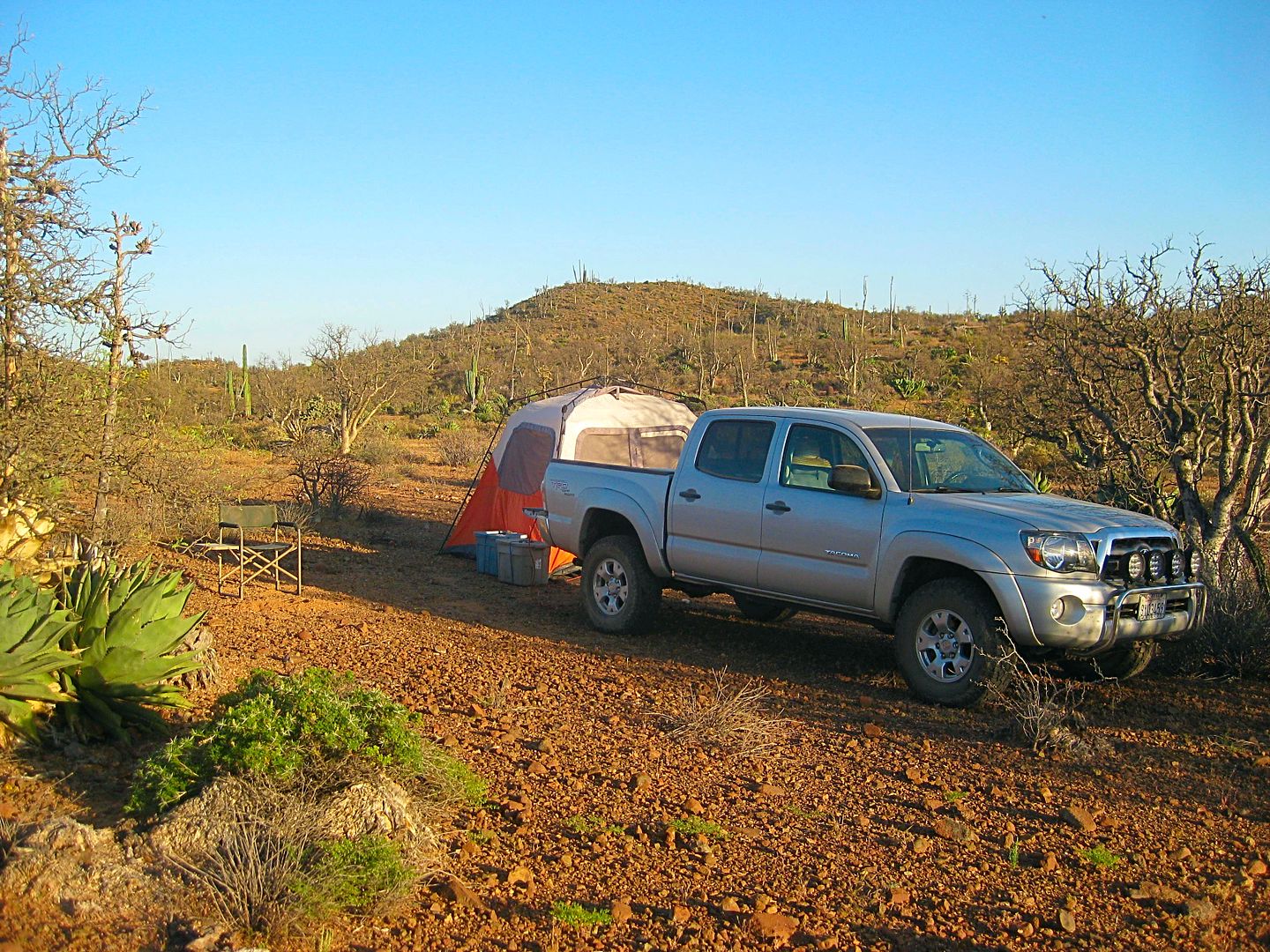
My first camp, a beautiful place, no wind, and lots of gnats! The desert was still very green and in bloom from all that rain this year. This was 9.1
miles up the abandoned road... and still 7 miles from the Faro San José road. See the star on the map for my camp location.
The coastal road via Los Morros isn't even on the Auto Club map.
Mileages between black darts, either those in the Baja Almanac already or ones I have added.
Continued with DAY 3, soon...
[Edited on 4-27-2017 by David K]
|
|
|
David K
Honored Nomad
Posts: 64479
Registered: 8-30-2002
Location: San Diego County
Member Is Online
Mood: Have Baja Fever
|
|
DAY 3 (FRI APR 21)
Well, I slept okay.. the air mattress helps. It was very quiet and only heard an owl once. No chupacabras and no ghosts.
I got the camp taken down and was on the road at 9 am.
This road log continues from yesterday's, which I will repeat the first four lines here to keep it flowing:
0.0 Puerto Canoas
0.5 Take the graded road (straight ahead or right fork).
1.3 Come to a cross road. Ahead are a windmill and water trough. Turn sharp right (south). A sign is here for Lazaro and Los Morros, to the south.
2.0 Important Fork. The grader has scraped the right branch, and this is the route south closest to the coast.
11.1 Road south, faded sign, no recent tracks (down this road is where Gary's 4Runner was discovered).
13.6 Abandoned ranch site. Cinder block room.
16.0 Junction with the main graded road between Hwy. 1 (Km. 168) and Faro San José. Highway 1 is approx 25 miles away. I turn right, towards Faro San
José.
Reset trip odometer. 9:52 am.
0.0 Abandoned road to Canoas and San José fish camp road junction.
3.2 Road to right. Trash can. Environmental sign.
4.3 Major Fork. An ejido meeting room is to the left, with picnic tables. I thought this looked like a school house back in 2007. The road to the
coast forks to the right. Ahead (left branch) is unsigned but would appear to be a new road east to Rancho Todos Santos, looking at the map and Google
Earth.
There is an onyx mine (Cerro Blanco or Cerrito Blanco) on the old road, north of Todos Santos. I had planned to go there this trip, but you will read
soon about the rescue mission that altered that plan.
5.1 A ranch to the right.
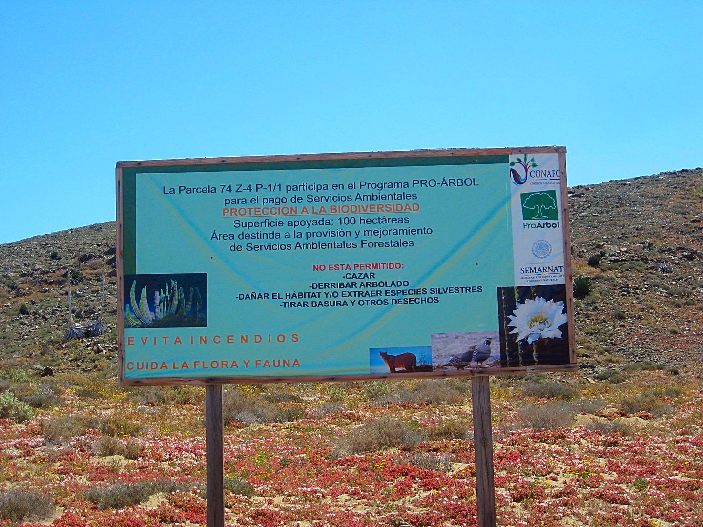
14.3 Road to the right. Trash cans. 10:50 am. It is amazing that some environmental group thought that it was better for people to empty their trash
here (in nowhere land) instead of waiting until they got to a town or their home. The trash cans are full and the excess trash is littering the
desert.
16.6 & 16.7 Road to the left (south).
18.4 Road to the right (north).
19.3 Pass home on the left.
19.4 Major Junction. The road to the right is the coastal road north to Canoas.
20.3 Road left is the road to continue south to Bahía Córbin and beyond.
20.4 road left over the hill into the fish camp of San José. Faro San José or San José de la Piedra are what signs and maps call it. A road to the
right goes 0.3 mi to a rocky beach.
20.5 San José fish camp
20.6 Beach by camp. A small island is just offshore.
In the next section, I will do the drive north from San José, past Los Morros to where I took the abandoned inland road the day before.
Photos:
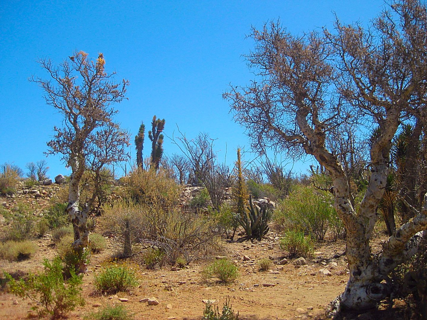
Several boojum trees had new coats of green leaves.
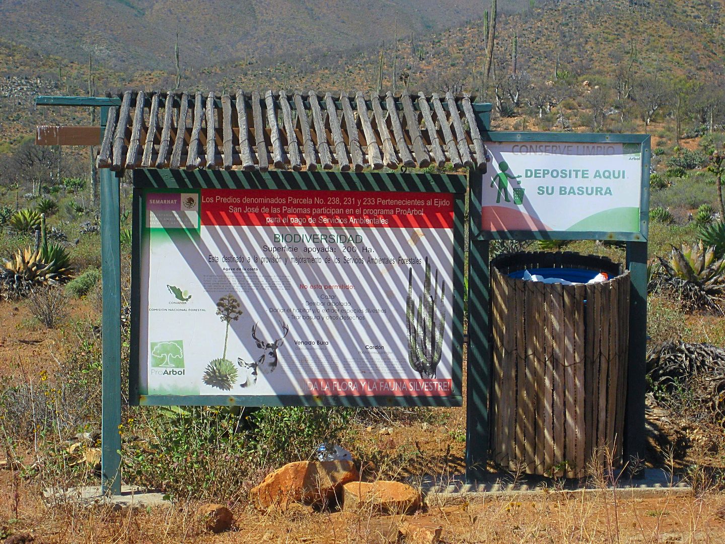
Enviro sign and trash can
The ejido meeting room (?) and picnic tables.
Some boojums get covered with Spanish moss or ball moss.
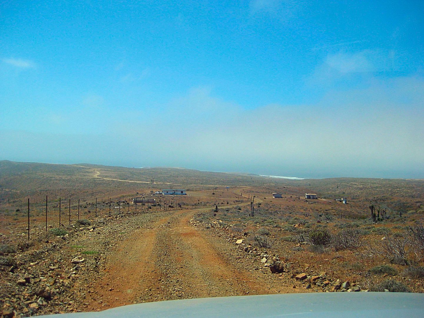
Approaching the house on the left (Mile 19.3) and the coastal road north (Mile 19.4), just over a mile from San José fish camp.
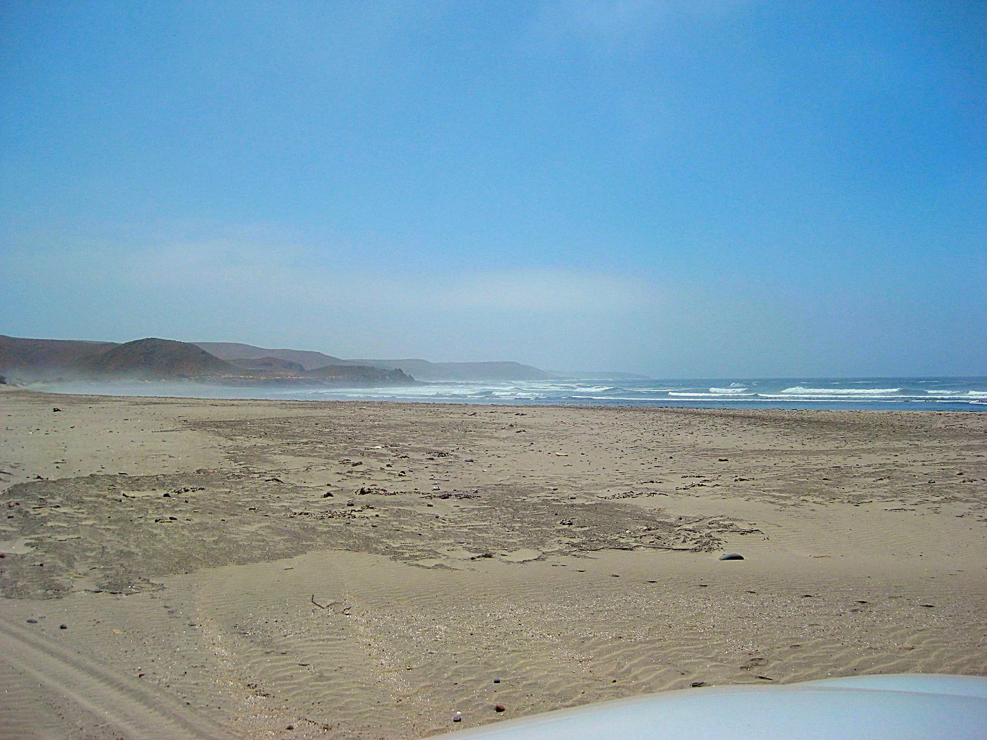
The end of the road at San José. Beach looking south. Mile 20.6.
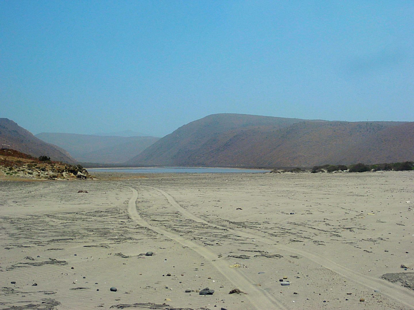
Looking inland at the San José arroyo estuary. The road to the south goes along the left side of the lagoon.
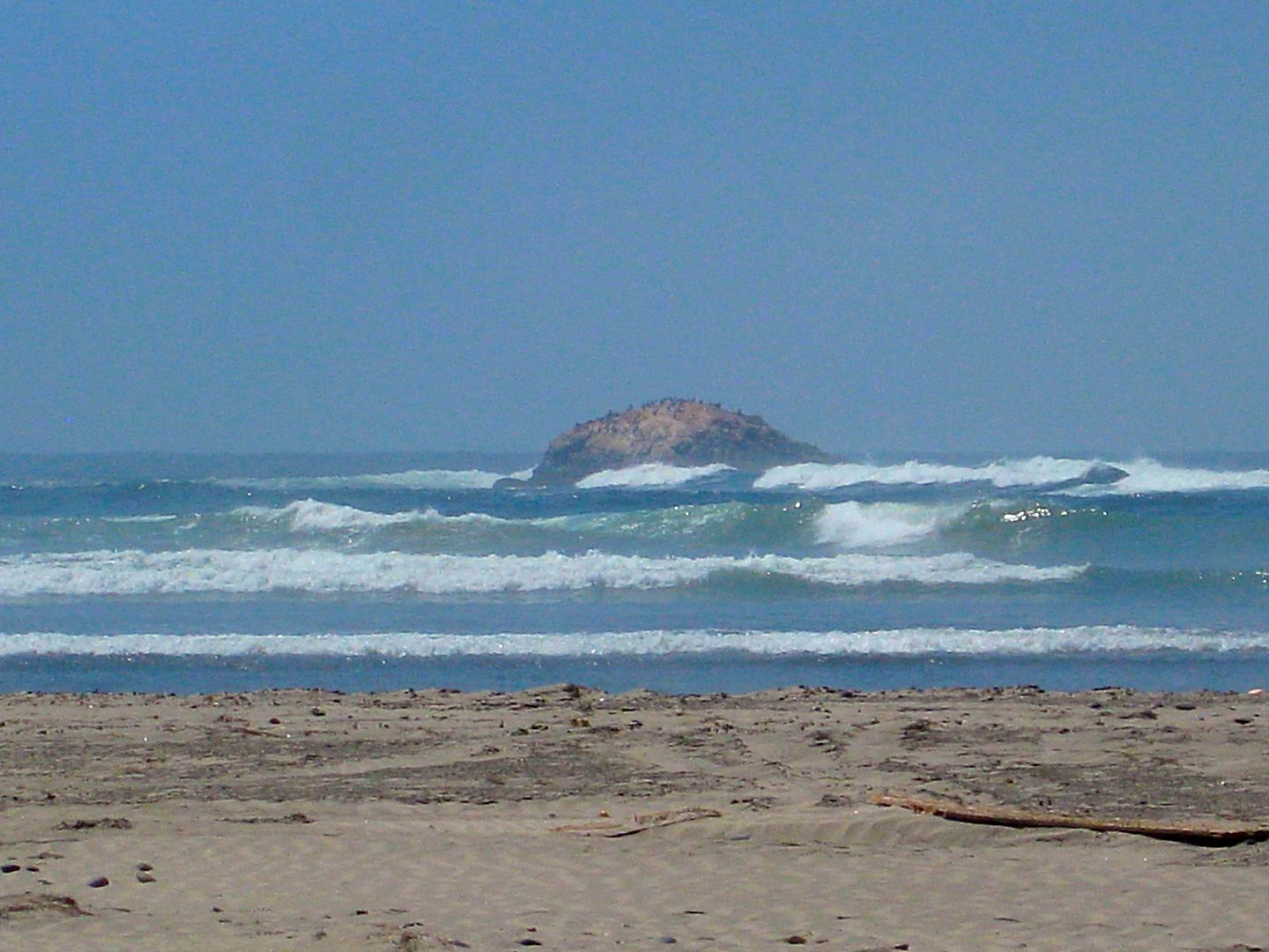
Islote Piedra de San José, just offshore of San José fish camp.
This trip report will continue with the drive north on the coastal road, 26 interesting miles! Stay tuned!!
[Edited on 9-15-2017 by David K]
|
|
|
Ateo
Elite Nomad
Posts: 5847
Registered: 7-18-2011
Member Is Offline
|
|
Nice!
|
|
|
David K
Honored Nomad
Posts: 64479
Registered: 8-30-2002
Location: San Diego County
Member Is Online
Mood: Have Baja Fever
|
|
Because I went on the inland road south from Canoas, but the coastal road is the primary route, I needed to check it... and because of my direction
was southbound, I would also have to drive the coastal road again, southbound.
So, after taking photos around San José, I drove back up the hill to Mile 19.4 for the coastal road north. Zero my trip odometer...
0.0 Junction Coastal Road and Faro San José road from Hwy 1, Km. 168 (near Cataviña).
4.3 Steep, eroded grade up (4WD).
5.0 Second grade up.
13.1 Los Morros. White picket fence around house. Rocky beach.
16.8 Enter Arroyo Lazaro from the south.
17.2 Rancho Lazaro
20.9 Road to beach, 0.3 mi, rocky. See photo of Acantilado los Candeleros.
22.6 Junction with inland road (2 miles from Puerto Canoas)
This coastal route (22.6 mi took 1.5 hours to drive). Now, I will turn around and drive it south...
0.0 Junction coastal and inland roads, go right, fresh grading. The grading doesn't last or was washed out by this season's rains. 1:36pm
1.7 Road right to a rocky beach with an impressive cliff, see photo.
5.2 & 5.4 driveway to Ranch (Rancho Lazaro) in Arroyo Lazaro.
9.5 Los Morros, white fence. 2:16pm
10.5 Steep grade up.
16.2 Steep grade up.
17.5 Big grade down.
18.2 Big grade down.
22.6 Junction Faro San José/ Cataviña graded road. 3:05pm
On my map, the mileages are all to the black darts, which include some roads beyond the above logs.

I once again popped down by fish camp San José to begin the next road log, on south.
The road south follows the shore of the lagoon (estuary) along the left (north) side and comes to a junction. The road on ahead (inland) seems to run
up to Rancho San José and Todos Santos, Cerrito Blanco and meets the graded road on to Hwy. 1 near Cataviña.
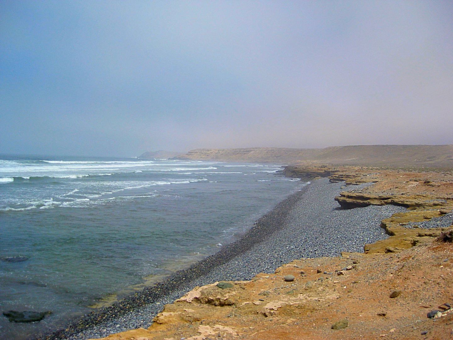
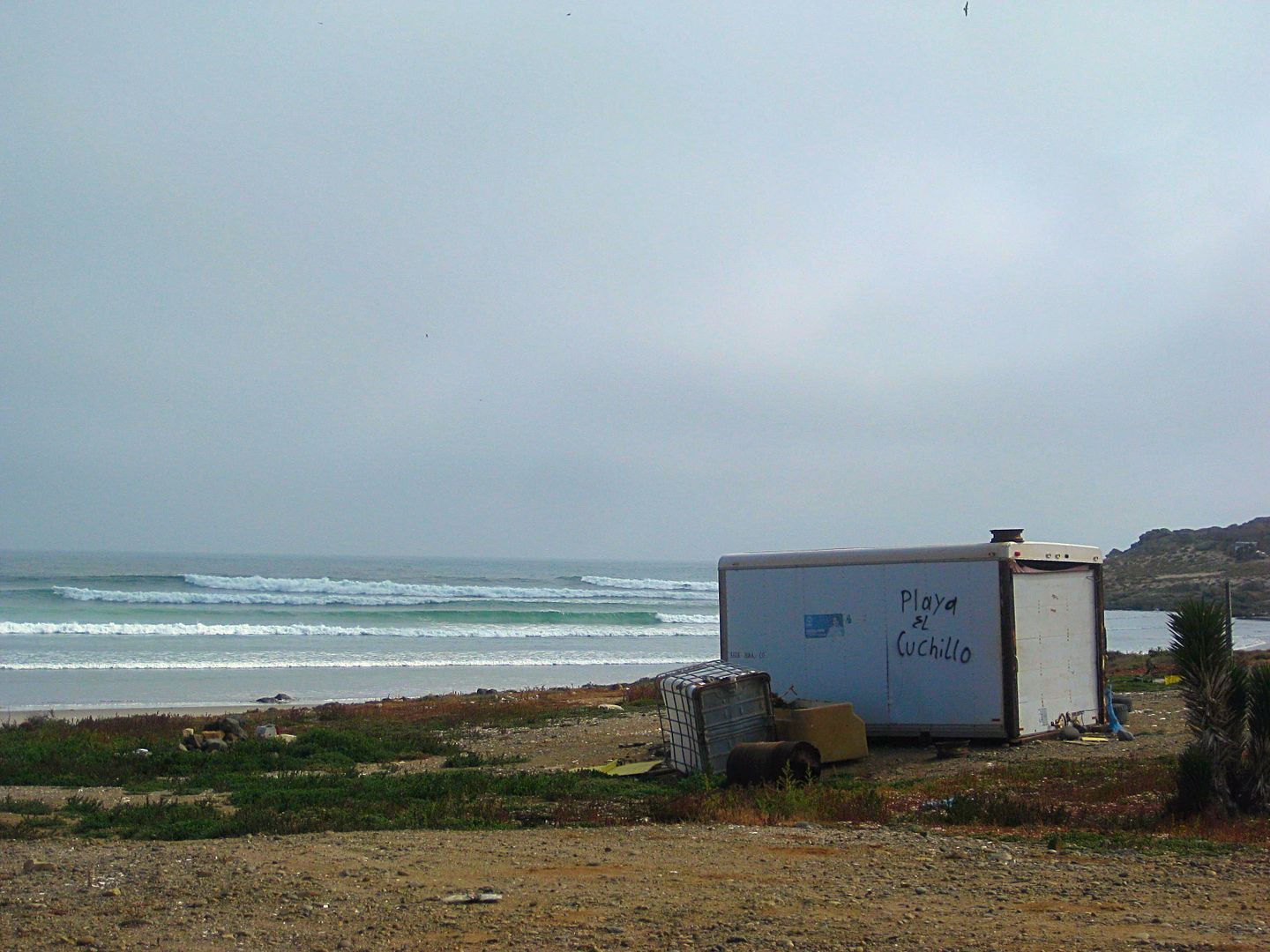
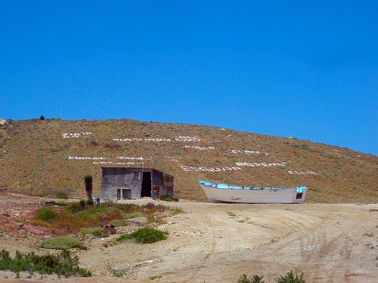
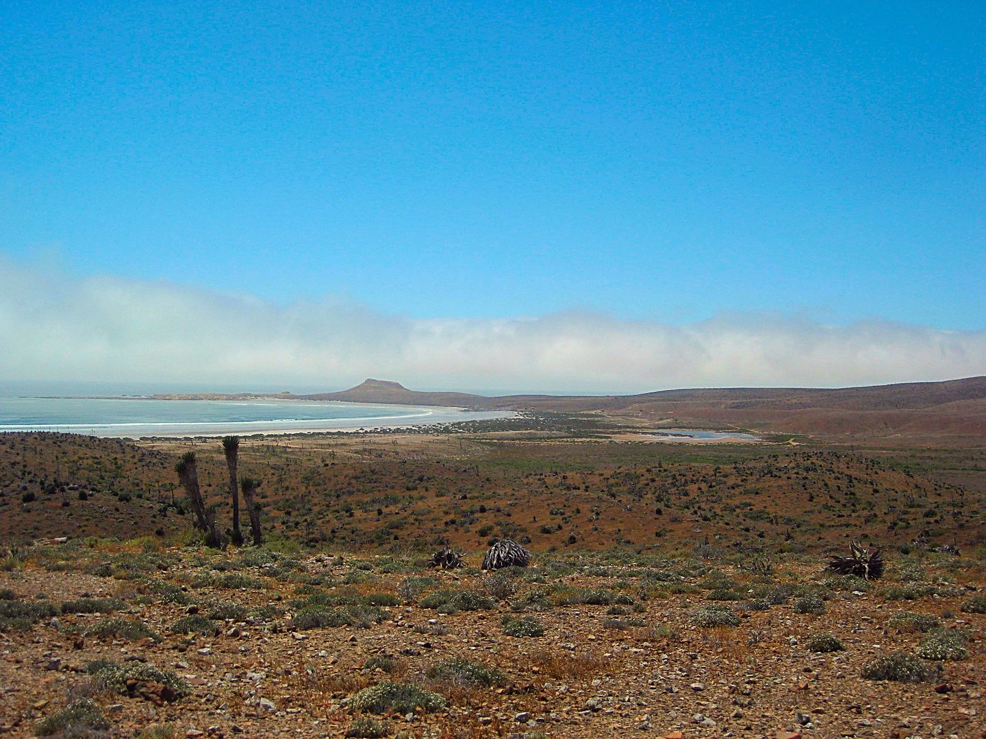
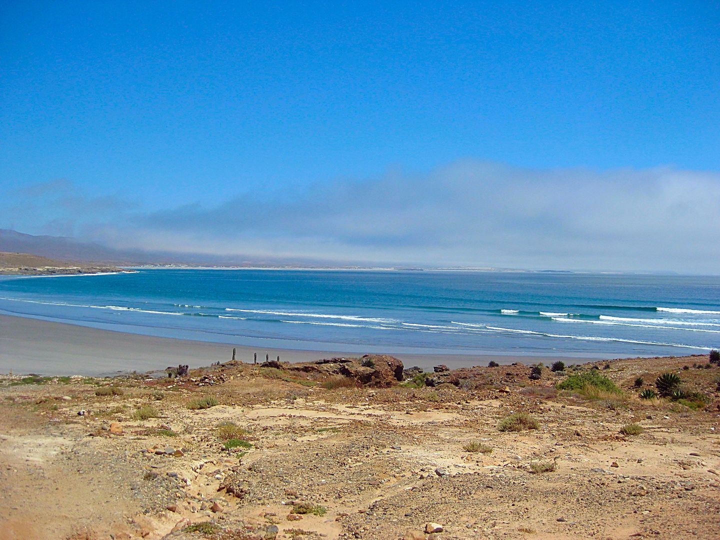
I go right to continue along the coast and soon arrive at Bahía Córbin. An abandoned fish camp and painted on a container is the name 'Playa El
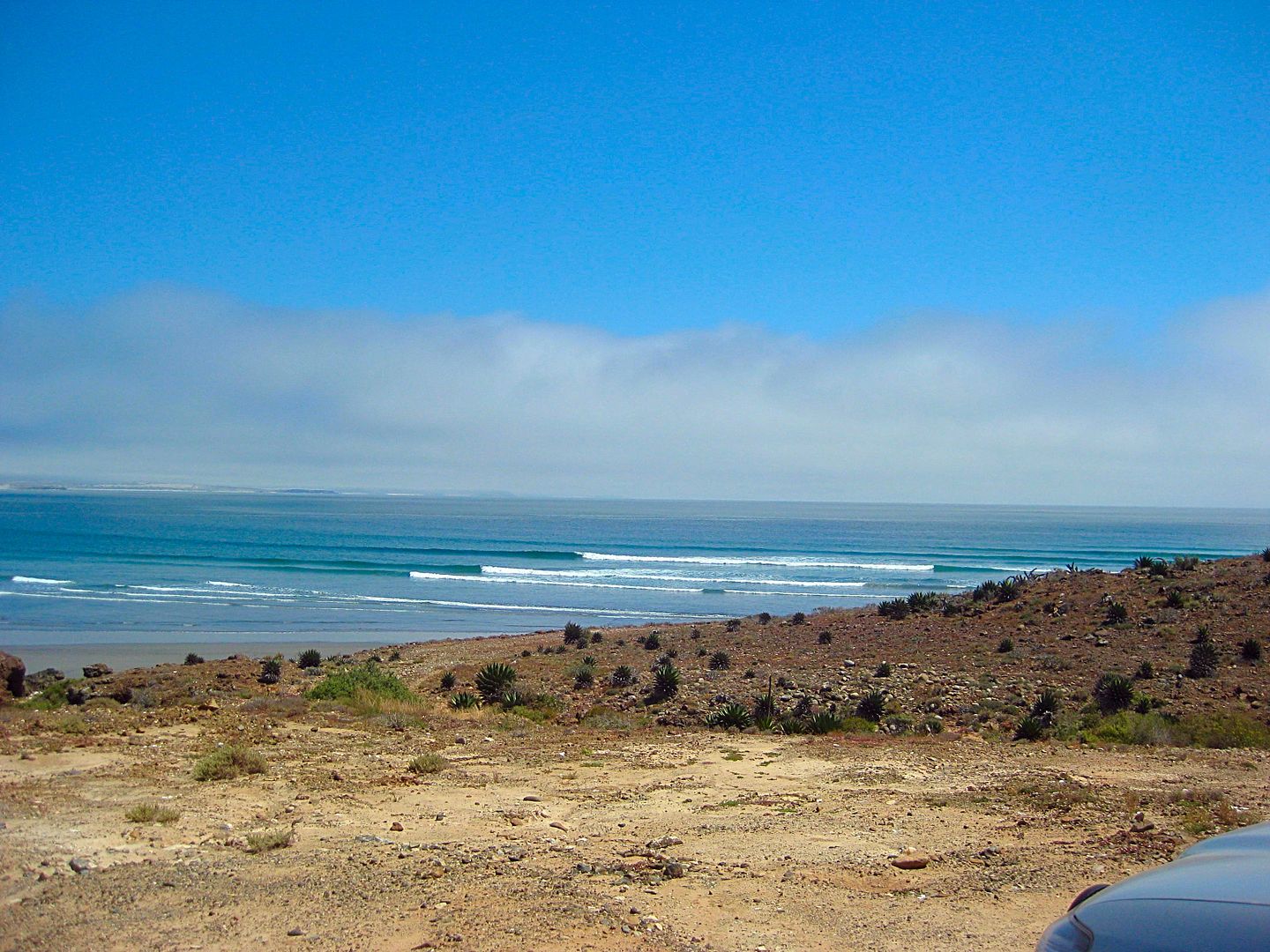
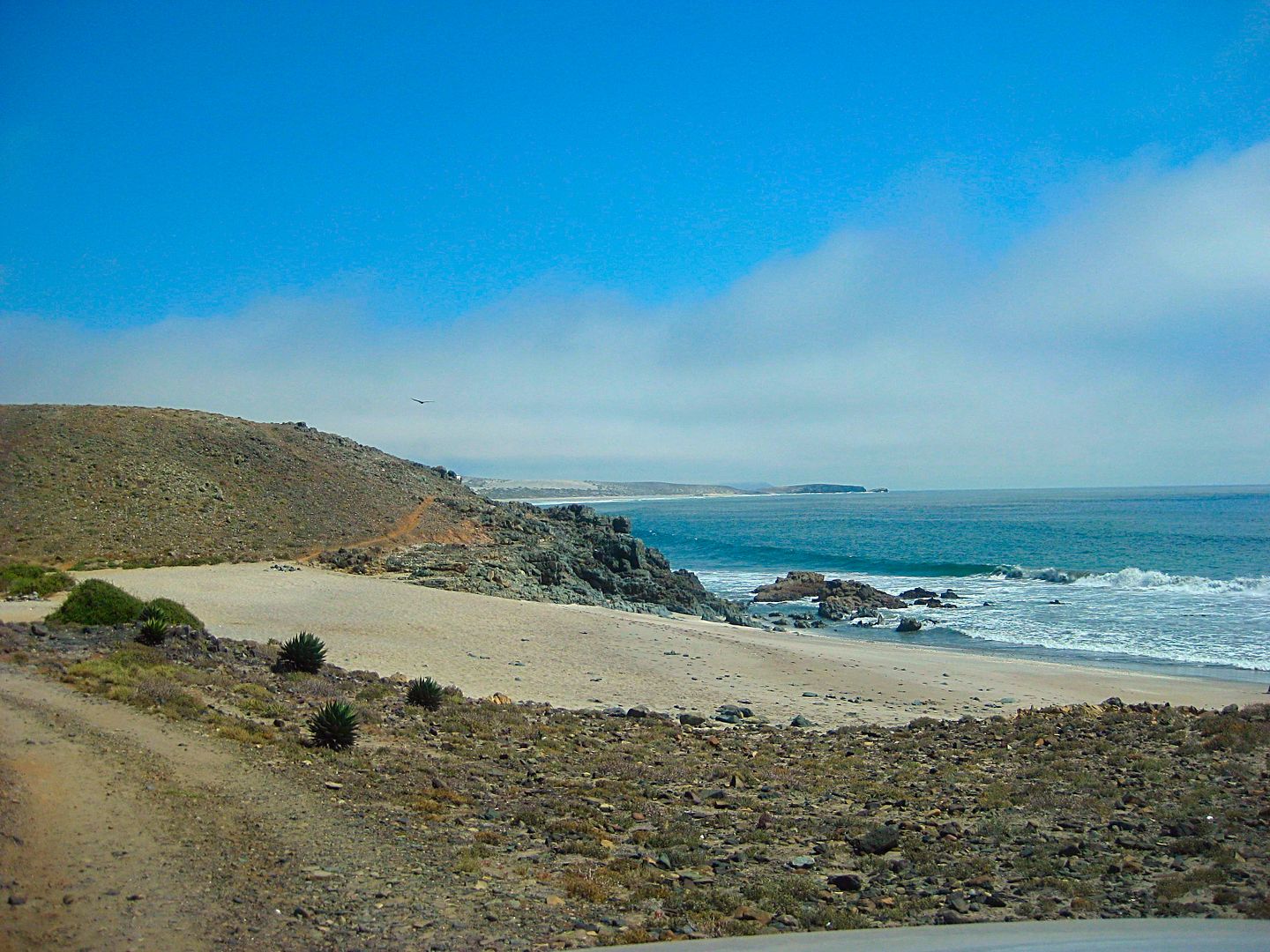
Cuchillo' (Knife Beach), friendly sounding? In the distance at the rocky point, I see a camper set up. In the water is a paddle boarder. This will be
the only 'tourist' vehicle and tourist person I will see in this entire off-road adventure.
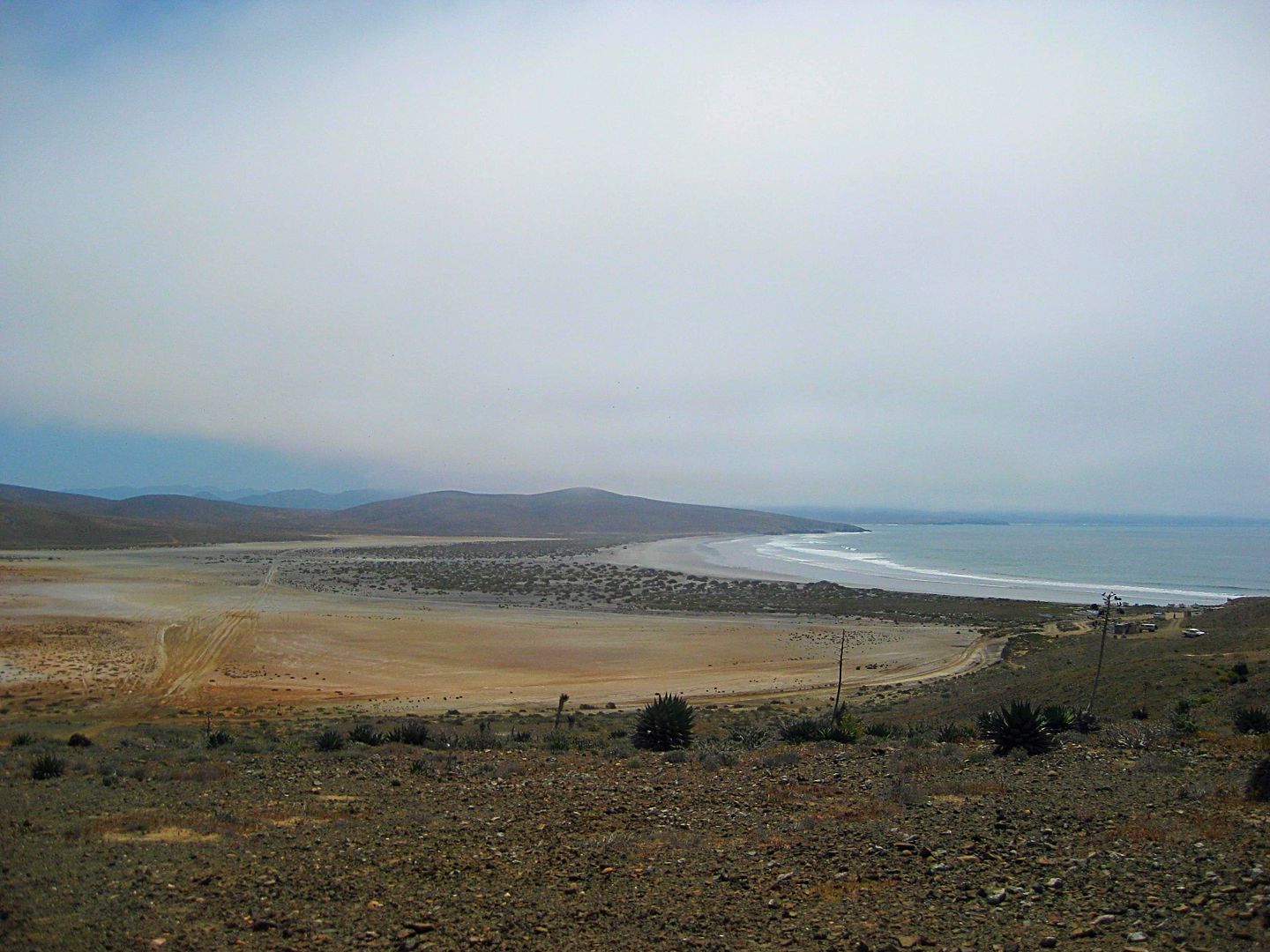
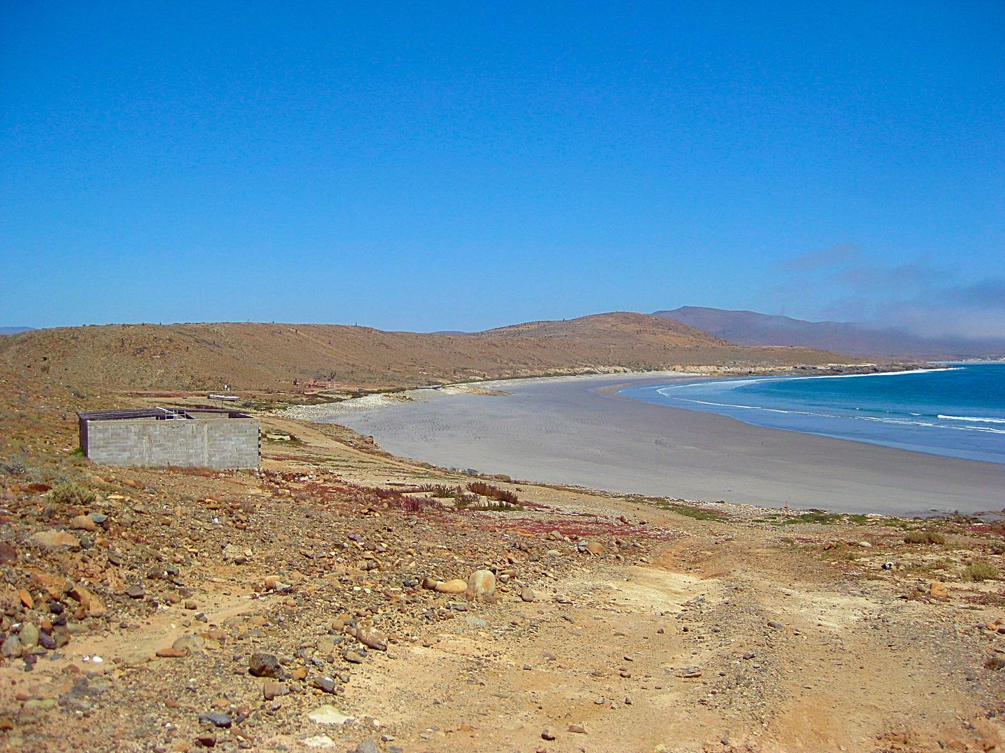
I drive down the beach and find some shelter from the wind behind a low dune. Camp #2 found. Friday Night, in the sand, the white noise of fierce
ocean waves crashing! I was happy!
PHOTOS:
Just north of San José, 1/4 mi.
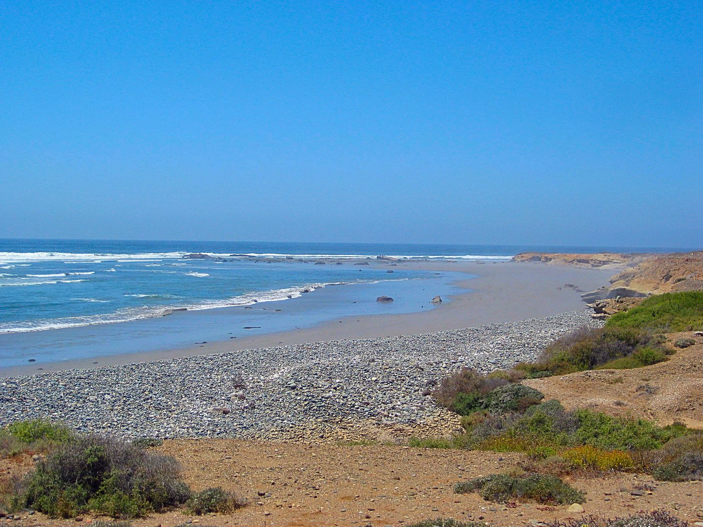
The road parallels the fog-lined coast, only rarely comes close to it. This is driving north from San José to Los Morros.
Looking south from one of the close to coast sections.
After passing a house with a white picket fence around it and some white road edge posts leading away from the house, was this sign, telling me the
name of where I just was. I guess they don't expect traffic on the 4WD trail to San José I just drove and only get visitors from the Canoas road?
Continuing north from Los Morros.
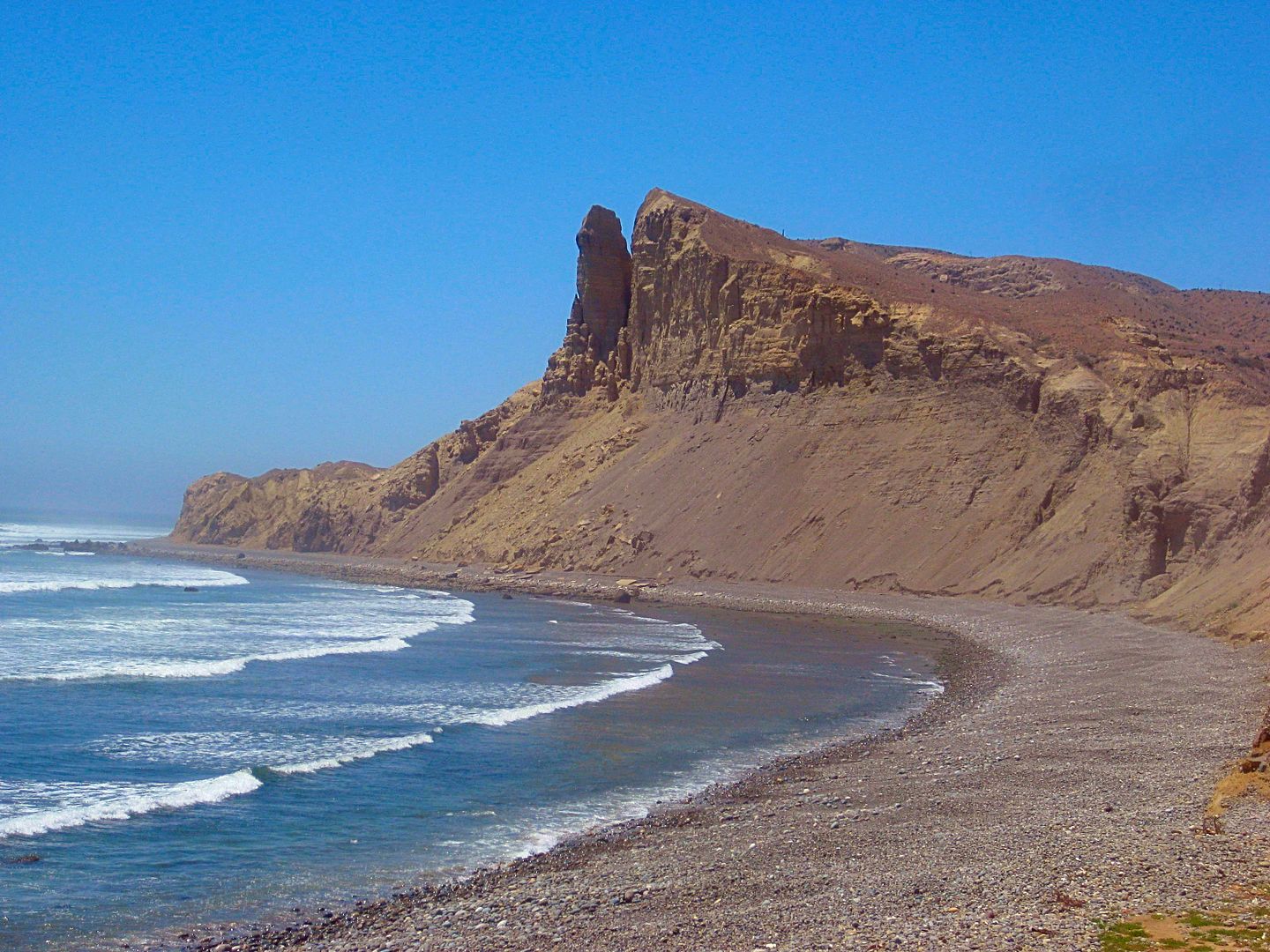
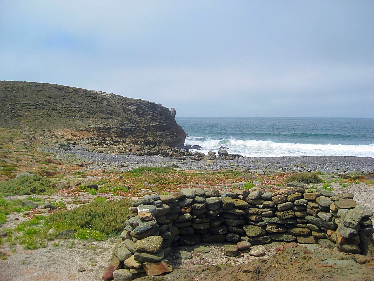
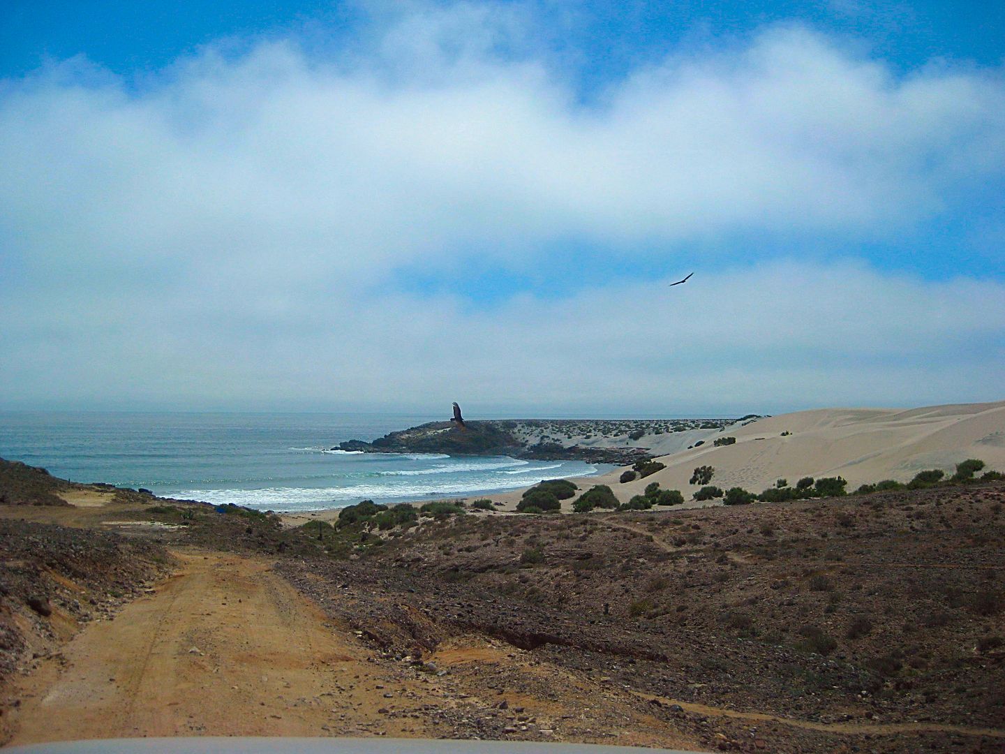
The Acantilado los Candeleros ("Cliff Candlestick"), turn off at Mile 20.9, go 0.3 to the beach.
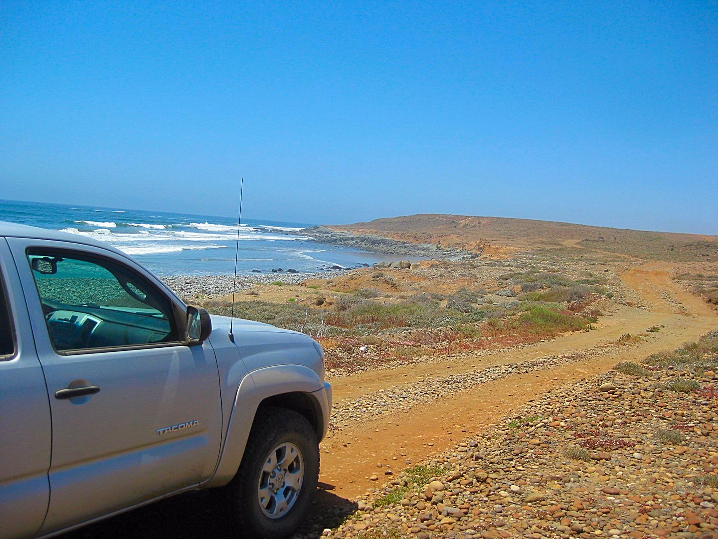
For you Tacoma fans out there!
I get to the junction with the abandoned inland road, 3 miles away, turn around, and head back south and back to San José. There just was no other
option to continue to do a road log south from San José fish camp.
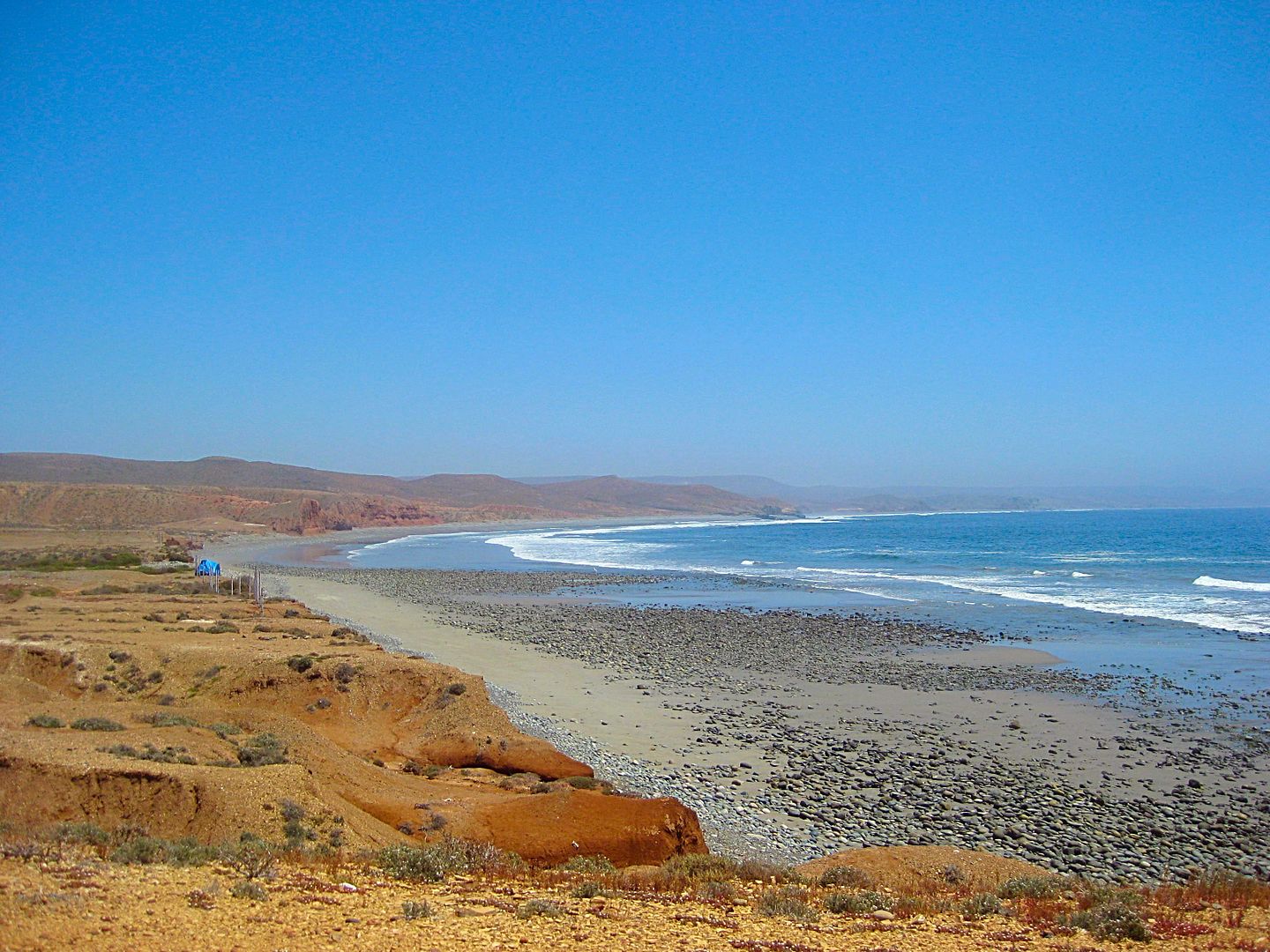
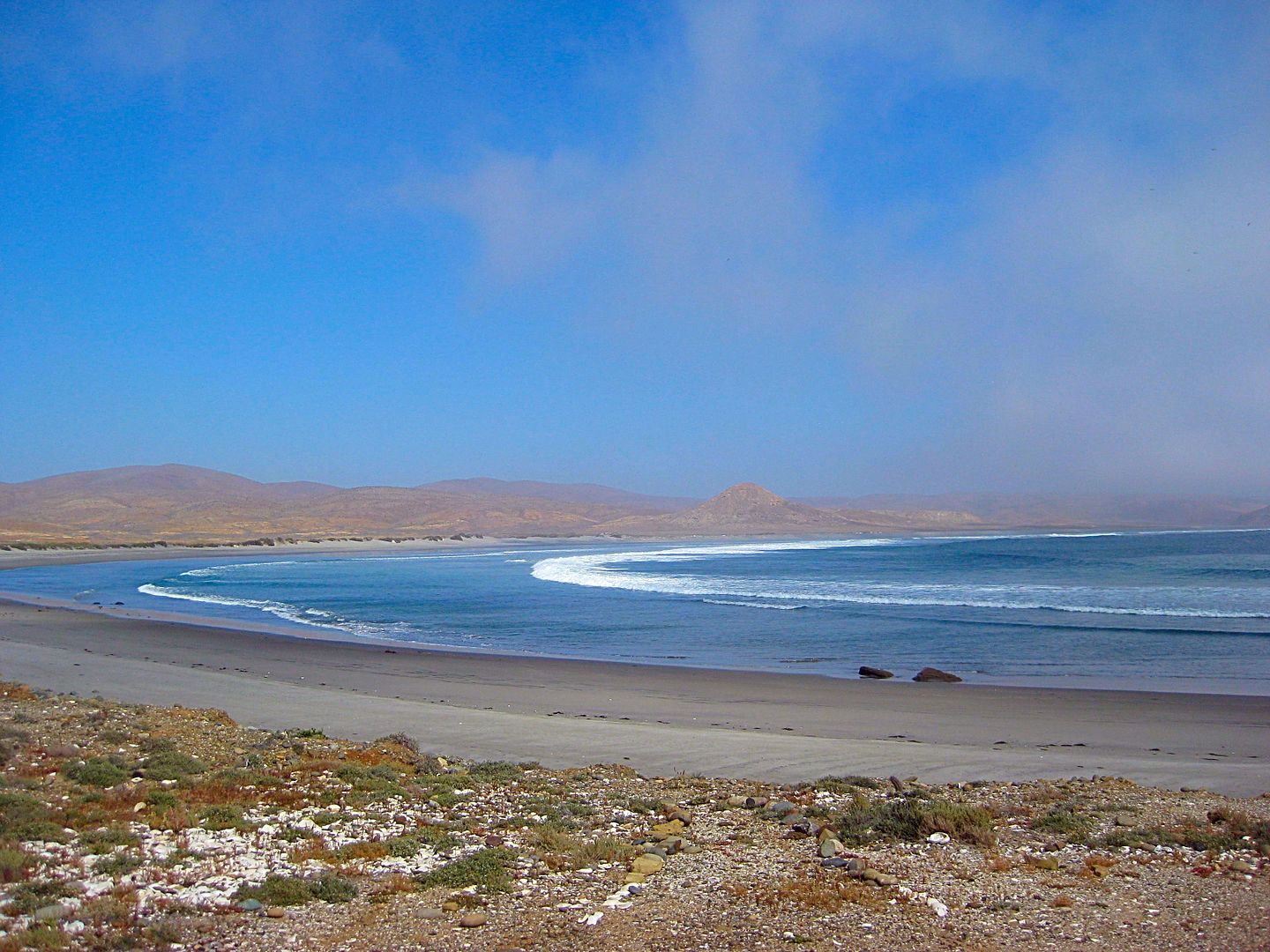
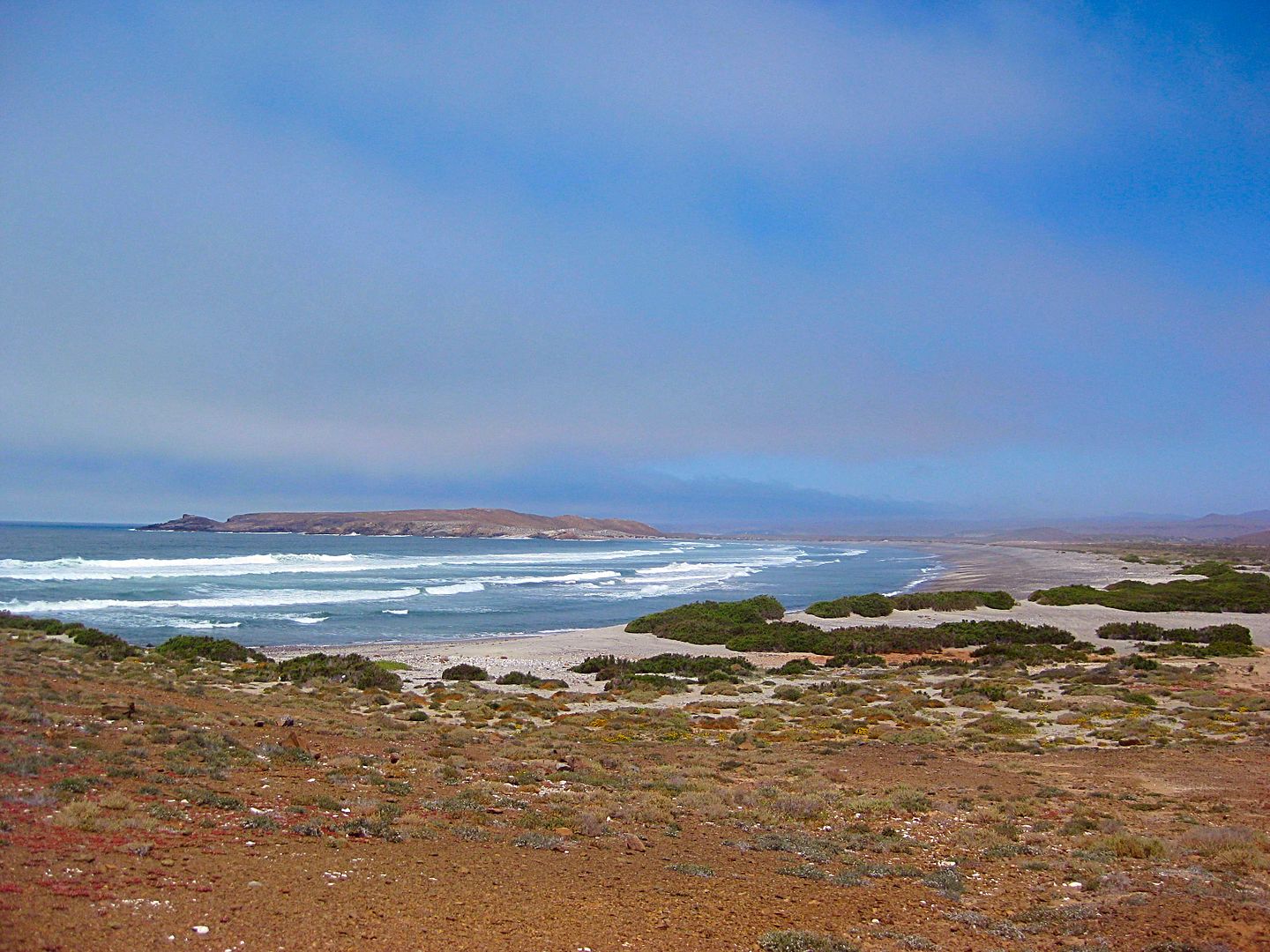
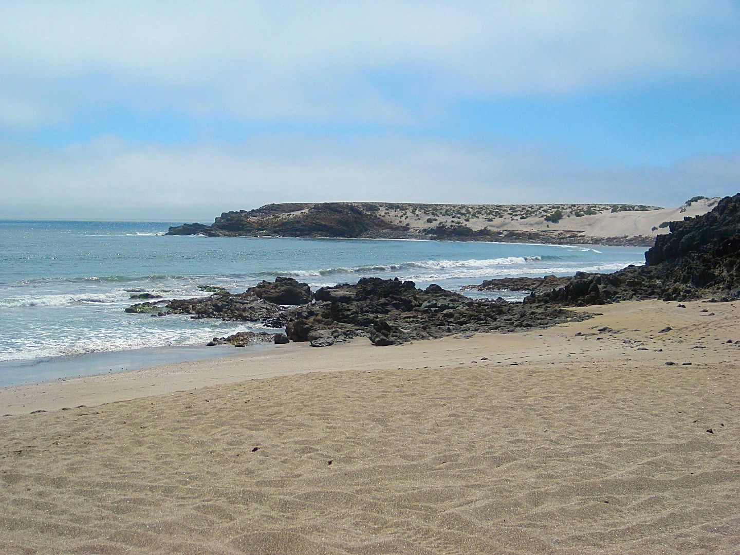
About 6 miles south from San José is Bahía Córbin and some dunes nearby.
Abandoned fish camp. A paddle boarder was camping at the end of the road past here, and I saw him out in the surf.
Will this get my tent out of the wind?
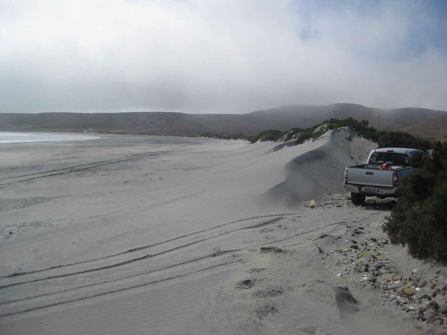
Maybe here?
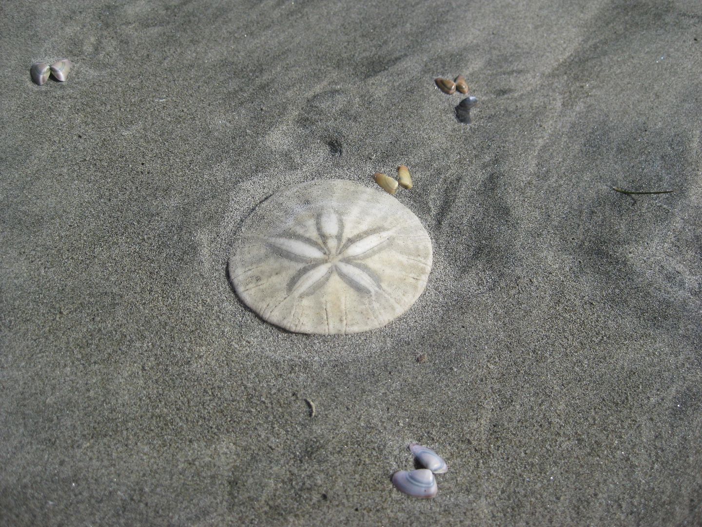
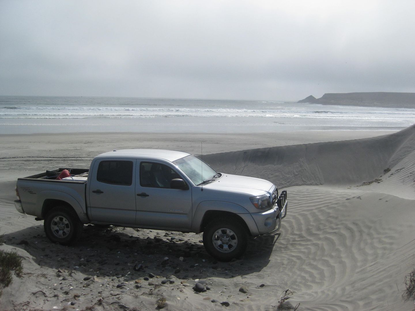
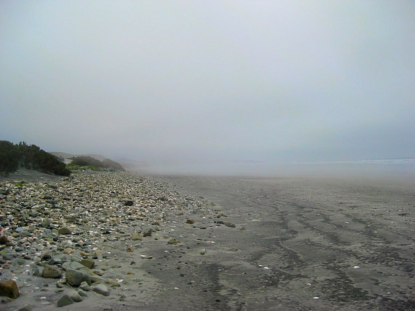
Many solid, round sand dollars on this beach... just like there used to be on San Diego beaches when I was a kid (50+ years ago, lol)!
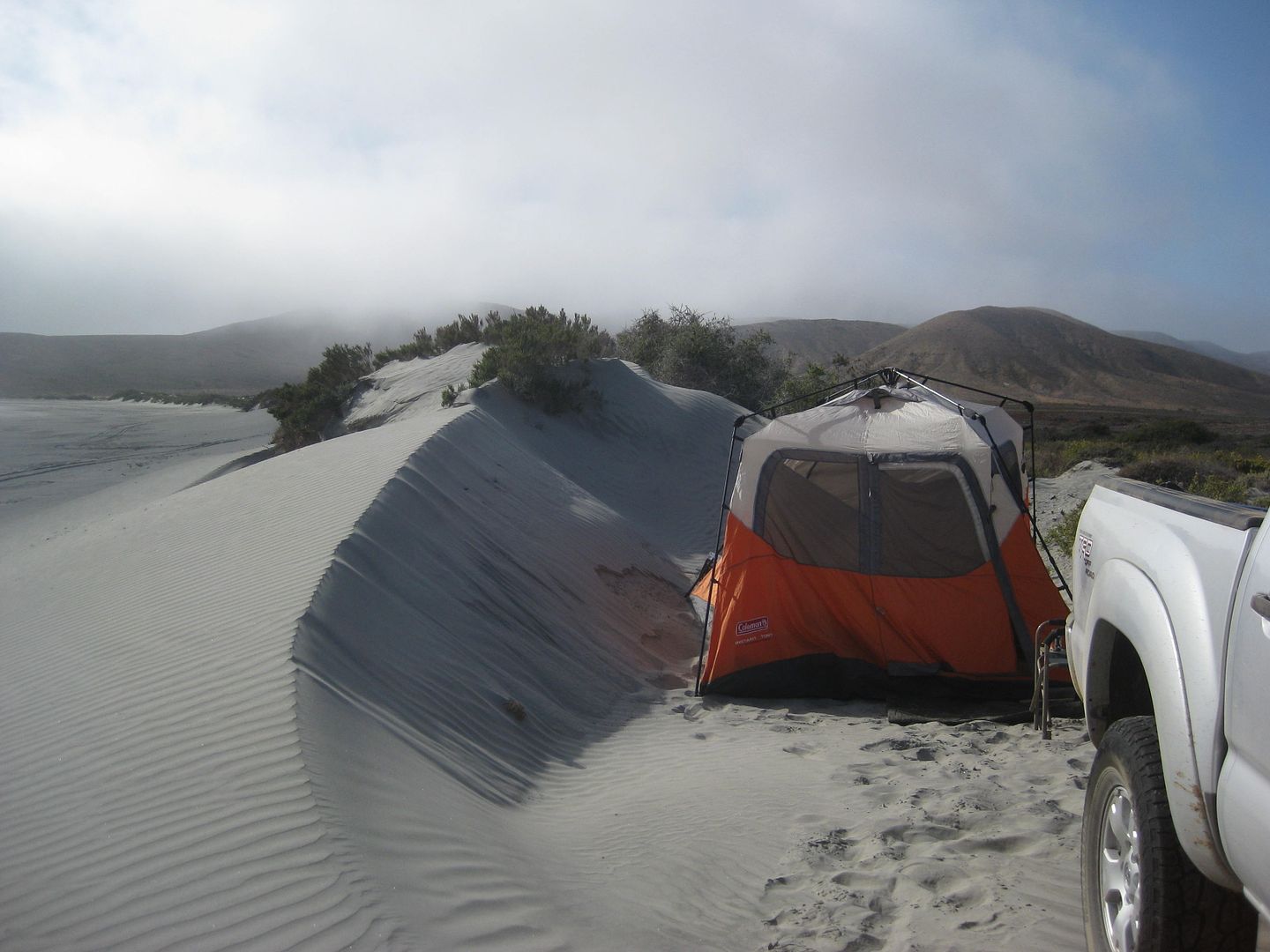
Tent up!
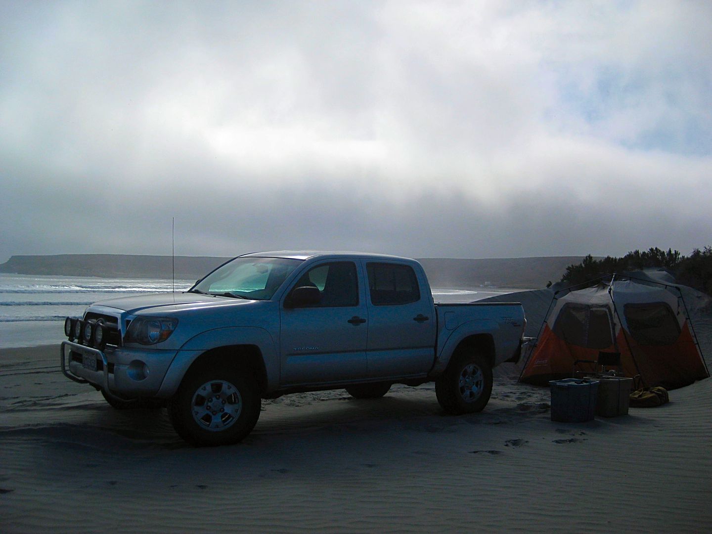
The fog rolls in as the sun sets.
No bugs, ok breeze, but later in the night... water drops in my tent! Is the fog so thick it penetrates the rainstop nylon? The Easy-Up tent has no
rain fly, so I just deal with it... where I had my air mattress was mostly spared from the drops that I listened to hitting the floor.
To be continued with DAY 4...
[Edited on 12-20-2018 by David K]
|
|
|
David K
Honored Nomad
Posts: 64479
Registered: 8-30-2002
Location: San Diego County
Member Is Online
Mood: Have Baja Fever
|
|
DAY 4 (SAT APR 22)
Because the tent was wet from the heavy fog, I wanted it to dry out before packing. It took the sun awhile to burn through the grayness but once it
did, things dried up fast. I was on the road at 10 am.
Starting back at the junction of the road south and the Bahía Córbin entrance road, I zero my odometer. Soon, a road comes in from the left. It
would appear to be a road up the valley to meet with the others going inland to Rancho San José and beyond? There is a big downhill grade, some road
junctions, salt flats, and come to Bahía Blanco in about 15 miles from Córbin. In 18 miles the road becomes a fast dirt highway at the junction to
Punta Cono.
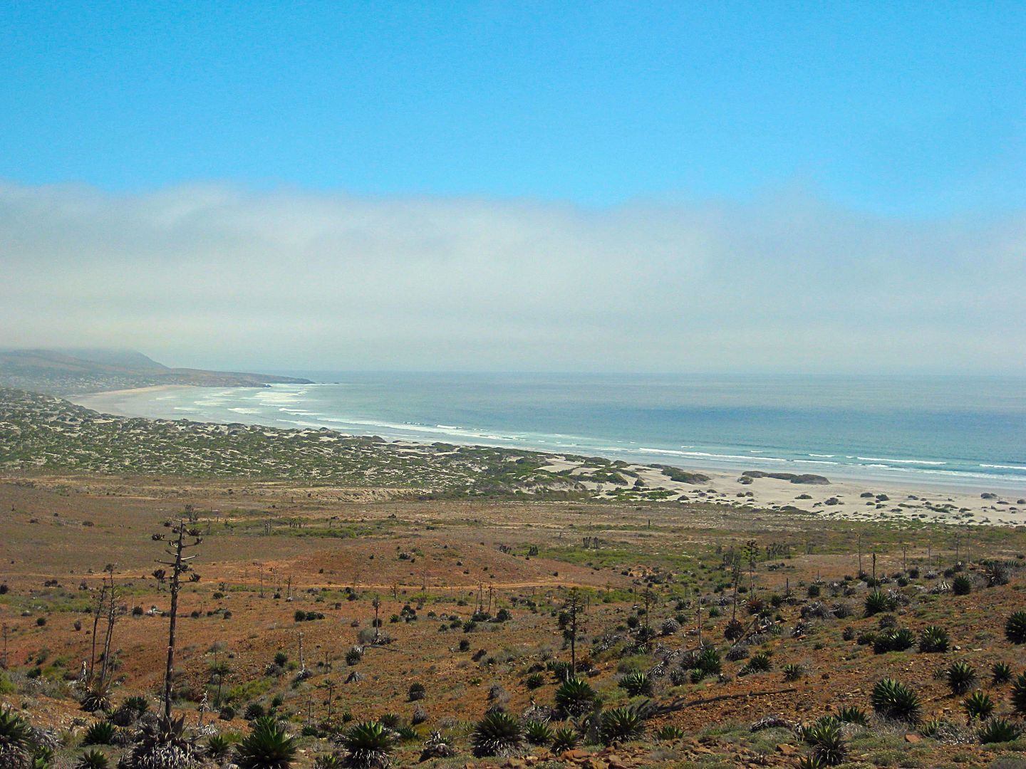
It is 45 mph most of the way to Santa Rosalillita (about 33 miles) on this well-built dirt highway. Only a few spots where rain erosion has eaten away
a bit was in necessary to slow down. I made many stops to explore side roads and take photos. My truck was lightly loaded, my tires were down at 24
psi, and I have Bilstein 5100 shocks all around, so the washboard that can slow down heavier rigs, well, it just smoothed out once I was driving over
35 mph.
When I got into Santa Rosalillita (a small fishing town on a paved road to Hwy. 1), I saw the Escalera Nautica harbor totally full of sand, but the
boat elevator was still there and the buildings, etc. In town, I asked someone for gasolina and I was pointed to the market/ motel 'Jessy'. The young
lady said "No gasolina". I get that they want to not be in the habit of selling to tourists who may not really need any. I said I was very low and my
light was on (it was). I was not sure if I could make it to Villa Jesus María, the closest Pemex gas station, 46 miles away. She consulted with
someone inside the store and came out all smiles and directed me to the shed near the store. There, opened up, was dozens of 1-gallon bottles and
plastic 20 liter (5.28 gallon) tanks full of gasoline... whatever I wanted! 20 liters would be fine, thank you. It was 400 pesos ($22.60) for the 20
liters. That was only an 80 cent/ gallon markup from the Pemex price, more than fair to have gasoline where it is needed!
I asked about a restaurant and was directed to the yellow house, facing the basketball court, town center. There is a pagoda of white painted tires in
front. Inside, two tables... and meat tortas or halibut for dinner! I ordered the Halibut!!! The owner of the unsigned eatery is Ramona. I asked her
if it had a name, she said no... so, I think to call the restaurant 'Ramona's' works?
I was stuffed, she gave me four halibut filets, rice, beans, tortillas, salad. She had no drinks for sale, so I brought a can of XX from my cooler.
After dinner, I drove out a few miles from the coast, into the desert to camp, where I thought the fog wouldn't find me! I was wrong!
Road log:
0.0 Bahía Córbin Rd. 10:00am
0.3 Road east (to Rancho San José?)
5.5 Top of big grade going down.
7.7 Fork, right to beach house Punta Vibora.
8.2 & 8.4 Roads left (east) to Laguna Chapala.
9.9 T Junction. Left to Chapala roads (?), turn right.
10.4 Road right onto salt flats, continue on most used route ahead.
12.5 Road right to beach and lighthouse (0.2 mi).
15.2 Road right to Bahía Blanco fish camp, 0.2 mi. Ahead, cross salt flat.
19.8 Junction. Taking road right, across marsh (dry) to follow coast. Ahead goes approx. 4 miles to gravesite 'Cordornices' on map and junction of
roads south and east.
22.2 After crossing the marsh area, and climbing a steep eroded, bulldozed grade, come near a beach. The road goes east and into an area of silt dust.
28.3 Junction with north/south road. Left (north) goes 4.7 miles to Cordornices graveyard. Turn right. 12:37pm
33.3 Road right to Punta Cono (3.6 mi). Begin, fast dirt highway southbound. Reset odometer to 0.0.
0.0 Punta Cono Road.
3.2 Punta María Road (2.5 mi, abandoned fish camp)
7.1 Camping El Cardón signs, 0.3 mi in. Also known as Punta el Diablo.
8.1 Rancho El Cardón, on the left.
10.9 Road right goes down a hillside to Punta Lobos beach.
17.5 Road in from right to the beach (1.4 mi) and on to El Marrón fish camp (1.9 mi).
27.2 Road right to San Andrés ranch (0.9 mi) and beach (2.9 mi).
31.0 End of dirt highway at a paved road. Right is Santa Rosalillita (1 mi). Left to Hwy. 1 at Km. 38.5 (8 mi).
Photos:
The gloom was heavy today at this popular photo spot.
One of the better down grades.
Signs like this were ALL over the region, even along deserted roads.
The wind is constant.
Bahía Blanco fish camp, on the right.
If wind or fog is your thing... this is your coast!
Boojum trees like it here!
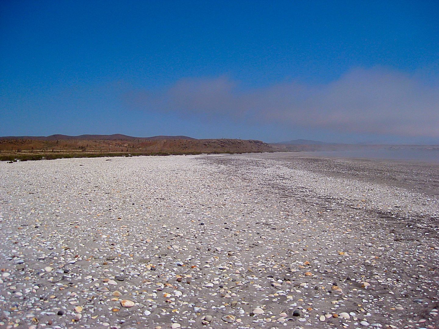
Lots of shells!
A bored fisherman at Punta Cono? Who are these names? Not a soul to be seen!
The next three are a panorama at Punta María...
Signed for camping 'El Cardón' (Punta el Diablo)
The beach south of Punta Lobos
The 31 mile super dirt highway.
More to come!
[Edited on 4-29-2017 by David K]
|
|
|
bajatrailrider
Super Nomad
Posts: 2423
Registered: 1-24-2015
Location: Mexico
Member Is Offline
Mood: Happy
|
|
Breath taking again thank you David
|
|
|
ehall
Super Nomad
Posts: 1906
Registered: 3-29-2014
Location: Buckeye, Az
Member Is Offline
Mood: It's 5 o'clock somewhere
|
|
Thanks for the time and effort you are putting in to share this with us.
|
|
|
David K
Honored Nomad
Posts: 64479
Registered: 8-30-2002
Location: San Diego County
Member Is Online
Mood: Have Baja Fever
|
|
I am back, thank you! When this all is formatted into a guidebook, I hope you find it worthy should it ever go on sale! There is lots of work yet to
do, and so much more Baja to research. The guide will not attempt to be an all-Baja guide, just one to cover most of the roads many of us would want
to use to get somewhere or to enjoy driving on. There will be a few interesting side trips thrown in, too!
I will continue to work on Day 4, soon! Still to come: El Tomatal, Laguna Manuela, the hairy-scary road past Rancho San Antonio, finding a husband and
wife marooned at a ranch without food or meds, their evacuation, my all night drive, flat tire... and MORE!
|
|
|
| Pages:
1
2
3
4 |
|


